





ESA Observing the Earth 
zdroje zpráv:
Earth from Space
24.11.2016 14:30
Join us Friday, 25 November, at 10:00 CET for the ‘Earth from Space’ video programme. This week features a Sentinel-3 image of Japan
Start of service for Europe’s SpaceDataHighway
23.11.2016 13:41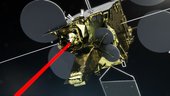
The European Data Relay System began servicing Europe’s Earth observing Copernicus programme yesterday, transferring observations in quasi-real time using cutting-edge laser technology.
Early warning from space of homes on the slide
23.11.2016 13:22
It was a literal property crash: multiple homes in the Cármenes del Mar resort on the south coast of Spain were engulfed in a landslide, leaving families homeless. But satellite archives offer early warning of such events – and now more accessible than ever before thanks to a new cloud computing platform.
Earth from Space
21.11.2016 14:03Join us Tuesday, 22 November at 14:00 CET for a special interview with ESA’s Valerie Fernandez and Paolo Laberinti from the Sentinel-2B cleanroom in ESTEC
Earth from Space
21.11.2016 14:03
ESA’s Valerie Fernandez and Paolo Laberinti join the Earth from Space video programme from the cleanroom in ESTEC to discuss the Sentinel-2B satellite
New map offers precise snapshot of human life on Earth
18.11.2016 11:07
A landmark global map showing nearly every human settlement on Earth is now available to researchers. Compared to previous mapping efforts, the satellite-based ‘Global Urban Footprint’ dataset shows not just urban centres, but also tiny rural hamlets.
Gibson Desert
18.11.2016 10:05
Earth observation image of the week: a Sentinel-2A image over Australia's Gibson Desert, also featured on the Earth from Space video programme
Earth from Space
17.11.2016 15:10Join us Friday, 18 November, at 10:00 CET for the ‘Earth from Space’ video programme. This week features burn scars in Australia’s Gibson Desert
Data release
17.11.2016 15:09
The first data from Sentinel-3A’s Sea and Land Surface Temperature Radiometer are now available to monitor Earth’s temperature
Sentinel sees us
17.11.2016 11:25
Operations image of the week: An impressive view of Germany’s Rhine-Main area, which includes ESA’s Sentinel mission control centre
Probing Greenland’s ice sheet for future satellites
16.11.2016 16:27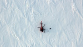
With a helicopter the sole feature on the vast expanse of ice and her only way back to warmth and safety, polar scientist Anna Hogg must have thought, “What on Earth am I doing out here?” as she set to taking ice samples.
Farewell to Sentinel-2B
15.11.2016 15:26
Just weeks before Sentinel-2B is packed up and sent to French Guiana for its launch next March, media representatives and specialists got one last look at the second satellite for Europe’s Copernicus programme.
Space agencies combine efforts for space hydrology
11.11.2016 16:15
Heads of space agencies are meeting today in Marrakesh, Morocco at the COP22 climate change summit to reaffirm their commitment to a coordinated approach for monitoring Earth’s climate, with particular focus on the water cycle.
Refurbished GEOSS portal now online
11.11.2016 11:20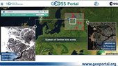
A new and improved version of the GEOSS web portal is ready to provide users with faster, more intuitive access to the ever-growing wealth of diverse Earth observation resources worldwide.
Virunga Mountains
11.11.2016 10:05
Earth observation image of the week: a Sentinel-1 radar composite image of the Virunga Mountains in East Africa, also featured on the Earth from Space video programme
Earth from Space
10.11.2016 18:20Join us Friday, 11 November, at 10:00 CET for the ‘Earth from Space’ video programme. This week features the Virunga Mountains in East Africa
Call for Media
9.11.2016 16:43
ESA and the European Commission together with Airbus Defence and Space are inviting media to view the Sentinel-2B satellite at ESA’s site in the Netherlands on 15 November
Iceberg patrol gains faster updates from orbit
9.11.2016 14:35
The international iceberg patrol service set up after the sinking of the Titanic is now able to track drifting ice from orbit more swiftly through ESA-backed cloud computing.
ESA and Asian Development Bank join forces
9.11.2016 14:25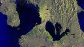
ESA and the Asian Development Bank have signed an agreement to collaborate over the next five years to use information from space to support sustainable development.
ESA and SAP launch new service for analysing satellite data
9.11.2016 9:20
ESA and the software company SAP have announced the Earth Observation Analysis service for the quick, easy consumption of Earth observation satellite data according to customer needs.
ESA at COP22 climate change summit
7.11.2016 17:00
The COP22 climate change summit opened today in Marrakesh, Morocco. ESA is joining international partners to report on the status of space-based climate research and propose improvements to how climate data are collected and distributed.
Deal signed for FLEX’s fluorescence finder
7.11.2016 14:40
ESA has selected Italian company Leonardo to build the main instrument for the upcoming FLEX satellite to study the health of Earth’s vegetation.
Explore Morocco
7.11.2016 12:05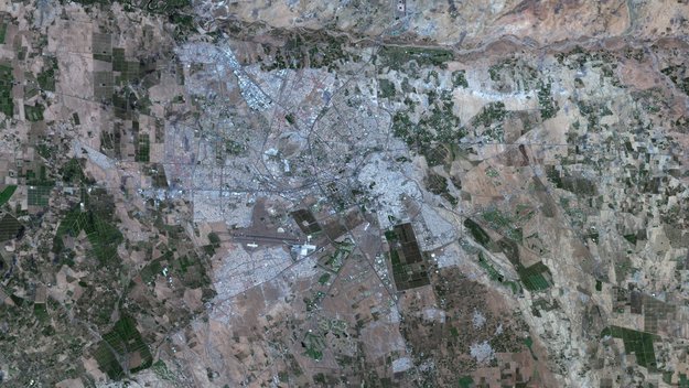
As the COP22 climate change summit begins in Marrakesh, explore Morocco with this mosaic from Sentinel-2. Experience Sentinel-2’s high-resolution imaging capabilities directly in your browser
Explore Morocco
7.11.2016 11:00
As the COP22 climate change summit begins in Marrakesh, explore Morocco with this mosaic from Sentinel-2. Zoom in and experience Sentinel-2’s high-resolution imaging capabilities directly in your browser
Explore Morocco
7.11.2016 11:00As the COP22 climate change summit begins in Marrakesh, explore Morocco with this mosaic from Sentinel-2. Experience Sentinel-2’s high-resolution imaging capabilities directly in your browser
ESA and the Vatican join forces to save data in the digital age
4.11.2016 15:30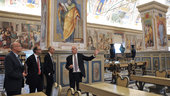
At a ceremony held in Vatican City today, ESA and the Vatican Apostolic Library have agreed to continue their years-long cooperation on the preservation, management and exploitation of archived information.
Pío XI
4.11.2016 10:05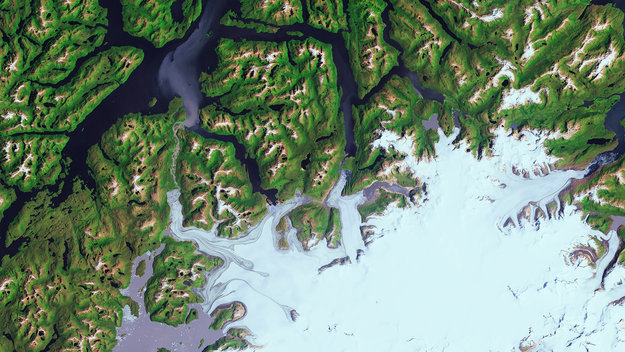
Earth observation image of the week: Chile’s Bernardo O’Higgins National Park and the Pío XI Glacier, also featured on the Earth from Space video programme
Sentinel satellites reveal east–west shift in Italian quake
3.11.2016 16:35
New information on the effects of the 30 October earthquake that struck central Italy continues to emerge as scientists analyse radar scans from satellites.
Earth from Space
3.11.2016 15:00Join us Friday, 4 November, at 10:00 CET for the ‘Earth from Space’ video programme. This week features the glaciers of Chile’s Bernardo O’Higgins National Park
Italy on the move
2.11.2016 12:03
Scientists are analysing Sentinel-1 radar images from before and after the 30 October earthquake that struck central Italy to reveal just how much the ground has shifted
Swarm reveals why satellites lose track
28.10.2016 13:29
Satellite engineers have been puzzling over why GPS navigation systems on low-orbiting satellites like ESA’s Swarm sometimes black out when they fly over the equator between Africa and South America. Thanks to Swarm, it appears ‘thunderstorms’ in the ionosphere are to blame.
Keep an automatic eye on seismic zones
28.10.2016 11:01
The Copernicus Sentinel-1 twin radar satellites combined with cloud computing are monitoring Europe’s earthquake zones by searching for ground shifts as small as a millimetre.
Putorana Plateau
28.10.2016 0:00
Earth observation image of the week: the snowy landscape of the Putorana Plateau in Siberia, also featured on the Earth from Space video programme
Earth from Space
27.10.2016 14:00
Join us Friday, 28 October, at 10:00 CEST for the ‘Earth from Space’ video programme. The flat-topped mountains of Russia’s Putoransky State Nature Reserve are featured in this week’s edition
Sentinel Hub wins Copernicus Masters prize
26.10.2016 10:53
A cloud-based web service that allows non-expert users to browse, process and distribute large amounts of Earth observation data takes home this year’s Copernicus Masters grand prize.
Fish farms guided by Sentinels and the cloud
21.10.2016 15:41
A new service harnesses three decades of satellite observations of coastal zones made available through a cloud-based system to provide a rich information source for fisheries, one of our fastest growing sources of food.
Kathmandu
21.10.2016 10:05
Earth observation image of the week: a Sentinel-2 false-colour image of Nepal’s capital city, Kathmandu, and part of the Himalayan foothills
Earth from Space
20.10.2016 15:25Join us Friday, 21 October, at 10:00 CEST for the ‘Earth from Space’ video programme. This week features Nepal’s capital city, Kathmandu, and part of the Himalayan foothills
Earth’s most active volcanoes on satellite watch
20.10.2016 15:15
As hundreds flee lava and ash spewed from Mexico’s Colima volcano, its continuing eruption is being tracked not only by ground instruments but also from space. Starting last month, Colima is one of 22 active volcanoes worldwide being monitored by satellites.
Earth from Space
20.10.2016 14:00Join us Friday, 21 October, at 10:00 CEST for the ‘Earth from Space’ video programme. This week features Nepal’s capital city, Kathmandu, and part of the Himalayan foothills
Sentinel-3A Earth colour data released
20.10.2016 11:50
Today, the Copernicus Sentinel-3A satellite has taken another step towards being fully ‘operational’ as the first data from its Ocean and Land Colour Instrument are made available to monitor the health of our planet.