


![]()


ESA Navigation 
zdroje zpráv:
ESA’s Celeste broadcasts first navigation signal from low Earth orbit
10.4.2026 9:04
The European Space Agency has achieved a European first with Celeste IOD-1, successfully transmitting a navigation signal from low Earth orbit, following the launch of the mission’s first satellites on March 28.
Update (17/04): On 17 April, Celeste IOD-2 transmitted its first navigation signal.
ESA’s Celeste broadcasts first navigation signal from low Earth orbit
10.4.2026 9:04
The European Space Agency has achieved a European first with Celeste, successfully transmitting a navigation signal from low Earth orbit, following the launch of the mission’s first satellites on March 28.
Galileo goes to the Moon
7.4.2026 10:45
Last year, history was made as a navigation receiver on the Moon determined its position in real time using signals from approximately 410 000 km away. The receiver, called the Lunar GNSS Receiver Experiment (LuGRE), acquired signals from four navigation satellites orbiting Earth: two Galileo satellites and two GPS satellites.
The mission also tested Galileo’s Emergency Warning Satellite Service (EWSS) on the Moon, demonstrating the robustness and reach of the planned service.
Celeste’s first satellites launched to explore LEO-based satellite navigation
28.3.2026 12:07
On 28 March, the European Space Agency (ESA) took a major step forward in strengthening Europe's ambition for more resilient satellite navigation, as the first two satellites of the Celeste in-orbit demonstration mission lifted off from New Zealand aboard Rocket Lab’s Electron. Their mission is to begin testing a complementary low Earth orbit layer for Galileo.
Celeste liftoff
28.3.2026 11:20 Video:
00:03:15
Video:
00:03:15
At 10:14 CET on 28 March, the first two satellites of ESA’s Celeste LEO-PNT in-orbit demonstration mission lifted off aboard a Rocket Lab Electron rocket from Māhia, New Zealand.
Celeste is Europe’s first initiative to bring satellite navigation into low Earth orbit (LEO). By testing next-generation technologies and new frequency bands, it will help shape the future of positioning, navigation and timing services.
Flying closer to Earth, Celeste will demonstrate how a complementary LEO layer can strengthen Europe’s Galileo system in medium Earth orbit — improving resilience, enhancing performance and enabling new services.
Launch of ESA’s Celeste mission 1
28.3.2026 11:20 Video:
00:03:15
Video:
00:03:15
At 10:14 CET on 28 March, the first two satellites of ESA’s Celeste LEO-PNT in-orbit demonstration mission lifted off aboard a Rocket Lab Electron rocket from Māhia, New Zealand.
Celeste is Europe’s first initiative to bring satellite navigation into low Earth orbit (LEO). By testing next-generation technologies and new frequency bands, it will help shape the future of positioning, navigation and timing services.
Flying closer to Earth, Celeste will demonstrate how a complementary LEO layer can strengthen Europe’s Galileo system in medium Earth orbit — improving resilience, enhancing performance and enabling new services.
Watch live: First Celeste launch
27.3.2026 15:00
Update: Rocket Lab has announced the next launch attempt for its Electron rocket carrying ESA's first two Celeste satellites is 28 March at 10:14 CET.
On 28 March, the first two satellites of the Celeste LEO-PNT in-orbit demonstration mission will lift off aboard Rocket Lab’s Electron rocket from the company’s Māhia Launch Complex in New Zealand.
Coverage will start 9:53 CET with live commentary. The rocket is scheduled for liftoff at 10:14, with a launch window of about an hour.
Celeste: Countdown to Launch 1
23.3.2026 17:00 Video:
00:03:50
Video:
00:03:50
On 25 March, the first two satellites of the Celeste in-orbit demonstration mission will lift off aboard Rocket Lab’s Electron rocket from the company’s Māhia Launch Complex in New Zealand.
Celeste will play a pioneering role in elevating the future of Europe’s satellite navigation capabilities.
As ESA’s initiative for satellite navigation in low Earth orbit (LEO-PNT), the mission will be testing next-generation technologies and add new frequency bands for satellite navigation to inform the deployment of a future European operational navigation system in low Earth orbit.
The mission will begin with two demonstrator satellites, IOD1-2, to secure and test the assigned frequency filings and transmit representative navigation signals until the end of the year.
The two satellites consist of two CubeSats (12U and 16U respectively), both developed by two consortia composed by a wide set of European players, one led by GMV (Spain) and the other led by Thales Alenia Space (France).
Learn more about Celeste: https://www.esa.int/Celeste/
Watch live: First Celeste launch
23.3.2026 11:06
Update: Rocket Lab has decided to postpone the launch of its Electron rocket carrying ESA's first two Celeste satellites. This is due to unfavourable weather conditions over the Māhia Launch Complex in New Zealand. We will keep you informed as soon as a next target launch date has been set.
On 25 March, the first two satellites of the Celeste LEO-PNT in-orbit demonstration mission will lift off aboard Rocket Lab’s Electron rocket from the company’s Māhia Launch Complex in New Zealand.
Coverage will start 9:53 CET with live commentary. The rocket is scheduled for liftoff at 10:14, with a launch window of about an hour.
Watch live: First Celeste launch
23.3.2026 11:06
On 25 March, the first two satellites of the Celeste LEO-PNT in-orbit demonstration mission will lift off aboard Rocket Lab’s Electron rocket from the company’s Māhia Launch Complex in New Zealand.
Coverage will start 9:53 CET with live commentary. The rocket is scheduled for liftoff at 10:14, with a launch window of about an hour.
Seven scientific benefits of ESA’s Genesis mission
20.3.2026 14:55
Genesis is the European Space Agency’s (ESA) navigation mission to measure Earth down to the millimetre. This precise measurement of Earth will have wide-ranging benefits, from satellite navigation to orbit determination to Earth science.
CELESTE pre-launch media briefing
12.3.2026 15:00 Video:
00:52:29
Video:
00:52:29
Watch the replay of the CELESTE pre-launch media briefing. The briefing covered the mission details of the ahead of the inaugural launch of ESA’s Celeste LEO-PNT in-orbit demonstration constellation. The first two satellites are scheduled to lift off no earlier than 24 March aboard Rocket Lab’s Electron rocket from New Zealand.
The tiny lens antenna with big potential
11.3.2026 11:00
Every day, we rely on satellite navigation – so much so that it has become a target for disruption. As our dependence on the technology grows, so do the risks associated with its interruption. Some antennas offer protection from the most common types of interference, but they are bulky and expensive to manufacture. A PhD researcher’s project explores an alternative: a football-sized, 3D-printed lens antenna that could provide resilience for satellite navigation while staying simple and cheap.
Follow the Celeste launch campaign
4.3.2026 15:21
The first two satellites of ESA’s Celeste LEO-PNT demonstration mission are scheduled to lift off no earlier than 24 March, aboard Rocket Lab’s Electron rocket from the company’s Māhia Launch Complex in New Zealand.
Follow the Celeste launch campaign
4.3.2026 15:21
The first two satellites of ESA’s Celeste LEO-PNT demonstration mission are scheduled to lift off no earlier than 25 March, aboard Rocket Lab’s Electron rocket from the company’s Māhia Launch Complex in New Zealand.
Follow the Celeste launch campaign
2.3.2026 15:21
The first two satellites of ESA’s Celeste LEO-PNT demonstration mission are scheduled to lift off no earlier than 24 March, aboard Rocket Lab’s Electron rocket from the company’s Māhia Launch Complex in New Zealand.
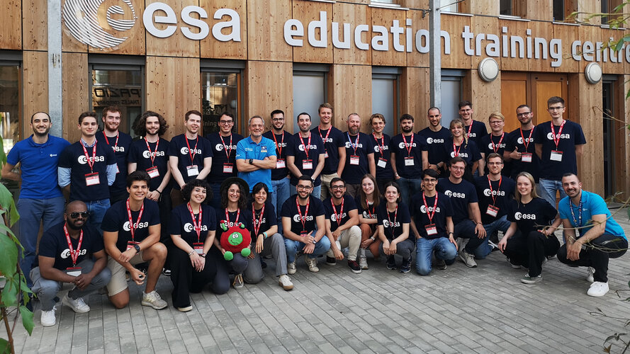
Navigation Training Course now open for application
26.2.2026 15:41
ESA Academy is inviting university students to apply for the Navigation Training Course, taking place from 22 to 26 June 2026 at ESA Academy’s Training and Learning Facility in ESA ESEC, Belgium. Organized in collaboration with ESA Education and ESA’s Directorate of Navigation, this course is perfect for those curious about the future of satellite navigation
Galileo vs. spoofing: ESA tests in real-world environments
24.2.2026 11:24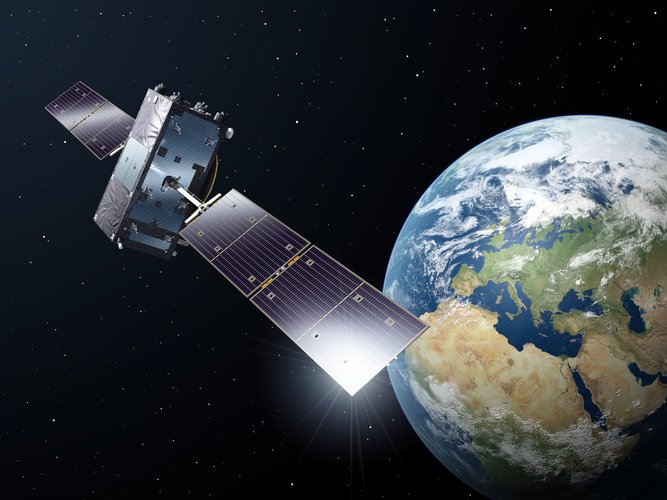
From adding timestamps to banking transactions to mapping the best route to a destination, satellite navigation plays a significant role in daily life. At the same time, attempts to interfere with and fake navigation signals are increasing. For the last seven months, a new verification service for Galileo has mitigated the threat of spoofing in the Open Service by confirming that the satellite navigation data used for positioning originated in the Galileo system.
ESA’s Celeste target launch date confirmed
19.2.2026 10:18
The European Space Agency (ESA) is preparing for the inaugural launch of the Celeste LEO-PNT in-orbit demonstration mission with the first two satellites scheduled to lift off no earlier than 24 March, aboard Rocket Lab’s Electron rocket from the company’s Māhia Launch Complex in New Zealand.
ESA’s Celeste target launch date confirmed
18.2.2026 10:18
The European Space Agency (ESA) is preparing for the inaugural launch of the Celeste LEO-PNT in-orbit demonstration mission with the first two satellites scheduled to lift off no earlier than 24 March, aboard Rocket Lab’s Electron rocket from the company’s Māhia Launch Complex in New Zealand.
 Image:
Genesis satellite
Image:
Genesis satellite
Let there be design: ESA’s Genesis mission passes PDR
16.2.2026 14:30
In December last year, teams from the European Space Agency (ESA) and industry completed the system Preliminary Design Review (PDR) for ESA’s Genesis mission, which will measure Earth down to the millimetre. The improved measurement of Earth will benefit fields as diverse as navigation, sea level monitoring and infrastructure development.
ESA’s Genesis mission celebrates International Day of Women and Girls in STEM
11.2.2026 17:00 Video:
00:02:42
Video:
00:02:42
On 11 February, International Day of Women and Girls in STEM, we are spotlighting the Genesis mission by speaking to Sara Gidlund, Head of the Genesis Project and Gaia Fusco, Genesis System and Operations Manager about the vision behind a mission for the world.
In this video, the women behind Genesis show how strong leadership drives technical innovation at ESA and inspire the next generation to lead with curiosity, vision and impact.
More on Genesis.
Three ways R&D has shaped Galileo Second Generation
5.2.2026 9:31
Dedicated research and development, funded by European Union (EU) and European Space Agency (ESA) programmes over the years, has played a key role in Galileo Second Generation.
Among the innovations that will benefit the new satellites are the development of new atomic clocks, links that allow the satellites to ‘talk’ to one another in orbit and a prototype ground station that can precisely pinpoint satellites in the sky. These advanced technologies will ensure Galileo continues to provide world‑class positioning, navigation and timing to users worldwide.
Jammertest: strengthening satellite navigation
2.2.2026 15:00 Video:
00:03:39
Video:
00:03:39
Satellite navigation is essential to everyday life, from tracking your morning jog to landing air ambulances. But as reliance on satellite navigation grows, so do the risks associated with its interruption, natural or intentional. To strengthen European resilience in navigation, the European Space Agency (ESA) takes part annually in Jammertest.
Organised on the remote island of Andøya, Norway, Jammertest is the world’s largest open air testing campaign for jamming and spoofing resilience. In September 2025, ESA engineers attended Jammertest with ESA’s mobile navigation lab to test how different systems respond to interference. After this, the data are analysed to check which technologies perform the best against jamming and spoofing.
By bringing together academia, industry and governmental organisations, Jammertest helps make satellite navigation better for everyone and protects European assets.
More on Jammertest: ESA - Navigating through interference at Jammertest
Galileo: the journey of satellites 33 and 34
19.12.2025 17:30 Video:
00:05:30
Video:
00:05:30
On 17 December 2025, two new Galileo satellites lifted off from Europe’s Spaceport in French Guiana. This was the 14th launch for Europe’s satellite navigation operational satellite programme, reinforcing Europe’s resilience and autonomy. The flight, VA266, was the first launch of Galileo satellites on Europe’s newest heavy-lift launcher Ariane 6.
The satellites, designated SAT 33 and SAT 34, separated from the launcher after a flight of just under four hours. The launch was declared successful after acquisition of signal and the confirmation that both satellites are healthy with their solar arrays deployed.
“With these new satellites, we strengthen Europe’s global navigation services - delivering greater precision, reliability and autonomy in space”, affirmed Andrius Kubilius, EU Commissioner for Defence and Space.
“Galileo stands as the world’s most accurate global navigation satellite system – and today we have increased its reliability and robustness,” said Josef Aschbacher, ESA’s Director General.
The European Space Agency was responsible for carrying out the Galileo launch with Arianespace on behalf of the European Commission. The Galileo satellites were manufactured by OHB, under contract with ESA. Now in orbit, the EU Agency for the Space Programme (EUSPA) brings the satellites into service and oversees their operation.
Galileo’s first Ariane 6 launch strengthens European resilience
17.12.2025 11:00
On 17 December, two Galileo satellites lifted off from Europe’s Spaceport in French Guiana aboard an Ariane 6 rocket. This marked the 14th launch for Europe’s Galileo constellation, reinforcing Europe’s satellite navigation capabilities, resilience and autonomy.
Galileo L14 launch highlights
17.12.2025 11:00 Video:
00:03:01
Video:
00:03:01
On 17 December, two new Galileo satellites lifted off from Europe’s Spaceport in French Guiana aboard an Ariane 6 rocket. This marked the 14th launch for Europe’s satellite navigation operational satellite programme, reinforcing Europe’s resilience and autonomy.
The European Space Agency (ESA) is responsible for carrying out the Galileo launch with Arianespace on behalf of the European Commission. The Galileo satellites were manufactured by OHB, under contract with ESA. Once in orbit, the EU Agency for the Space Programme (EUSPA) will bring the satellites into service and oversee their operation.
The flight, designated VA266, was the first launch of Galileo satellites on Europe’s newest heavy-lift launcher Ariane 6.
Galileo’s first Ariane 6 launch strengthens European resilience
17.12.2025 11:00
On 17 December, two Galileo satellites lifted off from Europe’s Spaceport in French Guiana aboard an Ariane 6 rocket. This marked the 14th launch for Europe’s Galileo constellation, reinforcing Europe’s satellite navigation capabilities, resilience and autonomy.
Watch live: Galileo launch on Ariane 6
12.12.2025 11:32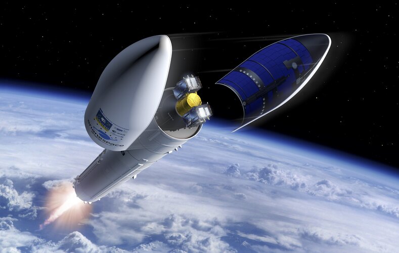
On 17 December, two Galileo satellites will be launched on an Ariane 6 rocket from Europe’s Spaceport in French Guiana in the 14th launch of operational satellites for the Galileo programme. This will be Galileo’s first launch on Ariane 6 and the fifth launch of Europe’s heavy-lift launcher.
Galileo pre-launch media briefing
9.12.2025 12:00 Video:
00:42:04
Video:
00:42:04
Watch the replay of the media briefing held ahead of the 14th operational launch of the Galileo programme. The briefing covers the mission details for the launch of two Galileo satellites, which are set to lift off on 17 December aboard Ariane 6 from Europe’s Spaceport in French Guiana.
 Image:
Galileo Launch History
Image:
Galileo Launch History
 Image:
Galileo launch history
Image:
Galileo launch history
 Image:
Galileo launch history
Image:
Galileo launch history
 Image:
Galileo launch history
Image:
Galileo launch history
The 30-year journey of European satellite navigation
4.12.2025 10:02
In 2025, Europe celebrated the 30th anniversary of satellite navigation on the continent, a milestone built on decades of innovation, collaboration and excellence. Three decades of challenges and triumphs that have shaped the navigation systems we rely on today: EGNOS and Galileo, and that serve as legacy to building the satellite navigation systems of tomorrow.
Follow the Galileo launch (L14) campaign
28.11.2025 15:07
On 17 December, two Galileo satellites will be launched on Ariane 6 from Europe’s Spaceport in French Guiana in the 14th operational launch of the Galileo programme. These satellites will improve the precision, availability and robustness of the Galileo system by adding spares to guarantee the system can always provide a navigation signal for users worldwide. This will be Galileo’s first launch on Ariane 6 and the fifth launch of Europe’s heavy-lift launcher.
European satellite navigation opens new chapter at ESA’s Ministerial Council
27.11.2025 15:16
The European Space Agency’s (ESA) Directorate of Navigation was pledged close to €1 billion by the Agency’s Member States during this week’s ESA Council at Ministerial Level (CM25) on 26 and 27 November in Bremen, Germany.
With the continuation and expansion of the NAVISP and FutureNAV programmes and three brand new missions, ESA’s Navigation Directorate experienced a significant boost to its optional programmes, with activities that are designed to shape the future of European navigation.
Galileo to take its first flight on Ariane 6 on 17 December
20.11.2025 10:31
On 17 December 2025, two Galileo satellites will be launched by Arianespace on Ariane 6 from Europe’s Spaceport in French Guiana. This 14th operational launch in the Galileo programme will improve the precision, availability and robustness of the Galileo system. These satellites will benefit the billions of people who use Galileo daily via their smartphone as well as key sectors such as critical infrastructure, autonomous driving, air traffic, maritime, agriculture, emergency services and rescue operations.
ESA Navigation at 2025 Ministerial Council
19.11.2025 16:30
The European Space Agency’s Navigation programmes are Europe’s driving force for performance, innovation and resilience in positioning, navigation and timing. At the upcoming ESA Ministerial Council (CM25), ESA Navigation presents a portfolio of activities designed to ensure that Europe’s satellite navigation capabilities remain reliable, competitive and strategically autonomous for decades to come.
Galileo, advancing toward the future
19.11.2025 14:00 Video:
00:02:09
Video:
00:02:09
Since becoming operational in 2016, Galileo has continued to evolve, introducing new capabilities and services to meet the needs of its over five billion users.
This December, two new Galileo satellites will launch aboard Ariane 6 - a major step for Europe’s autonomy and resilience in space.
And the journey doesn’t stop there: twelve Galileo Second Generation satellites are under construction, set to deliver even faster, more reliable positioning, navigation, and timing for everyone, everywhere.
ESA drives growth in Spanish positioning and timing industry with NAVISP
13.10.2025 11:33
Following a call by the European Space Agency (ESA), nine projects have been selected in close coordination with the Spanish Space Agency (AEE) for funding under ESA’s Navigation Innovation and Support Program (NAVISP). This initiative strengthens Spain’s industrial competitiveness in positioning, navigation and timing (PNT) with the development of new products and services and strengthens the country’s presence in the global space market.
Navigating through interference at Jammertest
6.10.2025 13:11
Satellite navigation is essential to everything from tracking your morning jog to landing air ambulances. But as reliance on satellite navigation grows, so do the risks associated with its interruption, natural or intentional. In its pursuit of strengthening European resilience in navigation, the European Space Agency (ESA) took part in Jammertest.
Galileo R&D tests new uplink antenna
25.9.2025 11:52
Galileo relies on ground-based uplink stations (ULS) to maintain accurate positioning for users worldwide. These stations transmit essential data to the satellites, including the information required to compute the satellites' orbits and clock corrections. Traditionally, such messages are sent using dish antennas. However, a new type of ground uplink antenna – a phased array antenna – was recently tested at the European Space Agency’s (ESA) site in Redu, Belgium. Developed under ESA's Horizon 2020 programme for R&D, which aims to keep Galileo up to date with the latest innovations, this innovative antenna could benefit Galileo operations.
Europe celebrates 30 years of satellite navigation
12.9.2025 9:10
On 2 September 2025, the European Space Agency (ESA) opened the doors of ESTEC, its research and technology centre, to celebrate 30 years of European satellite navigation. Partners from across the continent gathered for a sensational event that took the audience on a journey through time, honouring the achievements and collaboration that have shaped this success story.
Galileo ‘daughter mission’ name revealed: Celeste
4.9.2025 15:00
Following the announcement of the upcoming launch of LEO-PNT’s first satellites, ESA has now unveiled the name of the mission. Celeste, as it has been officially designated, will test the potential of a new, low Earth orbit layer of satellites to enhance Galileo’s resilience and complement its capabilities.
 Image:
Celeste mission patch
Image:
Celeste mission patch
 Image:
Celeste mission patch
Image:
Celeste mission patch
ESA’s LEO-PNT satellites set to launch by end of year
25.6.2025 11:00
The European Space Agency (ESA) confirms the launch of the first two LEO-PNT satellites is planned from second half of December 2025, on a Rocket Lab Electron launcher vehicle, from New Zealand. The LEO-PNT in-orbit demonstrator mission is a pioneer mission for Europe that will advance satellite navigation concepts for resilient positioning and timing services.
ESA teams up with Leonardo against satnav jamming
16.6.2025 14:19Press Release N° 36–2025
Uninterrupted access to satellite navigation is essential in our modern world, but it is threatened daily by external interference, such as jamming and spoofing. New technologies and concepts can help increase the resilience of our satellite navigation solutions. ESA and Leonardo are embarking on a joint project to explore smart antennas powered by Machine Learning to block unwanted signals
ESA teams up with Leonardo against satnav jamming
16.6.2025 14:19Press Release N° 36–2025
Uninterrupted access to satellite navigation is essential in our modern world, but it is threatened daily by external interference, such as jamming and spoofing. New technologies and concepts can help increase the resilience of our satellite navigation solutions. ESA and Leonardo are embarking on a joint project to explore smart antennas powered by Machine Learning to block unwanted signals.
Galileo Second Generation developing at full speed
20.5.2025 15:31
The building of twelve Galileo Second Generation satellites is progressing rapidly, with several key milestones achieved in recent months. Among the most significant are the successful compatibility tests with ground infrastructure, an essential step as the satellites move through the production cycle.
Galileo Second Generation
19.5.2025 16:55 Video:
00:03:57
Video:
00:03:57
Europe’s Galileo is the world’s most precise satellite navigation system, providing metre-level accuracy to billions of users. ESA and European industry are preparing a new generation of satellites for the European Union, the Galileo Second Generation or G2, that will revolutionise the fleet with enhanced capabilities.
Thank you for your service, Galileo GSAT0104
13.5.2025 10:47
On 12 March 2013, Galileo satellite GSAT0104, alongside its fellow In-Orbit Validation (IOV) satellites, made history by enabling the first position fix by Europe’s independent satellite navigation system Galileo. Now, after 12 years of service mostly in the area of Search and Rescue, GSAT0104 makes history again by becoming the first satellite in the Galileo constellation to be decommissioned.
Decommissioning Galileo satellites - Infographic
13.5.2025 10:13 Image:
Decommissioning Galileo satellites - Infographic
Image:
Decommissioning Galileo satellites - Infographic
DORIS joins ESA’s Genesis mission
6.4.2025 20:37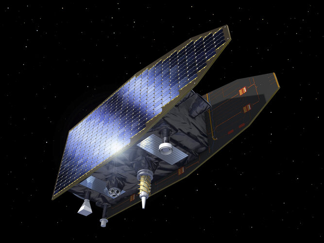
The second Genesis Science Workshop, held on 3 and 4 April in Matera, Italy, brought together the ESA Genesis team, industry experts and scientists from the international community to discuss the mission’s progress, including the latest satellite design evolutions, and prepare for the most extensive science exploitation possible. ESA and the French Space Agency CNES signed a contract during the event, confirming that the fourth geodetic technique, DORIS, will join the mission.
ESA’s NavLab on wheels: an Arctic mission
13.3.2025 10:02
High above the Arctic Circle, on the rugged terrain of Andøya, three ESA radionavigation engineers take a rare moment to unwind with a game of shuffleboard. Outside, sheep graze under the shimmering northern lights, a serene backdrop to their demanding mission: test how navigation technologies withstand interference signals. With 100TB of data collected over 5 days, their efforts promise to strengthen the reliability of satellite navigation for the benefit of us all.
ESA signs new chip development for more resilient satnav
5.3.2025 10:00
It is impossible to imagine our everyday lives – and Europe’s economy – without reliable satellite navigation. Accordingly, ESA prioritises developing and delivering more resilient positioning, navigation and timing technologies and systems into the future. NAVISP Industry Days saw the signing of an industrial contract between ESA and UK’s EnSilica Plc to develop a novel multi-band radio frequency receiver on a single chip, designed to simultaneously receive dual signal streams from all current and future satnav constellations to help overcome interference.
Call for information on low Earth orbit navigation
7.2.2025 16:39
The European Space Agency (ESA) is issuing a Request for Information (RFI) via OSIP for European industry to show interest and provide information on satellite technology that could enable the proposed next phase of ESA's LEO-PNT (Low Earth Orbit Positioning Navigation and Timing) programme, focused on industrialisation and in-orbit validation. ESA is looking to learn about production capability of payload building blocks and suitable off-the-shelf satellite platforms to accommodate them.
ESA to develop optical technology for navigation
7.2.2025 16:29
Optical technology has the potential to revolutionise the field of positioning, navigation and timing. To drive the development of this technology, ESA has signed a contract with a consortium of European companies that will conduct a definition study (Phase A/B1) and associated critical technology predevelopment.
This is the first step toward a potential in-orbit demonstrator for optical time synchronisation and ranging (OpSTAR) that will be proposed at the ESA Council at Ministerial Level in November 2025, to validate intersatellite optical links before future use in operational satellite navigation systems.
Galileo sites from pole to tropics begin migration
5.2.2025 15:24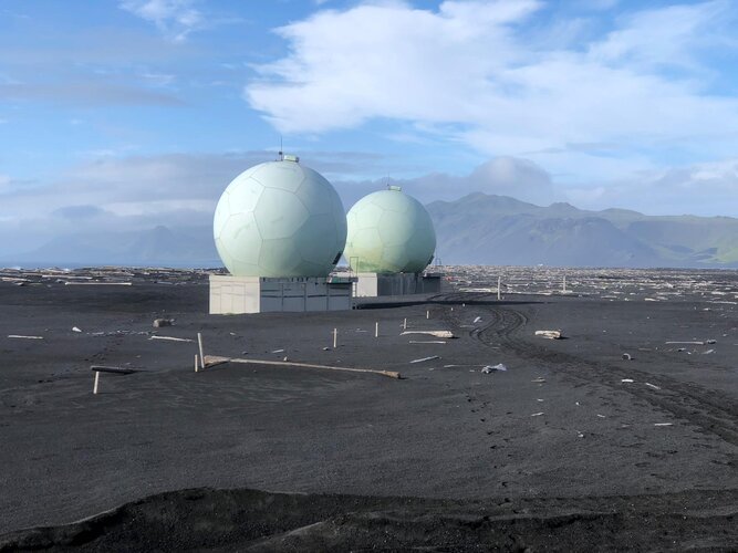
In a landmark achievement, ESA successfully migrated Galileo’s Control Centres in a highly complex operation involving over 200 people from the Agency, industry and EUSPA. This milestone marked the beginning of a global operation to upgrade Galileo’s entire Ground Segment, a vast network of stations spread around the world.
Satnav summer school open for registrations
20.1.2025 9:03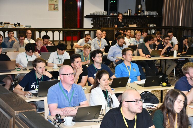
Are you a young researcher in the field of satellite navigation? Learn from top-notch experts and expand your network at this year’s ESA-JRC International Summer School on Global Navigation Satellite Systems, taking place this July in Arachova, Greece.
Join ESA FutureNAV Industry Day 2025
13.12.2024 10:04
The first FutureNAV Industry Day, on 18 February 2025, will bring together European stakeholders in satellite navigation to explore the future of positioning, navigation and timing (PNT) technologies. This gathering will spotlight emerging opportunities and foster a network of European companies in the PNT and GNSS sector. Don't miss this chance - secure your spot by registering here.
Seven ways navigation tech contributes to sustainability
25.10.2024 10:50
What does satellite navigation have to do with sustainable development? Quite a lot, in fact. Satnav and other positioning, navigation and timing (PNT) technologies provide critical data that support green solutions across numerous sectors. From enabling smart mobility to optimising energy grids and facilitating precision farming, the potential for PNT to drive sustainability is immense.
ESA's Moonlight programme: Pioneering the path for lunar exploration
15.10.2024 11:58
Imagine a near future where services such as satellite navigation, video conferencing, and file sharing are as seamless on the Moon as they are on Earth.
Navigation tech for the future of mobility
14.10.2024 13:49
Where would we be without our GNSS-enabled car navigation systems or navigation apps on our smartphone? Space technology, particularly global navigation satellite systems like the European Galileo, is the backbone of today's mobility and transport.
But are current technologies and systems enough to meet the evolving mobility needs of the future? The European Space Agency is closely monitoring emerging technology trends and staying ahead of the curve, designing and developing the future of Galileo and EGNOS, and conceiving new missions and programmes so that European space technology continues to serve the demands of an increasingly interconnected and mobile world.
Two new satellites added to Galileo constellation for increased robustness
17.9.2024 14:49
The European Galileo satellite navigation system keeps growing: a new pair of satellites has joined the constellation after a journey on a Falcon 9 rocket, launched from the Kennedy Space Center in Florida on 18 September at 00:50 CEST (17 September 18:50 local time).
Two new satellites added to Galileo constellation for increased resilience
17.9.2024 14:49
The European Galileo satellite navigation system Galileo keeps growing: a new pair of satellites has joined the constellation after a journey on a Falcon 9 rocket, launched from the Kennedy Space Center in Florida on 18 September at 00:50 CEST (17 September 18:50 local time).
Two new satellites added to Galileo constellation for increased resilience
17.9.2024 14:49
The European Galileo satellite navigation system keeps growing: a new pair of satellites has joined the constellation after a journey on a Falcon 9 rocket, launched from the Kennedy Space Center in Florida on 18 September at 00:50 CEST (17 September 18:50 local time).
New Galileo satellites operational after successful in-orbit testing
5.9.2024 17:00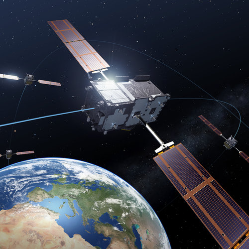
The two new Galileo satellites launched in April have entered service, completing the second of three constellation planes. With every addition to the constellation, the precision, availability and robustness of the Galileo signal is improved. The next launch is planned in the coming weeks and the remaining six Galileo First Generation satellites will join the constellation in the next years.
Satnav enables medical and emergency response
17.7.2024 11:35
Satellite navigation is not just about travel directions; its applications extend to search and rescue operations, agriculture, autonomous vehicles, sports and perhaps surprisingly, even health. ESA's NAVISP programme supports European companies in the creation of satnav-powered solutions with all sorts of applications – among them, emergency response and healthcare.
Call for ideas on navigation demonstrators and technologies
8.7.2024 14:13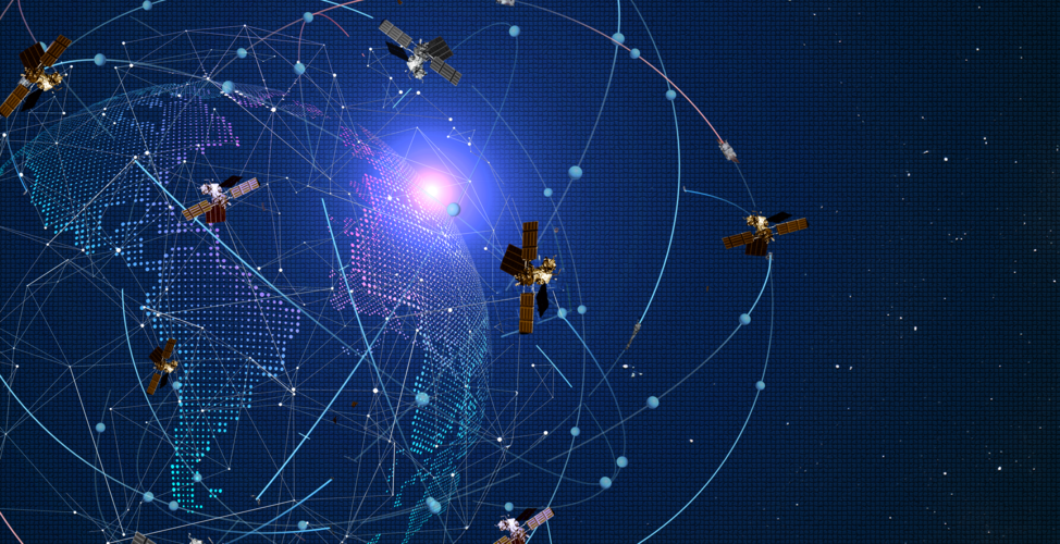
Do you want to help shape the future of European satellite navigation? ESA is issuing an open call via OSIP for companies and researchers to help identify future navigation demonstrators and disruptive technologies that will shape the landscape of satellite navigation in the coming decades.
Green light for Galileo Second Generation satellite design
12.6.2024 9:40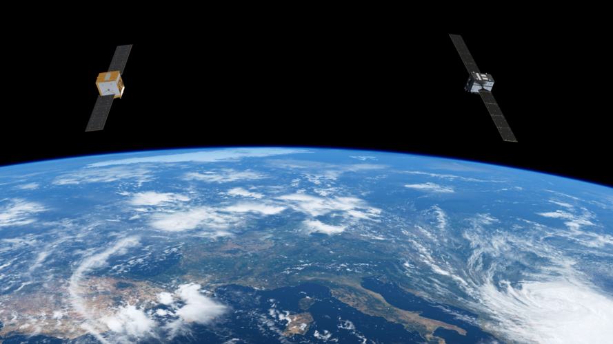
Production of Galileo Second Generation satellites advances at full speed after two independent Satellite Critical Design Review boards have confirmed that the satellite designs of the respective industries meet all mission and performance requirements. This achievement is another crucial milestone hit on time in the ambitious schedule to develop the first 12 satellites of the Galileo Second Generation fleet.
Europe’s largest ground segment updated with no user impact
29.5.2024 15:47
Over 200 dedicated professionals from ESA, EUSPA and European industry across four Galileo centres and seven external entities have seamlessly upgraded Galileo’s massive ground segment. In a remarkable feat of coordination and precision involving the deployment of 400 items, and after five months of rehearsals, Galileo’s ground segment, the largest in Europe, has transitioned seamlessly to System Build 2.0.
Two new satellites join the Galileo constellation
29.4.2024 12:00
The European Galileo navigation system has two more satellites in orbit following their launch in the early morning of Sunday, 28 April, at 01:34 BST/02:34 CEST. With 30 satellites now in orbit, Galileo is expanding its constellation, increasing the reliability, robustness and, ultimately, the precision, benefiting billions of users worldwide.
Two new satellites join the Galileo constellation
29.4.2024 12:00
The European Galileo navigation system has two more satellites in orbit following their launch on a SpaceX Falcon 9 in the early morning of Sunday, 28 April, at 01:34 BST/02:34 CEST. With 30 satellites now in orbit, Galileo is expanding its constellation, increasing the reliability, robustness and, ultimately, the precision, benefiting billions of users worldwide.
Six mind-blowing facts about Galileo
16.4.2024 13:40
Did you know Galileo was born in the Netherlands in the 1990s? Europe’s own global navigation satellite system was developed in ESA’s technological heart, ESTEC, in Noordwijk, almost three decades ago. Since then, it has grown to become one of the most complex and critical infrastructures ever built in Europe, as well as the largest European satellite constellation and ground segment.
Galileo Second Generation
2.4.2024 15:17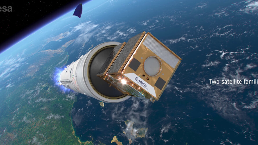 Video:
00:03:53
Video:
00:03:53
Europe’s Galileo is the world’s most precise satellite navigation system, providing metre-level accuracy to billions of users. ESA and European industry are preparing a new generation of satellites, the Galileo Second Generation or G2, that will revolutionise the fleet with enhanced capabilities.
Navigation Training Course now open for application
27.3.2024 10:01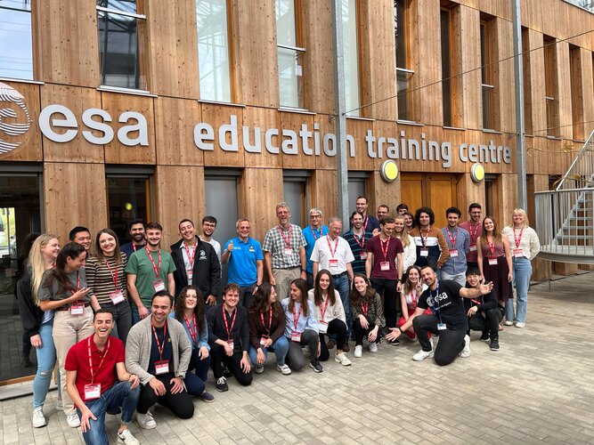
ESA Academy is calling on university students to apply for the Navigation Training Course to be held from 24 to 28 June 2024 at ESA Academy’s Training and Learning Facility in ESEC-Galaxia, Belgium. This Training Course is a collaboration between ESA Education and ESA’s Directorate of Navigation. Would you like to know more about the future of satellite navigation? Apply for our course today!
ESA kicks off two new navigation missions
18.3.2024 15:06
ESA has signed contracts with several European companies for an overall amount of € 233 million to develop Genesis and a LEO-PNT demonstrator, two new missions within the FutureNAV programme that will keep Europe at the forefront of satellite navigation worldwide.
ESA kicks off two new navigation missions
18.3.2024 15:06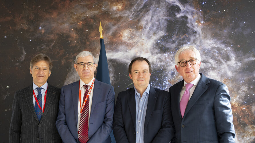
ESA has signed contracts with several European companies for an overall amount of € 233 million to develop Genesis and a LEO-PNT demonstrator, two new missions within the FutureNAV programme that will keep Europe at the forefront of satellite navigation worldwide.
Contract for new Galileo atomic clock tech signed
11.3.2024 13:55
ESA, on behalf of the European Commission, has signed a €12 million contract with Leonardo S.p.A (Italy) and Istituto Nazionale di Ricerca Metrologica to design and develop a new ultra-precise atomic clock technology for Galileo.
Contract for new Galileo atomic clock tech signed
11.3.2024 13:55
ESA, on behalf of the European Commission, has signed a €12 million contract with Leonardo S.p.A (Italy) and Istituto Nazionale di Ricerca Metrologica to design and develop a new ultra-precise atomic clock technology for Galileo.
The geodetic community meets Genesis
8.3.2024 11:45
The first Genesis science workshop brought together the ESA project team and the scientific geodesy community to establish the Genesis Scientific Exploitation Team and to set the ground for future collaboration.
The geodetic community meets Genesis
8.3.2024 11:45
The first Genesis science workshop brought together the ESA project team and the scientific geodesy community to establish the Genesis Scientific Exploitation Team and to set the ground for future collaboration.
 Image:
GENESIS mission patch
Image:
GENESIS mission patch
15th satnav summer school open for registrations
9.2.2024 8:48
Are you a researcher in the field of satellite navigation? Register now for this year’s ESA-JRC International Summer School on Global Navigation Satellite Systems, taking place in Slovenia in July, to learn from top-notch experts and expand your network.
15th satnav summer school open for registrations
9.2.2024 8:48
Are you a young researcher in the field of satellite navigation? Register now for this year’s ESA-JRC International Summer School on Global Navigation Satellite Systems, taking place in Slovenia in July, to learn from top-notch experts and expand your network.
15th satnav summer school open for registrations
9.2.2024 8:48
Are you a researcher in the field of satellite navigation? Register now for this year’s ESA-JRC International Summer School on Global Navigation Satellite Systems, taking place in Slovenia in July, to learn from top-notch experts and expand your network.
Galileo, now fit for aviation
29.1.2024 14:20
Galileo, already the world’s most precise satellite navigation system, now meets international standards to guide civil aviation from take-off to landing, complementing Europe’s EGNOS for the most critical operations. Galileo was not designed to comply with these strict safety requirements, so how did engineers at ESA achieve this feat? This is a tale of engineering excellence.
ESA’s NavLab drone
22.1.2024 10:00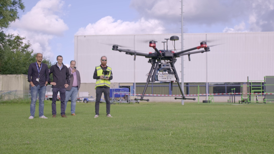 Video:
00:02:16
Video:
00:02:16
Based at the ESTEC technical centre in the Netherlands, ESA’s Navigation Laboratory has a high-flying new recruit: this drone can carry different types of satellite navigation receivers to collect data for follow-on analysis.
New instruments for Galileo’s tomorrow
14.12.2023 9:05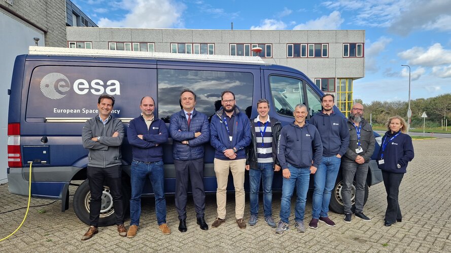
Galileo Second Generation is on the way with new and enhanced navigation satellites that will offer novel signals, services and even more precise positioning. But all the work being done to make it happen hinges on this single item at ESA’s Navigation Laboratory at ESTEC. The G2 test user receiver is designed to quantify the improvements the Second Generation will bring compared to current satellite navigation systems and will be used to verify the performance of early receivers processing the first G2 signals in space.
NAVISP Industry 2023 @ ESTEC
5.12.2023 18:00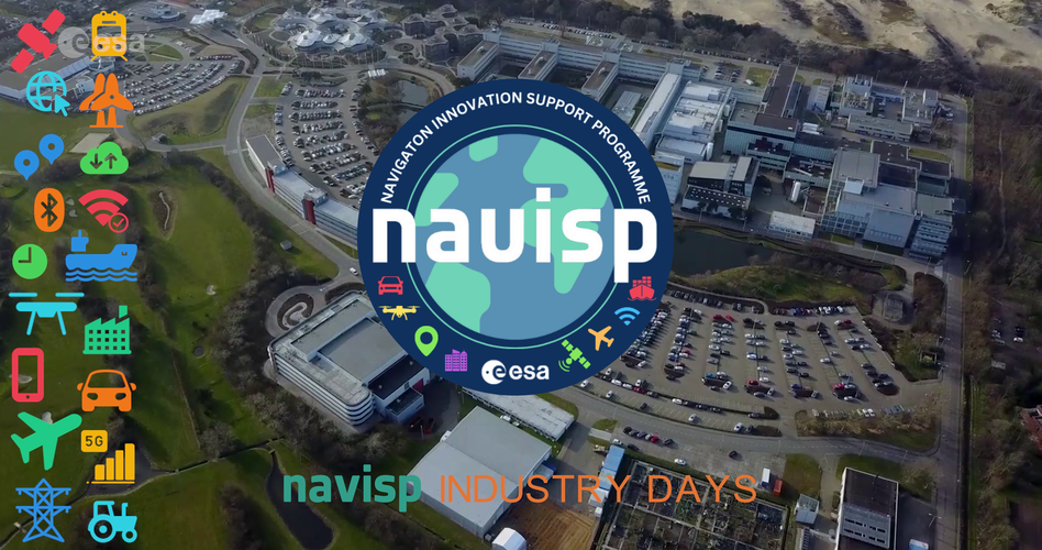 Video:
00:02:04
Video:
00:02:04
In November 2023, ESA hosted its annual NAVISP Industry Days event. This year, more than 200 positioning, navigation and timing (PNT) professionals from across Europe gathered at ESA’s Space Research and Technology Centre (ESTEC) in the Netherlands to explore together opportunities for innovation, commercialisation and collaboration via ESA’s Navigation Innovation and Support Programme (NAVISP).
For more information: visit https://navisp.esa.int
Galileo Second Generation satellites take shape
5.12.2023 13:10
To make the future of Galileo a reality, ESA and European industry are hard at work developing ultra-precise atomic clocks, system testbeds, ground mission and ground control segments and, of course, the satellites. Airbus Defence and Space, who is building six of the Galileo Second Generation constellation satellites, presented their first flight model structure to the programme’s stakeholders last week.
Navigation and telecommunications testbed vehicles
30.11.2023 9:18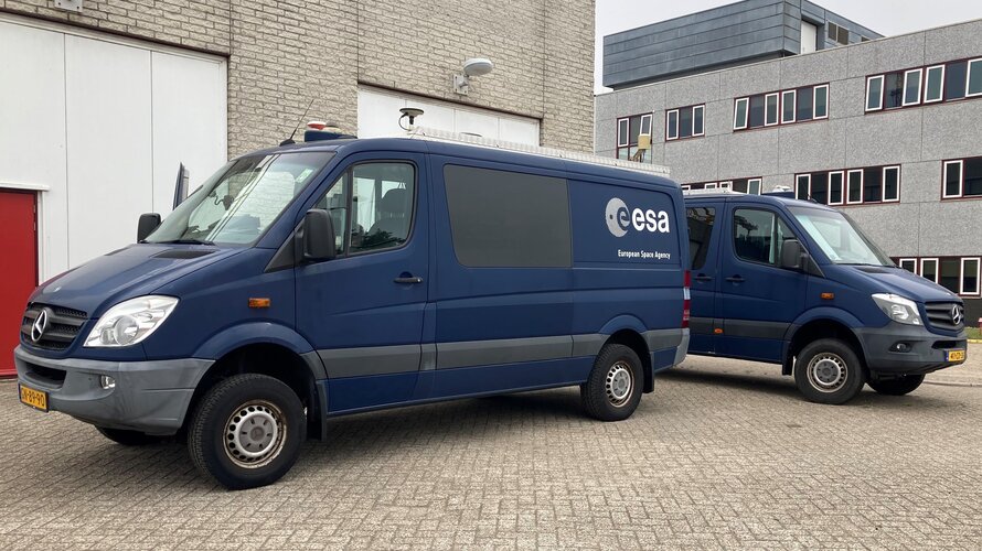
ESA’s navigation and telecommunications testbed vehicles are custom-built mobile test platforms operated by ESA’s Navigation Laboratory to support test campaigns for navigation and telecommunications services, most notably Europe’s Galileo constellation. Testing in the field provides a unique opportunity to complement laboratory tests, verifying the system’s performance from a user perspective in a more dynamic and realistic setting.
Unlocking Europe’s satellite navigation potential at NAVISP Industry Days
22.11.2023 9:23
Leading positioning, navigation and timing experts from companies and research institutions across Europe met last week at ESA’s NAVISP Industry Days, a two-day workshop dedicated to discussing trends and opportunities in this field.
Galileo Second Generation satellite aces first hardware tests
10.11.2023 9:20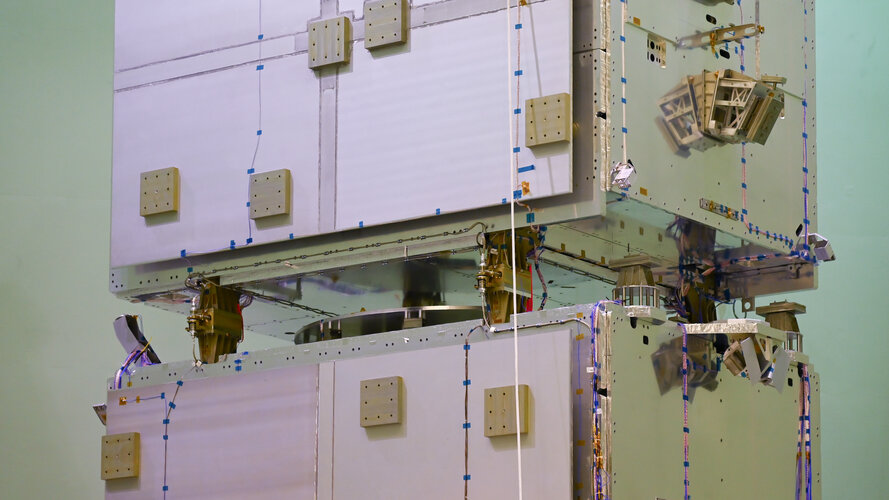
The new Galileo satellite model from Thales Alenia Space underwent mechanical and signal performance testing this summer at ESA’s ESTEC Test Centre. Structural models resisted launch-like noise and vibrations while an electrical model proved its ability to send Galileo signals - a major milestone in the development of Galileo’s Second Generation.
Satnav test on remote island lab
17.10.2023 14:45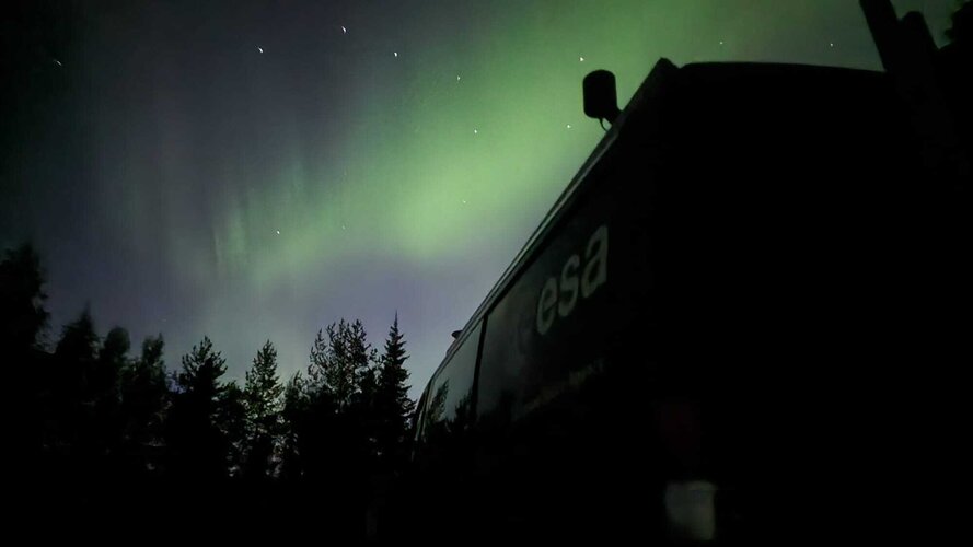
ESA’s navigation testbed vehicle participated in a campaign organised by Norwegian governmental authorities to assess the impact of jamming and spoofing on satnav systems and test innovative technologies for detection and mitigation.
Wanted: bright ideas to develop the lunar economy
9.10.2023 11:39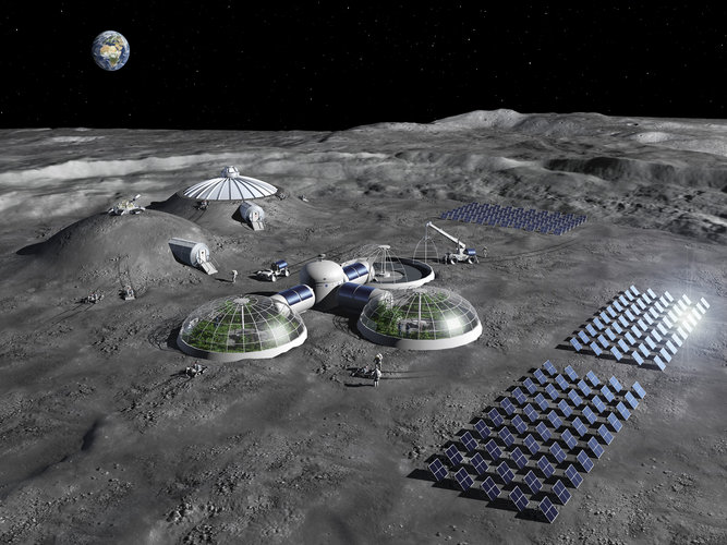
ESA is calling for visionary ideas for how to use a constellation of communication and navigation satellites around the Moon to establish lunar businesses – and unlock opportunities on Earth.
Harmonizing satnav for aviation: SBAS experts meet
6.10.2023 8:38
More than 150 000 aircraft and 5000 airports worldwide are equipped with Satellite-based Augmentation System (SBAS) technology for safer flying. Specialists overseeing these systems met from 19 to 21 September for the 38th SBAS Interoperability Working Group meeting, hosted by ESA in Toulouse, to coordinate efforts for seamless navigation.
NAVISP Industry Days 2023: register now
21.9.2023 14:57
Are you part of the positioning, navigation and timing community and want to play a part in shaping the future of this transformative field? Register now for this year’s NAVISP Industry Days!
Galileo becomes faster for every user
11.9.2023 10:22
ESA satnav receiver vans – driving between the busy heart of Rotterdam, quiet countryside, and the Agency’s ESTEC technical centre – have confirmed that Galileo signals now provide a first position fix more rapidly, while also offering improved robustness in challenging environments and streamlined access to time information.
Just add AI for smarter satnav... from rogue drone detection to safer driving
3.8.2023 10:54
With our society producing more data than ever before, Artificial Intelligence, AI, is allowing us to gather, analyse and make use of it in novel ways, including in space programmes. Now AI is also being applied to satellite navigation by the engineering teams of ESA’s NAVISP programme, working with European industry and academia to invent the future of navigation. The result is a growing portfolio of prototype services, variously employed to improve space and Earth weather forecasting, enhance the performance of autonomous cars and boats, and help identify rogue drones in sensitive airspace.
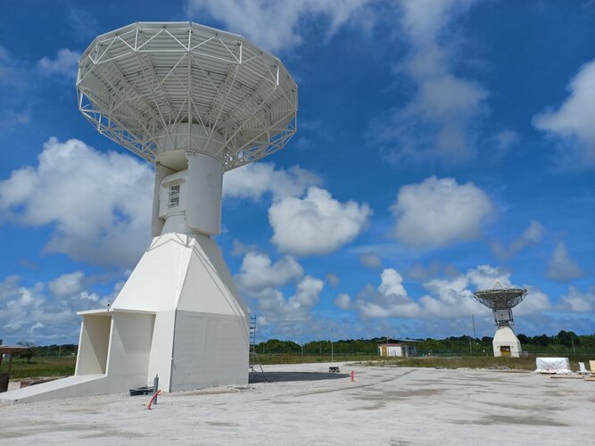 Image:
New Galileo station goes on duty
Image:
New Galileo station goes on duty
Rescue drones tested within Italian volcanoes
21.7.2023 14:28
Interconnected drones have been dispatched into volcanic territory to test their use for civil protection, to help guide responses to natural disasters using novel PNT technology. The project, named Pathfinder, is supported through ESA’s Navigation Innovation and Support Programme, NAVISP. Two test campaigns have been undertaken to date, around the active Stromboli Island volcano and within the Astroni Nature Reserve, in a volcanic crater near Naples.
A look back at our first ESA Academy’s Navigation Training Course
7.7.2023 11:19
From 26 to 30 June, the first ESA Academy’s Navigation Training Course took place at ESEC-Galaxia, the European Space Security and Education Centre , in Belgium. Developed in collaboration with ESA’s Directorate of Navigation, the course attracted 30 Master and PhD students of 12 different nationalities from engineering and scientific subjects with basic knowledge of Navigation to enrich their university portfolio with a unique experience. Let’s have a look at the event and impressions from the participants!
Industry invited to bid for low-Earth orbit satnav demo
21.6.2023 14:35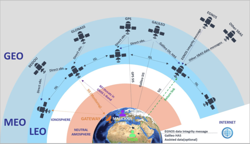
Europe’s Galileo constellation is already the world’s most accurate satellite navigation system, providing metre-level precision to users worldwide. The general expectation is that satnav is going to keep on getting better, in line with increasing user needs and accuracy requirements. But in fact, traditional Global Navigation Satellite Systems (GNSS) in medium Earth orbit are approaching their limits of technical performance.
Industry invited to bid for low-Earth orbit satnav demo
21.6.2023 14:35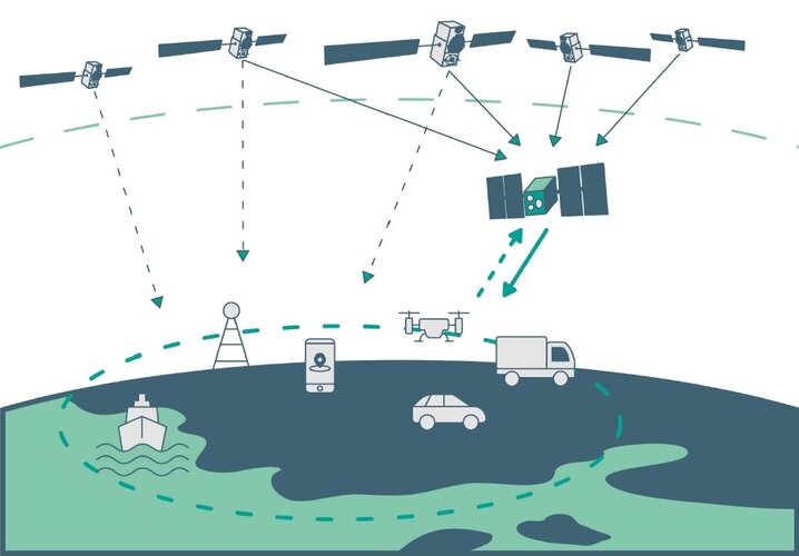
Europe’s Galileo constellation is already the world’s most accurate satellite navigation system, providing metre-level precision to users worldwide. The general expectation is that satnav is going to keep on getting better, in line with increasing user needs and accuracy requirements. But in fact, traditional Global Navigation Satellite Systems (GNSS) in medium Earth orbit are approaching their limits of technical performance.