


![]()

ESA Observing the Earth 
zdroje zpráv:
MTG-S1 enters service for weather forecasting
13.7.2026 9:39
One year after launch, the first Meteosat Third Generation Sounder satellite, MTG-S1, has completed commissioning with flying colours, been placed in its operational position in geostationary orbit and is now delivering vital data to strengthen weather forecasting across Europe.
Revisit the Earth Explorer 12 User Consultation Meeting
10.7.2026 14:00Revisit the Earth Explorer 12 User Consultation Meeting
Held on 7–8 July 2026 in Tallinn, Estonia
Earth from Space: Great Bear Lake, Canada
10.7.2026 10:00 Image:
The Copernicus Sentinel-2 mission captures Canada’s Great Bear Lake in striking colours.
Image:
The Copernicus Sentinel-2 mission captures Canada’s Great Bear Lake in striking colours.
Satellites in tandem reveal 30 years of Antarctic ice flow
9.7.2026 17:10
Thirty years after the European Space Agency first demonstrated the power of flying two satellites in very close formation, the concept was recently recreated. By temporarily positioning two Copernicus Sentinel-1 radar satellites to replicate the pioneering ERS-1–ERS-2 ‘tandem mission’, ESA achieved one-day repeat radar imaging of the same Antarctic region.
The results once again demonstrate how this approach can be used to measure glacier motion and pinpoint the critical grounding line with exceptional precision.
Hellenic Fire System achieves first light
7.7.2026 13:24
The Hellenic Fire System has returned its first image, marking an important milestone in Greece's future national space-based wildfire monitoring capability.
Unpacking Europe’s new weather imagers
7.7.2026 10:00
The second Meteosat Third Generation Imager satellite (MTG-I2) has begun its launch campaign, during which it will go through final inspections before being fitted inside the fairing of the Ariane 6 rocket that will launch it into space towards the end of the summer. So how will this 3800 kg satellite help improve weather forecasts for Europe and North Africa?
Earth from Space: Grand Canyon, US
3.7.2026 10:00 Image:
The Grand Canyon, a stunning natural feature in the landscape of Arizona, US, is featured in these two satellite views.
Image:
The Grand Canyon, a stunning natural feature in the landscape of Arizona, US, is featured in these two satellite views.
Watch: Earth Explorer 12 User Consultation Meeting
2.7.2026 14:30
On 7–8 July 2026, leading Earth observation scientists and experts are gathering in Tallinn, Estonia, for the Earth Explorer 12 User Consultation Meeting – a key milestone in the selection of ESA's next Earth Explorer mission.
Watch live: Earth Explorer 12 User Consultation Meeting on ESA WebTV TWO
Call for interest: MTG-I2 launch media programme at Europe’s Spaceport
2.7.2026 12:15Press Release N° 33–2026
Media representatives are invited to express their interest in attending the media programme for the launch of the Meteosat Third Generation (MTG) Imager weather satellite, MTG-I2, at Europe’s Spaceport in French Guiana.
FLEX and Sentinel-3C bound for launch site
2.7.2026 10:41 Image:
FLEX and Sentinel-3C bound for launch site
Image:
FLEX and Sentinel-3C bound for launch site
Authorisation paves the way for Aeolus-2 wind mission
2.7.2026 10:00
Building on the remarkable success of the Earth Explorer Aeolus wind mission, the European Space Agency has given Airbus Defence and Space in the UK the authorisation to proceed to begin the development of Aeolus’ successor, Aeolus-2 – which is set to be built to enhance operational weather forecasts.
Mediterranean Sea breaks June surface heat record
1.7.2026 15:45 Image:
This image shows the sea surface temperature anomaly detected in the Mediterranean Sea on 29 June 2026
Image:
This image shows the sea surface temperature anomaly detected in the Mediterranean Sea on 29 June 2026
Mediterranean Sea breaks June surface heat record
1.7.2026 15:45
Image:
This image shows the sea surface temperature anomaly detected in the Mediterranean Sea on 29 June 2026.
Time to say goodbye to Sentinel-1A
30.6.2026 14:30
After 12 years of exceptional service, the pioneering Copernicus Sentinel-1A radar satellite has reached the end of its mission. Originally designed for a seven-year life in orbit, the satellite has exceeded expectations, not only by its longevity, but through the extraordinary impact of its data, which have deepened our understanding of our changing planet and supported a wide range of operational services and laid the foundation for scientific discoveries.
Sentinel-1 shows ground displaced after Venezuela earthquakes
29.6.2026 15:00 Image:
The map is an interferogram derived from the comparison of Sentinel-1 data on two dates: on the 18 June before the earthquakes and on 25 June a day after.
Image:
The map is an interferogram derived from the comparison of Sentinel-1 data on two dates: on the 18 June before the earthquakes and on 25 June a day after.
Sentinel-1 shows ground displacement after Venezuela earthquakes
29.6.2026 15:00 Image:
The map is an interferogram derived from the comparison of Sentinel-1 data on two dates: on the 18 June before the earthquakes and on 25 June a day after.
Image:
The map is an interferogram derived from the comparison of Sentinel-1 data on two dates: on the 18 June before the earthquakes and on 25 June a day after.
Earth from Space: Desert cropland
26.6.2026 10:00 Image:
These Copernicus Sentinel-2 images show agricultural development in the desert of southern Egypt, close to the border with Sudan.
Image:
These Copernicus Sentinel-2 images show agricultural development in the desert of southern Egypt, close to the border with Sudan.
Europe Faces the Heat
25.6.2026 15:00 Video:
00:02:07
Video:
00:02:07
Europe is facing an intense heatwave, with record temperatures and several cities under red alert. On 23 June, France recorded its hottest June day ever.
This image was captured the same day by the Copernicus Sentinel-3 satellite, which measures land surface temperature from space.
Unlike air temperature, land surface temperature shows how hot the ground itself becomes, often much higher as rock and asphalt absorb heat throughout the day.
Sentinel-3 uses thermal sensors to monitor Earth’s land, oceans, ice, and atmosphere, supporting everything from weather response to long-term climate monitoring.
Europe faces the heat
25.6.2026 15:00
Video:
00:02:07
Europe is facing an intense heatwave, with record temperatures and several cities under red alert. On 23 June, France recorded its hottest June day ever.
This image was captured the same day by the Copernicus Sentinel-3 satellite, which measures land surface temperature from space.
Unlike air temperature, land surface temperature shows how hot the ground itself becomes, often much higher as rock and asphalt absorb heat throughout the day.
Sentinel-3 uses thermal sensors to monitor Earth’s land, oceans, ice, and atmosphere, supporting everything from weather response to long-term climate monitoring.
View image: Europe feels the heat beneath our feet
Europe feels the heat beneath our feet
25.6.2026 15:00 Image:
This image of land surface temperature was captured by the Copernicus Sentinel-3 mission on Wednesday, 23 June.
Image:
This image of land surface temperature was captured by the Copernicus Sentinel-3 mission on Wednesday, 23 June.
Europe feels the heat beneath our feet
25.6.2026 15:00 Image:
This image of land surface temperature was captured by the Copernicus Sentinel-3 mission on Wednesday, 23 June.
Image:
This image of land surface temperature was captured by the Copernicus Sentinel-3 mission on Wednesday, 23 June.
Europe feels the heat beneath our feet
25.6.2026 12:00 Image:
This image of land surface temperature was captured by the Copernicus Sentinel-3 mission on Wednesday, 23 June.
Image:
This image of land surface temperature was captured by the Copernicus Sentinel-3 mission on Wednesday, 23 June.
A first: EarthCARE cloud data sharpen weather forecasts
23.6.2026 13:28
The European Space Agency’s EarthCARE satellite was developed to make a unique set of simultaneous measurements that shed new light on the role that clouds and aerosols play in regulating Earth’s climate.
Now, in a remarkable example of a research mission delivering direct practical benefits, global observations from the satellite’s cloud profiling radar are being used operationally by the European Centre for Medium-Range Weather Forecasts to improve daily weather forecasts – this landmark achievement marks the first time that cloud radar data from space have been assimilated into a global weather forecasting system.
MTG captures Earth at June solstice
22.6.2026 16:34 Image:
This image of Earth, with the day-night terminator line clearly visible, was captured by the Meteosat Third Generation (MTG) mission
Image:
This image of Earth, with the day-night terminator line clearly visible, was captured by the Meteosat Third Generation (MTG) mission
Earth from Space celebrates 1000 images
19.6.2026 10:00 Image:
ESA’s Earth from Space series reaches its 1000th image with a return to the vibrant waters of southern Florida, Cuba and the Bahamas – the same region featured in the very first edition in 2004.
Image:
ESA’s Earth from Space series reaches its 1000th image with a return to the vibrant waters of southern Florida, Cuba and the Bahamas – the same region featured in the very first edition in 2004.
Don’t miss the Earth Explorer 12 User Consultation Meeting
18.6.2026 13:19
The countdown is on for scientists, researchers and Earth observation experts eager to help shape the future of the European Space Agency’s Earth Explorer satellite series. Registration is closing soon for the Earth Explorer 12 User Consultation Meeting.
This all-important event offers the opportunity to be part of the discussion on which of four pioneering candidate missions should advance to the next stage of development.


Arrival of MTG-I2 by boat at Europe’s Spaceport
15.6.2026 9:26 Image:
The Meteosat Third Generation-Imager-2 (MTG-I2) satellite has arrived at Pariacabo harbour in French Guiana, ready to be transported to Europe’s Spaceport.
Image:
The Meteosat Third Generation-Imager-2 (MTG-I2) satellite has arrived at Pariacabo harbour in French Guiana, ready to be transported to Europe’s Spaceport.
Earth from Space: Buenos Aires
12.6.2026 10:00 Image:
This radar image from the Copernicus Sentinel-1 mission captures Buenos Aires, the capital of Argentina, the surrounding countryside and the Rio de la Plata estuary.
Zoom in to explore this image at its full resolution.
This is a composite of three Sentinel-1 acquisitions taken in January, March and May this year, with each image assigned to a different colour channel (blue in January, green in March and red in May). As the environmental changes on the ground created a significant ‘backscatter’ reflection of the radar signal, they show up as bright shades that correspond to changes across the seasons.
On the right-hand side of the image, the metropolitan area of Buenos Aires is visible in light grey. The area has a population of more than 16 million people and lies at 25 m above sea level. The urban areas were largely unchanged between January and May, hence the lack of colour in this part of the image. Other towns, such as Luján and Junin, are also visible as smaller patches of grey west of the capital.
The blue areas correspond to surface changes such as choppy water, captured in January, which is mid-summer in Argentina. The rivers, deltas and open water are mainly coloured in either dark blue, purple or black. Winds and rough sea conditions during both January and May mean that the Rio de la Plata estuary, east of Buenos Aires, appears purple (a mix of blue in January and red in May). The Paraná river meanders through wetlands on the left of the image before flowing into the Rio de la Plata. The Uruguay river is also seen flowing from the north into the estuary.
To the west of Buenos Aires, agricultural fields and the Argentinean Pampas dominate the landscape. The green tint is due to significant ‘backscatter’ reflection of the radar signal in this area during the capture in March. Since this period is late summer in Argentina, it likely denotes growth of major crops such as soy and corn.
At the top of the image, a large area north of the Paraná river, in Entre Ríos province, appears in vivid red – the channel assigned to ground change in May, which is late Autumn in Argentina. It is likely that this is due to natural vegetation growth caused by seasonal rains during that period. This is when the areas of exposed grassland come back to life following the long, dry summers.
Tracking urban expansion in hazard-prone areas
11.6.2026 9:15
The World Settlement Footprint (WSF) Tracker, and its dedicated online platform, have been officially released at an event at the World Bank headquarters in Washington DC.
ESA awards contract to build Sentinel-1 Next Generation satellites
10.6.2026 17:40
The European Space Agency has awarded the contract to lead the development and build for two Copernicus Sentinel-1 Next Generation satellites to Thales Alenia Space. Building on the success of the current Sentinel-1 mission, the next-generation satellites will ensure the long-term continuity of Europe’s radar Earth observation capabilities while delivering enhanced performance.
Cleaner air and prosperity can go hand in hand
9.6.2026 9:31
For decades, economic growth and fossil-fuel consumption have been tightly intertwined. As cities have expanded, rising prosperity has often been accompanied by worsening air pollution. New research, however, suggests that this relationship is changing – and satellite data are helping to prove it.
ESA and EBRD to advance Earth observation for development and impact finance
8.6.2026 9:15
The European Space Agency (ESA) signed an agreement with the European Bank for Reconstruction and Development (EBRD), hailing a new era of cooperation with the aim of advancing the use of Earth observation data and services for development and impact finance initiatives.
Earth from Space: Baku, Azerbaijan
5.6.2026 10:00 Image:
On World Environment Day, the Copernicus Sentinel-2 mission brings us an amazing view from space of Baku, capital of Azerbaijan, hosting this year’s celebration.
Image:
On World Environment Day, the Copernicus Sentinel-2 mission brings us an amazing view from space of Baku, capital of Azerbaijan, hosting this year’s celebration.
Tessera AI model offers accessible way to view Earth
4.6.2026 15:00
A foundation model trained on Earth observation data from Copernicus Sentinel-1 and Sentinel-2 has been made widely available to researchers, it was announced at a computer industry conference this week in Denver, US.
Tessera AI model offers accessible way to view Earth
4.6.2026 15:00
A foundation model trained on Earth observation data from Copernicus Sentinel-1 and Sentinel-2 has been made widely available to researchers, it was announced at a computer industry conference this week in Denver, US.
Earth from Space: Batagaika Crater
29.5.2026 10:00 Image:
This Copernicus Sentinel-2 image features the Batagaika Crater in Siberia. This is the biggest permafrost crater in the world, caused by melting permafrost and also known as a ‘mega-slump’.
Image:
This Copernicus Sentinel-2 image features the Batagaika Crater in Siberia. This is the biggest permafrost crater in the world, caused by melting permafrost and also known as a ‘mega-slump’.
MTG-I2 embarks on journey to Europe’s Spaceport
28.5.2026 14:00 Image:
The Meteosat Third Generation-Imager2 satellite sets sail from France to French Guiana
Image:
The Meteosat Third Generation-Imager2 satellite sets sail from France to French Guiana
Surface temperatures during Europe's heatwave captured by Sentinel-3
27.5.2026 16:15 Image:
Europe is in the middle of a heatwave – Copernicus Sentinel-3 captured this image on Tuesday 26 May
Image:
Europe is in the middle of a heatwave – Copernicus Sentinel-3 captured this image on Tuesday 26 May
Hot surfaces during Europe's heatwave 'seen' by Sentinel-3
27.5.2026 16:00 Image:
Europe is in the middle of a heatwave – Copernicus Sentinel-3 captured this image on Tuesday 26 May
Image:
Europe is in the middle of a heatwave – Copernicus Sentinel-3 captured this image on Tuesday 26 May
Earth from Space: Algerian arid landscape
22.5.2026 10:00 Image:
The sandy and rocky terrain of the Sahara desert in central Algeria is featured in these images captured by the Copernicus Sentinel-2 mission.
Image:
The sandy and rocky terrain of the Sahara desert in central Algeria is featured in these images captured by the Copernicus Sentinel-2 mission.
Insights into Earth’s molten outer core from space
21.5.2026 15:00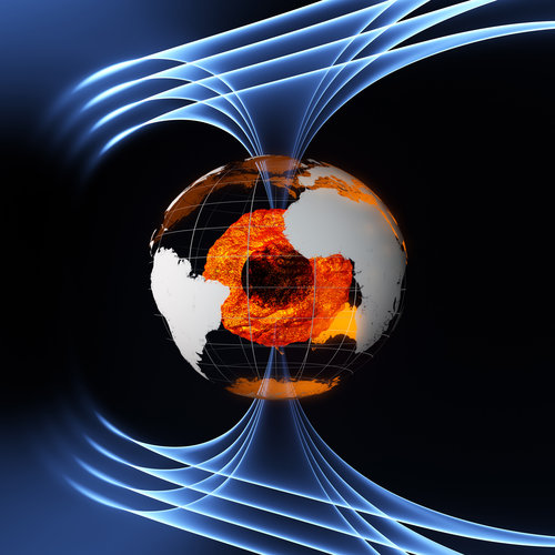
The liquid iron in Earth’s outer core doesn’t always behave as expected. When it changed direction in an unexplained way, ESA satellites provided data on the direction of flow, helping scientists gain better insight into the dynamics at the centre of our planet.
Greenlight for next two ESA Scout missions
20.5.2026 15:00
The European Space Agency is expanding its growing fleet of Earth-observing science Scout missions with the selection of two new satellites: Hibidis and SOVA-S.
Chosen from four final competing concepts, these missions will tackle very different but equally pressing scientific questions – from biodiversity below forest canopies to the effects of atmospheric gravity waves high above Earth.
Satellite Evidence in the Courtroom
19.5.2026 9:16
Satellite imagery can show when a crime leaves a mark on the landscape – a village destroyed, a lake drained, a forest cleared. However, whether a court will accept satellite evidence remains an open question. The 'Earth Observation for Human Rights and Legal Accountability Mechanisms' project, co-funded by the Discovery element of ESA's Basic Activities and the Centre for Sustainable Development at the University of Strathclyde, examined how Earth observation data can be systematically analysed and presented to meet the evidentiary standards required in legal proceedings.
Earth from Space: Quito’s volcanic landscape
15.5.2026 10:00 Image:
This image, captured by Copernicus Sentinel-2, gives us a glimpse of Ecuador’s capital, Quito, sprawling for 40 km along this high-altitude valley in the Andes.
Image:
This image, captured by Copernicus Sentinel-2, gives us a glimpse of Ecuador’s capital, Quito, sprawling for 40 km along this high-altitude valley in the Andes.
Earth observation data for the policymaking of tomorrow
8.5.2026 13:00
How can Earth observation data play a more central role in guiding future decisions on the environment? This was one of the questions asked at an ESA-hosted event that brought together leaders from Earth observation science with the global statistics community.
Earth from Space: Greenland's changing ice
8.5.2026 11:00 Image:
Part of the rugged and deeply indented coast of northeastern Greenland is featured in this radar image captured by Copernicus Sentinel-1.
Image:
Part of the rugged and deeply indented coast of northeastern Greenland is featured in this radar image captured by Copernicus Sentinel-1.
Watch live: selected sessions from the ESA CommEO Forum
8.5.2026 9:00
The third ESA Earth Observation Commercialisation Forum (ESA CommEO) will bring together the global Earth observation ecosystem for three days of insights, innovation and high-level networking. It takes place in Seville, Spain, from 12–14 May 2026, but you can join selected sessions online to hear about the latest trends arising in the Earth observation commercial market.
Putting the ‘super’ into a supersite for Earth observation
6.5.2026 14:58
In the far northern reaches of Finnish Lapland, an ambitious new chapter in Earth observation is unfolding. The European Space Agency, together with the Finnish Meteorological Institute and Finnish industrial partners, is advancing plans to develop a state-of-the-art ‘supersite’ in Sodankylä.
The plan is to equip this remote site with an array of new advanced environmental measuring technologies, including a striking high-tech airship carrying sensors to perform regional surveys.
Hellenic Fire System satellites launched for Greece
4.5.2026 9:30
A constellation of four new satellites has been launched for Greece, marking a world first for a national satellite capability dedicated to wildfire detection and tracking. The mission is the result of cooperation between the Greek government, private satellite company OroraTech and the European Space Agency (ESA), supported through the EU-funded Recovery and Resilience Facility.
Launch boosts European Earth monitoring and connectivity
4.5.2026 9:30
Thirteen European satellites on the same rideshare launcher have successfully reached orbit, bringing capabilities to Italian and Greek monitoring programmes as well as CubeSats that will test satellite connectivity.
Italy’s Earth monitoring programme reaches new milestone
4.5.2026 9:00
Italy’s IRIDE Earth observation programme has added seven more satellites to its Hawk for Earth Observation (HEO) constellation, enhancing the strategic data it provides for Italy’s environmental, emergency and security services.
Sentinel-1D goes live: a milestone for Europe’s radar mission
1.5.2026 10:32
The Copernicus Sentinel-1D satellite, launched last November, is now fully operational after successfully completing its critical in-orbit commissioning phase.
With all four Sentinel-1 satellites having now been deployed, this achievement marks a major milestone for this flagship radar mission – a journey that began more than a decade ago and that has helped pave the way for the future of Earth observation.
Earth from Space: Netherlands in bloom
1.5.2026 10:00 Image:
Captured by the Copernicus Sentinel-2 mission on 21 April 2026, this image shows a double bloom in the Netherlands: an array of vibrant colours in the tulip fields as well as the blue-greenish swirls of phytoplankton in the North Sea.
Image:
Captured by the Copernicus Sentinel-2 mission on 21 April 2026, this image shows a double bloom in the Netherlands: an array of vibrant colours in the tulip fields as well as the blue-greenish swirls of phytoplankton in the North Sea.
Stunning images from Biomass mark its one year in orbit
29.4.2026 14:40
To mark the first anniversary of the European Space Agency’s Biomass satellite, we present a selection of striking images captured over the past 12 months, revealing Earth’s forests, and much more, in new detail. In just one year, this pioneering mission has begun transforming our understanding of forest dynamics and advancing how scientists monitor the critical role forests play in regulating the global carbon cycle.
Braving the Arctic for upcoming polar-focused satellites
24.4.2026 11:08
As sea ice continues to succumb to the climate crisis, measuring its decline with precision has never been more urgent. To meet this challenge, the European Space Agency is developing three new Copernicus satellites, each employing distinct but complementary techniques to monitor this fragile component of the Earth system.
To ensure the data from these new satellites are razor-sharp, an international team of hardy scientists is now out on the Arctic sea ice braving the cold and flying above to collect critical in situ measurements.
Earth from Space: Cloud patterns over the Canary Islands
24.4.2026 10:00 Image:
This Copernicus Sentinel-2 image highlights a distinctive cloud formation north of the Canary Islands of Tenerife and La Gomera.
Image:
This Copernicus Sentinel-2 image highlights a distinctive cloud formation north of the Canary Islands of Tenerife and La Gomera.
Why is Antarctica’s mass increasing?
23.4.2026 15:00
The Antarctic Ice Sheet has been growing since 2020 – and scientists have now identified why. Research funded by the European Space Agency (ESA) looked at factors affecting Antarctica’s delicate environmental dynamics. Despite accelerating loss of ice through glacier melt, exceptionally heavy snowfall in recent years is adding to the mass of the icy continent.
ESA and EDA launch joint study to strengthen Europe’s Earth observation capabilities
22.4.2026 16:38Press Release N° 20–2026
The European Space Agency (ESA) and the European Defence Agency (EDA) have signed an Implementing Arrangement to jointly identify strategic and technological gaps in Europe’s Earth observation capabilities and develop a long-term roadmap in support of security and defence.
Turning data from space into action for Earth
22.4.2026 8:42
Happy Earth Day, 22 April – a global call to act and protect our planet. At the European Space Agency, that action begins in orbit, where satellites deliver a continuous, global view of Earth and track environmental change. Working with partners, ESA turns this stream of data into actionable information through its FutureEO programme, helping governments and communities respond faster and more effectively to climate-driven risks.
Here are two examples of how space technology is being used to anticipate threats to safeguard food security and public health.
Earth from Space: Land of rainforests
17.4.2026 10:00 Image:
This image from the Copernicus Sentinel-2 mission captures the coast of Gabon in striking colours.
Image:
This image from the Copernicus Sentinel-2 mission captures the coast of Gabon in striking colours.
Three ESA-built satellites on show in France
16.4.2026 14:00
Three Earth observation satellites, developed by the European Space Agency (ESA) with European partners, and due to launch later this year, have completed their functional and environmental tests and are ready to travel to the European spaceport in French Guiana. But first, journalists were invited to have one last look.
Antarctica’s vanishing sea ice transforms marine life
15.4.2026 15:43
Shrinking ice is arguably one of the most visible indicators of climate change – particularly in the Arctic. However, a European Space Agency-funded study used information from satellites to show that Antarctica is now experiencing similar dramatic changes, with profound consequences for key plankton species that underpin the region’s marine food web.
Earth from Space: Lava flow on Réunion Island
10.4.2026 10:00 Image:
This Copernicus Sentinel-2 image captures an active lava flow on the Piton de la Fournaise volcano on Réunion Island.
Image:
This Copernicus Sentinel-2 image captures an active lava flow on the Piton de la Fournaise volcano on Réunion Island.
ROSE-L radar unfolds in crucial ground test
8.4.2026 15:19
An important milestone has been reached in developing the upcoming Copernicus Radar Observing System for Europe in L-band satellite, known as ROSE-L. Engineers have tested the deployment of a structural model of its huge radar antenna – a key step towards preparing this new satellite for launch and its mission to monitor Earth’s land, oceans and ice from orbit.
Earth from Space: Eyes on our Moon
3.4.2026 10:00 Image:
In an unusual perspective for an Earth-observing satellite, the Copernicus Sentinel-2 mission captures this image of Earth’s only natural satellite.
Image:
In an unusual perspective for an Earth-observing satellite, the Copernicus Sentinel-2 mission captures this image of Earth’s only natural satellite.
Sahara whips up a dust storm over Canary islands
1.4.2026 11:55 Image:
The image from Copernicus Sentinel-3 shows a Saharan dust storm over the Atlantic Ocean, with the Canary Islands visible off the coast of Morocco.
Image:
The image from Copernicus Sentinel-3 shows a Saharan dust storm over the Atlantic Ocean, with the Canary Islands visible off the coast of Morocco.
Eight more satellites added to IRIDE space programme
31.3.2026 9:00
Eight satellites have been added to Italy’s IRIDE Earth observation programme, following launch on board a Falcon-9 rocket. The successful launch brings the total number of satellites in orbit for the Italian programme to 24.
Getting to the core of a medicane
27.3.2026 12:21
Everyone knows what a hurricane is, but a lesser-known storm type – a medicane – recently made landfall in Libya. While the arrival of Medicane Jolina, a rare Mediterranean cyclone, brought extreme weather, it also provided scientists with a crucial test case.
Using different types of data from Earth-observing satellites, researchers are gaining new insights into how these storms form and evolve, and therefore, how their impacts can be predicted more accurately.
Next MTG satellite passes final environmental tests
27.3.2026 11:50
The third satellite in the Meteosat Third Generation (MTG) constellation, MTG-Imager2 (MTG-I2) has completed a series of tests that certify the satellite is ready to operate in the harsh conditions found in space – and on the way to space. These range from the strong vibrations during launch to the huge variations in temperature once in orbit, caused by moving between direct sunlight and Earth’s shadow.
Earth from Space: Kimberley, Australia
27.3.2026 10:00 Image:
Western Australia’s Kimberley region is featured in this double view from the Copernicus Sentinel-2 mission.
Image:
Western Australia’s Kimberley region is featured in this double view from the Copernicus Sentinel-2 mission.
Amazon wildfire emissions up to three times higher than estimated
24.3.2026 16:00
Wildfires that swept across the Amazon in 2024 were the most devastating in more than two decades. New research funded by the European Space Agency (ESA) suggests emissions may have been up to three times higher than earlier estimates.
Tracking Arctic freshwater flow from space
23.3.2026 14:28
Arctic rivers and runoff from the land pour vast volumes of freshwater into the Arctic Ocean, influencing seawater salinity, sea-ice formation and ocean circulation, thereby playing an important role in regulating Earth’s heat balance.
As northern monitoring networks decline, scientists have turned to satellite data to reconstruct two decades of river discharge and runoff, revealing a striking mosaic of regional change as warming temperatures and shifting precipitation patterns reshape the Arctic’s hydrological system in uneven and unexpected ways.
Earth from Space: Jostedalsbreen, Norway
20.3.2026 10:00 Image:
Ahead of the World Day for Glaciers, Copernicus Sentinel-2 captures the diverse landscape of western Norway with its jagged fjords, fertile valleys, mountain plateaus and Jostedalsbreen, the largest glacier in continental Europe.
Image:
Ahead of the World Day for Glaciers, Copernicus Sentinel-2 captures the diverse landscape of western Norway with its jagged fjords, fertile valleys, mountain plateaus and Jostedalsbreen, the largest glacier in continental Europe.
OHB Sweden to build Sterna weather constellation
18.3.2026 10:00
Thanks to the success of the Arctic Weather Satellite prototype and Eumetsat’s recent greenlight to develop a full constellation of similar satellites called Sterna, the European Space Agency has awarded OHB Sweden with the contract to build 20 satellites.
This marks a major step toward better monitoring rapidly evolving weather, improving forecasts of severe events in vulnerable regions such as the Mediterranean, and closing critical data gaps over the Arctic – the fastest-warming region on Earth and a key driver of Europe’s weather systems.
How does an ice satellite detect a geomagnetic storm?
16.3.2026 9:00
It seems improbable that a satellite designed to monitor polar ice sheets and floating sea ice could accurately measure a disturbance in Earth’s magnetic field. But that is just what ESA’s CryoSat mission did earlier this year.
Earth from Space: Maritime highways in the Øresund Strait
13.3.2026 10:00 Image:
This image from the Copernicus Sentinel-1 mission shows us the maritime traffic passing through the Øresund Strait in 2025.
Image:
This image from the Copernicus Sentinel-1 mission shows us the maritime traffic passing through the Øresund Strait in 2025.
ESA’s HydroGNSS on track to scout for water
12.3.2026 13:12
Just three months after launch, the European Space Agency’s twin HydroGNSS satellites are already proving their capabilities in orbit. By exploiting reflected signals from navigation satellites – the sophisticated technique they use to generate Delay Doppler Maps in order to ‘scout’ for water across Earth’s surface – these compact satellites are beginning to reveal the scientific potential they were built to unlock, even while still in their commissioning phase.
Media invitation: three innovative European weather and climate satellites in the cleanroom
11.3.2026 9:27Press Release N° 13–2026
Journalists are invited to a one-off opportunity to see three ESA-built satellites in their final preparations before liftoff.
Hellenic Fire System moves a step closer to launch
9.3.2026 13:34
Following the launch of two radar satellites for Greece at the end of last year, four infrared imaging satellites dedicated to detecting and monitoring wildfires across the country are now being prepared for launch this spring. As part of the final preparations, these four CubeSats have recently undergone magnetic cleaning at the European Space Agency’s facilities in the Netherlands.
Earth from Space: Dhaka, Bangladesh
6.3.2026 10:00 Image:
These two views from Copernicus Sentinel-2 reveal the landscape transformation in the area around Dhaka, the capital of Bangladesh.
Image:
These two views from Copernicus Sentinel-2 reveal the landscape transformation in the area around Dhaka, the capital of Bangladesh.
Testing ozone-monitoring satellite’s solar wings
3.3.2026 13:21
Over the past year, satellite engineers at Redwire Space in Belgium have been hard at work assembling European Space Agency’s ozone-monitoring satellite, ALTIUS. The team has now passed a major milestone: testing the deployment of the satellite’s two solar panels, a critical step in preparing it for life in orbit.
Antarctica retreat study signals future ice loss
3.3.2026 9:25
The ice along Antarctica’s ‘grounding lines’ has been largely stable over the past 30 years – but ice has retreated by more than 40 km in some areas, a new study based on satellite data finds.
Earth from Space: Terra Nova Bay, Antarctica
27.2.2026 10:00 Image:
The Copernicus Sentinel-2 mission captures the icy landscape of Terra Nova Bay in East Antarctica.
Image:
The Copernicus Sentinel-2 mission captures the icy landscape of Terra Nova Bay in East Antarctica.
First MetOp Second Generation-B satellite spreads its wing
25.2.2026 10:20
With launch planned for later this year, testing is well underway to ensure the MetOp Second Generation-B1 weather satellite is ready for its life in orbit around Earth. These checks include verifying that its spectacular four-panel, 11-metre-long, solar wing will deploy correctly.
Earth from Space: Ouarzazate, Morocco
20.2.2026 10:00 Image:
The Copernicus Sentinel-2 mission takes us over south-central Morocco, near the city of Ouarzazate.
Image:
The Copernicus Sentinel-2 mission takes us over south-central Morocco, near the city of Ouarzazate.
Revealed: 10 new insights in climate science
18.2.2026 14:00
Each year, the world’s leading climate scientists evaluate the most critical evidence on how our planet is changing. Their assessments draw heavily on data from Earth-observing satellites – and the latest report delivers a stark warning: the planet’s energy balance is drifting further out of alignment, ocean warming is now accelerating, and the land’s capacity to absorb carbon is declining, along with other troubling trends.
River deltas are sinking faster than the sea is rising
17.2.2026 14:00
Earth’s river deltas, home to about 5% of the global population and some of the world’s major cities, are experiencing subsidence, which exacerbates the risks from sea-level rise. The Copernicus Sentinel-1 mission has captured a decade's worth of data showing land sinking faster than previously thought.
Earth from Space: Sending love from above
13.2.2026 10:00 Image:
For Valentine’s Day, the Copernicus Sentinel-2 mission sends love from space, capturing the heart-shaped oasis of Faiyum, just south of Cairo, Egypt.
Image:
For Valentine’s Day, the Copernicus Sentinel-2 mission sends love from space, capturing the heart-shaped oasis of Faiyum, just south of Cairo, Egypt.
Intense rainfall brings floods across Iberian Peninsula
10.2.2026 13:45
Satellite data has captured the intensity of rainfall over the Iberian Peninsula during three severe winter storms, and the extent of flooding that followed around the Tajo River and basin in Portugal.
Intense rainfall brings floods across Iberian Peninsula
10.2.2026 13:45
Satellite data has captured the intensity of rainfall over the Iberian Peninsula during three severe winter storms, and the extent of flooding that followed around the Tejo River and basin in Portugal.
Intense rainfall brings floods across Iberian Peninsula
10.2.2026 13:45
Satellite data have captured the intensity of rainfall over the Iberian Peninsula during three severe winter storms, and the extent of flooding that followed around the Tejo River and basin in Portugal.
Earth from Space: Olympic view
6.2.2026 11:00 Image:
With the 2026 Winter Olympics officially opening today, the Copernicus Sentinel-2 mission brings us a striking view of northern Italy, highlighting several key Olympic venues.
Image:
With the 2026 Winter Olympics officially opening today, the Copernicus Sentinel-2 mission brings us a striking view of northern Italy, highlighting several key Olympic venues.
The curious case of why methane spiked around Covid
6.2.2026 8:30
With fewer cars on the road, planes in the air and factories running, the skies seemed cleaner during the Covid-19 pandemic. However, while there was a decline in pollutants such as nitrogen dioxide, scientists were surprised to see that methane surged in the early 2020s and then dropped – and now they know why.
Europe’s digital Earth gets ready to grow user community
2.2.2026 9:00
Destination Earth (DestinE), a flagship initiative funded by the European Commission, to develop a highly accurate digital replica of Earth’s systems, is preparing to extend its rollout, so more people across Europe are able to access its data.
New satellite view of Tibet’s tectonic clash
30.1.2026 11:00
A study on tectonic plates that converge on the Tibetan Plateau has shown that Earth’s fault lines are far weaker and the continents are less rigid than scientists previously thought. This finding is based on ground-monitoring satellite data.
Earth from Space: Rudong coast, China
30.1.2026 10:00 Image:
The Copernicus Sentinel-2 mission takes us over part of the coastal area of Rudong County on China’s eastern seaboard.
Image:
The Copernicus Sentinel-2 mission takes us over part of the coastal area of Rudong County on China’s eastern seaboard.
Europe’s next-generation weather satellite sends back first images
27.1.2026 10:30
The first two images from the Meteosat Third Generation-Sounder satellite have been shared at the European Space Conference in Brussels, showing how the mission will provide data on temperature and humidity, for more accurate weather forecasting over Europe and northern Africa.
Europe’s next-generation weather satellite sends back first images
27.1.2026 10:30
The first images from the Meteosat Third Generation-Sounder satellite have been shared at the European Space Conference in Brussels, showing how the mission will provide data on temperature and humidity, for more accurate weather forecasting over Europe and northern Africa.
ESA’s Biomass goes live with data now open to all
26.1.2026 14:27
The European Space Agency’s innovative Biomass satellite is now fully commissioned, opening free access to a powerful new stream of data that promise a step change in our understanding of forest dynamics and their role in regulating the global carbon cycle.
Earth from Space: Pantanal
23.1.2026 10:00 Image:
The Copernicus Sentinel-2 mission takes us at the Brazilian-Bolivian border over part of the Pantanal region, a unique ecosystem, home to an impressive variety of plants and wildlife.
Image:
The Copernicus Sentinel-2 mission takes us at the Brazilian-Bolivian border over part of the Pantanal region, a unique ecosystem, home to an impressive variety of plants and wildlife.
Arctic Weather Satellite paves way for constellation
22.1.2026 11:12
Already recognised for its excellence and even adopted for operational weather forecasting, the European Space Agency’s Arctic Weather Satellite has now fulfilled its most important role. This small prototype mission has succeeded in paving the way for a new constellation of similar satellites, known as EPS-Sterna.
Smoke plumes from Chile wildfires seen by Sentinel-3
20.1.2026 15:03 Image:
This image, captured by Copernicus Sentinel-3 on 18 January 2026, shows clouds of smoke from wildfires on the coast of Chile.
Image:
This image, captured by Copernicus Sentinel-3 on 18 January 2026, shows clouds of smoke from wildfires on the coast of Chile.
Earth from Space: The fate of a giant
16.1.2026 10:00 Image:
This Copernicus Sentinel-2 image over the South Atlantic Ocean features a close-up view of the A23a iceberg, once the world’s largest. The unusually cloud-free image shows the first signs that the iceberg will soon disintegrate completely.
Image:
This Copernicus Sentinel-2 image over the South Atlantic Ocean features a close-up view of the A23a iceberg, once the world’s largest. The unusually cloud-free image shows the first signs that the iceberg will soon disintegrate completely.
Sentinel-2 explores night vision
15.1.2026 9:00
After more than 10 years in orbit, the first Copernicus Sentinel-2 satellite, Sentinel-2A, is still finding new ways to contribute to Earth observation. With its younger siblings, Sentinel-2B and Sentinel-2C, now leading the mission’s core task of delivering high-resolution, ‘camera-like’ images of Earth’s surface, the European Space Agency is pushing Sentinel-2A beyond its original remit.
In recent trials, this elderly satellite was even switched on at night to see how it would perform in the dark – and the results have been strikingly positive, offering encouraging news for the follow-on Copernicus Sentinel-2 Next Generation mission, currently in development.
Tiny patches of deforestation drive tropical carbon loss
8.1.2026 8:30
Often called Earth’s green lungs, tropical forests pull down massive amounts of carbon dioxide from the atmosphere, release oxygen and help regulate the global climate. While the threat of large-scale deforestation is well known, new findings reveal a surprising culprit – the clearance of small areas of forest accounts for more than half of net carbon losses across the Tropics.
Snow-covered Amsterdam
7.1.2026 14:09 Image:
This image, captured by the Copernicus Sentinel-2 mission on 6 January 2026, shows Amsterdam in the Netherlands blanketed in snow.
Image:
This image, captured by the Copernicus Sentinel-2 mission on 6 January 2026, shows Amsterdam in the Netherlands blanketed in snow.
Sentinel-1's decade of essential data over shifting ice sheets
7.1.2026 11:00
The extent and speed of ice moving off the ice sheets of Greenland and Antarctica into the sea – an important dynamic for climate and sea-rise modelling – has been captured over a 10-year period by satellites from the Copernicus Sentinel-1 mission.