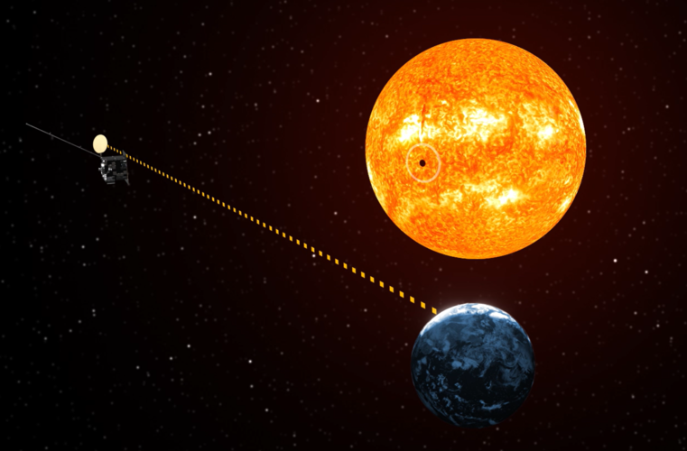
ESA Observing the Earth 
zdroje zpráv:
Earth from Space: Riyadh, Saudi Arabia
18.10.2024 10:00 Image:
The Copernicus Sentinel-2 mission takes us over Riyadh, the capital city of Saudi Arabia.
Future of Copernicus Expansion Missions secured
17.10.2024 9:30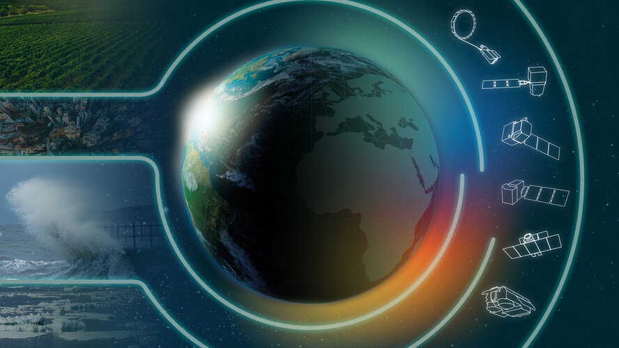
The Copernicus Sentinel Expansion Missions are a major leap forward in Europe’s Earth observation capabilities. With the United Kingdom’s re-entry to the EU’s Copernicus programme, funding has been confirmed to complete the development of all six Copernicus Sentinel Expansion Missions, as discussed this week during the International Astronautical Congress taking place in Milan, Italy.
Moving ahead with Italy’s constellation of Earth observation satellites
16.10.2024 17:25
Today, during the 75th International Astronautical Congress taking place in Milan, Italy, ESA signed the extension of contracts with Argotec and Thales Alenia Space Italia (TASI) for the production of the second batch of IRIDE satellites – a future Earth observation constellation designed to monitor environmental changes and support critical services in Italy.
EarthCARE synergy reveals power of clouds and aerosols
16.10.2024 9:30
With the initial images from each of the instruments aboard ESA’s EarthCARE satellite now in hand, it's time to reveal how these four advanced sensors work in synergy to measure exactly how clouds and aerosols influence the heating and cooling of our atmosphere.
Contract secures build for ESA’s Harmony mission
15.10.2024 11:25
ESA has awarded a contract valued at over €280 million to OHB in Germany to build ESA’s two Harmony Earth Explorer satellites.
This innovative research mission will provide valuable new data on various Earth processes, from shifts in the shape of the land surface caused by earthquakes and volcanic activity to insights into glacier movement. Additionally, it will enhance our understanding of the interactions between the upper ocean and lower atmosphere, all of which will contribute to a deeper comprehension of Earth's dynamic systems.
Living Planet Symposium 2025: time for abstracts
14.10.2024 12:00
ESA’s Living Planet Symposium 2025 will take place from 23–27 June 2025 at the Austria Center Vienna, Austria. As this prestigious event approaches, now is the time to submit your abstracts for a chance to present your research on topics related to Earth observation from space, with a special focus on the theme: From Observation to Climate Action and Sustainability for Earth.
Earth from Space: Hardap Dam, Namibia
11.10.2024 10:00 Image:
Resembling a Martian-like surface, this Copernicus Sentinel-2 image shows part of the Hardap region in south-central Namibia on the western edge of the Kalahari Desert.
Sound of Earth’s magnetic flip 41 000 years ago
10.10.2024 10:00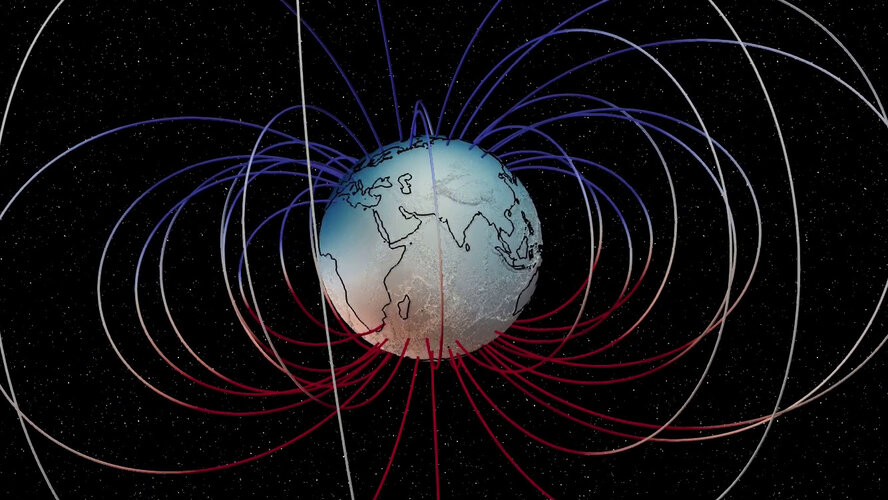 Video:
00:01:20
Approximately 41 000 years ago, Earth’s magnetic field briefly reversed during what is known as the Laschamp event. During this time, Earth’s magnetic field weakened significantly—dropping to a minimum of 5% of its current strength—which allowed more cosmic rays to reach Earth’s atmosphere.
Scientists at the Technical University of Denmark and the German Research Centre for Geosciences used data from ESA’s Swarm mission, along with other sources, to create a sounded visualisation of the Laschamp event. They mapped the movement of Earth’s magnetic field lines during the event and created a stereo sound version which is what you can hear in the video.
The soundscape was made using recordings of natural noises like wood creaking and rocks falling, blending them into familiar and strange, almost alien-like, sounds. The process of transforming the sounds with data is similar to composing music from a score.
Data from ESA’s Swarm constellation are being used to better understand how Earth’s magnetic field is generated. The satellites measure magnetic signals not only from the core, but also from the mantle, crust, oceans and up to the ionosphere and magnetosphere. These data are crucial for studying phenomena such as geomagnetic reversals and Earth’s internal dynamics.
The sound of Earth’s magnetic field, the first version of the magnetic field sonification produced with Swarm data, was originally played through a 32-speaker system set up in a public square in Copenhagen, with each speaker representing changes in the magnetic field at different places around the world over the past 100 000 years.
First all-new MetOp complete and sibling in testing
10.10.2024 8:40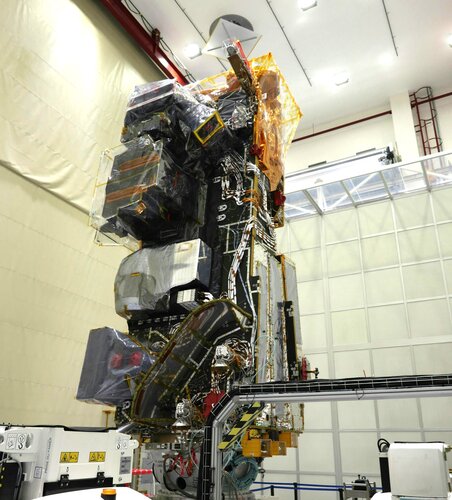
With all instruments integrated, the first MetOp Second Generation-A, MetOp-SG-A1, weather satellite is now fully assembled and on schedule for liftoff next year. Meanwhile, its sibling, MetOp-SG-B1, is undergoing rigorous testing to ensure that it will withstand the vacuum and extreme temperature swings of space.
Sentinel-1C arrives in French Guiana
9.10.2024 10:40
The Sentinel-1C satellite, the third satellite of the Copernicus Sentinel-1 mission, has arrived at the European spaceport in French Guiana for liftoff on the Vega-C rocket at the end of 2024. The satellite will continue the critical task of delivering key radar imagery of Earth’s surface for a wide range of Copernicus services and scientific applications.
Earth from Space: Kunshan, China
4.10.2024 10:00 Image:
This Copernicus Sentinel-2 image captures the intricate blend of natural, rural and urban landscapes around Kunshan, a city in eastern China.
Sentinel-2 unveils the seasonal rhythm of intertidal seagrass
3.10.2024 11:05
Thanks to an ESA-funded project and data from the Copernicus Sentinel-2 mission, researchers have revealed seasonal variations in intertidal seagrass across Western Europe and North Africa. As a key indicator of biodiversity, these new findings offer valuable insights for the conservation and restoration of these vital ecosystems.
Dust sparked biggest phytoplankton bloom in decades
1.10.2024 14:40
New research reveals that dust carried by the wind from southern Africa towards Madagascar triggered the largest phytoplankton bloom in two decades – and, unusually, this occurred at a time of year when such blooms are rarely seen.
Unveiling the hidden snow dunes shaping Antarctica's frozen landscape
1.10.2024 9:00
Sand dunes are a familiar sight along beaches and in deserts. While we know how regular sand dunes are formed, much less is known about dunes made of snow. In a new study, scientists have analysed the vast snow dunes across Antarctica – reshaping our understanding of the continent's surface dynamics.
This research sheds light on the unexplored world of Antarctic snow dunes, offering a fresh perspective on the complex interactions between wind, snow and climate in one of Earth's harshest environments.
ESA releases new strategy for Earth observation
30.9.2024 14:16
ESA has released its new Earth Observation Science Strategy, Earth Science in Action for Tomorrow’s World. Responding to the escalating threats from climate change, biodiversity loss, pollution and extreme weather and the need to take action to address these threats, this forward-looking strategy outlines a bold vision for Earth science through to 2040.
Earth from Space: Northern Territory, Australia
27.9.2024 10:00 Image:
This image captured by the Copernicus Sentinel-1 mission reveals the impact of severe flooding following heavy rain that hit Australia’s Northern Territory in March 2024.
Sentinel-2C captures stunning glimpse of the Moon
26.9.2024 16:00 Image:
On 20 September, the Copernicus Sentinel-2C satellite captured its first stunning image of the Moon, achieved by rolling the satellite sideways in a unique manoeuvre. Although Sentinel-2C is primarily designed for Earth observation, this image – intended for calibration and cross-mission comparisons – exceeded expectations.
Sentinel-2C captures stunning glimpse of the Moon
26.9.2024 16:00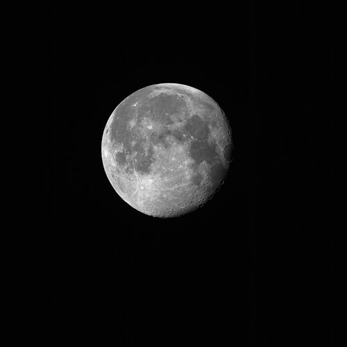 Image:
On 20 September, the Copernicus Sentinel-2C satellite captured its first stunning image of the Moon, achieved by rolling the satellite sideways in a unique manoeuvre. Although Sentinel-2C is primarily designed for Earth observation, this image – intended for calibration and cross-mission comparisons – exceeded expectations.
Catalysing new space ventures with ESA’s Earth Observation Commercialisation Forum
26.9.2024 11:25
Taking place at KAP Europa in Frankfurt, Germany, from 27 to 28 November 2024, the second ESA Earth Observation Commercialisation Forum will bring together stakeholders from the Earth observation and space commercialisation sectors, including end users, space industry players, entrepreneurs, private and public investors and policymakers to discuss and promote commercial opportunities in Earth observation.
The event is an important part of ESA’s broader strategy to enhance the economic return from Earth observation investments to ensure that space technology contributes to sustainable economic growth.
Sentinel-1B journeys back to Earth
23.9.2024 8:26
The Sentinel-1B satellite, the second satellite of the Copernicus Sentinel-1 mission, completed its disposal process – which included lowering its orbit and passivating its systems to ensure re-entry into Earth’s atmosphere within 25 years.
This careful operation highlights the European Union’s and ESA’s commitment to space safety and sustainability and provides valuable experience for the disposal of current and future spacecraft.
Earth from Space: Burning Man festival
20.9.2024 10:00 Image:
The Copernicus Sentinel-2 mission has snapped a souvenir of the Burning Man festival in the Black Rock desert in Nevada.
Arctic Weather Satellite’s first images capture Storm Boris
19.9.2024 13:19
Just a month after its launch, ESA’s Arctic Weather Satellite has already delivered its first images, notably capturing Storm Boris, which has been wreaking havoc across central Europe.
Sentinel-2C delivers stunning first images
17.9.2024 16:20
Less than two weeks after being launched into orbit, Sentinel-2C has delivered its first images. These spectacular views of Earth offer a sneak peek at the data that this new satellite will provide for Copernicus – Europe’s world-leading Earth observation programme.
Earth from Space: Adriatic bloom
13.9.2024 10:00 Image:
This Copernicus Sentinel-2 image captures algal bloom swirls in the north Adriatic Sea, along the coast of Italy.
The 2024 Global Methane Budget reveals alarming trends
10.9.2024 11:00
The Global Methane Budget 2024 paints a troubling picture of the current state of global methane emissions. The new report, which uses data from the Copernicus Sentinel-5P satellite, reveals that human activities are now responsible for at least two-thirds of global methane emissions.
This marks a significant increase in human-produced methane sources over the past two decades, with emissions rising by 20%, with the fastest rise occurring over the last five years.
A smooth start to life in orbit for Sentinel-2C
10.9.2024 11:00
Sentinel-2C has completed its important first few days in space, which saw teams on the ground working around the clock to ensure the spacecraft is ready to begin its mission.
The 2024 Global Methane Budget reveals alarming trends
10.9.2024 11:00
The Global Methane Budget 2024 paints a troubling picture of the current state of global methane emissions. The new report reveals that human activities are now responsible for at least two-thirds of global methane emissions.
This marks a significant increase in human-produced methane sources over the past two decades, with emissions rising by 20%, with the fastest rise occurring over the last five years.
Earth from Space: Sentinel-2 captures Sentinel-2
6.9.2024 10:00 Image:
The Copernicus Sentinel-2B satellite captured this image over Europe’s Spaceport in French Guiana on 2 September, just ahead of the Sentinel-2C launch.
Sentinel-2C launch highlights
5.9.2024 9:00 Video:
00:14:09
The Copernicus Sentinel-2C satellite lifted off on 5 September at 03:50 CEST (4 September 22:50 local time) aboard the last Vega rocket, flight VV24, from Europe’s Spaceport in French Guiana.
Sentinel-2C will continue the legacy of delivering high-resolution data that are essential to Copernicus – the Earth observation component of the EU Space Programme. Developed, built and operated by ESA, the Copernicus Sentinel-2 mission provides high-resolution optical imagery for a wide range of applications including land, water and atmospheric monitoring.
Sentinel-2C was the last liftoff for the Vega rocket – after 12 years of service this was the final flight, the original Vega is being retired to make way for an upgraded Vega-C.
Sentinel-2C joins the Copernicus family in orbit
5.9.2024 5:15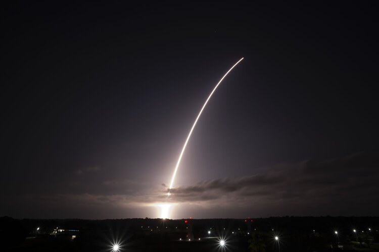
The third Copernicus Sentinel-2 satellite launched today aboard the final Vega rocket from Europe’s Spaceport in French Guiana. Sentinel-2C will continue providing high-resolution data that is essential to Copernicus – Europe’s world leading Earth observation programme.
Sentinel-2C launched into orbit on 5 September at 03:50 CEST (4 September 22:50 local time) and separated from the Vega rocket at approximately 04:48 CEST.
European greenhouse gas emissions decline but land stores weaken
4.9.2024 14:50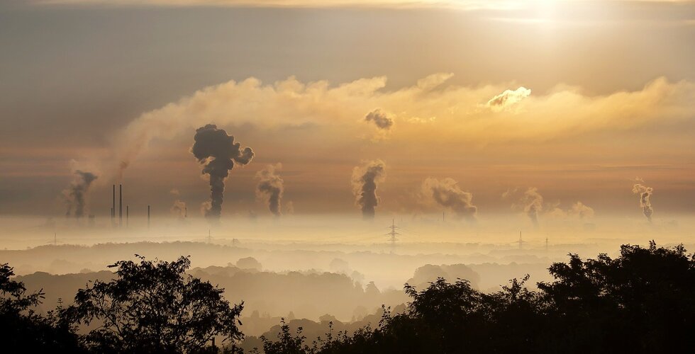
According to recent research, Europe’s net greenhouse gas emissions have decreased by around 25% since the 1990s. While this is good news, the study also revealed a weakening in the capacity of land and vegetation to absorb and store atmospheric carbon.
Watch Sentinel-2C launch live on the final Vega rocket
2.9.2024 11:15
The Copernicus Sentinel-2C satellite is ready for liftoff! Tune in to ESA WebTV on 4 September from 03:30 CEST to watch the satellite soar into space on the last Vega rocket to be launched from Europe’s Spaceport in Kourou, French Guiana. Sentinel-2C is scheduled to liftoff at 03:50 CEST.
Watch Sentinel-2C launch live on the final Vega rocket
2.9.2024 11:15
Due to electrical issues on the ground links, the VV24 launch chronology was interrupted for today. Additional checks are being conducted to confirm a new launch attempt tomorrow 5 September at 03:50 CEST (4 September 22:50 local time).
The launcher and its passenger, the Copernicus Sentinel-2C satellite, are in stable and safe conditions.
Watch Sentinel-2C launch live on the final Vega rocket
2.9.2024 11:15
Owing to electrical issues the VV24 Vega launch with Copernicus Sentinel-2C planned for 4 September was postponed. Arianespace has confirmed a new launch attempt for 5 September at 03:50 CEST (4 September 22:50 local time in French Guiana).
The launcher and its passenger, the Copernicus Sentinel-2C satellite, are in stable and safe conditions.
Watch Sentinel-2C launch live on the final Vega rocket
2.9.2024 11:15
Owing to electrical issues, the VV24 Vega launch with Copernicus Sentinel-2C planned for 4 September was postponed. Arianespace has confirmed a new launch attempt for 5 September at 03:50 CEST (4 September 22:50 local time in French Guiana).
The launcher and its passenger, the Copernicus Sentinel-2C satellite, are in stable and safe conditions.
Sentinel-2C: ready for liftoff
30.8.2024 10:00 Video:
00:02:32
Sentinel-2C is ready for launch! The new satellite will soon join its Copernicus Sentinel-2 family in orbit – where it will continue to provide detailed views of Earth’s land and coastal waters.
The mission is based on a constellation of two identical satellites: Sentinel-2A and Sentinel-2B. The constellation was originally designed to monitor land surfaces – but its scope has since expanded.
It now covers a wide range of applications including deforestation, water quality, monitoring natural disasters, methane emissions and much more.
Sentinel-2C, once in orbit, will replace the Sentinel-2A unit – prolonging the life of the Sentinel-2 mission – ensuring a continuous supply of data for Copernicus, the Earth observation component of the EU Space Programme.
Tune in to ESA WebTV on 4 September from 03:30 CEST to watch the satellite soar into space on the last Vega rocket to be launched from Europe’s Spaceport in Kourou, French Guiana.
Sentinel-2C pre-launch media briefing
29.8.2024 12:00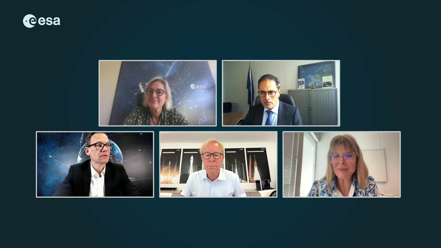 Video:
00:52:00
The Copernicus Sentinel-2C satellite is set for liftoff on 4 September on the last Vega rocket from Europe’s Spaceport in Kourou, French Guiana.
This recording is of a media briefing held on 29 August 2024 to offer journalists the possibility to learn more about the Sentinel-2 mission and the last flight of Vega, Europe’s nimble rocket specialising in launching small scientific and Earth observation spacecraft such as to sun-synchronous polar orbits, following the Sun.
The Sentinel-2 mission is based on a constellation of two identical satellites, Sentinel-2A and Sentinel-2B, flying in the same orbit but 180° apart to optimise coverage and revisit time. Once in orbit, Sentinel-2C will replace the Sentinel-2A unit – prolonging the life of the Sentinel-2 mission – ensuring a continuous supply of data for Copernicus, the Earth observation component of the EU Space Programme.
Data collected from Sentinel-2 are used for a wide range of applications, including precision farming, water quality monitoring, natural disaster management and methane emission detection.
Participants at the media briefing were:
- Simonetta Cheli, Director of Earth Observation Programmes, ESA
- Toni Tolker-Nielsen, Director of Space Transportation, ESA
- Stéphane Israël, CEO, Arianespace
- Mauro Facchini, Head of Unit for Earth Observation, European Commission
Sentinel-2C pre-launch media briefing
29.8.2024 12:00 Video:
00:52:00
The Copernicus Sentinel-2C satellite is set for liftoff on 4 September on the last Vega rocket from Europe’s Spaceport in Kourou, French Guiana.
This recording is of a media briefing held on 29 August 2024 to offer journalists the possibility to learn more about the Sentinel-2 mission and the last flight of Vega, Europe’s nimble rocket specialising in launching small scientific and Earth observation spacecraft such as to sun-synchronous polar orbits, following the Sun.
The Sentinel-2 mission is based on a constellation of two identical satellites, Sentinel-2A and Sentinel-2B, flying in the same orbit but 180° apart to optimise coverage and revisit time. Once in orbit, Sentinel-2C will replace the Sentinel-2A unit – prolonging the life of the Sentinel-2 mission – ensuring a continuous supply of data for Copernicus, the Earth observation component of the EU Space Programme.
Data collected from Sentinel-2 are used for a wide range of applications, including precision farming, water quality monitoring, natural disaster management and methane emission detection.
Participants at the media briefing were
Simonetta Cheli, Director of Earth Observation Programmes, ESA
- Toni Tolker-Nielsen, Director of Space Transportation, ESA
- Stéphane Israël, CEO, Arianespace
- Mauro Facchini, Head of Unit for Earth Observation, European Commission
Media invitation: Sentinel-2C pre-launch media briefings
28.8.2024 10:22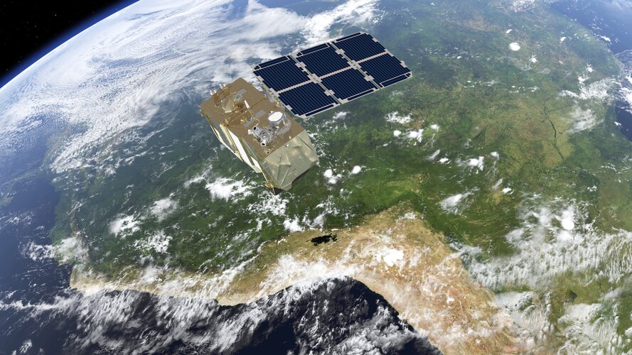
Media invitation: Sentinel-2C pre-launch media briefings
Sentinel-2C sealed in the Vega rocket fairing
23.8.2024 11:23
As preparations continue to launch the Copernicus Sentinel-2C satellite on 4 September, the team at Europe’s Spaceport in Kourou, French Guiana, has bid farewell to their precious satellite as it was sealed from view within the Vega rocket fairing.
EarthCARE profiles atmospheric particles in detail
21.8.2024 14:00
Launched in May, ESA’s EarthCARE satellite has been making waves, with the first images from three of its scientific instruments already delivered. Now, the spotlight is firmly on the atmospheric lidar, the most advanced of the satellite’s four instruments.
This cutting-edge sensor has captured detailed 20 km-high vertical profiles of atmospheric aerosols – tiny particles and droplets from natural sources like wildfires, dust, and sea spray, and from human activities like industrial emissions or burning of wood – and clouds across various regions of the globe.
New satellite demonstrates the power of AI for Earth observation
17.8.2024 13:30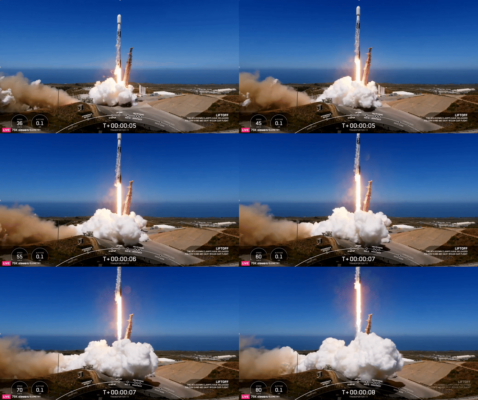
Φsat-2, ESA’s groundbreaking cubesat designed to revolutionise Earth observation with artificial intelligence, has launched.
The cubesat embarked on its journey into space on 16 August at 20:56 CEST (11:56 local time) on board a SpaceX Falcon 9 rocket from the Vandenberg Space Force Base in California, US, integrated by Exolaunch as part of the Transporter-11 rideshare mission, which also included ESA’s Arctic Weather Satellite.
Arctic Weather Satellite lifts off to set the stage for better forecasts
17.8.2024 3:27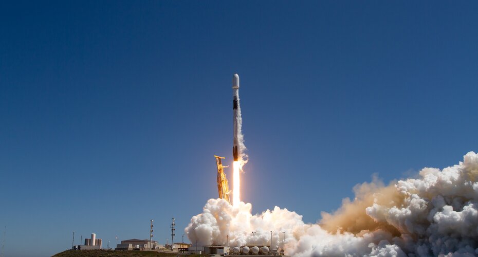
ESA’s Arctic Weather Satellite has been launched, paving the way for a potential constellation of satellites that would provide more frequent data not only to enhance short-term weather forecasts for Arctic nations, but for the world as a whole.
Watch Arctic Weather Satellite and Φsat-2 launch live
16.8.2024 9:50
ESA’s Arctic Weather Satellite and Φsat-2 missions are ready for lift-off from Vandenburg, California, with a target launch date of 16 August 2024.
Watch Arctic Weather Satellite and Φsat-2 launch live
16.8.2024 9:50
ESA’s Arctic Weather Satellite and Φsat-2 missions are ready for lift-off from Vandenberg, California, with a target launch date of 16 August 2024.
Wildfires rage across Athens
13.8.2024 14:31 Image:
Firefighters in Greece are battling a rapidly spreading wildfire that has swept across several neighbourhoods in Athens, Greece, on Monday. Thousands of residents have been evacuated as the massive fire reached the suburbs of Athens, with some flames reaching heights of 25 m.
This image shows the fires surrounding Athens on 12 August 2024, captured by the Copernicus Sentinel-2 mission. This image has been processed in a way that highlights vegetation in red, while the burned areas can be seen in black. The estimated affected area exceeds 100 sq km.
In response to the fires, the Copernicus Emergency Management Service was activated to cover the fire event affecting the Attica Region. Copernicus EMS Rapid Mapping was requested to provide an initial rough estimate, as well as emergency mapping of the fire’s extent and damage assessment.
The Copernicus Sentinel-2 mission is based on a constellation of two identical satellites, each carrying an innovative wide swath high-resolution multispectral imager with 13 spectral bands for monitoring changes in Earth’s land and vegetation.
Arctic Weather Satellite: advancing weather forecasting in a changing climate
13.8.2024 10:00 Video:
00:04:38
The effects of the climate crisis are felt more acutely in the Arctic than anywhere else on the planet. The weather in the Arctic is not only severe, but it changes extremely quickly. More frequent data are urgently needed to improve weather forecasts for this susceptible polar region.
Enter ESA’s Arctic Weather Satellite: a brand new prototype mission to show exactly how this can be achieved. The satellite will provide precise, short-term weather forecasts for the Arctic region. It is equipped with a 19-channel cross-track scanning microwave radiometer which will provide high-resolution humidity and temperature soundings of the atmosphere in all weather conditions.
The Arctic Weather Satellite is the forerunner of a potential constellation of satellites, called EPS-Sterna, that ESA would build for Eumetsat if this first prototype Arctic Weather Satellite performs well.
Detecting nitrogen dioxide from power plants with Sentinel-2
5.8.2024 10:25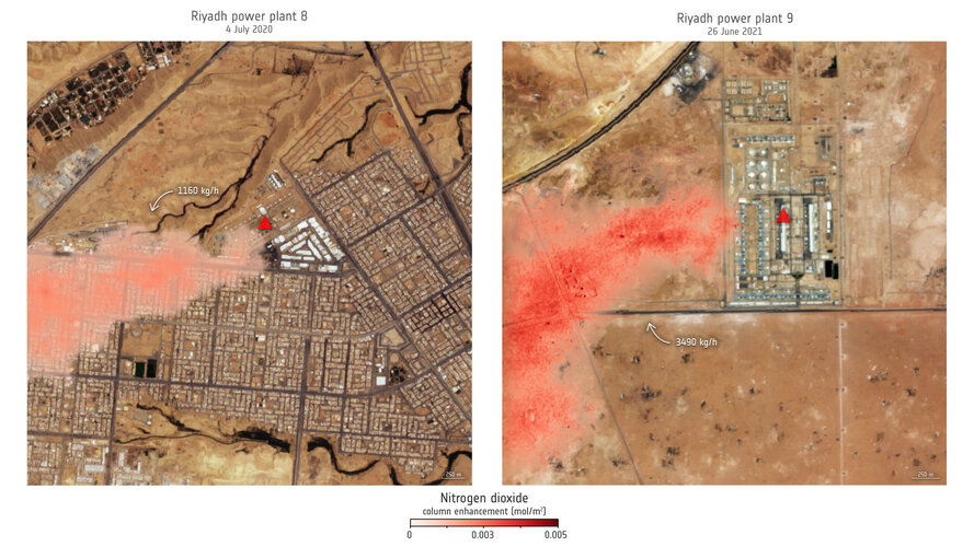
Atmospheric nitrogen dioxide is a harmful pollutant with significant impacts on air quality, climate and the biosphere. Although satellites have mapped nitrogen dioxide concentrations since the 1990s, their resolution was generally too coarse to pinpoint individual sources like power plants.
In a recent study, researchers used imagery from Copernicus Sentinel-2 to observe nitrogen dioxide plumes from power plants for the first time – marking a significant advancement in air pollution monitoring.
Earth from Space: Paris in focus
26.7.2024 10:00 Image:
This striking high-resolution image offers an in-depth view of central Paris, allowing you to explore and zoom into the city’s most captivating areas in exceptional detail.
EarthCARE’s multispectral imager puts clouds into context
24.7.2024 11:36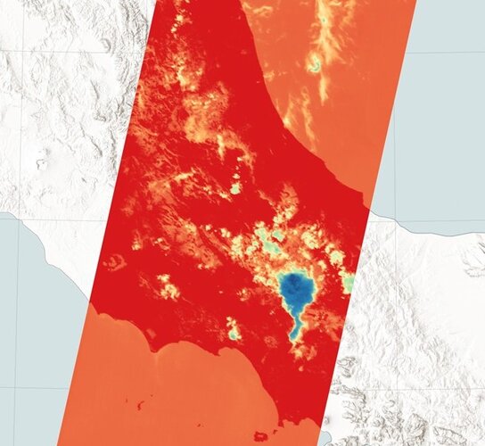
Launched less than two months ago, ESA’s EarthCARE satellite has already returned images from two of its four instruments. Now, it has also delivered the first images from its multispectral imager, showcasing various types of clouds and cloud temperatures worldwide. This instrument is set to add valuable context to the data from EarthCARE’s other instruments.
EarthCARE’s multispectral imager puts clouds into context
24.7.2024 11:36
Launched less than two months ago, ESA’s EarthCARE satellite has already returned images from two of its four instruments. Now, it has also delivered the first images from its multispectral imager, showcasing various types of clouds and cloud temperatures worldwide. This instrument is set to add valuable context to the data from EarthCARE’s other instruments.
EarthCARE’s multispectral imager puts clouds into context
24.7.2024 11:36
Launched less than two months ago, ESA’s EarthCARE satellite has already returned images from two of its four instruments. Now, it has also delivered the first images from its multispectral imager, showcasing various types of clouds and cloud temperatures worldwide. This instrument is set to add valuable context to the data from EarthCARE’s other instruments.
ESA and UK Space Agency announce new funding call
22.7.2024 14:25
ESA and the UK Space Agency are pleased to announce a new joint funding call ‘InCubed2 - Innovation in Public Services with Satellite Earth Observation’ for all UK-based entities developing innovative and commercially viable Earth observation projects. The deadline for pitch proposal submissions is 12 September 2024.
Sentinel-2C arrives in French Guiana
22.7.2024 8:50
The Sentinel-2C satellite, the third Copernicus Sentinel-2 satellite, has arrived at the European spaceport in French Guiana for liftoff on the final Vega rocket in September. Sentinel-2C, like its predecessors, will continue to provide high-quality data for Copernicus – the Earth observation component of the EU Space Programme.
Earth from Space: Central Ethiopia
19.7.2024 10:00 Image:
The Copernicus Sentinel-1 mission brings us a false-colour radar image of central Ethiopia.
Weather satellite passes bake and shake tests with flying colours
15.7.2024 8:30
As climate change drives more frequent and severe weather events, the need for accurate and timely forecasting has never been more critical. And now, the next Meteosat Third Generation weather satellite has passed its environmental test campaign with flying colours, taking it a significant step closer to launch.
Earth from Space: Hainan Strait
12.7.2024 10:00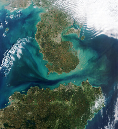 Image:
The Copernicus Sentinel-2 mission takes us over the Hainan Strait in southern China.
Earth from Space: Madeira
5.7.2024 10:00 Image:
The Copernicus Sentinel-2 mission captured a rare, cloud-free image over the Portuguese archipelago of Madeira in the North Atlantic Ocean.
EarthCARE offers a sneak peek into Earth’s energy balance
4.7.2024 17:20
Offering a foretaste of what’s to come once it is fully commissioned, ESA’s EarthCARE satellite has returned the first images from its broadband radiometer instrument. These initial images offer a tantalising glimpse into the intricacies of our planet’s energy balance – a delicate balance that governs our climate.
New satellite to show how AI advances Earth observation
2.7.2024 10:10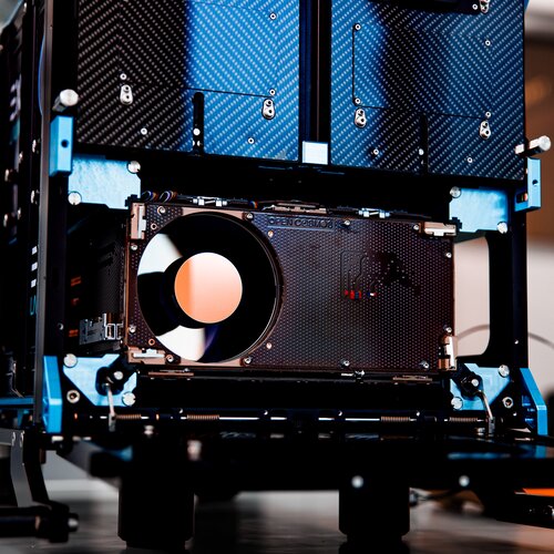
Artificial intelligence technologies have achieved remarkable successes and continue to show their value as backbones in scientific research and real-world applications.
ESA’s new Φsat-2 mission, launching in the coming weeks, will push the boundaries of AI for Earth observation – demonstrating the transformative potential of AI for space technology.
10 impact craters seen from space
28.6.2024 11:00 Video:
00:07:14
Have you ever wondered what an impact crater looks like from space? Today, we’re counting down some of our favourite impact craters here on Earth – captured by Earth-observing satellites.
Craters are inevitably part of being a rocky planet. They occur on every planetary body in our solar system – no matter the size. By studying impact craters and the meteorites that cause them, we can learn more about the processes and geology that shape our entire solar system.
Earth from Space: Meteor Crater
28.6.2024 10:00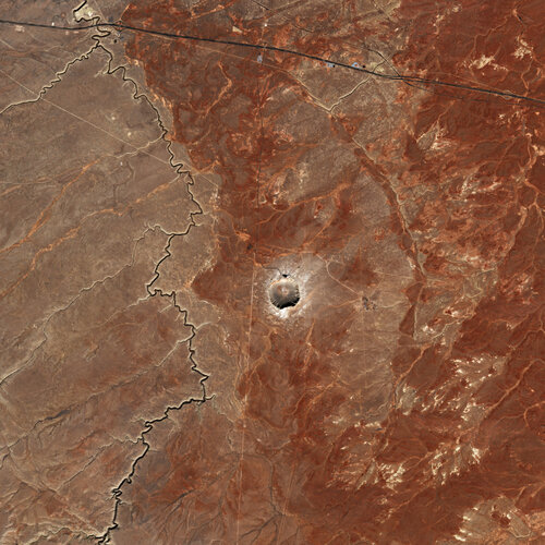 Image:
Ahead of Asteroid Day, the Copernicus Sentinel-2 mission takes us over the Meteor Crater, also known as the Barringer Meteorite Crater.
A first: EarthCARE reveals inner secrets of clouds
27.6.2024 9:00
Less than a month after it was launched, ESA’s EarthCARE satellite has returned the first image from one of its instruments – an image that, for the first time from space, unveils the internal structure and dynamics of clouds.
This remarkable first image, captured by the satellite’s cloud profiling radar, offers a mere glimpse of the instrument's full potential once it is fully calibrated.
Save the date: ESA’s Living Planet Symposium 2025
24.6.2024 8:35
Save the date for ESA’s next Living Planet Symposium, set for 23–27 June 2025 at the Austria Center Vienna. Held every three years, this premier Earth observation conference continues to expand in both size and scope. With the climate crisis intensifying, this event emphasises transitioning from ‘observation to climate action and sustainability for Earth’. Don't miss it!
Saharan dust over the Strait of Messina
21.6.2024 14:18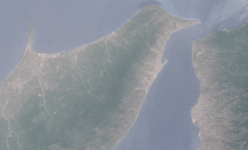 Image:
Saharan dust over the Strait of Messina
Earth from Space: Adam’s Bridge
21.6.2024 10:00 Image:
This Copernicus Sentinel-2 image shows Adam’s Bridge, a chain of shoals linking India and Sri Lanka.
Summer solstice 2024
20.6.2024 16:15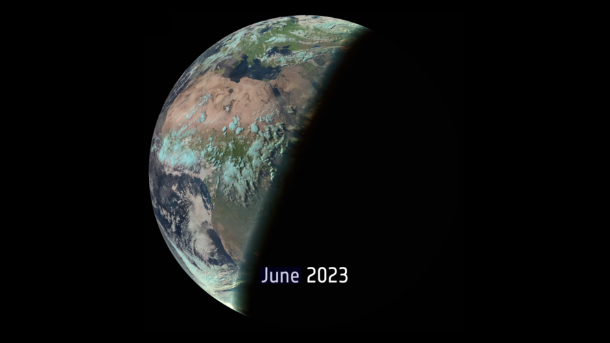 Video:
00:00:10
Summer officially begins in the Northern Hemisphere today 20 June, marking the longest day of the year. The summer solstice, which is when the Sun reaches the most northerly point in the sky, is set to occur tonight at 21:50 BST/22:50 CEST.
During the summer solstice, the Northern Hemisphere will experience the longest period of sunlight in a day or the longest day of the year. This is because of Earth’s position in orbit around the Sun and the way the North Pole is tilted towards the Sun during the solstice.
The Sun’s rays hit the Northern Hemisphere at their most direct angle, resulting in the most extended period of daylight. Despite the long hours of daylight, it may not necessarily be the hottest day of the year.
This animation shows one image per day captured by the Meteosat Second Generation from 20 June 2023 until 19 June 2024 captured at approximately 16:30 BST/17:30 CEST.
Summer solstice 2024
20.6.2024 15:00 Video:
00:00:10
Summer officially begins in the Northern Hemisphere today 20 June, marking the longest day of the year. The summer solstice, which is when the Sun reaches the most northerly point in the sky, is set to occur tonight at 22:50 CEST.
During the summer solstice, the Northern Hemisphere will experience the longest period of sunlight in a day or the longest day of the year. This is because of Earth’s position in orbit around the Sun and the way the North Pole is tilted towards the Sun during the solstice.
The Sun’s rays hit the Northern Hemisphere at their most direct angle, resulting in the most extended period of daylight. Despite the long hours of daylight, it may not necessarily be the hottest day of the year.
This animation shows one image per day captured by the Meteosat Second Generation from 20 June 2023 until 19 June 2024 captured at approximately 15:30 UTC.
Preparing ESA's Arctic Weather Satellite for liftoff
17.6.2024 10:12
With ESA’s Arctic Weather Satellite due to launch in a few weeks, the satellite is now at the Vandenberg Space Force Base in California being readied for its big day. Once in orbit, this new mission will show how short-term weather forecasts in the Arctic and beyond could be improved.
Preparing ESA's Arctic Weather Satellite for liftoff
17.6.2024 10:12
With ESA’s Arctic Weather Satellite due to launch in a few weeks, the satellite is now at the Vandenberg Space Force Base in California being readied for its big day. Once in orbit, this new mission will show how short-term weather forecasts in the Arctic and beyond could be improved.
Earth from Space: Heel of Italy
14.6.2024 10:00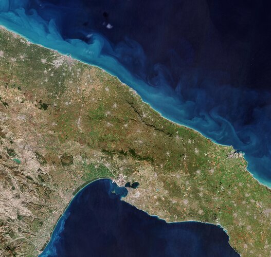 Image:
The Copernicus Sentinel-2 mission takes us over a section of Italy’s heel in the southern part of the boot-shaped peninsula.
Space for a travel quiz!
12.6.2024 10:00
A new collaboration between ESA and Schiphol Airport in the Netherlands has got passengers thinking about space. Digital screens throughout the airport featuring stunning satellite images of Earth have been stopping travellers in their tracks. That's because these pictures from space are part of a fun Where on Earth? travel quiz.
A milestone in digital Earth modelling
10.6.2024 16:25
Destination Earth is now live! Launched today during a ceremony at the EuroHPC LUMI Supercomputer Centre in Kajaani, Finland, Destination Earth provides unprecedented insights into the complexity of our planet to advance climate change adaption and environmental resilience modelling.
Earth from Space: Grand Bahama Island
7.6.2024 10:00 Image:
Ahead of World Ocean Day, the Copernicus Sentinel-2 mission takes us over the west of Grand Bahama Island, in the Bahamas.
Air-quality mission ready to join its host weather satellite
6.6.2024 12:58
Following months of meticulous testing to ensure that it will deliver first-class data on air quality around the world, the new Copernicus Sentinel-5 instrument has been delivered to Airbus in France ready to be installed on the first MetOp Second Generation weather satellite.
EarthCARE on cloud nine after smooth start to mission
5.6.2024 14:00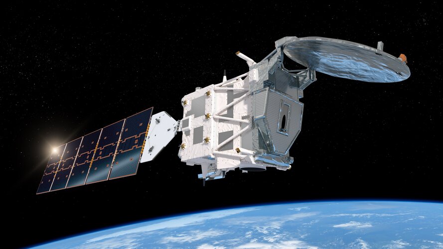
ESA’s EarthCARE mission has completed its important ‘Launch and Early Orbit Phase’ and is ready to begin the commissioning of its four scientific instruments. The data they gather will improve our understanding of the role that clouds and aerosols play in Earth’s radiation balance and benefit both climate modelling and weather forecasting.
Swarm helps discover Steve's long-lost twin
3.6.2024 13:29
Ever since aurora chasers discovered Steve, a mysterious ribbon of purple light in the night sky, scientists have wondered whether it might have a secret twin. Now, thanks to a photographer’s keen eye, and data from ESA’s Swarm satellites, we may have found it.
Earth from Space: Madagascar jellyfish
31.5.2024 10:00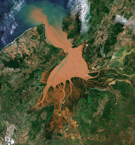 Image:
Resembling a reddish jellyfish, the Mahajamba Bay in Madagascar is imaged by Copernicus Sentinel-2.
EarthCARE is launched
29.5.2024 7:30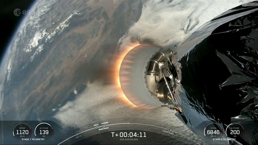 Video:
00:11:00
ESA’s EarthCARE satellite lifted off on a SpaceX Falcon 9 rocket from the Vandenberg Space Force Base in California, US, on 29 May at 00:20 CEST (28 May, 15:20 local time).
Developed as a cooperation between ESA and the Japan Aerospace Exploration Agency (JAXA), the Earth Cloud Aerosol and Radiation Explorer satellite carries a set of four instruments to make a range of different measurements that together will shed new light on the role that clouds and aerosols play in regulating Earth’s climate.
Replay: EarthCARE launch coverage
29.5.2024 7:00 Video:
02:15:00
Watch the replay of the EarthCARE launch coverage. The video includes streaming of the event at ESA’s European Space Operations Centre in Germany and footage of liftoff from the Vandenberg Space Force Base in California, US.
EarthCARE was lofted into orbit on a SpaceX Falcon 9 rocket on 29 May at 00:20 CEST (28 May, 15:20 local time).
Developed as a cooperation between ESA and the Japan Aerospace Exploration Agency (JAXA), the Earth Cloud Aerosol and Radiation Explorer satellite carries a set of four instruments to make a range of different measurements that together will shed new light on the role that clouds and aerosols play in regulating Earth’s climate. With the climate crisis increasingly affecting our planet, EarthCARE is poised to provide data for climate research, to improve the accuracy of climate models and to support numerical weather prediction.
EarthCARE is the most complex of ESA’s trailblazing Earth Explorer research missions – missions that deliver critical information to understand how our world functions and the impact that human activity is having on natural processes.
Taking EarthCARE into orbit
29.5.2024 7:00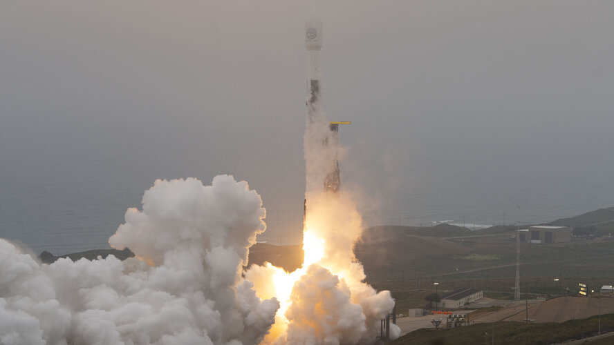 Video:
00:02:36
ESA’s EarthCARE satellite lifted off on a SpaceX Falcon 9 rocket from the Vandenberg Space Force Base in California, US, on 29 May at 00:20 CEST (28 May, 15:20 local time).
Developed as a cooperation between ESA and the Japan Aerospace Exploration Agency (JAXA), the Earth Cloud Aerosol and Radiation Explorer satellite carries a set of four instruments to make a range of different measurements that together will shed new light on the role that clouds and aerosols play in regulating Earth’s climate.
Taking EarthCARE into orbit
29.5.2024 7:00 Video:
00:02:36
ESA’s EarthCARE satellite lifted off on a SpaceX Falcon 9 rocket from the Vandenberg Space Force Base in California, US, on 29 May at 00:20 CEST (28 May, 15:20 local time).
Developed as a cooperation between ESA and the Japan Aerospace Exploration Agency (JAXA), the Earth Cloud Aerosol and Radiation Explorer satellite carries a set of four instruments to make a range of different measurements that together will shed new light on the role that clouds and aerosols play in regulating Earth’s climate.
EarthCARE launched to study role of clouds and aerosols in Earth's climate
29.5.2024 1:14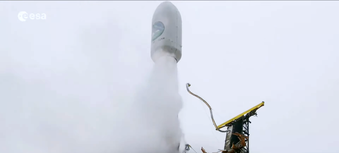
ESA’s EarthCARE satellite, poised to revolutionise our understanding of how clouds and aerosols affect our climate, has been launched. This extraordinary satellite embarked on its journey into space on 29 May at 00:20 CEST (28 May, 15:20 local time) aboard a Falcon 9 rocket from the Vandenberg Space Force Base in California, US.
EarthCARE launched to study role of clouds and aerosols in Earth's climate
29.5.2024 1:14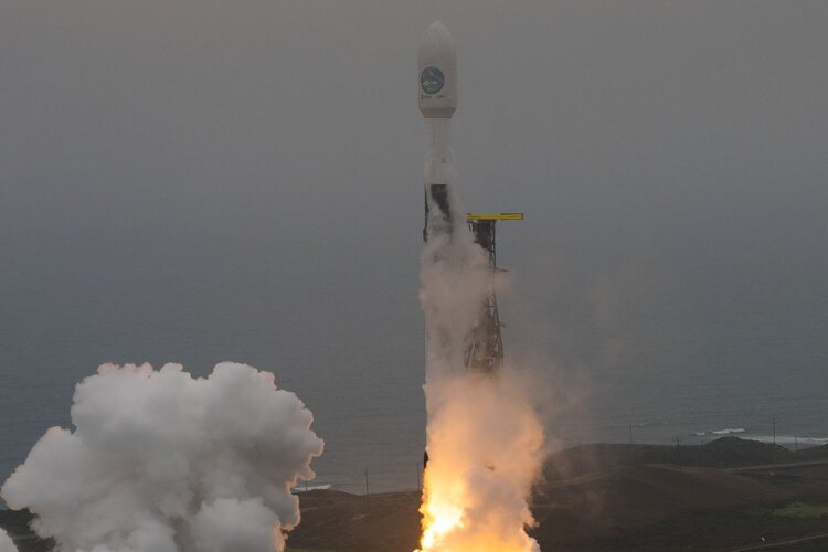
ESA’s EarthCARE satellite, poised to revolutionise our understanding of how clouds and aerosols affect our climate, has been launched. This extraordinary satellite embarked on its journey into space on 29 May at 00:20 CEST (28 May, 15:20 local time) aboard a Falcon 9 rocket from the Vandenberg Space Force Base in California, US.
EarthCARE ready for launch
28.5.2024 11:36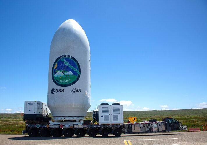
With liftoff now set for 29 May at 00:20 CEST (28 May, 15:20 local time), ESA’s EarthCARE satellite ready for launch at the Vandenberg Space Force Base in California. Once in orbit, this new satellite is set to revolutionise our understanding of how clouds and aerosols affect Earth’s climate.
Mission control GO for EarthCARE launch
28.5.2024 11:30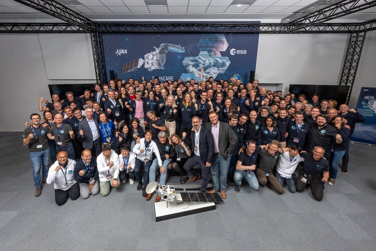 Image:
Mission control GO for EarthCARE launch
Mission Control GO for EarthCARE launch
28.5.2024 11:30 Image:
Mission Control GO for EarthCARE launch
Watch EarthCARE launch live
28.5.2024 9:30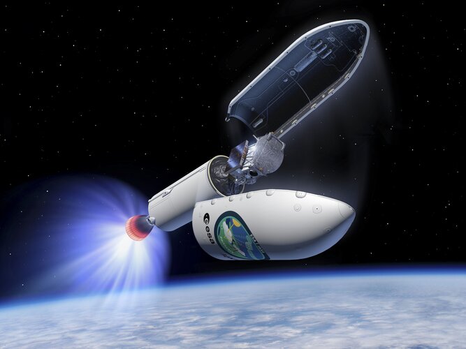
ESA's EarthCARE mission is ready for lift-off! Follow the live coverage and launch today 28 May on ESA WebTV or ESA YouTube. The live coverage begins at 23:30 CEST where we'll hear from our mission scientists and spacecraft operators, then follow the launch on a SpaceX Falcon 9 from Vandenberg Space Force Base, California, expected at 00:20 CEST.
Watch EarthCARE launch live
28.5.2024 9:30
ESA's EarthCARE mission is ready for lift-off! Follow the live coverage and launch today 28 May on ESA WebTV or ESA YouTube. Live coverage begins at 23:30 CEST where we'll hear from our mission scientists and spacecraft operators, then follow the launch on a SpaceX Falcon 9 from Vandenberg Space Force Base, California, expected at 00:20 CEST.
Watch EarthCARE launch live
24.5.2024 13:45
ESA’s Earth Cloud Aerosol and Radiation Explorer (EarthCARE) mission is getting ready for lift-off on a SpaceX Falcon 9 from Vandenberg, California, with a target launch date of no earlier than 28 May 2024. Save the date and watch the launch live on ESA WebTV or ESA YouTube.
Watch EarthCARE launch live
24.5.2024 13:45
ESA’s Earth Cloud Aerosol and Radiation Explorer (EarthCARE) mission is getting ready for lift-off on a SpaceX Falcon 9 from Vandenberg Space Force Base, California, with a target launch date of no earlier than 28 May 2024. Save the date and watch the launch live on ESA WebTV or ESA YouTube.
Unravelling the mysteries of clouds
24.5.2024 12:00 Video:
00:04:07
Clouds are one of the biggest mysteries in the climate system. They play a key role in the regulating the temperature of our atmosphere. But we don’t know how their behaviour will change over time as Earth’s atmosphere gets warmer. This is where EarthCARE comes in.
Launching on 28 May 2024, ESA’s Earth Cloud, Aerosol and Radiation Explorer will help quantify the role that clouds and aerosols play in heating and cooling Earth’s atmosphere. With its suite of four cutting-edge instruments, EarthCARE is a groundbreaking advancement in satellite technology.
It promises to deliver unprecedented data – unravelling the complexities of both clouds and aerosols. With this, we can refine our atmospheric models and climate forecasts, giving us the tools to tackle the challenges of a changing climate with greater accuracy and precision.
Watch EarthCARE launch live on ESA WebTV or ESA YouTube. For more information on how to stream the launch, click here.
Unravelling the mysteries of clouds
24.5.2024 12:00 Video:
00:04:07
Clouds are one of the biggest mysteries in the climate system. They play a key role in the regulating the temperature of our atmosphere. But we don’t know how their behaviour will change over time as Earth’s atmosphere gets warmer. This is where EarthCARE comes in.
Launching on 28 May 2024, ESA’s Earth Cloud, Aerosol and Radiation Explorer will help quantify the role that clouds and aerosols play in heating and cooling Earth’s atmosphere. With its suite of four cutting-edge instruments, EarthCARE is a groundbreaking advancement in satellite technology.
It promises to deliver unprecedented data – unravelling the complexities of both clouds and aerosols. With this, we can refine our atmospheric models and climate forecasts, giving us the tools to tackle the challenges of a changing climate with greater accuracy and precision.
Watch EarthCARE launch live on ESA WebTV or ESA YouTube. For more information on how to stream the launch, click here.
Unravelling the mysteries of clouds
24.5.2024 12:00 Video:
00:04:07
Clouds are one of the biggest mysteries in the climate system. They play a key role in the regulating the temperature of our atmosphere. But we don’t know how their behaviour will change over time as Earth’s atmosphere gets warmer. This is where EarthCARE comes in.
Launching on 28 May 2024, ESA’s Earth Cloud, Aerosol and Radiation Explorer will help quantify the role that clouds and aerosols play in heating and cooling Earth’s atmosphere. With its suite of four cutting-edge instruments, EarthCARE is a groundbreaking advancement in satellite technology.
It promises to deliver unprecedented data – unravelling the complexities of both clouds and aerosols. With this, we can refine our atmospheric models and climate forecasts, giving us the tools to tackle the challenges of a changing climate with greater accuracy and precision.
Watch EarthCARE launch live on ESA WebTV or ESA YouTube. For more information on how to stream the launch, click here.
Earth from Space: Changing Iceland in colour
24.5.2024 10:00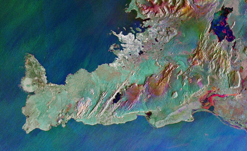 Image:
Iceland's Reykjanes Peninsula is featured in this colourful radar image captured by Copernicus Sentinel-1.
Iceberg A-83 breaks free
23.5.2024 8:45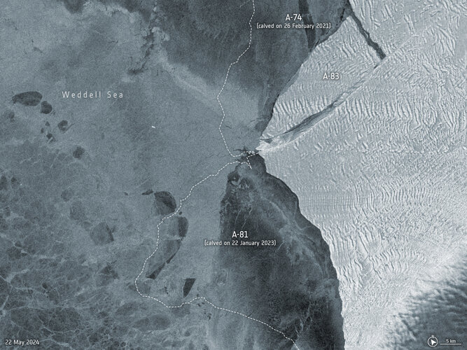 Image:
An iceberg roughly the size of the Isle of Wight has broken off the Brunt Ice Shelf in Antarctica on 20 May.
Watch EarthCARE launch live
22.5.2024 13:05
ESA’s Earth Cloud Aerosol and Radiation Explorer (EarthCARE) mission is getting ready for lift-off on a SpaceX Falcon 9 from Vandenberg, California, with a target launch date of no earlier than 28 May 2024. Save the date and watch the launch live on ESA WebTV or ESA YouTube.
Fireball witnessed by weather satellite
22.5.2024 10:39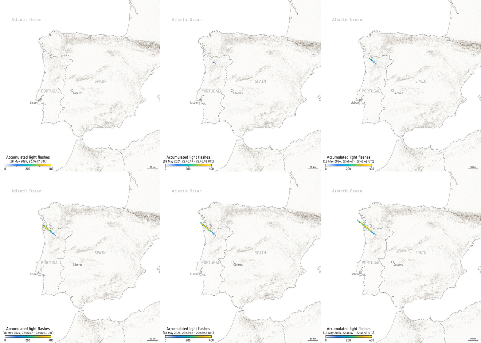
While a meteor lit up the skies over Spain and Portugal recently, it was also captured by the Meteosat Third Generation Imager weather satellite hovering 36,000 km away in geostationary orbit.
EarthCARE pre-launch press briefing
21.5.2024 18:00 Video:
00:51:05
ESA’s Earth Cloud Aerosol and Radiation Explorer (EarthCARE) mission is designed to advance our understanding of the role that clouds and aerosols play in reflecting incident solar radiation back out to space and trapping infrared radiation emitted from Earth’s surface.
Developed as a cooperation between ESA and the Japan Aerospace Exploration Agency (JAXA), this exciting mission will make a range of different measurements that together will shed new light on the role that clouds and aerosols play in regulating Earth’s delicate temperature balance.
With global climate change increasingly affecting our planet, EarthCARE is poised to provide data for climate research, improve the accuracy of climate models and support numerical weather prediction.
The EarthCare pre-launch press briefing featured: Simonetta Cheli, Director of Earth Observation Programmes, ESA, Dirk Bernaerts, EarthCARE project manager and Acting Head Earth Explorers Division, ESA, Futoshi Takiguchi, Vice President and Director General for the Space Technology Directorate, JAXA, Eiichi Tomita, EarthCARE/CPR Project Manager, JAXA and Maximilian Sauer, EarthCARE Project Manager, Airbus.
What does EarthCARE mean to me?
17.5.2024 12:00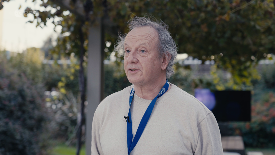 Video:
00:04:43
A new satellite called EarthCARE launching later this month will provide unprecedented data on clouds and aerosols, contributing to our understanding of climate change. As we approach its launch, join us as we delve into the minds of some of the individuals who have contributed to EarthCARE over the years.
The mission will shed new light on the role that clouds and aerosols play in regulating Earth’s temperature.
This video features interviews with: Dave Donovan, Senior Scientist at the Royal Netherlands Meteorological Institute, Robin Hogan, Senior Scientist at the European Centre for Medium-Range Weather Forecasts, Ulla Wandinger, Senior Scientist at Leibniz Institute for Tropospheric Research, Alain Lefebvre, Retired Project Manager of EarthCARE at ESA, Hajime Okamoto, Director, Research Institute for Applied Mechanics, Kyushu University, Bjoern Frommknecht, EarthCARE Mission Manager at ESA, Edward Baudrez, Scientific Assistant at the Royal Meteorological Institute of Belgium, Thorsten Fehr, EarthCARE Mission Scientist at ESA, Pavlos Kollias from Stony Brook University – McGill University and Dirk Bernaerts, EarthCARE Project Manager at ESA.
Follow the EarthCARE launch campaign blog for more updates.
What does EarthCARE mean to me?
17.5.2024 12:00 Video:
00:04:43
A new satellite called EarthCARE launching later this month will provide unprecedented data on clouds and aerosols, contributing to our understanding of climate change. As we approach its launch, join us as we delve into the minds of some of the individuals who have contributed to EarthCARE over the years.
The mission will shed new light on the role that clouds and aerosols play in regulating Earth’s temperature.
This video features interviews with: Dave Donovan, Senior Scientist at the Royal Netherlands Meteorological Institute, Robin Hogan, Senior Scientist at the European Centre for Medium-Range Weather Forecasts, Ulla Wandinger, Senior Scientist at Leibniz Institute for Tropospheric Research, Alain Lefebvre, Retired Project Manager of EarthCARE at ESA, Hajime Okamoto, Director, Research Institute for Applied Mechanics, Kyushu University, Bjoern Frommknecht, EarthCARE Mission Manager at ESA, Edward Baudrez, Scientific Assistant at the Royal Meteorological Institute of Belgium, Thorsten Fehr, EarthCARE Mission Scientist at ESA, Pavlos Kollias from Stony Brook University – McGill University and Dirk Bernaerts, EarthCARE Project Manager at ESA.
Follow the EarthCARE launch campaign blog for more updates.
Media advisory: EarthCARE launch media opportunities
17.5.2024 10:45
Media advisory: EarthCARE launch media opportunities
Earth from Space: New Zealand’s North Island
17.5.2024 10:00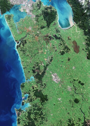 Image:
Captured on 7 May 2024, this Copernicus Sentinel-2 image shows part of New Zealand’s North Island.
EarthCARE mission kit
17.5.2024 8:45
Explore this mission kit to learn more about EarthCARE – ESA’s new mission that will shed new light on the role that clouds and aerosols play in regulating Earth’s climate.
Canada’s wildfire season begins
16.5.2024 14:15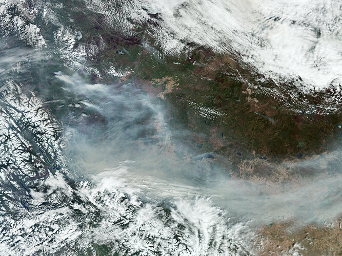
Wildfire season has arrived in full force in Canada, prompting evacuation orders and alerts in several towns in British Columbia and Alberta due to the danger of uncontrolled blazes.
Hazardous smoke from the fires has also triggered air quality alerts in Canada and the northern US. Satellite technology, including the Copernicus Sentinel-5P satellite and ESA’s Fire Atlas, plays a crucial role in monitoring these wildfires.
Earth from Space: Bolivian salt lakes
10.5.2024 10:00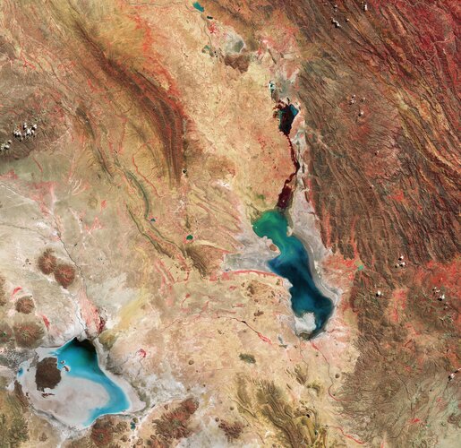 Image:
This Copernicus Sentinel-2 image features salt flats and lakes in southwest Bolivia, near the crest of the Andes Mountains.
AI in Earth observation: a force for good
9.5.2024 11:50
The upcoming launch of the Φsat-2 mission is a prime example of the pioneering work that ESA does in the field of AI in Earth observation.
But when it comes to AI, hopes and fears abound in equal measure. In this interview, ESA’s Rochelle Schneider sets the record straight on how this transformational technology is improving access to crucial information on the state and future of our planet.
Watch live: Workshop on Machine Learning for Earth System Observation and Prediction
8.5.2024 9:00
Watch live
ESA-ECMWF workshop on machine learning for Earth system observation and prediction
Mission control ready for EarthCARE despite disruption
5.5.2024 10:00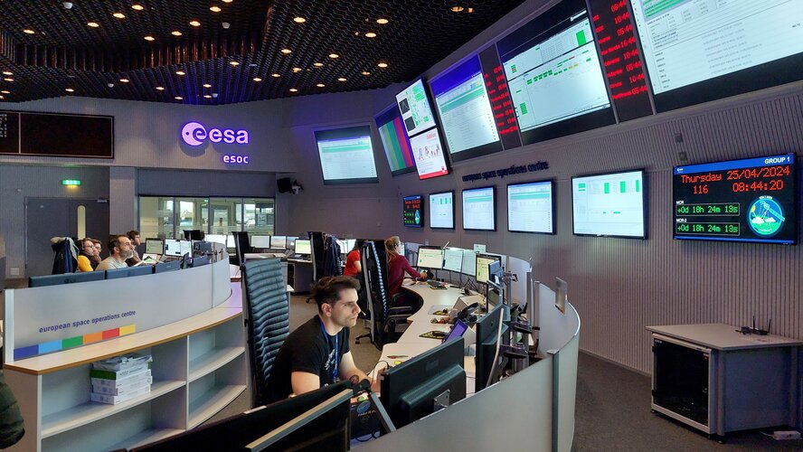
Teams at ESA’s European Space Operations Centre in Darmstadt, Germany, are currently engaged in intensive preparations for the critical ‘Launch and Early Orbit’ phase of the agency's EarthCARE satellite.
Meet the team behind EarthCARE
3.5.2024 14:00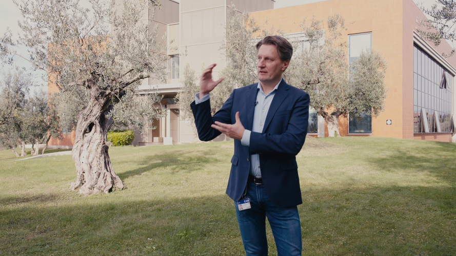 Video:
00:04:54
As we approach the launch of ESA’s EarthCARE mission, we caught up with some of the scientists, engineers and experts behind the mission.
With the climate crisis increasingly tightening its grip, ESA’s Earth Cloud Aerosol and Radiation Explorer mission (EarthCARE) will shed new light on the complex interactions between clouds, aerosols and radiation in Earth’s atmosphere.
EarthCARE is the largest and most complex Earth Explorer mission. It comes at a critical time in the development of kilometre-scale resolution, global climate models and will provide an important contribution to an improved understanding of cloud convection and its role in Earth’s radiation budget.
EarthCARE is an ESA mission, but it has been developed as a cooperation between ESA and JAXA, the Japanese Space Agency.
This video features interviews with: Pavlos Kollias from Stony Brook University – McGill University, Thorsten Fehr, EarthCARE Mission Scientist at ESA, Robin Hogan, Senior Scientist at ECMWF, Dirk Bernaerts, EarthCARE Project Manager at ESA, Kotska Wallace, Mission and Optical Payload Manager at ESA, Tomomi Nio, EarthCARE Mission Manager at JAXA, Eiichi Tomita, EarthCARE/CPR Project Manager at JAXA, Ulla Wandinger, Senior Scientist at Leibniz Institute for Tropospheric Research and Bjoern Frommknecht, EarthCARE Mission Manager at ESA.
Follow the EarthCARE launch campaign blog for more updates.
Access the related broadcast quality footage: animations / interviews / satellite stock footage
Earth from Space: Namibian landforms
3.5.2024 10:20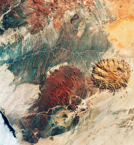 Image:
This image may resemble the surface of Mars, but it was actually captured by the Copernicus Sentinel-2 mission, revealing the stunning terrain of northwest Namibia.


 Image:
Sentinel-2C in the launch tower
 Image:
Sentinel-2C in the Vega launch tower
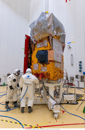 Image:
Sentinel-2C fully loaded
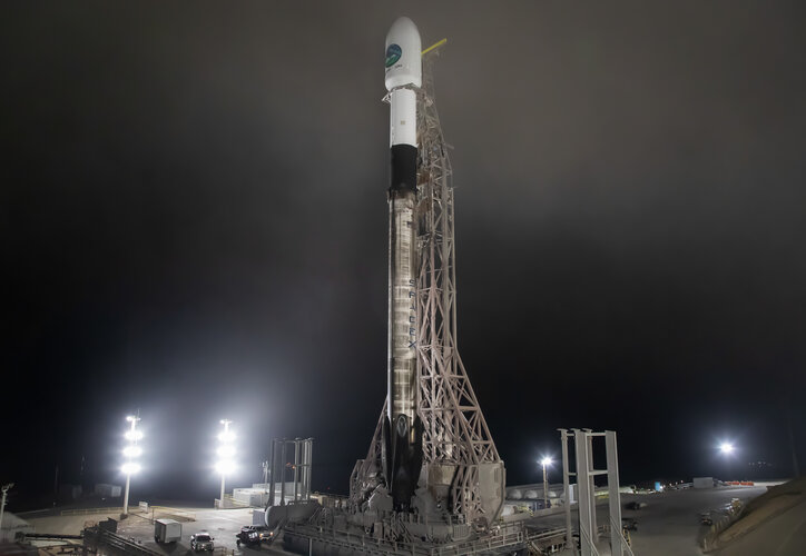 Image:
EarthCARE stands tall
 Image:
EarthCARE never to be seen again
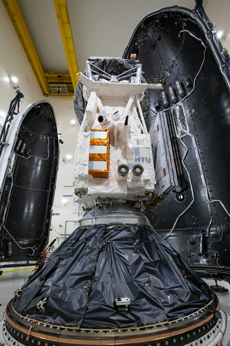 Image:
Last look at EarthCARE
