


![]()

zprávy
zdroje zpráv:Aktualizace průběhu turistických tras a cyklotras
16.3.2018 12:00 Plzeňský kraj Byl aktualizován tematický obsah interaktivní mapy zobrazující Turistické trasy a cyklotrasy v Plzeňském kraji. Data jsou s platností k 11/2017.Aktualizace dat ÚAP od poskytovatele ČEZ Distribuce, a.s. a ČEZ ICT Services, a.s.
16.3.2018 12:00 Plzeňský kraj V datech územně analytických podkladů Plzeňského kraje byla provedena aktualizace dat technické infrastruktury od poskytovatele ČEZ Distribuce, a. s. a ČEZ ICT Services, a. s. Data jsou s platností k 2. 1. 2018.V datech územně analytických p
16.3.2018 12:00 Plzeňský kraj V datech územně analytických podkladů Plzeňského kraje byla provedena aktualizace dat technické infrastruktury od poskytovatele ČEZ Distribuce, a. s. a ČEZ ICT Services, a. s. Data jsou s platností k 2. 1. 2018.Getting to know Steve
16.3.2018 11:00 ESA Observing the Earth
Steve – a strange shimmering ribbon of purple light in the night sky – was discovered in 2016, but now, thanks to ESA’s Swarm mission, more is known about this weird feature of the aurora.
Tokyo
16.3.2018 10:05 ESA Observing the Earth
Earth observation image of the week: Sentinel-2A takes us over Japan’s capital, the world’s largest megacity
Earth from Space
16.3.2018 10:05 ESA Observing the Earth
In this edition, discover the Japanese capital of Tokyo with Sentinel-2
Airbus launches photonics payload technology project – OPTIMA
16.3.2018 9:39 GISCafe.com Webcasts-Webinars Stevenage, 15/03/2018 - Airbus has launched the OPTIMA project, which will deliver a proof of concept demonstrator for the use of photonic payloads …"GISCafe Special Coverage: The World of State-of-the-Art Satellites, Reusable Spacecraft and More" by Susan Smith
16.3.2018 9:26 GISCafe.com Webcasts-Webinarsodborný referent / vrchní referent v personálním oddělení Katastrálního úřadu pro Pardubický kraj
16.3.2018 9:24 ČÚZK - předpisy a opatření Katastrální úřad pro Pardubický krajvypisuje výběrové řízení na místo
odborný referent / vrchní referent v personálním oddělení Katastrálního úřadu pro Pardubický kraj
odborný referent / vrchní referent v personálním oddělení Katastrálního úřadu pro Pardubický kraj
16.3.2018 9:24 ČÚZK - volná místa Katastrální úřad pro Pardubický kraj vypisuje výběrové řízení na místo odborný referent / vrchní referent v personálním oddělení Katastrálního úřadu pro Pardubický krajodborný referent / vrchní referent v personálním oddělení Katastrálního úřadu pro Pardubický kraj
16.3.2018 9:24 ČÚZK /Urady/Katastralni-urady/Katastralni-urady/Katastralni-urad-pro-Pardubicky-kraj/Uredni-deska/Oznameni-a-jina-uredni-sdeleni/Volna-mista/odborny-referent-vrchni-referent-v-personalnim-(1)Harmonizácia techník bezpilotných lietadiel pre monitoring poľnohospodárstva a prírodných ekosystémov.
16.3.2018 8:12 GISportal.cz
Vedci z celkovo 31 krajín sa spojili v spoločnom projekte s názvom “Harmonization of UAS techniques for agricultural and natural ecosystems monitoring“, v ktorom budú riešiť výskum využitia bezpilotných lietadiel pre poľnohospodárstvo a prírodné ekosystémy. V dňoch 14.-16. februára sa konalo v španielskej Valencii prvé pracovné stretnutie. Počas týchto dní sa uskutočnilo viacero brainstormingov a celodenný workshop. Celý workshop bol rozdelený do […]
The post Harmonizácia techník bezpilotných lietadiel pre monitoring poľnohospodárstva a prírodných ekosystémov. appeared first on GISportal.cz.
USGIF Renews Academic Accreditation for James Madison University
15.3.2018 23:11 GISCafe.com Webcasts-Webinars Collegiate certificate program provides students with GEOINT knowledge and skillsHerndon, Virginia (March 15, 2018)—The United States …
Stipendium pro GISáka v UK
15.3.2018 20:43 Agentura ESPA nám poslala zajímavou nabídku na 6měsíční stáž v GIS firmě ve městě Bath na jihozápadě Velké Británie, více informací zde: https://www.espauk.com/wp-content/uploads/2018/03/Geographic-Information-System-GIS-Developer-Internship-LIVGI2401.pdfBluesky National Tree Map Helps Tamworth Council Bloom
15.3.2018 19:52 GISCafe.com Webcasts-Webinars March 15, 2018 -- A unique countrywide map detailing the location, height and canopy cover of tree locations is helping the UK’s Tamworth …CoreLogic Reports Homeowner Equity Increased by $908 Billion in 2017
15.3.2018 19:50 GISCafe.com Webcasts-Webinars Negative Equity Share Fell to 4.9 Percent in Q4 2017Quarter Over Quarter, 19,000 Residential Properties Regained Equity
…
Helsinki Creates 3D City Models to Promote Commercial Research and Development
15.3.2018 15:35 Bentley SystemsPress Coverage
Lidar News, USA
Read the articleThe Earth Solutions Recognized as Bentley's 2017 Be Inspired Awards Winner for Reality Modeling Project
15.3.2018 15:30 Bentley SystemsPress Coverage
GISCafe, USA
Read the articleBentley Systems Eyes Asian Concrete Building Designers with Acquisition of S-Cube Futuretech
15.3.2018 15:25 Bentley SystemsPress Coverage
ARCWeb, USA
Read the articleTopcon to showcase automated technology at the Digital Construction Summit
15.3.2018 15:13 Bentley SystemsPress Coverage
BIM Today, UK
Read the articleRay O'Connor, President and CEO of Topcon Positioning Group on the future challenges facing the construction industry
15.3.2018 15:01 Bentley SystemsPress Coverage
Sunday Business Post, Ireland
Read the article20180315 Odborný rada právního oddělení
15.3.2018 14:21 ČÚZK - předpisy a opatření Katastrální úřad pro Středočeský kraj - Katastrální pracoviště Praha-východ Vyhlášení výběrového řízení: Odborný rada právního oddělení V části "Úřední deska", v sekci "Oznámení a jiná úřední sdělení" bylo vystaveno "Oznámení o vyhlášení výběrového řízení na obsazení služebního místa Odborný rada právního oddělení"20180315 Odborný rada právního oddělení
15.3.2018 14:21 ČÚZK /Urady/Katastralni-urady/Katastralni-urady/Katastralni-urad-pro-Stredocesky-kraj/Katastralni-pracoviste/KP-Praha-vychod/O-uradu/Aktuality/20161013Rada-odborny-rada-–-informatik-(5)Odborný rada právního oddělení
15.3.2018 14:19 ČÚZK - volná místa Katastrální úřad pro Středočeský kraj - Katastrální pracoviště Praha-východ vypisuje výběrové řízení na místo Odborný rada právního odděleníOdborný rada právního oddělení
15.3.2018 14:19 ČÚZK /Urady/Katastralni-urady/Katastralni-urady/Katastralni-urad-pro-Stredocesky-kraj/Uredni-deska/Oznameni-a-jina-uredni-sdeleni/Volna-mista/Odborny-rada-pravniho-oddeleni-(1)Odborný rada právního oddělení
15.3.2018 14:19 ČÚZK - předpisy a opatření Katastrální úřad pro Středočeský kraj - Katastrální pracoviště Praha-východvypisuje výběrové řízení na místo Odborný rada právního oddělení
Odborný rada právního oddělení
20180315 Odborný referent oddělení právních vztahů k nemovitostem
15.3.2018 14:05 ČÚZK /Urady/Katastralni-urady/Katastralni-urady/Katastralni-urad-pro-Stredocesky-kraj/Katastralni-pracoviste/KP-Slany/O-uradu/Aktuality/20161013Rada-odborny-rada-–-informatik-(2)20180315 Odborný referent oddělení právních vztahů k nemovitostem
15.3.2018 14:05 ČÚZK - předpisy a opatření Katastrální úřad pro Středočeský kraj - Katastrální pracoviště Slaný Vyhlášení výběrového řízení: Odborný referent oddělení právních vztahů k nemovitostem V části "Úřední deska", v sekci "Oznámení a jiná úřední sdělení" bylo vystaveno "Oznámení o vyhlášení výběrového řízení na obsazení služebního místa Odborný referent oddělení právních vztahů k nemovitostem"Odborný referent oddělení právních vztahů k nemovitostem
15.3.2018 14:01 ČÚZK - volná místa Katastrální úřad pro Středočeský kraj - Katastrální pracoviště Slaný vypisuje výběrové řízení na místo Odborný referent oddělení právních vztahů k nemovitostemOdborný referent oddělení právních vztahů k nemovitostem
15.3.2018 14:01 ČÚZK - předpisy a opatření Katastrální úřad pro Středočeský kraj - Katastrální pracoviště Slanývypisuje výběrové řízení na místo Odborný referent oddělení právních vztahů k nemovitostem
Odborný referent oddělení právních vztahů k nemovitostem
Bylo vyhlášeno dodatečné výběrové řízení na mobilitu Erasmus+ 2018/19
15.3.2018 13:43 Blogující geomatici - FAV ZČU Kdo by měl zájem vyjet v rámci studia do zahraničí, nechť se u mne přihlásí do 4. 4. 2018 (12:00) k podniknutí dalších kroků.Nový server
15.3.2018 12:45 Středočeský kraj Odbor Informatiky pořídil pro Geografický Informační Systém úřadu nový server. V rámci přechodu dat z původního serveru na nový server byly upgradovány všechny JavaScriptové mapové aplikace. Zároveň byly změněny cesty na mapové služby, které jsou k dispozici v záložce Prohlížecí služby. Odkaz ZDEVše je připraveno pro EDRS
15.3.2018 12:44 Český Kosmický Portál„Kosmická datová dálnice“ EDRS zahájila pravidelný přenos snímků Země pořízených družicí Sentinel-2A. To znamená, že už čtvrtý satelit systému GMES/Copernicus na oběžné dráze je pod službou EDRS.
Vše je připraveno pro EDRS
15.3.2018 12:44 Český Kosmický Portál„Kosmická datová dálnice“ EDRS zahájila pravidelný přenos snímků Země pořízených družicí Sentinel-2A. To znamená, že už čtvrtý satelit systému GMES/Copernicus na oběžné dráze je pod službou EDRS.
Hemisphere GNSS Announces New Atlas®-Capable, Multi-GNSS Vector™ V123 & V133 Smart Antennas
15.3.2018 11:47 GISCafe.com Webcasts-Webinars LONDON, UK – March 14, 2018 – Today from the Oceanology International exhibition and conference in London, UK, Hemisphere GNSS announces …20180315-GaKO-03-2018
15.3.2018 10:06 ČÚZK - předpisy a opatření Český úřad zeměměřický a katastrální zveřejnil novou aktualitu: Aktuální číslo Geodetického a kartografického obzoru (3/2018) je k dispozici ke stažení.EGNOS shows the way at 2018 World ATM Congress
15.3.2018 9:34 European GNSS Agency
EGNOS and Galileo were at the World Air Traffic Management (ATM) Congress in Madrid from 6 to 8 March to highlight the vital and increasing role of European GNSS (EGNSS) in the aviation sector enabling simplified, safe and integrated ATM for all aircraft from civil airliners to autonomous drones. On 6 March, funding for research, development, innovation and implementation opportunities worth more than €300 million for EGNSS related aviation projects were presented in a special conference session.
For three days in March, Madrid becomes the centre of the ATM world. Now in its sixth edition, the Congress is the largest ATM forum in the world and is a ‘one-stop shop’ for all things ATM. In 2018 it was bigger and better than ever with a record 237 exhibitors registered and thousands of aviation leaders arriving for three days of conference sessions, product demonstrations and launches, contract closures, and networking.
Be part of €300 million
The main feature for EGNSS at Madrid was an awareness-raising session on the afternoon of 6 March co-organised by GSA: ‘Discover EU funding opportunities worth €300 million....and be part of it’.
The event kicked off with a description of current and upcoming EGNSS funding opportunities in aviation: the current EGNOS for Aviation Call and the next Horizon 2020 EGNSS Market Uptake Call.
Carmen Aguilera, of the European GNSS Agency (GSA) moderated the session and gave an overview of the programmes that are worth, in total, €50 million with the aim to further accelerate the use of EGNOS and Galileo in all aviation application areas, including drones.
The Aviation Grant Programme is the basis for the recently launched third call from the GSA for proposals to promote EGNOS operational implementation throughout European airports and among European airspace users. It targets all segments and aims to foster the use of EGNOS for navigation and surveillance applications, increase network effect and maximise public benefits.
“The call is structured to cover six areas of activity,” said Aguilera including the design and operational implementation of EGNOS based LPV/LPV 200 approach procedures, low level routes, the installation of EGNOS-enabled avionics and granting of airworthiness certification, the development of retrofit and forward-fit solutions, and the development of enablers and other EGNOS based operations including, for example, simulators, validation tools, training materials, or drone applications.
The call was published on 12 February and the deadline for submitting applications is 21May with the signature of the first grant agreements foreseen for September – October 2018. Applications can be made by citizens of any EU Member State and Norway or Switzerland.
More information on the call can be found on the GSA website and a series of information sessions about the call is being organised, including a webinar scheduled for 15 March at 11:00 CET. Registration for the webinar is open now.
The second programme is the forthcoming GSA organised Horizon 2020 research and development call. The H2020-SPACE-EGNSS-2019 call will open on 16 October and cover four topics: EGNSS applications to foster sustainable mobility including the use of drones; EGNSS applications fostering digitisation; ENGSS applications for societal resilience and environmental protection; and projects to raise awareness of EGNSS and capacity building.
The total budget for the call is €20 million and the deadline for proposal submission is 5 March 2019
Project success
As an example of a successful EU-funded, GSA-managed research project in H2020, Christian Belleux, Aviation Director at Orolia described the work of the HELIOS project and its subsequent commercialisation.
The project developed a range of Galileo enhanced beacons and associated antennas to exploit the full capability of the MEOSAR COSPAS / SARSAT international programme that operates a global Search and Rescue (SAR) distress alert detection and information distribution system.
EGNOS significantly improves the localisation performance for these beacons, introducing new capabilities and the use of the Galileo SAR service with its return link adds further operational and life-saving features. Two maritime beacons for personal use with Life Jackets and one aviation beacon with an associated high-speed fuselage antenna have been brought to market.
The aviation device will feature remote activation through the Galileo return link service capability and enables accurate location of an aircraft and sharing of critical data. “The device is compatible with recommendations for autonomous distress tracking that will be applicable from January 2021 for all new aircraft builds,” said Bellux.
Transport call
The final presentation of the session was from Isabelle Jagiello of the Innovation and Networks Executive Agency (INEA) on the 2017 Connecting Europe Facility (CEF) Transport SESAR call for proposals. This €290 million call, which opened on 6 October 2017 and has a final deadline on 12 April 2018, is exclusively for proposals addressing the priority Single European Sky aka SESAR.
The call is aimed at supporting the effective implementation of the Single European Sky policy and improving overall ATM performance in Europe. Funded projects are studies and pilot activities looking to improve infrastructure or technology.
“All project proposals must clearly improve ATM performance,” said Jagiello. “And use of EGNOS and Galileo is also a general requirement.”
The GSA and INEA coordinate their calls to ensure no dual funding and to ensure maximum use of the available budget in the respective programmes.
EGNOS awards
Following the presentation, participants were invited to a networking drink and the presentation of the 2018 EGNOS awards at the EGNOS stand. The awards were introduced by Sofia Cilla, Service Adoption Manager at ESSP – the EGNOS Service provider - and presented by José Luis Fernandez, Service Provision Unit Manager at ESSP.
The first recipient was Adriana Salmón Fernandez representing FerroNATS, a commercial air traffic control operator in Spain that has just implemented their fifth EGNOS procedure. She praised the smooth coordination of the implementation and looked forward to future collaboration.
Similarly, the second recipient, George Angelou representing the Hellenic Civil Aviation Authority, appreciated the cooperation with GSA in the ongoing BlueGNSS programme and looked forward to EGNOS operational approaches in Greece being “up and running” soon.
Media note: This feature can be republished without charge provided the European GNSS Agency (GSA) is acknowledged as the source at the top or the bottom of the story. You must request permission before you use any of the photographs on the site. If you republish, we would be grateful if you could link back to the GSA website (http://www.gsa.europa.eu).
Nové číslo GaKO
15.3.2018 9:15
ÚGKK SR
Nové číslo časopisu Geodetického a Kartografického Obzoru 3/2018
Kdo se uchází o místo v předsednictvu CAGI?
15.3.2018 8:44 GISportal.cz
Česká asociace pro geoinformace (CAGI) bude 28. 3. 2018 na své volební členské schůzi volit nové předsednictvo na období 2018-2021. V současné době má předsednictvo 11 členů. Na nové pozice kandiduje 13 osob (tučně jsou současní členové). Otakar Čerba – České centrum pro vědu a společnost Robert Číhla – KPM CONSULT, a.s. Josef Hnojil – […]
The post Kdo se uchází o místo v předsednictvu CAGI? appeared first on GISportal.cz.
Odborný rada – vedoucí oddělení právních vztahů k nemovitostem VOPV 15
15.3.2018 8:25 ČÚZK - předpisy a opatření Katastrální úřad pro Plzeňský kraj - Katastrální pracoviště Tachovvypisuje výběrové řízení na místo
Odborný rada – vedoucí oddělení právních vztahů k nemovitostem VOPV 15
Odborný rada – vedoucí oddělení právních vztahů k nemovitostem VOPV 15
15.3.2018 8:25 ČÚZK /Urady/Katastralni-urady/Katastralni-urady/Katastralni-urad-pro-Plzensky-kraj/Uredni-deska/Oznameni-a-jina-uredni-sdeleni/Volna-mista/Odborny-rada-–-vedouci-oddeleni-pravnich-vztahu-kOdborný rada – vedoucí oddělení právních vztahů k nemovitostem VOPV 15
15.3.2018 8:25 ČÚZK - volná místa Katastrální úřad pro Plzeňský kraj - Katastrální pracoviště Tachov vypisuje výběrové řízení na místo Odborný rada – vedoucí oddělení právních vztahů k nemovitostem VOPV 15Sítě stanic pro sledování povrchových a podzemních vod (WFS)
15.3.2018 1:00 Cenia - Katalog metadat ČR - INSPIRE Služba byla vytvořena na základě dat ČHMÚ a obsahuje vrstvy se sítěmi stanic pro sledování povrchových a podzemních vod:1) síť stanic povrchových vod - průtoky,2) síť profilů sledování jakosti povrchových vod,3) síť objektů sledování podzemních vod - vrty,4) síť objektů sledování vydatnosti podzemních vod - prameny,5) síť objektů sledování jakosti podzemních vod.Samostatný odborný referent (asistent/ka), kancelář ústředního ředitele
15.3.2018 0:00 Státní pozemkový úřad Státní pozemkový úřad přijme zaměstnance na pozici samostatný odborný referent (asistent/ka), kancelář ústředního ředitele.Postup zhotovitelů návrhů pozemkových úprav
14.3.2018 22:14 Asociace poskytovatelů služeb v pozemkových úpravách Postup zhotovitelů návrhů pozemkových úprav k vymáhání úhrady víceprací vyvolaných nestabilitou technického předpisu objednatele o VFP Důvody podnětu zhotovitele k jednání o změně smlouvy v situaci pasivního přístupu objednatele Smlouvy zhotovitele zavazují (obvykle v článku II. , bod 2.3.) řídit se při provádění díla řadou právních a technických předpisů včetně jejich změn v průběhu plnění smlouvy. Z toho vyplývá nestabilita…Postup zhotovitelů návrhů pozemkových úprav
14.3.2018 22:14 Asociace poskytovatelů služeb v pozemkových úpravách Postup zhotovitelů návrhů pozemkových úprav k vymáhání úhrady víceprací vyvolaných nestabilitou technického předpisu objednatele o VFP Důvody podnětu zhotovitele k jednání o změně smlouvy v situaci pasivního přístupu objednatele Smlouvy zhotovitele zavazují (obvykle v článku II. , bod 2.3.) řídit se při provádění díla řadou právních a technických předpisů včetně jejich změn v průběhu plnění smlouvy. Z toho vyplývá nestabilita…Konala se Valná hromada Aliance pro bezpilotní letecký průmysl
14.3.2018 20:39 UpVision Minulý týden se v Plzni konala Valná hromada Aliance pro bezpilotní letecký průmysl. Za poslední rok se stalo novým členem Aliance několik velkých firem nejrůznějšího zaměření v oblasti dronů. Letos Aliance spustila zasílání newsletterů členům s nejzajímavějšími novinkami v ČR i Evropě (např. nové stanovisko EASA, novinky v U-Space, z jednání mezi ŘLP a VTÚ atd.), současně přináší zvýhodnění na DronFest, dále připravujeme už 4. konferenci na říjen 2018, jsme členy UVS International, partnerem mezinárodní soutěže Drone Hero 2018 a mnoho dalšího. Rádi uvítáme další zájemce o členství.Více zde:
https://uavaliance.cz/aktuality/
Maxar Technologies’ DigitalGlobe Selects SpaceX to Launch its Next-generation WorldView Legion Satellites
14.3.2018 16:40 GISCafe.com Webcasts-Webinars WorldView Legion will triple capacity in high-demand areas, withincreased capital efficiency
WESTMINSTER, Colo. — (BUSINESS …
KINTEX Presents Korea's Largest Conventions in Future Technology, 'RoboUniverse & K Drone' and 'VR Summit', in June
14.3.2018 16:40 GISCafe.com Webcasts-Webinars SEOUL, South Korea, March 14, 2018 — (PRNewswire) — RoboUniverse & K Drone (RoboUniverse) and VR Summit return to Seoul for the …Zahájení nového mapování v k. ú. Kamenický Šenov
14.3.2018 16:23 ČÚZK - předpisy a opatření Katastrální úřad pro Liberecký kraj - Katastrální pracoviště Česká Lípa zveřejnil novou aktualitu: Katastrální úřad pro Liberecký kraj, Katastrální pracoviště Česká Lípa (dále jen „katastrální úřad“) oznamuje, že dnem 3. 4. 2018 zahájí zjišťování průběhu hranic pozemků a vnějšího obvodu budov pro obnovu katastrálního operátu novým mapováním v katastrálním území Kamenický Šenov (dále jen „ZPH“). Vlastníci nemovitostí budou ke ZPH zváni písemnou pozvánkou nejméně týden předem. V této souvislosti upozorňujeme na povinnosti vlastníků stanovených zejména v § 37 katastrálního zákona, tj. povinnost zúčastnit se na výzvu katastrálního úřadu ZPH nebo na něj vyslat svého zástupce s písemnou plnou mocí, označit do zahájení ZPH trvalým způsobem a na vlastní náklad nesporné hranice svých pozemků a ohlásit katastrálnímu úřadu změny údajů katastru týkající se jejich nemovitostí a předložit v této souvislosti příslušné listiny. Podrobnosti jsou uvedeny v oznámení ze dne 28. 2. 2018, č. j. OO-3/2017-501-9, které je zveřejněno na úřední desce Městského úřadu v Kamenickém Šenově a katastrálního úřadu.Zahájení nového mapování v k. ú. Kamenický Šenov
14.3.2018 16:23 ČÚZK /Urady/Katastralni-urady/Katastralni-urady/Katastralni-urad-pro-Liberecky-kraj/Katastralni-pracoviste/KP-Ceska-Lipa/O-uradu/Aktuality/Zahajeni-noveho-mapovani-v-k-u-Kamenicky-SenovOdborný referent/vrchní referent v oddělení obnovy katastrálního operátu č. 2 na Technické sekci
14.3.2018 14:59 ČÚZK /Urady/Katastralni-urady/Katastralni-urady/Katastralni-urad-pro-Jihomoravsky-kraj/Uredni-deska/Oznameni-a-jina-uredni-sdeleni/Volna-mista/Odborny-referent-vrchni-referent-v-oddeleni-ob-(1)Odborný referent/vrchní referent v oddělení obnovy katastrálního operátu č. 2 na Technické sekci
14.3.2018 14:59 ČÚZK - předpisy a opatření Katastrální úřad pro Jihomoravský kraj - technická sekcevypisuje výběrové řízení na místo
Odborný referent/vrchní referent v oddělení obnovy katastrálního operátu č. 2 na Technické sekci
Odborný referent/vrchní referent v oddělení obnovy katastrálního operátu č. 2 na Technické sekci
14.3.2018 14:59 ČÚZK - volná místa Katastrální úřad pro Jihomoravský kraj - technická sekce vypisuje výběrové řízení na místo Odborný referent/vrchní referent v oddělení obnovy katastrálního operátu č. 2 na Technické sekciBanedanmark, Bentley building high-speed rail
14.3.2018 14:55 Bentley SystemsPress Coverage
RT&S, USA
Read the articleOdborný referent v oddělení obnovy katastrálního operátu č. 1 na Technické sekci
14.3.2018 14:53 ČÚZK - předpisy a opatření Katastrální úřad pro Jihomoravský kraj - technická sekcevypisuje výběrové řízení na místo
Odborný referent v oddělení obnovy katastrálního operátu č. 1 na Technické sekci
Odborný referent v oddělení obnovy katastrálního operátu č. 1 na Technické sekci
14.3.2018 14:53 ČÚZK /Urady/Katastralni-urady/Katastralni-urady/Katastralni-urad-pro-Jihomoravsky-kraj/Uredni-deska/Oznameni-a-jina-uredni-sdeleni/Volna-mista/Odborny-referent-v-oddeleni-obnovy-katastralni-(5)Odborný referent v oddělení obnovy katastrálního operátu č. 1 na Technické sekci
14.3.2018 14:53 ČÚZK - volná místa Katastrální úřad pro Jihomoravský kraj - technická sekce vypisuje výběrové řízení na místo Odborný referent v oddělení obnovy katastrálního operátu č. 1 na Technické sekciProběhl desátý ročník konference Inspirujme se
14.3.2018 14:53 CENIA - národní geoportál INSPIRE Ve dnech 27. - 28. 2. 2018 proběhl ve Vzdělávacím a informačním centru Floret v Průhonicích 10. ročník konference Inspirujme se… městy a regiony, organizovaný CENIA, českou informační agenturou životního prostředí a Ministerstvem životného prostredia SR. Děkujeme Všem účastníkům za velký zájem a podnětnou diskuzi k jednotlivým prezentacím, které si můžete prohlédnout na oficiálních stránkách...Konference GIS ve státní správě a samosprávě
14.3.2018 14:53 CENIA - národní geoportál INSPIRE Konference GIS ve státní správě a samosprávě. Novotného lávka 2.-3.5.2018.Czech Space Year 2018
14.3.2018 14:51 Český Kosmický PortálVedle 40. výročí prvního letu československého - a zároveň prvního neamerického a nesovětského - kosmonauta Vladimíra Remka do vesmíru je rok 2018 rokem několika dalších významných počinů epochy „dobývání vesmíru“ s českou stopou. V říjnu 2018 uplyne 40 let od vypuštění první české družice Magion 1 do vesmíru. A v listopadu 2018 Česká republika oslaví 10 let v ESA. Při té příležitosti vyhlašuje Ministerstvo dopravy společně s agenturou CzechInvest, kosmickým inkubátorem ESA BIC Prague a dalšími partnery rok 2018 českým kosmickým rokem pod oficiálním názvem "Czech Space Year 2018". Spouštíme také web czechspaceyear.com, kde bude možné v průběhu roku dohledat veškeré informace k plánovaným aktivitám po celé České republice!
What machine learning looks like for maintenance
14.3.2018 14:28 Bentley SystemsPress Coverage
Plant Services, USA
Read the articleWheels Turn On Gruyere Gold Plant
14.3.2018 14:05 Bentley SystemsPress Coverage
National Mining Chronicle, Australia/New Zealand
Read the articleBridge Breaks Record
14.3.2018 13:55 Bentley SystemsPress Coverage
Create, Australia/New Zealand
Read the articleOdborný rada v oddělení právních vztahů
14.3.2018 13:50 ČÚZK - volná místa Katastrální úřad pro Liberecký kraj - Katastrální pracoviště Jablonec nad Nisou vypisuje výběrové řízení na místo Odborný rada v oddělení právních vztahůOdborný referent v oddělení právních vztahů
14.3.2018 13:50 ČÚZK - předpisy a opatření Katastrální úřad pro Liberecký kraj - Katastrální pracoviště Jablonec nad Nisouvypisuje výběrové řízení na místo
Odborný referent v oddělení právních vztahů
Odborný rada v oddělení právních vztahů
14.3.2018 13:50 ČÚZK - předpisy a opatření Katastrální úřad pro Liberecký kraj - Katastrální pracoviště Jablonec nad Nisouvypisuje výběrové řízení na místo
Odborný rada v oddělení právních vztahů
Odborný referent v oddělení právních vztahů
14.3.2018 13:50 ČÚZK - volná místa Katastrální úřad pro Liberecký kraj - Katastrální pracoviště Jablonec nad Nisou vypisuje výběrové řízení na místo Odborný referent v oddělení právních vztahůOdborný rada v oddělení právních vztahů
14.3.2018 13:50 ČÚZK /Urady/Katastralni-urady/Katastralni-urady/Katastralni-urad-pro-Liberecky-kraj/Uredni-deska/Oznameni-a-jina-uredni-sdeleni/Volna-mista/Odborny-referent-v-oddeleni-pravnich-vztahu-(1)Putování pro mise Sentinel
14.3.2018 11:17 Český Kosmický PortálDvě vědecké výpravy překonaly vzdálenost 26 tisíc kilometrů napříč Atlantickým oceánem, aby získaly důležitá data pro družice Sentinel systému GMES/Copernicus. Ty totiž - krom jiného - dodávají kritické informace o stavu našich oceánů.
Natural Czechia – nová podkladová data
14.3.2018 10:11 GISportal.cz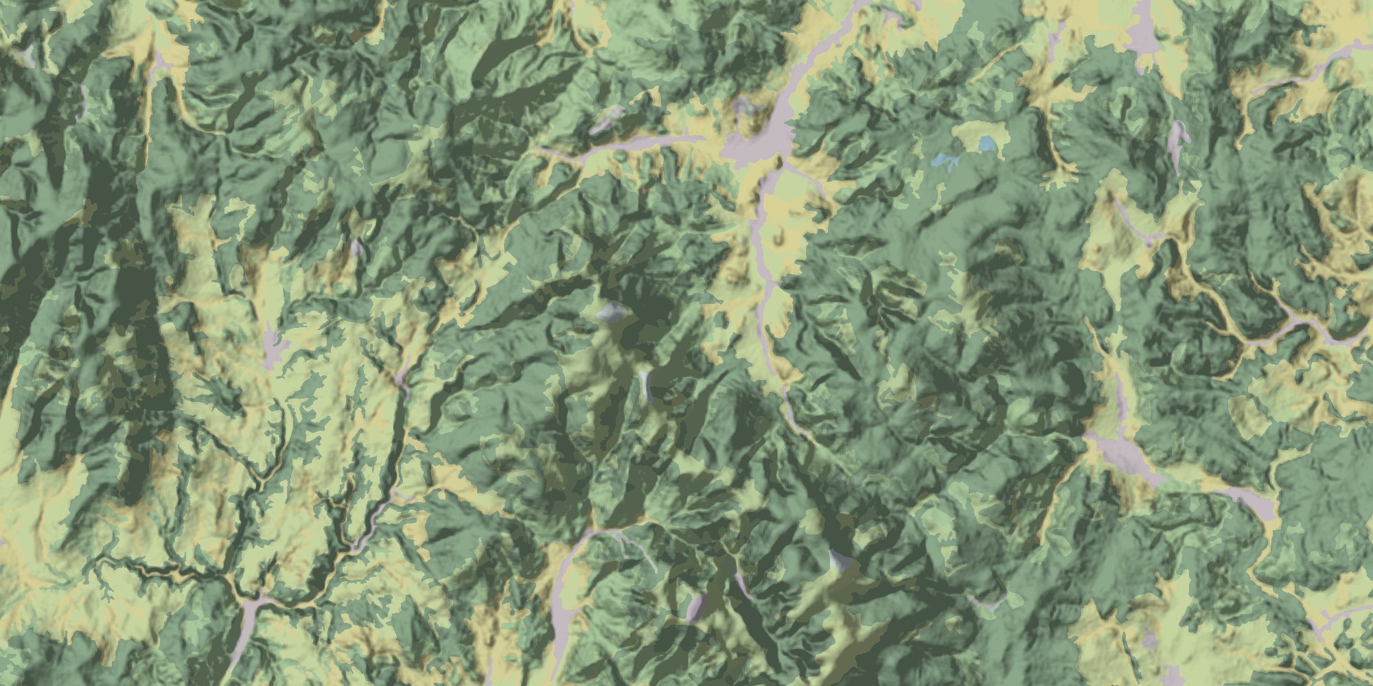
Na webu společnosti ARCDATA PRAHA se objevily nové rastrové podkladové vrstvy ke stažení. Jejich autorem je RNDr. Jan Miklín, Ph.D. z Katedry fyzické geografie a geoekologie Ostravské univerzity v Ostravě. Každá z vrstev je vždy kombinací dat stínovaného reliéfu SRTM s vrstvou krajinného krytu CORINE a je určena k použití ve formě podkladové map středních a velkých […]
The post Natural Czechia – nová podkladová data appeared first on GISportal.cz.
Natural Czechia – nová podkladová data
14.3.2018 10:11 GISportal.czNa webu společnosti ARCDATA PRAHA se objevily nové rastrové podkladové vrstvy ke stažení. Jejich autorem je RNDr. Jan Miklín, Ph.D. z Katedry fyzické geografie a geoekologie Ostravské univerzity v Ostravě. Každá z vrstev je vždy kombinací dat stínovaného reliéfu SRTM s vrstvou krajinného krytu CORINE a je vhodná k použití ve formě podkladové mapy středního a velkého […]
The post Natural Czechia – nová podkladová data appeared first on GISportal.cz.
Hemisphere GNSS Introduces New Atlas®-Capable Vector™ V1000 GNSS Receiver for Precise Marine Applications
14.3.2018 9:30 GISCafe.com Webcasts-Webinars LONDON, UK – March 13, 2018 – Today, Hemisphere GNSS introduces the all-new Vector V1000 GNSS receiver, which provides …Vrchní referent/rada – obnova katastrálního operátu OKO 1302
14.3.2018 9:26 ČÚZK - předpisy a opatření Katastrální úřad pro Plzeňský kraj - Katastrální pracoviště Rokycanyvypisuje výběrové řízení na místo
Vrchní referent/rada – obnova katastrálního operátu OKO 1302
Vrchní referent/rada – obnova katastrálního operátu OKO 1302
14.3.2018 9:26 ČÚZK /Urady/Katastralni-urady/Katastralni-urady/Katastralni-urad-pro-Plzensky-kraj/Uredni-deska/Oznameni-a-jina-uredni-sdeleni/Volna-mista/Vrchni-referent-rada-–-obnova-katastralniho-operatVrchní referent/rada – obnova katastrálního operátu OKO 1302
14.3.2018 9:26 ČÚZK - volná místa Katastrální úřad pro Plzeňský kraj - Katastrální pracoviště Rokycany vypisuje výběrové řízení na místo Vrchní referent/rada – obnova katastrálního operátu OKO 1302Kvartérní hydrogeologické rajony
14.3.2018 1:00 Cenia - Katalog metadat ČR - INSPIRE Vrstva hydrogeologických rajonů, tzv.svrchní vrstva zahrnující oblast kvartérních a propojených kvartérních a neogenních sedimentů (označení 1xxx) a jizerský coniak (rajon 4420).Digitální model terénu
14.3.2018 1:00 Cenia - Katalog metadat ČR - INSPIRE Digitální model terénu - WMS a INSPIRE prohlížecí službaDTM pro ortofoto 2005Brownfields
14.3.2018 1:00 Cenia - Katalog metadat ČR - INSPIRE Lokality brownfields Zlinský kraj, 2009, aktualizované podle potřeby, poslední aktualizace březen 2015Hydrogeologické rajony cenomanu
14.3.2018 1:00 Cenia - Katalog metadat ČR - INSPIRE Vrstva hydrogeologických rajonů, tzv. vrstva bazálního křídového kolektoru v oblasti Pojizeří, povodí Ploučnice a pravostranných přítoků Labe (rajony 4710, 4720, 4730).Digitální model terénu - WMS
14.3.2018 1:00 Cenia - Katalog metadat ČR - INSPIRE Digitální model terénu - WMS a INSPIRE prohlížecí službaDTM pro ortofoto 2005Orbital ATK Introduces Next Generation of In-Orbit Satellite Servicing Technology
13.3.2018 22:08 GISCafe.com Webcasts-Webinars Company Introduces Innovative Robotic Servicing and Life ExtensionSystem at SATELLITE 2018 Conference and Exhibition
DULLES, Va. …
Microsoft and Esri Launch Geospatial AI on Azure (ESRI)
13.3.2018 18:46 GISCafe.com Webcasts-WebinarsEsri FedGIS Conference Showcases How Spatial Analytics Turns Data Insight into Action for Government
13.3.2018 18:46 GISCafe.com Webcasts-Webinars Conference Will Highlight the Ways Location Intelligence ImprovesDecision-Making and Creates Efficient Workflows
REDLANDS, Calif. …
Trimble Announces Call for Speakers for its 2018 Dimensions International User Conference
13.3.2018 18:46 GISCafe.com Webcasts-Webinars SUNNYVALE, Calif., March 13, 2018 — (PRNewswire) — Trimble (NASDAQ:TRMB) has opened its Call for Speakers for the 2018 Trimble …Maxar Technologies to Present at J.P. Morgan Aviation, Transportation & Industrials Conference on March 13
13.3.2018 18:46 GISCafe.com Webcasts-Webinars WESTMINSTER, Colo. — (BUSINESS WIRE) — March 13, 2018 —Maxar Technologies, (“Company” formerly MacDonald, Dettwiler and …
CoreLogic Reports Early-Stage Delinquencies Increased Slightly in December But Serious Delinquency and Foreclosure Inventory Rates Declined Year Over Year
13.3.2018 18:46 GISCafe.com Webcasts-Webinars Overall Mortgage Delinquency Was Flat Year Over YearEarly-Stage Delinquencies Rose 0.1 Percentage Points Year Over Year
…
Yates Electrospace Corporation Expands Drone Delivery Business with Fundamental Patent Award
13.3.2018 18:46 GISCafe.com Webcasts-Webinars United States Patent 9,868,526 is the First to Cover a “FlyingWarehouse” Aircraft Deploying and Recovering Electric Drones for
…
Frost & Sullivan Recognizes Airobotics with the Global New Product Innovation Award for its First-of-a-Kind Completely Autonomous Drone Platform
13.3.2018 18:46 GISCafe.com Webcasts-Webinars SANTA CLARA, California, March 13, 2018 — (PRNewswire) — Based on its recent analysis of the Automated Drone industry, Frost & …TomTom’s Real-Time Electric Vehicle Service Arrives in North America
13.3.2018 18:46 GISCafe.com Webcasts-Webinars DETROIT — (BUSINESS WIRE) — March 13, 2018 —TomTom (TOM2)
today announced that its electric vehicle (EV) service, …
Kratos High Performance Tactical Unmanned Aerial Systems Approved for International Marketing by U.S. State Department
13.3.2018 18:46 GISCafe.com Webcasts-Webinars SAN DIEGO, March 13, 2018 (GLOBE NEWSWIRE) -- Kratos Defense & Security Solutions, Inc. (Nasdaq:KTOS), a leading National Security Solutions …Thales Alenia Space, Telespazio and Spaceflight Industries Finalize Alliance to Manufacture Smallsats at Scale and Deliver Innovative Geospatial Services
13.3.2018 18:38 GISCafe.com Webcasts-Webinars Parties will deploy the high revisit rate BlackSky constellationWASHINGTON — (BUSINESS WIRE) — March 13, 2018 —
At …
Baví tě práce s GIS? Přihlas se do EOVation City & Climate a vyhraj 100.000,- Kč!
13.3.2018 15:21 GISportal.cz
EOVation City & Climate je další z řady technologických soutěží organizovaných podnikatelským inkubátorem Evropské kosmické agentury ESA BIC Prague. Tentokrát půjde o klasický hackathon, který se uskuteční 16.─17. března 2018 v brněnské pobočce IBM – hlavního technologického partnera soutěže. O co v hackathonu půjde? Cílem je za 24 hodin vymyslet prototyp produktu či služby s byznysovým potenciálem zaměřené na […]
The post Baví tě práce s GIS? Přihlas se do EOVation City & Climate a vyhraj 100.000,- Kč! appeared first on GISportal.cz.
Bentley Systems Issues Call for Submissions to the Year in Infrastructure 2018 Awards for Going Digital: Advancements in Infrastructure
13.3.2018 14:40 Bentley SystemsPress Coverage
AECCafe, USA
Read the articleCall for Submissions: The Year in Infrastructure 2018 Awards Program
13.3.2018 14:37 Bentley SystemsPress Coverage
Concrete Construction, USA
Read the articleHabitat for Humanity breaks ground on 3 new homes in Coatesville
13.3.2018 14:33 Bentley SystemsPress Coverage
Daily Local News, USA
Read the articleEdge Computing and IIoT Platforms and More At ARC Forum
13.3.2018 14:28 Bentley SystemsPress Coverage
Manufacturing Connection, USA
Read the articlePoslední místa na GIVS 2018
13.3.2018 14:01 GISportal.cz
Již posledních cca 36 míst zbývá v registraci na konferenci Geoinformace ve veřejné správě, která se bude konat 3. až 4. května, již tradičně na Novotného lávce v Praze. Organizátoři již zveřejnili program, který nabízí zajímavý mix příspěvků od komerčních firem, státní správy, ale i akademiků.
The post Poslední místa na GIVS 2018 appeared first on GISportal.cz.
Urban Remote Sensing – Challenges & Solutions (pozvánka)
13.3.2018 12:45 GISportal.cz
V termínu 24. – 26. září se bude v německé Bochumi konat 5th Joint Workshop “Urban Remote Sensing – Challenges & Solutions” v rámci spolupráce EARSeL Special Interest Groups Urban Remote Sensing, 3D Remote Sensing, Developing Countries and Radar Remote Sensing. Workshop je sponzorovaný Evropskou vesmírnou agenturou (ESA) a mimo mnoho zajímavých přednášek je zde […]
The post Urban Remote Sensing – Challenges & Solutions (pozvánka) appeared first on GISportal.cz.
GSA funding opportunities: GNSS receiver technologies for premium and general mass markets
13.3.2018 10:42 European GNSS Agency
A call for proposals has been opened under the Fundamental Elements funding mechanism, targeting the development of GNSS receiver technologies for premium and general mass markets. This and other FE projects will be presented at Info Day in Prague on March 14.
As the Galileo constellation expands, and following the launch of Initial Services, the adoption of the system in the mass market has taken off with most major smartphone manufacturers announcing a series of products in the last eighteen months that will use Galileo.
But the mass market is not limited to smartphones. Two streams have been identified where additional efforts are required for fostering adoption:
- Premium Mass Market (PMM): the upper segment of mass market applications with respect to general purpose mass-market applications, requiring higher performances than those achievable by popular mass-market products such as trackers or step counters, but less stringent than the professional ones such as GIS receivers.
- General Mass Market (GMM): the low end of mass market applications, which is mainly cost-driven and for which energy consumption and physical size are key drivers.
Read this: GSA to host Fundamental Elements Info Day in Prague: join us on 14th of March
Proposals in the new call shall address any (or both) streams by developing, integrating, testing and demonstrating hardware components, software or firmware filling technology gaps for Premium Mass Market GNSS devices, Internet of Things, or any other general mass market application. They should also assess or, even better, leverage the several Galileo differentiators such as:
- Multiple carrier frequency, wide bandwidth E-GNSS signals;
- Data-less (pilot) channels;
- The prospect of a Navigation Message Authentication service transmitted over Open Service E1;
- The use of carrier-phase based applications and satellite-based real-time Precise Point Positioning (PPP) products, such as the ones foreseen in the Galileo Commercial Service;
- Integration of miniaturised Galileo SAR beacons with mass market devices such as smartphones.
One of the main characteristics of this call is its openness and flexibility. It constitutes a good opportunity for already-established providers of mass market solutions to improve or expand their product portfolio and for newcomers to facilitate the development of their own solutions and their entry into the market.
At a glance:
| Deadline for submission of proposals: | 12 July 2018 |
| Expected signature of contract: | November 2018 |
| Maximum budget allocated: | EUR 6.000.000 |
| Maximum number of projects: | 8 |
| Indicative EU financing amount for each of the projects: | EUR 500.000 – 1.500.000 (70% co funding) |
Apply here
This call is part of the annual Grant Plan published by the GSA and it follows the recent publication of calls for an Advanced interference detection and mitigation techniques and a Commercial Service User terminal. The 2018 Grant Plan should be published soon.
Furthermore, the GSA plans to hold an Info Day at its headquarters in Prague on March 14 2018, focusing on upcoming opportunities under Fundamental Elements. The event will also provide an update on the status of the programme. Participants in the Info Day will have the opportunity to meet with representatives from the European Commission/GSA, ongoing Fundamental Elements projects and the GNSS industry.
You can register for the Info Day here.
Media note: This feature can be republished without charge provided the European GNSS Agency (GSA) is acknowledged as the source at the top or the bottom of the story. You must request permission before you use any of the photographs on the site. If you republish, we would be grateful if you could link back to the GSA website (http://www.gsa.europa.eu).
GSA funding opportunities: GNSS receiver technologies for premium and general mass markets
13.3.2018 10:42 European GNSS AgencyA call for proposals has been opened under the Fundamental Elements funding mechanism, targeting the development of GNSS receiver technologies for premium and general mass markets.
As the Galileo constellation expands, and following the launch of Initial Services, the adoption of the system in the mass market has taken off with most major smartphone manufacturers announcing a series of products in the last eighteen months that will use Galileo.
But the mass market is not limited to smartphones. Two streams have been identified where additional efforts are required for fostering adoption:
- Premium Mass Market (PMM): the upper segment of mass market applications with respect to general purpose mass-market applications, requiring higher performances than those achievable by popular mass-market products such as trackers or step counters, but less stringent than the professional ones such as GIS receivers.
- General Mass Market (GMM): the low end of mass market applications, which is mainly cost-driven and for which energy consumption and physical size are key drivers.
Read this: GSA to host Fundamental Elements Info Day in Prague: join us on 14th of March
Proposals in the new call shall address any (or both) streams by developing, integrating, testing and demonstrating hardware components, software or firmware filling technology gaps for Premium Mass Market GNSS devices, Internet of Things, or any other general mass market application. They should also assess or, even better, leverage the several Galileo differentiators such as:
- Multiple carrier frequency, wide bandwidth E-GNSS signals;
- Data-less (pilot) channels;
- The prospect of a Navigation Message Authentication service transmitted over Open Service E1;
- The use of carrier-phase based applications and satellite-based real-time Precise Point Positioning (PPP) products, such as the ones foreseen in the Galileo Commercial Service;
- Integration of miniaturised Galileo SAR beacons with mass market devices such as smartphones.
One of the main characteristics of this call is its openness and flexibility. It constitutes a good opportunity for already-established providers of mass market solutions to improve or expand their product portfolio and for newcomers to facilitate the development of their own solutions and their entry into the market.
At a glance:
| Deadline for submission of proposals: | 12 July 2018 |
| Expected signature of contract: | November 2018 |
| Maximum budget allocated: | EUR 6.000.000 |
| Maximum number of projects: | 8 |
| Indicative EU financing amount for each of the projects: | EUR 500.000 – 1.500.000 (70% co funding) |
Apply here
This call is part of the annual Grant Plan published by the GSA and it follows the recent publication of calls for an Advanced interference detection and mitigation techniques and a Commercial Service User terminal. The 2018 Grant Plan should be published soon.
Furthermore, the GSA plans to hold an Info Day at its headquarters in Prague on March 14 2018, focusing on upcoming opportunities under Fundamental Elements. The event will also provide an update on the status of the programme. Participants in the Info Day will have the opportunity to meet with representatives from the European Commission/GSA, ongoing Fundamental Elements projects and the GNSS industry.
You can register for the Info Day here.
Media note: This feature can be republished without charge provided the European GNSS Agency (GSA) is acknowledged as the source at the top or the bottom of the story. You must request permission before you use any of the photographs on the site. If you republish, we would be grateful if you could link back to the GSA website (http://www.gsa.europa.eu).
Kosmický inkubátor ESA BIC otevřel pobočku v Brně
13.3.2018 10:06 Český Kosmický PortálStartuje Czech Space Year 2018, rok významných českých kosmických výročí
Praha, 7. březen 2018: Dva roky po založení prvního českého kosmického inkubátoru ESA BIC Prague se možnost využívat technologie a systémy Evropské kosmické agentury (ESA) otevírá i mimopražským firmám. Při příležitosti 40. výročí prvního letu československého kosmonauta Vladimíra Remka do vesmíru dnes agentura CzechInvest spolu s partnery slavnostně otevřela pobočku kosmického inkubátoru v Brně. Sídlit bude v Jihomoravském inovačním centru (JIC) a v následujících třech letech podpoří až devět progresivních start-upů, které hledají využití kosmických technologií v běžném životě.
Vyhlášení platnosti OKO v části k.ú. Rychnov u Verneřic
13.3.2018 9:52 ČÚZK /Urady/Katastralni-urady/Katastralni-urady/Katastralni-urad-pro-Ustecky-kraj/Katastralni-pracoviste/KP-Decin/O-uradu/Aktuality/Vyhlaseni-platnosti-OKO-v-casti-k-u-Rychnov-u-VerVyhlášení platnosti OKO v části k.ú. Rychnov u Verneřic
13.3.2018 9:52 ČÚZK - předpisy a opatření Katastrální úřad pro Ústecký kraj - Katastrální pracoviště Děčín zveřejnil novou aktualitu: Vážení klienti,oznamujeme Vám, že Katastrální pracoviště Děčín dokončilo dne 13. března 2018 obnovu katastrálního operátu na podkladě výsledků pozemkových úprav v části (extravilánu) katastrálního území Rychnov u Verneřic, obce Verneřice.
Full house for EDRS
13.3.2018 7:43 ESA Observing the EarthThe EDRS–SpaceDataHighway has now begun regularly relaying Earth images from Sentinel-2A, which marks the last of four Copernicus satellites in orbit being brought under the EDRS service.
Dokončena „Mise Nula“ akce Astro Pis
13.3.2018 7:04 Český Kosmický PortálVzdělávací kancelář ESA ve spolupráci s nadací Raspberry Pi Foundation s potěšením oznamuje, že „Mise Nula“ (Mission Zero) klání European Astro Pi Challenge 2017/18 byla dokončena.
Muzea a sbírkové expozice na Ústecku nově v turistické aplikaci
13.3.2018 7:00 Statutární město Ústí nad Labem V mapové aplikaci Turistické zajímavosti v Ústí nad Labem a okolí bylo zpracováno nové téma - Muzea a sbírkové expozice na Ústecku. Téma bylo původně vydáno formou tištěného materiálu oddělením cestovního ruchu Magistrátu města Ústí nad Labem. Tato webová aplikace převádí původní materiál do interaktivní mapové podoby a doplňuje jej o nově pořízené fotografie, GPS a další aktualizované informace.Poslední volná místa na GIVS 2018
13.3.2018 7:00 Česká asociace pro geoinformace Poslední přibližně dva tucty volných míst zbývají z kapacity sálu na letošní ročník konference Geoinformace ve veřejné správě. Neváhejte proto s registrací, která je do 15. března za zvýhodněné vložné!Více se o konferenci dozvíte z našeho předchozího článku nebo přímo na webových stránkách
Odborný referent oddělení správy majetku státu, Krajský pozemkový úřad pro Jihočeský kraj
13.3.2018 0:00 Státní pozemkový úřad Státní pozemkový úřad přijme zaměstnance na pozici odborný referent oddělení správy majetku státu, Krajský pozemkový úřad pro Jihočeský kraj.Státní pozemkový úřad je v soudních sporech nadprůměrně úspěšný
13.3.2018 0:00 Státní pozemkový úřad Praha, 13. března 2018 – Státní pozemkový úřad (SPÚ) historicky řešil více než 8 000 soudních sporů. K jejich výraznému nárůstu došlo zejména v posledních třech letech, kdy úřad zaevidoval přes 2 000 nových žalob. I navzdory tomuto faktu se SPÚ dařilo u soudů dosáhnout 80% úspěšnosti. V současné době Státní pozemkový úřad eviduje přibližně 3 500 soudních sporů.GIS Specialist – Rutgers University
12.3.2018 19:05 Job Title: Research Project Coordinator II Posting Summary: Rutgers, The State University of New Jersey, is seeking a Research Project Coordinator II to specialize in Geographic Information System (GIS) implementation and work under the guidance and direction of the Assistant Director of University Planning and Development. This position is responsible for a variety of tasks […]Postdoctoral research position in Melbourne, Australia
12.3.2018 19:05 2-year fixed-term Research Fellow in GI science: http://yourcareer.rmit.edu.au/caw/en/job/562622/research-fellowGroup Leader, GIS @ URPP Language and Space Lab (Univ. Zurich)
12.3.2018 19:04 We have an opening for a group leader position within an interdisciplinary research program on “Language and Space”. We are looking for a highly motivated scientist with a PhD degree who is actively pursuing research on the interface of GIScience and linguistics. It would be great if you could pass on this position announcement […]Associate Director, Spatial Structures in the Social Sciences, Brown University
12.3.2018 19:01 Brown University announces a search for the position of Associate Director of the research initiative on Spatial Structures in the Social Sciences. More information on the program is available at here. This is a 10-month per year position, with potential for salary during summer from external grants, beginning September 1, 2018. The Associate Director will participate in […]Stratum - ONF Launches Major New Open Source SDN Switching Platform with Support from Google
12.3.2018 16:46 GISCafe.com Webcasts-Webinars Backed by a collection of 23 founding members, Stratum delivers on the 'Software Defined' vision of SDNMENLO PARK, Calif., March 12, 2018 — …
Global GIS Market - Growth Forecast and Competitive Overview by Technavio
12.3.2018 16:45 GISCafe.com Webcasts-Webinars LONDON — (BUSINESS WIRE) — March 10, 2018 — Market research firm Technavio has announced the release of their latest report on the …International Launch Services (ILS) and Effective Space Announce the ILS Proton Breeze M Launch of Two Satellite-Servicing SPACE DRONE™ Spacecraft in 2020
12.3.2018 16:44 GISCafe.com Webcasts-Webinars WASHINGTON — (BUSINESS WIRE) — March 12, 2018 — ILS, a U.S.-based leading global commercial launch services provider and UK …Panasonic and Sygic partner to offer advanced professional mobile navigation solutions to business
12.3.2018 16:42 GISCafe.com Webcasts-Webinars Sygic joins Panasonic Toughbook’s Independent Software Vendor programmeBRACKNELL, UK. 12th MARCH 2018: Panasonic today announced that Sygic …