


zprávy
zdroje zpráv:20220525 - volné místo - Ředitel/ředitelka KP Ústí nad Labem na KÚ pro Ústecký kraj
24.5.2022 12:48 ČÚZK - předpisy a opatření Katastrální úřad pro Ústecký kraj - Katastrální pracoviště Ústí nad Labem zveřejnil novou aktualitu: Nabídka volného pracovního místa - Služební místo představeného - Ředitel / ředitelka Katastrálního pracoviště Ústí nad Labem na Katastrálním úřadu pro Ústecký kraj20220525 - volné místo - Ředitel/ředitelka KP Ústí nad Labem na KÚ pro Ústecký kraj
24.5.2022 12:47 ČÚZK /Urady/Katastralni-urady/Katastralni-urady/Katastralni-urad-pro-Ustecky-kraj/O-uradu/Aktuality/20220525-volne-misto-Reditel-reditelka-KP Usti20220525 - volné místo - Ředitel/ředitelka KP Ústí nad Labem na KÚ pro Ústecký kraj
24.5.2022 12:47 ČÚZK - předpisy a opatření Katastrální úřad pro Ústecký kraj - Katastrální pracoviště Ústí nad Labem zveřejnil novou aktualitu: Nabídka volného pracovního místa - Služební místo představeného - Ředitel / ředitelka Katastrálního pracoviště Ústí nad Labem na Katastrálním úřadu pro Ústecký krajSNAP spurs Earth observation innovation with one million downloads
24.5.2022 12:00 ESA Observing the Earth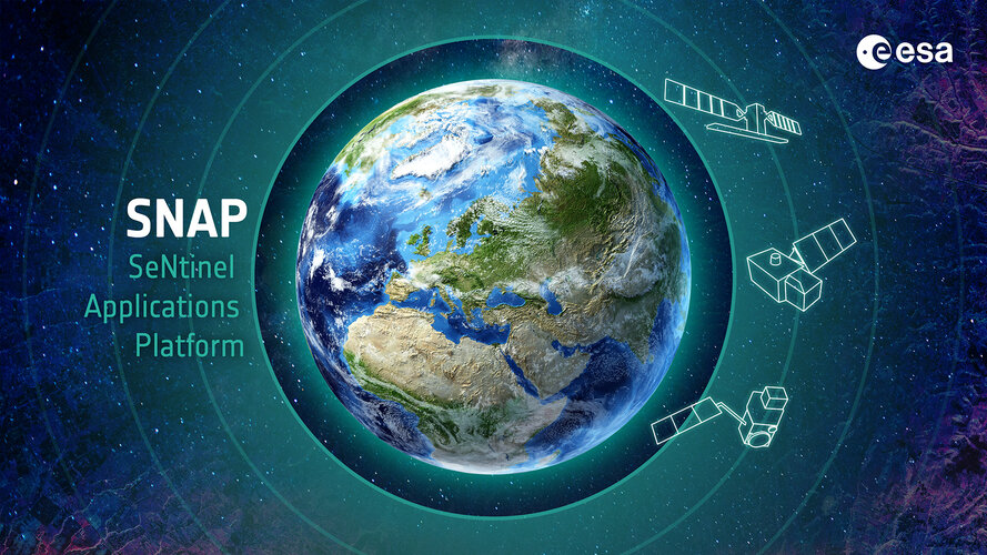
An open-access Earth observation analysis tool that has continued to grow in popularity in the seven years since its launch has now been projected to reach one million downloads, ESA announced today at the Living Planet Symposium.
Copernicus to expand its user-base with new demonstrators
24.5.2022 10:26 European GNSS Agency is playing a key role in the downstream user uptake activities of Copernicus, the EU Earth Observation Programme")
Copernicus has been monitoring the Earth’s environment from several years now, providing a unique combination of full, free and open data and services in six thematic areas: Land, Marine, Atmosphere, Climate Change, Emergency and Security. The Copernicus system consists of three main components: a space component, which delivers data from a fleet of dedicated observation satellites (the ‘Sentinels’) and from contributing missions; an in-situ component which collects data acquired by a multitude of sensors at air-, sea- and ground-level; and a service component which transforms the wealth of satellite and in-situ data into timely and actionable information products.
The European Union Agency for the Space Programme (EUSPA) is playing a key role in the downstream user uptake activities of Copernicus, the EU Earth Observation Programme. In its current role related to the Copernicus Programme, EUSPA is looking to demonstrate 6 innovative Proof of Concepts, starting from 10 areas, divided in two Lots:
- Lot 1: Mobility, Emergency and Infrastructures
- Lot 2: Consumer and Environment
For each Lot, 3 Proof of Concepts will be demonstrated, starting from 5 areas, prioritizing the most impactful and promising markets for current and potential Copernicus data use.
Read this: How the EU Space Programme helps address the new challenges of a changing Arctic
The objective is to demonstrate the utilization of Copernicus data and services in the user’s operational environment. Therefore, the technical demonstration should be concretely integrated in a controlled operational environment of the user.
EUSPA intends to promote the widest participation possible by economic operators, in particular start-ups, new entrants, and SMEs.
To do so, the agency is organizing an industry day on 06 June 2022 at 10:00 to present the details of the procurement for “Copernicus Demonstrators”. You can find the agenda here.
Potential participants will have the opportunity to learn more about the mission of the European Union Agency for the Space Programme and the procurement documentation and submission process.
For more information about the utility of Earth Observation data across various market segments you can consult the EUSPA EO and GNSS Market Report.
To attend this industry day, please register here.
Media note: This feature can be republished without charge provided the European Union Agency for the Space Programme (EUSPA) is acknowledged as the source at the top or the bottom of the story. You must request permission before you use any of the photographs on the site. If you republish, we would be grateful if you could link back to the EUSPA website (http://www.euspa.europa.eu).
Copernicus to expand its user-base with new demonstrators
24.5.2022 10:26 European GNSS AgencyCopernicus has been monitoring the Earth’s environment from several years now, providing a unique combination of full, free and open data and services in six thematic areas: Land, Marine, Atmosphere, Climate Change, Emergency and Security. The Copernicus system consists of three main components: a space component, which delivers data from a fleet of dedicated observation satellites (the ‘Sentinels’) and from contributing missions; an in-situ component which collects data acquired by a multitude of sensors at air-, sea- and ground-level; and a service component which transforms the wealth of satellite and in-situ data into timely and actionable information products.
The European Union Agency for the Space Programme (EUSPA) is playing a key role in the downstream user uptake activities of Copernicus, the EU Earth Observation Programme. In its current role related to the Copernicus Programme, EUSPA is looking to demonstrate 6 innovative Proof of Concepts, starting from 10 areas, divided in two Lots:
- Lot 1: Mobility, Emergency and Infrastructures
- Lot 2: Consumer and Environment
For each Lot, 3 Proof of Concepts will be demonstrated, starting from 5 areas, prioritizing the most impactful and promising markets for current and potential Copernicus data use.
Read this: How the EU Space Programme helps address the new challenges of a changing Arctic
The objective is to demonstrate the utilization of Copernicus data and services in the user’s operational environment. Therefore, the technical demonstration should be concretely integrated in a controlled operational environment of the user.
EUSPA intends to promote the widest participation possible by economic operators, in particular start-ups, new entrants, and SMEs.
To do so, the agency is organizing an industry day on 06 June 2022 at 10:00 to present the details of the procurement for “Copernicus Demonstrators”. You can find the agenda here.
Potential participants will have the opportunity to learn more about the mission of the European Union Agency for the Space Programme and the procurement documentation and submission process.
For more information about the utility of Earth Observation data across various market segments you can consult the EUSPA EO and GNSS Market Report.
To attend this industry day, please register here.
Media note: This feature can be republished without charge provided the European Union Agency for the Space Programme (EUSPA) is acknowledged as the source at the top or the bottom of the story. You must request permission before you use any of the photographs on the site. If you republish, we would be grateful if you could link back to the EUSPA website (http://www.euspa.europa.eu).
Copernicus to expand its user-base with new demonstrators (Webinar)
24.5.2022 10:26 European GNSS AgencyCopernicus has been monitoring the Earth’s environment from several years now, providing a unique combination of full, free and open data and services in six thematic areas: Land, Marine, Atmosphere, Climate Change, Emergency and Security. The Copernicus system consists of three main components: a space component, which delivers data from a fleet of dedicated observation satellites (the ‘Sentinels’) and from contributing missions; an in-situ component which collects data acquired by a multitude of sensors at air-, sea- and ground-level; and a service component which transforms the wealth of satellite and in-situ data into timely and actionable information products.
The European Union Agency for the Space Programme (EUSPA) is playing a key role in the downstream user uptake activities of Copernicus, the EU Earth Observation Programme. In its current role related to the Copernicus Programme, EUSPA is looking to demonstrate 6 innovative Proof of Concepts, starting from 10 areas, divided in two Lots:
- Lot 1: Mobility, Emergency and Infrastructures
- Lot 2: Consumer and Environment
For each Lot, 3 Proof of Concepts will be demonstrated, starting from 5 areas, prioritizing the most impactful and promising markets for current and potential Copernicus data use.
Read this: How the EU Space Programme helps address the new challenges of a changing Arctic
The objective is to demonstrate the utilization of Copernicus data and services in the user’s operational environment. Therefore, the technical demonstration should be concretely integrated in a controlled operational environment of the user.
EUSPA intends to promote the widest participation possible by economic operators, in particular start-ups, new entrants, and SMEs.
To do so, the agency is organizing an industry day -online- on 06 June 2022 at 10:00 to present the details of the procurement for “Copernicus Demonstrators”. You can find the agenda here.
Potential participants will have the opportunity to learn more about the mission of the European Union Agency for the Space Programme and the procurement documentation and submission process.
For more information about the utility of Earth Observation data across various market segments you can consult the EUSPA EO and GNSS Market Report.
Join us for the webinar, register here.
Media note: This feature can be republished without charge provided the European Union Agency for the Space Programme (EUSPA) is acknowledged as the source at the top or the bottom of the story. You must request permission before you use any of the photographs on the site. If you republish, we would be grateful if you could link back to the EUSPA website (http://www.euspa.europa.eu).
odborný referent / vrchní referent v oddělení právních vztahů na Katastrálním pracovišti Jablonec na
24.5.2022 9:49 ČÚZK - volná místa Katastrální úřad pro Liberecký kraj vypisuje výběrové řízení na místo odborný referent / vrchní referent v oddělení právních vztahů na Katastrálním pracovišti Jablonec naodborný referent / vrchní referent v oddělení právních vztahů na Katastrálním pracovišti Jablonec na
24.5.2022 9:49 ČÚZK - předpisy a opatření Katastrální úřad pro Liberecký kraj Katastrální pracoviště Jablonec nad Nisouvypisuje výběrové řízení na místo
odborný referent / vrchní referent v oddělení právních vztahů na Katastrálním pracovišti Jablonec nad Nisou
odborný referent / vrchní referent v oddělení právních vztahů na Katastrálním pracovišti Jablonec na
24.5.2022 9:49 ČÚZK /Urady/Katastralni-urady/Katastralni-urady/Katastralni-urad-pro-Liberecky-kraj/Uredni-deska/Oznameni-a-jina-uredni-sdeleni/Volna-mista/DMS/odborny-referent-vrchni-referent-v-oddeleni-pravodborný referent / vrchní referent v oddělení právních vztahů na Katastrálním pracovišti Jablonec na
24.5.2022 9:49 ČÚZK - volná místa Katastrální úřad pro Liberecký kraj Katastrální pracoviště Jablonec nad Nisou vypisuje výběrové řízení na místo odborný referent / vrchní referent v oddělení právních vztahů na Katastrálním pracovišti Jablonec naodborný referent / vrchní referent v oddělení právních vztahů na Katastrálním pracovišti Jablonec na
24.5.2022 9:49 ČÚZK - předpisy a opatření Katastrální úřad pro Liberecký krajvypisuje výběrové řízení na místo
odborný referent / vrchní referent v oddělení právních vztahů na Katastrálním pracovišti Jablonec nad Nisou
Accelerators gear up at ESA’s Living Planet Symposium
24.5.2022 8:58 ESA Observing the Earth
Global climate change is the single most challenging issue faced by humanity – affecting every region, continent and ocean on Earth. It fuels a range of other top-level challenges such as food security, migration, biodiversity loss, risks to human health and economic losses.
This week, at ESA’s Living Planet Symposium taking place in Bonn, high-level ESA representatives, along with a mix of academia and policy experts, came together to discuss ESA’s ‘Space for a Green Future Accelerator’ – a major ESA initiative aiming to accelerate the use of space in Europe.
Geodet/ka
24.5.2022 8:12 ČÚZK - předpisy a opatření Zeměměřický úřadvypisuje výběrové řízení na místo
Geodet/ka
Geodet/ka
24.5.2022 8:12 ČÚZK - volná místa Zeměměřický úřad vypisuje výběrové řízení na místo Geodet/kaGeodet/ka
24.5.2022 8:12 Zeměměřický úřad Zeměměřický úřadvypisuje výběrové řízení na místo
Geodet/ka
Geodet/ka
24.5.2022 8:12 ČÚZK /Urady/Zememericky-urad/Uredni-deska/Oznameni-a-jina-uredni-sdeleni/Volna-mista/DMS/Geodet-kaArchivář/ka
24.5.2022 8:09 ČÚZK /Urady/Zememericky-urad/Uredni-deska/Oznameni-a-jina-uredni-sdeleni/Volna-mista/DMS/Archivar-kaArchivář/ka
24.5.2022 8:09 Zeměměřický úřad Zeměměřický úřadvypisuje výběrové řízení na místo
Archivář/ka
Archivář/ka
24.5.2022 8:09 ČÚZK - předpisy a opatření Zeměměřický úřadvypisuje výběrové řízení na místo
Archivář/ka
Archivář/ka
24.5.2022 8:09 ČÚZK - volná místa Zeměměřický úřad vypisuje výběrové řízení na místo Archivář/kaStátní pozemkový úřad zveřejnil finance a plán pozemkových úprav pro rok 2022
23.5.2022 22:30 ZeměměřičStátní pozemkový úřad představil plán svých veřejných zakázek na rok 2022, které se týkají především pozemkových úprav a realizací plánů společných zařízení, a to v celkovém objemu předpokládaných hodnot 3,404 mld. Kč bez DPH. Z důvodu transparentnosti postupu zadavatele a maximální otevřenosti pro potencionální dodavatele, se Státní pozemkový úřad rozhodl představit plán nejvýznamnějších veřejných zakázek na kalendářní rok 2022. […]
The post Státní pozemkový úřad zveřejnil finance a plán pozemkových úprav pro rok 2022 appeared first on Zeměměřič.
3D monitor PluraView pro lepší práci s BIM a leteckými snímky
23.5.2022 21:44 GeoBusinessFirma Schneider Digital před časem představila nový 22palcový pasivní stereo monitor PluraView, který doplňuje jejich předchozí 24“ a 27″/28″ palcové varianty. 3D monitory, na nichž s pomocí brýlí vidíte skutečný 3D obraz, najdou uplatnění při rychlejším a mnohem přesnějším (pracujete s 3D ve skutečném 3D) vyhodnocení dat v GISu, fotogrammetrii, laserovém skenování nebo v 3D […]
The post 3D monitor PluraView pro lepší práci s BIM a leteckými snímky appeared first on GeoBusiness.
Hitachi launches Lumada Inspection Insights and strengthens digital and green portfolio
23.5.2022 20:32 GISCafe.com Webcasts-Webinars Zurich, Switzerland, May 23, 2022 (GLOBE NEWSWIRE) -- Hitachi, Ltd. (TSE:6501) today announced the launch of Lumada Inspection Insights, its …Drone Nerds Announces New partnerships with AirData and DroneLogbook
23.5.2022 20:32 GISCafe.com Webcasts-Webinars Dania Beach, FL, May 23, 2022 (GLOBE NEWSWIRE) -- Drone Nerds has added AirData and DroneLogbook to their suite of enterprise software solutions …Full steam ahead for carbon dioxide monitoring mission
23.5.2022 18:00 ESA Observing the Earth
The Copernicus Anthropogenic Carbon Dioxide Monitoring mission has taken another step forward as ESA authorises the mission’s prime contractor, OHB, to continue the development of the first satellite that will take it to being launch-ready and, in parallel, start production on the mission’s second satellite. Celebrated at ESA’s Living Planet Symposium in Bonn, this contract rider follows an initial contract that was signed in 2020.
How investors can shape the future of digital twins
23.5.2022 16:58 Bentley SystemsPressCoverage
New Civil Engineer, UK&I
Read the articleDigitální technická mapa ulehčí práci veřejné správě i investorům.
23.5.2022 16:52 TopGis V Česku vzniká projekt digitální technické mapy (DTM), pokrývající území celé republiky. Dílo má za cíl přehledně poskytnout spolehlivé a přesné informace o polohopisu a dopravní a technické infrastruktuře. Jednotlivé kraje již zakázky za stovky milionů realizují nebo finišují jejich přípravu. Vedle finanční náročnosti je pak zásadní i časový rámec, který se u DTM pohybujeSavings Achieved in Scheduling and Work Package Development With Modeling Software During
23.5.2022 16:18 Bentley SystemsPressCoverage
Journal of Petroleum Technology, USA
Read the articleZABAGED® - Katalog objektů
23.5.2022 16:01 ČÚZK - Geoportál ZABAGED® - Katalog objektůWebová verze Katalogu objektů ZABAGED® byla rozšířena o anglickou mutaci.
ZABAGED® - Katalog objektů
23.5.2022 16:01 ČÚZK - Geoportál ZABAGED® - Katalog objektůWebová verze Katalogu objektů ZABAGED® byla rozšířena o anglickou mutaci.
ZABAGED® - Katalog objektů
23.5.2022 16:01 ČÚZK - Geoportál ZABAGED® - Katalog objektůWebová verze Katalogu objektů ZABAGED® byla rozšířena o anglickou mutaci.
ZABAGED® - Katalog objektů
23.5.2022 16:01 ČÚZK - Geoportál ZABAGED® - Katalog objektůWebová verze Katalogu objektů ZABAGED® byla rozšířena o anglickou mutaci.
ZABAGED® - Katalog objektů
23.5.2022 16:01 ČÚZK - Geoportál ZABAGED® - Katalog objektůWebová verze Katalogu objektů ZABAGED® byla rozšířena o anglickou mutaci.
ZABAGED® - Katalog objektů
23.5.2022 16:01 ČÚZK - Geoportál ZABAGED® - Katalog objektůWebová verze Katalogu objektů ZABAGED® byla rozšířena o anglickou mutaci.
ZABAGED® - Katalog objektů
23.5.2022 16:01 ČÚZK - Geoportál ZABAGED® - Katalog objektůWebová verze Katalogu objektů ZABAGED® byla rozšířena o anglickou mutaci.
ZABAGED® - Katalog objektů
23.5.2022 16:01 ČÚZK - Geoportál ZABAGED® - Katalog objektůWebová verze Katalogu objektů ZABAGED® byla rozšířena o anglickou mutaci.
ZABAGED® - Katalog objektů
23.5.2022 16:01 ČÚZK - Geoportál ZABAGED® - Katalog objektůWebová verze Katalogu objektů ZABAGED® byla rozšířena o anglickou mutaci.
ZABAGED® - Katalog objektů
23.5.2022 16:01 ČÚZK - Geoportál ZABAGED® - Katalog objektůWebová verze Katalogu objektů ZABAGED® byla rozšířena o anglickou mutaci.
ZABAGED® - Katalog objektů
23.5.2022 16:01 ČÚZK - Geoportál ZABAGED® - Katalog objektůWebová verze Katalogu objektů ZABAGED® byla rozšířena o anglickou mutaci.
ZABAGED® - Katalog objektů
23.5.2022 16:01 ČÚZK - Geoportál ZABAGED® - Katalog objektůWebová verze Katalogu objektů ZABAGED® byla rozšířena o anglickou mutaci.
ZABAGED® - Katalog objektů
23.5.2022 16:01 ČÚZK - Geoportál ZABAGED® - Katalog objektůWebová verze Katalogu objektů ZABAGED® byla rozšířena o anglickou mutaci.
ZABAGED® - Katalog objektů
23.5.2022 16:01 ČÚZK - Geoportál ZABAGED® - Katalog objektůWebová verze Katalogu objektů ZABAGED® byla rozšířena o anglickou mutaci.
ZABAGED® - Katalog objektů
23.5.2022 16:01 ČÚZK - Geoportál ZABAGED® - Katalog objektůWebová verze Katalogu objektů ZABAGED® byla rozšířena o anglickou mutaci.
ZABAGED® - Katalog objektů
23.5.2022 16:01 ČÚZK - Geoportál ZABAGED® - Katalog objektůWebová verze Katalogu objektů ZABAGED® byla rozšířena o anglickou mutaci.
ZABAGED® - Katalog objektů
23.5.2022 16:01 ČÚZK - Geoportál ZABAGED® - Katalog objektůWebová verze Katalogu objektů ZABAGED® byla rozšířena o anglickou mutaci.
ZABAGED® - Katalog objektů
23.5.2022 16:01 ČÚZK - Geoportál ZABAGED® - Katalog objektůWebová verze Katalogu objektů ZABAGED® byla rozšířena o anglickou mutaci.
ZABAGED® - Katalog objektů
23.5.2022 16:01 ČÚZK - Geoportál ZABAGED® - Katalog objektůWebová verze Katalogu objektů ZABAGED® byla rozšířena o anglickou mutaci.
Esri to Preview ArcGIS for Microsoft Planetary Computer at Living Planet Symposium
23.5.2022 15:58 GISCafe.com Webcasts-Webinars Users Will See How Global Satellite Data Can Support Sustainability EffortsREDLANDS, Calif. — (BUSINESS WIRE) — May 23, 2022 …
Satellogic Announces Enhanced Operations in Australia to Serve the APAC Region
23.5.2022 15:58 GISCafe.com Webcasts-Webinars Regional Presence to be Overseen by Ken Fritschel, Vice President, International Sales, SatellogicNEW YORK — (BUSINESS WIRE) — May 23, …
Vexcel to Provide Catastrophe Analytics on Properties After Major Weather Events and Natural Disasters
23.5.2022 15:58 GISCafe.com Webcasts-Webinars CENTENNIAL, Colo., May 23, 2022 — (PRNewswire) — Vexcel Data Program announced today a new product to enhance insights and learning …Woolpert Selected by Pacific Community (SPC) for Topo-Bathy Lidar, Aerial Imagery in Vanuatu
23.5.2022 15:58 GISCafe.com Webcasts-Webinars VANUATU, May 23, 2022 — (PRNewswire) — Woolpert has been contracted by the Pacific Community (SPC) to acquire, process and deliver …Axon and Skydio Announce New Integration of Skydio Autonomous Drones with Axon Respond for Public Safety
23.5.2022 15:58 GISCafe.com Webcasts-Webinars SCOTTSDALE, Ariz., May 23, 2022 — (PRNewswire) — Axon (Nasdaq: AXON), the global leader in connected public safety technologies, and …Swarm unveils magnetic waves deep down
23.5.2022 15:00 ESA Observing the Earth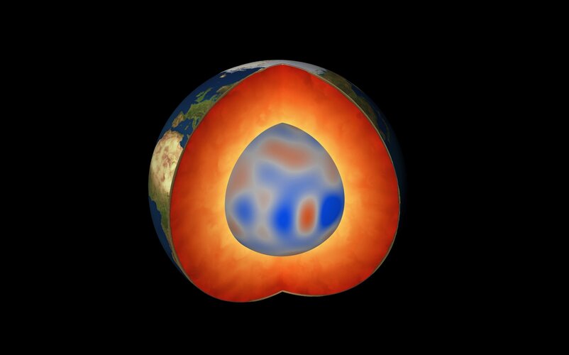
While volcanic eruptions and earthquakes serve as immediate reminders that Earth’s insides are anything but tranquil, there are also other, more elusive, dynamic processes happening deep down below our feet. Using information from ESA’s Swarm satellite mission, scientists have discovered a completely new type of magnetic wave that sweeps across the outermost part of Earth’s outer core every seven years. This fascinating finding, presented today at ESA’s Living Planet Symposium, opens a new window into a world we can never see.
Výběrové řízení
23.5.2022 13:24 ČÚZK - předpisy a opatření Katastrální úřad pro Liberecký kraj zveřejnil novou aktualitu: Oznámení o vyhlášení výběrového řízení na pracovní místo finanční referent ekonomického oddělení v kanceláři ředitele katastrálního úřadu pro Liberecký krajfinanční referent ekonomického oddělení
23.5.2022 13:19 ČÚZK - volná místa Katastrální úřad pro Liberecký kraj kancelář ředitele vypisuje výběrové řízení na místo finanční referent ekonomického oddělenífinanční referent ekonomického oddělení
23.5.2022 13:19 ČÚZK /Urady/Katastralni-urady/Katastralni-urady/Katastralni-urad-pro-Liberecky-kraj/Volna-mista/DMS/financni-referent-ekonomickeho-oddelenifinanční referent ekonomického oddělení
23.5.2022 13:19 ČÚZK - předpisy a opatření Katastrální úřad pro Liberecký kraj kancelář ředitelevypisuje výběrové řízení na místo
finanční referent ekonomického oddělení
Living Planet Symposium kicks off
23.5.2022 13:00 ESA Observing the Earth
ESA’s Living Planet Symposium has opened with a flourish with over 4000 participants including scientists, academics, space industry representatives, institutional stakeholders, data users, students and citizens gathered to discuss the latest findings on our changing planet, as well as advances in satellite technologies, new opportunities in the commercial world, and ESA’s plans for the future.
buildingSMART International hires Evandro Alfieri
23.5.2022 12:22 buildingSMART.orgbuildingSMART International is pleased to announce that Evandro Alfieri will be joining the technical Services team from May 1st as a Solutions Accelerator. Evandro has been working in the IFC Rail project for over four years and is highly regarded for his professionalism, technical expertise and his ability to bridge the gap between the…
The post buildingSMART International hires Evandro Alfieri appeared first on buildingSMART International.
buildingSMART International hires Evandro Alfieri
23.5.2022 12:22 buildingSMART.orgbuildingSMART International is pleased to announce that Evandro Alfieri will be joining the technical Services team from May 1st as a Solutions Accelerator. Evandro has been working in the…
The post buildingSMART International hires Evandro Alfieri appeared first on buildingSMART International.
Oznámení o přerušení dodávky elektrické energie dne 26.5.2022
23.5.2022 10:24 ČÚZK - předpisy a opatření Katastrální úřad pro Jihomoravský kraj - Katastrální pracoviště Boskovice zveřejnil novou aktualitu: Oznámení o přerušení dodávky elektrické energie dne 26.5.2022Oznámení o přerušení dodávky elektrické energie dne 26.5.2022
23.5.2022 10:24 ČÚZK /Urady/Katastralni-urady/Katastralni-urady/Katastralni-urad-pro-Jihomoravsky-kraj/Katastralni-pracoviste/KP-Boskovice/O-uradu/Aktuality/Oznameni-o-preruseni-dodavky-elektricke-energie-dnLive now: Living Planet Symposium
23.5.2022 8:20 ESA Observing the Earth
Live now: Living Planet Symposium
Watch the Opening Session live from Bonn
Slavnostní vyhlášení výsledků soutěže Mapa roku 2021 (pozvánka)
23.5.2022 8:08 GISportal.cz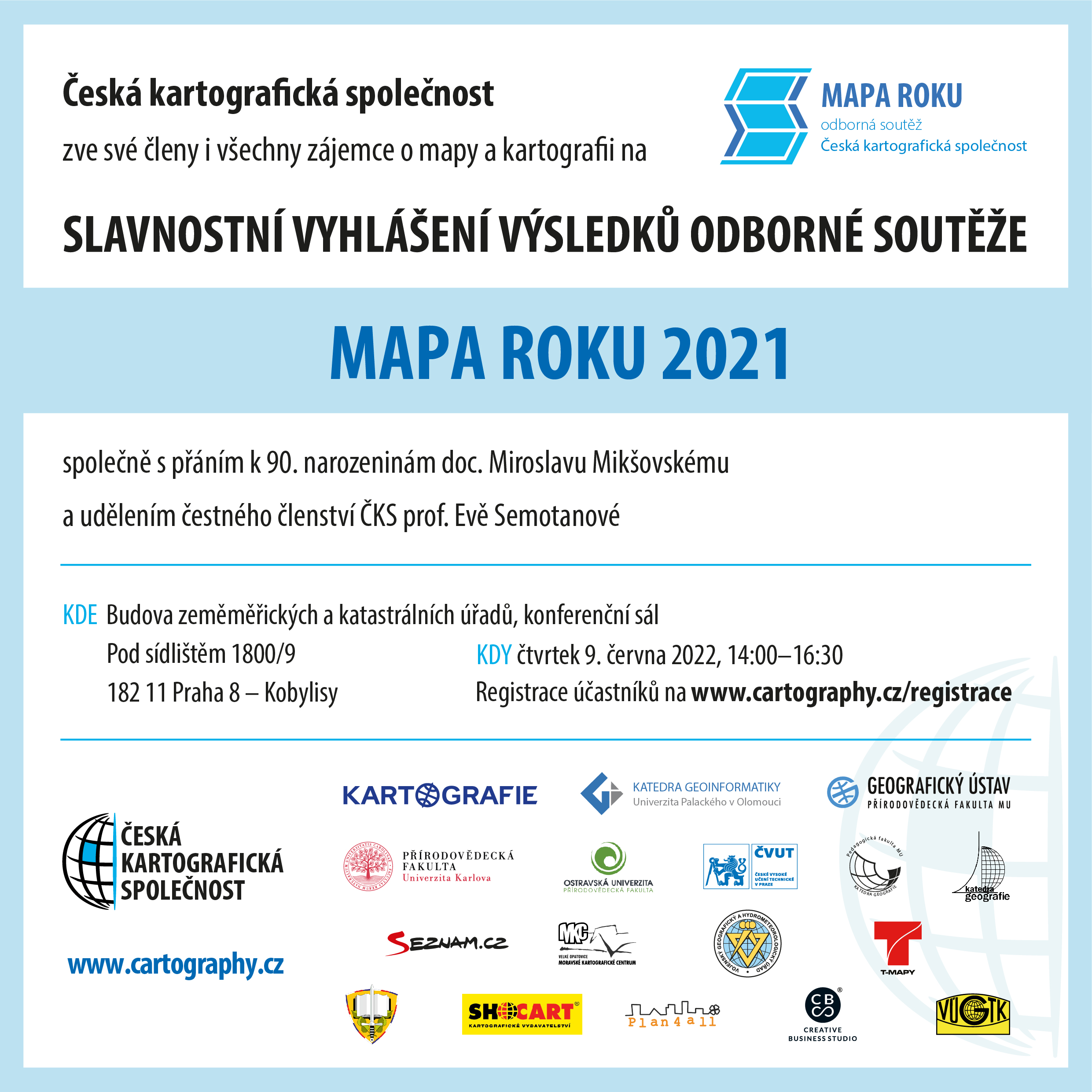
Výbor České kartografické společnosti a komise pro soutěž MAPA ROKU zvou všechny příznivce map, atlasů a kartografie na Slavnostní vyhlášení výsledků soutěže Mapa roku 2021 a dvě výjimečné události: přání doc. Miroslavu Mikšovskému k jeho úžasným 90. narozeninám a udělení čestného členství ČKS prof. Evě Semotanové. Vše se odehraje ve čtvrtek 9. června 2022 od […]
The post Slavnostní vyhlášení výsledků soutěže Mapa roku 2021 (pozvánka) appeared first on GISportal.cz.
Slavnostní vyhlášení výsledků soutěže Mapa roku 2021 (pozvánka)
23.5.2022 8:08 GISportal.czVýbor České kartografické společnosti a komise pro soutěž MAPA ROKU zvou všechny příznivce map, atlasů a kartografie na Slavnostní vyhlášení výsledků soutěže Mapa roku 2021 a dvě výjimečné události: přání doc. Miroslavu Mikšovskému k jeho úžasným 90. narozeninám a udělení čestného členství ČKS prof. Evě Semotanové. Vše se odehraje ve čtvrtek 9. června 2022 od […]
The post Slavnostní vyhlášení výsledků soutěže Mapa roku 2021 (pozvánka) appeared first on GISportal.cz.
Applications Invited for URISA's Vanguard Cabinet (URISA)
21.5.2022 1:58 GISCafe.com Webcasts-Webinars Des Plaines, IL (May 20, 2022) URISA is pleased to invite applications for its Vanguard Cabinet. The Vanguard Cabinet (VC), …Volocopter Collaborates with Microsoft on VoloIQ Aerospace Cloud Project
20.5.2022 17:15 GISCafe.com Webcasts-Webinars REDMOND, WASHINGTON and BRUCHSAL, Germany, May 17, 2022 — (PRNewswire) — Today, Volocopter, the pioneer of urban air mobility (UAM), …Flyability releases the Elios 3, an indoor LiDAR drone for Industry 4.0
20.5.2022 17:15 GISCafe.com Webcasts-Webinars Lausanne, SWITZERLAND and SINGAPORE and SHANGHAI, May 20, 2022 — (PRNewswire) — Flyability unveils the Elios 3, the world's first …Ecopia AI Partners with Snap Inc. Subsidiary to Pilot 3D Map Content Integration
20.5.2022 17:15 GISCafe.com Webcasts-Webinars TORONTO — (BUSINESS WIRE) — May 20, 2022 —Ecopia AI announced today that it was selected by a Snap Inc. subsidiary to provide …
Watch live: Living Planet Symposium 2022
20.5.2022 14:55 ESA Observing the Earth
The time has finally come for ESA’s Living Planet Symposium – one of the largest Earth observation conferences in the world. Follow our live streaming all week on ESA Web TV.
Watch live: Living Planet Symposium 2022
20.5.2022 14:55 ESA Observing the Earth
The time has finally come for ESA’s Living Planet Symposium – one of the largest Earth observation conferences in the world. Follow our live streaming all week on ESA Web TV, starting with the Opening Ceremony on Monday 23 May at 09:00 (CEST).
referent/rada – návrh zápisu, kontrola a zplatnění
20.5.2022 14:41 ČÚZK /Urady/Katastralni-urady/Katastralni-urady/Katastralni-urad-pro-hlavni-mesto-Prahu/Uredni-deska/Oznameni-a-jina-uredni-sdeleni/Volna-mista/DMS/referent-rada-–-navrh-zapisu,-kontrola-a-zplatnenireferent/rada – návrh zápisu, kontrola a zplatnění
20.5.2022 14:41 ČÚZK - volná místa Katastrální úřad pro hlavní město Prahu - Katastrální pracoviště Praha vypisuje výběrové řízení na místo referent/rada – návrh zápisu, kontrola a zplatněníreferent/rada – návrh zápisu, kontrola a zplatnění
20.5.2022 14:41 ČÚZK - předpisy a opatření Katastrální úřad pro hlavní město Prahu - Katastrální pracoviště Prahavypisuje výběrové řízení na místo
referent/rada – návrh zápisu, kontrola a zplatnění
Earth from Space: Bonn, Germany
20.5.2022 10:00 ESA Observing the Earth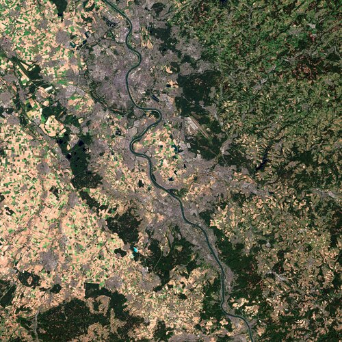
ESA’s Living Planet Symposium – one of the largest Earth observation conferences in the world – is being held on 23–27 May in Bonn, Germany. Held every three years, the symposium brings together scientists and researchers, as well as industry and users of Earth observation data, from all over the world to present and discuss the latest findings on Earth science.
Euroconsult Predicts $4.4B Revenue Growth for In-Orbit Satellite Services Sector by 2031
20.5.2022 9:00 GISCafe.com Webcasts-Webinars Space logistics markets ready to grow as on-orbit supplier services materializeCurrent on-orbit transportation and servicing trailblazers are …
Interview with Daryl Madden, VP Geospatial Systems, Textron Systems
20.5.2022 9:00 GISCafe.com Webcasts-WebinarsFinal Pléiades Neo satellites ready to join rest of family
20.5.2022 0:40 GISCafe.com Webcasts-Webinars
Toulouse, 18 May 2022 - The last two satellites of the Airbus-built, owned and operated Pléiades Neo constellation are on …
Streetdrone Expand Presence in Europe With Opening of New Office in Portugal
20.5.2022 0:37 GISCafe.com Webcasts-Webinars Opening of Portugal offices to expand international business opportunities and access skilled labour markets in Europe New office location …
USGIF Announces New Scholarships and a New Working Group Focused on Diversity, Inclusion, and Belonging
20.5.2022 0:04 GISCafe.com Webcasts-Webinars At the United States Geospatial Intelligence Foundation’s (USGIF) GEOINT Symposium today, Maxar and Evona announced commitments to …
Otevírací doba knihovny ve zkouškovém období [Knihovna geografie, byTopic]
20.5.2022 0:00 Katedra aplikované geoinformatiky a kartografie Přf UK V letním zkouškovém období (23.5. – 30.6.2022) se otevírací doba mění jen nepatrně, ve čtvrtek je otevřeno pouze do 12:00, jinak vše zůstává stejné.Topcon Continues its Commitment to Bridges to Prosperity, Donates Auto Levels
19.5.2022 21:11 GISCafe.com Webcasts-Webinars LIVERMORE, Calif. — (BUSINESS WIRE) — May 19, 2022 —Continuing a well-established support effort, Topcon Positioning Group has …
 Image:
Volunteers watching the skies
Image:
Volunteers watching the skies
Space agencies provide global view of our changing environment
19.5.2022 14:59 ESA Observing the Earth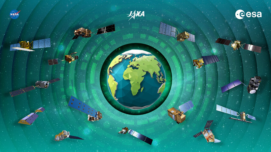
International collaboration among space agencies is central to the success of satellite Earth observation and data analysis. ESA, NASA and JAXA (Japan Aerospace Exploration Agency) have continued their joined effort to develop a storytelling dashboard that combines their resources and expertise to strengthen our global understanding of the changing environment and its economic effects.
New chair-elect for the Security Accreditation Board (SAB) of EUSPA
19.5.2022 9:55 European GNSS Agency
During the 52nd meeting of EUSPA’s Security Accreditation Board, Mr Philippe Bertrand, European affairs DGA coordinator, was elected as its new chair by the Member States representatives.
Philippe Bertrand has a vast experience in space-related activities and more specifically in satellite navigation. He has held several managerial positions in the public sector, namely in the French Armed Forces, the office of the French Prime Minister and the European Commission.
"I am honoured to have been elected Chair of the EUSPA Security Accreditation Board and I would like to thank all the EU Member States representatives for putting their trust in me. In times of increased security cyber threats and attacks, maintaining the systems intact and guaranteeing the reliability of data to end-users is of utmost importance" stated Bertrand. "All together, we will keep the safety and security of our space assets in the forefront" he concluded.Bertrand thanked outgoing Chair, Bruno Vermeire for his leadership over the past four years.
"EUSPA is a cluster of experienced professionals and they are doing a fantastic job. I want to thank them for their patience and their incredible competence in security matters. I would also like to thank the other Member states for their permanent commitment to supporting me in achieving my mission and the European Commission for their collaboration" were Vermeire’s final remarks.
"The only way to ensure the security of each and every link, and thus of the entire EU Space Programme, is through the collaboration of all relevant actors from EUSPA’s security apparatus. The SAB is central to ensuring the security of our systems" says EUSPA Executive Director, Rodrigo da Costa. "I look forward to working closely with our new SAB Chair now that EUSPA accredits all the EU Space Programme components" concludes da Costa.
"I would like to congratulate Phillippe Bertrand on his election by the EU Member States. I am sure the EUSPA SAB will benefit from his guidance and expertise in space security" said EUSPA AB Chair, Václav Kobera.
About the Security Accreditation Board
EUSPA is the security gatekeeper of the EU Space Programme. The SAB is the security accreditation authority for all of the EU Space Programme’s components. It ensures that all systems comply with the relevant security requirements, including Cyber and Supply Chain, and provides statements of approval to operate the systems and services with the objective that the EU space based services and data can be used by the EU citizens in a trusted way.
An independent body within EUSPA, the SAB is composed of a representative from each Member State, the Commission, and the High Representative for the Union for Foreign Affairs and Security Policy. The board independently makes its decisions, including in regard to the Commission and other bodies responsible for implementing the components and provision of service.
More information on the SAB way of working can be found in the SAB Rules of Procedure (RoP).
Media note: This feature can be republished without charge provided the European Union Agency for the Space Programme (EUSPA) is acknowledged as the source at the top or the bottom of the story. You must request permission before you use any of the photographs on the site. If you republish, we would be grateful if you could link back to the EUSPA website (http://www.euspa.europa.eu).
New chair-elect for the Security Accreditation Board (SAB) of EUSPA
19.5.2022 9:55 European GNSS AgencyDuring the 52nd meeting of EUSPA’s Security Accreditation Board, Mr Philippe Bertrand, European affairs DGA coordinator, was elected as its new chair by the Member States representatives.
Philippe Bertrand has a vast experience in space-related activities and more specifically in satellite navigation. He has held several managerial positions in the public sector, namely in the French Armed Forces, the office of the French Prime Minister and the European Commission.
"I am honoured to have been elected Chair of the EUSPA Security Accreditation Board and I would like to thank all the EU Member States representatives for putting their trust in me. In times of increased security cyber threats and attacks, maintaining the systems intact and guaranteeing the reliability of data to end-users is of utmost importance" stated Bertrand. "All together, we will keep the safety and security of our space assets in the forefront" he concluded.Bertrand thanked outgoing Chair, Bruno Vermeire for his leadership over the past four years.
"EUSPA is a cluster of experienced professionals and they are doing a fantastic job. I want to thank them for their patience and their incredible competence in security matters. I would also like to thank the other Member states for their permanent commitment to supporting me in achieving my mission and the European Commission for their collaboration" were Vermeire’s final remarks.
"The only way to ensure the security of each and every link, and thus of the entire EU Space Programme, is through the collaboration of all relevant actors from EUSPA’s security apparatus. The SAB is central to ensuring the security of our systems" says EUSPA Executive Director, Rodrigo da Costa. "I look forward to working closely with our new SAB Chair now that EUSPA accredits all the EU Space Programme components" concludes da Costa.
"I would like to congratulate Phillipe Bertrand on his election by the EU Member States. I am sure the EUSPA SAB will benefit from his guidance and expertise in space security" said EUSPA AB Chair, Václav Kobera.
About the Security Accreditation Board
EUSPA is the security gatekeeper of the EU Space Programme. The SAB is the security accreditation authority for all of the EU Space Programme’s components. It ensures that all systems comply with the relevant security requirements, including Cyber and Supply Chain, and provides statements of approval to operate the systems and services with the objective that the EU space based services and data can be used by the EU citizens in a trusted way.
An independent body within EUSPA, the SAB is composed of a representative from each Member State, the Commission, and the High Representative for the Union for Foreign Affairs and Security Policy. The board independently makes its decisions, including in regard to the Commission and other bodies responsible for implementing the components and provision of service.
More information on the SAB way of working can be found in the SAB Rules of Procedure (RoP).
Media note: This feature can be republished without charge provided the European Union Agency for the Space Programme (EUSPA) is acknowledged as the source at the top or the bottom of the story. You must request permission before you use any of the photographs on the site. If you republish, we would be grateful if you could link back to the EUSPA website (http://www.euspa.europa.eu).
Interview with Matt Nugent, Director of Product - INSITE, NV5 Geospatial
19.5.2022 9:00 GISCafe.com Webcasts-WebinarsSeptentrio makes GNSS/INS integration easy and fast
19.5.2022 9:00 GISCafe.com Webcasts-Webinars Inertial receiver set-up is significantly simplified with the new Lever Arm functionality, which in combination with the Web User Interface and …ISSS 2022 očima redaktorů GISportálu
19.5.2022 8:57 GISportal.cz
24. ročník konference Internet ve státní správě a samosprávě (ISSS 2022) se konal tradičně v Hradci Králové. Mnoho řečníků na konferenci zmínilo, že ISSS je takovou „pamětí národa“ co se týče digitalizace státní správy a samosprávy, a pokud tomu tak opravdu je, tak do letošní paměti se nám z konference zarylo hned několik poznatků (viz níže). Na […]
The post ISSS 2022 očima redaktorů GISportálu appeared first on GISportal.cz.
ISSS 2022 očima redaktorů GISportálu
19.5.2022 8:57 GISportal.cz24. ročník konference Internet ve státní správě a samosprávě (ISSS 2022) se konal tradičně v Hradci Králové. Mnoho řečníků na konferenci zmínilo, že ISSS je takovou „pamětí národa“ co se týče digitalizace státní správy a samosprávy, a pokud tomu tak opravdu je, tak do letošní paměti se nám z konference zarylo hned několik poznatků (viz níže). Na […]
The post ISSS 2022 očima redaktorů GISportálu appeared first on GISportal.cz.
Nová metodika pasportu vysokoškolských budov
19.5.2022 0:47 BIM NewsNová metodika pasportu vysokoškolských budov pomůže veřejným vysokým školám nejen při jednání s ministerstvem školství, ale poslouží jim pro lepší přehled o budovách, které univerzita vlastní a spravuje. Ministerstvo školství, mládeže a tělovýchovy (MŠMT) tak může připravovat dotační programy na základě porovnatelných informací o univerzitních nemovitostech. Metodiku vytvořila expertní skupina složená z odborníků z VUT, […]
The post Nová metodika pasportu vysokoškolských budov appeared first on BIM News.
Nová metodika pasportu vysokoškolských budov
19.5.2022 0:47 BIM News Nová metodika pasportu vysokoškolských budov pomůže veřejným vysokým školám nejen při jednání s ministerstvem školství, ale poslouží jim pro lepší přehled o budovách, které univerzita vlastní a spravuje. Ministerstvo školství, mládeže a tělovýchovy (MŠMT) tak může připravovat dotační programy na základě porovnatelných informací o univerzitních nemovitostech. Metodiku vytvořila expertní skupina složená z odborníků z VUT, […]British Land unifies data for a GPB 4 billion mixed-use development
18.5.2022 22:05 Bentley SystemsPress Announcements
Network Rail Uses Digital Twin for the Transpennine Route Upgrade
18.5.2022 21:38 Bentley SystemsPressCoverage
Arc Advisory Group, USA
Read the articleBIM dopravních staveb. 3D BIM modely jsou správným směrem pro dokumentaci mostů a vybraných propustků
18.5.2022 20:55 ZeměměřičSpolečnost Hrdlička v prvním čtvrtletí roku 2021 pro Ředitelství silnic a dálnic ČR (ŘSD) zpracovala pilotní zakázku pasportizace mostů a propustků v BIM. Zakázka byla zadána ve vazbě na zaváděné legislativní změny v dokumentaci staveb, především jde o Digitální technickou mapu krajů dle vyhlášky 393/2020 Sb. v platném znění (DTM) a o chystaný zákon o informačním modelu stavby, informačním a digitálním modelování, tzv. zákon o BIM, který předpokládá […]
The post BIM dopravních staveb. 3D BIM modely jsou správným směrem pro dokumentaci mostů a vybraných propustků appeared first on Zeměměřič.
Ukazuje se, že dokumentovat mosty a vybrané propustky jako 3D BIM modely je správný směr
18.5.2022 20:48 BIM News Společnost Hrdlička v prvním čtvrtletí roku 2021 pro Ředitelství silnic a dálnic ČR (ŘSD) zpracovala pilotní zakázku pasportizace mostů a propustků v BIM. Zakázka byla zadána ve vazbě na zaváděné legislativní změny v dokumentaci staveb, především jde o Digitální technickou mapu krajů dle vyhlášky 393/2020 Sb. v platném znění (DTM) a o chystaný zákon o informačním modelu stavby, informačním a digitálním modelování, […]Ukazuje se, že dokumentovat mosty a vybrané propustky jako 3D BIM modely je správný směr
18.5.2022 20:48 BIM NewsSpolečnost Hrdlička v prvním čtvrtletí roku 2021 pro Ředitelství silnic a dálnic ČR (ŘSD) zpracovala pilotní zakázku pasportizace mostů a propustků v BIM. Zakázka byla zadána ve vazbě na zaváděné legislativní změny v dokumentaci staveb, především jde o Digitální technickou mapu krajů dle vyhlášky 393/2020 Sb. v platném znění (DTM) a o chystaný zákon o informačním modelu stavby, informačním a digitálním modelování, […]
The post Ukazuje se, že dokumentovat mosty a vybrané propustky jako 3D BIM modely je správný směr appeared first on BIM News.
Dozvuky 24. ročníku konference ISSS (TZ)
18.5.2022 18:56 GISportal.cz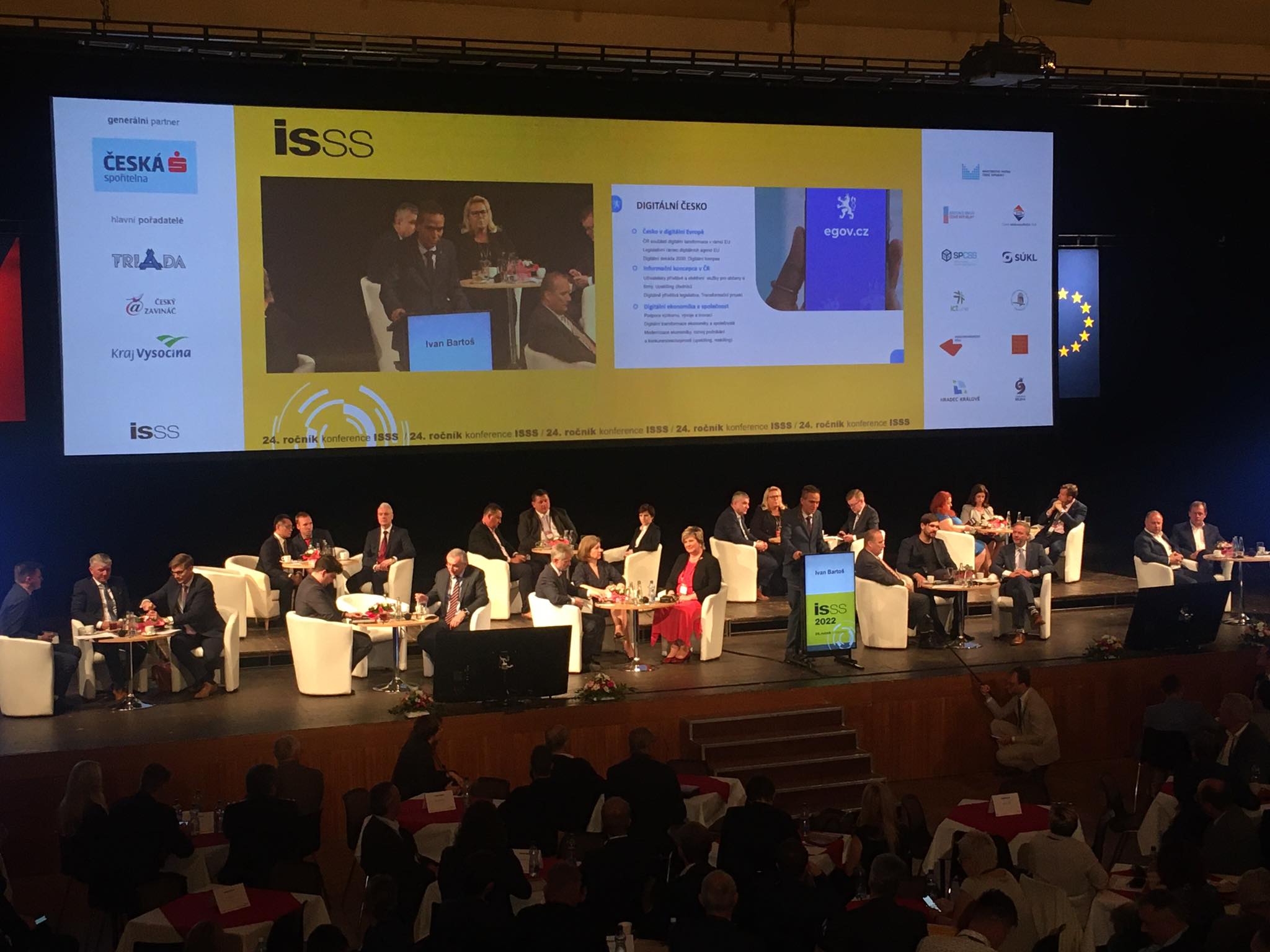
Pořadatelské město Hradec Králové dva dny 16. a 17. května hostilo prestižní konferenci ISSS zabývající se digitalizaci veřejné správy. Letošního ročníku se v Kongresovém centru Aldis zúčastnilo téměř 1 800 hostů, vystavovalo přes 60 firem a proběhlo kolem 200 přednášek. Vystoupily přední osobnosti z politiky, businessu a veřejné správy – například Ivan Bartoš, Věra Jourová, […]
The post Dozvuky 24. ročníku konference ISSS (TZ) appeared first on GISportal.cz.
Dozvuky 24. ročníku konference ISSS (TZ)
18.5.2022 18:56 GISportal.czPořadatelské město Hradec Králové dva dny 16. a 17. května hostilo prestižní konferenci ISSS zabývající se digitalizaci veřejné správy. Letošního ročníku se v Kongresovém centru Aldis zúčastnilo téměř 1 800 hostů, vystavovalo přes 60 firem a proběhlo kolem 200 přednášek. Vystoupily přední osobnosti z politiky, businessu a veřejné správy – například Ivan Bartoš, Věra Jourová, […]
The post Dozvuky 24. ročníku konference ISSS (TZ) appeared first on GISportal.cz.
Nearmap and Carahsoft Partner to Provide Geospatial Content and Location Intelligence Services at Scale to U.S. Federal Government Agencies
18.5.2022 17:20 GISCafe.com Webcasts-Webinars SALT LAKE CITY, May 18, 2022 — (PRNewswire) — Nearmap, a leading aerial imagery and location intelligence company, and Carahsoft …Spire Global to Launch Five Satellites on SpaceX Transporter-5 Mission
18.5.2022 17:12 GISCafe.com Webcasts-Webinars Launch will include three satellites and hosted payloads for Space Services, the company’s Space-as-a-Service (SPaaS) businessVIENNA, Va. — …
MOV.AI Partners with Ouster to Equip Autonomous Mobile Robots with High-Resolution Digital Lidar for Challenging Warehouse Environments
18.5.2022 17:12 GISCafe.com Webcasts-Webinars TEL AVIV, Israel, May 18, 2022 — (PRNewswire) — MOV.AI announced today its partnership with Ouster, a leading provider of …Rodney Cope Joins GeoCue as Senior Vice President of Federal Programs
18.5.2022 17:12 GISCafe.com Webcasts-Webinars Huntsville, Ala., May 18, 2022 (GLOBE NEWSWIRE) -- GeoCue, a leader in LiDAR and photogrammetry equipment and software, recently appointed Rodney …Slavíme 30 let na trhu. I díky vám!
18.5.2022 13:44 T-MAPYThe post Slavíme 30 let na trhu. I díky vám! appeared first on T-MAPY spol. s r.o..
Slavíme 30 let na trhu. I díky vám!
18.5.2022 13:44 T-MAPYThe post Slavíme 30 let na trhu. I díky vám! appeared first on T-MAPY spol. s r.o..
Odborný referent v právním oddělení na Katastrálním pracovišti Brno - venkov
18.5.2022 12:54 ČÚZK - předpisy a opatření Katastrální úřad pro Jihomoravský kraj Katastrální pracoviště Brno-venkovvypisuje výběrové řízení na místo
Odborný referent v právním oddělení na Katastrálním pracovišti Brno - venkov
Odborný referent v právním oddělení na Katastrálním pracovišti Brno - venkov
18.5.2022 12:54 ČÚZK - volná místa Katastrální úřad pro Jihomoravský kraj Katastrální pracoviště Brno-venkov vypisuje výběrové řízení na místo Odborný referent v právním oddělení na Katastrálním pracovišti Brno - venkovOdborný referent v právním oddělení na Katastrálním pracovišti Brno - venkov
18.5.2022 12:54 ČÚZK /Urady/Katastralni-urady/Katastralni-urady/Katastralni-urad-pro-Jihomoravsky-kraj/Volna-mista/DMS/Odborny-referent-v-pravnim-oddeleni-na-KatastralniCo přinášejí nové verze FME Desktop a FME Server
18.5.2022 10:53 GeoBusinessSoftware FME od kanadské firmy Safe Software se používá pro transformaci celé řady datových formátů. Firma pořádá FME World Tour 2022, která ve spolupráci s brněnskou firmou CSmap bude také v České republice. Udělejte si čas a podívejte se, co přinášejí nové verze nástrojů FME Desktop a FME Server. Akce se koná 24. května 2022 […]
The post Co přinášejí nové verze FME Desktop a FME Server appeared first on GeoBusiness.
Setkání geodetů Jihočeského kraje
18.5.2022 10:01 ZeměměřičAsociace podnikatelů v geomatice (APG) ve spolupráci s Katastrálním úřadem pro Jihočeský kraj a ZKI v Českých Budějovicích zvou na 9. setkání geodetů Jihočeského kraje. Seminář se koná v úterý 24. května 2022 v Českých Budějovicích v přednáškové aule E1 Vysoké školy technické a ekonomické v Českých Budějovicích (VŠTE ČB) (Okružní 517/10, 370 01 České Budějovice). Parkování je zajištěno v areálu VŠTE ČB. Dopolední blok Přivítání za VŠTE […]
The post Setkání geodetů Jihočeského kraje appeared first on Zeměměřič.
Innovative Technology continues to advance Chesapeake Bay restoration
18.5.2022 9:00 GISCafe.com Webcasts-Webinars New land use/land cover and change data provide powerful insights into how the watershed is transformingAnnapolis, MD – The Chesapeake Bay …