


![]()

zprávy
zdroje zpráv:Kontaktní místo Dačice UZAVŘENO DO ODVOLÁNÍ
7.2.2020 8:37 ČÚZK - předpisy a opatření Katastrální úřad pro Jihočeský kraj - Katastrální pracoviště Jindřichův Hradeczveřejnil novou aktualitu: Na základě mimořádných opatření rozhodl ředitel Katastrálního úřadu pro Jihočeský kraj o UZAVŘENÍ "Kontaktního místa katastrálního úřadu, Dačice" DO ODVOLÁNÍ.
Kontaktní místo Dačice mimo provoz
7.2.2020 8:37 ČÚZK /Urady/Katastralni-urady/Katastralni-urady/Katastralni-urad-pro-Jihocesky-kraj/Katastralni-pracoviste/KP-Jindrichuv-Hradec/O-uradu/Aktuality/Kontaktni-misto-Dacice-mimo-provozTopografická databáze České republiky (Data200) - všechny vrstvy
7.2.2020 1:00 Cenia - Katalog metadat ČR - INSPIRE Topografická databáze České republiky (Data200) - všechny vrstvy. Minimální polohová přesnost je 100 m a podrobnost odpovídá měřítku 1:200 000. Obsah Data200 tvoří 50 typů geografických objektů. Databáze je strukturovaná do osmi tematických skupin - administrativní hranice, vodstvo, doprava, sídla, geografická jména, různé objekty, vegetace a povrch, výškopis. Vrstva výškopisu byla v roce 2013 doplněna o stínovaný terén. Data jsou poskytována jako otevřená data ve formátu SHPProhlížecí služba WMS - Data200
7.2.2020 1:00 Cenia - Katalog metadat ČR - INSPIRE Prohlížecí služba WMS - Data200 je poskytována jako veřejná prohlížecí služba nad daty produktu Topografická databáze České republiky (Data200). Služba splňuje Technické pokyny pro INSPIRE prohlížecí služby v. 3.11 a zároveň splňuje standard OGC WMS 1.1.1. a 1.3.0. Databáze Data200 je digitální geografický model území České republiky (ČR) odpovídající přesností a stupněm generalizace měřítku 1:200 000. Data200 je zpracována v rozsahu celého území České republiky, vznikla na základě projektu EuroRegionalMap (ERM) evropského sdružení civilních zeměměřických a mapových služeb EuroGeographics.Prohlížecí služba Esri ArcGIS Server - Data200
7.2.2020 1:00 Cenia - Katalog metadat ČR - INSPIRE Prohlížecí služba AGS - Data200 je poskytována jako veřejná prohlížecí služba nad daty produktu Topografická databáze České republiky (Data200). Databáze Data200 je digitální geografický model území České republiky (ČR) odpovídající přesností a stupněm generalizace měřítku 1:200 000. Data200 je zpracována v rozsahu celého území České republiky, vznikla na základě projektu EuroRegionalMap (ERM) evropského sdružení civilních zeměměřických a mapových služeb EuroGeographics.DXC Technology Reports Third Quarter Fiscal 2020 Results
7.2.2020 0:12 GISCafe.com Webcasts-Webinars Q3 earnings per share from continuing operations was $0.32, including the cumulative impact of certain items of $(0.93) per share, reflecting …Geotronics představí novinky na Trimble Express 2020
6.2.2020 17:07 ZeměměřičFirma Geotronics Praha, která v České republice prodává techniku značky Trimble, oznámila datum své pravidelné jarní geodetické roadshow. Letošní Trimble Express 2020 se bude konat v druhé polovině března, konkrétně to budou dny 17. 3. 2020 – Opava 18. 3. 2020 – Brno 19. 3. 2020 – Praha 20. 3. 2020 – Praha Program zde doplníme, jakmile jej pořadatel uveřejní.
The post Geotronics představí novinky na Trimble Express 2020 appeared first on Zeměměřič.
Známe program Trimble Express 2020
6.2.2020 17:07 ZeměměřičFirma Geotronics Praha, která v České republice prodává techniku značky Trimble, oznámila datum své pravidelné jarní geodetické roadshow. Letošní Trimble Express 2020 se bude konat v druhé polovině března, konkrétně to budou dny 17. 3. 2020 – Opava 18. 3. 2020 – Brno 19. 3. 2020 – Praha 20. 3. 2020 – Praha Program Trimble Express 2020 9:00 – 9:30 Registrace 9:30 […]
The post Známe program Trimble Express 2020 appeared first on Zeměměřič.
TurboCAD MAC12 CZ (česky)
6.2.2020 10:16 ŠPINAR - softwareVážení zákazníci, pro operační systém MAC OS si Vám dovolujeme nabídnout novou verzi programu TurboCAD MAC 12 CZ pro kreslení ve 2D/3D a vizualizace. Vedle verze TurboCAD pro Windows i TurboCAD MAC nabízíme v české verzi! Můžete vybírat z rodiny TurboCAD MAC: TurboCAD MAC Pro CZ, TurboCAD MAC Deluxe CZ, TurboCAD MAC Designer CZ. TurboCAD MAC CZ nabízí přehledné prostředí...Read more
The post TurboCAD MAC12 CZ (česky) appeared first on ŠPINAR – software.
2020 URISA Exemplary Systems in Government Awards Process Opens
6.2.2020 10:08 GISCafe.com Webcasts-Webinars Des Plaines, IL (February 5, 2020) URISA is pleased to announce the Exemplary Systems in Government (ESIG) Awards process for 2020. Since 1980, …Zveřejnění obsahu informací poskytnutých na žádost dle zákona č. 106/1999 Sb. za rok 2019
6.2.2020 9:44 ČÚZK - předpisy a opatření Katastrální úřad pro Středočeský krajzveřejňuje obsah informace poskytnutých na žádost dle zákona č. 106/1999 Sb. za rok
2019
Zveřejnění obsahu informací poskytnutých na žádost dle zákona č. 106/1999 Sb. za rok 2019
6.2.2020 9:44 ČÚZK /Urady/Katastralni-urady/Katastralni-urady/Katastralni-urad-pro-Stredocesky-kraj/Casto-hledane-informace/Poskytovani-informaci-106-1999-Sb/Zverejneni-obsahu-informaci-poskytnutych-na-za-(1)/Zverejneni-obsahu-informaci-poskytnutych-na-za-(1)Orbit Logic Supporting SSCI for DARPA Blackjack Pit Boss
6.2.2020 9:18 GISCafe.com Webcasts-Webinars GREENBELT, MD (February 6th, 2020) – Orbit Logic announced today that they are a member of the Scientific Systems Company, Inc. (SSCI) …Industry support for South East Asia's inaugural geospatial show & conference builds momentum
6.2.2020 9:08 GISCafe.com Webcasts-Webinars Airbus and Hexagon join Trimble as sponsors, with notable speakers including representatives from the World Bank, Grab, and moreSingapore, 4 …
Nový zpravodaj české kartografické společnosti
6.2.2020 8:08 GISportal.cz
Česká kartografická společnost změnila vizuál svého pravidelného zpravodaje a právě vyšlo nové číslo, které mimo mnoha pozvánek a aktualit, obsahuje například rozhovor s předsedou ČKS – prof. Václavem Talhoferem.
The post Nový zpravodaj české kartografické společnosti appeared first on GISportal.cz.
Podcasty GeoTalks
6.2.2020 7:00 Česká asociace pro geoinformace GeotalksPokud jste ještě nezaregistrovali, Katedra geoinformatiky Univerzity Palackého v Olomouci začala vydávat jako první mezi univerzitami v České republice podcasty se zaměřením na nejen geoinformatiku. V současnosti jsou dostupné tři díly s doc. Jaroslavem Burianem, dr. Rostislavem Nétkem a dr. Stanislavem Popelkou.
Vyslechnout si je můžete na platformách Youtube
Swift Navigation Relocates its Global Headquarters
6.2.2020 1:30 GISCafe.com Webcasts-Webinars SAN FRANCISCO, Feb. 05, 2020 (GLOBE NEWSWIRE) -- Swift Navigation, a San Francisco-based tech firm redefining GNSS positioning technology for …GeoCue Group Announces True View® Sensor Distribution Partnership with Sumac Geomatics Incorporated
6.2.2020 1:29 GISCafe.com Webcasts-Webinars February 5, 2020 Huntsville, AL – GeoCue Group is pleased to announce a partnership with Sumac Geomatics Incorporated, based in …Archivní ortofoto České republiky
6.2.2020 1:00 Cenia - Katalog metadat ČR - INSPIRE Černobílé snímkování od r. 1998 do r. 2001. Velikost pixelu 50 cm. Barevné snímkování od r. 2002 (zkušební), dále pravidelné snímkování třetiny území ČR od r. 2003, poloviny území ČR od r. 2012. Do roku 2008 bylo barevné ortofoto vytvářeno s velikostí pixelu 0,5 m a od roku 2009 do roku 2015 s velikostí pixelu 0,25 m. Od roku 2016 je Ortofoto ČR vytvářeno s velikostí pixelu 0,20 m.Draganfly Creates New Payloads for the University of Saskatchewan Resulting in 20 Times More Efficiency in Collecting Data
5.2.2020 17:26 GISCafe.com Webcasts-Webinars Vancouver, British Columbia, Feb. 05, 2020 (GLOBE NEWSWIRE) -- Draganfly Inc. (CSE: DFLY) (OTCQB: DFLYF) (FSE: 3U8) (“Draganfly” or the …Renoworks Joins New EagleView Edge Program as Key Partner
5.2.2020 17:26 GISCafe.com Webcasts-Webinars CALGARY, Feb. 5, 2020 — (PRNewswire) — Renoworks Software Inc. (TSXV: RW) ("Renoworks"), the leading end-to-end visualization …Geospark Analytics Partners with Location Intelligence Leader Esri to Enable AI Risk and Threat Assessment Offerings Through Geographic Information Systems
5.2.2020 17:26 GISCafe.com Webcasts-Webinars HERNDON, Va., Feb. 5, 2020 — (PRNewswire) — Geospark Analytics, a world class leader in developing applied artificial intelligence …Oznámení o vyhlášení výběrového řízení na služební místo
5.2.2020 15:18 ČÚZK /Urady/Katastralni-urady/Katastralni-urady/Katastralni-urad-pro-Moravskoslezsky-kraj/O-uradu/Aktuality/Oznameni-o-vyhlaseni-vyberoveho-rizeni-na-sluz-(1)Oznámení o vyhlášení výběrových řízení na služební místa
5.2.2020 15:18 ČÚZK /Urady/Katastralni-urady/Katastralni-urady/Katastralni-urad-pro-Moravskoslezsky-kraj/O-uradu/Aktuality/Oznameni-o-vyhlaseni-vyberoveho-rizeni-na-sluz-(1)Oznámení o vyhlášení výběrových řízení na služební místa
5.2.2020 15:18 ČÚZK - předpisy a opatření Katastrální úřad pro Moravskoslezský kraj zveřejnil novou aktualitu: Oznámení o vyhlášení výběrových řízení na služební místa:Odborný referent/vrchní referent – obnova katastrálního operátu v technickém odboru (74),
Odborný referent/vrchní referent – obnova katastrálního operátu v technickém odboru (73),
Odborný referent – obnova katastrálního operátu v technickém odboru (68),
Odborný referent/vrchní referent – obnova katastrálního operátu na Katastrálním pracovišti Nový Jičín,
Rada/odborný rada – rozhodování o povolení vkladu na Katastrálním pracovišti Opava,
Vrchní referent/rada – obnova katastrálního operátu na Katastrálním pracovišti Opava,
Odborný referent/vrchní referent – poskytování informací KN na Katastrálním pracovišti Opava.
Zpravodaj ČKS 01/2020
5.2.2020 14:43 Česká kartografická společnost První letošní číslo Zpravodaje ČKS 01/2020 právě vyšlo! Podívejte se na nový grafický design a hlavně na spoustu zajímavých pozvánek, informací od našich členů a další novinky ze světa kartografie.Pozvánka na konferenci EUROCARTO 2020
5.2.2020 14:41 Česká kartografická společnost Největší středoevropská kartografická konference s názvem EUROCARTO 2020 se uskuteční ve dnech 20.–22. září 2020 ve Vídni. Mezi hlavní témata konference patří: Art and cartography Map Design, Usability and Cognition GeoVisual Analytics and Multivariate Big Data Mapping Topographic Mapping, Generalization and Updates Collaborative Mapping, VGI and Crowdsourcing Thematic Cartography, Atlas Cartography and Mapping Statistical Data Internet Mapping […]Odborný referent/vrchní referent – poskytování informací KN na Katastrálním pracovišti Opava
5.2.2020 14:40 ČÚZK - předpisy a opatření Katastrální úřad pro Moravskoslezský kraj Katastrální pracoviště Opavavypisuje výběrové řízení na místo
Odborný referent/vrchní referent – poskytování informací KN na Katastrálním pracovišti Opava
Odborný referent/vrchní referent – poskytování informací KN na Katastrálním pracovišti Opava
5.2.2020 14:40 ČÚZK /Urady/Katastralni-urady/Katastralni-urady/Katastralni-urad-pro-Moravskoslezsky-kraj/Uredni-deska/Oznameni-a-jina-uredni-sdeleni/Volna-mista/DMS/Odborny-referent-vrchni-referent-–-poskytovani-infOdborný referent/vrchní referent – poskytování informací KN na Katastrálním pracovišti Opava
5.2.2020 14:40 ČÚZK - volná místa Katastrální úřad pro Moravskoslezský kraj Katastrální pracoviště Opava vypisuje výběrové řízení na místo Odborný referent/vrchní referent – poskytování informací KN na Katastrálním pracovišti OpavaVrchní referent/rada – obnova katastrálního operátu na Katastrálním pracovišti Opava Katastrálního ú
5.2.2020 14:37 ČÚZK - volná místa Katastrální úřad pro Moravskoslezský kraj Katastrální pracoviště Opava vypisuje výběrové řízení na místo Vrchní referent/rada – obnova katastrálního operátu na Katastrálním pracovišti Opava Katastrálního úVrchní referent/rada – obnova katastrálního operátu na Katastrálním pracovišti Opava Katastrálního ú
5.2.2020 14:37 ČÚZK - předpisy a opatření Katastrální úřad pro Moravskoslezský kraj Katastrální pracoviště Opavavypisuje výběrové řízení na místo
Vrchní referent/rada – obnova katastrálního operátu na Katastrálním pracovišti Opava Katastrálního úřadu pro Moravskoslezský kraj
Vrchní referent/rada – obnova katastrálního operátu na Katastrálním pracovišti Opava Katastrálního ú
5.2.2020 14:37 ČÚZK /Urady/Katastralni-urady/Katastralni-urady/Katastralni-urad-pro-Moravskoslezsky-kraj/Uredni-deska/Oznameni-a-jina-uredni-sdeleni/Volna-mista/DMS/Vrchni-referent-rada-–-obnova-katastralniho-operatRada/odborný rada – rozhodování o povolení vkladu na Katastrálním pracovišti Opava Katastrálního úřa
5.2.2020 14:33 ČÚZK /Urady/Katastralni-urady/Katastralni-urady/Katastralni-urad-pro-Moravskoslezsky-kraj/Uredni-deska/Oznameni-a-jina-uredni-sdeleni/Volna-mista/DMS/Rada-odborny-rada-–-rozhodovani-o-povoleni-vkladuRada/odborný rada – rozhodování o povolení vkladu na Katastrálním pracovišti Opava Katastrálního úřa
5.2.2020 14:33 ČÚZK - volná místa Katastrální úřad pro Moravskoslezský kraj Katastrální pracoviště Opava vypisuje výběrové řízení na místo Rada/odborný rada – rozhodování o povolení vkladu na Katastrálním pracovišti Opava Katastrálního úřaRada/odborný rada – rozhodování o povolení vkladu na Katastrálním pracovišti Opava Katastrálního úřa
5.2.2020 14:33 ČÚZK - předpisy a opatření Katastrální úřad pro Moravskoslezský kraj Katastrální pracoviště Opavavypisuje výběrové řízení na místo
Rada/odborný rada – rozhodování o povolení vkladu na Katastrálním pracovišti Opava Katastrálního úřadu pro Moravskoslezský kraj
20_00496_3_oznameni_o_vyhlaseni_vyberoveho_rizeni_signed
5.2.2020 14:28 ČÚZK - předpisy a opatření Katastrální úřad pro Moravskoslezský kraj Katastrální pracoviště Nový Jičínvypisuje výběrové řízení na místo
Odborný referent/vrchní referent – obnova katastrálního operátu na Katastrálním pracovišti Nový Jičín
20_00496_3_oznameni_o_vyhlaseni_vyberoveho_rizeni_signed
5.2.2020 14:28 ČÚZK /Urady/Katastralni-urady/Katastralni-urady/Katastralni-urad-pro-Moravskoslezsky-kraj/Uredni-deska/Oznameni-a-jina-uredni-sdeleni/Volna-mista/DMS/20_00496_3_oznameni_o_vyhlaseni_vyberoveho_rizeni_20_00496_3_oznameni_o_vyhlaseni_vyberoveho_rizeni_signed
5.2.2020 14:28 ČÚZK - volná místa Katastrální úřad pro Moravskoslezský kraj Katastrální pracoviště Nový Jičín vypisuje výběrové řízení na místo 20_00496_3_oznameni_o_vyhlaseni_vyberoveho_rizeni_signed20_00496_3_oznameni_o_vyhlaseni_vyberoveho_rizeni_signed
5.2.2020 14:28 ČÚZK - volná místa Katastrální úřad pro Moravskoslezský kraj technický odbor vypisuje výběrové řízení na místo 20_00496_3_oznameni_o_vyhlaseni_vyberoveho_rizeni_signed20_00496_3_oznameni_o_vyhlaseni_vyberoveho_rizeni_signed
5.2.2020 14:28 ČÚZK - předpisy a opatření Katastrální úřad pro Moravskoslezský kraj technický odborvypisuje výběrové řízení na místo
20_00496_3_oznameni_o_vyhlaseni_vyberoveho_rizeni_signed
Odborný referent – obnova katastrálního operátu v technickém odboru (68) Katastrálního úřadu pro Mor
5.2.2020 14:26 ČÚZK - volná místa Katastrální úřad pro Moravskoslezský kraj technický odbor vypisuje výběrové řízení na místo Odborný referent – obnova katastrálního operátu v technickém odboru (68) Katastrálního úřadu pro MorOdborný referent – obnova katastrálního operátu v technickém odboru (68) Katastrálního úřadu pro Mor
5.2.2020 14:26 ČÚZK /Urady/Katastralni-urady/Katastralni-urady/Katastralni-urad-pro-Moravskoslezsky-kraj/Uredni-deska/Oznameni-a-jina-uredni-sdeleni/Volna-mista/DMS/Odborny-referent-–-obnova-katastralniho-operatu-vOdborný referent – obnova katastrálního operátu v technickém odboru (68) Katastrálního úřadu pro Mor
5.2.2020 14:26 ČÚZK - předpisy a opatření Katastrální úřad pro Moravskoslezský kraj technický odborvypisuje výběrové řízení na místo
Odborný referent – obnova katastrálního operátu v technickém odboru (68) Katastrálního úřadu pro Moravskoslezský kraj
Odborný referent/vrchní referent – obnova katastrálního operátu v technickém odboru (73) Katastrální
5.2.2020 14:24 ČÚZK - předpisy a opatření Katastrální úřad pro Moravskoslezský kraj technický odborvypisuje výběrové řízení na místo
Odborný referent/vrchní referent – obnova katastrálního operátu v technickém odboru (73) Katastrálního úřadu pro Moravskoslezský kraj
Odborný referent/vrchní referent – obnova katastrálního operátu v technickém odboru (73) Katastrální
5.2.2020 14:24 ČÚZK - volná místa Katastrální úřad pro Moravskoslezský kraj technický odbor vypisuje výběrové řízení na místo Odborný referent/vrchní referent – obnova katastrálního operátu v technickém odboru (73) KatastrálníOdborný referent/vrchní referent – obnova katastrálního operátu v technickém odboru (73) Katastrální
5.2.2020 14:24 ČÚZK /Urady/Katastralni-urady/Katastralni-urady/Katastralni-urad-pro-Moravskoslezsky-kraj/Uredni-deska/Oznameni-a-jina-uredni-sdeleni/Volna-mista/DMS/Odborny-referent-vrchni-referent-–-obnova-katastra20_00493_3_oznameni_o_vyhlaseni_vyberoveho_rizeni_signed
5.2.2020 14:16 ČÚZK - volná místa Katastrální úřad pro Moravskoslezský kraj technický odbor vypisuje výběrové řízení na místo 20_00493_3_oznameni_o_vyhlaseni_vyberoveho_rizeni_signed20_00493_3_oznameni_o_vyhlaseni_vyberoveho_rizeni_signed
5.2.2020 14:16 ČÚZK - předpisy a opatření Katastrální úřad pro Moravskoslezský kraj technický odborvypisuje výběrové řízení na místo
Odborný referent/vrchní referent – obnova katastrálního operátu v technickém odboru (74) Katastrálního úřadu pro Moravskoslezský kraj
20_00493_3_oznameni_o_vyhlaseni_vyberoveho_rizeni_signed
5.2.2020 14:16 ČÚZK /Urady/Katastralni-urady/Katastralni-urady/Katastralni-urad-pro-Moravskoslezsky-kraj/Uredni-deska/Oznameni-a-jina-uredni-sdeleni/Volna-mista/DMS/20_00493_3_oznameni_o_vyhlaseni_vyberoveho_rizeni_Seznam schválených věcných úkolů
5.2.2020 12:26 ČÚZK - předpisy a opatření Katastrální úřad pro Královéhradecký kraj zveřejnil novou aktualitu: Seznam schválených věcných úkolů pro rok 2022Seznam schválených věcných úkolů
5.2.2020 12:26 ČÚZK - předpisy a opatření Katastrální úřad pro Královéhradecký kraj zveřejnil novou aktualitu: Seznam schválených věcných úkolů pro rok 2020Seznam schválených věcných úkolů
5.2.2020 12:26 ČÚZK /Urady/Katastralni-urady/Katastralni-urady/Katastralni-urad-pro-Kralovehradecky-kraj/O-uradu/Aktuality/Seznam-schvalenych vecnych-ukoluSeznam schválených věcných úkolů
5.2.2020 12:26 ČÚZK - předpisy a opatření Katastrální úřad pro Královéhradecký kraj zveřejnil novou aktualitu: Seznam schválených věcných úkolů pro rok 2021NAPSALI O NÁS: Česko je zemí dopravních značek. Na kilometru dálnic jich je v průměru 21, vedou kilometrovníky a mosty
5.2.2020 12:22 TopGis Na 1267 kilometrů dálnic v Česku připadá celkem 26 702 svislých dopravních značek. Největší zastoupení mezi nimi mají kilometrovníky, kterých mohou řidiči potkat více než čtyři a půl tisíce. V Top 10 nejčastějších značek pak najdeme třeba i označení mostů či exitů. Vyplývá to z mobilního mapování tuzemských dálnic, které v minulých měsících realizovala brněnskáCommercial UAV Expo Americas & Commercial UAV Expo Europe Announce Call for Speakers for 2020 Events
5.2.2020 12:17 GISCafe.com Webcasts-Webinars The two leading global commercial drone events seek conference presentation applications from industry thought leadersPORTLAND, MAINE - USA, …
Phase One Industrial and AI-Survey GmbH Sign Partner Integrator Agreement
5.2.2020 12:07 GISCafe.com Webcasts-Webinars Enabling new opportunities in drone-based high-end aerial imaging Copenhagen, Denmark and Atenkirchen, Germany, February 3, 2020 …
Zveřejněny okruhy státnicových zkoušek
5.2.2020 11:56 Katedra geoinformatiky UP OlomoucV sekci Dokumenty byly zveřejněny aktuální okruhy státnicových zkoušek BC. a MGR. studia pro rok 2019/20.
The post Zveřejněny okruhy státnicových zkoušek appeared first on Katedra geoinformatiky.
Successful Galileo Return Link demonstration with market-ready beacon
5.2.2020 11:30 European GNSS Agency
The recent successful activation of the Galileo Search and Rescue (SAR) Return Link Service was very much in the spotlight at a press event held at the European GNSS Agency’s (GSA) Prague headquarters on February 3. At the ‘GNSS for #EUProtect’ event, which focused on the contribution of European GNSS to emergency response and civil protection in Europe, the SAR Return Link was successfully tested, demonstrating an impressive response time.
The Galileo Return Link Service (RLS), which allows people in distress to receive automatic acknowledgement that their distress signal has been received, was officially declared operational on January 21. The new functionality, currently offered uniquely by Galileo, enables a communication link that relays Return Link Messages (RLM) back to the originating beacon through the Galileo Navigation Signal in Space (I/NAV E1B).
Game changer
The RLS was successfully demonstrated during the Prague event, at which an end-to-end test of the forward and the return link was carried out with a ready-to-market beacon. With only 4.5 minutes between the activation of the beacon and the reception of the return link, the demonstration clearly showed the advantages of this service in a real life emergency situation.
For someone in distress, receiving such acknowledgment in just over four minutes will provide a significant psychological boost and reduce panic, while allowing the rescue crew to improve the on-board logistics and planning of the rescue mission, thereby helping to save more lives. As such, the RLS is a real game changer for search and rescue services.
Read this: Galileo Return Link Service declared at European Space Conference
Speaking at the event, Rodrigo da Costa, Galileo Services Programme Manager at the GSA, said that a new Galileo facility – the Return Link Service Provider – had just been deployed in Toulouse, France to act as an interface between Galileo and Cospas-Sarsat, the international satellite-based search and rescue system.
Da Costa summarised some of the RLS performance indicators: “The Galileo system loop latency is less than 15 minutes 99% of the time, with an end-to-end loop latency of less than 30 minutes,” he said, adding that this is typically less than 10 minutes as demonstrated during the Prague event, depending largely on the time it takes for Cospas-Sarsat to detect and locate the alert.
Saving lives
GSA Head of Market Development Fiammetta Diani spoke more generally about the contribution of EGNSS to the European economy and to emergency response, highlighting Galileo’s contribution to the eCall and E112 emergency response systems and the benefits of EGNOS for helicopter emergency medical services (HEMS).
“Galileo and EGNOS will contribute to saving at least 10,000 lives in the 2020-2025 timeframe. For example, with the Galileo-compatible eCall, by speeding up emergency response times by up to 50%, we can reduce the number of fatalities by 4% and the number of severe injuries by 6%-10%,” Diani said.
And this: Market understands value of dual frequency
“In the case of the Search and Rescue service we are demonstrating today, it is required to have a specialised beacon, as the users are normally outside the cellular network coverage, for example in the middle of the sea, while eCall and E112 are designed for our daily lives and can work directly from our cars and smartphones. They permit the emergency services to locate us quickly in case of accident or when we call the emergency number, without the need to explain where we are, which is often difficult or impossible when we are in distressful situations,” she said.
Following the launch of the RLS, the SAR/Galileo Service Definition Document (SDD) was updated to include information about new service, including details on the characteristics of the service and the infrastructure underpinning it, and also the Minimum Performance Levels (MPLs) that the SAR/Galileo Services users shall experience, as well as the main limitations and conditions of use. The latest version can be found here.
Galileo SAR RLS users that would like to receive more information can send their inquiries to the European GNSS Service Centre Help Desk at: www.gsc-europa.eu/helpdesk.
Media note: This feature can be republished without charge provided the European GNSS Agency (GSA) is acknowledged as the source at the top or the bottom of the story. You must request permission before you use any of the photographs on the site. If you republish, we would be grateful if you could link back to the GSA website (http://www.gsa.europa.eu).
Rozpočet úřadu za rok 2020
5.2.2020 10:44 ČÚZK /Urady/Katastralni-urady/Katastralni-urady/Katastralni-urad-pro-Moravskoslezsky-kraj/Rozpocet/Rozpocet-uradu-za-rok-2020Rozpočet úřadu za rok 2020
5.2.2020 10:44 ČÚZK - předpisy a opatření Katastrální úřad pro Moravskoslezský krajvystavuje rozpočet úřadu za rok
2020
Space key to wetland conservation
5.2.2020 9:00 ESA Observing the Earth
Wetlands worldwide are vanishing at an alarming rate. New maps produced by ESA’s GlobWetland Africa project show how satellite observations can be used for the effective use and management of wetlands in Africa.
GIS Ostrava 2020 (pozvánka)
5.2.2020 8:30 GISportal.cz
Katedra geoinformatiky VŠB-TU Ostrava pozýva na tradičnú konferenciu GIS Ostrava, ktorá sa uskutoční 18. – 20.3.2020 v Novej aule VŠB-TU. Ústrednou témou tohto ročníka konferencie sú „Prostorová data pro Smart City a Smart Region“ a „UAV in Smart City and Smart Region“. Ako kľúčoví rečníci sa predstavia Francesco Nex (University of Twente) s témou „New trends of […]
The post GIS Ostrava 2020 (pozvánka) appeared first on GISportal.cz.
Propagace APG na dni otevřených dveří SPŠ zeměměřické
5.2.2020 7:34 Asociace podnikatelů v geomatice Koncem ledna 2020 se na pražské Střední průmyslové škole zeměměřické konaly dny otevřených dveří pro zájemce o studium. Budoucím studentům jsme aktivity asociace přiblížili prostřednictvím propagačního letáku. Vedle propagace oboru a další spolupráce se středními a vysokými školami se v letošním roce chceme soustředit i na vytvoření strategie vzdělávání geomatiky v ČR. Domníváme se, že pro zachování oboru je velmi důležité, […]APGEO - PROPAGACE APG NA DNI OTEVŘENÝCH DVEŘÍ SPŠ ZEMĚMĚŘICKÉ
5.2.2020 1:00 Asociace podnikatelů v geomatice Koncem ledna 2020 se na pražské Střední průmyslové škole zeměměřické konaly dny otevřených dveří pro zájemce o studium..International Lidar Mapping Forum Announces Second Keynote of 2020 Conference Program
4.2.2020 19:40 GISCafe.com Webcasts-Webinars Dr. Michael Zanetti, Planetary Scientist at NASA's Marshall Space Flight Center, to Present on the Role of Lidar In Exploring the Moon and …Informace o výsledcích kontrol dle § 26 zákona č. 255/2012 Sb. za rok 2019
4.2.2020 18:09 ČÚZK - předpisy a opatření Zeměměřický a katastrální inspektorát v Libercivydává informace o výsledcích kontrol dle § 26 zákona č. 255/2012 Sb. za rok
2019
Pointivo Introduces Cutting-Edge Spatial Intelligence Solution for Smarter Decision-Making & Facility Management, Spatial IQ: Facility Management
4.2.2020 16:40 GISCafe.com Webcasts-Webinars AI-Powered Roof Assessment Solution Debuts at IRE2020ATLANTA — (BUSINESS WIRE) — February 4, 2020 —
Pointivo, a pioneer in …
CoreLogic Reports December Home Prices Increased by 4% Year Over Year
4.2.2020 16:39 GISCafe.com Webcasts-Webinars The CoreLogic HPI Forecast projects U.S. price index will rise 5.2% by December 2020Price gains varied significantly across states last December, …
Nearmap Brings Precise Roof Geometry Measurement to Your Fingertips Through API Integration
4.2.2020 16:39 GISCafe.com Webcasts-Webinars DALLAS, Feb. 04, 2020 (GLOBE NEWSWIRE) -- Nearmap, a company that delivers high-resolution aerial imagery as a service to businesses across the …TraceAir Will Showcase New Site Work Estimating Tool at CONEXPO 2020
4.2.2020 16:39 GISCafe.com Webcasts-Webinars A novel tool will help grading contractors to run more accurate takeoffs and get precise quantities based on bid documentsREDWOOD CITY, Calif., Feb. …
vHive Launches New AI Driven Capabilities to Accelerate Tower Inspections for Enterprises Worldwide
4.2.2020 16:39 GISCafe.com Webcasts-Webinars HERZLIYA, Israel, Feb. 4, 2020 — (PRNewswire) — vHive, the only software solution that enables enterprises to digitize their field …Industry support for South East Asia's inaugural geospatial show & conference builds momentum
4.2.2020 9:35 GISCafe.com Webcasts-Webinars Airbus and Hexagon join Trimble as sponsors, with notable speakers including Dr Vivian Balakrishnan, representatives from the World Bank, Grab, and …Představujeme nový Corpis Maps Portal a Corpis Maps Studio!
4.2.2020 9:20 T-MAPYThe post Představujeme nový Corpis Maps Portal a Corpis Maps Studio! appeared first on T-MAPY spol. s r.o..
URISA Announces 2020 Vanguard Cabinet of Young Professionals
4.2.2020 9:00 GISCafe.com Webcasts-Webinars Des Plaines, IL (February 3, 2020) URISA is pleased to announce the newest members of its Vanguard Cabinet. The Vanguard Cabinet (VC) …GISáček 2020 (pozvánka)
4.2.2020 8:47 GISportal.cz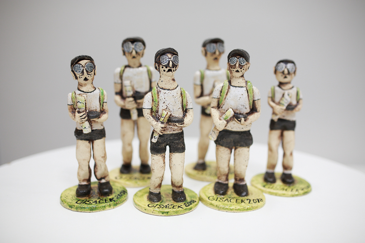
Tradiční konference GISáček (18. března 2020) je určená studentům vysokých škol, kteří zde mají možnost prezentovat výsledky svých odborných studentských prací. Stejně jako v předchozích letech bude konference součástí Sympozia GIS Ostrava 2020, které bude probíhat ve dnech 18.3.-20.3.2020. Všichni aktivní účastnici se mohou zdarma tohoto sympozia zúčastnit. Program Jako vždy bude i letos konference otevřená pro všechny studenty […]
The post GISáček 2020 (pozvánka) appeared first on GISportal.cz.
Biotop vybraných zvláště chráněných druhů velkých savců
4.2.2020 1:00 Cenia - Katalog metadat ČR - INSPIRE Biotop vybraných zvláště chráněných druhů velkých savcůGeospatial Analytics Safety InSite™ Delivers Powerful Safety Management Solution for Real Estate Portfolios
4.2.2020 0:34 GISCafe.com Webcasts-Webinars SCOTTSDALE, Ariz., Feb. 3, 2020 — (PRNewswire) — Geospatial Analytics®, a real estate software developer, announced a new release of …Fortem Technologies Wins Contract From Department of Defense for Advanced Airspace Security and Defense System
4.2.2020 0:34 GISCafe.com Webcasts-Webinars AI-powered detection and mitigation solutions selected to support Defense Innovation Unit's charter to counter improvised threatsPLEASANT GROVE, …
Geospatial Data for Social Change: A New Initiative is Announced by NLT and CEGA
3.2.2020 17:46 GISCafe.com Webcasts-Webinars New Light Technologies (NLT) and The Center for Effective Global Action (CEGA), based at the University of California, Berkeley, are teaming up to …Intermap Technologies Reports Preliminary 2019 Financial Results; Sharpened Focus on Government Contracting; and Director Resignation
3.2.2020 17:45 GISCafe.com Webcasts-Webinars DENVER, Jan. 31, 2020 — (PRNewswire) — Intermap Technologies today announced preliminary unaudited financial results for the year ended …Quantum Announces Agreement to Acquire Western Digital's ActiveScale Business
3.2.2020 17:45 GISCafe.com Webcasts-Webinars ActiveScale Object Storage Product Line Bolsters Quantum's Industry-Leading Portfolio for Managing Video and Unstructured DataSAN JOSE, Calif., Feb. …
Maxar Technologies Will Build Next-Generation Intelsat Epic Geostationary Communications Satellite with NASA Hosted Payload
3.2.2020 17:45 GISCafe.com Webcasts-Webinars WESTMINSTER, Colo. & MCLEAN, Va. — (BUSINESS WIRE) — February 3, 2020 —Intelsat (NYSE: I) has selected Maxar Technologies …
EagleView Unveils New EagleView Edge™ Program
3.2.2020 17:45 GISCafe.com Webcasts-Webinars Partner program to fuel data-driven workflow solutions for the construction industryBELLEVUE, Wash., Feb. 3, 2020 — (PRNewswire) — …
Fortem Technologies Announces Complete End to End C-UAS Solution
3.2.2020 17:45 GISCafe.com Webcasts-Webinars New addition to TrueView family of radar, R30, solves industry's mid-range radar challenges for comprehensive airspace security and defensePLEASANT …
Loveland Innovations Delivers First-Ever AI-Driven Damage Detection Tool for Hand-held Property Inspections
3.2.2020 17:45 GISCafe.com Webcasts-Webinars PLEASANT GROVE, Utah, Feb. 3, 2020 — (PRNewswire) — Loveland Innovations®, maker of advanced data analytics solutions, today released a …Oblasti se zhoršenou kvalitou ovzduší
3.2.2020 16:20 Středočeský kraj V mapové aplikaci Oblasti se zhoršenou kvalitou ovzduší byla přidána aktuální data 5letý průměr 2014–2018 a roční koncentrace za rok 2018.. Aktualizace byla provedena na základě nových údajů ČHMÚ.20200205 - volné místo - Odborný referent v oddělení právních vztahů KP Rumburk na KÚ pro ÚK
3.2.2020 15:23 ČÚZK /Urady/Katastralni-urady/Katastralni-urady/Katastralni-urad-pro-Ustecky-kraj/Katastralni-pracoviste/KP-Rumburk/O-uradu/Aktuality/20200203-volne-misto-Odborny-referent-v-oddele20200205 - volné místo - Odborný referent v oddělení právních vztahů KP Rumburk na KÚ pro ÚK
3.2.2020 15:23 ČÚZK - předpisy a opatření Katastrální úřad pro Ústecký kraj - Katastrální pracoviště Rumburk zveřejnil novou aktualitu: Nabídka volného pracovního místa - Odborný referent v oddělení právních vztahů k nemovitostem Katastrálního pracoviště Rumburk na Katastrálním úřadu pro Ústecký kraj20200205 - volné místo - Odborný referent v oddělení právních vztahů KP Rumburk na KÚ pro ÚK
3.2.2020 15:22 ČÚZK - předpisy a opatření Katastrální úřad pro Ústecký kraj - Katastrální pracoviště Rumburk zveřejnil novou aktualitu: Nabídka volného pracovního místa - Odborný referent v oddělení právních vztahů k nemovitostem Katastrálního pracoviště Rumburk na Katastrálním úřadu pro Ústecký kraj20200205 - volné místo - Odborný referent v oddělení právních vztahů KP Rumburk na KÚ pro ÚK
3.2.2020 15:22 ČÚZK /Urady/Katastralni-urady/Katastralni-urady/Katastralni-urad-pro-Ustecky-kraj/O-uradu/Aktuality/20200203-volne-misto-Odborny-referent-v-oddeleOdborný referent v oddělení právních vztahů k nemovitostem Katastrálního pracoviště Rumburk na Katas
3.2.2020 15:15 ČÚZK /Urady/Katastralni-urady/Katastralni-urady/Katastralni-urad-pro-Ustecky-kraj/Uredni-deska/Oznameni-a-jina-uredni-sdeleni/Volna-mista/DMS/Odborny-referent-v-oddeleni-pravnich-vztahu-k-nemoOdborný referent v oddělení právních vztahů k nemovitostem Katastrálního pracoviště Rumburk na Katas
3.2.2020 15:15 ČÚZK - volná místa Katastrální úřad pro Ústecký kraj Katastrální pracoviště Rumburk vypisuje výběrové řízení na místo Odborný referent v oddělení právních vztahů k nemovitostem Katastrálního pracoviště Rumburk na KatasOdborný referent v oddělení právních vztahů k nemovitostem Katastrálního pracoviště Rumburk na Katas
3.2.2020 15:15 ČÚZK - předpisy a opatření Katastrální úřad pro Ústecký kraj Katastrální pracoviště Rumburkvypisuje výběrové řízení na místo
Odborný referent v oddělení právních vztahů k nemovitostem Katastrálního pracoviště Rumburk na Katastrálním úřadu pro Ústecký kraj
Simcenter 3D rozšiřuje možnosti multidisciplinárních simulací
3.2.2020 11:48 Konstruktér Simcenter 3D podporuje multidisciplinární simulace z centrálního konstrukčního prostředí, které umožňují predikovat reálné chování mnoha fyzikálních [...]Rozpočet úřadu za rok 2020
3.2.2020 11:47 ČÚZK /Urady/Zememericke-a-katastralni-inspektoraty/Zememericke-a-katastralni-inspektoraty/Zememericky-a-katastralni-inspektorat-v-Plzni/Rozpocet/Rozpocet-uradu-za-rok-2020Rozpočet úřadu za rok 2020
3.2.2020 11:47 ČÚZK - předpisy a opatření Zeměměřický a katastrální inspektorát v Plznivystavuje rozpočet úřadu za rok
2020
Výroční souhrnná resortní zpráva za rok 2019
3.2.2020 10:50 ČÚZK - předpisy a opatření Katastrální úřad pro Liberecký krajvydává výroční zprávu úřadu za rok
2019
TT assistant prof position in Finland
3.2.2020 10:43 Aalto University in Finland is looking for a TT assistant professor in geoinformation technology:https://www.aalto.fi/en/open-positions/tenure-track-assistant-professor-in-geoinformation-technologyvrchní referent/rada – investiční referent
3.2.2020 10:33 ČÚZK /Urady/Katastralni-urady/Katastralni-urady/Katastralni-urad-pro-hlavni-mesto-Prahu/Uredni-deska/Oznameni-a-jina-uredni-sdeleni/Volna-mista/DMS/vrchni-referent-rada-–-investicni-referentvrchní referent/rada – investiční referent
3.2.2020 10:33 ČÚZK - předpisy a opatření Katastrální úřad pro hlavní město Prahu - Katastrální pracoviště Prahavypisuje výběrové řízení na místo
vrchní referent/rada – investiční referent
vrchní referent/rada – investiční referent
3.2.2020 10:33 ČÚZK - volná místa Katastrální úřad pro hlavní město Prahu - Katastrální pracoviště Praha vypisuje výběrové řízení na místo vrchní referent/rada – investiční referentSTOP-STAV v k.ú. Vyskeř
3.2.2020 10:27 ČÚZK - předpisy a opatření Katastrální úřad pro Liberecký kraj - Katastrální pracoviště Semily zveřejnil novou aktualitu: Dne 3. 2. 2020 byl na části k.ú. Vyskeř vyhlášen STOP-STAV pro všechny zápisy do katastru (vklady a záznamy) a rezervace nových parcelních čísel do doby zplatnění obnoveného katastrálního operátu mapováním.Geodetickou veřejnost tímto upozorňujeme na nemožnost rezervace nových parcelních čísel a žádáme je, aby danému STOP-STAVU přizpůsobili plánované, nebo rozpracované zakázky v tomto k.ú..
STOP-STAV v k.ú. Vyskeř
3.2.2020 10:27 ČÚZK - předpisy a opatření Katastrální úřad pro Liberecký kraj - Katastrální pracoviště Semily zveřejnil novou aktualitu: Dne 3. 2. 2020 byl v k.ú. Vyskeř vyhlášen STOP-STAV pro všechny zápisy do katastru (vklady a záznamy) a rezervace nových parcelních čísel do doby zplatnění obnoveného katastrálního operátu mapováním.Geodetickou veřejnost tímto upozorňujeme na nemožnost rezervace nových parcelních čísel a žádáme je, aby danému STOP-STAVU přizpůsobili plánované, nebo rozpracované zakázky v tomto k.ú..
STOP-STAV v k.ú. Vyskeř
3.2.2020 10:27 ČÚZK /Urady/Katastralni-urady/Katastralni-urady/Katastralni-urad-pro-Liberecky-kraj/Katastralni-pracoviste/KP-Semily/O-uradu/Aktuality/STOP-STAV-v-k-u-Vysker20200203 - volné místo - Vedoucí OMaK v kanceláři ředitele katastrálního úřadu na KÚ pro Ústecký kra
3.2.2020 9:52 ČÚZK - předpisy a opatření Katastrální úřad pro Ústecký kraj zveřejnil novou aktualitu: Nabídka volného pracovního místa - Vedoucí oddělení metodiky a kontroly v kanceláři ředitele katastrálního úřadu na Katastrálním úřadu pro Ústecký kraj20200203 - volné místo - Vedoucí OMaK v kanceláři ředitele katastrálního úřadu na KÚ pro Ústecký kra
3.2.2020 9:52 ČÚZK /Urady/Katastralni-urady/Katastralni-urady/Katastralni-urad-pro-Ustecky-kraj/O-uradu/Aktuality/20200203-volne-misto-Vedouci-OMaK-v-kancelariRevize v k.ú. Levínské Petrovice
3.2.2020 9:07 ČÚZK - předpisy a opatření Katastrální úřad pro Ústecký kraj - Katastrální pracoviště Litoměřicezveřejnil novou aktualitu: Vážení klienti, oznamujeme Vám, že od 1.4.2020 - do 30.11.2020 bude probíhat v katastrálním území Levínské Petrovice obce Lovečkovice revize katastru nemovitostí. Účelem provádění revize je soulad údajů katastru nemovitostí se skutečným stavem v terénu, kdy jsou zjišťovány změny a ověřován dosavadní stav předmětu evidence katastru nemovitostí.
Revize v k.ú. Levínské Petrovice
3.2.2020 9:07 ČÚZK /Urady/Katastralni-urady/Katastralni-urady/Katastralni-urad-pro-Ustecky-kraj/Katastralni-pracoviste/KP-Litomerice/O-uradu/Aktuality/Revize-v-k-u-Levinske-PetroviceRevize v k.ú. Libínky
3.2.2020 9:05 ČÚZK - předpisy a opatření Katastrální úřad pro Ústecký kraj - Katastrální pracoviště Litoměřicezveřejnil novou aktualitu: Vážení klienti, oznamujeme Vám, že od 25.3.2020 - do 31.12.2020 bude probíhat v katastrálním území Libínky obce Polepy revize katastru nemovitostí. Účelem provádění revize je soulad údajů katastru nemovitostí se skutečným stavem v terénu, kdy jsou zjišťovány změny a ověřován dosavadní stav předmětu evidence katastru nemovitostí.
Revize v k.ú. Libínky
3.2.2020 9:05 ČÚZK /Urady/Katastralni-urady/Katastralni-urady/Katastralni-urad-pro-Ustecky-kraj/Katastralni-pracoviste/KP-Litomerice/O-uradu/Aktuality/Revize-v-k-u-LibinkyRevize v k.ú. Račiněves
3.2.2020 9:03 ČÚZK /Urady/Katastralni-urady/Katastralni-urady/Katastralni-urad-pro-Ustecky-kraj/Katastralni-pracoviste/KP-Litomerice/O-uradu/Aktuality/Revize-v-k-u-RacinevesRevize v k.ú. Račiněves
3.2.2020 9:03 ČÚZK - předpisy a opatření Katastrální úřad pro Ústecký kraj - Katastrální pracoviště Litoměřicezveřejnil novou aktualitu: Vážení klienti, oznamujeme Vám, že od 16.3.2020- do 18.12.2020 bude probíhat v katastrálním území Račiněves obce Račiněves revize katastru nemovitostí. Účelem provádění revize je soulad údajů katastru nemovitostí se skutečným stavem v terénu, kdy jsou zjišťovány změny a ověřován dosavadní stav předmětu evidence katastru nemovitostí.
Revize v k.ú. Trnobrany
3.2.2020 9:02 ČÚZK - předpisy a opatření Katastrální úřad pro Ústecký kraj - Katastrální pracoviště Litoměřicezveřejnil novou aktualitu: Vážení klienti, oznamujeme Vám, že od 16.3.2020 - do 18.12.2020 bude probíhat v katastrálním území Trnobrany obce Liběšice revize katastru nemovitostí. Účelem provádění revize je soulad údajů katastru nemovitostí se skutečným stavem v terénu, kdy jsou zjišťovány změny a ověřován dosavadní stav předmětu evidence katastru nemovitostí.
Revize v k.ú. Trnobrany
3.2.2020 9:02 ČÚZK /Urady/Katastralni-urady/Katastralni-urady/Katastralni-urad-pro-Ustecky-kraj/Katastralni-pracoviste/KP-Litomerice/O-uradu/Aktuality/Revize-v-k-u-TrnobranyRevize v k.ú. Nížebohy
3.2.2020 9:01 ČÚZK /Urady/Katastralni-urady/Katastralni-urady/Katastralni-urad-pro-Ustecky-kraj/Katastralni-pracoviste/KP-Litomerice/O-uradu/Aktuality/Revize-v-k-u-NizebohyRevize v k.ú. Nížebohy
3.2.2020 9:01 ČÚZK - předpisy a opatření Katastrální úřad pro Ústecký kraj - Katastrální pracoviště Litoměřicezveřejnil novou aktualitu: Vážení klienti, oznamujeme Vám, že od 12.3.2020 - do 30.12.2020 bude probíhat v katastrálním území Nížebohy obce Budyně nad Ohří revize katastru nemovitostí. Účelem provádění revize je soulad údajů katastru nemovitostí se skutečným stavem v terénu, kdy jsou zjišťovány změny a ověřován dosavadní stav předmětu evidence katastru nemovitostí.