


![]()

zprávy
zdroje zpráv:u-blox Updates Guidance for FY 2018, and Provides Guidance for FY 2019
21.11.2018 19:51 GISCafe.com Webcasts-Webinars THALWIL, Switzerland, November 21, 2018 — (PRNewswire) — u-blox (SIX: UBXN), a global provider of leading positioning and wireless …XYO Network Successfully Completes World’s First Relative Location-Based Smart Contract Execution
21.11.2018 19:51 GISCafe.com Webcasts-Webinars XYO Team Takes Technology Beyond Testing Stage with Live DroneFlight, Thrilling Event Attendees and Setting Industry Precedent
…
Quanergy Announces Partnership With LiDAR USA
21.11.2018 19:51 GISCafe.com Webcasts-Webinars LiDAR USA to Integrate Quanergy’s Industry-Leading M8 Ultra Sensorsin Mapping Solutions
SUNNYVALE, Calif. — (BUSINESS WIRE) …
Autodesk to Present at Upcoming Investor Conferences
21.11.2018 19:51 GISCafe.com Webcasts-Webinars SAN RAFAEL, Calif., Nov. 21, 2018 — (PRNewswire) — Autodesk, Inc. (NASDAQ: ADSK) today announced its executives will be speaking at the …Bluesky first to use Leica CityMapper to capture major UK cities in 3D
21.11.2018 18:54 GISCafe.com Webcasts-Webinars November 21, 2018 -- Bluesky International Ltd has used the Leica CityMapper, the world’s first hybrid airborne sensor combining vertical and …Odborný referent - zápisy v řízení V a Z v oddělení právních vztahů k nemovitostem
21.11.2018 18:08 ČÚZK - volná místa Katastrální úřad pro Zlínský kraj - Katastrální pracoviště Zlín vypisuje výběrové řízení na místo Odborný referent - zápisy v řízení V a Z v oddělení právních vztahů k nemovitostemOdborný referent - zápisy v řízení V a Z v oddělení právních vztahů k nemovitostem
21.11.2018 18:08 ČÚZK - předpisy a opatření Katastrální úřad pro Zlínský kraj - Katastrální pracoviště Zlínvypisuje výběrové řízení na místo
Odborný referent - zápisy v řízení V a Z v oddělení právních vztahů k nemovitostem
Odborný referent - zápisy v řízení V a Z v oddělení právních vztahů k nemovitostem
21.11.2018 18:08 ČÚZK /Urady/Katastralni-urady/Katastralni-urady/Katastralni-urad-pro-Zlinsky-kraj/Uredni-deska/Oznameni-a-jina-uredni-sdeleni/Volna-mista/Odborny-referent-zapisy-v-rizeni-V-a-Z-v-oddelenParadise lost
21.11.2018 17:38 ESA Observing the Earth
California's Camp Fire has been one of the state’s most destructive. This animation uses data from different Copernicus Sentinels to show the spread of aerosols and smoke
Bentley Systems Launches New Digital Tools for Architects and Engineers
21.11.2018 16:11 Bentley SystemsPress Coverage
Architect Magazine, USA
Read the articleBentley unveils acquisitions, services at Year in Infrastructure Conference
21.11.2018 16:07 Bentley SystemsPress Coverage
Roads & Bridges, USA
Read the articleBentley’s AEC digital twin combines BIM, CAD, and more
21.11.2018 16:00 Bentley SystemsPress Coverage
Schnitger Corp, USA
Read the articleThe Digital Twin and Construction Infrastructure
21.11.2018 15:49 Bentley SystemsPress Coverage
Constructech, USA
Read the articleDriving Drones in Construction
21.11.2018 15:41 Bentley SystemsPress Coverage
Constructech, USA
Read the articleThe Beat from Bentley’s Year-In-Infrastructure Conference 2018
21.11.2018 15:21 Bentley SystemsPress Coverage
Bluefield Research, USA
Read the articleProblémy s přihlašováním do aplikace DP/WSDP
21.11.2018 13:41 ČÚZK /Aplikace-DP-do-KN/Aplikace-DP-do-KN/Archiv-DP/239754Problémy s přihlašováním do aplikace DP/WSDP
21.11.2018 13:41 Dálkový přístup k údajům KN ČR Vážení uživatelé,stále evidujeme prolémy s přihlašováním do aplikace DP/WSDP.
Na odstranění se intezivně pracuje.
Omlouváme se za komplikace a děkujeme za pochopení.
Problémy s přihlašováním do aplikace DP/WSDP
21.11.2018 13:41 ČÚZK - předpisy a opatření Vážení uživatelé,stále evidujeme prolémy s přihlašováním do aplikace DP/WSDP.
Na odstranění se intezivně pracuje.
Omlouváme se za komplikace a děkujeme za pochopení.
Připomeňte si konferenci
21.11.2018 13:28 ARCDATA
Každoroční listopadové setkání odborníků ze světa GIS doprovázel rekordní zájem 990 registrovaných účastníků.
Připomeňte si, co všechno bylo během dvoudenního programu možné vidět a slyšet. Na stránkách konference naleznete například:
- přehled všech příspěvků včetně prezentací v PDF,
- výsledky posterové a družicové soutěže,
- náhledy posterů,
- sborník konference.
Na sociálních sítích si pak můžete prohlédnout fotografie a videa:
- fotogalerii najdete na Facebookové stránce akce
- a více než 13 hodin přednášek a workshopů na našem YouTube kanálu.
GSA Open Days, linking space to citizens
21.11.2018 12:48 European GNSS Agency
The European GNSS Agency (GSA) opened the doors of its Prague headquarters to the public for the 4th year in a row on 16-17 November. As the final event in this year’s Czech Space Week, the GSA Open Days 2018 welcomed visitors eager to get an insider’s look at the European GNSS services and the people behind them.
This year’s event saw over 2,000 visitors visit the GSA to learn more about the European space programmes and how they benefit our daily lives. This included over 400 school children and their families, who enjoyed a full and exciting programme that included seminars and space workshops (in both Czech and English), competitions and quizzes, and other fun educational activities.
Watch this: European GNSS Agency: Linking space to user needs

From Launch to Services
Visitors to the event were able to experience the journey of a Galileo satellite from the rocket launch in Kourou, French Guiana, to the services used by citizens and business worldwide. What’s more, visitors were able to build Galileo satellites, take a selfie in space, try landing a plane with EGNOS and experience a Search and Rescue with the help of Galileo.
The ambience at this year’s Open Days was very friendly – the visitors were very enthusiastic and curious, asking many questions about what the European Union is doing in space, the role of the GSA, and the impact of satellite navigation on modern life. Some of the visitors had the opportunity to meet with Claudio Mastracci, previous ESA Director of Application Programmes, one of the founding fathers of the Galileo programme who signed the contract for the first Galileo satellites in 2003. What a path!

GSA’s Executive Director Carlo des Dorides and Claudio Mastracci, previous ESA Director of Application Programmes, one of the founding fathers of the Galileo programme
Hackathon winners
As the culmination of Czech Space Week, the GSA Open Days was an opportunity to present an award won at one of the first events of the week – the Space Applications Hackathon, held in Prague on 9-11 November. The GSA was a partner in this event, which aimed to find the most creative solutions in four main categories: Navigation/GNSS, Earth Observation, SpaceTech, and Blockchain in Space.
The winning application was Dronetag, an IoT device providing real-time drone identification and flight data sharing. The device can be adapted to all drones and the winning team is ready to bring their idea to the next level and to develop a business.
To see photos, and comments and feedback from the GSA Open Days 2018, check out the event’s Twitter and Facebook feeds.
GSA Open Days, linking space to citizens
21.11.2018 12:48 European GNSS AgencyThe European GNSS Agency (GSA) opened the doors of its Prague headquarters to the public for the 4th year in a row on 16-17 November. As the final event in this year’s Czech Space Week, the GSA Open Days 2018 welcomed visitors eager to get an insider’s look at the European GNSS services and the people behind them.
This year’s event saw over 2,000 visitors visit the GSA to learn more about the European space programmes and how they benefit our daily lives. This included over 400 school children and their families, who enjoyed a full and exciting programme that included seminars and space workshops (in both Czech and English), competitions and quizzes, and other fun educational activities.
Watch this: European GNSS Agency: Linking space to user needs
From Launch to Services
Visitors to the event were able to experience the journey of a Galileo satellite from the rocket launch in Kourou, French Guiana, to the services used by citizens and business worldwide. What’s more, visitors were able to build Galileo satellites, take a selfie in space, try landing a plane with EGNOS and experience a Search and Rescue with the help of Galileo.
The ambience at this year’s Open Days was very friendly – the visitors were very enthusiastic and curious, asking many questions about what the European Union is doing in space, the role of the GSA, and the impact of satellite navigation on modern life. Some of the visitors had the opportunity to meet with Claudio Mastracci, previous ESA Director of Application Programmes, one of the founding fathers of the Galileo programme who signed the contract for the first Galileo satellites in 2003. What a path!
GSA’s Executive Director Carlo des Dorides and Claudio Mastracci, previous ESA Director of Application Programmes, one of the founding fathers of the Galileo programme
Hackathon winners
As the culmination of Czech Space Week, the GSA Open Days was an opportunity to present an award won at one of the first events of the week – the Space Applications Hackathon, held in Prague on 9-11 November. The GSA was a partner in this event, which aimed to find the most creative solutions in four main categories: Navigation/GNSS, Earth Observation, SpaceTech, and Blockchain in Space.
The winning application was Dronetag, an IoT device providing real-time drone identification and flight data sharing. The device can be adapted to all drones and the winning team is ready to bring their idea to the next level and to develop a business.
To see photos, and comments and feedback from the GSA Open Days 2018, check out the event’s Twitter and Facebook feeds.
GSA Open Days, linking space to citizens
21.11.2018 12:48 European GNSS AgencyThe European GNSS Agency (GSA) opened the doors of its Prague headquarters to the public for the 4th year in a row on 16-17 November. As the final event in this year’s Czech Space Week, the GSA Open Days 2018 welcomed visitors eager to get an insider’s look at the European GNSS services and the people behind them.
This year’s event saw over 2,000 visitors visit the GSA to learn more about the European space programmes and how they benefit our daily lives. This included over 400 school children and their families, who enjoyed a full and exciting programme that included seminars and space workshops (in both Czech and English), competitions and quizzes, and other fun educational activities.
Watch this: European GNSS Agency: Linking space to user needs

From Launch to Services
Visitors to the event were able to experience the journey of a Galileo satellite from the rocket launch in Kourou, French Guiana, to the services used by citizens and business worldwide. What’s more, visitors were able to build Galileo satellites, take a selfie in space, try landing a plane with EGNOS and experience a Search and Rescue with the help of Galileo.
The ambience at this year’s Open Days was very friendly – the visitors were very enthusiastic and curious, asking many questions about what the European Union is doing in space, the role of the GSA, and the impact of satellite navigation on modern life. Some of the visitors had the opportunity to meet with Claudio Mastracci, previous ESA Director of Application Programmes, one of the founding fathers of the Galileo programme who signed the contract for the first Galileo satellites in 2003. What a path!
GSA’s Executive Director Carlo des Dorides and Claudio Mastracci, previous ESA Director of Application Programmes, one of the founding fathers of the Galileo programme
Hackathon winners
As the culmination of Czech Space Week, the GSA Open Days was an opportunity to present an award won at one of the first events of the week – the Space Applications Hackathon, held in Prague on 9-11 November. The GSA was a partner in this event, which aimed to find the most creative solutions in four main categories: Navigation/GNSS, Earth Observation, SpaceTech, and Blockchain in Space.
The winning application was Dronetag, an IoT device providing real-time drone identification and flight data sharing. The device can be adapted to all drones and the winning team is ready to bring their idea to the next level and to develop a business.
To see photos, and comments and feedback from the GSA Open Days 2018, check out the event’s Twitter and Facebook feeds.
GSA Open Days, linking space to citizens
21.11.2018 12:48 European GNSS AgencyThe European GNSS Agency (GSA) opened the doors of its Prague headquarters to the public for the 4th year in a row on 16-17 November. As the final event in this year’s Czech Space Week, the GSA Open Days 2018 welcomed visitors eager to get an insider’s look at the European GNSS services and the people behind them.
This year’s event saw over 2,000 visitors visit the GSA to learn more about the European space programmes and how they benefit our daily lives. This included over 400 school children and their families, who enjoyed a full and exciting programme that included seminars and space workshops (in both Czech and English), competitions and quizzes, and other fun educational activities.

Watch this: European GNSS Agency: Linking space to user needs
From Launch to Services
Visitors to the event were able to experience the journey of a Galileo satellite from the rocket launch in Kourou, French Guiana, to the services used by citizens and business worldwide. What’s more, visitors were able to build Galileo satellites, take a selfie in space, try landing a plane with EGNOS and experience a Search and Rescue with the help of Galileo.
The ambience at this year’s Open Days was very friendly – the visitors were very enthusiastic and curious, asking many questions about what the European Union is doing in space, the role of the GSA, and the impact of satellite navigation on modern life. Some of the visitors had the opportunity to meet with Claudio Mastracci, previous ESA Director of Application Programmes, one of the founding fathers of the Galileo programme who signed the contract for the first Galileo satellites in 2003. What a path!
Hackathon winners
As the culmination of Czech Space Week, the GSA Open Days was an opportunity to present an award won at one of the first events of the week – the Space Applications Hackathon, held in Prague on 9-11 November. The GSA was a partner in this event, which aimed to find the most creative solutions in four main categories: Navigation/GNSS, Earth Observation, SpaceTech, and Blockchain in Space.
The winning application was Dronetag, an IoT device providing real-time drone identification and flight data sharing. The device can be adapted to all drones and the winning team is ready to bring their idea to the next level and to develop a business.
To see photos, and comments and feedback from the GSA Open Days 2018, check out the event’s Twitter and Facebook feeds.
V České republice se připravuje revoluce v oblasti družicových pohonů
21.11.2018 11:37 Český Kosmický PortálSpolečnosti SpaceLab EU a Výzkumný a zkušební letecký ústav (VZLÚ) uzavřely partnerství, v jehož rámci budou během příštích pěti let společně pracovat na vývoji a komerčním využití unikátního air-breathing iontového motoru, který umožní družicím udržet svoji polohu na velmi nízké oběžné dráze. Tah motoru je vytvořen urychlením zbytkové atmosféry Země a nepotřebuje již žádnou jinou pohonnou látku. Projekt nového typu pohonu je odpovědí na zvýšenou poptávku uživatelů po provozování flotil malých družic a zlepšení samotné ekonomiky jejich provozu včetně prodloužení životnosti.
AMW Solutions Announces Availability of PIPE and DITCH Machine Control Products
21.11.2018 11:28 GISCafe.com Webcasts-Webinars Grand Rapids, Michigan – November 19, 2018 – AMW Machine Control Solutions Inc. (“AMW Solutions”), is pleased to announce the …Záplata pro zpracovatele geometrických plánů
21.11.2018 10:15 GEPROZpracovatelé geometrických plánů používající nejnovější verze systému KOKEŠ (verze 14.10 a případně také 13.74 či 13.73) žádný problém řešit nemusí.… >>
Informace o 23. kartografické konferenci jsou již známy
21.11.2018 9:24 Blogující geomatici - FAV ZČU Na stránkách http://23kk.natur.cuni.cz lze najít úvodní informace o následující, tentokrát již 23. kartografické konferenci, která se bude konat 18 - 20. 9. 2018 v Kutné Hoře.
Informace o 23. kartografické konferenci jsou již známy
21.11.2018 9:24 Blogující geomatici - FAV ZČU Na stránkách http://23kk.natur.cuni.cz lze najít úvodní informace o následující, tentokrát již 23. kartografické konferenci, která se bude konat 18 - 20. 9. 2019 v Kutné Hoře.Jakub byl minulý týden pozvaným speakerem na Commercial UAV Show 2018 v Londýně
21.11.2018 8:53 UpVision Minulý týden byl Jakub v Londýně pozvaným speakerem do sekce UTM na konferenci s veletrhem Commercial UAV Show 2018.Dalšími diskutujícími byly hosté například z General Atomics (výrobce nejznámějších dronů Predator a Reaper) nebo z britského NATS (britské řízení letového provozu).
Fotky z akce zde:
https://plus.google.com/u/0/b/115833877689730865211/+UpvisionCz1/posts/LyCDmBAWNqx
GIS Esri v Česku 2018 – očima GISportalu (Den 1)
21.11.2018 8:48 GISportal.cz
Je už tradicí, že na začátku listopadu se v Kongresovém centru Praha koná konference uživatelů rodiny Esri pod taktovkou ARCDATA PRAHA. Tento rok byla konference GIS Esri v ČR naplánována na středu a čtvrtek 7. a 8. listopadu. Ve dvou přednáškami a workshopy nahuštěných dnech byla seznámena česká geoinformatická veřejnost s novinkami v Esri produktech […]
The post GIS Esri v Česku 2018 – očima GISportalu (Den 1) appeared first on GISportal.cz.
Inspektor Zeměměřického a katastrálního inspektorátu v Brně (obor služby 70.)
21.11.2018 8:37 ČÚZK - volná místa Zeměměřický a katastrální inspektorát v Brně vypisuje výběrové řízení na místo Inspektor Zeměměřického a katastrálního inspektorátu v Brně (obor služby 70.)Inspektor Zeměměřického a katastrálního inspektorátu v Brně (obor služby 70.)
21.11.2018 8:37 ČÚZK - předpisy a opatření Zeměměřický a katastrální inspektorát v Brněvypisuje výběrové řízení na místo
Inspektor Zeměměřického a katastrálního inspektorátu v Brně (obor služby 70.)
Inspektor Zeměměřického a katastrálního inspektorátu v Brně (obor služby 70.)
21.11.2018 8:37 ČÚZK /Urady/Zememericke-a-katastralni-inspektoraty/Zememericke-a-katastralni-inspektoraty/Zememericky-a-katastralni-inspektorat-v-Brne/Uredni-deska/Oznameni-a-jina-uredni-sdeleni/Volna-mista/Inspektor-Zememerickeho-a-katastralniho-inspek-(2)Autodesk to Acquire PlanGrid to Accelerate Construction Productivity
21.11.2018 1:23 GISCafe.com Webcasts-Webinars Companies Aim to Improve Information Exchange Across All Construction Project TeamsSAN RAFAEL, Calif., Nov. 20, 2018 — (PRNewswire) — …
Annualized Recurring Revenue (ARR) Growth Acceleration Highlights Autodesk's Third Quarter Results
21.11.2018 1:23 GISCafe.com Webcasts-WebinarsBIM – FM – geomatika
21.11.2018 1:12 Asociace podnikatelů v geomatice APG společně s Asociací pro rozvoj trhu s nemovitostmi uspořádala diskuzní setkání o metodě BIM (Building Information Modeling). Ukázali jsme developerům geomatiku a BIM. Setkání bylo katalyzátorem pro otevření vztahů tří zájmových skupin: BIM specialistů, facility manažerů a geomatiků. Facility management, který většina developerů každodenně využívá, je dobrým spojovacím můstkem pro propojení činností vlastníků budov a geomatiků. Na akci byl samozřejmě […]INSPIRE téma Rozšířené Parcely (CPX)
21.11.2018 1:00 Cenia - Katalog metadat ČR - INSPIRE Rozšíření má za cíl poskytovat katastrální mapu s obsahem podle vyhlášky ve vektorové podobě ve struktuře plně v souladu se strukturou danou směrnicí INSPIRE. Data rozšiřují směrnici INSPIRE pro téma katastrální parcely (CP) o věcná břemena, geodetické body, další prvky mapy, původní obloukovou geometrii a o parcely určené definičním bodem (ty pouze v oblastech s analogovou mapou). Vychází z katastrální mapy, která je závazným státním mapovým dílem velkého měřítka, obsahuje body polohového bodového pole, polohopis a popis a může mít formu digitální mapy, analogové mapy nebo digitalizované mapy. Publikovaná data obsahují katastrální území pro celou Českou Republiku, parcely a jejich hranice, věcná břemena, další prvky mapy a původní obloukovou geometrii z území, kde je digitální mapa (k 26. 11. 2018 je to 96,16% území České republiky, t.j. 75 840,00km2) a ve zbytku území katastrální parcely určené pouze definičním bodem (tedy bez hranic a polygonu). Katastrální parcely a hranice obsahují oproti datové sadě INSPIRE některé atributy navíc. Jedná se o typ hranice, způsob využití území, druh pozemku, vazbu na budovu a o mapové značky. Více katastrální zákon 344/1992 SB., katastrální vyhláška č.26/2007 Sb. v platném znění a INSPIRE Data Specification on Cadastral Parcels v 3.0.1. Data ve formátu GML 3.2.1 jsou validní proti schématu XML pro Rozšířené Parcely (CPX) ve verzi 4.0.INSPIRE téma Rozšířené Parcely (CPX)
21.11.2018 1:00 Cenia - Katalog metadat ČR - INSPIRE Rozšíření má za cíl poskytovat katastrální mapu s obsahem podle vyhlášky ve vektorové podobě ve struktuře plně v souladu se strukturou danou směrnicí INSPIRE. Data rozšiřují směrnici INSPIRE pro téma katastrální parcely (CP) o věcná břemena, geodetické body, další prvky mapy, původní obloukovou geometrii a o parcely určené definičním bodem (ty pouze v oblastech s analogovou mapou). Vychází z katastrální mapy, která je závazným státním mapovým dílem velkého měřítka, obsahuje body polohového bodového pole, polohopis a popis a může mít formu digitální mapy, analogové mapy nebo digitalizované mapy. Publikovaná data obsahují katastrální území pro celou Českou Republiku, parcely a jejich hranice, věcná břemena, další prvky mapy a původní obloukovou geometrii z území, kde je digitální mapa (k 26. 11. 2018 je to 96,16% území České republiky, t.j. 75 840,00km2) a ve zbytku území katastrální parcely určené pouze definičním bodem (tedy bez hranic a polygonu). Katastrální parcely a hranice obsahují oproti datové sadě INSPIRE některé atributy navíc. Jedná se o typ hranice, způsob využití území, druh pozemku, vazbu na budovu a o mapové značky. Více katastrální zákon 344/1992 SB., katastrální vyhláška č.26/2007 Sb. v platném znění a INSPIRE Data Specification on Cadastral Parcels v 3.0.1. Data ve formátu GML 3.2.1 jsou validní proti schématu XML pro Rozšířené Parcely (CPX) ve verzi 4.0.INSPIRE téma Rozšířené Parcely (CPX)
21.11.2018 1:00 Cenia - Katalog metadat ČR - INSPIRE Rozšíření má za cíl poskytovat katastrální mapu s obsahem podle vyhlášky ve vektorové podobě ve struktuře plně v souladu se strukturou danou směrnicí INSPIRE. Data rozšiřují směrnici INSPIRE pro téma katastrální parcely (CP) o věcná břemena, geodetické body, další prvky mapy, původní obloukovou geometrii a o parcely určené definičním bodem (ty pouze v oblastech s analogovou mapou). Vychází z katastrální mapy, která je závazným státním mapovým dílem velkého měřítka, obsahuje body polohového bodového pole, polohopis a popis a může mít formu digitální mapy, analogové mapy nebo digitalizované mapy. Publikovaná data obsahují katastrální území pro celou Českou Republiku, parcely a jejich hranice, věcná břemena, další prvky mapy a původní obloukovou geometrii z území, kde je digitální mapa (k 26. 11. 2018 je to 96,16% území České republiky, t.j. 75 840,00km2) a ve zbytku území katastrální parcely určené pouze definičním bodem (tedy bez hranic a polygonu). Katastrální parcely a hranice obsahují oproti datové sadě INSPIRE některé atributy navíc. Jedná se o typ hranice, způsob využití území, druh pozemku, vazbu na budovu a o mapové značky. Více katastrální zákon 344/1992 SB., katastrální vyhláška č.26/2007 Sb. v platném znění a INSPIRE Data Specification on Cadastral Parcels v 3.0.1. Data ve formátu GML 3.2.1 jsou validní proti schématu XML pro Rozšířené Parcely (CPX) ve verzi 4.0.INSPIRE téma Rozšířené Parcely (CPX)
21.11.2018 1:00 Cenia - Katalog metadat ČR - INSPIRE Rozšíření má za cíl poskytovat katastrální mapu s obsahem podle vyhlášky ve vektorové podobě ve struktuře plně v souladu se strukturou danou směrnicí INSPIRE. Data rozšiřují směrnici INSPIRE pro téma katastrální parcely (CP) o věcná břemena, geodetické body, další prvky mapy, původní obloukovou geometrii a o parcely určené definičním bodem (ty pouze v oblastech s analogovou mapou). Vychází z katastrální mapy, která je závazným státním mapovým dílem velkého měřítka, obsahuje body polohového bodového pole, polohopis a popis a může mít formu digitální mapy, analogové mapy nebo digitalizované mapy. Publikovaná data obsahují katastrální území pro celou Českou Republiku, parcely a jejich hranice, věcná břemena, další prvky mapy a původní obloukovou geometrii z území, kde je digitální mapa (k 26. 11. 2018 je to 96,16% území České republiky, t.j. 75 840,00km2) a ve zbytku území katastrální parcely určené pouze definičním bodem (tedy bez hranic a polygonu). Katastrální parcely a hranice obsahují oproti datové sadě INSPIRE některé atributy navíc. Jedná se o typ hranice, způsob využití území, druh pozemku, vazbu na budovu a o mapové značky. Více katastrální zákon 344/1992 SB., katastrální vyhláška č.26/2007 Sb. v platném znění a INSPIRE Data Specification on Cadastral Parcels v 3.0.1. Data ve formátu GML 3.2.1 jsou validní proti schématu XML pro Rozšířené Parcely (CPX) ve verzi 4.0.INSPIRE téma Rozšířené Parcely (CPX)
21.11.2018 1:00 Cenia - Katalog metadat ČR - INSPIRE Rozšíření má za cíl poskytovat katastrální mapu s obsahem podle vyhlášky ve vektorové podobě ve struktuře plně v souladu se strukturou danou směrnicí INSPIRE. Data rozšiřují směrnici INSPIRE pro téma katastrální parcely (CP) o věcná břemena, geodetické body, další prvky mapy, původní obloukovou geometrii a o parcely určené definičním bodem (ty pouze v oblastech s analogovou mapou). Vychází z katastrální mapy, která je závazným státním mapovým dílem velkého měřítka, obsahuje body polohového bodového pole, polohopis a popis a může mít formu digitální mapy, analogové mapy nebo digitalizované mapy. Publikovaná data obsahují katastrální území pro celou Českou Republiku, parcely a jejich hranice, věcná břemena, další prvky mapy a původní obloukovou geometrii z území, kde je digitální mapa (k 26. 11. 2018 je to 96,16% území České republiky, t.j. 75 840,00km2) a ve zbytku území katastrální parcely určené pouze definičním bodem (tedy bez hranic a polygonu). Katastrální parcely a hranice obsahují oproti datové sadě INSPIRE některé atributy navíc. Jedná se o typ hranice, způsob využití území, druh pozemku, vazbu na budovu a o mapové značky. Více katastrální zákon 344/1992 SB., katastrální vyhláška č.26/2007 Sb. v platném znění a INSPIRE Data Specification on Cadastral Parcels v 3.0.1. Data ve formátu GML 3.2.1 jsou validní proti schématu XML pro Rozšířené Parcely (CPX) ve verzi 4.0.Avineon Completes Acquisition of InfoGeographics, Inc.
20.11.2018 19:42 GISCafe.com Webcasts-Webinars MCLEAN, Va., Nov. 20, 2018 (GLOBE NEWSWIRE) -- Avineon, Inc. (Avineon), a global provider of information technology, geospatial, and engineering …Geomni Makes Pre- and Post-California Wildfire Imagery Available
20.11.2018 19:38 GISCafe.com Webcasts-Webinars November 20, 2018 -- Multiple wildfires have swept through California at unprecedented rates, decimating over 240,000 acres and tens of thousands of …This Week in Tech: This Tiny House Runs on Dunkin'
20.11.2018 15:53 Bentley SystemsPress Coverage
Architect, USA
Read the articleHigher Education: The Story Behind Skand's Drone/Machine Learning Envelope Inspection
20.11.2018 15:50 Bentley SystemsPress Coverage
Engineering.com, USA
Read the articleGoing Open and Digital Twin Cloud Services Shape Bentley Year In Infrastructure 2018
20.11.2018 15:46 Bentley SystemsPress Coverage
AECCafe, USA
Read the articleBentley Systems Releases Open-Source Library: iModel.js
20.11.2018 15:25 Bentley SystemsPress Coverage
Market Watch, USA
Read the articleBentley's Year in Infrastructure 2018 Conference
20.11.2018 15:23 Bentley SystemsPress Coverage
AECbytes, USA
Read the articleSolution enables up-to-date, as-operated digital twins
20.11.2018 15:21 Bentley SystemsPress Coverage
Reliability Web, USA
Read the articlePodíleli jsme se zásadně na konceptu nové legislativy Chytré nebe o kterém informuje Ministerstvo dopravy
20.11.2018 15:10 UpVision "Chytré nebe" je koncept národní strategie pro drony, který jsme připravili a jeho finální znění vytvořili s ÚCL, ŘLP, Ministerstvem dopravy a ČVUT.Více v tiskové zprávě Ministerstva dopravy:
https://www.mdcr.cz/Media/Media-a-tiskove-zpravy/Dronu-nad-nasimi-hlavami-pribyva,-Cesko-se-chce-po
Aktualizace dat ÚAP o data Aktualizace č.2 Zásad územního rozvoje Plzeňského kraje
20.11.2018 14:15 Plzeňský kraj V datech územně analytických podkladů Plzeňského kraje byla provedena kompletní aktualizace dat Zásad územního rozvoje Plzeňského kraje o data Aktualizace č.2 ZÚR PK.Příležitost pro studenty a absolventy: Více než 100 volných pozic v rámci programu ESA „Young Graduate Trainee 2018“
20.11.2018 13:12 Český Kosmický PortálEvropská kosmická agentura (ESA) realizuje v rámci svých korporátních vzdělávacích aktivit program „Young Graduate Trainee (YGT)“. Jedná se o jednoletý stipendijní program, který je určený vysokoškolským studentům dokončujícím své studium, čerstvým absolventům a studentům doktorských programů.
Studenti a absolventi vysokých škol mají skrze program YGT možnost získat pracovní zkušenosti v mezinárodních programech a aktivitách ESA zejména v inženýrských, vědeckých a právně-politických oborech. Studenti budou během stáže pracovat jako členové odborných týmů pod vedením zkušených specialistů a poradců.
20181231
20.11.2018 11:57 ČÚZK - předpisy a opatření Katastrální úřad pro Jihomoravský kraj zveřejnil novou aktualitu: Dne 31.12.2018 budou úřední hodiny přepážek podatelny a poskytování údajů z KN redukovány na dobu od 8 do 15 hodin20181231
20.11.2018 11:57 ČÚZK /Urady/Katastralni-urady/Katastralni-urady/Katastralni-urad-pro-Jihomoravsky-kraj/O-uradu/Aktuality/20181231Registrujte se na Den s INSPIRE
20.11.2018 10:39 CENIA - národní geoportál INSPIRE Registrujte se na Den s INSPIRE, který proběhne 7.12.2018 od 10.00 v budově ČÚZK (Pod Sídlištěm 1800/9, Praha 8, metro C - Kobylisy) Registrační formulář a předběžný program je zveřejněn. Pro rozbrazení odkazu otevřete tuto novinku. Těšíme se na setkání s Vámi.Nedostupnost aplikace od 11:30 do cca 12:30
20.11.2018 10:34 Dálkový přístup k údajům KN ČR Vážení uživatelé,z důvodu odstranění problémů s přihlašováním do DP/WSDP oznamujeme, že bude aplikace od 11:30 do cca 12:30 nedostupná.
Za komplikace se omlouváme a děkujeme za pochopení.
Nedostupnost aplikace od 11:30 do cca 12:30
20.11.2018 10:34 ČÚZK - předpisy a opatření Vážení uživatelé,z důvodu odstranění problémů s přihlašováním do DP/WSDP oznamujeme, že bude aplikace od 11:30 do cca 12:30 nedostupná.
Za komplikace se omlouváme a děkujeme za pochopení.
Nedostupnost aplikace od 11:30 do cca 12:30
20.11.2018 10:34 ČÚZK /Aplikace-DP-do-KN/Aplikace-DP-do-KN/Archiv-DP/239573Vladimír Maršík odměněn medailí HZS
20.11.2018 9:56 T-MAPYThe post Vladimír Maršík odměněn medailí HZS appeared first on T-MAPY spol. s r.o..
20181120 - volné místo - Odborný rada v oddělení právních vztahů k nemovitostem KP Rumburk (právník)
20.11.2018 9:21 ČÚZK /Urady/Katastralni-urady/Katastralni-urady/Katastralni-urad-pro-Ustecky-kraj/O-uradu/Aktuality/20181120-volne-misto-Odborny-rada-v-oddeleni-p20181120 - volné místo - Odborný rada v oddělení právních vztahů k nemovitostem KP Rumburk (právník)
20.11.2018 9:21 ČÚZK - předpisy a opatření Katastrální úřad pro Ústecký kraj - Katastrální pracoviště Rumburk zveřejnil novou aktualitu: Nabídka volného pracovního místa - Odborný rada v oddělení právních vztahů k nemovitostem KP Rumburk (právník) na Katastrálním úřadu pro Ústecký krajOdborný rada v oddělení právních vztahů k nemovitostem KP Rumburk (právník) na Katastrálním úřadu pr
20.11.2018 9:15 ČÚZK /Urady/Katastralni-urady/Katastralni-urady/Katastralni-urad-pro-Ustecky-kraj/Uredni-deska/Oznameni-a-jina-uredni-sdeleni/Volna-mista/Odborny-rada-v-oddeleni-pravnich-vztahu-k-nemovitoOdborný rada v oddělení právních vztahů k nemovitostem KP Rumburk (právník) na Katastrálním úřadu pr
20.11.2018 9:15 ČÚZK - volná místa Katastrální úřad pro Ústecký kraj - Katastrální pracoviště Rumburk vypisuje výběrové řízení na místo Odborný rada v oddělení právních vztahů k nemovitostem KP Rumburk (právník) na Katastrálním úřadu prOdborný rada v oddělení právních vztahů k nemovitostem KP Rumburk (právník) na Katastrálním úřadu pr
20.11.2018 9:15 ČÚZK - předpisy a opatření Katastrální úřad pro Ústecký kraj - Katastrální pracoviště Rumburkvypisuje výběrové řízení na místo
Odborný rada v oddělení právních vztahů k nemovitostem KP Rumburk (právník) na Katastrálním úřadu pro Ústecký kraj
Interview with Mark Senior, Regional Sales Director of Pointfuse Limited at Intergeo 2018
20.11.2018 9:00 GISCafe.com Webcasts-WebinarsMapping Open Spaces and Extending Conservation’s Reach (ArcNews Online)
20.11.2018 9:00 GISCafe.com Webcasts-WebinarsŘeditel odboru – ředitel kanceláře ředitele Katastrálního úřad pro Královéhradecký kraj
20.11.2018 8:29 ČÚZK - volná místa Katastrální úřad pro Královéhradecký kraj vypisuje výběrové řízení na místo Ředitel odboru – ředitel kanceláře ředitele Katastrálního úřad pro Královéhradecký krajŘeditel odboru – ředitel kanceláře ředitele Katastrálního úřad pro Královéhradecký kraj
20.11.2018 8:29 ČÚZK /Urady/Katastralni-urady/Katastralni-urady/Katastralni-urad-pro-Kralovehradecky-kraj/Uredni-deska/Oznameni-a-jina-uredni-sdeleni/Volna-mista/Reditel-odboru-–-reditel-kancelare-reditele-Ka-(1)Ředitel odboru – ředitel kanceláře ředitele Katastrálního úřad pro Královéhradecký kraj
20.11.2018 8:29 ČÚZK - předpisy a opatření Katastrální úřad pro Královéhradecký krajvypisuje výběrové řízení na místo
Ředitel odboru – ředitel kanceláře ředitele Katastrálního úřad pro Královéhradecký kraj
INSPIRE info day
20.11.2018 7:53 CENIA - národní geoportál INSPIRE INSPIRE info day pořádá CENIA, česká informační agentura životního prostředí v budově ČÚZK (Pod sídlištěm 1800/9, Praha 8, stanice metra C Kobylisy). Registrace a předběžný program zde.vHive Releases Autonomous Drone Solution for Complex Cell Tower Inspection
19.11.2018 21:08 GISCafe.com Webcasts-Webinars HERZLIYA, Israel, Nov. 19, 2018 — (PRNewswire) — vHive, the developer of a cloud-based software solution that enables enterprises to …Accela Announces Civic Platform V10 for an Enhanced User Experience for State and Local Governments Worldwide
19.11.2018 19:19 GISCafe.com Webcasts-Webinars New features deliver a faster and easier way for government agencies to serve their communities with out-of-box Civic ApplicationsSAN RAMON, Calif., …
Digital twin collaboration advances brownfield process operations management
19.11.2018 15:49 Bentley SystemsPress Coverage
Plant Engineering, USA
Read the articleUkončení provozu WSDP verze 2.6
19.11.2018 15:48 Dálkový přístup k údajům KN ČR Vážení uživatelé webových služeb,oznamujeme Vám, že dne 16.11.2018 byl ukončen provoz webových služeb verze 2.6, bylo proto zamezeno se k těmto službám přihlašovat.
Pokusy o přihlášení k této verzi služeb končí chybou.
Děkujeme za pochopení
Ukončení provozu WSDP verze 2.6
19.11.2018 15:48 Dálkový přístup k údajům KN ČR Vážení uživatelé webových služeb,oznamujeme Vám, že dne 16.11.2018 byl ukončen provoz webových služeb verze 2.6, bylo proto zamezeno se ktěmto službám se přihlašovat.
Pokusy o přihlášení k této verzi služeb končí chybou.
Děkujeme za pochopení
Ukončení provozu WSDP verze 2.6
19.11.2018 15:48 ČÚZK - předpisy a opatření Vážení uživatelé webových služeb,oznamujeme Vám, že dne 16.11.2018 byl ukončen provoz webových služeb verze 2.6, bylo proto zamezeno se k těmto službám přihlašovat.
Pokusy o přihlášení k této verzi služeb končí chybou.
Děkujeme za pochopení
Ukončení provozu WSDP verze 2.6
19.11.2018 15:48 ČÚZK - předpisy a opatření Vážení uživatelé webových služeb,oznamujeme Vám, že dne 16.11.2018 byl ukončen provoz webových služeb verze 2.6, bylo proto zamezeno se ktěmto službám se přihlašovat.
Pokusy o přihlášení k této verzi služeb končí chybou.
Děkujeme za pochopení
Ukončení provozu WSDP verze 2.6
19.11.2018 15:48 ČÚZK /Aplikace-DP-do-KN/Aplikace-DP-do-KN/Archiv-DP/239509Bentley acquires LEGION, launches OpenBuildings Station Designer
19.11.2018 15:40 Bentley SystemsPress Coverage
RT&S, USA
Read the articleBentley Systems' Year in Infrastructure 2018 Award Winners
19.11.2018 15:33 Bentley SystemsPress Coverage
Architect Magazine, USA
Read the articleStrategic Acquisitions Fit Into Infrastructure Development Portfolio
19.11.2018 15:30 Bentley SystemsPress Coverage
ENR, USA
Read the articleBentley Announces YII2018 Winners
19.11.2018 15:24 Bentley SystemsPress Coverage
Engineering.com, USA
Read the articleOman company named as finalist in Bentley Systems’ award
19.11.2018 15:20 Bentley SystemsPress Coverage
Times of Oman, Middle East
Read the article20181120-GaKO-11-2018
19.11.2018 14:05 ČÚZK - předpisy a opatření Český úřad zeměměřický a katastrální zveřejnil novou aktualitu: Aktuální číslo Geodetického a kartografického obzoru (11/2018) je k dispozici ke stažení.
Nové číslo GaKO
19.11.2018 12:15
ÚGKK SR
Nové číslo časopisu Geodetického a Kartografického Obzoru 11/2018
Schneider Electric announces partnership with RMSI
19.11.2018 12:02 GISCafe.com Webcasts-Webinars Complementary expertise delivers powerful, end-to-end GIS solutions for customersFort Collins, Colo., November 19, 2018 – Schneider …
"SkyLogic’s 2018 Drone Market Sector Summary Report Offers Timely Research and Analytics on the Industry" by Susan Smith
19.11.2018 11:45 GISCafe.com Webcasts-WebinarsProblémy s přihlašováním do aplikace
19.11.2018 11:20 ČÚZK - předpisy a opatření Vážení uživatelé,v současné době evidujeme problémy s přihlášením do aplikace DP/WSDP.
Na odstranění problému se intenzivně pracuje.
Omlouváme se za komplikace.
Problémy s přihlašováním do aplikace
19.11.2018 11:20 ČÚZK /Aplikace-DP-do-KN/Aplikace-DP-do-KN/Archiv-DP/239472Problémy s přihlašováním do aplikace
19.11.2018 11:20 Dálkový přístup k údajům KN ČR Vážení uživatelé,v současné době evidujeme problémy s přihlášením do aplikace DP/WSDP.
Na odstranění problému se intenzivně pracuje.
Omlouváme se za komplikace.
Knihovní řád Univerzity Karlovy [Knihovna geografie, byTopic]
19.11.2018 11:10 Katedra aplikované geoinformatiky a kartografie Přf UK Opatření rektora č. 51/2018Pozvánka na výstavu 100 LET MAP Z DOBY VZNIKU SAMOSTATNÉHO ČESKOSLOVENSKÉHO STÁTU [Knihovna geografie, byTopic]
19.11.2018 10:35 Katedra aplikované geoinformatiky a kartografie Přf UK 23. listopadu 2018 v době od 9.:00 a od 13:00 - 14:30 hodinČeské výrobky ve vesmíru: Česká republika slaví 10 let členství v Evropské kosmické agentuře
19.11.2018 9:33 Český Kosmický PortálMeteorologické mise nové generace, telekomunikační platformy, nový systém řízení letového provozu nad Evropou, technologie pro drony či sondy směřující ke Slunci a Jupiteru, tam všude lze nalézt českou stupu pocházející od našich předních dodavatelů. Největší úspěchy a přínosy vyplývající z 10 let trvajícího členství České republiky v Evropské kosmické agentuře (ESA) představila stejnojmenná konference pořádaná u příležitosti desátého výročí v pražském Kongresovém centru. Konference je součástí Czech Space Week, kterým chtějí Ministerstvo dopravy a CzechInvest spolu s dalšími partnery přiblížit kosmické aktivity a jejich přínos pro rozvoj průmyslu, vědu, podnikání i každodenní život odborné i široké veřejnosti.
České výrobky ve vesmíru: Česká republika slaví 10 let členství v Evropské kosmické agentuře
19.11.2018 9:33 Český Kosmický PortálMeteorologické mise nové generace, telekomunikační platformy, nový systém řízení letového provozu nad Evropou, technologie pro drony či sondy směřující ke Slunci a Jupiteru, tam všude lze nalézt českou stupu pocházející od našich předních dodavatelů. Největší úspěchy a přínosy vyplývající z 10 let trvajícího členství České republiky v Evropské kosmické agentuře (ESA) představila stejnojmenná konference pořádaná u příležitosti desátého výročí v pražském Kongresovém centru. Konference je součástí Czech Space Week, kterým chtějí Ministerstvo dopravy a CzechInvest spolu s dalšími partnery přiblížit kosmické aktivity a jejich přínos pro rozvoj průmyslu, vědu, podnikání i každodenní život odborné i široké veřejnosti.
20181119 - Dokončení instalace nové verze ISKN 8.2
19.11.2018 9:26 ČÚZK - Výměnný formát ISKN Instalace ISKN 8.2 byla dokončena 18. 11. 2018. Od tohoto data jsou exporty VF ISKN vydávány ve verzi 5.3.Do konce roku 2018 bude možné vydávat data VFK včetně osobních údajů.
V sobotu jsme na Dnech otevřených dveří Ministerstva dopravy seznamovali s drony a jednali i s ministrem
19.11.2018 9:09 UpVision Tuto sobotu jsme na Dni otevřených dveří Ministerstva dopravy seznamovali veřejnost s drony a s ministrem jsme krátce probírali koncept nové legislativy Chytré nebe.Současně byl velký zájem o naše vlaštovky. :-)
Fotografie zde:
https://plus.google.com/u/0/b/115833877689730865211/+UpvisionCz1/posts/ET9rRuw3iB3
Video Interview: Microdrones launches mdMapper1000PPK and mdMapper1000+
19.11.2018 9:00 GISCafe.com Webcasts-WebinarsThe Top Six Features in Operations Dashboard for ArcGIS (ArcUser Online)
19.11.2018 9:00 GISCafe.com Webcasts-WebinarsDen s INSPIRE (pozvánka)
19.11.2018 8:42 GISportal.cz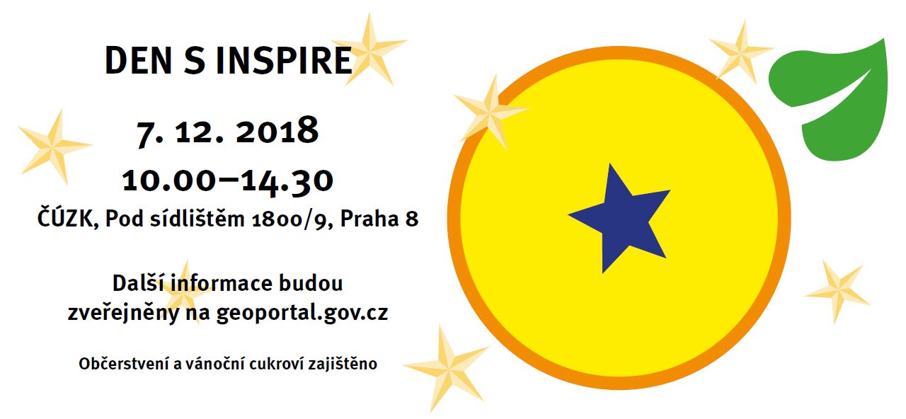
CENIA (Česká informační agentura životního prostředí) zve na akci s názvem Den s INSPIRE. Účast na akci je bezplatná, avšak je nutné zaregistrovat se na stránkách akce. Den s INSPIRE proběhne 7. prosince od 10.00 do 14.30 v budově ČÚZK (Pod Sídlištěm 1800/9, Praha 8). Předběžný program: 09:00–10:00 Registrace 10:00–12:00 Zahájení akce Stav implementace INSPIRE […]
The post Den s INSPIRE (pozvánka) appeared first on GISportal.cz.
Verze 14 – nová generace našich produktů
19.11.2018 7:38 GEPROZveřejnili jsme verzi 14 našich produktů MISYS, MISYS-WEB, KOKEŠ, a PROLAND.
Stahovat ji můžete z obvyklého umístění na našem download serveru:
Novinky v jednotlivých produktech naleznete v přehledu změn produktů:
… >>
Verze 14 – nová generace našich produktů
19.11.2018 7:38 GEPROZveřejnili jsme verzi 14 našich produktů MISYS, MISYS-WEB, KOKEŠ, a PROLAND.
Stahovat ji můžete z obvyklého umístění na našem download serveru:
Novinky v jednotlivých produktech naleznete v přehledu změn produktů:
… >>
Verze 14 – nová generace našich produktů
19.11.2018 7:38 GEPROZveřejnili jsme verzi 14 našich produktů MISYS, MISYS-WEB, KOKEŠ, a PROLAND.
Stahovat ji můžete z obvyklého umístění na našem download serveru:
Novinky v jednotlivých produktech naleznete v přehledu změn produktů:
… >>
Verze 14 – nová generace našich produktů
19.11.2018 7:38 GEPROZveřejnili jsme verzi 14 našich produktů MISYS, MISYS-WEB, KOKEŠ, a PROLAND.
Stahovat ji můžete z obvyklého umístění na našem download serveru:
Novinky v jednotlivých produktech naleznete v přehledu změn produktů:
… >>
Verze 14 – nová generace našich produktů
19.11.2018 7:38 GEPROZveřejnili jsme verzi 14 našich produktů MISYS, MISYS-WEB, KOKEŠ, a PROLAND.
Stahovat ji můžete z obvyklého umístění na našem download serveru:
Novinky v jednotlivých produktech naleznete v přehledu změn produktů:
… >>
Verze 14 – nová generace našich produktů
19.11.2018 7:38 GEPROZveřejnili jsme verzi 14 našich produktů MISYS, MISYS-WEB, KOKEŠ, a PROLAND.
Stahovat ji můžete z obvyklého umístění na našem download serveru:
Novinky v jednotlivých produktech naleznete v přehledu změn produktů:
… >>
Verze 14 – nová generace našich produktů
19.11.2018 7:38 GEPROZveřejnili jsme verzi 14 našich produktů MISYS, MISYS-WEB, KOKEŠ, a PROLAND.
Stahovat ji můžete z obvyklého umístění na našem download serveru:
Novinky v jednotlivých produktech naleznete v přehledu změn produktů:
… >>
Verze 14 – nová generace našich produktů
19.11.2018 7:38 GEPROZveřejnili jsme verzi 14 našich produktů MISYS, MISYS-WEB, KOKEŠ, a PROLAND.
Stahovat ji můžete z obvyklého umístění na našem download serveru:
Novinky v jednotlivých produktech naleznete v přehledu změn produktů:
… >>
Verze 14 – nová generace našich produktů
19.11.2018 7:38 GEPROZveřejnili jsme verzi 14 našich produktů MISYS, MISYS-WEB, KOKEŠ, a PROLAND.
Stahovat ji můžete z obvyklého umístění na našem download serveru:
Novinky v jednotlivých produktech naleznete v přehledu změn produktů:
… >>
Lokality výskytu národně významných druhů
19.11.2018 1:00 Cenia - Katalog metadat ČR - INSPIRE Lokality národně významných druhů převzaté z monitoringu ohrožených druhů, zajišťovaného Agenturou ochrany přírody a krajiny ČR; vrstva obsahuje jednoduché prvky (Singlepart Features); © AOPK ČR, 2018INSPIRE téma Rozšířené Parcely (CPX)
17.11.2018 1:00 Cenia - Katalog metadat ČR - INSPIRE Rozšíření má za cíl poskytovat katastrální mapu s obsahem podle vyhlášky ve vektorové podobě ve struktuře plně v souladu se strukturou danou směrnicí INSPIRE. Data rozšiřují směrnici INSPIRE pro téma katastrální parcely (CP) o věcná břemena, geodetické body, další prvky mapy, původní obloukovou geometrii a o parcely určené definičním bodem (ty pouze v oblastech s analogovou mapou). Vychází z katastrální mapy, která je závazným státním mapovým dílem velkého měřítka, obsahuje body polohového bodového pole, polohopis a popis a může mít formu digitální mapy, analogové mapy nebo digitalizované mapy. Publikovaná data obsahují katastrální území pro celou Českou Republiku, parcely a jejich hranice, věcná břemena, další prvky mapy a původní obloukovou geometrii z území, kde je digitální mapa (k 26. 11. 2018 je to 96,16% území České republiky, t.j. 75 840,00km2) a ve zbytku území katastrální parcely určené pouze definičním bodem (tedy bez hranic a polygonu). Katastrální parcely a hranice obsahují oproti datové sadě INSPIRE některé atributy navíc. Jedná se o typ hranice, způsob využití území, druh pozemku, vazbu na budovu a o mapové značky. Více katastrální zákon 344/1992 SB., katastrální vyhláška č.26/2007 Sb. v platném znění a INSPIRE Data Specification on Cadastral Parcels v 3.0.1. Data ve formátu GML 3.2.1 jsou validní proti schématu XML pro Rozšířené Parcely (CPX) ve verzi 4.0.INSPIRE téma Rozšířené Parcely (CPX)
17.11.2018 1:00 Cenia - Katalog metadat ČR - INSPIRE Rozšíření má za cíl poskytovat katastrální mapu s obsahem podle vyhlášky ve vektorové podobě ve struktuře plně v souladu se strukturou danou směrnicí INSPIRE. Data rozšiřují směrnici INSPIRE pro téma katastrální parcely (CP) o věcná břemena, geodetické body, další prvky mapy, původní obloukovou geometrii a o parcely určené definičním bodem (ty pouze v oblastech s analogovou mapou). Vychází z katastrální mapy, která je závazným státním mapovým dílem velkého měřítka, obsahuje body polohového bodového pole, polohopis a popis a může mít formu digitální mapy, analogové mapy nebo digitalizované mapy. Publikovaná data obsahují katastrální území pro celou Českou Republiku, parcely a jejich hranice, věcná břemena, další prvky mapy a původní obloukovou geometrii z území, kde je digitální mapa (k 26. 11. 2018 je to 96,16% území České republiky, t.j. 75 840,00km2) a ve zbytku území katastrální parcely určené pouze definičním bodem (tedy bez hranic a polygonu). Katastrální parcely a hranice obsahují oproti datové sadě INSPIRE některé atributy navíc. Jedná se o typ hranice, způsob využití území, druh pozemku, vazbu na budovu a o mapové značky. Více katastrální zákon 344/1992 SB., katastrální vyhláška č.26/2007 Sb. v platném znění a INSPIRE Data Specification on Cadastral Parcels v 3.0.1. Data ve formátu GML 3.2.1 jsou validní proti schématu XML pro Rozšířené Parcely (CPX) ve verzi 4.0.Updated Analysis from CoreLogic Shows 23,044 Homes at High or Extreme Risk Inside Wildfire Perimeters
17.11.2018 0:38 GISCafe.com Webcasts-Webinars —Reconstruction Cost Value totals more than $8 billion—IRVINE, Calif. — (BUSINESS WIRE) — November 16, 2018 —
…
Public Can Access NICB's Geospatial Intelligence Center Images of California Wildfires Damage
17.11.2018 0:38 GISCafe.com Webcasts-Webinars DES PLAINES, Ill., Nov. 16, 2018 — (PRNewswire) — Images showing the destruction left behind by the recent California wildfires …Maxar Technologies Shareholders Approve U.S. Domestication
17.11.2018 0:37 GISCafe.com Webcasts-Webinars WESTMINSTER, CO, Nov. 16, 2018 — (PRNewswire) — Maxar Technologies (NYSE:MAXR) (TSX:MAXR) ("Maxar" or the "Company"), a global …Minulý týden měl Jakub přednášku o našem mapování v Mongolsku na konferenci Mapování-GIS-Rozvoj na UPOL
16.11.2018 22:23 UpVision Minulý týden měl Jakub přednášku o našem mapování v Mongolsku na konferenci Mapování/GIS/Rozvoj, kterou pořádala Katedra rozvojových a environmentálních studií Univerzity Palackého Olomouc.Více zde:
https://plus.google.com/u/0/b/115833877689730865211/+UpvisionCz1/posts/emwCvte8VVg
ɸ-week highlights
16.11.2018 18:20 ESA Observing the Earth
As ESA’s ɸ-week draws to a close, let’s take a look at some of the ɸ-week highlights
ɸ and citizens
16.11.2018 16:00 ESA Observing the Earth
As ESA’s ɸ-week draws to a close, it’s worth remembering that the science and technology involved in observing our planet from space isn’t entirely for the preserve of experts. With a growing interest in the environment and the climate, there are plenty of opportunities for the general public to take part.