


zprávy
zdroje zpráv:Rada / odborný rada v oddělení právních vztahů k nemovitostem KP Rumburk
11.3.2024 10:07 ČÚZK - předpisy a opatření Katastrální úřad pro Ústecký kraj Katastrální pracoviště Rumburkvypisuje výběrové řízení na místo
Rada / odborný rada v oddělení právních vztahů k nemovitostem KP Rumburk
Odborný-vrchní referent - dokumentace KN KP Třebíč
11.3.2024 9:32 ČÚZK - předpisy a opatření Katastrální úřad pro Vysočinu Katastrální pracoviště Třebíčvypisuje výběrové řízení na místo
Odborný-vrchní referent - dokumentace KN KP Třebíč
Odborný-vrchní referent - dokumentace KN KP Třebíč
11.3.2024 9:32 ČÚZK - volná místa Katastrální úřad pro Vysočinu Katastrální pracoviště Třebíč vypisuje výběrové řízení na místo Odborný-vrchní referent - dokumentace KN KP TřebíčOdborný-vrchní referent - dokumentace KN KP Třebíč
11.3.2024 9:32 ČÚZK /Urady/Katastralni-urady/Katastralni-urady/Katastralni-urad-pro-Vysocinu/Uredni-deska/Oznameni-a-jina-uredni-sdeleni/Volna-mista/DMS/Odborny-vrchni-referent-dokumentace-KN-KP-TrebicProdej kovových regálů II. kolo
11.3.2024 9:18 ČÚZK - předpisy a opatřeníKatastrální úřad pro hlavní město Prahu nabízí nepotřebný majetek k odkupu. Jedná se o
Prodej kovových regálů II. kolo
Prodej kovových regálů II. kolo
11.3.2024 9:18 ČÚZK /Urady/Katastralni-urady/Katastralni-urady/Katastralni-urad-pro-hlavni-mesto-Prahu/Nabidky-majetku/Prodej-kovovych-regalu-II-koloAPGEO - Pozvánka na seminář: POZEMKOVÉ ÚPRAVY - BUDOUCNOST NAŠÍ KRAJINY
11.3.2024 1:00 Asociace podnikatelů v geomatice Seminář o pozemkových úpravách se koná ve středu 24. dubna 2024 od 9:00 v Poslanecké sněmovně.Nové prvky kuchyňských skříněk s dvířky Amber
10.3.2024 23:36 ŠPINAR - softwareVážení zákazníci,
dovolujeme si vám nabídnout novou knihovnu kuchyňských skříněk pro DAEX DESIGN 24 pro Vaše efektivní a kvalitnější navrhování.
The post Nové prvky kuchyňských skříněk s dvířky Amber appeared first on ŠPINAR – software.
Nové prvky kuchyňských skříněk s dvířky Amber
10.3.2024 23:36 ŠPINAR - software Vážení zákazníci,dovolujeme si vám nabídnout novou knihovnu kuchyňských skříněk pro DAEX DESIGN 24 pro Vaše efektivní a kvalitnější navrhování.
WSGP - Nová verze služeb 2.10 a ukončení provozu služeb verze 2.9
8.3.2024 13:53 ČÚZK - RSS kanál pro zeměměřiče WSGP - Nová verze služeb 2.10 a ukončení provozu služeb verze 2.9Vážení uživatelé webových služeb pro vyhotovitele a ověřovatele geometrických plánů,
upozorňujeme, že dne 26. 4. 2024 bude ukončen provoz webových služeb pro vyhotovitele a ověřovatele geometrických plánů verze 2.9. Od tohoto data bude v provozu pouze nová verze 2.10 webové služby pro vyhotovitele a ověřovatele geometrických plánů. Více informací naleznete na stránce Webová služba pro vyhotovitele a ověřovatele geometrických plánů (WSGP).
Za komplikace tímto způsobené se omlouváme a děkujeme za pochopení.
WSGP - Nová verze služeb 2.10 a ukončení provozu služeb verze 2.9
8.3.2024 13:53 ČÚZK - předpisy a opatření Český úřad zeměměřický a katastrální zveřejnil novou aktualitu: WSGP - Nová verze služeb 2.10 a ukončení provozu služeb verze 2.9Vážení uživatelé webových služeb pro vyhotovitele a ověřovatele geometrických plánů,
upozorňujeme, že dne 26. 4. 2024 bude ukončen provoz webových služeb pro vyhotovitele a ověřovatele geometrických plánů verze 2.9. Od tohoto data bude v provozu pouze nová verze 2.10 webové služby pro vyhotovitele a ověřovatele geometrických plánů. Více informací naleznete na stránce Webová služba pro vyhotovitele a ověřovatele geometrických plánů (WSGP).
Za komplikace tímto způsobené se omlouváme a děkujeme za pochopení.
WSGP - Nová verze služeb 2.10 a ukončení provozu služeb verze 2.9
8.3.2024 13:53 ČÚZK /Zememerictvi/Zememericke-cinnosti/Aktuality-pro-zememerice/WSGP-Nova-verze-sluzeb-2-10-a-ukonceni-provozu-sluValné zhromaždenie
8.3.2024 13:43 Komora geodetů a kartografů SRThe post Valné zhromaždenie appeared first on Komora geodetov a kartografov.
Prodej vozidla Škoda Fabia combi, RZ 4A7 0120
8.3.2024 11:56 ČÚZK - předpisy a opatřeníKatastrální úřad pro hlavní město Prahu nabízí nepotřebný majetek k odkupu. Jedná se o
Prodej vozidla Škoda Fabia combi, RZ 4A7 0120
Prodej vozidla Škoda Fabia combi, RZ 4A7 0120
8.3.2024 11:56 ČÚZK /Urady/Katastralni-urady/Katastralni-urady/Katastralni-urad-pro-hlavni-mesto-Prahu/Nabidky-majetku/Prodej-vozidla-Skoda-Fabia-Combi,-RZ-4A70120The geodetic community meets Genesis
8.3.2024 11:45 ESA Navigation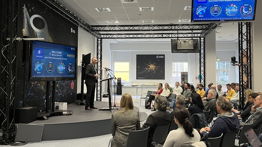
The first Genesis science workshop brought together the ESA project team and the scientific geodesy community to establish the Genesis Scientific Exploitation Team and to set the ground for future collaboration.
The geodetic community meets Genesis
8.3.2024 11:45 ESA Navigation
The first Genesis science workshop brought together the ESA project team and the scientific geodesy community to establish the Genesis Scientific Exploitation Team and to set the ground for future collaboration.
EUSPA launches new EGNOS Safety of Life Assisted Service for Maritime Users
8.3.2024 11:25 European GNSS Agency
EGNOS, Europe's regional satellite-based augmentation system (SBAS), is adding a new service to its repertoire: The EGNOS Safety of Life Assisted Service for Maritime Users (ESMAS).
“Although GNSS is the primary means of obtaining positioning, navigation and timing information while at sea, these signals must be augmented using ground-based signals like DGNSS,” explains EUSPA Executive Director Rodrigo da Costa. “Designed to complement ground-based augmented signals, ESMAS adds another layer of protection against errors while also increasing the accuracy and ensuring the integrity of the GNSS signal.”
DGNSS, short for Differential Global Navigation Satellite System, is an enhancement to GNSS that was developed to correct errors and inaccuracies in the GNSS system and thus allow for more accurate positioning information.
“ESMAS takes this one step further, providing an augmentation solution even in areas where DGNSS services are unavailable, not deployed or are out of the maritime user’s range,” adds da Costa.
Because it does not require any additional infrastructure, ESMAS is well-positioned to support navigation in ocean and coastal waters, including harbour approaches and entrances. All that is needed to utilise the service is an SBAS-enabled GNSS receiver developed according to the International Electrotechnical Commission (IEC) standards. With such a receiver onboard, a vessel can navigate with increased accuracy and can receive alerts signalling errors on GNSS with the objective to avoid unsafe situation. Furthermore, EGNOS interfaces NAVAREA coordinators, to timely provide Maritime Safety Information (MSI) - the navigational warnings and other urgent safety related messages - that could be broadcast to the ships using conventional channels.
Although the service targets merchant vessels, the ESMAS signal is available free of charge to all SOLAS-conforming vessels from EU Member States, Iceland, Norway and Switzerland.
The ESMAS offers a service tailored to maritime users to enable marine navigation in harbour entrances, harbour approaches and coastal waters of the European Union Member States and EGNOS contributing countries (Iceland, Norway and Switzerland) in line with the IMO Resolution A.1046.
Expanding the EGNOS service portfolio
Used to improve the performance of global navigation satellite systems like Galileo and GPS, EGNOS provides several navigation services to the aviation, maritime, rail, surveying and agriculture sectors, along with a range of land-based users.
The new ESMAS is in addition to the already available EGNOS Open Service, which is used by mass-market receivers and common user applications; the EGNOS Data Access Service (EDAS), which offers ground-based access to EGNOS data through the internet; and the Safety of Life Service (SoL), which is used for safety-critical aviation applications that require enhanced, guaranteed performance and an integrity warning system.
Unlike these other EGNOS services, which are delivered by ESSP under a contract with EUSPA, ESMAS will be delivered directly by EUSPA.
An ESMAS webpage, contains real-time service performance, and information about the service’s historical performance, along with all relevant documentation (e.g., SDD, Service Notices, etc.). Users can also pose questions related to the service via the site’s helpdesk. For urgent issues, a 24/7 hotline is available.
Media note: This feature can be republished without charge provided the European Union Agency for the Space Programme (EUSPA) is acknowledged as the source at the top or the bottom of the story. You must request permission before you use any of the photographs on the site. If you republish, we would be grateful if you could link back to the EUSPA website (http://www.euspa.europa.eu).
Earth from Space: Ireland
8.3.2024 10:00 ESA Observing the Earth Image:
The lush landscape of the island of Ireland and the coasts of Scotland, Wales and England, are pictured in this view from the Copernicus Sentinel-3 mission.
Image:
The lush landscape of the island of Ireland and the coasts of Scotland, Wales and England, are pictured in this view from the Copernicus Sentinel-3 mission.
WORKSHOP PRE MLADÝCH PROFESIONÁLOV
7.3.2024 16:00 Komora geodetů a kartografů SRThe post WORKSHOP PRE MLADÝCH PROFESIONÁLOV appeared first on Komora geodetov a kartografov.
New radar mission for Europe
7.3.2024 16:00 ESA Observing the Earth Video:
00:09:27
Video:
00:09:27
The upcoming Copernicus Radar Observation System for Europe in L-band (ROSE-L) will provide continuous day-and-night all-weather monitoring of Earth’s land, oceans and ice, and offer frequent observations of Earth’s surface at a high spatial resolution.
ROSE-L will carry an active phased array synthetic aperture radar instrument. The radar antenna will be the largest deployable planar antenna ever built measuring an impressive 40 sq m.
ROSE-L will deliver many benefits including essential information on forests and land cover, leading to improved monitoring of the terrestrial carbon cycle and carbon accounting.
The mission will also greatly extend our ability to monitor minute surface displacements and helping detect geohazards. It will automatically map surface soil moisture conditions over land helping improve hydrology and weather forecasts, and support the operational monitoring of sea and land ice across the Arctic.
ROSE-L is one of six Copernicus Sentinel Expansion missions that ESA is developing on behalf of the EU. The missions will expand the current capabilities of the Copernicus Space Component – the world’s biggest supplier of Earth observation data.
This video features interviews with Malcolm Davidson, ROSE-L Mission Scientist, Nico Gebert, ROSE-L Payload Manager and Gianluigi Di Cosimo, ROSE-L Project Manager.
Corpis Maps výrazně zvýšil efektivitu práce nejen technicko-obchodnímu týmu
7.3.2024 12:27 T-MAPYThe post Corpis Maps výrazně zvýšil efektivitu práce nejen technicko-obchodnímu týmu appeared first on T-MAPY spol. s r.o..
EarthCARE bids adieu to Europe
7.3.2024 12:00 ESA Observing the Earth Video:
00:03:29
Video:
00:03:29
After years of development and a rigorous testing programme, ESA’s EarthCARE satellite has left Munich, Germany, and is now on its away to SpaceX’s launch site in Vandenberg, California. Once it arrives, it will be put into storage for a few weeks until it is time to ready the satellite for liftoff – which is scheduled to launch in May on a Falcon 9 rocket.
The Earth Cloud Aerosol and Radiation Explorer, or EarthCARE for short, is the most complex Earth Explorer mission to date. The new satellite will look at the role that clouds and aerosols play in heating and cooling Earth’s atmosphere – contributing to our understanding of climate change.
With its unique set of four instruments, EarthCARE will examine the role clouds and aerosols play in reflecting solar radiation back into space and also in trapping infrared radiation emitted from Earth’s surface.
EarthCARE is a joint venture between ESA and JAXA, the Japan Aerospace Exploration Agency.
This video features interviews with Simonetta Cheli, Director of Earth Observation Programmes at ESA, Thorsten Fehr, ESA’s EarthCARE Mission Scientist, Dirk Bernaerts, ESA’s EarthCARE Project Manager and Eiichi Tomita, JAXA’s EarthCARE/CPR Project Manager.
EarthCARE bids adieu to Europe
7.3.2024 12:00 ESA Observing the Earth
Video:
00:03:29
After years of development and a rigorous testing programme, ESA’s EarthCARE satellite has left Munich, Germany, and is now on its away to SpaceX’s launch site in Vandenberg, California. Once it arrives, it will be put into storage for a few weeks until it is time to ready the satellite for liftoff – which is scheduled to launch in May on a Falcon 9 rocket.
The Earth Cloud Aerosol and Radiation Explorer, or EarthCARE for short, is the most complex Earth Explorer mission to date. The new satellite will look at the role that clouds and aerosols play in heating and cooling Earth’s atmosphere – contributing to our understanding of climate change.
With its unique set of four instruments, EarthCARE will examine the role clouds and aerosols play in reflecting solar radiation back into space and also in trapping infrared radiation emitted from Earth’s surface.
EarthCARE is a joint venture between ESA and JAXA, the Japan Aerospace Exploration Agency.
This video features interviews with Simonetta Cheli, Director of Earth Observation Programmes at ESA, Thorsten Fehr, ESA’s EarthCARE Mission Scientist, Dirk Bernaerts, ESA’s EarthCARE Project Manager and Eiichi Tomita, JAXA’s EarthCARE/CPR Project Manager.
Access the related broadcast quality video material through the links below
https://www.esa.int/esatv/Videos/2023/10/EarthCARE_animations
https://www.esa.int/esatv/Videos/2024/01/EarthCARE_interviews
https://www.esa.int/esatv/Videos/2022/07/Earthcare_Satellite_B-Rolls
20240307-Výroční zpráva
7.3.2024 11:55 ČÚZK - předpisy a opatření Český úřad zeměměřický a katastrální zveřejnil novou aktualitu: Zveřejněna Výroční zpráva Českého úřadu zeměměřického a katastrálního za rok 2023.20240307-Výroční zpráva
7.3.2024 11:55 ČÚZK - aktuality v resortu Zveřejněna Výroční zpráva Českého úřadu zeměměřického a katastrálního za rok 2023.Aliance pořádala s CzechTrade český stánek na Korea Drone Show 2024
7.3.2024 11:19 UAVA Aliance, s podporou CzechInvest a CzechTrade v Koreji zařídila český stánek na #Drone #Show #Korea 2024 v Busanu, které se účastní 5 českých firem. Prohlubujeme dlouhodobě aktivně spolupráci s korejským drone industry a navazujeme na loňskou Czechia-Korea drone roadshow a účast prezidenta Aliance na Korea Drone UAM Expo 2023. V rámci akce a českého stánku […]Aliance pořádala s CzechTrade český stánek na Korea Drone Show 2024
7.3.2024 11:19 UAVA Aliance, s podporou CzechInvest a CzechTrade v Koreji zařídila český stánek na #Drone #Show #Korea 2024 v Busanu, které se účastní 5 českých firem. Prohlubujeme dlouhodobě aktivně spolupráci s korejským drone industry a navazujeme na loňskou Czechia-Korea drone roadshow a účast prezidenta Aliance na Korea Drone UAM Expo 2023. V rámci akce a českého stánku […]odborný rada – ředitel/ka odboru geodetických informací KN
6.3.2024 17:28 ČÚZK - předpisy a opatření Katastrální úřad pro hlavní město Prahu zveřejnil novou aktualitu: Ředitelka úřadu vyhlašuje výběrové řízení na pozici:odborný rada – ředitel/ka odboru geodetických informací KN
odborný rada – ředitel/ka odboru geodetických informací KN
6.3.2024 17:28 ČÚZK /Urady/Katastralni-urady/Katastralni-urady/Katastralni-urad-pro-hlavni-mesto-Prahu/O-uradu/Aktuality/odborny-rada-–-reditel-ka-odboru-geodetickych-infoodborný rada – ředitel/ka odboru geodetických informací KN
6.3.2024 17:26 ČÚZK /Urady/Katastralni-urady/Katastralni-urady/Katastralni-urad-pro-hlavni-mesto-Prahu/Uredni-deska/Oznameni-a-jina-uredni-sdeleni/Volna-mista/odborny-rada-–-reditel-ka-odboru-geodetickych-infoodborný rada – ředitel/ka odboru geodetických informací KN
6.3.2024 17:26 ČÚZK - předpisy a opatření Katastrální úřad pro hlavní město Prahuvypisuje výběrové řízení na místo
odborný rada – ředitel/ka odboru geodetických informací KN
odborný rada – ředitel/ka odboru geodetických informací KN
6.3.2024 17:26 ČÚZK - volná místa Katastrální úřad pro hlavní město Prahu vypisuje výběrové řízení na místo odborný rada – ředitel/ka odboru geodetických informací KNStatistické okénko [Knihovna geografie, byTopic]
6.3.2024 14:50 Katedra aplikované geoinformatiky a kartografie Přf UK V předešlém roce se Knihovně geografie podařilo rozšířit svou sbírku kartografických dokumentů.rada/odborný rada – obnova katastrálního operátu v oddělení obnovy katastrálního operátu (3030) na K
6.3.2024 14:21 ČÚZK /Urady/Katastralni-urady/Katastralni-urady/Katastralni-urad-pro-Jihocesky-kraj/Uredni-deska/Oznameni-a-jina-uredni-sdeleni/Volna-mista/DMS/rada-odborny-rada-–-obnova-katastralniho-operatu-vrada/odborný rada – obnova katastrálního operátu v oddělení obnovy katastrálního operátu (3030) na K
6.3.2024 14:21 ČÚZK - volná místa Katastrální úřad pro Jihočeský kraj odbor obnovy katastrálního operátu vypisuje výběrové řízení na místo rada/odborný rada – obnova katastrálního operátu v oddělení obnovy katastrálního operátu (3030) na Krada/odborný rada – obnova katastrálního operátu v oddělení obnovy katastrálního operátu (3030) na K
6.3.2024 14:21 ČÚZK - předpisy a opatření Katastrální úřad pro Jihočeský kraj odbor obnovy katastrálního operátuvypisuje výběrové řízení na místo
rada/odborný rada – obnova katastrálního operátu v oddělení obnovy katastrálního operátu (3030) na KÚ pro Jihočeský kraj
The Information Delivery Specification (IDS) Final Standard is now out for review by the Standards Committee.
6.3.2024 14:10 buildingSMART.orgVote closing date: 30 May 2024Report: Link The Information Delivery Specification (IDS) Final Standard has been issued to the Standards Committee for their review and feedback. The vote closes 30th…
The post The Information Delivery Specification (IDS) Final Standard is now out for review by the Standards Committee. appeared first on buildingSMART International.
odborný/vrchní referent – obnova katastrálního operátu v oddělení obnovy katastrálního operátu (3030
6.3.2024 14:09 ČÚZK - předpisy a opatření Katastrální úřad pro Jihočeský kraj odbor obnovy katastrálního operátuvypisuje výběrové řízení na místo
odborný/vrchní referent – obnova katastrálního operátu v oddělení obnovy katastrálního operátu (3030) na KÚ pro Jihočeský kraj
Výroční souhrnná resortní zpráva za rok 2023
6.3.2024 13:25 ČÚZK - předpisy a opatření Český úřad zeměměřický a katastrálnívydává výroční zprávu úřadu za rok
2023
Empower your EU Space journey with the enhanced EU Space Academy Learning Platform
5.3.2024 17:36 European GNSS Agency
Following successful sessions gathering over 600 registered users, the EU Space Academy Learning Platform is back – and it’s better than ever.
The free online training programme will continue to provide entrepreneurs, start-ups and SMEs with the tools and skills they need to build ground-breaking new apps and disruptive business solutions using the power of the EU Space Programme.
But now this training comes with even more EU Space!
The revamped EU Space Academy Learning Platform covers the entire EU Space Programme, including EGNOS, Galileo, Copernicus, GOVSATCOM and Space Situational Awareness (SSA). We’ve also refreshed all our course materials and even added an entirely new course on EU Space for Security.
Participants can now choose from 12 learning modules and 44 lessons. They are designed to serve as building blocks for turning your innovative idea into a successful space business. These not only cover such hot topics as enabling technologies, New Space and cybersecurity, they also cover the technical components of the EU Space Programme and such ‘nuts and bolts’ business skills as:
- Customer support and sales
- Building a successful team
- Resource allocation
- Business plans and models
- Access to finance and funding
- Investment readiness
- Intellectual Property, copyrights and data policy
You can pick and choose which modules to follow and tailor your training to your own unique learning needs. All modules can be accessed online by using your own device – meaning you can complete them when and where you want. An online mobile app is currently being developed and should be available soon. The modules are taught by top academics, industry leaders and EUSPA experts, all of whom bring real-world experience to your learning journey.
In addition to the training modules, the EU Space Academy Learning Platform also comes with ample opportunities for Q&A, one-on-one sessions, additional workshops, networking and matchmaking, personalised follow-ups and mentoring. Once you finish the training, you’ll receive an official certificate of completion from EUSPA.
Ready to get started? Then head over here to enrol in the all-new EU Space Academy Learning Platform!
Media note: This feature can be republished without charge provided the European Union Agency for the Space Programme (EUSPA) is acknowledged as the source at the top or the bottom of the story. You must request permission before you use any of the photographs on the site. If you republish, we would be grateful if you could link back to the EUSPA website (http://www.euspa.europa.eu).
Empower your EU Space journey with the enhanced EU Space Academy Learning Platform
5.3.2024 17:36 European GNSS AgencyFollowing successful sessions gathering over 1100 registered users, the EU Space Academy Learning Platform is back – and it’s better than ever.
The free online training programme will continue to provide entrepreneurs, start-ups and SMEs with the tools and skills they need to build ground-breaking new apps and disruptive business solutions using the power of the EU Space Programme.
But now this training comes with even more EU Space!
The revamped EU Space Academy Learning Platform covers the entire EU Space Programme, including EGNOS, Galileo, Copernicus, GOVSATCOM and Space Situational Awareness (SSA). We’ve also refreshed all our course materials and even added an entirely new course on EU Space for Security.
Participants can now choose from 12 learning modules and 44 lessons. They are designed to serve as building blocks for turning your innovative idea into a successful space business. These not only cover such hot topics as enabling technologies, New Space and cybersecurity, they also cover the technical components of the EU Space Programme and such ‘nuts and bolts’ business skills as:
- Customer support and sales
- Building a successful team
- Resource allocation
- Business plans and models
- Access to finance and funding
- Investment readiness
- Intellectual Property, copyrights and data policy
You can pick and choose which modules to follow and tailor your training to your own unique learning needs. All modules can be accessed online by using your own device – meaning you can complete them when and where you want. An online mobile app is currently being developed and should be available soon. The modules are taught by top academics, industry leaders and EUSPA experts, all of whom bring real-world experience to your learning journey.
In addition to the training modules, the EU Space Academy Learning Platform also comes with ample opportunities for Q&A, one-on-one sessions, additional workshops, networking and matchmaking, personalised follow-ups and mentoring. Once you finish the training, you’ll receive an official certificate of completion from EUSPA.
Ready to get started? Then head over here to enrol in the all-new EU Space Academy Learning Platform!
Media note: This feature can be republished without charge provided the European Union Agency for the Space Programme (EUSPA) is acknowledged as the source at the top or the bottom of the story. You must request permission before you use any of the photographs on the site. If you republish, we would be grateful if you could link back to the EUSPA website (http://www.euspa.europa.eu).
20240306 - volné místo - Rada/odb.rada v OMaK kanceláře ředitele KÚ na Katastrálním úřadu pro ÚK
5.3.2024 14:48 ČÚZK /Urady/Katastralni-urady/Katastralni-urady/Katastralni-urad-pro-Ustecky-kraj/O-uradu/Aktuality/20240306-volne-misto-Rada-odb-rada-v-OMaK-kancelar20240306 - volné místo - Rada/odb.rada v OMaK kanceláře ředitele KÚ na Katastrálním úřadu pro ÚK
5.3.2024 14:48 ČÚZK - předpisy a opatření Katastrální úřad pro Ústecký kraj zveřejnil novou aktualitu: Nabídka volného místa - Rada / odborný rada v oddělení metodiky a kontroly kanceláře ředitele katastrálního úřadu na Katastrálním úřadu pro Ústecký kraj20240306 - volné místo - Vrchní referent/rada v OPV KP Ústí n.L. na Katastrálním úřadu pro Úst.kraj
5.3.2024 14:30 ČÚZK - předpisy a opatření Katastrální úřad pro Ústecký kraj - Katastrální pracoviště Ústí nad Labem zveřejnil novou aktualitu: Nabídka volného místa - Vrchní referent / rada v oddělení právních vztahů k nemovitostem Katastrálního pracoviště Ústí nad Labem na Katastrálním úřadu pro Ústecký kraj20240306 - volné místo - Vrchní referent/rada v OPV KP Ústí n.L. na Katastrálním úřadu pro Úst.kraj
5.3.2024 14:30 ČÚZK /Urady/Katastralni-urady/Katastralni-urady/Katastralni-urad-pro-Ustecky-kraj/Katastralni-pracoviste/KP-Usti-nad-Labem/O-uradu/Aktuality/20240306-volne-misto-Vrchni-referent-rada-v-OPV-KP20240306 - volné místo - Vrchní referent/rada v OPV KP Ústí n.L. na Katastrálním úřadu pro Úst.kraj
5.3.2024 14:29 ČÚZK - předpisy a opatření Katastrální úřad pro Ústecký kraj - Katastrální pracoviště Ústí nad Labem zveřejnil novou aktualitu: Nabídka volného místa - Vrchní referent / rada v oddělení právních vztahů k nemovitostem Katastrálního pracoviště Ústí nad Labem na Katastrálním úřadu pro Ústecký kraj20240306 - volné místo - Vrchní referent/rada v OPV KP Ústí n.L. na Katastrálním úřadu pro Úst.kraj
5.3.2024 14:29 ČÚZK /Urady/Katastralni-urady/Katastralni-urady/Katastralni-urad-pro-Ustecky-kraj/O-uradu/Aktuality/20240306-volne-misto-Vrchni-referent-rada-v-OPV-KPVrchní referent / rada v oddělení právních vztahů k nemovitostem Katastrálního pracoviště Ústí nad L
5.3.2024 14:24 ČÚZK - předpisy a opatření Katastrální úřad pro Ústecký kraj Katastrální pracoviště Ústí nad Labemvypisuje výběrové řízení na místo
Vrchní referent / rada v oddělení právních vztahů k nemovitostem Katastrálního pracoviště Ústí nad Labem na Katastrálním úřadu pro Ústecký kraj
Vrchní referent / rada v oddělení právních vztahů k nemovitostem Katastrálního pracoviště Ústí nad L
5.3.2024 14:24 ČÚZK /Urady/Katastralni-urady/Katastralni-urady/Katastralni-urad-pro-Ustecky-kraj/Uredni-deska/Oznameni-a-jina-uredni-sdeleni/Volna-mista/DMS/Vrchni-referent-rada-v-oddeleni-pravnich-vztahu-k-Vrchní referent / rada v oddělení právních vztahů k nemovitostem Katastrálního pracoviště Ústí nad L
5.3.2024 14:24 ČÚZK - volná místa Katastrální úřad pro Ústecký kraj Katastrální pracoviště Ústí nad Labem vypisuje výběrové řízení na místo Vrchní referent / rada v oddělení právních vztahů k nemovitostem Katastrálního pracoviště Ústí nad L
Nové úpravy v elektronických výstupoch z Portálu ESKN
5.3.2024 13:50
ÚGKK SR
Upozorňujeme klientov využívajúcich služby Portálu ESKN, že v záujme skvalitňovania služieb Úrad geodézie kartografie a katastra SR upravil výstupy výpis z listu vlastníctva. Úprava spočíva v zmene vzhľadu listu vlastníctva zmenou jeho formátu, konkrétne zhustenie textu bez zmeny obsahu. Úprava sa vykonala z dôvodu zníženia nákladov na tlač tak, aby zostali zachované všetky údaje, ktoré sa zobrazujú na liste vlastníctva.
#PortálESKN #od:06.03.2024@00:01#do:31.05.2024@23:59
Včera jsme se aktivně účastnili workshopu na CzechInvest k plánovaným akcím s českou účastí v letectví v Japonsku
5.3.2024 13:15 UAVA Včera jsme se aktivně účastnili workshopu na CzechInvest k letos plánovaným akcím s českou účastí v letectví v Japonsku, především Japan International Aerospace 2024, za účasti velvyslance Japonska a diskutovali potenciál v oblasti dronů na těchto akcích, především na základě zkušenosti českého stánku na Japan Drones 2023. #drony #letectví #inovace #CR #Japonsko #spolupraceVčera jsme se aktivně účastnili workshopu na CzechInvest k plánovaným akcím s českou účastí v letectví v Japonsku
5.3.2024 13:15 UAVA Včera jsme se aktivně účastnili workshopu na CzechInvest k letos plánovaným akcím s českou účastí v letectví v Japonsku, především Japan International Aerospace 2024, za účasti velvyslance Japonska a diskutovali potenciál v oblasti dronů na těchto akcích, především na základě zkušenosti českého stánku na Japan Drones 2023. #drony #letectví #inovace #CR #Japonsko #spolupraceFIG – pozvánka na medzinárodný deň geodetov
5.3.2024 12:29 Komora geodetů a kartografů SRThe post FIG – pozvánka na medzinárodný deň geodetov appeared first on Komora geodetov a kartografov.
Mosprema konference
5.3.2024 10:29 Katedra geoinformatiky UP OlomoucDovolujeme si pozvat všechny zájemce o problematiku kalamitních stavů komárů na závěrečnou konferenci projektu MOSPREMA. Konference se uskuteční 23. dubna 2024 od 10:00 v Příkazech. V rámci konference bude představen inovativní přístup zaměřený na management oblastí s výskytem kalamitních stavů komárů. Na konferenci budeme sdílet zkušenosti, představovat nové technologie a diskutovat o klíčových tématech, jako […]
The post Mosprema konference first appeared on Katedra geoinformatiky.
EUSPA Industry Day: Provision of support services to EUSPA and the European Commission
5.3.2024 9:27 European GNSS Agency
The European Union Agency for the Space Programme (EUSPA) plays a pivotal role in implementing the EU Space Programme. EUSPA requires therefore robust support services to effectively execute its responsibilities and mission.
Furthermore, as co-contracting authorities, EUSPA and the European Commission are jointly committed to leveraging these support services to drive innovation, enhance security, and promote the sustainable development of space-related initiatives within the European Union.
The total estimated value of the procedure, excluding VAT, is 297,418,000.00 EUR.
The time limit for receipt of tenders has been set out for Thursday, 25 April 2024 at 23:59 (Prague time)
The tender documents are available here
Precisely, the procedure is split into five distinctive lots, as follows, covering EUSPA’s and EC’s needs transversally, as well as covering all sites, EU space components and corporate activities:
Lot 1 – Mission, Services Engineering and Uptake Support;
Lot 2 – Ground and Space Segments Engineering Support;
Lot 3 – Security- Cyber and Risk Analysis Support;
Lot 4 – Project Management & Quality Support;
Lot 5 – Operations and Service Provision and Management Support.
The objective is to conclude two Multiple Framework Contracts per each lot in cascade. All lots are envisaged as interinstitutional contracts whereby EUSPA and EC will be co-contracting authorities.
The tasks are meant to support contracting authorities in fulfilling their respective roles in the implementation of the EU Space Programme Components and for the execution of future tasks that may be entrusted in relation to other EU Space Programmes, such as the IRIS2.
To ensure broad participation in the call, a dedicated webinar on the call will be held on Friday, 15 March 2024 from 09:30 to 12:00 (Prague local time). This informative webinar aims to provide clarity, address questions, and encourage engagement from all interested parties. The participation is encouraged to ensure a transparent and inclusive process.
You can participate by following this link.
Media note: This feature can be republished without charge provided the European Union Agency for the Space Programme (EUSPA) is acknowledged as the source at the top or the bottom of the story. You must request permission before you use any of the photographs on the site. If you republish, we would be grateful if you could link back to the EUSPA website (http://www.euspa.europa.eu).
odborný referent/vrchní referent v personálním oddělení Kanceláře ředitele
5.3.2024 9:01 ČÚZK - předpisy a opatření Katastrální úřad pro Vysočinu zveřejnil novou aktualitu: Oznámení o vyhlášení výběrového řízení na služební místo odborný referent/vrchní referent v personálním oddělení Kanceláře ředitele katastrálního úřadu na Katastrálním úřadu pro Vysočinu, místo výkonu služby Jihlava.odborný referent/vrchní referent v personálním oddělení Kanceláře ředitele
5.3.2024 9:01 ČÚZK /Urady/Katastralni-urady/Katastralni-urady/Katastralni-urad-pro-Vysocinu/O-uradu/Aktuality/odborny-referent-vrchni-referent-v-personalnim-odd20240305_Odborný / vrchní referent personálního oddělení KÚ SČK
5.3.2024 8:34 ČÚZK /Urady/Katastralni-urady/Katastralni-urady/Katastralni-urad-pro-Stredocesky-kraj/O-uradu/Aktuality/20210922_Odborny-referent-oddeleni-aktualizac-(6)20240305_Odborný / vrchní referent personálního oddělení KÚ SČK
5.3.2024 8:34 ČÚZK - předpisy a opatření Katastrální úřad pro Středočeský kraj Vyhlášení výběrového řízení: Odborný / vrchní referent personálního oddělení KÚ SČK V části "Úřední deska", v sekci "Oznámení a jiná úřední sdělení" bylo vystaveno "Oznámení o vyhlášení výběrového řízení na obsazení služebního místa Odborný / vrchní referent personálního oddělení KÚ SČK"Odborný / vrchní referent personálního oddělení Kanceláře ředitele
5.3.2024 8:33 ČÚZK - předpisy a opatření Katastrální úřad pro Středočeský kraj kancelář úřaduvypisuje výběrové řízení na místo
Odborný / vrchní referent personálního oddělení Kanceláře ředitele
Odborný / vrchní referent personálního oddělení Kanceláře ředitele
5.3.2024 8:33 ČÚZK /Urady/Katastralni-urady/Katastralni-urady/Katastralni-urad-pro-Stredocesky-kraj/Uredni-deska/Oznameni-a-jina-uredni-sdeleni/Volna-mista/DMS/Odborny-vrchni-referent-personalniho-oddeleni-KancOdborný / vrchní referent personálního oddělení Kanceláře ředitele
5.3.2024 8:33 ČÚZK - volná místa Katastrální úřad pro Středočeský kraj kancelář úřadu vypisuje výběrové řízení na místo Odborný / vrchní referent personálního oddělení Kanceláře řediteleodborný referent / vrchní referent – obnova katastrálního operátu
5.3.2024 8:32 ČÚZK - volná místa Katastrální úřad pro Olomoucký kraj Katastrální pracoviště Prostějov vypisuje výběrové řízení na místo odborný referent / vrchní referent – obnova katastrálního operátuodborný referent / vrchní referent – obnova katastrálního operátu
5.3.2024 8:32 ČÚZK /Urady/Katastralni-urady/Katastralni-urady/Katastralni-urad-pro-Olomoucky-kraj/Uredni-deska/Oznameni-a-jina-uredni-sdeleni/Volna-mista/DMS/odborny-referent-vrchni-referent-–-obnova-katastraodborný referent / vrchní referent – obnova katastrálního operátu
5.3.2024 8:32 ČÚZK - předpisy a opatření Katastrální úřad pro Olomoucký kraj Katastrální pracoviště Prostějovvypisuje výběrové řízení na místo
odborný referent / vrchní referent – obnova katastrálního operátu
odborný referent-vrchní referent -personální oddělení Kanceláře ředitele KÚ
5.3.2024 7:59 ČÚZK /Urady/Katastralni-urady/Katastralni-urady/Katastralni-urad-pro-Vysocinu/Uredni-deska/Oznameni-a-jina-uredni-sdeleni/Volna-mista/DMS/odborny-referent-vrchni-referent-personalni-oddeleodborný referent-vrchní referent -personální oddělení Kanceláře ředitele KÚ
5.3.2024 7:59 ČÚZK - volná místa Katastrální úřad pro Vysočinu kancelář ředitele vypisuje výběrové řízení na místo odborný referent-vrchní referent -personální oddělení Kanceláře ředitele KÚodborný referent-vrchní referent -personální oddělení Kanceláře ředitele KÚ
5.3.2024 7:59 ČÚZK - předpisy a opatření Katastrální úřad pro Vysočinu kancelář ředitelevypisuje výběrové řízení na místo
odborný referent-vrchní referent -personální oddělení Kanceláře ředitele KÚ
20240304 - volné místo - Odborný / vrchní referent v OOKO II v TO
4.3.2024 14:25 ČÚZK - předpisy a opatření Český úřad zeměměřický a katastrální zveřejnil novou aktualitu: Nabídka volného místa - Odborný vrchní referent v oddělení obnovy katastrálního operátu II v technickém oddělení20240304 - volné místo - Odborný / vrchní referent v OOKO II v TO
4.3.2024 14:25 ČÚZK - předpisy a opatření Katastrální úřad pro Ústecký kraj zveřejnil novou aktualitu: Nabídka volného místa - Odborný vrchní referent v oddělení obnovy katastrálního operátu II v technickém odboru20240304 - volné místo - Odborný / vrchní referent v OOKO II v TO
4.3.2024 14:25 ČÚZK /Urady/Katastralni-urady/Katastralni-urady/Katastralni-urad-pro-Ustecky-kraj/O-uradu/Aktuality/20240304-volne-misto-Odborny-vrchni-referent-v-(1)Odborný / vrchní referent v oddělení obnovy katastrálního operátu II v TO
4.3.2024 14:17 ČÚZK - předpisy a opatření Katastrální úřad pro Ústecký kraj technický odborvypisuje výběrové řízení na místo
Odborný / vrchní referent v oddělení obnovy katastrálního operátu II v TO
Odborný / vrchní referent v oddělení obnovy katastrálního operátu II v TO
4.3.2024 14:17 ČÚZK - volná místa Katastrální úřad pro Ústecký kraj technický odbor vypisuje výběrové řízení na místo Odborný / vrchní referent v oddělení obnovy katastrálního operátu II v TOOdborný / vrchní referent v oddělení obnovy katastrálního operátu II v TO
4.3.2024 14:17 ČÚZK /Urady/Katastralni-urady/Katastralni-urady/Katastralni-urad-pro-Ustecky-kraj/Uredni-deska/Oznameni-a-jina-uredni-sdeleni/Volna-mista/DMS/Odborny-vrchni-referent-v-oddeleni-obnovy-katastra20240304 - volné místo - Odborný / vrchní referent v OOKO I v TO
4.3.2024 14:09 ČÚZK /Urady/Katastralni-urady/Katastralni-urady/Katastralni-urad-pro-Ustecky-kraj/O-uradu/Aktuality/20240304-volne-misto-Odborny-vrchni-referent-v-OOK20240304 - volné místo - Odborný / vrchní referent v OOKO II v TO
4.3.2024 14:09 ČÚZK - předpisy a opatření Katastrální úřad pro Ústecký kraj zveřejnil novou aktualitu: Nabídka volného místa - Odborný / vrchní referent v oddělení obnovy katastrálního operátu I v technickém odboru20240304 - volné místo - Odborný / vrchní referent v OOKO I v TO
4.3.2024 14:09 ČÚZK - předpisy a opatření Katastrální úřad pro Ústecký kraj zveřejnil novou aktualitu: Nabídka volného místa - Odborný / vrchní referent v oddělení obnovy katastrálního operátu I v technickém odboru20240304 - volné místo - Odborný / vrchní referent v OOKO II v TO
4.3.2024 14:09 ČÚZK /Urady/Katastralni-urady/Katastralni-urady/Katastralni-urad-pro-Ustecky-kraj/O-uradu/Aktuality/20240304-volne-misto-Odborny-vrchni-referent-v-OOK20240304 - volné místo - Odborný / vrchní referent v OOKO II v TO
4.3.2024 14:09 ČÚZK - předpisy a opatření Český úřad zeměměřický a katastrální zveřejnil novou aktualitu: Nabídka volného místa - Odborný / vrchní referent v oddělení obnovy katastrálního operátu I v technickém odděleníOdborný / vrchní referent v oddělení obnovy katastrálního operátu I v TO
4.3.2024 14:05 ČÚZK /Urady/Katastralni-urady/Katastralni-urady/Katastralni-urad-pro-Ustecky-kraj/Uredni-deska/Oznameni-a-jina-uredni-sdeleni/Volna-mista/DMS/Odborny-vrchni-referent-v-oddeleni-katastralniho-oOdborný / vrchní referent v oddělení obnovy katastrálního operátu I v TO
4.3.2024 14:05 ČÚZK - volná místa Katastrální úřad pro Ústecký kraj vypisuje výběrové řízení na místo Odborný / vrchní referent v oddělení obnovy katastrálního operátu I v TOOdborný / vrchní referent v oddělení obnovy katastrálního operátu I v TO
4.3.2024 14:05 ČÚZK - předpisy a opatření Katastrální úřad pro Ústecký krajvypisuje výběrové řízení na místo
Odborný / vrchní referent v oddělení obnovy katastrálního operátu I v TO
Obsazení místa rozpočtář
4.3.2024 13:33 ČÚZK - předpisy a opatření Katastrální úřad pro Plzeňský kraj zveřejnil novou aktualitu: Katastrální úřad pro Plzeňský kraj oznamuje, že obsazuje pracovní místo: rozpočtář.Pracovní místo je obsazováno na dobu neurčitou v režimu pracovního poměru.
Místem výkonu práce je Plzeň.
Předpokládaný nástup: 1. května 2024 nebo dohodou.
Pracovní doba 40 hod/ týdně - možnost zkráceného úvazku.
Pracovní místo je zařazeno do 10. platové třídy.
Obsazení místa rozpočtář
4.3.2024 13:33 ČÚZK /Urady/Katastralni-urady/Katastralni-urady/Katastralni-urad-pro-Plzensky-kraj/O-uradu/Aktuality/Obsazeni-mista-rozpoctarKÚ pro Plzeňský kraj obsazuje pracovní místo: rozpočtář.
4.3.2024 13:30 ČÚZK - volná místa Katastrální úřad pro Plzeňský kraj vypisuje výběrové řízení na místo KÚ pro Plzeňský kraj obsazuje pracovní místo: rozpočtář.KÚ pro Plzeňský kraj obsazuje pracovní místo: rozpočtář.
4.3.2024 13:30 ČÚZK - předpisy a opatření Katastrální úřad pro Plzeňský krajvypisuje výběrové řízení na místo
KÚ pro Plzeňský kraj obsazuje pracovní místo: rozpočtář.
KÚ pro Plzeňský kraj obsazuje pracovní místo: rozpočtář.
4.3.2024 13:30 ČÚZK /Urady/Katastralni-urady/Katastralni-urady/Katastralni-urad-pro-Plzensky-kraj/Volna-mista/DMS/KU-pro-Plzensky-kraj-obsazuje-pracovni-misto-rozpoAliance pořádala s Úřadem pro civilní letectví webinář k novému Oprávnění k letu v Otevřené kategorii
4.3.2024 11:11 UAVA Aliance pořádala s Úřadem pro civilní letectví webinář k novému Oprávnění k letu v Otevřené kategorii, které je možné využívat pro provoz dronů od začátku letošního roku 2024. Tento webinář ukazuje prakticky jak o takové oprávnění žádat a jaký je rozdíl mezi Oprávněním k letu v Otevřené kategorii a Oprávněním k provozu ve Specifické kategorii. […]Aliance pořádala s Úřadem pro civilní letectví webinář k novému Oprávnění k letu v Otevřené kategorii
4.3.2024 11:11 UAVA Aliance pořádala s Úřadem pro civilní letectví webinář k novému Oprávnění k letu v Otevřené kategorii, které je možné využívat pro provoz dronů od začátku letošního roku 2024. Tento webinář ukazuje prakticky jak o takové oprávnění žádat a jaký je rozdíl mezi Oprávněním k letu v Otevřené kategorii a Oprávněním k provozu ve Specifické kategorii. […]Výběrové řízení
4.3.2024 10:50 ČÚZK - předpisy a opatření Katastrální úřad pro Plzeňský kraj zveřejnil novou aktualitu: Ředitelka Katastrálního úřadu pro Plzeňský kraj jako služební orgán příslušný podle § 10 odst. 1 písm. f) zákona č. 234/2014 Sb., o státní službě, ve znění pozdějších předpisů, vyhlašuje výběrové řízení na služební místo rada/odborný rada – správce informačních a komunikačních technologií, SIKT04, oddělení podpory ICT, na Katastrálním úřadu pro Plzeňský kraj, se služebním působištěm v Plzni.Na služebním místě je státní služba (dále jen „služba“) vykonávána v oboru služby 28. Informační a komunikační technologie.
Služební místo je zařazeno podle přílohy č. 1 k zákonu o státní službě do 11. platové třídy.
Služba na služebním místě bude vykonávána ve služebním poměru na dobu neurčitou.
Předpokládaným dnem nástupu do služby na služebním místě je 1. květen 2024.
Délka stanovené týdenní služební doby je 40 hodin.
Na služebním místě se umožňuje služba se zkrácenou služební dobou („kratší úvazek“).
Výběrové řízení na služební místo rada/odborný rada – správce informačních a komunikačních technolog
4.3.2024 10:44 ČÚZK - předpisy a opatření Katastrální úřad pro Plzeňský krajvypisuje výběrové řízení na místo
Výběrové řízení na služební místo rada/odborný rada – správce informačních a komunikačních technologií
Výběrové řízení na služební místo rada/odborný rada – správce informačních a komunikačních technolog
4.3.2024 10:44 ČÚZK /Urady/Katastralni-urady/Katastralni-urady/Katastralni-urad-pro-Plzensky-kraj/Uredni-deska/Oznameni-a-jina-uredni-sdeleni/Volna-mista/DMS/Vyberove-rizeni-na-sluzebni-misto-rada-odborny-radVýběrové řízení na služební místo rada/odborný rada – správce informačních a komunikačních technolog
4.3.2024 10:44 ČÚZK - volná místa Katastrální úřad pro Plzeňský kraj vypisuje výběrové řízení na místo Výběrové řízení na služební místo rada/odborný rada – správce informačních a komunikačních technologKomplexní řešení pro návrháře a výrobce nábytku a interiérů
3.3.2024 18:27 ŠPINAR - softwareVážení zákazníci,
truhláři, nábytkáři, návrháři interiéru a výrobci nábytku, připravili jsem pro Vás nástroje pro zefektivnění Vaší práce.
The post Komplexní řešení pro návrháře a výrobce nábytku a interiérů appeared first on ŠPINAR – software.
Komplexní řešení pro návrháře a výrobce nábytku a interiérů
3.3.2024 18:27 ŠPINAR - softwareVážení zákazníci,
truhláři, nábytkáři, návrháři interiéru a výrobci nábytku, připravili jsem pro Vás nástroje pro zefektivnění Vaší práce.
The post Komplexní řešení pro návrháře a výrobce nábytku a interiérů appeared first on ŠPINAR – software.
Odborný referent - návrh zápisu v katastru v oddělení aktualizace KN Katastrálního pracoviště Valašs
1.3.2024 13:10 ČÚZK - volná místa Katastrální úřad pro Zlínský kraj Katastrální pracoviště Valašské Meziříčí vypisuje výběrové řízení na místo Odborný referent - návrh zápisu v katastru v oddělení aktualizace KN Katastrálního pracoviště ValašsOdborný referent - návrh zápisu v katastru v oddělení aktualizace KN Katastrálního pracoviště Valašs
1.3.2024 13:10 ČÚZK /Urady/Katastralni-urady/Katastralni-urady/Katastralni-urad-pro-Zlinsky-kraj/Uredni-deska/Oznameni-a-jina-uredni-sdeleni/Volna-mista/DMS/Odborny-referent-navrh-zapisu-v-katastru-v-oddelenOdborný referent - návrh zápisu v katastru v oddělení aktualizace KN Katastrálního pracoviště Valašs
1.3.2024 13:10 ČÚZK - předpisy a opatření Katastrální úřad pro Zlínský kraj Katastrální pracoviště Valašské Meziříčívypisuje výběrové řízení na místo
Odborný referent - návrh zápisu v katastru v oddělení aktualizace KN Katastrálního pracoviště Valašské Meziříčí
Prodej vozidla Škoda Octavia, RZ 6B7 2553
1.3.2024 10:52 ČÚZK /Urady/Katastralni-urady/Katastralni-urady/Katastralni-urad-pro-Jihomoravsky-kraj/Nabidky-majetku/Prodej-vozidla-Skoda-Octavia,-RZ-6B7-2553-(1)Prodej vozidla Škoda Octavia, RZ 6B7 2553
1.3.2024 10:52 ČÚZK - předpisy a opatřeníKatastrální úřad pro Jihomoravský kraj nabízí nepotřebný majetek k odkupu. Jedná se o
Prodej vozidla Škoda Octavia, RZ 6B7 2553
Prodej vozidla Škoda Fabia combi, RZ 8A7 4503
1.3.2024 10:51 ČÚZK /Urady/Katastralni-urady/Katastralni-urady/Katastralni-urad-pro-Jihomoravsky-kraj/Nabidky-majetku/Prodej-vozidla-Skoda-Fabia-combi,-RZ-8A7-4503-(1)Prodej vozidla Škoda Fabia combi, RZ 8A7 4503
1.3.2024 10:51 ČÚZK - předpisy a opatřeníKatastrální úřad pro Jihomoravský kraj nabízí nepotřebný majetek k odkupu. Jedná se o
Prodej vozidla Škoda Fabia combi, RZ 8A7 4503
Prodej vozidla Škoda Fabia combi, RZ 5A9 6846
1.3.2024 10:50 ČÚZK - předpisy a opatřeníKatastrální úřad pro Jihomoravský kraj nabízí nepotřebný majetek k odkupu. Jedná se o
Prodej vozidla Škoda Fabia combi, RZ 5A9 6846
Prodej vozidla Škoda Fabia combi, RZ 5A9 6846
1.3.2024 10:50 ČÚZK /Urady/Katastralni-urady/Katastralni-urady/Katastralni-urad-pro-Jihomoravsky-kraj/Nabidky-majetku/Prodej-vozidla-Skoda-Fabia-combi,-RZ-5A9-6846-(1)Prodej vozidla Škoda Fabia combi, RZ 5A9 3007
1.3.2024 10:49 ČÚZK /Urady/Katastralni-urady/Katastralni-urady/Katastralni-urad-pro-Jihomoravsky-kraj/Nabidky-majetku/Prodej-vozidla-Skoda-Fabia-combi,-RZ-5A9-3007-(1)Prodej vozidla Škoda Fabia combi, RZ 5A9 3007
1.3.2024 10:49 ČÚZK - předpisy a opatřeníKatastrální úřad pro Jihomoravský kraj nabízí nepotřebný majetek k odkupu. Jedná se o
Prodej vozidla Škoda Fabia combi, RZ 5A9 3007
Earth from Space: Dawson-Lambton Glacier home to penguins
1.3.2024 10:00 ESA Observing the Earth Image:
This Copernicus Sentinel-2 image features the ice tongue of the Dawson-Lambton Glacier in Antarctica.
Image:
This Copernicus Sentinel-2 image features the ice tongue of the Dawson-Lambton Glacier in Antarctica.
Odstávka INT1 od 1.3.2024
29.2.2024 21:36 ČÚZK - předpisy a opatření Český úřad zeměměřický a katastrální upozorňuje, že v termínu od 1. do 11. března 2024 bude z provozních důvodů nedostupné integrační prostředí INT1 IS DMVS. Důvodem odstávky je přechod napojených testovacích instancí IS DTM krajů na novou verzi JVF DTM 1.4.3 a s tím spojené nutné úpravy v těchto informačních systémech. Po opětovném zprovoznění bude v prostředí INT1 k dispozici nová verze 1.6.1.3 IS DMVS (která oproti aktuální verzi obsahuje důležitou změnu v pojmenování odesílaných JVF - soubory obsahující data ve formátu JVF musí mít příponu .jvf.xml) a avizovaná nová verze JVF DTM 1.4.3.Doporučujeme vývojářům IS VSP, aby na tuto konfiguraci připravili svá vývojová prostředí tak, aby mohli úpravy včas otestovat a nasadit i na produkční prostředí.
How will space transform the global food system?
29.2.2024 16:00 ESA Observing the EarthAccording to the Food and Agriculture Organization (FAO), global agricultural production will need to increase by 60% by 2050 to meet the food demands of the growing global population.
A new satellite called Copernicus Hyperspectral Imaging Mission for the Environment, or CHIME, is being developed to support EU policies on the management of natural resources – ultimately helping to address the global issue of food security.
CHIME will carry a unique visible to shortwave infrared spectrometer to provide routine hyperspectral observations to support new and enhanced services for sustainable agricultural and biodiversity management, as well as soil property characterisation.
CHIME is one of six Copernicus Sentinel Expansion missions that ESA is developing on behalf of the EU. The missions will expand the current capabilities of the Copernicus Space Component – the world’s biggest supplier of Earth observation data.
This video features interviews with Marco Celesti, CHIME Mission Scientist and Jens Nieke, CHIME Project Manager.
Access all "Unpacking Sentinels" videos.
Prodej kovových regálů
29.2.2024 13:42 ČÚZK - předpisy a opatřeníKatastrální úřad pro hlavní město Prahu nabízí nepotřebný majetek k odkupu. Jedná se o
Prodej kovových regálů
Prodej kovových regálů
29.2.2024 13:42 ČÚZK /Urady/Katastralni-urady/Katastralni-urady/Katastralni-urad-pro-hlavni-mesto-Prahu/Nabidky-majetku/Prodej-kovovych-regaluProdej tonerů
29.2.2024 13:40 ČÚZK - předpisy a opatřeníKatastrální úřad pro hlavní město Prahu nabízí nepotřebný majetek k odkupu. Jedná se o
Prodej tonerů
Prodej tonerů
29.2.2024 13:40 ČÚZK /Urady/Katastralni-urady/Katastralni-urady/Katastralni-urad-pro-hlavni-mesto-Prahu/Nabidky-majetku/Prodej-tonerubSI & OGC Roadmap Webinar
29.2.2024 13:40 buildingSMART.orgDate: 22nd February 2024 Speakers: Marc Goldman, Jagannath Mallela, Abhishek Bhargava, Francesca Noardo, Michel Rives and Erik Poirer. This webinar presents insights from members of the working group regarding the…
The post bSI & OGC Roadmap Webinar appeared first on buildingSMART International.