


![]()

zprávy
zdroje zpráv:RACE
4.6.2019 16:56 ESA Observing the Earth
RACE
Access latest information on the impacts of COVID-19
RACE
4.6.2019 16:56 ESA Observing the Earth
Rapid action on coronavirus and EO
Access latest information on the impacts of COVID-19
Oznámení
4.6.2019 15:58 ČÚZK /Urady/Katastralni-urady/Katastralni-urady/Katastralni-urad-pro-Moravskoslezsky-kraj/Katastralni-pracoviste/KP-Opava/O-uradu/Aktuality/OznameniOznámení
4.6.2019 15:58 ČÚZK - předpisy a opatření Katastrální úřad pro Moravskoslezský kraj - Katastrální pracoviště Opava zveřejnil novou aktualitu:OZNÁMENÍ
Od 5. 6. 2019 lze na Katastrálním pracovišti Opava hradit veškeré správní poplatky a úplaty za výstupy z KN (mimo službu sledování změn) i prostřednictvím platebních karet.
Oznámení
4.6.2019 15:58 ČÚZK - předpisy a opatření Katastrální úřad pro Moravskoslezský kraj - Katastrální pracoviště Opava zveřejnil novou aktualitu:Od 5. 6. 2019 lze na Katastrálním pracovišti Opava hradit veškeré správní poplatky a úplaty za výstupy z KN (mimo službu sledování změn) i prostřednictvím platebních karet.
Interesantní pracovní nabídka od Vertical Images s.r.o.
4.6.2019 13:53 Blogující geomatici - FAV ZČU Firma Vertical Images s.r.o. hledá geodety, fotogrammetry, geomatiky a informatiky do svého týmu, především pro práci v oblastech 3D modelování, 3D laserového skenování, fotogrammetrie a termografie. Více informací naleznete na přiloženém obrázku .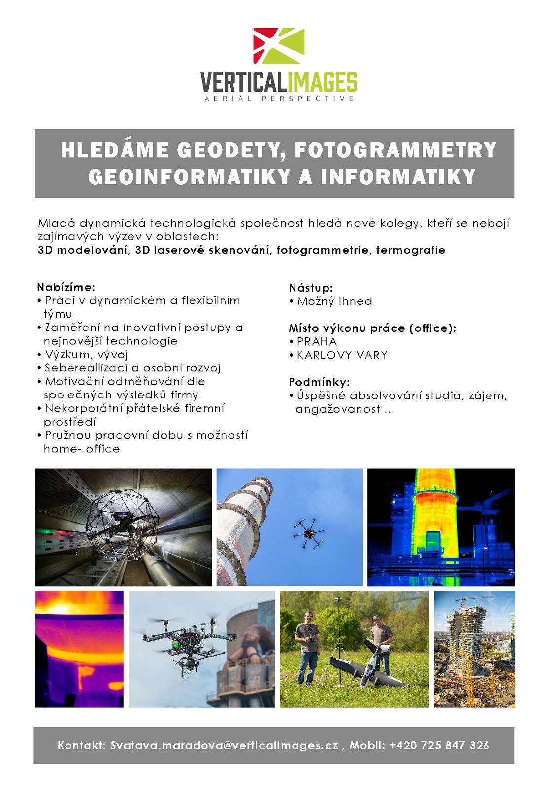
7. referent KN – právník do právního oddělení XI.
4.6.2019 13:48 ČÚZK /Urady/Katastralni-urady/Katastralni-urady/Katastralni-urad-pro-hlavni-mesto-Prahu/O-uradu/Aktuality/VR-04-06-20197. referent KN – právník do právního oddělení XI.
4.6.2019 13:48 ČÚZK - předpisy a opatření Katastrální úřad pro hlavní město Prahu zveřejnil novou aktualitu: Ředitel úřadu vyhlašuje výběrová řízení na služební místo:referent KN – právník do právního oddělení XI.
7. referent KN – právník do právního oddělení III.
4.6.2019 13:48 ČÚZK /Urady/Katastralni-urady/Katastralni-urady/Katastralni-urad-pro-hlavni-mesto-Prahu/O-uradu/Aktuality/VR-04-06-2019referent KN – právník do právního oddělení III.
4.6.2019 13:48 ČÚZK - předpisy a opatření Katastrální úřad pro hlavní město Prahu zveřejnil novou aktualitu: Ředitel úřadu vyhlašuje výběrová řízení na služební místa:referent KN – právník do právního oddělení III.
odborný referent/vrchní referent – návrh zápisu v katastru
7. referent KN – právník do právního oddělení III.
4.6.2019 13:48 ČÚZK - předpisy a opatření Katastrální úřad pro hlavní město Prahu zveřejnil novou aktualitu: Ředitel úřadu vyhlašuje výběrová řízení na služební místo:referent KN – právník do právního oddělení III.
6. referent KN – právník do právního oddělení III.
4.6.2019 13:48 ČÚZK - předpisy a opatření Katastrální úřad pro hlavní město Prahu zveřejnil novou aktualitu: Ředitel úřadu vyhlašuje výběrová řízení na služební místo:referent KN – právník do právního oddělení III.
VŘ - 04.06.2019
4.6.2019 13:48 ČÚZK /Urady/Katastralni-urady/Katastralni-urady/Katastralni-urad-pro-hlavni-mesto-Prahu/O-uradu/Aktuality/VR-04-06-2019VŘ - 04.06.2019
4.6.2019 13:48 ČÚZK - předpisy a opatření Katastrální úřad pro hlavní město Prahu zveřejnil novou aktualitu: Ředitel úřadu vyhlašuje výběrové řízení na služební místo:rada/odborný rada – interní auditor Katastrálního úřadu pro hlavní město Prahu
referent KN – právník do právního oddělení III.
4.6.2019 13:48 ČÚZK - předpisy a opatření Katastrální úřad pro hlavní město Prahu zveřejnil novou aktualitu: Ředitel úřadu vyhlašuje výběrové řízení na služební místo:referent KN – právník do právního oddělení III.
referent KN – právník do právního oddělení III.
4.6.2019 13:48 ČÚZK - předpisy a opatření Katastrální úřad pro hlavní město Prahu zveřejnil novou aktualitu: Ředitel úřadu vyhlašuje výběrová řízení na služební místo:referent KN – právník do právního oddělení III.
VŘ - 04.06.2019
4.6.2019 13:48 ČÚZK - předpisy a opatření Katastrální úřad pro hlavní město Prahu zveřejnil novou aktualitu: Ředitel úřadu vyhlašuje výběrové řízení na služební místo:rada/odborný rada – interní auditor Katastrálního úřadu pro hlavní město Prahu
referent KN – právník do právního oddělení III.
4.6.2019 13:48 ČÚZK /Urady/Katastralni-urady/Katastralni-urady/Katastralni-urad-pro-hlavni-mesto-Prahu/O-uradu/Aktuality/VR-04-06-2019referent KN – právník do právního oddělení III.
4.6.2019 13:48 ČÚZK - předpisy a opatření Katastrální úřad pro hlavní město Prahu zveřejnil novou aktualitu: Ředitel úřadu vyhlašuje výběrová řízení na služební místa:referent KN – právník do právního oddělení III.
odborný referent/vrchní referent – návrh zápisu v katastru
odborný referent/vrchní referent – návrh zápisu v katastru
4.6.2019 13:45 ČÚZK /Urady/Katastralni-urady/Katastralni-urady/Katastralni-urad-pro-hlavni-mesto-Prahu/Uredni-deska/Oznameni-a-jina-uredni-sdeleni/Volna-mista/na-samostatne-systemizovane-sluzebni-misto-rada-ododborný referent/vrchní referent – návrh zápisu v katastru
4.6.2019 13:45 ČÚZK - volná místa Katastrální úřad pro hlavní město Prahu - Katastrální pracoviště Plzeň-sever vypisuje výběrové řízení na místo odborný referent/vrchní referent – návrh zápisu v katastrurada/odborný rada – interní auditor Katastrálního úřadu pro hlavní město Prahu
4.6.2019 13:45 ČÚZK - předpisy a opatření Katastrální úřad pro hlavní město Prahuvypisuje výběrové řízení na místo
rada/odborný rada – interní auditor Katastrálního úřadu pro hlavní město Prahu
na samostatné systemizované služební místo rada/odborný rada – interní auditor
4.6.2019 13:45 ČÚZK - volná místa Katastrální úřad pro hlavní město Prahu vypisuje výběrové řízení na místo na samostatné systemizované služební místo rada/odborný rada – interní auditorodborný referent/vrchní referent – návrh zápisu v katastru
4.6.2019 13:45 ČÚZK - předpisy a opatření Katastrální úřad pro hlavní město Prahu - Katastrální pracoviště Plzeň-severvypisuje výběrové řízení na místo
odborný referent/vrchní referent – návrh zápisu v katastru
odborný referent/vrchní referent – návrh zápisu v katastru
4.6.2019 13:45 ČÚZK - volná místa Katastrální úřad pro hlavní město Prahu - Katastrální pracoviště Praha vypisuje výběrové řízení na místo odborný referent/vrchní referent – návrh zápisu v katastruna samostatné systemizované služební místo rada/odborný rada – interní auditor
4.6.2019 13:45 ČÚZK /Urady/Katastralni-urady/Katastralni-urady/Katastralni-urad-pro-hlavni-mesto-Prahu/Uredni-deska/Oznameni-a-jina-uredni-sdeleni/Volna-mista/na-samostatne-systemizovane-sluzebni-misto-rada-ododborný referent/vrchní referent – návrh zápisu v katastru
4.6.2019 13:45 ČÚZK - předpisy a opatření Katastrální úřad pro hlavní město Prahu - Katastrální pracoviště Prahavypisuje výběrové řízení na místo
odborný referent/vrchní referent – návrh zápisu v katastru
rada/odborný rada – interní auditor Katastrálního úřadu pro hlavní město Prahu
4.6.2019 13:45 ČÚZK /Urady/Katastralni-urady/Katastralni-urady/Katastralni-urad-pro-hlavni-mesto-Prahu/Uredni-deska/Oznameni-a-jina-uredni-sdeleni/Volna-mista/na-samostatne-systemizovane-sluzebni-misto-rada-odrada/odborný rada – interní auditor Katastrálního úřadu pro hlavní město Prahu
4.6.2019 13:45 ČÚZK - volná místa Katastrální úřad pro hlavní město Prahu vypisuje výběrové řízení na místo rada/odborný rada – interní auditor Katastrálního úřadu pro hlavní město PrahuRevize v k.ú. Třebušín
4.6.2019 13:35 ČÚZK - předpisy a opatření Katastrální úřad pro Ústecký kraj - Katastrální pracoviště Litoměřicezveřejnil novou aktualitu: Vážení klienti, oznamujeme Vám, že od 1.7.2019 - do 31.5.2020 bude probíhat v katastrálním území Třebušín obce Třebušín revize katastru nemovitostí. Účelem provádění revize je soulad údajů katastru nemovitostí se skutečným stavem v terénu, kdy jsou zjišťovány změny a ověřován dosavadní stav předmětu evidence katastru nemovitostí.
Revize v k.ú. Třebušín
4.6.2019 13:35 ČÚZK /Urady/Katastralni-urady/Katastralni-urady/Katastralni-urad-pro-Ustecky-kraj/Katastralni-pracoviste/KP-Litomerice/O-uradu/Aktuality/Revize-v-k-u-TrebusinRevize v k.ú. Horní Chobolice
4.6.2019 13:34 ČÚZK - předpisy a opatření Katastrální úřad pro Ústecký kraj - Katastrální pracoviště Litoměřicezveřejnil novou aktualitu: Vážení klienti, oznamujeme Vám, že od 1.7.2019 - do 31.1.2020 bude probíhat v katastrálním území Horní Chobolice obce Liběšice revize katastru nemovitostí. Účelem provádění revize je soulad údajů katastru nemovitostí se skutečným stavem v terénu, kdy jsou zjišťovány změny a ověřován dosavadní stav předmětu evidence katastru nemovitostí.
Revize v k.ú. Horní Chobolice
4.6.2019 13:34 ČÚZK /Urady/Katastralni-urady/Katastralni-urady/Katastralni-urad-pro-Ustecky-kraj/Katastralni-pracoviste/KP-Litomerice/O-uradu/Aktuality/Revize-v-k-u-Horni-ChoboliceRevize v k.ú. Vetlá
4.6.2019 13:33 ČÚZK - předpisy a opatření Katastrální úřad pro Ústecký kraj - Katastrální pracoviště Litoměřicezveřejnil novou aktualitu: Vážení klienti, oznamujeme Vám, že od 3.6.2019 - do 20.12.2019 bude probíhat v katastrálním území Vetlá obce Vrbice revize katastru nemovitostí. Účelem provádění revize je soulad údajů katastru nemovitostí se skutečným stavem v terénu, kdy jsou zjišťovány změny a ověřován dosavadní stav předmětu evidence katastru nemovitostí.
Revize v k.ú. Vetlá
4.6.2019 13:33 ČÚZK /Urady/Katastralni-urady/Katastralni-urady/Katastralni-urad-pro-Ustecky-kraj/Katastralni-pracoviste/KP-Litomerice/O-uradu/Aktuality/Revize-v-k-u-VetlaRevize v k.ú. Třebívlice
4.6.2019 13:29 ČÚZK - předpisy a opatření Katastrální úřad pro Ústecký kraj - Katastrální pracoviště Litoměřicezveřejnil novou aktualitu: Vážení klienti, oznamujeme Vám, že od 3.6.2019 - do 30.4.2020 bude probíhat v katastrálním území Třebívlice obce Třebívlice revize katastru nemovitostí. Účelem provádění revize je soulad údajů katastru nemovitostí se skutečným stavem v terénu, kdy jsou zjišťovány změny a ověřován dosavadní stav předmětu evidence katastru nemovitostí.
Revize v k.ú. Třebívlice
4.6.2019 13:29 ČÚZK /Urady/Katastralni-urady/Katastralni-urady/Katastralni-urad-pro-Ustecky-kraj/Katastralni-pracoviste/KP-Litomerice/O-uradu/Aktuality/Revize-v-k-u-TrebivliceRevize v k.ú. Hlupice
4.6.2019 13:27 ČÚZK - předpisy a opatření Katastrální úřad pro Ústecký kraj - Katastrální pracoviště Litoměřicezveřejnil novou aktualitu: Vážení klienti, oznamujeme Vám, že od 27.5.2019 - do 28.2.2020 bude probíhat v katastrálním území Hlupice obce Lovečkovice revize katastru nemovitostí. Účelem provádění revize je soulad údajů katastru nemovitostí se skutečným stavem v terénu, kdy jsou zjišťovány změny a ověřován dosavadní stav předmětu evidence katastru nemovitostí.
Revize v k.ú. Hlupice
4.6.2019 13:27 ČÚZK /Urady/Katastralni-urady/Katastralni-urady/Katastralni-urad-pro-Ustecky-kraj/Katastralni-pracoviste/KP-Litomerice/O-uradu/Aktuality/Revize-v-k-u-HlupiceRevize v k.ú. Vlastislav
4.6.2019 13:24 ČÚZK - předpisy a opatření Katastrální úřad pro Ústecký kraj - Katastrální pracoviště Litoměřicezveřejnil novou aktualitu: Vážení klienti, oznamujeme Vám, že od 15.4.2019 - do 15.11.2019 bude probíhat v katastrálním území Vlastislav obce Vlastislav revize katastru nemovitostí. Účelem provádění revize je soulad údajů katastru nemovitostí se skutečným stavem v terénu, kdy jsou zjišťovány změny a ověřován dosavadní stav předmětu evidence katastru nemovitostí.
Revize v k.ú. Vlastislav
4.6.2019 13:24 ČÚZK /Urady/Katastralni-urady/Katastralni-urady/Katastralni-urad-pro-Ustecky-kraj/Katastralni-pracoviste/KP-Litomerice/O-uradu/Aktuality/Revize-v-k-u-VlastislavRevize v k.ú. Starý Týn
4.6.2019 13:23 ČÚZK /Urady/Katastralni-urady/Katastralni-urady/Katastralni-urad-pro-Ustecky-kraj/Katastralni-pracoviste/KP-Litomerice/O-uradu/Aktuality/Revize-v-k-u-Stary-TynRevize v k.ú. Starý Týn
4.6.2019 13:23 ČÚZK - předpisy a opatření Katastrální úřad pro Ústecký kraj - Katastrální pracoviště Litoměřicezveřejnil novou aktualitu: Vážení klienti, oznamujeme Vám, že od 9.4.2019 - do 31.10.2019 bude probíhat v katastrálním území Starý Týn obce Úštěk revize katastru nemovitostí. Účelem provádění revize je soulad údajů katastru nemovitostí se skutečným stavem v terénu, kdy jsou zjišťovány změny a ověřován dosavadní stav předmětu evidence katastru nemovitostí.
Revize v k.ú. Štětí II
4.6.2019 13:21 ČÚZK - předpisy a opatření Katastrální úřad pro Ústecký kraj - Katastrální pracoviště Litoměřicezveřejnil novou aktualitu: Vážení klienti, oznamujeme Vám, že od 18.3.2019 - do 15.10.2019 bude probíhat v katastrálním území Štětí II obce Štětí revize katastru nemovitostí. Účelem provádění revize je soulad údajů katastru nemovitostí se skutečným stavem v terénu, kdy jsou zjišťovány změny a ověřován dosavadní stav předmětu evidence katastru nemovitostí.
Revize v k.ú. Štětí II
4.6.2019 13:21 ČÚZK /Urady/Katastralni-urady/Katastralni-urady/Katastralni-urad-pro-Ustecky-kraj/Katastralni-pracoviste/KP-Litomerice/O-uradu/Aktuality/Revize-v-k-u-Steti-IIRevize v k.ú. Čakovice u Radouně
4.6.2019 13:20 ČÚZK - předpisy a opatření Katastrální úřad pro Ústecký kraj - Katastrální pracoviště Litoměřicezveřejnil novou aktualitu: Vážení klienti, oznamujeme Vám, že od 18.3.2019 - do 15.10.2019 bude probíhat v katastrálním území Čakovice u Radouně obce Štětí revize katastru nemovitostí. Účelem provádění revize je soulad údajů katastru nemovitostí se skutečným stavem v terénu, kdy jsou zjišťovány změny a ověřován dosavadní stav předmětu evidence katastru nemovitostí.
Revize v k.ú. Čakovice u Radouně
4.6.2019 13:20 ČÚZK /Urady/Katastralni-urady/Katastralni-urady/Katastralni-urad-pro-Ustecky-kraj/Katastralni-pracoviste/KP-Litomerice/O-uradu/Aktuality/Revize-v-k-u-Cakovice-u-RadouneRevize v k.ú. Mladé
4.6.2019 13:19 ČÚZK - předpisy a opatření Katastrální úřad pro Ústecký kraj - Katastrální pracoviště Litoměřicezveřejnil novou aktualitu: Vážení klienti, oznamujeme Vám, že od 11.3.2019 - do 30.9.2019 bude probíhat v katastrálním území Mladé obce Liběšice revize katastru nemovitostí. Účelem provádění revize je soulad údajů katastru nemovitostí se skutečným stavem v terénu, kdy jsou zjišťovány změny a ověřován dosavadní stav předmětu evidence katastru nemovitostí.
Revize v k.ú. Mladé
4.6.2019 13:19 ČÚZK /Urady/Katastralni-urady/Katastralni-urady/Katastralni-urad-pro-Ustecky-kraj/Katastralni-pracoviste/KP-Litomerice/O-uradu/Aktuality/Revize-v-k-u-MladeZlínský kraj nově nabízí službu UtilityReport
4.6.2019 12:12 Hrdlička„Jde o elegantní, rychlý a bezplatný způsob, jak mohou občané podat žádost o vyjádření správcům inženýrských sítí a mít při tom jistotu, že na nikoho nezapomněli,“ řekl hejtman Zlínského kraje Jiří Čunek. Službu, jejímž provozovatelem je společnost HRDLIČKA spol. s r.o., doposud nabízelo na svých webových stránkách 7 měst ve Zlínském kraji a za její... View Article
The post Zlínský kraj nově nabízí službu UtilityReport appeared first on HRDLIČKA spol. s r.o. - komplexní služby v oblasti geodézie.
USGIF Announces 2019 Stu Shea Endowed Scholarship Recipient
4.6.2019 11:18 GISCafe.com Webcasts-Webinars Clark University’s Jaclyn Guz becomes second recipient of $15,000 scholarshipSan Antonio, Texas (June 3, 2019)— This morning at the …
SZÚ - Kvalita koupacích vod - sezóna 2019
4.6.2019 2:00 Cenia - Katalog metadat ČR - INSPIRE Kompozice obsahuje vrstvy s údaji o kvalitě koupacích vod v letním období roku 2019.SZÚ - Kvalita koupacích vod - sezóna 2018
4.6.2019 2:00 Cenia - Katalog metadat ČR - INSPIRE Kompozice obsahuje vrstvy s údaji o kvalitě koupacích vod v letním období roku 2018.Kvalita koupacích vod v koupacích sezónách 2016 a 2018
4.6.2019 2:00 Cenia - Katalog metadat ČR - INSPIRE Kvalita koupacích vod v koupací sezóně v letech 2016-2018.BlackSky Awarded NRO Contract for Commercial Imagery to Support U.S. Government Mission Needs
4.6.2019 1:40 GISCafe.com Webcasts-Webinars HERNDON, Va. — (BUSINESS WIRE) — June 3, 2019 —BlackSky,
a leading provider of geospatial intelligence, satellite …
Maxar Technologies Awarded Study Contract with U.S. National Reconnaissance Office for Commercial Imagery Capabilities
4.6.2019 1:40 GISCafe.com Webcasts-Webinars WESTMINSTER, Colo. — (BUSINESS WIRE) — June 3, 2019 —Maxar
Technologies (NYSE:MAXR) (TSX:MAXR) today announced that …
TomTom Traffic Index: Congestion Up, but New Technologies Show Promise in the U.S.
4.6.2019 1:40 GISCafe.com Webcasts-Webinars Cities Investing in Traffic Mitigation Tactics See Steady Improvements in Traffic CongestionAMSTERDAM, June 3, 2019 — (PRNewswire) — …
Cepton Launches New High-Speed SORA-P60 Lidar For Vehicle Scanning
3.6.2019 23:36 GISCafe.com Webcasts-Webinars New sensor provides industry-leading 1,200 scan lines per second forhigh-velocity vehicle scanning and classification
SAN JOSE, …
Orbit GT and MasterMind, USA, sign Reseller Agreement
3.6.2019 21:40 GISCafe.com Webcasts-Webinars Lokeren, Belgium, June 4th, 2019Orbit GT is pleased to announce that MasterMind, USA, has joined as Authorized Reseller of Orbit GT 3D Mapping …
OZNÁMENÍ
3.6.2019 20:25 ČÚZK /Urady/Katastralni-urady/Katastralni-urady/Katastralni-urad-pro-Moravskoslezsky-kraj/Katastralni-pracoviste/KP-Ostrava/O-uradu/Aktuality/OZNAMENIOZNÁMENÍ
3.6.2019 20:25 ČÚZK - předpisy a opatření Katastrální úřad pro Moravskoslezský kraj - Katastrální pracoviště Ostrava zveřejnil novou aktualitu:OZNÁMENÍ
Od 5. 6. 2019 lze na Katastrálním pracovišti Ostrava hradit veškeré správní poplatky a úplaty za výstupy z KN (mimo službu sledování změn) i prostřednictvím platebních karet.OZNÁMENÍ
3.6.2019 20:19 ČÚZK - předpisy a opatření Katastrální úřad pro Moravskoslezský kraj - Katastrální pracoviště Karviná zveřejnil novou aktualitu:OZNÁMENÍ
Od 7. 6. 2019 lze na Katastrálním pracovišti Karviná hradit veškeré správní poplatky a úplaty za výstupy z KN (mimo službu sledování změn) i prostřednictvím platebních karet.
OZNÁMENÍ
3.6.2019 20:19 ČÚZK /Urady/Katastralni-urady/Katastralni-urady/Katastralni-urad-pro-Moravskoslezsky-kraj/Katastralni-pracoviste/KP-Karvina/O-uradu/Aktuality/OZNAMENIBAE Systems Completes Acquisition of the Riptide Autonomous Solutions Business
3.6.2019 19:42 GISCafe.com Webcasts-Webinars ARLINGTON, Virginia — (BUSINESS WIRE) — June 3, 2019 —BAE Systems, Inc. has announced the purchase of the …
Maxar Earth Intelligence Solutions Expands its Support for the U.S. National Security Community
3.6.2019 16:14 GISCafe.com Webcasts-Webinars Company awarded $95M of new contracts from the U.S. Air Force,Special Operations Command and National Geospatial-Intelligence Agency
…
Space Dynamics Lab Names Former Intelligence Agency Director to Guidance Council
3.6.2019 16:14 GISCafe.com Webcasts-Webinars San Antonio, June 03, 2019 (GLOBE NEWSWIRE) -- Utah State University’s Space Dynamics Laboratory announced today that Robert Cardillo has been …BlackSky Begins Commercial Operations, Signs Agreement with HawkEye 360 to Include Radio Frequency Data in Its Geospatial Platform
3.6.2019 16:14 GISCafe.com Webcasts-Webinars SAN ANTONIO — (BUSINESS WIRE) — June 3, 2019 —Today at the USGIF-sponsored GEOINT Symposium in San Antonio, BlackSky,
…
Former FCC Chair Tom Wheeler Joins AirMap Board to Help Shape Future Unmanned Airspace Economy
3.6.2019 16:14 GISCafe.com Webcasts-Webinars SANTA MONICA, Calif., June 3, 2019 — (PRNewswire) — Today, AirMap, the leading global unmanned aerial systems traffic management (UTM) …Riverside Research Contributes in GEOINT Lightning Talks
3.6.2019 16:14 GISCafe.com Webcasts-Webinars WASHINGTON, June 3, 2019 — (PRNewswire) — As a not-for-profit serving the defense and intelligence communities, Riverside Research …Demetra delivers dividends for ELPROMA
3.6.2019 10:41 European GNSS Agency
ELPROMA, a Polish manufacturer of NTP/PTP time servers, has won a seven-figure US$ contract to supply Rubidium IEEE1588 NTS-5000 servers to support a country-scale modern smart grid system in Asia. The servers, which are custom built (designated “Safe Time”), incorporate a modified version of the cyber-security TSI#2 solution developed as part of the Horizon 2020 ‘DEMonstrator of EGNSS services based on Time Reference Architecture’ (Demetra) project, in which ELPROMA participated in 2015-2016.
While it is not yet possible, for reasons of commercial secrecy, to name the client country, we can reveal that the contract is for a total of over 350 mostly advanced Rubidium-class PTP IEEE1588 time servers. These servers will ensure the cyber security and robust nanosecond synchronisation of the country-scale electricity grid, which is in the process of transition from a classical grid to a state-of-the-art IEC61850 system capable of safely distributing power throughout the country.
Read this: Time as a service with Galileo
“This is the biggest one-off deal of its kind so far,” Tomasz Widomski, a member of the ELPROMA Supervisory Board, said. “For comparison, a stock exchange or a new 5G telecom network requires approximately 10-15 grandmaster PTP IEEE1588 servers to operate efficiently, so 350 is a really huge number of servers,” he said. Due to the server volume, the system requires a special management and monitoring facility to ensure the accuracy and time domain operation of the IEC61850 smart grid.
Nanosecond accuracy
The PTP servers will be customised according to the specific needs of the client to ensure reliable, country-scale synchronisation and time domain operation. The Demetra TSI#2 solution is a core element of the new smart grid, with a modified version of the solution implemented inside the NTS-5000 dual oscillator servers (Rubidium and OCXO), helping to ensure the delivery of nanosecond accuracy and top-level cyber security. The key is real-time auditing, which ensures that everything stays stable during power distribution management.
“ELPROMA is the first supplier in the world of this level of synchronisation and this size of system, which will be more and more popular once Industry 4.0 technology becomes a reality,” Widomski said, adding that Galileo accuracy is a key element for improving security. “The ELPROMA servers are multi-constellation and are able to select the GNSS system that they operate with, however Galileo is the preferred one, with GPS, BaiDou and Glonass as a backup,” he said.
Watch this: Demetra – Time as a Service
ELPROMA is currently in the process of delivering the servers to the client and these will be gradually deployed over the next two to three months. “It is expected that the system will be fully operational at the end of 2019,” Widomski said.
Demetra solution
ELPROMA was member of Demetra Horizon 2020 project (2015-2016), which developed a prototype of an EGNSS-based time disseminator that provides time certification, redundancy, resilience, integrity and improved accuracy, while validating the concept of ‘time as a service’.
The Demetra developers engaged with the main timing and synchronisation users, including energy companies, to ensure that their needs were incorporated into the project design. The demonstrator was built around the concept of a common core infrastructure hosting advanced time services. It was deployed as an open and scalable architecture with common interfaces, making it easier to integrate new services and enabling service developers to focus on performance at user level.
The ELPROMA contract is a good example of how EGNSS-based innovations, such as the solutions created by Demetra, are driving economic growth and job creation in Europe. “The servers are 100% manufactured in the EU, in Poland,” Widomski said.
Media note: This feature can be republished without charge provided the European GNSS Agency (GSA) is acknowledged as the source at the top or the bottom of the story. You must request permission before you use any of the photographs on the site. If you republish, we would be grateful if you could link back to the GSA website (http://www.gsa.europa.eu).
Sleva na všechna prázdninová školení
3.6.2019 10:32 ARCDATAChcete-li si osvojit nové znalosti a dovednosti, využijte naší prázdninové nabídky. Všechna školení v termínu od 1. 7. do 31. 8. 2019 nabízíme s 30% slevou. V tomto termínu můžete vybírat z následujících kurzů:
- ArcGIS Pro: základy a pracovní postupy
- Migrace z ArcMap do ArcGIS Pro
- Rozšiřování ArcGIS Pro pomocí doplňků
- Tvorba a editace dat v ArcGIS Pro
- Tvorba modelů v prostředí ModelBuilder
- Úvod do GIS
- ArcGIS Enterprise: nasazení a konfigurace
- Sdílení geografických dat pomocí ArcGIS
- ArcGIS Online
- Správa geografických dat v ArcGIS
Dále si vás dovolujeme upozornit na tři nové kurzy, které v naší nabídce nyní naleznete: Tvorba a editace dat v ArcGIS Pro, Administrace ArcGIS EnterpriseaÚvod do tvorby webových aplikací pomocí ArcGIS API for JavaScript.
Prohlédnout si můžete i tabulku se všemi našimi kurzy a jejich termíny.

Sleva na všechna prázdninová školení
3.6.2019 10:32 ARCDATAChcete-li si osvojit nové znalosti a dovednosti, využijte naší prázdninové nabídky. Všechna školení v termínu od 1. 7. do 31. 8. 2019 nabízíme s 30% slevou. V tomto termínu můžete vybírat z následujících kurzů:
- ArcGIS Pro: základy a pracovní postupy
- Migrace z ArcMap do ArcGIS Pro
- Rozšiřování ArcGIS Pro pomocí doplňků
- Tvorba a editace dat v ArcGIS Pro
- Tvorba modelů v prostředí ModelBuilder
- Úvod do GIS
- ArcGIS Enterprise: nasazení a konfigurace
- Sdílení geografických dat pomocí ArcGIS
- ArcGIS Online
- Správa geografických dat v ArcGIS
Dále si vás dovolujeme upozornit na tři nové kurzy, které v naší nabídce nyní naleznete: Tvorba a editace dat v ArcGIS Pro, Administrace ArcGIS EnterpriseaÚvod do tvorby webových aplikací pomocí ArcGIS API for JavaScript.
Prohlédnotu si můžete i tabulku se všemi našimi kurzy a jejich termíny.

Space App Camp
3.6.2019 10:25 ESA Observing the Earth
Developers are invited to apply for the September 2019 Space App Camp at ESA’s establishment in Frascati, Italy. Applications will be accepted until 15 July
Skyline Software Systems Releases TerraExplorer for Desktop 7.1
2.6.2019 11:17 GISCafe.com Webcasts-Webinars Herndon, VA – May 31, 2019 – Skyline Software Systems Inc. announced today that it has released TerraExplorer™ for Desktop 7.1 …Kleos to showcase at International GEOINT 2019 Symposium
2.6.2019 11:10 GISCafe.com Webcasts-Webinars Prime position at premier annual global Geospatial Intelligence eventKleos to gain international government and market exposure
Access to …
Jakub byl v Madridu opět jako poradce mezinárodního projektu na UTM
1.6.2019 11:39 UpVision Tento týden byl Jakub v Madridu opět jako poradce na dalším jednání italsko-holandsko-španělského konsorcia U-Space SESAR projektu DREAMS.Více zde:
https://www.facebook.com/permalink.php?story_fbid=986271928228041&id=199025016952740
Jakub byl na diskuzi s eurokomisařkou pro dopravu a mluvili jsme o dronech
1.6.2019 11:39 UpVision Jakub byl minulý týden na veřejné diskuzi s evropskou komisařkou pro dopravu Violetou Bulc o budoucnosti mobility a aktivně jsme mluvili o dronech, které má mezi prioritami.Díky jejímu přístupu a DG MOVE k inovacím se prosadila nová evropská legislativa pro drony.
Více zde:
https://www.facebook.com/permalink.php?story_fbid=984107301777837&id=199025016952740
Chytrá myšlenka
1.6.2019 5:53 Chytrá myšlenka je jedinečný program na podporu inovací a podnikání v Moravskoslezském kraji. Akcelerační program pomáhá lidem s nápady růst a rozvíjet projekty, které mohou ovlivnit i naši budoucnost. Máte myšlenku a nechybí vám odvaha? Přihlaste se do akcelerace! Více na: https://chytramyslenka.cz/ Registrace projektů a nápadů do 30.6.2019 Program proběhne ve dvou bězích podle vyspělosti projektu. […]Esri Releases ArcGIS Excalibur, An Integrated Imagery Application
1.6.2019 1:36 GISCafe.com Webcasts-Webinars A Modern Web Application that Simplifies Imagery Exploitation andVisualization
REDLANDS, Calif. — (BUSINESS WIRE) — May …
Esri Joins 2019 USGIF GEOINT Symposium with Training, Exhibits, and Key Speakers
1.6.2019 1:36 GISCafe.com Webcasts-Webinars Technology Market Leader to Showcase the Role of GIS in TransformingGeospatial Intelligence
REDLANDS, Calif. — (BUSINESS WIRE) …
Winners Announced in $7M Shell Ocean Discovery XPRIZE for Advancements in Autonomous Ocean Exploration
1.6.2019 1:36 GISCafe.com Webcasts-Webinars Winners also Announced for National Oceanic and AtmosphericAdministration’s $1M Bonus Prize for Underwater “Sniffer” Technology
…
Verity-HERON® Integration Introduces Real-Time 3D Mobile Mapping and Construction Verification
1.6.2019 1:36 GISCafe.com Webcasts-Webinars The collaboration between Verity construction verification software from ClearEdge3D and HERON, the latest wearable mobile scanners from Gexcel, …Aizawa Concrete Partners with Heavy Lift Long Range UAV provider 'Top Flight Technologies' for Proactive Road and Bridge Aerial Inspection and Repair
31.5.2019 20:41 GISCafe.com Webcasts-Webinars Aizawa teams up with Boston-based aerospace company to scale commercial UAVs for road and bridge network inspection and repair throughout Hokkaido …Aechelon Technology Selects VATC's EPIC Builder for Primary 3D Terrain Tool
31.5.2019 20:41 GISCafe.com Webcasts-Webinars TAMPA, Fla., May 31, 2019 — (PRNewswire) — Visual Awareness Technologies and Consulting's (VATC®) EPIC Builder product has been …Bentley Systems buys cloud company Keynetix to boost digital twins
31.5.2019 15:15 Bentley SystemsPress Coverage
Power Engineering International, UK
Read the articleBentley Systems Announces the Acquisition of Keynetix
31.5.2019 15:10 Bentley SystemsPress Coverage
GeoConnexion, UK
Read the articleBentley Systems announces acquisition of Keynetix
31.5.2019 15:04 Bentley SystemsPress Coverage
Ground Engineering, UK
Read the articleBentley boosts infrastructure design and engineering capabilities
31.5.2019 14:47 Bentley SystemsPress Coverage
BIM+, UK
Read the article"Airbus Defence and Space and Orbital Insight Expand Partnership Agreement to create Earth Monitor" by Susan Smith
31.5.2019 10:55 GISCafe.com Webcasts-WebinarsAktualizace dat ÚAP poskytovatelů Česká geologická služba, Národní památkový ústav a data vodovodů a kanalizací z aplikace PRVaK
31.5.2019 10:45 Plzeňský kraj V datech územně analytických podkladů Plzeňského kraje byla provedena kompletní aktualizace dat ve správě poskytovatelů Česká geologická služba, Národní památkový ústav a data aplikace Plán rozvoje vodovodů a kanalizací.rada/odborný rada - rozhodování o povolení vkladu v právním oddělení Katastrálního pracoviště České
31.5.2019 10:23 ČÚZK /Urady/Katastralni-urady/Katastralni-urady/Katastralni-urad-pro-Jihocesky-kraj/Uredni-deska/Oznameni-a-jina-uredni-sdeleni/Volna-mista/rada-odb-r-povolvrada/odborný rada - rozhodování o povolení vkladu v právním oddělení Katastrálního pracoviště České
31.5.2019 10:23 ČÚZK - volná místa Katastrální úřad pro Jihočeský kraj - Katastrální pracoviště České Budějovice vypisuje výběrové řízení na místo rada/odborný rada - rozhodování o povolení vkladu v právním oddělení Katastrálního pracoviště Českérada/odborný rada - rozhodování o povolení vkladu v právním oddělení Katastrálního pracoviště České
31.5.2019 10:23 ČÚZK - předpisy a opatření Katastrální úřad pro Jihočeský kraj - Katastrální pracoviště České Budějovicevypisuje výběrové řízení na místo
rada/odborný rada - rozhodování o povolení vkladu v právním oddělení Katastrálního pracoviště České Budějovice
Earth from Space
31.5.2019 10:05 ESA Observing the Earth
In this edition, Copernicus Sentinel-2 takes us over El Salvador, the smallest and most densely populated country in Central America
El Salvador
31.5.2019 10:05 ESA Observing the Earth
Earth observation image of the week: the Copernicus Sentinel-2 mission takes us over the mountainous terrain of El Salvador
Plán obnovy
31.5.2019 9:18 ČÚZK - předpisy a opatření Katastrální úřad pro Ústecký kraj - Katastrální pracoviště Teplice zveřejnil novou aktualitu: Zveřejňujeme plán revizí a obnovy katastrálního operátu v okrese Teplice.Plán obnovy
31.5.2019 9:18 ČÚZK /Urady/Katastralni-urady/Katastralni-urady/Katastralni-urad-pro-Ustecky-kraj/Katastralni-pracoviste/KP-Teplice/O-uradu/Aktuality/Zverejnujeme-plan-revizi-a-obnovy-katastralniho-opMerced County Selects DATAMARK Public Safety and GIS Expert Team for NG9-1-1 Preparation
31.5.2019 9:00 GISCafe.com Webcasts-Webinars SANTA ANA, Calif., May 29, 2019 (GLOBE NEWSWIRE) -- The Merced County California GIS Department, along with its Public Safety Communications …Phase One Industrial Introduces Three High Performance Lenses for High-Altitude Aerial Photography and Long-Range Aerial and Ground Inspection
31.5.2019 9:00 GISCafe.com Webcasts-Webinars The new 300mm AF, 180mm, and 150mm MK II lenses are designed to enhance the versatility and performance of Phase One Industrial’s iXM-RS and …Extensis to Cameo Digital Asset Management Solution Incorporating LizardTech’s MrSID at GEOINT 2019
31.5.2019 9:00 GISCafe.com Webcasts-Webinars PORTLAND, Ore., 24 May 2019 – Extensis® will demonstrate its full suite of digital asset, font, and imagery management solutions - …Máme nového docenta!
31.5.2019 8:49 Katedra geoinformatiky UP OlomoucObrovský úspěch a ocenění za svou dlouholetou práci dosáhl Jaroslav Burian, který se posunul o úroveň výš a stal se docentem! Díky tomu se počet docentů na naší katedře zvýšil na číslo 4. Všichni blahopřejeme doc. RNDr. Jardo, Ph.D.!
The post Máme nového docenta! appeared first on Katedra geoinformatiky.
20190531 - Vyhlášení výsledků voleb
31.5.2019 7:36 ČÚZK /Uvod/Produkty-a-sluzby/RUIAN/Volebni-okrsky-v-RUIAN/Archiv-novinky/20190531-Vyhlaseni-vysledku-voleb20190531 - Vyhlášení výsledků voleb
31.5.2019 7:36 ČÚZK - předpisy a opatření Dne 28. 5. 2019 byly vyhlášeny a uveřejněny ve Sbírce zákonů pod č. 132/2019 Sb. celkové výsledky voleb do Evropského parlamentu. Státní volební komisí byly odemčeny volební okrsky v RÚIAN a nyní je možné měnit jejich vymezení.20190531 - Vyhlášení výsledků voleb
31.5.2019 7:31 ČÚZK /Uvod/Produkty-a-sluzby/RUIAN/RUIAN-novinky/2019/20190531-Vyhlaseni-vysledku-voleb20190531 - Vyhlášení výsledků voleb
31.5.2019 7:31 ČÚZK - předpisy a opatření Dne 28. 5. 2019 byly vyhlášeny a uvěřejněny ve Sbírce zákonů č. 132/2019 Sb. celkové výsledky voleb do Evropského parlamentu. Státní volební komisí byly odemčeny volební okrsky v RÚIAN a nyní je možné měnit jejich vymezení.Nová zvažovaná mise ESA se jmenuje TRUTHS
30.5.2019 21:07 Český Kosmický PortálSetkání ESA Space19+ na ministerské úrovni v listopadu bude řešit i to, zdali se nová družice TRUTHS dostane na seznam misí financovaných v rámci programu EOEW (Earth Observation Earth Watch).
Esri Partners with AgIntegrated to Bring Users Precision Agriculture
30.5.2019 20:21 GISCafe.com Webcasts-Webinars Partnership Makes Agricultural Location Intelligence More EasilyAccessible for Users
REDLANDS, Calif. — (BUSINESS WIRE) — …
Ouster Announces Two Week Lead Time Guarantee for OS-1 Lidar Sensors
30.5.2019 17:49 GISCafe.com Webcasts-Webinars Industry-first guarantee gets sensors into customers’ hands quickly.SAN FRANCISCO — (BUSINESS WIRE) — May 30, 2019 —
…
7.3 Million Homes at Risk of 2019 Hurricane Storm Surge Damage with $1.8 Trillion in Potential Reconstruction Costs, According to CoreLogic Report
30.5.2019 17:49 GISCafe.com Webcasts-Webinars New York City and Miami metropolitan areas have greatest risk ofstorm surge
Atlantic Coast contains 57% of the total …
TSX Affirms Intermap's Continued Listing
30.5.2019 17:49 GISCafe.com Webcasts-Webinars DENVER, May 30, 2019 — (PRNewswire) — Intermap Technologies Corporation ("Intermap" or the "Company") today announced that it has …Firemní teambuilding – Váňův statek
30.5.2019 15:52 HrdličkaPřivítalo nás pěkné počasí, krásné prostředí a příjemná obsluha, která se o nás starala po celou dobu pobytu s úsměvem. Již tradičně jsme se v rámci upevňování kolektivu věnovali společným aktivitám. Soutěžili jsme v jízdě na traktoru, hodu vidlemi nebo koulení balíků slámy. Odpoledne jsme měli k dispozici čtyřkolky a brněnská pobočka sehrála dramatické volejbalové... View Article
The post Firemní teambuilding – Váňův statek appeared first on HRDLIČKA spol. s r.o. - komplexní služby v oblasti geodézie.
The Past, Present and Future of Automated Predictive Technology
30.5.2019 15:30 Bentley SystemsPress Coverage
Finextra, UK
Read the articlePolygon porridge and people: The future of infrastructure?
30.5.2019 15:28 Bentley SystemsPress Coverage
Civil Engineering Surveyor, UK
Read the articleDigital twins: Opening the doors of great design
30.5.2019 15:21 Bentley SystemsPress Coverage
ME Construction News, Middle East
Read the articleBentley Systems acquires Keynetix for underground digital twins
30.5.2019 15:14 Bentley SystemsPress Coverage
PBC Today, UK
Read the articleInspektor/ka – právník Zeměměřického a katastrálního inspektorátu v Praze (obor služby 70.)
30.5.2019 13:59 ČÚZK /Urady/Zememericke-a-katastralni-inspektoraty/Zememericke-a-katastralni-inspektoraty/Zememericky-a-katastralni-inspektorat-v-Praze/Uredni-deska/Oznameni-a-jina-uredni-sdeleni/Volna-mista/Inspektor-ka-–-pravnik-Zememerickeho-a-katastralniInspektor/ka – právník Zeměměřického a katastrálního inspektorátu v Praze (obor služby 70.)
30.5.2019 13:59 ČÚZK - předpisy a opatření Zeměměřický a katastrální inspektorát v Prazevypisuje výběrové řízení na místo
Inspektor/ka – právník Zeměměřického a katastrálního inspektorátu v Praze (obor služby 70.)