


![]()

zprávy
zdroje zpráv:Promo video – HRDLIČKA “Geodézie v souvislostech”
9.5.2019 13:40 Hrdlička🔊 Děláme geodézii v souvislostech na více než 110 % 🙂 Podívejte se na naše promo 🎥 👇
The post Promo video – HRDLIČKA “Geodézie v souvislostech” appeared first on HRDLIČKA spol. s r.o. - komplexní služby v oblasti geodézie.
Promo video – HRDLIČKA „Geodézie v souvislostech“
9.5.2019 13:40 Hrdlička🔊 Děláme geodézii v souvislostech na více než 110 % 🙂 Podívejte se na naše promo 🎥 👇
The post Promo video – HRDLIČKA „Geodézie v souvislostech“ appeared first on HRDLIČKA spol. s r.o. - komplexní služby v oblasti geodézie.
Příležitost provádět testy na simulátoru atomárního kyslíku ESA
9.5.2019 13:39 Český Kosmický PortálMise směřující na nízkou oběžnou dráhu do výšky zhruba 1000 km musí být navrhované tak, aby byly odolné proti působení atomárního kyslíku. Aby v této oblasti podala pomocnou ruku, nabízí ESA malým a středním podnikům, akademické sféře a národním institucím příležitost otestovat materiály pro kosmické mise a celá zařízení na simulátoru LEOX, který se nachází v technickém středisku ESA v Nizozemí. Uzávěrka návrhů je 31. května 2019.
Corpis Maps na HackPrague 2019
9.5.2019 13:30 T-MAPYThe post Corpis Maps na HackPrague 2019 appeared first on T-MAPY spol. s r.o..
Overwatch Imaging, a Leader in Airborne Imaging Systems, Completes Series A Funding with Investment from Tenax Aerospace
9.5.2019 11:20 GISCafe.com Webcasts-Webinars Investment to Help Expand Production Operations and Accelerate the Development of Onboard Artificial Intelligence SoftwareHood River, OR—May …
Orbit GT to exhibit and present at SPAR3D, Anaheim, CA
9.5.2019 11:13 GISCafe.com Webcasts-Webinars Lokeren, Belgium, May 8th, 2019 -- Orbit GT will be exhibiting and hosting a presentation at the SPAR3D Conference, Anaheim, CA, May 21st-23rd, …Ocenění za nejlepší článek na konferenci GISTAM 2019
9.5.2019 11:07 Blogující geomatici - FAV ZČU
Space for climate
9.5.2019 10:53 ESA Observing the Earth
Learn how ESA's Climate Change Initiative helps us understand climate change from space
Druhé kolo přijímacího řízení
9.5.2019 8:31 Katedra geoinformatiky UP OlomoucVyhlašujeme druhé kolo podávaní přihlášek pro bakalářské i magisterské studium! Hlásit se můžete do 12. července 2019, proto neváhejte a pošlete ji ještě dnes 🙂 Více informace naleznete na našem webu v záložce přijímací řízení nebo na fakultních stránkách
The post Druhé kolo přijímacího řízení appeared first on Katedra geoinformatiky.
Nepotřebný majetek - výběrové řízení
9.5.2019 6:31 ČÚZK /Urady/Katastralni-urady/Katastralni-urady/Katastralni-urad-pro-Liberecky-kraj/Nabidky-majetku/Nepotrebny-majetek-vyberove-rizeni-(3)Nepotřebný majetek - výběrové řízení
9.5.2019 6:31 ČÚZK - předpisy a opatřeníKatastrální úřad pro Liberecký kraj nabízí nepotřebný majetek k odkupu. Jedná se o
Nepotřebný majetek - výběrové řízení
Swift Navigation Opens an Office in Australia
8.5.2019 22:44 GISCafe.com Webcasts-Webinars SAN FRANCISCO and MELBOURNE, Australia, May 08, 2019 (GLOBE NEWSWIRE) -- Swift Navigation, a San Francisco-based tech firm building …Kratos Reports First Quarter 2019 Financial Results
8.5.2019 22:44 GISCafe.com Webcasts-Webinars SAN DIEGO, May 08, 2019 (GLOBE NEWSWIRE) -- Kratos Defense & Security Solutions, Inc. (Nasdaq:KTOS), a leading National Security Solutions …Introducing Next Generation Mapping for EZMaxMobile from InterPro Solutions
8.5.2019 16:54 GISCafe.com Webcasts-Webinars EZMaxMobile customers can now utilize next generation mapping to complete their work.STONEHAM, Mass., May 8, 2019 — (PRNewswire) — …
Geospatial Technology Firm Offers Mobile Data Collection Platform at No Cost for Disaster Response Teams
8.5.2019 16:54 GISCafe.com Webcasts-Webinars In response to Cyclone Fani and other disasters, such as the wildfires in California and flash flooding across the U.S. Midwest, tech company Spatial …NAVISP projects target satnav interference
8.5.2019 16:20 ESA Navigation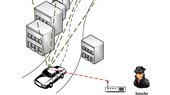
Satellite navigation has become a global utility, but one that is vulnerable to interference. ESA’s new NAVISP research and development programme is prioritising research into countering jamming and spoofing of satnav signals, with partner companies exploring varied approaches.
NAVISP projects target satnav interference
8.5.2019 16:20 ESA Navigation
Satellite navigation has become a global utility, but one that is vulnerable to interference. ESA’s new NAVISP research and development programme is prioritising research into countering jamming and spoofing of satnav signals, with partner companies exploring varied approaches.
Conceptioneering Digital Workflow Helps Optimize Water Distribution for 1 Million Households in West Bengal, India
8.5.2019 15:22 Bentley SystemsPress Coverage
Automation Connect, India
Read the articleBentley Applications Produce Comprehensive Network Model To Help Revitalize Water Distribution for Agra, India
8.5.2019 15:17 Bentley SystemsPress Coverage
Automation Connect, India
Read the articleCollaborative BIM Workflows Help Lower Cost of the Zhengzhou-Xixia Expressway Project
8.5.2019 15:12 Bentley SystemsPress Coverage
Automation Connect, India
Read the articleHave your say on Horizon Europe
8.5.2019 11:38 European GNSS Agency
The European GNSS Agency (GSA) is to host a workshop at its Prague headquarters on 4 June 2019 to consult with industry and academia on Horizon Europe EGNSS Downstream R&D. At the workshop, participants will discuss priorities for EGNSS downstream applications, receivers, and market uptake in Horizon Europe – the European Commission’s ambitious €100 billion research and innovation programme that will succeed Horizon 2020.
In June 2018 the Commission published its proposal for the Horizon Europe programme, which is currently being negotiated in the European Council and the European Parliament, after which it should be launched on 1 January 2021. In the programme, EGNSS related activities are currently covered within the Digital Industry cluster, Pillar 2: Global Challenges and Industrial Competitiveness, but there is a proposal from the Parliament and Council to have a dedicated Digital-Industry-Space cluster.
Fostering adoption, underpinning competitiveness
Within the Digital Industry pillar, EGNSS activities are structured as follows: innovative applications; global uptake; solutions improving robustness; authentication; integrity of services; and development of fundamental elements such as chipsets, receivers and antennas. Other activities focus on sustainability of supply chains, new technologies, work targeted at sustained exploitation of services to tackle societal challenges, and the development of next generation systems for new challenges such as security or autonomous driving. EGNSS related activities could also be covered in other Horizon Europe clusters and pillars.
Read this: Innovation procurement opportunities explored at Prague workshop
As the programme is currently being negotiated, now is the time to consult with stakeholders and agree on the EGNSS downstream R&D priorities for the next framework programme and to exploit new funding tools to increase the business impact of EGNSS. Moreover, the budget for EGNSS downstream applications in Horizon Europe needs to be secured in order to foster wide-scale EGNSS adoption and underpin the competitiveness of EU industry.
Review of requirements
The upcoming GSA workshop will provide a forum for this consultation, offering representatives from industry and academia the opportunity to discuss high-level EGNSS downstream R&D priorities. The workshop will kick off by taking a look at the status quo of the Horizon 2020 and Fundamental Elements funding mechanisms and then present how EGNSS downstream R&D is reflected in Horizon Europe. This will be followed by a discussion of EGNSS R&D User Requirements, with a review of inputs from the 2018 EGNSS User Consultation Platform by market segment. Finally, there will be an open discussion on high-level priorities for Horizon Europe.
To help participants to prepare for the workshop, the GSA has prepared a questionnaire, which you can access here, along with the agenda for the workshop. For more information contact: com@gsa.europa.eu.
Media note: This feature can be republished without charge provided the European GNSS Agency (GSA) is acknowledged as the source at the top or the bottom of the story. You must request permission before you use any of the photographs on the site. If you republish, we would be grateful if you could link back to the GSA website (http://www.gsa.europa.eu).
Have your say on Horizon Europe
8.5.2019 11:38 European GNSS AgencyThe European GNSS Agency (GSA) is to host a workshop at its Prague headquarters on 4 June 2019 to consult with industry and academia on Horizon Europe EGNSS Downstream R&D. At the workshop, participants will discuss priorities for EGNSS downstream applications, receivers, and market uptake in Horizon Europe – the European Commission’s ambitious €100 billion research and innovation programme that will succeed Horizon 2020.
In June 2018 the Commission published its proposal for the Horizon Europe programme, which is currently being negotiated in the European Council and the European Parliament, after which it should be launched on 1 January 2021. In the programme, EGNSS related activities are currently covered within the Digital Industry cluster, Pillar 2: Global Challenges and Industrial Competitiveness, but there is a proposal from the Parliament and Council to have a dedicated Digital-Industry-Space cluster.
Fostering adoption, underpinning competitiveness
EGNSS activities such as innovative applications; global uptake; solutions improving robustness; authentication; integrity of services; and development of fundamental elements such as chipsets, receivers and antennas, are covered under the Digital Industry pillar. Other EGNSS activities in the area of sustainability of supply chains, new technologies, work targeting solutions for societal challenges, and the development of next generation systems for emerging security threats or applications such as autonomous driving, can also be addressed in other Horizon Europe clusters and pillars.
Read this Innovation procurement opportunities explored at Prague workshop
As the programme is currently being negotiated, now is the time to consult with stakeholders and agree on the EGNSS downstream R&D priorities for the next framework programme and to exploit new funding tools to increase the business impact of EGNSS. Moreover, the budget for EGNSS downstream applications in Horizon Europe needs to be secured in order to foster wide-scale EGNSS adoption and underpin the competitiveness of EU industry.
Review of requirements
The upcoming GSA workshop will provide a forum for this consultation, offering representatives from industry and academia the opportunity to discuss high-level EGNSS downstream R&D priorities. The workshop will kick off by taking a look at the status quo of the Horizon 2020 and Fundamental Elements funding mechanisms and then present how EGNSS downstream R&D is reflected in Horizon Europe. This will be followed by a discussion of EGNSS R&D User Requirements, with a review of inputs from the 2018 EGNSS User Consultation Platform by market segment. Finally, there will be an open discussion on high-level priorities for Horizon Europe.
You can now register to the workshop here. To help participants to prepare for the workshop, the GSA has prepared a questionnaire, which you can access here, along with the agenda for the workshop. For more information contact: com@gsa.europa.eu
Media note: This feature can be republished without charge provided the European GNSS Agency (GSA) is acknowledged as the source at the top or the bottom of the story. You must request permission before you use any of the photographs on the site. If you republish, we would be grateful if you could link back to the GSA website (http://www.gsa.europa.eu).
Have your say on Horizon Europe
8.5.2019 11:38 European GNSS AgencyThe European GNSS Agency (GSA) is to host a workshop at its Prague headquarters on 4 June 2019 to consult with industry and academia on Horizon Europe EGNSS Downstream R&D. At the workshop, participants will discuss priorities for EGNSS downstream applications, receivers, and market uptake in Horizon Europe – the European Commission’s ambitious €100 billion research and innovation programme that will succeed Horizon 2020.
In June 2018 the Commission published its proposal for the Horizon Europe programme, which is currently being negotiated in the European Council and the European Parliament, after which it should be launched on 1 January 2021. In the programme, EGNSS related activities are currently covered within the Digital Industry cluster, Pillar 2: Global Challenges and Industrial Competitiveness, but there is a proposal from the Parliament and Council to have a dedicated Digital-Industry-Space cluster.
Fostering adoption, underpinning competitiveness
Within the Digital Industry pillar, EGNSS activities are structured as follows: innovative applications; global uptake; solutions improving robustness; authentication; integrity of services; and development of fundamental elements such as chipsets, receivers and antennas. Other activities focus on sustainability of supply chains, new technologies, work targeted at sustained exploitation of services to tackle societal challenges, and the development of next generation systems for new challenges such as security or autonomous driving. EGNSS related activities could also be covered in other Horizon Europe clusters and pillars.
Read thisInnovation procurement opportunities explored at Prague workshop
As the programme is currently being negotiated, now is the time to consult with stakeholders and agree on the EGNSS downstream R&D priorities for the next framework programme and to exploit new funding tools to increase the business impact of EGNSS. Moreover, the budget for EGNSS downstream applications in Horizon Europe needs to be secured in order to foster wide-scale EGNSS adoption and underpin the competitiveness of EU industry.
Review of requirements
The upcoming GSA workshop will provide a forum for this consultation, offering representatives from industry and academia the opportunity to discuss high-level EGNSS downstream R&D priorities. The workshop will kick off by taking a look at the status quo of the Horizon 2020 and Fundamental Elements funding mechanisms and then present how EGNSS downstream R&D is reflected in Horizon Europe. This will be followed by a discussion of EGNSS R&D User Requirements, with a review of inputs from the 2018 EGNSS User Consultation Platform by market segment. Finally, there will be an open discussion on high-level priorities for Horizon Europe.
You can now register to the workshop here. To help participants to prepare for the workshop, the GSA has prepared a questionnaire, which you can access here, along with the agenda for the workshop. For more information contact: com@gsa.europa.eu
Media note: This feature can be republished without charge provided the European GNSS Agency (GSA) is acknowledged as the source at the top or the bottom of the story. You must request permission before you use any of the photographs on the site. If you republish, we would be grateful if you could link back to the GSA website (http://www.gsa.europa.eu).
Newly Appointed Commercial Director for the European Region
8.5.2019 8:19 Satlab GeosolutionsSweden, 8 May 2019 Satlab Geosolutions is pleased to announce the newly appointed Commercial Director, Mauro Campos, who will be based in Sweden to expand the European Region. Mauro Campos was the Head of Strategy and Business Control with Volvo Construction Equipment. He has extensive hands-on international exposure in Latin America, Europe and China. Having […]
The post Newly Appointed Commercial Director for the European Region appeared first on Satlab – Global Satellite Positioning Solutions.
Newly Appointed Commercial Director for the European Region
8.5.2019 8:19 Satlab GeosolutionsSweden, 8 May 2019 Satlab Geosolutions is pleased to announce the newly appointed Commercial Director, Mauro Campos, who will be based in Sweden to expand the European Region. Mauro Campos was the Head of Strategy and Business Control with Volvo Construction Equipment. He has extensive hands-on international exposure in Latin America, Europe and China. Having […]
The post Newly Appointed Commercial Director for the European Region appeared first on SatLab – Global Satellite Positioning Solutions.
Newly Appointed Commercial Director for the European Region
8.5.2019 8:19 Satlab GeosolutionsSweden, 8 May 2019 Satlab Geosolutions is pleased to an […]
The post Newly Appointed Commercial Director for the European Region appeared first on Satlab – Global Satellite Positioning Solutions.
Newly Appointed Commercial Director for the European Region
8.5.2019 8:19 Satlab GeosolutionsSweden, 8 May 2019 Satlab Geosolutions is pleased to an […]
The post Newly Appointed Commercial Director for the European Region appeared first on Satlab – Global Satellite Positioning Solutions.
Newly Appointed Commercial Director for the European Region
8.5.2019 8:19 Satlab GeosolutionsSweden, 8 May 2019 Satlab Geosolutions is pleased to announce the newly appointed Commercial Director, Mauro Campos, who will be based in Sweden to expand the European Region. Mauro Campos was the Head of Strategy and Business Control with Volvo Construction Equipment. He has extensive hands-on international exposure in Latin America, Europe and China. Having […]
The post Newly Appointed Commercial Director for the European Region appeared first on Satlab – Global Satellite Positioning Solutions.
Newly Appointed Commercial Director for the European Region
8.5.2019 8:19 Satlab GeosolutionsSweden, 8 May 2019 Satlab Geosolutions is pleased to an […]
The post Newly Appointed Commercial Director for the European Region appeared first on SatLab – Global Satellite Positioning Solutions.
Art and climate
7.5.2019 17:05 ESA Observing the Earth
ESA’s visiting artist, Shane Sutton, explains the background to his Climate from Space street art exhibition to be unveiled at the Living Planet Symposium
Bentley Systems names Dr. Nabil Abou-Rahme as Chief Research Officer
7.5.2019 17:02 Bentley SystemsPress Coverage
The Geospatial World, India
Read the articleOpen Source Digital Twins Will Transform Infrastructure Design and Management
7.5.2019 16:57 Bentley SystemsPress Coverage
AECCafe, USA
Read the articleThe Rise of Digital Twins in Rail
7.5.2019 16:46 Bentley SystemsPress Coverage
TDH Rail, Southeast Asia
Read the articleAn Exclusive Interview with Mr. Steve Cockerell
7.5.2019 16:25 Bentley SystemsPress Coverage
Rail Analysis, India
Read the article20190507 - volné místo - Odborný rada v oddělení PV k nemovitostem KP Žatec na KÚ pro Úst.kraj
7.5.2019 14:27 ČÚZK - předpisy a opatření Katastrální úřad pro Ústecký kraj - Katastrální pracoviště Žatec zveřejnil novou aktualitu: Nabídka volného místa - Odborný rada v oddělení právních vztahů k nemovitostem KP Žatec na Katastrálním úřadu pro Ústecký kraj20190507 - volné místo - Odborný rada v oddělení PV k nemovitostem KP Žatec na KÚ pro Úst.kraj
7.5.2019 14:27 ČÚZK /Urady/Katastralni-urady/Katastralni-urady/Katastralni-urad-pro-Ustecky-kraj/O-uradu/Aktuality/20190507-volne-misto-odborny-rada-v-oddeleni-POdborný rada v oddělení právních vztahů k nemovitostem KP Žatec na Katastrálním úřadu pro Ústecký kr
7.5.2019 14:21 ČÚZK /Urady/Katastralni-urady/Katastralni-urady/Katastralni-urad-pro-Ustecky-kraj/Uredni-deska/Oznameni-a-jina-uredni-sdeleni/Volna-mista/Odborny-rada-v-oddeleni-pravnich-vztahu-k-nemovitoOdborný rada v oddělení právních vztahů k nemovitostem KP Žatec na Katastrálním úřadu pro Ústecký kr
7.5.2019 14:21 ČÚZK - volná místa Katastrální úřad pro Ústecký kraj - Katastrální pracoviště Žatec vypisuje výběrové řízení na místo Odborný rada v oddělení právních vztahů k nemovitostem KP Žatec na Katastrálním úřadu pro Ústecký krOdborný rada v oddělení právních vztahů k nemovitostem KP Žatec na Katastrálním úřadu pro Ústecký kr
7.5.2019 14:21 ČÚZK - předpisy a opatření Katastrální úřad pro Ústecký kraj - Katastrální pracoviště Žatecvypisuje výběrové řízení na místo
Odborný rada v oddělení právních vztahů k nemovitostem KP Žatec na Katastrálním úřadu pro Ústecký kraj
20190507 - volné místo - Vedoucí oddělení právních vztahů k nemovitostem KP Žatec na KÚ pro Úst.kraj
7.5.2019 14:11 ČÚZK /Urady/Katastralni-urady/Katastralni-urady/Katastralni-urad-pro-Ustecky-kraj/O-uradu/Aktuality/20190507-volne-misto-Vedouci-oddeleni-pravnich20190507 - volné místo - Vedoucí oddělení právních vztahů k nemovitostem KP Žatec na KÚ pro Úst.kraj
7.5.2019 14:11 ČÚZK - předpisy a opatření Katastrální úřad pro Ústecký kraj - Katastrální pracoviště Žatec zveřejnil novou aktualitu: Nabídka volného místa - Vedoucí oddělení právních vztahů k nemovitostem KP Žatec na Katastrálním úřadu pro Ústecký krajVedoucí oddělení právních vztahů k nemovitostem KP Žatec na Katastrálním úřadu pro Ústecký kraj
7.5.2019 14:07 ČÚZK /Urady/Katastralni-urady/Katastralni-urady/Katastralni-urad-pro-Ustecky-kraj/Uredni-deska/Oznameni-a-jina-uredni-sdeleni/Volna-mista/Vedouci-oddeleni-pravnich-vztahu-k-nemovitostem-KPVedoucí oddělení právních vztahů k nemovitostem KP Žatec na Katastrálním úřadu pro Ústecký kraj
7.5.2019 14:07 ČÚZK - předpisy a opatření Katastrální úřad pro Ústecký kraj - Katastrální pracoviště Žatecvypisuje výběrové řízení na místo
Vedoucí oddělení právních vztahů k nemovitostem KP Žatec na Katastrálním úřadu pro Ústecký kraj
Vedoucí oddělení právních vztahů k nemovitostem KP Žatec na Katastrálním úřadu pro Ústecký kraj
7.5.2019 14:07 ČÚZK - volná místa Katastrální úřad pro Ústecký kraj - Katastrální pracoviště Žatec vypisuje výběrové řízení na místo Vedoucí oddělení právních vztahů k nemovitostem KP Žatec na Katastrálním úřadu pro Ústecký krajUchovávání historických dat v ESA
7.5.2019 13:40 Český Kosmický PortálProč je archivování a udržování historických družicových dat tak nesmírně důležité? A jak může být dědictví ze starých družic přínosné při srovnání s nejnovějšími objevy?
Uchovávání historických dat v ESA
7.5.2019 13:40 Český Kosmický PortálProč je archivování a udržování historických družicových dat tak nesmírně důležité? A jak může být dědictví ze starých družic přínosné při srovnání s nejnovějšími objevy?
Galileo Masters 2019 open for submissions!
7.5.2019 10:26 European GNSS Agency
The 2019 edition of the Galileo Masters opened for submissions on May 1. Since it began in 2004, the Galileo Masters has scouted for the most forward‐thinking applications based on Galileo and EGNOS. Innovators and entrepreneurs are now invited to submit their innovative solutions to the competition by 31 July.
The Galileo Masters seeks to award applications, services and new ideas that use Galileo and EGNOS to respond to pressing challenges facing business and society. The most innovative solutions will be able to share in more than EUR 1 million worth of cash prizes. Sounds interesting? Then why not apply for this year’s competition? To register, click here.
In addition to the cash prizes, the winners will be able to take advantage of business development opportunities, tailored E-GNSS Accelerator business support packages worth EUR 62,000, a crowd funding campaign worth EUR 35,000, and much more.
Powered by GSA
New in the 2019 edition is a synergy challenge by the European GNSS Agency (GSA) and the European Commission, targeting solutions using Earth observation data combined with Galileo/EGNOS georeferenced data. In another new development, this year the competition is structured in two class categories– ‘Start-up of the Year’ and ‘Idea of the Year’ - both of which are sponsored by the GSA. The start-up category aims to identify the year’s best GNSS-enabled prototype, product or product idea by start-ups from around the world and help them to scale up; while the ideas class will encourage innovative solutions and help turn their ideas into reality.
“The GSA has been a partner of the Galileo Masters for 11 years already, and during this time the competition has consistently generated exciting ideas that leverage European GNSS to create economic opportunities and improve people’s lives. I am very interested to see what this year’s competition delivers, not only in terms of innovative EGNSS-based solutions, but also ideas that exploit the synergies between Galileo and Copernicus,” said GSA Executive Director Carlo des Dorides.
Special Prizes
In addition to the two general categories, participants also submit their solutions to be eligible for one of six special prizes:
- Galileo-Copernicus Synergy Challenge;
- Galileo 5G IoT Challenge;
- DLR Artificial Intelligence Navigation Challenge;
- University Challenge;
- BMVI Special Prize; and
- GNSS Living Lab Prize.
There is also a Regional Challenge, where participants can choose a challenge set by a regional partner from around the world that best matches their business case. The regional partner organisations include national space agencies, ministries, space clusters, universities, and incubators.
Make sure to register now, even if your idea is not fully formed - that way you can receive information about all the great support activities and additional opportunities that arise throughout the submission phase. Registration is free and available to participants all around the world. To find out more, click here.
Media note: This feature can be republished without charge provided the European GNSS Agency (GSA) is acknowledged as the source at the top or the bottom of the story. You must request permission before you use any of the photographs on the site. If you republish, we would be grateful if you could link back to the GSA website (http://www.gsa.europa.eu).
vrchní referent/rada v oddělení aktualizace KN II Katastrálního pracoviště Jihlava
7.5.2019 9:21 ČÚZK /Urady/Katastralni-urady/Katastralni-urady/Katastralni-urad-pro-Vysocinu/O-uradu/Aktuality/vrchni-referent-rada-v-oddeleni-aktualizace-KN-IIvrchní referent/rada v oddělení aktualizace KN II Katastrálního pracoviště Jihlava
7.5.2019 9:21 ČÚZK - předpisy a opatření Katastrální úřad pro Vysočinu zveřejnil novou aktualitu: Oznámení o vyhlášení výběrového řízení na služební místo vrchní referent/rada v oddělení aktualizace KN II Katastrálního pracoviště Jihlavavrchní referent/rada v oddělení aktualizace KN II Katastrálního pracoviště Jihlava
7.5.2019 9:18 ČÚZK - předpisy a opatření Katastrální úřad pro Vysočinu - Katastrální pracoviště Jihlava zveřejnil novou aktualitu: Oznámení o vyhlášení výběrového řízení na služební místo vrchní referent/rada v oddělení aktualizace KN II Katastrálního pracoviště Jihlavavrchní referent/rada v oddělení aktualizace KN II Katastrálního pracoviště Jihlava
7.5.2019 9:18 ČÚZK /Urady/Katastralni-urady/Katastralni-urady/Katastralni-urad-pro-Vysocinu/Katastralni-pracoviste/KP-Jihlava/O-uradu/Aktuality/vrchni-referent-rada-v-oddeleni-aktualizace-KN-IIvrchní referent/rada v oddělení aktualizace KN II Katastrálního pracoviště Jihlava
7.5.2019 9:13 ČÚZK - volná místa Katastrální úřad pro Vysočinu - Katastrální pracoviště Jihlava vypisuje výběrové řízení na místo vrchní referent/rada v oddělení aktualizace KN II Katastrálního pracoviště Jihlavavrchní referent/rada v oddělení aktualizace KN II Katastrálního pracoviště Jihlava
7.5.2019 9:13 ČÚZK - předpisy a opatření Katastrální úřad pro Vysočinu - Katastrální pracoviště Jihlavavypisuje výběrové řízení na místo
vrchní referent/rada v oddělení aktualizace KN II Katastrálního pracoviště Jihlava
vrchní referent/rada v oddělení aktualizace KN II Katastrálního pracoviště Jihlava
7.5.2019 9:13 ČÚZK /Urady/Katastralni-urady/Katastralni-urady/Katastralni-urad-pro-Vysocinu/Uredni-deska/Oznameni-a-jina-uredni-sdeleni/Volna-mista/vrchni-referent-rada-v-oddeleni-aktualizace-KN-(1)Sledujte nás na sociální síti Linkedln
7.5.2019 8:52 HrdličkaPřinášíme zajímavé novinky z oblasti geomatiky, softwarová řešení a aplikace, život zaměstnanců ve společnosti, nové pracovní pozice, postřehy z odborných konferencí a seminářů, kterých se pravidelně zúčastňujeme.. Sledujte nás: https://www.linkedin.com/company/hrdlicka
The post Sledujte nás na sociální síti Linkedln appeared first on HRDLIČKA spol. s r.o. - komplexní služby v oblasti geodézie.
FOSS4G – Grant
7.5.2019 8:52 Hi all, As some of you already know, I’m involved in organizing committee of FOSS4G Bucharest(https://2019.foss4g.org/), flag event of the open geospatial community(OSGeo). Maybe you can pass the below info to your academic contacts to allow more students to come. Our company is also a sponsor of the event. With support of OSGeo&sponsors, the organizing committee […]Studenti geografie z celé Evropy se sejdou v Česku, aby diskutovali o migraci a ochraně přírody (TZ)
7.5.2019 8:22 GISportal.cz
Česko bude v tomto roce hostit největší studentskou geografickou konferenci v Evropě. Studenti geografie ze spolků EGEA Praha při Univerzitě Karlově a EGEA Brno působící na Masarykově univerzitě pořádají výroční kongres Evropské geografické asociace (EGEA), která sdružuje více než 3000 členů z téměř 90 evropských univerzit. Kongres se bude konat v Loučné nad Desnou v Jeseníkách 16.–22. září za […]
The post Studenti geografie z celé Evropy se sejdou v Česku, aby diskutovali o migraci a ochraně přírody (TZ) appeared first on GISportal.cz.
Rozpočet úřadu za rok 2019
7.5.2019 6:51 ČÚZK - předpisy a opatření Katastrální úřad pro Plzeňský krajvystavuje rozpočet úřadu za rok
2019
Magnetická měření na sekulárních bodech
7.5.2019 2:00 Cenia - Katalog metadat ČR - INSPIRE Opakovaná měření geomagnetického pole s intervalem 2 roky na sedmi bodech geomagnetické sítě (Aš, Frýdlant v Čechách, Lanžhot, Mýto (okr. Rokycany), Ostrava, Polička, Vyšší Brod). Účelem měření je sledování dlouhodobých změn geomagnetického pole s lepším prostorovým rozlišením, než poskytují geomagnetické observatoře.Siemens Asset Performance Management (APM) for Power Plants Named as Winner of 2019 Solution Award for Excellence in Asset Management
7.5.2019 2:00 Bentley Systems
Uptime Magazine and Reliabilityweb.com recognize Siemens and Bentley Systems’ joint solution for asset performance management with award at the 2019 Reliability Conference.
Seattle, Washington, USA – Bentley Systems and Siemens’ joint solution, Siemens APM for Power Plants, has been named as the winner of the Solution Award for Excellence in Asset Management. The Solution Awards competition is held annually in conjunction with The Reliability Conference and the Maintenance 4.0 Digitalization Forum, recognizing innovative products, software, training, and services for reliability and asset management.
Mark Confer, director of business model development, digital industries at Siemens, said, “It’s an honor for Siemens to be recognized for the work we are doing in the power generation industry. The partnership with Bentley Systems to use of their software as the foundation of our asset performance management solution is the perfect marriage of technology and expertise to advance digitalization in power plants toward higher levels of reliability, availability and ultimately, profitability.”
Siemens’ asset performance management (APM) solution covers the entire power plant, including turbines, generators, pumps, motors, transformers, valves, switchgears, and other equipment that affects plant reliability and performance. Using intelligent models paired with predictive analytics, the solution takes data from multiple sources, applies domain and analytical expertise, and seamlessly integrates the data into a customer’s existing Computerized Maintenance Management System (CMMS)/Enterprise Asset Management (EAM) environment to provide insights, which help to improve maintenance planning, reduce outages, and optimize performance.
“Bentley is delighted to receive this award in recognition of our strong partnership with Siemens and our mutual dedication to advancing infrastructure,” said Mark Biagi, director, digital co-ventures, Bentley Systems. “Many thanks to ReliabilityWeb for recognizing the innovations from Siemens and Bentley to drive asset performance improvement in the global power industry.”
The Solution Awards were judged by Uptime Magazine and Reliabilityweb.com and a jury of independent experts in the reliability and asset management community within the Association of Maintenance Professionals (AMP). The awards were announced at a ceremony during The Reliability Conference in Seattle on Tuesday, May 7.
Learn more about the conference.
Caption and hi-res image:
Siemens colleagues Mark Confer and Karsten Abert and Bentley colleagues Aaron Beazley, Mark Biagi, and Pierre Dewet outside of Siemens’ world headquarters in Munich, Germany
Siemens AG (Berlin and Munich) is a global technology powerhouse that has stood for engineering excellence, innovation, quality, reliability and internationality for 170 years. The company is active around the globe, focusing on the areas of electrification, automation and digitalization. One of the world’s largest producers of energy-efficient, resource-saving technologies, Siemens is a leading supplier of efficient power generation and power transmission solutions and a pioneer in infrastructure solutions as well as automation, drive and software solutions for industry. The company is also a leading provider of medical imaging equipment – such as computed tomography and magnetic resonance imaging systems – and a leader in laboratory diagnostics as well as clinical IT. Further information is available at www.siemens.com
Odborná exkurze v okrese Prostějov
7.5.2019 0:00 Státní pozemkový úřad Českomoravská komora pozemkových úprav a Státní pozemkový úřad - KPÚ pro Olomoucký kraj, Pobočka Prostějov Vás zvou na odbornou exkurzi na téma pozemkové úpravy, protipovodňová ochrana obcí a zadržení vody v krajině. Čeká Vás prohlídka katastrů obcí Skřípov a Brodek u Konice. V případě zájmu zašlete vyplněnou přihlášku do 17. května 2019 na adresu: ČMKPÚ pobočka 07, tř. Kosmonautů 1143/8B, 779 00 Olomouc nebo na e-mail: administrativa@geocentrum.cz.http://www.cmkpu.cz/upload/files/POZVANKA+NA+SEMINAR+2019.pdf
Podpořili jsme mezinárodní studentskou akci IG5
6.5.2019 14:46 HrdličkaSmyslem této akce bylo především setkání studentů a učitelů z oboru geodézie napříč Českou republikou, Slovenskem, Maďarskem a Polskem a utužování vzájemných vztahů. V neposlední řadě bylo snahou účastníků získat prestižní umístění na stupních vítězů v této soutěži. Oproti minulým běhům se týmy velmi zlepšily. Náš kolega Kamil Fára byl na stanovišti orientace a centrace,... View Article
The post Podpořili jsme mezinárodní studentskou akci IG5 appeared first on HRDLIČKA spol. s r.o. - komplexní služby v oblasti geodézie.
20150625 - Registrace agendy A1281
6.5.2019 14:33 ČÚZK /Uvod/Produkty-a-sluzby/RUIAN/Volebni-okrsky-v-RUIAN/Archiv-novinky/20150625-Registrace-agendy-A128120150625 - Registrace agendy A1281
6.5.2019 14:33 ČÚZK - předpisy a opatření- oznámení působnosti v agendě ze strany obce,
- uplynutí 5 denní lhůty od oznámení působnosti v agendě (bezprostředně po oznámení působnosti v agendě se změní stav z „K oznámení“ na stav „K registraci MV“. Stav „Schváleno“ nastává automaticky 5 dnů od oznámení působnosti v agendě).
Rada / odborný rada – organizační pracovník Kanceláře ředitele
6.5.2019 13:47 ČÚZK - předpisy a opatření Katastrální úřad pro Zlínský krajvypisuje výběrové řízení na místo
Rada / odborný rada – organizační pracovník Kanceláře ředitele
Rada / odborný rada – organizační pracovník Kanceláře ředitele
6.5.2019 13:47 ČÚZK /Urady/Katastralni-urady/Katastralni-urady/Katastralni-urad-pro-Zlinsky-kraj/Uredni-deska/Oznameni-a-jina-uredni-sdeleni/Volna-mista/Rada-odborny-rada-–-organizacni-pracovnik-Kanc-(1)Rada / odborný rada – organizační pracovník Kanceláře ředitele
6.5.2019 13:47 ČÚZK - volná místa Katastrální úřad pro Zlínský kraj vypisuje výběrové řízení na místo Rada / odborný rada – organizační pracovník Kanceláře řediteleVýstava Voda & civilizace
6.5.2019 13:20 ARCDATAJedním z nejzávažnějších témat současnosti je určitě voda. Její dostatek a nedostatek, změny v její distribuci, naše hospodaření s touto klíčovou surovinou a známé i méně známé jevy, které voda ovlivňuje – to vše (a ještě mnohem více) je předmětem rozsáhlé výstavy Voda & civilizace, kterou můžete po celý květen navštívit na pražské Kampě.
Autorem koncepce výstavy a mnoha odborných textů je profesor Miroslav Bárta, ředitel Českého egyptologického ústavu. Na jednotlivých tématech pak pracovali odborníci z několika desítek českých vědeckých institucí (za všechny například Česká geologická služba, Český hydrometeorologický ústav, Povodí Vltavy), ale také třeba Scrippsův institut pro oceánografii a univerzita v San Diegu v Kalifornii. Společnost ARCDATA PRAHA k výstavě přispěla mapami a vizualizacemi.
Výstava je do 28. května umístěna na náměstí Na Kampě hned u Karlova mostu a je veřejně přístupná. Vstup je volný.
Reportáž o zahájení výstavy si můžete prohlédnout například na stránkách PRAHA TV.

Mapy jsou pro každého 2019. Podívejte se na přednášející
6.5.2019 11:53 GeoBusiness Organizátoři konference Mapy jsou pro každého doplňují program letošního ročníku akce. Konečný program a časový harmonogram bude uveřejněn v průběhu května. V tuto chvíli ... PřečístOdborný referent/Vrchní referent – Oddělení dokumentace katastru nemovitostí
6.5.2019 11:29 ČÚZK - volná místa Katastrální úřad pro Karlovarský kraj - Katastrální pracoviště Karlovy Vary vypisuje výběrové řízení na místo Odborný referent/Vrchní referent – Oddělení dokumentace katastru nemovitostíOdborný referent/Vrchní referent – Oddělení dokumentace katastru nemovitostí
6.5.2019 11:29 ČÚZK - předpisy a opatření Katastrální úřad pro Karlovarský kraj - Katastrální pracoviště Karlovy Varyvypisuje výběrové řízení na místo
Odborný referent/Vrchní referent – Oddělení dokumentace katastru nemovitostí
Odborný referent/Vrchní referent – Oddělení dokumentace katastru nemovitostí
6.5.2019 11:29 ČÚZK /Urady/Katastralni-urady/Katastralni-urady/Katastralni-urad-pro-Karlovarsky-kraj/Uredni-deska/Oznameni-a-jina-uredni-sdeleni/Volna-mista/Odborny-referent-Vrchni-referent-–-Oddeleni-dokumeAdding satnav to turn power grids into smart systems
6.5.2019 10:00 ESA Navigation
An ESA-backed project is harnessing satnav to insert an intelligent sense of place and time to power grids, to provide early warning of potentially dangerous electricity network failures.
Adding satnav to turn power grids into smart systems
6.5.2019 10:00 ESA Navigation
An ESA-backed project is harnessing satnav to insert an intelligent sense of place and time to power grids, to provide early warning of potentially dangerous electricity network failures.
Space Race Hackathon 2019 na KGI
6.5.2019 9:19 Katedra geoinformatiky UP OlomoucVe dnech 26. – 28. dubna 2019 se na u nás na katedře konal Space Race Hackathon 2019 zaměřený na využití dálkového průzkumu Země (DPZ) a geoinformačních systému (GIS). Během 48 hodin musely týmy studentů řešit jednu z pěti zadaných výzev. Své řešení této výzvy poté prezentovali během festivalu AFO 54 před odbornou porotou složenou […]
The post Space Race Hackathon 2019 na KGI appeared first on Katedra geoinformatiky.
Pozvánka na vernisáž [Knihovna geografie, byTopic]
6.5.2019 9:15 Katedra aplikované geoinformatiky a kartografie Přf UK Pavel Aretin z Ehrenfeldu: mapa mezi defenestrací a Bílou horouPozvánka na vernisáž [Knihovna geografie, byTopic]
6.5.2019 9:15 Katedra aplikované geoinformatiky a kartografie Přf UK Geografická sekce Přírodovědecké fakulty Univerzity Karlovy, Mapová sbírka a Knihovna geografie pořádají výstavu Pavel Aretin z Ehrenfeldu: mapa mezi defenestrací a Bílou horou. Výstavu můžete zhlédnout do 30.9.2019 na Albertově 6, Praha 2. Vstup volný.Pavel Aretin z Ehrenfeldu: mapa mezi defenestrací a Bílou horou [Knihovna geografie, byTopic]
6.5.2019 9:15 Katedra aplikované geoinformatiky a kartografie Přf UK Geografická sekce Přírodovědecké fakulty Univerzity Karlovy, Mapová sbírka a Knihovna geografie pořádají výstavu Pavel Aretin z Ehrenfeldu: mapa mezi defenestrací a Bílou horou. Výstavu můžete zhlédnout do 30.9.2019 na Albertově 6, Praha 2. Vstup volný.Konference Mapy jsou pro každého se blíží
6.5.2019 8:07 GISportal.cz
Letošní ročník konference Mapy jsou pro každého proběhne 4. a 5. června v prostředí Hotelu Luna na Vysočina. Pokud máte zájem o zvýhodněné vložné, tak máte možnost do 15. května s tím, že možnost online registrace na konferenci je do 17. května, ale v případě naplnění kapacity hotelu bude uzavřena dříve. Program konference ještě není plně zveřejněn, […]
The post Konference Mapy jsou pro každého se blíží appeared first on GISportal.cz.
Mapa roku 2018 - nominace
6.5.2019 7:00 Česká asociace pro geoinformaceHodnotící komise uveřejnila nominace na ocenění Mapa roku 2018. O titul Mapa roku 2018 bojovalo celkem 95 produktů, které do soutěže přihlásilo 19 producentů z celé České republiky. Seznam nominovaných je k dispozici na webových stránkách soutěže.
Slavnostní vyhlášení výsledků soutěže se uskuteční ve čtvrtek 9. května 2019 od 13 hodin v Literárním sále na
Registrace na konferenci GIS Esri v ČR 2019 spuštěny
6.5.2019 7:00 Česká asociace pro geoinformaceOrganizátoři největší české geoinformatické konference GIS Esri v ČR 2019 spustili online registrace na letošní ročník. Zájemci se moho již nyní registrovat jak na konferenci, tak na předkonferenční seminář. Akce se uskuteční ve dnech 6. a 7. listopadu 2019 v Kongresovém centru Praha.
Konference GIS Esri v ČR je tradičně určena zejména těm, kdo se chtějí
GIVS 2019 již za dva týdny!
6.5.2019 7:00 Česká asociace pro geoinformaceZa 14 dní pořádá Česká asociace pro geoinformace již 12. ročník konference Geoinformace ve veřejné správě. Podobně jako v předchozích letech je kapacita konferenčního sálu dlouho dopředu obsazená. A stejně jako každý rok čeká i letos účastníky program nabitý zajímavými přednáškami.
Konference se uskuteční ve dnech 20. a 21. května na Novotného lávce v
Náklonová data zemského povrchu
6.5.2019 2:00 Cenia - Katalog metadat ČR - INSPIRE Digitální záznamy náklonů zemského povrchu na observatořích Příbram, Sklaná, Jezeří.Cartographic Metadata Librarian, University of Minnesota, Twin Cities
4.5.2019 10:54 The University of Minnesota Libraries invites applications for a full-time 12-month, continuous-appointment Cartographic Metadata Librarian. The successful candidate will provide leadership and coordination for cartographic resource cataloging/metadata held by the University of Minnesota Libraries, including the John R. Borchert Map Library, and will contribute to and collaborate with the Big Ten Academic Alliance Geospatial team to […]Innovation procurement opportunities explored at Prague workshop
3.5.2019 12:06 European GNSS Agency
Innovation procurement can deliver solutions to public interest challenges and may be an interesting new instrument for European GNSS (EGNSS). To explore these opportunities, the European GNSS Agency (GSA) hosted the “EGNSS Innovation procurement opportunities within Horizon 2020 and Horizon Europe” workshop at its Prague headquarters on 11 April 2019.
The workshop was held as part of the European Commission project “Analysis to define the potential use of Innovation Procurement (PCP/PPI) within Horizon 2020 and Horizon Europe EGNSS market uptake calls”. It gave the participants an opportunity to learn about innovation procurement instruments; share their views on EGNSS R&D and the pilot pre-commercial procurement call for EGNSS planned for October 2019; and learn about the rules and conditions for participation in European Commission-funded projects to resolve public challenges.
Integrated approach
Welcoming the participants, GSA Head of Market Development Fiammetta Diani said that to support EGNSS market uptake, the GSA adopts an integrated approach built on market and user knowledge, support for market demand, and the creation of offers through new products and services.
She said that research and development programmes currently address needs all along the value chain, from navigation service provision to the end user, but that new downstream R&D funding tools would be needed after 2020 as the market and Galileo will change.
Read this: GSA presents EGNSS opportunities in aviation
“It will be necessary to significantly increase the budget of Horizon Europe compared to Horizon 2020 in order to complete market uptake in longer-term regulated segments. An increased budget will also be needed to position Galileo as a leader in market segments where its differentiators make an impact, and to support the export potential of EU industry,” Diani said.
She added that new funding tools would be required to cope with new needs. “A lot has been achieved thanks to current R&D initiatives, but now it is time to move forward and prepare the background for Horizon Europe and the EU Space Programme.”
Solutions adapted to public sector needs
Tina Mede, from the European Commission’s Directorate General for Internal Market, Industry, Entrepreneurship and SMEs (DG GROW) highlighted some of the reasons why innovation procurement is important. She explained that Pre-Commercial Procurement (PCP) is used when there are no near-to-market solutions available and more R&D is required, while Public Procurement of Innovative solutions (PPI) is used when these solutions are almost ready or partially available on the market.
Mede stressed that the public sector is an important user of EGNSS applications and that, through pre-commercial procurement, EGNSS applications can be adapted to the specific needs of public authorities. She said that suppliers are also interested in the public sector as a ‘first customer’ for innovative EGNSS products.
Mede cited recommendations from the last Galileo User Consultation Platform, held during European Space Week in Marseille in December, which called for the use of innovative procurement schemes to be strengthened in order to stimulate the demand-side of innovation.
Regarding the 5th EGNSS call - Pilot on Pre-commercial Procurement of EGNSS applications for public authorities, planned for October this year, Mede said that this call aimed to launch demand-driven innovation actions by public authorities. Among promising applications, she mentioned Mobility as a Service (MaaS), cooperative Intelligent Transport Systems, helicopter emergency medical services, EGNSS to support port operations, among other applications.
Solutions addressing concrete needs
Marco Bolschi, Principal Consultant at VVA, highlighted some of the main results of the European Commission’s PCP/PPI analysis. He said that procurers should be innovation-oriented and enthusiastic about cross-border cooperation. Furthermore, they should have a concrete need and the investment should be worthwhile in terms of operational and public benefits.
And this: GSA opens new GSMC invitation to tenders
Bolschi highlighted some examples of promising applications for a potential PCP project, as revealed by the analysis. These include public safety applications, such as civil drones for emergency response; GNSS-based earthquake early warning systems; and the modernisation of Professional Mobile Radio (PMR) with improved performance in terms of position refresh rate, accuracy and battery life.
In the maritime and inland waterways sector, PCP can be used to improve port management through smart port systems and to secure the use of EGNOS corrections in IALA beacons and Automatic Identification System base stations.
Selected recommendations
The analysis also generated some recommendations for public procurers, who should start with defining a shared EGNSS-related need and inform themselves of any relevant legislation, standards, IPR and certification in the particular EGNSS area of application. Focusing the scope of the application will also help shape a manageable project.
Procurers should inform themselves – the more they learn about the state-of-the-art of the offer, the more effective the procurement will be. Finally, communication is particularly important – both with other procurers and with potential suppliers.
Meade noted some of the work still to be concluded as part of the PCP/PPI analysis, including a review of the impact of PCP/PPI implementation in other R&D activities, an analysis of interesting EGNSS applications for the introduction of PCP/PPI, and mapping the needs of relevant public institutions.
It is also planned to draft recommendations for an EGNSS innovation procurement implementation strategy using a number of pilot cases, and to organise a workshop with interested stakeholders to raise awareness.
To learn more and view the sessions' presentations, click here.
Media note: This feature can be republished without charge provided the European GNSS Agency (GSA) is acknowledged as the source at the top or the bottom of the story. You must request permission before you use any of the photographs on the site. If you republish, we would be grateful if you could link back to the GSA website (http://www.gsa.europa.eu).
Vrchní referent / rada v oddělení aktualizace KN na Katastrálním pracovišti Vyškov
3.5.2019 11:49 ČÚZK - volná místa Katastrální úřad pro Jihomoravský kraj - Katastrální pracoviště Vyškov vypisuje výběrové řízení na místo Vrchní referent / rada v oddělení aktualizace KN na Katastrálním pracovišti VyškovVrchní referent / rada v oddělení aktualizace KN na Katastrálním pracovišti Vyškov
3.5.2019 11:49 ČÚZK - předpisy a opatření Katastrální úřad pro Jihomoravský kraj - Katastrální pracoviště Vyškovvypisuje výběrové řízení na místo
Vrchní referent / rada v oddělení aktualizace KN na Katastrálním pracovišti Vyškov
Vrchní referent / rada v oddělení aktualizace KN na Katastrálním pracovišti Vyškov
3.5.2019 11:49 ČÚZK /Urady/Katastralni-urady/Katastralni-urady/Katastralni-urad-pro-Jihomoravsky-kraj/Uredni-deska/Oznameni-a-jina-uredni-sdeleni/Volna-mista/Vrchni-referent-rada-v-oddeleni-aktualizace-KN-nVrchní referent / rada v oddělení obnovy katastrálního operátu č. 2 na Technické sekci
3.5.2019 11:44 ČÚZK /Urady/Katastralni-urady/Katastralni-urady/Katastralni-urad-pro-Jihomoravsky-kraj/Uredni-deska/Oznameni-a-jina-uredni-sdeleni/Volna-mista/Vrchni-referent-rada-v-oddeleni-obnovy-katastr-(1)Vrchní referent / rada v oddělení obnovy katastrálního operátu č. 2 na Technické sekci
3.5.2019 11:44 ČÚZK - předpisy a opatření Katastrální úřad pro Jihomoravský kraj - technická sekcevypisuje výběrové řízení na místo
Vrchní referent / rada v oddělení obnovy katastrálního operátu č. 2 na Technické sekci
Vrchní referent / rada v oddělení obnovy katastrálního operátu č. 2 na Technické sekci
3.5.2019 11:44 ČÚZK - volná místa Katastrální úřad pro Jihomoravský kraj - technická sekce vypisuje výběrové řízení na místo Vrchní referent / rada v oddělení obnovy katastrálního operátu č. 2 na Technické sekciOdborný referent v oddělení aktualizace KN na Katastrálním pracovišti Kyjov
3.5.2019 11:41 ČÚZK - předpisy a opatření Katastrální úřad pro Jihomoravský kraj - Katastrální pracoviště Kyjovvypisuje výběrové řízení na místo
Odborný referent v oddělení aktualizace KN na Katastrálním pracovišti Kyjov
Odborný referent v oddělení aktualizace KN na Katastrálním pracovišti Kyjov
3.5.2019 11:41 ČÚZK - volná místa Katastrální úřad pro Jihomoravský kraj - Katastrální pracoviště Kyjov vypisuje výběrové řízení na místo Odborný referent v oddělení aktualizace KN na Katastrálním pracovišti KyjovOdborný referent v oddělení aktualizace KN na Katastrálním pracovišti Kyjov
3.5.2019 11:41 ČÚZK /Urady/Katastralni-urady/Katastralni-urady/Katastralni-urad-pro-Jihomoravsky-kraj/Uredni-deska/Oznameni-a-jina-uredni-sdeleni/Volna-mista/Odborny-referent-v-oddeleni-aktualizace-KN-na-(1)Vrchní referent / rada v oddělení obnovy a revize KN na Katastrálním pracovišti Brno-venkov
3.5.2019 11:38 ČÚZK - předpisy a opatření Katastrální úřad pro Jihomoravský kraj - Katastrální pracoviště Brno-venkovvypisuje výběrové řízení na místo
Vrchní referent / rada v oddělení obnovy a revize KN na Katastrálním pracovišti Brno-venkov
Vrchní referent / rada v oddělení obnovy a revize KN na Katastrálním pracovišti Brno-venkov
3.5.2019 11:38 ČÚZK - volná místa Katastrální úřad pro Jihomoravský kraj - Katastrální pracoviště Brno-venkov vypisuje výběrové řízení na místo Vrchní referent / rada v oddělení obnovy a revize KN na Katastrálním pracovišti Brno-venkovVedoucí oddělení – rada / odborný rada v oddělení obnovy a revize KN na Katastrálním pracovišti Brno
3.5.2019 11:34 ČÚZK - předpisy a opatření Katastrální úřad pro Jihomoravský kraj - Katastrální pracoviště Brno-městovypisuje výběrové řízení na místo
Vedoucí oddělení – rada / odborný rada v oddělení obnovy a revize KN na Katastrálním pracovišti Brno-město
Vedoucí oddělení – rada / odborný rada v oddělení obnovy a revize KN na Katastrálním pracovišti Brno
3.5.2019 11:34 ČÚZK - volná místa Katastrální úřad pro Jihomoravský kraj - Katastrální pracoviště Brno-město vypisuje výběrové řízení na místo Vedoucí oddělení – rada / odborný rada v oddělení obnovy a revize KN na Katastrálním pracovišti BrnoEvropské instituce zvažují použití raket Ariane 6 a Vega-C
3.5.2019 10:26 Český Kosmický PortálESA a Arianespace dostávají plnou podporu evropských vládních zákazníků v tom, že pro své mise využijí rakety Ariane 6 a Vega-C.
20190503 Rada/odborný rada oddělení právních vztahů k nemovitostem
3.5.2019 10:10 ČÚZK - předpisy a opatření Katastrální úřad pro Středočeský kraj - Katastrální pracoviště Kolín Vyhlášení výběrového řízení: Rada/odborný rada oddělení právních vztahů k nemovitostem V části "Úřední deska", v sekci "Oznámení a jiná úřední sdělení" bylo vystaveno "Oznámení o vyhlášení výběrového řízení na obsazení služebního místa Rada/odborný rada oddělení právních vztahů k nemovitostem"20190503 Rada/odborný rada oddělení právních vztahů k nemovitostem
3.5.2019 10:07 ČÚZK - předpisy a opatření Katastrální úřad pro Středočeský kraj - Katastrální pracoviště Kolín Vyhlášení výběrového řízení: Rada/odborný rada oddělení právních vztahů k nemovitostem Katastrálního pracoviště Kolín V části "Úřední deska", v sekci "Oznámení a jiná úřední sdělení" bylo vystaveno oznámení o vyhlášení výběrového řízení na obsazení služebního místa "Rada/odborný rada oddělení právních vztahů k nemovitostem Katastrálního pracoviště Kolín"Rada/odborný rada oddělení právních vztahů k nemovitostem
3.5.2019 10:06 ČÚZK - předpisy a opatření Katastrální úřad pro Středočeský kraj - Katastrální pracoviště Kolínvypisuje výběrové řízení na místo: Rada/odborný rada oddělení právních vztahů k nemovitostem
Rada/odborný rada oddělení právních vztahů k nemovitostem
Rada/odborný rada oddělení právních vztahů k nemovitostem
3.5.2019 10:06 ČÚZK - volná místa Katastrální úřad pro Středočeský kraj - Katastrální pracoviště Kolín vypisuje výběrové řízení na místo Rada/odborný rada oddělení právních vztahů k nemovitostem20190503 Odborný referent oddělení aktualizace popisných informací katastru nemovitostí I.
3.5.2019 9:58 ČÚZK - předpisy a opatření Katastrální úřad pro Středočeský kraj - Katastrální pracoviště Praha-západ Vyhlášení výběrového řízení: Odborný referent oddělení aktualizace popisných informací katastru nemovitostí I. V části "Úřední deska", v sekci "Oznámení a jiná úřední sdělení" bylo vystaveno "Oznámení o vyhlášení výběrového řízení na obsazení služebního místa Odborný referent oddělení aktualizace popisných informací katastru nemovitostí I. "20190503 odborný referent oddělení aktualizace popisných informací katastru nemovitostí I.
3.5.2019 9:56 ČÚZK - předpisy a opatření Katastrální úřad pro Středočeský kraj - Katastrální pracoviště Praha-západ Vyhlášení výběrového řízení: Odborný referent oddělení aktualizace popisných informací katastru nemovitostí I.Katastrálního pracoviště Praha - západ V části "Úřední deska", v sekci "Oznámení a jiná úřední sdělení" bylo vystaveno oznámení o vyhlášení výběrového řízení na obsazení služebního místa "Odborný referent oddělení aktualizace popisných informací katastru nemovitostí I.Katastrálního pracoviště Praha - západ"Odborný referent oddělení aktualizace popisných informací katastru nemovitostí I.
3.5.2019 9:53 ČÚZK - předpisy a opatření Katastrální úřad pro Středočeský kraj - Katastrální pracoviště Praha-západvypisuje výběrové řízení na místo: Odborný referent oddělení aktualizace popisných informací katastru nemovitostí I.
Odborný referent oddělení aktualizace popisných informací katastru nemovitostí I.
Odborný referent oddělení aktualizace popisných informací katastru nemovitostí I.
3.5.2019 9:53 ČÚZK - volná místa Katastrální úřad pro Středočeský kraj - Katastrální pracoviště Praha-západ vypisuje výběrové řízení na místo Odborný referent oddělení aktualizace popisných informací katastru nemovitostí I.Věcné úkoly Katastrálního úřadu pro Moravskoslezský kraj v roce 2019
3.5.2019 9:35 ČÚZK - předpisy a opatření Katastrální úřad pro Moravskoslezský kraj zveřejnil novou aktualitu: Seznam schválených věcných úkolů pro rok 2019.Věcné úkoly Katastrálního úřadu pro Moravskoslezský kraj v roce 2019
3.5.2019 9:35 ČÚZK /Urady/Katastralni-urady/Katastralni-urady/Katastralni-urad-pro-Moravskoslezsky-kraj/O-uradu/Aktuality/Vecne-ukoly-Katastralniho-uradu-pro-MoravskoslezskElektromechanik
3.5.2019 9:34 ČÚZK - volná místa Zeměměřický úřad vypisuje výběrové řízení na místo ElektromechanikElektromechanik
3.5.2019 9:34 Zeměměřický úřad Zeměměřický úřadvypisuje výběrové řízení na místo
Elektromechanik
Elektromechanik
3.5.2019 9:34 ČÚZK - předpisy a opatření Zeměměřický úřadvypisuje výběrové řízení na místo
Elektromechanik
Nominace na ocenění Mapa roku 2018
3.5.2019 8:59 GISportal.cz
O titul Mapa roku 2018 bojovalo celkem 95 produktů, které do soutěže přihlásilo 19 producentů z celé České republiky. Počet přihlášených produktů v kategoriích: Atlasy, soubory a edice map – 11 Samostatná kartografická díla – 64 Kartografická díla pro školy – 6 Studentské kartografické kvalifikační práce – 9 Digitální kartografické produkty a aplikace na internetu – 5 […]
The post Nominace na ocenění Mapa roku 2018 appeared first on GISportal.cz.
zásobovač
3.5.2019 8:38 ČÚZK - předpisy a opatření Katastrální úřad pro Jihočeský kraj - kancelář ředitelevypisuje výběrové řízení na místo
zásobovač