


![]()

zprávy
zdroje zpráv:Nevíte, jak na GIS? Poradí Vám GISMentors! (PR)
8.6.2018 8:42 GISportal.cz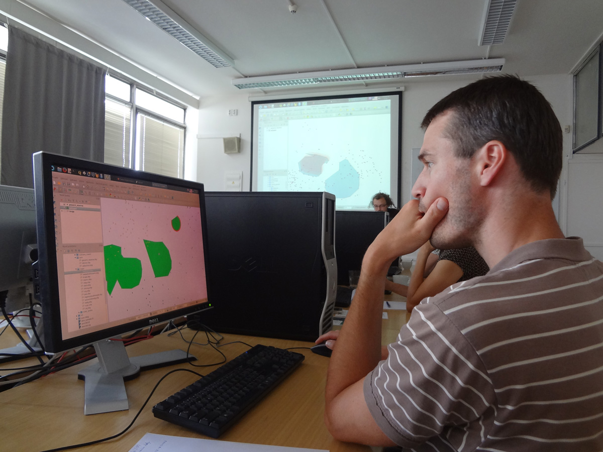
V pátek 1. 6. proběhl v Praze na Fakultě stavební ČVÚT kurz QGIS pro začátečníky pod záštitou skupiny GISMentors. Akce je určena pro každého, kdo má zájem o geografické informační systémy a setkává se s nimi ať už při pracovních nebo při studijních potřebách. Tentokrát se kurzu zúčastnili zástupci ČÚZK, městských úřadů a také studenti, rozšiřující si své znalosti. […]
The post Nevíte, jak na GIS? Poradí Vám GISMentors! (PR) appeared first on GISportal.cz.
MDA's satellite subsystems support innovative communications technologies in space
8.6.2018 2:37 GISCafe.com Webcasts-Webinars QUEBEC, June 7, 2018 — (PRNewswire) —QUEBEC, June 7, 2018 /CNW/ - MDA, a Maxar Technologies company (formerly MacDonald, Dettwiler …
INSPIRE Protected sites - IUCN
8.6.2018 2:00 Cenia - Katalog metadat ČR - INSPIRE This data set contains spatial data for protected sites of the Czech Republic that match any of IUCN Protected Area Category. The protected sites in this data set are divided into IUCN categories according to the INSPIRE registry codelist (http://inspire.ec.europa.eu/codelist/IUCNDesignationValue). Not all categories must be filled at a specific time; © NCA CR (AOPK ČR), 2018INSPIRE Protected sites - other
8.6.2018 2:00 Cenia - Katalog metadat ČR - INSPIRE This data set contains two groups of spatial data:1) Buffer Zones. These Buffer Zones of Specially Protected Areas are proclaimed in accordance with Section 37 of the Act No. 114/1992 Coll., on nature and landscape protection and preservation (Collection of Laws of the Czech Republic) to safeguard selected Specially Protected Areas in the Czech Republic against disturbing influences of the surroundings. 2) Contract Protected Areas. Contract Protected Areas are proclaimed in accordance with Section 39 of the Act No. 114/1992 Coll., on nature and landscape protection and preservation (Collection of Laws of the Czech Republic) on the basis of a written contract concluded between the owner of the concerned land and the authority competent to their proclamation. It is proclaimed instead of Specially Protected Areas where suitable; © NCA CR (AOPK ČR), 2018Silent Auction to Benefit URISA's GISCorps Announced
7.6.2018 23:02 GISCafe.com Webcasts-Webinars Des Plaines, IL (June 7, 2018) URISA is pleased to announce a silent auction to benefit URISA’s GISCorps during GIS-Pro & CalGIS 2018 …CubeWerx releases ClearSkies online haze removal tool for aerial and satellite imagery
7.6.2018 21:20 GISCafe.com Webcasts-Webinars Gatineau, Canada, May 21, 2018 - CubeWerx today announced the general availability of its ClearSkies platform, a pay-as-you-go service for …Subsurface Utility Engineering (SUE) Association to Form and hold an Organizing Conference
7.6.2018 20:23 GISCafe.com Webcasts-Webinars June 7, 2018 -- Reston, VA - A new trade and professional association of subsurface utility engineering (SUE) practitioners, the SUE …Toyo Pioneers STAAD Advanced Concrete Design to Deliver Its Largest Ethylene Plant Project
7.6.2018 20:16 Bentley SystemsPress Coverage
Construction HQ World, Middle East
Read the articleWater HQ Exclusive: Advancing Management of Urban Water Infrastructure
7.6.2018 20:12 Bentley SystemsPress Coverage
Water HQ World, Middle East
Read the articleBentley Systems Year In Infrastructure Conference and Awards Gala to be held in London, October 15-18, 2018
7.6.2018 20:07 Bentley SystemsPress Coverage
D + C Magazine, Southeast Asia
Read the articleAirbus and U.S. Air Force Commemorate 25 years of the Eagle Vision Program
7.6.2018 19:00 GISCafe.com Webcasts-Webinars Washington, D.C., 7 June 2018 – Airbus Defence and Space celebrates the twenty-fifth anniversary of Eagle Vision, its lightweight deployable …OGC Invites you to the Disasters CDS Workshop at the NOAA Auditorium, Silver Spring, M
7.6.2018 18:41 GISCafe.com Webcasts-Webinars Workshop will shape future activities to be led by OGC regarding disaster preparedness & response, and will inform potential Disaster Spatial …CoreLogic Reports Home Equity Gains Topped $1 Trillion in the First Quarter of 2018
7.6.2018 18:39 GISCafe.com Webcasts-Webinars In the First Quarter of 2018, 84,000 Residential PropertiesRegained Equity
About 2.5 Million Mortgaged Residential …
Energy Web Atlas, ESRI Partner to Enhance Energy Data Offering
7.6.2018 18:38 GISCafe.com Webcasts-Webinars New agreement brings real-time pipeline, LNG project information to ESRI usersHOUSTON, June 7, 2018 — (PRNewswire) — Gulf Energy …
Galileo, inside out
7.6.2018 16:30 ESA Navigation
Technology image of the week: an entire Galileo satellite was taken apart then put back together on this test bench for laboratory testing
Galileo, inside out
7.6.2018 16:30 ESA Navigation
Technology image of the week: an entire Galileo satellite was taken apart then put back together on this test bench for laboratory testing
Galileo, inside out
7.6.2018 14:38 ESA NavigationTechnology image of the week: an entire Galileo satellite was taken apart then put back together on this test bench for laboratory testing
Referent technického odboru
7.6.2018 13:48 ČÚZK /Urady/Katastralni-urady/Katastralni-urady/Katastralni-urad-pro-Liberecky-kraj/Uredni-deska/Oznameni-a-jina-uredni-sdeleni/Volna-mista/Referent-technickeho-odboruReferent technického odboru
7.6.2018 13:48 ČÚZK - předpisy a opatření Katastrální úřad pro Liberecký kraj - technický odborvypisuje výběrové řízení na místo
Referent technického odboru
Referent technického odboru
7.6.2018 13:48 ČÚZK - volná místa Katastrální úřad pro Liberecký kraj - technický odbor vypisuje výběrové řízení na místo Referent technického odboru20180607 - volné místo - Odborný rada v oddělení právních vztahů Katastrálního pracoviště Žatec
7.6.2018 13:29 ČÚZK - předpisy a opatření Katastrální úřad pro Ústecký kraj - Katastrální pracoviště Žatec zveřejnil novou aktualitu: Nabídka volného pracovního místa - Odborný rada v oddělení právních vztahů k nemovitostem Katastrálního pracoviště Žatec na KÚ pro Ústecký kraj20180607 - volné místo - Odborný rada v oddělení právních vztahů Katastrálního pracoviště Žatec
7.6.2018 13:29 ČÚZK /Urady/Katastralni-urady/Katastralni-urady/Katastralni-urad-pro-Ustecky-kraj/O-uradu/Aktuality/20180607-volne-misto-Odborny-rada-v-oddeleni-pOdborný rada v oddělení právních vztahů k nemovitostem Katastrálního pracoviště Žatec na KÚ pro Úste
7.6.2018 13:23 ČÚZK - volná místa Katastrální úřad pro Ústecký kraj - Katastrální pracoviště Žatec vypisuje výběrové řízení na místo Odborný rada v oddělení právních vztahů k nemovitostem Katastrálního pracoviště Žatec na KÚ pro ÚsteOdborný rada v oddělení právních vztahů k nemovitostem Katastrálního pracoviště Žatec na KÚ pro Úste
7.6.2018 13:23 ČÚZK /Urady/Katastralni-urady/Katastralni-urady/Katastralni-urad-pro-Ustecky-kraj/Uredni-deska/Oznameni-a-jina-uredni-sdeleni/Volna-mista/Odborny-rada-v-oddeleni-pravnich-vztahu-k-nemovitoOdborný rada v oddělení právních vztahů k nemovitostem Katastrálního pracoviště Žatec na KÚ pro Úste
7.6.2018 13:23 ČÚZK - předpisy a opatření Katastrální úřad pro Ústecký kraj - Katastrální pracoviště Žatecvypisuje výběrové řízení na místo
Odborný rada v oddělení právních vztahů k nemovitostem Katastrálního pracoviště Žatec na KÚ pro Ústecký kraj
Polní dny ze vzduchu
7.6.2018 13:20 Geotronics DRONY - Přijďte se podívat na možnosti využití bezpilotních prostředků a satelitního průzkumu pro běžnou zemědělskou praxi.Otevíračka dopisů
7.6.2018 13:02 ČÚZK - předpisy a opatřeníKatastrální úřad pro Jihomoravský kraj nabízí nepotřebný majetek k odkupu. Jedná se o
Otevíračka dopisů
Otevíračka dopisů
7.6.2018 13:02 ČÚZK /Urady/Katastralni-urady/Katastralni-urady/Katastralni-urad-pro-Jihomoravsky-kraj/Nabidky-majetku/Oteviracka-dopisu"Boundless Ventures Offline with the Offline Tile Server" by Susan Smith
7.6.2018 12:24 GISCafe.com Webcasts-WebinarsReferent ZKN
7.6.2018 11:17 ČÚZK - volná místa Zeměměřický úřad vypisuje výběrové řízení na místo Referent ZKNReferent ZKN
7.6.2018 11:17 ČÚZK /Urady/Zememericky-urad/Uredni-deska/Oznameni-a-jina-uredni-sdeleni/Volna-mista/Referent-ZKNReferent ZKN
7.6.2018 11:17 Zeměměřický úřad Zeměměřický úřadvypisuje výběrové řízení na místo
Referent ZKN
Referent ZKN
7.6.2018 11:17 ČÚZK - volná místa Zeměměřický úřad vypisuje výběrové řízení na místo Referent ZKNReferent ZKN
7.6.2018 11:17 ČÚZK - předpisy a opatření Zeměměřický úřadvypisuje výběrové řízení na místo
Referent ZKN
Referent ZKN
7.6.2018 11:17 ČÚZK - předpisy a opatření Zeměměřický úřadvypisuje výběrové řízení na místo
Referent ZKN
Referent ZKN
7.6.2018 11:17 Zeměměřický úřad Zeměměřický úřadvypisuje výběrové řízení na místo
Referent ZKN
20180607 - volné místo - Odborný referent v oddělení OKO II. v technickém odboru na KÚ pro ÚK
7.6.2018 11:08 ČÚZK /Urady/Katastralni-urady/Katastralni-urady/Katastralni-urad-pro-Ustecky-kraj/O-uradu/Aktuality/20180607-volne-misto-Odborny-referent-v-oddele20180607 - volné místo - Odborný referent v oddělení OKO II. v technickém odboru na KÚ pro ÚK
7.6.2018 11:08 ČÚZK - předpisy a opatření Katastrální úřad pro Ústecký kraj zveřejnil novou aktualitu: Nabídka volného pracovního místa - Odborný referent/vrchní referent v oddělení OKO II. v technickém odboru na Katastrálním úřadu pro Ústecký krajGeodet
7.6.2018 11:08 ČÚZK - předpisy a opatření Zeměměřický úřadvypisuje výběrové řízení na místo
Geodet
Odborný referent/vrchní referent v oddělení OKO II. v technickém odboru na Katastrálním úřadu pro Ús
7.6.2018 11:00 ČÚZK - předpisy a opatření Katastrální úřad pro Ústecký krajvypisuje výběrové řízení na místo
Odborný referent/vrchní referent v oddělení OKO II. v technickém odboru na Katastrálním úřadu pro Ústecký kraj
Odborný referent/vrchní referent v oddělení OKO II. v technickém odboru na Katastrálním úřadu pro Ús
7.6.2018 11:00 ČÚZK - volná místa Katastrální úřad pro Ústecký kraj - odbor obnovy katastrálního operátu vypisuje výběrové řízení na místo Odborný referent/vrchní referent v oddělení OKO II. v technickém odboru na Katastrálním úřadu pro ÚsOdborný referent/vrchní referent v oddělení OKO II. v technickém odboru na Katastrálním úřadu pro Ús
7.6.2018 11:00 ČÚZK /Urady/Katastralni-urady/Katastralni-urady/Katastralni-urad-pro-Ustecky-kraj/Uredni-deska/Oznameni-a-jina-uredni-sdeleni/Volna-mista/Odborny-referent-vrchni-referent-v-oddeleni-OKO-IIOdborný referent/vrchní referent v oddělení OKO II. v technickém odboru na Katastrálním úřadu pro Ús
7.6.2018 11:00 ČÚZK - volná místa Katastrální úřad pro Ústecký kraj - technický odbor vypisuje výběrové řízení na místo Odborný referent/vrchní referent v oddělení OKO II. v technickém odboru na Katastrálním úřadu pro ÚsOdborný referent/vrchní referent v oddělení OKO II. v technickém odboru na Katastrálním úřadu pro Ús
7.6.2018 11:00 ČÚZK - předpisy a opatření Katastrální úřad pro Ústecký kraj - odbor obnovy katastrálního operátuvypisuje výběrové řízení na místo
Odborný referent/vrchní referent v oddělení OKO II. v technickém odboru na Katastrálním úřadu pro Ústecký kraj
Odborný referent/vrchní referent v oddělení OKO II. v technickém odboru na Katastrálním úřadu pro Ús
7.6.2018 11:00 ČÚZK - volná místa Katastrální úřad pro Ústecký kraj vypisuje výběrové řízení na místo Odborný referent/vrchní referent v oddělení OKO II. v technickém odboru na Katastrálním úřadu pro ÚsOdborný referent/vrchní referent v oddělení OKO II. v technickém odboru na Katastrálním úřadu pro Ús
7.6.2018 11:00 ČÚZK - předpisy a opatření Katastrální úřad pro Ústecký kraj - technický odborvypisuje výběrové řízení na místo
Odborný referent/vrchní referent v oddělení OKO II. v technickém odboru na Katastrálním úřadu pro Ústecký kraj
GSA pays tribute to Per Tegnér
7.6.2018 10:58 European GNSS Agency
The European GNSS Agency (GSA) joins with the European space community in paying tribute to Per Tegnér, former chair of the GSA Administrative Board.
Per was born in Stockholm, Sweden, on 22 April 1944. He studied at the Stockholm School of Economics, where he obtained his Master’s Degree in Economics. After working for more than 25 years with the Swedish Ministry of Industry, he was appointed Director General of the Swedish National Space Board (now the Swedish National Space Agency) in 1998, a position he held until 2009.
Per joined the GSA Administrative Board in 2006 and served as chair from November 2008 to June 2011, which was a pivotal time for the Agency. While serving as chair of the Administrative Board, he appointed Carlo des Dorides as the Agency’s executive director.
“With his vast experience, Per made a valuable contribution to the European GNSS Agency, bringing clear vision and strong leadership during its formative years. He was a key partner when I took over the position of executive director of the GSA, guiding me along the path the Agency needed to take. I’ll bring with me his gentle smile which was often more meaningful than many words. He will be sadly missed by all the GSA family,” des Dorides said.
“Per served as an inspiration to those who followed in his footsteps, thanks to his dedication and experience. The space community has lost a valued colleague and dear friend,” said current GSA Administrative Board Chair Jean-Yves Le Gall.
“In his role as Chair of the GSA Administrative Board Per Tegnér made a big contribution to making the two European flagship programmes EGNOS and Galileo work. He was a very kind man with an excellent ability to foster consensus even between the most diverging points of view. Per was an inspiration and a role model for me when I took over the post of Chair from him,” noted Sabine Dannelke, his successor in the role of AB Chair
Before joining the GSA, Per became a European Space Agency (ESA) Council delegate in June 1998, and then served as ESA Council chair from 2002 to 2005. He later served as vice-chair for two more years before returning as acting Council chair from 2007 to 2008.
Per will be sadly missed by all those who worked with him at the GSA.
Media note: This feature can be republished without charge provided the European GNSS Agency (GSA) is acknowledged as the source at the top or the bottom of the story. You must request permission before you use any of the photographs on the site. If you republish, we would be grateful if you could link back to the GSA website (http://www.gsa.europa.eu).
GSA pays tribute to Per Tegnér
7.6.2018 10:58 European GNSS AgencyThe European GNSS Agency (GSA) joins with the European space community in paying tribute to Per Tegnér, former chair of the GSA Administrative Board.
Per was born in Stockholm, Sweden, on 22 April 1944. He studied at the Stockholm School of Economics, where he obtained his Master’s Degree in Economics. After working for more than 25 years with the Swedish Ministry of Industry, he was appointed Director General of the Swedish National Space Board (now the Swedish National Space Agency) in 1998, a position he held until 2009.
Per joined the GSA Administrative Board in 2006 and served as chair from November 2008 to June 2011, which was a pivotal time for the Agency. While serving as chair of the Administrative Board, he appointed Carlo des Dorides as the Agency’s executive director.
“With his vast experience, Per made a valuable contribution to the European GNSS Agency, bringing clear vision and strong leadership during its formative years. He was a key partner when I took over the position of executive director of the GSA, guiding me along the path the Agency needed to take. I’ll bring with me his gentle smile which was often more meaningful than many words. He will be sadly missed by all the GSA family,” des Dorides said.
“Per served as an inspiration to those who followed in his footsteps, thanks to his dedication and experience. The space community has lost a valued colleague and dear friend,” said current GSA Administrative Board Chair Jean-Yves Le Gall.
“In his role as Chair of the GSA Administrative Board Per Tegnér made a big contribution to making the two European flagship programmes EGNOS and Galileo work. He was a very kind man with an excellent ability to foster consensus even between the most diverging points of view. Per was an inspiration and a role model for me when I took over the post of Chair from him,” noted Sabine Dannelke, his successor in the role of AB Chair
Before joining the GSA, Per became a European Space Agency (ESA) Council delegate in June 1998, and then served as ESA Council chair from 2002 to 2005. He later served as vice-chair for two more years before returning as acting Council chair from 2007 to 2008.
Per will be sadly missed by all those who worked with him at the GSA.
Media note: This feature can be republished without charge provided the European GNSS Agency (GSA) is acknowledged as the source at the top or the bottom of the story. You must request permission before you use any of the photographs on the site. If you republish, we would be grateful if you could link back to the GSA website (http://www.gsa.europa.eu).
GSA pays tribute to Per Tegnér
7.6.2018 10:58 European GNSS Agency
The European GNSS Agency (GSA) joins with the European space community in paying tribute to Per Tegnér, former chair of the GSA Administrative Board.
Per was born in Stockholm, Sweden, on 22 April 1944. He studied at the Stockholm School of Economics, where he obtained his Master’s Degree in Economics. After working for more than 25 years with the Swedish Ministry of Industry, he was appointed Director General of the Swedish National Space Board (now the Swedish National Space Agency) in 1998, a position he held until 2009.
Per joined the GSA Administrative Board in 2006 and served as chair from November 2008 to June 2011, which was a pivotal time for the Agency. While serving as chair of the Administrative Board, he appointed Carlo des Dorides as the Agency’s executive director.
“With his vast experience, Per made a valuable contribution to the European GNSS Agency, bringing clear vision and strong leadership during its formative years. He was a key partner when I took over the position of executive director of the GSA, guiding me along the path the Agency needed to take. I’ll bring with me his gentle smile which was often more meaningful than many words. He will be sadly missed by all the GSA family,” des Dorides said.
“Per served as an inspiration to those who followed in his footsteps, thanks to his dedication and experience. The space community has lost a valued colleague and dear friend,” said current GSA Administrative Board Chair Jean-Yves Le Gall.
“In his role as Chair of the GSA Administrative Board Per Tegnér made a big contribution to making the two European flagship programmes EGNOS and Galileo work. He was a very kind man with an excellent ability to foster consensus even between the most diverging points of view. Per was an inspiration and a role model for me when I took over the post of Chair from him,” noted Sabine Dannelke, his successor in the role of AB Chair
Before joining the GSA, Per became a European Space Agency (ESA) Council delegate in June 1998, and then served as ESA Council chair from 2002 to 2005. He later served as vice-chair for two more years before returning as acting Council chair from 2007 to 2008.
Per will be sadly missed by all those who worked with him at the GSA.
Media note: This feature can be republished without charge provided the European GNSS Agency (GSA) is acknowledged as the source at the top or the bottom of the story. You must request permission before you use any of the photographs on the site. If you republish, we would be grateful if you could link back to the GSA website (http://www.gsa.europa.eu).
odborný rada - vedoucí oddělení právních vztahů k nemovitostem KP JI
7.6.2018 10:49 ČÚZK - předpisy a opatření Katastrální úřad pro Vysočinu - Katastrální pracoviště Jihlava zveřejnil novou aktualitu: výběrové řízení na služební místo odborný rada - vedoucí oddělení právních vztahů k nemovitostem Katastrálního pracoviště Jihlava. Oznámení o vyhlášení výběrového řízení na služební místo odborný rada - vedoucí oddělení právních vztahů k nemovitostem Katastrálního pracoviště Jihlava na Katastrálním úřadu pro Vysočinu, místo výkonu služby Jihlava, více zde.odborný rada - vedoucí oddělení právních vztahů k nemovitostem KP JI
7.6.2018 10:49 ČÚZK /Urady/Katastralni-urady/Katastralni-urady/Katastralni-urad-pro-Vysocinu/Katastralni-pracoviste/KP-Jihlava/O-uradu/Aktuality/odborny-rada-vedouci-oddeleni-pravnich-vztahu-kodborný rada - vedoucí oddělení právních vztahů k nemovitostem KP JI
7.6.2018 10:49 ČÚZK - předpisy a opatření Katastrální úřad pro Vysočinu - Katastrální pracoviště Jihlava zveřejnil novou aktualitu: výběrové řízení na služební místo odborný rada - vedoucí oddělení právních vztahů k nemovitostem Katastrálního pracoviště Jihlava. Oznámení o vyhlášení výběrového řízení na služební místo odborný rada - vedoucí oddělení právních vztahů k nemovitostem Katastrálního pracoviště Jihlava na Katastrálním úřadu pro Vysočinu, místo výkonu služby Jihlava zde.odborný rada - vedoucí oddělení právních vztahů k nemovitostem Katastrálního pracoviště Jihlava na K
7.6.2018 10:40 ČÚZK /Urady/Katastralni-urady/Katastralni-urady/Katastralni-urad-pro-Vysocinu/Uredni-deska/Oznameni-a-jina-uredni-sdeleni/Volna-mista/odborny-rada-vedouci-oddeleni-pravnich-vztahu-kodborný rada - vedoucí oddělení právních vztahů k nemovitostem Katastrálního pracoviště Jihlava na K
7.6.2018 10:40 ČÚZK - předpisy a opatření Katastrální úřad pro Vysočinu - Katastrální pracoviště Jihlavavypisuje výběrové řízení na místo odborný rada - vedoucí oddělení právních vztahů k nemovitostem Katastrálního pracoviště Jihlava na Katastrálním úřadu pro Vysočinu.
odborný rada - vedoucí oddělení právních vztahů k nemovitostem Katastrálního pracoviště Jihlava na Katastrálním úřadu pro Vysočinu.
odborný rada - vedoucí oddělení právních vztahů k nemovitostem Katastrálního pracoviště Jihlava na K
7.6.2018 10:40 ČÚZK - volná místa Katastrální úřad pro Vysočinu - Katastrální pracoviště Jihlava vypisuje výběrové řízení na místo odborný rada - vedoucí oddělení právních vztahů k nemovitostem Katastrálního pracoviště Jihlava na KKosmonaut ESA Alexander Gerst se vrátil do vesmíru
7.6.2018 10:33 Český Kosmický PortálVe středu 6. června se v 11:12 h GMT (13:12 h středoevropského času) vydal kosmonaut ESA Alexander Gerst do vesmíru společně s americkou astronautkou Serenou Auñón-Chancellorovou a ruským pilotem Sergejem Prokopjevem. Odstartovali na palubě lodi Sojuz MS-09 z kosmodromu Bajkonur v Kazachstánu.
Kosmonaut ESA Alexander Gerst se vrátil do vesmíru
7.6.2018 10:33 Český Kosmický PortálVe středu 6. června se v 11:12 h GMT (13:12 h středoevropského času) vydal kosmonaut ESA Alexander Gerst do vesmíru společně s americkou astronautkou Serenou Auñón-Chancellorovou a ruským pilotem Sergejem Prokopjevem. Odstartovali na palubě lodi Sojuz MS-09 z kosmodromu Bajkonur v Kazachstánu.
Nová kniha “Eye-tracking (nejen) v kognitivní kartografii” + SOUTEŽ
7.6.2018 6:49 GISportal.cz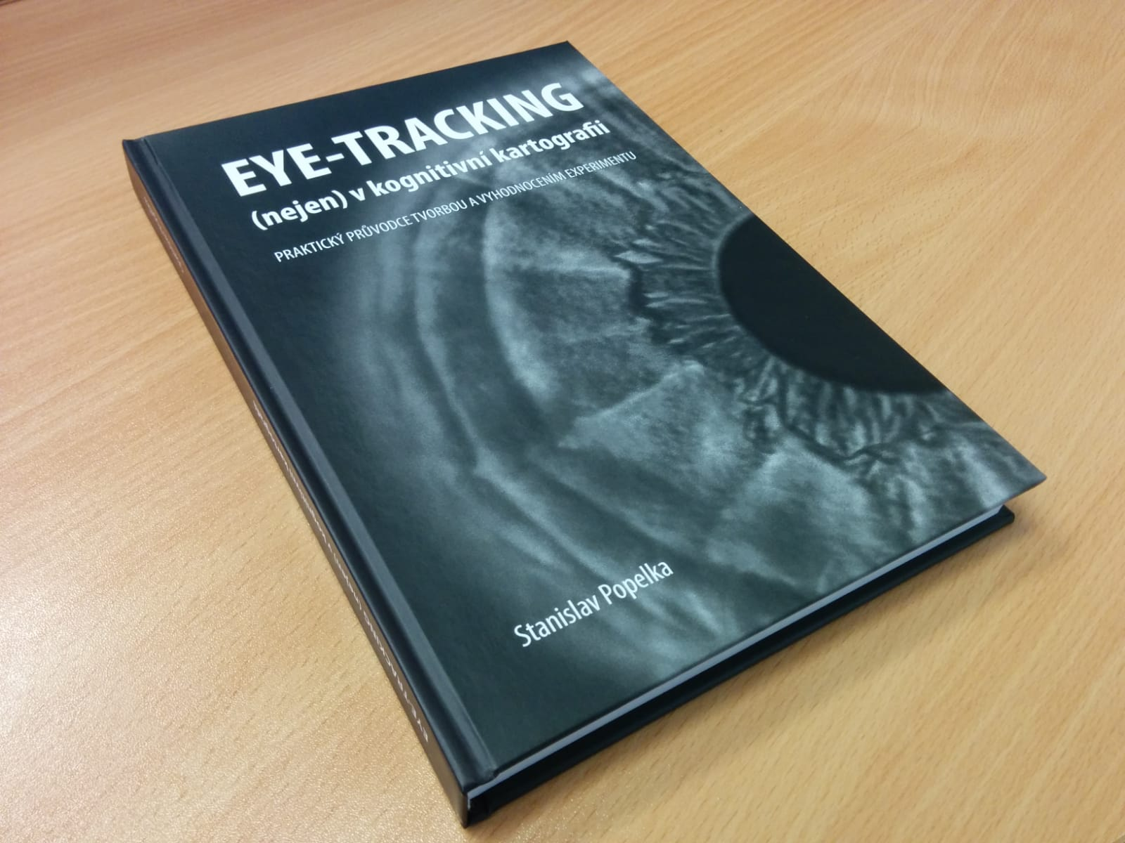
Stanislav Popelka z Katedry geoinformatiky UP v Olomouci vydal novou knihu zaměřenou na problematiku eye-trackingu s důrazem na využití v kartografii Publikace „Eye-tracking (nejen) v kognitivní kartografii – Praktický průvodce tvorbou a vyhodnocením experimentu“ nabízí komplexní pohled na využití sledování pohybu očí při hodnocení a optimalizaci map. Čtenáři se v ní dozvědí teoretické základy, na […]
The post Nová kniha “Eye-tracking (nejen) v kognitivní kartografii” + SOUTEŽ appeared first on GISportal.cz.
Časové řady souřadnic z GNSS / GNSS coordinate time series
7.6.2018 2:00 Cenia - Katalog metadat ČR - INSPIRE Časové řady souřadnic jsou výsledkem zpracování GNSS měření podmnožiny stanic EPN (Permanentní síť EUREF) nebo CZECH - GNSS sít v České republice - VESOG, GEONAS a CZEPOS. Obsahuje denní řešení EUREF zpracování nebo EUREF reanalýzy.Coordinate time series based on processing of GNSS observations of subset of EPN (EUREF Permanent Network) or CZECH - GNSS networks in Czech Republic - VESOG, GEONAS, CZEPOS. It include the daily solutions EUREF processing or EUREF reanalyse.GNSS měření PPGNET / GNSS observations PPGNET
7.6.2018 2:00 Cenia - Katalog metadat ČR - INSPIRE Síť permanentních GNSS stanic v Řecku provozovaná Výzkumným ústavem geodetickým, topografickým a kartografickým - Geodetickou observatoří Pecný a Karlovou univerzitou v Praze, Matematicko-fyzikální fakultou, katedrou geofyziky v úzké spolupráci se Seismologickou laboratoří Univerzity v Patrasu.Network of Permanent GNSS Stations in Greece operated by the Research Institute of Geodesy, Topography and Cartography, Geodetic Observatory Pecny and the Charles University in Prague, Faculty of Mathematics and Physics, Department of Geophysics, in close cooperation with the Seismological Laboratory of University of PatrasOpakovaná měření tíhového zrychlení absolutními gravimetry / Repeated measurement of gravity acceleration by absolute gravimeters
7.6.2018 2:00 Cenia - Katalog metadat ČR - INSPIRE Opakovaná měření tíhového zrychlení na 5 absolutních tíhových bodech v České republice jsou prováděna absolutními gravimetry FG5 č. 215 a FG5X č. 251 vyrobenými Micro-g LaCoste, Inc. v USA. Data jsou distribuována do databáze A-grav.Repeated measurement of gravity acceleration at five absolute gravity stations in the Czech Republic are performed by absolute gravimeters FG5 No. 215 and FG5X No. 251 manufactured by Micro-g LaCoste, Inc. USA. Data are distributed to A-grav database.INSPIRE stahovací služba WCS pro téma Ortofotosnímky (OI)
7.6.2018 2:00 Cenia - Katalog metadat ČR - INSPIRE INSPIRE stahovací služba WCS pro téma Ortofotosnímky (OI) je služba umožňující opakované stahování dat pomocí technologie WCS 1.0.0. Stahovací služba umožňuje stahování dat ve formátech GeoTIFF, JPEG2000,ECW nebo IMG, součástí může být GML soubor s doplňujícími informacemi. Jednorázové stahování dat je z kapacitních důvodů omezeno na 100 000 000 pixelů. Data jsou poskytována v souřadnicovém systému ETRS89/TM33. Základem poskytovaných dat je Ortofoto České republiky. Služba splňuje standard OGC WCS 1.0.0. Služba je prozatím provozována ve zkušebním režimu.GNSS dráhy a parametry rotace Země / GNSS orbits and Earth rotation parameters
7.6.2018 2:00 Cenia - Katalog metadat ČR - INSPIRE Dráhy GNSS družic a parametry rotace Země založené na zpracování GNSS měření z globální sítě IGS (Mezinárodní GNSS Služby) jako rapid produkt nebo ultra-rapid produkt.Orbits of GNSS satellites and Earth rotation parameters based on processing of GNSS observations of global network of IGS (International GNSS Service) as rapid product or ultra-rapid product.Kontinuální observace supravodivým gravimetrem / Continual observations by superconducting gravimeter
7.6.2018 2:00 Cenia - Katalog metadat ČR - INSPIRE Relativní supravodivý gravimetr OSG-050 vyrobený GWR Instruments, Inc. v USA provádí kontinuální měření změn tíhováho zrychlení s intervalem záznamu 1 sekunda v gravimetrické laboratoři Pecný od roku 2007. Data jsou distribuována do IGETS (Mezinárodní služba pro geodynamiku a zemské slapy).Relative superconducting gravimeter OSG-050 manufactured by GWR Instruments, Inc. USA. It provides continuous measurement of gravity variations with sampling rate of 1 sec at the gravimetric station Pecny since 2007. Data are distribued to IGETS (International Geodynamics and Earth Tide Service).Vrtná prozkoumanost s mocností kvartéru
7.6.2018 2:00 Cenia - Katalog metadat ČR - INSPIRE ArcGIS Server služba zpřístupňuje informace o mocnosti kvartéru ve vrtech a dalších dílech evidovaných v databázi geologicky dokumentovaných objektů.GNSS měření VESOG / GNSS observations VESOG
7.6.2018 2:00 Cenia - Katalog metadat ČR - INSPIRE Výzkumná a experimentální síť permanentních GNSS stanic provozovaná Výzkumným ústavem geodetickým, topografickým a kartografickým - Geodetickou observatoří Pecný ve spolupráci s více akademickými a výzkumnými institucemi v České republice: Vysokým učením technickým v Brně, Universitou Palackého v Olomouci, VŠB-Technickou universitou Ostrava, Západočeskou universitou v Plzni, Ústavem fyziky atmosféry AV ČR, Vojenským geografickým a hydrometeorologickým úřadem v Dobrušce.Research and experimental network of permanent GNSS stations operated by the Research Institute of Geodesy, Topography and Cartography, Geodetic Observatory Pecny in cooperation with more academic and research institutions in the Czech Republic: Brno University of Technology, Palacky University of Olomouc, Technical University of Ostrava, West-Bohemia University in Pilsen, Institute for atmospehric physics CAS, Military Geography and Hydrometeorologic Office Dobruska.INSPIRE stahovací služba WCS pro téma Nadmořská výška-GRID (EL GRID)
7.6.2018 2:00 Cenia - Katalog metadat ČR - INSPIRE INSPIRE stahovací služba WCS pro data Nadmořská výška - GRID (EL GRID) je služba umožňující opakované stahování dat pomocí technologie WCS 1.0.0. Stahovací služba umožňuje stahování dat ve formátech GeoTIFF, JPEG2000,ECW nebo IMG, součástí může být GML soubor s doplňujícími informacemi.Jednorázové stahování dat je z kapacitních důvodů omezeno na 100 000 000 pixelů. Data jsou poskytována v souřadnicovém systému ETRS89/TM33. Základem poskytovaných dat je Digitální model reliiéfu České republiky 4. generace (DMR 4G). Služba splňuje standard OGC WCS 1.0.0. Služba je prozatím provozována ve zkušebním režimu.Časové řady troposférických zpoždění z GNSS dat / GNSS based time series of tropospheric delays
7.6.2018 2:00 Cenia - Katalog metadat ČR - INSPIRE Časové řady ze zpracování GNSS měření z globální sítě IGS (Mezinárodní GNSS Služby) nebo regionální - podmnožiny EPN (Permanentní sítě EUREF) nebo lokálního řešení CZECH z GNSS sítí v České republice - VESOG, GEONAS, CZEPOS. Time series based on processing of GNSS observations of global network of IGS (International GNSS Service) or regional - subset of EPN (EUREF Permanent Network) or local CZECH solution from GNSS networks in Czech Republic - VESOG, GEONAS, CZEPOS.2018 World Football Championship stadiums seen from space. 06.06.2018
6.6.2018 20:47 GISCafe.com Webcasts-WebinarsKittyhawk Raises $5M Funding Round to Build Next-Generation Enterprise Drone Solutions
6.6.2018 18:25 GISCafe.com Webcasts-Webinars Bonfire Ventures, Boeing HorizonX Ventures, Freestyle Ventures, and The Flying Object Prepare for Takeoff in the Rapidly Maturing Commercial Drone …3DR Brings On Uplift Data Partners As Preferred Commercial Drone Provider
6.6.2018 18:16 GISCafe.com Webcasts-Webinars Collaboration Offers 360-Approach to Drone Technology Service to AEC CustomersCHICAGO, June 6, 2018 — (PRNewswire) — Uplift Data …
Latest Canon PRISMAsync Print Server Raises the Bar in Color Management
6.6.2018 18:15 GISCafe.com Webcasts-Webinars New version helps streamline print production for high-quality output with minimum effortMELVILLE, N.Y., June 6, 2018 — (PRNewswire) — …
Making smart grids even smarter
6.6.2018 15:00 Bentley SystemsPress Coverage
International Power Engineer, UK
Read the articleBentley Systems Acquires Dutch and Canadian Subsurface Design Tools
6.6.2018 14:38 Bentley SystemsPress Coverage
ENR, USA
Read the articleAre meshes making point-cloud animation pointless?
6.6.2018 14:32 Bentley SystemsPress Coverage
Spar 3D, USA
Read the articleE-SHOP.REPORT hlásí integraci s CORPIS MAPS
6.6.2018 14:08 T-MAPYThe post E-SHOP.REPORT hlásí integraci s CORPIS MAPS appeared first on T-MAPY spol. s r.o..
Kosmická výzkumná služba ICE Cubes se otevírá pro zájemce
6.6.2018 11:21 Český Kosmický PortálPrvní evropské zařízení pro komerční výzkum na Mezinárodní kosmické stanici bylo instalováno na počátku června v laboratorním modulu Columbus. Jde o zařízení služby International Commercial Experiments - zkráceně ICE Cubes - která nabídne rychlý, jednoduchý a dostupný přístup k výzkumným a technologickým experimentům v podmínkách mikrogravitace.
EGNOS geostationary navigation payload services – Request for Information
6.6.2018 10:57 European GNSS Agency
The European GNSS Agency (GSA) has issued a Request for Information (RFI) in preparation for the procurement of EGNOS geostationary navigation payload services: GEO-4 and GEO-5.
The EGNOS space segment is provided by commercial satellite operators on the basis of service contracts. The GEO-1, GEO-2 and GEO-3 service contracts currently cover the EGNOS space segment needs and the GEO-1 and GEO-2 services will be the first of these to end. These will be replaced by GEO-4 and GEO-5 - the subject of this RFI.
The GSA is already planning how it will replace the services currently delivered by the GEO-1 and GEO-2 satellites. Ahead of this procurement, the Agency is conducting a preliminary market analysis and issuing an RFI to collect information about opportunities to embark navigation payloads on-board GEO satellites launched in a suitable timeframe.
Best procurement approach
The results of the RFI will be used to decide on the best approach for the procurement of the payload services, which may be either procured at the same time or separately. The RFI will also help the GSA to define the tender specifications and decide on the most appropriate time to launch Invitation(s) to Tender.
With the RFI, the GSA aims to obtain information from owners of geostationary satellites that will be available for operational service from 2021 to 2027 and able to embark a navigation payload. Specifically, it is seeking information on future satellite plans and the possibility to embark SBAS payload(s) in due time to ensure an operational start date from 2021 to 2027.
Information requested
Other information requested includes information on service availability and long-term payload reliability; the process for EGNOS payload procurement, in orbit testing and commissioning; information on the locations of the potential hosting sites for the EGNOS radio frequency uplink stations; and, finally, information on contractual arrangements, the payment scheme, and cost estimates.
This information will help the Agency understand what parameters influence the service provided and, based on these, to shape the potential procurement of EGNOS navigation payload services.
In preparing their answers, participants should take into account that the scope of the service will comprise provision of the EGNOS GEO-4 and/or GEO-5 payload service, provision of two independent uplink stations located on the territory of the European Union; and a target service provision phase of 15 years starting from the operational qualification or Operational Start Date (OSD).
Answers to the RFI should be sent electronically to tenders@gsa.europa.eu by 31 August 2018, at the latest.
For more information, check here.
Media note: This feature can be republished without charge provided the European GNSS Agency (GSA) is acknowledged as the source at the top or the bottom of the story. You must request permission before you use any of the photographs on the site. If you republish, we would be grateful if you could link back to the GSA website (http://www.gsa.europa.eu).
EGNOS geostationary navigation payload services – Request for Information
6.6.2018 10:57 European GNSS AgencyThe European GNSS Agency (GSA) has issued a Request for Information (RFI) in preparation for the procurement of EGNOS geostationary navigation payload services: GEO-4 and GEO-5.
The EGNOS space segment is provided by commercial satellite operators on the basis of service contracts. The GEO-1, GEO-2 and GEO-3 service contracts currently cover the EGNOS space segment needs and the GEO-1 and GEO-2 services will be the first of these to end. These will be replaced by GEO-4 and GEO-5 - the subject of this RFI.
The GSA is already planning how it will replace the services currently delivered by the GEO-1 and GEO-2 satellites. Ahead of this procurement, the Agency is conducting a preliminary market analysis and issuing an RFI to collect information about opportunities to embark navigation payloads on-board GEO satellites launched in a suitable timeframe.
Best procurement approach
The results of the RFI will be used to decide on the best approach for the procurement of the payload services, which may be either procured at the same time or separately. The RFI will also help the GSA to define the tender specifications and decide on the most appropriate time to launch Invitation(s) to Tender.
With the RFI, the GSA aims to obtain information from owners of geostationary satellites that will be available for operational service from 2021 to 2027 and able to embark a navigation payload. Specifically, it is seeking information on future satellite plans and the possibility to embark SBAS payload(s) in due time to ensure an operational start date from 2021 to 2027.
Information requested
Other information requested includes information on service availability and long-term payload reliability; the process for EGNOS payload procurement, in orbit testing and commissioning; information on the locations of the potential hosting sites for the EGNOS radio frequency uplink stations; and, finally, information on contractual arrangements, the payment scheme, and cost estimates.
This information will help the Agency understand what parameters influence the service provided and, based on these, to shape the potential procurement of EGNOS navigation payload services.
In preparing their answers, participants should take into account that the scope of the service will comprise provision of the EGNOS GEO-4 and/or GEO-5 payload service, provision of two independent uplink stations located on the territory of the European Union; and a target service provision phase of 15 years starting from the operational qualification or Operational Start Date (OSD).
Answers to the RFI should be sent electronically to tenders@gsa.europa.eu by 31 August 2018, at the latest.
For more information, check here.
Media note: This feature can be republished without charge provided the European GNSS Agency (GSA) is acknowledged as the source at the top or the bottom of the story. You must request permission before you use any of the photographs on the site. If you republish, we would be grateful if you could link back to the GSA website (http://www.gsa.europa.eu).
Nová mapová služba Národní registr poskytovatelů zdravotních služeb
6.6.2018 10:53 CENIA - národní geoportál INSPIRE Na Národním geoportálu INSPIRE byla vytvořena nová mapová služba "Národní registr poskytovatelů zdravotních služeb" a mapová kompozice "ÚZIS – Národní registr poskytovatelů zdravotních služeb". Národní registr poskytovatelů zdravotních služeb (NRPZS) je zřízen podle §§ 74 a 75 zákona č. 372/2011 Sb. o zdravotních službách. Registr obsahuje informace o poskytovatelích...Nová data High Resolution Layers
6.6.2018 10:53 CENIA - národní geoportál INSPIRE Na základě nejnovějších dat z Pan-evropské komponenty Služby Copernicus pro monitorování území byla aktualizována data High Resolution Layers (HRL) v mapové službě Národního geoportálu INSPIRE Služby Copernicus pro monitorování území. Kromě aktualizace stávajících dat byla doplněna i nová data za rok 2015 pro všechny vrstvy HRL - nepropustnost povrchu, lesy, louky, vodní plochy a mokřady. Data si...OGC announces an Urban themed Location Powers event, calls for speakers and participants
6.6.2018 10:48 GISCafe.com Webcasts-Webinars Location Powers: ‘Data, Interoperability and our Urban World’ will occur in Singapore 25-26 September 2018.5 June 2018: The Open …
Nová data High resolution Layers
6.6.2018 9:53 CENIA - národní geoportál INSPIRE Na základě nejnovějších dat z Pan-evropské komponenty Služby Copernicus pro monitorování území byla aktualizována data High Resolution Layers (HRL) v mapové službě Národního geoportálu INSPIRE Služby Copernicus pro monitorování území. Kromě aktualizace stávajících dat byla doplněna i nová data za rok 2015 pro všechny vrstvy HRL - nepropustnost povrchu, lesy, louky, vodní plochy a mokřady. Data si...Kvalita koupacích vod v sezóně 2018
6.6.2018 9:39 CENIA - národní geoportál INSPIRE Stejně jako v předchozích letech jsou na geoportálu k dispozici informace o kvalitě koupacích vod v aktuální sezóně. Do seznamu mapových kompozic přibyla kompozice "SZÚ - Kvalita koupacích vod - sezóna 2018", která bude pravidelně aktualizována každý týden po dobu celé koupací sezóny. Data jsou dostupná taktéž prostřednictvím WMS služby geoportálu na adrese...Kvalita koupacích vod v aktuální sezóně
6.6.2018 9:23 CENIA - národní geoportál INSPIRE Stejně jako v předchozích letech jsou na geoportálu k dispozici informace o kvalitě koupacích vod v aktuální sezóně. Do seznamu mapových kompozic přibyla kompozice "SZÚ - SZÚ - Kvalita koupacích vod - sezóna 2018", která bude pravidelně aktualizována každý týden po dobu celé koupací sezóny. Data jsou dostupná taktéž prostřednictvím WMS služby geoportálu na adrese...SXblue Introduces Android Application ToolBox for Its GNSS receiver’s Configuration and Control
6.6.2018 9:00 GISCafe.com Webcasts-Webinars June 5, 2018 - Montreal, QC – In this times of mobile device technology progress, Geneq (SXblue) is always listening to GIS and surveying …Vrchní referent / rada – správce informačních a komunikačních technologií v oddělení podpory ICT tec
6.6.2018 8:42 ČÚZK - volná místa Katastrální úřad pro Královéhradecký kraj vypisuje výběrové řízení na místo Vrchní referent / rada – správce informačních a komunikačních technologií v oddělení podpory ICT tecVrchní referent / rada – správce informačních a komunikačních technologií v oddělení podpory ICT tec
6.6.2018 8:42 ČÚZK - předpisy a opatření Katastrální úřad pro Královéhradecký krajvypisuje výběrové řízení na místo
Vrchní referent / rada – správce informačních a komunikačních technologií v oddělení podpory ICT technického útvaru Katastrálního úřadu pro Královéhradecký kraj
Vrchní referent / rada – správce informačních a komunikačních technologií v oddělení podpory ICT tec
6.6.2018 8:42 ČÚZK /Urady/Katastralni-urady/Katastralni-urady/Katastralni-urad-pro-Kralovehradecky-kraj/Uredni-deska/Oznameni-a-jina-uredni-sdeleni/Volna-mista/Vrchni-referent-rada-–-spravce-informacnich-a-koIndexy Geologické mapy České republiky 1 : 50 000
6.6.2018 2:00 Cenia - Katalog metadat ČR - INSPIRE ArcGIS Server mapová služba obsahující indexy geologické mapz v měřítku 1:50 000 pokrývající celé území ČR.Národní registr poskytovatelů zdravotních služeb
6.6.2018 2:00 Cenia - Katalog metadat ČR - INSPIRE Soubor všech míst poskytování zdravotních služeb registrovaných poskytovatelů zdravotní péče s oprávněním dle zákona 371/2011.Axon and DJI Announce Drone Partnership to Strengthen Law Enforcement Tools for Public Safety
6.6.2018 0:55 GISCafe.com Webcasts-Webinars New Axon Air Program links DJI's drone technology to Evidence.comSCOTTSDALE, Ariz., June 5, 2018 — (PRNewswire) — Axon (Nasdaq: …
Altamira Technologies Awarded as Prime Contractor on NGA Janus Geography Contract
6.6.2018 0:55 GISCafe.com Webcasts-Webinars MCLEAN, Va. — (BUSINESS WIRE) — June 5, 2018 —Altamira Technologies Corporation has been selected as a prime
…
Novými členy SFDP se stali: doc. Ing. Hana Staňková Ph.D. , doc. Ing. Pavel Černota Ph.D. a Ing. Jiří Pospíšil Ph.D.
5.6.2018 23:56 Společnost pro fotogrammetrii a dálkový průzkumNovými členy SFDP se stali: doc. Ing. Hana Staňková Ph.D. , doc. Ing. Pavel Černota Ph.D. a Ing. Jiří Pospíšil Ph.D. z Vysoké školy báňské – Technické univerzity Ostrava, a Ing. Josef Knapík, Ředitel Zeměměřického odboru Pardubice. Velice si vážíme jejich rozhodnutí a těšíme se na spolupráci.
The post Novými členy SFDP se stali: doc. Ing. Hana Staňková Ph.D. , doc. Ing. Pavel Černota Ph.D. a Ing. Jiří Pospíšil Ph.D. appeared first on SFDP.
Blahopřejeme Martinu Řehákovi , absolventu katedry geomatiky, FSv ČVUT v Praze
5.6.2018 23:41 Společnost pro fotogrammetrii a dálkový průzkumBlahopřejeme Martinu Řehákovi , absolventu katedry geomatiky, FSv ČVUT v Praze (bakalářskou práci obhájil pod vedením Doc. Ing. L. Halounové CSc. a magisterskou práci u prof. Dr. Ing. K. Pavelky), který společně s Janem Škaloudem a Davidem Antonio Cuccim obdržel ocenění U. V. Helavy – za nejlepší článek uveřejněný v ISPRS Journal of Photogrammetry and Remote Sensing v roce 2017. Název článku: “Bundle adjustment with raw inertial observations in UAV applications” (École Polytechnique Fédérale de Lausanne, Switzerland) Odkaz na článek v příloze: https://www.sciencedirect.com/science/article/pii/S0924271617301387 odkaz na zdůvodnění hodnocení: http://www.isprs.org/news/newsletter/2018-02/best_paper_2017.pdf
The post Blahopřejeme Martinu Řehákovi , absolventu katedry geomatiky, FSv ČVUT v Praze appeared first on SFDP.
Airbus-built Aeolus wind sensor satellite ready for shipment
5.6.2018 19:56 GISCafe.com Webcasts-WebinarsEsri Location Intelligence to Integrate with SAP HANA Spatial Services
5.6.2018 18:08 GISCafe.com Webcasts-Webinars Esri Selected as the Preferred Geospatial Technology Provider forNew SAP Offering
REDLANDS, Calif. — (BUSINESS WIRE) — …
Harris Corporation Delivers Fifth GPS III Satellite Navigation Payload
5.6.2018 16:08 GISCafe.com Webcasts-Webinars Highlights:Continues delivery momentum with fifth of ten advanced GPS III
navigation payloads
…
TomTom and Toyota to Offer Drivers a Navigation App that Mirrors to In-Dash Screens
5.6.2018 16:08 GISCafe.com Webcasts-Webinars DETROIT — (BUSINESS WIRE) — June 5, 2018 —TU-Automotive --Today, TomTom (TOM2)
launched a new navigation app that …
CoreLogic Reports April Home Prices Up, Washington State Increased 12.8 Percent
5.6.2018 16:08 GISCafe.com Webcasts-Webinars All 50 States Gained Value Year Over Year in AprilOnly One-Third of the Nation’s Top 50 Markets Were Considered At
…
FLIR Launches Next-Generation Black Hornet 3 Nano-UAV
5.6.2018 16:08 GISCafe.com Webcasts-Webinars Latest Black Hornet Enables Operation in GPS-Denied AreasWILSONVILLE, Ore. — (BUSINESS WIRE) — June 5, 2018 —
FLIR …
Boundless Server Enterprise Now Available as Managed Cloud Service
5.6.2018 16:08 GISCafe.com Webcasts-Webinars ST. LOUIS, June 05, 2018 (GLOBE NEWSWIRE) -- Boundless, the leader in open and scalable GIS, today announced that Boundless Server Enterprise™ is …MapBusinessOnline.com Provides ZIP Code Mapping for Industries
5.6.2018 16:07 GISCafe.com Webcasts-Webinars CORNISH, Maine, June 5, 2018 — (PRNewswire) — Business mapping software leader, Map Business Online (MBO) published by SpatialTEQ …Wind satellite shows off
5.6.2018 16:07 ESA Observing the Earth
Before ESA’s Aeolus satellite is packed up and shipped to French Guiana for liftoff in August, media representatives had the chance to see this wind measuring Earth Explorer satellite standing proud in the cleanroom.
Integrating Geotechnical engineering and digital workflows
5.6.2018 15:21 Bentley SystemsPress Coverage
Position IT, Sub Sahara Africa
Read the articlePTC and the Industrial IoT
5.6.2018 15:17 Bentley SystemsPress Coverage
Railway Age, USA
Read the article