


zprávy
zdroje zpráv:V pátečních Událostech na ČT byla s námi reportáž o našem mapování dronem v Mongolsku
5.11.2018 7:40 UpVision V pátečních Událostech na České televizi byla reportáž o našem mapování drony v Mongolsku s geologickým průzkumem jednoho z největších měděných dolů na světě.Více zde:
https://ct24.ceskatelevize.cz/2641784-dron-nad-mongolskym-dolem-cesi-pomahaji-s-tezbou-medi-kterou-nasli-jejich-predchudci
Sbohem Evropo, vzhůru k Měsíci: již brzy se vydá na cestu evropský servisní modul
5.11.2018 7:33 Český Kosmický PortálEvropský servisní modul (ESM), který bude zajišťovat pohon a energii pro kosmickou loď Orion na její první misi kolem Měsíce bude již brzy odeslán z Brém do Spojených států. Na svoji cestu se vydá na palubě letounu Antonov An-124 v časných ranních hodinách 5. listopadu. Do Kennedyho kosmického střediska na Floridě dorazí 6. listopadu.
MŽP - Hodnocení území pro realizaci VTE z hlediska limitů ochrany přírody a krajiny
5.11.2018 1:00 Cenia - Katalog metadat ČR - INSPIRE Hodnocení území pro realizaci VTE z hlediska limitů ochrany přírody a krajiny.Svahové nestability (optimalizované pro mobil)
5.11.2018 1:00 Cenia - Katalog metadat ČR - INSPIRE ArcGIS Server služba zobrazuje detailně vymapované svahové nestability. Jejich zobrazení je přizpůsobeno pro mobilní aplikace.Pozůstatky po těžbě (optimalizované pro mobil)
5.11.2018 1:00 Cenia - Katalog metadat ČR - INSPIRE ArcGIS Server služba zobrazuje sdružená data z databází České geologické služby (Důlní díla, Poddolovaná území, Inventarizace úložných míst), která jsou přizpůsobená pro mobilní aplikace.Popularizace geologie (optimalizované pro mobil)
5.11.2018 1:00 Cenia - Katalog metadat ČR - INSPIRE Aplikace zobrazuje pro širokou veřejnost stručné popisy ke stovkám geologicky zajímavých míst, geoparkům, geologickým expozicím v muzeích nebo přírodě a dostupným exkurzním průvodcům. Stručný popis zajímavostí je doplněn fotografií, údajem o ochraně lokality a případně odkazy na další informace. Odbornějším účelům slouží vrstva geologicky významných lokalit zobrazující lokalizaci a základní charakteristiku dalších tisíců lokalit na území ČR s odkazem na stránky s jejich podrobným popisem. Navíc je možné zobrazit i vrstvu s geologickou mapou 1 : 50 000.Aplikace využívá řešení vyvinuté ČGS pro zobrazování mapových služeb pomocí ESRI API 3.x. Je funkčně a designem optimalizována pro použití na dotykových zařízeních a malých displejích. Aplikace umožňuje lokalizovat aktuální polohu uživatele na mapě pomocí geolokačních schopností použitého zařízení, čímž usnadňuje využití přímo v terénu. Vše na podkladě podrobných topografických map nebo leteckých snímků přebíraných od společnosti Seznam.cz, a.s..Geologická mapa České republiky 1 : 50 000 (GEOČR50 - optimalizované pro mobil)
5.11.2018 1:00 Cenia - Katalog metadat ČR - INSPIRE ArcGIS Server mapová služba zobrazující bezešvou geologickou mapu v měřítku 1:50 000 pokrývající celé území ČR (GEOCR50). Data jsou přizpůsobena pro mobilní aplikace.MŽP - Hodnocení území pro realizaci FVE z hlediska ochrany zemědělského půdního fondu
5.11.2018 1:00 Cenia - Katalog metadat ČR - INSPIRE Hodnocení území pro realizaci FVE z hlediska ochrany zemědělského půdního fonduMožnosti umístění větrných a fotovoltaických elektráren z hlediska ochrany přírody a krajiny
5.11.2018 1:00 Cenia - Katalog metadat ČR - INSPIRE Vyhodnocení možností umístění větrných a fotovoltaických elektráren z hlediska ochrany přírody a krajiny.Geohazardy (optimalizované pro mobil)
5.11.2018 1:00 Cenia - Katalog metadat ČR - INSPIRE Mapová aplikace, zobrazuje vymapované objekty, které patří do kategorie geohazardů. Jedná se o data úložných míst těžebního odpadu, důlní díla, poddolovaná území, svahové nestability a radonová mapa. Stručný popis je doplněn odkazy na další informace a u důlních děl i na dokumentační fotografie. Aplikace využívá řešení vyvinuté ČGS pro zobrazování mapových služeb pomocí ESRI API 3.x. Je funkčně a designem optimalizována pro použití na dotykových zařízeních a malých displejích. Aplikace umožňuje lokalizovat aktuální polohu uživatele na mapě pomocí geolokačních schopností použitého zařízení, čímž usnadňuje využití přímo v terénu. Vše na podkladě podrobných topografických map nebo leteckých snímků přebíraných od společnosti Seznam.cz, a.s..Stacionární zdroje znečišťování - palivo, výkon
5.11.2018 1:00 Cenia - Katalog metadat ČR - INSPIRE Mapová služba prezentuje vyjmenované stacionární zdroje znečištění ovzduší (REZZO 1 a 2) dle jejich instalovaného tepelného výkonu a převládajícího druhu paliva. Vstupní data jsou každoročně aktualizována. Poslední aktualizace: listopad 2018. Stav dat: 2017.Možnosti umístění VTE a FVE z hlediska ochrany přírody a krajiny
5.11.2018 1:00 Cenia - Katalog metadat ČR - INSPIRE Datová sada vycházející z metodického návodu "Vyhodnocení možností umístění větrných a fotovoltaických elektráren z hlediska ochrany přírody a krajiny".Metodický návod popisuje zásady preventivního hodnocení území z hlediska ochrany přírody a krajiny, zejm. z hlediska ochrany krajinného rázu, zvláště chráněných území, lokalit soustavy Natura 2000 a druhů, a dále ochrany kulturních památek a ochrany zemědělského půdního fondu, a to se zaměřením na umísťování větrných a fotovoltaických elektráren.Výstup je preventivním hodnocením velkého krajinného celku na úrovni kraje, ORP či jejich části, který však nepracuje s přesnými parametry potenciální výstavby VTE a FVE. Proto datový výstup pouze stanovuje obecné principy hodnocení, které budou v případě posuzování konkrétních záměrů upřesňovány a může být využit jako specifický oborový podklad v procesech územního plánování (zásady územního rozvoje, územní plány), případně jako podklad pro další koncepční dokumenty (územní studie krajiny, krajská koncepce ochrany přírody a krajiny, územní energetická koncepce a další).Geovědní mapy (optimalizované pro mobil)
5.11.2018 1:00 Cenia - Katalog metadat ČR - INSPIRE Mapová aplikace zobrazuje Geologickou mapu České republiky v měřítku 1 : 50 000, indexy ke geologické mapě a vrstvu rukopisných map geologické mapy 1 : 28 800 z 19. století pro srovnání geologického poznání. Dále je v aplikaci vrstva vrtné prozkoumanosti (databáze Geologicky dokumentovaných objektů), kde jsou data: hloubka horniny pod kvartérem, kvartér v celé hloubce vrtu a vrty bez litologických dat.Aplikace využívá řešení vyvinuté ČGS pro zobrazování mapových služeb pomocí ESRI API 3.x. Je funkčně a designem optimalizována pro použití na dotykových zařízeních a malých displejích. Aplikace umožňuje lokalizovat aktuální polohu uživatele na mapě pomocí geolokačních schopností použitého zařízení, čímž usnadňuje využití přímo v terénu.Vše na podkladě podrobných topografických map nebo leteckých snímků přebíraných od společnosti Seznam.cz, a.s..MŽP - Hodnocení území pro realizaci FVE z hlediska limitů ochrany přírody a krajiny
5.11.2018 1:00 Cenia - Katalog metadat ČR - INSPIRE Vyhodnocení možností umístění větrných a fotovoltaických elektráren z hlediska ochrany přírody a krajiny.České studentské experimenty letěly do stratosféry
4.11.2018 18:31 Česká kosmická kancelář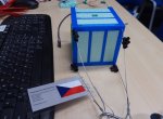
Česká kosmická kancelář bez nároku na finanční odměnu zajistila příležitost pro české studentské týmy k vypuštění jejich experimentů na stratosférickém balónu až do výšky přibližně 22 km v rámci Near Space konference konané během jediného dne, 22. září 2018.
České studentské experimenty letěly do stratosféry
4.11.2018 18:31 Česká kosmická kancelář
Česká kosmická kancelář bez nároku na finanční odměnu zajistila příležitost pro české studentské týmy k vypuštění jejich experimentů na stratosférickém balónu až do výšky přibližně 22 km v rámci Near Space konference konané během jediného dne, 22. září 2018.
INSPIRE téma Rozšířené Parcely (CPX)
3.11.2018 1:00 Cenia - Katalog metadat ČR - INSPIRE Rozšíření má za cíl poskytovat katastrální mapu s obsahem podle vyhlášky ve vektorové podobě ve struktuře plně v souladu se strukturou danou směrnicí INSPIRE. Data rozšiřují směrnici INSPIRE pro téma katastrální parcely (CP) o věcná břemena, geodetické body, další prvky mapy, původní obloukovou geometrii a o parcely určené definičním bodem (ty pouze v oblastech s analogovou mapou). Vychází z katastrální mapy, která je závazným státním mapovým dílem velkého měřítka, obsahuje body polohového bodového pole, polohopis a popis a může mít formu digitální mapy, analogové mapy nebo digitalizované mapy. Publikovaná data obsahují katastrální území pro celou Českou Republiku, parcely a jejich hranice, věcná břemena, další prvky mapy a původní obloukovou geometrii z území, kde je digitální mapa (k 26. 11. 2018 je to 96,16% území České republiky, t.j. 75 840,00km2) a ve zbytku území katastrální parcely určené pouze definičním bodem (tedy bez hranic a polygonu). Katastrální parcely a hranice obsahují oproti datové sadě INSPIRE některé atributy navíc. Jedná se o typ hranice, způsob využití území, druh pozemku, vazbu na budovu a o mapové značky. Více katastrální zákon 344/1992 SB., katastrální vyhláška č.26/2007 Sb. v platném znění a INSPIRE Data Specification on Cadastral Parcels v 3.0.1. Data ve formátu GML 3.2.1 jsou validní proti schématu XML pro Rozšířené Parcely (CPX) ve verzi 4.0.INSPIRE téma Rozšířené Parcely (CPX)
3.11.2018 1:00 Cenia - Katalog metadat ČR - INSPIRE Rozšíření má za cíl poskytovat katastrální mapu s obsahem podle vyhlášky ve vektorové podobě ve struktuře plně v souladu se strukturou danou směrnicí INSPIRE. Data rozšiřují směrnici INSPIRE pro téma katastrální parcely (CP) o věcná břemena, geodetické body, další prvky mapy, původní obloukovou geometrii a o parcely určené definičním bodem (ty pouze v oblastech s analogovou mapou). Vychází z katastrální mapy, která je závazným státním mapovým dílem velkého měřítka, obsahuje body polohového bodového pole, polohopis a popis a může mít formu digitální mapy, analogové mapy nebo digitalizované mapy. Publikovaná data obsahují katastrální území pro celou Českou Republiku, parcely a jejich hranice, věcná břemena, další prvky mapy a původní obloukovou geometrii z území, kde je digitální mapa (k 26. 11. 2018 je to 96,16% území České republiky, t.j. 75 840,00km2) a ve zbytku území katastrální parcely určené pouze definičním bodem (tedy bez hranic a polygonu). Katastrální parcely a hranice obsahují oproti datové sadě INSPIRE některé atributy navíc. Jedná se o typ hranice, způsob využití území, druh pozemku, vazbu na budovu a o mapové značky. Více katastrální zákon 344/1992 SB., katastrální vyhláška č.26/2007 Sb. v platném znění a INSPIRE Data Specification on Cadastral Parcels v 3.0.1. Data ve formátu GML 3.2.1 jsou validní proti schématu XML pro Rozšířené Parcely (CPX) ve verzi 4.0.Sledujte naše video se zajímavými komentáři z konference Aliance a představení UTM v Plzni
2.11.2018 21:39 UpVision Prohlédněte si naše video z 4. konference Aliance pro bezpilotní letecký průmysl, která se konala v Plzni a kde jsme poprvé představili UTM systém ,který dodáváme s americkou firmou AirMap pro Řízení letového provozu. Ve videu jsou i krátké rozhovory s ředitelem ŘLP a AirMapu.Video zde:
https://youtu.be/5Ng7ZOLjHWc
Digital Evolution Moves on at Bentley Year in Infrastructure 2019 in London
2.11.2018 20:10 Bentley SystemsPress Coverage
GISCafe, USA
Read the articleGoing Digital is Theme of Bentley’s YII 2018 Conference
2.11.2018 20:05 Bentley SystemsPress Coverage
Lidar News, USA
Read the articleiModel.js Library Released by Bentley to Open-Source
2.11.2018 20:00 Bentley SystemsPress Coverage
Lidar News, USA
Read the articleDigital Twin – The Key Concept from YII 2018
2.11.2018 19:55 Bentley SystemsPress Coverage
Lidar News, USA
Read the articleYear in Infrastructure Awards 2018 in London
2.11.2018 19:48 Bentley SystemsPress Coverage
Lidar News, USA
Read the articleTopcon Announces Release of Next Generation All-In-One Mass Data Processing Software
2.11.2018 19:43 Bentley SystemsPress Coverage
American Surveyor, USA
Read the articleDružice MetOp-C je připravena na svůj velký den
2.11.2018 14:56 Český Kosmický PortálProtože plánovaný termín startu 7. listopadu se neúprosně blíží, byla meteorologická družice MetOp-C vyvezena společně s nosnou raketou Sojuz na startovací rampu. Již brzy tak vzlétne z evropského kosmodromu Kourou (Francouzská Guayana) do vesmíru.
Earth from Space
2.11.2018 10:05 ESA Observing the Earth
In this edition, discover the port city of Semarang on the north coast of Java, Indonesia
Semarang
2.11.2018 10:05 ESA Observing the Earth
Earth observation image of the week: Copernicus Sentinel-2 takes us over the port city of Semarang in Indonesia
"NavVis IndoorViewer Upgrade Automatically Renders 360° Immersive Imagery from E57 Point Clouds" by Susan Smith
2.11.2018 9:54 GISCafe.com Webcasts-Webinars20181102 Vrchní referent/rada oddělení obnovy katastrálního operátu
2.11.2018 9:17 ČÚZK /Urady/Katastralni-urady/Katastralni-urady/Katastralni-urad-pro-Stredocesky-kraj/O-uradu/Aktuality/20181102-Vrchni-referent-rada-oddeleni-obnovy-kata20181102 Vrchní referent/rada oddělení obnovy katastrálního operátu
2.11.2018 9:17 ČÚZK - předpisy a opatření Katastrální úřad pro Středočeský kraj zveřejnil novou aktualitu: vVrchní referent/rada oddělení obnovy katastrálního operátu části "Úřední deska", v sekci "Oznámení a jiná úřední sdělení" bylo vystaveno "Oznámení o vyhlášení výběrového řízení na obsazení systemizovaného místa vrchní referent/rada oddělení obnovy katastrálního operátu "Vrchní referent/rada oddělení obnovy katastrálního operátu 03120
2.11.2018 8:54 ČÚZK /Urady/Katastralni-urady/Katastralni-urady/Katastralni-urad-pro-Stredocesky-kraj/Uredni-deska/Oznameni-a-jina-uredni-sdeleni/Volna-mista/Vrchni-referent-rada-oddeleni-obnovy-katastralnihoVrchní referent/rada oddělení obnovy katastrálního operátu 03120
2.11.2018 8:54 ČÚZK - předpisy a opatření Katastrální úřad pro Středočeský kraj - technická sekcevypisuje výběrové řízení na místo Vrchní referent/rada oddělení obnovy katastrálního operátu
Vrchní referent/rada oddělení obnovy katastrálního operátu 03120
Vrchní referent/rada oddělení obnovy katastrálního operátu 03120
2.11.2018 8:54 ČÚZK - volná místa Katastrální úřad pro Středočeský kraj - technická sekce vypisuje výběrové řízení na místo Vrchní referent/rada oddělení obnovy katastrálního operátu 03120Interview with Javad Ashjaee, Founder of Javad GNSS at Intergeo 2018
2.11.2018 8:00 GISCafe.com Webcasts-WebinarsDigital Elevation Models Bring Mining History to Life (ArcNews Online)
2.11.2018 8:00 GISCafe.com Webcasts-WebinarsSvahové nestability (optimalizované pro mobil)
2.11.2018 1:00 Cenia - Katalog metadat ČR - INSPIRE ArcGIS Server služba zobrazující vymapované sesuvy na území České republiky. Je využita v aplikaci, která je funkčně a designem optimalizována pro použití na dotykových zařízeních a malých displejích.Hexagon Interim Report 1 January - 30 September 2018
1.11.2018 18:26 GISCafe.com Webcasts-Webinars NACKA STRAND, Sweden, Nov 1, 2018 — (PRNewswire) — Third quarter 2018- Operating net sales increased by 10 per cent to 946.1 MEUR …
VERSES and XYO Network Partner to Power Emerging Spatial Web
1.11.2018 18:26 GISCafe.com Webcasts-Webinars New Partnership to Leverage XYO Network Proof-of-Location Validationat Massive Scale
SAN DIEGO & LOS ANGELES — (BUSINESS …
VRMesh V10.1 Improves Workflow on Point Cloud Cleanup and Road Resurfacing
1.11.2018 17:12 GISCafe.com Webcasts-Webinars Nov. 1st, 2018 - VirtualGrid is pleased to announce the availability of VRMesh v10.1, the latest version of its powerful 3D point cloud and mesh …Bentley Systems Acquires LEGION, Leading Pedestrian Simulation Software
1.11.2018 15:14 Bentley SystemsPress Coverage
APN News, India
Read the articleNIC chair labels UK construction industry as 'laggards'
1.11.2018 14:38 Bentley SystemsPress Coverage
New Civil Engineer, UK
Read the articleBentley Systems awards winners announced
1.11.2018 14:33 Bentley SystemsPress Coverage
World Highways, UK
Read the articleNew campaign launched to help firms embrace digital change
1.11.2018 14:30 Bentley SystemsPress Coverage
Infrastructure Intelligence, UK
Read the articleBentley Systems Launches New ‘Open’ Applications
1.11.2018 14:23 Bentley SystemsPress Coverage
Cadventure, UK
Read the articleBentley promises geotechnical data sharing revolution
1.11.2018 14:17 Bentley SystemsPress Coverage
Ground Engineering, UK
Read the articleOdborný referent / vrchní referent – obnova katastrálního operátu
1.11.2018 12:51 ČÚZK - volná místa Katastrální úřad pro Zlínský kraj - Katastrální pracoviště Kroměříž vypisuje výběrové řízení na místo Odborný referent / vrchní referent – obnova katastrálního operátuOdborný referent / vrchní referent – obnova katastrálního operátu
1.11.2018 12:51 ČÚZK /Urady/Katastralni-urady/Katastralni-urady/Katastralni-urad-pro-Zlinsky-kraj/Uredni-deska/Oznameni-a-jina-uredni-sdeleni/Volna-mista/Odborny-referent-vrchni-referent-–-obnova-katastOdborný referent / vrchní referent – obnova katastrálního operátu
1.11.2018 12:51 ČÚZK - předpisy a opatření Katastrální úřad pro Zlínský kraj - Katastrální pracoviště Kroměřížvypisuje výběrové řízení na místo
Odborný referent / vrchní referent – obnova katastrálního operátu
Where (exactly) are my things? Learn how Galileo empowers IoT solutions
1.11.2018 11:48 European GNSS Agency
Global Navigation Satellite Systems (GNSS), including Galileo, play a key role in the Internet of Things (IoT), and positioning, velocity and timing information supports a wide range of context-aware applications, from drones and driverless cars to asset tracking. At a webinar hosted by the Alliance for Internet of Things Innovation (AIOTI) on November 29, representatives from the GSA will explain how the IoT can benefit from Galileo’s unique features.
The Alliance for Internet Of Things Innovation (AIOTI) is an European organisation created to strengthen dialogue and interaction among IoT players and counting among its members an important number of global and European industry players and research centres active in the IoT domain. GSA in cooperation with AIOTI is organizing a dedicated webinar addressing the important benefits that Galileo can bring to the IoT community.
In recent years, access to GNSS technology has developed exponentially, quickly progressing from the appearance of the first GPS navigation equipment to the current situation, with more than 6 billion GNSS devices available globally. What’s more, the arrival of the IoT has considerably increased the number of services and applications that require positioning information.
Key development areas
GNSS supports real-time, accurate tracking, timing, and other machine-to-machine communication. The current location performance is sufficient to support many applications, but as the IoT market expands, so will the demands placed on GNSS systems. The IoT and the self-driving cars and drones of tomorrow will all require more accuracy, ubiquity of location both indoors and outdoors, and security of location data, all with the lowest possible power consumption.
Read this: GNSS a key element of all-purpose, user-driven positioning solutions
With such a wide range of applications, innovation around positioning is evolving along three main paths. First of all, there is ubiquitous location, where the aim is to be able to locate people and objects at anytime, anywhere. The second area of development is the automation of positioning systems, enabling systems to sense their environment and react to it in real time. Finally, there is security of positioning. This is particularly important in liability-critical applications such as autonomous driving, where hacking threats can put people’s lives in danger.
What Galileo brings to the table
On 29 November 2018, at 14:00, the GSA’s Deputy Head of Market Development Fiammetta Diani and Justyna Redelkiewicz Musial, in charge of LBS and IoT market development at the GSA, will talk about Galileo’s unique features for IoT, including signal authentication to prevent spoofing, additional frequencies for better accuracy in urban environments, and high accuracy service for more demanding applications.
Don’t miss out on this opportunity to learn how your IoT solution can benefit from Galileo. Register today by following this link.
Media note: This feature can be republished without charge provided the European GNSS Agency (GSA) is acknowledged as the source at the top or the bottom of the story. You must request permission before you use any of the photographs on the site. If you republish, we would be grateful if you could link back to the GSA website (http://www.gsa.europa.eu).
GEODÉZIE - Nová sestava Trimbl
1.11.2018 10:08 Geotronics GEODÉZIE - Nová sestava Trimble C5 colibri je nejlepším poměrem výkonu a ceny.Prodej movitého majetku - PC, monitory a switche
1.11.2018 8:18 ČÚZK /Urady/Katastralni-urady/Katastralni-urady/Katastralni-urad-pro-Pardubicky-kraj/Nabidky-majetku/Prodej-moviteho-majetku-PC,-monitory-a-switcheProdej movitého majetku - PC, monitory a switche
1.11.2018 8:18 ČÚZK - předpisy a opatřeníKatastrální úřad pro Pardubický kraj nabízí nepotřebný majetek k odkupu. Jedná se o PC, monitory LCD a switche
Prodej movitého majetku - PC, monitory a switche
Historické mapy
1.11.2018 8:01 Statutární město Ústí nad Labem Mapová aplikace <a href="https://mapy.usti-nad-labem.cz/apps/historie/" target="_blank">Historické mapy v ORP Ústí nad Labem</a> je převedena do nového modernějšího prostředí. Již není nutné instalovat plugin Adobe Flash Player, aplikace běží i na mobilních telefonech a lépe se ovládá. Aplikace nabízí 2 synchronizovaná mapová okna, do každého lze přidat jiný mapový podklad a vzájemně je překrývat. Snadno tak lze pozorovat vývoj vybrané lokality v různých časových obdobích (dle zvoleného mapového podkladu). Aplikace obsahuje mapové podklady za posledních 170 let - od Císařských otisků z roku 1842 po aktuální leteckou mapu z roku 2018.Inovace webu a aplikací oddělení GIS - nový Mapový portál
1.11.2018 8:00 Statutární město Ústí nad Labem Webové stránky oddělení GIS, odkud lze spouštět mapové aplikace pro veřejnost a kde jsou umístěné další informace související s mapami a geografickým informačním systémem (GIS) města, prošly několika inovacemi.Video Interview with Kevin Dowling, CEO of KAARTA at Intergeo 2018
1.11.2018 8:00 GISCafe.com Webcasts-WebinarsSonda Mars Express pozoruje zajímavý oblak
1.11.2018 7:35 Český Kosmický PortálOd 13. září pozoruje sonda ESA Mars Express v atmosféře stejnojmenné planety vývoj protáhlé oblačné formace, která se objevila v blízkosti 20 km vysoké sopky Arsia Mons. Ta se nachází blízko rovníku planety.
Sonda Mars Express pozoruje zajímavý oblak
1.11.2018 7:35 Český Kosmický PortálOd 13. září pozoruje sonda ESA Mars Express v atmosféře stejnojmenné planety vývoj protáhlé oblačné formace, která se objevila v blízkosti 20 km vysoké sopky Arsia Mons. Ta se nachází blízko rovníku planety.
3rd Annual DroneDeploy Event Explores the Future of Drones in the Age of Automation
31.10.2018 21:32 GISCafe.com Webcasts-Webinars Leading Drone Software Company Announces Forthcoming Products Including Analytics AI Suite & Redesigned "Site-Aware" User ExperienceSAN FRANCISCO, …
Nearmap Capturing Aerial Images of Areas in Path of Hurricane Michael to Aid in Cleanup and Recovery Efforts
31.10.2018 21:32 GISCafe.com Webcasts-Webinars Aerial maps help public safety organizations, utility companies andinsurance agencies clearly see damaged areas and compare to historical
…
DECISIVE ANALYTICS to Implement Semantic Machine Learning Algorithms for NGA Advanced Geospatial Analytics
31.10.2018 21:32 GISCafe.com Webcasts-Webinars ARLINGTON, Va., Oct. 12, 2018 — (PRNewswire) — The National Geospatial-Intelligence Agency (NGA) has awarded DECISIVE ANALYTICS …Hurricane Michael Wind and Storm Surge Cause An Estimated $3 Billion to $5 Billion in Losses, CoreLogic Analysis Shows
31.10.2018 21:32 GISCafe.com Webcasts-Webinars IRVINE, Calif. — (BUSINESS WIRE) — October 12, 2018 —CoreLogic® (NYSE: CLGX), a leading global property
…
OnTerra Systems Announces New, Free Web Mapping Service Buyer’s Guide
31.10.2018 21:32 GISCafe.com Webcasts-Webinars New Web Map Service Buyer’s Guide Provides Important Insights To Save Money When Buying Aerial Imagery for Business, Government & Research…
Orbit GT to exhibit at Smart City Expo and World Congress, Barcelona, Spain.
31.10.2018 20:33 GISCafe.com Webcasts-Webinars Lokeren, Belgium, October 31st, 2018.Orbit GT is to exhibit at the Smart City Expo and World Congress in Barcelona, Spain, November 13th - 15th …
WorldDEM now entirely edited and available via streaming
31.10.2018 20:33 GISCafe.com Webcasts-Webinars Friedrichshafen, 31 October 2018 – Airbus Defence and Space announced that the entire edited WorldDEM database, together with the already …Atos and Bentley Systems team up to create and operate infrastructure digital twins
31.10.2018 19:17 Bentley SystemsPress Coverage
Infrastructure Intelligence, UK
Read the articleBentley Systems expanding product range and operations
31.10.2018 19:12 Bentley SystemsPress Coverage
World Highways, UK
Read the articleAtos and Bentley Systems Announce Strategic Partnership to Create Digital Twins for Owner-Operators of Industrial and Infrastructure Assets
31.10.2018 19:07 Bentley SystemsPress Coverage
Global Banking & Finance Review, UK
Read the articleSiemens and Bentley Systems introduce PlantSight digital twin solution
31.10.2018 19:04 Bentley SystemsPress Coverage
International Mining, UK
Read the articleBentley Systems announces Year in Infrastructure 2018 Awards winners
31.10.2018 19:00 Bentley SystemsPress Coverage
Roads & Infrastructure Australia, Australia/New Zealand
Read the articleBentley Systems acquires pedestrian simulation software
31.10.2018 18:44 Bentley SystemsPress Coverage
Roads & Infrastructure Australia, Australia/New Zealand
Read the article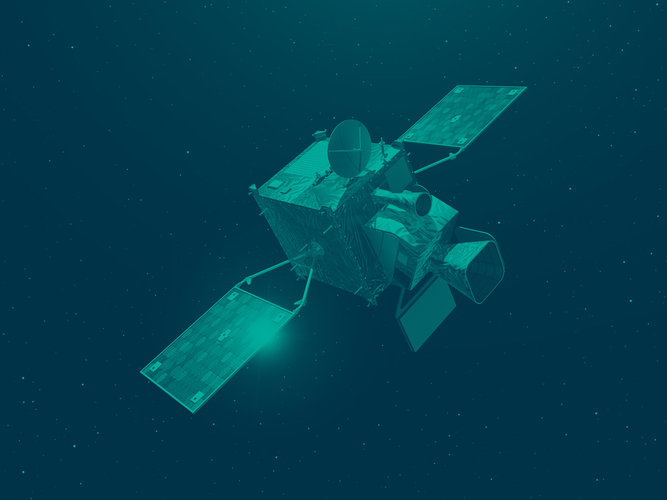
EuroGeographics expands coverage of administrative boundaries in latest data release
31.10.2018 15:53 GISCafe.com Webcasts-Webinars Boundary information for 55 countries is available in EuroGeographics’ latest release of data from official national sources.October 31, 2018 …
Maxar Technologies reports third quarter 2018 results, declares quarterly dividend
31.10.2018 15:51 GISCafe.com Webcasts-WebinarsJust published: First report series on User Needs and Requirements on Position, Navigation and Time
31.10.2018 14:18 European GNSS Agency
A first series of Reports on User Needs and Requirements on position, navigation and time has been published on the European GNSS Service Centre web portal in the section “GSA Publications”. The publication of this series paves the way to the 2018 edition of the User Consultation Platform to be held in Marseille on 3-4 December 2018 as part of European Space Week.
The User Consultation Platform (UCP) is a periodic forum organised by the European Commission and the GSA that aims at listening to users’ needs and feedback. The event is a part of a process developed at the GSA to collect user needs and requirements and take them as inputs to support the provision of user-driven Galileo and EGNOS services.
In preparation for the next UCP, which will take place in Marseille on 3-4 December 2018, a total of eight reports are being published:
- Report on Aviation User Needs and Requirements;
- Report on Maritime and Inland Waterways User Needs and Requirements;
- Report on Location-Based Services User Needs and Requirements;
- Report on Agriculture User Needs and Requirements;
- Report on Surveying User Needs and Requirements;
- Report on Time & Synchronization User Needs and Requirements;
- Report on Rail User Needs and Requirements;
- Report on Road User Needs and Requirements.
The reports are available in the European GNSS Service Centre (GSC) website, in the Electronic Library under the “GSA Publications” section.
All the reports are structured in the same way: they start with an overview of the GNSS trends applicable to the segment in question, an in-depth analysis of the user needs and requirements, and finalising with a user requirements specification applicable to the particular market segment.
Finally, as the reports are publicly available, they serve also as a reference for users and industry, supporting planning and decision-making activities for those concerned with the use of location technologies.
Media note: This feature can be republished without charge provided the European GNSS Agency (GSA) is acknowledged as the source at the top or the bottom of the story. You must request permission before you use any of the photographs on the site. If you republish, we would be grateful if you could link back to the GSA website (http://www.gsa.europa.eu).
Counting down to MetOp-C
31.10.2018 13:30 ESA Observing the Earth
Teams at ESA’s European Space Operations Centre in Germany have been training for months in preparation for next week’s launch of MetOp-C – the last in the current series of meteorological satellites that provide high-quality data for weather forecasting and climate monitoring from polar orbit.
As a collaborative undertaking between ESA and Eumetsat, the European Organisation for the Exploitation of Meteorological Satellites, ESA is responsible for building the satellites and placing them into orbit, and Eumetsat for operating them once in orbit, and processing and distributing the data.
Informační leták k provádění revize katastru nemovitostí
31.10.2018 11:03 ČÚZK - předpisy a opatření Český úřad zeměměřický a katastrální - Katastrální pracoviště Rumburkzveřejnil novou aktualitu: Informační leták k provádění revize katastru nemovitostí zveřejněn na úřední desce v Oznámení a jiná úřední sdělení
Informační leták k provádění revize katastru nemovitostí
31.10.2018 11:03 ČÚZK /Urady/Katastralni-urady/Katastralni-urady/Katastralni-urad-pro-Ustecky-kraj/Katastralni-pracoviste/KP-Rumburk/O-uradu/Aktuality/Informacni-letak-k-provadeni-revize-katastru-nemovInformační leták k provádění revize katastru nemovitostí
31.10.2018 11:03 ČÚZK - předpisy a opatření Katastrální úřad pro Ústecký kraj - Katastrální pracoviště Rumburkzveřejnil novou aktualitu: Informační leták k provádění revize katastru nemovitostí zveřejněn na úřední desce v Oznámení a jiná úřední sdělení
The power of three
31.10.2018 10:30 ESA Observing the Earth
With the third MetOp satellite set for liftoff on 7 November, this video highlights how it is used for weather forecasting and how it will orbit along with its predecessors
Automechanik
31.10.2018 9:49 Zeměměřický úřad Zeměměřický úřadvypisuje výběrové řízení na místo
Automechanik
Automechanik
31.10.2018 9:49 ČÚZK - předpisy a opatření Zeměměřický úřadvypisuje výběrové řízení na místo
Automechanik
Automechanik
31.10.2018 9:49 ČÚZK - volná místa Zeměměřický úřad vypisuje výběrové řízení na místo AutomechanikKartograf-Sedlčany
31.10.2018 9:48 Zeměměřický úřad Zeměměřický úřadvypisuje výběrové řízení na místo
Kartograf-Sedlčany
Kartograf-Sedlčany
31.10.2018 9:48 ČÚZK - předpisy a opatření Zeměměřický úřadvypisuje výběrové řízení na místo
Kartograf-Sedlčany
Kartograf-Sedlčany
31.10.2018 9:48 ČÚZK - volná místa Zeměměřický úřad vypisuje výběrové řízení na místo Kartograf-SedlčanyAirpup – kombinace balónů, dronu a vzducholodě.
31.10.2018 8:22 GISportal.cz
Asi před šesti lety jsme psali o crowdfundingové kampani na balónové mapování. Nyní se podobným způsobem snaží vybrat peníze další zajímavý projekt, který k mapování využívá ovladatelné modely vzducholodí. Pokud Vás tento popis zaujal, určitě se podívejte na video a případně můžete na tento projekt i přispět.
The post Airpup – kombinace balónů, dronu a vzducholodě. appeared first on GISportal.cz.
Mapping and Modeling Lidar Data with ArcGIS Pro (ArcUser Online)
31.10.2018 8:00 GISCafe.com Webcasts-WebinarsInterview with Peter Bonne, CEO of Orbit GT at Intergeo 2018
31.10.2018 8:00 GISCafe.com Webcasts-WebinarsZaměřeno na mexickou půdu
31.10.2018 7:40 Český Kosmický PortálCoby součást vědecké spolupráce s Mexickou kosmickou agenturou a dalšími mexickými veřejnými vědeckými institucemi, zkombinovala ESA snímky z mise GMES/Copernicus Sentinel-2. Tím vznikly detailní mapy různých typů vegetace, která roste v celé zemi.
Zaměřeno na mexickou půdu
31.10.2018 7:40 Český Kosmický PortálCoby součást vědecké spolupráce s Mexickou kosmickou agenturou a dalšími mexickými veřejnými vědeckými institucemi, zkombinovala ESA snímky z mise GMES/Copernicus Sentinel-2. Tím vznikly detailní mapy různých typů vegetace, která roste v celé zemi.
Odborný referent – poskytování informací KN PIKN0602
31.10.2018 7:20 ČÚZK - předpisy a opatření Katastrální úřad pro Plzeňský kraj - Katastrální pracoviště Klatovyvypisuje výběrové řízení na místo
Odborný referent – poskytování informací KN PIKN0602
Odborný referent – poskytování informací KN PIKN0602
31.10.2018 7:20 ČÚZK /Urady/Katastralni-urady/Katastralni-urady/Katastralni-urad-pro-Plzensky-kraj/Uredni-deska/Oznameni-a-jina-uredni-sdeleni/Volna-mista/Odborny-referent-–-poskytovani-informaci-KN-PIKN06Odborný referent – poskytování informací KN PIKN0602
31.10.2018 7:20 ČÚZK - volná místa Katastrální úřad pro Plzeňský kraj - Katastrální pracoviště Klatovy vypisuje výběrové řízení na místo Odborný referent – poskytování informací KN PIKN0602DJI Expands Drone Ecosystem With New Hardware, Software and Partnerships To Help Enterprises Gain Aerial Productivity
30.10.2018 18:58 GISCafe.com Webcasts-Webinars AirWorks 2018 Bolsters The DJI Platform For Businesses, Governments, And Others Ready To Do Their Work Better With Professional DronesNEW YORK, Oct. …
Bentley Systems launches new suite of modeling software applications
30.10.2018 18:47 Bentley SystemsPress Coverage
Roads & Infrastructure Australia, Australia/New Zealand
Read the articleSiemens and Bentley Systems announce PlantSight digital twin cloud services
30.10.2018 18:45 Bentley SystemsPress Coverage
Oil & Gas Australia, Australia/New Zealand
Read the articleAnnual Gains Fall Below 6% For The First Time In 12 Months According To S&P CoreLogic Case-Shiller Index
30.10.2018 18:44 GISCafe.com Webcasts-Webinars NEW YORK, Oct. 30, 2018 — (PRNewswire) — S&P Dow Jones Indices today released the latest results for the S&P CoreLogic …Altamira to Enhance Homeland Security in Recent US Navy GeoReadiness Award
30.10.2018 18:44 GISCafe.com Webcasts-Webinars MCLEAN, Va. — (BUSINESS WIRE) — October 30, 2018 —Altamira Technologies Corporation has been awarded a $6M prime contract
…
AirMap Chooses Microsoft Azure as its Trusted Cloud Platform for Responsible Drone Use
30.10.2018 18:44 GISCafe.com Webcasts-Webinars Microsoft Azure will power AirMap's traffic management platform for drones, bringing more safe, responsible, and intelligent drone operations to the …Siemens and Bentley announce integrated APM for power plants
30.10.2018 18:42 Bentley SystemsPress Coverage
Process Technology Online, Australia/New Zealand
Read the articleBentley launches YII 2018 with barrage of new products, acquisitions
30.10.2018 18:40 Bentley SystemsPress Coverage
Spatial Source, Australia/New Zealand
Read the articleBentley Systems’ New Open Design Applications Advance Comprehensive Modeling Environment
30.10.2018 18:38 Bentley SystemsPress Coverage
ARC Advisory Group, USA
Read the articleCity scale digital twins to go global
30.10.2018 18:34 Bentley SystemsPress Coverage
New Civil Engineer, UK
Read the articleCall for media
30.10.2018 16:49 ESA Observing the Earth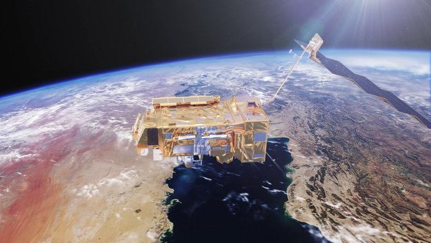
Media representatives are invited to Eumetsat in Germany on 6 November to follow the launch of Europe’s third polar-orbiting weather satellite, MetOp-C
Končí začátek mise sondy BepiColombo
30.10.2018 16:16 Český Kosmický PortálV sobotu 20. října se během dechberoucího startu dostala do vesmíru společná mise ESA a JAXA BepiColombo. Zároveň šlo o začátek intenzivních a nepřetržitých kontrolních činností, jejichž cílem bylo spojené sondy oživit, zkontrolovat jejich stav a funkci přímo v drsných podmínkách vesmíru.
V novém čísle časopisu Travel Digest najdete náš pohled na důl na měď v Mongolsku
30.10.2018 15:01 UpVision V novém čísle časopisu Travel Digest najdete například náš pohled na jeden z největších dolů na měď na světě v Mongolsku.Zde více:
https://plus.google.com/u/0/b/115833877689730865211/+UpvisionCz1/posts/QhfkSrj9ZZm
Delair Acquires Key Airware Assets to Expand its Leadership in Commercial Drone Industry
30.10.2018 14:50 GISCafe.com Webcasts-Webinars Combination of expertise, technology from two UAV pioneersstrengthens industry’s most comprehensive offering across a wide range
…
Garmin® redefines marine cartography with the introduction of BlueChart® g3 and LakeVü g3 with Navionics integration
30.10.2018 14:50 GISCafe.com Webcasts-Webinars New cartography first to offer built-in Auto GuidanceOLATHE, Kan. — (BUSINESS WIRE) — October 30, 2018 —
Garmin …
Garmin® debuts GPSMAP® 8600/8600xsv series, expands its flagship line of all-in-one chartplotters with new sizes, built-in sonar and more
30.10.2018 14:50 GISCafe.com Webcasts-Webinars New Garmin chartplotters first to offer built-in BlueChart®g3 with Navionics data
OLATHE, Kan. — (BUSINESS WIRE) — …
SAP NS2 Collaborates with Drone Aviation to Integrate Distributed Drone-Based Video into its Software Security Platform
30.10.2018 14:50 GISCafe.com Webcasts-Webinars JACKSONVILLE, FL, Oct. 30, 2018 (GLOBE NEWSWIRE) -- Drone Aviation Holding Corp. (“Drone Aviation”) (OTCQB: DRNE), a manufacturer of tethered …Esri Announces Beta Program of ArcGIS Runtime SDK for Qt Supporting Embedded Linux Devices
30.10.2018 14:50 GISCafe.com Webcasts-Webinars Location Intelligence to Enhance the Qt Software Developer KitREDLANDS, Calif. — (BUSINESS WIRE) — October 30, 2018 —
…
Positioning and mapping technologies converging to deliver innovation in high added value applications
30.10.2018 11:29 European GNSS Agency
Positioning and mapping technologies are converging and integrating as never before, enabling developers to deliver innovative high added-value applications and services, according to participants in the 5th edition of Technology for All, a forum dedicated to technological innovation in support of the environment, cultural heritage and smart cities, which was held at Rome’s Higher Institute for Firefighting (Istituto Superiore Antincendi) on 3-5 October.
At the event, which brought together over a hundred industrial stakeholders, public administrators, researchers and students, participants discussed how positioning, navigation and imagery technologies are being used to enable applications in the public sector and in other areas, such as autonomous machines, and military and civilian robotic applications.
Galileo added value
Speaking at a session on Position, Navigation and Timing: accurate position for safety, Gian Gherardo Calini, Head of Market Development at the European GNSS Agency (GSA), said that the global satellite navigation market had seen strong growth recently and it is expected that by 2020 the number of devices equipped with satellite positioning would reach 8 billion, creating ‘numerous opportunities’ for application developers to provide high value-added services.
Read this: GNSS a key element of all-purpose, user-driven positioning solutions
“Satellite navigation services already touch our daily lives and are generating economic and social benefits, with the European satellite navigation programmes Galileo and EGNOS being adopted by many users in various fields, such as transport, consumer and professional services,” Calini said. This was thanks to the GSA’s market outreach work and to the development of new applications by European companies leveraging the unique features of EGNOS and Galileo.
“There are many other development opportunities where Galileo can bring added value, such as in autonomous vehicles and in smart cities”, Calini said, adding that “the GSA is committed to keep the fruitful cooperation with European business to improve competitiveness and reach new heights”.
Interest in high-precision GNSS
Speaking about the high positioning accuracy of GNSS receivers, Marco Lisi from the European Space Agency said that there had been a significant increase in interest in high-precision GNSS in recent months.
“In particular, this increased demand for greater positioning accuracy is evident for mass-market applications in areas such as IoT, wearable tracking devices, assisted and autonomous driving, UAV and robotic vehicles,” he said.
Watch this: Who is using Galileo today?
Mass market revolution
Meanwhile, Lisi noted that the world of GNSS handset and chipset manufacturing is experiencing a small revolution. “Four major companies - Broadcom, Intel, STMicroelectronics and u-blox - have decided to make Galileo dual-frequency receivers commercially available to mass market applications, offering positioning accuracy of up to 30 centimetres,” he said, adding that several flagship smartphone manufacturers would integrate these into their products in the course of 2018.
Roberto Capua, responsible for GNSS R&D at Sogei, the technological partner of Italy’s Ministry of Economy and Finance, presented a GNSS-enabled software defined radio (SDR) receiver that has been extensively tested in the area of Rome to verify its usability for cadastral survey. “The test showed the usefulness of this technology, which is comparable with hardware receivers,” he said, adding that convergence time could be reduced in future by using different constellations and frequencies.
Finally, GNSS and Earth Observation applications presented at Technology for All 2018, demonstrated that Space technologies help to protect and monitor both the natural and built environment, with a view to guaranteeing our heritage for future generations.
Media note: This feature can be republished without charge provided the European GNSS Agency (GSA) is acknowledged as the source at the top or the bottom of the story. You must request permission before you use any of the photographs on the site. If you republish, we would be grateful if you could link back to the GSA website (http://www.gsa.europa.eu).
Positioning and mapping technologies converging to deliver innovation in high added value applications
30.10.2018 11:29 European GNSS AgencyPositioning and mapping technologies are converging and integrating as never before, enabling developers to deliver innovative high added-value applications and services, according to participants in the 5th edition of Technology for All, a forum dedicated to technological innovation in support of the environment, cultural heritage and smart cities, which was held at Rome’s Higher Institute for Firefighting (Istituto Superiore Antincendi) on 3-5 October.
At the event, which brought together over a hundred industrial stakeholders, public administrators, researchers and students, participants discussed how positioning, navigation and imagery technologies are being used to enable applications in the public sector and in other areas, such as autonomous machines, and military and civilian robotic applications.
Galileo added value
Speaking at a session on Position, Navigation and Timing: accurate position for safety, Gian Gherardo Calini, Head of Market Development at the European GNSS Agency (GSA), said that the global satellite navigation market had seen strong growth recently and it is expected that by 2020 the number of devices equipped with satellite positioning would reach 8 billion, creating ‘numerous opportunities’ for application developers to provide high value-added services.
Read this: GNSS a key element of all-purpose, user-driven positioning solutions
“Satellite navigation services already touch our daily lives and are generating economic and social benefits, with the European satellite navigation programmes Galileo and EGNOS being adopted by many users in various fields, such as transport, consumer and professional services,” Calini said. This was thanks to the GSA’s market outreach work and to the development of new applications by European companies leveraging the unique features of EGNOS and Galileo.
“There are many other development opportunities where Galileo can bring added value, such as in autonomous vehicles and in smart cities”, Calini said, adding that “the GSA is committed to keep the fruitful cooperation with European business to improve competitiveness and reach new heights”.
Interest in high-precision GNSS
Speaking about the high positioning accuracy of GNSS receivers, Marco Lisi from the European Space Agency said that there had been a significant increase in interest in high-precision GNSS in recent months.
“In particular, this increased demand for greater positioning accuracy is evident for mass-market applications in areas such as IoT, wearable tracking devices, assisted and autonomous driving, UAV and robotic vehicles,” he said.
Watch this: Who is using Galileo today?
Mass market revolution
Meanwhile, Lisi noted that the world of GNSS handset and chipset manufacturing is experiencing a small revolution. “Four major companies - Broadcom, Intel, STMicroelectronics and u-blox - have decided to make Galileo dual-frequency receivers commercially available to mass market applications, offering positioning accuracy of up to 30 centimetres,” he said, adding that several flagship smartphone manufacturers would integrate these into their products in the course of 2018.
Roberto Capua, responsible for GNSS R&D at Sogei, the technological partner of Italy’s Ministry of Economy and Finance, presented a GNSS-enabled software defined radio (SDR) receiver that has been extensively tested in the area of Rome to verify its usability for cadastral survey. “The test showed the usefulness of this technology, which is comparable with hardware receivers,” he said, adding that convergence time could be reduced in future by using different constellations and frequencies.
Finally, GNSS and Earth Observation applications presented at Technology for All 2018, demonstrated that Space technologies help to protect and monitor both the natural and built environment, with a view to guaranteeing our heritage for future generations.
Media note: This feature can be republished without charge provided the European GNSS Agency (GSA) is acknowledged as the source at the top or the bottom of the story. You must request permission before you use any of the photographs on the site. If you republish, we would be grateful if you could link back to the GSA website (http://www.gsa.europa.eu).