


![]()

zprávy
zdroje zpráv:ZABAGED® - aktualizace
3.4.2024 9:00 ČÚZK - Geoportál ZABAGED® - aktualizaceV 1. čtvrtletí 2024 byla dokončena plošná aktualizace ZABAGED® na celém území mapových listů Základní topografické mapy ČR 1:50 000: 0707-C a 0807-A.
V 1. čtvrtletí 2024 byly v rámci aktualizace stavebních objektů v ZABAGED® (na podkladě existující kresby v ISKN, Ortofota ČR, výstupů z dat leteckého laserového skenování a dalších dostupných zdrojů) aktualizovány budovy a další stavební objekty v okresech: Benešov, Beroun, Brno-město, Brno-venkov, Český Krumlov, Děčín, Domažlice, Havlíčkův Brod, Hl. m. Praha, Chrudim, Jičín, Karviná, Kroměříž, Nový Jičín, Olomouc, Pardubice, Pelhřimov, Plzeň-jih, Praha-východ, Praha-západ, Přerov, Rakovník, Rokycany, Sokolov, Tábor, Uherské Hradiště, Ústí nad Orlicí, Zlín a Znojmo.
Začátkem dubna 2024 byly zpřístupněny uživatelům zaktualizované sady těchto typů objektů ZABAGED®: definiční body adresních míst, hranice správních jednotek a katastrálních území společně s definičními body správních celků, školy, školská zařízení, maloplošné a velkoplošné zvláště chráněné území, kótované body, golfový areál, policejní služebna, hraniční přechod a přeshraniční propojení. Průběžně byly během celého období aktualizovány definiční čáry ulic podle návrhu obcí současně s definičními body náměstí.
Více informací o stavu aktualizace je uvedeno v tabulce Informace o produktu, v oddíle Aktualizační cyklus - stav aktualizace.
Pracovní nabídka: Výzkumný a vývojový pracovník se specializací na zpracování dat z dálkového průzkumu Země a GIS
2.4.2024 16:58 Katedra geoinformatiky UP OlomoucČeský hydrometeorologický ústav hledá pracovníka na pozici: Výzkumný a vývojový pracovník – Dálkový průzkum Země a GIS Popis činnosti: práce na výzkumné oblasti Dlouhodobé koncepce rozvoje výzkumné organizace – „Dálkový průzkum Země a geografické informační systémy – Rozvoj metod, technik a nástrojů dálkového průzkumu a geografických informačních systémů v České republice“ řešení výzkumných cílů může […]
The post Pracovní nabídka: Výzkumný a vývojový pracovník se specializací na zpracování dat z dálkového průzkumu Země a GIS first appeared on Katedra geoinformatiky.
Galileo Second Generation
2.4.2024 15:17 ESA Navigation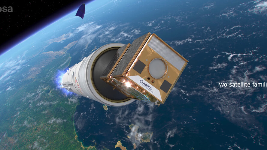 Video:
00:03:53
Video:
00:03:53
Europe’s Galileo is the world’s most precise satellite navigation system, providing metre-level accuracy to billions of users. ESA and European industry are preparing a new generation of satellites, the Galileo Second Generation or G2, that will revolutionise the fleet with enhanced capabilities.
20240403 - volné místo - Vrchní referent/rada v OPV KP Ústí n.L.na Katastrálním úřadu pro Ústec.kraj
2.4.2024 15:05 ČÚZK - předpisy a opatření Katastrální úřad pro Ústecký kraj - Katastrální pracoviště Ústí nad Labem zveřejnil novou aktualitu: Nabídka volného místa - Vrchní referent / rada v oddělení právních vztahů k nemovitostem Katastrálního pracoviště Ústí nad Labem na Katastrálním úřadu pro Ústecký kraj20240403 - volné místo - Vrchní referent/rada v OPV KP Ústí n.L.na Katastrálním úřadu pro Ústec.kraj
2.4.2024 15:05 ČÚZK /Urady/Katastralni-urady/Katastralni-urady/Katastralni-urad-pro-Ustecky-kraj/Katastralni-pracoviste/KP-Usti-nad-Labem/O-uradu/Aktuality/20240403-volne-misto-Vrchni-referent-rada-v-OPV-KP20240403 - volné místo - Vrchní referent/rada v OPV KP Ústí n.L.na Katastrálním úřadu pro Ústec.kraj
2.4.2024 15:04 ČÚZK /Urady/Katastralni-urady/Katastralni-urady/Katastralni-urad-pro-Ustecky-kraj/O-uradu/Aktuality/20240403-volne-misto-Vrchni-referent-rada-v-OPV-KP20240403 - volné místo - Vrchní referent/rada v OPV KP Ústí n.L.na Katastrálním úřadu pro Ústec.kraj
2.4.2024 15:04 ČÚZK - předpisy a opatření Katastrální úřad pro Ústecký kraj - Katastrální pracoviště Ústí nad Labem zveřejnil novou aktualitu: Nabídka volného místa - Vrchní referent / rada v oddělení právních vztahů k nemovitostem Katastrálního pracoviště Ústí nad Labem na Katastrálním úřadu pro Ústecký krajIFC 4.3 Formally Approved and Published as an ISO Standard
2.4.2024 9:59 buildingSMART.orgLondon, (March 21, 2024) – buildingSMART International is delighted to announce that IFC 4.3 is now formally approved and published as an international standard by the International Organization for Standardization (ISO).…
The post IFC 4.3 Formally Approved and Published as an ISO Standard appeared first on buildingSMART International.
IFC 4.3 Formally Approved and Published as an ISO Standard
2.4.2024 9:59 buildingSMART.orgLondon, (April 2, 2024) – buildingSMART International is delighted to announce that IFC 4.3 is now formally approved and published as an international standard by the International Organization for Standardization (ISO).…
The post IFC 4.3 Formally Approved and Published as an ISO Standard appeared first on buildingSMART International.
RTX korekcie na rok zadarmo!
1.4.2024 15:44 Geotronics.sk Prijímače Trimble RTX + Trimble GNSS RTX korekcie zadarmo Od 1. apríla 2024 budú novo zakúpené GNSS prijímače Trimble R12i, R780, R580 a R750 obsahovať aktivované ročné predplatné Trimble RTX korekcií pripravené na použitie počas prvých 12 mesiacov v hodnote 2 000 € bez DPH. K dispozícii sú možnosti ročného obnovenia pre pokračujúci prístup. [...]RTX korekcie na rok zadarmo!
1.4.2024 15:44 Geotronics.sk RTX korekcie zadarmoOd 1. apríla 2024 budú novo zakúpené GNSS prijímače Trimble R980, R12i, R780, R580 a R750 obsahovať aktivované ročné predplatné Trimble RTX korekcií pripravené na použitie počas prvých 12 mesiacov v hodnote 2 000 € bez DPH. K dispozícii sú možnosti ročného obnovenia pre pokračujúci prístup.Merajte kdekoľvek.Neobmedzujte sa internetovým pokrytím. [...]RTX korekcie na rok zadarmo!
1.4.2024 15:44 Geotronics.sk RTX korekcie zadarmo Od 1. apríla 2024 budú novo zakúpené GNSS prijímače Trimble R12i, R780, R580 a R750 obsahovať aktivované ročné predplatné Trimble RTX korekcií pripravené na použitie počas prvých 12 mesiacov v hodnote 2 000 € bez DPH. K dispozícii sú možnosti ročného obnovenia pre pokračujúci prístup. Merajte kdekoľvek. Neobmedzujte sa internetovým pokrytím. [...]RTX korekcie na rok zadarmo!
1.4.2024 15:44 Geotronics.sk RTX korekcie zadarmo Od 1. apríla 2024 budú novo zakúpené GNSS prijímače Trimble R12i, R780, R580 a R750 obsahovať aktivované ročné predplatné Trimble RTX korekcií pripravené na použitie počas prvých 12 mesiacov v hodnote 2 000 € bez DPH. K dispozícii sú možnosti ročného obnovenia pre pokračujúci prístup. Merajte kdekoľvek. Neobmedzujte sa internetovým pokrytím. [...]Výroční zpráva dle zákona č. 106/1999 Sb. za rok 2023
1.4.2024 11:49 ČÚZK - předpisy a opatření Zeměměřický úřadvydává výroční zprávu úřadu za rok
2023
Výroční zpráva dle zákona č. 106/1999 Sb. za rok 2023
1.4.2024 11:49 Zeměměřický úřad Zeměměřický úřadvydává výroční zprávu úřadu za rok
2023
Výroční zpráva dle zákona č. 106/1999 Sb. za rok 2023
1.4.2024 11:49 Zeměměřický úřad Zeměměřický úřadvydává výroční zprávu úřadu za rok
2023
Výroční zpráva dle zákona č. 106/1999 Sb. za rok 2023
1.4.2024 11:49 ČÚZK /Urady/Zememericky-urad/Dalsi-informace/UAZK/Vyrocni-zprava-UAZK/Vyrocni-zprava-dle-zakona-c-106-1999-Sb-za-rok-(4)Výroční zpráva dle zákona č. 106/1999 Sb. za rok 2022
1.4.2024 11:48 Zeměměřický úřad Zeměměřický úřadvydává výroční zprávu úřadu za rok
2022
Výroční zpráva dle zákona č. 106/1999 Sb. za rok 2022
1.4.2024 11:48 ČÚZK - předpisy a opatření Zeměměřický úřadvydává výroční zprávu úřadu za rok
2022
Výroční zpráva dle zákona č. 106/1999 Sb. za rok 2022
1.4.2024 11:48 Zeměměřický úřad Zeměměřický úřadvydává výroční zprávu úřadu za rok
2022
Výroční zpráva dle zákona č. 106/1999 Sb. za rok 2022
1.4.2024 11:48 ČÚZK /Urady/Zememericky-urad/Dalsi-informace/UAZK/Vyrocni-zprava-UAZK/Vyrocni-zprava-dle-zakona-c-106-1999-Sb-za-rok-202APGEO - Valbek-EU novým kmenovým členem APG
31.3.2024 1:00 Asociace podnikatelů v geomatice Novým kmenovým členem APG se v březnu stala společnost VALBEK-EU, a.s.Earth from Space: The Amazon plume
29.3.2024 10:00 ESA Observing the Earth Image:
The Copernicus Sentinel-3 mission takes us over northern Brazil, where the Amazon River meets the Atlantic Ocean.
Image:
The Copernicus Sentinel-3 mission takes us over northern Brazil, where the Amazon River meets the Atlantic Ocean.
Zkrácení otevírací doby [Knihovna geografie, byTopic]
28.3.2024 12:30 Katedra aplikované geoinformatiky a kartografie Přf UK Ve středu 3. dubna 2024 bude Knihovna geografie z technických důvodů otevřena pouze do 16:00.Projekt Geoportál ČSÚ je IT projektem roku 2023
28.3.2024 11:23 T-MAPYThe post Projekt Geoportál ČSÚ je IT projektem roku 2023 appeared first on T-MAPY spol. s r.o..
Reportáž o eye-trackingu
28.3.2024 8:25 Katedra geoinformatiky UP OlomoucProhlédněte si reportáž o našem Eye-Tracking výzkumu! Dovolujeme si vám představit reportáž vytvořenou studentem žurnalistiky Martinem Kubešem, který ji zpracoval v rámci samostatného projektu během svého studia. V reportáži představujeme eye-tracking a praktické možnosti jeho využití v interdisciplinárním výzkumu. Video si můžete prohlédnout na následující adrese: https://www.youtube.com/watch?v=7Df6uK_2qc4 — Check out the report on our Eye-Tracking […]
The post Reportáž o eye-trackingu first appeared on Katedra geoinformatiky.
Pilotní provoz IS DMVS a IS DTM krajů
27.3.2024 20:31 ČÚZK - předpisy a opatření Český úřad zeměměřický a katastrální upozorňuje, že v termínu od 1. dubna 2024 bude v produkčním prostředí IS DMVS a produkčních prostředích krajských IS DTM spuštěn pilotní provoz. Ve stejném termínu bude v souladu s harmonogramem na produkčním prostředí IS DMVS nasazena verze JVF DTM 1.4.3. Veškeré informace s tím spojené a další důležité změny jsou shrnuty v dokumentu36. jednání KRS
27.3.2024 19:56 ČÚZK - předpisy a opatření Dne 10. dubna 2024 proběhne distančně 36. jednání Koordinační rady správců DMVS a DTM.Nová knihovna úchytek, věšáků a kování firmy SIRO
27.3.2024 19:22 ŠPINAR - softwareVážení zákazníci,
dovolujeme si vám nabídnout novou knihovnu kuchyňských skříněk pro DAEX DESIGN 24 pro Vaše efektivní a kvalitnější navrhování.
The post Nová knihovna úchytek, věšáků a kování firmy SIRO appeared first on ŠPINAR – software.
Nová knihovna úchytek, věšáků a kování firmy SIRO
27.3.2024 19:22 ŠPINAR - software Vážení zákazníci,dovolujeme si vám nabídnout novou knihovnu úchytek, věšáků, a kování SIRO pro DAEX DESIGN 24.
Nová knihovna úchytek, věšáků a kování firmy SIRO
27.3.2024 19:22 ŠPINAR - softwareVážení zákazníci,
dovolujeme si vám nabídnout novou knihovnu úchytek, věšáků, a kování SIRO pro DAEX DESIGN 24.
The post Nová knihovna úchytek, věšáků a kování firmy SIRO appeared first on ŠPINAR – software.
Dubnový den s CAD technikem – bezplatná online konzultace pro vaši firmu
27.3.2024 16:30 Arkance SystemsČtvrtek 25. dubna 2024 - přihlaste se na nový termín akce společnosti ARKANCE. Těšíme se na vás.
Zpráva Dubnový den s CAD technikem – bezplatná online konzultace pro vaši firmu pochází z arkance-systems.cz.
rada / odborný rada v oddělení právních vztahů k nemovitostem Katastrálního pracoviště Trutnov
27.3.2024 13:05 ČÚZK - volná místa Katastrální úřad pro Královéhradecký kraj - Katastrální pracoviště Trutnov vypisuje výběrové řízení na místo rada / odborný rada v oddělení právních vztahů k nemovitostem Katastrálního pracoviště Trutnovrada / odborný rada v oddělení právních vztahů k nemovitostem Katastrálního pracoviště Trutnov
27.3.2024 13:05 ČÚZK - předpisy a opatření Katastrální úřad pro Královéhradecký kraj - Katastrální pracoviště Trutnovvypisuje výběrové řízení na místo
rada / odborný rada v oddělení právních vztahů k nemovitostem Katastrálního pracoviště Trutnov
Věcné úkoly Katastrálního úřadu pro Moravskoslezský kraj v roce 2024/3
27.3.2024 12:25 ČÚZK /Urady/Katastralni-urady/Katastralni-urady/Katastralni-urad-pro-Moravskoslezsky-kraj/O-uradu/Aktuality/Vecne-ukoly-Katastralniho-uradu-pro-Moravskosl-(1)Věcné úkoly Katastrálního úřadu pro Moravskoslezský kraj v roce 2024/3
27.3.2024 12:25 ČÚZK - předpisy a opatření Katastrální úřad pro Moravskoslezský kraj zveřejnil novou aktualitu: Seznam schválených věcných úkolů s plánovaným dokončením v roce 2024 (s uvedeným datem již dokončených VÚ).Navigation Training Course now open for application
27.3.2024 10:01 ESA Navigation
ESA Academy is calling on university students to apply for the Navigation Training Course to be held from 24 to 28 June 2024 at ESA Academy’s Training and Learning Facility in ESEC-Galaxia, Belgium. This Training Course is a collaboration between ESA Education and ESA’s Directorate of Navigation. Would you like to know more about the future of satellite navigation? Apply for our course today!
Vegetation gets a boost with data from space
27.3.2024 9:40 ESA Observing the Earth
When it comes to predicting what our climate will be like in the future, vegetation matters. Plants and trees exert a powerful influence over both the energy cycle and the water cycle. And, crucially, it is estimated that vegetation draws down well over three billion tonnes of carbon from the atmosphere each year – this is equivalent to a third of greenhouse-gas emissions from human activity.
Accounting for vegetation growth is clearly important in the complex climate puzzle – and the release of a new satellite dataset is set to help climate modellers with the challenge of evaluating the impacts of climate change.
Vegetation gets a boost with data from space
27.3.2024 9:40 ESA Observing the Earth
When it comes to predicting what our climate will be like in the future, vegetation matters. Plants and trees exert a powerful influence over both the energy cycle and the water cycle. And, crucially, it is estimated that vegetation draws down well over three billion tonnes of carbon from the atmosphere each year – this is equivalent to a third of greenhouse gas emissions from human activity.
Accounting for vegetation growth is clearly important in the complex climate puzzle – and the release of a new satellite dataset is set to help climate modellers with the challenge of evaluating the impacts of climate change.
Účetní v odělení ekonomicko-správním v Kanceláři ředitele katastrálního úřadu
27.3.2024 8:46 ČÚZK - předpisy a opatření Katastrální úřad pro Jihomoravský kraj kancelář úřaduvypisuje výběrové řízení na místo
Účetní v odělení ekonomicko-správním v Kanceláři ředitele katastrálního úřadu
Účetní v odělení ekonomicko-správním v Kanceláři ředitele katastrálního úřadu
27.3.2024 8:46 ČÚZK /Urady/Katastralni-urady/Katastralni-urady/Katastralni-urad-pro-Jihomoravsky-kraj/Volna-mista/DMS/Ucetni-v-odeleni-ekonomicko-spravnim-v-Kancelari-rÚčetní v odělení ekonomicko-správním v Kanceláři ředitele katastrálního úřadu
27.3.2024 8:46 ČÚZK - volná místa Katastrální úřad pro Jihomoravský kraj kancelář úřadu vypisuje výběrové řízení na místo Účetní v odělení ekonomicko-správním v Kanceláři ředitele katastrálního úřaduAutodesk uvádí produkty řady 2025 – termíny a novinky
26.3.2024 17:01 Arkance SystemsNové softwarové aplikace produktové řady Autodesk 2024 - seznamte se s novinkami, novými funkcemi a vylepšeními.
Zpráva Autodesk uvádí produkty řady 2025 – termíny a novinky pochází z arkance-systems.cz.
Autodesk uvádí produkty řady 2025 – termíny a novinky
26.3.2024 17:01 Arkance SystemsNové softwarové aplikace produktové řady Autodesk 2025 - seznamte se s novinkami, novými funkcemi a vylepšeními.
Zpráva Autodesk uvádí produkty řady 2025 – termíny a novinky pochází z arkance-systems.cz.
Rada/odborný rada v oddělení dokumentace KN na Katastrálním pracovišti Břeclav
26.3.2024 15:20 ČÚZK - volná místa Katastrální úřad pro Jihomoravský kraj Katastrální pracoviště Břeclav vypisuje výběrové řízení na místo Rada/odborný rada v oddělení dokumentace KN na Katastrálním pracovišti BřeclavRada/odborný rada v oddělení dokumentace KN na Katastrálním pracovišti Břeclav
26.3.2024 15:20 ČÚZK /Urady/Katastralni-urady/Katastralni-urady/Katastralni-urad-pro-Jihomoravsky-kraj/Uredni-deska/Oznameni-a-jina-uredni-sdeleni/Volna-mista/DMS/Rada-odborny-rada-v-oddeleni-dokumentace-KN-na-KatRada/odborný rada v oddělení dokumentace KN na Katastrálním pracovišti Břeclav
26.3.2024 15:20 ČÚZK - předpisy a opatření Katastrální úřad pro Jihomoravský kraj Katastrální pracoviště Břeclavvypisuje výběrové řízení na místo
Rada/odborný rada v oddělení dokumentace KN na Katastrálním pracovišti Břeclav
Philippe Bertrand re-elected as Chair of the Security Accreditation Board of the EU Space Programme
26.3.2024 13:46 European GNSS Agency
Representatives from EU Member States, representing 92% of the European population, re-elected Philippe Bertrand as the Chair of the Security Accreditation Board. Bertrand, who brings a wealth of experience in security and space, expressed his gratitude for the opportunity to continue serving in this crucial role.
"I am deeply honoured to have been re-elected Chair of the EU Space Programme Security Accreditation Board and would like to thank all the EU Member States representatives for their trust," stated Bertrand.
The Security Accreditation Board (SAB), where C. Schanet remains SAB deputy Chair, plays a pivotal role as the security accreditation authority for the entire EU Space Programme and all its components: Copernicus, EGNOS, Galileo, GOVSATCOM, IRIS2, and SSA. In this capacity, it ensures that the security risks are known and that security measures are defined to reduce such risks to an acceptable level, given the security needs of the Union and its Member States. Within the SAB, Member States make accreditation decisions independently from the European Commission, EUSPA and ESA to approve satellite launches, the operations of systems and the services.
"At the SAB, the Member States rigorously assess independently the reality of security measures in place in particular with cyber audits and cyber penetration tests. In times of increased cyber security threats, the SAB helps the Programme in identifying when additional security measures are needed to develop user trust in the EU Space programme services." confirmed P. Bertrand.
Media note: This feature can be republished without charge provided the European Union Agency for the Space Programme (EUSPA) is acknowledged as the source at the top or the bottom of the story. You must request permission before you use any of the photographs on the site. If you republish, we would be grateful if you could link back to the EUSPA website (http://www.euspa.europa.eu).
Philippe Bertrand re-elected as Chair of Security Accreditation Board of the EU Space Programme
26.3.2024 13:46 European GNSS AgencyRepresentatives from EU Member States, representing 92% of the European population, re-elected Philippe Bertrand as the Chair of the Security Accreditation Board. Bertrand, who brings a wealth of experience in security and space, expressed his gratitude for the opportunity to continue serving in this crucial role.
"I am deeply honoured to have been re-elected Chair of the EU Space Programme Security Accreditation Board and would like to thank all the EU Member States representatives for their trust," stated Bertrand.
The Security Accreditation Board (SAB), where C. Schanet remains SAB deputy Chair, plays a pivotal role as the security accreditation authority for the entire EU Space Programme and all its components: Copernicus, EGNOS, Galileo, GOVSATCOM, IRIS2, and SSA. In this capacity, it ensures that the security risks are known and that security measures are defined to reduce such risks to an acceptable level, given the security needs of the Union and its Member States. Within the SAB, Member States make accreditation decisions independently from the European Commission, EUSPA and ESA to approve satellite launches, the operations of systems and the services.
"At the SAB, the Member States rigorously assess independently the reality of security measures in place in particular with cyber audits and cyber penetration tests. In times of increased cyber security threats, the SAB helps the Programme in identifying when additional security measures are needed to develop user trust in the EU Space programme services." confirmed P. Bertrand.
Media note: This feature can be republished without charge provided the European Union Agency for the Space Programme (EUSPA) is acknowledged as the source at the top or the bottom of the story. You must request permission before you use any of the photographs on the site. If you republish, we would be grateful if you could link back to the EUSPA website (http://www.euspa.europa.eu).
Výběrové řízení na KÚ pro Vysočinu
26.3.2024 12:49 ČÚZK - předpisy a opatření Katastrální úřad pro Vysočinu zveřejnil novou aktualitu: KÚ Oznámení o vyhlášení výběrového řízení na služební místo odborný referent/vrchní referent – mzdová/ý účetní v personálním oddělení Kanceláře ředitele katastrálního úřadu na Katastrálním úřadu pro Vysočinu.Květnový den s CAM technikem – bezplatná online konzultace pro vaši firmu
26.3.2024 11:15 Arkance SystemsNová akce z oboru CAM a výroba! Středa 15. května 2024 - přihlaste se na nový termín konzultací od společnosti ARKANCE. Těšíme se na vás.
Zpráva Květnový den s CAM technikem – bezplatná online konzultace pro vaši firmu pochází z arkance-systems.cz.
SMOS and Swarm team up to spot huge solar storm
26.3.2024 10:30 ESA Observing the Earth
The Sun erupted over the weekend, flinging electromagnetic radiation towards Earth, even illuminating skies with spectacular aurora borealis. For the first time, ESA’s unlikely space weather duo of SMOS and Swarm tracked the severe solar storm — which warped Earth’s magnetic field.
Statistický geoportál – prostor pro statistická data
26.3.2024 10:04 blog ARCDATA Zajímá vás, ve kterých oblastech Česka žije nejvíce vysokoškoláků nebo svobodných? Kde žije nejvíce rodáků? Nebo jaké jsou technické charakteristiky domů a bytů ve vašem okolí či do jakých měst a v jaké intenzitě jezdí lidé do zaměstnání a do škol? Odpovědi na tyto otázky vám poskytne Statistický geoportál, držitel ocenění Cacio IT projekt roku 2023.Členská schůze 2024
25.3.2024 23:53 Spolek zeměměřičů Brno Členská schůze proběhla dne 14. března 2024 od 15:50 hodin v konferenčním sále Katastrálního pracoviště Brno-venkov. Usnesení členské schůze je přiloženo zde. Pozvánka byla distribuovaná e-mailem.Členská schůze 2024
25.3.2024 23:53 Spolek zeměměřičů Brno Členská schůze proběhla dne 14. března 2024 od 15:50 hodin v konferenčním sále Katastrálního pracoviště Brno-venkov. Usnesení členské schůze je přiloženo zde. Pozvánka byla distribuovaná e-mailem.20240325_Odborný referent oddělení právních vztahů k nemovitostem
25.3.2024 10:42 ČÚZK /Urady/Katastralni-urady/Katastralni-urady/Katastralni-urad-pro-Stredocesky-kraj/Katastralni-pracoviste/KP-Pribram/O-uradu/Aktuality/20230910_Odborny-vrchni-referent-oddeleni-prav-(1)20240325_Odborný referent oddělení právních vztahů k nemovitostem
25.3.2024 10:42 ČÚZK - předpisy a opatření Katastrální úřad pro Středočeský kraj - Katastrální pracoviště Příbram Vyhlášení výběrového řízení: Odborný referent oddělení právních vztahů k nemovitostem V části "Úřední deska", v sekci "Oznámení a jiná úřední sdělení" bylo vystaveno "Oznámení o vyhlášení výběrového řízení na obsazení služebního místa Odborný referent oddělení právních vztahů k nemovitostem"Zahájení revize katastru nemovitostí od 1. 6. 2024
25.3.2024 10:41 ČÚZK /Urady/Katastralni-urady/Katastralni-urady/Katastralni-urad-pro-Liberecky-kraj/Katastralni-pracoviste/KP-Ceska-Lipa/O-uradu/Aktuality/Zahajeni-revize-katastru-nemovitosti-od-1-6-2024Zahájení revize katastru nemovitostí od 1. 6. 2024
25.3.2024 10:41 ČÚZK - předpisy a opatření Katastrální úřad pro Liberecký kraj - Katastrální pracoviště Česká Lípa zveřejnil novou aktualitu: Katastrální úřad pro Liberecký kraj, Katastrální pracoviště Česká Lípa oznamuje, že dnem 1. 6. 2024 bude zahájena revize katastru nemovitostí v k. ú. Kozly u České Lípy (obec Kozly), k. ú. Okřešice u České Lípy (město Česká Lípa) a k. ú. Slunečná u České Lípy (obec Slunečná). Podrobnosti viz úřední deska.
Technická odstávka
25.3.2024 9:50
ÚGKK SR
Úrad geodézie, kartografie a katastra SR v snahe vylepšiť svoje služby realizuje aktualizáciu informačných systémov. Dňa 25.03.2024 (pondelok) prebieha technická odstávka vybraných elektronických služieb katastra nehnuteľností. Ospravedlňujeme sa za prípadné nepríjemnosti v súvislosti s výpadkom elektronických služieb katastra nehnuteľností
#PortálESKN #od:25.03.2024@18:00 #do: 25.03.2024@20:30
Building ChatGPT-style tools with Earth observation
25.3.2024 9:27 ESA Observing the Earth
Imagine being able to ask a chatbot, “Can you make me an extremely accurate classification map of crop cultivation in Kenya?” or “Are buildings subsiding in my street?” And imagine that the information that comes back is scientifically sound and based on verified Earth observation data.
ESA, in conjunction with technology partners, is working to make such a tool a reality by developing AI applications that will revolutionise information retrieval in Earth observation.
Domácí návrhář domu, bytu a zahrady – TurboFLOORPLAN v akční ceně
24.3.2024 21:57 ŠPINAR - softwareVážení zákazníci,
máme pro Vás připravený domácí návrhář pro Váš dům, byt nebo zahradu snů - v akční ceně.
The post Domácí návrhář domu, bytu a zahrady – TurboFLOORPLAN v akční ceně appeared first on ŠPINAR – software.
Domácí návrhář domu, bytu a zahrady – TurboFLOORPLAN v akční ceně
24.3.2024 21:57 ŠPINAR - softwareVážení zákazníci,
máme pro Vás připravený domácí návrhář pro Váš dům, byt nebo zahradu snů - v akční ceně.
Evidence-based urban planning starts with EO
22.3.2024 17:00 European GNSS Agency
The world is becoming increasingly urban. Driven by climate change, inequalities and conflict, urbanisation is a phenomenon seen around the globe. However, it is particularly prominent in Europe and North Africa, where 70% and 78% of the respective populations live in cities.
The problem is that the bulk of this urban development, especially in emerging countries, happens without any real planning. As a result, liveability in cities tends to trend downwards.
But Earth Observation (EO) data could offer a solution.
According to the EUSPA-supported and Horizon Europe funded UDENE project, the EO data coming from Copernicus satellites and local sources has the potential to enable evidence-based decision making for urban development.
To support the UN Sustainable Development Goal 11 of making cities safe, resilient and sustainable, the UDENE project is developing a platform that will provide scenario-based projections using Copernicus data complemented by remote sensing and local in-situ data.
“The wealth of EO data in fast and accessible data cube format provides a great search space for exploring natural experiments and exploiting the value-add of causal analysis,” says Ali Türker, Digital Transformation Leader at WEglobal and UDENE project coordinator.
An EO-based approach to urban development
The UDENE project brings together partners from France, Italy, Serbia, Slovenia, Tunisia and Turkey. Together, this international team will conduct such activities as data acquisition and partnership building – all of which will be facilitated by open Financial Support for Third Parties calls.
All the project’s outcomes will be integrated into a virtual laboratory platform, which will match users to existing EO products, processes and services. “We want to provide a place where urban visionaries, planners and developers from our partner countries can use Copernicus derived data to test the specific impact of their ideas via natural experiments that occurred in another place and/or at another time,” explains Türker.
The virtual lab will be validated via three use cases. In Istanbul, Turkey, a use case will focus on the impact high-rise building districts have on earthquake preparedness and/or damage and loss assessment. In Tunis, Tunisia, the project looks to classify local climate zones and involve citizens in the data collection process as part of a use case evaluating how green spaces can help reduce urban heat islands.
Read more: Using Copernicus data to climate-proof cities
The third use case, set to take place in Novi Sad, Serbia, will leverage local traffic metrics to analyse the effects the construction of a ring road would have on congestion and air quality.
“We are confident that our evidence-based approach to urban development – an approach that is powered by a vast amount of EO data – will complement existing Earth Observation products and services,” concludes Türker. “In doing so, UDENE will also expand European excellence in the use of EO technology for urban development applications that have both a high economic and societal impact.”
Earth Observation: A powerful tool for effective urban planning
Earth Observation is a particularly powerful tool for urban planning. According to the latest edition of EUSPA’s EO and GNSS Market Report, EO provides valuable information for monitoring informal dwellings and informing the progress and state of urban greening.
Moreover, EO-based services provide essential information on air quality in urban environments, measuring particles that might affect the heath of citizens and monitoring greenhouse gas emissions. EO data also facilitates the assessment of an urban area’s vulnerability to a range of natural hazards and aids in the creation of resilient urban spaces that can withstand, or even minimise, the impact of natural disasters.
EO data further serves as a valuable source for detecting signs of urban decline, mapping the extent of destruction, and providing essential geospatial information for effective urban planning and development. When combined with GNSS data, it offers a comprehensive understanding of the urban landscape, empowering urban planners and stakeholders to make informed decisions and drive sustainable recovery and development.
The UDENE MissionObjective 1: Structure local in-situ data on urban environments as data cubes and link them to existing Copernicus data cube federations to enable the fast exploration of impact evidence about potential urban development ideas across time and locations in EO data. Objective 2: Jointly develop new and advanced sensitivity analysis algorithms to verify and operationalise multivariate causal effect models of the impact that an urban development option may have on economic outcomes that are relevant for cities (e.g., efficient water use, air pollution, heat load, energy consumption, earthquakes, mobility measures). Objective 3: Build partnerships between the European space industry, SMEs, universities, research institutes, and GEO initiatives and non-EU (public/private) entities, with the shared goal of valorising existing EO-related technologies and promoting further investments. Leverage the urban development decision support system for this purpose. |
Media note: This feature can be republished without charge provided the European Union Agency for the Space Programme (EUSPA) is acknowledged as the source at the top or the bottom of the story. You must request permission before you use any of the photographs on the site. If you republish, we would be grateful if you could link back to the EUSPA website (http://www.euspa.europa.eu).
Evidence-based urban planning starts with EO
22.3.2024 17:00 European GNSS AgencyThe world is becoming increasingly urban. Driven by climate change, inequalities and conflict, urbanisation is a phenomenon seen around the globe. However, it is particularly prominent in Europe and North Africa, where 70% and 78% of the respective populations live in cities.
The problem is that the bulk of this urban development, especially in emerging countries, happens without any real planning. As a result, liveability in cities tends to trend downwards.
But Earth Observation (EO) data could offer a solution.
According to the EUSPA-supported and Horizon Europe funded UDENE project, the EO data coming from Copernicus satellites and local sources has the potential to enable evidence-based decision making for urban development.
With the aim of supporting the UN Sustainable Development Goal 11 of making cities safe, resilient and sustainable, the UDENE project is developing a platform that will provide scenario-based projections using Copernicus data complemented by remote sensing and local in-situ data.
“The wealth of EO data in fast and accessible data cube format provides a great search space for exploring natural experiments and exploiting the value-add of causal analysis,” says Ali Türker, Digital Transformation Leader at WEglobal and UDENE project coordinator.
An EO-based approach to urban development
The UDENE project brings together partners from France, Italy, Serbia, Slovenia, Tunisia and Turkey. Together, this international team will conduct such activities as data acquisition and partnership building – all of which will be facilitated by open Financial Support for Third Parties calls.
All the project’s outcomes will be integrated into a virtual laboratory platform, which will match users to existing EO products, processes and services. “We want to provide a place where urban visionaries, planners and developers from our partner countries can use Copernicus derived data to test the specific impact of their ideas via natural experiments that occurred in another place and/or at another time,” explains Türker.
The virtual lab will be validated via three use cases. In Istanbul, Turkey, a use case will focus on the impact high-rise building districts have on earthquake preparedness and/or damage and loss assessment. In Tunis, Tunisia, the project looks to classify local climate zones and involve citizens in the data collection process as part of a use case evaluating how green spaces can help reduce urban heat islands.
Read more: Using Copernicus data to climate-proof cities
The third use case, set to take place in Novi Sad, Serbia, will leverage local traffic metrics to analyse the effects the construction of a ring road would have on congestion and air quality.
“We are confident that our evidence-based approach to urban development – an approach that is powered by a vast amount of EO data – will complement existing Earth Observation products and services,” concludes Türker. “In doing so, UDENE will also expand European excellence in the use of EO technology for urban development applications that have both a high economic and societal impact.”
Earth Observation: A powerful tool for effective urban planning
Earth Observation is a particularly powerful tool for urban planning. According to the latest edition of EUSPA’s EO and GNSS Market Report, EO provides valuable information for monitoring informal dwellings and informing the progress and state of urban greening.
Moreover, EO-based services provide essential information on air quality in urban environments, measuring particles that might affect the heath of citizens and monitoring greenhouse gas emissions. EO data also facilitates the assessment of an urban area’s vulnerability to a range of natural hazards and aids in the creation of resilient urban spaces that can withstand, or even minimise, the impact of natural disasters.
EO data further serves as a valuable source for detecting signs of urban decline, mapping the extent of destruction, and providing essential geospatial information for effective urban planning and development. When combined with GNSS data, it offers a comprehensive understanding of the urban landscape, empowering urban planners and stakeholders to make informed decisions and drive sustainable recovery and development.
The UDENE MissionObjective 1: Structure local in-situ data on urban environments as data cubes and link them to existing Copernicus data cube federations to enable the fast exploration of impact evidence about potential urban development ideas across time and locations in EO data. Objective 2: Jointly develop new and advanced sensitivity analysis algorithms to verify and operationalise multivariate causal effect models of the impact that an urban development option may have on economic outcomes that are relevant for cities (e.g., efficient water use, air pollution, heat load, energy consumption, earthquakes, mobility measures). Objective 3: Build partnerships between the European space industry, SMEs, universities, research institutes, and GEO initiatives and non-EU (public/private) entities, with the shared goal of valorising existing EO-related technologies and promoting further investments. Leverage the urban development decision support system for this purpose. |
Media note: This feature can be republished without charge provided the European Union Agency for the Space Programme (EUSPA) is acknowledged as the source at the top or the bottom of the story. You must request permission before you use any of the photographs on the site. If you republish, we would be grateful if you could link back to the EUSPA website (http://www.euspa.europa.eu).
Krátka správa č. 16/2024
22.3.2024 15:33 Komora geodetů a kartografů SRThe post Krátka správa č. 16/2024 appeared first on Komora geodetov a kartografov.
Krátka správa č. 15/2024
22.3.2024 15:29 Komora geodetů a kartografů SRThe post Krátka správa č. 15/2024 appeared first on Komora geodetov a kartografov.
Krátka správa č. 14/2024
22.3.2024 15:27 Komora geodetů a kartografů SRThe post Krátka správa č. 14/2024 appeared first on Komora geodetov a kartografov.
Krátka správa č. 13/2024
22.3.2024 15:26 Komora geodetů a kartografů SRThe post Krátka správa č. 13/2024 appeared first on Komora geodetov a kartografov.
Krátka správa č. 12/2024
22.3.2024 15:22 Komora geodetů a kartografů SRThe post Krátka správa č. 12/2024 appeared first on Komora geodetov a kartografov.
odborný/vrchní referent – zápis do protokolu V a Z
22.3.2024 14:04 ČÚZK /Urady/Katastralni-urady/Katastralni-urady/Katastralni-urad-pro-hlavni-mesto-Prahu/O-uradu/Aktuality/odborny-vrchni-referent-–-zapis-do-protokolu-V-a-Zodborný/vrchní referent – zápis do protokolu V a Z
22.3.2024 14:04 ČÚZK - předpisy a opatření Katastrální úřad pro hlavní město Prahu zveřejnil novou aktualitu: Ředitelka úřadu vyhlašuje výběrové řízení na pozici:odborný/vrchní referent – zápis do protokolu V a Z
odborný/vrchní referent – zápis do protokolu V a Z
22.3.2024 14:02 ČÚZK - předpisy a opatření Katastrální úřad pro hlavní město Prahuvypisuje výběrové řízení na místo
odborný/vrchní referent – zápis do protokolu V a Z
odborný/vrchní referent – zápis do protokolu V a Z
22.3.2024 14:02 ČÚZK /Urady/Katastralni-urady/Katastralni-urady/Katastralni-urad-pro-hlavni-mesto-Prahu/Uredni-deska/Oznameni-a-jina-uredni-sdeleni/Volna-mista/odborny-vrchni-referent-–-zapis-do-protokolu-V-a-Zodborný/vrchní referent – zápis do protokolu V a Z
22.3.2024 14:02 ČÚZK - volná místa Katastrální úřad pro hlavní město Prahu vypisuje výběrové řízení na místo odborný/vrchní referent – zápis do protokolu V a Zodborný rada – rozhodování o povolení vkladu práv k nemovitostem do KN
22.3.2024 13:54 ČÚZK - předpisy a opatření Katastrální úřad pro hlavní město Prahu zveřejnil novou aktualitu: Ředitelka úřadu vyhlašuje výběrové řízení na pozici:odborný rada – rozhodování o povolení vkladu práv k nemovitostem do KN
odborný rada – rozhodování o povolení vkladu práv k nemovitostem do KN
22.3.2024 13:54 ČÚZK /Urady/Katastralni-urady/Katastralni-urady/Katastralni-urad-pro-hlavni-mesto-Prahu/O-uradu/Aktuality/odborny-rada-–-rozhodovani-o-povoleni-vkladu-prav-odborný rada – rozhodování o povolení vkladu práv k nemovitostem do KN
22.3.2024 13:52 ČÚZK - předpisy a opatření Katastrální úřad pro hlavní město Prahuvypisuje výběrové řízení na místo
odborný rada – rozhodování o povolení vkladu práv k nemovitostem do KN
odborný rada – rozhodování o povolení vkladu práv k nemovitostem do KN
22.3.2024 13:52 ČÚZK - volná místa Katastrální úřad pro hlavní město Prahu vypisuje výběrové řízení na místo odborný rada – rozhodování o povolení vkladu práv k nemovitostem do KNodborný rada – rozhodování o povolení vkladu práv k nemovitostem do KN
22.3.2024 13:52 ČÚZK /Urady/Katastralni-urady/Katastralni-urady/Katastralni-urad-pro-hlavni-mesto-Prahu/Uredni-deska/Oznameni-a-jina-uredni-sdeleni/Volna-mista/odborny-rada-–-rozhodovani-o-povoleni-vkladu-pravodborný/vrchní referent – revize katastrálního operátu
22.3.2024 13:08 ČÚZK - předpisy a opatření Katastrální úřad pro hlavní město Prahu zveřejnil novou aktualitu: Ředitelka úřadu vyhlašuje výběrové řízení na pozici:odborný/vrchní referent – revize katastrálního operátu
odborný/vrchní referent – revize katastrálního operátu
22.3.2024 13:08 ČÚZK /Urady/Katastralni-urady/Katastralni-urady/Katastralni-urad-pro-hlavni-mesto-Prahu/O-uradu/Aktuality/odborny-vrchni-referent-–-revize-katastralniho-(1)odborný/vrchní referent – revize katastrálního operátu
22.3.2024 13:05 ČÚZK - volná místa Katastrální úřad pro hlavní město Prahu vypisuje výběrové řízení na místo odborný/vrchní referent – revize katastrálního operátuodborný/vrchní referent – revize katastrálního operátu
22.3.2024 13:05 ČÚZK - předpisy a opatření Katastrální úřad pro hlavní město Prahuvypisuje výběrové řízení na místo
odborný/vrchní referent – revize katastrálního operátu
odborný/vrchní referent – revize katastrálního operátu
22.3.2024 13:05 ČÚZK /Urady/Katastralni-urady/Katastralni-urady/Katastralni-urad-pro-hlavni-mesto-Prahu/Uredni-deska/Oznameni-a-jina-uredni-sdeleni/Volna-mista/odborny-vrchni-referent-–-revize-katastralniho-(1)20240322-VŘ KP
22.3.2024 12:21 ČÚZK - aktuality v resortu Oznámení o vyhlášení výběrových řízení na obsazení služebních míst ředitele/ ředitelky Katastrálního pracoviště Žďár nad Sázavou a Katastrálního pracoviště Velké Meziříči.20240322-VŘ KP
22.3.2024 12:21 ČÚZK - předpisy a opatření Český úřad zeměměřický a katastrální zveřejnil novou aktualitu: Oznámení o vyhlášení výběrových řízení na obsazení služebních míst ředitele/ ředitelky Katastrálního pracoviště Žďár nad Sázavou a Katastrálního pracoviště Velké Meziříči.20240322-VŘ KP
22.3.2024 12:21 ČÚZK - předpisy a opatření Český úřad zeměměřický a katastrálnízveřejnil novou aktualitu: Oznámení o vyhlášení výběrových řízení na obsazení služebních míst ředitele/ ředitelky Katastrálního pracoviště Žďár nad Sázavou a Katastrálního pracoviště Velké Meziříči.
20240322-VŘ KP
22.3.2024 12:21 ČÚZK - aktuality v resortu Oznámení o vyhlášení výběrových řízení na obsazení služebních míst ředitele/ ředitelky Katastrálního pracoviště Žďár nad Sázavou a Katastrálního pracoviště Velké Meziříči.Katalog kartografických symbolů 1.4.3
22.3.2024 10:34 ČÚZK - předpisy a opatření Do záložky Značkový klíč objektů DTM byl vystaven Katalog kartografických symbolů DTM ČR pro verzi 1.4.3 JVF DTM včetně legendy a vyznačení změn oproti předchozí verzi.Mapy jsou pro každého 2024 (pozvánka)
22.3.2024 10:12 GISportal.cz
Michal Souček a Drahomíra Zedníčková pro Vás připravují již 10. ročník GIS konference MAPY JSOU PRO KAŽDÉHO 2024. Letošní ročník se bude konat opět v hotelu Luna na Vysočině v termínu 24. a 25. září 2024. Konference Mapy jsou pro každého je především o setkání, poznání, sdílení zkušeností a o výměně zkušeností z praxe a […]
The post Mapy jsou pro každého 2024 (pozvánka) appeared first on GISportal.cz.
Mapy jsou pro každého 2024 (pozvánka)
22.3.2024 10:12 GISportal.czMichal Souček a Drahomíra Zedníčková pro Vás připravují již 10. ročník GIS konference MAPY JSOU PRO KAŽDÉHO 2024. Letošní ročník se bude konat opět v hotelu Skalský dvůr na Vysočině v termínu 24. a 25. září 2024. Konference Mapy jsou pro každého je především o setkání, poznání, sdílení zkušeností a o výměně zkušeností z praxe a […]
The post Mapy jsou pro každého 2024 (pozvánka) appeared first on GISportal.cz.
Earth from Space: Southeast Kenya
22.3.2024 10:00 ESA Observing the Earth Image:
The striking contrast of the diverse landscape in southeast Kenya is featured in this false-colour image captured by Copernicus Sentinel-2.
Image:
The striking contrast of the diverse landscape in southeast Kenya is featured in this false-colour image captured by Copernicus Sentinel-2.
20240322_Odborný referent oddělení aktualizace PI KN I.
22.3.2024 9:44 ČÚZK /Urady/Katastralni-urady/Katastralni-urady/Katastralni-urad-pro-Stredocesky-kraj/Katastralni-pracoviste/KP-Praha-zapad/O-uradu/Aktuality/20210922_Odborny-referent-oddeleni-aktualizac-(1)20240322_Odborný referent oddělení aktualizace PI KN I.
22.3.2024 9:44 ČÚZK - předpisy a opatření Katastrální úřad pro Středočeský kraj - Katastrální pracoviště Praha-západ Vyhlášení výběrového řízení: Odborný referent oddělení aktualizace PI KN I. V části "Úřední deska", v sekci "Oznámení a jiná úřední sdělení" bylo vystaveno "Oznámení o vyhlášení výběrového řízení na obsazení služebního místa Odborný referent oddělení aktualizace PI KN I."odborný referent v oddělení aktualizace PI KN I.
22.3.2024 9:42 ČÚZK - volná místa Katastrální úřad pro Středočeský kraj Katastrální pracoviště Praha-západ vypisuje výběrové řízení na místo odborný referent v oddělení aktualizace PI KN I.odborný referent v oddělení aktualizace PI KN I.
22.3.2024 9:42 ČÚZK /Urady/Katastralni-urady/Katastralni-urady/Katastralni-urad-pro-Stredocesky-kraj/Uredni-deska/Oznameni-a-jina-uredni-sdeleni/Volna-mista/DMS/odborny-referent-v-oddeleni-aktualizace-PI-KN-Iodborný referent v oddělení aktualizace PI KN I.
22.3.2024 9:42 ČÚZK - předpisy a opatření Katastrální úřad pro Středočeský kraj Katastrální pracoviště Praha-západvypisuje výběrové řízení na místo
Odborný referent v oddělení aktualizace PI KN I.
20240322_Odborný / vrchní referent oddělení obnovy katastrálního operátu 03110 Technické sekce
22.3.2024 8:41 ČÚZK - předpisy a opatření Katastrální úřad pro Středočeský kraj Vyhlášení výběrového řízení: Odborný / vrchní referent oddělení obnovy katastrálního operátu 03110 Technické sekce V části "Úřední deska", v sekci "Oznámení a jiná úřední sdělení" bylo vystaveno oznámení o vyhlášení výběrového řízení na obsazení služebního místa Odborný / vrchní referent oddělení obnovy katastrálního operátu 03110 Technické sekce"20240322_Odborný / vrchní referent oddělení obnovy katastrálního operátu 03110 Technické sekce
22.3.2024 8:41 ČÚZK /Urady/Katastralni-urady/Katastralni-urady/Katastralni-urad-pro-Stredocesky-kraj/O-uradu/Aktuality/20210922_Odborny-referent-oddeleni-aktualizac-(2)Odborný / vrchní referent oddělení obnovy katastrálního operátu 03110 Technické sekce
22.3.2024 8:41 ČÚZK /Urady/Katastralni-urady/Katastralni-urady/Katastralni-urad-pro-Stredocesky-kraj/Uredni-deska/Oznameni-a-jina-uredni-sdeleni/Volna-mista/DMS/Odborny-vrchni-referent-oddeleni-obnovy-katastralnOdborný / vrchní referent oddělení obnovy katastrálního operátu 03110 Technické sekce
22.3.2024 8:41 ČÚZK - volná místa Katastrální úřad pro Středočeský kraj technická sekce vypisuje výběrové řízení na místo Odborný / vrchní referent oddělení obnovy katastrálního operátu 03110 Technické sekceOdborný / vrchní referent oddělení obnovy katastrálního operátu 03110 Technické sekce
22.3.2024 8:41 ČÚZK - předpisy a opatření Katastrální úřad pro Středočeský kraj technická sekcevypisuje výběrové řízení na místo
Odborný / vrchní referent oddělení obnovy katastrálního operátu 03110 Technické sekce
Referent/ka zeměměřictví a katastru nemovitostí č.2
22.3.2024 8:11 ČÚZK /Urady/Zememericky-urad/Uredni-deska/Oznameni-a-jina-uredni-sdeleni/Volna-mista/DMS/Referent-ka-zememerictvi-a-katastru-nemovitosti-c-Referent/ka zeměměřictví a katastru nemovitostí č.2
22.3.2024 8:11 ČÚZK - předpisy a opatření Zeměměřický úřadvypisuje výběrové řízení na místo
Referent/ka zeměměřictví a katastru nemovitostí č.2
Referent/ka zeměměřictví a katastru nemovitostí č.2
22.3.2024 8:11 ČÚZK - volná místa Zeměměřický úřad vypisuje výběrové řízení na místo Referent/ka zeměměřictví a katastru nemovitostí č.2Referent/ka zeměměřictví a katastru nemovitostí č.2
22.3.2024 8:11 Zeměměřický úřad Zeměměřický úřadvypisuje výběrové řízení na místo
Referent/ka zeměměřictví a katastru nemovitostí č.2
Referent/ka zeměměřictví a katastru nemovitostí č.2
22.3.2024 8:11 ČÚZK /Urady/Zememericky-urad/Uredni-deska/Oznameni-a-jina-uredni-sdeleni/Volna-mista/DMS/Referent-ka-zememerictvi-a-katastru-nemovitosti-cMedia invitation: Last chance to see Arctic Weather Satellite
21.3.2024 17:02 ESA Observing the Earth
Call for media: Last chance to see Arctic Weather Satellite
Toward the next generation of air quality monitoring
21.3.2024 16:00 ESA Observing the Earth Video:
00:17:57
Video:
00:17:57
Air pollution is the largest environmental health risk in Europe and significantly impacts the health of the European population, particularly in urban areas.
Following on from the Sentinel-5P satellite – the first Copernicus mission dedicated to monitoring our atmosphere – the Sentinel-4 and Sentinel-5 missions will take current air quality measuring capabilities to the next level.
Together, the Sentinel-4 and -5 missions will provide information on atmospheric variables in support of European policies. This will include the monitoring of air quality, stratospheric ozone and solar radiation, and climate monitoring.
This video features interviews with Giorgio Bagnasco, Sentinel-4 Mission Project Manager, Ben Veilhelmann, Sentinel-4&5 Mission Scientist and Didier Martin, Sentinel-5 Mission Project Manager.
Autodesk Fusion – "Digitální dvojče" pro dokonalé obrábění
21.3.2024 14:30 Adeon
Fusion umožňuje vytvořit "Digitální dvojče" obráběcího stroje. Jedná se o věrnou repliku stroje v 3D virtuálním prostředí, která zahrnuje všechny […]
The post Autodesk Fusion – "Digitální dvojče" pro dokonalé obrábění appeared first on Adeon CZ.
Autodesk Fusion – "Digitální dvojče" pro dokonalé obrábění
21.3.2024 14:30 AdeonFusion umožňuje vytvořit "Digitální dvojče" obráběcího stroje. Jedná se o věrnou repliku stroje v 3D virtuálním prostředí, která zahrnuje všechny […]
The post Autodesk Fusion – "Digitální dvojče" pro dokonalé obrábění appeared first on Adeon CZ.
Vrchní referent / rada v oddělení právních vztahů k nemovitostem KP Ústí nad Labem
21.3.2024 13:33 ČÚZK - volná místa Katastrální úřad pro Ústecký kraj Katastrální pracoviště Ústí nad Labem vypisuje výběrové řízení na místo Vrchní referent / rada v oddělení právních vztahů k nemovitostem KP Ústí nad LabemVrchní referent / rada v oddělení právních vztahů k nemovitostem KP Ústí nad Labem
21.3.2024 13:33 ČÚZK - předpisy a opatření Katastrální úřad pro Ústecký kraj Katastrální pracoviště Ústí nad Labemvypisuje výběrové řízení na místo
Vrchní referent / rada v oddělení právních vztahů k nemovitostem KP Ústí nad Labem