


zprávy
zdroje zpráv:Aktualizace Data50
1.3.2021 9:19 ČÚZK - Geoportál Aktualizace Data50Byla provedena pravidelná roční aktualizace datové sady Data50 (digitální geografický model území České republiky odvozený z kartografické databáze pro Základní mapu ČR 1 : 50 000), která je poskytována bezplatně jako otevřená data.
Nová aktualizace již také zahrnuje změny RÚIAN, které od 1. 1. 2021 nastaly v souvislosti
s účinností zákona č. 51/2020 Sb., o územně správním členění státu.
Aktualizována byla i příslušná prohlížecí služba ArcGIS Server, která poskytuje i WMS rozhraní.
Česká kartografická společnost vyhlašuje 23. ročník kartografické soutěže Mapa roku
1.3.2021 8:41 GISportal.cz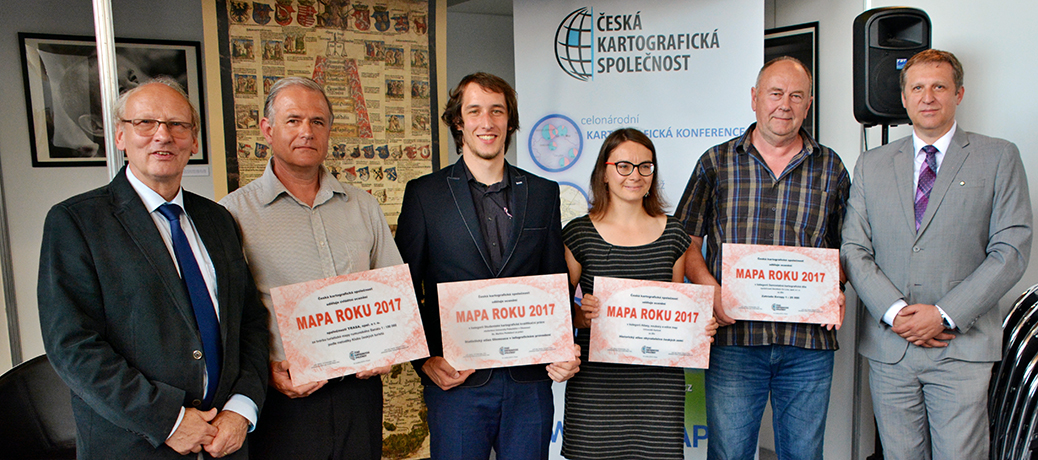
Zúčastněte se tradičního kartografického klání a získejte pro své dílo ocenění Mapa roku 2020! Vítáme všechny autory a producenty kartografických produktů, a to těch tradičních i netradičních. Stejně jako v loňském roce proběhne výstava všech nominovaných a dalších vybraných produktů, která bude přístupná široké veřejnosti. Nejzajímavější díla pak poputují na Mezinárodní kartografickou výstavu, která se […]
The post Česká kartografická společnost vyhlašuje 23. ročník kartografické soutěže Mapa roku appeared first on GISportal.cz.
Mapová aplikace ÚPD - nové dokumentace
1.3.2021 8:30 Jihočeský kraj V mapové aplikaci Územně plánovací dokumentace obcí byla aktualizována ÚPD obcí ORP Jindřichův Hradec – Stráž nad Nežárkou, Kardašova Řečice, ORP Český Krumlov – Český Krumlov, ORP Milevsko – Stehlovice, ORP Třeboň - TřeboňMapová aplikace ÚPD - nové dokumentace
1.3.2021 8:30 Jihočeský kraj V mapové aplikaci Územně plánovací dokumentace obcí byla aktualizována ÚPD obcí ORP Jindřichův Hradec – Stráž nad Nežárkou, Kardašova Řečice, ORP Český Krumlov – Český Krumlov, ORP Milevsko – Stehlovice, ORP Třeboň - Třeboň, ORP Soběslav - ŘípecProč jsou výstavby sítí důležité pro budoucnost
28.2.2021 12:45 Unicorn V časopise Next Generation Telekomunikace vyšel článek o významu optických sítí pro veřejnost a místní samosprávu. Provádí nás celým procesem výstavby sítí FTTH a také se zmiňuje o řešení pro rozvoj a plánování optické sítě, které Unicorn připravil ve spolupráci s holandským partnerem Geostruct.SharkCAD Pro MAC 12 CZ
26.2.2021 21:52 ŠPINAR - software Vážení zákazníci, dovolujeme si Vám představit nový CAD pro platformu Macintosh SharkCAD Pro MAC v12 CZ. V akční slevě do 4. 3. 2021! SharkCAD MAC CZ nabízí přehledné prostředí se silnými nástrojů pro 2D / 3D kreslení a vizualizace pro platformu Macintosh. Kompletní nabídku CAD programů pro platformu Macintosh nabízíme pod populární značkou TurboCAD. 2D/3D kreslící a editační...Read moreSharkCAD Pro MAC 12 CZ
26.2.2021 21:52 ŠPINAR - softwareVážení zákazníci, dovolujeme si Vám představit nový CAD pro platformu Macintosh SharkCAD Pro v12 CZ. V akční slevě do 4. 3. 2021! TurboCAD MAC CZ nabízí přehledné prostředí se silnými nástrojů pro 2D a 3D kreslení 2D/3D kreslící a editační nástroje Rozšířené nástroje pro architekturu Široká nabídka materiálů a symboly Obtisknutí textu na 3D povrch Fotorealistické zobrazení 3D...Read more
The post SharkCAD Pro MAC 12 CZ appeared first on ŠPINAR – software.
SharkCAD Pro MAC 12 CZ
26.2.2021 21:52 ŠPINAR - softwareVážení zákazníci, dovolujeme si Vám představit nový CAD pro platformu Macintosh SharkCAD Pro MAC v12 CZ. V akční slevě do 4. 3. 2021! SharkCAD MAC CZ nabízí přehledné prostředí se silnými nástrojů pro 2D / 3D kreslení a vizualizace pro platformu Macintosh. Kompletní nabídku CAD programů pro platformu Macintosh nabízíme pod populární značkou TurboCAD. 2D/3D kreslící a editační...Read more
The post SharkCAD Pro MAC 12 CZ appeared first on ŠPINAR – software.
SharkCAD Pro MAC 12 CZ
26.2.2021 21:52 ŠPINAR - softwareVážení zákazníci, dovolujeme si Vám představit nový CAD pro platformu Macintosh SharkCAD Pro v12 CZ. V akční slevě do 4. 3. 2021! TurboCAD MAC CZ nabízí přehledné prostředí se silnými nástrojů pro 2D a 3D kreslení 2D/3D kreslící a editační nástroje Rozšířené nástroje pro architekturu Široká nabídka materiálů a symboly Obtisknutí textu na 3D povrch Fotorealistické zobrazení 3D...Read more
The post SharkCAD Pro MAC 12 CZ appeared first on ŠPINAR – software.
Efficiency is in Season: senseFly Launches eBee Ag Fixed-wing Mapping Drone for Agriculture
26.2.2021 20:17 GISCafe.com Webcasts-Webinars CHESEAUX-SUR-LAUSANNE, Switzerland, 15th February 2021 – senseFly, the global leader in fixed-wing mapping drones, today announces the launch …FOURSQUARE, KOREM CEMENT PARTNERSHIP TO ENHANCE FOCUS ON GEOSPATIAL DATA
26.2.2021 20:11 GISCafe.com Webcasts-Webinars NEW YORK, NY and QUÉBEC CITY, QC, February 16, 2021 – Foursquare, the leading independent location technology company and Korem, the …Vytvořili jste mapu? Soutěž Mapa roku se koná i letos
26.2.2021 18:22 GeoBusinessČeská kartografická společnost již přes dvacet let pořádá soutěž Mapa roku. Do letošního ročníku soutěže můžete své kartografické dílo přihlašovat do 20. března. Podobně jako v roce 2020 i tentokrát se uskuteční výstava všech nominovaných a dalších vybraných produktů. Nejzajímavější díla vezme Česká kartografická společnost v prosinci 2021 s sebou do Itálie na mezinárodní kartografickou […]
The post Vytvořili jste mapu? Soutěž Mapa roku se koná i letos appeared first on GeoBusiness.
Změna úředních hodin
26.2.2021 12:30 ČÚZK /Urady/Katastralni-urady/Katastralni-urady/Katastralni-urad-pro-Ustecky-kraj/Katastralni-pracoviste/KP-Most/O-uradu/Aktuality/Zmena-urednich-hodin-(1)Změna úředních hodin
26.2.2021 12:30 ČÚZK - předpisy a opatření Katastrální úřad pro Ústecký kraj - Katastrální pracoviště Most zveřejnil novou aktualitu: S účinností od 1.3.2021 je provedena změna Úředních hodin na Katastrálním pracovišti Most Katastrálního úřadu pro Ústecký kraj.Úřední hodiny jsou nově pro všechny agendy:
Pondělí, Středa : 8:00 - 17:00
Úterý, Čtvrtek : 8:00 - 14:00
Pátek : 8:00 - 12:00
Změna úředních hodin
26.2.2021 12:30 ČÚZK - předpisy a opatření Katastrální úřad pro Ústecký kraj - Katastrální pracoviště Most zveřejnil novou aktualitu: S účinností od 8.3.2021 je provedena změna Úředních hodin na Katastrálním pracovišti Most Katastrálního úřadu pro Ústecký kraj.Úřední hodiny jsou nově pro všechny agendy:
Pondělí, Středa : 8:00 - 17:00
OpenLandUse (pozvánka na webinář)
26.2.2021 10:38 GISportal.cz
Webinář 8: OpenLandUse – otevřená databáze pro vyhodnocení využití území a základ pro budování digitálních dvojčat (Digital Twin) pro potřeby komplexních modelů vývoje a stavu zemského povrchu – Úterý 2.3.2021, ve 13:00 Informace o využití půdy a půdním krytu v kombinaci s dalšími tematickými datovými sadami vztažené k podrobným referenčním prostorovým datům v lokalitách tvoří […]
The post OpenLandUse (pozvánka na webinář) appeared first on GISportal.cz.
Earth from Space: Vancouver
26.2.2021 10:00 ESA Observing the Earth
The Copernicus Sentinel-2 mission takes us over Vancouver – the third largest city in Canada.
Earth from Space: Vancouver
26.2.2021 10:00 ESA Observing the Earth
The Copernicus Sentinel-2 mission takes us over Vancouver – the third largest city in Canada.
thinkWhere Wins Contract to Open Up Access to European Mapping
26.2.2021 9:00 GISCafe.com Webcasts-Webinars Scotland, 25 February 2021 – thinkWhere has been awarded a major contract to develop a gateway that will provide easy online access to official …vrchní referent / rada v oddělení dokumentace katastru nemovitostí Katastrálního pracoviště Ústí nad
26.2.2021 8:35 ČÚZK /Urady/Katastralni-urady/Katastralni-urady/Katastralni-urad-pro-Pardubicky-kraj/Uredni-deska/Oznameni-a-jina-uredni-sdeleni/Volna-mista/vrchni-referent-rada-v-oddeleni-dokumentace-ka-(1)vrchní referent / rada v oddělení dokumentace katastru nemovitostí Katastrálního pracoviště Ústí nad
26.2.2021 8:35 ČÚZK - předpisy a opatření Katastrální úřad pro Pardubický kraj - Katastrální pracoviště Ústí nad Orlicívypisuje výběrové řízení na místo
vrchní referent / rada v oddělení dokumentace katastru nemovitostí Katastrálního pracoviště Ústí nad Orlicí
vrchní referent / rada v oddělení dokumentace katastru nemovitostí Katastrálního pracoviště Ústí nad
26.2.2021 8:35 ČÚZK - volná místa Katastrální úřad pro Pardubický kraj - Katastrální pracoviště Ústí nad Orlicí vypisuje výběrové řízení na místo vrchní referent / rada v oddělení dokumentace katastru nemovitostí Katastrálního pracoviště Ústí nadVelodyne Lidar Reports Fourth Quarter and Full Year 2020 Financial Results
26.2.2021 1:38 GISCafe.com Webcasts-Webinars 2020 annual revenue of $95.4 millionFourth quarter shipments were a record 4,237 units, including 718 solid state units
$350.3 million of cash …
Velodyne Lidar Announces Appointment of Hamid Zarringhalam to Board of Directors
26.2.2021 1:38 GISCafe.com Webcasts-Webinars Brings 35 Years of Technology, Operations and Business Development Expertise at NikonSAN JOSE, Calif. — (BUSINESS WIRE) — February 25, …
Kratos Reports Fourth Quarter and Fiscal 2020 Financial Results
26.2.2021 1:38 GISCafe.com Webcasts-Webinars Fourth Quarter and Fiscal 2020 Revenues of $206.4 and $747.7 Million, Increased 11.5 percent and 4.2 percent, respectively, over 2019 Fourth Quarter …Autodesk, Inc. Announces Fiscal 2021 Fourth Quarter And Full-Year Results
26.2.2021 1:38 GISCafe.com Webcasts-Webinars -Fiscal 2021 Revenue Increased 16% to $3.8 Billion Driven by Strong Enterprise and Cloud-Based Sales, and Resilient SaaS ModelSAN RAFAEL, Calif., …
Ušetřete až 20 % na programu AutoCAD či Revit LT (a dárek navíc) - poslední den
26.2.2021 1:00 CAD Studio Ušetřete až 20 % na Vašem novém CAD/BIM software - platí jen do 26.2.a získejte navíc narozeninový dárek Váš nový CAD či BIM software Autodesk si nyní můžete pořídit levněji. V rámci krátké slevové promo akce můžete zakoupit o 20 % zvýhodněné 3leté ...Výpůjčky prodlouženy do 30.4.2021 [Knihovna geografie, byTopic]
26.2.2021 0:00 Katedra aplikované geoinformatiky a kartografie Přf UK S ohledem na přetrvávající pandemickou situaci prodlužujeme našim čtenářům výpůjčky až do 30.4.2021.Výpůjčky prodlouženy do 1.4.2021 [Knihovna geografie, byTopic]
26.2.2021 0:00 Katedra aplikované geoinformatiky a kartografie Přf UK S ohledem na vládní nařízení a vyhlášení nového nouzového stavu prodlužujeme našim čtenářům výpůjčky až do 1.4.2021.Prodlužování výpůjček – aktuálně (26.2.2021) [Knihovna geografie, byTopic]
26.2.2021 0:00 Katedra aplikované geoinformatiky a kartografie Přf UK Kvůli přetrvávající epidemiologické situaci prodlužujeme našim čtenářům výpůjčky do 8.3.2021.Airbus imagery supports IBM efforts to provide vegetation insights for grid reliability
25.2.2021 22:47 GISCafe.com Webcasts-Webinars Herndon, VA, USA, 25 February 2021 – Airbus now provides very high-resolution satellite imagery to The Weather Company, an IBM Business. IBM …OGC Membership approves and publishes minor update to GeoPackage
25.2.2021 22:41 GISCafe.com Webcasts-Webinars
V1.3 is a minor update to GeoPackage, the open, standards-based, platform-independent, portable, self-describing, compact format for …
Innovyze Introduces Dynamic Digital Twins to the Water Industry with Info360.com
25.2.2021 22:40 GISCafe.com Webcasts-Webinars Info360.com platform and Info360 Insight solution by Innovyze are available now for solving water utility problemsInfo360.com platform and the …
Autodesk za miliardu dolarů koupil firmu, zabývající se predikcí a optimalizací ve vodohospodářství a inženýrských sítích
25.2.2021 19:55 GeoBusinessFirma Autodesk oznámila, že kupuje za miliardu dolarů firmu Innovyze. Americká firma Innovyze byla založena před 35 lety v Portlandu (Oregon, USA) a specializuje se na predikci a optimalizaci ve vodohospodářství a v inženýrských sítích. Innovyze používá pro optimalizaci strojové učení a svoji technologii umělé inteligence, pojmenovanou Emagin. Firma má přes tři tisíce zákazníků v […]
The post Autodesk za miliardu dolarů koupil firmu, zabývající se predikcí a optimalizací ve vodohospodářství a inženýrských sítích appeared first on GeoBusiness.
Kdo z Čechů je v přehledu Geospatial World 50 Rising Stars 2021
25.2.2021 19:33 GeoBusinessČasopis Geospatial World uveřejnil díky sponzoringu firmy Trimble přehled tzv. „rising stars“ v geoinformačním průmyslu. Podmínkou pro zařazení do přehledu byl věk do 40 let. Redakce nakonec vybrala padesátku z celkem 250 jmen, nominovaných veřejností. Geospatial World 50 Rising Stars 2021 Aimee Barciauskas Alexandra Fredericks Alexander Gunkel Alison DeGraff Ollivierre Anita Graser Benjamin D’Incau Annina […]
The post Kdo z Čechů je v přehledu Geospatial World 50 Rising Stars 2021 appeared first on GeoBusiness.
Newcastle University Pioneers Hyper-Resolution Flood Risk Modelling using Bluesky 3D Data
25.2.2021 18:10 GISCafe.com Webcasts-Webinars Leicestershire, UK, 24 February 2021 – Newcastle University is developing advanced computer modelling to assess the flood risk of individual …Nová verze QGISu 3.18 pracuje se SAP HANA a umí mračna bodů z laserového skenování
25.2.2021 18:06 GeoBusiness20. února 2021 byla představena nová verze open source softwaru QGIS. Verze 3.18 je pojmenována Zürich a největší novinkou je nativní podpora práce s mračny bodů z laserového skenování. QGIS tedy umí načíst a vykreslit mračna bodů v různých datových formátech díky knihovně PDAL (Point Data Abstraction Library), což je něco jako GDAL, ale pro […]
The post Nová verze QGISu 3.18 pracuje se SAP HANA a umí mračna bodů z laserového skenování appeared first on GeoBusiness.
GAF HAS BEEN AWARDED A MULTI-YEAR CONTRACT BY THE GERMAN FEDERAL STATE OF SAXONY-ANHALT
25.2.2021 18:06 GISCafe.com Webcasts-Webinars GAF AG has won the first European call for tenders for the operational implementation of the agricultural area monitoring system in Germany in 2021 …Helicopter Medical Emergency Flight lands at Motol Hospital thanks to EGNOS (Real Video Demo)
25.2.2021 17:54 European GNSS Agency
Motol University Hospital – Prague’s largest medical facility – embraces EGNOS technology and becomes accessible even under harsh weather conditions.
Helicopter Emergency Medical Services (HEMS) are crucial in times of crises such as global pandemics, and are an integral part of many healthcare systems across the globe. They help with emergency evacuations and inter-hospital transports across Europe and also with transporting doctors and medical equipment to remote sites. Often, adverse weather conditions or other factors, such as smoke, cause helicopters to divert or abort landings. In addition, many hospitals lack costly ground-based helicopter navigation equipment to provide guidance in bad weather, which may lead to significant delays when time is of the essence.
To continue delivering high level healthcare services, Motol University Hospital upgraded its facilities by implementing an EGNOS landing procedure, allowing helicopters to land safely even under bad weather conditions on the rooftop helipad of the hospital. The European Geostationary Navigation Overlay Service (EGNOS) is the European Satellite-Based Augmentation System. It is improving the performance of Global Navigation Satellite Systems by offering an additional layer of accuracy in the landing procedure.
Thanks to EGNOS, the European Satellite-Based Augmentation System, pilots can navigate through the clouds and fog, and land safely at the Prague-based hospital. Hospital accessibility around the clock is crucial for the transportation of critically ill patients and also for operations such as the organ transplant transportation service of Motol Hospital.
“I am delighted that the GSA has been instrumental to the implementation of this procedure and that Motol Hospital now relies on EGNOS to ensure that patients in critical conditions can safely land on its helipad. I am looking forward to making more hospitals accessible across the European Union.’’ says GSA Executive Director, Rodrigo da Costa.
“As the director of the Motol University Hospital, I am pleased that the European GNSS Agency (GSA) helped to create and implement a satellite-based procedure for the hospital’s helipad. This will enable using the helipad in adverse weather conditions, while the complicated transfer of patients to emergency will be eliminated. Above all, it will enhance our Transplant Programme as it will allow very quick organ transfer directly from the helicopter to the operating rooms’’, concludes Motol University Hospital Director, Dr. Miloslav Ludvík
The implementation of this procedure as first in the Czech republic on the hospital helipad has been co-funded by GSA within the EGNOS Adoption CZ project under Aviation Grant Programme. The demonstration of this approach procedure took place early in December 2020, with the participation of the Aviation Service of the Police of the Czech Republic where an Airbus EGNOS-enabled helicopter H135 (EC135) landed successfully at Motol’s helipad thanks to EGNOS.
Read the press release in CZ here and EN here
Watch the video below:
Media note: This feature can be republished without charge provided the European GNSS Agency (GSA) is acknowledged as the source at the top or the bottom of the story. You must request permission before you use any of the photographs on the site. If you republish, we would be grateful if you could link back to the GSA website (http://www.gsa.europa.eu).
Helicopter Medical Emergency Flight lands at Motol Hospital thanks to EGNOS (Real Video Demo)
25.2.2021 17:54 European GNSS AgencyMotol University Hospital – Prague’s largest medical facility – embraces EGNOS technology and becomes accessible even under harsh weather conditions.
Helicopter Emergency Medical Services (HEMS) are crucial in times of crises such as global pandemics, and are an integral part of many healthcare systems across the globe. They help with emergency evacuations and inter-hospital transports across Europe and also with transporting doctors and medical equipment to remote sites. Often, adverse weather conditions or other factors, such as smoke, cause helicopters to divert or abort landings. In addition, many hospitals lack costly ground-based helicopter navigation equipment to provide guidance in bad weather, which may lead to significant delays when time is of the essence.
To continue delivering high level healthcare services, Motol University Hospital upgraded its facilities by implementing an EGNOS landing procedure, allowing helicopters to land safely even under bad weather conditions on the rooftop helipad of the hospital. The European Geostationary Navigation Overlay Service (EGNOS) is the European Satellite-Based Augmentation System. It is improving the performance of Global Navigation Satellite Systems by offering an additional layer of accuracy in the landing procedure.
Thanks to EGNOS, the European Satellite-Based Augmentation System, pilots can navigate through the clouds and fog, and land safely at the Prague-based hospital. Hospital accessibility around the clock is crucial for the transportation of critically ill patients and also for operations such as the organ transplant transportation service of Motol Hospital.
“I am delighted that the GSA has been instrumental to the implementation of this procedure and that Motol Hospital now relies on EGNOS to ensure that patients in critical conditions can safely land on its helipad. I am looking forward to making more hospitals accessible across the European Union.’’ says GSA Executive Director, Rodrigo da Costa.
“As the director of the Motol University Hospital, I am pleased that the European GNSS Agency (GSA) helped to create and implement a satellite-based procedure for the hospital’s helipad. This will enable using the helipad in adverse weather conditions, while the complicated transfer of patients to emergency will be eliminated. Above all, it will enhance our Transplant Programme as it will allow very quick organ transfer directly from the helicopter to the operating rooms’’, concludes Motol University Hospital Director, Dr. Miloslav Ludvík
The first flight landed early in December 2020, with the participation of the Aviation Service of the Police of the Czech Republic where an Airbus EGNOS-enabled helicopter H135 (EC135) landed successfully at Motol’s helipad with the help of EGNOS.
Read the press release in CZ here and EN here
Watch the video below:
Media note: This feature can be republished without charge provided the European GNSS Agency (GSA) is acknowledged as the source at the top or the bottom of the story. You must request permission before you use any of the photographs on the site. If you republish, we would be grateful if you could link back to the GSA website (http://www.gsa.europa.eu).
Helicopter Medical Emergency Flight lands at Motol Hospital thanks to EGNOS (Real Video Demo)
25.2.2021 17:54 European GNSS AgencyMotol University Hospital – Prague’s largest medical facility – embraces EGNOS technology and becomes accessible even under harsh weather conditions.
Helicopter Emergency Medical Services (HEMS) are crucial in times of crises such as global pandemics, and are an integral part of many healthcare systems across the globe. They help with emergency evacuations and inter-hospital transports across Europe and also with transporting doctors and medical equipment to remote sites. Often, adverse weather conditions or other factors, such as smoke, cause helicopters to divert or abort landings. In addition, many hospitals lack costly ground-based helicopter navigation equipment to provide guidance in bad weather, which may lead to significant delays when time is of the essence.
To continue delivering high level healthcare services, Motol University Hospital upgraded its facilities by implementing an EGNOS landing procedure, allowing helicopters to land safely even under bad weather conditions on the rooftop helipad of the hospital. The European Geostationary Navigation Overlay Service (EGNOS) is the European Satellite-Based Augmentation System. It is improving the performance of Global Navigation Satellite Systems by offering an additional layer of accuracy in the landing procedure.
Thanks to EGNOS, the European Satellite-Based Augmentation System, pilots can navigate through the clouds and fog, and land safely at the Prague-based hospital. Hospital accessibility around the clock is crucial for the transportation of critically ill patients and also for operations such as the organ transplant transportation service of Motol Hospital.
“I am delighted that the GSA has been instrumental to the implementation of this procedure and that Motol Hospital now relies on EGNOS to ensure that patients in critical conditions can safely land on its helipad. I am looking forward to making more hospitals accessible across the European Union.’’ says GSA Executive Director, Rodrigo da Costa.
“As the director of the Motol University Hospital, I am pleased that the European GNSS Agency (GSA) helped to create and implement a satellite-based procedure for the hospital’s helipad. This will enable using the helipad in adverse weather conditions, while the complicated transfer of patients to emergency will be eliminated. Above all, it will enhance our Transplant Programme as it will allow very quick organ transfer directly from the helicopter to the operating rooms’’, concludes Motol University Hospital Director, Dr. Miloslav Ludvík
The flight landed early in December 2020, with the participation of the Aviation Service of the Police of the Czech Republic where an Airbus EGNOS-enabled helicopter H135 (EC135) landed successfully at Motol’s helipad with the help of EGNOS.
Read the press release in CZ here and EN here
Watch the video below:
Media note: This feature can be republished without charge provided the European GNSS Agency (GSA) is acknowledged as the source at the top or the bottom of the story. You must request permission before you use any of the photographs on the site. If you republish, we would be grateful if you could link back to the GSA website (http://www.gsa.europa.eu).
Helicopter Medical Emergency Flight lands at Motol Hospital thanks to EGNOS (Real Video Demo)
25.2.2021 17:54 European GNSS AgencyMotol University Hospital – Prague’s largest medical facility – embraces EGNOS technology and becomes accessible even under harsh weather conditions.
Helicopter Emergency Medical Services (HEMS) are crucial in times of crises such as global pandemics, and are an integral part of many healthcare systems across the globe. They help with emergency evacuations and inter-hospital transports across Europe and also with transporting doctors and medical equipment to remote sites. Often, adverse weather conditions or other factors, such as smoke, cause helicopters to divert or abort landings. In addition, many hospitals lack costly ground-based helicopter navigation equipment to provide guidance in bad weather, which may lead to significant delays when time is of the essence.
To continue delivering high level healthcare services, Motol University Hospital upgraded its facilities by implementing an EGNOS landing procedure, allowing helicopters to land safely even under bad weather conditions on the rooftop helipad of the hospital. The European Geostationary Navigation Overlay Service (EGNOS) is the European Satellite-Based Augmentation System. It is improving the performance of Global Navigation Satellite Systems by offering an additional layer of accuracy in the landing procedure.
Thanks to EGNOS, the European Satellite-Based Augmentation System, pilots can navigate through the clouds and fog, and land safely at the Prague-based hospital. Hospital accessibility around the clock is crucial for the transportation of critically ill patients and also for operations such as the organ transplant transportation service of Motol Hospital.
“I am delighted that the GSA has been instrumental to the implementation of this procedure and that Motol Hospital now relies on EGNOS to ensure that patients in critical conditions can safely land on its helipad. I am looking forward to making more hospitals accessible across the European Union.’’ says GSA Executive Director, Rodrigo da Costa.
“As the director of the Motol University Hospital, I am pleased that the European GNSS Agency (GSA) helped to create and implement a satellite-based procedure for the hospital’s helipad. This will enable using the helipad in adverse weather conditions, while the complicated transfer of patients to emergency will be eliminated. Above all, it will enhance our Transplant Programme as it will allow very quick organ transfer directly from the helicopter to the operating rooms’’, concludes Motol University Hospital Director, Dr. Miloslav Ludvík
The implementation of this procedure as first in the Czech republic on the hospital helipad has been co-funded by GSA within the EGNOS Adoption CZ project under Aviation Grant Programme and coordinated by GNSS Centre of Excellence. The procedure has been designed by Air Navigation Services of the Czech Republic and the demonstration of this approach procedure took place early in December 2020, with the participation of the Aviation Service of the Police of the Czech Republic where an Airbus EGNOS-enabled helicopter H135 (EC135) landed successfully at Motol’s helipad thanks to EGNOS.
Read the press release in CZ here and EN here
Watch the video below:
Media note: This feature can be republished without charge provided the European GNSS Agency (GSA) is acknowledged as the source at the top or the bottom of the story. You must request permission before you use any of the photographs on the site. If you republish, we would be grateful if you could link back to the GSA website (http://www.gsa.europa.eu).
Helicopter Medical Emergency Flight lands at Motol Hospital thanks to EGNOS (Real Video Demo)
25.2.2021 17:54 European GNSS AgencyMotol University Hospital – Prague’s largest medical facility – embraces EGNOS technology and becomes accessible even under harsh weather conditions.
Helicopter Emergency Medical Services (HEMS) are crucial in times of crises such as global pandemics, and are an integral part of many healthcare systems across the globe. They help with emergency evacuations and inter-hospital transports across Europe and also with transporting doctors and medical equipment to remote sites. Often, adverse weather conditions or other factors, such as smoke, cause helicopters to divert or abort landings. In addition, many hospitals lack costly ground-based helicopter navigation equipment to provide guidance in bad weather, which may lead to significant delays when time is of the essence.
To continue delivering high level healthcare services, Motol University Hospital upgraded its facilities by implementing an EGNOS landing procedure, allowing helicopters to land safely even under bad weather conditions on the rooftop helipad of the hospital. The European Geostationary Navigation Overlay Service (EGNOS) is the European Satellite-Based Augmentation System. It is improving the performance of Global Navigation Satellite Systems by offering an additional layer of accuracy in the landing procedure.
Thanks to EGNOS, the European Satellite-Based Augmentation System, pilots can navigate through the clouds and fog, and land safely at the Prague-based hospital. Hospital accessibility around the clock is crucial for the transportation of critically ill patients and also for operations such as the organ transplant transportation service of Motol Hospital.
“I am delighted that the GSA has been instrumental to the implementation of this procedure and that Motol Hospital now relies on EGNOS to ensure that patients in critical conditions can safely land on its helipad. I am looking forward to making more hospitals accessible across the European Union.’’ says GSA Executive Director, Rodrigo da Costa.
“As the director of the Motol University Hospital, I am pleased that the European GNSS Agency (GSA) helped to create and implement a satellite-based procedure for the hospital’s helipad. This will enable using the helipad in adverse weather conditions, while the complicated transfer of patients to emergency will be eliminated. Above all, it will enhance our Transplant Programme as it will allow very quick organ transfer directly from the helicopter to the operating rooms’’, concludes Motol University Hospital Director, Dr. Miloslav Ludvík
The implementation of this procedure as first in the Czech republic on the hospital helipad has been co-funded by GSA within the EGNOS Adoption CZ project under Aviation Grant Programme. The demonstration of this approach procedure took place early in December 2020, with the participation of the Aviation Service of the Police of the Czech Republic where an Airbus EGNOS-enabled helicopter H135 (EC135) landed successfully at Motol’s helipad thanks to EGNOS.
Read the press release in CZ here and EN here
Watch the video below:
Media note: This feature can be republished without charge provided the European GNSS Agency (GSA) is acknowledged as the source at the top or the bottom of the story. You must request permission before you use any of the photographs on the site. If you republish, we would be grateful if you could link back to the GSA website (http://www.gsa.europa.eu).
Databáze OpenLandUse jako příležitost pro geodety a geoinformatiky
25.2.2021 17:49 ZeměměřičPřestože již byly představeny strategie jako Green Deal či Destination Earth (DestinE) a v celé řadě oborů se diskutuje o tvorbě dvojčat zemského povrchu, známých také jako tzv. Digital Twins, tak v tuto chvíli zatím neexistuje model a databáze, v níž by šlo efektivně shromažďovat všechny informace o zemském povrchu v patřičném detailu a v dostatečně komplexních vazbách. Informace o využití půdy a o půdním krytu v kombinaci s dalšími tematickými datovými […]
The post Databáze OpenLandUse jako příležitost pro geodety a geoinformatiky appeared first on Zeměměřič.
Databáze OpenLandUse a jak se do ní můžete také zapojit
25.2.2021 17:41 GeoBusinessPřestože již byly představeny strategie jako Green Deal či Destination Earth (DestinE) a v celé řadě oborů se diskutuje o tvorbě dvojčat zemského povrchu, známých také jako tzv. Digital Twins, tak v tuto chvíli zatím neexistuje model a databáze, v níž by šlo efektivně shromažďovat všechny informace o zemském povrchu v patřičném detailu a v […]
The post Databáze OpenLandUse a jak se do ní můžete také zapojit appeared first on GeoBusiness.
Trimble Launches Dimensions Spotlight Series for 2021
25.2.2021 16:35 GISCafe.com Webcasts-Webinars On-Demand Series Kicks Off with Focus on InfrastructureSUNNYVALE, Calif., Feb. 25, 2021 — (PRNewswire) — Trimble (NASDAQ: TRMB) …
Intermap Technologies Meets Standards to Trade on the OTCQX® Best Market
25.2.2021 16:35 GISCafe.com Webcasts-Webinars DENVER, Colo., Feb. 25, 2021 — (PRNewswire) — Intermap Technologies Corp. (TSX: IMP) (OTCQX: ITMSF) ("Intermap" or the "Company"), …Ibeo Automotive Systems Tests LiDAR Systems for Autonomous Driving in Berlin and Beijing
25.2.2021 16:35 GISCafe.com Webcasts-Webinars Validation of LiDAR sensors for series productionHAMBURG, Germany, Feb. 25, 2021 — (PRNewswire) — The LiDAR sensor specialist …
Z důvodu změny struktury nahlí
25.2.2021 11:58 GEUSware Z důvodu změny struktury nahlížení na stránkách ČÚZK přestaly v programu GEUS 25.0 fungovat funkce "Pomůcky/ Nahlížení do KN ČÚZK..." a "Pomůcky/ Doplnění vlastníka", v programu Geometr 18.0 nefunguje "Pomůcky/ Nahlížení do KN...". Usilovně pracujeme na opravě a vydání nových sestavení programů GEUS 25.0 a Geometr 18.0. Rada/odborný rada – řízení o údajích SGI
25.2.2021 10:50 ČÚZK /Urady/Katastralni-urady/Katastralni-urady/Katastralni-urad-pro-Moravskoslezsky-kraj/Uredni-deska/Oznameni-a-jina-uredni-sdeleni/Volna-mista/DMS/Rada-odborny-rada-–-rizeni-o-udajich-SGIRada/odborný rada – řízení o údajích SGI
25.2.2021 10:50 ČÚZK - volná místa Katastrální úřad pro Moravskoslezský kraj Katastrální pracoviště Nový Jičín vypisuje výběrové řízení na místo Rada/odborný rada – řízení o údajích SGIRada/odborný rada – řízení o údajích SGI
25.2.2021 10:50 ČÚZK - předpisy a opatření Katastrální úřad pro Moravskoslezský kraj Katastrální pracoviště Nový Jičínvypisuje výběrové řízení na místo
Rada/odborný rada – řízení o údajích SGI
Vrchní referent / rada – návrh zápisu v katastru v oddělení aktualizace KN Katastrálního pracoviště
25.2.2021 10:09 ČÚZK - předpisy a opatření Katastrální úřad pro Zlínský kraj Katastrální pracoviště Zlínvypisuje výběrové řízení na místo
Vrchní referent / rada – návrh zápisu v katastru v oddělení aktualizace KN Katastrálního pracoviště Zlín
Vrchní referent / rada – návrh zápisu v katastru v oddělení aktualizace KN Katastrálního pracoviště
25.2.2021 10:09 ČÚZK - volná místa Katastrální úřad pro Zlínský kraj Katastrální pracoviště Zlín vypisuje výběrové řízení na místo Vrchní referent / rada – návrh zápisu v katastru v oddělení aktualizace KN Katastrálního pracovištěVrchní referent / rada – návrh zápisu v katastru v oddělení aktualizace KN Katastrálního pracoviště
25.2.2021 10:09 ČÚZK /Urady/Katastralni-urady/Katastralni-urady/Katastralni-urad-pro-Zlinsky-kraj/Uredni-deska/Oznameni-a-jina-uredni-sdeleni/Volna-mista/DMS/Vrchni-referent-rada-–-navrh-zapisu-v-katastru-vÚzemně plánovací dokumentace
25.2.2021 10:00 Středočeský kraj Mapová aplikace Územně plánovací dokumentace ve Středočeském kraji byla aktualizována. Do nástroje Informace, záložka Reporty byl přidán nový report Nová data (stav ke dni 17.02.2021). Od poslední aktualizace přibylo 34 ÚPD. Celkem je prezentováno 730 hlavních a koordinačních výkresů z 1 144 obcí.QGIS 3.18 Zürich je ke stažení!
25.2.2021 9:28 GISportal.cz
QGIS je v současné době nejpoužívanější open source GIS a jeho nová verze s pořadovým číslem 3.18 a názvem Zürich je nově ke stažení (zdarma) ve verzích pro Win, Mac OS, Linux. Tradičně je v nové verzi velké množství změn a vylepšení – jejich kompletní seznam najdete v Changelogu, a nebo v krátkém videu níže. […]
The post QGIS 3.18 Zürich je ke stažení! appeared first on GISportal.cz.
Geo Week Event In Denver
25.2.2021 9:00 GISCafe.com Webcasts-Webinars Advisory Board Set for Geo Week February 6-8, 2022 in Denver, CO16 experts have been tapped to help craft critical programming for Geo WeekDenver, …
Nedostupné_tel_linky
25.2.2021 7:55 ČÚZK - předpisy a opatření Katastrální úřad pro Středočeský kraj - Katastrální pracoviště Kolín zveřejnil novou aktualitu: Vážení klienti,aktuálně jsou nedostupné telefonní linky. Na nápravě současného stavu a obnovení funkčnosti telefonického spojení pracuje dodavatel služeb.
Pro případné dotazy prosím využijte e-mail: kp.kolin@cuzk.cz
Za způsobené nepříjemnosti se velice omlouváme.
Maxar’s Vricon Awarded Phase 2 of U.S. Army’s One World Terrain Contract
25.2.2021 1:21 GISCafe.com Webcasts-Webinars Program’s second phase to provide highly accurate 3D data and technology for expanding operational missions across Army networkWESTMINSTER, Colo. …
Maxar Technologies Reports Fourth Quarter and Full-Year 2020 Results
25.2.2021 1:21 GISCafe.com Webcasts-Webinars WESTMINSTER, Colo. — (BUSINESS WIRE) — February 24, 2021 —Maxar Technologies (NYSE:MAXR) (TSX:MAXR) (“Maxar” or the …
USNESENÍ VLÁDY ČR! ZÁKAZ VSTUPU BEZ RESPIRÁTORU!
25.2.2021 0:00 Státní pozemkový úřad Na základě Usnesení vlády ČR jsou všichni povinni při vstupu do všech budov našich pracovišť nosit respirátory třídy FFP2 nebo KN95. Pokud jdete na předem domluvenou schůzku, opatřete se tedy těmito ochrannými pomůckami, jinak vás nemůžeme do budov vpustit. Všechny žádáme o striktní dodržování stanovených pravidel. Děkujeme za pochopení.USNESENÍ VLÁDY ČR! ZÁKAZ VSTUPU BEZ RESPIRÁTORU!
25.2.2021 0:00 Státní pozemkový úřad Na základě Usnesení vlády ČR jsou všichni povinni při vstupu do všech budov našich pracovišť nosit respirátory třídy FFP2, KN95, N95 a vyšší (včetně nano roušek). Pokud jdete na předem domluvenou schůzku, opatřete se tedy těmito ochrannými pomůckami, jinak vás nemůžeme do budov vpustit. Všechny žádáme o striktní dodržování stanovených pravidel. Děkujeme za pochopení.Colonnade Acquisition Corp. Announces Extraordinary General Meeting Date to Approve Proposed Business Combination with Ouster
24.2.2021 21:26 GISCafe.com Webcasts-Webinars Extraordinary general meeting of CLA shareholders to approve proposed business combination with Ouster, Inc. to be held on March 9, 2021WEST PALM …
Europe's Falck in partnership with Silicon Valley's Kitty Hawk
24.2.2021 21:24 GISCafe.com Webcasts-Webinars SILICON VALLEY, Calif., Feb. 24, 2021 — (PRNewswire) — Emergency response and healthcare company Falck today announced a …Innoviz Names Udy Gal-On Chief Operating Officer
24.2.2021 21:24 GISCafe.com Webcasts-Webinars TEL AVIV, Israel, Feb. 24, 2021 — (PRNewswire) — Innoviz Technologies, a technology leader of high-performance, solid-state LiDAR …Twenty-five Alberta communities receive support for stronger asset management practices
24.2.2021 17:17 GISCafe.com Webcasts-Webinars OTTAWA, ON, Feb. 24, 2021 — (PRNewswire) —OTTAWA, ON, Feb. 24, 2021 /CNW/ - As we continue to adapt to the new physical, …
AeroVironment Acquires Progeny Systems Corporation’s Intelligent Systems Group, a Leading Provider of Artificial Intelligence-Enabled Machine Learning and Perceptive Autonomy Technologies and Services
24.2.2021 17:02 GISCafe.com Webcasts-Webinars Transaction significantly accelerates AeroVironment’s artificial intelligence and autonomy initiatives with best-in-class computer vision and …LeddarTech Launches PixSet, the Industry’s First Full-Waveform Flash LiDAR Dataset
24.2.2021 14:02 GISCafe.com Webcasts-Webinars QUEBEC CITY, Feb. 24, 2021 (GLOBE NEWSWIRE) -- LeddarTech®, a global leader in Level 1-5 ADAS and AD sensing technology, announces its first …LeddarTech Launches PixSet, the Industry’s First Full-Waveform Flash LiDAR Dataset
24.2.2021 14:02 GISCafe.com Webcasts-Webinars QUEBEC CITY, Feb. 24, 2021 (GLOBE NEWSWIRE) -- LeddarTech®, a global leader in Level 1-5 ADAS and AD sensing technology, announces its first …Autodesk to Acquire Innovyze, Inc. for $1 Billion; Provider of Smart Water Infrastructure Modeling and Simulation Technology
24.2.2021 14:02 GISCafe.com Webcasts-Webinars Positions Autodesk to offer end-to-end solutions for design, construction, operations and maintenance of water infrastructureSAN RAFAEL, Calif., …
EASA Committee schválila U-Space regulaci, která bude od ledna 2023
24.2.2021 12:34 UAVAJako první přinášíme novinku, že dnes byla schválena EASA Committee U-Space regulace a to s platností od 26.1.2023 (hlasovalo pro 98,91%). Nyní už jen Evropská komise formálně adoptuje toto nařízení a zveřejní ve věstníku, což by se mělo uskutečnit přibližně během jednoho měsíce. Současně se připravuje podpůrné AMC/GM na němž se v EASA expert group […]
The post EASA Committee schválila U-Space regulaci, která bude od ledna 2023 appeared first on UAV Aliance pro bezpilotní letecký průmysl.
Galileo enabling infrastructure development in harsh environments
24.2.2021 11:24 European GNSS Agency
At an infrastructure project in Norway, Galileo-enabled machine guidance systems continued to operate in a challenging environment when others had already given up. This had a major impact in terms of work continuity and operating costs, so it is clear that access to Galileo’s differentiators will be a key criterion for industry and service providers when selecting operating systems in the future.
The infrastructure project in question is the Follo Line (Follobanen) - a EUR 2.4-billion high-speed railway project that aims to cut commute times between the Norwegian urban centres of Oslo and Ski by half. The line includes a 19-km tunnel, after which a 2-km section of track is being laid between high sheet pile walls on both sides, to protect passenger trains from falling rocks.
During construction of this segment, machines used guidance technology from various providers for automated digging enabled by RTK positioning with centimetre-level accuracy. Accuracy at this level is required to ensure proper alignment of the wall segments as well as effective water drainage slopes.
Differentiators making a difference
As the walls went up, they created a canyon around the construction site. Suddenly, one by one, the machine guidance systems started to fail. Excavators and loaders were grounded for days, incurring costs and delays for the operators. As construction slowly progressed, eventually only those machines with Galileo-enabled 3D guidance systems from Makin’ - a Scandinavian machine control supplier - equipped with the latest AsteRx-U GNSS receivers from Septentrio, were still operational on the site.
“Galileo’s differentiators, such as better multipath mitigation and multi-frequency, together with multi-constellation capability, are delivering real benefits to users. We are working closely with industry to make them aware of these benefits so they can pass them on to their customers,” said GSA Head of Market Development Fiammetta Diani.
Operators are becoming increasingly aware. “Robust GNSS receivers in our guidance systems helped us get the reputation we needed to become the number one machine control company in Norway in under two years,” said Makin’ Chief Operating Officer Ruben Hensen.
Improved availability and accuracy
The construction site canyon blocked satellite visibility required by the GNSS guidance systems. As traditional GPS systems failed, only receivers that had access to the highest number of positioning satellites continued operating. The multi-constellation capacity of the Septentrio receivers on the Makin’ systems meant that they had access to more satellites, giving them the best positioning availability.
Watch this: What is Multipath?
In addition, the more signals a receiver can access the more information it can gather from the available satellites. For example, Galileo multi-frequency receivers make use of five signals per satellite, while dual-frequency receivers can make use of only two signals. This makes positioning of multi-frequency receivers more reliable in areas where the number of visible satellites is limited. Multi-frequency receivers also improve positioning accuracy by resolving ionospheric errors.
On the rail line project, metal fences around the construction site not only blocked low-elevation satellites but also generated reflected GNSS signals causing multipath. Receivers with access to the Galileo constellation benefit from the multipath mitigation that Galileo signals offer, allowing them to work better in challenging environments.
When GNSS outages occur, guidance system integrators can lose time and money, while workers in the field get demotivated. From the experience of the Norwegian rail project, it is clear that not all GNSS receivers are made equal, and access to Galileo signals can make all the difference to a machine’s guidance systems when projects get tough. Having a high-quality Galileo-enabled GNSS receiver allows machine control systems to work even in the toughest environments.
Media note: This feature can be republished without charge provided the European GNSS Agency (GSA) is acknowledged as the source at the top or the bottom of the story. You must request permission before you use any of the photographs on the site. If you republish, we would be grateful if you could link back to the GSA website (http://www.gsa.europa.eu).
vypsáno nové výběrové řízení - rozhodování o povolení vkladu
24.2.2021 11:10 ČÚZK /Urady/Katastralni-urady/Katastralni-urady/Katastralni-urad-pro-Jihocesky-kraj/Katastralni-pracoviste/KP-Pisek/O-uradu/Aktuality/vypsano-nove-vyberove-rizeni-rozhodovani-o-povolvypsáno nové výběrové řízení - rozhodování o povolení vkladu
24.2.2021 11:10 ČÚZK - předpisy a opatření Katastrální úřad pro Jihočeský kraj - Katastrální pracoviště Písek zveřejnil novou aktualitu: Vypsáno nové výběrové řízení na služební místo rada/odborný rada – rozhodování o povolení vkladu v oddělení právních vztahů k nemovitostem.Vrchní referent / rada – správce informačních a komunikačních technologií v oddělení podpory ICT tec
24.2.2021 10:44 ČÚZK - předpisy a opatření Katastrální úřad pro Královéhradecký krajvypisuje výběrové řízení na místo
Vrchní referent / rada – správce informačních a komunikačních technologií v oddělení podpory ICT technického útvaru Katastrálního úřadu pro Královéhradecký kraj
Kotlíkové dotace - III. výzva
24.2.2021 10:00 Středočeský kraj Byla aktualizována mapová aplikace Kotlíkové dotace - III. výzva, která nabízí základní přehled o aktuálním stavu přijatých žádostí v rámci projektu III. výzvy Kotlíkových dotací. Zároveň nabízí prostorovou analýzu, která odpovídá na otázku, jaký podíl obyvatelstva za obec má zájem o dotaci. V mapě si lze zapnout i další vrstvy, jako např. vrstvu tzv. Prioritních obcí nebo vrstvu Oblasti se zhoršenou kvalitou ovzduší. Uživatel přes nástroj Vybrat si může zobrazit podrobnější informace i za konkrétní obec. Zdrojem aplikace je veřejně dostupná excelová tabulka, která je jednou měsíčně aktualizována Odborem řízení dotačních projektů. Cílem aplikace je pomocí nástrojů geografického informačního systému ukázat statistická data jednoduše a přehledně prostřednictvím interaktivní mapy.Výroční zpráva dle zákona č. 106/1999 Sb. za rok 2020
24.2.2021 8:07 ČÚZK - předpisy a opatření Český úřad zeměměřický a katastrálnívydává výroční zprávu úřadu za rok
2020
Zjistěte, na čem pracuje Asociace podnikatelů v geomatice. V polovině března budete mít příležitost
23.2.2021 21:39 ZeměměřičV úterý 16. března Asociace podnikatelů v geomatice uspořádá online setkání s vedením sdružení. V průběhu hodinu a půl dlouhého setkání budete mít příležitost dozvědět se, na čem APG aktuálně pracuje. V programu vystoupí předseda APG Martin Hrdlička, vedoucí pracovní skupiny Pozemkové úpravy Lubor Pekarský a výkonný ředitel APG Jaroslav Cibulka. Program: Zahájení Vystoupení Ing. Martina Hrdličky (předseda představenstva, vedoucí […]
The post Zjistěte, na čem pracuje Asociace podnikatelů v geomatice. V polovině března budete mít příležitost appeared first on Zeměměřič.
Zjistěte, na čem pracuje Asociace podnikatelů v geomatice. V polovině března bude příležitost
23.2.2021 21:39 ZeměměřičV úterý 16. března Asociace podnikatelů v geomatice uspořádá online setkání s vedením sdružení. V průběhu hodinu a půl dlouhého setkání budete mít příležitost dozvědět se, na čem APG aktuálně pracuje. V programu vystoupí předseda APG Martin Hrdlička, vedoucí pracovní skupiny Pozemkové úpravy Lubor Pekarský a výkonný ředitel APG Jaroslav Cibulka. Prostor bude samozřejmě také na dotazy. Svůj zájem o účast […]
The post Zjistěte, na čem pracuje Asociace podnikatelů v geomatice. V polovině března bude příležitost appeared first on Zeměměřič.
S&P CoreLogic Case-Shiller Index Reports 10.4% Annual Home Price Gain To End 2020
23.2.2021 20:26 GISCafe.com Webcasts-Webinars NEW YORK, Feb. 23, 2021 — (PRNewswire) — S&P Dow Jones Indices (S&P DJI) today releases the latest results for the S&P …Pointivo Lands Eighth Patent Increasing Coverage of the Drone Analytics Market
23.2.2021 20:26 GISCafe.com Webcasts-Webinars Latest IP Extends to Automatic Generation of CAD ModelsATLANTA, Feb. 23, 2021 — (PRNewswire) — Pointivo, the leading software …
OGC membership approves new Community Standard: Indoor Mapping Data Format (IMDF)
23.2.2021 18:52 GISCafe.com Webcasts-Webinars
IMDF enables anyone to create indoor map apps and services using the same highly accurate and detailed data on any app, …
Zveme vás na online setkání s vedením Asociace podnikatelů v geomatice
23.2.2021 17:26 Asociace podnikatelů v geomatice Dovolujeme si vás jménem Ing. Jaroslava Cibulky, výkonného ředitele pozvat na online setkání s vedením Asociace podnikatelů v geomatice. Setkání se uskuteční v úterý 16. března 2021 od 16:00 do 17:30 hodin formou živého vysílání přes YouTube. Své dotazy budete mít možnost pokládat prostřednictvím chatu. Více informací včetně programu naleznete zde. Pro připojení k videokonferenci klikněte zde. Svou účast na setkání, prosím, […]Liteye Systems Launches: Liteye SHIELD The Next Generation of Counter UAS Defense
23.2.2021 17:06 GISCafe.com Webcasts-Webinars Centennial Colorado, Feb. 23, 2021 (GLOBE NEWSWIRE) -- Liteye Systems, Inc., a US leader in Counter Unmanned Aerial Systems, announces Liteye …Industrial Internet Consortium White Paper Surveys IIoT Information Models and Develops Meta-model for Interoperability
23.2.2021 17:06 GISCafe.com Webcasts-Webinars Captures commonalities and addresses the challenge of integrating subsystems that use different information modelsBOSTON, Feb. 23, 2021 — …
ESA moves forward with Harmony
23.2.2021 16:40 ESA Observing the Earth
Following the selection of three Earth Explorer candidate missions to enter a first feasibility study in September 2018, ESA has chosen one of the candidates, Harmony, to move to the next phase of development. Harmony is envisaged as a mission with two satellites that orbit in formation with one of the Copernicus Sentinel-1 satellites to address key scientific questions related to ocean, ice and land dynamics.
Getz on the run
23.2.2021 11:11 ESA Observing the Earth
Using a 25-year record of satellite observations over the Getz region in West Antarctica, scientists have discovered that the pace at which glaciers flow towards the ocean is accelerating. This new research, which includes data from the Copernicus Sentinel-1 mission and ESA’s CryoSat mission, will help determine if these glaciers could collapse in the next few decades and how this would affect future global sea-level rise.
Správa kreditů na ArcGIS Online
23.2.2021 11:04 blog ARCDATA Kredity na ArcGIS Online umožňují používat některé z náročnějších funkcí, jako je prostorová analýza, geokóding nebo obohacení dat. Správce organizace může uživatelům nastavit limity pro jejich využívání.Join ESA’s virtual workshop on 5G plus satnav
23.2.2021 8:30 ESA Navigation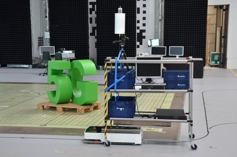
The coming of 5G promises much more than simply better-than-wi-fi smartphone connectivity; it should enable a wide range of novel services, including asset tracking, autonomous driving and drone flying as well as the internet of things. Highly precise localisation is needed to make such innovations feasible however. ESA has led a major project assessing the potential of 5G and satellite navigation in combination and next month a webinar will make its initial findings public.
Webinář: Regionální speciality – internetová platforma pro podporu lokálních výrobců a přímého prodeje jejich produktů.
23.2.2021 7:00 Česká asociace pro geoinformaceWebinář: Regionální speciality – internetová platforma pro podporu lokálních výrobců a přímého prodeje jejich produktů. Dnes 23.2.2021 od 13:00 do 14:00.
Dostupnost lokálních produktů a podpora místních farmářů jsou témata, která nabývají velkého významu i vzhledem k aktuální koronavirové situaci. WirelessInfo v loňském roce připravilo nástroje
APGEO - Zveme vás na online setkání s vedením Asociace podnikatelů v Geomatice
23.2.2021 1:00 Asociace podnikatelů v geomatice Dovolujeme si vás jménem Ing. Jaroslava Cibulky, výkonného ředitele pozvat na online setkání s vedením Asociace ...Pražská SPŠZ slaví sedmdesátku. Zavzpomínejte si na studium
22.2.2021 23:59 ZeměměřičPražská Střední průmyslová škola zeměměřická na podzim 2021 oslaví 70 let od svého založení. Škola u této příležitosti připravuje nový almanach. Škola by ráda věděla, zda její absolventi zůstali věrni oboru nebo šli jinam? Jak na školu vzpomínají – v dobrém či zlém? Chtěli by si zavzpomínat a podělit se o své vzpomínky? Jste-li tedy geodet/ka či kartograf/ka se smyslem pro humor […]
The post Pražská SPŠZ slaví sedmdesátku. Zavzpomínejte si na studium appeared first on Zeměměřič.
Leidos and Gateway Global team up on Geospatial Intelligence Training for students
22.2.2021 20:50 GISCafe.com Webcasts-Webinars Reston, Va.) Feb. 22 , 2021 – Leidos (NYSE:LDOS), a FORTUNE® 500 science and technology leader, announced today it is partnering with …Otevřené jaro 2021: Lesprojekt cloud
22.2.2021 20:44 GeoBusinessSdružení Plan4all pořádá sérii webinářů Otevřené jaro. Webinář, pojmenovaný Lesprojekt Cloud, seznámil s cloudovou infrastrukturou Lesprojekt (hardware, software, data, nástroje) pro analýzu prostorových, statistických a dalších dat včetně jejich publikace. Představeno bylo také webové prostředí JupyterHub pro vzdálené analýzy a zpracování dat na serveru prostřednictvím webového prohlížeče. Na webináři prezentoval Jiří Kvapil architekturu a nástroje […]
The post Otevřené jaro 2021: Lesprojekt cloud appeared first on GeoBusiness.
USGIF and OGC Host the First Virtual GEOINT Community Forum of the Year
22.2.2021 19:57 GISCafe.com Webcasts-Webinars The GEOINT Community Forum offers insights around advances in modeling, simulation, and gaming technology Herndon, Virginia (February 22, …
New Drone Surveillance System to be Deployed on Canadian Coast Guard Vessels in Trials Funded by DRDC
22.2.2021 19:41 GISCafe.com Webcasts-Webinars Combining a unique Vertical Take-off aircraft and new sensor data PED solution allows for rapid collection and analysis of sensor dataOttawa, ON …
Nově akreditovaný obor na katedře aplikované geoinformatiky a kartografie PřF UK
22.2.2021 19:23 GeoBusinessNa katedře aplikované geoinformatiky a kartografie Přírodovědecké fakultě Univerzity Karlovy bude od zimního semestru 2021 zahájena výuka nového akreditovaného magisterského oboru s názvem Geoinformatika, kartografie a dálkový průzkum Země. V programu bude vymezen větší prostor pro obor dálkový průzkumu Země. Velká pozornost byla rovněž věnována aktualizaci a modernizaci výuky předmětů v oborech geoinformatika a kartografie. […]
The post Nově akreditovaný obor na katedře aplikované geoinformatiky a kartografie PřF UK appeared first on GeoBusiness.
referent KN – návrh zápisu, kontrola a zplatnění v PO VI.
22.2.2021 18:11 ČÚZK - volná místa Katastrální úřad pro hlavní město Prahu vypisuje výběrové řízení na místo referent KN – návrh zápisu, kontrola a zplatnění v PO VI.referent KN – návrh zápisu, kontrola a zplatnění v PO VI.
22.2.2021 18:11 ČÚZK /Urady/Katastralni-urady/Katastralni-urady/Katastralni-urad-pro-hlavni-mesto-Prahu/Uredni-deska/Oznameni-a-jina-uredni-sdeleni/Volna-mista/DMS/referent-KN-–-navrh-zapisu,-kontrola-a-zplatne-(1)referent KN – návrh zápisu, kontrola a zplatnění v PO VI.
22.2.2021 18:11 ČÚZK - předpisy a opatření Katastrální úřad pro hlavní město Prahuvypisuje výběrové řízení na místo
referent KN – návrh zápisu, kontrola a zplatnění v PO VI.
referent KN – vedení DKM, vedení katastrální mapy, PT 11
22.2.2021 18:06 ČÚZK - volná místa Katastrální úřad pro hlavní město Prahu vypisuje výběrové řízení na místo referent KN – vedení DKM, vedení katastrální mapy, PT 11referent KN – vedení DKM, vedení katastrální mapy, PT 11
22.2.2021 18:06 ČÚZK - předpisy a opatření Katastrální úřad pro hlavní město Prahuvypisuje výběrové řízení na místo
referent KN – vedení DKM, vedení katastrální mapy, PT 11
referent KN – vedení DKM, vedení katastrální mapy, PT 11
22.2.2021 18:06 ČÚZK /Urady/Katastralni-urady/Katastralni-urady/Katastralni-urad-pro-hlavni-mesto-Prahu/Uredni-deska/Oznameni-a-jina-uredni-sdeleni/Volna-mista/DMS/referent-KN-–-vedeni-DKM,-vedeni-katastralni-m-(1)referent KN – vedení DKM, vedení katastrální mapy, PT 10
22.2.2021 18:01 ČÚZK - předpisy a opatření Katastrální úřad pro hlavní město Prahuvypisuje výběrové řízení na místo
referent KN – vedení DKM, vedení katastrální mapy, PT 10
referent KN – vedení DKM, vedení katastrální mapy, PT 10
22.2.2021 18:01 ČÚZK /Urady/Katastralni-urady/Katastralni-urady/Katastralni-urad-pro-hlavni-mesto-Prahu/Uredni-deska/Oznameni-a-jina-uredni-sdeleni/Volna-mista/DMS/referent-KN-–-vedeni-DKM,-vedeni-katastralni-mapy,referent KN – vedení DKM, vedení katastrální mapy, PT 10
22.2.2021 18:01 ČÚZK - volná místa Katastrální úřad pro hlavní město Prahu vypisuje výběrové řízení na místo referent KN – vedení DKM, vedení katastrální mapy, PT 10Výběrová řízení do 16.3.20202
22.2.2021 17:57 ČÚZK - předpisy a opatření Katastrální úřad pro hlavní město Prahu - Katastrální pracoviště Praha zveřejnil novou aktualitu: Ředitel úřadu vyhlašuje výběrové řízení na služební místo:rada/odborný rada – vedoucí oddělení potvrzování geometrických plánů
rada/odborný rada – návrh zápisu, kontrola a zplatnění
Výběrová řízení do 16.3.20202
22.2.2021 17:57 ČÚZK /Urady/Katastralni-urady/Katastralni-urady/Katastralni-urad-pro-hlavni-mesto-Prahu/O-uradu/Aktuality/Vyberova-rizeni-do-16-3-20202rada/odborný rada – návrh zápisu, kontrola a zplatnění
22.2.2021 17:45 ČÚZK - předpisy a opatření Katastrální úřad pro hlavní město Prahu - Katastrální pracoviště Prahavypisuje výběrové řízení na místo
rada/odborný rada – návrh zápisu, kontrola a zplatnění
rada/odborný rada – návrh zápisu, kontrola a zplatnění
22.2.2021 17:45 ČÚZK /Urady/Katastralni-urady/Katastralni-urady/Katastralni-urad-pro-hlavni-mesto-Prahu/Uredni-deska/Oznameni-a-jina-uredni-sdeleni/Volna-mista/DMS/rada-odborny-rada-–-navrh-zapisu,-kontrola-a-zplatrada/odborný rada – návrh zápisu, kontrola a zplatnění
22.2.2021 17:45 ČÚZK - volná místa Katastrální úřad pro hlavní město Prahu - Katastrální pracoviště Praha vypisuje výběrové řízení na místo rada/odborný rada – návrh zápisu, kontrola a zplatněnírada/odborný rada – vedoucí oddělení potvrzování geometrických plánů
22.2.2021 17:42 ČÚZK - předpisy a opatření Katastrální úřad pro hlavní město Prahu - Katastrální pracoviště Prahavypisuje výběrové řízení na místo
rada/odborný rada – vedoucí oddělení potvrzování geometrických plánů
rada/odborný rada – vedoucí oddělení potvrzování geometrických plánů
22.2.2021 17:42 ČÚZK - volná místa Katastrální úřad pro hlavní město Prahu - Katastrální pracoviště Praha vypisuje výběrové řízení na místo rada/odborný rada – vedoucí oddělení potvrzování geometrických plánůGalileo/GNSS vacancies at ESA
22.2.2021 17:00 ESA Navigation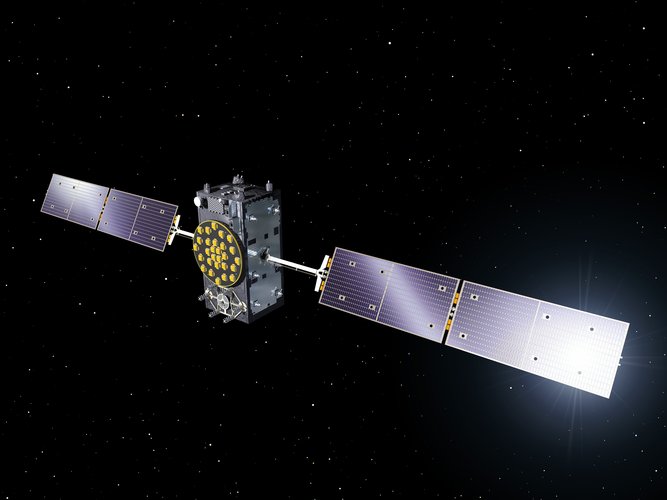
We are looking for Global Navigation Satellite System experts to join our team and support the design and development of the next generation of satellites for Europe’s GNSS System, Galileo. If you have experience in GNSS systems, space systems, project planning or Galileo architecture read on to find out more.
InfiniDome Successfully Completes “GPS Jammed” Scenario Flight Ops
22.2.2021 16:19 GISCafe.com Webcasts-Webinars - GPSdome Enables BVLOS Flight in GPS-Challenged Environment -CAESAREA, Israel — (BUSINESS WIRE) — February 20, 2021 —
infiniDome …