


zprávy
zdroje zpráv:Lesní hospodářský plán - ÚP Srní (LHC 383220)
10.6.2020 2:00 Cenia - Katalog metadat ČR - INSPIRE O všechny lesy ve vlastnictví státu je podle zákona o lesích č. 289/1995 Sb. pečováno na základě lesních hospodářských plánů nebo-li LHP. LHP jsou zákonným nástrojem pro vlastníka nebo správce státního majetku, který umožňuje efektivní péči o lesní majetek.LHP jsou vyhotoveny v souladu s § 24 a s využitím § 36 zákona č. 289/1995 Sb., o lesích a o změně a doplnění některých zákonů ve znění pozdějších předpisů (dále jen „zákon o lesích“), dle vyhlášky MZe č. 84/1996 Sb. o lesním hospodářském plánování. Obsahují náležitosti uvedené ve výše uvedených zákonných předpisech a předepsané přílohy. LHP jsou schvalována MŽP. Data LHP v datovém formátu XML jsou předávána do datového skladu ÚHÚL se sídlem v Brandýse nad Labem."Výsledkem je z hlediska digitálních GIS dat zejména - hospodářská kniha, grafická část LHPHospodářská kniha - popisuje stav lesa v jednotkách prostorového rozdělení lesa (JPRL) (tabulka s jednotlivými atributy)Grafická část - geografické znázornění JPRL v rastrové podobě (lesnická obrysová mapa porostní, lesnická mapa porostní - měřítko 1:10000)Rastrové podobě předchází vektorizace JPRL (porostní detail ve vektorové podobě s atributy vyjadřujcími zejména označení JPRL)Propojení hospodářské knihy s grafickou částí LHP je umožněno relačním způsobem.Bentley Systems’ Year in Infrastructure 2020 Conference is Going Digital!
10.6.2020 0:07 GISCafe.com Webcasts-Webinars Annual Event for Infrastructure Professionals and Thought Leaders Launches—Virtually—in OctoberEXTON, Pa. — (BUSINESS WIRE) — June …
Geospan Recruits CoreLogic Sr. Leader Andrew Zickell as CEO, and Moves Industry Into Remote Servicing and Next-Gen 4D Geospatial Solutions
9.6.2020 20:05 GISCafe.com Webcasts-Webinars President and Visual Geographic Information Pioneer Ted Lachinski Remains Onboard, Harnessing IP and Decades of IngenuityMINNEAPOLIS — …
Swift Navigation Demonstrates First-Ever Nationwide Lane-Level Precise Positioning With Ambitious Continental U.S. Drive Test
9.6.2020 20:05 GISCafe.com Webcasts-Webinars SAN FRANCISCO, June 09, 2020 (GLOBE NEWSWIRE) -- Swift Navigation, a San Francisco-based tech firm redefining GNSS and precise …Planet Announces 50cm SkySat Imagery, Tasking Dashboard and Up to 12x Revisit
9.6.2020 16:40 GISCafe.com Webcasts-Webinars SAN FRANCISCO, June 9, 2020 — (PRNewswire) — Planet, operator of history's largest commercial fleet of satellites, today announced …ZENRIN to join the HERE Marketplace
9.6.2020 16:40 GISCafe.com Webcasts-Webinars Japanese mapping company to offer its location data via global location data exchange hub from HEREAmsterdam, The Netherlands/Kitakyushu city, …Velodyne Lidar Announces Sales Agreement with AGROINTELLI
9.6.2020 16:40 GISCafe.com Webcasts-Webinars Velodyne Lidar Sensors Power AGROINTELLI’s Autonomous Farm VehiclesSAN JOSE, Calif. — (BUSINESS WIRE) — June 9, 2020 —
Velodyne …
Mapcom Systems Joins VertiGIS
9.6.2020 16:40 GISCafe.com Webcasts-Webinars LONDON — (BUSINESS WIRE) — June 9, 2020 —VertiGIS, a leading geographic information systems (GIS) solution provider and software …
AEye Reveals Advanced MEMS That Delivers Solid-State Performance and Reliability Needed to Advance Adoption of Low-Cost LiDAR
9.6.2020 16:40 GISCafe.com Webcasts-Webinars Independent tests validate that the new 4Sight™ long range intelligent MEMS-based sensor exceeds automotive and industrial standards for shock and …Weathering the Storm for Now: Mortgage Delinquencies Remain Low in March 2020 Despite Early Impacts of the Pandemic, CoreLogic Reports
9.6.2020 16:40 GISCafe.com Webcasts-Webinars The share of mortgages that transitioned from current to 30 days past due increased to 1% in March but remained below the 20-year average of …EOS Crop Monitoring update: track the soil moisture on your fields
9.6.2020 16:40 GISCafe.com Webcasts-Webinars MENLO PARK, Calif., June 9, 2020 — (PRNewswire) — EOS Crop Monitoring, a satellite crop monitoring platform, has launched an …Space synergies for food security
9.6.2020 16:18 European GNSS Agency
GNSS and Earth observation experts came together at a webinar organised by the European GNSS Agency (GSA) on 26 May to discuss how combining Galileo and EGNOS navigation and positioning tools with the data and services offered by EU Earth observation programme Copernicus can be used to improve food security and make agriculture in general more efficient and sustainable.
Disruptions caused by the COVID-19 pandemic have thrown the importance of our food supply chain into sharp focus. At the same time, synergies between positioning data from Galileo and EGNOS and Earth observation data from Copernicus offer huge untapped potential for making the agriculture sector more efficient, resilient and sustainable.
It was to explore this potential and to drive the use of space technology in the service of sustainable agriculture and a more secure food chain that the EO4AGRI H2020 project organised this webinar, in collaboration with GSA, targeted at students, researchers, data analysts, participants in European, national and international projects, service and application developers, and other stakeholders.
Early adopter
The agricultural sector was an early adopter of Europe’s satellite augmentation service EGNOS and over 95% of agricultural receivers in Europe are currently EGNOS-enabled, with more than 65% of receivers Galileo-enabled also. “Galileo plays a key role in precision agriculture not only in positioning but also when combined with other technologies such as Copernicus. The coming High Accuracy Service and Navigation Message Authentication will mean a turning point in smart farming applications”, said María-Eva Ramírez from the European GNSS Service Centre (GSC).
In agriculture, EGNOS-based solutions are used for low-value crop cultivation and low-accuracy operations such as ploughing, fertilizing and harvesting while Galileo receivers are used in a multi-constellation environment for high-value crop cultivation and precision operations such as sowing and transplanting. “EGNOS usage in European farming is a reality. Hundreds of thousands of cereal farmers benefit from free enhanced GPS accuracy. Thanks to EGNOS, crop productivity is increased and more sustainable farming is possible”, said Sofía Cilla from the European Satellite Service Provider (ESSP).
Watch this: European Satellites for Agriculture
“GNSS has become an integral part of smart, connected and integrated farm management solutions and is a key driver for precision farming across the whole crop cycle”, said Joaquín Reyes González, Market Development Technology Officer at the GSA.
Strength through synergy
But it is when EU GNSS and Earth observation services work in synergy that the benefits are most keenly felt. Synergies between EGNSS and Copernicus support a number of agriculture solutions, such as variable rate application, which enables the precise use of fertilisers and pesticides where and when they are most needed, thereby making the sector more resource-efficient and reducing its environmental footprint.
“We just scratched the surface of what is possible when these two core components are put into use operationally. The combination of these two European flagship space projects is a key enabler of the Farm to Fork Strategy, the core of the European Green Deal, allowing for a fair, healthy and environmentally-friendly food system in Europe and beyond”, said David Kolitzus from GeoVille Information Systems and Data Processing.
Read this: EGNSS and agriculture – a win-win relationship
EGNSS and Copernicus also enable soil moisture monitoring, providing timely information on water availability and reducing the amount of water used by linking it to the moisture level needed in the soil for a particular crop. Synergies between the two programmes also support the implementation of the Common Agricultural Policy, simplifying and digitising processes related to subsidies control and enabling more efficient checks. “EGNSS and Copernicus are core components in digital farming,” Reyes González said.
Webinar series
The May 26 webinar is the first in a series of webinars that will explore the benefits of EGNSS and Earth observation in the agriculture sector. All the presentations and video recording are now available here. A poll held at the event proposed two topics for future webinars: projects that showcase the use of EGNSS and Earth observation for agricultural applications, and technical tools for combining EGNSS and EO, with use cases from agriculture.
The vote was evenly split, so both these topics are likely to be the subjects of future webinars organised by the GSA. Stay tuned for updates!
Media note: This feature can be republished without charge provided the European GNSS Agency (GSA) is acknowledged as the source at the top or the bottom of the story. You must request permission before you use any of the photographs on the site. If you republish, we would be grateful if you could link back to the GSA website (http://www.gsa.europa.eu).
Bentley Systems’ Year in Infrastructure 2020 Conference is Going Digital!
9.6.2020 15:10 Bentley SystemsAnnual Event for Infrastructure Professionals and Thought Leaders
Launches—Virtually—in October
EXTON, Pa., USA – June 9, 2020 – Bentley Systems, Incorporated, a leading global provider of comprehensive software and digital twins services for advancing the design, construction, and operations of infrastructure, today announced that its annual infrastructure event, the Year in Infrastructure 2020 Conference, is “going digital.” This new digital format will bring together, now for a broader global community, the thought leadership, networking, and learning content that Bentley conference attendees have come to expect.
The virtual Year in Infrastructure 2020 Conference provides complementary access to a wide range of content relevant to infrastructure professionals in every role and at every phase of the infrastructure lifecycle. Highlights include:
Live Judging: Year in Infrastructure 2020 Awards Finalists’ Presentations – October 5 - 16
The Year in Infrastructure Awards finalists, chosen by independent juries of industry experts, present their projects to the judges beginning October 5. This is your chance to hear from the people behind the most extraordinary infrastructure projects of the year as they tell the story of how they leveraged digital advancements to achieve unprecedented outcomes.
Year in Infrastructure 2020 Executive Perspectives – October 20 - 21
Greg Bentley, CEO of Bentley Systems, will be joined by leading infrastructure executives for an interactive discussion on the resilience challenges they face and how to meet those challenges through digital advancement.
Keith Bentley, founder and chief technology officer, will discuss Bentley’s open strategy for digital twins. Keith will be joined by other leading industry visionaries who have deployed digital twins successfully for project delivery or asset performance.
TwinTalks Premiere – October 20
Infrastructure digital twins will be front and center at this year’s event. Join leading industry figures as they moderate six sector-specific TwinTalks, exploring the implications of digital twins for Digital Cities, Design and Construction, Digital Plants, Energy Utilities, Rail and Transit, and Roads and Bridges. Listen to interactive panel discussions with leading industry and business leaders and discover the fascinating opportunities that digital twins introduce for each of these critical infrastructure sectors. The initial October 20 TwinTalks are each part of a three-part series, with the second and third installments of the TwinTalks’ series scheduled through mid-November.
Year in Infrastructure 2020 Awards Ceremony – October 21
After months of jury deliberations, the winners of the Year in Infrastructure 2020 Awards will be announced in our live global broadcast. Don’t miss what has been called the “Academy Awards of Infrastructure.”
ACCELERATE Sessions – October 27 and beyond
Join Bentley product executives Dustin Parkman (Project Delivery), Robert Mankowski (Digital Cities), Ken Adamson (Design Integration), and Alan Kiraly (Asset and Network Performance) as they and their leadership teams review the latest advancements in Bentley applications and cloud services. These sessions will kick-off a multi-track program of more than 100 ACCELERATE sessions that will continue into November. ACCELERATE will feature Bentley and user experts in panel discussions and interactive demonstrations on the latest product advances, innovations, and best practice digital workflows.
Learn More about the Year in Infrastructure 2020 Conference
Join us online for the virtual Year in Infrastructure 2020 Conference and learn from peers, industry experts, and innovators who will share their infrastructure digital twins’ successes. Register for updates at https://yii.bentley.com/en.
Image: Year in Infrastructure 2020 Conference
Caption: The Year in Infrastructure 2020 Conference is Going Digital.
##
About Bentley Systems
Bentley Systems is a leading global provider of software solutions to engineers, architects, geospatial professionals, constructors, and owner-operators for the design, construction, and operations of infrastructure. Bentley’s MicroStation-based engineering and BIM applications, and its digital twin cloud services, advance the project delivery (ProjectWise) and the asset performance (AssetWise) of transportation and other public works, utilities, industrial and resources plants, and commercial and institutional facilities.
Bentley Systems employs more than 3,500 colleagues and generates annual revenues of more than $700 million in 172 countries. From inception in 1984, the company has remained majority-owned by its five founding Bentley brothers. www.bentley.com
Bentley, the Bentley logo, AssetWise, MicroStation, and ProjectWise are either registered or unregistered trademarks or service marks of Bentley Systems, Incorporated or one of its direct or indirect wholly owned subsidiaries. All other brands and product names are trademarks of their respective owners.
Bentley Systems’ Year in Infrastructure 2020 Conference is Going Digital!
9.6.2020 15:10 Bentley SystemsAnnual Event for Infrastructure Professionals and Thought Leaders
Launches—Virtually—in October
EXTON, Pa., USA – June 9, 2020 – Bentley Systems, Incorporated, a leading global provider of comprehensive software and digital twins services for advancing the design, construction, and operations of infrastructure, today announced that its annual infrastructure event, the Year in Infrastructure 2020 Conference, is “going digital.” This new digital format will bring together, now for a broader global community, the thought leadership, networking, and learning content that Bentley conference attendees have come to expect.
The virtual Year in Infrastructure 2020 Conference provides complementary access to a wide range of content relevant to infrastructure professionals in every role and at every phase of the infrastructure lifecycle. Highlights include:
Live Judging: Year in Infrastructure 2020 Awards Finalists’ Presentations – October 5 - 16
The Year in Infrastructure Awards finalists, chosen by independent juries of industry experts, present their projects to the judges beginning October 5. This is your chance to hear from the people behind the most extraordinary infrastructure projects of the year as they tell the story of how they leveraged digital advancements to achieve unprecedented outcomes.
Year in Infrastructure 2020 Executive Perspectives – October 20 - 21
Greg Bentley, CEO of Bentley Systems, will be joined by leading infrastructure executives for an interactive discussion on the resilience challenges they face and how to meet those challenges through digital advancement.
Keith Bentley, founder and chief technology officer, will discuss Bentley’s open strategy for digital twins. Keith will be joined by other leading industry visionaries who have deployed digital twins successfully for project delivery or asset performance.
TwinTalks Premiere – October 20
Infrastructure digital twins will be front and center at this year’s event. Join leading industry figures as they moderate six sector-specific TwinTalks, exploring the implications of digital twins for Digital Cities, Design and Construction, Digital Plants, Energy Utilities, Rail and Transit, and Roads and Bridges. Listen to interactive panel discussions with leading industry and business leaders and discover the fascinating opportunities that digital twins introduce for each of these critical infrastructure sectors. The initial October 20 TwinTalks are each part of a three-part series, with the second and third installments of the TwinTalks’ series scheduled through mid-November.
Year in Infrastructure 2020 Awards Ceremony – October 21
After months of jury deliberations, the winners of the Year in Infrastructure 2020 Awards will be announced in our live global broadcast. Don’t miss what has been called the “Academy Awards of Infrastructure.”
ACCELERATE Sessions – October 27 and beyond
Join Bentley product executives Dustin Parkman (Project Delivery), Robert Mankowski (Digital Cities), Ken Adamson (Design Integration), and Alan Kiraly (Asset and Network Performance) as they and their leadership teams review the latest advancements in Bentley applications and cloud services. These sessions will kick-off a multi-track program of more than 100 ACCELERATE sessions that will continue into November. ACCELERATE will feature Bentley and user experts in panel discussions and interactive demonstrations on the latest product advances, innovations, and best practice digital workflows.
Learn More about the Year in Infrastructure 2020 Conference
Join us online for the virtual Year in Infrastructure 2020 Conference and learn from peers, industry experts, and innovators who will share their infrastructure digital twins’ successes. Register for updates at https://yii.bentley.com/en.
##
Image: Year in Infrastructure 2020 Conference
Caption: The Year in Infrastructure 2020 Conference is Going Digital.
##
About Bentley Systems
Bentley Systems is a leading global provider of software solutions to engineers, architects, geospatial professionals, constructors, and owner-operators for the design, construction, and operations of infrastructure. Bentley’s MicroStation-based engineering and BIM applications, and its digital twin cloud services, advance the project delivery (ProjectWise) and the asset performance (AssetWise) of transportation and other public works, utilities, industrial and resources plants, and commercial and institutional facilities.
Bentley Systems employs more than 3,500 colleagues and generates annual revenues of more than $700 million in 172 countries. From inception in 1984, the company has remained majority-owned by its five founding Bentley brothers. www.bentley.com
Bentley, the Bentley logo, AssetWise, MicroStation, and ProjectWise are either registered or unregistered trademarks or service marks of Bentley Systems, Incorporated or one of its direct or indirect wholly owned subsidiaries. All other brands and product names are trademarks of their respective owners.
Galileo-enabled receivers soon in Prague tramways
9.6.2020 10:42 European GNSS Agency
The Prague Public Transit Company (DPP) has issued a tender for Galileo-enabled receivers to be included in Prague tramways as part of a modernization plan to increase network efficiency and improve user experience.
Prague has one of the largest tram fleets in Europe. The city's tramways are using a 20-year old system based on GPS-only. DPP has decided on a unique upgrade of their system to improve localization accuracy and provide vehicle positioning data to passengers. DPP Prague plans to buy Galileo-enabled, multifrequency, multiconstellation receivers for its entire tramway vehicle park. To develop the project, DPP cooperated with the Czech Technical University in Prague, the Czech Department for Transportation, the Municipality of Prague and the European GNSS Agency (GSA). The improvement in localization accuracy connected with the upgrade will bring important efficiency benefits to the DPP network such as a decrease in maintenance costs.
Satellite navigation in practice
"Space applications have a great potential for improving efficiency and safety across a wide variety of sectors and transport belongs to the largest users of space technologies. Galileo adoption in Prague tramways is a great example how to apply European satellite navigation in practice," said Karel Havlíček, Deputy Prime Minister, Czech Republic.
The receivers are planned to be deployed in the entire tram fleet (838 receivers are procured). DPP will be one of the first public transit companies to use Galileo in their entire fleet.
Read the Czech version here: Přijímače Galilea brzy v pražských tramvajích
"Public transport has to be comfortable and user friendly not only inside the vehicles and at the stops. We managed to provide real-time data about bus departures and their position on-line to passengers. For this year, we have promised to provide the same also for the tramways," said Adam Scheinherr, Deputy Mayor for Transport from the Municipality of Prague.
"Thanks to the new receivers and the possibility to use the European navigation system Galileo, we will be able to improve localization accuracy based on the tests that have been carried out so far down to 1.5 meters. Further, it will allow us to improve other systems used within DPP such as, for example, automatic speed limitation over the switches," added Petr Witowski, chairman of the board and executive director of DPP.
"Regarding the network extent and the quality of the transport service provided, Prague belongs to the top cities in the European Union. It shows therefore the recognition of Galileo efficiency that DPP plans to use Galileo within the whole tramway fleet as one of the first public transport operators in Europe," commented Pascal Claudel, Acting Executive Director of the European GNSS Agency.
DPP is expecting that the tender will be completed by the end of August 2020. The selected supplier will have to provide and install the receivers within the entire fleet of Prague tramways within 180 days from the contract signature. It is therefore expected that the First Galileo-enabled trams should be on track at the end of 2020.
Media note: This feature can be republished without charge provided the European GNSS Agency (GSA) is acknowledged as the source at the top or the bottom of the story. You must request permission before you use any of the photographs on the site. If you republish, we would be grateful if you could link back to the GSA website (http://www.gsa.europa.eu).
Galileo-enabled receivers soon in Prague tramways
9.6.2020 10:42 European GNSS AgencyThe Prague Public Transit Company (DPP) has issued a tender for Galileo-enabled receivers to be included in the Prague tramways as part of their modernization plan to increase network efficiency and improve user experience.
Prague has one of the largest tram fleets in Europe. Tramways are using a 20 years old system based on GPS-only. DPP has decided a unique upgrade of their system and intends to replace the current system to improve the localization accuracy and to provide vehicle positioning data to passengers. DPP Prague plans to buy Galileo-enabled, multifrequency, multiconstellation receivers for its entire Tramway vehicle park. To elaborate the project, DPP has cooperated with the Czech Technical University in Prague, the Czech Department for Transportation, the Municipality of Prague and with the European GNSS Agency (GSA). The improvement in localization accuracy connected with the upgrade will bring important efficiency benefits to the DPP network such as a decrease of the maintenance costs.
"Space applications have a great potential for improving efficiency and safety across a wide variety of sectors and transport belongs to the largest users of space technologies. Galileo adoption in Prague Tramways is a great example how to apply European satellite navigation in practice," underlined Karel Havlíček, Deputy Prime Minister, Czech Republic.
The receivers are planned to be deployed in the entire tram fleet (838 receivers are procured). DPP will be one of the first public transit companies to use Galileo in the entire tram fleet.
Read the Czech version here: Přijímače Galilea brzy v pražských tramvajích
"Public transport has to be comfortable and user friendly not only inside the vehicles and at the stops. We managed to provide real-time data about bus departures and their position on-line to passengers. For this year, we have promised to provide the same also for the tramways," said Adam Scheinherr, Deputy Mayor for Transport from Municipality of Prague
"Thanks to the new receivers and the possibility to use the European navigation system Galileo, we will be able to improve localization accuracy based on the test that have been carried out so far down to 1,5 meters. Further, it will allow us to improve other systems used within DPP, such as for example automatic speed limitation over the switches," added Petr Witowski, chairman of the board and executive director of DPP.
"Regarding the network extent and the quality of the transport service provided, Prague belongs to the top cities in the European Union. It shows therefore the recognition of Galileo efficiency that DPP plans to use Galileo within the whole Tramway fleet as one of the first public transport operators in Europe," commented Pascal Claudel, Acting Executive Director of the European GNSS Agency.
DPP is expecting that the competition will be completed by the end of August 2020. The selected supplier will have to provide and install the receivers within the entire fleet of Prague Tramways within 180 days from the contract signature. It is therefore expected that the First Galileo-enabled trams should be on track at the end of 2020.
Media note: This feature can be republished without charge provided the European GNSS Agency (GSA) is acknowledged as the source at the top or the bottom of the story. You must request permission before you use any of the photographs on the site. If you republish, we would be grateful if you could link back to the GSA website (http://www.gsa.europa.eu).
Galileo-enabled receivers soon in Prague tramways
9.6.2020 10:42 European GNSS AgencyThe Prague Public Transit Company (DPP) has issued a tender for Galileo-enabled receivers to be included in the Prague tramways as part of their modernization plan to increase network efficiency and improve user experience.
Prague has one of the largest tram fleets in Europe. Tramways are using a 20 years old system based on GPS-only. DPP has decided a unique upgrade of their system and intends to replace the current system to improve the localization accuracy and to provide vehicle positioning data to passengers. DPP Prague plans to buy Galileo-enabled, multifrequency, multiconstellation receivers for its entire Tramway vehicle park. To elaborate the project, DPP has cooperated with the Czech Technical University in Prague, the Czech Department for Transportation, the Municipality of Prague and with the European GNSS Agency (GSA). The improvement in localization accuracy connected with the upgrade will bring important efficiency benefits to the DPP network such as a decrease of the maintenance costs.
"Space applications have a great potential for improving efficiency and safety across a wide variety of sectors and transport belongs to the largest users of space technologies. Galileo adoption in Prague Tramways is a great example how to apply European satellite navigation in practice," underlined Karel Havlíček, Deputy Prime Minister, Czech Republic.
The receivers are planned to be deployed in the entire tram fleet (838 receivers are procured). DPP will be one of the first public transit companies to use Galileo in the entire tram fleet.
Read the czech version here: Přijímače Galilea brzy v pražských tramvajích
"Public transport has to be comfortable and user friendly not only inside the vehicles and at the stops. We managed to provide real-time data about bus departures and their position on-line to passengers. For this year, we have promised to provide the same also for the tramways," said Adam Scheinherr, Deputy Mayor for Transport from Municipality of Prague
"Thanks to the new receivers and the possibility to use the European navigation system Galileo, we will be able to improve localization accuracy based on the test that have been carried out so far down to 1,5 meters. Further, it will allow us to improve other systems used within DPP, such as for example automatic speed limitation over the switches," added Petr Witowski, chairman of the board and executive director of DPP.
"Regarding the network extent and the quality of the transport service provided, Prague belongs to the top cities in the European Union. It shows therefore the recognition of Galileo efficiency that DPP plans to use Galileo within the whole Tramway fleet as one of the first public transport operators in Europe," commented Pascal Claudel, Acting Executive Director of the European GNSS Agency.
DPP is expecting that the competition will be completed by the end of August 2020. The selected supplier will have to provide and install the receivers within the entire fleet of Prague Tramways within 180 days from the contract signature. It is therefore expected that the First Galileo-enabled trams should be on track at the end of 2020.
Media note: This feature can be republished without charge provided the European GNSS Agency (GSA) is acknowledged as the source at the top or the bottom of the story. You must request permission before you use any of the photographs on the site. If you republish, we would be grateful if you could link back to the GSA website (http://www.gsa.europa.eu).
Interview with Tom Turchioe, HANA CoE Spatial Expert and Evangelist, SAP
9.6.2020 9:00 GISCafe.com Webcasts-WebinarsAndré Trudel named president of Korem's new Business Consulting division
9.6.2020 9:00 GISCafe.com Webcasts-Webinars André Trudel, a well known figure in the fields of business development and high performance management, is joining Korem as President of the …Parking in a pandemic
9.6.2020 8:35 ESA Observing the Earth
The coronavirus pandemic has brought the tourism and travel industry to a near-standstill, with nationwide lockdowns significantly impacting the aviation and maritime industry worldwide. Satellite images, captured by the Copernicus Sentinel-2 mission, show parked aircraft and anchored vessels in times of COVID-19.
V Olomouci tvoří teplotní mapu města – zapojte se i Vy!
9.6.2020 8:30 GISportal.cz
Během horkých letních dnů lidé v Olomouci z některých míst spěchají a na jiná naopak cíleně míří, aby se vyhnuli největšímu horku. Výzkumníci z katedry geografie a katedry rozvojových a environmentálních studií (obě PřF UP) si vzali za cíl sestavit pocitovou teplotní mapu Olomouce, která pomůže při návrhu efektivních opatření ke snížení stresu z tepla […]
The post V Olomouci tvoří teplotní mapu města – zapojte se i Vy! appeared first on GISportal.cz.
Pocitová teplotní mapa Olomouce
9.6.2020 7:00 Česká asociace pro geoinformace Katedra geografie a Katedra rozvojových a environmentálních studií Přírodovědecké fakulty Univerzity Palackého v Olomouci ve spolupráci s Magistrátem města Olomouc nově připravuje teplotní mapu Olomouce. Výzkum navazuje na bioklimatickou analýzu teplotních poměrů města a jeho cílem je návrh efektivních opatření ke snížení teplotního stresu ve městě během horkýchElistair Unveils the SAFE-T 2, The New Standard for Tethered Drone Stations
8.6.2020 22:28 GISCafe.com Webcasts-Webinars LYON, France — (BUSINESS WIRE) — June 8, 2020 —Elistair has announced the release of the Safe-T 2, their most advanced and …
Post-doc position in the MIning MUlti-source and MUlti-modal geo-referenced information (MIMU) project
8.6.2020 19:27 Post-doc position in Portugal Innovative geographic knowledge discovery is becoming increasingly possible through the analysis of large-scale data, for instance made available by Earth observation projects leveraging satellites and remote-sensing, provided by ground-level sensors, or given as volunteered geographical information (e.g., geo-referenced multimedia contents posted online on social media platforms). However, problems that involve combining […]Interview with Damon Ogando, Regional Sales Manager, Handheld Group
8.6.2020 17:50 GISCafe.com Webcasts-WebinarsMedia Alert: BlackSky to Provide Satellite Images of Black Lives Matter Protest in Washington, D.C.
8.6.2020 17:41 GISCafe.com Webcasts-Webinars (BUSINESS WIRE) — June 5, 2020 —
View source version on businesswire.com: …
CyberTech is First Esri Partner to be Awarded ArcGIS Cloud Services Specialty Designation
8.6.2020 17:41 GISCafe.com Webcasts-Webinars OAK BROOK, Ill., June 8, 2020 — (PRNewswire) — CyberTech Systems and Software Inc. today announced CyberTech's recognition as …Odborný referent – zápisy v řízení V a Z v oddělení právních vztahů k nemovitostem Katastrálního pra
8.6.2020 14:12 ČÚZK - předpisy a opatření Katastrální úřad pro Zlínský kraj Katastrální pracoviště Uherský Brodvypisuje výběrové řízení na místo
Odborný referent – zápisy v řízení V a Z v oddělení právních vztahů k nemovitostem Katastrálního pracoviště Uherský Brod
Odborný referent – zápisy v řízení V a Z v oddělení právních vztahů k nemovitostem Katastrálního pra
8.6.2020 14:12 ČÚZK - volná místa Katastrální úřad pro Zlínský kraj Katastrální pracoviště Uherský Brod vypisuje výběrové řízení na místo Odborný referent – zápisy v řízení V a Z v oddělení právních vztahů k nemovitostem Katastrálního praOdborný referent – zápisy v řízení V a Z v oddělení právních vztahů k nemovitostem Katastrálního pra
8.6.2020 14:12 ČÚZK /Urady/Katastralni-urady/Katastralni-urady/Katastralni-urad-pro-Zlinsky-kraj/Uredni-deska/Oznameni-a-jina-uredni-sdeleni/Volna-mista/DMS/Odborny-referent-–-zapisy-v-rizeni-V-a-Z-v-oddelen20200608 - VŘ ředitel KP Pelhřimov
8.6.2020 13:52 ČÚZK - aktuality v resortu Oznámení o vyhlášení výběrového řízení na obsazení služebního místa ředitele katastrálního pracoviště Pelhřimov.20200608 - VŘ ředitel KP Pelhřimov
8.6.2020 13:52 ČÚZK /Aktuality-resort/2020/20200608-VR-reditel-KP-Pelhrimov20200608 - VŘ ředitel KP Pelhřimov
8.6.2020 13:52 ČÚZK - předpisy a opatření Český úřad zeměměřický a katastrální - Katastrální pracoviště Pelhřimov zveřejnil novou aktualitu: Oznámení o vyhlášení výběrového řízení na obsazení služebního místa ředitele katastrálního pracoviště Pelhřimov.20200608 - VŘ ředitel KP Pelhřimov
8.6.2020 13:52 ČÚZK /Aktuality-resort/2020/20200608-VR-reditel-KP-Pelhrimov20200608 - VŘ ředitel KP Pelhřimov
8.6.2020 13:52 ČÚZK - předpisy a opatření Český úřad zeměměřický a katastrální - Katastrální pracoviště Pelhřimovzveřejnil novou aktualitu: Oznámení o vyhlášení výběrového řízení na obsazení služebního místa ředitele katastrálního pracoviště Pelhřimov.
Safeguarding our oceans
8.6.2020 13:30 ESA Observing the Earth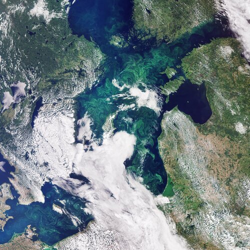 Image:
This image, captured by the Copernicus Sentinel-3 mission, takes us over the green algae blooms swirling around the Baltic Sea.
Image:
This image, captured by the Copernicus Sentinel-3 mission, takes us over the green algae blooms swirling around the Baltic Sea.
Making space for the oceans
8.6.2020 11:50 European GNSS Agency
On June 8 the world celebrates World Oceans Day, when people around the planet celebrate our oceans and seas and work to raise awareness about problems facing the marine environment. The EU space programmes Galileo, EGNOS and Copernicus, with their positioning, navigation and Earth observation services, are helping to monitor and protect the oceans and make Europe’s Blue Economy more sustainable, in support of the European Green Deal agenda.
The EU space services play a key role in driving innovation in the context of marine sustainability by enabling the development of applications and services that help monitor and protect the marine environment and marine bio-resources. At the same time, highly accurate navigation and positioning information is helping to make maritime transport more efficient, safe and sustainable.
Increasing safety, protecting the environment
EGNOS, Europe’s sat-nav augmentation system, provides users with more accurate position information compared to GPS alone and a new maritime service based on the current version (EGNOS V2) will provide users with integrity information and maritime safety information, i.e. navigational warnings and notice to mariners, in line with IALA Guidelines. EGNOS V3, the planned evolution of this system, will augment Galileo signals in addition to GPS.
Watch this: EGNOS for Maritime
A number of projects leverage EGNSS (Galileo and EGNOS) to increase maritime safety and help protect the environment. The EGNOSforAtoN project demonstrated operationally how to use EGNOS as source of differential corrections for IALA beacons and AIS stations in a cost-efficient way and in line with IALA Guidelines. The SeaSOLAS project has defined a potential maritime safety service based on EGNOS V3-enabled receivers on vessels, while the Hull-to-Hull project has defined new safety concepts based on EGNSS for operations between vessels and also for docking.
The Safeport project delivered an EGNOS-based portable pilot unit and an app for pilotage and docking operations (SafePilot). The app is continuing to evolve and it is available for tablets and SmartWatches.
What’s more, EGNOS is helping to increase our awareness of the oceans through projects like CoSuDEC, which has created a system for enhanced surveying of coastal waters using standard navigation equipment.
EGNSS is also a key enabler of the Automatic Identification System (AIS), which is used on ships and by vessel traffic services to identify and locate vessels. It also supports Long Range Identification and Tracking (LRIT), which is designed to collect and disseminate vessel position information. In so doing, the European space programmes are enabling more efficient traffic management and safer maritime navigation, and providing greater situational awareness in the marine environment.
In relation to this, the GNSS-enabled MEDUSE project aims at a more sustainable use of marine parks, and provides services to marine park users and tools to the park authorities, allowing them to track and trace vessels within restricted marine areas using AIS Class B transponders with EGNOS.
Fighting illegal fishing
GNSS also enables position reporting (the so-called ‘blue box’) in the Vessel Monitoring System (VMS), which is used in fisheries monitoring and provides data to the fisheries authorities on the location, course and speed of vessels. When combined with remote imagery in the Vessel Detection System (VDS), satellite technology is a key tool in the fight against illegal fishing, helping to identify and catch violators and protect fish stocks.
Read this: Space – underpinning the blue economy
Galileo satellites carry a SAR payload and the Galileo SAR service is an important contributor to the Global Cospas-Sarsat service for Search & Rescue. The Galileo SAR service is comprised of two components: an automatic Forward Link distress alert Service (FLS) and a Return Link Service (RLS), launched earlier this year, which allows people in distress to receive automatic acknowledgement that their alert has been received and is being processed.
This combination, along with the increased positioning accuracy provided by Galileo, has reduced the time it takes to detect a person lost at sea from three hours to just 10 minutes after the distress beacon is activated. Localisation of the distress beacon has also improved - from 10 km to less than 5 km.
The Helios Project has developed maritime search and rescue beacons for vessels (EPIRBs) and for personal use (PLBs), which are already on the market and using Galileo (to see all Galileo enabled PLBs click here).
Europe’s eyes on Earth
It is not only the EGNSS component of the EU Space Programme that is helping support sustainability of our oceans and seas. Copernicus, “Europe’s eyes on Earth,” provides essential information in six main domains, including atmosphere monitoring, marine environment monitoring, and climate monitoring. In particular, the observations and forecasts produced by the Copernicus Marine Environment Monitoring Service (CMEMS) support marine applications, including safety, monitoring of marine resources and of the coastal and marine environment, in addition to providing weather, seasonal and climate forecasts.
According to the EU Blue Economy Report 2019, the usefulness of CMEMS is reflected in the increasing number of users not only among universities and public authorities, but also among businesses from different domains, including maritime safety, coastal and marine environment, marine resources and weather forecasting.
Copernicus services for security applications also offer maritime surveillance, thereby supporting a better understanding and improved monitoring of activities at sea within a wide range of operational functions such as maritime safety and security, fisheries control, customs, law enforcement, marine environment pollution monitoring, and others.
A final example of the exploitation of synergies between EGNSS and Copernicus for maritime surveillance and search and rescue is the SARA project, where a tethered drone installed on a vessel is used to locate seafarers and passengers in distress after a wreck.
Media note: This feature can be republished without charge provided the European GNSS Agency (GSA) is acknowledged as the source at the top or the bottom of the story. You must request permission before you use any of the photographs on the site. If you republish, we would be grateful if you could link back to the GSA website (http://www.gsa.europa.eu).
Making space for the oceans
8.6.2020 11:50 European GNSS AgencyOn June 8 the world celebrates World Oceans Day, when people around the planet celebrate our oceans and seas and work to raise awareness about problems facing the marine environment. The EU space programmes Galileo, EGNOS and Copernicus, with their positioning, navigation and Earth observation services, are helping to monitor and protect the oceans and make Europe’s Blue Economy more sustainable, in support of the European Green Deal agenda.
The EU space services play a key role in driving innovation in the context of marine sustainability by enabling the development of applications and services that help monitor and protect the marine environment and marine bio-resources. At the same time, highly accurate navigation and positioning information is helping to make maritime transport more efficient, safe and sustainable.
Increasing safety, protecting the environment
EGNOS, Europe’s sat-nav augmentation system, provides users with more accurate position information compared to GPS alone and a new maritime service based on the current version (EGNOS V2) will provide users with integrity information and maritime safety information, i.e. navigational warnings and notice to mariners, in line with IALA Guidelines. EGNOS V3, the planned evolution of this system, will augment Galileo signals in addition to GPS.
Watch this: EGNOS and Galileo for Waterborne Transport
A number of projects leverage EGNSS (Galileo and EGNOS) to increase maritime safety and help protect the environment. The EGNOSforAtoN project demonstrated operationally how to use EGNOS as source of differential corrections for IALA beacons and AIS stations in a cost-efficient way and in line with IALA Guidelines. The SeaSOLAS project has defined a potential maritime safety service based on EGNOS V3-enabled receivers on vessels, while the Hull-to-Hull project has defined new safety concepts based on EGNSS for operations between vessels and also for docking.
The Safeport project delivered an EGNOS-based portable pilot unit and an app for pilotage and docking operations (SafePilot). The app is continuing to evolve and it is available for tablets and SmartWatches.
What’s more, EGNOS is helping to increase our awareness of the oceans through projects like CoSuDEC, which has created a system for enhanced surveying of coastal waters using standard navigation equipment.
EGNSS is also a key enabler of the Automatic Identification System (AIS), which is used on ships and by vessel traffic services to identify and locate vessels. It also supports Long Range Identification and Tracking (LRIT), which is designed to collect and disseminate vessel position information. In so doing, the European space programmes are enabling more efficient traffic management and safer maritime navigation, and providing greater situational awareness in the marine environment.
In relation to this, the GNSS-enabled MEDUSE project aims at a more sustainable use of marine parks, and provides services to marine park users and tools to the park authorities, allowing them to track and trace vessels within restricted marine areas using AIS Class B transponders with EGNOS.
Fighting illegal fishing
GNSS also enables position reporting (the so-called ‘blue box’) in the Vessel Monitoring System (VMS), which is used in fisheries monitoring and provides data to the fisheries authorities on the location, course and speed of vessels. When combined with remote imagery in the Vessel Detection System (VDS), satellite technology is a key tool in the fight against illegal fishing, helping to identify and catch violators and protect fish stocks.
Read this: Space – underpinning the blue economy
Galileo satellites carry a SAR payload and the Galileo SAR service is an important contributor to the Global Cospas-Sarsat service for Search & Rescue. The Galileo SAR service is comprised of two components: an automatic Forward Link distress alert Service (FLS) and a Return Link Service (RLS), launched earlier this year, which allows people in distress to receive automatic acknowledgement that their alert has been received and is being processed.
This combination, along with the increased positioning accuracy provided by Galileo, has reduced the time it takes to detect a person lost at sea from three hours to just 10 minutes after the distress beacon is activated. Localisation of the distress beacon has also improved - from 10 km to less than 5 km.
The Helios Project has developed maritime search and rescue beacons for vessels (EPIRBs) and for personal use (PLBs), which are already on the market and using Galileo (to see all Galileo enabled PLBs click here).
Europe’s eyes on Earth
It is not only the EGNSS component of the EU Space Programme that is helping support sustainability of our oceans and seas. Copernicus, “Europe’s eyes on Earth,” provides essential information in six main domains, including atmosphere monitoring, marine environment monitoring, and climate monitoring. In particular, the observations and forecasts produced by the Copernicus Marine Environment Monitoring Service (CMEMS) support marine applications, including safety, monitoring of marine resources and of the coastal and marine environment, in addition to providing weather, seasonal and climate forecasts.
According to the EU Blue Economy Report 2019, the usefulness of CMEMS is reflected in the increasing number of users not only among universities and public authorities, but also among businesses from different domains, including maritime safety, coastal and marine environment, marine resources and weather forecasting.
Copernicus services for security applications also offer maritime surveillance, thereby supporting a better understanding and improved monitoring of activities at sea within a wide range of operational functions such as maritime safety and security, fisheries control, customs, law enforcement, marine environment pollution monitoring, and others.
A final example of the exploitation of synergies between EGNSS and Copernicus for maritime surveillance and search and rescue is the SARA project, where a tethered drone installed on a vessel is used to locate seafarers and passengers in distress after a wreck.
Media note: This feature can be republished without charge provided the European GNSS Agency (GSA) is acknowledged as the source at the top or the bottom of the story. You must request permission before you use any of the photographs on the site. If you republish, we would be grateful if you could link back to the GSA website (http://www.gsa.europa.eu).
Ředitel Katastrálního pracoviště Pelhřimov
8.6.2020 9:37 ČÚZK - předpisy a opatření Katastrální úřad pro Vysočinu - Katastrální pracoviště Pelhřimov zveřejnil novou aktualitu: Oznámení o vyhlášení výběrového řízení na služební místo rada/odborný rada – ředitel Katastrálního pracoviště Pelhřimovna Katastrálním úřadu pro Vysočinu, místo výkonu služby Pelhřimov
Geografie pro udržitelný rozvoj měst a regionů
8.6.2020 9:29 Česká kartografická společnost Ve dnech 8.–10. září 2020 se v kampusu Západočeské univerzity v Plzni uskuteční Výroční konference ČGS s hlavním tématem „Geografie pro udržitelný rozvoj měst a regionů“. Více informací na webu konference.Ředitel Katastrálního pracoviště Pelhřimov
8.6.2020 9:27 ČÚZK - předpisy a opatření Katastrální úřad pro Vysočinu zveřejnil novou aktualitu: Oznámení o vyhlášení výběrového řízení na služební místo rada/odborný rada – ředitel Katastrálního pracoviště Pelhřimov na Katastrálním úřadu pro Vysočinu, místo výkonu služby PelhřimovŘeditel Katastrálního pracoviště Pelhřimov
8.6.2020 9:27 ČÚZK /Urady/Katastralni-urady/Katastralni-urady/Katastralni-urad-pro-Vysocinu/O-uradu/Aktuality/Reditel-Katastralniho-pracoviste-PelhrimovŘeditel Katastrálního pracoviště Pelhřimov
8.6.2020 9:22 ČÚZK /Urady/Katastralni-urady/Katastralni-urady/Katastralni-urad-pro-Vysocinu/Katastralni-pracoviste/KP-Pelhrimov/O-uradu/Aktuality/Reditel-Katastralniho-pracoviste-PelhrimovŘeditel Katastrálního pracoviště Pelhřimov
8.6.2020 9:22 ČÚZK - předpisy a opatření Katastrální úřad pro Vysočinu - Katastrální pracoviště Pelhřimov zveřejnil novou aktualitu:Oznámení o vyhlášení výběrového řízení na služební místo rada/odborný rada – ředitel Katastrálního pracoviště Pelhřimov na Katastrálním úřadu pro Vysočinu, místo výkonu služby Pelhřimov
ředitel KP Pelhřimov
8.6.2020 8:38 ČÚZK - volná místa Katastrální úřad pro Vysočinu Katastrální pracoviště Pelhřimov vypisuje výběrové řízení na místo ředitel KP Pelhřimovředitel KP Pelhřimov
8.6.2020 8:38 ČÚZK - předpisy a opatření Katastrální úřad pro Vysočinu Katastrální pracoviště Pelhřimovvypisuje výběrové řízení na místo
ředitel KP Pelhřimov
ředitel KP Pelhřimov
8.6.2020 8:38 ČÚZK /Urady/Katastralni-urady/Katastralni-urady/Katastralni-urad-pro-Vysocinu/Uredni-deska/Oznameni-a-jina-uredni-sdeleni/Volna-mista/DMS/reditel-KP-PelhrimovZávěrečná konference projektu EduChange
8.6.2020 8:11 GISportal.cz
Organizátoři projektu EduChange, který se zaměřuje na inovativní metody (virtuální realitu, geohry, využití GIS) ve výuce o dopadech klimatické změny, zvou na závěrečnou konferenci. Konference se bude konat 29. června v Olomouci. Dopolední program bude probíhat i online (viz program níže) a odpolední program budou naplňovat praktické workshopy a neformální síťování. Vzhledem k tomu, že minimálně […]
The post Závěrečná konference projektu EduChange appeared first on GISportal.cz.
Nabídka studijních a výzkumných pobytů v Japonsku
8.6.2020 7:44 Blogující geomatici - FAV ZČU Akademická informační agentura informuje o nabídkách stipendijních pobytů v zahraničí na základě mezinárodních smluv pro studenty a akademické pracovníky veřejných vysokých škol.KM Dačice uzavřeno
8.6.2020 6:08 ČÚZK - předpisy a opatření Katastrální úřad pro Jihočeský kraj - Katastrální pracoviště Jindřichův Hradeczveřejnil novou aktualitu: Dne 15.06.2020 bude Kontaktní místo v Dačicích UZAVŘENO.
KM Dačice uzavřeno
8.6.2020 6:08 ČÚZK /Urady/Katastralni-urady/Katastralni-urady/Katastralni-urad-pro-Jihocesky-kraj/Katastralni-pracoviste/KP-Jindrichuv-Hradec/O-uradu/Aktuality/KM-Dacice-uzavrenoKM Dačice uzavřeno
8.6.2020 6:08 ČÚZK - předpisy a opatření Český úřad zeměměřický a katastrální - Katastrální pracoviště Jindřichův Hradeczveřejnil novou aktualitu: Dne 15.06.2020 bude Kontaktní místo v Dačicích UZAVŘENO.
World Geospatial Industry Council welcomes new members to the executive board
5.6.2020 23:21 GISCafe.com Webcasts-Webinars WGIC is delighted to welcome senior leadership from AAM, Bentley Systems, e-GEOS, and Riegl to the WGIC executive board.June 5, 2020 – …
Automation driving safety and efficiency in essential streetworks for Northern Gas Networks
5.6.2020 17:19 GISCafe.com Webcasts-Webinars June 05, 2020 -- 1Spatial, the global geospatial software and solutions company and Northern Gas Networks (NGN) have been working together to create …Drone Delivery Services Provide Much-needed Supplies to Rural Communities
5.6.2020 17:19 GISCafe.com Webcasts-Webinars FN Media Group Presents Microsmallcap.com Market CommentaryNEW YORK, June 5, 2020 — (PRNewswire) — Since the beginning of the pandemic, …
Riešenie problému s pripojením kontrolnej jednotky po aktualizácií Windows 10
5.6.2020 16:24 Geotronics.sk Pred mesiacom sme zaznamenali problém s pripojením kontrolných jednotiek s operačným systém Windows Mobile k PC.Problém spôsobila aktualizácia operačného systému Windows 10. Operačné systémy Windows 10 verzia 1703 a vyššia nemusia podporovať pripojenie zariadení cez Windows Mobile Device Center.Riešenie problému:1.) nainštalujte si najnovšiu verziu .NET Framework 3.52.) nainštalujte si Windows Mobile Device Center 6.164 bitová verzia na stiahnutie32 bitová verzia na stiahnutie3.) [...]Riešenie problému s pripojením kontrolnej jednotky po aktualizácií Windows 10
5.6.2020 16:24 Geotronics.sk Pred mesiacom sme zaznamenali problém s pripojením kontrolných jednotiek s operačným systém Windows Mobile k PC. Problém spôsobila aktualizácia operačného systému Windows 10. Operačné systémy Windows 10 verzia 1703 a vyššia nemusia podporovať pripojenie zariadení cez Windows Mobile Device Center. Riešenie problému: 1.) nainštalujte si najnovšiu verziu .NET Framework 3.5 2.) nainštalujte si Windows Mobile Device Center 6.1 64 bitová verzia na [...]Riešenie problému s pripojením kontrolnej jednotky po aktualizácií Windows 10
5.6.2020 16:24 Geotronics.sk Pred mesiacom sme zaznamenali problém s pripojením kontrolných jednotiek s operačným systém Windows Mobile k PC. Problém spôsobila aktualizácia operačného systému Windows 10. Operačné systémy Windows 10 verzia 1703 a vyššia nemusia podporovať pripojenie zariadení cez Windows Mobile Device Center. Riešenie problému: 1.) nainštalujte si najnovšiu verziu .NET Framework 3.5 2.) nainštalujte si Windows Mobile Device Center 6.1 64 bitová verzia na [...]RACE dashboard now available
5.6.2020 12:05 ESA Observing the Earth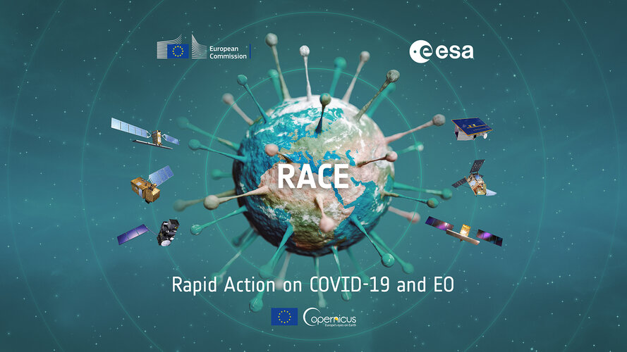
The coronavirus pandemic constitutes an unprecedented challenge with severe societal and socio-economic consequences. In order to shed new light on these changes taking place, ESA and the European Commission have worked closely together to create the ‘Rapid Action Coronavirus Earth observation’ dashboard – also known as RACE. The platform, which was unveiled today during an online event, uses Earth observation satellite data to measure the impact of the coronavirus lockdown and monitor post-lockdown recovery.
RACE dashboard now available
5.6.2020 12:05 ESA Observing the Earth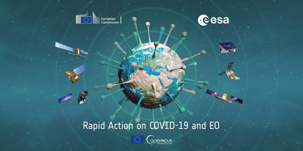
The coronavirus pandemic constitutes an unprecedented challenge with severe societal and socio-economic consequences. In order to shed new light on these changes taking place, ESA and the European Commission have worked closely together to create the ‘Rapid Action Coronavirus Earth observation’ dashboard – also known as RACE. The platform, which was unveiled today during an online event, uses Earth observation satellite data to measure the impact of the coronavirus lockdown and monitor post-lockdown recovery.
Projekt bronzového odlitku vypálené synagogy
5.6.2020 11:22 Katedra geoinformatiky UP OlomoucNěco velkého se chystá ‼️ Geoinformatika UPOL Přírodovědecká fakulta Univerzity Palackého v Olomouci ve spolupráci s Židovská obec Olomouc / Jewish Community Olomouc a sochařem Jiřím Žlebkem připravuje projekt bronzového modelu olomoucké synagogy, vypálené v roce 1939 🤓 Na katedře vznikl virtuální 3D model a právě probíhá fáze prvních testovacích 3D tisků 👌 Sada 3D modelů bude sloužit jako forma pro bronzový odlitek ve velikosti […]
The post Projekt bronzového odlitku vypálené synagogy appeared first on Katedra geoinformatiky.
Omezení provozu pracoviště
5.6.2020 10:57 ČÚZK - předpisy a opatření Katastrální úřad pro Plzeňský kraj - Katastrální pracoviště Kralovice omezení provozu pracoviště Katastrální úřad pro Plzeňský kraj, Katastrální pracoviště Kralovice oznamuje, že v týdnu od 15. do 19.6.2020 bude, z důvodu stěhování pracoviště, omezen rozsah služeb pro veřejnost.Poskytování údajů z KN (výpisy z LV, snímky z mapy, kopie listin) bude naposledy na adrese Masarykovo nám. 1 v pondělí 15.6. v době od 8 do 17 hodin. Další poskytování údajů bude pak až v pondělí 22.6. od 8 do 17 hodin, již na nové adrese Náměstí Osvobození 886 ( budova, kde dříve sídlil finanční úřad).
Ve středu 17.6. bude přepážka poskytování údajů z technických důvodů uzavřena.
Podatelna bude přijímat podání do 18.6. ještě na adrese Masarykovo nám. 1, od 19.6 pak na adrese Náměstí Osvobození 886 ( budova, kde dříve sídlil finanční úřad).
Power-efficient positioning for the IoT
5.6.2020 10:36 European GNSS Agency
The European GNSS Agency (GSA) has published a White Paper on “Power-efficient positioning for the Internet of Things”, providing an overview of GNSS technologies that are relevant for low-power IoT applications, including those that require hybridisation with other connectivity solutions. The GSA is organising a dedicated webinar on 18 June to present the main findings from the paper.
The world is embracing Internet of Things (IoT) applications. Billions of internet-connected devices are capable of sensing, communicating, interacting, computing and actuating. These devices are set to become even more integrated into our daily lives and by 2022 it is estimated that around 18 billion out of 29 billion connected devices will be related to the IoT.
With millions of moving interconnected devices in the IoT environment, many applications require or benefit from knowing the location of an individual device. In this context, the latest GSA White Paper looks at how GNSS-based positioning for the IoT can be made more power-efficient, to meet the needs of this growing market.
Key findings
GNSS is a viable solution for tracking objects in the IoT world. However, the power consumed by positioning is an important concern. Two basic approaches have emerged in recent years to optimise consumption: transmission of pseudoranges for remote position determination, and snapshot techniques. In the first of these, the power consumption related to determining position is saved by transmitting the measurements to an external facility with no power restrictions while, for the second, the GNSS receiver is only activated for short periods to determine the position.
Read this: Harnessing Galileo to shape the future of IoT
Combining both approaches will decrease the power consumption even further but, ultimately, the optimal solution will depend on the application in question. “When deciding on a GNSS-based solution for a given application, numerous factors play a role including target accuracy, selected LPWAN, desired battery life, ease of integration, and hardware and implementation cost,” according to the report.
The White Paper also advises applications that require a position accuracy of one meter or less to use a multi-constellation, multi-frequency receiver. “However, as most low-power IoT applications prioritise extending battery life, a multi-constellation single-frequency receiver is sufficient when positioning accuracy of multiple meters is acceptable,” it notes.
The report also states that, when deciding on an energy-efficient GNSS technique, the choice of the terrestrial network limits the possible options, as most solutions rely on external data to determine the position via GNSS.
A dedicated webinar
The main findings from the White Paper will be presented at a dedicated webinar on Power-efficient positioning for the Internet of Things, to take place at 15:00 on 18 June. This GSA-hosted webinar will also feature input from major chipset manufacturers in the IoT domain such as STM & U-blox.
What’s more, EU-funded R&D projects that are working to reduce the power consumption of GNSS positioning for the Internet of Things will also present their innovative solutions. These include: “Accurate GNSS POsitioning for Low power and Low-cost Objects” (APOLLO), which aims at providing a Galileo-based geolocation solution for the IoT market by drastically reducing energy consumption.
The APOLLO project noted in the White Paper that: “The ability to calculate the GNSS position of IoT objects with a very small energy footprint will pave the way for a market of tens of millions of moving objects each year.”
Also presenting at the webinar will be the GEONAV IoT project, which is working to develop and deliver precise ubiquitous positioning and navigation applications and services; and the Galileo of Things gs(GoT) project, which is targeting the delivery of a Galileo semiconductor-IP core that mates with NB-IoT IP for low-power consumption solutions.
Interested? For more information and to register, click here.
Media note: This feature can be republished without charge provided the European GNSS Agency (GSA) is acknowledged as the source at the top or the bottom of the story. You must request permission before you use any of the photographs on the site. If you republish, we would be grateful if you could link back to the GSA website (http://www.gsa.europa.eu).
Power-efficient positioning for the IoT
5.6.2020 10:36 European GNSS AgencyThe European GNSS Agency (GSA) has published a White Paper on “Power-efficient positioning for the Internet of Things”, providing an overview of GNSS technologies that are relevant for low-power IoT applications, including those that require hybridisation with other connectivity solutions. The GSA is organising a dedicated webinar on 18 June to present the main findings from the paper.
The world is embracing Internet of Things (IoT) applications. Billions of internet-connected devices are capable of sensing, communicating, interacting, computing and actuating. These devices are set to become even more integrated into our daily lives and by 2022 it is estimated that around 18 billion out of 29 billion connected devices will be related to the IoT.
With millions of moving interconnected devices in the IoT environment, many applications require or benefit from knowing the location of an individual device. In this context, the latest GSA White Paper looks at how GNSS-based positioning for the IoT can be made more power-efficient, to meet the needs of this growing market.
Key findings
GNSS is a viable solution for tracking objects in the IoT world. However, the power consumed by positioning is an important concern. Two basic approaches have emerged in recent years to optimise consumption: transmission of pseudoranges for remote position determination, and snapshot techniques. In the first of these, the power consumption related to determining position is saved by transmitting the measurements to an external facility with no power restrictions while, for the second, the GNSS receiver is only activated for short periods to determine the position.
Read this: Harnessing Galileo to shape the future of IoT
Combining both approaches will decrease the power consumption even further but, ultimately, the optimal solution will depend on the application in question. “When deciding on a GNSS-based solution for a given application, numerous factors play a role including target accuracy, selected LPWAN, desired battery life, ease of integration, and hardware and implementation cost,” according to the report.
The White Paper also advises applications that require a position accuracy of one meter or less to use a multi-constellation, multi-frequency receiver. “However, as most low-power IoT applications prioritise extending battery life, a multi-constellation single-frequency receiver is sufficient when positioning accuracy of multiple meters is acceptable,” it notes.
The report also states that, when deciding on an energy-efficient GNSS technique, the choice of the terrestrial network limits the possible options, as most solutions rely on external data to determine the position via GNSS.
A dedicated webinar
The main findings from the White Paper will be presented at a dedicated webinar on Power-efficient positioning for the Internet of Things, to take place at 14:45 CET on 18 June. This GSA-hosted webinar will also feature input from major chipset manufacturers in the IoT domain such as STM & U-blox.
What’s more, EU-funded R&D projects that are working to reduce the power consumption of GNSS positioning for the Internet of Things will also present their innovative solutions. These include: “Accurate GNSS POsitioning for Low power and Low-cost Objects” (APOLLO), which aims at providing a Galileo-based geolocation solution for the IoT market by drastically reducing energy consumption.
The APOLLO project noted in the White Paper that: “The ability to calculate the GNSS position of IoT objects with a very small energy footprint will pave the way for a market of tens of millions of moving objects each year.”
Also presenting at the webinar will be the GEONAV IoT project, which is working to develop and deliver precise ubiquitous positioning and navigation applications and services; and the Galileo of Things gs(GoT) project, which is targeting the delivery of a Galileo semiconductor-IP core that mates with NB-IoT IP for low-power consumption solutions.
Interested? For more information and to register, click here.
Media note: This feature can be republished without charge provided the European GNSS Agency (GSA) is acknowledged as the source at the top or the bottom of the story. You must request permission before you use any of the photographs on the site. If you republish, we would be grateful if you could link back to the GSA website (http://www.gsa.europa.eu).
Power-efficient positioning for the IoT
5.6.2020 10:36 European GNSS AgencyThe European GNSS Agency (GSA) has published a White Paper on “Power-efficient positioning for the Internet of Things”, providing an overview of GNSS technologies that are relevant for low-power IoT applications, including those that require hybridisation with other connectivity solutions. The GSA is organising a dedicated webinar on 18 June to present the main findings from the paper.
The world is embracing Internet of Things (IoT) applications. Billions of internet-connected devices are capable of sensing, communicating, interacting, computing and actuating. These devices are set to become even more integrated into our daily lives and by 2022 it is estimated that around 18 billion out of 29 billion connected devices will be related to the IoT.
With millions of moving interconnected devices in the IoT environment, many applications require or benefit from knowing the location of an individual device. In this context, the latest GSA White Paper looks at how GNSS-based positioning for the IoT can be made more power-efficient, to meet the needs of this growing market.
Key findings
GNSS is a viable solution for tracking objects in the IoT world. However, the power consumed by positioning is an important concern. Two basic approaches have emerged in recent years to optimise consumption: transmission of pseudoranges for remote position determination, and snapshot techniques. In the first of these, the power consumption related to determining position is saved by transmitting the measurements to an external facility with no power restrictions while, for the second, the GNSS receiver is only activated for short periods to determine the position.
Read this: Harnessing Galileo to shape the future of IoT
Combining both approaches will decrease the power consumption even further but, ultimately, the optimal solution will depend on the application in question. “When deciding on a GNSS-based solution for a given application, numerous factors play a role including target accuracy, selected LPWAN, desired battery life, ease of integration, and hardware and implementation cost,” according to the report.
The White Paper also advises applications that require a position accuracy of one meter or less to use a multi-constellation, multi-frequency receiver. “However, as most low-power IoT applications prioritise extending battery life, a multi-constellation single-frequency receiver is sufficient when positioning accuracy of multiple meters is acceptable,” it notes.
The report also states that, when deciding on an energy-efficient GNSS technique, the choice of the terrestrial network limits the possible options, as most solutions rely on external data to determine the position via GNSS.
A dedicated webinar
The main findings from the White Paper will be presented at a dedicated webinar on Power-efficient positioning for the Internet of Things, to take place at 15:00 CET on 18 June. This GSA-hosted webinar will also feature input from major chipset manufacturers in the IoT domain such as STM & U-blox.
What’s more, EU-funded R&D projects that are working to reduce the power consumption of GNSS positioning for the Internet of Things will also present their innovative solutions. These include: “Accurate GNSS POsitioning for Low power and Low-cost Objects” (APOLLO), which aims at providing a Galileo-based geolocation solution for the IoT market by drastically reducing energy consumption.
The APOLLO project noted in the White Paper that: “The ability to calculate the GNSS position of IoT objects with a very small energy footprint will pave the way for a market of tens of millions of moving objects each year.”
Also presenting at the webinar will be the GEONAV IoT project, which is working to develop and deliver precise ubiquitous positioning and navigation applications and services; and the Galileo of Things gs(GoT) project, which is targeting the delivery of a Galileo semiconductor-IP core that mates with NB-IoT IP for low-power consumption solutions.
Interested? For more information and to register, click here.
Media note: This feature can be republished without charge provided the European GNSS Agency (GSA) is acknowledged as the source at the top or the bottom of the story. You must request permission before you use any of the photographs on the site. If you republish, we would be grateful if you could link back to the GSA website (http://www.gsa.europa.eu).
WSDP - nový HTTPS certifikát od 14.6.2020
5.6.2020 10:16 Dálkový přístup k údajům KN ČR Vážení uživatelé webových služeb,oznamujeme, že v neděli dne 14.6.2020 dojde k výměně HTTPS certifikátů u aplikací ČÚZK. Tato změna může být důležitá zejména pro uživatele webových služeb aplikací: WSDP, WSGP, WSNV. Pokud Vaše aplikace vyžadují uložení certifikátů na Vaší straně, vyměňte certifikáty včas za nové. Nový certifikát, včetně certifikátu vydávající CA. V opačném případě mohou být aplikace ČÚZK považovány na nedůvěryhodné.
Omlouváme se za komplikace a děkujeme za pochopení.
WSDP - nový HTTPS certifikát od 14.6.2020
5.6.2020 10:16 ČÚZK - předpisy a opatření Vážení uživatelé webových služeb,oznamujeme, že v neděli dne 14.6.2020 dojde k výměně HTTPS certifikátů u aplikací ČÚZK. Tato změna může být důležitá zejména pro uživatele webových služeb aplikací: WSDP, WSGP, WSNV. Pokud Vaše aplikace vyžadují uložení certifikátů na Vaší straně, vyměňte certifikáty včas za nové. Nový certifikát, včetně certifikátu vydávající CA. V opačném případě mohou být aplikace ČÚZK považovány na nedůvěryhodné.
Omlouváme se za komplikace a děkujeme za pochopení.
WSDP - nový HTTPS certifikát od 14.6.2020
5.6.2020 10:16 ČÚZK /Aplikace-DP-do-KN/Aplikace-DP-do-KN/Archiv-DP/291188vedoucí oddělení hospodářské správy Katastrálního úřadu pro Pardubický kraj
5.6.2020 10:04 ČÚZK - volná místa Katastrální úřad pro Pardubický kraj vypisuje výběrové řízení na místo vedoucí oddělení hospodářské správy Katastrálního úřadu pro Pardubický krajvedoucí oddělení hospodářské správy Katastrálního úřadu pro Pardubický kraj
5.6.2020 10:04 ČÚZK /Urady/Katastralni-urady/Katastralni-urady/Katastralni-urad-pro-Pardubicky-kraj/Uredni-deska/Oznameni-a-jina-uredni-sdeleni/Volna-mista/vedouci-oddeleni-hospodarske-spravy-Katastralnihovedoucí oddělení hospodářské správy Katastrálního úřadu pro Pardubický kraj
5.6.2020 10:04 ČÚZK - předpisy a opatření Katastrální úřad pro Pardubický krajvypisuje výběrové řízení na místo
vedoucí oddělení hospodářské správy Katastrálního úřadu pro Pardubický kraj
Earth from Space: Colourful Queensland
5.6.2020 10:00 ESA Observing the Earth Video:
00:03:02
Video:
00:03:02
This week's edition of the Earth from Space programme features a Copernicus Sentinel-2 image over part of Channel Country – a pastural region located mostly in southwest Queensland, Australia.
See also Colourful Queensland, Australia to download the image.
Earth from Space: Colourful Queensland
5.6.2020 10:00 ESA Observing the Earth
Video:
00:03:02
This week's edition of the Earth from Space programme features a Copernicus Sentinel-2 image over part of Channel Country – a pastoral region located mostly in southwest Queensland, Australia.
See also Colourful Queensland, Australia to download the image.
Colourful Queensland, Australia
5.6.2020 10:00 ESA Observing the Earth Image:
This image, captured by Copernicus Sentinel-2, takes us over part of Channel Country – a pastural region located mostly in southwest Queensland, Australia.
Image:
This image, captured by Copernicus Sentinel-2, takes us over part of Channel Country – a pastural region located mostly in southwest Queensland, Australia.
Arctic Circle oil spill
5.6.2020 8:55 ESA Observing the Earth Image:
Images captured by the Copernicus Sentinel-2 mission show the extent of the Arctic Circle oil spill
Image:
Images captured by the Copernicus Sentinel-2 mission show the extent of the Arctic Circle oil spill
Výstava k 300. výročí vydání Velké mapy Čech od J. Chr. Müllera je i online
5.6.2020 8:16 Česká kartografická společnost Geografická sekce Přírodovědecké fakulty Univerzity Karlovy, Mapová sbírka a Knihovna geografie pořádají výstavu Mapa Království českého, 1720. Vernisáž se měla konat 17. března 2020, ale z důvodu protipandemických opatření byla zrušena. Přestože nyní je již výstava běžně dostupná a její konání bylo prodlouženo do 18. 6. 2020, organizátoři vytvořili i online alternativu. Fyzicky si výstavu […]GeoKARTO 2020
5.6.2020 8:10 Česká kartografická společnost Dovoľujeme si Vás pozvať na konferenciu GeoKARTO 2020, ktorá sa uskutoční v termíne 10.–11. septembra 2020 v priestoroch Univerzity Pavla Jozefa Šafárika v Košiciach. Konferenciu organizuje Kartografická spoločnosť SR v spolupráci s Ústavom geografie, a Geografickým ústavom Slovenskej akadémie vied v Bratislave. Konferencia je organizovaná každé dva roky Kartografickou spoločnosťou SR v spolupráci s významnými akademickými inštitúciami. Nadväzuje na dlhoročnú tradíciu kartografických […]GeoKARTO 2020
5.6.2020 8:10 Česká kartografická společnost Dovoľujeme si Vás pozvať na konferenciu GeoKARTO 2020, ktorá sa uskutoční v termíne 10.–11. 9. 2020 v priestoroch Univerzity Pavla Jozefa Šafárika v Košiciach. Konferenciu organizuje Kartografická spoločnosť SR v spolupráci s Ústavom geografie a Geografickým ústavom Slovenskej akadémie vied v Bratislave. Konferencia je organizovaná každé dva roky Kartografickou spoločnosťou SR v spolupráci s významnými akademickými inštitúciami. Nadväzuje na dlhoročnú tradíciu […]INSPIRE téma Budovy (BU)
5.6.2020 2:00 Cenia - Katalog metadat ČR - INSPIRE Data odpovídají směrnici INSPIRE pro téma budovy (BU). Data pochází částečně z projektu RÚIAN (Registr územní identifikace, adres a nemovitostí), který je součástí základních registrů České Republiky a obsahuje informace o územní identifikaci, adresách a nemovitostech, a částečně z ISKN (Informační systém katastru nemovistostí). Zdrojem informací o budovách v ISKN je objekt Stavba, v RÚIAN je to Stavební objekt. Většina Staveb je zároveň Stavebními objekty, ale jsou případy, kdy tomu tak není. Kromě Budov datová sada obsahuje i části budov, které jsou pro potřeby INSPIRE vyjádřeny vchody z RÚIAN. Vchody obsahují informace o počtu podlaží, technickoekonomických atributech apod. Datová sada pokrývá celé území české republiky. V datové sadě není uvedeno 1,14%, t.j. 48324 budov (k 01. 06. 2020), protože neobsahují definiční bod ani polygon. Více v zákoně č. 111/2009 Sb., o základních registrech, ve vyhlášce č. 359/2011 Sb., o základním registru územní identifikace, adres a nemovitostí v platných zněních, v zákoně 256/2013 Sb., o katastru nemovitostí, v katastrální vyhlášce č. 357/2013 Sb. v platném znění a INSPIRE Data Specification on Buildings v 3.0 z 13.12.2013. Data ve formátu GML 3.2.1 jsou validní proti schématu XML pro INSPIRE téma Budovy ve verzi 4.0 a proti schématu pro prostorová data ELF ve verzi 1.0.INSPIRE téma Parcely (CP)
5.6.2020 2:00 Cenia - Katalog metadat ČR - INSPIRE Data odpovídají směrnici INSPIRE pro téma katastrální parcely (CP). Vychází z katastrální mapy, která je závazným státním mapovým dílem velkého měřítka, obsahuje body polohového bodového pole, polohopis a popis a může mít formu digitální mapy, analogové mapy nebo digitalizované mapy. Data publikovaná v rámci INSPIRE obsahují pouze katastrální území (pro celou Českou Republiku) a parcely a jejich hranice z území, kde je digitální mapa (k 01. 06. 2020 je to 96,79% území České republiky, t.j. 76 337,34km2). Více katastrální zákon 344/1992 SB., katastrální vyhláška č.26/2007 Sb. v platném znění a INSPIRE Data Specification on Cadastral Parcels v 3.0.1. Data ve formátu GML 3.2.1 jsou validní proti schématu XML pro INSPIRE téma Parcely ve verzi 4.0 a proti schématu pro prostorová data ELF ve verzi 1.0.Katastrální mapa v rastrové podobě poskytovaná v e-shopu
5.6.2020 2:00 Cenia - Katalog metadat ČR - INSPIRE Katastrální mapa v rastrové podobě je poskytována za úplatu a obsahuje analogovou mapu s kompletní kresbou. Analogová mapa pokrývá 2,99 % území České republiky, což je 2 360,49km2. Více katastrální vyhláška č.357/2013 Sb. v platném znění.INSPIRE téma Rozšířené Parcely (CPX)
5.6.2020 2:00 Cenia - Katalog metadat ČR - INSPIRE Rozšíření má za cíl poskytovat katastrální mapu s obsahem podle vyhlášky ve vektorové podobě ve struktuře plně v souladu se strukturou danou směrnicí INSPIRE. Data rozšiřují směrnici INSPIRE pro téma katastrální parcely (CP) o věcná břemena, geodetické body, další prvky mapy, původní obloukovou geometrii a o parcely určené definičním bodem (ty pouze v oblastech s analogovou mapou). Vychází z katastrální mapy, která je závazným státním mapovým dílem velkého měřítka, obsahuje body polohového bodového pole, polohopis a popis a může mít formu digitální mapy, analogové mapy nebo digitalizované mapy. Publikovaná data obsahují katastrální území pro celou Českou Republiku, parcely a jejich hranice, věcná břemena, další prvky mapy a původní obloukovou geometrii z území, kde je digitální mapa (k 01. 06. 2020 je to 96,79% území České republiky, t.j. 76 337,34km2) a ve zbytku území katastrální parcely určené pouze definičním bodem (tedy bez hranic a polygonu). Katastrální parcely a hranice obsahují oproti datové sadě INSPIRE některé atributy navíc. Jedná se o typ hranice, způsob využití území, druh pozemku, vazbu na budovu a o mapové značky. Více katastrální zákon 344/1992 SB., katastrální vyhláška č.26/2007 Sb. v platném znění a INSPIRE Data Specification on Cadastral Parcels v 3.0.1. Data ve formátu GML 3.2.1 jsou validní proti schématu XML pro Rozšířené Parcely (CPX) ve verzi 4.0.Katastrální mapa ve formátech DGN a DXF poskytovaná v e-shopu
5.6.2020 2:00 Cenia - Katalog metadat ČR - INSPIRE Katastrální mapa je závazným státním mapovým dílem velkého měřítka, obsahuje body polohového bodového pole, polohopis a popis. Katastrální mapa ve vektorové podobě je poskytována zdarma ve formátu DGN a DXF a obsahuje prvky Digitální katastrální mapy (DKM) a Katastrální mapy digitalizované (KMD), tedy bodová pole, budovy, další prvky mapy, hranice parcel, katastrální hranice, parcely katastru nemovitostí, prvky orientační mapy a hranice věcného břemene. Z důvodu použití formátu DGN produkt neobsahuje značky na liniích a oblouky jsou nahrazeny lomenými čárami. Katastrální mapa ve vektorové podobě k 01. 06. 2020 pokrývá 96,79% území České republiky, t.j. 76 337,34km2. Více katastrální vyhláška č.357/2013 Sb. v platném znění.INSPIRE téma Adresy (AD)
5.6.2020 2:00 Cenia - Katalog metadat ČR - INSPIRE Data odpovídají směrnici INSPIRE pro téma adresy (AD). Vychází především z projektu RÚIAN (Registr územní identifikace, adres a nemovitostí), který je součástí základních registrů České Republiky a obsahuje informace o územní identifikaci, adresách a nemovitostech. Data publikovaná v rámci INSPIRE obsahují pouze adresní místa a jejich komponenty, kterými jsou stát, obec, část obce, městský obvod v Praze (MOP), městký obvod/městská část (MO/MČ), ulice a pošta a to na území celé České Republiky. Obsahují rozvněž geometrii, která určuje definiční bod adresního místa. V datové sadě nění uvedeno 1,15%, t.j. 33760 adresních míst (k 01. 06. 2020), protože neobsahují definiční bod, podle kterého by je bylo možné prostorově určit. Více v zákoně č. 111/2009 Sb., o základních registrech a ve vyhlášce č. 359/2011 Sb., o základním registru územní identifikace, adres a nemovitostí v platných zněních a INSPIRE Data Specification on Addresses v 3.0.1 z 26.4.2010. Data ve formátu GML 3.2.1 jsou validní proti schématu XML pro INSPIRE téma Adresy ve verzi 4.0 a proti schématu pro prostorová data ELF ve verzi 1.0.NextNav Strengthens Executive Leadership Team With Industry Pioneers
5.6.2020 0:05 GISCafe.com Webcasts-Webinars NextNav Appoints Ashutosh Pande VP/GM of Metropolitan Beacon System (MBS) Services and Dan Hight VP/GM of Data PartnershipsSUNNYVALE, Calif., June …
OGC Members Revise IoT Standard SensorThings API Part 1 - Sensing; Public Comment Sought
4.6.2020 23:07 GISCafe.com Webcasts-Webinars Version 1.1 is a minor update to OGC’s IoT standard, which is used across the globe in logistics, public safety, energy utilities, …Draganfly Inc. Announces Launch of Global Dealer Network
4.6.2020 16:30 GISCafe.com Webcasts-Webinars Vancouver, British Columbia, June 04, 2020 (GLOBE NEWSWIRE) -- Draganfly Inc. (CSE: DFLY) (OTCQB: DFLYF) (FSE: 3U8) (“Draganfly” or the …EagleView Hits Key Milestone, Processing 100M Images So Far This Year
4.6.2020 16:30 GISCafe.com Webcasts-Webinars Company breaks imagery capture record just five months into the yearBELLEVUE, Wash., June 4, 2020 — (PRNewswire) —
BELLEVUE, Wash., …
20200604 - VŘ Správce ISKN
4.6.2020 15:24 ČÚZK - předpisy a opatření Český úřad zeměměřický a katastrální zveřejnil novou aktualitu: Oznámení o vyhlášení výběrového řízení na obsazení služebního místa rada/odborný rada - Správce ISKN.To Help Building and Facilities Managers Meet the Demands of Social Distancing, Bentley Systems Opens Up Full Access to LEGION Simulator and OpenBuildings Station Designer and Waives Subscription Fees through September 30
4.6.2020 15:11 Bentley SystemsSimulate People Movement and Test Space Performance to Mitigate Risk
in Reopening Public Facilities
EXTON, Pa.– June 4, 2020 –Bentley Systems, Incorporated, a leading global provider of comprehensive software and digital twins services for advancing the design, construction, and operations of infrastructure, today announced it has opened up its LEGION Simulator and OpenBuildings Station Designer software, including waiving new subscription fees through September 30, 2020, for facilities managers to incorporate pedestrian simulation methodologies across their planning, design, and operations teams.
With social distancing and crowd management at the forefront of global concerns, OpenBuildings Station Designer and LEGION Simulator software can help station owners, planning and design firms, and facilities operators to develop models, simulate crowd movement, analyze foot traffic, and optimize space utilization of infrastructure assets such as rail and metro stations, airports, retail and commercial complexes, hospitals, and stadiums. OpenBuildings Station Designer’s BIM environment provides 3D context for LEGION’s included pedestrian simulation to create an operational digital twin to improve safety, efficiency, and security, while mitigating risk.
LEGION Simulator helps users solve new planning and operations challenges in:
- validating social distancing plans while helping to ensure safe operations;
- ensuring space maximization, activities distribution and controlled egress/ingress;
- modeling safe and comfortable wayfinding strategies and evacuation plans; and
- providing virtual, collaborative planning, design and operations reviews.
Further, LEGION Simulator and OpenBuildings Station Designer offer the continued long-term benefits of a BIM collaboration environment that avoids data silos, coordination delays, and other limitations that result from the separation of planning and design workflows.
“We are going through extraordinary times and change will be a constant reality in the months and years ahead. Bentley’s OpenBuildings Station Designer and LEGION Simulator enable planners, architects, engineers, and operators to apply digital twin approaches to solve today’s design and operation challenges more quickly, efficiently, and safely across rail and metro stations, airports, and other public buildings and amenities,” said Ken Adamson, Vice President, Design Integration for Bentley.
“Atkins has collaborated successfully with LEGION for over 20 years, and we look forward to building upon our own thought leadership on Covid-19 and for the Transport Sector by applying LEGION’s simulations for social distancing in response to requests by our metro clients in Hong Kong, Singapore, Dubai, and Saudi Arabia,” said Cameron MacDonald, Technical Director, Operations Advisory, Atkins, a member of the SNC-Lavalin Group.
Please visit LEGION to learn more about LEGION Simulator and OpenBuildings Station Designer and visit LEGION and Social Distancing to learn more about the LEGION waived subscription fee offer.
Image: OpenBuildings Station Designer and LEGION
Caption: Top left illustrates a 3D model of a retail operation created using OpenBuildings Station Designer. Bottom left shows 2D floor plans that are then imported into LEGION Simulator (right) to test two scenarios. Examples shown are at occupancy rates of 75% (top) and 25% (bottom) to comply with social distancing requirements.
LEGION and OpenBuildings Station Designer are part of Bentley’s comprehensive efforts to provide resources and useful information to help both user organizations and end users meet the current challenges successfully. For more about Bentley’s response to the challenges of working from home and other software offers, please visit www.bentley.com/en/workingfromhome.
##
About Bentley’s OpenBuildings Station Designer
OpenBuildings Station Designer enables professionals of multiple disciplines, including Planners, Architects and Mechanical, Electrical, and Structural Engineers, to collaborate in real-time to design, analyze, visualize, and simulate infrastructure assets such as rail and metro stations, airports, retail and commercial complexes, hospitals, and stadiums. Projects of any size, form, and complexity can benefit and it is the only design application to fully integrate people movement simulation, via LEGION Simulator.
About Bentley’s LEGION Simulator
LEGION Simulator enables fast and scientifically validated evacuation simulation, for baseline operations and for any what-if scenario that operations teams may wish to test. It can seamlessly validate new entrances and exits, queuing strategies, flow separation barriers, and any other physical or operational changes in public spaces. Users can reduce risk and enhance the safety of their facilities through single source of truth models that enable easier collaboration and alignment between planning, design, operations, and safety teams.
About Bentley Systems
Bentley Systems is a leading global provider of software solutions to engineers, architects, geospatial professionals, constructors, and owner-operators for the design, construction, and operations of infrastructure. Bentley’s MicroStation-based engineering and BIM applications, and its digital twin cloud services, advance the project delivery (ProjectWise) and the asset performance (AssetWise) of transportation and other public works, utilities, industrial and resources plants, and commercial and institutional facilities.
Bentley Systems employs more than 3,500 colleagues and generates annual revenues of more than $700 million in 172 countries. From inception in 1984, the company has remained majority-owned by its five founding Bentley brothers.www.bentley.com
Bentley, the Bentley logo, AssetWise, LEGION, LEGION Simulator, MicroStation, OpenBuildings, OpenBuildings Station Designer, and ProjectWise are either registered or unregistered trademarks or service marks of Bentley Systems, Incorporated or one of its direct or indirect wholly owned subsidiaries. All other brands and product names are trademarks of their respective owners.
Watch live
4.6.2020 14:20 ESA Observing the Earth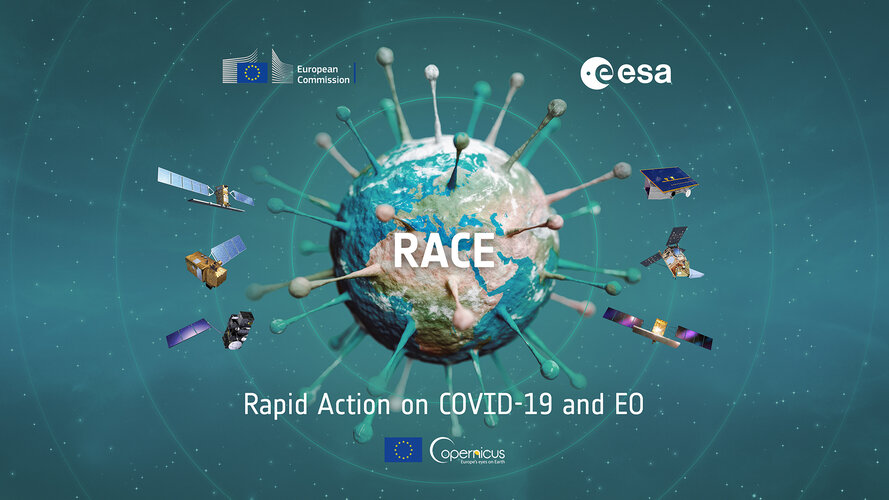
Watch live
Join the event on 5 June at 11:00 CEST, where ESA and the European Commission will present their new dashboard: Rapid action in response to coronavirus with Earth observation
20200604 - Výměna HTTPS certifikátu na aplikacích ČÚZK
4.6.2020 13:47 ČÚZK - předpisy a opatření Uživatelům webových služeb ISÚI oznamujeme, že dne 14.6.2020 dojde k výměně HTTPS certifikátů u aplikací ČÚZK. Pokud vaše aplikace vyžadují uložení certifikátů na vaší straně, vyměňte certifikáty včas za nové. Nový certifikát, včetně certifikátu vydávající CA. V opačném případě může být aplikace ČÚZK považována na nedůvěryhodnou.20200604 - Výměna HTTPS certifikátu na aplikacích ČÚZK
4.6.2020 13:47 ČÚZK - předpisy a opatření Uživatelům webových služeb ISÚI oznamujeme, že dne 14.6.2020 dojde k výměně HTTPS certifikátů u aplikací ČÚZK. Pokud vaše aplikace vyžadují uložení certifikátů na vaší straně, vyměňte certifikáty včas za nové. Nový certifikát, včetně certifikátu vydávající CA. V opačném případě může být aplikace ČÚZK považována na nedůvěryhodnou.20200604 - Výměna HTTPS certifikátu na aplikacích ČÚZK
4.6.2020 13:47 ČÚZK - předpisy a opatření20200604 - Výměna HTTPS certifikátu na aplikacích ČÚZK
4.6.2020 13:47 ČÚZK /Uvod/Produkty-a-sluzby/RUIAN/RUIAN-novinky/2020/20200604-Vymena-HTTPS-certifikatu-na-aplikacichNový klasifikační systém CCI
4.6.2020 12:58 BIM NewsČeská republika se stala iniciátorem vzniku nového klasifikačního systému CCI (Construction Classification International) pro BIM na evropské úrovni. Společný klasifikační systém zajistí jednotné pojmenování všech prvků stavby, které bude srozumitelné napříč obory i různými používanými programy. Zjednodušeně řečeno, zásuvka bude vždy zásuvka, ať ji již ve svém počítači a programu otevře projektant, investor, správcovská firma […]
The post Nový klasifikační systém CCI appeared first on BIM News.
Galileo Green Lane proving a hit with drivers
4.6.2020 12:56 European GNSS Agency
With over 2 500 downloads since it was launched at the start of May, the Galileo Green Lane app is proving to be popular with drivers. Developed by the European GNSS Agency (GSA) in collaboration with the European Commission, the app is a key tool in the EU’s COVID-19 pandemic response. By easing traffic flow through the EU’s borders, the app is helping to support a fundamental EU principle - the free movement of goods and freight in the internal market.
The Galileo Green Lane app uses the positioning services of Galileo- Europe’s Global Navigation Satellite System (GNSS) - to monitor and facilitate the free movement of freight, making it possible to reduce waiting times at the EU’s internal land borders and facilitate the transport of goods.
Keeping transport moving
Over the last few months, the transport sector has played a vital role in the European response to the pandemic – transporting essential goods to fight the crisis and keeping the internal market intact. The Galileo Green Lane App supports drivers and national authorities as they keep up their essential work in these difficult circumstances. The initiative builds on the so-called ‘Green Lanes’, established at land border crossing points by EU Member States following guidelines from the European Commission: On 23 March, the Commission asked all EU Member States to designate relevant border-crossing points along the Trans-European Transport Network (TEN-T) as ‘Green Lane’ border crossings to minimise waiting times and keep freight moving. Via these Green Lanes, freight vehicles should be able to cross the border within a maximum of 15 minutes.
Two-interface solution
The Galileo Green Lane app is designed to address the needs of both border control authorities and of truck drivers, through two intuitive user interfaces. For border control authorities, the app provides a real-time visualisation of the situation at border crossings along with regular updates on the traffic flow situation. For truck and passenger car drivers, the app also provides real-time border visualisation with an EU-wide map produced by real-time visibility provider Sixfold. This enables drivers to better prepare their routes, by providing advance knowledge of the waiting time at each border crossing.
At the same time, the app provides Member States with a website where they can generate reports automatically, making it easier to comply with EU recommendations. The solution is the product of cooperation not only between EU Member States and agencies, but also with users, who provide the data that is aggregated and analysed to produce the solution. To check out the Galileo Green Lane benefits, download the app here.
A welcome initiative
Several European Union countries have welcomed the opportunity to use “Galileo Green Lane” and the app has already been tested with the Border Police at border crossings in Hungary, the Czech Republic and Spain, with over 5 000 datasets collected. Testing is still ongoing in France and Greece.
“With the ‘Galileo Green Lane’ app, the GSA is fulfilling its mission to address economic and societal challenges by leveraging the European GNSS capabilities,” said GSA Acting Executive Director Pascal Claudel. “If more Member States get involved, more border crossings will be brought into play, which means that the benefits of EU investment in space will be more widely felt,” he said.
A pilot has also been carried out with drivers, in collaboration with the International Road Transport Union (IRU), with over 2,500 apps downloaded. This pilot generated data from 97 of the total 187 Green Lane border crossings in 26 EU and neighbouring countries.
Coordinated support
The GSA is coordinating the Galileo Green Lane project with the support of the European Commission, in particular the Directorate-General for Mobility and Transport (DG MOVE) regarding needs linked to the Green Lanes, the Directorate-General for Defence Industry and Space (DG DEFIS), the Directorate-General for Migration and Home Affairs (DG HOME), bringing together the border authorities of the Member States, and the Joint Research Centre (JRC) with its geo-fencing technology development expertise.
Commissioner for Transport, Adina Vălean, said: “While borders were closing and lockdowns looming we opened Green Lanes, thus preventing a supply chain crisis. Member States embraced this concept and made it operational very quickly. The Galileo Green Lane app is a direct result of EU coordination in the transport sector and I encourage transport workers and operators to download and use it.”
Commissioner for Internal Market, Thierry Breton, said: “Through the Galileo Green Lane app, we demonstrate the value of space based technologies and applications to provide innovative and concrete solutions, for instance in support to the free flow of goods across the Single Market.”
Media note: This feature can be republished without charge provided the European GNSS Agency (GSA) is acknowledged as the source at the top or the bottom of the story. You must request permission before you use any of the photographs on the site. If you republish, we would be grateful if you could link back to the GSA website (http://www.gsa.europa.eu).
Galileo Green Lane proving a hit with drivers
4.6.2020 12:56 European GNSS AgencyWith over 2 500 downloads since it was launched at the start of May, the Galileo Green Lane app is proving to be popular with drivers. Developed by the European GNSS Agency (GSA) in collaboration with the European Commission, the app is a key tool in the EU’s COVID-19 pandemic response. By easing traffic flow through the EU’s borders, the app is helping to support a fundamental EU principle - the free movement of goods and freight in the internal market.
The Galileo Green Lane app uses the positioning services of Galileo- Europe’s Global Navigation Satellite System (GNSS) - to monitor and facilitate the free movement of freight, making it possible to reduce waiting times at the EU’s internal land borders and facilitate the transport of goods.
Keeping transport moving
Over the last few months, the transport sector has played a vital role in the European response to the pandemic – transporting essential goods to fight the crisis and keeping the internal market intact. The Galileo Green Lane App supports drivers and national authorities as they keep up their essential work in these difficult circumstances. The initiative builds on the so-called ‘Green Lanes’, established at land border crossing points by EU Member States following guidelines from the European Commission: On 23 March, the Commission asked all EU Member States to designate relevant border-crossing points along the Trans-European Transport Network (TEN-T) as ‘Green Lane’ border crossings to minimise waiting times and keep freight moving. Via these Green Lanes, freight vehicles should be able to cross the border within a maximum of 15 minutes.
Two-interface solution
The Galileo Green Lane app is designed to address the needs of both border control authorities and of truck drivers, through two intuitive user interfaces. For border control authorities, the app provides a real-time visualisation of the situation at border crossings along with regular updates on the traffic flow situation. For truck and passenger car drivers, the app also provides real-time border visualisation with an EU-wide map produced by real-time visibility provider Sixfold. This enables drivers to better prepare their routes, by providing advance knowledge of the waiting time at each border crossing.
At the same time, the app provides Member States with a website where they can generate reports automatically, making it easier to comply with EU recommendations. The solution is the product of cooperation not only between EU Member States and agencies, but also with users, who provide the data that is aggregated and analysed to produce the solution. To check out the Galileo Green Lane benefits, download the app here.
A welcome initiative
Several European Union countries have welcomed the opportunity to use “Galileo Green Lane” and the app has been already been tested with the Border Police at border crossings in Hungary, the Czech Republic and Spain, with over 5 000 datasets collected. Testing is still ongoing in in France and Greece.
“With the ‘Galileo Green Lane’ app, the GSA is fulfilling its mission to address economic and societal challenges by leveraging the European GNSS capabilities,” said GSA Acting Executive Director Pascal Claudel. “If more Member States get involved, more border crossings will be brought into play, which means that the benefits of EU investment in space will be more widely felt,” he said.
A pilot has also been carried out with drivers, in collaboration with the International Road Transport Union (IRU), with over 2,500 apps downloaded. This pilot generated data from 97 of the total 187 Green Lane border crossings in 26 EU and neighbouring countries.
Coordinated support
The GSA is coordinating the Galileo Green Lane project with the support of the European Commission, in particular the Directorate-General for Mobility and Transport (DG MOVE) regarding needs linked to the Green Lanes, the Directorate-General for Defence Industry and Space (DG DEFIS), the Directorate-General for Migration and Home Affairs (DG HOME), bringing together the border authorities of the Member States, and the Joint Research Centre (JRC) with its geo-fencing technology development expertise.
Commissioner for Transport, Adina Vălean, said: “While borders were closing and lockdowns looming we opened Green Lanes, thus preventing a supply chain crisis. Member States embraced this concept and made it operational very quickly. The Galileo Green Lane app is a direct result of EU coordination in the transport sector and I encourage transport workers and operators to download and use it.”
Commissioner for Internal Market, Thierry Breton, said: “Through the Galileo Green Lane app, we demonstrate the value of space based technologies and applications to provide innovative and concrete solutions, for instance in support to the free flow of goods across the Single Market.”
Media note: This feature can be republished without charge provided the European GNSS Agency (GSA) is acknowledged as the source at the top or the bottom of the story. You must request permission before you use any of the photographs on the site. If you republish, we would be grateful if you could link back to the GSA website (http://www.gsa.europa.eu).
Galileo Green Lane proving a hit with drivers
4.6.2020 12:56 European GNSS Agency
With over 2 500 downloads since it was launched at the start of May, the Galileo Green Lane app is proving to be popular with drivers. Developed by the European GNSS Agency (GSA) in collaboration with the European Commission, the app is a key tool in the EU’s COVID-19 pandemic response. By easing traffic flow through the EU’s borders, the app is helping to support a fundamental EU principle - the free movement of goods and freight in the internal market.
The Galileo Green Lane app uses the positioning services of Galileo- Europe’s Global Navigation Satellite System (GNSS) - to monitor and facilitate the free movement of freight, making it possible to reduce waiting times at the EU’s internal land borders and facilitate the transport of goods.
Keeping transport moving
Over the last few months, the transport sector has played a vital role in the European response to the pandemic – transporting essential goods to fight the crisis and keeping the internal market intact. The Galileo Green Lane App supports drivers and national authorities as they keep up their essential work in these difficult circumstances. The initiative builds on the so-called ‘Green Lanes’, established at land border crossing points by EU Member States following guidelines from the European Commission: On 23 March, the Commission asked all EU Member States to designate relevant border-crossing points along the Trans-European Transport Network (TEN-T) as ‘Green Lane’ border crossings to minimise waiting times and keep freight moving. Via these Green Lanes, freight vehicles should be able to cross the border within a maximum of 15 minutes.
Two-interface solution
The Galileo Green Lane app is designed to address the needs of both border control authorities and of truck drivers, through two intuitive user interfaces. For border control authorities, the app provides a real-time visualisation of the situation at border crossings along with regular updates on the traffic flow situation. For truck and passenger car drivers, the app also provides real-time border visualisation with an EU-wide map produced by real-time visibility provider Sixfold. This enables drivers to better prepare their routes, by providing advance knowledge of the waiting time at each border crossing.
At the same time, the app provides Member States with a website where they can generate reports automatically, making it easier to comply with EU recommendations. The solution is the product of cooperation not only between EU Member States and agencies, but also with users, who provide the data that is aggregated and analysed to produce the solution. To check out the Galileo Green Lane benefits, download the app here.
A welcome initiative
Several European Union countries have welcomed the opportunity to use “Galileo Green Lane” and the app has already been tested with the Border Police at border crossings in Hungary, the Czech Republic and Spain, with over 5 000 datasets collected. Testing is still ongoing in France and Greece.
“With the ‘Galileo Green Lane’ app, the GSA is fulfilling its mission to address economic and societal challenges by leveraging the European GNSS capabilities,” said GSA Acting Executive Director Pascal Claudel, more Member States getting involved and more border crossings brought into play, means the benefits of EU investment in space will be more widely felt.
A pilot has also been carried out with drivers, in collaboration with the International Road Transport Union (IRU), with over 2,500 apps downloaded. This pilot generated data from 97 of the total 187 Green Lane border crossings in 26 EU and neighbouring countries.
Coordinated support
The GSA is coordinating the Galileo Green Lane project with the support of the European Commission, in particular the Directorate-General for Mobility and Transport (DG MOVE) regarding needs linked to the Green Lanes, the Directorate-General for Defence Industry and Space (DG DEFIS), the Directorate-General for Migration and Home Affairs (DG HOME), bringing together the border authorities of the Member States, and the Joint Research Centre (JRC) with its geo-fencing technology development expertise.
Commissioner for Transport, Adina Vălean, said: “While borders were closing and lockdowns looming we opened Green Lanes, thus preventing a supply chain crisis. Member States embraced this concept and made it operational very quickly. The Galileo Green Lane app is a direct result of EU coordination in the transport sector and I encourage transport workers and operators to download and use it.”
Commissioner for Internal Market, Thierry Breton, said: “Through the Galileo Green Lane app, we demonstrate the value of space based technologies and applications to provide innovative and concrete solutions, for instance in support to the free flow of goods across the Single Market.”
Media note: This feature can be republished without charge provided the European GNSS Agency (GSA) is acknowledged as the source at the top or the bottom of the story. You must request permission before you use any of the photographs on the site. If you republish, we would be grateful if you could link back to the GSA website (http://www.gsa.europa.eu).
Galileo Green Lane proving a hit with drivers
4.6.2020 12:56 European GNSS AgencyWith over 2 500 downloads since it was launched at the start of May, the Galileo Green Lane app is proving to be popular with drivers. Developed by the European GNSS Agency (GSA) in collaboration with the European Commission, the app is a key tool in the EU’s COVID-19 pandemic response. By easing traffic flow through the EU’s borders, the app is helping to support a fundamental EU principle - the free movement of goods and freight in the internal market.
The Galileo Green Lane app uses the positioning services of Galileo- Europe’s Global Navigation Satellite System (GNSS) - to monitor and facilitate the free movement of freight, making it possible to reduce waiting times at the EU’s internal land borders and facilitate the transport of goods.
Keeping transport moving
Over the last few months, the transport sector has played a vital role in the European response to the pandemic – transporting essential goods to fight the crisis and keeping the internal market intact. The Galileo Green Lane App supports drivers and national authorities as they keep up their essential work in these difficult circumstances. The initiative builds on the so-called ‘Green Lanes’, established at land border crossing points by EU Member States following guidelines from the European Commission: On 23 March, the Commission asked all EU Member States to designate relevant border-crossing points along the Trans-European Transport Network (TEN-T) as ‘Green Lane’ border crossings to minimise waiting times and keep freight moving. Via these Green Lanes, freight vehicles should be able to cross the border within a maximum of 15 minutes.
Two-interface solution
The Galileo Green Lane app is designed to address the needs of both border control authorities and of truck drivers, through two intuitive user interfaces. For border control authorities, the app provides a real-time visualisation of the situation at border crossings along with regular updates on the traffic flow situation. For truck and passenger car drivers, the app also provides real-time border visualisation with an EU-wide map produced by real-time visibility provider Sixfold. This enables drivers to better prepare their routes, by providing advance knowledge of the waiting time at each border crossing.
At the same time, the app provides Member States with a website where they can generate reports automatically, making it easier to comply with EU recommendations. The solution is the product of cooperation not only between EU Member States and agencies, but also with users, who provide the data that is aggregated and analysed to produce the solution. To check out the Galileo Green Lane benefits, download the app here.
A welcome initiative
Several European Union countries have welcomed the opportunity to use “Galileo Green Lane” and the app has already been tested with the Border Police at border crossings in Hungary, the Czech Republic and Spain, with over 5 000 datasets collected. Testing is still ongoing in France and Greece.
“With the ‘Galileo Green Lane’ app, the GSA is fulfilling its mission to address economic and societal challenges by leveraging the European GNSS capabilities,” said GSA Acting Executive Director Pascal Claudel. “If more Member States get involved, more border crossings will be brought into play, which means that the benefits of EU investment in space will be more widely felt,” he said.
A pilot has also been carried out with drivers, in collaboration with the International Road Transport Union (IRU), with over 2,500 apps downloaded. This pilot generated data from 97 of the total 187 Green Lane border crossings in 26 EU and neighbouring countries.
Coordinated support
The GSA is coordinating the Galileo Green Lane project with the support of the European Commission, in particular the Directorate-General for Mobility and Transport (DG MOVE) regarding needs linked to the Green Lanes, the Directorate-General for Defence Industry and Space (DG DEFIS), the Directorate-General for Migration and Home Affairs (DG HOME), bringing together the border authorities of the Member States, and the Joint Research Centre (JRC) with its geo-fencing technology development expertise.
Commissioner for Transport, Adina Vălean, said: “While borders were closing and lockdowns looming we opened Green Lanes, thus preventing a supply chain crisis. Member States embraced this concept and made it operational very quickly. The Galileo Green Lane app is a direct result of EU coordination in the transport sector and I encourage transport workers and operators to download and use it.”
Commissioner for Internal Market, Thierry Breton, said: “Through the Galileo Green Lane app, we demonstrate the value of space based technologies and applications to provide innovative and concrete solutions, for instance in support to the free flow of goods across the Single Market.”
Media note: This feature can be republished without charge provided the European GNSS Agency (GSA) is acknowledged as the source at the top or the bottom of the story. You must request permission before you use any of the photographs on the site. If you republish, we would be grateful if you could link back to the GSA website (http://www.gsa.europa.eu).
Referent ZKN – geodet/geograf pro správu dat ZABAGED®
4.6.2020 12:55 ČÚZK - předpisy a opatření Zeměměřický úřadvypisuje výběrové řízení na místo
Referent ZKN – geodet/geograf pro správu dat ZABAGED®
Referent ZKN
4.6.2020 12:55 Zeměměřický úřad Zeměměřický úřadvypisuje výběrové řízení na místo
Referent ZKN
Referent ZKN – geodet/geograf pro správu dat ZABAGED®
4.6.2020 12:55 ČÚZK /Urady/Zememericky-urad/Uredni-deska/Oznameni-a-jina-uredni-sdeleni/Volna-mista/Referent-ZKN-–-geodet-geograf-pro-spravu-dat-ZABAGReferent ZKN – geodet/geograf pro správu dat ZABAGED®
4.6.2020 12:55 Zeměměřický úřad Zeměměřický úřadvypisuje výběrové řízení na místo
Referent ZKN – geodet/geograf pro správu dat ZABAGED®
Referent zeměměřictví a katastr nemovitostí
4.6.2020 12:55 ČÚZK - předpisy a opatření Zeměměřický úřadvypisuje výběrové řízení na místo
Referent zeměměřictví a katastr nemovitostí
Referent zeměměřictví a katastr nemovitostí
4.6.2020 12:55 ČÚZK /Urady/Zememericky-urad/Uredni-deska/Oznameni-a-jina-uredni-sdeleni/Volna-mista/Referent-ZKN-–-geodet-geograf-pro-spravu-dat-ZABAGReferent ZKN – geodet/geograf pro správu dat ZABAGED®
4.6.2020 12:55 ČÚZK - volná místa Zeměměřický úřad vypisuje výběrové řízení na místo Referent ZKN – geodet/geograf pro správu dat ZABAGED®Referent ZKN
4.6.2020 12:55 ČÚZK - předpisy a opatření Zeměměřický úřadvypisuje výběrové řízení na místo
Referent ZKN
Referent ZKN
4.6.2020 12:55 ČÚZK /Urady/Zememericky-urad/Uredni-deska/Oznameni-a-jina-uredni-sdeleni/Volna-mista/Referent-ZKN-–-geodet-geograf-pro-spravu-dat-ZABAGReferent zeměměřictví a katastr nemovitostí
4.6.2020 12:55 Zeměměřický úřad Zeměměřický úřadvypisuje výběrové řízení na místo
Referent zeměměřictví a katastr nemovitostí
Referent zeměměřictví a katastr nemovitostí
4.6.2020 12:55 ČÚZK - volná místa Zeměměřický úřad vypisuje výběrové řízení na místo Referent zeměměřictví a katastr nemovitostíNovinky ke světové konferenci Esri
4.6.2020 12:35 ARCDATAPoslední šance poslat obrázky pro prezentaci Jacka Dangermonda
Obrázky ze svých map a aplikací, fotografie vašeho GIS v akci a jakékoliv další obrázky, které zachycují vaši práci a které byste chtěli dát k dispozici pro tvorbu úvodní prezentace na konferenci, můžete zasílat už jen do zítřka.
https://www.esri.com/en-us/about/events/uc/get-involved/call-for-images#/home
Detailní program konference
Naplánujte si přednášky a workshopy, které na konferenci chcete vidět. Na stránce https://userconference2020.schedule.esri.com/schedule si je můžete filtrovat podle tématu, náročnosti i podle přednášejících. Můžete si také označit přednášky, které vás zajímají, nahrát si upomínky do kalendáře a nebo si svůj naplánovaný program vytisknout.
Otevírací doba o letních prázdninách [Knihovna geografie, byTopic]
4.6.2020 11:15 Katedra aplikované geoinformatiky a kartografie Přf UK V době letních prázdnin bude knihovna otevřena ve zvláštním režimu. Podrobnosti naleznete v článku.Vědy o Zemi v magazínu M
4.6.2020 8:24 Geografický ústav MUV novém článku v magazínu M se píše, že Masarykova univerzita dosáhla vynikajícího hodnocení. A to kromě jiného i díky kvalitnímu oboru vědy o Zemi.
"Mezi nejlepší vysoké školy v Česku se Masarykova univerzita zařadila díky dobrým výsledkům v řadě oborů. Z hodnocení výstupů v impaktovaných časopisech na národní i mezinárodní úrovni, při němž se bere ohled na poměr výstupů v prvních deseti procentech a v první čtvrtině nejlepších časopisů daného oboru, dopadly v rámci MUNI nejlépe z přírodovědných oborů biologie, vědy o Zemi, chemie a fyzika."
Celý článek naleznete zde:
https://www.em.muni.cz/veda-a-vyzkum/12974-muni-ma-novou-metodiku-pro-financovani-vedy
700 kanálový GNSS
4.6.2020 8:20 GEUSware 700 kanálový GNSS board Hemisphere
sledování satelitů GPS, GLONASS, SBAS, GALILEO a BEIDOU v ceně
velmi malé rozměry (146mm x 146mm x 76mm)
WiFi
interní 4G modem
Web User Interface (veškerá nastavení a stav můžete kontrolovat online přes Váš mobil přímo v terénu)
6800 mAh baterie
vysoce odolný magnesiový povrch
Katalogová cena: 133.900,- Kč bez DPH
Akční cena: 119.900,- Kč bez DPH
Bližší informace viz e-shop
Nový GNSS rover Stonex S700A
4.6.2020 8:20 GEUSware 700 kanálový GNSS board Hemisphere
sledování satelitů GPS, GLONASS, SBAS, GALILEO a BEIDOU v ceně
velmi malé rozměry (146mm x 146mm x 76mm)
WiFi
interní 4G modem
Web User Interface (veškerá nastavení a stav můžete kontrolovat online přes Váš mobil přímo v terénu)
6800 mAh baterie
vysoce odolný magnesiový povrch
Katalogová cena: 133.900,- Kč bez DPH
Akční cena: 126.900,- Kč bez DPH
Bližší informace viz e-shop