


![]()

zprávy
zdroje zpráv:vrchní referent / rada v oddělení právních vztahů k nemovitostem Katastrálního pracoviště Ústí nad O
10.5.2024 9:41 ČÚZK - předpisy a opatření Katastrální úřad pro Pardubický kraj Katastrální pracoviště Ústí nad Orlicívypisuje výběrové řízení na místo
vrchní referent / rada v oddělení právních vztahů k nemovitostem Katastrálního pracoviště Ústí nad Orlicí
Aktualizace dat KN v mapových aplikacích
10.5.2024 9:10 Jihočeský krajData katastru nemovitostí (DKM, KMD, KM-D) byla v mapových aplikacích a výdejním moduli aktualizována k 1.4.2024.
Mapa roku 2023 – výsledky!
10.5.2024 9:08 GISportal.cz
Na slavnostním vyhlášení výsledků 26. ročníku odborné soutěže České kartografické společnosti bylo z rukou prezidenta ČKS prof. Václava Talhofera předáno pět diplomů a tři zvláštní ocenění Mapa roku 2023. Oceněným gratulujeme! kategorie Atlasy, soubory a edice map: Český úřad zeměměřický a katastrální za Základní topografické mapy České republiky kategorie Samostatná kartografická díla: Kartografie Praha, a. s., za mapu Svět – […]
The post Mapa roku 2023 – výsledky! appeared first on GISportal.cz.
Mapa roku 2023 – výsledky!
10.5.2024 9:08 GISportal.czNa slavnostním vyhlášení výsledků 26. ročníku odborné soutěže České kartografické společnosti bylo z rukou prezidenta ČKS prof. Václava Talhofera předáno pět diplomů a tři zvláštní ocenění Mapa roku 2023. Oceněným gratulujeme! kategorie Atlasy, soubory a edice map: Český úřad zeměměřický a katastrální za Základní topografické mapy České republiky kategorie Samostatná kartografická díla: Kartografie Praha, a. s., za mapu Svět – […]
The post Mapa roku 2023 – výsledky! appeared first on GISportal.cz.
Nabídka nepotřebného majetku k prodeji
10.5.2024 9:04 ČÚZK /Urady/Katastralni-urady/Katastralni-urady/Katastralni-urad-pro-Olomoucky-kraj/Nabidky-majetku/Nabidka-nepotrebneho-majetku-k-prodejiNabídka nepotřebného majetku k prodeji
10.5.2024 9:04 ČÚZK - předpisy a opatřeníKatastrální úřad pro Olomoucký kraj nabízí nepotřebný majetek k odkupu. Jedná se o
Nabídka nepotřebného majetku k prodeji
Ředitel/ka odboru kartografie a polygrafie
10.5.2024 8:49 ČÚZK - volná místa Zeměměřický úřad vypisuje výběrové řízení na místo Ředitel/ka odboru kartografie a polygrafieŘeditel/ka odboru kartografie a polygrafie
10.5.2024 8:49 Zeměměřický úřad Zeměměřický úřadvypisuje výběrové řízení na místo
Ředitel/ka odboru kartografie a polygrafie
Ředitel/ka odboru kartografie a polygrafie
10.5.2024 8:49 ČÚZK - předpisy a opatření Zeměměřický úřadvypisuje výběrové řízení na místo
Ředitel/ka odboru kartografie a polygrafie
Ředitel/ka odboru kartografie a polygrafie
10.5.2024 8:49 ČÚZK /Urady/Zememericky-urad/Uredni-deska/Oznameni-a-jina-uredni-sdeleni/Volna-mista/DMS/Reditel-ka-odboru-kartografie-a-polygrafiePostup registrace subjektu kritické infrastruktury
9.5.2024 17:42 ČÚZK - předpisy a opatření Do záložky Portál DMVS byl vystaven dokument Postup registrace subjektu kritické infrastrukturyARKANCE nabízí řadu software Carveco, která navazuje na Autodesk ArtCAM
9.5.2024 14:58 Arkance SystemsProgramy Maker, Maker Plus a Carveco pro kreativní tvůrce a umělce navazují na Autodesk ArtCAM. Umění se potkává s průmyslem.
Zpráva ARKANCE nabízí řadu software Carveco, která navazuje na Autodesk ArtCAM pochází z arkance-systems.cz.
ARKANCE nabízí řadu software Carveco, která navazuje na Autodesk ArtCAM
9.5.2024 14:58 Arkance SystemsProgramy Maker, Maker Plus a Carveco pro kreativní tvůrce navazují na Autodesk ArtCAM. Umění se potkává s průmyslem.
Zpráva ARKANCE nabízí řadu software Carveco, která navazuje na Autodesk ArtCAM pochází z arkance-systems.cz.
Krátka správa č. 21/2024
9.5.2024 12:37 Komora geodetů a kartografů SRThe post Krátka správa č. 21/2024 appeared first on Komora geodetov a kartografov.
Krátka správa č. 20/2024
9.5.2024 12:35 Komora geodetů a kartografů SRThe post Krátka správa č. 20/2024 appeared first on Komora geodetov a kartografov.
AI in Earth observation: a force for good
9.5.2024 11:50 ESA Observing the Earth
The upcoming launch of the Φsat-2 mission is a prime example of the pioneering work that ESA does in the field of AI in Earth observation.
But when it comes to AI, hopes and fears abound in equal measure. In this interview, ESA’s Rochelle Schneider sets the record straight on how this transformational technology is improving access to crucial information on the state and future of our planet.
Jarní webináře ArcGIS
9.5.2024 9:27 GISportal.cz
Společnost ARCDATA PRAHA zve na serii pěti nových webinářů o technologiích ArcGIS, které bude vysílat jednou týdně v průběhu května a června 2024. Účast na webinářích je zdarma, stačí se jen zaregistrovat. Součástí webináře bude také chat, kde se budete moci přednášejících (ale i ostatních posluchačů) na cokoliv zeptat. Záznamy webinářů z minulých ročníků můžete […]
The post Jarní webináře ArcGIS appeared first on GISportal.cz.
Jarní webináře ArcGIS
9.5.2024 9:27 GISportal.czSpolečnost ARCDATA PRAHA zve na serii pěti nových webinářů o technologiích ArcGIS, které bude vysílat jednou týdně v průběhu května a června 2024. Účast na webinářích je zdarma, stačí se jen zaregistrovat. Součástí webináře bude také chat, kde se budete moci přednášejících (ale i ostatních posluchačů) na cokoliv zeptat. Záznamy webinářů z minulých ročníků můžete […]
The post Jarní webináře ArcGIS appeared first on GISportal.cz.
SatLab LiDAR and SLAM Hands-On Demo Coming This May – Sat-Live Day 2024
8.5.2024 9:37 Satlab GeosolutionsGet ready to elevate your understanding of geospatial technology to new heights! SatLab proudly presents […]
The post SatLab LiDAR and SLAM Hands-On Demo Coming This May – Sat-Live Day 2024 appeared first on Global Satellite Positioning Solutions | SatLab Geosolutions AB.
Watch live: Workshop on Machine Learning for Earth System Observation and Prediction
8.5.2024 9:00 ESA Observing the Earth
Watch live
ESA-ECMWF workshop on machine learning for Earth system observation and prediction
GeoKARTO 2024 (pozvánka)
8.5.2024 8:30 GISportal.cz
Organizačný výbor pozýva na medzinárodnú konferenciu GeoKARTO 2024, ktorá sa uskutoční 5. – 6. septembra 2024 v priestoroch Kongresového centra SAV ACADEMIA v Starej Lesnej. Konferenciu organizuje Kartografická spoločnosť SR v spolupráci s Geografickým ústavom Slovenskej akadémie vied, v. v. i. v Bratislave. Konferencia je organizovaná každé dva roky Kartografickou spoločnosťou SR v spolupráci s […]
The post GeoKARTO 2024 (pozvánka) appeared first on GISportal.cz.
GeoKARTO 2024 (pozvánka)
8.5.2024 8:30 GISportal.czOrganizačný výbor pozýva na medzinárodnú konferenciu GeoKARTO 2024, ktorá sa uskutoční 5. – 6. septembra 2024 v priestoroch Kongresového centra SAV ACADEMIA v Starej Lesnej. Konferenciu organizuje Kartografická spoločnosť SR v spolupráci s Geografickým ústavom Slovenskej akadémie vied, v. v. i. v Bratislave. Konferencia je organizovaná každé dva roky Kartografickou spoločnosťou SR v spolupráci s […]
The post GeoKARTO 2024 (pozvánka) appeared first on GISportal.cz.
odborný referent/vrchní referent – poskytování informací a nahlížení do KN
7.5.2024 15:45 ČÚZK - předpisy a opatření Katastrální úřad pro hlavní město Prahu zveřejnil novou aktualitu: Ředitelka úřadu vyhlašuje výběrové řízení na pozici:odborný referent/vrchní referent – poskytování informací a nahlížení do KN
odborný referent/vrchní referent – poskytování informací a nahlížení do KN
7.5.2024 15:45 ČÚZK /Urady/Katastralni-urady/Katastralni-urady/Katastralni-urad-pro-hlavni-mesto-Prahu/O-uradu/Aktuality/odborny-referent-vrchni-referent-–-poskytovani-infodborný referent/vrchní referent – poskytování informací a nahlížení do KN
7.5.2024 15:43 ČÚZK - volná místa Katastrální úřad pro hlavní město Prahu vypisuje výběrové řízení na místo odborný referent/vrchní referent – poskytování informací a nahlížení do KNodborný referent/vrchní referent – poskytování informací a nahlížení do KN
7.5.2024 15:43 ČÚZK - předpisy a opatření Katastrální úřad pro hlavní město Prahuvypisuje výběrové řízení na místo
odborný referent/vrchní referent – poskytování informací a nahlížení do KN
odborný referent/vrchní referent – poskytování informací a nahlížení do KN
7.5.2024 15:43 ČÚZK /Urady/Katastralni-urady/Katastralni-urady/Katastralni-urad-pro-hlavni-mesto-Prahu/Uredni-deska/Oznameni-a-jina-uredni-sdeleni/Volna-mista/odborny-referent-vrchni-referent-–-poskytovani-(2)Odborný referent v oddělení obnovy katastrálního operátu č.4 na Technické sekci
7.5.2024 13:10 ČÚZK - předpisy a opatření Katastrální úřad pro Jihomoravský kraj technická sekcevypisuje výběrové řízení na místo
Odborný referent v oddělení obnovy katastrálního operátu č.4 na Technické sekci
Odborný referent v oddělení obnovy katastrálního operátu č.4 na Technické sekci
7.5.2024 13:10 ČÚZK /Urady/Katastralni-urady/Katastralni-urady/Katastralni-urad-pro-Jihomoravsky-kraj/Uredni-deska/Oznameni-a-jina-uredni-sdeleni/Volna-mista/DMS/Odborny-referent-v-oddeleni-obnovy-katastralni-(1)Odborný referent v oddělení obnovy katastrálního operátu č.4 na Technické sekci
7.5.2024 13:10 ČÚZK - volná místa Katastrální úřad pro Jihomoravský kraj technická sekce vypisuje výběrové řízení na místo Odborný referent v oddělení obnovy katastrálního operátu č.4 na Technické sekciOdborný referent v oddělení obnovy katastrálního operátu č.2 na Technické sekci
7.5.2024 13:09 ČÚZK - předpisy a opatření Katastrální úřad pro Jihomoravský kraj technická sekcevypisuje výběrové řízení na místo
Odborný referent v oddělení obnovy katastrálního operátu č.2 na Technické sekci
Odborný referent v oddělení obnovy katastrálního operátu č.2 na Technické sekci
7.5.2024 13:09 ČÚZK /Urady/Katastralni-urady/Katastralni-urady/Katastralni-urad-pro-Jihomoravsky-kraj/Uredni-deska/Oznameni-a-jina-uredni-sdeleni/Volna-mista/DMS/Odborny-referent-v-oddeleni-obnovy-katastralniho-oOdborný referent v oddělení obnovy katastrálního operátu č.2 na Technické sekci
7.5.2024 13:09 ČÚZK - volná místa Katastrální úřad pro Jihomoravský kraj technická sekce vypisuje výběrové řízení na místo Odborný referent v oddělení obnovy katastrálního operátu č.2 na Technické sekciVrchní referent/rada v oddělení obnovy katastrálního operátu č.4 na Technické sekci
7.5.2024 13:07 ČÚZK - předpisy a opatření Katastrální úřad pro Jihomoravský kraj technická sekcevypisuje výběrové řízení na místo
Vrchní referent/rada v oddělení obnovy katastrálního operátu č.4 na Technické sekci
Vrchní referent/rada v oddělení obnovy katastrálního operátu č.4 na Technické sekci
7.5.2024 13:07 ČÚZK /Urady/Katastralni-urady/Katastralni-urady/Katastralni-urad-pro-Jihomoravsky-kraj/Uredni-deska/Oznameni-a-jina-uredni-sdeleni/Volna-mista/DMS/Vrchni-referent-rada-v-oddeleni-obnovy-katastr-(3)Vrchní referent/rada v oddělení obnovy katastrálního operátu č.4 na Technické sekci
7.5.2024 13:07 ČÚZK - volná místa Katastrální úřad pro Jihomoravský kraj technická sekce vypisuje výběrové řízení na místo Vrchní referent/rada v oddělení obnovy katastrálního operátu č.4 na Technické sekciVrchní referent/rada v oddělení obnovy katastrálního operátu č.3 na Technické sekci
7.5.2024 13:04 ČÚZK /Urady/Katastralni-urady/Katastralni-urady/Katastralni-urad-pro-Jihomoravsky-kraj/Uredni-deska/Oznameni-a-jina-uredni-sdeleni/Volna-mista/DMS/Vrchni-referent-rada-v-oddeleni-obnovy-katastr-(2)Vrchní referent/rada v oddělení obnovy katastrálního operátu č.3 na Technické sekci
7.5.2024 13:04 ČÚZK - volná místa Katastrální úřad pro Jihomoravský kraj technická sekce vypisuje výběrové řízení na místo Vrchní referent/rada v oddělení obnovy katastrálního operátu č.3 na Technické sekciVrchní referent/rada v oddělení obnovy katastrálního operátu č.3 na Technické sekci
7.5.2024 13:04 ČÚZK - předpisy a opatření Katastrální úřad pro Jihomoravský kraj technická sekcevypisuje výběrové řízení na místo
Vrchní referent/rada v oddělení obnovy katastrálního operátu č.3 na Technické sekci
Květnový den s CAD technikem – bezplatná online konzultace pro vaši firmu
7.5.2024 11:30 Arkance SystemsPátek 31. května 2024 - přihlaste se na nový termín akce společnosti ARKANCE. Těšíme se na vás.
Zpráva Květnový den s CAD technikem – bezplatná online konzultace pro vaši firmu pochází z arkance-systems.cz.
Aliance opět partnerem největšího světového průzkumu Drone Industry Barometer 2024
7.5.2024 11:04 UAVA Jako každý rok jsme opět partnerem největšího světového průzkumu Drone Industry Barometer 2024 od DRONEII.com – Drone Industry Insights. Prosíme o jeho vyplnění, nezabere to více než 10 minut a kromě získání zdarma výsledného průzkumu, máte možnost vyhrát vstupenky na několik mezinárodních akcí jako například Amsterdam Drone Week, InterGeo, Commercial UAV Expo a další. Současně […]GeoKARTO 2024 – pozvánka
7.5.2024 8:23 Česká kartografická společnostVážené kolegyne, vážení kolegovia, dovoľujeme si Vám zaslať pozvánku na medzinárodnú konferenciu GeoKARTO 2024, ktorá sa uskutoční 5. – 6. septembra 2024 v priestoroch Kongresového centra SAV ACADEMIA v Starej Lesnej. Konferenciu organizuje Kartografická spoločnosť SR v spolupráci s Geografickým ústavom Slovenskej akadémie vied v Bratislave. Konferencia je organizovaná každé dva roky Kartografickou spoločnosťou SR v spolupráci s […]
The post GeoKARTO 2024 – pozvánka first appeared on Česká kartografická společnost.
International Spring School on Visualization (pozvánka)
7.5.2024 8:06 GISportal.cz
Katedra geoinformatiky PřF UP Olomouc zve na další ze svých letních škol, tentokrát s jedná o online mezinárodní letní školu na téma Vizualizace! Akce se koná od 20. do 22. května a účast je zpoplatněna poplatkem 40 EUR/1000 Kč.
The post International Spring School on Visualization (pozvánka) appeared first on GISportal.cz.
odborný referent – správa dokumentace katastru v oddělení dokumentace katastru nemovitostí na Katast
6.5.2024 14:55 ČÚZK - předpisy a opatření Český úřad zeměměřický a katastrální - Katastrální pracoviště Česká Lípavypisuje výběrové řízení na místo
odborný referent – správa dokumentace katastru v oddělení dokumentace katastru nemovitostí na Katastrálním pracovišti Česká Lípa
odborný referent – správa dokumentace katastru v oddělení dokumentace katastru nemovitostí na Katast
6.5.2024 14:55 ČÚZK - volná místa Český úřad zeměměřický a katastrální - Katastrální pracoviště Česká Lípa vypisuje výběrové řízení na místo odborný referent – správa dokumentace katastru v oddělení dokumentace katastru nemovitostí na Katastodborný referent – správa dokumentace katastru v oddělení dokumentace katastru nemovitostí na Katast
6.5.2024 14:55 ČÚZK /Urady/Katastralni-urady/Katastralni-urady/Katastralni-urad-pro-Liberecky-kraj/Uredni-deska/Oznameni-a-jina-uredni-sdeleni/Volna-mista/odborny-referent-–-sprava-dokumentace-katastru-v-oreferent KN – rozhodování o povolení vkladu práv k nemovitostem do KN v právním oddělení VI.
6.5.2024 14:32 ČÚZK - předpisy a opatření Katastrální úřad pro hlavní město Prahu zveřejnil novou aktualitu: Ředitelka úřadu vyhlašuje výběrové řízení na pozici:referent KN – rozhodování o povolení vkladu práv k nemovitostem do KN v právním oddělení VI.
referent KN – rozhodování o povolení vkladu práv k nemovitostem do KN v právním oddělení VI.
6.5.2024 14:32 ČÚZK /Urady/Katastralni-urady/Katastralni-urady/Katastralni-urad-pro-hlavni-mesto-Prahu/O-uradu/Aktuality/referent-KN-–-rozhodovani-o-povoleni-vkladu-prav-kreferent KN – rozhodování o povolení vkladu práv k nemovitostem do KN v právním oddělení VI.
6.5.2024 14:28 ČÚZK - volná místa Katastrální úřad pro hlavní město Prahu vypisuje výběrové řízení na místo referent KN – rozhodování o povolení vkladu práv k nemovitostem do KN v právním oddělení VI.referent KN – rozhodování o povolení vkladu práv k nemovitostem do KN v právním oddělení VI.
6.5.2024 14:28 ČÚZK - předpisy a opatření Katastrální úřad pro hlavní město Prahuvypisuje výběrové řízení na místo
referent KN – rozhodování o povolení vkladu práv k nemovitostem do KN v právním oddělení VI.
referent KN – rozhodování o povolení vkladu práv k nemovitostem do KN v právním oddělení VI.
6.5.2024 14:28 ČÚZK /Urady/Katastralni-urady/Katastralni-urady/Katastralni-urad-pro-hlavni-mesto-Prahu/Volna-mista/referent-KN-–-rozhodovani-o-povoleni-vkladu-prav-kVýběrové řízení na KP Třebíč
6.5.2024 14:05 ČÚZK - předpisy a opatření Katastrální úřad pro Vysočinu - Katastrální pracoviště Třebíč zveřejnil novou aktualitu: Oznámení o vyhlášení výběrového řízení na služební místo odborný referent – oddělení aktualizace KN Katastrálního pracoviště Třebíč.Výběrové řízení na KP Třebíč
6.5.2024 14:05 ČÚZK /Urady/Katastralni-urady/Katastralni-urady/Katastralni-urad-pro-Vysocinu/O-uradu/Aktuality/Vyberove-rizeni-na-KP-Trebic-(1)odborný referent - aktualizace KN KP Třebíč
6.5.2024 13:42 ČÚZK - volná místa Katastrální úřad pro Vysočinu Katastrální pracoviště Třebíč vypisuje výběrové řízení na místo odborný referent - aktualizace KN KP Třebíčodborný referent - aktualizace KN KP Třebíč
6.5.2024 13:42 ČÚZK - předpisy a opatření Katastrální úřad pro Vysočinu Katastrální pracoviště Třebíčvypisuje výběrové řízení na místo
odborný referent - aktualizace KN KP Třebíč
odborný referent - aktualizace KN KP Třebíč
6.5.2024 13:42 ČÚZK /Urady/Katastralni-urady/Katastralni-urady/Katastralni-urad-pro-Vysocinu/Uredni-deska/Oznameni-a-jina-uredni-sdeleni/Volna-mista/DMS/odborny-referent-aktualizace-KN-KP-TrebicŘeditel/ka odboru kartografie a polygrafie
6.5.2024 9:02 ČÚZK - předpisy a opatření Český úřad zeměměřický a katastrálnívypisuje výběrové řízení na místo
Ředitel/ka odboru kartografie a polygrafie
Ředitel/ka odboru kartografie a polygrafie
6.5.2024 9:02 ČÚZK - volná místa Český úřad zeměměřický a katastrální vypisuje výběrové řízení na místo Ředitel/ka odboru kartografie a polygrafieŘeditel/ka odboru kartografie a polygrafie
6.5.2024 9:02 ČÚZK /Urady/Cesky-urad-zememericky-a-katastralni/Uredni-deska/Oznameni-a-jina-uredni-sdeleni/Volna-mista/DMS/Reditel-ka-odboru-kartografie-a-polygrafieVŘ referent/ka ZKN
6.5.2024 8:51 Zeměměřický úřad Zeměměřický úřadvypisuje výběrové řízení na místo
VŘ referent/ka ZKN
VŘ referent/ka ZKN
6.5.2024 8:51 ČÚZK - volná místa Zeměměřický úřad vypisuje výběrové řízení na místo VŘ referent/ka ZKNVŘ referent/ka ZKN
6.5.2024 8:51 ČÚZK - předpisy a opatření Zeměměřický úřadvypisuje výběrové řízení na místo
VŘ referent/ka ZKN
VŘ referent/ka ZKN
6.5.2024 8:51 ČÚZK /Urady/Zememericky-urad/Uredni-deska/Oznameni-a-jina-uredni-sdeleni/Volna-mista/DMS/VR-referent-ka-ZKN-(1)QGIS užívateľská konferencia 2024 v Bratislave (registrácia)
6.5.2024 8:30 GISportal.cz
Organizátori užívateľskej konferencie QGIS spustili pred pár dňami registráciu na toto podujatie, ktoré sa uskutoční 9. – 10. septembra 2024 na Stavebnej fakulte STU v Bratislave. Ak teda vo svojej práci alebo voľnočasových aktivitách používate open source GIS software QGIS, určite sa prihláste (odkaz na registráciu je dostupný tu). Okrem množstva zaujímavých prednášok sa účastníci […]
The post QGIS užívateľská konferencia 2024 v Bratislave (registrácia) appeared first on GISportal.cz.
QGIS užívateľská konferencia 2024 v Bratislave (registrácia)
6.5.2024 8:30 GISportal.czOrganizátori užívateľskej konferencie QGIS spustili pred pár dňami registráciu na toto podujatie, ktoré sa uskutoční 9. – 10. septembra 2024 na Stavebnej fakulte STU v Bratislave. Ak teda vo svojej práci alebo voľnočasových aktivitách používate open source GIS software QGIS, určite sa prihláste (odkaz na registráciu je dostupný tu). Okrem množstva zaujímavých prednášok sa účastníci […]
The post QGIS užívateľská konferencia 2024 v Bratislave (registrácia) appeared first on GISportal.cz.
International Spring School on Visualization
6.5.2024 7:39 Katedra geoinformatiky UP OlomoucJoin Us for the International Spring School on Visualization online! Are you ready to advance your skills in geoinformatics and visualization? We are excited to invite students and professionals to our comprehensive spring program, where you’ll learn about mapping and the geography of rural and urban regions, rural-urban dichotomy, urbanization in literature, and 3D (geo) […]
The post International Spring School on Visualization first appeared on Katedra geoinformatiky.
Mission control ready for EarthCARE despite disruption
5.5.2024 10:00 ESA Observing the Earth
Teams at ESA’s European Space Operations Centre in Darmstadt, Germany, are currently engaged in intensive preparations for the critical ‘Launch and Early Orbit’ phase of the agency's EarthCARE satellite.
APGEO - Seminář POZEMKOVÉ ÚPRAVY: BUDOUCNOST NAŠÍ KRAJINY
5.5.2024 2:00 Asociace podnikatelů v geomatice Ohlédnutí za seminářem APG k problematice pozemkových úprav, který se 24. dubna 2024 konal v Poslanecké sněmovně.Dokončená instalace na PROD
3.5.2024 18:45 ČÚZK - předpisy a opatření Český úřad zeměměřický a katastrální informuje, že instalace nové verze 1.7.2 informačního systému byla dokončena také na produkčním prostředí IS DMVS, prostředí je dostupné.DAEX DESIGN Start pro výrobce a prodejce nábytku a interiérů
3.5.2024 17:31 ŠPINAR - softwareDAEX DESIGN Start 24 v akční ceně!
The post DAEX DESIGN Start pro výrobce a prodejce nábytku a interiérů appeared first on ŠPINAR – software.
Novinka – Materiály Egger 2024
3.5.2024 16:32 ŠPINAR - softwareVážení zákazníci,
dovolujeme si Vám nabídnout (zdarma) materiály EGGER 2024 pro TurboCAD Platinum 28 (DAEX DESIGN 24 Pro, Plus a Standard.
The post Novinka – Materiály Egger 2024 appeared first on ŠPINAR – software.
Novinka: Příklady prvků pro DAEX DESIGN 24
3.5.2024 15:06 ŠPINAR - softwareVážení zákazníci,
dovolujeme si Vám nabídnout (zdarma) Příklady prvků pro DAEX DESIGN.
The post Novinka: Příklady prvků pro DAEX DESIGN 24 appeared first on ŠPINAR – software.
Novinka: Příklady prvků pro DAEX DESIGN 24
3.5.2024 15:06 ŠPINAR - software Vážení zákazníci,dovolujeme si Vám nabídnout (zdarma) Příklady prvků pro DAEX DESIGN.
Meet the team behind EarthCARE
3.5.2024 14:00 ESA Observing the Earth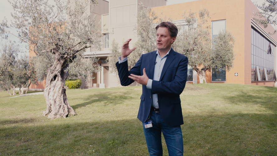 Video:
00:04:54
Video:
00:04:54
As we approach the launch of ESA’s EarthCARE mission, we caught up with some of the scientists, engineers and experts behind the mission.
With the climate crisis increasingly tightening its grip, ESA’s Earth Cloud Aerosol and Radiation Explorer mission (EarthCARE) will shed new light on the complex interactions between clouds, aerosols and radiation in Earth’s atmosphere.
EarthCARE is the largest and most complex Earth Explorer mission. It comes at a critical time in the development of kilometre-scale resolution, global climate models and will provide an important contribution to an improved understanding of cloud convection and its role in Earth’s radiation budget.
EarthCARE is an ESA mission, but it has been developed as a cooperation between ESA and JAXA, the Japanese Space Agency.
This video features interviews with: Pavlos Kollias from Stony Brook University – McGill University, Thorsten Fehr, EarthCARE Mission Scientist at ESA, Robin Hogan, Senior Scientist at ECMWF, Dirk Bernaerts, EarthCARE Project Manager at ESA, Kotska Wallace, Mission and Optical Payload Manager at ESA, Tomomi Nio, EarthCARE Mission Manager at JAXA, Eiichi Tomita, EarthCARE/CPR Project Manager at JAXA, Ulla Wandinger, Senior Scientist at Leibniz Institute for Tropospheric Research and Bjoern Frommknecht, EarthCARE Mission Manager at ESA.
Follow the EarthCARE launch campaign blog for more updates.
Access the related broadcast quality footage: animations / interviews / satellite stock footage
Kde se uplatní portálový jeřáb
3.5.2024 13:22 Konstruktér Portálové jeřáby představují klíčový komponent pro efektivní manipulaci s materiálem v různých průmyslových odvětvích. Tyto [...]Earth from Space: Namibian landforms
3.5.2024 10:20 ESA Observing the Earth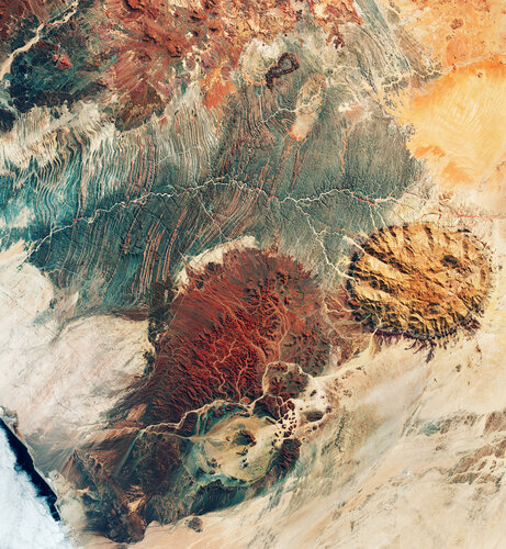 Image:
This image may resemble the surface of Mars, but it was actually captured by the Copernicus Sentinel-2 mission, revealing the stunning terrain of northwest Namibia.
Image:
This image may resemble the surface of Mars, but it was actually captured by the Copernicus Sentinel-2 mission, revealing the stunning terrain of northwest Namibia.
ESA’s cloud and aerosol satellite aerosol-free
3.5.2024 9:29 ESA Observing the Earth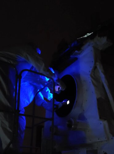
A few weeks ago, a team of engineers carefully extracted ESA's EarthCARE satellite from its protective transport container, initiating a meticulous process of inspection, testing and preparation for its liftoff later this month from the Vandenberg launch site in California.
Amidst an extensive checklist of tasks, was a rigorous effort to guarantee that the satellite is in pristine condition, underscoring the thorough attention to detail essential to making the satellite ready for launch.
ESA’s cloud and aerosol satellite aerosol-free
3.5.2024 9:29 ESA Observing the Earth
A few weeks ago, a team of engineers carefully extracted ESA's EarthCARE satellite from its protective transport container, initiating a meticulous process of inspection, testing and preparation for its liftoff later this month from Vandenberg Space Force Base in California.
Amidst an extensive checklist of tasks, was a rigorous effort to guarantee that the satellite is in pristine condition, underscoring the thorough attention to detail essential to making the satellite ready for launch.
Konference GIS Esri v ČR 2024 (registrace)
3.5.2024 8:34 GISportal.cz
Společnost ARCDATA PRAHA právě spustila přihlášku na Konferenci GIS Esri v ČR, která se bude konat 6. a 7. listopadu 2024 v Kongresovém centru Praha. Ode dneška se můžete začít přihlašovat na největší české setkání geoinformatiků, kde nebudou chybět inspirativní řečníci, podnětné uživatelské přednášky, workshopy plné technologických novinek, ani bohatý doprovodný program. Máte zajímavý projekt? […]
The post Konference GIS Esri v ČR 2024 (registrace) appeared first on GISportal.cz.
Konference GIS Esri v ČR 2024 (registrace)
3.5.2024 8:34 GISportal.czSpolečnost ARCDATA PRAHA právě spustila přihlášku na Konferenci GIS Esri v ČR, která se bude konat 6. a 7. listopadu 2024 v Kongresovém centru Praha. Ode dneška se můžete začít přihlašovat na největší české setkání geoinformatiků, kde nebudou chybět inspirativní řečníci, podnětné uživatelské přednášky, workshopy plné technologických novinek, ani bohatý doprovodný program. Máte zajímavý projekt? […]
The post Konference GIS Esri v ČR 2024 (registrace) appeared first on GISportal.cz.
Výběrové řízení na KP Žďár nad Sázavou
3.5.2024 6:46 ČÚZK - předpisy a opatření Katastrální úřad pro Vysočinu - Katastrální pracoviště Žďár nad Sázavou zveřejnil novou aktualitu: Oznámení o vyhlášení výběrového řízení na na obsazení služebního místa osobou v pracovním poměru na dobu určitou podle pracovněprávních předpisů pro Katastrální pracoviště Žďár nad Sázavou rada/odborný rada v oddělení dokumentace katastru nemovitostí.Nová geografie pro 21. století? (workshop/kulatý stůl)
2.5.2024 13:27 GISportal.cz
Aktuálně probíhající velká revize RVP ZV se dotýká i výuky geografie/zeměpisu. Ve spolupráci Národního pedagogického institutu a Fakulty přírodovědně-humanitní a pedagogické v Liberci se pro vás připravuje diskusní a pracovní setkání se zástupci tvůrců návrhu. Již nyní, v etapě připomínkování návrhů, vám nabízím náhled na navrhované změny, jejich vysvětlení a doplnění o konkrétní příklady. […]
The post Nová geografie pro 21. století? (workshop/kulatý stůl) appeared first on GISportal.cz.
Nová geografie pro 21. století? (workshop/kulatý stůl)
2.5.2024 13:27 GISportal.czAktuálně probíhající velká revize RVP ZV se dotýká i výuky geografie/zeměpisu. Ve spolupráci Národního pedagogického institutu a Fakulty přírodovědně-humanitní a pedagogické v Liberci se pro vás připravuje diskusní a pracovní setkání se zástupci tvůrců návrhu. Již nyní, v etapě připomínkování návrhů, vám nabízím náhled na navrhované změny, jejich vysvětlení a doplnění o konkrétní příklady. […]
The post Nová geografie pro 21. století? (workshop/kulatý stůl) appeared first on GISportal.cz.
rada-odborný rada dokumentace KN KP ZR
2.5.2024 12:56 ČÚZK /Urady/Katastralni-urady/Katastralni-urady/Katastralni-urad-pro-Vysocinu/Volna-mista/DMS/rada-odborny-rada-dokumentace-KN-KP-ZRrada-odborný rada dokumentace KN KP ZR
2.5.2024 12:56 ČÚZK - předpisy a opatření Katastrální úřad pro Vysočinu Katastrální pracoviště Žďár nad Sázavouvypisuje výběrové řízení na místo
rada-odborný rada dokumentace KN KP ZR
rada-odborný rada dokumentace KN KP ZR
2.5.2024 12:56 ČÚZK - volná místa Katastrální úřad pro Vysočinu Katastrální pracoviště Žďár nad Sázavou vypisuje výběrové řízení na místo rada-odborný rada dokumentace KN KP ZRNedostupnost WSDP na zkoušku ve dnech 6.5. - 13.5.2024
2.5.2024 12:14 Dálkový přístup k údajům KN ČR Vážení uživatelé webových služeb,oznamujeme, že z technických důvodů nebudou ve dnech od 6.5.2024 do 13.5.2024 dostupné webové služby dálkového přístupu na zkoušku.
Za komplikace se omlouváme a děkujeme za pochopení.
Nedostupnost WSDP na zkoušku ve dnech 6.5. - 13.5.2024
2.5.2024 12:14 ČÚZK - předpisy a opatření Vážení uživatelé webových služeb,oznamujeme, že z technických důvodů nebudou ve dnech od 6.5.2024 do 13.5.2024 dostupné webové služby dálkového přístupu na zkoušku.
Za komplikace se omlouváme a děkujeme za pochopení.
Nedostupnost WSDP na zkoušku ve dnech 6.5. - 13.5.2024
2.5.2024 12:14 ČÚZK /Aplikace-DP-do-KN/Aplikace-DP-do-KN/Archiv-DP/414540Nedostupnost WSDP na zkoušku ve dnech 6.5. - 13.5.2024
2.5.2024 12:14 Dálkový přístup k údajům KN ČR Vážení uživatelé webových služeb,oznamujeme, že z technických důvodů nebudou ve dnech od 6.5.2024 do 13.5.2024 dostupné webové služby dálkového přístupu na zkoušku.
Za komplikace se omlouváme a děkujeme za pochopení.
Státní svátek [Knihovna geografie, byTopic]
2.5.2024 11:20 Katedra aplikované geoinformatiky a kartografie Přf UK Ve středu 8. května bude Knihovna geografie ve státní svátek uzavřena.rada / odborný rada v oddělení právních vztahů k nemovitostem Katastrálního pracoviště Svitavy
2.5.2024 10:04 ČÚZK - volná místa Katastrální úřad pro Pardubický kraj Katastrální pracoviště Svitavy vypisuje výběrové řízení na místo rada / odborný rada v oddělení právních vztahů k nemovitostem Katastrálního pracoviště Svitavyrada / odborný rada v oddělení právních vztahů k nemovitostem Katastrálního pracoviště Svitavy
2.5.2024 10:04 ČÚZK /Urady/Katastralni-urady/Katastralni-urady/Katastralni-urad-pro-Pardubicky-kraj/Uredni-deska/Oznameni-a-jina-uredni-sdeleni/Volna-mista/DMS/rada-odborny-rada-v-oddeleni-pravnich-vztahu-k-nemrada / odborný rada v oddělení právních vztahů k nemovitostem Katastrálního pracoviště Svitavy
2.5.2024 10:04 ČÚZK - předpisy a opatření Katastrální úřad pro Pardubický kraj Katastrální pracoviště Svitavyvypisuje výběrové řízení na místo
rada / odborný rada v oddělení právních vztahů k nemovitostem Katastrálního pracoviště Svitavy
20240502 - VŘ Agenda VZ a smluv
2.5.2024 8:03 ČÚZK /Aktuality-resort/2024/20240502-VR-Agenda-VZ-a-smluv20240502 - VŘ Agenda VZ a smluv
2.5.2024 8:03 ČÚZK - předpisy a opatření Český úřad zeměměřický a katastrální zveřejnil novou aktualitu: Oznámení o vyhlášení výběrového řízení na obsazení služebního místa odborný rada - Agenda veřejných zakázek a smluv odboru informatiky.20240502 - VŘ Agenda VZ a smluv
2.5.2024 8:03 ČÚZK - aktuality v resortu Oznámení o vyhlášení výběrového řízení na obsazení služebního místa odborný rada - Agenda veřejných zakázek a smluv odboru informatiky.Věcné úkoly Katastrálního úřadu pro Moravskoslezský kraj v roce 2024/4
30.4.2024 13:15 ČÚZK - předpisy a opatření Katastrální úřad pro Moravskoslezský kraj zveřejnil novou aktualitu: Seznam schválených věcných úkolů s plánovaným dokončením v roce 2024 (s uvedeným datem již dokončených VÚ).Věcné úkoly Katastrálního úřadu pro Moravskoslezský kraj v roce 2024/4
30.4.2024 13:15 ČÚZK /Urady/Katastralni-urady/Katastralni-urady/Katastralni-urad-pro-Moravskoslezsky-kraj/O-uradu/Aktuality/Vecne-ukoly-Katastralniho-uradu-pro-Moravskosl-(2)Dokončená instalace na INT1
30.4.2024 12:30 ČÚZK - předpisy a opatření Český úřad zeměměřický a katastrální informuje, že byla dokončena instalace nové verze 1.7.2 informačního systému na integrační prostředí INT1 IS DMVS, prostředí je opět dostupné.Výběrové řízení na KÚ pro Vysočinu
30.4.2024 10:27 ČÚZK - předpisy a opatření Katastrální úřad pro Vysočinu zveřejnil novou aktualitu: Oznámení o vyhlášení výběrového řízení na služební místo rada/odborný rada – kontrolor v oddělení metodiky a kontroly Kanceláře ředitele katastrálního úřadu na Katastrálním úřadu pro Vysočinu.Geodeti sehráli důležitou úlohu na stavbě „V403/803“
30.4.2024 10:15 Hrdlička V úseku č. 1 bylo odstraněno stávající jednoduché vedení a nahrazeno dvojitým vedením 400 kV.rada-odborný rada -oddělení metodiky a kontroly Kanceláře ředitele KÚ
30.4.2024 10:02 ČÚZK /Urady/Katastralni-urady/Katastralni-urady/Katastralni-urad-pro-Vysocinu/Uredni-deska/Oznameni-a-jina-uredni-sdeleni/Volna-mista/DMS/rada-odborny-rada-oddeleni-metodiky-a-kontroly-Kanrada-odborný rada -oddělení metodiky a kontroly Kanceláře ředitele KÚ
30.4.2024 10:02 ČÚZK - předpisy a opatření Katastrální úřad pro Vysočinu kancelář ředitelevypisuje výběrové řízení na místo
rada-odborný rada -oddělení metodiky a kontroly Kanceláře ředitele KÚ
rada-odborný rada -oddělení metodiky a kontroly Kanceláře ředitele KÚ
30.4.2024 10:02 ČÚZK - volná místa Katastrální úřad pro Vysočinu kancelář ředitele vypisuje výběrové řízení na místo rada-odborný rada -oddělení metodiky a kontroly Kanceláře ředitele KÚGeodeti sehráli důležitou úlohu na stavbě „V403/803“
30.4.2024 10:01 Hrdlička V úseku č. 1 bylo odstraněno stávající jednoduché vedení a nahrazeno dvojitým vedením 400 kV.Geodeti sehráli důležitou úlohu při realizaci zdvojeného elektrického vedení
30.4.2024 9:52 Hrdlička Na stavbě „V403/803“ v úseku č. 1 bylo odstraněno stávající jednoduché vedení 400 kV a nahrazeno dvojitým vedením 400kV.GEUS 28.0 - plná instalace
29.4.2024 16:12 GEUSware Podrobnosti ke standardní instalaci programu GEUS 28.0Nové verze 16.71
29.4.2024 16:09 GEPROPřipravili jsme pro vás nové verze 16.71 našich produktů. Stahovat je můžete z obvyklého umístění na našem download serveru. Novinky, které jsme pro vás nachystali: KOKEŠ MISYS Geoportál GEPRO PROLAND MISYS VIEW KOKEŠ Obecné Vlastnosti: doplněna možnost zapnout zobrazení výkresu bez symbologie. Informace o prvku výkresu, Identifikace prvku, Výpis prvků: doplněn název WFS zdroje Selekce […]
Článek Nové verze 16.71 se nejdříve objevil na GEPRO.
GEUS 28.0 - standardní instalace
29.4.2024 14:55 GEUSware Podrobnosti ke standardní instalaci programu GEUS 28.0Two new satellites join the Galileo constellation
29.4.2024 12:00 ESA Navigation
The European Galileo navigation system has two more satellites in orbit following their launch in the early morning of Sunday, 28 April, at 01:34 BST/02:34 CEST. With 30 satellites now in orbit, Galileo is expanding its constellation, increasing the reliability, robustness and, ultimately, the precision, benefiting billions of users worldwide.
Two new satellites join the Galileo constellation
29.4.2024 12:00 ESA Navigation
The European Galileo navigation system has two more satellites in orbit following their launch on a SpaceX Falcon 9 in the early morning of Sunday, 28 April, at 01:34 BST/02:34 CEST. With 30 satellites now in orbit, Galileo is expanding its constellation, increasing the reliability, robustness and, ultimately, the precision, benefiting billions of users worldwide.
VŘ referent/ka ZKN
29.4.2024 10:54 ČÚZK - volná místa Zeměměřický úřad vypisuje výběrové řízení na místo VŘ referent/ka ZKNVŘ referent/ka ZKN
29.4.2024 10:54 ČÚZK /Urady/Zememericky-urad/Uredni-deska/Oznameni-a-jina-uredni-sdeleni/Volna-mista/DMS/VR-referent-ka-ZKNVŘ referent/ka ZKN
29.4.2024 10:54 Zeměměřický úřad Zeměměřický úřadvypisuje výběrové řízení na místo
VŘ referent/ka ZKN
VŘ referent/ka ZKN
29.4.2024 10:54 ČÚZK - předpisy a opatření Zeměměřický úřadvypisuje výběrové řízení na místo
VŘ referent/ka ZKN