


![]()

zprávy
zdroje zpráv:Veřejná anketa pomocí nástrojů GIS
29.10.2020 12:38 T-MAPYThe post Veřejná anketa pomocí nástrojů GIS appeared first on T-MAPY spol. s r.o..
Omezení úředních hodin
29.10.2020 12:31 ČÚZK - předpisy a opatření Katastrální úřad pro Pardubický kraj zveřejnil novou aktualitu: změna úředních hodin Vážení klienti,s účinností od 23.12.2020 budou úřední hodiny:
PONDĚLÍ 8:00 - 14:00
STŘEDA 8:00 - 14:00
Schránka pro příjem podání bude vybírána dne 23. 12. mimořádně jen do 14:00 hodin a dne 31. 12. jen do 11:00 hodin.
Děkujeme za pochopení.
Omezení úředních hodin
29.10.2020 12:31 ČÚZK - předpisy a opatření Katastrální úřad pro Pardubický kraj uoravil aktualitu: změna úředních hodin Vážení klienti,s účinností od 1.2.2021 budou úřední hodiny:
PONDĚLÍ 8:00 - 17:00
STŘEDA 8:00 - 17:00
Děkujeme za pochopení.
Omezení úředních hodin
29.10.2020 12:31 ČÚZK - předpisy a opatření Český úřad zeměměřický a katastrální zveřejnil novou aktualitu: VÁŽENÝ KLIENTE,NA ZÁKLADĚ USNESENÍ VLÁDY ČR BUDOU OD 2. 11. 2020 OMEZENY ÚŘEDNÍ HODINY:
PONDĚLÍ 8:00 - 13:00
STŘEDA 12:00 - 17:00
DĚKUJEME ZA POCHOPENÍ.
Ing. Karel Švarc
ředitel
Katastrálního úřadu pro Pardubický kraj
Omezení úředních hodin
29.10.2020 12:31 ČÚZK - předpisy a opatření Katastrální úřad pro Pardubický kraj uoravil aktualitu: změna úředních hodin Vážení klienti,s účinností od 23.12.2020 budou úřední hodiny:
PONDĚLÍ 8:00 - 14:00
STŘEDA 8:00 - 14:00
Děkujeme za pochopení.
Omezení úředních hodin
29.10.2020 12:31 ČÚZK - předpisy a opatření Katastrální úřad pro Pardubický kraj zveřejnil novou aktualitu: změna úředních hodin Vážení klienti,s účinností od 7.12.2020 budou úřední hodiny:
PONDĚLÍ 8:00 - 17:00
STŘEDA 8:00 - 17:00
děkujeme za pochopení.
Omezení úředních hodin
29.10.2020 12:31 ČÚZK - předpisy a opatření Katastrální úřad pro Pardubický kraj zveřejnil novou aktualitu: změna úředních hodin Vážení klienti,s účinností od 7.12.2020 budou úřední hodiny:
PONDĚLÍ 8:00 - 17:00
STŘEDA 8:00 - 17:00
děkujeme za pochopení.
Omezení úředních hodin
29.10.2020 12:31 ČÚZK - předpisy a opatření Katastrální úřad pro Pardubický kraj zveřejnil novou aktualitu: omezení úředních hodin Vážení klienti,na základě usnesení vlády ČR budou od 2. 11. 2020 omezeny úřední hodiny:
PONDĚLÍ 8:00 - 13:00
STŘEDA 12:00 - 17:00
děkujeme za pochopení.
Omezení úředních hodin
29.10.2020 12:31 ČÚZK /Urady/Katastralni-urady/Katastralni-urady/Katastralni-urad-pro-Pardubicky-kraj/O-uradu/Aktuality/Omezeni-urednich-hodinOmezení úředních hodin
29.10.2020 12:31 ČÚZK - předpisy a opatření Český úřad zeměměřický a katastrální zveřejnil novou aktualitu: Vážení klienti,na základě usnesení vlády ČR budou od 2. 11. 2020 omezeny úřední hodiny:
PONDĚLÍ 8:00 - 13:00
STŘEDA 12:00 - 17:00
dkujeme za pochopení.
Omezení úředních hodin
29.10.2020 12:31 ČÚZK - předpisy a opatření Český úřad zeměměřický a katastrální zveřejnil novou aktualitu: Vážení klienti,na základě usnesení vlády ČR budou od 2. 11. 2020 omezeny úřední hodiny:
PONDĚLÍ 8:00 - 13:00
STŘEDA 12:00 - 17:00
děkujeme za pochopení.
Přijetí krizových opatření 3.11.2020
29.10.2020 11:50 ČÚZK /Urady/Katastralni-urady/Katastralni-urady/Katastralni-urad-pro-Kralovehradecky-kraj/O-uradu/Aktuality/Prijeti-krizovych-opatreni-29-10-2020Přijetí krizových opatření 29.10.2020
29.10.2020 11:50 ČÚZK - předpisy a opatření Katastrální úřad pro Královéhradecký kraj zveřejnil novou aktualitu: Přijetí krizových opatření:v návaznosti na Usnesení vlády ČR ze dne 21. 10. 2020 č. 1080 o přijetí krizového opatření oznamuje úpravu úředních hodin od 2. 11. 2020 na katastrálních pracovištích takto:
Hradec Králové, Náchod, Rychnov nad Kněžnou a Trutnov:
pondělí 08:00 – 13:00
středa: 12:00 – 17:00
Jičín:
pondělí 09:00 – 14:00
středa 10:00 – 15:00
Více podrobností v oznámení.
Přijetí krizových opatření 29.10.2020
29.10.2020 11:50 ČÚZK /Urady/Katastralni-urady/Katastralni-urady/Katastralni-urad-pro-Kralovehradecky-kraj/O-uradu/Aktuality/Prijeti-krizovych-opatreni-29-10-2020Přijetí krizových opatření 3.11.2020
29.10.2020 11:50 ČÚZK - předpisy a opatření Katastrální úřad pro Královéhradecký kraj zveřejnil novou aktualitu: Přijetí krizových opatření:v návaznosti na Usnesení vlády ČR ze dne 30. 10. 2020 č. 1114 o přijetí krizového opatření oznamuje úpravu úředních hodin od 4. 11. 2020 na katastrálních pracovištích takto:
Hradec Králové, Náchod, Rychnov nad Kněžnou a Trutnov:
pondělí 08:00 – 13:00
středa: 12:00 – 17:00
Jičín:
pondělí 09:00 – 14:00
středa 10:00 – 15:00
Více podrobností v oznámení.
Přijetí krizových opatření 29.10.2020
29.10.2020 11:50 ČÚZK - předpisy a opatření Katastrální úřad pro Královéhradecký kraj zveřejnil novou aktualitu: Přijetí krizových opatření:v návaznosti na Usnesení vlády ČR ze dne 21. 10. 2020 č. 1080 o přijetí krizového opatření oznamuje úpravu úředních hodin od 2. 11. 2020 na katastrálních pracovištích takto:
Hradec Králové, Náchod, Rychnov nad Kněžnou a Trutnov:
pondělí 8:00 – 13:00
středa: 12:00 – 17:00
Jičín:
pondělí 9:00 – 14:00
středa 10:00 – 15:00
Více podrobností v oznámení.
zrušení naplánovaného veřejného nahlédnutí do obnoveného oprátu kú Slaviboř
29.10.2020 11:04 ČÚZK - předpisy a opatření Katastrální úřad pro Vysočinu - Katastrální pracoviště Jihlava zveřejnil novou aktualitu: Oznamujeme, že z důvodu vzniklé krizové situace na území České republiky týkající se COVID 19 se ruší dokončení obnovy katastrálního operátu a jeho vyložení k veřejnému nahlédnutí v katastrálním území Slaviboř.zrušení naplánovaného veřejného nahlédnutí do obnoveného oprátu kú Slaviboř
29.10.2020 11:04 ČÚZK /Urady/Katastralni-urady/Katastralni-urady/Katastralni-urad-pro-Vysocinu/Katastralni-pracoviste/KP-Jihlava/O-uradu/Aktuality/zruseni-naplanovaneho-verejneho-nahlednuti-do-obnoAktualizace dat v mapových aplikacích
29.10.2020 10:45 Jihočeský kraj Data katastru nemovitostí (DKM, KMD, KM-D a ÚKM) byla v mapových aplikacích i výdejním modulu aktualizována k 1. 10. 2020.Sledujte nás na GIS Esri v ČR
29.10.2020 10:33 Geotronics Představíme komplexní mobilní snímkovací systém Trimble MX7 pro mapování z vozidla a nejvyspělejší řešení skenování, mapování a inspekce pomocí dronů DJI Enterprise formou virtuálních přednášek.Sledujte nás na GIS Esri v ČR
29.10.2020 10:33 GeotronicsPředstavíme komplexní mobilní snímkovací systém Trimble MX7 pro mapování z vozidla a nejvyspělejší řešení skenování, mapování a inspekce pomocí dronů DJI Enterprise formou virtuálních přednášek.
The post Sledujte nás na GIS Esri v ČR first appeared on GEOTRONICS Praha.
Katedra geoinformatiky získala dva projekty Jean Monnet Module
29.10.2020 9:16 Katedra geoinformatiky UP OlomoucKatedře se podařilo získat dva prestižní projekty Jean Monnet Module, které jsou zaměřené na získávání a analýzu evropských dat ‼️ Projekty podporují inovace, vzájemné využívání poznatků a šíření informací o evropské problematice v oblasti geovědních oborů. Konkrétně se projekty budou zabývat vlivem politik EU na geovědy a také data mining-em a zpracováním geodat dostupných v […]
The post Katedra geoinformatiky získala dva projekty Jean Monnet Module appeared first on Katedra geoinformatiky.
FARO Announces Third Quarter Financial Results
29.10.2020 0:22 GISCafe.com Webcasts-Webinars LAKE MARY, Fla., Oct. 28, 2020 — (PRNewswire) — FARO® (Nasdaq: FARO), a global leader of 3D measurement, imaging and realization …OGC Geopackage Standards Working Group updates its Charter; public comment requested
28.10.2020 20:12 GISCafe.com Webcasts-Webinars New purpose of SWG is to revise the GeoPackage Encoding Standard and revise existing, or produce new, extensions to improve and increase …
Swift Navigation’s Production-Grade SSR Service is Now Available Across Two Continents
28.10.2020 18:49 GISCafe.com Webcasts-Webinars SAN FRANCISCO, Oct. 28, 2020 (GLOBE NEWSWIRE) -- Swift Navigation, a San Francisco-based tech firm redefining GNSS (Global Navigation Satellite …Garmin reports record third quarter operating results; issues fiscal 2020 guidance
28.10.2020 17:32 GISCafe.com Webcasts-Webinars SCHAFFHAUSEN, Switzerland — (BUSINESS WIRE) — October 28, 2020 —Garmin Ltd. (Nasdaq: GRMN) today announced results for the third …
CUSIP Global Services Links Environmental, Social and Governance (ESG) Data with Municipal Bond Identifiers in Two New Mapping Files
28.10.2020 17:32 GISCafe.com Webcasts-Webinars Partnership Pairs CUSIP Identifier with ACRe Data's Municipal ESG Scores to Provide Quick Reference Snapshot of Values-Based Data for InvestorsNEW …
Workhorse Group Submits Formal Application to the FAA for Type Certification of its HorseFly™ Delivery Drone
28.10.2020 17:32 GISCafe.com Webcasts-Webinars CINCINNATI, Oct. 28, 2020 — (PRNewswire) — Workhorse Group Inc. (Nasdaq: WKHS) ("Workhorse" or "the Company"), an …CoreLogic Issues Statement about a potential acquisition
28.10.2020 17:32 GISCafe.com Webcasts-Webinars IRVINE, Calif. — (BUSINESS WIRE) — October 28, 2020 — CoreLogic (NYSE: CLGX), a leading global provider of property information, …Hexagon Interim Report 1 January - 30 September 2020
28.10.2020 15:50 GISCafe.com Webcasts-Webinars Third quarter 2020NACKA STRAND, Sweden, Oct. 28, 2020 — (PRNewswire) — - Net sales decreased by -2 per cent to 939.9 MEUR (956.3). …
CoreLogic Reports a 26.3% Year-Over-Year Decrease in Mortgage Fraud Risk in Second Quarter of 2020
28.10.2020 15:50 GISCafe.com Webcasts-Webinars Risk Index decrease was driven by a record volume of refinances; however, purchase applications showed a 6% increase in riskInvestment properties …
YellowScan launches its new updated Mapper product offering
28.10.2020 15:50 GISCafe.com Webcasts-Webinars A high-performance solution integrating the Livox Horizon laser scannerMONTPELLIER, France, Oct. 28, 2020 — (PRNewswire) — YellowScan, …
Konference GIS Esri v ČR 2020: CEDA využívá online data z dopravy.
28.10.2020 14:40 CEDA Maps a.s. Praha, 27. října 2020 – Konference GIS Esri v ČR bude letos jiná. Proběhne ve dnech 4. a 5. listopadu 2020 a přihlášeným nabídne poučná a inspirativní témata z oblasti GIS a ICT v novém, virtuálním formátu.Příspěvek CEDA tentkrát najdete v sekci Management životního prostředí, zdravotnictví, doprava, data. Zpřístupněn bude ze záznamu v den zahájení konference.
Naše video na téma Online data z dopravy a jejich využití se zaměří hlavně na možnosti využití FCD dat a dat o parkování, ale stranou nenechá ani sledování dopravy pěších. Věříme, že vás zaujme a budeme se těšit na vaše dotazy v prostředí konference nebo na emailu projekty@ceda.cz.
Přejeme příjemně strávený čas na konferenci a tešíme se na budoucí osobní setkávání!
Hexagon technologies to support public safety efforts in Guayaquil, Ecuador
27.10.2020 18:43 Hexagon Safety & InfrastructureHexagon technologies to support public safety efforts in Guayaquil, Ecuador
27.10.2020 18:43 Hexagon Safety & InfrastructureS&P CoreLogic Case-Shiller Index Shows Annual Home Price Gains Increased To 5.7% In August
27.10.2020 18:26 GISCafe.com Webcasts-Webinars NEW YORK, Oct. 27, 2020 — (PRNewswire) — S&P Dow Jones Indices today released the latest results for the S&P CoreLogic …The tunable sensitivity of ActLight Dynamic Photodiode enables improved 3D sensing performance in LiDAR
27.10.2020 18:26 GISCafe.com Webcasts-Webinars LAUSANNE, Switzerland, Oct. 27, 2020 — (PRNewswire) — ActLight, the Swiss technology firm known for its best in class …Descartes Labs Wins Contract With AFRL STAR to Enhance U.S. Air Force Operations
27.10.2020 16:08 GISCafe.com Webcasts-Webinars SANTA FE, N.M., Oct. 27, 2020 (GLOBE NEWSWIRE) -- Descartes Labs, a New Mexico-based geospatial analytics company, today announced that it has won …Continental Expands LiDAR Technology Portfolio by Investing in Robotic Vision and Sensing Pioneer AEye
27.10.2020 15:57 GISCafe.com Webcasts-Webinars Continental has signed an agreement for a minority investment in California-based LiDAR pioneer AEyeBoth companies are jointly developing a …
Plus3 IT Systems Awarded NGA's Digital Engineering Contract
27.10.2020 15:50 GISCafe.com Webcasts-Webinars RESTON, Va., Oct. 27, 2020 — (PRNewswire) — Plus3 IT Systems, LLC (Plus3 IT) is pleased to announce it has been awarded the National …Konference uživatelů GIS Esri v ČR pro studenty VŠB-TUO ZDARMA
27.10.2020 15:40 Konference uživatelů GIS Esri v ČR pro studenty VŠB-TUO ZDARMA Společnost ARCDATA nabízí pro naše studenty možnost zdarma se zúčastnit on-line konference GIS Esri v ČR konaná v termínu 4-5. 11. 2020. Více informace níže. Letošní Konference GIS Esri v ČR se vzhledem k aktuálním opatřením uskuteční výhradně virtuální formou. Přesto věříme, že se nám podařilo připravit […]Upozorneni
27.10.2020 14:15 ČÚZK /Urady/Katastralni-urady/Katastralni-urady/Katastralni-urad-pro-Stredocesky-kraj/Katastralni-pracoviste/KP-Kolin/O-uradu/Aktuality/UpozorneniUpozorneni
27.10.2020 14:15 ČÚZK - předpisy a opatření Katastrální úřad pro Středočeský kraj - Katastrální pracoviště Kolín zveřejnil novou aktualitu:Upozornění:
S ohledem na vývoj pandemické situace v ČR Vás prosíme, abyste katastrální pracoviště navštěvovali jen v nejnutnějších případech (po telefonickém objednání) a podání zasílali elektronicky, poštou nebo v zalepené obálce vhodili do sběrné schránky umístěné ve vstupních dveří do úřadu.
Přihlášení na konferenci je možné do 30. října 2020
27.10.2020 13:14 ARCDATAKonference GIS Esri v ČR se letos koná virtuálně. Nabídne dva dny živých přenosů, 15 předtočených uživatelských a partnerských přednášek, 6 technických workshopů a také 20 map a aplikací v online přehlídce.
Tematickou linkou pro letošní konferenci je oblast digitální transformace, a proto nás těší, že jedním z hostů hlavního programu je prof. Vladimír Mařík, odborník zabývající se otázkami kybernetiky a umělé inteligence. Na konferenci vystoupí taktéž i ředitel Vojenského geografického a hydrometeorologického úřadu plk. gšt. Jan Marša a vedoucí oddělení rozvoje a projektového řízení Generálního ředitelství Hasičského záchranného sboru ČR plk. Jan Brothánek.
Jaké další přednášky vás čekají, si můžete přečíst v podrobném programu na webových stránkách konference.
Do kdy je možné se na konferenci přihlásit?
Možnost přihlásit se máte až do 30. října. Na konferenci má přitom nárok na 100% slevu z registračního poplatku každý uživatel z organizace, která má platnou systémovou podporu (maintenance), a každý student či pedagog.
Podrobné informace o konferenci a možných slevách naleznete také na webových stránkách akce.


Registrations for the 3rd User Consultation Platform are now open: it’s your chance to shape next-generation space applications.
27.10.2020 12:03 European GNSS Agency is a biennial event involving a wide range of users from 12 different market segments.")
The EU Space Programme is evolving and so are the needs and requirements of its user community. The 3rd edition of the User Consultation Platform (UCP) will be held on 1-2 December 2020 as part of the preparatory phase of the 2020 European Space Week. The Consultation is open to user communities, industries, service providers and R&D leveraging space for the creation of applications, businesses, and innovation.
The User Consultation Platform (UCP) is a biennial event involving a wide range of users from 12 different market segments. It is a space where users from 12 different market segments meet to discuss their needs for applications relying on Location, Navigation, Timing, Earth Observation, and Secure Telecommunications. New entry for the 2020 edition, the UCP will include other Copernicus users and GovSatCom users in addition to the classic EGNSS ones.
The Consultation is engaging with user communities, industries, service providers and R&D, bringing together expertise and insights from different applications, sharing experiences, and strengthening a EU network of innovators that can strive only by working together.
Building on the central role of users in shaping EU Space applications, the outcomes of the Consultation will help informing the decision-making process around service definition and service provision, leveraging on the unique perspective of EU Space multi-disciplinary user community.
Most of the work of the UCP will be carried out during 1-2 December, in 12 parallel panel sessions grouping users by market segment: Road, Agriculture & Forestry, Maritime & Ocean Monitoring, Geomatics & Urban Planning, Public Transport, Natural Disasters & Emergency Response, Critical Infrastructures, Rail, Mass market, Space Users, Aviation & Drones and Governmental. During these sessions several topics will be addressed including an update on the user requirements, testing campaigns, main market trends, evolution of Galileo/EGNOS, and R&D. A new entry for the 2020 edition will be the addition of other Copernicus users and GovSatCom users.
On December 7, representatives of each segment will present the outcomes of the panel sessions during the User Consultation Plenary at the European Space Week 2020. During the plenary the audience will have the opportunity to ask questions and interact with the panellists from the European Commission and the European GNSS Agency (GSA). Insights from the UCP will feed into the future release of the new Reports on User needs and Requirements.
To register click here, and get ready to engage with business leaders, experts and innovators shaping the future of next-generation space applications.
Media note: This feature can be republished without charge provided the European GNSS Agency (GSA) is acknowledged as the source at the top or the bottom of the story. You must request permission before you use any of the photographs on the site. If you republish, we would be grateful if you could link back to the GSA website (http://www.gsa.europa.eu).
Registrations for the 3rd User Consultation Platform are now open: it’s your chance to shape next-generation space applications.
27.10.2020 12:03 European GNSS AgencyThe EU Space Programme is evolving and so are the needs and requirements of its user community. The 3rd edition of the User Consultation Platform (UCP) will be held on 1-2 December 2020 as part of the preparatory phase of the 2020 European Space Week. The Consultation is open to user communities, industries, service providers and R&D leveraging space for the creation of applications, businesses, and innovation.
The User Consultation Platform (UCP) is a biennial event involving a wide range of users from 12 different market segments. It is a space where users from 12 different market segments meet to discuss their needs for applications relying on Location, Navigation, Timing, Earth Observation, and Secure Telecommunications. New entry for the 2020 edition, the UCP will include other Copernicus users and GovSatCom users in addition to the classic EGNSS ones.
The Consultation is engaging with user communities, industries, service providers and R&D, bringing together expertise and insights from different applications, sharing experiences, and strengthening a EU network of innovators that can strive only by working together.
Building on the central role of users in shaping EU Space applications, the outcomes of the Consultation will help informing the decision-making process around service definition and service provision, leveraging on the unique perspective of EU Space multi-disciplinary user community.
Most of the work of the UCP will be carried out during 1-2 December, in 12 parallel panel sessions grouping users by market segment: Road, Agriculture & Forestry, Maritime & Ocean Monitoring, Geomatics & Urban Planning, Public Transport, Natural Disasters & Emergency Response, Critical Infrastructures, Rail, Mass market, Space Users, Aviation & Drones and Governmental. During these sessions several topics will be addressed including an update on the user requirements, testing campaigns, main market trends, evolution of Galileo/EGNOS, and R&D. A new entry for the 2020 edition will be the addition of other Copernicus users and GovSatCom users.
On December 7, representatives of each non-governmental segment will present the outcomes of the panel sessions during the User Consultation Plenary at the European Space Week 2020. The outcomes of the GOVSATCOM session will be instead presented at the session on Secure Satellite. During the plenary the audience will have the opportunity to ask questions and interact with the panellists from the European Commission and the European GNSS Agency (GSA). Insights from the UCP will feed into the future release of the new Reports on User needs and Requirements.
To register click here, and get ready to engage with business leaders, experts and innovators shaping the future of next-generation space applications.
Media note: This feature can be republished without charge provided the European GNSS Agency (GSA) is acknowledged as the source at the top or the bottom of the story. You must request permission before you use any of the photographs on the site. If you republish, we would be grateful if you could link back to the GSA website (http://www.gsa.europa.eu).
Registrations for the 3rd User Consultation Platform are now open: it’s your chance to shape next-generation space applications.
27.10.2020 12:03 European GNSS AgencyThe EU Space Programme is evolving and so are the needs and requirements of its user community. The 3rd edition of the User Consultation Platform (UCP) will be held on 1-2 December 2020 as part of the preparatory phase of the 2020 European Space Week. The Consultation is open to user communities, industries, service providers and R&D leveraging space for the creation of applications, businesses, and innovation.
The User Consultation Platform (UCP) is a biennial event involving a wide range of users from 12 different market segments. It is a space where users from 12 different market segments meet to discuss their needs for applications relying on Location, Navigation, Timing, Earth Observation, and Secure Telecommunications. New entry for the 2020 edition, the UCP will include other Copernicus users and GovSatCom users in addition to the classic EGNSS ones.
The Consultation is engaging with user communities, industries, service providers and R&D, bringing together expertise and insights from different applications, sharing experiences, and strengthening a EU network of innovators that can strive only by working together.
Building on the central role of users in shaping EU Space applications, the outcomes of the Consultation will help informing the decision-making process around service definition and service provision, leveraging on the unique perspective of EU Space multi-disciplinary user community.
Most of the work of the UCP will be carried out during 1-2 December, in 12 parallel panel sessions grouping users by market segment: Road, Agriculture & Forestry, Maritime & Ocean Monitoring, Geomatics & Urban Planning, Public Transport, Natural Disasters & Emergency Response, Critical Infrastructures, Rail, Mass market, Space Users, Aviation & Drones and Governmental. During these sessions several topics will be addressed including an update on the user requirements, testing campaigns, main market trends, evolution of Galileo/EGNOS, and R&D. A new entry for the 2020 edition will be the addition of other Copernicus users and GovSatCom users.
Check out www.euspaceweek.eu for the dates of the User Consultation Plenary during the European Space Week 2020. The outcomes of the GOVSATCOM session will be presented during the session on Secure Satellite Communications on December 9th, while all other segments will present the outcomes of their panel sessions on December 7.
To register click here, and get ready to engage with business leaders, experts and innovators shaping the future of next-generation space applications.
Media note: This feature can be republished without charge provided the European GNSS Agency (GSA) is acknowledged as the source at the top or the bottom of the story. You must request permission before you use any of the photographs on the site. If you republish, we would be grateful if you could link back to the GSA website (http://www.gsa.europa.eu).
Usmernenie MV SR
27.10.2020 11:30
ÚGKK SR
V súvislosti s Usmernením generálneho riaditeľa sekcie verejnej správy Ministerstva vnútra Slovenskej republiky č. VI/8/2020 zo dňa 27.10.2020 Úrad geodézie, kartografie a katastra Slovenskej republiky informuje verejnosť o prijatí opatrení týkajúcich sa poskytovania služieb katastrálnymi odbormi okresných úradov. Rozsah opatrení a informácia o nadobudnutí ich účinnosti sú obsiahnuté v predmetnom usmernení.
Letošní konference Aliance pro bezpilotní letecký průmysl přesunuta na jaro 2021
27.10.2020 9:42 UAVALETOŠNÍ DRONEDGE 2020 PŘESUNUTA NA JARO 2021 Bohužel musíme informovat, že letošní Dronedge – 6. konference Aliance pro bezpilotní letecký průmysl pod záštitou Ministerstva obchodu a průmyslu je kvůli aktuální epidemiologické situaci přesunut z původního termínu 12.11.2020 na jaro 2021. O novém termínu budeme informovat co nejdříve, zatím se můžete podívat, jaký měl být letošní […]
The post Letošní konference Aliance pro bezpilotní letecký průmysl přesunuta na jaro 2021 appeared first on UAV Aliance pro bezpilotní letecký průmysl.
GIS Ostrava 2021 bude – ať už prezenčně, či virtuálně!
27.10.2020 9:39 GISportal.cz
GIS Ostrava 2021 – Prostorové služby pro Smart City a Smart Region se bude konat v – Kongresovém centru VŠB-TUO (nová aula), Ostrava v termínu 17. 3. – 19. 3. 2021. Anglická verze konference bude mít podtitul – Advances in Localization and Navigation. Sympozium je připravováno jako prezenční, avšak vzhledem k infekční situaci počítáme s […]
The post GIS Ostrava 2021 bude – ať už prezenčně, či virtuálně! appeared first on GISportal.cz.
20201027 - další dopady zákona o územně správním členění státu na data RÚIAN
27.10.2020 9:21 ČÚZK /Uvod/Produkty-a-sluzby/RUIAN/2-Poskytovani-udaju-RUIAN-ISUI-VDP/Vymenny-format-RUIAN/Archiv-novinek-VFR/20201027-dalsi-dopady-zakona-o-uzemne-spravnim-c20201027 - další dopady zákona o územně správním členění státu na data RÚIAN
27.10.2020 9:21 ČÚZK - předpisy a opatření Na stránce Dopady zákona č. 51/2020 Sb., o územně správním členění státu do RÚIAN (účinnost od 1.1.2021) byly upřesněny informace ohledně způsobu, jakým se změny v datech od ledna 2021 zapíší do souborů VFR. Dále byl doplněn popis změn, ke kterým dojde v poskytovaných souborech s adresními místy ve formátu CSV a v souborech ve formátu SHP.Zveřejněno: 27. 10. 2020
Výběrové řízení
27.10.2020 8:15 ČÚZK - předpisy a opatření Katastrální úřad pro Liberecký kraj - Katastrální pracoviště Jablonec nad Nisou zveřejnil novou aktualitu: Ředitel úřadu vyhlašuje výběrové řízení na služební místo:rada / odborný rada v oddělení aktualizace a dokumentace KN
Výběrové řízení
27.10.2020 8:15 ČÚZK /Urady/Katastralni-urady/Katastralni-urady/Katastralni-urad-pro-Liberecky-kraj/Katastralni-pracoviste/KP-Jablonec-nad-Nisou/O-uradu/Aktuality/Vyberove-rizeni-(1)Výběrové řízení
27.10.2020 8:13 ČÚZK - předpisy a opatření Katastrální úřad pro Liberecký kraj - Katastrální pracoviště Jablonec nad Nisou zveřejnil novou aktualitu: Ředitel úřadu vyhlašuje výběrové řízení na služební místo:odborný referent v oddělení právních vztahů k nemovitostem
Výběrové řízení
27.10.2020 8:13 ČÚZK /Urady/Katastralni-urady/Katastralni-urady/Katastralni-urad-pro-Liberecky-kraj/Katastralni-pracoviste/KP-Jablonec-nad-Nisou/O-uradu/Aktuality/Vyberove-rizeniPrezident Aliance je v expertní skupině EASA pro U-Space
27.10.2020 8:00 UAVAPrezident Aliance Jakub Karas je členem expertní skupiny EASA na drony a U-Space, kterou tvoří pouze 16 největších odborníků v EU, včetně zástupců Evropské komise. Tato skupina má aktivně spolupracovat na AMC/GM (přijatelné způsoby průkazu a poradenský materiál) k podpoře připravované evropské regulaci pro U-Space, která by měla být v příštím roce přijata. Znamená to […]
The post Prezident Aliance je v expertní skupině EASA pro U-Space appeared first on UAV Aliance pro bezpilotní letecký průmysl.
Bentley Systems to Announce Third Quarter 2020 Earnings; Presenting at an Upcoming Investor Conference
27.10.2020 8:00 GISCafe.com Webcasts-Webinars EXTON, Pa. — (BUSINESS WIRE) — October 23, 2020 — Bentley Systems, Incorporated (Nasdaq: BSY) (“Bentley Systems” or the …Všechny naše běžné činnosti js
27.10.2020 0:00 SolidVision Všechny naše běžné činnosti jsou plně zajištěny, jen jsme v maximální míře přešli na on-line komunikaci.Všechny naše běžné činnosti js
27.10.2020 0:00 SolidVision Všechny naše běžné činnosti jsou plně zajištěny, jen jsme v maximální míře přešli na on-line komunikaci.Map of the Month: GfK Purchasing Power Europe 2020
26.10.2020 22:26 GISCafe.com Webcasts-Webinars According to GfK's latest purchasing power study, Europeans have an average of €13,894 per person available for spending and saving in 2020. …Prodloužení speciálního čísla UAV in Smart City and Smart Region
26.10.2020 17:40 Pokud máte v rukávu odbornou publikaci z oblasti využívání bezpilotních leteckých prostředků v aplikacích souvisejících s chytrými městy a regiony a váháte, kde ji publikovat, tak vězte, že konferenční speciální číslo pro GIS Ostrava 2020 v časopise ISPRS International Journal of Geo-Information bylo prodlouženo až do 30. 4. 2021. Přímý odkaz: https://www.mdpi.com/journal/ijgi/special_issues/UAV_smartLivox Continues To Push Lidar Industry Forward With Two New Solutions For Long Range and Short Range Detection
26.10.2020 15:20 GISCafe.com Webcasts-Webinars New Mid-70 System To Offer Blind Spot Free Operation While Avia Brings Increased Long Range Detection And Performance To The MarketSHENZHEN, China, …
CACI’s Aerial Sensor Technology Provides Real-Time Heat Mapping Data and Reduces Risk to Firefighters
26.10.2020 15:16 GISCafe.com Webcasts-Webinars ARLINGTON, Va. — (BUSINESS WIRE) — October 26, 2020 —CACI International Inc (NYSE: CACI) announced today that its aerial sensor …
New Light Technologies and Voyager Search Team Win New Contracts with the U.S. Department of Agriculture to Implement Data Search and Discovery Solutions
26.10.2020 15:16 GISCafe.com Webcasts-Webinars WASHINGTON, Oct. 26, 2020 — (PRNewswire) — New Light Technologies Inc. (NLT), a leading provider of cloud, cybersecurity, software …
Uzatvorenie OÚ KO Ružomberok
26.10.2020 15:00
ÚGKK SR
Na základe oznámenia prednostu Okresného úradu Ružomberok JUDr. Emila Marettu, PhD. zo dňa 26.10.2020 Úrad geodézie, kartografie a katastra Slovenskej republiky informuje verejnosť, že katastrálny odbor Okresného úradu Ružomberok bude z dôvodu nariadenej karantény v dňoch 26.-31.10.2020 zatvorený.
Podania týkajúce sa návrhov na vykonanie zápisu do katastra nehnuteľností a geometrických plánov na úradné overenie je možné doručiť do podateľne na adrese: Dončova 11, 034 01 Ružomberok.
First Galileo Return Link Service Personal Location Beacon (PLB) to be released in Europe
26.10.2020 13:20 European GNSS AgencyThe first Galileo Return Link Service Personal Location Beacon (PLB) developed under the H2020 funded Helios project will be released in December 2020 across 18 European countries.
In close collaboration with the European GNSS Agency and within framework of the H2020 HELIOS project, Orolia has been working to equip SAR beacons with the breakthrough Galileo Return Link Service. Declared operational in January 2020, the Galileo Return Link Service is a unique feature of Galileo – Europe’s Global Navigation Satellite System - it allows people in distress to receive an automatic acknowledgement that their signal has been received and their location is known.
How does it actually work?
The FastFind ReturnLink PLB transmits the user’s unique ID and GNSS location via the global network of Cospas-Sarsat search and rescue satellites. When a person in distress activates the emergency beacon, the Galileo satellites capture the signal and transmit it to a set of Ground Segment Facilities namely the Galileo Return Link Service Provider (RLSP) based in Toulouse. Once the location of the person in distress is determined, an automatic message is sent through the Galileo satellites confirming to the user that their position has been detected and the information has been routed to the relevant government authorities. With the FastFind ReturnLink PLB the person in distress - whether on land or at sea- will see a blue light blinking on their beacon, around 10-15 minutes after confirmation that the distress signal and the beacon’s location has been detected.
”At the GSA, our objective is to ensure that EU Space investments and our work on Galileo services are bringing added value to citizens. With the first Search and Rescue beacon worldwide deployed thanks to the H2020 project HELIOS, we can proudly state that our actions made a difference for innovation but also for the citizens. The ones who need to use this Personal Location Beacon will be reassured by the Return Link Service” confirmed Rodrigo da Costa, GSA Executive Director.
Galileo a real game-changer in SAR
Galileo’s immediate impact on Search and Rescue (SAR) has been the addition of 26 new satellites, allowing for greater global coverage and faster detection of the 406MHz distress frequency. Coupled with Galileo’s robust signal, SAR beacons deliver greater positioning accuracy.
Galileo’s development is part of the European Union’s preparations for upgrading the international distress beacon locating organisation Cospas-Sarsat’s Search and Rescue (SAR) Ecosystem under the MEOSAR program, which requires new earth -based antenna and a network of 72 GNSS satellites, combining the US GPS, the EU Galileo and the Russian Glonass systems. The Return Link Service is a unique feature provided by Galileo within its contribution to Cospas-Sarsat.
A confidence booster
By sending a confirmation to the user that the distress signal from the beacon has been localised by the Cospas-Sarsat system and the information has been relayed to the relevant Search and Rescue authorities, the Return Link Service provides confidence and reassurance to the people in distress that help is on the way.
Chris Loizou, Vice President of Maritime at Orolia, said: “The Search and Rescue community has long known the survival impact of dealing with a distress situation on your own, either as a solo adventurer or as a group that feels isolated due to the lack of communication with the outside world. The Return Link reassurance signal will reduce the chances of rash decisions taken by those who feel they have nothing to lose, such as leaving the site of an accident or attempting to swim to safety. The psychological impact of knowing that help is on the way cannot be underestimated, and this PLB will provide invaluable peace of mind for those in distress.”
The Galileo Return Link Service increases survival rates by giving an important psychological boost to people in distress. It is estimated by Cospas-Sarsatthat the international SAR system, with the contribution of the Galileo Search and Rescue service, saves more than 2000 lives a year.
*The Galileo Return Service Link enabled beacons will be so far available in the following countries:
Croatia, Cyprus, Denmark, Faroe Islands (DK) France Germany Greece, Greenland (DK), Iceland, Ireland,Israel, Italy, Latvia, Liechtenstein, Norway, Sweden, Switzerland, United Kingdom
Media note: This feature can be republished without charge provided the European GNSS Agency (GSA) is acknowledged as the source at the top or the bottom of the story. You must request permission before you use any of the photographs on the site. If you republish, we would be grateful if you could link back to the GSA website (http://www.gsa.europa.eu).
First Galileo Return Link Service Personal Location Beacon (PLB) to be released in Europe
26.10.2020 13:20 European GNSS AgencyThe first Galileo Return Link Service Personal Location Beacon (PLB) developed under the H2020 funded Helios project will be released in December 2020 across 18 European countries.
In close collaboration with the European GNSS Agency and within framework of the H2020 HELIOS project, Orolia has been working to equip SAR beacons with the breakthrough Galileo Return Link Service. Declared operational in January 2020, the Galileo Return Link Service is a unique feature of Galileo – Europe’s Global Navigation Satellite System - it allows people in distress to receive an automatic acknowledgement that their signal has been received and their location is known.
How does it actually work?
The FastFind ReturnLink PLB transmits the user’s unique ID and GNSS location via the global network of Cospas-Sarsat search and rescue satellites. When a person in distress activates the emergency beacon, the Galileo satellites capture the signal and transmit it to a set of Ground Segment Facilities namely the Galileo Return Link Service Provider (RLSP) based in Toulouse. Once the location of the person in distress is determined, an automatic message is sent through the Galileo satellites confirming to the user that their position has been detected and the information has been routed to the relevant government authorities. With the FastFind ReturnLink PLB the person in distress - whether on land or at sea- will see a blue light blinking on their beacon, around 10-15 minutes after confirmation that the distress signal and the beacon’s location has been detected.
”At the GSA, our objective is to ensure that EU Space investments and our work on Galileo services are bringing added value to citizens. With the first Search and Rescue beacon worldwide deployed thanks to the H2020 project HELIOS, we can proudly state that our actions made a difference for innovation but also for the citizens. The ones who need to use this Personal Location Beacon will be reassured by the Return Link Service” confirmed Rodrigo da Costa, GSA Executive Director.
Galileo a real game-changer in SAR
Galileo’s immediate impact on Search and Rescue (SAR) has been the addition of 26 new satellites, allowing for greater global coverage and faster detection of the 406MHz distress frequency. Coupled with Galileo’s robust signal, SAR beacons deliver greater positioning accuracy.
Galileo’s development is part of the European Union’s preparations for upgrading the international distress beacon locating organisation Cospas-Sarsat’s Search and Rescue (SAR) Ecosystem under the MEOSAR program, which requires new earth -based antenna and a network of 72 GNSS satellites, combining the US GPS, the EU Galileo and the Russian Glonass systems. The Return Link Service is a unique feature provided by Galileo within its contribution to Cospas-Sarsat.
A confidence booster
By sending a confirmation to the user that the distress signal from the beacon has been localised by the Cospas-Sarsat system and the information has been relayed to the relevant Search and Rescue authorities, the Return Link Service provides confidence and reassurance to the people in distress that help is on the way.
Chris Loizou, Vice President of Maritime at Orolia, said: “The Search and Rescue community has long known the survival impact of dealing with a distress situation on your own, either as a solo adventurer or as a group that feels isolated due to the lack of communication with the outside world. The Return Link reassurance signal will reduce the chances of rash decisions taken by those who feel they have nothing to lose, such as leaving the site of an accident or attempting to swim to safety. The psychological impact of knowing that help is on the way cannot be underestimated, and this PLB will provide invaluable peace of mind for those in distress.”
The Galileo Return Link Service increases survival rates by giving an important psychological boost to people in distress. It is estimated by Cospas-Sarsatthat the international SAR system, with the contribution of the Galileo Search and Rescue service, saves more than 2000 lives a year.
*The Galileo Return Service Link enabled beacons will be so far available in the following countries: Croatia, Cyprus, Denmark, Faroe Islands (DK) France, Germany, Greece, Greenland (DK), Iceland, Ireland,Israel, Italy, Latvia, Liechtenstein, Norway, Sweden, Switzerland, United Kingdom.
Media note: This feature can be republished without charge provided the European GNSS Agency (GSA) is acknowledged as the source at the top or the bottom of the story. You must request permission before you use any of the photographs on the site. If you republish, we would be grateful if you could link back to the GSA website (http://www.gsa.europa.eu).
First Galileo Return Link Service Personal Location Beacon (PLB) to be released in Europe
26.10.2020 13:20 European GNSS AgencyThe first Galileo Return Link Service Personal Location Beacon (PLB) developed under the H2020 funded Helios project will be released in December 2020 across 19 European countries.
In close collaboration with the European GNSS Agency and within framework of the H2020 HELIOS project, Orolia has been working to equip SAR beacons with the breakthrough Galileo Return Link Service. Declared operational in January 2020, the Galileo Return Link Service is a unique feature of Galileo – Europe’s Global Navigation Satellite System - it allows people in distress to receive an automatic acknowledgement that their signal has been received and their location is known.
How does it actually work?
The FastFind ReturnLink PLB transmits the user’s unique ID and GNSS location via the global network of Cospas-Sarsat search and rescue satellites. When a person in distress activates the emergency beacon, the Galileo satellites capture the signal and transmit it to a set of Ground Segment Facilities namely the Galileo Return Link Service Provider (RLSP) based in Toulouse. Once the location of the person in distress is determined, an automatic message is sent through the Galileo satellites confirming to the user that their position has been detected and the information has been routed to the relevant government authorities. With the FastFind ReturnLink PLB the person in distress - whether on land or at sea- will see a blue light blinking on their beacon, around 10-15 minutes after confirmation that the distress signal and the beacon’s location has been detected.
”At the GSA, our objective is to ensure that EU Space investments and our work on Galileo services are bringing added value to citizens. With the first Search and Rescue beacon worldwide deployed thanks to the H2020 project HELIOS, we can proudly state that our actions made a difference for innovation but also for the citizens. The ones who need to use this Personal Location Beacon will be reassured by the Return Link Service” confirmed Rodrigo da Costa, GSA Executive Director.
Galileo a real game-changer in SAR
Galileo’s immediate impact on Search and Rescue (SAR) has been the addition of 26 new satellites, allowing for greater global coverage and faster detection of the 406MHz distress frequency. Coupled with Galileo’s robust signal, SAR beacons deliver greater positioning accuracy.
Galileo’s development is part of the European Union’s preparations for upgrading the international distress beacon locating organisation Cospas-Sarsat’s Search and Rescue (SAR) Ecosystem under the MEOSAR program, which requires new earth -based antenna and a network of 72 GNSS satellites, combining the US GPS, the EU Galileo and the Russian Glonass systems. The Return Link Service is a unique feature provided by Galileo within its contribution to Cospas-Sarsat.
A confidence booster
By sending a confirmation to the user that the distress signal from the beacon has been localised by the Cospas-Sarsat system and the information relayed to the relevant Search and Rescue l authorities, the Return Link Serviceprovides confidence and reassurance to the people in distress that help is on the way.
Chris Loizou, Vice President of Maritime at Orolia, said: “The Search and Rescue community has long known the survival impact of dealing with a distress situation on your own, either as a solo adventurer or as a group that feels isolated due to the lack of communication with the outside world. The Return Link reassurance signal will reduce the chances of rash decisions taken by those who feel they have nothing to lose, such as leaving the site of an accident or attempting to swim to safety. The psychological impact of knowing that help is on the way cannot be underestimated, and this PLB will provide invaluable peace of mind for those in distress.”
The Galileo Return Link Service increases survival rates by giving an important psychological boost to people in distress. It is estimated by Cospas-Sarsatthat the international SAR system, with the contribution of the Galileo Search and Rescue service, saves more than 2000 lives a year.
Media note: This feature can be republished without charge provided the European GNSS Agency (GSA) is acknowledged as the source at the top or the bottom of the story. You must request permission before you use any of the photographs on the site. If you republish, we would be grateful if you could link back to the GSA website (http://www.gsa.europa.eu).
Preparing for Sentinel-6's challenging early days
26.10.2020 13:20 ESA Observing the Earth
Teams at ESA's mission control centre are getting ready to ensure a new Sentinel Earth Observation mission safely arrives in its correct orbit, from where it will map, measure and monitor rising sea levels after its launch on 10 November.
Odklad NŘ Merboltice
26.10.2020 12:47 ČÚZK - předpisy a opatření Katastrální úřad pro Ústecký kraj - Katastrální pracoviště Děčín zveřejnil novou aktualitu: Z důvodu opatření ministerstva zdravotnictví, která zakazují shromažďování osob, bylo rozhodnuto o odkladu vyložení obnoveného katastrálního operátu k.ú. Merboltice v obci k veřejnému nahlédnutí.Původně oznámený termín od 2. do 13.11.2020 sr odkládá na dobu, kdy bude možné za přiměřených hygienických opatření takovou akci uskutečnit. O novém termínu vyložení operátu budou vlastníci a jiní oprávnění vyrozuměni stejným způsobem jakým byl vyhlášen původní termín.
Odklad NŘ Merboltice
26.10.2020 12:47 ČÚZK /Urady/Katastralni-urady/Katastralni-urady/Katastralni-urad-pro-Ustecky-kraj/Katastralni-pracoviste/KP-Decin/O-uradu/Aktuality/Odklad-NR-MerbolticeOdklad NŘ Merboltice
26.10.2020 12:47 ČÚZK - předpisy a opatření Katastrální úřad pro Ústecký kraj - Katastrální pracoviště Děčín zveřejnil novou aktualitu: Z důvodu opatření ministerstva zdravotnictví, která zakazují shromažďování osob, bylo rozhodnuto o odkladu vyložení na dobu, kdy bude možné za přiměřených hygienických opatření takovou akci uskutečnit. O novém termínu vyložení operátu budou vlastníci a jiní oprávnění vyrozuměni stejným způsobem jakým byl vyhlášen původní termín.Bezkontaktní podání
26.10.2020 11:49 ČÚZK /Urady/Katastralni-urady/Katastralni-urady/Katastralni-urad-pro-Jihomoravsky-kraj/Katastralni-pracoviste/KP-Znojmo/O-uradu/Aktuality/Bezkontaktni-podaniBezkontaktní podání
26.10.2020 11:49 ČÚZK - předpisy a opatření Katastrální úřad pro Jihomoravský kraj - Katastrální pracoviště Znojmo zveřejnil novou aktualitu: Bezkontaktní podání v týdnuod 26.10.2020 do 30.10.2020 :
Sběrný box
Bezkontaktní podání
26.10.2020 11:49 ČÚZK - předpisy a opatření Katastrální úřad pro Jihomoravský kraj - Katastrální pracoviště Znojmo zveřejnil novou aktualitu: Bezkontaktní podání v týdnuod 26. do 30.10.2020 :
Sběrný box
Video: The world's most accurate navigation signals
26.10.2020 11:40 ESA Navigation
Video: The world's most accurate navigation signals
obnova katastrálního operátu Kosoř
26.10.2020 10:59 ČÚZK - předpisy a opatření Katastrální úřad pro Středočeský kraj - Katastrální pracoviště Praha-západ zveřejnil novou aktualitu: Katastrální úřad pro Středočeský kraj, Katastrální pracoviště Praha – západ (dále jen „katastrální úřad“) oznamuje, že vzhledem k usnesení vlády ČR č. 1080 ze dne 21. 10. 2020, o přijetí krizového opatření, v rámci kterého byl omezen osobní styk pracovníků úřadů s veřejností, ruší se vyložení obnoveného katastrálního operátu k nahlédnutí svolané v rámci dokončení obnovy přepracováním na digitalizovanou katastrální mapu (dále jen "obnovený katastrální operát") v částech katastrálního území Kosoř, které nebyly zahrnuté do pozemkové úpravy, obce Kosoř, které se mělo konat v období od 9.11.2020 do 23.11.2020. Vyložení nebude probíhat ani v budově Obecního úřadu Kosoř, ani na katastrálním úřadu. Obnovený katastrální operát zatím nebude vystaven ani na webových stránkách Českého úřadu zeměměřického a katastrálního. Po ukončení platnosti opatření omezujících osobní styk pracovníků úřadu s veřejností bude oznámen nový termín pro vyložení obnoveného katastrálního operátu.obnova katastrálního operátu Kosoř
26.10.2020 10:59 ČÚZK /Urady/Katastralni-urady/Katastralni-urady/Katastralni-urad-pro-Stredocesky-kraj/Katastralni-pracoviste/KP-Praha-zapad/O-uradu/Aktuality/obnova-katastralniho-operatu-KosorRušení dokončení obnovy - Hostín u Mělníka
26.10.2020 9:42 ČÚZK /Urady/Katastralni-urady/Katastralni-urady/Katastralni-urad-pro-Stredocesky-kraj/Katastralni-pracoviste/KP-Melnik/O-uradu/Aktuality/Ruseni-dokonceni-obnovy-Hostin-u-MelnikaRušení dokončení obnovy - Hostín u Mělníka
26.10.2020 9:42 ČÚZK - předpisy a opatření Katastrální úřad pro Středočeský kraj - Katastrální pracoviště Mělníkzveřejnil novou aktualitu: „S ohledem na možné ohrožení zdraví v souvislosti s prokázáním výskytu koronaviru na území České republiky a z důvodů vzniklé krizové situace se ruší dokončení obnovy katastrálního operátu a jeho vyložení k veřejnému nahlédnutí v katastrálním území Hostín u Mělníka.“
QGIS 3.16 Hannover
26.10.2020 8:42 GISportal.cz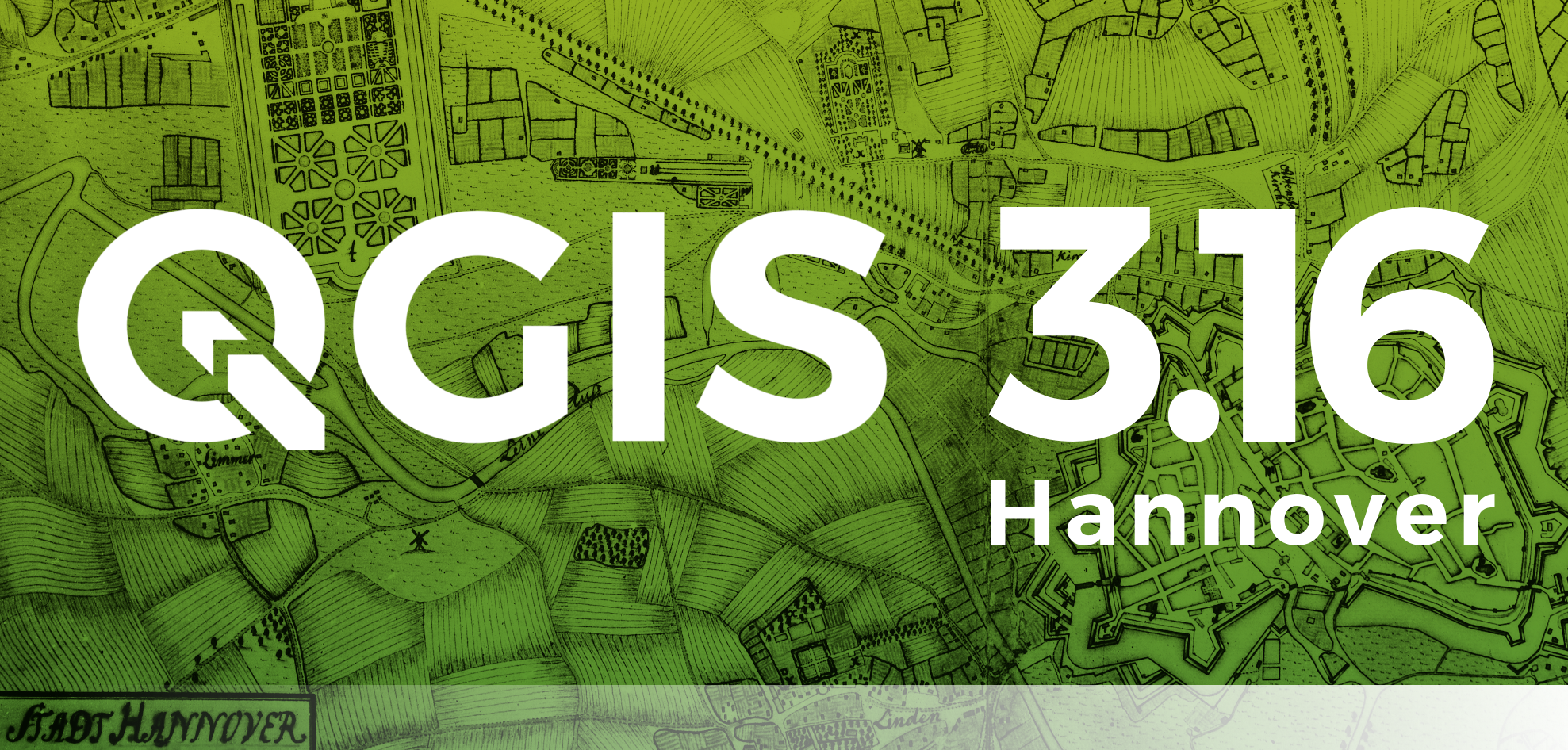
Nová verze populárního open-source GISu – QGIS 3.16 Hannover byla právě představena veřejnosti. Nová verze přináši opět řadu vylepšení, která jsou důkladně popsána na webu. Nicméně ty nejdůležitější jsou shrnuty ve videu níže.
The post QGIS 3.16 Hannover appeared first on GISportal.cz.
změna pracovní doby - KP Liberec
26.10.2020 6:44 ČÚZK /Urady/Katastralni-urady/Katastralni-urady/Katastralni-urad-pro-Liberecky-kraj/Katastralni-pracoviste/KP-Liberec/O-uradu/Aktuality/zmena-pracovni-doby-KP-Libereczměna pracovní doby - KP Liberec
26.10.2020 6:44 ČÚZK - předpisy a opatření Český úřad zeměměřický a katastrální - Katastrální pracoviště Liberec zveřejnil novou aktualitu:Na základě usnesení Vlády České republiky ze dne 21. října 2020 č. 1080 oznamujeme, že v týdnu 26.10.202 až 30.10.2020 je úředním dnem Katastrálního pracoviště Liberec pouze pondělí 26. 10. 2020 v době od 8 do 17 hodin.
V souladu s výše citovaným usnesením Vlády České republiky je upřednostňován písemný, elektronický či telefonický kontakt před kontaktem osobním. Za uvedeným účelem žádáme klienty o upřednostnění kontaktu na dálku s využitím datové schránky, e-mailu, telefonu a zejména prostřednictvím sběrného boxu (podrobnosti níže v Aktualitách pracoviště).
Kontakty katastrálního pracoviště jsou zveřejněny na úvodní stránce. Kontakty na zaměstnance pracoviště jsou na adrese:
http://www.cuzk.cz/Urady/Katastralni-urady/Katastralni-urady/Katastralni-urad-pro-Liberecky-kraj/Katastralni-pracoviste/KP-Liberec/O-uradu/Kontakty.aspxDěkujeme za pochopení
Anita Graser získala ocenění Sola Katze za přínos geo open source komunitě
25.10.2020 21:10 GeoBusinessOSGeo každoročně uděluje jednotlivcům ocenění za přínos komunitě geo otevřeného a svobodného softwaru. (GFOSS). Ocenění svými aktivitami významně přispěli k prosazování ideálů open source v geoprostorové sféře. V letošním roce cenu obdržela Anita Graser, která se již v roce 2009 zapojila do QGIS komunity na hackfestu ve Vídni. Od té doby posouvá hranice QGIS a […]
The post Anita Graser získala ocenění Sola Katze za přínos geo open source komunitě appeared first on GeoBusiness.
Anita Graser získala ocenění Sola Katze za přínos geo open source komunitě
25.10.2020 21:10 GeoBusinessOSGeo každoročně uděluje jednotlivcům ocenění za přínos komunitě geo otevřeného a svobodného softwaru. (GFOSS). Letošní ocenění Ocenění svými aktivitami významně přispěli k prosazování ideálů open source v geoprostorové sféře. V letošním roce cenu obdržela Anita Graser, která se již v roce 2009 zapojila do QGIS komunity na hackfestu ve Vídni. Od té doby posouvá hranice […]
The post Anita Graser získala ocenění Sola Katze za přínos geo open source komunitě appeared first on GeoBusiness.
Den otevřených dveří ve firmě Topgeosys. Firma představila nové technologie pro měření
25.10.2020 18:30 ZeměměřičSpolečnost Topgeosys uspořádala začátkem října dny otevřených dveří. Mezinárodní veletrh Intergeo se letos uskutečnil pouze ve virtuální podobě, proto chtěla firma Topgeosys zájemcům o geodetickou techniku nabídnout jinou možnost k seznámení se s nejmodernějšími produkty firmy Topcon. Pěkné počasí, prostředí a malé občerstvení si tak mohli dopřát všichni, kdo do firmy Topgeosys ve dnech 8. a 9. října 2020 na dny otevřených […]
The post Den otevřených dveří ve firmě Topgeosys. Firma představila nové technologie pro měření appeared first on Zeměměřič.
Video Asociace podnikatelů v geomatice propaguje všechny geodety
25.10.2020 18:02 ZeměměřičMožná jste před rokem zaznamenali promo video, které tehdy představila Asociace podnikatelů v geomatice. Je to video, které propaguje nejen APG, ale především důležitost geodézie, katastru nemovitostí, inženýrské geodézie, pozemkových úprav, GIS i BIM pro společnost. V jednotě je síla. Členem asociace se můžete stát i vy a připojit se k těm firmám, které se již ke geomatice přihlásily. V našem […]
The post Video Asociace podnikatelů v geomatice propaguje všechny geodety appeared first on Zeměměřič.
Nové verze Misys, Kokeš a Proland reagují na změny v protokolech ČÚZK
25.10.2020 16:22 ZeměměřičFirma GEPRO, producent softwarů Misys, Kokeš a Proland, publikovala novou verzi svých produktů. Software nese označení 14.75 a týká se produktů MISYS, MISYS-WEB – licenční server, KOKEŠ, Geoportál GEPRO i PROLAND. Tyto verze reagují mimo jiné na změny, které Český úřad zeměměřický a katastrální udělal v zabezpečené komunikaci se službami WSDP, WSGP a ctiOS. Konkrétně došlo k posílení bezpečnosti spojení a nově jsou […]
The post Nové verze Misys, Kokeš a Proland reagují na změny v protokolech ČÚZK appeared first on Zeměměřič.
GIS Day 2020. Co všechno je k dispozici?
25.10.2020 14:17 GeoBusinessLetošní plakáty na propagaci GIS Day jsou opravdu povedené. Firma Esri má celosvětové akci, letos konané 18. listopadu 2020, věnovanou celou stránku GISday.com. Vzhledem k situaci s virem covid-19 po celém světě ovšem i sama Esri vyzývá, že oslavu můžete uspořádat v klidnější době. Rozhodně se zkuste podívat, co všechno je pro lokální organizátory přichystáno […]
The post GIS Day 2020. Co všechno je k dispozici? appeared first on GeoBusiness.
Geografka Gretchen Peterson a její kartografický seznam
25.10.2020 8:20 GeoBusinessAmerická geografka Gretchen Peterson (@PetersonGIS) si na svém webu vede seznam odkazů se vztahem ke kartografii. Podívejte se, třeba by vás mohlo něco zaujmout. Cartography Barber, Peter. The Map Book. Walker & Company, 2005. Brewer, Cynthia A. Designing Better Maps: A Guide for GIS Users 2nd Edition. ESRI Press, 2016. Brotton, Jerry. Great Maps (Dk […]
The post Geografka Gretchen Peterson a její kartografický seznam appeared first on GeoBusiness.
Geografka Gretchen Peterson a její kartografický seznam
25.10.2020 8:20 GeoBusinessAmerická geografka Gretchen Peterson (@PetersonGIS) si na svém webu vede seznam odkazů se vztahem ke kartografii. Podívejte se, třeba by vás mohlo také něco zaujmout. Cartography Barber, Peter. The Map Book. Walker & Company, 2005. Brewer, Cynthia A. Designing Better Maps: A Guide for GIS Users 2nd Edition. ESRI Press, 2016. Brotton, Jerry. Great Maps […]
The post Geografka Gretchen Peterson a její kartografický seznam appeared first on GeoBusiness.
6 knih, s nimiž se naučíte QGIS
24.10.2020 8:42 GeoBusinessQGIS je open source software, srovnatelný s komerčním ArcGISem od Esri. Anita Graser (@underdarkGIS) a Gretchen N. Peterson (@PetersonGIS) před časem aktualizovaly svoji knihu QGIS Map Design a vydaly její druhé vydání pro verzi QGIS 3.x. Při té příležitosti přinášíme přehled dalších knih, ze kterých se můžete také učit QGIS. Anita Graser, Gretchen N. Peterson: […]
The post 6 knih, s nimiž se naučíte QGIS appeared first on GeoBusiness.
Smarter Data, Smarter World Conference Agendas Announced
23.10.2020 20:45 GISCafe.com Webcasts-Webinars Join us online 9th - 12th NovemberCambridge, UK, 15th October 2020, (www.1spatial.com) 1Spatial, a global leader in Location Master Data Management …
Aquiline Drones Signs Exclusive Manufacturing and Distribution License Agreement with World’s Top Drone and Sensor Company, Drone Volt
23.10.2020 20:37 GISCafe.com Webcasts-Webinars Solidifies Company Goal of Creating “Made in the USA” Drone Products-(HARTFORD, CONN) – October 16, 2020 …
Cherre's Real Estate Data and Analytics Platform Wins Real Estate Tech Award for Data
23.10.2020 18:10 GISCafe.com Webcasts-Webinars This marks the third year in a row that Cherre has been a category winner in the most prestigious awards in commercial real estate techNEW YORK, …
Esri Ireland partners with Bluesky to enhance its digital mapping offering in Ireland
23.10.2020 16:32 GISCafe.com Webcasts-Webinars Esri Ireland, the market leader in Geographic Information Systems (GIS), is partnering with aerial mapping company Bluesky International to provide …Woolpert, Smartronix Tracking COVID-19 Relief Funding for the Council of the Inspectors General on Integrity and Efficiency
23.10.2020 16:13 GISCafe.com Webcasts-Webinars A team of geospatial experts are building datasets and a mapping application to provide information management and transparency in support of the …Příjem podání do sběrného boxu v Plzni
23.10.2020 15:34 ČÚZK - předpisy a opatření Katastrální úřad pro Plzeňský kraj - Katastrální pracoviště Plzeň-sever zveřejnil novou aktualitu: Katastrální úřad pro Plzeňský kraj zřizuje možnost podání do SBĚRNÉHO BOXU.Příjem podání do sběrného boxu v Plzni
23.10.2020 15:34 ČÚZK /Urady/Katastralni-urady/Katastralni-urady/Katastralni-urad-pro-Plzensky-kraj/Katastralni-pracoviste/KP-Plzen-sever/O-uradu/Aktuality/Prijem-podani-do-sberneho-boxu-v-PlzniPříjem podání do sběrného boxu v Plzni
23.10.2020 15:34 ČÚZK - předpisy a opatření Katastrální úřad pro Plzeňský kraj - Katastrální pracoviště Plzeň-sever zveřejnil novou aktualitu: Katastrální úřad pro Plzeňský kraj v návaznosti na přijetí usnesení vlády č. 1080 o přijetí krizového opatření zřizuje SBĚRNÝ BOXOd 26. října 2020 do odvolání je možno učinit podání v listinné podobě i bezkontaktně do sběrného boxu, umístěného v budově Katastrálního úřadu pro Plzeňský kraj v Plzni. Vaše podání a žádosti v listinné podobě vhazujte do sběrného boxu v zalepené obálce.
Na obálku uveďte Vaše kontaktní údaje: jméno, příjmení, adresu, e-mail a telefonní číslo. Následně Vám zašleme na uvedený e-mail informaci o přijetí podání. U podání, která vyžadují uhrazení správního poplatku, bude na Vámi uvedený e-mail zaslán předpis k úhradě, který budete moci realizovat bezhotovostně převodem na účet.
Sběrný box je přístupný ve vchodu do katastrálního úřadu v době:
pondělí 6:00 – 17:00
úterý 6:00 – 14:00
středa 6:00 – 17:00
čtvrtek 6:00 – 14:00
pátek 6:00 – 12:00
Sběrný box je vybírán v pracovních dnech několikrát denně. Za okamžik podání návrhu na vklad se považuje okamžik výběru sběrného boxu.
Příjem podání do sběrného boxu v Plzni
23.10.2020 15:33 ČÚZK - předpisy a opatření Katastrální úřad pro Plzeňský kraj - Katastrální pracoviště Plzeň-město zveřejnil novou aktualitu: Katastrální úřad pro Plzeňský kraj v návaznosti na přijetí usnesení vlády č. 1080 o přijetí krizového opatření zřizuje SBĚRNÝ BOXOd 26. října 2020 do odvolání je možno učinit podání v listinné podobě i bezkontaktně do sběrného boxu, umístěného v budově Katastrálního úřadu pro Plzeňský kraj v Plzni. Vaše podání a žádosti v listinné podobě vhazujte do sběrného boxu v zalepené obálce.
Na obálku uveďte Vaše kontaktní údaje: jméno, příjmení, adresu, e-mail a telefonní číslo. Následně Vám zašleme na uvedený e-mail informaci o přijetí podání. U podání, která vyžadují uhrazení správního poplatku, bude na Vámi uvedený e-mail zaslán předpis k úhradě, který budete moci realizovat bezhotovostně převodem na účet.
Sběrný box je přístupný ve vchodu do katastrálního úřadu v době:
pondělí 6:00 – 17:00
úterý 6:00 – 14:00
středa 6:00 – 17:00
čtvrtek 6:00 – 14:00
pátek 6:00 – 12:00
Sběrný box je vybírán v pracovních dnech několikrát denně. Za okamžik podání návrhu na vklad se považuje okamžik výběru sběrného boxu.
Příjem podání do sběrného boxu v Plzni
23.10.2020 15:33 ČÚZK /Urady/Katastralni-urady/Katastralni-urady/Katastralni-urad-pro-Plzensky-kraj/Katastralni-pracoviste/KP-Plzen-mesto/O-uradu/Aktuality/Prijem-podani-do-sberneho-boxu-v-PlzniPříjem podání do sběrného boxu v Plzni
23.10.2020 15:33 ČÚZK - předpisy a opatření Katastrální úřad pro Plzeňský kraj - Katastrální pracoviště Plzeň-město zveřejnil novou aktualitu: Katastrální úřad pro Plzeňský kraj zřizuje možnost podání do SBĚRNÉHO BOXU.Příjem podání do sběrného boxu v Plzni
23.10.2020 15:32 ČÚZK - předpisy a opatření Katastrální úřad pro Plzeňský kraj - Katastrální pracoviště Plzeň-jih zveřejnil novou aktualitu: Katastrální úřad pro Plzeňský kraj v návaznosti na přijetí usnesení vlády č. 1080 o přijetí krizového opatření zřizuje SBĚRNÝ BOX.Příjem podání do sběrného boxu v Plzni
23.10.2020 15:32 ČÚZK /Urady/Katastralni-urady/Katastralni-urady/Katastralni-urad-pro-Plzensky-kraj/Katastralni-pracoviste/KP-Plzen-jih/O-uradu/Aktuality/Prijem-podani-do-sberneho-boxu-v-PlzniPříjem podání do sběrného boxu v Plzni
23.10.2020 15:32 ČÚZK - předpisy a opatření Katastrální úřad pro Plzeňský kraj - Katastrální pracoviště Plzeň-jih zveřejnil novou aktualitu: Katastrální úřad pro Plzeňský kraj v návaznosti na přijetí usnesení vlády č. 1080 o přijetí krizového opatření zřizuje SBĚRNÝ BOXOd 26. října 2020 do odvolání je možno učinit podání v listinné podobě i bezkontaktně do sběrného boxu, umístěného v budově Katastrálního úřadu pro Plzeňský kraj v Plzni. Vaše podání a žádosti v listinné podobě vhazujte do sběrného boxu v zalepené obálce.
Na obálku uveďte Vaše kontaktní údaje: jméno, příjmení, adresu, e-mail a telefonní číslo. Následně Vám zašleme na uvedený e-mail informaci o přijetí podání. U podání, která vyžadují uhrazení správního poplatku, bude na Vámi uvedený e-mail zaslán předpis k úhradě, který budete moci realizovat bezhotovostně převodem na účet.
Sběrný box je přístupný ve vchodu do katastrálního úřadu v době:
pondělí 6:00 – 17:00
úterý 6:00 – 14:00
středa 6:00 – 17:00
čtvrtek 6:00 – 14:00
pátek 6:00 – 12:00
Sběrný box je vybírán v pracovních dnech několikrát denně. Za okamžik podání návrhu na vklad se považuje okamžik výběru sběrného boxu.
Příjem podání do sběrného boxu v Plzni
23.10.2020 15:32 ČÚZK - předpisy a opatření Katastrální úřad pro Plzeňský kraj - Katastrální pracoviště Plzeň-jih zveřejnil novou aktualitu: Katastrální úřad pro Plzeňský kraj zřizuje možnost podání do SBĚRNÉHO BOXU.Příjem podání do sběrného boxu v Plzni
23.10.2020 15:30 ČÚZK - předpisy a opatření Katastrální úřad pro Plzeňský kraj zveřejnil novou aktualitu: Katastrální úřad pro Plzeňský kraj zřizuje možnost podání do SBĚRNÉHO BOXU v budově KÚ v Plzni, Radobyčická 12.Příjem podání do sběrného boxu v Plzni
23.10.2020 15:30 ČÚZK - předpisy a opatření Katastrální úřad pro Plzeňský kraj zveřejnil novou aktualitu: Katastrální úřad pro Plzeňský kraj v návaznosti na přijetí usnesení vlády č. 1080 o přijetí krizového opatření zřizuje SBĚRNÝ BOXOd 26. října 2020 do odvolání je možno učinit podání v listinné podobě i bezkontaktně do sběrného boxu, umístěného v budově Katastrálního úřadu pro Plzeňský kraj v Plzni. Vaše podání a žádosti v listinné podobě vhazujte do sběrného boxu v zalepené obálce.
Na obálku uveďte Vaše kontaktní údaje: jméno, příjmení, adresu, e-mail a telefonní číslo. Následně Vám zašleme na uvedený e-mail informaci o přijetí podání. U podání, která vyžadují uhrazení správního poplatku, bude na Vámi uvedený e-mail zaslán předpis k úhradě, který budete moci realizovat bezhotovostně převodem na účet.
Sběrný box je přístupný ve vchodu do katastrálního úřadu v době:
pondělí 6:00 – 17:00
úterý 6:00 – 14:00
středa 6:00 – 17:00
čtvrtek 6:00 – 14:00
pátek 6:00 – 12:00
Sběrný box je vybírán v pracovních dnech několikrát denně. Za okamžik podání návrhu na vklad se považuje okamžik výběru sběrného boxu.
Příjem podání do sběrného boxu v Plzni
23.10.2020 15:30 ČÚZK - předpisy a opatření Katastrální úřad pro Plzeňský kraj zveřejnil novou aktualitu: Katastrální úřad pro Plzeňský kraj zřizuje možnost podání do SBĚRNÉHO BOXU.Příjem podání do sběrného boxu v Plzni
23.10.2020 15:30 ČÚZK /Urady/Katastralni-urady/Katastralni-urady/Katastralni-urad-pro-Plzensky-kraj/O-uradu/Aktuality/Prijem-podani-do-sberneho-boxu-v-PlzniPříjem podání do sběrného boxu v Plzni
23.10.2020 15:30 ČÚZK - předpisy a opatření Katastrální úřad pro Plzeňský kraj zveřejnil novou aktualitu: Katastrální úřad pro Plzeňský kraj v návaznosti na přijetí usnesení vlády č. 1080 o přijetí krizového opatření zřizuje SBĚRNÝ BOX.Aktualizace údajů
23.10.2020 14:30 Ústecký kraj V Geoportálu ÚAP Ústeckého kraje byla vytvořena mapová aplikace odběrných míst na COVID-19 v Ústeckém kraji .Omezení provozu
23.10.2020 13:26 ČÚZK - předpisy a opatření Katastrální úřad pro Liberecký kraj - Katastrální pracoviště Jablonec nad Nisou zveřejnil novou aktualitu:Na základě usnesení Vlády České republiky ze dne 21. října 2020 č. 1080 oznamujeme, že v týdnu 26.10.202 až 30.10.2020 je úředním dnem Katastrálního pracoviště Frýdlant pouze pondělí 26. 10. 2020 v době od 8 do 17 hodin.
V souladu s výše citovaným usnesením Vlády České republiky je upřednostňován písemný, elektronický či telefonický kontakt před kontaktem osobním. Za uvedeným účelem žádáme klienty o upřednostnění kontaktu na dálku s využitím datové schránky, e-mailu, telefonu a zejména prostřednictvím sběrného boxu (podrobnosti níže v Aktualitách pracoviště).
Kontakty katastrálního pracoviště jsou zveřejněny na úvodní stránce. Kontakty na zaměstnance pracoviště jsou na adrese:
Děkujeme za pochopení