


![]()

zprávy
zdroje zpráv:Platební karty
10.7.2019 20:03 ČÚZK /Urady/Katastralni-urady/Katastralni-urady/Katastralni-urad-pro-Zlinsky-kraj/O-uradu/Aktuality/Platebni-kartyOdborný referent / vrchní referent v oddělení obnovy a revize KN
10.7.2019 19:05 ČÚZK /Urady/Katastralni-urady/Katastralni-urady/Katastralni-urad-pro-Jihomoravsky-kraj/Uredni-deska/Oznameni-a-jina-uredni-sdeleni/Volna-mista/odborny-referent-vrchni-referent-v-oddeleni-obnoOdborný referent / vrchní referent v oddělení obnovy a revize KN
10.7.2019 19:05 ČÚZK - volná místa Katastrální úřad pro Jihomoravský kraj - Katastrální pracoviště Brno-venkov vypisuje výběrové řízení na místo Odborný referent / vrchní referent v oddělení obnovy a revize KNOdborný referent / vrchní referent v oddělení obnovy a revize KN na Katastrálním pracovišti Brno-ven
10.7.2019 19:05 ČÚZK /Urady/Katastralni-urady/Katastralni-urady/Katastralni-urad-pro-Jihomoravsky-kraj/Uredni-deska/Oznameni-a-jina-uredni-sdeleni/Volna-mista/odborny-referent-vrchni-referent-v-oddeleni-obnoOdborný referent / vrchní referent v oddělení obnovy a revize KN
10.7.2019 19:05 ČÚZK - předpisy a opatření Katastrální úřad pro Jihomoravský kraj - Katastrální pracoviště Brno-venkovvypisuje výběrové řízení na místo
Odborný referent / vrchní referent v oddělení obnovy a revize KN
Odborný referent / vrchní referent v oddělení obnovy a revize KN na Katastrálním pracovišti Brno-ven
10.7.2019 19:05 ČÚZK - předpisy a opatření Katastrální úřad pro Jihomoravský kraj - Katastrální pracoviště Brno-venkovvypisuje výběrové řízení na místo
Odborný referent / vrchní referent v oddělení obnovy a revize KN na Katastrálním pracovišti Brno-venkov
Odborný referent / vrchní referent v oddělení obnovy a revize KN na Katastrálním pracovišti Brno-ven
10.7.2019 19:05 ČÚZK - volná místa Katastrální úřad pro Jihomoravský kraj - Katastrální pracoviště Brno-venkov vypisuje výběrové řízení na místo Odborný referent / vrchní referent v oddělení obnovy a revize KN na Katastrálním pracovišti Brno-venVelodyne Highlights Advanced Lidar at Automated Vehicles Symposium
10.7.2019 17:28 GISCafe.com Webcasts-Webinars Velodyne Lidar Critical Sensors for Vehicle Autonomy and Advanced Driver Assistance Systems (ADAS)SAN JOSE, Calif. — (BUSINESS WIRE) — …
Esri Releases Book Detailing Geodatabase Creation and Management
10.7.2019 17:28 GISCafe.com Webcasts-Webinars ArcGIS Pro Users Will Learn to Be More Cost-Efficient with Data WorkflowsREDLANDS, Calif. — (BUSINESS WIRE) — July 10, 2019 …
Valassis’ Marketing Technology Platform Earns Tech Award
10.7.2019 17:28 GISCafe.com Webcasts-Webinars Esri Presents Special Achievement in GIS AwardLIVONIA, Mich. — (BUSINESS WIRE) — July 10, 2019 —
Valassis, the leader in …
MDI Selects Trimble SmartDelivery to Enhance Final Mile Distribution
10.7.2019 17:28 GISCafe.com Webcasts-Webinars Implementation of New Technology to Extend MDI's Use of Trimble ProductsSUNNYVALE, Calif., July 10, 2019 — (PRNewswire) — Trimble …
Spatial Networks, Vricon, and Cesium Announce Technology Partnership to Deliver Powerful, Accessible Geospatial Solutions
10.7.2019 17:28 GISCafe.com Webcasts-Webinars The three-way partnership will enable users to visualize massive amounts of high-fidelity data in context, providing unique and actionable …Inpixon to Acquire Indoor Mapping Leader Jibestream
10.7.2019 17:28 GISCafe.com Webcasts-Webinars PALO ALTO, Calif., July 10, 2019 (GLOBE NEWSWIRE) -- Inpixon (Nasdaq: INPX) (the “Company” or “Inpixon”), a leading indoor positioning and …Vexcel Imaging Releases Subscription Image Service Solutions to Government Agencies
10.7.2019 17:28 GISCafe.com Webcasts-Webinars Vexcel's geospatial information-as-a-service supports the new model for government where ultra-high-resolution data is readily accessible in the …Oznámení o vyhlášení výběrového řízení na obsazení služebního místa
10.7.2019 14:19 ČÚZK - předpisy a opatření Zeměměřický a katastrální inspektorát v Liberci zveřejnil novou aktualitu: Oznámení o vyhlášení výběrového řízení na služební místo inspektor - právník Zeměměřického a katastrálního inspektorátu v Liberci Oznámení o vyhlášení výběrového řízení na obsazení služebního místa inspektor - právník Zeměměřického a katastrálního inspektorátu v LiberciOznámení o vyhlášení výběrového řízení na obsazení služebního místa
10.7.2019 14:19 ČÚZK /Urady/Zememericke-a-katastralni-inspektoraty/Zememericke-a-katastralni-inspektoraty/Zememericky-a-katastralni-inspektorat-v-Liberci/O-uradu/Aktuality/Oznameni-o-vyhlaseni-vyberoveho-rizeni-na-obsazeniinspektor – právník Zeměměřického a katastrálního inspektorátu v Liberci
10.7.2019 13:55 ČÚZK - předpisy a opatření Zeměměřický a katastrální inspektorát v Libercivypisuje výběrové řízení na místo inspektor – právník Zeměměřického a katastrálního inspektorátu v Liberci
inspektor – právník Zeměměřického a katastrálního inspektorátu v Liberci
Orbit Logic Awarded Phase II Navy Autonomy Contract
10.7.2019 11:26 GISCafe.com Webcasts-Webinars GREENBELT, MD (July 9th, 2019) – Orbit Logic has been awarded a Phase II Small Business Technology Transfer (STTR) contract sponsored by the …Geospatial Intelligence Center and Esri Team Up to Introduce New Tool that Enhances Remote Property Assessments for Insurers
10.7.2019 11:00 GISCafe.com Webcasts-Webinars Virtual Inspection Studio provides access to high-resolution aerial imagery and precise measuring tools to improve underwriting assessments and …Závěrečné přípravy k vypuštění družice ESAIL
10.7.2019 9:42 Český Kosmický PortálMikrodružice ESAIL, která byla vyvinutá v rámci programu ESA zaměřeného na sledování námořního provozu, prochází finálními zkouškami před startem.
Videa z konference Esri na YouTube
10.7.2019 9:15 ARCDATAV San Diegu je konference v plném proudu a Esri již zveřejnila první videa z letošních přednášek. Všechna dostupná videa nyní najdete na stránkách Esri Video E360 a YouTube kanálu Esri Events.

Pozvánka na „Měření, vizualizace a zpracování dat v BIM pro projektování a řízení staveb 2019“
10.7.2019 7:43 Asociace podnikatelů v geomatice Dovolujeme si vás pozvat na národní konferenci zaměřenou na „Měření, vizualizaci a zpracování dat v BIM pro projektování a řízení staveb“, která se uskuteční 25. – 26. 9. 2019 na ČVUT v Praze. Konference se bude věnovat především digitalizaci stavebního řízení, novelizaci souvisejících zákonů a v neposlední řadě i DTM. Veškeré informace o připravované konferenci naleznete zde.APGEO - POZVÁNKA NA „MĚŘENÍ, VIZUALIZACE A ZPRACOVÁNÍ DAT V BIM PRO PROJEKTOVÁNÍ A ŘÍZENÍ STAVEB 2019“
10.7.2019 2:00 Asociace podnikatelů v geomatice Dovolujeme si vás pozvat na národní konferenci zaměřenou na „Měření, vizualizaci a zpracování dat v BIM pro ...Uzavření Pobočky Kroměříž
10.7.2019 0:00 Státní pozemkový úřad Z provozně-technických důvodů bude i dne 11. července uzavřena Pobočka Kroměříž. Děkujeme za pochopení.Uzavření Pobočky Kroměříž
10.7.2019 0:00 Státní pozemkový úřad Z provozně-technických důvodů bude i dne 11. července uzavřena Pobočka Kroměříž. Děkujeme za pochopení.SAP and Esri Deliver First-Ever Database as a Service to ArcGIS Customers
9.7.2019 15:28 GISCafe.com Webcasts-Webinars SAN DIEGO, California, July 9, 2019 — (PRNewswire) — SAP SE (NYSE: SAP) today announced that Esri, the global leader in location …Cesium launches with $5 million investment to make real world 3D data more usable
9.7.2019 15:28 GISCafe.com Webcasts-Webinars AGI spins off Cesium as an independent company to fuel the growth of its 3D geospatial platformPHILADELPHIA, July 9, 2019 — (PRNewswire) …
DroneDeploy Launches Single Enterprise Solution for All Drone Operations
9.7.2019 15:27 GISCafe.com Webcasts-Webinars New release delivers one platform to manage drone operations, capture all media types, and analyze dataSAN FRANCISCO, July 9, 2019 — …
New Usage-Based Service Plans for Trimble Catalyst Enable Geospatial Organizations to Access Precise Positioning On Demand
9.7.2019 15:27 GISCafe.com Webcasts-Webinars Scalable and Flexible Access to Professional GNSS Positioning-as-a-ServiceSUNNYVALE, Calif., July 9, 2019 — (PRNewswire) — …
S-100 Data Model brings new versatility to chart production in CARIS HPD 4.0
9.7.2019 15:27 GISCafe.com Webcasts-Webinars Fredericton, NB, Canada — July 9, 2019 â”� Teledyne CARIS, a Teledyne Technologies company [NYSE: TDY], is pleased to announce …CoreLogic Reports Lowest Overall Delinquency Rate in More Than 20 Years this April
9.7.2019 15:27 GISCafe.com Webcasts-Webinars U.S. serious delinquency rate this April was the lowest for any month in nearly 14 yearsNo state posted an annual gain in its overall or serious …
Esri Recognizes Student Mapping Projects From Across the Nation at 2019 User Conference
9.7.2019 15:27 GISCafe.com Webcasts-Webinars Winners Honored in Esri's Third Annual Online Competition for US High School and Middle School StudentsREDLANDS, Calif. — (BUSINESS WIRE) …
Defense Innovation Unit Fast Tracking Acquisition of Citadel Defense's Automated Counter Drone Solution to Save Lives
9.7.2019 15:27 GISCafe.com Webcasts-Webinars Citadel technology is deployed and trusted by US Special Forces, Army, Navy, Air Force, and Border PatrolSAN DIEGO, July 9, 2019 — …
Esri to Use Mobileye Data for Dynamic Edge Mapping
9.7.2019 15:27 GISCafe.com Webcasts-Webinars Esri Collaborates with Mobileye to Bring HD Map Data Beyond Automotive MarketREDLANDS, Calif. — (BUSINESS WIRE) — July 9, 2019 …
3. odborný referent/vrchní referent – obnova a revize katastrálního operátu
9.7.2019 15:17 ČÚZK - předpisy a opatření Katastrální úřad pro hlavní město Prahu - Katastrální pracoviště Praha zveřejnil novou aktualitu: Ředitel úřadu vyhlašuje výběrové řízení na služební místo:odborný referent/vrchní referent – obnova a revize katastrálního operátu
odborný referent/vrchní referent – obnova a revize katastrálního operátu
9.7.2019 15:17 ČÚZK /Urady/Katastralni-urady/Katastralni-urady/Katastralni-urad-pro-hlavni-mesto-Prahu/O-uradu/Aktuality/odborny-referent-vrchni-referent-–-obnova-a-revize3. odborný referent/vrchní referent – obnova a revize katastrálního operátu
9.7.2019 15:17 ČÚZK /Urady/Katastralni-urady/Katastralni-urady/Katastralni-urad-pro-hlavni-mesto-Prahu/O-uradu/Aktuality/odborny-referent-vrchni-referent-–-obnova-a-revizeodborný referent/vrchní referent – obnova a revize katastrálního operátu
9.7.2019 15:17 ČÚZK - předpisy a opatření Katastrální úřad pro hlavní město Prahu - Katastrální pracoviště Praha zveřejnil novou aktualitu: Ředitel úřadu vyhlašuje výběrové řízení na služební místo:odborný referent/vrchní referent – obnova a revize katastrálního operátu
Orolia selected for Galileo resilient time server initiative
9.7.2019 12:14 European GNSS Agency
The European GNSS Agency (GSA) has awarded a grant of up to €1.7 million to resilient positioning, navigation and timing (PNT) solution provider Orolia to develop a resilient time and frequency server to protect critical GNSS-reliant systems. The Galileo Authenticated Robust Timing System (GEARS) project will provide accurate and highly robust Galileo-based time and frequency data for critical infrastructure. The project should deliver its robust Galileo timing solution by 2021.
Critical infrastructure such as telecommunications, broadcast, data centres, transportation, energy generation and distribution, and finance all rely on GNSS signals. However, detailed studies have documented the vulnerability of this infrastructure to threats from signal jamming or spoofing. This is where the GEARS project comes in.
Accurate and robust time
The GEARS programme will fund the development of a timing system to validate GNSS signals and protect the Galileo system from GNSS threats, providing accurate and robust time in GNSS challenged environments. It will also provide a backup signal and timing reference if Galileo is unavailable.
Read this: Demetra delivers dividends for ELPROMA
The time server will leverage the new Galileo navigation data authentication signal to make it resilient to spoofing. It will also utilise Orolia’s portfolio of interference detection and mitigation capabilities to increase resistance to jamming. Finally, the initiative will develop a new standard for GNSS timing system protection by defining minimum testing criteria to qualify robustness against threats.
“Once adopted, this new standard will help ensure that Galileo’s GNSS timing and synchronisation services are resilient to intentional and unintentional interference, or denial of service, for all critical infrastructure operations,” said Thierry Delhomme, EMEA General Manager at Orolia. “Orolia is honoured to support Resilient PNT initiatives for GSA and Galileo,” he said.
Key role for Galileo
“We have only scratched the surface of the potential of Galileo for Timing and Synchronisation solutions,” said GSA Executive Director Carlo des Dorides. “Galileo has a key role to play in the management of critical infrastructure, and by developing a Galileo-based timing receiver for this infrastructure we are enabling a wealth of solutions to secure the provision of critical applications to all citizens in important markets, such as telecommunication, energy and finance, once again responding to user needs with space technologies,” he said, adding: “I look forward to the first prototype.”
And this: Time as a service with Galileo
The two-year grant agreement with the GSA will be coordinated by Orolia, collaborating with four European partners: FDC (France), NLR (Netherlands Aerospace Centre, Netherlands), NLS - FGI (National Land Survey of Finland – Finnish Geospatial Research Institute, Finland) and NavCert (Germany). The prototype to be developed and validated will embed all relevant new technologies and innovations to ensure maximum security and robustness for Galileo’s timing receivers by 2021.
Media note: This feature can be republished without charge provided the European GNSS Agency (GSA) is acknowledged as the source at the top or the bottom of the story. You must request permission before you use any of the photographs on the site. If you republish, we would be grateful if you could link back to the GSA website (http://www.gsa.europa.eu).
Orolia selected for Galileo resilient time receiver initiative
9.7.2019 12:14 European GNSS AgencyThe European GNSS Agency (GSA) has awarded a grant of up to €1.7 million to resilient positioning, navigation and timing (PNT) solution provider Orolia to develop a resilient time and frequency server to protect critical GNSS-reliant systems. The Galileo Authenticated Robust Timing System (GEARS) project will provide accurate and highly robust Galileo-based time and frequency data for critical infrastructure. The project should deliver its robust Galileo timing solution by 2021.
Critical infrastructure such as telecommunications, broadcast, data centres, transportation, energy generation and distribution, and finance all rely on GNSS signals. However, detailed studies have documented the vulnerability of this infrastructure to threats from signal jamming or spoofing. This is where the GEARS project comes in.
Accurate and robust time
The GEARS solution will leverage the new Galileo navigation data authentication signal and utilise Orolia’s portfolio of interference detection and mitigation capabilities to increase resistance to jamming. Finally, it will develop a new approach for GNSS timing system protection by defining minimum testing criteria to qualify robustness against threats.
“Once adopted, this will help ensure that Galileo’s GNSS timing and synchronisation services are resilient to intentional and unintentional interference, or denial of service, for all critical infrastructure operations,” said Thierry Delhomme, EMEA General Manager at Orolia. “Orolia is honoured to support Resilient PNT initiatives for GSA and Galileo,” he said.
Key role for Galileo
“We have only scratched the surface of the potential of Galileo for Timing and Synchronisation solutions,” said GSA Executive Director Carlo des Dorides. “Galileo has a key role to play in the management of critical infrastructure, and by developing a Galileo-based timing receiver for this infrastructure we are enabling a wealth of solutions to secure the provision of critical applications to all citizens in important markets, such as telecommunication, energy and finance, once again responding to user needs with space technologies,” he said, adding: “I look forward to the first prototype.”
And this: Time as a service with Galileo
The two-year grant agreement with the GSA will be coordinated by Orolia, collaborating with four European partners: FDC (France), NLR (Netherlands Aerospace Centre, Netherlands), NLS - FGI (National Land Survey of Finland – Finnish Geospatial Research Institute, Finland) and NavCert (Germany). The prototype to be developed and validated will embed all relevant new technologies and innovations to ensure maximum robustness for Galileo’s timing receivers by 2021.
Media note: This feature can be republished without charge provided the European GNSS Agency (GSA) is acknowledged as the source at the top or the bottom of the story. You must request permission before you use any of the photographs on the site. If you republish, we would be grateful if you could link back to the GSA website (http://www.gsa.europa.eu).
Orolia selected for Galileo resilient time receiver initiative
9.7.2019 12:14 European GNSS AgencyThe European GNSS Agency (GSA) has awarded a grant of up to €1.7 million to resilient positioning, navigation and timing (PNT) solution provider Orolia to develop a resilient time and frequency receiver to protect critical GNSS-reliant systems. The Galileo Authenticated Robust Timing System (GEARS) project will provide accurate and highly robust Galileo-based time and frequency data for critical infrastructure. The project should deliver its robust Galileo timing solution by 2021.
Critical infrastructure such as telecommunications, broadcast, data centres, transportation, energy generation and distribution, and finance all rely on GNSS signals. However, detailed studies have documented the vulnerability of this infrastructure to threats from signal jamming or spoofing. This is where the GEARS project comes in.
Accurate and robust time
The GEARS solution will leverage the new Galileo navigation data authentication signal and utilise Orolia’s portfolio of interference detection and mitigation capabilities to increase resistance to jamming. Finally, it will develop a new approach for GNSS timing system protection by defining minimum testing criteria to qualify robustness against threats.
“Once adopted, this will help ensure that Galileo’s GNSS timing and synchronisation services are resilient to intentional and unintentional interference, or denial of service, for all critical infrastructure operations,” said Thierry Delhomme, EMEA General Manager at Orolia. “Orolia is honoured to support Resilient PNT initiatives for GSA and Galileo,” he said.
Key role for Galileo
“We have only scratched the surface of the potential of Galileo for Timing and Synchronisation solutions,” said GSA Executive Director Carlo des Dorides. “Galileo has a key role to play in the management of critical infrastructure, and by developing a Galileo-based timing receiver for this infrastructure we are enabling a wealth of solutions to secure the provision of critical applications to all citizens in important markets, such as telecommunication, energy and finance, once again responding to user needs with space technologies,” he said, adding: “I look forward to the first prototype.”
And this: Time as a service with Galileo
The two-year grant agreement with the GSA will be coordinated by Orolia, collaborating with four European partners: FDC (France), NLR (Netherlands Aerospace Centre, Netherlands), NLS - FGI (National Land Survey of Finland – Finnish Geospatial Research Institute, Finland) and NavCert (Germany). The prototype to be developed and validated will embed all relevant new technologies and innovations to ensure maximum robustness for Galileo’s timing receivers by 2021.
Media note: This feature can be republished without charge provided the European GNSS Agency (GSA) is acknowledged as the source at the top or the bottom of the story. You must request permission before you use any of the photographs on the site. If you republish, we would be grateful if you could link back to the GSA website (http://www.gsa.europa.eu).
Airbus to develop CO3D Earth Observation programme for CNES
9.7.2019 10:52 GISCafe.com Webcasts-Webinars Paris, France, 08 July 2019 – The French Space Agency (CNES) has awarded the CO3D (Constellation Optique 3D) contract to Airbus. Under this …Technický výpadek mapových služeb a webových aplikací
9.7.2019 10:29 Geoportál PrahaUpozorňujeme uživatelé serveru mpp.praha.eu/arcgis na technický výpadek mapových služeb. Výpadek komplikuje hladké užívání webových aplikací.
Portál „Space19+“ – seznamte se s vizí ESA v oblasti budoucnosti evropských kosmických aktivit
9.7.2019 9:45 Český Kosmický PortálV listopadu 2019 se uskuteční ministerská Rada Evropské kosmické agentury (ESA), na které bude mít ČR možnost vstoupit do nově připravovaných kosmických programů!
Rada ESA na ministerské úrovni představují vrcholný orgán agentury ESA, který je tvořen zástupci jejich jednotlivých členských států. Rada se schází zpravidla jednou za 2 až 3 roky a rozhoduje o budoucím směřování aktivit ESA a o finančních závazcích jednotlivých členských států v širokém portfoliu kosmických programů. Nadcházející Rada s přídomkem „Space19+“ se uskuteční v listopadu 2019 ve španělské Seville a představuje revoluci v evropském pojetí kosmických aktivit!
Portál „Space+19“ – seznamte se s vizí ESA v oblasti budoucnosti evropských kosmických aktivit
9.7.2019 9:45 Český Kosmický PortálV listopadu 2019 se uskuteční ministerská Rada Evropské kosmické agentury (ESA), na které bude mít ČR možnost vstoupit do nově připravovaných kosmických programů!
Rada ESA na ministerské úrovni představují vrcholný orgán agentury ESA, který je tvořen zástupci jejich jednotlivých členských států. Rada se schází zpravidla jednou za 2 až 3 roky a rozhoduje o budoucím směřování aktivit ESA a o finančních závazcích jednotlivých členských států v širokém portfoliu kosmických programů. Nadcházející Rada s přídomkem „Space19+“ se uskuteční v listopadu 2019 ve španělské Seville a představuje revoluci v evropském pojetí kosmických aktivit!
Vypuštěny průkopnické družice
9.7.2019 8:47 Český Kosmický PortálV rámci nejnovější mise partnerských projektů (Partnership Projects) ESA byly vypuštěny na palubě rakety Sojuz z ruského kosmodromu Vostočnyj dvě nanodružice vybavené superpočítačem.
Konferencia OSSConf 2019 (report)
9.7.2019 8:30 GISportal.czV dňoch 2.7. – 4.7.2019 sa na Fakulte riadenia a informatiky Žilinskej univerzity uskutočnil 11. ročník konferencie OSSConf. Konferencia je primárne venovaná otvorenému softvéru vo vzdelávaní, výskume a IT riešeniach. Aktuálny 11. ročník zastrešoval osem tematických blokov: 3D tlač, Open Data, Open GIS, Open Hardware, OSS vo vzdelávaní, TeX a jeho priatelia, Vývoj OSS. Nás samozrejme […]
The post Konferencia OSSConf 2019 (report) appeared first on GISportal.cz.
Úhrada poplatků platební kartou
9.7.2019 7:00 ČÚZK /Urady/Katastralni-urady/Katastralni-urady/Katastralni-urad-pro-Ustecky-kraj/Katastralni-pracoviste/KP-Litomerice/O-uradu/Aktuality/Uhrada-poplatku-platebni-kartouÚhrada poplatků platební kartou
9.7.2019 7:00 ČÚZK - předpisy a opatření Katastrální úřad pro Ústecký kraj - Katastrální pracoviště Litoměřicezveřejnil novou aktualitu: Vážení klienti, oznamujeme Vám, že od 1.7.2019 je možné hradit poplatky platební kartou.
Základní báze geografických dat České republiky (ZABAGED®) - polohopis
9.7.2019 2:00 Cenia - Katalog metadat ČR - INSPIRE Základní báze geografických dat České republiky (ZABAGED®) je digitální geografický model území České republiky (ČR). Polohopisnou část ZABAGED® tvoří v současné době 125 typů geografických objektů sídel, komunikací, rozvodných sítí a produktovodů, vodstva, územních jednotek a chráněných území, vegetace a povrchu, terénního reliéfu a vybrané údaje o geodetických bodech. Objekty jsou reprezentovány dvourozměrnou vektorovou prostorovou složkou a popisnou složkou, obsahující kvalitativní a kvantitativní informace o objektech.Omezení provozu Pobočky Šumperk
9.7.2019 0:00 Státní pozemkový úřad Z důvodu rekonstrukce Pobočky Šumperk bude ve dnech 10. – 16. 7. 2019 omezen provoz této pobočky. Nezbytná činnost úřadu a podatelny bude zajištěna. Děkujeme za pochopení.Omezení provozu Pobočky Šumperk
9.7.2019 0:00 Státní pozemkový úřad Z důvodu rekonstrukce Pobočky Šumperk bude ve dnech 10. – 16. 7. 2019 omezen provoz této pobočky. Nezbytná činnost úřadu a podatelny bude zajištěna. Děkujeme za pochopení.Omezení provozu Pobočky Šumperk
9.7.2019 0:00 Státní pozemkový úřad Z důvodu rekonstrukce Pobočky Šumperk bude ve dnech 10. – 16. 7. 2019 omezen provoz této pobočky. Nezbytná činnost úřadu a podatelny bude zajištěna. Děkujeme za pochopení.Omezení provozu Pobočky Šumperk
9.7.2019 0:00 Státní pozemkový úřad Z důvodu rekonstrukce Pobočky Šumperk bude ve dnech 10. – 16. 7. 2019 omezen provoz této pobočky. Nezbytná činnost úřadu a podatelny bude zajištěna. Děkujeme za pochopení.Omezení provozu Pobočky Šumperk
9.7.2019 0:00 Státní pozemkový úřad Z důvodu rekonstrukce Pobočky Šumperk bude ve dnech 10. – 16. 7. 2019 omezen provoz této pobočky. Nezbytná činnost úřadu a podatelny bude zajištěna. Děkujeme za pochopení.CentralSquare to Showcase Cloud-Based and Fully Mobile Public Administration Software at Esri User Conference
8.7.2019 23:35 GISCafe.com Webcasts-Webinars Lake Mary, Fla., July 08, 2019 (GLOBE NEWSWIRE) -- CentralSquare, a leader in public sector software, announced today that it will participate at …Esri Honors Organizations for Exceptional Use of Geospatial Technology
8.7.2019 23:35 GISCafe.com Webcasts-Webinars GIS Innovators in Smart Cities and Open Data Recognized at Annual User ConferenceREDLANDS, Calif. — (BUSINESS WIRE) — July 8, 2019 …
EuroGeographics adds new administrative boundaries to its geospatial open data
8.7.2019 17:34 GISCafe.com Webcasts-Webinars EuroGeographics today (8 July 2019) announced the addition of NUTS 3 official boundary information in its European geospatial open data from official …Cartegraph and PenBay Partner to Provide World-Class Campus Facility Management
8.7.2019 17:33 GISCafe.com Webcasts-Webinars DUBUQUE, Iowa — (BUSINESS WIRE) — July 8, 2019 —Cartegraph, a leader in operations management software and services, is …
VertiGIS Continues to Grow with the Acquisition of SynerGIS GIS & FM Solutions
8.7.2019 16:39 GISCafe.com Webcasts-Webinars MUNICH — (BUSINESS WIRE) — July 8, 2019 —VertiGIS announced today the completed acquisition of SynerGIS GIS & FM Solutions …
Maxar Technologies Extends Contract with Esri for Highest Quality Satellite Imagery Mosaics
8.7.2019 16:39 GISCafe.com Webcasts-Webinars WESTMINSTER, Colo. — (BUSINESS WIRE) — July 8, 2019 —Maxar Technologies (NYSE:MAXR) (TSX:MAXR) today announced that it signed a …
SKYMAGIC take to the skies over the Zurich Festival, delivering the city's first ever drone show
8.7.2019 16:39 GISCafe.com Webcasts-Webinars LEEDS, England, July 8, 2019 — (PRNewswire) — SKYMAGIC, one of the world's leading performance drone companies, designed and delivered a …BIRD - Israel-U.S. Binational Industrial R&D Foundation to Invest $8.2 Million in 9 New Projects
8.7.2019 16:39 GISCafe.com Webcasts-Webinars The approved projects involve innovations in the areas of Agrotechnology, Cleantech, Healthcare IT, Life Science, Media, Communication and othersTEL …
Intermap Announces Definitive Agreement with Lufthansa Systems
8.7.2019 16:39 GISCafe.com Webcasts-Webinars DENVER, July 8, 2019 — (PRNewswire) — Intermap Technologies ("Intermap" or the "Company"), a global leader in geospatial …DTN and Esri Strengthen Partnership With Expanded Services
8.7.2019 16:39 GISCafe.com Webcasts-Webinars Together, the organizations will ensure industry-leading, highly accurate weather solutions available through Esri products.MINNEAPOLIS — …
Launch Fairings Up: Second Lockheed Martin-Built GPS III Satellite Ready for July 25 Liftoff
8.7.2019 16:39 GISCafe.com Webcasts-Webinars More powerful, accurate, resilient GPS III satellite will help modernize today's GPS constellationTITUSVILLE, Fla., July 8, 2019 — …
Rada / odborný rada – vedoucí oddělení aktualizace
8.7.2019 13:21 ČÚZK /Urady/Katastralni-urady/Katastralni-urady/Katastralni-urad-pro-Kralovehradecky-kraj/Katastralni-pracoviste/KP-Trutnov/O-uradu/Aktuality/Rada-odborny-rada-–-vedouci-oddeleni-aktualizaceRada / odborný rada – vedoucí oddělení aktualizace
8.7.2019 13:21 ČÚZK - předpisy a opatření Katastrální úřad pro Královéhradecký kraj - Katastrální pracoviště Trutnov zveřejnil novou aktualitu: Rada / odborný rada - vedoucí oddělení aktualizace katastru nemovitostí Katastrálního pracoviště TrutnovTechnický výpadek mapových služeb a webových aplikací
8.7.2019 13:17 Geoportál PrahaUpozorňujeme uživatelé serveru mpp.praha.eu/arcgis na technický výpadek mapových služeb. Výpadek komplikuje hladké užívání webových aplikací.
Rada / odborný rada – vedoucí oddělení aktualizace katastru nemovitostí Katastrálního pracoviště Tru
8.7.2019 13:16 ČÚZK - předpisy a opatření Katastrální úřad pro Královéhradecký kraj - Katastrální pracoviště Trutnovvypisuje výběrové řízení na místo
Rada / odborný rada – vedoucí oddělení aktualizace katastru nemovitostí Katastrálního pracoviště Trutnov
Rada / odborný rada – vedoucí oddělení aktualizace katastru nemovitostí Katastrálního pracoviště Tru
8.7.2019 13:16 ČÚZK - volná místa Katastrální úřad pro Královéhradecký kraj - Katastrální pracoviště Trutnov vypisuje výběrové řízení na místo Rada / odborný rada – vedoucí oddělení aktualizace katastru nemovitostí Katastrálního pracoviště TruRada / odborný rada – vedoucí oddělení aktualizace katastru nemovitostí Katastrálního pracoviště Tru
8.7.2019 13:16 ČÚZK /Urady/Katastralni-urady/Katastralni-urady/Katastralni-urad-pro-Kralovehradecky-kraj/Uredni-deska/Oznameni-a-jina-uredni-sdeleni/Volna-mista/Rada-odborny-rada-–-vedouci-oddeleni-aktualizaceOdborný / vrchní referent v oddělení obnovy katastrálního operátu (03020) technického útvaru Katastr
8.7.2019 13:05 ČÚZK /Urady/Katastralni-urady/Katastralni-urady/Katastralni-urad-pro-Kralovehradecky-kraj/Uredni-deska/Oznameni-a-jina-uredni-sdeleni/Volna-mista/Odborny-vrchni-referent-v-oddeleni-obnovy-katastOdborný / vrchní referent v oddělení obnovy katastrálního operátu (03020) technického útvaru Katastr
8.7.2019 13:05 ČÚZK - předpisy a opatření Katastrální úřad pro Královéhradecký krajvypisuje výběrové řízení na místo
Odborný / vrchní referent v oddělení obnovy katastrálního operátu (03020) technického útvaru Katastrálního úřadu pro Královéhradecký kraj
Odborný / vrchní referent v oddělení obnovy katastrálního operátu (03020) technického útvaru Katastr
8.7.2019 13:05 ČÚZK - volná místa Katastrální úřad pro Královéhradecký kraj vypisuje výběrové řízení na místo Odborný / vrchní referent v oddělení obnovy katastrálního operátu (03020) technického útvaru KatastrEGNOS Service Provider call is now open
8.7.2019 10:56 European GNSS Agency
The GSA has published a call - OJ/S 299295-2019-EN - in the Official Journal of the European Union containing all the information on the EGNOS Service Provider call.
The EGNOS Service Provision consists in delivering three types of services: the Open Service (OS), the Safety of Life service (SoL) and EGNOS Data Access Services (EDAS). The current Version 2 of the EGNOS System was developed in the early 2000s and is to be replaced by a new generation (named EGNOS V3), which is currently under development.
This latter is foreseen to enter into service in 2024. After the completion of the transition to V3, the V2 system will be decommissioned. The first version of EGNOS V3, V3.1, is expected to ensure continuity of EGNOS augmentation of GPS L1, while the second EGNOS V3 version, V3.2, will provide additional SBAS service capabilities through a new SBAS channel on L5, including augmentation of Galileo on top of GPS signals. EGNOS V3 security will be reinforced to increase the robustness of EGNOS services against potential threats.
Presently, the provision of EGNOS Services is ensured via the current ESP contract, which continues until the end of 2021, as a baseline. The subject of the present procurement is the continuation of the EGNOS service provision.
It is expected that the next EGNOS Service Provider will be in charge of:
- the delivery of EGNOS Open Service and Safety of Life service and contribution to EDAS service provision based on EGNOS V2 infrastructure from the end of the current ESP contract, following a hand-over from the current contractor, including operations, integrated logistics support, service performance and security monitoring, user services, some maintenance tasks, support to service and system evolutions, EGNOS releases deployment, etc.
- the management of V2 to V3 transition;
- the delivery of the EGNOS services listed in (i), extended to DFMC services based on EGNOS V3 infrastructure until the end of the contract as explained in the procurement documents; and
- the decommissioning of the EGNOS V2 infrastructure.
The contract is expected to be signed before the end of 2020, with a duration of 8 years and an option for extension by up to 24 months.
As EGNOS provides Safety of Life (SoL) service for civil aviation, the next EGNOS service provider will have to be certified according to the European Single European Sky regulations, and maintain this certificate for the duration of the Contract. The Contractor shall have the responsibility and obligation to complete the certification process by September 2021 as per the applicable EASA rules and procedures.
Call details are available here.
Media note: This feature can be republished without charge provided the European GNSS Agency (GSA) is acknowledged as the source at the top or the bottom of the story. You must request permission before you use any of the photographs on the site. If you republish, we would be grateful if you could link back to the GSA website (http://www.gsa.europa.eu).
Esri and the Jane Goodall Institute Partner to Provide Community Mapping Tools to Protect Nature
8.7.2019 10:42 GISCafe.com Webcasts-Webinars Collaboration Builds on 25 Years of Making Conservation Science Locally Accessible REDLANDS, Calif.—July 8, 2019— Esri, the …
Družice Spacebus Neo si vyzkoušela, jaké to bude ve vesmíru
8.7.2019 10:37 Český Kosmický PortálDne 25. června byla dokončena testovací kampaň první družice Spacebus Neo v teplotně-vakuové komoře. Ač se družice Konnect nacházela méně než sto metrů od Středozemního moře, strávila uplynulých šest týdnů vystavená ledovým teplotám vesmíru.
Galileo Demo Centre Hanoi – only a few spaces left!
8.7.2019 9:59 European GNSS Agency
Space is in high demand in the Galileo Demo Centre, opened at the NAVIS Centre in Hanoi by the BELS+ project. The Demo Centre provides European companies with a venue to showcase their GNSS-based solutions to stakeholders from South East Asia, and BELS+ is offering vouchers to interested companies to support the installation of their products in the Centre. The call to apply is closing soon, so don’t miss out!
BELS+ aims to develop GNSS markets for EU companies and help EU GNSS applications gain a foothold in South East Asia. With this aim in mind, the project opened the Galileo Demo Centre at the NAVIS Centre in Hanoi, Vietnam, as a venue where European companies can showcase their GNSS-based solutions.
The Demo Centre offers companies the opportunity to establish business relations in the SEA region and provides a venue to promote their GNSS-based products and services as well as to find the right business partners and potential customers in the South East Asia region.
Read this: BELS Builds Bridges to Southeast Asia
Given these benefits, it is no surprise that demand for space in the Centre is high, and several European companies are already showcasing or preparing the presentation of their products and solutions in the Demo Centre. These include: Septentrio (Belgium), NSL and Spirent (UK), SpacEarth and SpaceExe (Italy), ANavS, navXperience, TeleOrbit and IFEN (Germany), marXact (the Netherlands), and Bluecover and TeroMovigo (Portugal).
What’s on offer?
BELS+ has opened a call for companies interested in space in the Galileo Demo Centre. The project is offering interested companies vouchers to support the installation of their products. Successful applicants will receive up to EUR 2,500 to cover travel and accommodation expenses in Hanoi and up to EUR 3,000 to cover expenses connected with setting up their demos, such as shipping costs and import duties.
The call to apply for a voucher is closing soon, so don’t miss out! For more information and to apply, click here.
About BELS+
BELS - Building European Links towards Southeast Asia - was set up in 2015 and extended, as BELS+, in 2018 to facilitate the breakthrough of EGNSS technology in the South East Asian (SEA) market. Funded under Horizon 2020, BELS+ conducts a range of coordinated activities to raise awareness and build capacities for the exploitation of EGNSS technologies in South East Asia.
And this: Exporting Galileo – developing EGNSS markets outside Europe
The BELS+ consortium brings together partners from Europe and South East Asia, including European companies with a presence in the region, as well as leading universities. Together, these partners concentrate on three core objectives:
- Opening new markets to EU companies;
- Increasing awareness of EGNSS technology through workshops;
- Increasing the technical expertise of people in the region.
One of the project’s core aims is to promote Galileo and demonstrate how it can benefit the region. This work is particularly important as the SEA region lacks its own satellite navigation capabilities and is therefore dependent on other national or regional systems.
For more information, visit the project portal.
Media note: This feature can be republished without charge provided the European GNSS Agency (GSA) is acknowledged as the source at the top or the bottom of the story. You must request permission before you use any of the photographs on the site. If you republish, we would be grateful if you could link back to the GSA website (http://www.gsa.europa.eu).
Pozvánka na konferenci INSPIRUJME SE… (TZ)
8.7.2019 9:20 GISportal.cz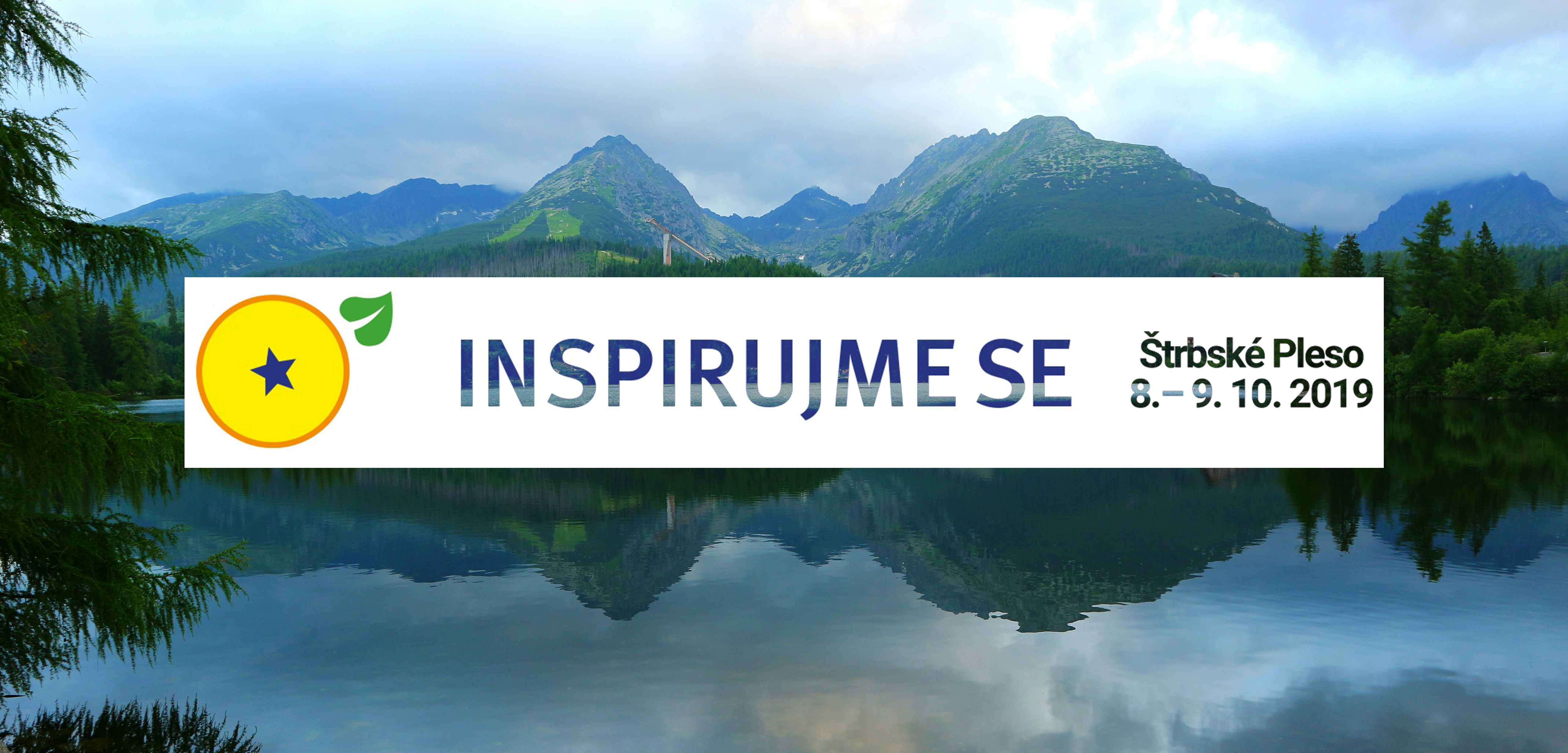
CENIA, česká informační agentura životního prostředí a Ministerstvo životného prostredia Slovenskej republiky vás zvou na tradiční konferenci Inspirujme se…, která se letos bude konat 8. – 9. 10. 2019 v prostorách Hotelu SOREA Trigan ve Štrbském plese na Slovensku. Tento 11. ročník má ambici podpořit výměnu aktuálních informací a zkušeností z oblasti zpřístupňování a využívání prostorových […]
The post Pozvánka na konferenci INSPIRUJME SE… (TZ) appeared first on GISportal.cz.
Známe výherce soutěže
8.7.2019 9:00 HrdličkaVážení uživatelé, rádi bychom Vám poděkovali za Vaší účast v soutěži! Celkem se do soutěže přihlásilo 94 osob. Správný počet podaných žádostí pomocí služby UtilityReport za uplynulých 10 let k datu 30. 6. 2019 bylo 1 543 088. Soutěžící s nejbližším tipem: 1. místo – Jan Vitner (1 530 000) 2. místo – Martina Burandová... View Article
The post Známe výherce soutěže appeared first on HRDLIČKA spol. s r.o. - komplexní služby v oblasti geodézie.
Platebních karty
8.7.2019 7:36 ČÚZK - předpisy a opatření Katastrální úřad pro Jihočeský kraj zveřejnil novou aktualitu: OZNÁMENÍSprávní poplatky a úplaty za výstupy z KN (mimo službu sledování změn) lze nově hradit na všech KP KÚ pro Jihočeský kraj i prostřednictvím platebních karet.
Platebních karty
8.7.2019 7:36 ČÚZK - předpisy a opatření Katastrální úřad pro Jihočeský kraj zveřejnil novou aktualitu:OZNÁMENÍ
Správní poplatky a úplaty za výstupy z KN (mimo službu sledování změn) lze nově hradit na všech KP KÚ pro Jihočeský kraj i prostřednictvím platebních karet.
Platebních karty
8.7.2019 7:36 ČÚZK /Urady/Katastralni-urady/Katastralni-urady/Katastralni-urad-pro-Jihocesky-kraj/O-uradu/Aktuality/Platebnich-kartyPozvánka na konferenci Inspirujme se...
8.7.2019 7:00 Česká asociace pro geoinformaceCENIA, česká informační agentura životního prostředí a Ministerstvo životného prostredia Slovenskej republiky vás zvou na tradiční konferenci Inspirujme se, která se letos bude konat 8. – 9. 10. 2019 v prostorách Hotelu SOREA Trigan na Štrbském Plese na Slovensku.
Tento 11. ročník má ambici podpořit výměnu aktuálních informací a zkušeností z oblasti
GISCI Announces Revised Blueprint for the GISCI Geospatial Core Technical Knowledge Exam ®
7.7.2019 10:33 GISCafe.com Webcasts-Webinars Des Plaines, IL (July 5, 2019) -- GISCI has released a revised blueprint for the Geospatial Core Technical Knowledge Exam ® for the GISP …Media Advisory - President of Earth Day Network to speak at Esri User Conference
7.7.2019 10:26 GISCafe.com Webcasts-Webinars San Diego, CA (July 9, 2019) - President of Earth Day Network, Kathleen Rogers, will speak at the Esri User Conference about the role citizen science …Barry Wellar, C.M., GISP Announced as Closing Speaker for URISA's GIS Leadership Academy in Toronto
7.7.2019 10:16 GISCafe.com Webcasts-Webinars Des Plaines, IL (July 5, 2019) -- URISA is pleased to announce that Barry Wellar, C.M., GISP will provide the closing remarks at the …What’s happening to Greenland’s ice?
5.7.2019 17:30 ESA Observing the Earth
Heatwave conditions catapulted Greenland into an early Arctic summer in June, prompting widespread melting across its icesheet surface, according to researchers at the Danish Meteorological Institute.
RMSI Appoints Dr. Erik Shepard as Executive Vice President-Utility, North America
5.7.2019 16:47 GISCafe.com Webcasts-Webinars New Delhi, July 5, 2019: RMSI, a leading provider of end to end asset data management solutions to the utility sector, announced the expansion of its …HIPAA-Compliant Geospatial Health Analytics - Now Available for Tableau
5.7.2019 16:47 GISCafe.com Webcasts-Webinars OAKBROOK, Ill., July 4, 2019 — (PRNewswire) — Spatialitics, the leader in enterprise geospatial SaaS applications, and Integeo, a …Hexagon Announces the Impact of a Slowdown in China and Related Restructuring Program
5.7.2019 16:47 GISCafe.com Webcasts-Webinars NACKA STRAND, Sweden, July 5, 2019 — (PRNewswire) — Having experienced favorable growth in China over recent quarters, Hexagon has seen …VertiGIS continues to grow with the acquisition of SynerGIS GIS & FM Solutions
5.7.2019 10:08 GISCafe.com Webcasts-Webinars Munich, Germany, Release: July 4, 2019 -- VertiGIS announced today the completed acquisition of SynerGIS GIS & FM Solutions GmbH, …Earth from Space
5.7.2019 10:05 ESA Observing the EarthIn this week's edition, explore a swirl of sea ice off the east coast of Greenland with Copernicus Sentinel-2
Irminger Sea ice swirl
5.7.2019 10:05 ESA Observing the Earth
Earth observation image of the week: the Copernicus Sentinel-2 mission takes us over fragments of swirling sea ice off the coast of Greenland
"Omnisci Takes on Big Data with GPU Accelerated Analytics Technology" by Susan Smith
5.7.2019 10:00 GISCafe.com Webcasts-WebinarsSummit Koncepce BIM v listopadu 2019
4.7.2019 20:58 GeoBusiness Vládní zmocněnec pro digitalizaci a IT Vladimír Dzurilla spolu s Ministerstvem průmyslu a obchodu převzali záštitu nad akcí s názvem Summit Koncepce BIM. Akci ... PřečístDružice pro sledování počasí zvládla simulovaný start
4.7.2019 20:31 Český Kosmický PortálZa několik let se do vesmíru dostane první z nové generace družic Meteosat. Důležitý test nás přitom nyní k tomu mezníku přiblížil. S novou generací družic Meteosat se totiž významně zlepší předpověď počasí. A to je něco, na co všichni spoléháme.
Lucky-7 míří do kosmu
4.7.2019 18:53 Česká kosmická kancelář
V pátek 5. července bude na oběžnou dráhu vypuštěna další česká vědecko-technologická družice Lucky-7, postavená soukromou společností SkyFox Labs. Společně s ní bude vypuštěno dalších 31 družic, mezi nimiž bude i družice Socrat-R, na jejíž palubě jsou dva české dozimetry vyvinuté na akademické půdě.
Esri Silver Business Partner, Sparrow Data Solutions, at the 2019 International Esri User Conference
4.7.2019 16:12 GISCafe.com Webcasts-Webinars Sparrow will be at ESRIUC to share how they are using GIS / mapping technology to help non-profits with donor retention, engagement and …3 PhD scholarships at the Institute for Geoinformatics, start April 1, 2020
4.7.2019 16:09 The Graduate School for Geoinformatics at the Institute for Geoinformatics, University of Münster(http://www.uni-muenster.de/Geoinformatics/) offers up to three full PhD scholarships for open topics linked to one of the research groups (labs) at ifgi. Maybe some of you are interested in this call or you know other people you might be – please feel free to forward. […]Hrdličkovi zdolali horu v Nepálu
4.7.2019 13:17 HrdličkaBylo nebylo. Již před nějakým časem jsem si začal o Nepálu povídat s Katkou Hrdličkovou na firemních akcích. No a čas uzrál a letos jsme byli s Miri rádi, že jsme měli možnost majitelům ukázat svět, ve kterém trávíme více času než v podnikové kanceláři. Výškový rekord firemního práporu je nyní stanoven na výšku 5 475 m. Posuneme... View Article
The post Hrdličkovi zdolali horu v Nepálu appeared first on HRDLIČKA spol. s r.o. - komplexní služby v oblasti geodézie.
vrchní referent / rada v oddělení právních vztahů k nemovitostem Katastrálního pracoviště Chrudim
4.7.2019 11:16 ČÚZK /Urady/Katastralni-urady/Katastralni-urady/Katastralni-urad-pro-Pardubicky-kraj/Uredni-deska/Oznameni-a-jina-uredni-sdeleni/Volna-mista/vrchni-referent-rada-v-oddeleni-pravnich-vztahuvrchní referent / rada v oddělení právních vztahů k nemovitostem Katastrálního pracoviště Chrudim
4.7.2019 11:16 ČÚZK - volná místa Katastrální úřad pro Pardubický kraj - Katastrální pracoviště Chrudim vypisuje výběrové řízení na místo vrchní referent / rada v oddělení právních vztahů k nemovitostem Katastrálního pracoviště Chrudimvrchní referent / rada v oddělení právních vztahů k nemovitostem Katastrálního pracoviště Chrudim
4.7.2019 11:16 ČÚZK - předpisy a opatření Katastrální úřad pro Pardubický kraj - Katastrální pracoviště Chrudimvypisuje výběrové řízení na místo vrchní referent / rada v oddělení právních vztahů k nemovitostem Katastrálního pracoviště Chrudim
vrchní referent / rada v oddělení právních vztahů k nemovitostem Katastrálního pracoviště Chrudim
NSGIC announces keynote speaker Meagan Wolfe at first-ever Elections GeoSummit, August 14, Washington, DC
4.7.2019 10:27 GISCafe.com Webcasts-Webinars July 2, 2019, New Orleans, LA -- National States Geographic Information Council (NSGIC) has announced Meagan Wolfe, Administrator, Wisconsin …Rare lava lake
4.7.2019 10:21 ESA Observing the Earth
The Copernicus Sentinel-2 mission captures a persistent lava lake on the remote Mount Michael volcano
ArcGIS Pro 2.4
4.7.2019 10:00 ARCDATANa stránkách My Esri je ke stažení nová verze ArcGIS Pro, a my proto přinášíme přehled těch nejzajímavějších novinek.
Dynamické shlukování
U bodové třídy prvků, uložené v relační databázi, můžeme nástrojem Enable Feature Binning umožnit automatické shlukování do šestiúhelníků či čtverců. Při oddálení mapy se tak zobrazení prvků změní na pravidelnou síť, jejíž symboliku lze nastavit podle souhrnných statistik v jednotlivých buňkách.

GeoAnalytics Desktop
Nástroje GeoAnalytics Desktop, dostupné v licenci Advanced, dokážou díky technologii Apache Spark využívat paralelní geoprocessing na více procesorech. Usnadní tak analýzu a zpracování objemných dat.

Pixel editor
Součástí nadstavby Image Analyst je nově i editor rastrových dat. Jeho prostřednictvím je možné upravovat jednotlivé hodnoty pixelů (např. multispektrálních nebo výškových dat); vyhlazovat hodnoty pomocí speciálních filtrů; ponechat pouze pixely, které reprezentují povrch, a vzniklé díry (např. po budovách) dopočítat a vyplnit; klonovat určitou oblast snímku a vložit ji na místo zastíněné oblačností či do oblasti, která podléhá utajení.

3D editace
Pro editaci 3D prvků typu multipatch jsou k dispozici nové nástroje: Explode, Merge a Slice Multipatch.
ModelBuilder: export do skriptu a tvorba modelu z historie
ModelBuilder má dva nové nástroje pro export modelu: Export To Python File a Send To Python Window.
Z okna geoprocessingové historie je možné přetáhnout použité nástroje do prostředí ModelBuilder, kde se z nich automaticky vytvoří model podle posloupnosti, v jaké byly použity.

Zobrazení 3D profilu
Při práci se scénou je možné zobrazit profil v interaktivně zadaném řezu – což je vhodné například při prohlížení budov nebo při práci s daty ve formátu LAS.

Vylepšená 3D vizualizace
Vykreslení světla ve 3D nyní bere v úvahu i zastínění okolím. Při vykreslování bodových prvků se navíc používá metoda Eye-dome lighting, díky které je snazší od sebe rozeznat jednotlivé symboly.

Novinkou je také styl Voda, který je určen pro polygony vodních ploch. Ty jsou pak vykresleny jako fotorealistická vodní hladina s animovanými vlnkami, na které se odráží slunce.

Maskování na úrovni vrstev symbolu
Pokud je zapnuto vykreslování po jednotlivých vrstvách symbolu, je možné aplikovat masku pouze na vybrané vrstvy.
Pozadí v popiskách a anotacích
Formátovací tag <BGD> umožňuje nastavit pozadí popisku (nebo anotace), což je vhodné například pro napodobení informačních tabulí nebo dopravních značek.

Nový graf
Použít můžeme i nový typ grafu, calendar heat chart, který zobrazuje četnost výskytu v jednotlivých měsících v roce, dnech v týdnu, hodinách apod.

Kompletní přehled novinek
Novinek a změn je ve verzi 2.4 velké množství a jejich podrobný seznam naleznete v nápovědě k ArcGIS Pro: What's New in ArcGIS Pro nebo se můžete podívat na video, které vám mnoho z nich v rychlém sledu představí.
ArcGIS Pro 2.4 si můžete stáhnout na stránkách My Esri, na záložce Organizace – Stahování.
ESA podpoří portugalský program nosné rakety
3.7.2019 20:02 Český Kosmický PortálPortugalsko vyvíjí infrastrukturu pro národní kosmodrom, který bude na jednom z ostrovů Azorského souostroví, na Santě Marii. Půjde o místo pro starty a přistávání malých evropských družic.
Join ɸ-week
3.7.2019 16:09 ESA Observing the Earth
Join ESA’s ɸ-week on 9–13 September to hear all about the latest trends in Earth observation and to explore the space business of tomorrow. Registration closes 25 July
New in G-Cloud 11 - Data Vault from Europa Technologies
3.7.2019 15:58 GISCafe.com Webcasts-Webinars 3 July 2019 -- Europa Technologies is delighted to announce that its services have once again been included in the latest procurement …thinkWhere Scoops Double Awards for Geographic Cloud Solutions
3.7.2019 15:28 GISCafe.com Webcasts-Webinars July 03, 2019 -- Scottish based GIS company thinkWhere has been awarded a place on the UK Government’s G-Cloud 11 framework agreement. Designed …ATLAS Expands On-Orbit Customer Base, Bolsters Global Ground Network
3.7.2019 15:27 GISCafe.com Webcasts-Webinars TRAVERSE CITY, Mich. — (BUSINESS WIRE) — July 2, 2019 —ATLAS Space Operations, a leading innovator of ground communications in …
Spending a day with Earth Observation
3.7.2019 15:12 European GNSS Agency
At the ‘A Day with EO’ conference, held as part of the annual assembly of the European Association of Remote Sensing Companies (EARSC), stakeholders from various sectors came together to discuss the multiple activities that have been made possible, or influenced by Earth Observation. At the event, GSA Executive Director Carlo des Dorides spoke about how the collective experience of the GSA’s market development team would be engaged to benefit the Copernicus programme.
In a series of panel discussions at the conference, stakeholders outlined how Earth Observation (EO) data is leveraged to improve efficiency and tackle a wide range of challenges – from food production and environmental protection to the built environment, security and the management of cultural heritage.
Golden era for EO
Will Marshall, founder and CEO of satellite designer Planet said that we are currently living in “a golden era for Earth Observation,” thanks to new datasets and advances in machine learning that enable more applications based on this data. “You can’t fix what you can’t see,” he said, adding that action to save the planet required data on a faster time-scale than the planet is changing.
In his presentation Patrick Child, Deputy Director General of the European Commission’s Directorate General for Research and Innovation (DG RTD), noted that if we are currently in the ‘golden era of EO’, then this is “precisely because we are facing some immediate and significant existential challenges for the planet, and EO will need to be a big part of the response to these challenges – in particular the challenge of climate change.”
Read this: EGNSS and EO: A promising convergence for sustainable development
Child noted that there was a strong and growing demand internationally for research and innovation and for EO in particular to bring solutions. He said that the EU was currently leading the global debate on climate change and sustainability. Child noted that the EU had made significant investment in developing its EO systems and was keen that this investment should bring benefits to European industry, which is ideally placed to rise to these challenges.
Kamil Kiljanski, Head of Unit for Space Data for Societal Challenges and Growth at DG GROW, noted that, to reap the greatest benefits from EO data, it is important that it be combined with other data. He specifically noted the importance of interaction between the Copernicus and Galileo programmes.
Space Regulation
Kiljanski said that, with its new Space Regulation, the Commission was moving in this direction – more towards its traditional role of gatekeeper and market regulator, operating and exploiting the systems with the assistance of specialised agencies, in particular the European Union Agency for the Space Programme in Prague, the European Space Agency, Eumetsat and all the other entities involved in the delivery of Copernicus services.

“We are really looking forward to helping to make Copernicus an even bigger success than it is today,” GSA Executive Director Carlo des Dorides at ‘A Day with EO’
European GNSS Agency (GSA) Executive Director Carlo des Dorides confirmed that his agency is well placed to provide this assistance, in particular thanks to its market development team, whose work has made a significant contribution to the success of the Galileo programme. “Today we have close to one billion users worldwide. This is the most visible figure, but there are also success stories in the maritime sector, in civil aviation, in the automotive and rail sectors and many others,” des Dorides said.
And this: Space serving our blue planet
Des Dorides noted that the new Space Regulation would bring a horizontal dimension to the EU space programmes. “For the first time we have one regulation for both GNSS and Copernicus. This is important because it creates a uniform approach for the two programmes,” he said.
He stressed that the role of the GSA was to support the Commission, to support market development and to communicate about and promote the EU space programme, including Copernicus. “There are three main areas of focus along these lines, one is to adopt a user-centric approach, the second is to maximise the social and economic value of the Copernicus programme, leveraging all the services, and finally to develop the downstream segment using Horizon Europe,” he said, adding: “We are really looking forward to helping to make Copernicus an even bigger success than it is today.”
Media note: This feature can be republished without charge provided the European GNSS Agency (GSA) is acknowledged as the source at the top or the bottom of the story. You must request permission before you use any of the photographs on the site. If you republish, we would be grateful if you could link back to the GSA website (http://www.gsa.europa.eu).
Spending a day with Earth Observation
3.7.2019 15:12 European GNSS AgencyAt the ‘A Day with EO’ conference, held as part of the annual assembly of the European Association of Remote Sensing Companies (EARSC), stakeholders from various sectors came together to discuss the multiple activities that have been made possible, or influenced by Earth Observation. At the event, GSA Executive Director Carlo des Dorides spoke about how the collective experience of the GSA’s market development team would be engaged to benefit the Copernicus programme.
In a series of panel discussions at the conference, stakeholders outlined how Earth Observation (EO) data is leveraged to improve efficiency and tackle a wide range of challenges – from food production and environmental protection to the built environment, security and the management of cultural heritage.
Golden era for EO
Will Marshall, founder and CEO of satellite designer Planet said that we are currently living in “a golden era for Earth Observation,” thanks to new datasets and advances in machine learning that enable more applications based on this data. “You can’t fix what you can’t see,” he said, adding that action to save the planet required data on a faster time-scale than the planet is changing.
In his presentation Patrick Child, Deputy Director General of the European Commission’s Directorate General for Research and Innovation (DG RTD), noted that if we are currently in the ‘golden era of EO’, then this is “precisely because we are facing some immediate and significant existential challenges for the planet, and EO will need to be a big part of the response to these challenges – in particular the challenge of climate change.”
Read this: EGNSS and EO: A promising convergence for sustainable development
Child noted that there was a strong and growing demand internationally for research and innovation and for EO in particular to bring solutions. He said that the EU was currently leading the global debate on climate change and sustainability. Child noted that the EU had made significant investment in developing its EO systems and was keen that this investment should bring benefits to European industry, which is ideally placed to rise to these challenges.
Kamil Kiljanski, Head of Unit for Space Data for Societal Challenges and Growth at DG GROW, noted that, to reap the greatest benefits from EO data, it is important that it be combined with other data. He specifically noted the importance of interaction between the Copernicus and Galileo programmes.
Space Regulation
Kiljanski said that, with its new Space Regulation, the Commission was moving in this direction – more towards its traditional role of gatekeeper and market regulator, operating and exploiting the systems with the assistance of specialised agencies, in particular the European Union Agency for the Space Programme in Prague, the European Space Agency, Eumetsat and all the other entities involved in the delivery of Copernicus services.
Thanks to new datasets and advances in machine learning we are now living in a golden era for Earth Observation
European GNSS Agency (GSA) Executive Director Carlo des Dorides confirmed that his agency is well placed to provide this assistance, in particular thanks to its market development team, whose work has made a significant contribution to the success of the Galileo programme. “Today we have close to one billion users worldwide. This is the most visible figure, but there are also success stories in the maritime sector, in civil aviation, in the automotive and rail sectors and many others,” des Dorides said.
And this: Space serving our blue planet
Des Dorides noted that the new Space Regulation would bring a horizontal dimension to the EU space programmes. “For the first time we have one regulation for both GNSS and Copernicus. This is important because it creates a uniform approach for the two programmes,” he said.
He stressed that the role of the GSA was to support the Commission, to support market development and to communicate about and promote the EU space programme, including Copernicus. “There are three main areas of focus along these lines, one is to adopt a user-centric approach, the second is to maximise the social and economic value of the Copernicus programme, leveraging all the services, and finally to develop the downstream segment using Horizon Europe,” he said, adding: “We are really looking forward to helping to make Copernicus an even bigger success than it is today.”
Media note: This feature can be republished without charge provided the European GNSS Agency (GSA) is acknowledged as the source at the top or the bottom of the story. You must request permission before you use any of the photographs on the site. If you republish, we would be grateful if you could link back to the GSA website (http://www.gsa.europa.eu).
referent KN – právník do právního oddělení III.
3.7.2019 14:41 ČÚZK - předpisy a opatření Katastrální úřad pro hlavní město Prahuvypisuje výběrové řízení na místo
referent KN – právník do právního oddělení III.