


![]()

zprávy
zdroje zpráv:Změna úředních hodin dne 31.12.2018
10.12.2018 12:32 ČÚZK - předpisy a opatření Katastrální úřad pro Olomoucký kraj - Katastrální pracoviště Šumperk zveřejnil novou aktualitu:Změna úředních hodin dne 31.12.2018
ÚŘEDNÍ HODINY 8:00 - 13:00 HOD
Blue Marble Releases Geographic Calculator 2019 with Updated Geodetic Datasource and Numerous Workflow Improvements
10.12.2018 11:34 GISCafe.com Webcasts-Webinars Hallowell, Maine – December 9, 2018 - Blue Marble Geographics (bluemarblegeo.com) is pleased to announce the immediate availability of the …Omezení úředních hodin 31.12.2018
10.12.2018 11:05 ČÚZK /Urady/Katastralni-urady/Katastralni-urady/Katastralni-urad-pro-Pardubicky-kraj/O-uradu/Aktuality/Omezeni-urednich-hodin-31-12-2018Omezení úředních hodin 31.12.2018
10.12.2018 11:05 ČÚZK - předpisy a opatření Katastrální úřad pro Pardubický kraj zveřejnil novou aktualitu: Omezení úředních hodin 31.12.2018Vážení klienti,
dne 31.12.2018 budou úřední hodiny pouze v době od 8:00 do 12:00 hodin.
Děkujeme za pochopení.
20181210 - Novinky ve verzi RÚIAN 2.5
10.12.2018 10:32 ČÚZK - předpisy a opatření Instalace nové verze ISÚI/VDP do produkčního prostředí proběhla ve dnech 7. - 9. 12. 2018.V sekci 1. Editační agendový systém ISÚI byl publikován dokument "Novinky v ISÚI a VDP ve verzi 2.5".
20181210 - Novinky ve verzi RÚIAN 2.5
10.12.2018 10:32 ČÚZK /Uvod/Produkty-a-sluzby/RUIAN/RUIAN-novinky/2018/20181210-Novinky-ve-verzi-RUIAN-2-520181210 - Novinky ve verzi RÚIAN 2.5
10.12.2018 10:32 ČÚZK - předpisy a opatření Instalace nové verze ISÚI/VDP do produkčního prostředí proběhla ve dnech 7. - 9. 12. 2018.V sekci 1. Editační agendový systém ISÚI byl publikován dokument "Novinky v ISÚI a VDP ve verzi 2.5".
Zveřejněno 10. 12. 2018
Silvestr 2018
10.12.2018 10:20 ČÚZK /Urady/Katastralni-urady/Katastralni-urady/Katastralni-urad-pro-Jihocesky-kraj/O-uradu/Aktuality/Silvestr-2018Silvestr 2018
10.12.2018 10:20 ČÚZK - předpisy a opatření Katastrální úřad pro Jihočeský kraj zveřejnil novou aktualitu: Katastrálního úřadu pro Jihočeský kraj si dovoluje upozornit, že v pondělí dne 31.12.2018 budou všechna katastrální pracoviště Katastrálního úřadu pro Jihočeský kraj (včetně kontaktního místa Katastrálního pracoviště Jindřichův Hradec v Dačicích) otevřena pro veřejnost pouze v době od 8:00 do 14:00 hodin.Děkujeme za pochopení.
Ing. Jiří Vrána, ředitel úřadu
Eos Announces Orthometric Height Support for Arrow GNSS Receivers (Survey-Grade Elevations)
10.12.2018 9:00 GISCafe.com Webcasts-Webinars Supporting GEOID models enables Arrow GNSS receivers to collect high-accuracy, survey-grade vertical datum with any softwareDecember 06, 2018 -- …
Knihovna geografie pořádá školení Elektronické informační zdroje. [Knihovna geografie, byTopic]
10.12.2018 9:00 Katedra aplikované geoinformatiky a kartografie Přf UKMapTiler oceněn Evropskou kosmickou agenturou (TZ)
10.12.2018 8:22 GISportal.cz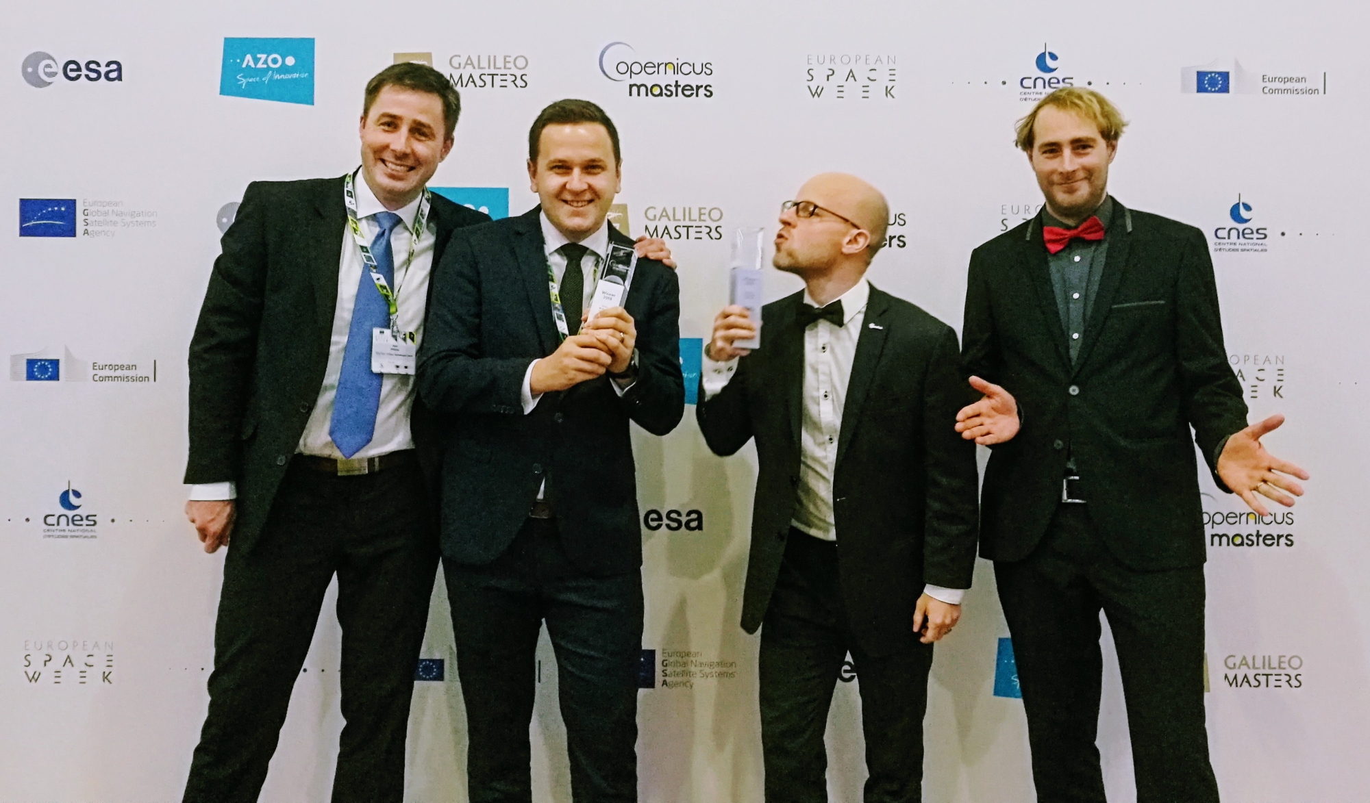
Česk-švýcarský startup MapTiler, který se specializuje na poskytování map a softwaru k jejich tvorbě, získal ocenění Evropské kosmické agentury. O jejich produktech, které by mohly nahradit Google Maps jsme psali v červnu. MapTiler cílí na globální trh a je používán společnostmi, jejichž mapy jsou skrz web či mobilní aplikace měsíčně zhlédnuty miliony návštěvníků. Za vývojem […]
The post MapTiler oceněn Evropskou kosmickou agenturou (TZ) appeared first on GISportal.cz.
UPOZORNĚNÍ
10.12.2018 8:05 ČÚZK - předpisy a opatření Katastrální úřad pro Ústecký kraj - Katastrální pracoviště Teplice zveřejnil novou aktualitu: Vážení klientiDne 31. 12. 2018 (pondělí) budou úřední hodiny Katastrálního pracoviště Teplice z provozních důvodů od 8:00 do 14:00 hodin. Děkujeme za pochopení a přejeme příjemné prožití vánočních svátků Katastrální úřad pro Ústecký kraj, Katastrální pracoviště Teplice
Oznámení o uzavření provozu Pobočky Domažlice
10.12.2018 0:00 Státní pozemkový úřad Z provozních důvodu (havárie vodovodu) bude v úterý 11. 12. 2018 uzavřena Pobočka Domažlice (KPÚ pro Plzeňský kraj).Vývoj rakety Ariane 6 úspěšně pokračuje
9.12.2018 23:02 Český Kosmický PortálUplynulý rok byl velmi intenzivní z hlediska vývoje nosiče Ariane 6. Pokrok je přitom viditelný napříč celou Evropou: továrny vyrábí nové díly za použití inovativních metod, došlo k otestování motorů všech stupňů a v plném proudu je stavba vypouštěcí rampy.
Poslední dny registrace na seminář Nemofora
9.12.2018 7:00 Česká asociace pro geoinformacePoslední dny registrace na seminář Nemofora
Poslední volná místa zbývají na seminář Využijeme šance vybudovat digitální mapu veřejné správy?, který pořádá Nemoforum ve spolupráci s ČÚZK, Ministerstvem vnitra a Českou asociací pro geoinformace. Seminář se uskuteční v pátek 18. října 2019 od 9:30 hodin v konferenčních prostorách Hotelu Akademie Naháč v
Přihlášení na GIS Esri v ČR je do konce týdne se slevou
9.12.2018 7:00 Česká asociace pro geoinformace Pokud jste se ještě nepřihlásili na letošní Konferenci GIS Esri v ČR, můžete tak učinit do konce tohoto týdne se slevou. Konference, která se uskuteční ve dnech 6. a 7. listopadu v Kongresovém centru Praha, opět nabídne bohatý program, ve kterém nebudou chybět novinky ze světa GIS, workshopy ani uživatelskéINSPIRE téma Rozšířené Parcely (CPX)
9.12.2018 1:00 Cenia - Katalog metadat ČR - INSPIRE Rozšíření má za cíl poskytovat katastrální mapu s obsahem podle vyhlášky ve vektorové podobě ve struktuře plně v souladu se strukturou danou směrnicí INSPIRE. Data rozšiřují směrnici INSPIRE pro téma katastrální parcely (CP) o věcná břemena, geodetické body, další prvky mapy, původní obloukovou geometrii a o parcely určené definičním bodem (ty pouze v oblastech s analogovou mapou). Vychází z katastrální mapy, která je závazným státním mapovým dílem velkého měřítka, obsahuje body polohového bodového pole, polohopis a popis a může mít formu digitální mapy, analogové mapy nebo digitalizované mapy. Publikovaná data obsahují katastrální území pro celou Českou Republiku, parcely a jejich hranice, věcná břemena, další prvky mapy a původní obloukovou geometrii z území, kde je digitální mapa (k 28. 01. 2019 je to 96,25% území České republiky, t.j. 75 913,13km2) a ve zbytku území katastrální parcely určené pouze definičním bodem (tedy bez hranic a polygonu). Katastrální parcely a hranice obsahují oproti datové sadě INSPIRE některé atributy navíc. Jedná se o typ hranice, způsob využití území, druh pozemku, vazbu na budovu a o mapové značky. Více katastrální zákon 344/1992 SB., katastrální vyhláška č.26/2007 Sb. v platném znění a INSPIRE Data Specification on Cadastral Parcels v 3.0.1. Data ve formátu GML 3.2.1 jsou validní proti schématu XML pro Rozšířené Parcely (CPX) ve verzi 4.0.NAPSALI O NÁS: Chytrá města pro budoucnost 2018: Oceněním dominovala Praha, ostatní města zaznamenala mimořádný vzestup
8.12.2018 12:35 TopGis Chytrým městům v České republice v roce 2018 dominovala Praha. I ostatní tuzemská města však zaznamenala oproti minulým obdobím mimořádný vzestup tzv. chytrých řešení. V Praze byla v úterý předána ocenění municipalitám a dodavatelům nejvýznamnějších projektů Smart City a Smart Region z České republiky, Slovenska a Německa za rok 2018. V rámci II. ročníku soutěže Chytrá města pro budoucnost 2018 byli2018 Awards for Excellence in Public Safety GIS Recipients Recognized at the National Geospatial Preparedness Summit
7.12.2018 21:12 GISCafe.com Webcasts-Webinars WASHINGTON, Dec. 7, 2018 — (PRNewswire) — The National Alliance for Public Safety GIS (NAPSG) Foundation Board of Directors is …MapTiler oceněn Evropskou kosmickou agenturou
7.12.2018 19:04 GeoBusiness Evropská kosmická agentura a firma Airbus ocenily v soutěži Copernicus Masters tým, který stojí za vývojem produktu MapTiler. Stejnojmenný česko-švýcarský startup se specializuje na ... PřečístBoundless Awarded Certificate of Networthiness by U.S. Army for Desktop GIS Software
7.12.2018 16:48 GISCafe.com Webcasts-Webinars ST. LOUIS, Dec. 04, 2018 (GLOBE NEWSWIRE) -- Boundless, the leader in open and scalable GIS, today announced that its Boundless Desktop™ solution …Teledyne image sensors power cameras onboard NASA’s InSight Mission to Mars
7.12.2018 16:48 GISCafe.com Webcasts-Webinars WATERLOO, Ontario, Nov. 29, 2018 (GLOBE NEWSWIRE) -- Teledyne DALSA, a Teledyne Technologies [NYSE: TDY] company and global leader in digital …DeepMap Announces New Customers in Europe and North America; Einride and Ridecell Select DeepMap’s HD Mapping Technology for Autonomous Vehicle Fleets
7.12.2018 16:48 GISCafe.com Webcasts-Webinars PALO ALTO, Calif., Dec. 05, 2018 (GLOBE NEWSWIRE) -- DeepMap, leading provider of high-definition (HD) mapping and localization technology for …Microdrones Merges with Schübeler Technologies
7.12.2018 16:48 GISCafe.com Webcasts-Webinars SIEGEN, Germany, Dec. 06, 2018 (GLOBE NEWSWIRE) -- As part of ongoing global expansion, Microdrones is proud to announce a merger with Schübeler …Smart Gate takes first place in GSA Special Prize at ESNC
7.12.2018 15:09 European GNSS Agency
Smart Gate, a system designed to measure time precisely during sporting activities, has been awarded first place in the GSA Special Prize at this year’s European Satellite Navigation Competition. The awards were handed out at the Galileo and Copernicus Masters gala award ceremony – the ‘Space Oscars’, held on 4 December as part of 2018 European Space Week in Marseille.
The Smart Gate team, a group of sport and tech enthusiasts, combined their two passions to develop a cost-effective solution that enables skiers and snowboarders to improve their performance. Using GNSS precise timing combined with radio-frequency identification (RFID) technology, Smart Gate provides precise times on ski/snowboard runs, which sportspeople can use to hone their skills and techniques.
"So far, the Smart Gate solution has been built using the private funds of its founders. We have dedicated a lot of our knowledge, involvement and passion to it,” project developer Marcin Wilik said.
Wilik said that winning the GSA Special Prize would be extremely important for the project. “First of all, we will have funds to improve our prototype and secondly it will give us the attention of the media and investors. This is what we need right now. It is no exaggeration to say that winning the GSA prize will be an important turning point for the Smart Gate project," he said.
Ridesharing
Second place in this year’s GSA prize went to Troodle – a ridesharing solution that, unlike previous systems, offers socially and ecologically motivated drivers a digital platform based on environmental awareness and social responsibility rather than earning opportunities or cost sharing.
Utilising geodata-based real-time communication, the Troodle app calculates optimal stopping points, ideal routes and average travel times as a basis for immediate and effective ridesharing. As a result, it can offer spontaneous, safe, environmentally friendly and low-cost mobility without advance agreement, for short and long distances in both cities and rural areas.
"We are very pleased about the ESNC GSA Prize. Together with the ESA-BIC funding, the financial support will enable us to develop our prototype of the Troodle app, which will be tested in two German cities at the beginning of 2019," Troodle founder Bernd Sailer said.
Autonomous machines
Finally, the third place this year goes to HIVE, a cloud-based solution for highly accurate GNSS positioning and navigation that helps position, navigate, and track drones, robots, and other autonomous GNSS-equipped machines with up to centimetre-level precision.
To improve their positioning accuracy, autonomous vehicles need to be connected to a ground-based, continuously operating reference station (CORS) that uses GNSS. HIVE’s software combines unlimited numbers of fragmented GNSS CORS facilities in a single solution and provides easy access to all of them. In this way, it acts as an instrument for creating a united European GNSS CORS infrastructure, supporting the next-generation of autonomous machines.
“Winning a GSA nomination is a significant milestone for us, as the project we have worked hard on for years is receiving international recognition. And this is just the beginning,” project founder Simon Litvinov said.
10 years of partnership
This year is the 10th consecutive year that the GSA has been a main partner in the European Satellite Navigation Competition and awarded a Special Prize. This year for the first time the GSA awarded cash prizes of EUR 7,000, EUR 5,000 and EUR 3,000 to the top three proposals. This year’s contenders for the GSA prize addressed the topic 'When and where? – Exact timing and positioning matters'.
Watch this: Galileo Masters-GSA – 10 Years of Partnership
“I would like to congratulate this year’s worthy winners of the GSA Galileo Special Prize and all the Galileo Masters prize winners,” GSA Executive Director Carlo des Dorides said. “During our 10 years of partnership with the competition, the GSA has awarded a Special Prize to contenders who presented the most pioneering ideas for the commercial use of Galileo and EGNOS. This year has been no different, and market uptake potential was an important criterion when evaluating the winning projects,” he said.
As part of its Special Topic Prizes over the past ten years, the GSA has received more than 80 innovative proposals per year, covering new applications across the broad scope of sectors that benefit from Galileo and EGNOS in a wide variety of areas. Over the years, the GSA Special Prize winners have helped establish the ESNC as a major driver of new, useful and economically viable GNSS applications.
Media note: This feature can be republished without charge provided the European GNSS Agency (GSA) is acknowledged as the source at the top or the bottom of the story. You must request permission before you use any of the photographs on the site. If you republish, we would be grateful if you could link back to the GSA website (http://www.gsa.europa.eu).
Smart Gate takes first place in GSA Special Prize at ESNC
7.12.2018 15:09 European GNSS AgencySmart Gate, a system designed to measure time precisely during sporting activities, has been awarded first place in the GSA Special Prize at this year’s European Satellite Navigation Competition. The awards were handed out at the Galileo and Copernicus Masters gala award ceremony – the ‘Space Oscars’, held on 4 December as part of 2018 European Space Week in Marseille.
The Smart Gate team, a group of sport and tech enthusiasts, combined their two passions to develop a cost-effective solution that enables skiers and snowboarders to improve their performance. Using GNSS precise timing combined with radio-frequency identification (RFID) technology, Smart Gate provides precise times on ski/snowboard runs, which sportspeople can use to hone their skills and techniques.
"So far, the Smart Gate solution has been built using the private funds of its founders. We have dedicated a lot of our knowledge, involvement and passion to it,” project developer Marcin Wilik said.
Wilik said that winning the GSA Special Prize would be extremely important for the project. “First of all, we will have funds to improve our prototype and secondly it will give us the attention of the media and investors. This is what we need right now. It is no exaggeration to say that winning the GSA prize will be an important turning point for the Smart Gate project," he said.
Ridesharing
Second place in this year’s GSA prize went to Troodle – a ridesharing solution that, unlike previous systems, offers socially and ecologically motivated drivers a digital platform based on environmental awareness and social responsibility rather than earning opportunities or cost sharing.
Utilising geodata-based real-time communication, the Troodle app calculates optimal stopping points, ideal routes and average travel times as a basis for immediate and effective ridesharing. As a result, it can offer spontaneous, safe, environmentally friendly and low-cost mobility without advance agreement, for short and long distances in both cities and rural areas.
"We are very pleased about the ESNC GSA Prize. Together with the ESA-BIC funding, the financial support will enable us to develop our prototype of the Troodle app, which will be tested in two German cities at the beginning of 2019," Troodle founder Bernd Sailer said.
Autonomous machines
Finally, the third place this year goes to HIVE, a cloud-based solution for highly accurate GNSS positioning and navigation that helps position, navigate, and track drones, robots, and other autonomous GNSS-equipped machines with up to centimetre-level precision.
To improve their positioning accuracy, autonomous vehicles need to be connected to a ground-based, continuously operating reference station (CORS) that uses GNSS. HIVE’s software combines unlimited numbers of fragmented GNSS CORS facilities in a single solution and provides easy access to all of them. In this way, it acts as an instrument for creating a united European GNSS CORS infrastructure, supporting the next-generation of autonomous machines.
“Winning a GSA nomination is a significant milestone for us, as the project we have worked hard on for years is receiving international recognition. And this is just the beginning,” project founder Simon Litvinov said.
10 years of partnership
This year is the 10th consecutive year that the GSA has been a main partner in the European Satellite Navigation Competition and awarded a Special Prize. This year for the first time the GSA awarded cash prizes of EUR 7,000, EUR 5,000 and EUR 3,000 to the top three proposals. This year’s contenders for the GSA prize addressed the topic 'When and where? – Exact timing and positioning matters'.
“I would like to congratulate this year’s worthy winners of the GSA Galileo Special Prize and all the Galileo Masters prize winners,” GSA Executive Director Carlo des Dorides said. “During our 10 years of partnership with the competition, the GSA has awarded a Special Prize to contenders who presented the most pioneering ideas for the commercial use of Galileo and EGNOS. This year has been no different, and market uptake potential was an important criterion when evaluating the winning projects,” he said.
As part of its Special Topic Prizes over the past ten years, the GSA has received more than 80 innovative proposals per year, covering new applications across the broad scope of sectors that benefit from Galileo and EGNOS in a wide variety of areas. Over the years, the GSA Special Prize winners have helped establish the ESNC as a major driver of new, useful and economically viable GNSS applications.
Media note: This feature can be republished without charge provided the European GNSS Agency (GSA) is acknowledged as the source at the top or the bottom of the story. You must request permission before you use any of the photographs on the site. If you republish, we would be grateful if you could link back to the GSA website (http://www.gsa.europa.eu).
Smart Gate takes first place in GSA Special Prize at ESNC
7.12.2018 15:09 European GNSS AgencySmart Gate, a system designed to measure time precisely during sporting activities, has been awarded first place in the GSA Special Prize at this year’s European Satellite Navigation Competition. The awards were handed out at the Galileo and Copernicus Masters gala award ceremony – the ‘Space Oscars’, held on 4 December as part of 2018 European Space Week in Marseille.
The Smart Gate team, a group of sport and tech enthusiasts, combined their two passions to develop a cost-effective solution that enables skiers and snowboarders to improve their performance. Using GNSS precise timing combined with radio-frequency identification (RFID) technology, Smart Gate provides precise times on ski/snowboard runs, which sportspeople can use to hone their skills and techniques.
"So far, the Smart Gate solution has been built using the private funds of its founders. We have dedicated a lot of our knowledge, involvement and passion to it,” project developer Marcin Wilk said.
Wilk said that winning the GSA Special Prize would be extremely important for the project. “First of all, we will have funds to improve our prototype and secondly it will give us the attention of the media and investors. This is what we need right now. It is no exaggeration to say that winning the GSA prize will be an important turning point for the Smart Gate project," he said.
Ridesharing
Second place in this year’s GSA prize went to Troodle – a ridesharing solution that, unlike previous systems, offers socially and ecologically motivated drivers a digital platform based on environmental awareness and social responsibility rather than earning opportunities or cost sharing.
Utilising geodata-based real-time communication, the Troodle app calculates optimal stopping points, ideal routes and average travel times as a basis for immediate and effective ridesharing. As a result, it can offer spontaneous, safe, environmentally friendly and low-cost mobility without advance agreement, for short and long distances in both cities and rural areas.
"We are very pleased about the ESNC GSA Prize. Together with the ESA-BIC funding, the financial support will enable us to develop our prototype of the Troodle app, which will be tested in two German cities at the beginning of 2019," Troodle founder Bernd Sailer said.
Autonomous machines
Finally, the third place this year goes to HIVE, a cloud-based solution for highly accurate GNSS positioning and navigation that helps position, navigate, and track drones, robots, and other autonomous GNSS-equipped machines with up to centimetre-level precision.
To improve their positioning accuracy, autonomous vehicles need to be connected to a ground-based, continuously operating reference station (CORS) that uses GNSS. HIVE’s software combines unlimited numbers of fragmented GNSS CORS facilities in a single solution and provides easy access to all of them. In this way, it acts as an instrument for creating a united European GNSS CORS infrastructure, supporting the next-generation of autonomous machines.
“Winning a GSA nomination is a significant milestone for us, as the project we have worked hard on for years is receiving international recognition. And this is just the beginning,” project founder Simon Litvinov said.
10 years of partnership
This year is the 10th consecutive year that the GSA has been a main partner in the European Satellite Navigation Competition and awarded a Special Prize. This year for the first time the GSA awarded cash prizes of EUR 7,000, EUR 5,000 and EUR 3,000 to the top three proposals. This year’s contenders for the GSA prize addressed the topic 'When and where? – Exact timing and positioning matters'.
Watch this: Galileo Masters-GSA – 10 Years of Partnership
“I would like to congratulate this year’s worthy winners of the GSA Galileo Special Prize and all the Galileo Masters prize winners,” GSA Executive Director Carlo des Dorides said. “During our 10 years of partnership with the competition, the GSA has awarded a Special Prize to contenders who presented the most pioneering ideas for the commercial use of Galileo and EGNOS. This year has been no different, and market uptake potential was an important criterion when evaluating the winning projects,” he said.
As part of its Special Topic Prizes over the past ten years, the GSA has received more than 80 innovative proposals per year, covering new applications across the broad scope of sectors that benefit from Galileo and EGNOS in a wide variety of areas. Over the years, the GSA Special Prize winners have helped establish the ESNC as a major driver of new, useful and economically viable GNSS applications.
Media note: This feature can be republished without charge provided the European GNSS Agency (GSA) is acknowledged as the source at the top or the bottom of the story. You must request permission before you use any of the photographs on the site. If you republish, we would be grateful if you could link back to the GSA website (http://www.gsa.europa.eu).
Šestý letošní start rakety Ariane 5
7.12.2018 14:59 Český Kosmický PortálNosná raketa Ariane 5 provozovaná společností Arianespace dopravila na plánované oběžné dráhy družice GSAT-11 a Geo-Kompsat-2A.
Omezení
7.12.2018 13:41 ČÚZK - předpisy a opatření Český úřad zeměměřický a katastrální zveřejnil novou aktualitu: Vážení klienti,dne 31.12.2018 budou úřední hodiny Katastrálního pracoviště Děčín z provozních důvodů od 8:00 hod. do 14:00 hod.
Děkujeme za pochopení.
Omezení
7.12.2018 13:41 ČÚZK /Urady/Katastralni-urady/Katastralni-urady/Katastralni-urad-pro-Ustecky-kraj/Katastralni-pracoviste/KP-Decin/O-uradu/Aktuality/OmezeniWoolpert Contracted to Collect Lidar Data Across 10K Square Miles of Florida
7.12.2018 13:24 GISCafe.com Webcasts-Webinars TALLAHASSEE, Fla. (Dec. 6, 2018) — Woolpert has been contracted by Dewberry Engineers Inc. to collect high-resolution lidar data over …Přerušení provozu DP a WSDP ve čtvrtek 13.12.2018 od 16:30 do cca 18:30
7.12.2018 13:21 ČÚZK /Aplikace-DP-do-KN/Aplikace-DP-do-KN/Archiv-DP/241408Přerušení provozu DP a WSDP ve čtvrtek 13.12.2018 od 16:30 do cca 18:30
7.12.2018 13:21 ČÚZK - předpisy a opatření Vážení uživatelé,oznamujeme, že ve čtvrtek 13.12.208 od 16:30 bude z provozních důvodů zcela přerušen provoz Dálkového přístupu i Webových služeb dálkového přístupu. Obnovení provozu předpokládáme v cca 18:30 hodin.
Za komplikace tímto způsobené se omlouváme a děkujeme za pochopení.
Přerušení provozu DP a WSDP ve čtvrtek 13.12.2018 od 16:30 do cca 18:30
7.12.2018 13:21 Dálkový přístup k údajům KN ČR Vážení uživatelé,oznamujeme, že ve čtvrtek 13.12.208 od 16:30 bude z provozních důvodů zcela přerušen provoz Dálkového přístupu i Webových služeb dálkového přístupu. Obnovení provozu předpokládáme v cca 18:30 hodin.
Za komplikace tímto způsobené se omlouváme a děkujeme za pochopení.
Úřední doba dne 31.12.2018
7.12.2018 13:20 ČÚZK - předpisy a opatření Katastrální úřad pro Ústecký kraj - Katastrální pracoviště Louny zveřejnil novou aktualitu:Vážení klienti,
Dne 31.12.2018 budou úřední hodiny Katastrálního pracoviště Louny z provozních důvodů od 8:00 hod. do 14:00 hod.
Děkujeme za pochopení
Úřední doba dne 31.12.2018
7.12.2018 13:20 ČÚZK - předpisy a opatření Český úřad zeměměřický a katastrální - Katastrální pracoviště Louny zveřejnil novou aktualitu:Vážení klienti,
Dne 31.12.2018 budou úřední hodiny Katastrálního pracoviště Louny z provozních důvodů od 8:00 hod. do 14:00 hod.
Děkujeme za pochopení
Úřední doba dne 31.12.2018
7.12.2018 13:20 ČÚZK /Urady/Katastralni-urady/Katastralni-urady/Katastralni-urad-pro-Ustecky-kraj/Katastralni-pracoviste/KP-Louny/O-uradu/Aktuality/Uredni-doba-dne-31-12-201820181207 - oznámení o změně úředních hodin KÚ pro Ústecký kraj dne 31.12.2018
7.12.2018 13:13 ČÚZK - předpisy a opatření Katastrální úřad pro Ústecký kraj zveřejnil novou aktualitu: Vážení klienti,dne 31.12.2018 budou úřední hodiny v budově Katastrálního úřadu pro Ústecký kraj, Krčínova 797/2, Ústí nad Labem z provozních důvodů od 8:00 hod. do 14:00 hod.
Děkujeme za pochopení.
20181207 - oznámení rozsahu úředních hodin KÚ pro Ústecký kraj dne 31.12.2018
7.12.2018 13:13 ČÚZK /Urady/Katastralni-urady/Katastralni-urady/Katastralni-urad-pro-Ustecky-kraj/O-uradu/Aktuality/20181207-oznameni-o-zmene-urednich-hodin-KU-pro20181207 - oznámení o změně úředních hodin KÚ pro Ústecký kraj dne 31.12.2018
7.12.2018 13:13 ČÚZK - předpisy a opatření Katastrální úřad pro Ústecký kraj zveřejnil novou aktualitu: Vážení klienti,dne 31.12.2018 budou úřední hodiny Katastrálního úřadu pro Ústecký kraj z provozních důvodů od 8:00 hod. do 14:00 hod.
Děkujeme za pochopení.
20181207 - oznámení o změně úředních hodin KÚ pro Ústecký kraj dne 31.12.2018
7.12.2018 13:13 ČÚZK /Urady/Katastralni-urady/Katastralni-urady/Katastralni-urad-pro-Ustecky-kraj/O-uradu/Aktuality/20181207-oznameni-o-zmene-urednich-hodin-KU-pro20181207 - oznámení rozsahu úředních hodin KÚ pro Ústecký kraj dne 31.12.2018
7.12.2018 13:13 ČÚZK - předpisy a opatření Katastrální úřad pro Ústecký kraj zveřejnil novou aktualitu: Vážení klienti,dne 31.12.2018 budou úřední hodiny Katastrálního úřadu pro Ústecký kraj z provozních důvodů od 8:00 hod. do 14:00 hod.
Děkujeme za pochopení.
NAPSALI O NÁS: Nová aplikace Chytrémapy.cz
7.12.2018 13:07 TopGis Spojení leteckých snímků celé České republiky s přímým přístupem do katastru nemovitostí nabízí nová aplikace na webu Chytremapy.cz společnosti TopGis. Kromě toho v ní návštěvníci naleznou na jednom místě řadu dalších důležitých informací včetně panoramatického pohledu do ulic. Podívat se mohou i na věcná břemena, způsob vytápění či použitý materiál pro výstavbu budov. Přímo vDynamo a vizuální programování pro Revit
7.12.2018 12:41 Konference BIM OpenVideo záznam prezentace z konference BIM Open ve které se dozvíte pár konkrétních příkladů Dynamo kódů pro Revit, které vám mohou velmi usnadnit vaši dennodenní práci projektanta. Na přiloženém videu se podívejte na konkrétní použití kódů a níže na stránce si je můžete následně stáhnout pro vlastní použití.
The post Dynamo a vizuální programování pro Revit appeared first on BIM Open.
Omezení provozní doby dne 31.12.2018
7.12.2018 12:18 ČÚZK - předpisy a opatření Katastrální úřad pro Ústecký kraj - Katastrální pracoviště Litoměřice zveřejnil novou aktualitu: Vážení klienti, oznamujeme Vám, že dne 31.12.2018 bude Katastrální pracoviště Litoměřice z provozních důvodů otevřeno od 8:00 do 14:00.Omezení provozní doby dne 31.12.2018
7.12.2018 12:18 ČÚZK /Urady/Katastralni-urady/Katastralni-urady/Katastralni-urad-pro-Ustecky-kraj/Katastralni-pracoviste/KP-Litomerice/O-uradu/Aktuality/Omezeni-provozni-doby-dne-31-12-201820181207 - volné místo - Rada/odborný rada v OPV k nemovitostem (právník) na KP Chomutov
7.12.2018 12:17 ČÚZK /Urady/Katastralni-urady/Katastralni-urady/Katastralni-urad-pro-Ustecky-kraj/O-uradu/Aktuality/20181207-volne-misto-Rada-odborny-rada-v-OPV-k20181207 - volné místo - Rada/odborný rada v OPV k nemovitostem (právník) na KP Chomutov
7.12.2018 12:17 ČÚZK - předpisy a opatření Katastrální úřad pro Ústecký kraj - Katastrální pracoviště Chomutov zveřejnil novou aktualitu: Nabídka volného pracovního místa - Rada/odborný rada v oddělení právních vztahů k nemovitostem (právník) na Katastrálním pracovišti Chomutov (zástup za RD max. do 26.2.2021)Rada/odborný rada v oddělení právních vztahů k nemovitostem (právník) na Katastrálním pracovišti Cho
7.12.2018 12:08 ČÚZK - volná místa Katastrální úřad pro Ústecký kraj - Katastrální pracoviště Chomutov vypisuje výběrové řízení na místo Rada/odborný rada v oddělení právních vztahů k nemovitostem (právník) na Katastrálním pracovišti ChoRada/odborný rada v oddělení právních vztahů k nemovitostem (právník) na Katastrálním pracovišti Cho
7.12.2018 12:08 ČÚZK /Urady/Katastralni-urady/Katastralni-urady/Katastralni-urad-pro-Ustecky-kraj/Uredni-deska/Oznameni-a-jina-uredni-sdeleni/Volna-mista/Rada-odborny-rada-v-oddeleni-pravnich-vztahu-k-(1)Rada/odborný rada v oddělení právních vztahů k nemovitostem (právník) na Katastrálním pracovišti Cho
7.12.2018 12:08 ČÚZK - předpisy a opatření Katastrální úřad pro Ústecký kraj - Katastrální pracoviště Chomutovvypisuje výběrové řízení na místo
Rada/odborný rada v oddělení právních vztahů k nemovitostem (právník) na Katastrálním pracovišti Chomutov
USGIF Appoints New Vice President of Programs
7.12.2018 11:28 GISCafe.com Webcasts-Webinars Career GEOINT professional Ronda Schrenk to lead the Foundation’s event programming, working groups, and moreHerndon, Virginia (December 6, …
Pozvánka na habilitační přednášku [Katedra aplikované geoinformatiky a kartografie, byTopic]
7.12.2018 11:25 Katedra aplikované geoinformatiky a kartografie Přf UK Pozvánka na habilitační přednášku RNDr. Přemysla Štycha, Ph.D. "Analýza změn využití krajiny Česka a střední Evropy pomocí GIS a DPZ", která se bude konat 13. prosince 2018 v 9.00 hod. v Pravé rýsovně.OGC seeks public comment on PipelineML candidate standard, to support the interchange of data pertaining to oil and gas pipeline systems
7.12.2018 11:13 GISCafe.com Webcasts-Webinars Initial release of PipelineML addresses two critical business use cases that are specific to the pipeline industry: new construction surveys and …Another El Niño on the horizon?
7.12.2018 11:00 ESA Observing the Earth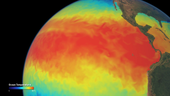
The jury is still out as to whether climate change will lead to stronger El Niño events, but while representatives from around 200 countries at the COP24 conference are working to breathe life into the 2105 Paris Agreement, there is a 75–80% chance that a fully-fledged event could be with us in the next couple of months.
vrchní referent/rada - obnova katastrálního operátu - v oddělení aktualizace KN Katastrálního pracov
7.12.2018 10:57 ČÚZK - předpisy a opatření Katastrální úřad pro Jihočeský kraj - Katastrální pracoviště Strakonicevypisuje výběrové řízení na místo
vrchní referent/rada - obnova katastrálního operátu - v oddělení aktualizace KN Katastrálního pracoviště Strakonice
vrchní referent/rada - obnova katastrálního operátu - v oddělení aktualizace KN Katastrálního pracov
7.12.2018 10:57 ČÚZK /Urady/Katastralni-urady/Katastralni-urady/Katastralni-urad-pro-Jihocesky-kraj/Uredni-deska/Oznameni-a-jina-uredni-sdeleni/Volna-mista/vrchni-ref-rada-obnova-OA-KP-STvrchní referent/rada - obnova katastrálního operátu - v oddělení aktualizace KN Katastrálního pracov
7.12.2018 10:57 ČÚZK - volná místa Katastrální úřad pro Jihočeský kraj - Katastrální pracoviště Strakonice vypisuje výběrové řízení na místo vrchní referent/rada - obnova katastrálního operátu - v oddělení aktualizace KN Katastrálního pracovMaptek−MinLog partnership closes the gap between mine planning and production
7.12.2018 10:23 GISCafe.com Webcasts-Webinars 6 December 2018 -- Maptek has announced further investment in MinLog, building on a longstanding partnership that bridges the gap between mine …First Amsterdam Drone Week clarifies vision on the future of drones
7.12.2018 10:16 GISCafe.com Webcasts-Webinars Amsterdam, 6 December 2018 -- A safe and secure development of the drone industry, including all its applications and opportunities, requires …Jakub byl v Marseille na European Space Week 2018 vyslán GSA na EGNSS User Platform in Surveying
7.12.2018 10:09 UpVision Tento týden se konal ve francouzském Marseille European Space Week 2018, kde byl Jakub jako Drone expert vyslán GSA na EGNSS User Consultation Platform in Surveying.Fotky zde:
https://plus.google.com/u/0/b/115833877689730865211/+UpvisionCz1/posts/NJPCosSmtzd
Earth from Space
7.12.2018 10:05 ESA Observing the Earth
This week's edition features a Copernicus Sentinel-2 view over the Chachani mountain and the city of Arequipa in Peru
Chachani, Peru
7.12.2018 10:05 ESA Observing the Earth
Earth observation image of the week: Copernicus Sentinel-2 takes us over the Chachani mountain in Peru
Department of Homeland Security Selects PAE ISR to Participate in UAS Solution Program for Border and Critical Infrastructure Security Scenarios
7.12.2018 9:00 GISCafe.com Webcasts-Webinars STERLING, Va., Dec. 3, 2018 /PRNewswire/ -- The Department of Homeland Security Science and Technology Directorate selects PAE ISR to …Pozvánka na 23. kartografickou konferenci
7.12.2018 8:58 GISportal.cz
V příštím roce se uskuteční již 23. kartografická konference, jejímž podtitulem je Kartografie v proměnách času. Přijměte tedy i naše pozvání do Kutné Hory, kde se bude akce konat. V pořadí 23. kartografická konference se uskuteční ve dnech 18.–20. září 2019 v Galerii Středočeského kraje. Ta se rozkládá v bezprostřední blízkosti kutnohorského chrámu sv. Barbory […]
The post Pozvánka na 23. kartografickou konferenci appeared first on GISportal.cz.
ČÚZK se připojil k memorandu DTM
7.12.2018 1:18 Asociace podnikatelů v geomatice Předseda ČÚZK Ing. Karel Večeře připojil svůj podpis pod memorandum digitální technické mapy (DTM). Dle jeho slov ČÚZK vznik tohoto díla podporuje a je připraven pomoci především s definováním technického standardu DTM. Digitální technická mapa České republiky má sloužit k systematické a jednotné správě geografických dat o umístění sítí elektronických komunikací a dalších infrastrukturních sítí (dále jen „technická infrastruktura“) včetně […]Geologická mapa ČR 1 : 500 000 - INSPIRE stahovací služba (téma Geologie)
7.12.2018 1:00 Cenia - Katalog metadat ČR - INSPIRE Stahovací služba (prostřednictvím kanálu ATOM) zobrazující datovou sadu GeoCR500, která byla harmonizována pro účely splnění požadavků směrnice INSPIRE.Mapa radonového indexu 1 : 50 000 - INSPIRE stahovací služba pro téma oblasti ohrožené přírodními riziky
7.12.2018 1:00 Cenia - Katalog metadat ČR - INSPIRE Stahovací služba (prostřednictvím kanálu ATOM) poskytuje základní informace o výsledcích mapování radonového indexu na území České republiky v měřítku 1 : 50 000.Půdní mapa 1 : 1 000 000 - INSPIRE stahovací služba pro téma půda
7.12.2018 1:00 Cenia - Katalog metadat ČR - INSPIRE Stahovací služba (prostřednictvím kanálu ATOM) poskytuje půdní mapu v měřítku 1:1 000 000, která byla sestavena Milanem Tomáškem a vydána v rámci publikace Půdy České republiky (3.vydání, Česká geologická služba, 2003). Součástí mapové služby je vrstva půdní zrnitosti.Sesuvy v ČR - INSPIRE stahovací služba (téma Oblasti ohrožené přírodními riziky)
7.12.2018 1:00 Cenia - Katalog metadat ČR - INSPIRE Stahovací služba (prostřednictvím kanálu ATOM) poskytuje informace o sesuvech v měřítku 1:10 000 na území České republiky. Údaje jsou průběžně aktualizovány.Aerobo uses Vermeer and Geomni to provide AR-Maps for Major Golf Tournament
6.12.2018 19:17 GISCafe.com Webcasts-Webinars December 06, 2018 -- Black Friday was a record-breaking day for golf enthusiasts worldwide. Two of the world’s best golfers, Tiger Woods and …Esri Named a Leader in Location Intelligence Platforms Report by Independent Research Firm
6.12.2018 17:56 GISCafe.com Webcasts-Webinars REDLANDS, Calif. — (BUSINESS WIRE) — December 6, 2018 —Esri,
the global leader in GIS, location intelligence, and …
Harris Corporation Successfully Launches Its First Smallsat; Showcases Company’s Complete Mission Solution
6.12.2018 17:56 GISCafe.com Webcasts-Webinars Highlights:Offers affordable solution for customers with very high-speed
communications requirements
…
CoreLogic Reports Homeowners with Negative Equity Declines by Only 81,000 in the Third Quarter of 2018
6.12.2018 17:56 GISCafe.com Webcasts-Webinars Smallest quarter-to-quarter decline in negative equity sinceeconomic recovery began in 2010
Homeowners had an average …
Hummingbird Technologies Adds Iteris ClearAg to AI-powered Crop Analysis Platform
6.12.2018 17:56 GISCafe.com Webcasts-Webinars ClearAg Smart Content to Enhance Hummingbird’s Remote-Sensing CropHealth Capability
ClearAg data now available to …
Broadband mapping pioneer, Michael Byrne, joins Conexon as vice president, Information Technology
6.12.2018 17:56 GISCafe.com Webcasts-Webinars FAYETTEVILLE, Ark., Dec. 6, 2018 — (PRNewswire) — Conexon, a company committed to partnering with electric membership cooperatives to …ArangoDB 3.4 Introduces Native Search Engine and Full GeoJSON Support
6.12.2018 17:56 GISCafe.com Webcasts-Webinars Over 40 New Features Added to Simplify Application DevelopmentSAN FRANCISCO, Dec. 6, 2018 — (PRNewswire) —
SAN FRANCISCO, Dec. 6, …
Greenland ice loss quickening
6.12.2018 17:08 ESA Observing the Earth
Using a 25-year record of ESA satellite data, recent research shows that the pace at which Greenland is losing ice is getting faster.
ESA expands climate dataset portfolio
6.12.2018 17:04 ESA Observing the Earth
ESA has added nine new projects to its flagship climate initiative as part of ongoing efforts to systematically observe and collect data in support of the United Nations Framework Convention on Climate Change.
Industrializing Project Delivery Using BIM Methodologies And a CDE for Digital Cities in Kunming City – Bentley Systems
6.12.2018 16:09 Bentley SystemsPress Coverage
AECCafe, USA
Read the articleBIM Methodologies Help Beijing Water Increase Water Distribution in Northern China – Bentley Systems
6.12.2018 15:44 Bentley SystemsPress Coverage
AECCafe, USA
Read the articleCollaborative BIM Workflows Help Lower Cost of the Zhengzhou-Xixia Expressway Project – Bentley Systems
6.12.2018 15:41 Bentley SystemsPress Coverage
AECCafe, USA
Read the articleSpeaker Interview: Craig Garrett
6.12.2018 15:35 Bentley SystemsPress Coverage
The Big 5 Hub, Middle East
Read the articleBentley Co-founder: iTwins Services announcement is one of our biggest in decades
6.12.2018 15:31 Bentley SystemsPress Coverage
ME Construction News, Middle East
Read the articleBuilding on stronger grounds with geotechnical engineering
6.12.2018 15:27 Bentley SystemsPress Coverage
Geospatial World, India
Read the articleAccuracy Matters. When close isn’t enough, use Galileo!
6.12.2018 15:21 European GNSS Agency
The European GNSS Agency (GSA) kicked off a new campaign to raise awareness of the fact that Galileo is making a real difference in the lives of the over half-a-billion users who have extra Galileo accuracy in their phone…. yet may not know it!
Did you know that Galileo is already improving the GPS signal that your smartphone receives, giving you extra accuracy and precision? Most Europeans are unaware that they are already benefitting from Galileo, but this is about to change! The Accuracy Matters campaign aim to increase public awareness of Galileo’s success and the added value it brings to the mass-market.
Lost in Location? Use Galileo!
According to the latest figures, today over 500 million devices - most of them the latest smartphone models - are now Galileo-enabled. The time has come to make people aware that Europe’s investment in Galileo is bringing daily benefits to millions! The new campaign is focusing on the fact that a little goes a long way and that “Accuracy Matters”. The new awareness-building campaign will include ten short video clips that give an entertaining glimpse of everyday situations where ‘Accuracy Matters’ to anyone using location data on their smartphones.
The campaign will be fully launched on December 15, but you can already get a first taste here: Lost in Location? The video clips will be released in all EU languages and promoted on the Internet and through social media.
Do you know whether your phone is Galileo-enabled? You can check out all the devices that are already Galileo-enabled here: UseGalileo.eu.
Media note: This feature can be republished without charge provided the European GNSS Agency (GSA) is acknowledged as the source at the top or the bottom of the story. You must request permission before you use any of the photographs on the site. If you republish, we would be grateful if you could link back to the GSA website (http://www.gsa.europa.eu).
Accuracy Matters. When close isn’t enough, use Galileo!
6.12.2018 15:21 European GNSS Agency
The European GNSS Agency (GSA) kicked off a new campaign to raise awareness of the fact that Galileo is making a real difference in the lives of the over half-a-billion users who have extra Galileo accuracy in their phone…. yet may not know it!
Did you know that Galileo is already improving the GPS signal that your smartphone receives, giving you extra accuracy and precision? Most Europeans are unaware that they are already benefitting from Galileo, but this is about to change! The Accuracy Matters campaign aim to increase public awareness of Galileo’s success and the added value it brings to the mass-market.
Lost in Location? Use Galileo!
According to the latest figures, today over 500 million devices - most of them the latest smartphone models - are now Galileo-enabled. The time has come to make people aware that Europe’s investment in Galileo is bringing daily benefits to millions! The new campaign is focusing on the fact that a little goes a long way and that “Accuracy Matters”. The new awareness-building campaign will include ten short video clips that give an entertaining glimpse of everyday situations where ‘Accuracy Matters’ to anyone using location data on their smartphones.
The campaign will be fully launched on December 15, but you can already get a first taste here: Lost in Location? The video clips will be released in all EU languages and promoted on the Internet and through social media.
Do you know whether your phone is Galileo-enabled? You can check out all the devices that are already Galileo-enabled here: UseGalileo.eu.
Media note: This feature can be republished without charge provided the European GNSS Agency (GSA) is acknowledged as the source at the top or the bottom of the story. You must request permission before you use any of the photographs on the site. If you republish, we would be grateful if you could link back to the GSA website (http://www.gsa.europa.eu).
20181206-VŘ Analytik-programátor
6.12.2018 15:12 ČÚZK /Aktuality-resort/2018/20181206-VR-Analytik-programator20181206-VŘ Analytik-programátor
6.12.2018 15:12 ČÚZK - předpisy a opatření Český úřad zeměměřický a katastrální zveřejnil novou aktualitu: Oznámení o vyhlášení výběrového řízení na služební místo Analytik/analytička - programátor/programátorka.Analytik/analytička - programátor/programátorka
6.12.2018 15:02 ČÚZK - předpisy a opatření Český úřad zeměměřický a katastrálnívypisuje výběrové řízení na místo
Analytik/analytička - programátor/programátorka
Analytik/analytička - programátor/programátorka
6.12.2018 15:02 ČÚZK /Urady/Cesky-urad-zememericky-a-katastralni/Uredni-deska/Oznameni-a-jina-uredni-sdeleni/Volna-mista/Analytik-analyticka-programator-programatorkaAnalytik/analytička - programátor/programátorka
6.12.2018 15:02 ČÚZK - volná místa Český úřad zeměměřický a katastrální vypisuje výběrové řízení na místo Analytik/analytička - programátor/programátorkaOcenění SpaceNews pro ESA
6.12.2018 15:01 Český Kosmický PortálESA získala ocenění „Vládní agentura roku“ v nejnovějším udílení cen SpaceNews Awards. Organizace SpaceNews každoročně oceňuje výjimečnost a inovaci mezi kosmickými profesionály, společnostmi, programy a organizacemi.
Informace k úpravě pracovní doby a výběru poplatků
6.12.2018 13:53 ČÚZK - předpisy a opatření Katastrální úřad pro Plzeňský kraj - Katastrální pracoviště Tachov zveřejnil novou aktualitu:UPOZORNĚNÍ
Vážení klienti,dne 27. 12. - 31. 12. 2018 lze z technických důvodů správní poplatky uhradit pouze kolkovými známkami nebo bezhotovostním převodem na účet.
Dne 31. 12. 2018 bude otevřeno pouze do 12:00 hodin.
Informace k úpravě pracovní doby a výběru poplatků
6.12.2018 13:53 ČÚZK /Urady/Katastralni-urady/Katastralni-urady/Katastralni-urad-pro-Plzensky-kraj/Katastralni-pracoviste/KP-Tachov/O-uradu/Aktuality/Informace-k-uprave-pracovni-doby-a-vyberu-poplatkuInformace k úpravě pracovní doby a výběru poplatků
6.12.2018 13:52 ČÚZK - předpisy a opatření Katastrální úřad pro Plzeňský kraj - Katastrální pracoviště Rokycany zveřejnil novou aktualitu:UPOZORNĚNÍ
Vážení klienti,dne 27. 12. - 31. 12. 2018 lze z technických důvodů správní poplatky uhradit pouze kolkovými známkami nebo bezhotovostním převodem na účet.
Dne 31. 12. 2018 bude otevřeno pouze do 12:00 hodin.
Informace k úpravě pracovní doby a výběru poplatků
6.12.2018 13:52 ČÚZK /Urady/Katastralni-urady/Katastralni-urady/Katastralni-urad-pro-Plzensky-kraj/Katastralni-pracoviste/KP-Rokycany/O-uradu/Aktuality/Informace-k-uprave-pracovni-doby-a-vyberu-poplatkuInformace k úpravě pracovní doby a výběru poplatků
6.12.2018 13:51 ČÚZK - předpisy a opatření Katastrální úřad pro Plzeňský kraj - Katastrální pracoviště Kralovice zveřejnil novou aktualitu:UPOZORNĚNÍ
Vážení klienti,dne 27. 12. - 31. 12. 2018 lze z technických důvodů správní poplatky uhradit pouze kolkovými známkami nebo bezhotovostním převodem na účet.
Dne 31. 12. 2018 bude otevřeno pouze do 12:00 hodin.
Informace k úpravě pracovní doby a výběru poplatků
6.12.2018 13:51 ČÚZK /Urady/Katastralni-urady/Katastralni-urady/Katastralni-urad-pro-Plzensky-kraj/Katastralni-pracoviste/KP-Kralovice/O-uradu/Aktuality/Informace-k-uprave-pracovni-doby-a-vyberu-poplatkuInformace k úpravě pracovní doby a výběru poplatků
6.12.2018 13:50 ČÚZK /Urady/Katastralni-urady/Katastralni-urady/Katastralni-urad-pro-Plzensky-kraj/Katastralni-pracoviste/KP-Klatovy/O-uradu/Aktuality/Informace-k-uprave-pracovni-doby-a-vyberu-poplatkuInformace k úpravě pracovní doby a výběru poplatků
6.12.2018 13:50 ČÚZK - předpisy a opatření Katastrální úřad pro Plzeňský kraj - Katastrální pracoviště Klatovy zveřejnil novou aktualitu:UPOZORNĚNÍ
Vážení klienti,dne 27. 12. - 31. 12. 2018 lze z technických důvodů správní poplatky uhradit pouze kolkovými známkami nebo bezhotovostním převodem na účet.
Dne 31. 12. 2018 bude otevřeno pouze do 12:00 hodin.
Informace k úpravě pracovní doby a výběru poplatků
6.12.2018 13:48 ČÚZK - předpisy a opatření Katastrální úřad pro Plzeňský kraj - Katastrální pracoviště Domažlice zveřejnil novou aktualitu:UPOZORNĚNÍ
Vážení klienti,dne 27. 12. - 31. 12. 2018 lze z technických důvodů správní poplatky uhradit pouze kolkovými známkami nebo bezhotovostním převodem na účet.
Dne 31. 12. 2018 bude otevřeno pouze do 12:00 hodin.
Informace k úpravě pracovní doby a výběru poplatků
6.12.2018 13:48 ČÚZK /Urady/Katastralni-urady/Katastralni-urady/Katastralni-urad-pro-Plzensky-kraj/Katastralni-pracoviste/KP-Domazlice/O-uradu/Aktuality/Informace-k-uprave-pracovni-doby-a-vyberu-poplatkuInformace k úpravě pracovní doby a výběru poplatků
6.12.2018 13:46 ČÚZK - předpisy a opatření Katastrální úřad pro Plzeňský kraj - Katastrální pracoviště Plzeň-sever zveřejnil novou aktualitu:UPOZORNĚNÍ
Vážení klienti,dne 31. 12. 2018 lze z technických důvodů správní poplatky uhradit pouze kolkovými známkami, bezhotovostním převodem na účet nebo platebními kartami.
Dne 31. 12. 2018 bude otevřeno pouze do 12:00 hodin.
Informace k úpravě pracovní doby a výběru poplatků
6.12.2018 13:46 ČÚZK /Urady/Katastralni-urady/Katastralni-urady/Katastralni-urad-pro-Plzensky-kraj/Katastralni-pracoviste/KP-Plzen-sever/O-uradu/Aktuality/Informace-k-uprave-pracovni-doby-a-vyberu-poplatkuPředadventní setkání ve Villa Hrdlička
6.12.2018 13:45 HrdličkaLetošní ročník byl již sedmý a těší nás, že jsme se opět setkali v předvánočním čase. Tato akce je velkým poděkování našim partnerům a spolupracovníkům, kterých si vážíme a touto formou jim chceme poděkovat. Hudba provázela slavnostní akci celým večerem. Kytarové trio za ZUŠ Česká Lípa přivítalo příchozí hosty, večerní vystoupení harfistky Kateřiny Englichové a... View Article
The post Předadventní setkání ve Villa Hrdlička appeared first on HRDLIČKA spol. s r.o. - komplexní služby v oblasti geodézie.
Informace k úpravě pracovní doby a výběru poplatků
6.12.2018 13:45 ČÚZK - předpisy a opatření Katastrální úřad pro Plzeňský kraj - Katastrální pracoviště Plzeň-město zveřejnil novou aktualitu:UPOZORNĚNÍ
Vážení klienti,dne 31. 12. 2018 lze z technických důvodů správní poplatky uhradit pouze kolkovými známkami, bezhotovostním převodem na účet nebo platebními kartami.
Dne 31. 12. 2018 bude otevřeno pouze do 12:00 hodin.
Informace k úpravě pracovní doby a výběru poplatků
6.12.2018 13:45 ČÚZK /Urady/Katastralni-urady/Katastralni-urady/Katastralni-urad-pro-Plzensky-kraj/Katastralni-pracoviste/KP-Plzen-mesto/O-uradu/Aktuality/Informace-k-uprave-pracovni-doby-a-vyberu-poplatkuInformace k úpravě pracovní doby a výběru poplatků
6.12.2018 13:43 ČÚZK - předpisy a opatření Katastrální úřad pro Plzeňský kraj - Katastrální pracoviště Plzeň-jih zveřejnil novou aktualitu:UPOZORNĚNÍ
Vážení klienti,dne 31. 12. 2018 lze z technických důvodů správní poplatky uhradit pouze kolkovými známkami, bezhotovostním převodem na účet nebo platebními kartami.
Dne 31. 12. 2018 bude otevřeno pouze do 12:00 hodin.
Informace k úpravě pracovní doby a výběru poplatků
6.12.2018 13:43 ČÚZK /Urady/Katastralni-urady/Katastralni-urady/Katastralni-urad-pro-Plzensky-kraj/Katastralni-pracoviste/KP-Plzen-jih/O-uradu/Aktuality/Informace-k-uprave-pracovni-doby-a-vyberu-poplatkuInformace k úpravě pracovní doby a výběru poplatků
6.12.2018 13:32 ČÚZK - předpisy a opatření Katastrální úřad pro Plzeňský kraj zveřejnil novou aktualitu:UPOZORNĚNÍ
Vážení klienti,dne 31. 12. 2018 lze z technických důvodů správní poplatky uhradit pouze kolkovými známkami, bezhotovostním převodem na účet nebo platebními kartami.
Dne 31. 12. 2018 bude otevřeno pouze do 12:00 hodin.
Informace k úpravě pracovní doby a výběru poplatků
6.12.2018 13:32 ČÚZK /Urady/Katastralni-urady/Katastralni-urady/Katastralni-urad-pro-Plzensky-kraj/O-uradu/Aktuality/Informace-k-uprave-pracovni-doby-a-vyberu-poplatkuAktualizace údajů
6.12.2018 13:20 Ústecký kraj V Geoportálu ÚAP Ústeckého kraje byla provedena aktualizace údajů pro poskytovatele Severočeské vodovody a kanalizace, a.s. – Jev 44, 67, 68, 69, 70, 72, 732018 European Union Space Week takes off in Marseille!
6.12.2018 12:28 European GNSS Agency
Entrepreneurs and SMEs, along with business and public sector professionals using space data from across Europe and around the globe descended on Marseille ‘en masse’ for the 2018 edition of EU Space Week. The event featured presentations from high-level personalities, as well as key user communities. Plus, awards for Europe's up-and-coming space application researchers and innovators were given at the annual ‘Space Oscars’.
The EU Space Week opening plenary gathered speakers from industry and the public sector. They discussed how European Satellite Navigation and Earth Observation serve as powerful tools for tackling today's economic, social, and environmental challenges and creating opportunities for growth and job creation.
Elżbieta Bieńkowska, European Commissioner for Internal Market, Industry, Entrepreneurship and SMEs, said, “Space is essential for our economy. We are not investing in space for the sake of space itself, but because of the benefits it brings to our citizens and society.”
Watch this: EU Space Week in Marseille, 3 - 6 December 2018
The Commissioner's comments come as EU parliamentarians and Member States are in the midst of negotiations concerning the next EU space budget. “Galileo, EGNOS and Copernicus are world-class European success stories,” she said. “We have fought hard to keep them funded and we can see the results.” She also argued that a change of mind-set is needed to keep young European entrepreneurs in Europe, through greater private investment and venture capitalism.
President of the French Space Agency (CNES) Jean-Yves Le Gall called Galileo a “fine testimony” to European teamwork, as are the over 500 million Galileo-enabled smartphones now on the market. The opening plenary also featured round-table discussions with business leaders who are turning space-based data from Galileo and Copernicus into valuable and profitable services on the ground.
For European GNSS Agency (GSA) Executive Director Carlo des Dorides, the success of Galileo has had a lot to do with forward thinking. "We did a lot of preparatory work," he said. "We had to get to know the people we were talking to, those instrument and receiver manufacturers. And we had the financial tools in place to help facilitate their decision making." The GSA handles, among other things, promoting Galileo market uptake.
Cooperation and competition were the key words for ESA Director General Jan Wörner. He said competition is good, but he added, “To remain strong and autonomous, Europe also needs to focus on cooperation. We all need to continue to come together, to join forces.”
User Consultation Platform helps ensure customer satisfaction
The annual EGNSS User Consultation Platform (UCP) enables direct interaction between users of positioning, navigation and timing solutions and the organisations and institutions providing Galileo and EGNOS services. The ultimate goal is to allow programme decision-makers to immediately take on-board inputs coming from users.
UCP participants are actual users of European GNSS systems, representatives of standardisation bodies and industry groups, regulatory bodies, and other members of the GNSS value chain. The work of the Platform in Marseille entailed eight parallel panel sessions bringing together users by market segment. The segments were: Mass Market; Road Transport; Aviation; Rail; Maritime; Agriculture; Surveying & Mapping; and Timing & Synchronisation.
At the UCP plenary session, representatives of the sectors reported the results of their discussions. Members of the audience were encouraged to ask questions and a panel of representatives from the European Commission and the European GNSS Agency (GSA) also interacted directly with the user representatives.
“The exercise was extremely fruitful,” said panellist Fiammetta Diani of the GSA. ”All comments, suggestions and requests will be taken into account and will have a real impact on the evolution of European GNSS services.”
GSA Executive Director Carlo des Dorides thanked participants for their strong engagement and said, “The GSA works hard to maintain close relationships with European GNSS users, and that means all stakeholders in the downstream markets. The real value of the GSA is built on these relationships.”
Matthias Petschke, European Commission Director of EU Satellite Navigation Programmes, said, “What this User Consultation shows is that we are listening to you. Unlike other GNSS around the world, Galileo is a demand-driven programme. We want to hear your ideas and we want to know what you need, to bring your ideas to the market and create business.”
Rewarding programme
The stars came out for the prestigious Galileo and Copernicus Masters Gala Awards Ceremony, also known as the 'Space Oscars'. This year's annual European space innovation competition focused on how to tackle global challenges with Galileo and Copernicus. Prizes were presented by high-ranking competition partners from business, government and the space community.
Carlo des Dorides presented the 2018 GSA Special Prizes around the theme, 'When and Where'. He explained the rationale for the Agency's ongoing involvement in the awards, which are organised by Germany's AZO. “The focus is this virtuous cycle between innovation, SMEs and finally business in the market,” des Dorides said. “This partnership is a good fit. We have 60 projects funded under Horizon 2020, this is really R&D. We are funding specific technology areas. With the European Satellite Navigation Competition, we can get closer to the market, so this is certainly where we want to be.”
2018 European Union Space Week takes off in Marseille!
6.12.2018 12:28 European GNSS Agency
Entrepreneurs and SMEs, along with business and public sector professionals using space data from across Europe and around the globe descended on Marseille ‘en masse’ for the 2018 edition of EU Space Week. The event featured presentations from high-level personalities, as well as key user communities. Plus, awards for Europe's up-and-coming space application researchers and innovators were given at the annual ‘Space Oscars’.
The EU Space Week opening plenary gathered speakers from industry and the public sector. They discussed how European Satellite Navigation and Earth Observation serve as powerful tools for tackling today's economic, social, and environmental challenges and creating opportunities for growth and job creation.
Elżbieta Bieńkowska, European Commissioner for Internal Market, Industry, Entrepreneurship and SMEs, said, “Space is essential for our economy. We are not investing in space for the sake of space itself, but because of the benefits it brings to our citizens and society.”
Watch this: EU Space Week in Marseille, 3 - 6 December 2018
The Commissioner's comments come as EU parliamentarians and Member States are in the midst of negotiations concerning the next EU space budget. “Galileo, EGNOS and Copernicus are world-class European success stories,” she said. “We have fought hard to keep them funded and we can see the results.” She also argued that a change of mind-set is needed to keep young European entrepreneurs in Europe, through greater private investment and venture capitalism.
President of the French Space Agency (CNES) Jean-Yves Le Gall called Galileo a “fine testimony” to European teamwork, as are the over 500 million Galileo-enabled smartphones now on the market. The opening plenary also featured round-table discussions with business leaders who are turning space-based data from Galileo and Copernicus into valuable and profitable services on the ground.
For European GNSS Agency (GSA) Executive Director Carlo des Dorides, the success of Galileo has had a lot to do with forward thinking. "We did a lot of preparatory work," he said. "We had to get to know the people we were talking to, those instrument and receiver manufacturers. And we had the financial tools in place to help facilitate their decision making." The GSA handles, among other things, promoting Galileo market uptake.
Cooperation and competition were the key words for ESA Director General Jan Wörner. He said competition is good, but he added, “To remain strong and autonomous, Europe also needs to focus on cooperation. We all need to continue to come together, to join forces.”
User Consultation Platform helps ensure customer satisfaction
The annual EGNSS User Consultation Platform (UCP) enables direct interaction between users of positioning, navigation and timing solutions and the organisations and institutions providing Galileo and EGNOS services. The ultimate goal is to allow programme decision-makers to immediately take on-board inputs coming from users.
UCP participants are actual users of European GNSS systems, representatives of standardisation bodies and industry groups, regulatory bodies, and other members of the GNSS value chain. The work of the Platform in Marseille entailed eight parallel panel sessions bringing together users by market segment. The segments were: Mass Market; Road Transport; Aviation; Rail; Maritime; Agriculture; Surveying & Mapping; and Timing & Synchronisation.
At the UCP plenary session, representatives of the sectors reported the results of their discussions. Members of the audience were encouraged to ask questions and a panel of representatives from the European Commission and the European GNSS Agency (GSA) also interacted directly with the user representatives.
“The exercise was extremely fruitful,” said panellist Fiammetta Diani of the GSA. ”All comments, suggestions and requests will be taken into account and will have a real impact on the evolution of European GNSS services.”
GSA Executive Director Carlo des Dorides thanked participants for their strong engagement and said, “The GSA works hard to maintain close relationships with European GNSS users, and that means all stakeholders in the downstream markets. The real value of the GSA is built on these relationships.”
Matthias Petschke, European Commission Director of EU Satellite Navigation Programmes, said, “What this User Consultation shows is that we are listening to you. Unlike other GNSS around the world, Galileo is a demand-driven programme. We want to hear your ideas and we want to know what you need, to bring your ideas to the market and create business.”
Rewarding programme
The stars came out for the prestigious Galileo and Copernicus Masters Gala Awards Ceremony, also known as the 'Space Oscars'. This year's annual European space innovation competition focused on how to tackle global challenges with Galileo and Copernicus. Prizes were presented by high-ranking competition partners from business, government and the space community.
Carlo des Dorides presented the 2018 GSA Special Prizes around the theme, 'When and Where'. He explained the rationale for the Agency's ongoing involvement in the awards, which are organised by Germany's AZO. “The focus is this virtuous cycle between innovation, SMEs and finally business in the market,” des Dorides said. “This partnership is a good fit. We have 60 projects funded under Horizon 2020, this is really R&D. We are funding specific technology areas. With the European Satellite Navigation Competition, we can get closer to the market, so this is certainly where we want to be.”
2018 European Space Week takes off in Marseille!
6.12.2018 12:28 European GNSS AgencyEntrepreneurs and SMEs, along with business and public sector professionals using space data from across Europe and around the globe descended on Marseille ‘en masse’ for the 2018 edition of EU Space Week. The event featured presentations from high-level personalities, as well as key user communities. Plus, awards for Europe's up-and-coming space application researchers and innovators were given at the annual ‘Space Oscars’.
The EU Space Week opening plenary gathered speakers from industry and the public sector. They discussed how European Satellite Navigation and Earth Observation serve as powerful tools for tackling today's economic, social, and environmental challenges and creating opportunities for growth and job creation.
Elżbieta Bieńkowska, European Commissioner for Internal Market, Industry, Entrepreneurship and SMEs, said, “Space is essential for our economy. We are not investing in space for the sake of space itself, but because of the benefits it brings to our citizens and society.”
Watch this: EU Space Week in Marseille, 3 - 6 December 2018
The Commissioner's comments come as EU parliamentarians and Member States are in the midst of negotiations concerning the next EU space budget. “Galileo, EGNOS and Copernicus are world-class European success stories,” she said. “We have fought hard to keep them funded and we can see the results.” She also argued that a change of mind-set is needed to keep young European entrepreneurs in Europe, through greater private investment and venture capitalism.
President of the French Space Agency (CNES) Jean-Yves Le Gall called Galileo a “fine testimony” to European teamwork, as are the over 500 million Galileo-enabled smartphones now on the market. The opening plenary also featured round-table discussions with business leaders who are turning space-based data from Galileo and Copernicus into valuable and profitable services on the ground.
For European GNSS Agency (GSA) Executive Director Carlo des Dorides, the success of Galileo has had a lot to do with forward thinking. "We did a lot of preparatory work," he said. "We had to get to know the people we were talking to, those instrument and receiver manufacturers. And we had the financial tools in place to help facilitate their decision making." The GSA handles, among other things, promoting Galileo market uptake.
Cooperation and competition were the key words for ESA Director General Jan Wörner. He said competition is good, but he added, “To remain strong and autonomous, Europe also needs to focus on cooperation. We all need to continue to come together, to join forces.”
User Consultation Platform helps ensure customer satisfaction
The annual EGNSS User Consultation Platform (UCP) enables direct interaction between users of positioning, navigation and timing solutions and the organisations and institutions providing Galileo and EGNOS services. The ultimate goal is to allow programme decision-makers to immediately take on-board inputs coming from users.
UCP participants are actual users of European GNSS systems, representatives of standardisation bodies and industry groups, regulatory bodies, and other members of the GNSS value chain. The work of the Platform in Marseille entailed eight parallel panel sessions bringing together users by market segment. The segments were: Mass Market; Road Transport; Aviation; Rail; Maritime; Agriculture; Surveying & Mapping; and Timing & Synchronisation.
At the UCP plenary session, representatives of the sectors reported the results of their discussions. Members of the audience were encouraged to ask questions and a panel of representatives from the European Commission and the European GNSS Agency (GSA) also interacted directly with the user representatives.
“The exercise was extremely fruitful,” said panellist Fiammetta Diani of the GSA. ”All comments, suggestions and requests will be taken into account and will have a real impact on the evolution of European GNSS services.”
GSA Executive Director Carlo des Dorides thanked participants for their strong engagement and said, “The GSA works hard to maintain close relationships with European GNSS users, and that means all stakeholders in the downstream markets. The real value of the GSA is built on these relationships.”
Matthias Petschke, European Commission Director of EU Satellite Navigation Programmes, said, “What this User Consultation shows is that we are listening to you. Unlike other GNSS around the world, Galileo is a demand-driven programme. We want to hear your ideas and we want to know what you need, to bring your ideas to the market and create business.”
Rewarding programme
The stars came out for the prestigious Galileo and Copernicus Masters Gala Awards Ceremony, also known as the 'Space Oscars'. This year's annual European space innovation competition focused on how to tackle global challenges with Galileo and Copernicus. Prizes were presented by high-ranking competition partners from business, government and the space community.
Carlo des Dorides presented the 2018 GSA Special Prizes around the theme, 'When and Where'. He explained the rationale for the Agency's ongoing involvement in the awards, which are organised by Germany's AZO. “The focus is this virtuous cycle between innovation, SMEs and finally business in the market,” des Dorides said. “This partnership is a good fit. We have 60 projects funded under Horizon 2020, this is really R&D. We are funding specific technology areas. With the European Satellite Navigation Competition, we can get closer to the market, so this is certainly where we want to be.”