


![]()

zprávy
zdroje zpráv:QANTAS Talking Business - Brian Middleton - Vice President ANZ at Bentley Systems
16.4.2018 2:00 Bentley SystemsPress Coverage
QANTAS Talking Business with Alan Kohler, Australia/New Zealand
Read the articleintenzita dopravy 2016
16.4.2018 2:00 Cenia - Katalog metadat ČR - INSPIRE výsledky celostátního sčítání dopravy 2016 na silniční a dálniční síti ČR (dálnice, silnice I.-III.tříd)Víte, jak se léčí česká krajina? Přijďte se podívat na fotografickou výstavu na střeše muzea
16.4.2018 0:00 Státní pozemkový úřad Na nově přístupné střeše Národního zemědělského muzea si nyní užijete nejen pražské výhledy, ale i nevšední záběry české krajiny. Fotografická výstava Státní pozemkový úřad – správce české krajiny představuje místa v České republice, do kterých se díky plánovaným zásahům vrátily krajinné prvky, tolik potřebné pro udržení zdravé rovnováhy. Výstava potrvá od 15. dubna do 16. května.Víte, jak se léčí česká krajina? Přijďte se podívat na fotografickou výstavu na střeše muzea
16.4.2018 0:00 Státní pozemkový úřad Na nově přístupné střeše Národního zemědělského muzea si nyní užijete nejen pražské výhledy, ale i nevšední záběry české krajiny. Fotografická výstava Státní pozemkový úřad – správce české krajiny představuje místa v České republice, do kterých se díky plánovaným zásahům vrátily krajinné prvky, tolik potřebné pro udržení zdravé rovnováhy. Výstava potrvá od 15. dubna do 16. května.If The Earth Were Flat…
15.4.2018 23:57 Carlson Software If The Earth Were Flat…………. Cats would have knocked everything off by now… ….also, it would be a heck of a lot easier to survey. I just returned from a very fun and informative Carlson User’s Conference that was held in San Diego. I taught five classes and assisted in a sixth over […]GIS Esri v ČR 2018 - důležité termíny
15.4.2018 7:00 Česká asociace pro geoinformace Největší oborové setkání geoinformatiků, konference GIS Esri v ČR, proběhne 7. a 8. listopadu 2018 v Kongresovém centru Praha. Konferenci pořádá společnost ARCDATA Praha, kolektivní člen CAGI.Důležité termíny:
30. 6. 2018 – přihláška přednášky,
30. 6. 2018 – přihláška firemní prezentace,
30. 6. 2018 – přihláška stánku,
12. 10. 2018 –
Prezentace Prahy v Bruselu: hlavní město evropské družicové navigace
13.4.2018 16:23 Český Kosmický PortálVe čtvrtek 12. 4. 2018 uspořádalo Stálé zastoupení ČR při EU a Pražský dům v Bruselu ve spolupráci s Evropskou agenturou pro globální navigační družicové systémy (GSA) a Ministerstvem dopravy ČR akci zaměřenou na prezentaci města Prahy a agentury GSA.
Sentinel-3B fully tanked
13.4.2018 14:58 ESA Observing the Earth
Getting a satellite ready to be launched involves a long list of jobs, but with the Copernicus Sentinel-3B satellite now fuelled, this particular ‘to do’ list is significantly shorter. And, importantly, all is on track for liftoff on 25 April.
BLUEGNSS accelerates 3D GNSS approach implementation
13.4.2018 13:58 European GNSS Agency
The GSA-funded BLUEGNSS project (Promoting EGNSS Operational Adoption in BLUEMED) was launched in 2016 with the aim of promoting the adoption of European GNSS in the BLUEMED Functional Airspace Block. Preliminary results, presented at the World ATM Congress in Madrid on March 6, show significant gains in safety and airport accessibility in the target countries.
To achieve its overarching goal of promoting EGNSS adoption, the BLUEGNSS project’s primary objective is to harmonise the implementation of PBN approach operations among the BLUE MED FAB states - Greece, Cyprus, Malta and Italy - using EGNSS (EGNOS and Galileo). With this in mind, the project focuses on three main streams: GNSS procedures design and validation; GNSS training; and GNSS monitoring.
Good results
BLUEGNSS is designing 3D GNSS procedures, known as RNP approach (Required Navigation Performance), for 11 selected airports (4 in Greece, 4 in Italy, 2 in Cyprus and 1 in Malta) to increase their accessibility and safety. In this way, the project supports BLUE MED countries in accelerating GNSS 3D approaches in view of the European PBN Implementing Rule, which is under discussion and which proposes implementation of 3D GNSS approaches by 2024, either as the primary approach or as a back-up for precision approaches.
Watch this: EGNOS for Aviation - High Precision, Low investment
The project got off to a good start in 2018 with the successful validation in January of 3 new GNSS procedures for Lamezia, Parma and Cuneo airports in Italy. This was followed by validations for Larnaca and Paphos in Cyprus in March. The GNSS approaches in Cyprus were successfully validated despite bad weather, further demonstrating the safety benefits of GNSS vertical guidance in adverse weather conditions. To date, 14 GNSS procedures have been designed and validated by the BLUEGNSS project. The last remaining one, Bolzano, is the most challenging due to its orography and the need to test RNP Authorization Required procedures, which is the first time Italy has had to deal with this.
Supporting implementation
The project is also providing training, to ensure that airspace procedure designers are able to deal with the design of RNP approach procedures and related minima. Specific workshops were organised to share and discuss the design principles among design task leaders and project members. In 2016, training was provided on Advanced Procedures for Air Navigation Services, Operations (PANS OPS) design and in 2017 there have been air traffic controller (ATCO) and non-ATCO training courses for instructors, all of which have been delivered by the certified ENAV Academy.
In addition, the project recognises GNSS performance monitoring as one of the main enablers for the implementation and acceptance of the new RNP APCH operations, paving the way for Galileo acceptance in aviation. With this in mind, the project is adopting a regional and multi-source approach to monitoring through the deployment of an innovative dedicated network devoted not only to standard GNSS performance assessment, but also to interference assessment and reporting, and GNSS data recording.
The project’s GNSS monitoring solution is the first to be fully ICAO compliant, it is modular and interoperable with other systems, and cost-benefit analyses at regional level have shown positive results. The system automatically generates daily and monthly monitoring reports, which are available in the restricted area of the BLUEMED portal www.bluemed.aero.
Speaking at the World ATM Congress in Madrid on March 6, BLUEGNSS Project Coordinator Patrizio Vanni was upbeat about the project results achieved so far. “The project is in good health and close to completion, almost all of the challenges have been successfully completed,” Vanni said.
Cross-fertilization
BLUEGNSS is the first time in Europe that a RNP approach implementation project has been coordinated at FAB level. One of the advantages of this approach is that countries and air navigation service providers with limited experience in RNP approach operational implementation can benefit from intra-FAB cross-fertilization.
BLUEGNSS is one of the Horizon 2020-Galileo-2015-1 projects selected for co-financing by the GSA. The consortium, led by ENAV, is composed of the BLUE MED FAB ANSP partners - DCAC, HCAA and MATS - and IDS (Ingegneria dei Sistemi) which is the only industrial partner. Launched in January 2016, the project is scheduled to last 30 months.
For more information, check the project website or the project page on the GSA site.
Media note: This feature can be republished without charge provided the European GNSS Agency (GSA) is acknowledged as the source at the top or the bottom of the story. You must request permission before you use any of the photographs on the site. If you republish, we would be grateful if you could link back to the GSA website (http://www.gsa.europa.eu).
Jakub byl v Amsterdamu opět porotcem mezinárodní soutěže inovativních využití dronů Drone Hero 2018
13.4.2018 12:53 UpVision Jakub byl tento týden v Amsterdamu opět porotcem mezinárodní soutěže inovativních projektů s drony Drone Hero 2018. Soutěž se opět konala v průběhu jedné z největších evropských akcí s drony Commercial UAV Expo 2018.Vítězné projekty lze prohlédnout zde:
https://www.dronecommunity.biz/drone-hero-eur…/winners-2018/
Fotografie z akce jsou zde:
https://plus.google.com/u/0/b/115833877689730865211/+UpvisionCz1/posts/K62FjtmawLX
senseFly announces the appointment of new CEO, Gilles Labossière
13.4.2018 12:48 GISCafe.com Webcasts-Webinars Gilles Labossière, the Executive Vice President and COO of Parrot Group, will focus on further boosting senseFly’s growth and leveraging …Zemřela Ing. Monika Mikšovská
13.4.2018 12:04 Zeměměřič Ing. Mikšovská (1929-2018) byla velmi známým vysokoškolským pedagogem zeměměřické fakulty ČVUT v Husově ulici v Praze.Radio astronomers focus on ionosphere for sharper satellite navigation
13.4.2018 10:05 ESA Navigation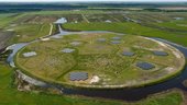
Radio astronomers and satellite navigation engineers are focusing their attention on the same point of the sky, looking into methods of improving both satnav accuracy and radio astronomy.
Earth from Space
13.4.2018 10:05 ESA Observing the Earth
This week's edition features a Sentinel-2A image of one of the largest metropolitan areas in India: Hyderabad
Hyderabad
13.4.2018 10:05 ESA Observing the Earth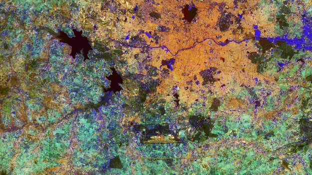
Earth observation image of the week: Sentinel-2A takes us over Hyderabad in southern India
Chcete létat s drony? Pak musíte znát vaše povinnosti!
13.4.2018 9:47 GISportal.cz
Počet vlastníků dronů trvale narůstá a s přicházejícím jarem jich budeme na obloze vídat stále více. Víte však, jaká jsou základní pravidla pro provoz dronů? A plníte je? Pokud ještě nemáte jasno, nabízíme to nejdůležitější ze zákona č. 49/1997 Sb. o civilním letectví, ve kterém se nachází také doplněk X – Bezpilotní systémy. 1. Ačkoliv […]
The post Chcete létat s drony? Pak musíte znát vaše povinnosti! appeared first on GISportal.cz.
Lovec bouří zaujal svoji pozici
13.4.2018 9:37 Český Kosmický PortálPřístroj ASIM (Atmosphere-Space Interactions Monitor), který je též známý jako „kosmický lovec bouří“, byl instalován vně evropské kosmické laboratoře Columbus na ISS.
Lovec bouří zaujal svoji pozici
13.4.2018 9:37 Český Kosmický PortálPřístroj ASIM (Atmosphere-Space Interactions Monitor), který je též známý jako „kosmický lovec bouří“, byl instalován vně evropské kosmické laboratoře Columbus na ISS.
Swarm turns to whistlers and storms
13.4.2018 9:10 ESA Observing the Earth
The batch of new results from ESA’s Swarm mission has not only included the highest-resolution map of the magnetic field generated by Earth’s crust and a map of the tiny magnetic signals from the oceans, but also, remarkably, some unexpected insight into lightning in the upper atmosphere and geomagnetic storms.
Harris Corporation to Announce Third Quarter Results on Wednesday, May 2, 2018
13.4.2018 9:00 GISCafe.com Webcasts-Webinars MELBOURNE, Fla. — (BUSINESS WIRE) — April 10, 2018 — Harris Corporation (NYSE:HRS) will host a conference call on Wednesday, May 2, …Maxar Technologies’ Radiant Solutions Voted Top Workplace for the Second Consecutive Year
13.4.2018 9:00 GISCafe.com Webcasts-Webinars TAMPA, Fla. — (BUSINESS WIRE) — April 10, 2018 — Radiant Solutions, a Maxar Technologies company (formerly MacDonald, Dettwiler and …Soukromý cloud – nová řada NAS od Qnapu zvládne až 8 disků
13.4.2018 8:28 GeoBusiness V době, kdy dostupnost a bezpečnost dat je pro instituce či firmy zásadní pro jejich fungování, je dobré uvažovat také o soukromých cloudech. Proto ... PřečístBilance množství a jakosti vody
13.4.2018 2:00 Cenia - Katalog metadat ČR - INSPIRE Pro zpracování bilance množství vody (zákon 254/2001 Sb. a vyhláška 431/3001 Sb.) je vymezeno 74 bilančních povodí a 10 bilančních oblastí. Výstupy bilance množství obsahují v měsíčním kroku v těchto povodích a oblastech údaje o atmosférických srážkách, celkovém odtoku, základním odtoku, zásobách vody ve sněhové pokrývce, změnách zásob podzemní vody a přirozených průtocích ve vybraných vodoměrných stanicích. Pro zpracování bilance jakosti povrchových vod bylo v roce 2016 použito 199 profilů shodných s předchozími roky. Provádí se dva typy hodnocení. Výstupy jsou mapy jakosti povrchových vod pro vybrané ukazatele a výsledky výpočtu látkového odnosu zvolených látek ve vybraných profilech.Pro zpracování bilance jakosti podzemních vod bylo v roce 2016 použito celkem 675 objektů - 184 pramenů, 223 mělkých a 268 hlubokých vrtů a 1348 vzorků v jarním a podzimním monitoringu. Výstupy jsou sestava ukazatelů jakosti vody porovnaných s referenčními hodnotami a mapy jakosti podzemních vod v přírodním prostředí.V této zprávě se kromě výsledků bilance množství a jakosti vod za rok 2016 nachází ještě zhodnocení výsledků za období 2014 až 2016.Výstupy hydrologické bilance jsou podkladem pro sestavení vodohospodářské bilance, kterou zajišťují příslušní správci povodí.Geofyzikální prozkoumanost
13.4.2018 2:00 Cenia - Katalog metadat ČR - INSPIRE ArcGIS Server služba znázorňuje situaci geofyzikálních průzkumů provedených převážně Geofyzikou Brno od počátku padesátých let minulého století. Podle měřítka původního zákresu do map rozlišujeme prozkoumanost regionální, která znázorňuje rozsáhlá měření v mapách 1 : 200 000, a prozkoumanost lokální se zákresy měření menšího rozsahu v měřítku 1 : 50 000.Seismické profily
13.4.2018 2:00 Cenia - Katalog metadat ČR - INSPIRE ArcGIS Server služba znázorňuje informace o seismických profilech z let 1966-1994, odměřených na území České republiky z prostředků státního rozpočtu.Vertikální elektrické sondy (VES)
13.4.2018 2:00 Cenia - Katalog metadat ČR - INSPIRE ArcGIS Server služba znázorňuje lokalizace měřících stanovišť vertikálního elektrického sondování (VES) v ČR od roku 1957.Mapa z Mapové sbírky PřF UK byla zapsána do seznamu UNESCO
12.4.2018 21:11 Zeměměřič Renesanční Camociova mapa tureckého obléhání Malty roku 1565 z Mapové sbírky PřF UK byla právě zapsána do prestižního seznamu Paměť světa UNESCO.Zeměměřič otiskl její kopii již v r. 2016.
Airbus has shipped SES-12 highly innovative satellite to launch base.
12.4.2018 20:17 GISCafe.com Webcasts-WebinarsSuited and booted
12.4.2018 16:41 ESA Observing the Earth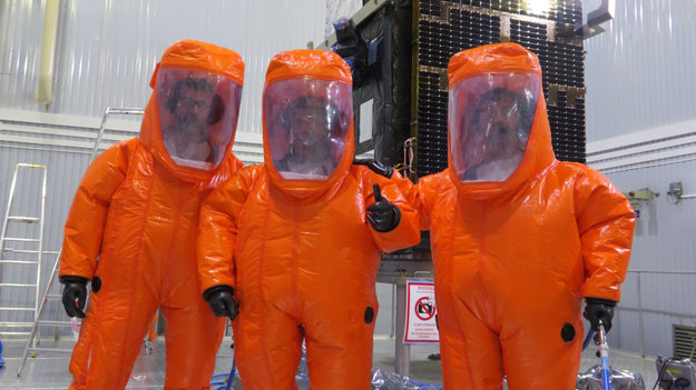
Fuelling team look fab, ready to load the Copernicus Sentinel-3B satellite for its life in orbit
OSIsoft and Dragos Form Partnership to Provide Increased Coverage for Threat Detection in ICS Networks
12.4.2018 16:39 GISCafe.com Webcasts-Webinars Dragos, Inc. and OSIsoft, LLC. create unique value by combining industrial network and operational data for greater situational awareness and …Esri and Alibaba Cloud Working Together to Bring Enhanced Location Intelligence Technology to Cloud Users
12.4.2018 16:36 GISCafe.com Webcasts-Webinars New Agreement brings Esri’s excellence in GIS to Alibaba Cloud’sworld-class Cloud Computing Capabilities
REDLANDS, Calif. — …
ION launches enterprise version of Marlin software to more broadly optimize offshore operations and continue advancing maritime digitization
12.4.2018 16:36 GISCafe.com Webcasts-Webinars HOUSTON, April 12, 2018 — (PRNewswire) — ION Geophysical Corporation (NYSE: IO) today announced the launch of its enterprise …Teledyne Optech presenting on Coastal Zone Mapping and Imaging Lidar at SPIE Defense & Commercial Sensing Conference
12.4.2018 16:33 GISCafe.com Webcasts-Webinars April 12, 2018 — Teledyne Optech is pleased to announce that Software Development Manager Mr. Vinod Ramnath will present his paper, Total …CoreLogic Acquires a la mode technologies, LLC
12.4.2018 16:33 GISCafe.com Webcasts-Webinars —Expands and Scales Data-Driven Valuations Platform Offerings—IRVINE, Calif. — (BUSINESS WIRE) — April 12, 2018 —
…
DroneDeploy Launches Drone on Demand to Make Real-time Drone Insights Accessible to All
12.4.2018 16:33 GISCafe.com Webcasts-Webinars Businesses of All Sizes Can Now Access Aerial Data In 3 StepsSAN FRANCISCO — (BUSINESS WIRE) — April 12, 2018 …
Cape Analytics Joins Duck Creek Partner Ecosystem to Provide Property Intelligence Solution Enabled by AI and Geospatial Imagery to Property & Casualty Insurers
12.4.2018 16:33 GISCafe.com Webcasts-Webinars BOSTON — (BUSINESS WIRE) — April 12, 2018 —Duck
Creek Technologies has expanded its Partner Ecosystem program
…
20180412-VŘ Řízení projektů
12.4.2018 15:20 ČÚZK - předpisy a opatření Český úřad zeměměřický a katastrální zveřejnil novou aktualitu: Oznámení o vyhlášení výběrového řízení na služební místo Řízení projektů.Řízení projektů
12.4.2018 14:55 ČÚZK - předpisy a opatření Český úřad zeměměřický a katastrálnívypisuje výběrové řízení na místo
Řízení projektů
Řízení projektů
12.4.2018 14:55 ČÚZK - volná místa Český úřad zeměměřický a katastrální vypisuje výběrové řízení na místo Řízení projektůInspektor Zeměměřického a katastrálního inspektorátu v Brně (obor služby 70.)
12.4.2018 13:49 ČÚZK - volná místa Zeměměřický a katastrální inspektorát v Brně vypisuje výběrové řízení na místo Inspektor Zeměměřického a katastrálního inspektorátu v Brně (obor služby 70.)Inspektor Zeměměřického a katastrálního inspektorátu v Brně (obor služby 70.)
12.4.2018 13:49 ČÚZK - předpisy a opatření Zeměměřický a katastrální inspektorát v Brněvypisuje výběrové řízení na místo
Inspektor Zeměměřického a katastrálního inspektorátu v Brně (obor služby 70.)
Inspektor Zeměměřického a katastrálního inspektorátu v Brně (obor služby 70.)
12.4.2018 13:49 ČÚZK /Urady/Zememericke-a-katastralni-inspektoraty/Zememericke-a-katastralni-inspektoraty/Zememericky-a-katastralni-inspektorat-v-Brne/Uredni-deska/Oznameni-a-jina-uredni-sdeleni/Volna-mista/Inspektor-Zememerickeho-a-katastralniho-inspek-(2)Úklid
12.4.2018 13:45 ČÚZK - volná místa Český úřad zeměměřický a katastrální vypisuje výběrové řízení na místo ÚklidÚklid
12.4.2018 13:45 ČÚZK - předpisy a opatření Český úřad zeměměřický a katastrálnívypisuje výběrové řízení na místo
Úklid
Odborný referent - zápisy v řízení V a Z v oddělení právních vztahů
12.4.2018 13:32 ČÚZK /Urady/Katastralni-urady/Katastralni-urady/Katastralni-urad-pro-Zlinsky-kraj/Uredni-deska/Oznameni-a-jina-uredni-sdeleni/Volna-mista/Odborny-referent-zapisy-v-rizeni-V-a-Z-v-oddelenOdborný referent - zápisy v řízení V a Z v oddělení právních vztahů
12.4.2018 13:32 ČÚZK - předpisy a opatření Katastrální úřad pro Zlínský kraj - Katastrální pracoviště Zlínvypisuje výběrové řízení na místo Odborný referent - zápisy v řízení V a Z v oddělení právních vztahů
Odborný referent - zápisy v řízení V a Z v oddělení právních vztahů
Odborný referent - zápisy v řízení V a Z v oddělení právních vztahů
12.4.2018 13:32 ČÚZK - volná místa Katastrální úřad pro Zlínský kraj - Katastrální pracoviště Zlín vypisuje výběrové řízení na místo Odborný referent - zápisy v řízení V a Z v oddělení právních vztahůAktualizace mapové aplikace
12.4.2018 13:30 Ústecký krajPro sezónu 2018 byla aktualizována mapová aplikace "Turistické vlakové linky ÚK" v rámci Dopravy Ústeckého kraje (DÚK). Od 30.3.2018 jsou opět v provozu turistické vlakové linky, které Vás zavedou na zajímavá místa našeho kraje,ale do sousedního spolkového státu Sasko.
Mapovou aplikaci naleznete na úvodní straně a také v sekci MAPY - > Turistika a cestovní ruch- > Turistické linky Ústeckého kraje.
20180412 Odborný referent oddělení dokumentace katastru nemovitostí
12.4.2018 13:28 ČÚZK /Urady/Katastralni-urady/Katastralni-urady/Katastralni-urad-pro-Stredocesky-kraj/Katastralni-pracoviste/KP-Kolin/O-uradu/Aktuality/20180223-Nabidka-tri-pracovnich-pozic-v-odboru-(3)20180412 Odborný referent oddělení dokumentace katastru nemovitostí
12.4.2018 13:28 ČÚZK - předpisy a opatření Katastrální úřad pro Středočeský kraj - Katastrální pracoviště Kolín zveřejnil novou aktualitu: Odborný referent oddělení dokumentace katastru nemovitostí V části "Úřední deska", v sekci "Oznámení a jiná úřední sdělení" bylo vystaveno "Oznámení o vyhlášení výběrového řízení na obsazení služebního místa Odborný referent oddělení dokumentace katastru nemovitostí"Odborný referent oddělení dokumentace katastru nemovitostí
12.4.2018 13:26 ČÚZK - volná místa Katastrální úřad pro Středočeský kraj - Katastrální pracoviště Kolín vypisuje výběrové řízení na místo Odborný referent oddělení dokumentace katastru nemovitostíOdborný referent oddělení dokumentace katastru nemovitostí
12.4.2018 13:26 ČÚZK - předpisy a opatření Katastrální úřad pro Středočeský kraj - Katastrální pracoviště Kolínvypisuje výběrové řízení na místo Odborný referent oddělení dokumentace katastru nemovitostí
Odborný referent oddělení dokumentace katastru nemovitostí
Odborný referent v oddělení právních vztahů k nemovitostem na Katastrálním pracovišti Znojmo
12.4.2018 13:16 ČÚZK - předpisy a opatření Katastrální úřad pro Jihomoravský kraj - Katastrální pracoviště Znojmovypisuje výběrové řízení na místo
Odborný referent v oddělení právních vztahů k nemovitostem na Katastrálním pracovišti Znojmo
Odborný referent v oddělení právních vztahů k nemovitostem na Katastrálním pracovišti Znojmo
12.4.2018 13:16 ČÚZK /Urady/Katastralni-urady/Katastralni-urady/Katastralni-urad-pro-Jihomoravsky-kraj/Uredni-deska/Oznameni-a-jina-uredni-sdeleni/Volna-mista/Odborny-referent-v-oddeleni-pravnich-vztahu-k-(1)Odborný referent v oddělení právních vztahů k nemovitostem na Katastrálním pracovišti Znojmo
12.4.2018 13:16 ČÚZK - volná místa Katastrální úřad pro Jihomoravský kraj - Katastrální pracoviště Znojmo vypisuje výběrové řízení na místo Odborný referent v oddělení právních vztahů k nemovitostem na Katastrálním pracovišti ZnojmoNabídka bezúplatného převodu nepotřebného majetku
12.4.2018 11:41 ČÚZK - předpisy a opatřeníKatastrální úřad pro Královéhradecký kraj nabízí nepotřebný majetek k odkupu. Jedná se o
Nabídka bezúplatného převodu nepotřebného majetku
Nabídka bezúplatného převodu nepotřebného majetku
12.4.2018 11:41 ČÚZK /Urady/Katastralni-urady/Katastralni-urady/Katastralni-urad-pro-Kralovehradecky-kraj/Nabidky-majetku/Nabidka-bezuplatneho-prevodu-nepotrebneho-majetkurada/odborný rada v oddělení aktualizace KN II
12.4.2018 10:06 ČÚZK /Urady/Katastralni-urady/Katastralni-urady/Katastralni-urad-pro-Vysocinu/Katastralni-pracoviste/KP-Jihlava/O-uradu/Aktuality/rada-odborny-rada-v-oddeleni-aktualizace-KN-IIrada/odborný rada v oddělení aktualizace KN II
12.4.2018 10:06 ČÚZK - předpisy a opatření Katastrální úřad pro Vysočinu - Katastrální pracoviště Jihlava zveřejnil novou aktualitu: Oznámení o vyhlášení výběrového řízení na služební místo rada/odborný rada v oddělení aktualizace KN II Katastrálního pracoviště Jihlava na Katastrálním úřadu pro Vysočinu. Oznámení o vyhlášení výběrového řízení na služební místo rada/odborný rada v oddělení aktualizace KN II Katastrálního pracoviště Jihlava na Katastrálním úřadu pro Vysočinu, místo výkonu služby Jihlava, více zde.rada/odborný rada v oddělení aktualizace KN II Katastrálního pracoviště Jihlava.
12.4.2018 9:58 ČÚZK - volná místa Katastrální úřad pro Vysočinu - Katastrální pracoviště Jihlava vypisuje výběrové řízení na místo rada/odborný rada v oddělení aktualizace KN II Katastrálního pracoviště Jihlava.rada/odborný rada v oddělení aktualizace KN II Katastrálního pracoviště Jihlava.
12.4.2018 9:58 ČÚZK - předpisy a opatření Katastrální úřad pro Vysočinu - Katastrální pracoviště Jihlavavypisuje výběrové řízení na místo rada/odborný rada v oddělení aktualizace KN II Katastrálního pracoviště Jihlava na Katastrálním úřadu pro Vysočinu, místo výkonu služby Jihlava.
rada/odborný rada v oddělení aktualizace KN II Katastrálního pracoviště Jihlava.
rada/odborný rada v oddělení aktualizace KN II Katastrálního pracoviště Jihlava.
12.4.2018 9:58 ČÚZK /Urady/Katastralni-urady/Katastralni-urady/Katastralni-urad-pro-Vysocinu/Uredni-deska/Oznameni-a-jina-uredni-sdeleni/Volna-mista/rada-odborny-rada-v-oddeleni-aktualizace-KN-II-KatNovinky v programu POZEM 17 pro pozemkové úpravy
12.4.2018 9:45 GeoBusiness Jaké nové funkce jsou k dispozici v programu POZEM 17? POZEM je software firmy HSI pro podporu zpracování celého procesu komplexní pozemkové úpravy. Všechny ... PřečístKdy bude Konference GIS Esri v ČR 2018?
12.4.2018 9:04 ARCDATAZveme vás na tradiční Konferenci GIS Esri v ČR. Toto největší setkání odborníků z oblasti geoinformačních systémů Vám opět nabídne bohatý program a pokud zavítáte do Kongresového centra Praha můžete se těšit na:
- novinky ze světa Esri a ENVI,
- odborné přednášky,
- zajímavé projekty z nejrůznějších oborů,
- praktické workshopy,
- setkání s kolegy.
Přihlášky na konferenci sice otevřeme v průběhu května, ale již nyní si do svých kalendářů můžete poznačit datum 7. a 8. listopadu 2018.
Perfektní rajčata zásluhou mise k Marsu
12.4.2018 8:57 Český Kosmický PortálAž budete příště jíst rajčata nebo sladké papriky, dobře si je prohlédněte. Je totiž docela solidní šance, že za svůj zdravý vzhled vděčí jednomu z projevů bývalého prezidenta USA Baracka Obamy a výzkumu ESA, který se zabýval vysláním lidí na dlouhé kosmické mise.
23. pozemkové úpravy v Třebíči
12.4.2018 8:25 GeoBusiness Kdo vystoupil s referátem na 23. setkání, věnovaném pozemkovým úpravám? Pozemkové úpravy jsou jedním z klíčových faktorů rozvoje venkova a také nepřímo napomáhání rozvoji podnikání. ... PřečístAktualizace mapové aplikace
12.4.2018 8:03 Ústecký krajPro sezónu 2018 byla aktualizována mapová aplikace "Po hladině řeky Labe" v rámci Dopravy Ústeckého kraje (DÚK). V mapové aplikaci naleznete, jak pravidelné lodní linky č. 901 a 902 ,tak i mimořádné a tématické plavby.
Mapovou aplikaci naleznete na úvodní straně a také v sekci MAPY - > Doprava a silniční hospodářství- > Po hladině řeky Labe.
GeoSpatial Summer School v Olomouci
12.4.2018 6:19 GISportal.cz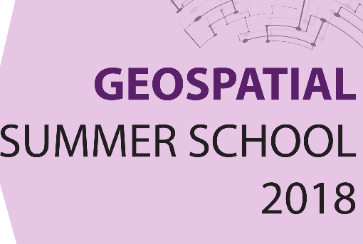
Ve dnech od 27. června do 3. července 2018 proběhne v Olomouci letní škola “GeoSpatial Summer School 2018“, která je zaměřena na využití free a open source softwaru a dat – vše pod zkratkou G3S Open 2018. Letní školu pořádá olomoucká Katedra geoinformatiky, jež má s podobnými akcemi bohaté zkušenosti. Ideou letní školy je během […]
The post GeoSpatial Summer School v Olomouci appeared first on GISportal.cz.
Nový GeoProhlížeč také pro mobily a tablety
11.4.2018 22:50 GeoBusiness Kde je budoucnost mapových aplikací? ČÚZK dlouhodobě sází spíš na mobilní verze svých stránek než na vlastní mobilní aplikaci. Český úřad zeměměřický a katastrální ... PřečístColorado Company Liteye Systems Announced as Finalist for AUVSI XCELLENCE Awards
11.4.2018 17:12 GISCafe.com Webcasts-Webinars Liteye's fielded Counter UAS system nominated, awards ceremony at XPONENTIAL in Denver, May 1ARLINGTON, Va., April 11, 2018 — (PRNewswire) …
Elvoline Chooses Gimmonix as Exclusive Mapping Provider
11.4.2018 17:12 GISCafe.com Webcasts-Webinars After realizing their current mapping tool was lacking many needed qualities, online travel agency Elvoline chose to work with Gimmonix and its fully …DigitalGlobe Partners with Ecopia Tech Corporation to Generate Building Footprints by Leveraging Machine Learning in the Cloud
11.4.2018 17:12 GISCafe.com Webcasts-Webinars WESTMINSTER, Colo. — (BUSINESS WIRE) — April 11, 2018 —DigitalGlobe,
a Maxar Technologies company (formerly …
Cyient and BlueBird Aero Systems Sign Joint Venture to Offer UAV Systems to Indian Defence and Industry
11.4.2018 17:10 GISCafe.com Webcasts-Webinars CHENNAI, India, and HYDERABAD, India, and KADIMA, Israel, April 11, 2018 — (PRNewswire) — Cyient, a provider of engineering design, …HP Revamps Pavilion PCs with Premium Features and Design
11.4.2018 17:10 GISCafe.com Webcasts-Webinars PALO ALTO, Calif., April 11, 2018 (GLOBE NEWSWIRE) -- HP, Inc. today introduced its next generation Pavilion portfolio, infusing premium features …Konference GIS Esri v ČR 2018 – první informace
11.4.2018 15:31 GeoBusiness Firma Arcdata Praha uveřejnila letošní harmonogram své uživatelské konference. Konference, kterou již více než 20 let pořádá firma Arcdata Praha pro své zákazníky, se ... PřečístByla aktualizována mapová apli
11.4.2018 12:00 Ústecký krajByla aktualizována mapová aplikace "Rodinné stříbro Ústeckého kraje". Tento rok byly do programu zařazeny dva nové projekty, a to „Císařský den 2018“ a „29. národní festival dechových orchestrů FEDO 2018“, čímž se celkový počet těchto důležitých akcí podporovaných naším krajem zvýšil na 29 (některé aktivity se konají s periodou dva nebo tři roky).
Mapovou aplikaci naleznete na úvodní straně a také v sekci MAPY - > Rozvoj kraje a dotace - > Rodinné stříbro Ústeckého kraje
Mediterranean salt
11.4.2018 11:08 ESA Observing the Earth
ESA’s SMOS mission has been used to show how the saltiness of the western Mediterranean has varied over six years
GEO Business 2018 reveal brand new seminar and workshop programme
11.4.2018 11:07 GISCafe.com Webcasts-Webinars April 11, 2018 - GEO Business 2018, taking place in London from 22-23 May, is fast approaching and the action packed 5th instalment of the …Sonda Mars Express, verze 2.0
11.4.2018 10:32 Český Kosmický PortálČas od času váš počítač, tablet nebo chytrý telefon obdrží nový software, který zlepší jeho funkčnost a prodlouží životnost. Nyní takovouto „modernizací“ prochází i sonda ESA Mars Express, na kterou je nový software instalovaný skrze propast 150 miliónů kilometrů vesmíru.
Mapová aplikace Investiční akce 2018
11.4.2018 10:00 Jihočeský kraj Byla vytvořena mapová aplikace Investiční akce 2018 zobrazující plánované investiční akce Jihočeského kraje a Správy a údržby silnic JčK na silnicích II. a III. třídy pro rok 2018.Flowbox – integrační platforma pro řízení výrobních podniků, budov a mest
11.4.2018 9:53 GeoBusinessDuben je měsíc pro vyplňování Monitoringu
11.4.2018 9:39 CENIA - národní geoportál INSPIRE Poskytovatelé dat a služeb Národního geoportálu INSPIRE jsou povinni v sekci Monitoring odeslat údaje o zpřístupněných datech a službách. Toto je nutné provést do 30.4.2018 Informace o datech a službách lze jednoduše předvyplnit z metadat , případně z monitoringu odeslaného v minulých letech. Více v nápovědě geoportálu. O jakou povinnost přesně se jedná? § 11b odstavec 5 zákona 123/1998, o...Přihlaste svou mapu s příběhem do soutěže
11.4.2018 9:37 ARCDATA
Mapy s příběhem budou hodnoceny v pěti kategoriích a na nejlepší autory čekají zajímavé ceny. Porota je bude hodnotit z hlediska srozumitelnosti, poutavosti příběhu, schopnosti zapojit čtenáře, designu a kreativity.
Přihlásit se můžete až do pondělí 7. května 2018. Na stránkách soutěže naleznete vedle kompletních pravidel také galerii loňských vítězů i zajímavé tipy pro tvorbu aplikace. V příspěvcích technické podpory ARCDATA PRAHA pak naleznete několik článků, které jsou zaměřeny na mapy s příběhem.
20180411-VŘ Právník a Koordinátor řízení kvality
11.4.2018 9:25 ČÚZK /Aktuality-resort/2018/20180411-VR-Pravnik-a-Koordinator-rizeni-kvality20180411-VŘ Právník a Koordinátor řízení kvality
11.4.2018 9:25 ČÚZK - předpisy a opatření Český úřad zeměměřický a katastrální zveřejnil novou aktualitu: Oznámení o vyhlášení výběrových řízení na služební místa Právník/Právnička a Koordinátor/ka řízení kvality.Koordinátor/ka řízení kvality
11.4.2018 9:13 ČÚZK /Urady/Cesky-urad-zememericky-a-katastralni/Uredni-deska/Oznameni-a-jina-uredni-sdeleni/Volna-mista/Koordinator-ka-rizeni-kvalityKoordinátor/ka řízení kvality
11.4.2018 9:13 ČÚZK - volná místa Český úřad zeměměřický a katastrální vypisuje výběrové řízení na místo Koordinátor/ka řízení kvalityKoordinátor/ka řízení kvality
11.4.2018 9:13 ČÚZK - předpisy a opatření Český úřad zeměměřický a katastrálnívypisuje výběrové řízení na místo
Koordinátor/ka řízení kvality
Mapová aplikace ÚAP - aktualizace
11.4.2018 9:00 Jihočeský kraj Mapová aplikace Územně analytické podklady byla aktualizována k 10. 4. 2018.Právník/Právnička
11.4.2018 8:55 ČÚZK - předpisy a opatření Český úřad zeměměřický a katastrálnívypisuje výběrové řízení na místo
Právník/Právnička
Právník/Právnička
11.4.2018 8:55 ČÚZK /Urady/Cesky-urad-zememericky-a-katastralni/Uredni-deska/Oznameni-a-jina-uredni-sdeleni/Volna-mista/Pravnik-PravnickaPrávník/Právnička
11.4.2018 8:55 ČÚZK - volná místa Český úřad zeměměřický a katastrální vypisuje výběrové řízení na místo Právník/PrávničkaMapová aplikace při příležitosti oslav 115. výročí Harley Davidson
11.4.2018 8:34 GISportal.cz
Víte, že v červenci se do Prahy sjedou harlejáři z celého světa a to při příležitosti oslav 115. výročí značky Harley Davidson? Očekává se, že se setká až 60 000 strojů jako tomu bylo v Římě v roce 2013. K této mimořádné události Středočeský kraj, Odbor informatiky ve spolupráci s Odborem kultury a památkové péče připravil mapovou aplikaci Vítejte ve Středočeském kraji. Aplikace […]
The post Mapová aplikace při příležitosti oslav 115. výročí Harley Davidson appeared first on GISportal.cz.
Satelitní data s velmi vysokým rozlišením. Gisat aktualizoval přehled dostupných dat
11.4.2018 8:08 GeoBusiness Družicová data s velmi vysokým rozlišením, která také často najdete pod označením VHR (Very High Resolution), mají prostorové rozlišení v řádu jednoho metru. Data ... PřečístDokumentace ÚPD z databáze iLAS
11.4.2018 7:05 Jihočeský kraj Z důvodu problémů na straně služeb iLAS Ústavu územního rozvoje (ÚÚR), není garantována aktuálnost popisných dat územně plánovacích dokumentací. Na odstranění závady se pracuje. Za případné komplikace se omlouváme.Chytrá města, chytré budovy a Průmysl 4.0 – konference IQRF Summit 2018
11.4.2018 5:09 GeoBusiness V Praze se uskuteční velká středoevropská dvoudenní konference, věnovaná internetu věcí. IQRF Summit 2018 je určen vývojářům, výrobcům, systémovým integrátorům, kteří se zajímají o ... PřečístINSPIRE Distribution of natural habitat types of community interest test1
11.4.2018 2:00 Cenia - Katalog metadat ČR - INSPIRE Distribution of natural habitat types of community interest (habitats) is a product of species and biotopes surveillance under the obligations of Article 17 of EU Habitats Directive (92/43/ EEC). The grid distribution (EEA reference grid 1 x 1 km) from data of habitat reports 2013 is presented. For detailed description and commentary see CHOBOT K. (2016). Druhy a přírodní stanoviště. Hodnotící zprávy o stavu v České republice 2013. Agentura ochrany přírody a krajiny ČR & Ministerstvo životního prostředí, Praha. 226 str., ISBN 978-80-8076-20-9. Habitat classification and national interpretation manual see CHYTRÝ, M.; KUČERA, T.; KOČÍ, M. (eds.) et al. (2010). Katalog biotopů České republiky. 2.upr. a rozš. vyd. Praha: Agentura ochrany přírody a krajiny ČR. 445 s. ISBN 978-80-87457-03-0. © NCA CR (AOPK ČR), 2013First Desktop Training, Now Image Generation: BISim Aims to Disrupt Military Simulation Market Again With Innovative 3D Virtual Earth Image Generator
11.4.2018 0:00 GISCafe.com Webcasts-Webinars ORLANDO, Fla. — (BUSINESS WIRE) — April 10, 2018 —Bohemia
Interactive Simulations (BISim), a global developer of …
Airbus further strengthens its Earth observation imagery portfolio with the addition of TripleSat satellite data
10.4.2018 20:00 GISCafe.com Webcasts-WebinarsUrtheCast Announces Commitments for CAD$35 Million Brokered Private Placement of Subscription Receipts to Enable the UrtheDaily™ Financing Package
10.4.2018 18:53 GISCafe.com Webcasts-Webinars VANCOUVER, April 10, 2018 — (PRNewswire) — UrtheCast Corp. (TSX: UR) ("UrtheCast" or the "Company") is pleased to announce that it has …Trimble's Forensics Solution Enables Efficient Data Collection for Crash and Crime Scene Investigators
10.4.2018 16:47 GISCafe.com Webcasts-Webinars All-in-One Solution for Law Enforcement Professionals Provides Speed, AccuracySUNNYVALE, Calif., April 10, 2018 — (PRNewswire) — …
CoreLogic Reports Early-Stage Delinquencies Declined in January as Impact from 2017 Hurricanes and Wildfires Fades
10.4.2018 16:47 GISCafe.com Webcasts-Webinars Overall Mortgage Delinquency Rate Fell Year Over YearEarly-Stage Delinquencies Fell 0.1 Percentage Points Year Over Year
…
DT Research Introduces First Purpose-built Rugged Tablet with Scientific-grade GNSS
10.4.2018 16:47 GISCafe.com Webcasts-Webinars Military-grade Tablet with Integrated RTK PositioningPowers Forensic Mapping, Collision Reconstruction, Land Surveying, e-Construction and Building …Změna cen software a služeb společnosti Bentley Systems (10.4.2018)
10.4.2018 16:31 GISoftSpolečnost Bentley Systems oznámila, že s platností od 1.4.2018 navyšuje ceny svých softwarových produktů a poplatků za jejich podporu (službu Bentley SELECT) o cca. 2,5%. Změna cen softwarových produktů je platná od tohoto měsíce, změna poplatků za službu Bentley SELECT se uživatelům projeví k datu prodloužení jejich smlouvy v poplatcích na následující období.
Swarm tracks elusive ocean magnetism
10.4.2018 13:00 ESA Observing the Earth
The magnetic field is arguably one of the most mysterious features of our planet. ESA’s Swarm mission is continually yielding more insight into how our protective shield is generated, how it behaves and how it is changing. Adding yet another string to its bow, Swarm is now tracking changes in the magnetic field produced in the oceans in more detail that ever before.
Crusty detail
10.4.2018 12:40 ESA Observing the Earth
The magnetic field generated by Earth crust has been mapped in greater detail than ever before, thanks largely to ESA’s Swarm mission
Analýza nehodovosti na Novém Zélandu vytvořená v CORPIS MAPS
10.4.2018 12:10 T-MAPYThe post Analýza nehodovosti na Novém Zélandu vytvořená v CORPIS MAPS appeared first on T-MAPY spol. s r.o..
GSA sets challenges for ActInSpace participants
10.4.2018 12:04 European GNSS Agency
On May 25-26 the ActInSpace innovation contest will bring entrepreneurs, students, job seekers, developers and creative minds together in over 60 cities across 5 continents to work on real-life challenges and to design innovative services and applications using space technologies and data. This year the European GNSS Agency (GSA) has set three challenges in the contest.
Initiated by the French Space Agency (CNES) and supported by the European GNSS Agency and European Space Agency (ESA), ActInSpace aims to demonstrate the socio-economic potential of the space sector and show how it can have a positive impact on our daily lives. By demonstrating that space is a vector of innovation for employment and economic development, the contest hopes to boost start-up creation by encouraging young people to leverage space technologies in their businesses.
GSA Challenges
For this year’s event, the European GNSS Agency (GSA) has set three challenges, the first of which – Geocaching by Satellite - asks participants to use Galileo to develop an innovative geocaching game relying on GNSS positioning. For the second GSA challenge – Art with Satellites – teams should develop an app to draw and write in a map using satellite navigation and the users’ movements by leveraging on Galileo-enhanced positioning.
Finally, the GNSS Satellites Selector challenge asks hackathon participants to design an app that allows them to calculate the Position Velocity and Time (PVT) solution by employing their favourite GNSS constellations and, of course, Galileo. By comparing the data obtained by single satellites, they should propose selection algorithms for satellite constellations based on different criteria.
GSA prize
During the contest the GSA will present its Galileo Geekie Award to the team considered to have best responded to one of the above challenges. The lucky winner will be selected to present their application at European Space Week 2018, the largest gathering of GNSS and Earth Observation experts in Europe, to be held in Marseille on 3-6 December. The GSA will offer the winner a three-day stay at the conference and the possibility to present their application idea.
Bringing creative minds together
The competition is open to teams of from two to five people made up of individuals - business creators, students, researchers, entrepreneurs, developers, users, creators and space experts, job seekers, etc. and/or private legal entities (associations, companies), represented by an individual delegated to participate in the competition. There are no limitations regarding nationality.
Each team will present its project to a jury at an 8-minute presentation which will take place at the end of the competition. The winning teams will proceed to national and then international finals, where they will present their project to an international jury of experts on technology transfer and business development.
Registration for the hackathon is now open – if you would like to take part, you can register here.
Media note: This feature can be republished without charge provided the European GNSS Agency (GSA) is acknowledged as the source at the top or the bottom of the story. You must request permission before you use any of the photographs on the site. If you republish, we would be grateful if you could link back to the GSA website (http://www.gsa.europa.eu).
GSA sets challenges for ActInSpace participants
10.4.2018 12:04 European GNSS AgencyOn May 25-26 the ActInSpace innovation contest will bring entrepreneurs, students, job seekers, developers and creative minds together in over 60 cities across 5 continents to work on real-life challenges and to design innovative services and applications using space technologies and data. This year the European GNSS Agency (GSA) has set three challenges in the contest.
Initiated by the French Space Agency (CNES) and supported by the European GNSS Agency and European Space Agency (ESA), ActInSpace aims to demonstrate the socio-economic potential of the space sector and show how it can have a positive impact on our daily lives. By demonstrating that space is a vector of innovation for employment and economic development, the contest hopes to boost start-up creation by encouraging young people to leverage space technologies in their businesses.
GSA Challenges
For this year’s event, the European GNSS Agency (GSA) has set three challenges, the first of which – Geocaching by Satellite - asks participants to use Galileo to develop an innovative geocaching game relying on GNSS positioning. For the second GSA challenge – Art with Satellites – teams should develop an app to draw and write in a map using satellite navigation and the users’ movements by leveraging on Galileo-enhanced positioning.
Finally, the GNSS Satellites Selector challenge asks hackathon participants to design an app that allows them to calculate the Position Velocity and Time (PVT) solution by employing their favourite GNSS constellations and, of course, Galileo. By comparing the data obtained by single satellites, they should propose selection algorithms for satellite constellations based on different criteria.
GSA prize
During the contest the GSA will present its Galileo Geekie Award to the team considered to have best responded to one of the above challenges. The lucky winner will be selected to present their application at European Space Week 2018, the largest gathering of GNSS and Earth Observation experts in Europe, to be held in Marseille on 3-6 December. The GSA will offer the winner a three-day stay at the conference and the possibility to present their application idea.
Bringing creative minds together
The competition is open to teams of from two to five people made up of individuals - business creators, students, researchers, entrepreneurs, developers, users, creators and space experts, job seekers, etc. and/or private legal entities (associations, companies), represented by an individual delegated to participate in the competition. There are no limitations regarding nationality.
Each team will present its project to a jury at an 8-minute presentation which will take place at the end of the competition. The winning teams will proceed to national and then international finals, where they will present their project to an international jury of experts on technology transfer and business development.
Registration for the hackathon is now open – if you would like to take part, you can register here.
Media note: This feature can be republished without charge provided the European GNSS Agency (GSA) is acknowledged as the source at the top or the bottom of the story. You must request permission before you use any of the photographs on the site. If you republish, we would be grateful if you could link back to the GSA website (http://www.gsa.europa.eu).
Skytec Joins Esri Startup Program
10.4.2018 10:41 GISCafe.com Webcasts-Webinars Unmanned Aircraft System Leader Skytec LLC Joins Top GIS Developmental ProgramApril 10, 2018 - CHATTANOOGA, TN – Skytec LLC, a leading …