


![]()

zprávy
zdroje zpráv:Přerušení provozu Sbírky listin v DP 5.4.2018
30.3.2018 21:46 ČÚZK - předpisy a opatřeníVážení uživatelé, oznamujeme, že ve čtvrtek 5.4.2018 od 16:30 do cca 19:30 nebudou z provozních důvodů dostupné dokumenty ze Sbírky listin. Za komplikace tímto způsobené se omlouváme a děkujeme za pochopení.
Přerušení provozu Sbírky listin v DP 5.4.2018
30.3.2018 21:46 Dálkový přístup k údajům KN ČR Vážení uživatelé, oznamujeme, že ve čtvrtek 5.4.2018 od 16:30 do cca 19:30 nebudou z provozních důvodů dostupné dokumenty ze Sbírky listin. Za komplikace tímto způsobené se omlouváme a děkujeme za pochopení.Coffee-Making Toolbar Now Available in Update to Global Mapper
30.3.2018 19:19 GISCafe.com Webcasts-Webinars Hallowell, Maine - April 1, 2018 – Blue Marble Geographics (bluemarblegeo.com) is pleased to announce the immediate availability of an interim …Výběrové řízení k obsazení místa doktoranda [Katedra aplikované geoinformatiky a kartografie, byTopic]
30.3.2018 12:50 Katedra aplikované geoinformatiky a kartografie Přf UK Přírodovědecká fakulta Univerzity Karlovy, sekce geografie, www.zaniklekrajiny.cz vyhlašuje výběrové řízení k obsazení místa DOKTORANDA participujícího na rešení projektu NAKI Ministerstva kultury ČR „Dědictví zaniklých krajin: identifikace, rekonstrukce a zpřístupnění“.Viking, drak a bůh bouří
30.3.2018 11:27 Český Kosmický PortálSkandinávské mytologické příběhy jsou bohaté na fantastická stvoření a severský kosmonaut je připravený psát jejich novou kapitolu, když „kosmický viking“ Andreas Mogensen bude v nejbližších dnech sledovat přílet zásobovací lodi Dragon na Mezinárodní kosmickou stanici. Jejím nákladem bude (kromě jiného) špičkový lovec bouří.
Viking, drak a bůh bouří
30.3.2018 11:27 Český Kosmický PortálSkandinávské mytologické příběhy jsou bohaté na fantastická stvoření a severský kosmonaut je připravený psát jejich novou kapitolu, když „kosmický viking“ Andreas Mogensen bude v nejbližších dnech sledovat přílet zásobovací lodi Dragon na Mezinárodní kosmickou stanici. Jejím nákladem bude (kromě jiného) špičkový lovec bouří.
Copernicus Data Warehouse Offers 40 cm Imagery Exclusively From European Space Imaging
30.3.2018 11:00 GISCafe.com Webcasts-Webinars Munich, 29/03/18 - The Copernicus Data Warehouse is now offering eligible users the ability to order 40 cm satellite imagery in remarkably …Egg Island
30.3.2018 10:05 ESA Observing the Earth
Earth observation image of the week: since it’s Easter, let’s have a look at this Sentinel-2 image of Egg Island – get it?
Earth from Space
30.3.2018 10:05 ESA Observing the Earth
In this edition, Sentinel-2 treats us to a gorgeous picture of Egg Island in the Bahamas
OGC seeks public comment on version 1.1 of CDB standard
30.3.2018 9:41 GISCafe.com Webcasts-Webinars Minor update to CDB standard brings guidance on metadata, vector network priority, and more29 March 2018: The Open Geospatial Consortium (OGC) …
"Esri’s new Survey123 for ArcGIS Includes Spike Laser Measurement Integration" by Susan Smith
30.3.2018 9:33 GISCafe.com Webcasts-WebinarsCoreLogic to Announce First Quarter 2018 Financial Results
29.3.2018 17:07 GISCafe.com Webcasts-Webinars IRVINE, Calif. — (BUSINESS WIRE) — March 29, 2018 —CoreLogic® (NYSE: CLGX), a leading global provider of
property …
eCall emergency alert system launched
29.3.2018 15:32 European GNSS Agency
As of 31 March 2018, all new car and light van models sold in the EU have to be fitted with eCall devices that automatically alert rescue services in the event of an accident, sending their position. The aim of the system is to reduce the emergency response time for road accidents and to save lives.
eCall is activated automatically as soon as in-vehicle sensors detect a serious crash. Once activated, the system dials the European emergency number 112 and establishes a telephone link to the appropriate emergency call centre.
Leveraging EGNSS (Galileo and EGNOS), the system sends the time of incident, the accurate position of the crashed vehicle and the direction of travel to the emergency services, enabling the emergency responders to get to the accident site faster. An eCall can also be triggered manually by pushing a button in the car, for example by a witness to a serious accident.
GSA Guidelines
Ahead of the eCall launch, the European GNSS Agency (GSA) and the Joint Research Centre, the European Commission’s in-house science service, published a set of guidelines to help the eCall industry value chain to pre-test the accuracy of their new devices and understand how to reap the benefits of Galileo.
Commenting on the eCall launch, GSA Executive Director Carlo des Dorides said that knowing the precise location of a road accident would speed up the emergency response. “Thanks also to EGNOS and Galileo, eCall will enable emergency response teams to locate an accident faster and with much greater accuracy, thereby saving more lives, an important day for Europe and Galileo!” he said.
In fact, it is estimated that eCall can speed up emergency response times by 40% in urban areas and 50% in the countryside and can reduce the number of fatalities by at least 4% and the number of severe injuries by 6%.
Background
Over 25,500 people were killed and 135,000 people were seriously injured in road accidents in the EU 2016, according to figures released by the European Commission. In addition to the tragedy of loss of life and injury, this also carries an economic burden of around EUR 130 billion in costs to society every year.
Against this backdrop, the estimated cost of eCall devices of less than EUR 100 per vehicle at the date of entry into force of the proposed regulation does not seem very high. Moreover, this cost is expected to decrease even further in the future, following cost trends for electronic components and also due to economies of scale.
Media note: This feature can be republished without charge provided the European GNSS Agency (GSA) is acknowledged as the source at the top or the bottom of the story. You must request permission before you use any of the photographs on the site. If you republish, we would be grateful if you could link back to the GSA website (http://www.gsa.europa.eu).
Aktualizace kresby ochranných pásem vodních zdrojů
29.3.2018 15:30 Plzeňský kraj V datech územně analytických podkladů Plzeňského kraje byla provedena aktualizace dat ochranných pásem vodních zdrojů od poskytovatele Plzeňský kraj. Zároveň byl aktualizován tematický obsah interaktivní mapy zobrazující Ochranná pásma vodních zdrojů v Plzeňském kraji. Data jsou s platností k 1.2.2018.26th ACM SIGSPATIAL International Conference on Advances in Geographic Information Systems (ACM SIGSPATIAL 2018)
29.3.2018 15:07 GISCafe.com Webcasts-Webinars Call for Workshop Proposals, November6, 2018, Seattle, Washington, USAThe ACM SIGSPATIAL International Conference on Advances in Geographic …
High-Speed Mapping for High-Speed Rail
29.3.2018 14:51 Bentley SystemsPress Coverage
UAS Vision, USA
Read the articleBentley Systems' Year in Infrastructure 2018 Conference and Awards Gala to be Held in London, Oct. 15-18
29.3.2018 14:46 Bentley SystemsPress Coverage
GISCafe, USA
Read the article20180329 - Oprava informačních služeb
29.3.2018 13:57 ČÚZK /Uvod/Produkty-a-sluzby/RUIAN/RUIAN-novinky/2018/20180329-Oprava-informacnich-sluzeb20180329 - Oprava informačních služeb
29.3.2018 13:57 ČÚZK - předpisy a opatření V dodávce RÚIAN 2.4.0.3 byla opravena funkčnost informačních služeb E38 a E185.Více v dokumentu: oprava_ws.pdf.
Zveřejněno 29.3.2018
Mapová aplikace ÚPD - nové dokumentace
29.3.2018 13:30 Jihočeský kraj V mapové aplikaci Územně plánovací dokumentace obcí byla aktualizována územně plánovací dokumentace obcí Báňovice, Číčenice, Husinec, Kožlí, Mičovice, Nové Hutě, Slavonice a Stachy.InterDrone Forms Industry Advisory Board
29.3.2018 10:22 GISCafe.com Webcasts-Webinars Former FAA Administrator Michael Huerta Joins 19-Member Board to Guide Programming, Speaker Selection, and Ensure Comprehensive Commercial Drone …OGC announces retirement of board members Michael Jackson and Jack Pellicci, appointment of Kristin Tolle
29.3.2018 9:53 GISCafe.com Webcasts-Webinars Two longest-serving OGC board members have announced their retirement; new appointment brings expertise in AI, machine learning, and other relevant …EGNOS and Galileo – opening the door to new drone applications
29.3.2018 9:08 European GNSS Agency in Barcelona, where the GSA highlighted a number of innovative drone applications that utilise EGNOS and Galileo.")
With European GNSS providing the positioning accuracy that drones need to operate safely, more and more drone-based applications are hitting the market. The GSA highlighted a number of these innovative services during the Mobile World Congress in Barcelona.
The integration of EGNOS and Galileo into drone and UAV technology enhances positioning and opens the door to a wide range of new applications and services. In fact, according to the latest edition of the European GNSS Agency’s (GSA) Market Report, by 2025 the installed base of GNSS devices in drones will reach 70 million – more than twice the sum of other professional market segments combined. But with this growing market comes growing concerns about how to ensure the safe operation of drones.
Luckily, European GNSS offers a solution.
To operate safely, today’s drones are increasingly dependent on the precise positioning and navigation information provided by EGNOS and Galileo. As a result, drones and UAVs are used for applications and services spanning from search and rescue to providing photovoltaic maintenance. They also represent a promising growth market for European GNSS. “Highly precise positioning is key for operating drones, and this is where Galileo and EGNOS can really make a difference - on one hand enhancing the precision in manoeuvring the drone and on the other making flying operations safer,” GSA Market Development Officer Carmen Aguilera said.
This growing role of drones was on full display during the Mobile World Congress (MWC) in Barcelona, where the GSA highlighted a number of Horizon 2020-funded drone and UAV applications that utilise EGNOS and Galileo:
REAL
Researchers with the REAL project are developing EGNOS-based navigation and surveillance sensors for two Remotely Piloted Aircraft Systems (RPAS), one for urgent medical transport and the other for providing linear powerline inspections. “REAL integrates EGNOS positioning in support of aviation and surveillance functions for UAVs,” explains project researcher Santiago Soley. “The idea is to exploit EGNOS’ positioning and, more importantly, the integrity that it provides.”
EASY-PV
The EASY-PV project has developed a time-efficient and cost-effective maintenance solution for photovoltaic plants. Using a drone equipped with a European GNSS high-accuracy receiver, the system flies over a photovoltaic field and collects such relevant data as visible and thermal images. “This data is then automatically geo-referenced and processed, producing a detailed report on which modules need to be replaced,” explains project coordinator Marco Nisi.
GAUSS
To better regulate drone traffic in Europe, the EU has launched a UAV Traffic Management initiative. “GAUSS integrates EGNOS and Galileo’s navigation and location services into this initiative to provide the level of accuracy needed to safely position drones in the sky,” says project coordinator Jiménez González.
GEOVISION
To increase emergency response times, GEO-VISION captures images and video streaming from the UAV, which are then sent to the pilot and routed in real-time to a control room. “In emergency search and rescue situations, everything is about time – the quicker you know what is happening, the faster you can respond to it,” says project coordinator Harald Skinnemoen. “GEOVISION results is an increased efficiency in emergency response, leading to more lives being saved.”
MAPKITE
This mapping-based project integrates drones with terrestrial mobile mapping systems to provide surveyors and mappers with an end-to- end solution for 3D high-resolution corridor mapping. “For drone applications such as MAPKITE, EGNOS is the standard for accuracy,” explains project coordinator Pere Molina. “Galileo plays an important role too, adding more satellites in view and by offering some resilience against hacking.”
ARGONAUT
ARGONAUT combines an advanced, multi-constellation GNSS receiver and a powerful navigation data processing cloud service for more accurate and affordable geolocation. “For us, the use of Galileo basically translates into being able to provide a better service,” says project coordinator Xavier Banqué-Casanovas. “Because ARGONAUT is a multi-constellation solution, we can offer drone users a more robust solution for overcoming such adverse scenarios as obstructions.”
Want to learn more about the role of European GNSS in drone applications and services? Stay tuned as our EGNOS, Galileo and Drones series takes a behind-the-scenes look at each of these projects in the coming weeks.
Media note: This feature can be republished without charge provided the European GNSS Agency (GSA) is acknowledged as the source at the top or the bottom of the story. You must request permission before you use any of the photographs on the site. If you republish, we would be grateful if you could link back to the GSA website (http://www.gsa.europa.eu).
EGNOS and Galileo – opening the door to new drone applications
29.3.2018 9:08 European GNSS AgencyWith European GNSS providing the positioning accuracy that drones need to operate safely, more and more drone-based applications are hitting the market. The GSA highlighted a number of these innovative services during the Mobile World Congress in Barcelona.
The integration of EGNOS and Galileo into drone and UAV technology enhances positioning and opens the door to a wide range of new applications and services. In fact, according to the latest edition of the European GNSS Agency’s (GSA) Market Report, by 2025 the installed base of GNSS devices in drones will reach 70 million – more than twice the sum of other professional market segments combined. But with this growing market comes growing concerns about how to ensure the safe operation of drones.
Luckily, European GNSS offers a solution.
To operate safely, today’s drones are increasingly dependent on the precise positioning and navigation information provided by EGNOS and Galileo. As a result, drones and UAVs are used for applications and services spanning from search and rescue to providing photovoltaic maintenance. They also represent a promising growth market for European GNSS. “Highly precise positioning is key for operating drones, and this is where Galileo and EGNOS can really make a difference - on one hand enhancing the precision in manoeuvring the drone and on the other making flying operations safer,” GSA Market Development Officer Carmen Aguilera said.
This growing role of drones was on full display during the Mobile World Congress (MWC) in Barcelona, where the GSA highlighted a number of Horizon 2020-funded drone and UAV applications that utilise EGNOS and Galileo:
REAL
Researchers with the REAL project are developing EGNOS-based navigation and surveillance sensors for two Remotely Piloted Aircraft Systems (RPAS), one for urgent medical transport and the other for providing linear powerline inspections. “REAL integrates EGNOS positioning in support of aviation and surveillance functions for UAVs,” explains project researcher Santiago Soley. “The idea is to exploit EGNOS’ positioning and, more importantly, the integrity that it provides.”
EASY-PV
The EASY-PV project has developed a time-efficient and cost-effective maintenance solution for photovoltaic plants. Using a drone equipped with a European GNSS high-accuracy receiver, the system flies over a photovoltaic field and collects such relevant data as visible and thermal images. “This data is then automatically geo-referenced and processed, producing a detailed report on which modules need to be replaced,” explains project coordinator Marco Nisi.
GAUSS
To better regulate drone traffic in Europe, the EU has launched a UAV Traffic Management initiative. “GAUSS integrates EGNOS and Galileo’s navigation and location services into this initiative to provide the level of accuracy needed to safely position drones in the sky,” says project coordinator Jiménez González.
GEOVISION
To increase emergency response times, GEO-VISION captures images and video streaming from the UAV, which are then sent to the pilot and routed in real-time to a control room. “In emergency search and rescue situations, everything is about time – the quicker you know what is happening, the faster you can respond to it,” says project coordinator Harald Skinnemoen. “GEOVISION results is an increased efficiency in emergency response, leading to more lives being saved.”
MAPKITE
This mapping-based project integrates drones with terrestrial mobile mapping systems to provide surveyors and mappers with an end-to- end solution for 3D high-resolution corridor mapping. “For drone applications such as MAPKITE, EGNOS is the standard for accuracy,” explains project coordinator Pere Molina. “Galileo plays an important role too, adding more satellites in view and by offering some resilience against hacking.”
ARGONAUT
ARGONAUT combines an advanced, multi-constellation GNSS receiver and a powerful navigation data processing cloud service for more accurate and affordable geolocation. “For us, the use of Galileo basically translates into being able to provide a better service,” says project coordinator Xavier Banqué-Casanovas. “Because ARGONAUT is a multi-constellation solution, we can offer drone users a more robust solution for overcoming such adverse scenarios as obstructions.”
Want to learn more about the role of European GNSS in drone applications and services? Stay tuned as our EGNOS, Galileo and Drones series takes a behind-the-scenes look at each of these projects in the coming weeks.
Media note: This feature can be republished without charge provided the European GNSS Agency (GSA) is acknowledged as the source at the top or the bottom of the story. You must request permission before you use any of the photographs on the site. If you republish, we would be grateful if you could link back to the GSA website (http://www.gsa.europa.eu).
Kosmické okno k elektrizující vědě
29.3.2018 8:56 Český Kosmický PortálBlesky zažehují silné elektrické výboje v zemské atmosféře prakticky každou sekundu. Vnitřní mechanismus fungování těchto úžasných přírodních sil je přitom stále neznámý, takže vzácná pozorování provedená kosmonautem ESA představují pro vědeckou komunitu důležitý zdroj informací. Už v nejbližších dnech začne po blescích ve vesmíru pátrat nový evropský detektor.
Pozvanie na konferenciu GeoKARTO 2018
29.3.2018 8:30 GISportal.cz
Dňa 6. – 7.septembra 2018 sa na Lesníckej fakulte TU vo Zvolene uskutoční konferencia GeoKARTO. Pozvánka na konferenciu je dostupná tu. Konferencia bude venovaná aktuálnym otázkam a trendom z oblasti kartografie, geoinformatiky, geodézie a geografie. Podujatie ponúka pestrú paletu tematických okruhov: mapovanie a zber dát pre GIS, geovizualizácia a publikovanie máp na internete, tvorba, vydávanie, používanie máp a […]
The post Pozvanie na konferenciu GeoKARTO 2018 appeared first on GISportal.cz.
odborný referent/vrchní referent – obnova katastrálního operátu
29.3.2018 8:11 ČÚZK - volná místa Katastrální úřad pro Olomoucký kraj - Katastrální pracoviště Prostějov vypisuje výběrové řízení na místo odborný referent/vrchní referent – obnova katastrálního operátuodborný referent/vrchní referent – obnova katastrálního operátu
29.3.2018 8:11 ČÚZK - předpisy a opatření Katastrální úřad pro Olomoucký kraj - Katastrální pracoviště Prostějovvypisuje výběrové řízení na místo
odborný referent/vrchní referent – obnova katastrálního operátu
Zahájení nového mapování v části k. ú. Svor
29.3.2018 8:03 ČÚZK /Urady/Katastralni-urady/Katastralni-urady/Katastralni-urad-pro-Liberecky-kraj/Katastralni-pracoviste/KP-Ceska-Lipa/O-uradu/Aktuality/Obnova-kat-operatu-v-casti-k-u-Svor-zahajeniZahájení nového mapování v části k. ú. Svor
29.3.2018 8:03 ČÚZK - předpisy a opatření Katastrální úřad pro Liberecký kraj - Katastrální pracoviště Česká Lípa zveřejnil novou aktualitu: Katastrální úřad pro Liberecký kraj, Katastrální pracoviště Česká Lípa oznamuje, že v části katastrálního území Svor (v části obce Rousínov) bude dne 1. 6. 2018 zahájena obnova katastrálního operátu zjišťováním průběhu hranic pozemků a obvodů budov pro obnovu katastrálního operátu novým mapováním (dále jen „ZPH“). Vlastníci nemovitostí budou ke ZPH zváni písemnou pozvánkou nejméně týden předem. V této souvislosti upozorňujeme na povinnosti vlastníků stanovených zejména v § 37 katastrálního zákona, tj. povinnost zúčastnit se na výzvu katastrálního úřadu ZPH nebo na něj vyslat svého zástupce s písemnou plnou mocí, označit do zahájení ZPH trvalým způsobem a na vlastní náklad nesporné hranice svých pozemků a ohlásit katastrálnímu úřadu změny údajů katastru týkající se jejich nemovitostí a předložit v této souvislosti příslušné listiny. Podrobnosti jsou uvedeny na úřední desce Obecního úřadu ve Svoru a katastrálního úřadu.FLIR Provides Thermal Imaging for Next Generation DJI Zenmuse XT2 Dual-Sensor Commercial Drone Camera
29.3.2018 1:54 GISCafe.com Webcasts-Webinars Companies Extend Collaboration as DJI Joins 'Thermal by FLIR' ThermalInnovation Program
WILSONVILLE, Ore. — (BUSINESS WIRE) …
Sentera Integrates High-Precision AGX710 Sensor with DJI Matrice 200 Series Industrial Drones
29.3.2018 1:54 GISCafe.com Webcasts-Webinars Seamless digital solutions, from field to actionMINNEAPOLIS, March 28, 2018 — (PRNewswire) — Sentera today announced the …
Cansel to Distribute Microdrones Fully Integrated Drone Systems Throughout Canada
28.3.2018 16:52 GISCafe.com Webcasts-Webinars VAUDREUIL-DORION, Quebec, March 28, 2018 (GLOBE NEWSWIRE) -- Leading geospatial solutions provider, Cansel, signed an agreement to distribute …Drone USA Announces a Reseller Partnership with Skyfire Consulting to Provide Certificates of Authorization and Waivers to Police, Fire and Emergency Services
28.3.2018 16:52 GISCafe.com Webcasts-Webinars NEW YORK — (BUSINESS WIRE) — March 28, 2018 —Drone USA, Inc. (OTC Markets: DRUS) (“Drone USA” or the “Company”), a …
Ouster Launches Two New LIDAR Sensors, Adopts NVIDIA DRIVE™ AI Platform
28.3.2018 16:52 GISCafe.com Webcasts-Webinars OS-2 boasts 64 beams with >200m range; OS-1-16 presents a budget-friendly option priced at only $3,500 - least expensive high-performance LIDAR …Savuka Gold Mine, Gauteng
28.3.2018 16:13 Bentley SystemsPress Coverage
Mining Technology, UK
Read the articleIZZI Telecom reduces design costs by 25 percent
28.3.2018 16:07 Bentley SystemsPress Coverage
Total Telecom, UK
Read the articleWorld of Galileo
28.3.2018 15:30 ESA Navigation
Galileo’s initial services have been running for more than 15 months now: signals from the satellites in space are routinely serving users all across the world. The functioning of Galileo is dependent on a global network of ground stations, its current extent shown in the map here.
High-speed mapping for high-speed rail
28.3.2018 15:26 Bentley SystemsPress Coverage
RT&S, USA
Read the articleZhodnoťte Vaše nápady na využití družic v zemědělství v rámci soutěže „Farming by Satellite 2018“
28.3.2018 14:29 Český Kosmický PortálPrezentujte své nápady na využití družicových dat a souvisejících technologií pro zlepšení zemědělství a snížení jeho dopadů na životní prostředí. Hlavní cenou je 5.000 EUR. Cílem soutěže je podpora služeb založených na evropských navigačních systémech Galileo a EGNOS v kombinaci s daty evropského programu pro dálkový prozkum Země Copernicus.
Vrchní referent/rada – správce informačních a komunikačních technologií v oddělení podpory ICT techn
28.3.2018 14:18 ČÚZK - předpisy a opatření Katastrální úřad pro Královéhradecký krajvypisuje výběrové řízení na místo
Vrchní referent/rada – správce informačních a komunikačních technologií v oddělení podpory ICT technického útvaru Katastrálního úřadu pro Královéhradecký kraj
Vrchní referent/rada – správce informačních a komunikačních technologií v oddělení podpory ICT techn
28.3.2018 14:18 ČÚZK - volná místa Katastrální úřad pro Královéhradecký kraj vypisuje výběrové řízení na místo Vrchní referent/rada – správce informačních a komunikačních technologií v oddělení podpory ICT technVrchní referent/rada – správce informačních a komunikačních technologií v oddělení podpory ICT techn
28.3.2018 14:18 ČÚZK /Urady/Katastralni-urady/Katastralni-urady/Katastralni-urad-pro-Kralovehradecky-kraj/Uredni-deska/Oznameni-a-jina-uredni-sdeleni/Volna-mista/Vrchni-referent-rada-–-spravce-informacnich-a-komuNabídka brigády ve společnosti ČEZ Energetické služby
28.3.2018 12:08 Blogující geomatici - FAV ZČU Nabízíme brigádu pro studenty na 1-2 dny v týdnu na oddělení Veřejného osvětlení firmy ČEZ Energetické služby.Hlavní náplní práce je zpracování pasportů veřejného osvětlení. Tvorba pasportů probíhá v programu AutoCAD, předchozí zkušenost s programem je výhodou, nikoliv nutností.
Náplň práce: Zpracování pasportů veřejného osvětlení, plnění databáze veřejného osvětlení
Místo: Guldenerova 17, Plzeň
Úvazek: DPP, 1-2 dny v týdnu
Mzda: 110,-/hod
Kontakt:
Marek Činčera: mara.cincera(AT)seznam.cz
20180328-Vrchní referent/rada oddělení právních vztahů k nemovitostem
28.3.2018 11:08 ČÚZK - předpisy a opatření Katastrální úřad pro Středočeský kraj - Katastrální pracoviště Mladá Boleslav Oznámení o vyhlášení výběrového řízení na služební místo Vrchní referent/rada oddělení právních vztahů k nemovitostem Na úřední elektronické desce Katastrálního úřadu pro Středočeský kraj, v sekci "Oznámení a jiná úřední sdělení" bylo vystaveno "Oznámení o vyhlášení výběrového řízení na služební místo Vrchní referent/rada oddělení právních vztahů k nemovitostemKatastrálního pracoviště Mladá Boleslav"
20180328-Vrchní referent/rada oddělení právních vztahů k nemovitostem
28.3.2018 11:08 ČÚZK /Urady/Katastralni-urady/Katastralni-urady/Katastralni-urad-pro-Stredocesky-kraj/Katastralni-pracoviste/KP-Mlada-Boleslav/O-uradu/Aktuality/20140318-Geodet-Melnik-(3)Vrchní referent/rada oddělení právních vztahů k nemovitostem
28.3.2018 11:07 ČÚZK - volná místa Katastrální úřad pro Středočeský kraj - Katastrální pracoviště Mladá Boleslav vypisuje výběrové řízení na místo Vrchní referent/rada oddělení právních vztahů k nemovitostemVrchní referent/rada oddělení právních vztahů k nemovitostem
28.3.2018 11:07 ČÚZK /Urady/Katastralni-urady/Katastralni-urady/Katastralni-urad-pro-Stredocesky-kraj/Uredni-deska/Oznameni-a-jina-uredni-sdeleni/Volna-mista/Vrchni-referent-rada-oddeleni-pravnich-vztahu-(1)Vrchní referent/rada oddělení právních vztahů k nemovitostem
28.3.2018 11:07 ČÚZK - předpisy a opatření Katastrální úřad pro Středočeský kraj - Katastrální pracoviště Mladá Boleslavvypisuje výběrové řízení na místo Vrchní referent/rada oddělení právních vztahů k nemovitostem
Vrchní referent/rada oddělení právních vztahů k nemovitostem
20180328-Vrchní referent/rada oddělení aktualizace katastru nemovitostí
28.3.2018 10:55 ČÚZK - předpisy a opatření Katastrální úřad pro Středočeský kraj - Katastrální pracoviště Mladá Boleslav Oznámení o vyhlášení výběrového řízení na služební místo Vrchní referent/rada oddělení aktualizace katastru nemovitostí Na úřední elektronické desce Katastrálního úřadu pro Středočeský kraj, v sekci "Oznámení a jiná úřední sdělení" bylo vystaveno "Oznámení o vyhlášení výběrového řízení na služební místo Vrchní referent/rada oddělení aktualizace katastru nemovitostíKatastrálního pracoviště Mladá Boleslav"
20180328-Vrchní referent/rada oddělení aktualizace katastru nemovitostí
28.3.2018 10:55 ČÚZK /Urady/Katastralni-urady/Katastralni-urady/Katastralni-urad-pro-Stredocesky-kraj/Katastralni-pracoviste/KP-Mlada-Boleslav/O-uradu/Aktuality/20140318-Geodet-Melnik-(2)Vrchní referent/rada oddělení aktualizace katastru nemovitostí
28.3.2018 10:54 ČÚZK /Urady/Katastralni-urady/Katastralni-urady/Katastralni-urad-pro-Stredocesky-kraj/Uredni-deska/Oznameni-a-jina-uredni-sdeleni/Volna-mista/Vrchni-referent-rada-oddeleni-aktualizace-kata-(1)Vrchní referent/rada oddělení aktualizace katastru nemovitostí
28.3.2018 10:54 ČÚZK - volná místa Katastrální úřad pro Středočeský kraj - Katastrální pracoviště Mladá Boleslav vypisuje výběrové řízení na místo Vrchní referent/rada oddělení aktualizace katastru nemovitostíVrchní referent/rada oddělení aktualizace katastru nemovitostí
28.3.2018 10:54 ČÚZK - předpisy a opatření Katastrální úřad pro Středočeský kraj - Katastrální pracoviště Mladá Boleslavvypisuje výběrové řízení na místo Vrchní referent/rada oddělení aktualizace katastru nemovitostí
Vrchní referent/rada oddělení aktualizace katastru nemovitostí
WSDP - Dokumentace k verzi WSDP 2.7
28.3.2018 10:06 ČÚZK - předpisy a opatření Vážení uživatelé Webových služeb DP,upozorňujeme, že došlo k aktualizaci dokumentace pro Webové služby Dálkového přístupu (WSDP), byla vystavena dokumentace verze v2.7, kterou najdete na http://www.cuzk.cz/Katastr-nemovitosti/Poskytovani-udaju-z-KN/Dalkovy-pristup/Webove-sluzby-dalkoveho-pristupu.aspx. Současně upozorňujeme, že nasazením WSDP 2.7 bude ukončen provoz WSDP 2.5. Termín předpokládné instalace je konec května 2018.
Za komplikace tímto způsobené se omlouváme a děkujeme za pochopení.
WSDP - Dokumentace k verzi WSDP 2.7
28.3.2018 10:06 Dálkový přístup k údajům KN ČR Vážení uživatelé Webových služeb DP,upozorňujeme, že došlo k aktualizaci dokumentace pro Webové služby Dálkového přístupu (WSDP), byla vystavena dokumentace verze v2.7, kterou najdete na http://www.cuzk.cz/Katastr-nemovitosti/Poskytovani-udaju-z-KN/Dalkovy-pristup/Webove-sluzby-dalkoveho-pristupu.aspx. Současně upozorňujeme, že nasazením WSDP 2.7 bude ukončen provoz WSDP 2.5. Termín předpokládné instalace je konec května 2018.
Za komplikace tímto způsobené se omlouváme a děkujeme za pochopení.
WSDP - Dokumentace k verzi WSDP 2.7
28.3.2018 10:06 ČÚZK /Aplikace-DP-do-KN/Aplikace-DP-do-KN/Archiv-DP/214197WSDP - Dokumentace k verzi WSDP 2.7
28.3.2018 10:06 Dálkový přístup k údajům KN ČR Vážení uživatelé Webových služeb DP,upozorňujeme, že došlo k aktualizaci dokumentace pro Webové služby Dálkového přístupu (WSDP), byla vystavena dokumentace verze v2.7, kterou najdete na http://www.cuzk.cz/Katastr-nemovitosti/Poskytovani-udaju-z-KN/Dalkovy-pristup/Webove-sluzby-dalkoveho-pristupu.aspx. Současně upozorňujeme, že nasazením WSDP 2.7 bude ukončen provoz WSDP 2.5. Termín předpokládné instalace je konec května 2018.
Za komplikace tímto způsobené se omlouváme a děkujeme za pochopení.
GIS Ostrava 2018 očami GISportalu
28.3.2018 10:00 GISportal.cz
V dňoch 21. – 23.3.2018 sa v priestoroch Novej auly VŠB-TU v Ostrave konalo tradičné Sympózium GIS Ostrava 2018. Ako už býva zvykom, nechýbala ani redakcia GISportalu. Pred samotným začiatkom Sympózia sa konali dva workshopy. Prvý mal názov „Missing maps mapathon“ a viedol ho David Kocich. Hlavná myšlienka spočívala v mapovaní „bielych priestorov“ na mape (t.j. ohrozených miest sveta, […]
The post GIS Ostrava 2018 očami GISportalu appeared first on GISportal.cz.
Fourth Galileo IS OS Quarterly Performance Report available
28.3.2018 9:47 European GNSS Agency
The last Open Service Quarterly Performance Report of 2017 (from October to December) has been published in the Performance Reports section of the GSC web portal.
The fourth OS Performance Report is available in the Electronic Library, providing the status of the Galileo constellation and the achieved performance over the reporting period (October, November and December 2017).
These quarterly reports provide the public with the latest information on the Galileo Open Service measured performance statistics with respect to their Minimum Performance Levels (MPLs), as declared in the Galileo OS Service Definition Document (OS SDD), in particular, on parameters such as:
- Galileo Initial OS ranging performance,
- Galileo Coordinated Universal Time (UTC) dissemination,
- Galileo to GPS Time Offset (GGTO) determination performance, and
- Timely publication of NAGUs (Notice Advisory to Galileo Users).
Highlights from Q4 2017
As in the preceding three quarters of 2017, the measured Galileo Initial Open Service performance figures generally exceed the MPL targets by significant margins.
Some highlights from the Q4 performance report:
- Availability of both the Galileo Ranging Service at the Worst User Location (WUL) and Healthy Signal has been significantly better than expected: both have achieved values above the threshold (which is 87%).
- Availability of the Galileo UTC Determination and the GGTO Determination Services were achieved, with all monthly values above MPL targets (in particular, 100% in November and December);
- MPLs of the Timely Publication of NAGUs were met during the whole period for both Planned and Unplanned events: target of at least 24 hours before the start of a scheduled event is always achieved, as well as not more than 72 hours after an unscheduled one.
For the most up-to-date information on the Galileo system and constellation, visit the European GNSS Service Centre (GSC) website, in particular, the Galileo constellation status section. For more details on Galileo performance and its Services, do not hesitate to contact the Galileo Help Desk.
Media note: This feature can be republished without charge provided the European GNSS Agency (GSA) is acknowledged as the source at the top or the bottom of the story. You must request permission before you use any of the photographs on the site. If you republish, we would be grateful if you could link back to the GSA website (http://www.gsa.europa.eu).
Zůstane Velká Británie součástí projektu Galileo?
28.3.2018 9:32 GISportal.cz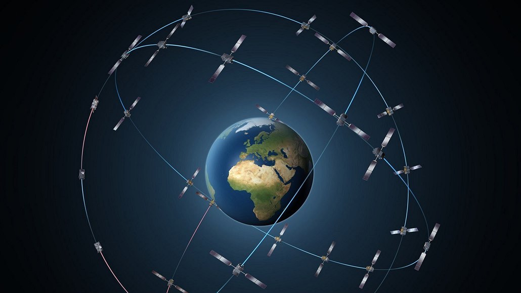
Vyjednávání o brexitu v Bruselu stále pokračují a některá z nich se dotýkají i geoinformatických témat. Momentálně je totiž na stole otázka, zda bude moci Velká Británie i po odchodu z Evropské unie setrvat v projektu Galileo, který je s unií pevně svázaný. Britská premiérka Mayová již byla konfrontována s návrhem z Bruselu, který z […]
The post Zůstane Velká Británie součástí projektu Galileo? appeared first on GISportal.cz.
DJI Gives Drones More Power For Commercial Use
28.3.2018 9:00 GISCafe.com Webcasts-Webinars MENLO PARK, Calif., March 28, 2018 — (PRNewswire) — DJI, the world's leader in civilian drones and aerial imaging technology, unveiled …Přípravy ke startu družice Sentinel-3B jsou v plném proudu
28.3.2018 8:54 Český Kosmický PortálDružice Sentinel-3B je nyní na ruském kosmodromu Pleseck a má jako datum startu určeno 25. dubna. Technici tak pokračují v celé řadě úkonů, aby byl nejnovější evropský satelit systému GMES/Copernicus včas připravený k cestě na oběžnou dráhu.
Oznámení o uzavření KP Chomutov 13.4.2018
28.3.2018 8:26 ČÚZK - předpisy a opatření Katastrální úřad pro Ústecký kraj - Katastrální pracoviště Chomutov zveřejnil novou aktualitu: Vážení klienti, na základě oznámení společnosti ČEZ Distribuce a.s. o plánovaném přerušení dodávky elektřiny, vám dáváme tímto na vědomí, že dne 13.4.2018 (pátek) bude Katastrální pracoviště Chomutov z technických důvodů uzavřeno pro veřejnost.Omlouváme se za případné komplikace a děkujeme za pochopení.
Oznámení o uzavření KP Chomutov 13.4.2018
28.3.2018 8:26 ČÚZK /Urady/Katastralni-urady/Katastralni-urady/Katastralni-urad-pro-Ustecky-kraj/Katastralni-pracoviste/KP-Chomutov/O-uradu/Aktuality/Oznameni-o-uzavreni-KP-Chomutov-13-4-2018Oznámení o uzavření KP Chomutov 13.4.2018
28.3.2018 8:19 ČÚZK - předpisy a opatření Katastrální úřad pro Ústecký kraj - Katastrální pracoviště Chomutov zveřejnil novou aktualitu: Vážení klienti, na základě oznámení společnosti ČEZ Distribuce a.s. o plánovaném přerušení dodávky elektřiny, vám dáváme tímto na vědomí, že dne 13.4.2018 (pátek) bude Katastrální pracoviště Chomutov z technických důvodů uzavřeno pro veřejnost.Omlouváme se za případné komplikace a děkujeme za pochopení.
Oznámení o uzavření KP Chomutov 13.4.2018
28.3.2018 8:19 ČÚZK /Urady/Katastralni-urady/Katastralni-urady/Katastralni-urad-pro-Ustecky-kraj/O-uradu/Aktuality/Oznameni-o-uzavreni-KP-Chomutov-13-4-2018Zemřel Ing. Michal Witiska
28.3.2018 2:03 Zeměměřič Zemřel tragicky v pátek 16. března 2018 ve věku 33 let. Poslední rozloučení bude ve čtvrtek 29. března ve 12 hodin v obřadní síni krematoria města Jihlavy.Záplavová území
28.3.2018 2:00 Cenia - Katalog metadat ČR - INSPIRE Záplavová území - Q100, Q20, Q5, aktivní zóny, hlásné profily, Pravidelně aktualizované v případě změn - nabytí právní moci opatření obecné povahy o stanovení záplavového území a vymezení aktivní zóny. Poslední aktualizace 1/2018.Lokální seismická síť WEBNET
28.3.2018 2:00 Cenia - Katalog metadat ČR - INSPIRE Seismické digitální záznamy stanic lokální seismické sítě WEBNET v západních Čechách. Lokální síť WEBNET se skládá ze 23 stanic. Na provozu stanic se podílí Geofyzikální ústav AV ČR Praha a Ústav struktury a mechaniky hornin AV ČR Praha.OGC requests responses to a survey regarding potential Professional Certification program
28.3.2018 1:27 GISCafe.com Webcasts-Webinars 27 March 2018: The Open Geospatial Consortium (OGC) is considering developing a Professional Certification program. The program would allow …HP Introduces World’s Most Powerful Workstation for Machine Learning Development
27.3.2018 23:42 GISCafe.com Webcasts-Webinars News Highlights: New optimized machine learning performance configurations for HP Z8 and HP Z4 Workstations …
S&P CoreLogic Case-Shiller Home Prices: All 20 Cities Up Year-Over-Year
27.3.2018 20:57 GISCafe.com Webcasts-Webinars NEW YORK, March 27, 2018 — (PRNewswire) — S&P Dow Jones Indices today released the latest results for the S&P CoreLogic …Aktuálne problémy prístupu k pôde, vlastníctva a nájmu poľnohospodárskej pôdy a priamych platieb
27.3.2018 20:06 Komora pozemkových úprav SR
Využitie súčasných zákonov – zápis zmlúv do katastra, overené notársky, verejná informovanosť sú len prvým, nevyhnutným krokom v prospech spravodlivého vysporiadania vlastníctva a nájomných vzťahov.
AgEagle Aerial Systems Closes Merger with EnerJex; To Initiate Trading on NYSE as UAVS
27.3.2018 17:16 GISCafe.com Webcasts-Webinars Innovative Company is Advancing Drone Imagery Collection and Analytics to Help Decrease Chemical Use on Food ProductsNeodesha, KS, March 27, …
Strategic ACI Awarded $3.35M Contract by U.S. Army Geospatial Center (AGC) for Army Geospatial Enterprise (AGE) Support
27.3.2018 17:16 GISCafe.com Webcasts-Webinars U.S. Army Geospatial Center (AGC) selects Strategic ACI to Provide Systems Engineering and Technical Assistance (SETA) Support and Expertise to the …PlanetObserver Announces Release of PlanetSAT Global Imagery Basemap Version #2018
27.3.2018 17:13 GISCafe.com Webcasts-Webinars Clermont-Ferrand, France - 27 March 2018 - PlanetObserver, provider of geospatial data for civil and military solutions,announces the release of the …Vektorové mapové dlaždice: Novinka mezi datovými produkty CEDA
27.3.2018 17:00 CEDA Maps a.s. Praha, 21.března2018 – Rozšiřujeme nabídku datových produktů o vektorové mapové dlaždice. Nový a efektivní nástroj pro vizualizaci atributově obsáhlých GIS databází.Bentley infrastructure awards program seeks entries
27.3.2018 16:18 Bentley SystemsPress Coverage
Railway Age, USA
Read the articleHigh-speed mapping for high-speed rail
27.3.2018 16:15 Bentley SystemsPress Coverage
Railway Age, USA
Read the articleEarth from Space
27.3.2018 16:15 ESA Observing the Earth
In this special edition, the Chair of the Advisory Committee for Earth Observation and ESA's Josef Aschbacher discuss how this new committee will help to further Earth science
Smarter Analytics for Asset Health
27.3.2018 16:09 Bentley SystemsPress Coverage
Plant Services, USA
Read the articleSmarter Analytics for Asset Health
27.3.2018 16:09 Bentley SystemsPress Coverage
Plant Services, USA
Read the articleSr Geo Graphic Inform Analyst
27.3.2018 14:49 http://employment.ku.edu/sr-geo-graphic-inform-analyst/11425br Position Overview The University of Kansas seeks a GIS Coordinator to be responsible for the development and implementation of geographic information systems (GIS) solutions and standards. This individual will participate on IT projects requiring GIS data, define data needs with business users, assist with collection of field survey data, and develop and maintain […]CAD/GIS specialista
27.3.2018 14:46 Jedná se o pozici CAD/GIS specialista na oddělení Praha – mapový server. Práce se software Bentley MIcrostation, PowerCivil, MGEO, ArcGIS, QGIS, FME a další. Náplň práce je různorodá, od spolupráce s geodety, kontroly a zpracování jejich měření přes správu provozních dokumentací a s tím spojených GIS analýz až po správu mapových webových služeb a spolupráci na testování a […]Sonda BepiColombo dostala zelenou pro cestu na kosmodrom
27.3.2018 13:45 Český Kosmický PortálPrvní evropská mise k planetě Merkur bude již brzy připravena k odeslání na kosmodrom. Zde začnou její závěrečné přípravy na start.
Sonda BepiColombo dostala zelenou pro cestu na kosmodrom
27.3.2018 13:45 Český Kosmický PortálPrvní evropská mise k planetě Merkur bude již brzy připravena k odeslání na kosmodrom. Zde začnou její závěrečné přípravy na start.
First high capacity space-to-ground laser communications system for the new European external ISS Platform Bartolomeo
27.3.2018 13:02 GISCafe.com Webcasts-Webinars Bremen, 26/03/2018 - The first high capacity space-to-ground laser communication system is to be installed on the Bartolomeo platform of the …GISáček 2018
27.3.2018 11:13 Již od roku 1998 se pravidelně koná na katedry geoinformatiky studentská konference GISáček, nejinak tomu bylo i letos. Konference, je určená studentům vysokých škol v oblasti geoinformatiky, kteří zde mají možnost prezentovat výsledky svých odborných studentských prací. Pro studenty je tato akce dobrou příležitostí, jak představit své práce a dovednosti porotě, která je složena ze zástupců […]GISáček 2018
27.3.2018 11:13 Již od roku 1998 se pravidelně koná na katedrau geoinformatiky studentská konference GISáček, nejinak tomu bylo i letos. Konference, je určená studentům vysokých škol v oblasti geoinformatiky, kteří zde mají možnost prezentovat výsledky svých odborných studentských prací. Pro studenty je tato akce dobrou příležitostí, jak představit své práce a dovednosti porotě, která je složena ze zástupců […]GISáček 2018
27.3.2018 11:13 Již od roku 1998 se pravidelně koná na institutu geoinformatiky studentská konference GISáček, nejinak tomu bylo i letos. Konference, je určená studentům vysokých škol v oblasti geoinformatiky, kteří zde mají možnost prezentovat výsledky svých odborných studentských prací. Pro studenty je tato akce dobrou příležitostí, jak představit své práce a dovednosti porotě, která je složena ze zástupců […]20180327 Rada/odborný rada oddělení právních vztahů k nemovitostem
27.3.2018 11:12 ČÚZK /Urady/Katastralni-urady/Katastralni-urady/Katastralni-urad-pro-Stredocesky-kraj/Katastralni-pracoviste/KP-Pribram/O-uradu/Aktuality/20161013Rada-odborny-rada-–-informatik-(4)20180327 Rada/odborný rada oddělení právních vztahů k nemovitostem
27.3.2018 11:12 ČÚZK - předpisy a opatření Katastrální úřad pro Středočeský kraj - Katastrální pracoviště Příbram Vyhlášení výběrového řízení: Rada/odborný rada oddělení právních vztahů k nemovitostem V části "Úřední deska", v sekci "Oznámení a jiná úřední sdělení" bylo vystaveno "Oznámení o vyhlášení výběrového řízení na obsazení služebního místa Rada/odborný rada oddělení právních vztahů k nemovitostem"Rada/odborný rada oddělení právních vztahů k nemovitostem
27.3.2018 11:10 ČÚZK - volná místa Katastrální úřad pro Středočeský kraj - Katastrální pracoviště Příbram vypisuje výběrové řízení na místo Rada/odborný rada oddělení právních vztahů k nemovitostemRada/odborný rada oddělení právních vztahů k nemovitostem
27.3.2018 11:10 ČÚZK - předpisy a opatření Katastrální úřad pro Středočeský kraj - Katastrální pracoviště Příbramvypisuje výběrové řízení na místo Rada/odborný rada oddělení právních vztahů k nemovitostem
Rada/odborný rada oddělení právních vztahů k nemovitostem
Rada/odborný rada oddělení právních vztahů k nemovitostem
27.3.2018 11:10 ČÚZK /Urady/Katastralni-urady/Katastralni-urady/Katastralni-urad-pro-Stredocesky-kraj/Uredni-deska/Oznameni-a-jina-uredni-sdeleni/Volna-mista/Rada-odborny-rada-oddeleni-pravnich-vztahu-k-n-(5)Rozhovor s expertem na samořiditelné automobily
27.3.2018 10:08 GISportal.cz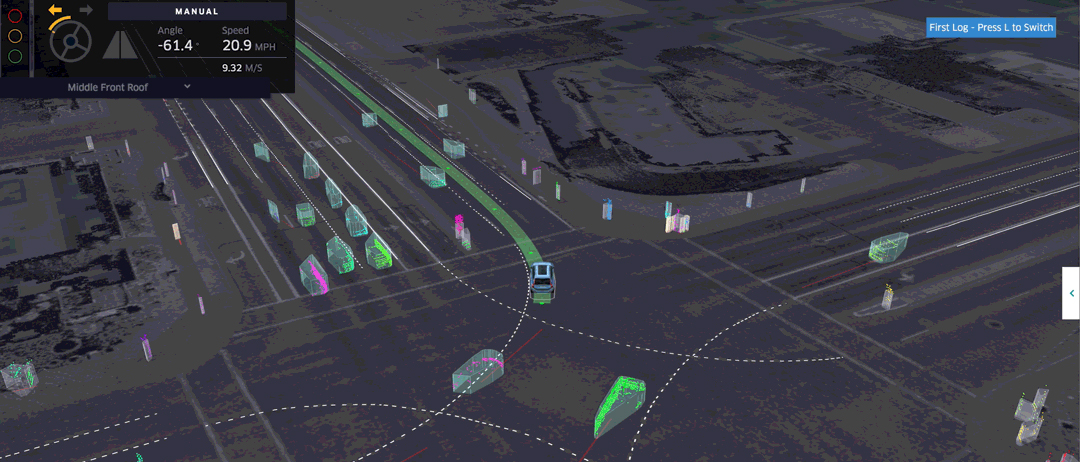
V prosinci jsme na GISportálu přinesli reportáž o testování autonomních vozů Uber. Samořiditelné vozy se nedávno dostaly opět na titulní strany novin, když v americké Arizoně došlo ke smrtelné nehodě automobilu s chodkyní. V Hospodářských novinách před pár dny vyšlo interview s Jamesem Prittsem, americkým vědcem, který v současnosti působí v Centru strojového vnímání na […]
The post Rozhovor s expertem na samořiditelné automobily appeared first on GISportal.cz.
Rozhovor s expertem na samořiditelné automobily
27.3.2018 10:08 GISportal.czV prosinci jsme na GISportálu přinesli reportáž o testování autonomních vozů Uber. Samořiditelné vozy se nedávno dostaly opět na titulní strany novin, když v americké Arizoně došlo ke smrtelné nehodě automobilu s chodkyní. V Hospodářských novinách před pár dny vyšlo interview s Jamesem Prittsem, americkým vědcem, který v současnosti působí v Centru strojového vnímání na […]
The post Rozhovor s expertem na samořiditelné automobily appeared first on GISportal.cz.
GSA supporting development of all PRS user segments
27.3.2018 9:12 European GNSS Agency
Deployment of the Galileo Public Regulated Service (PRS) has been ongoing in recent years and the European GNSS Agency (GSA) has been actively contributing to the development of all user segments to ensure the widespread uptake of the service. GSA PRS Service Manager Charles Villie gave participants in the Munich Satellite Navigation Summit on March 7 a status update on the Galileo PRS and outlined plans for the future.
The Galileo PRS is an encrypted navigation service that is designed to be more resistant to jamming, involuntary interference and spoofing than other services. The launch of Galileo initial services at the end of 2016 also marked the start of the initial Galileo PRS service phase, during which receivers are being tested and all declared PRS functionalities and infrastructure are functional and operational.
Speaking at the Munich Summit, Villie said that the plan for this year is to move to the PRS enhanced service, during which pre-operational receivers will be tested. In preparation for enhanced delivery, the GSA will continue to update PRS functionalities and procedures and improve the navigation performance of PRS, which will benefit from the new satellites added to the constellation, he said.
This work is being conducted in preparation for the initial operational capability (IOC) phase, which is timed for delivery according to the European Commission Galileo roadmap. “IOC is a very important target for us, because it will be the moment when the service and the functionalities will be completely operational and the user segment will be ready to start using operational receivers,” Villie said.
He said that, ahead of IOC, the GSA is actively contributing to the development of all PRS user segments to ensure that user needs are met. This support is provided in three main axes: technical assistance to Competent PRS Authorities (CPA) in the form of workshops and training; operational demonstration and validation in PRS pilot projects and grants for joint test activities; and, finally, support for the development of user equipment, provided through Horizon 2020 and the Fundamental Elements funding mechanism.
High resilience to threats
Richard Bowden, Programme Manager at UK receiver producer QinetiQ noted at the Summit session that, as the Galileo PRS moves towards operational capacity, there is recognition of its benefits in the civil sector, but that a number of challenges remain to widespread uptake. He said that positioning, navigation, and timing (PNT) would need to be at least as good as Open Service alternatives, with substantially higher resilience to threats.
This was one of the issues addressed by Villie in his presentation. Citing encryption as the main differentiator of the PRS, Villie said that the key differences between PRS and other Galileo services are the fact PRS access is ensured by an access management policy for users, which means that continuity of service to authorised users is ensured even when access to other navigation services is denied.
“In cases of malicious or unintentional interference, the PRS increases the likelihood of continuous availability of the signal-in-space and provides an authenticated position, velocity and timing service,” he said.
High interest among users
One essential pre-requisite for the future adoption of PRS by multiple user communities is the availability of receivers for different applications. In his presentation at the Summit, Alessandro Ambri from Italian receiver producer Leonardo outlined some of the company’s main Galileo PRS receiver projects, including the GSA-funded projects P3RS-2, PRISMA, and DISPATCH.
Ambri said that his company sees the installation of Galileo PRS on its platforms as an opportunity, as it can be used in many sectors - critical infrastructure, in the military, and by emergency and security services. “We are active in all these areas and our customers have expressed an interest in the Galileo PRS,” he said.
Media note: This feature can be republished without charge provided the European GNSS Agency (GSA) is acknowledged as the source at the top or the bottom of the story. You must request permission before you use any of the photographs on the site. If you republish, we would be grateful if you could link back to the GSA website (http://www.gsa.europa.eu).
GSA supporting development of all PRS user segments
27.3.2018 9:12 European GNSS Agency
Deployment of the Galileo Public Regulated Service (PRS) has been ongoing in recent years and the European GNSS Agency (GSA) has been actively contributing to the development of all user segments to ensure the widespread uptake of the service. GSA PRS Service Manager Charles Villie gave participants in the Munich Satellite Navigation Summit on March 7 a status update on the Galileo PRS and outlined plans for the future.
The Galileo PRS is an encrypted navigation service that is designed to be more resistant to jamming, involuntary interference and spoofing than other services. The launch of Galileo initial services at the end of 2016 also marked the start of the initial Galileo PRS service phase, during which receivers are being tested and all declared PRS functionalities and infrastructure are functional and operational.
Speaking at the Munich Summit, Villie said that the plan for this year is to move to the PRS enhanced service, during which pre-operational receivers will be tested. In preparation for enhanced delivery, the GSA will continue to update PRS functionalities and procedures and improve the navigation performance of PRS, which will benefit from the new satellites added to the constellation, he said.
This work is being conducted in preparation for the initial operational capability (IOC) phase, which is timed for delivery according to the European Commission Galileo roadmap. “IOC is a very important target for us, because it will be the moment when the service and the functionalities will be completely operational and the user segment will be ready to start using operational receivers,” Villie said.
He said that, ahead of IOC, the GSA is actively contributing to the development of all PRS user segments to ensure that user needs are met. This support is provided in three main axes: technical assistance to Competent PRS Authorities (CPA) in the form of workshops and training; operational demonstration and validation in PRS pilot projects and grants for joint test activities; and, finally, support for the development of user equipment, provided through Horizon 2020 and the Fundamental Elements funding mechanism.
High resilience to threats
Richard Bowden, Programme Manager at UK receiver producer QuinetiQ noted at the Summit session that, as the Galileo PRS moves towards operational capacity, there is recognition of its benefits in the civil sector, but that a number of challenges remain to widespread uptake. He said that positioning, navigation, and timing (PNT) would need to be at least as good as Open Service alternatives, with substantially higher resilience to threats.
This was one of the issues addressed by Villie in his presentation. Citing encryption as the main differentiator of the PRS, Villie said that the key differences between PRS and other Galileo services are the fact PRS access is ensured by an access management policy for users, which means that continuity of service to authorised users is ensured even when access to other navigation services is denied.
“In cases of malicious or unintentional interference, the PRS increases the likelihood of continuous availability of the signal-in-space and provides an authenticated position, velocity and timing service,” he said.
High interest among users
One essential pre-requisite for the future adoption of PRS by multiple user communities is the availability of receivers for different applications. In his presentation at the Summit, Alessandro Ambri from Italian receiver producer Leonardo outlined some of the company’s main Galileo PRS receiver projects, including the GSA-funded projects P3RS-2, PRISMA, and DISPATCH.
Ambri said that his company sees the installation of Galileo PRS on its platforms as an opportunity, as it can be used in many sectors - critical infrastructure, in the military, and by emergency and security services. “We are active in all these areas and our customers have expressed an interest in the Galileo PRS,” he said.
Media note: This feature can be republished without charge provided the European GNSS Agency (GSA) is acknowledged as the source at the top or the bottom of the story. You must request permission before you use any of the photographs on the site. If you republish, we would be grateful if you could link back to the GSA website (http://www.gsa.europa.eu).
Mapy jsou pro každého 2018
27.3.2018 9:06 TopGis Tak jako každý rok i letos jsme partnery konference „Mapy jsou pro každého 2018“. Tentokrát v hotelu Svratka na Vysočině. Zveme vás a budeme rádi, pokud se s Vámi setkáme osobně, ve dnech 22. – 23. 5. 2018. Více informací na webu konference. Těšíme se na setkání s VámiMapy jsou pro každého 2018
27.3.2018 9:06 TopGis Tak jako každý rok i letos jsme partnery konference „Mapy jsou pro každého 2018“. Tentokrát v hotelu Svratka na Vysočině. Zveme vás a budeme rádi, pokud se s Vámi setkáme osobně, ve dnech 22. – 23. 5. 2018. Více informací na webu konference. Těšíme se na setkání s VámiGISáček 2018 – výsledky súťaže
27.3.2018 8:30 GISportal.cz
Dňa 21.3.2018 sa na pôde VŠB-TU v Ostrave uskutočnila už tradičná študentská súťaž GISáček. Toto podujatie je primárne určené študentom vysokých škôl, ktorí sa v rámci svojich bakalárskych, magisterských/inžinierskych prác venujú témam z oblasti geoinformatiky, geoinformačných technológií a ich aplikácií. Študenti tu majú možnosť prezentovať výsledky svojich prác pred komisiou zloženou z odborníkov z akademickej aj súkromnej sféry, čím […]
The post GISáček 2018 – výsledky súťaže appeared first on GISportal.cz.
YOUTH STARTUP FESTIVAL
27.3.2018 7:00 Česká asociace pro geoinformace Největší prezentace projektů mládeže v srdci Evropy - to je YOUTH STARTUP FESTIVAL. Ať jsi student s chutí podnikat nebo chceš jen poznávat svět startupů a technologií, doraž 16. května do Brna.Více informací nalezneš na webu