


zprávy
zdroje zpráv:Konala se členská schůze Aliance 2.2.2022
3.2.2022 14:33 UAVAVčera 2.2.2022 v 2pm se konala členská schůze UAVA 2022 s velkou účastí. Minulý rok i přes značná omezení se povedlo realizovat spoustu aktivit Aliance, včetně Dronedge 2021 a letošní rok nebude jiný. Již v březnu bude Český stánek na Amsterdam Drone Week 2022 a plánuje se i v září na Commercial UAV Expo Americas […]
The post Konala se členská schůze Aliance 2.2.2022 appeared first on UAV Aliance pro bezpilotní letecký průmysl.
Vrchní referent/rada v oddělení obnovy a revize KN na Katastrálním pracovišti Brno - venkov
3.2.2022 12:59 ČÚZK /Urady/Katastralni-urady/Katastralni-urady/Katastralni-urad-pro-Jihomoravsky-kraj/Volna-mista/DMS/Vrchni-referent-rada-v-oddeleni-obnovy-a-reviz-(1)Vrchní referent/rada v oddělení obnovy a revize KN na Katastrálním pracovišti Brno - venkov
3.2.2022 12:59 ČÚZK - volná místa Katastrální úřad pro Jihomoravský kraj Katastrální pracoviště Brno-venkov vypisuje výběrové řízení na místo Vrchní referent/rada v oddělení obnovy a revize KN na Katastrálním pracovišti Brno - venkovVrchní referent/rada v oddělení obnovy a revize KN na Katastrálním pracovišti Brno - venkov
3.2.2022 12:59 ČÚZK - předpisy a opatření Katastrální úřad pro Jihomoravský kraj Katastrální pracoviště Brno-venkovvypisuje výběrové řízení na místo
Vrchní referent/rada v oddělení obnovy a revize KN na Katastrálním pracovišti Brno - venkov
Údržba komunikačnej infraštruktúry rezortu
3.2.2022 12:00
ÚGKK SR
Dňa 04.02.2022 v čase od 07:00 hod. do 08:00 hod. bude vykonaná plánovaná údržba komunikačnej infraštruktúry rezortu (konfiguračné zmeny). Z uvedeného dôvodu v uvedenom čase môže dôjsť k občasným výpadkom služieb portálu ESKN (https://kataster.skgeodesy.sk/).
Za vzniknuté problémy sa ospravedlňujeme.
Galileo SAR delivers best performance since declared operational in December 2016
3.2.2022 10:46 European GNSS Agency
The Galileo SAR, reached new heights with a record-breaking location accuracy performance of 98.12% below 2km. The EU constellation is the biggest contributor to the Cospas-Sarsat MEOSAR system.
The Galileo Search and Rescue Service (SAR) was launched on 15 December 2016 to provide aid to people in distress or imminent danger. The Galileo SAR service relays highly accurate, timely, and reliable distress alert data to Cospas-Sarsat.
Under EUSPA management, the Galileo SAR Service has been introducing breakthrough features such as the Galileo Return Link Service which was declared operational in January 2020. Since then, the service has been going from strength to strength, consistently exceeding the minimum performance levels committed in the SAR/Galileo Service Definition Document.
Similarly, the SAR Galileo Forward Link Service (FLS) has seen the addition of new elements such as the SAR/Galileo calibration beacons as well as continuous upgrades of its ground infrastructure that are significantly contributing to excellent operability, performance and therefore overall SAR Galileo Service delivery.
Unprecedented levels of location accuracy for Galileo
The EU Agency for the Space Programme is committed to delivering top-notch satellite services which is why the dedicated Galileo team performs continuous quantitative controls to monitor key performance parameters (KPI) of the Galileo SAR service.
One of the most relevant performance parameters gauged is the "quality of the location service" or location accuracy. The said KPI measures the probability of success in locating any emergency distress with an error better than 2km and 10minutes within the declared SAR/Galileo Coverage Area. Thanks to a streamlined Galileo SAR service delivery and a robust infrastructure, the SAR/Galileo achieved an average location accuracy within a 2km value of 98.12% during December 2021, the best location accuracy performance since the start of the operations (see graph below).

Media note: This feature can be republished without charge provided the European Union Agency for the Space Programme (EUSPA) is acknowledged as the source at the top or the bottom of the story. You must request permission before you use any of the photographs on the site. If you republish, we would be grateful if you could link back to the EUSPA website (http://www.euspa.europa.eu).
Galileo SAR delivers the best performance since declared operational in December 2016
3.2.2022 10:46 European GNSS AgencyThe Galileo SAR, reached new heights with a record-breaking location accuracy performance of 98.12% below 2km. The EU constellation is the biggest contributor to the Cospas-Sarsat MEOSAR system.
The Galileo Search and Rescue Service (SAR) was launched on 15 December 2016 to provide aid to people in distress or imminent danger. The Galileo SAR service relays highly accurate, timely, and reliable distress alert data to Cospas-Sarsat.
Under EUSPA management, the Galileo SAR Service has been introducing breakthrough features such as the Galileo Return Link Service which was declared operational in January 2020. Since then, the service has been going from strength to strength, consistently exceeding the minimum performance levels committed in the SAR/Galileo Service Definition Document.
Similarly, the SAR Galileo Forward Link Service (FLS) has seen the addition of new elements such as the SAR/Galileo calibration beacons as well as continuous upgrades of its ground infrastructure that are significantly contributing to excellent operability, performance and therefore overall SAR Galileo Service delivery.
Unprecedented levels of location accuracy for Galileo
The EU Agency for the Space Programme is committed to delivering top-notch satellite services which is why the dedicated Galileo team performs continuous quantitative controls to monitor key performance parameters (KPI) of the Galileo SAR service.
One of the most relevant performance parameters gauged is the "quality of the location service" or location accuracy. The said KPI measures the probability of success in locating any emergency distress with an error better than 2km and 10minutes within the declared SAR/Galileo Coverage Area. Thanks to a streamlined Galileo SAR service delivery and a robust infrastructure, the SAR/Galileo achieved an average location accuracy within a 2km value of 98.12% during December 2021, the best location accuracy performance since the start of the operations (see graph below).
Media note: This feature can be republished without charge provided the European Union Agency for the Space Programme (EUSPA) is acknowledged as the source at the top or the bottom of the story. You must request permission before you use any of the photographs on the site. If you republish, we would be grateful if you could link back to the EUSPA website (http://www.euspa.europa.eu).
Galileo SAR delivers best performance since declared operational in December 2016
3.2.2022 10:46 European GNSS AgencyThe Galileo SAR reached new heights with a record-breaking location accuracy performance of 98.12% below 2km. The EU constellation is the biggest contributor to the Cospas-Sarsat MEOSAR system.
The Galileo Search and Rescue Service (SAR) was launched on 15 December 2016 to provide aid to people in distress or imminent danger. The Galileo SAR service relays highly accurate, timely, and reliable distress alert data to Cospas-Sarsat.
Under EUSPA management, the Galileo SAR Service has been introducing breakthrough features such as the Galileo Return Link Service which was declared operational in January 2020. Since then, the service has been going from strength to strength, consistently exceeding the minimum performance levels committed in the SAR/Galileo Service Definition Document.
Similarly, the SAR Galileo Forward Link Service (FLS) has seen the addition of new elements such as the SAR/Galileo calibration beacons as well as continuous upgrades of its ground infrastructure that are significantly contributing to excellent operability, performance and therefore overall SAR Galileo Service delivery.
Unprecedented levels of location accuracy for Galileo
The EU Agency for the Space Programme is committed to delivering top-notch satellite services which is why the dedicated Galileo team performs continuous quantitative controls to monitor key performance parameters (KPI) of the Galileo SAR service.
One of the most relevant performance parameters gauged is the "quality of the location service" or location accuracy. The said KPI measures the probability of success in locating any emergency distress with an error better than 2km and 10minutes within the declared SAR/Galileo Coverage Area. Thanks to a streamlined Galileo SAR service delivery and a robust infrastructure, the SAR/Galileo achieved an average location accuracy within a 2km value of 98.12% during December 2021, the best location accuracy performance since the start of the operations (see graph below).
Media note: This feature can be republished without charge provided the European Union Agency for the Space Programme (EUSPA) is acknowledged as the source at the top or the bottom of the story. You must request permission before you use any of the photographs on the site. If you republish, we would be grateful if you could link back to the EUSPA website (http://www.euspa.europa.eu).
Odborný referent v oddělení obnovy katastrálního operátu technického útvaru Katastrálního úřadu pro
3.2.2022 10:03 ČÚZK /Urady/Katastralni-urady/Katastralni-urady/Katastralni-urad-pro-Kralovehradecky-kraj/Volna-mista/DMS/Odborny-referent-v-oddeleni-obnovy-katastralniho-oOdborný referent v oddělení obnovy katastrálního operátu technického útvaru Katastrálního úřadu pro
3.2.2022 10:03 ČÚZK - volná místa Katastrální úřad pro Královéhradecký kraj technický útvar vypisuje výběrové řízení na místo Odborný referent v oddělení obnovy katastrálního operátu technického útvaru Katastrálního úřadu proOdborný referent v oddělení obnovy katastrálního operátu technického útvaru Katastrálního úřadu pro
3.2.2022 10:03 ČÚZK - předpisy a opatření Katastrální úřad pro Královéhradecký kraj technický útvarvypisuje výběrové řízení na místo
Odborný referent v oddělení obnovy katastrálního operátu technického útvaru Katastrálního úřadu pro Královéhradecký kraj
We should be putting energy into ensuring we have the right people ready at the right time.
2.2.2022 20:27 Bentley SystemsPressCoverage
Position Magazine, Australia
Read the articleBowler Pons deploys Cepton’s smart lidar solution to augment 3D security system for critical infrastructure
2.2.2022 18:05 GISCafe.com Webcasts-Webinars SAN JOSE, Calif. — (BUSINESS WIRE) — February 2, 2022 —Cepton Technologies, Inc. (Cepton), an innovative provider of smart lidar …
Monarch Weather Consulting Launches Weather Intelligence GIS Content Solutions on Esri’s ArcGIS Marketplace
2.2.2022 18:05 GISCafe.com Webcasts-Webinars SAN DIEGO — (BUSINESS WIRE) — February 1, 2022 —As the entrepreneurs behind Monarch Weather Consulting, meteorologists Crystal …
New Garmin inReach Mini 2 delivers up to 30 days of global satellite communication, emergency services and enhanced location tracking
2.2.2022 18:05 GISCafe.com Webcasts-Webinars Lightweight and compact handheld adds Garmin Explore app capability and navigation features so you can explore with confidenceOLATHE, Kan. — …
Trimble Dimensions+ 2022 Call for Speakers Now Open
2.2.2022 18:05 GISCafe.com Webcasts-Webinars SUNNYVALE, Calif., Feb. 2, 2022 — (PRNewswire) — Trimble (NASDAQ: TRMB) has opened its Call for Speakers for the Trimble Dimensions+ …Bantec's Drone USA Receives Purchase Order to Ultra High-Tech Thermal Drone to a Coastal New Jersey Fire Department
2.2.2022 18:05 GISCafe.com Webcasts-Webinars LITTLE FALLS, N.J., Feb. 2, 2022 — (PRNewswire) — Bantec, Inc. (OTCPINK: BANT) ("Bantec" or the "Company"), Bantec, Inc., a …Nová mapová aplikace - Uzavírky silnic v Jihočeském kraji v roce 2022
2.2.2022 16:54 Jihočeský krajByla vytvořena mapová aplikace Uzavírky silnic v Jihočeském kraji v roce 2022, zobrazující dopravní omezení včetně objízdných tras na silnicích v Jihočeském kraji.
Acer představil nové odolné notebooky Swift X. Mají matné IPS displeje s vysokým rozlišením
2.2.2022 13:18 GeoBusiness Dva nové notebooky v řadě Acer Swift X mají úhlopříčku 14 a 16 palců, přičemž jsou lehké (1,4 a 1,7 kg), ale přitom mají odolné hliníkové šasi a vysoké rozlišení displejů. Ultrapřenosný 14″ model SFX14-51G, který váží pouhých 1,4 kg, má matný IPS displej s rozlišením 2240 × 1400 pixelů s pěkně tenkým rámečkem a […]Acer představil nové odolné notebooky Swift X. Mají matné IPS displeje s vysokým rozlišením
2.2.2022 13:18 GeoBusinessDva nové notebooky v řadě Acer Swift X mají úhlopříčku 14 a 16 palců, přičemž jsou lehké (1,4 a 1,7 kg), ale přitom mají odolné hliníkové šasi a vysoké rozlišení displejů. Ultrapřenosný 14″ model SFX14-51G, který váží pouhých 1,4 kg, má matný IPS displej s rozlišením 2240 × 1400 pixelů s pěkně tenkým rámečkem a 100% pokrytím barevného gamutu sRGB. Notebook je osazen […]
The post Acer představil nové odolné notebooky Swift X. Mají matné IPS displeje s vysokým rozlišením appeared first on GeoBusiness.
Acer představil nové odolné notebooky Swift X. Mají matné IPS displeje s vysokým rozlišením
2.2.2022 13:18 GeoBusinessDva nové notebooky v řadě Acer Swift X mají úhlopříčku 14 a 16 palců, přičemž jsou lehké (1,4 a 1,7 kg), ale přitom mají odolné hliníkové šasi a vysoké rozlišení displejů. Ultrapřenosný 14″ model SFX14-51G, který váží pouhých 1,4 kg, má matný IPS displej s rozlišením 2240 × 1400 pixelů s pěkně tenkým rámečkem a […]
The post Acer představil nové odolné notebooky Swift X. Mají matné IPS displeje s vysokým rozlišením appeared first on GeoBusiness.
Acer představil nové odolné notebooky Swift X. Mají vysoké rozlišení matného IPS displeje
2.2.2022 13:18 GeoBusinessDva nové notebooky v řadě Acer Swift X mají úhlopříčku 14 a 16 palců, přičemž jsou lehké (1,4 a 1,7 kg), ale přitom mají odolné hliníkové šasi a vysoké rozlišení displejů. Ultrapřenosný 14″ model SFX14-51G, který váží pouhých 1,4 kg, má matný IPS displej s rozlišením 2240 × 1400 pixelů s pěkně tenkým rámečkem a 100% pokrytím barevného gamutu sRGB. Notebook je osazen […]
The post Acer představil nové odolné notebooky Swift X. Mají vysoké rozlišení matného IPS displeje appeared first on GeoBusiness.
Acer představil nové odolné notebooky Swift X. Mají matné IPS displeje s vysokým rozlišením
2.2.2022 13:18 GeoBusiness Dva nové notebooky v řadě Acer Swift X mají úhlopříčku 14 a 16 palců, přičemž jsou lehké (1,4 a 1,7 kg), ale přitom mají odolné hliníkové šasi a vysoké rozlišení displejů. Ultrapřenosný 14″ model SFX14-51G, který váží pouhých 1,4 kg, má matný IPS displej s rozlišením 2240 × 1400 pixelů s pěkně tenkým rámečkem a 100% pokrytím barevného gamutu sRGB. Notebook je osazen […]vrchní referent/rada – obnova katastrálního operátu
2.2.2022 12:41 ČÚZK - předpisy a opatření Katastrální úřad pro hlavní město Prahu - Katastrální pracoviště Prahavypisuje výběrové řízení na místo
vrchní referent/rada – obnova katastrálního operátu
vrchní referent/rada – obnova katastrálního operátu
2.2.2022 12:41 ČÚZK - volná místa Katastrální úřad pro hlavní město Prahu - Katastrální pracoviště Praha vypisuje výběrové řízení na místo vrchní referent/rada – obnova katastrálního operátuvrchní referent/rada – obnova katastrálního operátu
2.2.2022 12:41 ČÚZK /Urady/Katastralni-urady/Katastralni-urady/Katastralni-urad-pro-hlavni-mesto-Prahu/Uredni-deska/Oznameni-a-jina-uredni-sdeleni/Volna-mista/DMS/vrchni-referent-rada-–-obnova-katastralniho-operatČeská lokalizace pro Autodesk Fusion 360 je nyní ZDARMA
2.2.2022 11:24 Arkance SystemsUsnadněte si ovládání CAD/CAM/CAE aplikace Autodesk Fusion 360 díky bezplatné české lokalizaci
Zpráva Česká lokalizace pro Autodesk Fusion 360 je nyní ZDARMA pochází z arkance-systems.cz.
Nové verze 15.54 našich produktů
2.2.2022 10:46 GEPROPřipravili jsme pro vás nové verze 15.54 našich produktů, které obsahují řadu změn. Stahovat je můžete z obvyklého umístění na našem download serveru:
Výběr z hlavních novinek, které jsme pro vás nachystali, si můžete prohlédnout v následujících odkazech: Přehled změn:
… >>Odborný referent / vrchní referent v oddělení aktualizace katastru nemovitostí Katastrálního pracovi
2.2.2022 10:21 ČÚZK /Urady/Katastralni-urady/Katastralni-urady/Katastralni-urad-pro-Kralovehradecky-kraj/Uredni-deska/Oznameni-a-jina-uredni-sdeleni/Volna-mista/DMS/Odborny-referent-vrchni-referent-v-oddeleni-aktuOdborný referent / vrchní referent v oddělení aktualizace katastru nemovitostí Katastrálního pracovi
2.2.2022 10:21 ČÚZK - předpisy a opatření Katastrální úřad pro Královéhradecký kraj Katastrální pracoviště Hradec Královévypisuje výběrové řízení na místo
Odborný referent / vrchní referent v oddělení aktualizace katastru nemovitostí Katastrálního pracoviště Hradec Králové
Odborný referent / vrchní referent v oddělení aktualizace katastru nemovitostí Katastrálního pracovi
2.2.2022 10:21 ČÚZK - volná místa Katastrální úřad pro Královéhradecký kraj Katastrální pracoviště Hradec Králové vypisuje výběrové řízení na místo Odborný referent / vrchní referent v oddělení aktualizace katastru nemovitostí Katastrálního pracoviNovinky v ArcGIS Storymaps
2.2.2022 9:44 ARCDATAV prosinci a v lednu získaly ArcGIS Storymaps několik nových funkcí. Pojďme si je představit.
3D prohlídka mapy
Prohlížení mapy snímek po snímku bylo dosud možné pouze pro 2D mapy. Nyní v bloku prohlídka mapy (Map Tour) můžeme přepnout i do 3D.
Akce v expresních mapách
Pro expresní mapu lze konfigurovat „akci“, která se spouští kliknutím na odkaz nebo na tlačítko. Akce může znamenat například přesun na vybrané místo na mapě – čtenář tak může tedy klikat na odkazy a tlačítka v textové části bočního bloku (Sidecar) a mapa se bude podle jeho aktivity měnit.

Nahrávání PDF do sbírky
Sbírky umožňují sdružovat různý, obvykle tematicky blízký obsah. Od začátku do nich bylo možné vkládat mapové aplikace a odkazy na webové stránky, od podzimu mohou obsahovat i obrázky a videa a od posledních aktualizací podporují také nahrávání PDF souborů.
Překrývání (Swipe) expresních map
Do bloku překrývání (Swipe) je možné vložit dvě expresní mapy. Velmi rychle se tak dá vytvořit porovnání dvou map, které si autor nakreslí přímo v prostředí map s příběhem.

Úprava názvu mapy v legendě bloku překrývání (Swipe)
Užitečná drobnost se týká také legendy v bloku překrývání (Swipe). Název mapy nad příslušnou legendou lze nyní editovat a přizpůsobit jej tak velikosti okénka, ve kterém se legenda nachází.
Vylepšené formátování textu
Engine pro formátování textu byl přepracován. Některé úpravy jsou proto rychlejší, pohyb kurzoru mezi bloky je pohodlnější a k dispozici jsou i nové formátovací příkazy, jako je například horní a dolní index, dvouúrovňové seznamy, lepší rozeznávání hypertextových odkazů a podpora oblíbených formátovacích zkratek: ctrl+b pro tučné, ctrl+i pro kurzivu, ctrl+enter pro nový řádek a další.
Pro rychlejší formátování je také možné využít zkratku pro nastavení stylu odstavce. Pokud na samý začátek bloku napíšeme následující symbol, změní se formát bloku na:
- Záhlaví: #
- Dílčí záhlaví: ##
- Citace: >
- Velký odstavec: %
- Seznam: 1., *, nebo -

GEOING Plzeň, spol.s.r.o. přijme pracovníka GIS
2.2.2022 9:37 Blogující geomatici - FAV ZČUGeoing Plzeň, spol. s r. o. přijme pracovníka GIS
Požadujeme:- samostatnost, aktivitu, komunikativnost
- znalost práce s geografickým informačním systémem, výhodou znalost Misys
- znalost práce s Bentley Microstation výhodou
- řidičský průkaz B
- zaškolení a podpora dalšího vzdělávání
- odpovídající finanční ohodnocení
- samostatnou a zodpovědnou práci
- práce v rozvíjející se zeměměřické společnosti Geoing Plzeň.
Typ smluvního vztahu: Pracovní smlouva
Benefity: Mobilní telefon, Notebook, Vzdělávací kurzy,
školení
Ing. David Havel
oddělení GIS
GEOING Plzeň, spol. s r.o.
tel.: 377 683 166
724 936 431
havel@geoing.cz
GEOING Plzeň, spol.s.r.o., Lobezská 15, 326 00 Plzeň 26
tel: 377456790, 377456791, fax: 377456792e-mail: info@geoing.cz, www.geoing.cz
IČO: 453 58 460, DIČ: CZ453 58 460
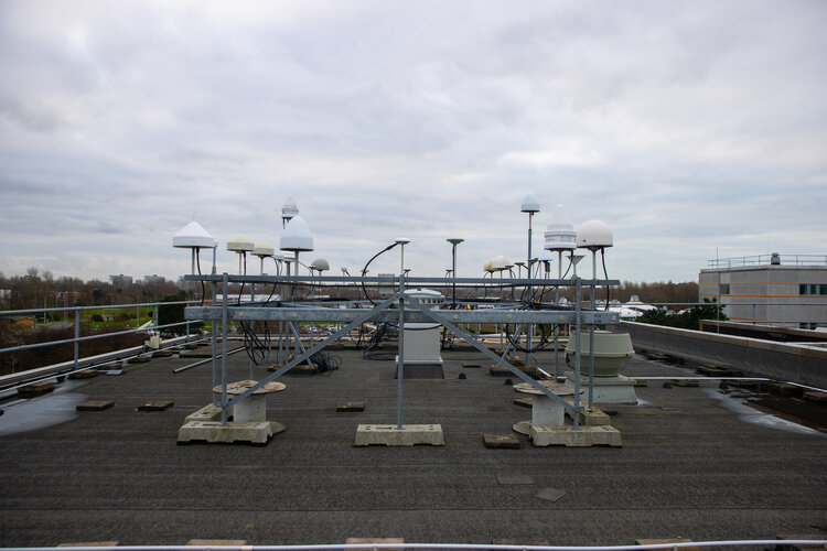 Image:
Roof of the satnav world
Image:
Roof of the satnav world
Mokřady mají svůj den
2.2.2022 0:00 Státní pozemkový úřad Praha, 2. února 2022 - Státní pozemkový úřad (SPÚ) se snaží svými realizacemi vodohospodářských zařízení přispět ke zvýšení počtu revitalizovaných nebo nově vytvořených mokřadů, které zadržují v krajině více vody než klasické rybníky, což je vědecky dokázáno.Aeva Introduces Aeries II – The World’s First 4D LiDAR with Camera-Level Resolution
1.2.2022 23:06 GISCafe.com Webcasts-Webinars Next-generation FMCW LiDAR Sensor with Advanced 4D Perception Software Detects Instant Velocity in Addition to Position, with Automotive Grade …PhoneQuad Drone Founder Announces Expanded Executive Team
1.2.2022 18:34 GISCafe.com Webcasts-Webinars Flying, foldable smartphone case/drone technology is attracting the attention of top experts from the startup worldWESTCHESTER, N.Y., Jan. 31, 2022 …
Kratos and Kymeta Join Forces to Develop Solutions that Integrate Advanced Antenna Technologies with Software-Defined Ground Systems
1.2.2022 18:32 GISCafe.com Webcasts-Webinars SAN DIEGO and REDMOND, Wash., Feb. 01, 2022 (GLOBE NEWSWIRE) -- Kratos Defense & Security Solutions, Inc. (Nasdaq: KTOS), a leading National …CoreLogic Reports Upward Trend in Annual Home Price Appreciation Continues; Up 18.5% in December
1.2.2022 18:32 GISCafe.com Webcasts-Webinars Home price gains averaged 15% in 2021, up from 6% in 2020Price gains are predicted to start 2022 above 10%, but slow to 3.5% by December
IRVINE, …
Satellogic Announces Strategic Partnership With Palantir Technologies
1.2.2022 18:32 GISCafe.com Webcasts-Webinars Five-year partnership builds on existing technology collaborationUnlocks advanced image and geospatial products, and tailored AI insights for …
Intermap Announces Preliminary Fourth Quarter and Full Year 2021 Financials Results and NEXTView™ Aviation Contract
1.2.2022 18:32 GISCafe.com Webcasts-Webinars DENVER, Feb. 1, 2022 — (PRNewswire) — Intermap Technologies (TSX: IMP) (OTCQX: ITMSF) ("Intermap" or the "Company"), a global leader in …DroneUp Appoints Eric Grubman As New Chairman of the Board
1.2.2022 18:32 GISCafe.com Webcasts-Webinars - DroneUp Appoints Experienced Financial Sector Executive to Board of DirectorsVIRGINIA BEACH, Va., Feb. 1, 2022 — (PRNewswire) — …
Huawei autonabíječka SuperCharge CP36
1.2.2022 17:27 GeoBusinessZákladní sada každého řidiče auta by dnes měla obsahovat vedle povinné lékarničky či vesty také řadu dalších potřebných věcí na cesty. Jedním z těch hodně potřebných může být nabíječka mobilních telefonů a dalších zařízení. V produkci firmy Huawei, který je dnes mnohem známější jako jeden z hlavních výrobců chytrých telefonů a příslušenství, je také nabíječka […]
The post Huawei autonabíječka SuperCharge CP36 appeared first on GeoBusiness.
Huawei autonabíječka SuperCharge CP36
1.2.2022 17:27 GeoBusiness Základní sada každého řidiče auta by dnes měla obsahovat vedle povinné lékarničky či vesty také řadu dalších potřebných věcí na cesty. Jedním z těch hodně potřebných může být nabíječka mobilních telefonů a dalších zařízení. V produkci firmy Huawei, který je dnes mnohem známější jako jeden z hlavních výrobců chytrých telefonů a příslušenství, je také nabíječka CP36. Díky dvěma USB portům […]Huawei autonabíječka SuperCharge CP36
1.2.2022 17:27 GeoBusinessZákladní sada každého řidiče auta by dnes měla obsahovat vedle povinné lékarničky či vesty také řadu dalších potřebných věcí na cesty. Jedním z těch hodně potřebných může být nabíječka mobilních telefonů a dalších zařízení. V produkci firmy Huawei, který je dnes mnohem známější jako jeden z hlavních výrobců chytrých telefonů a příslušenství, je také nabíječka CP36. Díky dvěma USB portům […]
The post Huawei autonabíječka SuperCharge CP36 appeared first on GeoBusiness.
Huawei autonabíječka SuperCharge CP36
1.2.2022 17:27 GeoBusiness Základní sada každého řidiče auta by dnes měla obsahovat vedle povinné lékarničky či vesty také řadu dalších potřebných věcí na cesty. Jedním z těch hodně potřebných může být nabíječka mobilních telefonů a dalších zařízení. V produkci firmy Huawei, který je dnes mnohem známější jako jeden z hlavních výrobců chytrých telefonů a příslušenství, je také nabíječka […]Technický pracovník - obsluha velínu
1.2.2022 16:58 ČÚZK /Urady/Zememericky-urad/Volna-mista/Technicky-pracovnik-obsluha-velinuTechnický pracovník - obsluha velínu
1.2.2022 16:58 ČÚZK - předpisy a opatření Zeměměřický úřadvypisuje výběrové řízení na místo
Technický pracovník - obsluha velínu
Technický pracovník - obsluha velínu
1.2.2022 16:58 Zeměměřický úřad Zeměměřický úřadvypisuje výběrové řízení na místo
Technický pracovník - obsluha velínu
Technický pracovník - obsluha velínu
1.2.2022 16:58 ČÚZK - volná místa Zeměměřický úřad vypisuje výběrové řízení na místo Technický pracovník - obsluha velínuvrchní referent/rada - obnova katastrálního operátu v oddělení obnovy katastrálního operátu (3050) K
1.2.2022 14:09 ČÚZK - předpisy a opatření Katastrální úřad pro Jihočeský kraj odbor obnovy katastrálního operátuvypisuje výběrové řízení na místo
vrchní referent/rada - obnova katastrálního operátu v oddělení obnovy katastrálního operátu (3050) Katastrálního úřadu pro Jihočeský kraj (ID SM 30000073/30003697)
vrchní referent/rada - obnova katastrálního operátu v oddělení obnovy katastrálního operátu (3050) K
1.2.2022 14:09 ČÚZK - volná místa Katastrální úřad pro Jihočeský kraj odbor obnovy katastrálního operátu vypisuje výběrové řízení na místo vrchní referent/rada - obnova katastrálního operátu v oddělení obnovy katastrálního operátu (3050) Kvrchní referent/rada - obnova katastrálního operátu v oddělení obnovy katastrálního operátu (3050) K
1.2.2022 14:09 ČÚZK /Urady/Katastralni-urady/Katastralni-urady/Katastralni-urad-pro-Jihocesky-kraj/Uredni-deska/Oznameni-a-jina-uredni-sdeleni/Volna-mista/DMS/vrchni-referent-rada-obnova-katastralniho-operatNedostupné produkční prostředí ISÚI a VDP
1.2.2022 13:52 ČÚZK /ruian/Editacni-agendovy-system-ISUI/Provozni-informace-a-odstavky/Archiv-PROD/Nedostupne-produkcni-prostredi-ISUI-a-VDP-(1)Dotisk publikace Webová kartografie
1.2.2022 13:21 Katedra geoinformatiky UP OlomoucK dispozici ve Vydavatelství UP je dotisk publikace Webová kartografie. Tištěná verze za 399 Kč (https://www.vydavatelstviupol.cz/cz/000107700147) a e-PDF za 199 Kč (https://www.vydavatelstviupol.cz/cz/978-80-244-6028-4). Kdo má zájem, kupujte dokud je tiskem Více info https://webova.kartografie.upol.cz/.
The post Dotisk publikace Webová kartografie appeared first on Katedra geoinformatiky.
Dotisk publikace Webová kartografie
1.2.2022 13:21 Katedra geoinformatiky UP OlomoucK dispozici ve Vydavatelství UP je dotisk publikace Webová kartografie. Tištěná verze za 399 Kč (https://www.vydavatelstviupol.cz/cz/000107700147) a e-PDF za 199 Kč (https://www.vydavatelstviupol.cz/cz/978-80-244-6028-4). Kdo má zájem, kupujte dokud je Více info https://webova.kartografie.upol.cz/.
The post Dotisk publikace Webová kartografie appeared first on Katedra geoinformatiky.
Rada/odborný rada - vedoucí oddělení aktualizace PI KN č.1 na Katastrálním pracovišti Brno - venkov
1.2.2022 12:17 ČÚZK /Urady/Katastralni-urady/Katastralni-urady/Katastralni-urad-pro-Jihomoravsky-kraj/Uredni-deska/Oznameni-a-jina-uredni-sdeleni/Volna-mista/DMS/Rada-odborny-rada-vedouci-oddeleni-aktualizace-PRada/odborný rada - vedoucí oddělení aktualizace PI KN č.1 na Katastrálním pracovišti Brno - venkov
1.2.2022 12:17 ČÚZK - volná místa Katastrální úřad pro Jihomoravský kraj Katastrální pracoviště Brno-venkov vypisuje výběrové řízení na místo Rada/odborný rada - vedoucí oddělení aktualizace PI KN č.1 na Katastrálním pracovišti Brno - venkovRada/odborný rada - vedoucí oddělení aktualizace PI KN č.1 na Katastrálním pracovišti Brno - venkov
1.2.2022 12:17 ČÚZK - předpisy a opatření Katastrální úřad pro Jihomoravský kraj Katastrální pracoviště Brno-venkovvypisuje výběrové řízení na místo
Rada/odborný rada - vedoucí oddělení aktualizace PI KN č.1 na Katastrálním pracovišti Brno - venkov
20210201_Rada / odborný rada – informatik
1.2.2022 10:55 ČÚZK - předpisy a opatření Katastrální úřad pro Středočeský kraj - Katastrální pracoviště Benešov Vyhlášení výběrového řízení: Rada / odborný rada – informatik V části "Úřední deska", v sekci "Oznámení a jiná úřední sdělení" bylo vystaveno "Oznámení o vyhlášení výběrového řízení na obsazení služebního místa Rada / odborný rada – informatik"20210201_Rada / odborný rada – informatik
1.2.2022 10:55 ČÚZK /Urady/Katastralni-urady/Katastralni-urady/Katastralni-urad-pro-Stredocesky-kraj/Katastralni-pracoviste/KP-Benesov/O-uradu/Aktuality/20210113_odborny-rada,-reditel-Katastralniho-p-(6)Rada / odborný rada - informatik
1.2.2022 10:55 ČÚZK - předpisy a opatření Katastrální úřad pro Středočeský kraj - Katastrální pracoviště Benešovvypisuje výběrové řízení na místo Rada / odborný rada - informatik
Rada / odborný rada - informatik
Rada / odborný rada - informatik
1.2.2022 10:55 ČÚZK - volná místa Katastrální úřad pro Středočeský kraj - Katastrální pracoviště Benešov vypisuje výběrové řízení na místo Rada / odborný rada - informatikRada / odborný rada - informatik
1.2.2022 10:55 ČÚZK /Urady/Katastralni-urady/Katastralni-urady/Katastralni-urad-pro-Stredocesky-kraj/Uredni-deska/Oznameni-a-jina-uredni-sdeleni/Volna-mista/Rada-odborny-rada-informatik20220201_Odborný rada – metodik katastru nemovitostí v oddělení metodiky a kontroly
1.2.2022 10:38 ČÚZK - předpisy a opatření Katastrální úřad pro Středočeský kraj Vyhlášení výběrového řízení: Odborný rada – metodik katastru nemovitostí v oddělení metodiky a kontroly V části "Úřední deska", v sekci "Oznámení a jiná úřední sdělení" bylo vystaveno "Oznámení o vyhlášení výběrového řízení na obsazení systemizovaného místa Odborný rada – metodik katastru nemovitostí v oddělení metodiky a kontroly"20220201_Odborný rada – metodik katastru nemovitostí v oddělení metodiky a kontroly
1.2.2022 10:38 ČÚZK /Urady/Katastralni-urady/Katastralni-urady/Katastralni-urad-pro-Stredocesky-kraj/O-uradu/Aktuality/20220105_Rada-odborny-rada-–-interni-auditor-(2)Zajímavá přednáška o aplikaci evropského kosmického programu v Česku a Evropě
1.2.2022 9:29 Katedra geoinformatiky UP OlomoucZajímá vás, jak je to s kosmickým programem v Česku a Evropě? Pak si nezapomeňte zapnout živou přednášku Ondřeje Švába, vedoucího oddělení kosmických technologií a aplikací českého ministerstva dopravy, EUSPA, v rámci předmětu EUGEO. Neváhejte a připojte se, záznam bohužel nebude… Informace: Ondřej Šváb (EUSPA, vedoucí oddělení kosmických technologií a aplikací českého ministerstva dopravy) téma: […]
The post Zajímavá přednáška o aplikaci evropského kosmického programu v Česku a Evropě appeared first on Katedra geoinformatiky.
Vrchní referent/rada v oddělení aktualizace KN č.2 na Katastrálním pracovišti Znojmo
1.2.2022 9:07 ČÚZK - volná místa Katastrální úřad pro Jihomoravský kraj vypisuje výběrové řízení na místo Vrchní referent/rada v oddělení aktualizace KN č.2 na Katastrálním pracovišti ZnojmoVrchní referent/rada v oddělení aktualizace KN č.2 na Katastrálním pracovišti Znojmo
1.2.2022 9:07 ČÚZK - volná místa Katastrální úřad pro Jihomoravský kraj Katastrální pracoviště Znojmo vypisuje výběrové řízení na místo Vrchní referent/rada v oddělení aktualizace KN č.2 na Katastrálním pracovišti ZnojmoVrchní referent/rada v oddělení aktualizace KN č.2 na Katastrálním pracovišti Znojmo
1.2.2022 9:07 ČÚZK - předpisy a opatření Katastrální úřad pro Jihomoravský kraj Katastrální pracoviště Znojmovypisuje výběrové řízení na místo
Vrchní referent/rada v oddělení aktualizace KN č.2 na Katastrálním pracovišti Znojmo
Vrchní referent/rada v oddělení aktualizace KN č.2 na Katastrálním pracovišti Znojmo
1.2.2022 9:07 ČÚZK - předpisy a opatření Katastrální úřad pro Jihomoravský krajvypisuje výběrové řízení na místo
Vrchní referent/rada v oddělení aktualizace KN č.2 na Katastrálním pracovišti Znojmo
Vrchní referent/rada v oddělení aktualizace KN č.2 na Katastrálním pracovišti Znojmo
1.2.2022 9:07 ČÚZK /Urady/Katastralni-urady/Katastralni-urady/Katastralni-urad-pro-Jihomoravsky-kraj/Uredni-deska/Oznameni-a-jina-uredni-sdeleni/Volna-mista/DMS/Vrchni-referent-rada-v-oddeleni-aktualizace-KN-c-23D vizualizační program Enscape v únoru výhodně
1.2.2022 0:00 Arkance SystemsZačněte rok 2022 správně - 22 dnů 22% slevy na Enscape!
Zpráva 3D vizualizační program Enscape v únoru výhodně pochází z arkance-systems.cz.
Poklady Mapové sbírky opět vystaveny [Knihovna geografie, byTopic]
1.2.2022 0:00 Katedra aplikované geoinformatiky a kartografie Přf UK Výstava Poklady Mapové sbírky, kterou v roce 2014 uspořádala Mapová sbírka ve spolupráci s Ministerstvem kultury ČR, sklidila velký úspěch. Poté, co jako putovní výstava byla k vidění na různých místech v Česku, je možné si ji opět prohlédnout na Albertově od 24. ledna do 10. května 2022 v předsálí Mapové sbírky. Přijďte se podívat!Poklady Mapové sbírky opět vystaveny [Knihovna geografie, byTopic]
1.2.2022 0:00 Katedra aplikované geoinformatiky a kartografie Přf UK Výstava Poklady Mapové sbírky, kterou v roce 2014 uspořádala Mapová sbírka ve spolupráci s Ministerstvem kultury ČR, sklidila velký úspěch. Poté, co jako putovní výstava byla k vidění na různých místech v Česku, je možné si ji opět prohlédnout na Albertově od 24. ledna do 31. května 2022 v předsálí Mapové sbírky. Přijďte se podívat!HEREs global library of terrestrial lidar data enables digital twin creation
31.1.2022 21:16 Bentley SystemsPressCoverage
GeoWeek News, USA
Read the articleCase Study on PGESCo using Bentley Applications for 460 Mn Power Station Project
31.1.2022 20:55 Bentley SystemsPressCoverage
Energetica India, India
Read the articleCase Study on PGESCo using Bentley Applications for 460 Mn Power Station Project
31.1.2022 20:55 Bentley SystemsPressCoverage
Energetica India, India
Read the articleZpravodaj ČKS 1/2022
31.1.2022 19:54 Česká kartografická společnost První číslo roku 2022 na sebe nenechalo dlouho čekat. Přinášíme vám mnoho zajímavých informací a také pozvánek! Hlavním tématem je také reportáž z Mezinárodní kartografické konference, včetně fotografií od účastníků. O čem bude kartografický den? Jaké můžete navštívit kartografické výstavy? Jaké publikace s tématem historické kartografie vloni vyšly? Přejeme příjemné čtení!Bentley Systems Completes Acquisition of Power Line Systems
31.1.2022 18:45 Bentley SystemsPress Announcements
Rozpočet úřadu za rok 20
31.1.2022 16:12 ČÚZK /Urady/Zememericke-a-katastralni-inspektoraty/Zememericke-a-katastralni-inspektoraty/Zememericky-a-katastralni-inspektorat-v-CB/Rozpocet/Rozpocet-uradu-za-rok-20Rozpočet úřadu za rok 20
31.1.2022 16:12 ČÚZK - předpisy a opatření Zeměměřický a katastrální inspektorát v Českých Budějovicíchvystavuje rozpočet úřadu za rok
2022
Teledyne Marine Announces Sale of Three Gavia AUVs to Terradepth
31.1.2022 15:34 GISCafe.com Webcasts-Webinars REYKJAVIK, Iceland — (BUSINESS WIRE) — January 31, 2022 —A global leader in the manufacture of Unmanned Maritime Systems, …
American Robotics CEO Appointed To Commercial Drone Alliance Board
31.1.2022 15:34 GISCafe.com Webcasts-Webinars American Robotics joins Alphabet’s Wing, Amazon Prime Air, Zipline and other industry leaders to help advocate for policies that spur innovation …NextBillion.ai to Leverage Otonomo’s Mobility Intelligence Platform to Enhance its Map Data and AI Platform Offerings
31.1.2022 15:34 GISCafe.com Webcasts-Webinars HERZLIYA, Israel and SAN JOSE, Calif. and SAN FRANCISCO, Jan. 31, 2022 (GLOBE NEWSWIRE) -- Otonomo Technologies Ltd. (Otonomo) (Nasdaq: OTMO), a …SkyCam Aviation Selects Optelos Asset Advisor Platform to Provide Complete Visual Data Management and Analysis Capability to Its Clients
31.1.2022 15:34 GISCafe.com Webcasts-Webinars Optelos delivers robust data management and analytics complementing SkyCam Aviation's unique multi-spectral data collection servicesAUSTIN, Texas, …
Brazil Introduces Agricultural Drones from XAG to Plant Trees
31.1.2022 15:34 GISCafe.com Webcasts-Webinars CURITIBA, Brazil, Jan. 31, 2022 — (PRNewswire) — A forest restoration project using XAG Agricultural Drones has been initiated in …Zveřejnění obsahu informací poskytnutých na žádost dle zákona č. 106/1999 Sb. za rok 2022
31.1.2022 15:22 ČÚZK - předpisy a opatření Český úřad zeměměřický a katastrálnízveřejňuje obsah informace poskytnutých na žádost dle zákona č. 106/1999 Sb. za rok
2022
Zveřejnění obsahu informací poskytnutých na žádost dle zákona č. 106/1999 Sb. za rok 2022
31.1.2022 15:22 ČÚZK /Urady/Cesky-urad-zememericky-a-katastralni/Casto-hledane-informace/Poskytovani-informaci-106-1999-Sb/Zverejneni-obsahu-informaci-poskytnutych-na-za-(1)/Zverejneni-obsahu-informaci-poskytnutych-na-za-(4)Zveřejnění obsahu informací poskytnutých na žádost dle zákona č. 106/1999 Sb. za rok 2022
31.1.2022 15:22 ČÚZK /Urady/Cesky-urad-zememericky-a-katastralni/Casto-hledane-informace/Poskytovani-informaci-106-1999-Sb/Zverejneni-obsahu-informaci-poskytnutych-na-za-(1)/Rok2008-2013/Zverejneni-obsahu-informaci-poskytnutych-na-za-(4)Zveřejnění obsahu informací poskytnutých na žádost dle zákona č. 106/1999 Sb. za rok 2022
31.1.2022 15:22 ČÚZK - předpisy a opatření Český úřad zeměměřický a katastrálnízveřejňuje obsah informace poskytnutých na žádost dle zákona č. 106/1999 Sb. za rok
2022
Get to grips with analysing climate data
31.1.2022 13:30 ESA Observing the Earth
Satellites provide crucial, and increasingly important, information to help understand our changing climate. However, better understanding Earth observation data can be a daunting task for new users. A new online course, developed by the University of Twente, on behalf of ESA, helps students, researchers and other professionals analyse satellite data to help measure and mitigate against the effects of climate change.
Informace o výsledcích kontrol dle § 26 zákona č. 255/2012 Sb. za rok 20
31.1.2022 10:32 ČÚZK - předpisy a opatření Zeměměřický a katastrální inspektorát v Českých Budějovicíchvydává informace o výsledcích kontrol dle § 26 zákona č. 255/2012 Sb. za rok
2021
Na letošního Sympozium GIS Ostrava 2022 pro studenty zdarma? Ano, jde to!
31.1.2022 10:10 Blogující geomatici - FAV ZČUPro studenty zcela zdarma – celé sympozium, účast i vystoupení. Do 4. 3. se můžou studenti hlásit na Sympozium GIS Ostrava 2022 do sekce GISáček, více přiložený leták.

Nabídka práce jako GIS konzultant ve firmě HSIcom
31.1.2022 10:01 Blogující geomatici - FAV ZČUHlavní činnost:
- Práce s nejmodernější GIS technologií
- Zajištění aktualizace dat provozovaných systémů
- Spolupráce se zákazníky po celé ČR
- V případě zájmu možnost zapojit se do vlastního vývoje GIS SW
Požadujeme:
- SŠ/VŠ technického zaměření (ideálně stavební, elektro, IT)
- Organizační a komunikační schopnosti
- Znalost AJ na komunikativní úrovni
- Řidičský průkaz skupiny B
- Ochotu a chuť učit se novým věcem
Nabízíme:
- Po zaškolení zajímavou práci v perspektivním oboru
- Příjemné pracovní prostředí, přátelský kolektiv firmy s českým vedením
- Propracovaný systém osobního hodnocení
- Možnost jazykových kurzů
- Příspěvky na stravování formou stravovacího paušálu
- Flexibilní pracovní dobu s možností částečné práce z domu (po zaškolení)
- 25 dní dovolené
- Služební telefon, notebook
V případě zájmu pošlete svoje CV na adresu obchod@hsicom.cz nebo nás přímo
kontaktujte na +420 602 486 771.

Rozpočet úřadu leden - březen 2022
31.1.2022 9:43 ČÚZK - předpisy a opatření Zeměměřický a katastrální inspektorát v Pardubicíchvystavuje rozpočet úřadu leden - březen 2022
2022
Rozpočet úřadu na rok 2022
31.1.2022 9:43 ČÚZK - předpisy a opatření Zeměměřický a katastrální inspektorát v Pardubicíchvystavuje rozpočet úřadu na rok 2022
2022
Rozpočet úřadu leden - únor 2022
31.1.2022 9:43 ČÚZK - předpisy a opatření Zeměměřický a katastrální inspektorát v Pardubicíchvystavuje rozpočet úřadu leden - únor 2022
2022
Rozpočet úřadu leden - únor 2022
31.1.2022 9:43 ČÚZK /Urady/Zememericke-a-katastralni-inspektoraty/Zememericke-a-katastralni-inspektoraty/Zememericky-a-katastralni-inspektorat-v-Pardubicic/Rozpocet/Rozpocet-uradu-leden-unor-2022Rozpočet úřadu leden - březen 2022
31.1.2022 9:43 ČÚZK /Urady/Zememericke-a-katastralni-inspektoraty/Zememericke-a-katastralni-inspektoraty/Zememericky-a-katastralni-inspektorat-v-Pardubicic/Rozpocet/Rozpocet-uradu-leden-unor-2022Rozpočet úřadu na rok 2022
31.1.2022 9:43 ČÚZK /Urady/Zememericke-a-katastralni-inspektoraty/Zememericke-a-katastralni-inspektoraty/Zememericky-a-katastralni-inspektorat-v-Pardubicic/Rozpocet/Rozpocet-uradu-leden-unor-2022Telefonní spojení - porucha
31.1.2022 7:39 ČÚZK - předpisy a opatření Katastrální úřad pro Olomoucký kraj zveřejnil novou aktualitu: AKTUÁLNÍ OZNÁMENÍ:Telefonní spojení na Katastrální úřad pro Olomoucký kraj a Katastrální pracoviště Olomouc
je momentálně nedostupné z důvodu poruchy telefonní ústředny.
Na odstranění poruchy se pracuje.
Děkujeme za pochopení.
Telefonní spojení - porucha
31.1.2022 7:39 ČÚZK /Urady/Katastralni-urady/Katastralni-urady/Katastralni-urad-pro-Olomoucky-kraj/O-uradu/Aktuality/Telefonni-spojeni-poruchaTelefonní spojení - porucha
31.1.2022 7:39 ČÚZK - předpisy a opatření Katastrální úřad pro Olomoucký kraj zveřejnil novou aktualitu: AKTUÁLNÍ OZNÁMENÍ:Telefonní spojení na Katastrální pracoviště Olomouc
je momentálně nedostupné z důvodu poruchy telefonní ústředny.
Na odstranění poruchy se pracuje.
Děkujeme za pochopení.
Satlab Geosolutions and Yuneec Formed a Strategic Partnership Alliance to Provide Comprehensive UAV Solutions
31.1.2022 4:31 Satlab GeosolutionsSatlab Geosolutions and Yuneec announced that they are collaborating together as a Strategic Partnership Alliance to expand its existing UAV solutions
The post Satlab Geosolutions and Yuneec Formed a Strategic Partnership Alliance to Provide Comprehensive UAV Solutions appeared first on Global Satellite Positioning Singapore | SatLab Geosolutions AB.
Satlab Geosolutions Established a Strategic Partnership Alliance with Geo-Plus
31.1.2022 4:31 Satlab GeosolutionsSatlab Geosolutions, a Swedish based surveying equipment manufacturer and solutions provider, has partnered with Geo-Plus
The post Satlab Geosolutions Established a Strategic Partnership Alliance with Geo-Plus appeared first on Global Satellite Positioning Solutions | SatLab Geosolutions AB.
Satlab Geosolutions Established a Strategic Partnership Alliance with Geo-Plus
31.1.2022 4:31 Satlab Geosolutions Satlab Geosolutions, a Swedish based surveying equipment manufacturer and solutions provider, has partnered with Geo-PlusSatlab Introduces the New Range of GNSS Receivers
31.1.2022 4:31 Satlab Geosolutions Satlab Geosolutions released the next generation Global Navigation Satellite System (GNSS) receivers (SL700, SL800 and SL900) for real-time network applications.Satlab Geosolutions and Yuneec Formed a Strategic Partnership Alliance to Provide Comprehensive UAV Solutions
31.1.2022 4:31 Satlab Geosolutions Satlab Geosolutions and Yuneec announced that they are collaborating together as a Strategic Partnership Alliance to expand its existing UAV solutionsSatlab Geosolutions and Yuneec Formed a Strategic Partnership Alliance to Provide Comprehensive UAV Solutions
31.1.2022 4:31 Satlab Geosolutions Satlab Geosolutions and Yuneec announced that they are collaborating together as a Strategic Partnership Alliance to expand its existing UAV solutionsSatlab Geosolutions Established a Strategic Partnership Alliance with Geo-Plus
31.1.2022 4:31 Satlab Geosolutions Satlab Geosolutions, a Swedish based surveying equipment manufacturer and solutions provider, has partnered with Geo-PlusSatlab Introduces the New Range of GNSS Receivers
31.1.2022 4:31 Satlab GeosolutionsSatlab Geosolutions released the next generation Global Navigation Satellite System (GNSS) receivers (SL700, SL800 and SL900) for real-time network applications.
The post Satlab Introduces the New Range of GNSS Receivers appeared first on Global Satellite Positioning Singapore | SatLab Geosolutions AB.
Satlab Geosolutions Established a Strategic Partnership Alliance with Geo-Plus
31.1.2022 4:31 Satlab GeosolutionsSatlab Geosolutions, a Swedish based surveying equipment manufacturer and solutions provider, has partnered with Geo-Plus
The post Satlab Geosolutions Established a Strategic Partnership Alliance with Geo-Plus appeared first on Global Satellite Positioning Singapore | SatLab Geosolutions AB.
Satlab Introduces the New Range of GNSS Receivers
31.1.2022 4:31 Satlab Geosolutions Satlab Geosolutions released the next generation Global Navigation Satellite System (GNSS) receivers (SL700, SL800 and SL900) for real-time network applications.Satlab Introduces the New Range of GNSS Receivers
31.1.2022 4:31 Satlab GeosolutionsSatlab Geosolutions released the next generation Global Navigation Satellite System (GNSS) receivers (SL700, SL800 and SL900) for real-time network applications.
The post Satlab Introduces the New Range of GNSS Receivers appeared first on Global Satellite Positioning Solutions | SatLab Geosolutions AB.
Satlab Geosolutions and Yuneec Formed a Strategic Partnership Alliance to Provide Comprehensive UAV Solutions
31.1.2022 4:31 Satlab GeosolutionsSatlab Geosolutions and Yuneec announced that they are collaborating together as a Strategic Partnership Alliance to expand its existing UAV solutions
The post Satlab Geosolutions and Yuneec Formed a Strategic Partnership Alliance to Provide Comprehensive UAV Solutions appeared first on Global Satellite Positioning Solutions | SatLab Geosolutions AB.
Docent Daniel Nývl v pořadu Hyde Park Civilizace
29.1.2022 20:00 Geografický ústav MUDne 29. ledna 2022 byl doc. Mgr. Daniel Nývlt, Ph.D. hostem v pořadu Hyde Park Civilizace, který se vysílal na programu ČT24.
Záznam pořadu lze shlédnout zde: https://www.ceskatelevize.cz/porady/10441294653-hyde-park-civilizace/222411058090129/