


![]()

zprávy
zdroje zpráv:Ročenka půdního fondu
15.2.2023 10:50 ČÚZK - předpisy a opatření Český úřad zeměměřický a katastrální zveřejnil novou aktualitu: Zveřejněna publikace "Souhrnné přehledy o půdním fondu z údajů katastru nemovitostí České republiky 2023".Investiční referent OHS – vrchní referent / rada KÚ SČK
15.2.2023 10:48 ČÚZK - předpisy a opatření Katastrální úřad pro Středočeský krajvypisuje výběrové řízení na místo
Investiční referent OHS – vrchní referent / rada KÚ SČK
Investiční referent OHS – vrchní referent / rada KÚ SČK
15.2.2023 10:48 ČÚZK /Urady/Katastralni-urady/Katastralni-urady/Katastralni-urad-pro-Stredocesky-kraj/Uredni-deska/Oznameni-a-jina-uredni-sdeleni/Volna-mista/DMS/Investicni-referent-OHS-–-vrchni-referent-rada-KU-Investiční referent OHS – vrchní referent / rada KÚ SČK
15.2.2023 10:48 ČÚZK - volná místa Katastrální úřad pro Středočeský kraj vypisuje výběrové řízení na místo Investiční referent OHS – vrchní referent / rada KÚ SČKProstorový popis železniční sítě ve správě SŽ jako pilotní řešení popisu části dopravní infrastruktury v rámci DTM (seminář)
15.2.2023 8:55 GISportal.cz
CAGI zve na členskou schůzi CAGI, která se uskuteční v úterý 28. 3. 2023 na Novotného lávce v Praze, sál č. 319. Členské schůzi bude předcházet odborný seminář na téma „Prostorový popis železniční sítě ve správě SŽ jako pilotní řešení popisu části dopravní infrastruktury v rámci DTM„, na který jste rovněž srdečně zváni. Účast na semináři je po […]
The post Prostorový popis železniční sítě ve správě SŽ jako pilotní řešení popisu části dopravní infrastruktury v rámci DTM (seminář) appeared first on GISportal.cz.
Prostorový popis železniční sítě ve správě SŽ jako pilotní řešení popisu části dopravní infrastruktury v rámci DTM (seminář)
15.2.2023 8:55 GISportal.czCAGI zve na členskou schůzi CAGI, která se uskuteční v úterý 28. 3. 2023 na Novotného lávce v Praze, sál č. 319. Členské schůzi bude předcházet odborný seminář na téma „Prostorový popis železniční sítě ve správě SŽ jako pilotní řešení popisu části dopravní infrastruktury v rámci DTM„, na který jste rovněž srdečně zváni. Účast na semináři je po […]
The post Prostorový popis železniční sítě ve správě SŽ jako pilotní řešení popisu části dopravní infrastruktury v rámci DTM (seminář) appeared first on GISportal.cz.
The Ports and Waterways phase 1 deliverables are now available in the UCM service.
14.2.2023 20:00 buildingSMART.orgPlease click the link to view the Ports and Waterways information in the Use Case Management (UCM) system. Go to document
The post The Ports and Waterways phase 1 deliverables are now available in the UCM service. appeared first on buildingSMART International.
Kombinovaná forma studia geoinformatiky
14.2.2023 14:49 GISportal.cz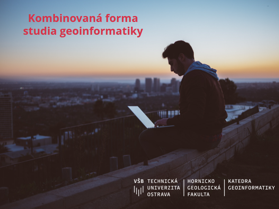
Katedra geoinformatiky na VŠB-TU Ostrava nabízí po delší odmlce pro následující akademický rok 2023/2024 studium oboru Geoinformatika taktéž v kombinované formě pro externisty – v bakalářském i navazujícím magisterském stupni (titul Ing.). Výuka probíhá blokově v pátky v Ostravě. Studium je zaměřeno na komplexní činnosti související s pořizováním, zpracováním, analýzou a vizualizováním prostorových dat, webovými mapovými […]
The post Kombinovaná forma studia geoinformatiky appeared first on GISportal.cz.
Kombinovaná forma studia geoinformatiky
14.2.2023 14:49 GISportal.czKatedra geoinformatiky na VŠB-TU Ostrava nabízí po delší odmlce pro následující akademický rok 2023/2024 studium oboru Geoinformatika taktéž v kombinované formě pro externisty – v bakalářském i navazujícím magisterském stupni (titul Ing.). Výuka probíhá blokově v pátky v Ostravě. Studium je zaměřeno na komplexní činnosti související s pořizováním, zpracováním, analýzou a vizualizováním prostorových dat, webovými mapovými […]
The post Kombinovaná forma studia geoinformatiky appeared first on GISportal.cz.
vrchní referent / rada v oddělení právních vztahů k nemovitostem Katastrálního pracoviště Chrudim
14.2.2023 14:08 ČÚZK - předpisy a opatření Katastrální úřad pro Pardubický kraj Katastrální pracoviště Chrudimvypisuje výběrové řízení na místo
vrchní referent / rada v oddělení právních vztahů k nemovitostem Katastrálního pracoviště Chrudim
vrchní referent / rada v oddělení právních vztahů k nemovitostem Katastrálního pracoviště Chrudim
14.2.2023 14:08 ČÚZK /Urady/Katastralni-urady/Katastralni-urady/Katastralni-urad-pro-Pardubicky-kraj/Uredni-deska/Oznameni-a-jina-uredni-sdeleni/Volna-mista/DMS/vrchni-referent-rada-v-oddeleni-pravnich-vztahu-k-vrchní referent / rada v oddělení právních vztahů k nemovitostem Katastrálního pracoviště Chrudim
14.2.2023 14:08 ČÚZK - volná místa Katastrální úřad pro Pardubický kraj Katastrální pracoviště Chrudim vypisuje výběrové řízení na místo vrchní referent / rada v oddělení právních vztahů k nemovitostem Katastrálního pracoviště Chrudim
Odstávka Portálu ESKN
14.2.2023 13:47
ÚGKK SR
Dňa 14.02.2023 (utorok) bude v čase od 20:00 hod. do 21:00 hod. odstávka elektronických služieb katastra nehnuteľností, nakoľko bude realizovaná aktualizácia vybraných modulov systému. #PortálESKN #od:14.02.2023@20:00 #do:14.12.2023@21:00
rada / odborný rada – metodik katastru nemovitostí v oddělení metodiky a kontroly v Kanceláři ředite
14.2.2023 12:52 ČÚZK - předpisy a opatření Katastrální úřad pro Liberecký kraj kancelář ředitelevypisuje výběrové řízení na místo
rada / odborný rada – metodik katastru nemovitostí v oddělení metodiky a kontroly v Kanceláři ředitele Katastrálního úřadu pro Liberecký kraj
rada / odborný rada – metodik katastru nemovitostí v oddělení metodiky a kontroly v Kanceláři ředite
14.2.2023 12:52 ČÚZK - volná místa Katastrální úřad pro Liberecký kraj - kancelář ředitele vypisuje výběrové řízení na místo rada / odborný rada – metodik katastru nemovitostí v oddělení metodiky a kontroly v Kanceláři řediterada / odborný rada – metodik katastru nemovitostí v oddělení metodiky a kontroly v Kanceláři ředite
14.2.2023 12:52 ČÚZK - předpisy a opatření Katastrální úřad pro Liberecký kraj - kancelář ředitelevypisuje výběrové řízení na místo
rada / odborný rada – metodik katastru nemovitostí v oddělení metodiky a kontroly v Kanceláři ředitele Katastrálního úřadu pro Liberecký kraj
rada / odborný rada – metodik katastru nemovitostí v oddělení metodiky a kontroly v Kanceláři ředite
14.2.2023 12:52 ČÚZK /Urady/Katastralni-urady/Katastralni-urady/Katastralni-urad-pro-Liberecky-kraj/Uredni-deska/Oznameni-a-jina-uredni-sdeleni/Volna-mista/DMS/rada-odborny-rada-–-metodik-katastru-nemovitos-(1)Oznámení o vyhlášení výběrového řízení na služební místo odborný/vrchní referent – návrh zápisu v ka
14.2.2023 11:36 ČÚZK - předpisy a opatření Katastrální úřad pro Plzeňský kraj Katastrální pracoviště Plzeň-městovypisuje výběrové řízení na místo
Oznámení o vyhlášení výběrového řízení na služební místo odborný/vrchní referent – návrh zápisu v katastru – NZK1004, KÚ pro Plzeňský kraj, Katastrální pracoviště Plzeň-město
Oznámení o vyhlášení výběrového řízení na služební místo odborný/vrchní referent – NZK10004
14.2.2023 11:09 ČÚZK - předpisy a opatření Český úřad zeměměřický a katastrální - Katastrální pracoviště Plzeň-město zveřejnil novou aktualitu: Ředitelka Katastrálního úřadu pro Plzeňský kraj jako služební orgán příslušný podle § 10 odst. 1 písm. f) zákona č. 234/2014 Sb., o státní službě, ve znění pozdějších předpisů (dále jen „zákon o státní službě“), vyhlašuje výběrové řízení na služební místo odborný/vrchní referent – návrh zápisu v katastru – NZK1004, na Katastrálním úřadu pro Plzeňský kraj, oddělení aktualizace KN, na Katastrálním pracovišti Plzeň - město, se služebním působištěm v Plzni.Oznámení o vyhlášení výběrového řízení na služební místo odborný/vrchní referent – NZK10004
14.2.2023 11:09 ČÚZK - předpisy a opatření Český úřad zeměměřický a katastrální - Katastrální pracoviště Plzeň-město zveřejnil novou aktualitu: Ředitelka Katastrálního úřadu pro Plzeňský kraj jako služební orgán příslušný podle § 10 odst. 1 písm. f) zákona č. 234/2014 Sb., o státní službě, ve znění pozdějších předpisů (dále jen „zákon o státní službě“), vyhlašuje výběrové řízení na služební místo odborný/vrchní referent – návrh zápisu v katastru – NZK1004, na Katastrálním úřadu pro Plzeňský kraj, oddělení aktualizace KN, na Katastrálním pracovišti Plzeň - město, se služebním působištěm v Plzni.Oznámení o vyhlášení výběrového řízení na služební místo odborný/vrchní referent – NZK10004
14.2.2023 11:09 ČÚZK - předpisy a opatření Český úřad zeměměřický a katastrální - Katastrální pracoviště Plzeň-město zveřejnil novou aktualitu: Ředitelka Katastrálního úřadu pro Plzeňský kraj jako služební orgán příslušný podle § 10 odst. 1 písm. f) zákona č. 234/2014 Sb., o státní službě, ve znění pozdějších předpisů (dále jen „zákon o státní službě“), vyhlašuje výběrové řízení na služební místo odborný/vrchní referent – návrh zápisu v katastru – NZK1004, na Katastrálním úřadu pro Plzeňský kraj, oddělení aktualizace KN, na Katastrálním pracovišti Plzeň - město, se služebním působištěm v Plzni.Oznámení o vyhlášení výběrového řízení na služební místo odborný/vrchní referent – NZK10004
14.2.2023 11:09 ČÚZK /Urady/Katastralni-urady/Katastralni-urady/Katastralni-urad-pro-Plzensky-kraj/O-uradu/Aktuality/Oznameni-o-vyhlaseni-vyberoveho-rizeni-na-sluzebniOznámení o vyhlášení výběrového řízení na služební místo odborný/vrchní referent – NZK10004
14.2.2023 11:09 ČÚZK - předpisy a opatření Katastrální úřad pro Plzeňský kraj - Katastrální pracoviště Plzeň-město zveřejnil novou aktualitu: Ředitelka Katastrálního úřadu pro Plzeňský kraj jako služební orgán příslušný podle § 10 odst. 1 písm. f) zákona č. 234/2014 Sb., o státní službě, ve znění pozdějších předpisů (dále jen „zákon o státní službě“), vyhlašuje výběrové řízení na služební místo odborný/vrchní referent – návrh zápisu v katastru – NZK1004, na Katastrálním úřadu pro Plzeňský kraj, oddělení aktualizace KN, na Katastrálním pracovišti Plzeň - město, se služebním působištěm v Plzni.Oznámení o vyhlášení výběrového řízení na služební místo odborný/vrchní referent – návrh zápisu v ka
14.2.2023 11:03 ČÚZK - předpisy a opatření Katastrální úřad pro Plzeňský kraj Katastrální pracoviště Plzeň-městovypisuje výběrové řízení na místo
Oznámení o vyhlášení výběrového řízení na služební místo odborný/vrchní referent – návrh zápisu v katastru – NZK1004, oddělení aktualizace KN, Katastrální úřad pro Plzeňský kraj, Katastrální pracovišt
Oznámení o vyhlášení výběrového řízení na služební místo odborný/vrchní referent – návrh zápisu v ka
14.2.2023 11:03 ČÚZK /Urady/Katastralni-urady/Katastralni-urady/Katastralni-urad-pro-Plzensky-kraj/Uredni-deska/Oznameni-a-jina-uredni-sdeleni/Volna-mista/DMS/Oznameni-o-vyhlaseni-vyberoveho-rizeni-na-sluzebniOznámení o vyhlášení výběrového řízení na služební místo odborný/vrchní referent – návrh zápisu v ka
14.2.2023 11:03 ČÚZK - volná místa Katastrální úřad pro Plzeňský kraj Katastrální pracoviště Plzeň-město vypisuje výběrové řízení na místo Oznámení o vyhlášení výběrového řízení na služební místo odborný/vrchní referent – návrh zápisu v kaVrchní referent/rada – obnova katastrálního operátu
14.2.2023 10:44 ČÚZK - předpisy a opatření Katastrální úřad pro Moravskoslezský kraj Katastrální pracoviště Frýdek-Místekvypisuje výběrové řízení na místo
Vrchní referent/rada – obnova katastrálního operátu
Vrchní referent/rada – obnova katastrálního operátu
14.2.2023 10:44 ČÚZK - volná místa Katastrální úřad pro Moravskoslezský kraj Katastrální pracoviště Frýdek-Místek vypisuje výběrové řízení na místo Vrchní referent/rada – obnova katastrálního operátuVrchní referent/rada – obnova katastrálního operátu
14.2.2023 10:44 ČÚZK /Urady/Katastralni-urady/Katastralni-urady/Katastralni-urad-pro-Moravskoslezsky-kraj/Uredni-deska/Oznameni-a-jina-uredni-sdeleni/Volna-mista/DMS/Vrchni-referent-rada-–-obnova-katastralniho-op-(5)Vrchní referent/rada – obnova katastrálního operátu
14.2.2023 10:41 ČÚZK - předpisy a opatření Katastrální úřad pro Moravskoslezský kraj Katastrální pracoviště Frýdek-Místekvypisuje výběrové řízení na místo
Vrchní referent/rada – obnova katastrálního operátu
Vrchní referent/rada – obnova katastrálního operátu
14.2.2023 10:41 ČÚZK /Urady/Katastralni-urady/Katastralni-urady/Katastralni-urad-pro-Moravskoslezsky-kraj/Uredni-deska/Oznameni-a-jina-uredni-sdeleni/Volna-mista/DMS/Vrchni-referent-rada-–-obnova-katastralniho-op-(4)Vrchní referent/rada – obnova katastrálního operátu
14.2.2023 10:41 ČÚZK - volná místa Katastrální úřad pro Moravskoslezský kraj Katastrální pracoviště Frýdek-Místek vypisuje výběrové řízení na místo Vrchní referent/rada – obnova katastrálního operátuVrchní referent/rada – obnova katastrálního operátu
14.2.2023 10:35 ČÚZK /Urady/Katastralni-urady/Katastralni-urady/Katastralni-urad-pro-Moravskoslezsky-kraj/Uredni-deska/Oznameni-a-jina-uredni-sdeleni/Volna-mista/DMS/Vrchni-referent-rada-–-obnova-katastralniho-op-(3)Vrchní referent/rada – obnova katastrálního operátu
14.2.2023 10:35 ČÚZK - volná místa Katastrální úřad pro Moravskoslezský kraj Katastrální pracoviště Ostrava vypisuje výběrové řízení na místo Vrchní referent/rada – obnova katastrálního operátuVrchní referent/rada – obnova katastrálního operátu
14.2.2023 10:35 ČÚZK - předpisy a opatření Katastrální úřad pro Moravskoslezský kraj Katastrální pracoviště Ostravavypisuje výběrové řízení na místo
Vrchní referent/rada – obnova katastrálního operátu
vrchní referent/rada – obnova katastrálního operátu
14.2.2023 10:21 ČÚZK - volná místa Katastrální úřad pro Moravskoslezský kraj Katastrální pracoviště Bruntál vypisuje výběrové řízení na místo vrchní referent/rada – obnova katastrálního operátuvrchní referent/rada – obnova katastrálního operátu
14.2.2023 10:21 ČÚZK /Urady/Katastralni-urady/Katastralni-urady/Katastralni-urad-pro-Moravskoslezsky-kraj/Uredni-deska/Oznameni-a-jina-uredni-sdeleni/Volna-mista/DMS/vrchni-referent-rada-–-obnova-katastralniho-op-(2)vrchní referent/rada – obnova katastrálního operátu
14.2.2023 10:21 ČÚZK - předpisy a opatření Katastrální úřad pro Moravskoslezský kraj Katastrální pracoviště Bruntálvypisuje výběrové řízení na místo
vrchní referent/rada – obnova katastrálního operátu
Vrchní referent/rada – obnova katastrálního operátu
14.2.2023 10:18 ČÚZK - volná místa Katastrální úřad pro Moravskoslezský kraj Katastrální pracoviště Karviná vypisuje výběrové řízení na místo Vrchní referent/rada – obnova katastrálního operátuVrchní referent/rada – obnova katastrálního operátu
14.2.2023 10:18 ČÚZK - předpisy a opatření Katastrální úřad pro Moravskoslezský kraj Katastrální pracoviště Karvinávypisuje výběrové řízení na místo
Vrchní referent/rada – obnova katastrálního operátu
Vrchní referent/rada – obnova katastrálního operátu
14.2.2023 9:23 ČÚZK - volná místa Katastrální úřad pro Moravskoslezský kraj technický odbor vypisuje výběrové řízení na místo Vrchní referent/rada – obnova katastrálního operátuVrchní referent/rada – obnova katastrálního operátu
14.2.2023 9:23 ČÚZK /Urady/Katastralni-urady/Katastralni-urady/Katastralni-urad-pro-Moravskoslezsky-kraj/Uredni-deska/Oznameni-a-jina-uredni-sdeleni/Volna-mista/DMS/Vrchni-referent-rada-–-obnova-katastralniho-operatVrchní referent/rada – obnova katastrálního operátu
14.2.2023 9:23 ČÚZK - předpisy a opatření Katastrální úřad pro Moravskoslezský kraj technický odborvypisuje výběrové řízení na místo
Vrchní referent/rada – obnova katastrálního operátu
ETIM 9.0 is now published in the bSDD
13.2.2023 18:09 buildingSMART.orgFollowing its release in December 2022, ETIM International is pleased to announce the publication of ETIM 9.0 in the buildingSMART Data Dictionary (bSDD). Indeed, a milestone for both the ETIM…
The post ETIM 9.0 is now published in the bSDD appeared first on buildingSMART International.
Galileo: putting the smart into smartphones
13.2.2023 17:16 European GNSS Agency
Accurate positioning is what puts the smart into smartphones. Without it, your rideshare drives right past you, your food delivery ends up next door and your date is left thinking they’ve been stood up.
In other words, without accurate positioning, your smartphone can leave you looking rather dumb.
The good news is that pretty much all smartphones come equipped with a satellite navigation chip, which automatically calculates where your phone is and provides this information to your location-based apps. The bad news is that not all chips are created equal.
“Your phone determines its position by accessing the GNSS signals that come from satellites,” explains EUSPA Chief Operating Officer, Pascal Claudel. “The more signals it can access, the more accurate the positioning.”
Gaining access
So, how can your phone access more signals?
According to Claudel, the key is to have what is called a multi-constellation chip. “Multi-constellation chips collect data coming from more than one GNSS constellation, such as Galileo and GPS,” he explains.
The advantage of having a phone equipped with a multi-constellation chip is that location can be calculated using all the available satellites from both the Galileo and GPS constellations, amongst others. This is particularly helpful in urban environments where narrow streets and tall buildings can block satellite signals, rendering many mobile services useless.
“By accessing more satellites, Galileo-enabled devices definitely have an advantage – an advantage that translates into more accurate and reliable positioning for users,” adds Claudel.
Thanks to HAS and OSNMA, Galileo potential is unique
Looking forward, however, the contribution of Galileo is expected to go way beyond. Being the newest GNSS in the arena, Galileo signal’s features bring many unmatched innovations to its users. Among these, the provision of Galileo HAS (High Accuracy Service) and OSNMA (Open Service – Navigation Message Authentication) is set to be of the highest interest to smartphone users. The recently declared operational Galileo HAS, for example, will provide for accuracy below a few decimetres (<25cm horizontal in nominal conditions of use). Galileo OSNMA, a data authentication function that will be soon freely accessible worldwide, will pave the way towards robust Position, Velocity and Time information (PVT) for the Galileo Open Service users.
In the upcoming years, once chipset receivers able to make use of those innovations will be integrated into smartphones, users will benefit from both those Galileo services for free. This is expected to fuel a massive development of innovative applications. Within consumer apps, indeed, those new Galileo services will enable innovative solutions and/ or functions. The HAS increased accuracy will have a direct impact on the performance of a wide range of consumer application categories such as Gaming, Healthcare, Robotics, AR and Geo-marketing. Mobile payments and enterprise workforce management and tracking solutions are some of the areas that will benefit from OSNMA.
Overall, the provision of Galileo HAS and OSNMA is expected to further narrow the distance between consumer and enterprise apps, with professional users across several verticals being able to perform directly in their smartphones activities and tasks once possible only with dedicated devices. The enhanced positioning capabilities provided by Galileo will also further consolidate the role of the smartphone as one of the key devices able to establish a bridge between the digital and the physical worlds in the metaverse and digital twin technologies.
Find out if your smartphone is Galileo enabled
EUSPA wants everyone to benefit from the enhanced positioning accuracy and reliability that Galileo provides. That’s why we’ve been working tirelessly to ensure that the world’s leading chip manufacturers include Galileo in their products. We’re also supporting the industry’s development of such chips through our Fundamental Elements funding mechanism.
As a result of this work, over 3.9 billion Galileo-enabled smartphones have been sold worldwide. You can see if yours is one of them by visiting www.useGalileo.eu.
There are also a number of apps you can use to check where your positioning data is coming from. For example, the GPSTest application, which can be downloaded for free from Google Play, provides users with real-time information about which satellites are providing positioning data to your phone. If the Galileo satellite on the user screen (indicated by the EU flag) has a ‘U’ next to it, then you know your phone is using Galileo to calculate its position at that very moment.
Similar applications are available for iOS users such as here.
Accuracy matters more than ever
Considering the plethora of location-based services out there, many of which we use on a daily basis, accuracy matters more than ever.
“Thanks to the added accuracy that Galileo brings to smartphones everywhere, you can rest assured that your food will come before it goes cold, that your rideshare will actually arrive when and where it’s supposed to, and that you won’t miss a potential match the next time you swipe right,” concludes Claudel.
Media note: This feature can be republished without charge provided the European Union Agency for the Space Programme (EUSPA) is acknowledged as the source at the top or the bottom of the story. You must request permission before you use any of the photographs on the site. If you republish, we would be grateful if you could link back to the EUSPA website (http://www.euspa.europa.eu).
20230213_Odborný / vrchní referent oddělení aktualizace KN
13.2.2023 15:47 ČÚZK - předpisy a opatření Katastrální úřad pro Středočeský kraj - Katastrální pracoviště Benešov Vyhlášení výběrového řízení: Odborný / vrchní referent oddělení aktualizace KN V části "Úřední deska", v sekci "Oznámení a jiná úřední sdělení" bylo vystaveno "Oznámení o vyhlášení výběrového řízení na obsazení služebního místa Odborný / vrchní referent oddělení aktualizace KN"20230213_Odborný / vrchní referent oddělení aktualizace KN
13.2.2023 15:47 ČÚZK /Urady/Katastralni-urady/Katastralni-urady/Katastralni-urad-pro-Stredocesky-kraj/Katastralni-pracoviste/KP-Benesov/O-uradu/Aktuality/20210922_Odborny-referent-oddeleni-aktualizace-(2)Odborný / vrchní referent oddělení aktualizace KN
13.2.2023 15:46 ČÚZK - volná místa Katastrální úřad pro Středočeský kraj Katastrální pracoviště Benešov vypisuje výběrové řízení na místo Odborný / vrchní referent oddělení aktualizace KNOdborný / vrchní referent oddělení aktualizace KN
13.2.2023 15:46 ČÚZK - předpisy a opatření Katastrální úřad pro Středočeský kraj Katastrální pracoviště Benešovvypisuje výběrové řízení na místo
Odborný / vrchní referent oddělení aktualizace KN
Krátka správa č. 6/2023
13.2.2023 14:27 Komora geodetů a kartografů SRThe post Krátka správa č. 6/2023 appeared first on Komora geodetov a kartografov.
Krátka správa č. 7/2023
13.2.2023 14:27 Komora geodetů a kartografů SRThe post Krátka správa č. 7/2023 appeared first on Komora geodetov a kartografov.
Krátka správa č. 5/2023
13.2.2023 14:23 Komora geodetů a kartografů SRThe post Krátka správa č. 5/2023 appeared first on Komora geodetov a kartografov.
Šablona pro psaní BD a DP prací – verze 2023
13.2.2023 13:17 Katedra geoinformatiky UP OlomoucV sekci Dokumenty je ke stažení aktuální platná šablona pro psaní bakalářských a magisterských prací studijních programů Geoinformatika a kartografie. Šablona upřesňuje některé pokyny a zejména reflektuje změnu, kdy jsou BP a DP od ak. roku 2022/23 odevzdávány pouze elektornicky do studijní evidence STAG.
The post Šablona pro psaní BD a DP prací – verze 2023 appeared first on Katedra geoinformatiky.
Státnicové okruhy pro bakalářské studium platné pro ak. rok 2022/2023
13.2.2023 13:11 Katedra geoinformatiky UP OlomoucStátnicové okruhy pro novou akreditaci studijního programu Geoinformatika a kartografie jsou dostupné v sekci Dokumenty. Okruhy jsou platné od termínu státnic v červnu a srpnu/září 2023.
The post Státnicové okruhy pro bakalářské studium platné pro ak. rok 2022/2023 appeared first on Katedra geoinformatiky.
Satellites support impact assessment after Türkiye–Syria earthquakes
13.2.2023 12:45 ESA Observing the Earth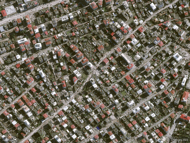
Türkiye and Syria are reeling from one of the worst earthquakes to strike the region in almost a century. Tens of thousands of people have been killed with many more injured in this tragedy.
Satellite data are being used to help emergency aid organisations, while scientists have begun to analyse ground movement – aiding risk assessments that authorities will use as they plan recovery and reconstruction, as well as long-term research to better model such events.
What is Information Delivery Specification (IDS)
13.2.2023 12:40 buildingSMART.orgThe Information Delivery Specification (IDS) is a standard in development from buildingSMART for defining information requirements in a way that is easily read by humans and interpreted by computers. This…
The post What is Information Delivery Specification (IDS) appeared first on buildingSMART International.
What is Information Delivery Specification (IDS)
13.2.2023 12:40 buildingSMART.orgThe Information Delivery Specification (IDS) is a standard from buildingSMART for defining information requirements in a way that is easily read by humans and interpreted by computers. This standard helps…
The post What is Information Delivery Specification (IDS) appeared first on buildingSMART International.
HLEDÁME: Stereo operátor/operátorka pro oddělení digitální fotogrametrie (HPP)
13.2.2023 9:45 TopGis Hledáme novou posilu do našeho týmu. Jsme společnost s dlouholetou praxí v oboru geoinformačních technologií. Provozujeme vlastní datové centrum s jedinečnými mapovými podklady ČR a mapovou aplikaci GisOnline.cz. Co musíte umět: Co Vám nabízíme: Zaujala Vás naše nabídka? Pokud Vás tato pozice zaujala, zašlete nám Váš CV na e-mail: kariera@topgis.cz V případě, že Váš životopis budeVýroční zpráva dle zákona č. 106/1999 Sb. za rok 2022
13.2.2023 9:08 ČÚZK - předpisy a opatření Český úřad zeměměřický a katastrálnívydává výroční zprávu úřadu za rok 2022
2022
rada-odborný rada - právní vztahy k nemovitostem KP Jihlava
13.2.2023 9:04 ČÚZK /Urady/Katastralni-urady/Katastralni-urady/Katastralni-urad-pro-Vysocinu/O-uradu/Aktuality/rada-odborny-rada-pravni-vztahy-k-nemovitostem-KP-rada-odborný rada - právní vztahy k nemovitostem KP Jihlava
13.2.2023 9:04 ČÚZK - předpisy a opatření Katastrální úřad pro Vysočinu - Katastrální pracoviště Jihlava zveřejnil novou aktualitu: Oznámení o vyhlášení výběrového řízení na služební místorada/odborný rada - oddělení právní vztahy k nemovitostem
Katastrálního pracoviště Jihlava na Katastrálním úřadu pro Vysočinu,
místo výkonu služby Jihlava
HLEDÁME: Stereo operátor/operátorka pro oddělení digitální fotogrametrie
13.2.2023 8:45 TopGisHledáme novou posilu do našeho týmu. Jsme společnost s dlouholetou praxí v oboru geoinformačních technologií. Provozujeme vlastní datové centrum s jedinečnými mapovými podklady ČR a mapovou aplikaci GisOnline.cz. Co musíte umět: SŠ vzdělání znalost práce na PC pečlivost a schopnost samostatné práce základní znalost práce s daty bez zrakového postižení Co Vám nabízíme: práce ...
Článek HLEDÁME: Stereo operátor/operátorka pro oddělení digitální fotogrametrie se nejdříve objevil na TopGis, s.r.o..
rada-odborný rada - právní vztahy k nemovitostem KP Jihlava
13.2.2023 8:34 ČÚZK - předpisy a opatření Katastrální úřad pro Vysočinu Katastrální pracoviště Jihlavavypisuje výběrové řízení na místo
rada-odborný rada - právní vztahy k nemovitostem KP Jihlava
rada-odborný rada - právní vztahy k nemovitostem KP Jihlava
13.2.2023 8:34 ČÚZK - volná místa Katastrální úřad pro Vysočinu Katastrální pracoviště Jihlava vypisuje výběrové řízení na místo rada-odborný rada - právní vztahy k nemovitostem KP Jihlavarada-odborný rada - právní vztahy k nemovitostem KP Jihlava
13.2.2023 8:34 ČÚZK /Urady/Katastralni-urady/Katastralni-urady/Katastralni-urad-pro-Vysocinu/Uredni-deska/Oznameni-a-jina-uredni-sdeleni/Volna-mista/DMS/rada-odborny-rada-pravni-vztahy-k-nemovitostem-KP-Výběrové řízení pro studijní pobyty Erasmus+ [Katedra aplikované geoinformatiky a kartografie, byTopic]
12.2.2023 11:15 Katedra aplikované geoinformatiky a kartografie Přf UK Výběrové řízení pro studijní pobyty Erasmus+ v akademickém roce 2023/24 proběhne na katedře aplikované geoinformatiky a kartografie 9.3.2023. Termín pro odevzdání podkladů je 7.3.2023.EUSPA is looking for Guarding Services for the Galileo Security Monitoring Center in France
10.2.2023 16:24 European GNSS Agency
The European Union Agency for the Space Programme (EUSPA) has a key role in the Galileo Programme, the EU Global Navigation Satellite System, ensuring the service provision, implementing, supporting the security of the EU Space Programme, and promoting and developing the markets for EU companies. The GSMC, Galileo Security Monitoring Centre, as part of EUSPA, is being responsible for several major tasks including overall management of the system’s security, management of Galileo Public Regulated Service (PRS) access, command and control of European GNSS, and provision of PRS and GNSS security expertise and analysis. The GSMC ensures the reliability of the Galileo system, which is crucial for its success. The GSMC has its main location in France, with a backup site located in Spain. This site is essential to provide redundancy for the security of Galileo. The Galileo Security Monitoring Centre (GSMC) delivers services 24/7.
The procurement concerns the provision of guarding services for the Galileo Security Monitoring Center located in Saint-Germain-en-Laye (France), a critical infrastructure requiring 24/7 guarding services. EUSPA is committed to promoting the widest participation possible by economic operators, in particular start-ups, new entrants, and SMEs.
The Agency is thus organizing an industry day on 20 February 2023 at 14.30 to present the details of the procurement for “Provision of Guarding Services for the GSMC”.
Potential participants will have the opportunity to learn more about the mission of the European Union Agency for the Space Programme and the procurement documentation and submission process.
To attend this industry day, please register here.
Media note: This feature can be republished without charge provided the European Union Agency for the Space Programme (EUSPA) is acknowledged as the source at the top or the bottom of the story. You must request permission before you use any of the photographs on the site. If you republish, we would be grateful if you could link back to the EUSPA website (http://www.euspa.europa.eu).
Inzerát: Vrchní ministerský rada v oddělení pořizování a územně správním, v odboru územního plánování
10.2.2023 15:03 Blogující geomatici - FAV ZČUHlavní náplní práce bude řešení problematiky digitalizace územního plánování, zejména další rozvoj standardizace územně plánovacích dokumentací a databáze územně analytických podkladů.
Více informací o inzerátu zde: https://www.mmr.cz/cs/kariera/pracovni-prilezitosti/vrchni-ministersky-rada-v-oddeleni-porizovani-(7)
Posuzovány budou žádosti o přijetí do služebního poměru a zařazení na služební místo doručené MMR ve lhůtě do 2. března 2023.
V případě potřeby podrobnějších informací je možné obrátit se na Ing. Vladimíra Voldřicha (vladimir.voldrich@mmr.cz ).
Přerušení provozu DP a WSDP ve čtvrtek 16.2.2023 od 18:00 do cca 20:00.
10.2.2023 14:31 ČÚZK - předpisy a opatření Vážení uživatelé,oznamujeme, že ve čtvrtek 16.2.2023 od 18:00 bude z provozních důvodů zcela přerušen provoz Dálkového přístupu i Webových služeb dálkového přístupu. Obnovení provozu předpokládáme v cca 20 hodin. U této verze nedochází ke změnám webových služeb.
Za komplikace tímto způsobené se omlouváme a děkujeme za pochopení.
Přerušení provozu DP a WSDP ve čtvrtek 16.2.2023 od 18:00 do cca 20:00.
10.2.2023 14:31 Dálkový přístup k údajům KN ČR Vážení uživatelé,oznamujeme, že ve čtvrtek 16.2.2023 od 18:00 bude z provozních důvodů zcela přerušen provoz Dálkového přístupu i Webových služeb dálkového přístupu. Obnovení provozu předpokládáme v cca 20 hodin. U této verze nedochází ke změnám webových služeb.
Za komplikace tímto způsobené se omlouváme a děkujeme za pochopení.
Přerušení provozu DP a WSDP ve čtvrtek 16.2.2023 od 18:00 do cca 20:00.
10.2.2023 14:31 ČÚZK /Aplikace-DP-do-KN/Aplikace-DP-do-KN/Archiv-DP/378535Smernice
10.2.2023 10:21 Komora geodetů a kartografů SRThe post Smernice appeared first on Komora geodetov a kartografov.
Virtuálna knižnica
10.2.2023 10:21 Komora geodetů a kartografů SRThe post Virtuálna knižnica appeared first on Komora geodetov a kartografov.
Záplata pro KOKEŠ a PROLAND verze 16.12
10.2.2023 10:00 GEPROPřipravili jsme záplaty produktů KOKEŠ a PROLAND verze 16.12, které opravují chyby v kódování při předávání dat na katastrální úřad. Záplaty lze stáhnout z obvyklého umístění na našem download serveru.
Článek Záplata pro KOKEŠ a PROLAND verze 16.12 se nejdříve objevil na GEPRO.
Earth from Space: Swedish landscape
10.2.2023 10:00 ESA Observing the Earth Image:
Agricultural fields that surround the cities of Lund and Malmö in Sweden are pictured in this image, captured by the Copernicus Sentinel-2 mission.
Image:
Agricultural fields that surround the cities of Lund and Malmö in Sweden are pictured in this image, captured by the Copernicus Sentinel-2 mission.
EASA pořádala workshop k nové verzi SORA 2.5
10.2.2023 8:54 UAVAVčera a dnes se konal workshop EASA k publikované nové verzi SORA 2.5 (Specific Operations Risk Assessment), která je k veřejným konzultacím do 6. března na webových stránkách JARUS. Tato verze přináší zjednodušení provozovatelům dronů a obsahuje kvantitativní posouzení pozemního rizika. Konečná verze vypořádaná s připomínkami by měla být publikována v létě 2023 a posléze […]
The post EASA pořádala workshop k nové verzi SORA 2.5 appeared first on UAV Aliance pro bezpilotní letecký průmysl.
rada/odborný rada - vedoucí oddělení podpory ICT na Katastrálním úřadu pro Jihočeský kraj (ID SM 300
10.2.2023 8:32 ČÚZK - volná místa Katastrální úřad pro Jihočeský kraj vypisuje výběrové řízení na místo rada/odborný rada - vedoucí oddělení podpory ICT na Katastrálním úřadu pro Jihočeský kraj (ID SM 300rada/odborný rada - vedoucí oddělení podpory ICT na Katastrálním úřadu pro Jihočeský kraj (ID SM 300
10.2.2023 8:32 ČÚZK /Urady/Katastralni-urady/Katastralni-urady/Katastralni-urad-pro-Jihocesky-kraj/Uredni-deska/Oznameni-a-jina-uredni-sdeleni/Volna-mista/DMS/rada-odborny-rada-vedouci-oddeleni-podpory-ICT-na-rada/odborný rada - vedoucí oddělení podpory ICT na Katastrálním úřadu pro Jihočeský kraj (ID SM 300
10.2.2023 8:32 ČÚZK - předpisy a opatření Katastrální úřad pro Jihočeský krajvypisuje výběrové řízení na místo
rada/odborný rada - vedoucí oddělení podpory ICT na Katastrálním úřadu pro Jihočeský kraj (ID SM 30000011/30003635)
Moravskehospodarstvi.cz: Digitální technické mapy. Co přinesou městům a obcím?
9.2.2023 16:20 TopGis Výrazné zrychlení přípravy nejrůznějších staveb v regionu i samotného stavebního řízení, přesnější údaje pro územní plánování či efektivní správa veřejné infrastruktury. To jsou některé z přínosů digitálních technických map, jejichž 1. kolo v roce 2022–2023 v České republice jednotlivé kraje realizují. Technické mapy jsou důležitým datovým podkladem pro celou řadu odborných činností ve veřejné správěDigitální technické mapy. Co přinesou městům a obcím?
9.2.2023 16:20 TopGis Výrazné zrychlení přípravy nejrůznějších staveb v regionu i samotného stavebního řízení. Přesnější údaje pro územní plánování či efektivní správa veřejné infrastruktury. To jsou některé z přínosů digitálních technických map, jejichž 1. kolo v roce 2022–2023 v České republice jednotlivé kraje realizují. Technické mapy jsou důležitým datovým podkladem pro celou řadu odborných činností ve veřejné správěDomácí návrhář domu, bytu a zahrady & TurboFLOORPLAN v akční ceně
9.2.2023 16:09 ŠPINAR - softwareVážení zákazníci,
máme pro Vás připravené programy TurboCAD Platinum 28 CZ + TurboPDF CZ, které spojují CAD nástroje pro kreslení ve 2D / 3D prostoru včetně fotorealistických výstupů s editorem a převodníkem PDF dokumentů v akční ceně do 10. 02. 2023.
The post Domácí návrhář domu, bytu a zahrady & TurboFLOORPLAN v akční ceně appeared first on ŠPINAR – software.
Domácí návrhář domu, bytu a zahrady – TurboFLOORPLAN v akční ceně
9.2.2023 16:09 ŠPINAR - softwareVážení zákazníci,
máme pro Vás připravený domácí návrhář pro Váš dům, byt nebo zahradu snů - v akční ceně.
The post Domácí návrhář domu, bytu a zahrady – TurboFLOORPLAN v akční ceně appeared first on ŠPINAR – software.
Domácí návrhář domu, bytu a zahrady – TurboFLOORPLAN v akční ceně
9.2.2023 16:09 ŠPINAR - softwareVážení zákazníci,
máme pro Vás připravený domácí návrhář pro Váš dům, byt nebo zahradu snů - v akční ceně.
Domácí návrhář domu, bytu a zahrady – TurboFLOORPLAN v akční ceně
9.2.2023 16:09 ŠPINAR - softwareVážení zákazníci,
máme pro Vás připravený domácí návrhář pro Váš dům, byt nebo zahradu snů - v akční ceně.
The post Domácí návrhář domu, bytu a zahrady – TurboFLOORPLAN v akční ceně appeared first on ŠPINAR – software.
Moravskehospodarstvi.cz: Ekologie a její budoucnost. Odpady – legislativa, dotace a unikátní projekty
9.2.2023 14:17 TopGis Odpadové hospodářství a hlavně předcházení vzniku odpadu, a také nová legislativa a její dopady v praxi. To byla některá z hlavních témat setkání Ekologie a její budoucnost, na kterém diskutovali zástupci měst a obcí s představiteli Ministerstva životního prostředí ČR, Státního fondu životního prostředí ČR a dalšími odborníky. Akci v brněnském hotelu Avanti pořádala společnostrada/odborný rada - vedoucí právního oddělení Katastrálního pracoviště České Budějovice (ID SM 30000
9.2.2023 13:31 ČÚZK /Urady/Katastralni-urady/Katastralni-urady/Katastralni-urad-pro-Jihocesky-kraj/Uredni-deska/Oznameni-a-jina-uredni-sdeleni/Volna-mista/DMS/rada-odborny-rada-vedouci-pravniho-oddeleni-Katastrada/odborný rada - vedoucí právního oddělení Katastrálního pracoviště České Budějovice (ID SM 30000
9.2.2023 13:31 ČÚZK - předpisy a opatření Katastrální úřad pro Jihočeský kraj Katastrální pracoviště České Budějovicevypisuje výběrové řízení na místo
rada/odborný rada - vedoucí právního oddělení Katastrálního pracoviště České Budějovice (ID SM 30000092/30003716)
rada/odborný rada - vedoucí právního oddělení Katastrálního pracoviště České Budějovice (ID SM 30000
9.2.2023 13:31 ČÚZK - volná místa Katastrální úřad pro Jihočeský kraj Katastrální pracoviště České Budějovice vypisuje výběrové řízení na místo rada/odborný rada - vedoucí právního oddělení Katastrálního pracoviště České Budějovice (ID SM 30000Galileo signal component tested for Internet of Things use
9.2.2023 12:45 ESA Navigation
One of Europe's Galileo satellites has been reconfigured to emit a new signal component optimised to serve low-end receiver devices and Internet of Things applications.
Odstávka Portálu ESKN
9.2.2023 10:50
ÚGKK SR
Dňa 09.02.2023 /štvrtok/ bude v čase od 18:00 hod. do 22:00 hod. plánovaná technická odstávka Portálu ESKN /údržba systému/. Z uvedeného dôvodu nebudú v uvedenom čase dostupné elektronické služby katastra nehnuteľností pre verejnosť. Za vzniknuté problémy sa ospravedlňujeme. #PortálESKN #od:09.02.2023@18:00 #do: 09.02.2023@22:00
Sentinel-4 set to join next weather satellite
9.2.2023 9:53 ESA Observing the Earth
Copernicus Sentinel-4, which is set to play a key role in monitoring air quality over Europe, is ready to be fitted to its host, the first Meteosat Third Generation Sounder weather satellite.
Copernicus Sentinel-4 is a state-of-the-art ultraviolet, visible, near-infrared spectrometer instrument that has been developed to deliver hourly high-resolution measurements of trace gases such as nitrogen dioxide, ozone, sulphur dioxide and formaldehyde, as well as aerosols.
Rozpočet úřadu za rok 2023
9.2.2023 8:55 Zeměměřický úřad Zeměměřický úřadvystavuje rozpočet úřadu za rok
2023
Rozpočet úřadu za rok 2023
9.2.2023 8:55 ČÚZK - předpisy a opatření Zeměměřický úřadvystavuje rozpočet úřadu za rok
2023
Rozpočet úřadu za rok 2023
9.2.2023 8:55 Zeměměřický úřad Zeměměřický úřadvystavuje rozpočet úřadu za rok
2023
Rozpočet úřadu za rok 2023
9.2.2023 8:55 ČÚZK /Urady/Zememericky-urad/Rozpocty/Rozpocet-uradu-za-rok-2023Dočasná nefunkčnost některých částí Geoportálu
9.2.2023 8:30 Ústecký kraj Z důvodu probíhajícího technologického upgradu Geoportálu mohou být některé funkcionality dočasně nedostupné.From Good To Better: Hands-on Training on Modern Surveying Instruments in India
9.2.2023 4:53 Satlab Geosolutions On 5th January 2023, SatLab Indian Team, together with partner APS technologies, was honored to […]Zamilujte si naše BIM aplikace – valentýnská sleva 33 %
9.2.2023 0:00 Arkance SystemsValentýnská promo akce - pořiďte si BIM software od Autodesku nebo z vlastní dílny Arkance Systems výhodně!
Zpráva Zamilujte si naše BIM aplikace – valentýnská sleva 33 % pochází z arkance-systems.cz.
VR do 12.5
8.2.2023 15:00 ČÚZK - předpisy a opatření Katastrální úřad pro hlavní město Prahu zveřejnil novou aktualitu: Ředitelka úřadu vyhlašuje výběrové řízení na služební místo:referent/vrchní referent – vedení katastrální mapy
VR do 03.03.2023
8.2.2023 15:00 ČÚZK - předpisy a opatření Katastrální úřad pro hlavní město Prahu zveřejnil novou aktualitu: Ředitelka úřadu vyhlašuje výběrové řízení na služební místo:referent KN – zápis do protokolu řízení V a Z
VR do 21.4
8.2.2023 15:00 ČÚZK - předpisy a opatření Katastrální úřad pro hlavní město Prahu - Katastrální pracoviště Praha zveřejnil novou aktualitu: Ředitelka úřadu vyhlašuje výběrové řízení na služební místo:rada/odborný rada – revize katastrálního operátu
VR do 21.4
8.2.2023 15:00 ČÚZK /Urady/Katastralni-urady/Katastralni-urady/Katastralni-urad-pro-hlavni-mesto-Prahu/O-uradu/Aktuality/VR-do-03-03-2023VR do 03.03.2023
8.2.2023 15:00 ČÚZK /Urady/Katastralni-urady/Katastralni-urady/Katastralni-urad-pro-hlavni-mesto-Prahu/O-uradu/Aktuality/VR-do-03-03-2023VR do 05.6
8.2.2023 15:00 ČÚZK - předpisy a opatření Katastrální úřad pro hlavní město Prahu - Katastrální pracoviště Praha zveřejnil novou aktualitu: Ředitelka úřadu vyhlašuje výběrové řízení na služební místo:odborný referent/vrchní referent – poskytování informací a nahlížení do KN
VR do 31.03.2023
8.2.2023 15:00 ČÚZK /Urady/Katastralni-urady/Katastralni-urady/Katastralni-urad-pro-hlavni-mesto-Prahu/O-uradu/Aktuality/VR-do-03-03-2023VR do 31.03.2023
8.2.2023 15:00 ČÚZK - předpisy a opatření Katastrální úřad pro hlavní město Prahu - Katastrální pracoviště Praha zveřejnil novou aktualitu: Ředitelka úřadu vyhlašuje výběrové řízení na služební místo:rada/odborný rada – revize katastrálního operátu
VR do 05.6
8.2.2023 15:00 ČÚZK /Urady/Katastralni-urady/Katastralni-urady/Katastralni-urad-pro-hlavni-mesto-Prahu/O-uradu/Aktuality/VR-do-03-03-2023VR do 12.5
8.2.2023 15:00 ČÚZK /Urady/Katastralni-urady/Katastralni-urady/Katastralni-urad-pro-hlavni-mesto-Prahu/O-uradu/Aktuality/VR-do-03-03-2023VR do 05.6
8.2.2023 15:00 ČÚZK - předpisy a opatření Katastrální úřad pro hlavní město Prahu zveřejnil novou aktualitu: Ředitelka úřadu vyhlašuje výběrové řízení na služební místo:referent KN – návrh zápisu, kontrola a zplatnění v PO X
referent KN – zápis do protokolu řízení V a Z
8.2.2023 14:58 ČÚZK /Urady/Katastralni-urady/Katastralni-urady/Katastralni-urad-pro-hlavni-mesto-Prahu/Uredni-deska/Oznameni-a-jina-uredni-sdeleni/Volna-mista/DMS/referent-KN-–-zapis-do-protokolu-rizeni-V-a-Zreferent KN – zápis do protokolu řízení V a Z
8.2.2023 14:58 ČÚZK - předpisy a opatření Katastrální úřad pro hlavní město Prahu Katastrální pracoviště Prahavypisuje výběrové řízení na místo
referent KN – zápis do protokolu řízení V a Z