


![]()

zprávy
zdroje zpráv:DAEX DESIGN Professional 22 v akční nabídce
8.10.2021 15:33 ŠPINAR - software Vážení zákazníci,v akční nabídce nyní můžete získat náš nejsilnější program pro navrhování nábytku a interiérů DAEX Professional.
DAEX DESIGN Professional 22 v akční nabídce
8.10.2021 15:33 ŠPINAR - softwareVážení zákazníci,
v akční nabídce nyní můžete získat náš nejsilnější program pro navrhování nábytku a interiérů DAEX Professional.
The post DAEX DESIGN Professional 22 v akční nabídce appeared first on ŠPINAR – software.
odborný referent/vrchní referent – zápis do protokolu řízení V a Z
8.10.2021 12:44 ČÚZK /Urady/Katastralni-urady/Katastralni-urady/Katastralni-urad-pro-hlavni-mesto-Prahu/Uredni-deska/Oznameni-a-jina-uredni-sdeleni/Volna-mista/DMS/odborny-referent-vrchni-referent-–-zapis-do-protokodborný referent/vrchní referent – zápis do protokolu řízení V a Z
8.10.2021 12:44 ČÚZK - volná místa Katastrální úřad pro hlavní město Prahu - Katastrální pracoviště Praha vypisuje výběrové řízení na místo odborný referent/vrchní referent – zápis do protokolu řízení V a Zodborný referent/vrchní referent – zápis do protokolu řízení V a Z
8.10.2021 12:44 ČÚZK - předpisy a opatření Katastrální úřad pro hlavní město Prahu - Katastrální pracoviště Prahavypisuje výběrové řízení na místo
odborný referent/vrchní referent – zápis do protokolu řízení V a Z
GEORISKS – Přeshraniční expertní systém a systém včasného varování před geologickými riziky v Labském pískovcovém pohoří [Katedra aplikované geoinformatiky a kartografie, byTopic]
8.10.2021 12:00 Katedra aplikované geoinformatiky a kartografie Přf UK V rámci programu spolupráce Česká republika – Svobodný stát Sasko 2014 – 2020 se naše pracoviště podílelo na řešení projektu, který se zabýval vytvořením expertního systému v oblasti Labských pískovců v souvislosti s geologickými riziky a ohrožením veřejnosti a infrastruktury pádem skalních masivů.referent KN – poskytování informací KN, nahlížení do KN
8.10.2021 11:08 ČÚZK - volná místa Katastrální úřad pro hlavní město Prahu vypisuje výběrové řízení na místo referent KN – poskytování informací KN, nahlížení do KNreferent KN – poskytování informací KN, nahlížení do KN
8.10.2021 11:08 ČÚZK /Urady/Katastralni-urady/Katastralni-urady/Katastralni-urad-pro-hlavni-mesto-Prahu/Uredni-deska/Oznameni-a-jina-uredni-sdeleni/Volna-mista/DMS/referent-KN-–-poskytovani-informaci-KN,-nahlizenireferent KN – poskytování informací KN, nahlížení do KN
8.10.2021 11:08 ČÚZK - předpisy a opatření Katastrální úřad pro hlavní město Prahuvypisuje výběrové řízení na místo
referent KN – poskytování informací KN, nahlížení do KN
Rada / odborný rada – rozhodování o povolení vkladu v oddělení právních vztahů k nemovitostem Katast
8.10.2021 10:56 ČÚZK - předpisy a opatření Katastrální úřad pro Zlínský kraj Katastrální pracoviště Zlínvypisuje výběrové řízení na místo
Rada / odborný rada – rozhodování o povolení vkladu v oddělení právních vztahů k nemovitostem Katastrálního pracoviště Zlín
Rada / odborný rada – rozhodování o povolení vkladu v oddělení právních vztahů k nemovitostem Katast
8.10.2021 10:56 ČÚZK - volná místa Katastrální úřad pro Zlínský kraj Katastrální pracoviště Zlín vypisuje výběrové řízení na místo Rada / odborný rada – rozhodování o povolení vkladu v oddělení právních vztahů k nemovitostem KatastEarth from Space: Budapest, Hungary
8.10.2021 10:00 ESA Observing the Earth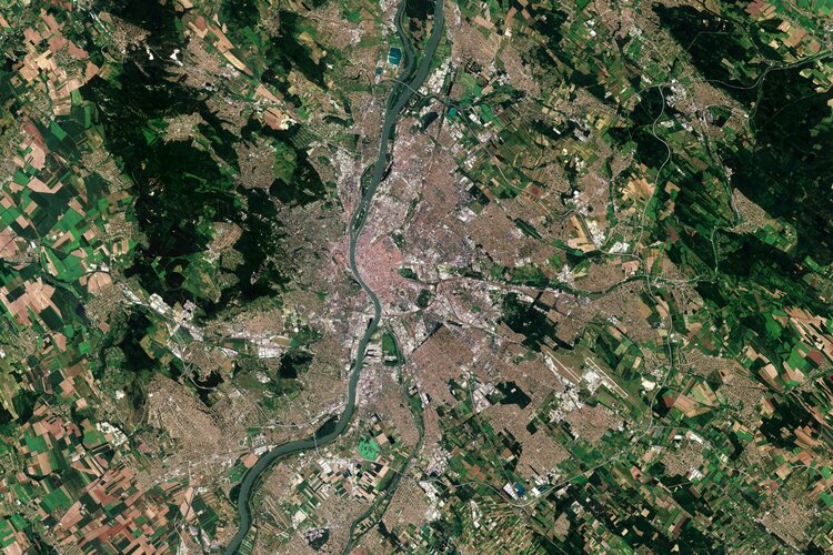
Budapest, the capital and most populous city in Hungary, is visible in this image captured by the Copernicus Sentinel-2 mission.
Galileo satellites arrive at Europe’s Spaceport
8.10.2021 9:20 ESA Navigation
The latest pair of Galileo satellites have touched down at Europe’s Spaceport in French Guiana, ahead of their launch together next month.
Interview with Joshua France, Mobile Division Manager, RIEGL
8.10.2021 9:00 GISCafe.com Webcasts-WebinarsJICA and Synspective start demonstration for the development of a disaster prevention management system in Guatemala using SAR satellite data
8.10.2021 9:00 GISCafe.com Webcasts-Webinars Japan International Cooperation Agency (JICA) and Synspective have started a satellite use service demonstration to monitor ground movements in …Bluesky LiDAR Benchmarks Carbon Neutral Farming in Northern Ireland
8.10.2021 9:00 GISCafe.com Webcasts-Webinars Leicestershire, UK, 05 October 2021 - A European Innovation Partnership project to accelerate the move towards net carbon zero farming is using …Známe vítěze 14. ročníku soutěže Žít krajinou
8.10.2021 0:00 Státní pozemkový úřad Praha, 8. října 2021 – Ve čtvrtek 7. října 2021 se v prostorách Senátu Parlamentu ČR uskutečnilo vyhlášení výsledků 14. ročníku soutěže Žít krajinou, kterou pořádá Státní pozemkový úřad (SPÚ) ve spolupráci se Stálou komisí senátu pro rozvoj venkova a s Českomoravskou komorou pro pozemkové úpravy. Jejím cílem je ocenit nejúspěšnější realizace pozemkových úprav, které jsou komplexním a účinným nástrojem, jak vrátit krajině její schopnost vyrovnávat se s klimatickými změnami i vlivy zemědělské činnosti. Mají pozitivní přínos pro kvalitu životního prostředí a zvyšují i celkovou kvalitu života na venkově.Interview with Mike Paniccia, World Magnetic Model Program Manager at the National Geo-intelligence Agency
7.10.2021 20:44 GISCafe.com Webcasts-WebinarsInsurity Acquires Maprisk, Expanding Leading Geospatial Analytic Capabilities for Personal and Commercial P&C Carriers and MGAs
7.10.2021 17:08 GISCafe.com Webcasts-Webinars Acquiring Maprisk expands Insurity’s current cloud-based geospatial analytics and proprietary data capabilities into the personal lines market …Safety, Sustainability and Efficiency Top Agenda at Velodyne Lidar’s World Safety Summit on Autonomous Technology
7.10.2021 17:08 GISCafe.com Webcasts-Webinars Free Virtual Event Explores How to Tackle Changing Needs of a World in Continuous MotionSAN JOSE, Calif. — (BUSINESS WIRE) — October 7, …
ASTERRA Releases EarthWorks Rail, Providing Soil Moisture Assessments to the Railroad Industry
7.10.2021 17:08 GISCafe.com Webcasts-Webinars Potential and likely failure locations are mapped out so that they can mitigate problems before more severe and expensive damage occursROSH HA'AYIN, …
tZERO Joins Forces With XY Labs, the Company Behind XYO, to Digitize & Trade XY Labs Equity
7.10.2021 17:08 GISCafe.com Webcasts-Webinars NEW YORK — (BUSINESS WIRE) — October 7, 2021 —tZERO, a leader in blockchain innovation and liquidity for digital assets, …
The Township of Aberdeen Adopts ProStar's Solution to Meet New Jersey Department of Environmental Protection (NJDEP) Mandate
7.10.2021 17:08 GISCafe.com Webcasts-Webinars GRAND JUNCTION, Colo., Oct. 7, 2021 — (PRNewswire) — ProStar Holdings Inc. ("ProStar®" or the "the Company") (OTCQB: MAPPF) …Father of ERS wins Nobel prize in physics
7.10.2021 16:30 ESA Observing the Earth
The Royal Swedish Academy of Sciences has awarded a share of this year’s Nobel Prize in Physics to Klaus Hasselmann in acknowledgment of his contribution to ‘the physical modelling of Earth’s climate, quantifying variability and reliably predicting global warming’. Among Prof. Hasselmann’s long list of outstanding achievements, ESA also recognises him as one of the ‘fathers’ of ESA’s first Earth observation mission, ERS-1, which has been key to understanding our changing planet and which paved the way to modern techniques in observing Earth from space.
Watch live: ESA Φ-week
7.10.2021 16:00 ESA Observing the Earth
Focusing on the New Space economy and innovations in Earth observation, ESA’s fourth Φ-week kicks off on Monday 11 October. Join us live for two of the main sessions: the Opening session on Monday at 10:30 CEST and the Blending New Space Technologies and Services session on Tuesday at 16:00 CEST.
Volby do Poslanecké sněmovny Parlamentu České republiky 2021
7.10.2021 10:10 Statutární město Ústí nad Labem Mezi veřejné mapové aplikace byla přidána mapová aplikace Volby do Poslanecké sněmovny Parlamentu České republiky 2021. Mapová aplikace obsahuje volební okrsky a volební místnosti, po zadání adresy (ulice + číslo popisné) ukáže volební místnost, která zadané adrese přísluší.20211007_účetní
7.10.2021 10:03 ČÚZK - předpisy a opatření Katastrální úřad pro Středočeský kraj Vyhlášení výběrového řízení: účetní V části "Úřední deska", v sekci "Oznámení a jiná úřední sdělení" bylo vystaveno "Oznámení o vyhlášení výběrového řízení na obsazení systemizovaného místa účetní v kanceláři ředitele KÚ"20211007_účetní
7.10.2021 10:03 ČÚZK /Urady/Katastralni-urady/Katastralni-urady/Katastralni-urad-pro-Stredocesky-kraj/O-uradu/Aktuality/20210113_odborny-rada,-reditel-Katastralniho-p-(7)účetní
7.10.2021 10:03 ČÚZK /Urady/Katastralni-urady/Katastralni-urady/Katastralni-urad-pro-Stredocesky-kraj/Volna-mista/ucetniúčetní
7.10.2021 10:03 ČÚZK - předpisy a opatření Katastrální úřad pro Středočeský kraj - kancelář ředitelevypisuje výběrové řízení na místo účetní
účetní
účetní
7.10.2021 10:03 ČÚZK - volná místa Katastrální úřad pro Středočeský kraj - kancelář ředitele vypisuje výběrové řízení na místo účetnírada/odborný rada – opravy chyb v KN
7.10.2021 9:11 ČÚZK - předpisy a opatření Katastrální úřad pro hlavní město Prahuvypisuje výběrové řízení na místo
rada/odborný rada – opravy chyb v KN
rada/odborný rada – opravy chyb v KN
7.10.2021 9:11 ČÚZK - volná místa Katastrální úřad pro hlavní město Prahu vypisuje výběrové řízení na místo rada/odborný rada – opravy chyb v KNRada/odborný rada – řízení o opravě chyby v SPI
7.10.2021 8:54 ČÚZK /Urady/Katastralni-urady/Katastralni-urady/Katastralni-urad-pro-Moravskoslezsky-kraj/Uredni-deska/Oznameni-a-jina-uredni-sdeleni/Volna-mista/DMS/Rada-odborny-rada-–-rizeni-o-oprave-chyby-v-SPIRada/odborný rada – řízení o opravě chyby v SPI
7.10.2021 8:54 ČÚZK - volná místa Katastrální úřad pro Moravskoslezský kraj Katastrální pracoviště Frýdek-Místek vypisuje výběrové řízení na místo Rada/odborný rada – řízení o opravě chyby v SPIRada/odborný rada – řízení o opravě chyby v SPI
7.10.2021 8:54 ČÚZK - předpisy a opatření Katastrální úřad pro Moravskoslezský kraj Katastrální pracoviště Frýdek-Místekvypisuje výběrové řízení na místo
Rada/odborný rada – řízení o opravě chyby v SPI
Odborný referent – zápisy v řízení V a Z
7.10.2021 8:51 ČÚZK - předpisy a opatření Katastrální úřad pro Moravskoslezský krajvypisuje výběrové řízení na místo
Odborný referent – zápisy v řízení V a Z
Odborný referent – zápisy v řízení V a Z
7.10.2021 8:51 ČÚZK - volná místa Katastrální úřad pro Moravskoslezský kraj vypisuje výběrové řízení na místo Odborný referent – zápisy v řízení V a ZOdborný referent – zápisy v řízení V a Z
7.10.2021 8:51 ČÚZK - volná místa Katastrální úřad pro Moravskoslezský kraj - Katastrální pracoviště Ostrava vypisuje výběrové řízení na místo Odborný referent – zápisy v řízení V a ZOdborný referent – zápisy v řízení V a Z
7.10.2021 8:51 ČÚZK - předpisy a opatření Katastrální úřad pro Moravskoslezský kraj - Katastrální pracoviště Ostravavypisuje výběrové řízení na místo
Odborný referent – zápisy v řízení V a Z
Odborný referent/vrchní referent – obnova katastrálního operátu
7.10.2021 8:36 ČÚZK - předpisy a opatření Katastrální úřad pro Moravskoslezský kraj Katastrální pracoviště Bruntálvypisuje výběrové řízení na místo
Odborný referent/vrchní referent – obnova katastrálního operátu
Odborný referent/vrchní referent – obnova katastrálního operátu
7.10.2021 8:36 ČÚZK - volná místa Katastrální úřad pro Moravskoslezský kraj Katastrální pracoviště Bruntál vypisuje výběrové řízení na místo Odborný referent/vrchní referent – obnova katastrálního operátuAPGEO - APG zvolila nové členy představenstva a dozorčí rady
7.10.2021 2:00 Asociace podnikatelů v geomatice Členové APG zvolili nové představenstvo a dozorčí radu.The Auto Club Group (ACG) Chooses Geospatial Property Weather Monitoring and Analytics Mapping Solution — Reactor™ from CoreLogic
6.10.2021 16:22 GISCafe.com Webcasts-Webinars Single source solution for real-time weather monitoring and identifying storm impacts to enhance response for better policyholder customer …SkyGrid Launches Autonomous Remote UAV Operations Solution
6.10.2021 16:22 GISCafe.com Webcasts-Webinars Company's remote flight operations capability is a ready-to-use solution that enables drone operators to remotely conduct missions, control flights, …Valqari Secures Position as Drone Delivery Industry Leader with New U.S. Patent
6.10.2021 16:22 GISCafe.com Webcasts-Webinars 28th granted patent establishes Valqari's broad coverage in competitive drone mailbox categoryCHICAGO, Oct. 6, 2021 — (PRNewswire) — …
VR do 31.10. rada/odborný rada – vedoucí oddělení potvrzování geometrických plánů
6.10.2021 15:26 ČÚZK - předpisy a opatření Katastrální úřad pro hlavní město Prahu - Katastrální pracoviště Praha zveřejnil novou aktualitu: vyhlášení výběrového řízení na služební místo rada/odborný rada – vedoucí oddělení potvrzování geometrických plánů Ředitelka úřadu vyhlašuje výběrové řízení na služební místo:rada/odborný rada – vedoucí oddělení potvrzování geometrických plánů
VR do 31.10. rada/odborný rada – vedoucí oddělení potvrzování geometrických plánů
6.10.2021 15:26 ČÚZK /Urady/Katastralni-urady/Katastralni-urady/Katastralni-urad-pro-hlavni-mesto-Prahu/O-uradu/Aktuality/VR-do-31-10-rada-odborny-rada-–-vedouci-oddeleniVR do 27.10. rada/odborný rada – kontrolor
6.10.2021 15:20 ČÚZK - předpisy a opatření Katastrální úřad pro hlavní město Prahu zveřejnil novou aktualitu: vyhlášení výběrového řízení na služební místo rada/odborný rada – kontrolor Ředitelka úřadu vyhlašuje výběrové řízení na služební místo:rada/odborný rada – kontrolor
VR do 27.10. rada/odborný rada – kontrolor
6.10.2021 15:20 ČÚZK /Urady/Katastralni-urady/Katastralni-urady/Katastralni-urad-pro-hlavni-mesto-Prahu/O-uradu/Aktuality/VR-do-27-10-rada-odborny-rada-–-kontrolorVR do 27.10. rada/odborný rada – kontrolor
6.10.2021 15:20 ČÚZK - předpisy a opatření Katastrální úřad pro hlavní město Prahu zveřejnil novou aktualitu: vyhlášení výběrového řízení na služební místo rada/odborný rada – kontrolor Ředitelka úřadu vyhlašuje výběrové řízení na služební místo:referent KN – vedení DKM, vedení katastrální mapy, PT 10
VR do 27.10. rada/odborný rada – kontrolor
6.10.2021 15:20 ČÚZK - předpisy a opatření Katastrální úřad pro hlavní město Prahu zveřejnil novou aktualitu: vyhlášení výběrového řízení na služební místo rada/odborný rada – kontrolor Ředitelka úřadu vyhlašuje výběrové řízení na služební místo:referent KN – vedení DKM, vedení katastrální mapy, PT 10
rada/odborný rada – kontrolor
6.10.2021 14:53 ČÚZK - předpisy a opatření Katastrální úřad pro hlavní město Prahu kancelář ředitelevypisuje výběrové řízení na místo
rada/odborný rada – kontrolor
rada/odborný rada – kontrolor
6.10.2021 14:53 ČÚZK - volná místa Katastrální úřad pro hlavní město Prahu kancelář ředitele vypisuje výběrové řízení na místo rada/odborný rada – kontrolorrada/odborný rada – kontrolor
6.10.2021 14:53 ČÚZK /Urady/Katastralni-urady/Katastralni-urady/Katastralni-urad-pro-hlavni-mesto-Prahu/Uredni-deska/Oznameni-a-jina-uredni-sdeleni/Volna-mista/DMS/rada-odborny-rada-–-kontrolor20211007 - volné místo - Rada/odborný rada v oddělení OKO I. v technickém odboru na KÚ pro Úst.kraj
6.10.2021 13:46 ČÚZK /Urady/Katastralni-urady/Katastralni-urady/Katastralni-urad-pro-Ustecky-kraj/O-uradu/Aktuality/20211007-volne-misto-Rada-odborny-rada-v oddel20211007 - volné místo - Rada/odborný rada v oddělení OKO I. v technickém odboru na KÚ pro Úst.kraj
6.10.2021 13:46 ČÚZK - předpisy a opatření Katastrální úřad pro Ústecký kraj zveřejnil novou aktualitu: Nabídka volného místa - Rada / odborný rada v oddělení obnovy katastrálního operátu I. v technickém odboru na Katastrálním úřadu pro Ústecký krajRada / odborný rada v oddělení obnovy katastrálního operátu I. v technickém odboru na Katastrálním ú
6.10.2021 13:44 ČÚZK - volná místa Katastrální úřad pro Ústecký kraj technický odbor vypisuje výběrové řízení na místo Rada / odborný rada v oddělení obnovy katastrálního operátu I. v technickém odboru na Katastrálním úRada / odborný rada v oddělení obnovy katastrálního operátu I. v technickém odboru na Katastrálním ú
6.10.2021 13:44 ČÚZK /Urady/Katastralni-urady/Katastralni-urady/Katastralni-urad-pro-Ustecky-kraj/Uredni-deska/Oznameni-a-jina-uredni-sdeleni/Volna-mista/DMS/Rada-odborny-rada-v oddeleni-obnovy-katastralnihRada / odborný rada v oddělení obnovy katastrálního operátu I. v technickém odboru na Katastrálním ú
6.10.2021 13:44 ČÚZK - předpisy a opatření Katastrální úřad pro Ústecký kraj technický odborvypisuje výběrové řízení na místo
Rada / odborný rada v oddělení obnovy katastrálního operátu I. v technickém odboru na Katastrálním úřadu pro Ústecký kraj
EGNOS improves its robustness and efficiency with modernized processing facilities
6.10.2021 11:45 European GNSS Agency
The EGNOS ground segment in Torrejon de Ardoz, Spain and Ciampino, Italy is currently undergoing an important upgrade to ensure further robustness and integrity of services to the users of Europe’s Satellite-Based-Augmentation System (SBAS).
EGNOS, the European Geostationary Navigation Overlay Service, has been augmenting GPS signal and providing services to users in Europe since June 2005. The provision of EGNOS services is generating tangible benefits to numerous market segments, including road, rail, maritime, geomatics, agriculture and in particular aviation. About to celebrate its 10th Safety of Life (SoL) anniversary, the system is currently replacing its five Central Processing Facilities (CPF) of first generation with new, second generation ones.
The role of CPFs is to process the data received from the network of more than 40 reference stations (RIMS) to elaborate clock and ephemeris corrections for each GPS satellite in view. CPFs generate a model for ionospheric induced delays over the EGNOS service area to compensate for ionospheric perturbations to the navigation signals ensuring the integrity of the broadcast corrections. The second generation CPFs, developed by Thales Alenia Space, come together with the entry into service of a new EGNOS System Release "ESR-242A".
A step-wise approach
The changes in the EGNOS ground segment were performed in a seamless manner without any interruption from an EGNOS user point of view, and without compromising at any moment the EGNOS performance. The deployment plan ensures the service continuity on the two geostationary satellites, with just few minutes outage in each. A two-month testing period will follow before decommissioning the old CPF, allowing for a rollback in case of need.
"The CPF upgrade is an important building block which will further ensure the uninterrupted and robust provision of service to our diverse group of users that grows daily," says Jean-Marc Piéplu, Head of EGNOS Services Department. "Congratulations to all teams involved, industry, the service provider, ESA and EUSPA teams," Piéplu concludes.
Media note: This feature can be republished without charge provided the European Union Agency for the Space Programme (EUSPA) is acknowledged as the source at the top or the bottom of the story. You must request permission before you use any of the photographs on the site. If you republish, we would be grateful if you could link back to the EUSPA website (http://www.euspa.europa.eu).
Pracovník/pracovnice vztahu k veřejnosti + Telefonista/ka
6.10.2021 9:59 Zeměměřický úřad Zeměměřický úřadvypisuje výběrové řízení na místo
Pracovník/pracovnice vztahu k veřejnosti + Telefonista/ka
Pracovník/pracovnice vztahu k veřejnosti + Telefonista/ka
6.10.2021 9:59 ČÚZK /Urady/Zememericky-urad/Volna-mista/Pracovnik-pracovnice-vztahu-k-verejnosti-TelefoPracovník/pracovnice vztahu k veřejnosti + Telefonista/ka
6.10.2021 9:59 ČÚZK - předpisy a opatření Zeměměřický úřadvypisuje výběrové řízení na místo
Pracovník/pracovnice vztahu k veřejnosti + Telefonista/ka
Pracovník/pracovnice vztahu k veřejnosti + Telefonista/ka
6.10.2021 9:59 ČÚZK - volná místa Zeměměřický úřad vypisuje výběrové řízení na místo Pracovník/pracovnice vztahu k veřejnosti + Telefonista/kaTechnická specifikace IS DTM šesti krajů
6.10.2021 9:49 ČÚZK - předpisy a opatření Na základě předběžného průzkumu trhu byla zveřejněna technická specifikace IS DTM šesti krajů (K6). Všechny zveřejněné dokumenty najdete zdeAPGEO - Doc. Šíma čestným členem APG
6.10.2021 2:00 Asociace podnikatelů v geomatice Představenstvo APG udělilo titul čestného člena doc. Ing. Jiřímu Šímovi, CSc.Ouster to Establish Automotive Group with Planned Acquisition of Sense Photonics to Accelerate Automotive Growth and Bring Solid-State Digital Lidar to Market
5.10.2021 18:55 GISCafe.com Webcasts-Webinars Strategic acquisition expected to solidify Ouster as frontrunner in automotive with long-range solid-state digital lidar, a major global auto OEM …Nearmap Expands Partnership With New Jersey To Provide Aerial Images Of Entire State, Offering Extra Resource to Government Agencies
5.10.2021 18:55 GISCafe.com Webcasts-Webinars SALT LAKE CITY, Oct. 05, 2021 (GLOBE NEWSWIRE) -- Leading aerial imagery company Nearmap announced today its next steps in a growing …Rendered.ai Raises $6M, Expanding First-ever Developer Framework for Synthetic Data
5.10.2021 18:55 GISCafe.com Webcasts-Webinars The company offers simulation-based engineered data for industries ranging from autonomous vehicles to robotics, life sciences, and satellite …Program konference GIS Esri v ČR 2021. Přednášet bude i Jan Kolář, zakladatel České kosmické kanceláře
5.10.2021 17:46 GeoBusinessJiž jsme před časem informovali, že letošní ročník konference GIS Esri v ČR se opět uskuteční pouze virtuálně. Na webu firmy Arcdata Praha, která konferenci již třicet let v listopadu pořádá, byly zveřejněny informace o úvodním přednáškovém bloku, profily úvodních řečníků, náplň technologického bloku a dalších živě vysílaných sekcí, přehled předtočených videopřednášek uživatelů a partnerů, abstrakty workshopů, které budeme vysílat […]
The post Program konference GIS Esri v ČR 2021. Přednášet bude i Jan Kolář, zakladatel České kosmické kanceláře appeared first on GeoBusiness.
The Cohesive Companies Expand in Transportation Infrastructure Globally with Acquisition of OXplus
5.10.2021 17:13 Bentley SystemsPress Announcements
JICA Assisted Agra Water Supply Project
5.10.2021 16:37 Bentley SystemsPressCoverage
Everything About Water, India
Read the articleVortex and Cepton Partner to Enable V2I Solutions With Smart Lidar and AI
5.10.2021 16:05 GISCafe.com Webcasts-Webinars Innovative project in West Midlands, UK turns buses into mobile road inspection tools to help build safer, greener and smarter citiesSAN JOSE, …
Esri Releases ArcGIS GeoBIM, Bringing Spatial Context to AEC Operations
5.10.2021 16:05 GISCafe.com Webcasts-Webinars New Product Connects with Autodesk Construction Cloud to Bridge GIS and BIMREDLANDS, Calif. — (BUSINESS WIRE) — October 5, 2021 …
Vexcel Data Program Launches Building Footprints and Property Attributes Information Services for Australia and U.S.
5.10.2021 16:05 GISCafe.com Webcasts-Webinars BOULDER, Colo., Oct. 5, 2021 — (PRNewswire) — The world's largest aerial imagery program, Vexcel Data Program announced today the …BlackSky Appoints Susan M. Gordon to Board of Directors
5.10.2021 16:05 GISCafe.com Webcasts-Webinars Geospatial Intelligence Company Adds National Intelligence Community Leader to Leadership TeamHERNDON, Va. — (BUSINESS WIRE) — October …
Vexcel Data Program Expands Aerial Imagery Collection Program To Japan
5.10.2021 16:05 GISCafe.com Webcasts-Webinars The world's largest aerial imagery and geospatial data provider adds the major metro areas of Japan to its global coverage program.BOULDER, Colo., …
Aquiline Drones Establishes AI-Driven Airline to Save Lives
5.10.2021 16:05 GISCafe.com Webcasts-Webinars Aquiline Drones Becomes First U.S. Drone Manufacturer to Establish Airline Division to Transport Human Tissue and OrgansHARTFORD, Conn., Oct. 5, …
RedTail Delivers LiDAR System to DoD's Explosive Ordnance Disposal Community
5.10.2021 16:05 GISCafe.com Webcasts-Webinars Microelectromechanical Systems (MEMS) LiDAR Delivered for Tactical Operations.FAIRMONT, Va., Oct. 5, 2021 — (PRNewswire) — …
Digitally enabled factory development saves China steel and iron firm US 6 million
5.10.2021 15:45 Bentley SystemsPressCoverage
IT Brief AU, Australia/New Zealand
Read the articleVrchní referent / rada v oddělení dokumentace katastru nemovitostí Katastrálního pracoviště Jičín
5.10.2021 13:41 ČÚZK - volná místa Katastrální úřad pro Královéhradecký kraj - Katastrální pracoviště Jičín vypisuje výběrové řízení na místo Vrchní referent / rada v oddělení dokumentace katastru nemovitostí Katastrálního pracoviště JičínVrchní referent / rada v oddělení dokumentace katastru nemovitostí Katastrálního pracoviště Jičín
5.10.2021 13:41 ČÚZK - předpisy a opatření Katastrální úřad pro Královéhradecký kraj - Katastrální pracoviště Jičínvypisuje výběrové řízení na místo
Vrchní referent / rada v oddělení dokumentace katastru nemovitostí Katastrálního pracoviště Jičín
Vrchní referent / rada v oddělení dokumentace katastru nemovitostí Katastrálního pracoviště Jičín
5.10.2021 13:41 ČÚZK /Urady/Katastralni-urady/Katastralni-urady/Katastralni-urad-pro-Kralovehradecky-kraj/Uredni-deska/Oznameni-a-jina-uredni-sdeleni/Volna-mista/Vrchni-referent-rada-v-oddeleni-dokumentace-ka-(1)Program letošní Konference GIS Esri v ČR
5.10.2021 13:00 ARCDATAKonference GIS Esri v ČR se letos uskuteční virtuálně. Pojďte si o jejím programu přečíst více a nezapomeňte se na konferenci přihlásit, abyste o nic z toho nepřišli.
Na webových stránkách akce nyní naleznete:
- informace o náplni zahajovacího bloku,
- profily hlavních řečníků,
- náplň technologického bloku a dalších živě vysílaných sekcí,
- přehled předtočených videopřednášek uživatelů a partnerů
- abstrakty workshopů, které budeme vysílat v průběhu listopadu a prosince,
- informace o letošní novince – setkání s konzultanty ARCDATA
- a další doprovodný program.
Podmínky registrace
Veškerý výše uvedený obsah se zpřístupní pouze registrovaným účastníkům. Na 100% slevu z registračního poplatku má nárok každý uživatel organizace, jež má platnou systémovou podporu (maintenance), a každý pedagog či student.
Termín pro přihlášení
Pokud si chcete konferenci užít s veškerým servisem, přihlaste se prosím nejpozději do středy 13. 10. 2021 – jen tak vám totiž stihneme zaslat i balíček konferenčních materiálů. Stejný termín platí také v případě, že se rozhodnete přihlásit svoji práci do on-line přehlídky map a aplikací.
Aktualizované pokyny pro zpracování bakalářských a diplomových prací z geografie a kartografie
5.10.2021 12:53 Geografický ústav MUAktualizované pokyny pro zpracování bakalářských a diplomových prací z geografie a kartografie jsou ke stažení na adrese https://is.muni.cz/auth/el/sci/jaro2020/Z6004/Pokyny_BPDP_GU.pdf.
V nové verzi došlo ke sjednocení citačního stylu se stylem časopisu Geografie – Sborník ČGS, aby bylo možné využívat tzv. citační mažery (např. Zotero https://is.muni.cz/do/sukb/kuk/materialy/cze/Zotero/index.html>) pro tvorbu a správu citací.
Součástí pokynů jsou také šablony k úvodním stránkám práce.
Jak nespáchat parametrovou sebevraždu nebo zkušenosti se zaváděním CDE. Taková byla konference BIM Open 2021
5.10.2021 12:02 BIM NewsŠestý ročník BIM konference, pořádaný firmou Adeon, se uskutečnil 21. září 2021 online formou. Konference je sice zaměřena na konkrétní využití Autodesk BIM softwarů pro pozemní a liniové stavby od firmy Autodesk, na konferenci ovšem vystoupili také zástupci několika firem, které BIM již používají v praxi. Autodesk a inovace pro stavebnictví, Patrik Minks Koncepce BIM […]
The post Jak nespáchat parametrovou sebevraždu nebo zkušenosti se zaváděním CDE. Taková byla konference BIM Open 2021 appeared first on BIM News.
20211006 - volné místo - Odborný referent v oddělení právních vztahů k nemovitostem KP Teplice na KÚ
5.10.2021 11:55 ČÚZK - předpisy a opatření Katastrální úřad pro Ústecký kraj - Katastrální pracoviště Teplice zveřejnil novou aktualitu: Nabídka volného nísta - Odborný referent v oddělení právních vztahů k nemovitostem Katastrálního pracoviště Teplice na Katastrálním úřadu pro Ústecký kraj20211006 - volné místo - Odborný referent v oddělení právních vztahů k nemovitostem KP Teplice na KÚ
5.10.2021 11:55 ČÚZK /Urady/Katastralni-urady/Katastralni-urady/Katastralni-urad-pro-Ustecky-kraj/Katastralni-pracoviste/KP-Teplice/O-uradu/Aktuality/20211006-volne-misto-Odborny-referent-v-oddele20211006 - volné místo - Odborný referent v oddělení právních vztahů k nemovitostem KP Teplice na KÚ
5.10.2021 11:54 ČÚZK /Urady/Katastralni-urady/Katastralni-urady/Katastralni-urad-pro-Ustecky-kraj/O-uradu/Aktuality/20211006-volne-misto-Odborny-referent-v-oddele20211006 - volné místo - Odborný referent v oddělení právních vztahů k nemovitostem KP Teplice na KÚ
5.10.2021 11:54 ČÚZK - předpisy a opatření Katastrální úřad pro Ústecký kraj - Katastrální pracoviště Teplice zveřejnil novou aktualitu: Nabídka volného nísta - Odborný referent v oddělení právních vztahů k nemovitostem Katastrálního pracoviště Teplice na Katastrálním úřadu pro Ústecký krajVýběrové řízení
5.10.2021 11:30 ČÚZK - předpisy a opatření Katastrální úřad pro Liberecký kraj zveřejnil novou aktualitu: Oznámení o vyhlášení výběrového řízení na obsazení služebního místa odborný referent v oddělení právních vztahů k nemovitostem na Katastrálním pracovišti Jablonec nad Nisou.Výběrové řízení
5.10.2021 11:30 ČÚZK /Urady/Katastralni-urady/Katastralni-urady/Katastralni-urad-pro-Liberecky-kraj/O-uradu/Aktuality/Vyberove-rizeniJak zjistit skutečnou polohu odvodňovacích staveb v KoPÚ pomocí nových dat
5.10.2021 11:26 ZeměměřičV časopise Geodetický a kartografický obzor vyšel článek „Analýza možností zisku nových datových zdrojů a postupů zjištění reálné polohy odvodňovacích staveb ve vazbě na proces komplexních pozemkových úprav“. Autory jsou Václav Šafář (VÚGTK) a Lenka Tlapáková (VÚMOP). Článek představuje možnosti validace mapových podkladů, stávajících a dostupných informací o odvodňovacích stavbách, a zajištění nových zdrojů dat pro zjištění jejich reálné polohy za […]
The post Jak zjistit skutečnou polohu odvodňovacích staveb v KoPÚ pomocí nových dat appeared first on Zeměměřič.
Oznámení o vyhlášení výběrového řízení na služební místo odborný referent v oddělení dokumentace kat
5.10.2021 11:16 ČÚZK /Urady/Katastralni-urady/Katastralni-urady/Katastralni-urad-pro-Pardubicky-kraj/Uredni-deska/Oznameni-a-jina-uredni-sdeleni/Volna-mista/DMS/Oznameni-o-vyhlaseni-vyberoveho-rizeni-na-sluzebniOznámení o vyhlášení výběrového řízení na služební místo odborný referent v oddělení dokumentace kat
5.10.2021 11:16 ČÚZK - předpisy a opatření Katastrální úřad pro Pardubický kraj Katastrální pracoviště Ústí nad Orlicívypisuje výběrové řízení na místo
Oznámení o vyhlášení výběrového řízení na služební místo odborný referent v oddělení dokumentace katastru nemovitostí Katastrálního pracoviště Ústí nad Orlicí
Oznámení o vyhlášení výběrového řízení na služební místo odborný referent v oddělení dokumentace kat
5.10.2021 11:16 ČÚZK - volná místa Katastrální úřad pro Pardubický kraj Katastrální pracoviště Ústí nad Orlicí vypisuje výběrové řízení na místo Oznámení o vyhlášení výběrového řízení na služební místo odborný referent v oddělení dokumentace katOd chaosu k digitalizaci – poučení ze skandinávského trhu. Podrobný program konference BIM Day 2021
5.10.2021 10:47 GeoBusinessOdborná rada pro BIM (czBIM) pořádá v polovině října svoji dvoudenní konferenci BIM Day 2021. O své zkušenosti s BIM se podělí pozvaní hosté z Polska, Německa, Slovinska i čeští odborníci. V programu je také několik pracovních seminářů. První den – úterý 12. října 2021 (09:00 – 17:10) Hlavní program moderuje Leoš Svoboda. 09:00 Zahájení a úvod konference Petr Vaněk, místopředseda […]
The post Od chaosu k digitalizaci – poučení ze skandinávského trhu. Podrobný program konference BIM Day 2021 appeared first on GeoBusiness.
Výběrové řízení
5.10.2021 10:22 ČÚZK - předpisy a opatření Katastrální úřad pro Liberecký kraj - Katastrální pracoviště Jablonec nad Nisou zveřejnil novou aktualitu: Oznámení o vyhlášení výběrového řízení na obsazení služebního místa odborný referent v oddělení právních vztahů k nemovitostem na Katastrálním pracovišti Jablonec nad Nisou.odborný referent v oddělení právních vztahů k nemovitostem
5.10.2021 10:06 ČÚZK /Urady/Katastralni-urady/Katastralni-urady/Katastralni-urad-pro-Liberecky-kraj/Uredni-deska/Oznameni-a-jina-uredni-sdeleni/Volna-mista/odborny-referent-v-oddeleni-pravnich-vztahu-k-nemoodborný referent v oddělení právních vztahů k nemovitostem
5.10.2021 10:06 ČÚZK - předpisy a opatření Katastrální úřad pro Liberecký kraj - Katastrální pracoviště Jablonec nad Nisouvypisuje výběrové řízení na místo
odborný referent v oddělení právních vztahů k nemovitostem
odborný referent v oddělení právních vztahů k nemovitostem
5.10.2021 10:06 ČÚZK - volná místa Katastrální úřad pro Liberecký kraj - Katastrální pracoviště Jablonec nad Nisou vypisuje výběrové řízení na místo odborný referent v oddělení právních vztahů k nemovitostemRiverside Research to Unveil the Commercial Innovation Center
5.10.2021 2:07 GISCafe.com Webcasts-Webinars The Commercial Innovation Center enables application developers easy access to unprecedented amounts of remote sensing data for research and …The evolution of digital engineering and its impact on project delivery
4.10.2021 21:31 Bentley SystemsPressCoverage
Roads and Infrastructure, Australia/New Zealand
Read the article15 Simple Smart Ways to Extend the Life of Your Technology Equipment
4.10.2021 21:18 Bentley SystemsPressCoverage
Forbes, USA
Read the articleWater management Aguas do Porto combines data from 22 types of sources into a Digital Twin
4.10.2021 21:09 Bentley SystemsPressCoverage
WaterSolutions / gwf, DACH
Read the articleGain a Digital Line of Sight across the Whole Lifecycle of the Plant with a Digital Twin
4.10.2021 20:51 Bentley SystemsPressCoverage
BIM Community, Southern Europe
Read the articleDarkPulse, Inc. Announces Acquisition of TerraData Unmanned, PLLC a Drone Based Company Offering Multiple Platforms Including Underwater Capabilities
4.10.2021 17:48 GISCafe.com Webcasts-Webinars NEW YORK, Oct. 04, 2021 (GLOBE NEWSWIRE) -- Dark Pulse, Inc. (OTC Markets: DPLS) (“DarkPulse” and the “Company”), a technology company …#myEUSpace competition aims for solutions that look after our planet
4.10.2021 16:35 European GNSS Agency
Two out of the six challenges included in the #myEUSpace competition are targeting solutions that will power Europe’s efforts to become climate neutral by 2050.
The EU space technology has a fundamental role in the delivery of innovative solutions and #myEUspace competition is the perfect tool at the fingertips of entrepreneurs and visionaries with deeper technical knowledge of EGNSS and/or Copernicus. In the "Our Green Planet" challenge "environmental entrepreneurs" are tasked with developing trailblazing solutions to address environmental challenges, promote sustainable life, consumption and production, but also mitigate climate change, by relying on space services from the EU Space Programme.
Since their inception, the EU’s flagships, Galileo and EGNOS have been contributing to the rollout of sustainable transport modes by reducing emissions, when optimizing routes in the air, on land and at sea. In particular, the use of satellite navigation systems such as Galileo, in road vehicles, can reduce journey times by more than ten per cent, and thus contribute to cutting down emissions. Likewise, geospatial data by Copernicus can also be used to improve site selection of assets such as solar panels or wind turbines. Imagery from the Sentinel satellites offers greater situational awareness and help mitigate risks such as vegetation encroachment on power grids and turbines.
EUSPA supporting EU Green Deal objectives
The EU Green Deal is a multilayered package of well though-out policies and initiatives aimed not only at reversing climate change but also shifting the European economic model to a new more sustainable path. To do so, significant investment is needed in new digital technologies that will help curb greenhouse gas emissions, support the development of green infrastructure and promote the circular economy model. The two challenges are, to a large extend, interlinked with the objectives of the Deal.
For this particular challenge, EUSPA will rely on the expertise of the European Centre for Medium-Range Weather Forecasts (ECMWF) when reviewing the proposals. The ECMWF is a research institute and a 24/7 operational service, producing global numerical weather predictions and other data for our Member and Co-operating States and the broader community. The Centre has one of the largest supercomputer facilities and meteorological data archives in the world. Other strategic activities include delivering advanced training and assisting the WMO in implementing its programmes.
EUSPA has previously founded applications with an eco-friendly approach such as the autonomous robotic solution 10Lines, or ThunderFly, a drone performing atmosphere analyses, leveraging services and data from Galileo and Copernicus.
Farming by Satellite in line with the Farm to Fork Strategy

The aim of the challenge is to promote Galileo, Europe’s Global Navigation Satellite System (GNSS) and Copernicus, the EU Earth Observation (EO) services in agriculture.
Grassland and cropland together make up 39 % of Europe's land cover. Today’s agricultural landscape is facing the challenge of producing enough food to respond to a rapid world population growth, while reducing its environmental footprint in terms of emissions, soil degradation, water consumption, fertilizer and pesticide application. To tackle these challenges more and more farmers and agriculturists across the European Union resort to precision agriculture.
When working in synergy, Galileo, EGNOS and Copernicus contribute to smart and sustainable farming techniques. With around 70% of new GNSS tractors using Galileo and another 97% using EGNOS, the EU space technology is becoming the preferred technology for precision farming in Europe. With Galileo’s capability of combining signals from other constellations (GPS, GLONASS) and with corrections coming from EGNOS coupled with the upcoming Galileo High Accuracy Service, service provision becomes more seamless than ever. EU farmers are able to steer their machinery precisely and, fertilise exactly where needed. Thanks to the joint usage of EU Space assets, it is estimated that EU farmers can save up to 20% of pesticides and fertilisers.
The "Farming by Satellite" challenge is built around the unlimited opportunities the EU Space Programme components generate to the benefit of agribusiness. Participants are asked to get creative and come up with solutions to manage the variability of agricultural production, improve crop yield, reduce environmental impact and optimize the food chain in line with the EU’s Farm to Fork strategy and Green Deal.
For more information about the competition, the next steps and the evaluation criteria please consult our page here.
Media note: This feature can be republished without charge provided the European Union Agency for the Space Programme (EUSPA) is acknowledged as the source at the top or the bottom of the story. You must request permission before you use any of the photographs on the site. If you republish, we would be grateful if you could link back to the EUSPA website (http://www.euspa.europa.eu).
#myEUSpace competition aims for solutions that look after our planet
4.10.2021 16:35 European GNSS AgencyTwo out of the six challenges included in the #myEUSpace competition are targeting solutions that will power Europe’s efforts to become climate neutral by 2050.
The EU space technology has a fundamental role in the delivery of innovative solutions and #myEUspace competition is the perfect tool at the fingertips of entrepreneurs and visionaries with deeper technical knowledge of EGNSS and/or Copernicus. In the "Our Green Planet" challenge "environmental entrepreneurs" are tasked with developing trailblazing solutions to address environmental challenges, promote sustainable life, consumption and production, but also mitigate climate change, by relying on space services from the EU Space Programme.
Since their inception, the EU’s flagships, Galileo and EGNOS have been contributing to the rollout of sustainable transport modes by reducing emissions, when optimizing routes in the air, on land and at sea. In particular, the use of satellite navigation systems such as Galileo, in road vehicles, can reduce journey times by more than ten per cent, and thus contribute to cutting down emissions. Likewise, geospatial data by Copernicus can also be used to improve site selection of assets such as solar panels or wind turbines. Imagery from the Sentinel satellites offers greater situational awareness and help mitigate risks such as vegetation encroachment on power grids and turbines.
EUSPA supporting EU Green Deal objectives
The EU Green Deal is a multilayered package of well though-out policies and initiatives aimed not only at reversing climate change but also shifting the European economic model to a new more sustainable path. To do so, significant investment is needed in new digital technologies that will help curb greenhouse gas emissions, support the development of green infrastructure and promote the circular economy model. The two challenges are, to a large extend, interlinked with the objectives of the Deal.
EUSPA has previously founded applications with an eco-friendly approach such as the autonomous robotic solution 10Lines, or ThunderFly, a drone performing atmosphere analyses, leveraging services and data from Galileo and Copernicus.
Farming by Satellite in line with the Farm to Fork Strategy

The aim of the challenge is to promote Galileo, Europe’s Global Navigation Satellite System (GNSS) and Copernicus, the EU Earth Observation (EO) services in agriculture.
Grassland and cropland together make up 39 % of Europe's land cover. Today’s agricultural landscape is facing the challenge of producing enough food to respond to a rapid world population growth, while reducing its environmental footprint in terms of emissions, soil degradation, water consumption, fertilizer and pesticide application. To tackle these challenges more and more farmers and agriculturists across the European Union resort to precision agriculture.
When working in synergy, Galileo, EGNOS and Copernicus contribute to smart and sustainable farming techniques. With around 70% of new GNSS tractors using Galileo and another 97% using EGNOS, the EU space technology is becoming the preferred technology for precision farming in Europe. With Galileo’s capability of combining signals from other constellations (GPS, GLONASS) and with corrections coming from EGNOS coupled with the upcoming Galileo High Accuracy Service, service provision becomes more seamless than ever. EU farmers are able to steer their machinery precisely and, fertilise exactly where needed. Thanks to the joint usage of EU Space assets, it is estimated that EU farmers can save up to 20% of pesticides and fertilisers.
The "Farming by Satellite" challenge is built around the unlimited opportunities the EU Space Programme components generate to the benefit of agribusiness. Participants are asked to get creative and come up with solutions to manage the variability of agricultural production, improve crop yield, reduce environmental impact and optimize the food chain in line with the EU’s Farm to Fork strategy and Green Deal.
For more information about the competition, the next steps and the evaluation criteria please consult our page here
Media note: This feature can be republished without charge provided the European Union Agency for the Space Programme (EUSPA) is acknowledged as the source at the top or the bottom of the story. You must request permission before you use any of the photographs on the site. If you republish, we would be grateful if you could link back to the EUSPA website (http://www.euspa.europa.eu).
#myEUSpace competition aims for solutions that look after our planet
4.10.2021 16:35 European GNSS AgencyTwo out of the six challenges included in the #myEUSpace competition are targeting solutions that will power Europe’s efforts to become climate neutral by 2050.
The EU space technology has a fundamental role in the delivery of innovative solutions and #myEUspace competition is the perfect tool at the fingertips of entrepreneurs and visionaries with deeper technical knowledge of EGNSS and/or Copernicus. In the "Our Green Planet" challenge "environmental entrepreneurs" are tasked with developing trailblazing solutions to address environmental challenges, promote sustainable life, consumption and production, but also mitigate climate change, by relying on space services from the EU Space Programme.
Since their inception, the EU’s flagships, Galileo and EGNOS have been contributing to the rollout of sustainable transport modes by reducing emissions, when optimizing routes in the air, on land and at sea. In particular, the use of satellite navigation systems such as Galileo, in road vehicles, can reduce journey times by more than ten per cent, and thus contribute to cutting down emissions. Likewise, geospatial data by Copernicus can also be used to improve site selection of assets such as solar panels or wind turbines. Imagery from the Sentinel satellites offers greater situational awareness and help mitigate risks such as vegetation encroachment on power grids and turbines.
EUSPA supporting EU Green Deal objectives
The EU Green Deal is a multilayered package of well though-out policies and initiatives aimed not only at reversing climate change but also shifting the European economic model to a new more sustainable path. To do so, significant investment is needed in new digital technologies that will help curb greenhouse gas emissions, support the development of green infrastructure and promote the circular economy model. The two challenges are, to a large extend, interlinked with the objectives of the Deal.
For this particular challenge, EUSPA will rely on the expertise of the European Centre for Medium-Range Weather Forecasts (ECMWF) when reviewing the proposals. The ECMWF is a research institute and a 24/7 operational service, producing global numerical weather predictions and other data for our Member and Co-operating States and the broader community. ECMWF operates two services from the EU’s Copernicus Earth observation programme, the Copernicus Atmosphere Monitoring Service (CAMS) and the Copernicus Climate Change Service (C3S) while it also contributes to the Copernicus Emergency Management Service (CEMS).
EUSPA has previously founded applications with an eco-friendly approach such as the autonomous robotic solution 10Lines, or ThunderFly, a drone performing atmosphere analyses, leveraging services and data from Galileo and Copernicus.
Farming by Satellite in line with the Farm to Fork Strategy
The aim of the challenge is to promote Galileo, Europe’s Global Navigation Satellite System (GNSS) and Copernicus, the EU Earth Observation (EO) services in agriculture.
Grassland and cropland together make up 39 % of Europe's land cover. Today’s agricultural landscape is facing the challenge of producing enough food to respond to a rapid world population growth, while reducing its environmental footprint in terms of emissions, soil degradation, water consumption, fertilizer and pesticide application. To tackle these challenges more and more farmers and agriculturists across the European Union resort to precision agriculture.
When working in synergy, Galileo, EGNOS and Copernicus contribute to smart and sustainable farming techniques. With around 70% of new GNSS tractors using Galileo and another 97% using EGNOS, the EU space technology is becoming the preferred technology for precision farming in Europe. With Galileo’s capability of combining signals from other constellations (GPS, GLONASS) and with corrections coming from EGNOS coupled with the upcoming Galileo High Accuracy Service, service provision becomes more seamless than ever. EU farmers are able to steer their machinery precisely and, fertilise exactly where needed. Thanks to the joint usage of EU Space assets, it is estimated that EU farmers can save up to 20% of pesticides and fertilisers.
The "Farming by Satellite" challenge is built around the unlimited opportunities the EU Space Programme components generate to the benefit of agribusiness. Participants are asked to get creative and come up with solutions to manage the variability of agricultural production, improve crop yield, reduce environmental impact and optimize the food chain in line with the EU’s Farm to Fork strategy and Green Deal.
For more information about the competition, the next steps and the evaluation criteria please consult our page here.
Media note: This feature can be republished without charge provided the European Union Agency for the Space Programme (EUSPA) is acknowledged as the source at the top or the bottom of the story. You must request permission before you use any of the photographs on the site. If you republish, we would be grateful if you could link back to the EUSPA website (http://www.euspa.europa.eu).
Prezentace DMVS na konferenci ISSS
4.10.2021 16:27 ČÚZK - předpisy a opatření Na konferenci ISSS 2021, která se konala 20.-21.9.2021 v Hradci Králové, prezentovali pracovníci ČÚZK novinky v oblasti přípravy DMVS. Místopředseda úřadu Ing. Karel Štencel informoval o celkovém postupu projektu (prezentacePrezentace DMVS na konferenci ISSS
4.10.2021 16:27 ČÚZK - předpisy a opatření Na konferenci ISSS 2021, která se konala 20.-21.9.2021 v Hradci králové, prezentovali pracovníci ČÚZK novinky v oblasti přípravy DMVS. Místopředseda úřadu Ing. Karel Štencel informoval o celkovém postupu projektu (prezentaceFirst Copernicus satellite exceeds design working life
4.10.2021 16:20 ESA Observing the Earth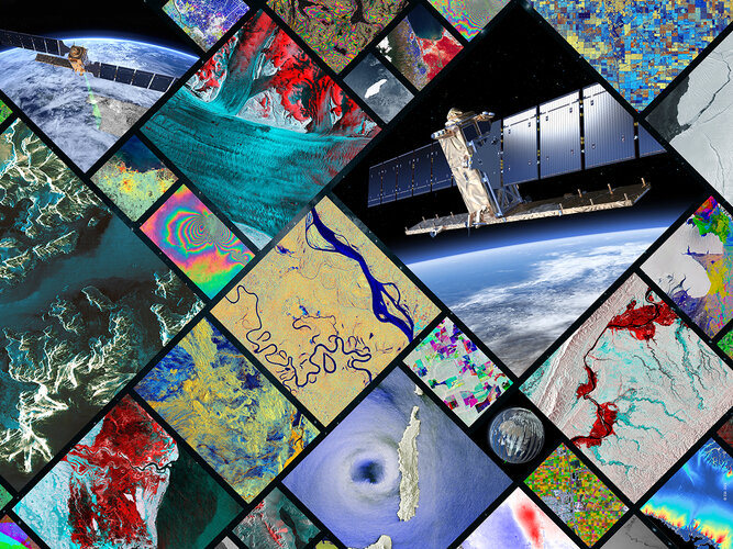
This week marks seven years since the very first satellite that ESA built for the European Union’s Copernicus programme started delivering data to monitor the environment. The Sentinel-1A satellite has shed new light on our changing world and has been key to supplying a wealth of radar imagery to aid disaster response. While this remarkable satellite may have been designed for an operational life of seven years, it is still going strong and fully expected to be in service for several years to come.
Optelos, Imagine Technologies and Cotney Partner to Deliver Breakthrough Drone-Based Commercial Roofing Inspection Solution
4.10.2021 16:03 GISCafe.com Webcasts-Webinars Partnership combines Optelos' drone roofing inspection platform, Imagine Technologies' turnkey services and training and Cotney's industry-leading …Maxar Awarded G-EGD Contract Renewal for Mission-Ready Satellite Imagery by U.S. Government
4.10.2021 16:03 GISCafe.com Webcasts-Webinars WESTMINSTER, Colo. — (BUSINESS WIRE) — October 4, 2021 —Maxar Technologies (NYSE:MAXR) (TSX:MAXR), a trusted partner and …