


![]()

zprávy
zdroje zpráv:VR do 4.2 2022
29.4.2021 15:34 ČÚZK /Urady/Katastralni-urady/Katastralni-urady/Katastralni-urad-pro-hlavni-mesto-Prahu/O-uradu/Aktuality/odborny-rada-–-reditel-ka-odboru-pravnich-vztahu-kodborný rada – ředitel/ka odboru právních vztahů k nemovitostem
29.4.2021 15:34 ČÚZK - předpisy a opatření Katastrální úřad pro hlavní město Prahu - Katastrální pracoviště Praha zveřejnil novou aktualitu: Ředitel úřadu vyhlašuje výběrové řízení na služební místo:odborný rada – ředitel/ka odboru právních vztahů k nemovitostem
VR do 20.10 odborný referent/vrchní referent – návrh zápisu v katastru
29.4.2021 15:34 ČÚZK - předpisy a opatření Katastrální úřad pro hlavní město Prahu - Katastrální pracoviště Praha zveřejnil novou aktualitu: Ředitelka úřadu vyhlašuje výběrové řízení na služební místo:referent KN – poskytování informací KN, nahlížení do KN
VR do 17.08 rada/odborný rada – opravy chyb v KN
29.4.2021 15:34 ČÚZK - předpisy a opatření Katastrální úřad pro hlavní město Prahu - Katastrální pracoviště Praha zveřejnil novou aktualitu: Ředitelka úřadu vyhlašuje výběrové řízení na služební místo:vrchní referent/rada – návrh zápisu, kontrola a zplatnění
VR do 4.2 2022
29.4.2021 15:34 ČÚZK - předpisy a opatření Katastrální úřad pro hlavní město Prahu - Katastrální pracoviště Praha zveřejnil novou aktualitu: Ředitelka úřadu vyhlašuje výběrové řízení na služební místo:* odborný referent/vrchní referent – návrh zápisu v katastru
* rada/odborný rada – kontrolor
* rada/odborný rada – vedoucí právního oddělení VIII.
VR do 26.11 odborný referent/vrchní referent – návrh zápisu v katastru
29.4.2021 15:34 ČÚZK - předpisy a opatření Katastrální úřad pro hlavní město Prahu - Katastrální pracoviště Praha zveřejnil novou aktualitu: Ředitelka úřadu vyhlašuje výběrové řízení na služební místo:* rada/odborný rada – kontrolor
* rada/odborný rada – vedoucí oddělení potvrzování geometrických plánů
* rada/odborný rada – opravy chyb v KN
VR do 17.08 rada/odborný rada – opravy chyb v KN
29.4.2021 15:34 ČÚZK /Urady/Katastralni-urady/Katastralni-urady/Katastralni-urad-pro-hlavni-mesto-Prahu/O-uradu/Aktuality/odborny-rada-–-reditel-ka-odboru-pravnich-vztahu-kVR do 11.4
29.4.2021 15:34 ČÚZK /Urady/Katastralni-urady/Katastralni-urady/Katastralni-urad-pro-hlavni-mesto-Prahu/O-uradu/Aktuality/odborny-rada-–-reditel-ka-odboru-pravnich-vztahu-kVR do 23.12 2021 v počtu 4ks
29.4.2021 15:34 ČÚZK - předpisy a opatření Katastrální úřad pro hlavní město Prahu - Katastrální pracoviště Praha zveřejnil novou aktualitu: Ředitelka úřadu vyhlašuje výběrová řízení na služební místa:* referent KN – návrh zápisu, kontrola a zplatnění do PO VIII
* referent KN – vedení DKM, vedení katastrální mapy, PT 10
* referent KN – obnova a revize katastrálního operátu
VR do 26.11 odborný referent/vrchní referent – návrh zápisu v katastru
29.4.2021 15:34 ČÚZK - předpisy a opatření Katastrální úřad pro hlavní město Prahu - Katastrální pracoviště Praha zveřejnil novou aktualitu: Ředitelka úřadu vyhlašuje výběrové řízení na služební místo:rada/odborný rada – kontrolor Katastrálního úřadu pro hlavní
rada/odborný rada – vedoucí oddělení potvrzování geometrických plánů
rada/odborný rada – opravy chyb v KN
VM do 20.07 rada/odborný rada – vedoucí oddělení metodiky a kontroly
29.4.2021 15:34 ČÚZK - předpisy a opatření Katastrální úřad pro hlavní město Prahu - Katastrální pracoviště Praha zveřejnil novou aktualitu: Ředitelka úřadu vyhlašuje výběrové řízení na služební místo:rada/odborný rada – vedoucí oddělení metodiky a kontroly
VR do 20.10 odborný referent/vrchní referent – návrh zápisu v katastru
29.4.2021 15:34 ČÚZK /Urady/Katastralni-urady/Katastralni-urady/Katastralni-urad-pro-hlavni-mesto-Prahu/O-uradu/Aktuality/odborny-rada-–-reditel-ka-odboru-pravnich-vztahu-kVR do 23.12 2021 v počtu 4ks
29.4.2021 15:34 ČÚZK - předpisy a opatření Katastrální úřad pro hlavní město Prahu - Katastrální pracoviště Praha zveřejnil novou aktualitu: Ředitelka úřadu vyhlašuje výběrová řízení na služební místa:* referent KN – návrh zápisu, kontrola a zplatnění do PO VIII
* referent KN – vedení DKM, vedení katastrální mapy, PT 10
* referent KN – potvrzování geometrických plánů
* referent KN – obnova a revize katastrálního operátu
VR do 26.11 odborný referent/vrchní referent – návrh zápisu v katastru
29.4.2021 15:34 ČÚZK - předpisy a opatření Katastrální úřad pro hlavní město Prahu - Katastrální pracoviště Praha zveřejnil novou aktualitu: Ředitelka úřadu vyhlašuje výběrové řízení na služební místo:* rada/odborný rada – kontrolor
* rada/odborný rada – vedoucí oddělení potvrzování GP
* rada/odborný rada – opravy chyb
VM do 21.06 odborný rada – ředitel/ka odboru právních vztahů k nemovitostem
29.4.2021 15:34 ČÚZK /Urady/Katastralni-urady/Katastralni-urady/Katastralni-urad-pro-hlavni-mesto-Prahu/O-uradu/Aktuality/odborny-rada-–-reditel-ka-odboru-pravnich-vztahu-kodborný rada – ředitel/ka odboru právních vztahů k nemovitostem
29.4.2021 15:34 ČÚZK /Urady/Katastralni-urady/Katastralni-urady/Katastralni-urad-pro-hlavni-mesto-Prahu/O-uradu/Aktuality/odborny-rada-–-reditel-ka-odboru-pravnich-vztahu-kVR do 11.4
29.4.2021 15:34 ČÚZK - předpisy a opatření Katastrální úřad pro hlavní město Prahu zveřejnil novou aktualitu: Ředitelka úřadu vyhlašuje výběrové řízení na služební místo:* rada/odborný rada – ředitel/ka kanceláře ředitelky
VR do 23.12 2021 v počtu 4ks
29.4.2021 15:34 ČÚZK - předpisy a opatření Katastrální úřad pro hlavní město Prahu - Katastrální pracoviště Praha zveřejnil novou aktualitu: Ředitelka úřadu vyhlašuje výběrové řízení na služební místo:* referent KN – pracovník výpravny
VR do 17.08 rada/odborný rada – opravy chyb v KN
29.4.2021 15:34 ČÚZK - předpisy a opatření Katastrální úřad pro hlavní město Prahu - Katastrální pracoviště Praha zveřejnil novou aktualitu: Ředitelka úřadu vyhlašuje výběrové řízení na služební místo:rada/odborný rada – opravy chyb v KN
VM do 21.06 rada/odborný rada – vedoucí samostatného oddělení ostatních řízení
29.4.2021 15:34 ČÚZK /Urady/Katastralni-urady/Katastralni-urady/Katastralni-urad-pro-hlavni-mesto-Prahu/O-uradu/Aktuality/odborny-rada-–-reditel-ka-odboru-pravnich-vztahu-kVM do 20.07 rada/odborný rada – vedoucí oddělení metodiky a kontroly
29.4.2021 15:34 ČÚZK /Urady/Katastralni-urady/Katastralni-urady/Katastralni-urad-pro-hlavni-mesto-Prahu/O-uradu/Aktuality/odborny-rada-–-reditel-ka-odboru-pravnich-vztahu-kVR do 23.12 2021 v počtu 4ks
29.4.2021 15:34 ČÚZK - předpisy a opatření Katastrální úřad pro hlavní město Prahu - Katastrální pracoviště Praha zveřejnil novou aktualitu: Ředitelka úřadu vyhlašuje výběrová řízení na služební místa:* referent KN – návrh zápisu, kontrola a zplatnění do PO VIII
* referent KN – vedení DKM, vedení katastrální mapy, PT 10
* referent KN – potvrzování geometrických plánů
* referent KN – obnova a revize katastrálního operátu
VR do 23.12 2021 v počtu 4ks
29.4.2021 15:34 ČÚZK /Urady/Katastralni-urady/Katastralni-urady/Katastralni-urad-pro-hlavni-mesto-Prahu/O-uradu/Aktuality/odborny-rada-–-reditel-ka-odboru-pravnich-vztahu-kGSA and EIB reinvigorate agreement on European space-based investment
29.4.2021 14:06 European GNSS Agency
At a recent interactive workshop, the European GNSS Agency (GSA) and the European Investment Bank (EIB) gave a new impetus to the Memorandum of Understanding, MoU, between the two organisations to set common operational principles for scaling up investments in downstream commercial applications related to Global Navigation Satellite Services (GNSS). Under their MoU, signed in 2019, the GSA and EIB are exploring the investment potential for the so-called New Space Economy, with a view to supporting a higher private sector involvement in GNSS innovation-based pilots and projects, thereby contributing to high-skilled jobs and European value-added, while implementing the EU Space Programme.
Expanded EUSPA Mandate
GSA will soon be transformed into EUSPA, the European Union Agency for the Space Programme, with an expanded mandate and a number of key objectives. In addition to building the GovSatCom user base, the Agency will also focus on promoting Galileo and Copernicus as market leaders, increasing the competitiveness of European downstream space companies and broadening the involvement of private enterprises from all EU Member States in the EU space-based economy.
At the experts’ workshop with the EIB, which took place on 12 March 2021, the GSA presented case studies in the downstream market segments. A key sector for investment is transport, where GNSS technology and market trends are opening up new opportunities, from emissions monitoring and intelligent routes in aviation, the digitalisation of the rail sector, to automation of operations and optimised traffic management at ports and airports, new urban mobility schemes and autonomous vehicles. However, new opportunities are also developing fast in the governmental sector, linked to synchronisation capabilities linked to GNSS, which pave the ways to new applications in energy, finance and telecom infrastructure. Consumer solutions are also rapidly expanding, enabling personalised location-based services in sport and social-media.
Disruptive potential
“GNSS technologies have the potential today to be as disruptive as the internet was 30 years ago. The business models of manufacturers in the automobile, aviation, rail, maritime, agriculture, consumer and telecoms sectors will change to increasingly focus on fusion with new technologies, including Artificial Intelligence, the Internet of Things and satellite data,” was a key message of the EIB experts. “European market leaders are already strong players in some sectors, but they need to keep investing and scaling up rapidly their applications to retain their competitive edge, amid fast changing market dynamics, driven by more affordable prices of location-based technologies."
New financial instruments
By working together under the MoU, the GSA and EIB will promote R&D investments and pilots in the GNSS market and encourage companies and public authorities to mobilise GNSS funds, so that the next decade can see new European GNSS winners. To facilitate this, the GSA and the EIB will cooperate to design new financial instruments and set up a targeted financial envelope to support the development of EU New Space.
Media note: This feature can be republished without charge provided the European Union Agency for Space Programme (EUSPA) is acknowledged as the source at the top or the bottom of the story. You must request permission before you use any of the photographs on the site. If you republish, we would be grateful if you could link back to the EUSPA website (http://www.euspa.europa.eu).
GSA and EIB reinvigorate agreement on European space-based investment
29.4.2021 14:06 European GNSS AgencyAt a recent interactive workshop, the European GNSS Agency (GSA) and the European Investment Bank (EIB) gave a new impetus to the Memorandum of Understanding, MoU, between the two organisations to set common operational principles for scaling up investments in downstream commercial applications related to Global Navigation Satellite Services (GNSS). Under their MoU, signed in 2019, the GSA and EIB are exploring the investment potential for the so-called New Space Economy, with a view to supporting a higher private sector involvement in GNSS innovation-based pilots and projects, thereby contributing to high-skilled jobs and European value-added, while implementing the EU Space Programme.
Expanded EUSPA Mandate
GSA will soon be transformed into EUSPA, the European Union Agency for the Space Programme, with an expanded mandate and a number of key objectives. In addition to building the GovSatCom user base, the Agency will also focus on promoting Galileo and Copernicus as market leaders, increasing the competitiveness of European downstream space companies and broadening the involvement of private enterprises from all EU Member States in the EU space-based economy.
At the experts’ workshop with the EIB, which took place on 12 March 2021, the GSA presented case studies in the downstream market segments. A key sector for investment is transport, where GNSS technology and market trends are opening up new opportunities, from emissions monitoring and intelligent routes in aviation, the digitalisation of the rail sector, to automation of operations and optimised traffic management at ports and airports, new urban mobility schemes and autonomous vehicles. However, new opportunities are also developing fast in the governmental sector, linked to synchronisation capabilities linked to GNSS, which pave the ways to new applications in energy, finance and telecom infrastructure. Consumer solutions are also rapidly expanding, enabling personalised location-based services in sport and social-media.
Disruptive potential
“GNSS technologies have the potential today to be as disruptive as the internet was 30 years ago. The business models of manufacturers in the automobile, aviation, rail, maritime, agriculture, consumer and telecoms sectors will change to increasingly focus on fusion with new technologies, including Artificial Intelligence, the Internet of Things and satellite data,” was a key message of the EIB experts. “European market leaders are already strong players in some sectors, but they need to keep investing and scaling up rapidly their applications to retain their competitive edge, amid fast changing market dynamics, driven by more affordable prices of location-based technologies."
New financial instruments
By working together under the MoU, the GSA and EIB will promote R&D investments and pilots in the GNSS market and encourage companies and public authorities to mobilise GNSS funds, so that the next decade can see new European GNSS winners. To facilitate this, the GSA and the EIB will cooperate to design new financial instruments and set up a targeted financial envelope to support the development of EU New Space.
Media note: This feature can be republished without charge provided the European Union Agency for Space Programme (EUSPA) is acknowledged as the source at the top or the bottom of the story. You must request permission before you use any of the photographs on the site. If you republish, we would be grateful if you could link back to the EUSPA website (http://www.euspa.europa.eu).
odborný/vrchní referent – obnova katastrálního operátu v oddělení obnovy katastrálního operátu (3030
29.4.2021 13:56 ČÚZK - předpisy a opatření Katastrální úřad pro Jihočeský kraj odbor obnovy katastrálního operátuvypisuje výběrové řízení na místo
odborný/vrchní referent – obnova katastrálního operátu v oddělení obnovy katastrálního operátu (3030) Katastrálního úřadu pro Jihočeský kraj (ID 30000052/30003676)
odborný/vrchní referent – obnova katastrálního operátu v oddělení obnovy katastrálního operátu (3030
29.4.2021 13:56 ČÚZK /Urady/Katastralni-urady/Katastralni-urady/Katastralni-urad-pro-Jihocesky-kraj/Uredni-deska/Oznameni-a-jina-uredni-sdeleni/Volna-mista/DMS/odborny-vrchni-referent-–-obnova-katastralniho-opeodborný/vrchní referent – obnova katastrálního operátu v oddělení obnovy katastrálního operátu (3030
29.4.2021 13:56 ČÚZK - volná místa Katastrální úřad pro Jihočeský kraj odbor obnovy katastrálního operátu vypisuje výběrové řízení na místo odborný/vrchní referent – obnova katastrálního operátu v oddělení obnovy katastrálního operátu (303020210430 - volné místo - Odborný/vrchní referent v OPV k nemov. KP Teplice na KÚ pro Ústecký kraj
29.4.2021 13:52 ČÚZK - předpisy a opatření Katastrální úřad pro Ústecký kraj - Katastrální pracoviště Teplice zveřejnil novou aktualitu: Nabídka volného pracovního místa - Odborný / vrchní referent v oddělení právních vztahů k nemovitostem Katastrálního pracoviště Teplice na Katastrálním úřadu pro Ústecký kraj20210430 - volné místo - Odborný/vrchní referent v OPV k nemov. KP Teplice na KÚ pro Ústecký kraj
29.4.2021 13:52 ČÚZK /Urady/Katastralni-urady/Katastralni-urady/Katastralni-urad-pro-Ustecky-kraj/Katastralni-pracoviste/KP-Teplice/O-uradu/Aktuality/20210430-volne-misto-Odborny-vrchni-referent-v20210430 - volné místo - Odborný/vrchní referent v OPV k nemov. KP Teplice na KÚ pro Ústecký kraj
29.4.2021 13:51 ČÚZK /Urady/Katastralni-urady/Katastralni-urady/Katastralni-urad-pro-Ustecky-kraj/O-uradu/Aktuality/20210430-volne-misto-Odborny-vrchni-referent-v20210430 - volné místo - Odborný/vrchní referent v OPV k nemov. KP Teplice na KÚ pro Ústecký kraj
29.4.2021 13:51 ČÚZK - předpisy a opatření Katastrální úřad pro Ústecký kraj - Katastrální pracoviště Teplice zveřejnil novou aktualitu: Nabídka volného pracovního místa - Odborný / vrchní referent v oddělení právních vztahů k nemovitostem Katastrálního pracoviště Teplice na Katastrálním úřadu pro Ústecký krajOdborný / vrchní referent v oddělení právních vztahů k nemovitostem Katastrálního pracoviště Teplice
29.4.2021 13:47 ČÚZK /Urady/Katastralni-urady/Katastralni-urady/Katastralni-urad-pro-Ustecky-kraj/Uredni-deska/Oznameni-a-jina-uredni-sdeleni/Volna-mista/DMS/Odborny-vrchni-referent-v-oddeleni-pravnich-vztaOdborný / vrchní referent v oddělení právních vztahů k nemovitostem Katastrálního pracoviště Teplice
29.4.2021 13:47 ČÚZK - volná místa Katastrální úřad pro Ústecký kraj Katastrální pracoviště Teplice vypisuje výběrové řízení na místo Odborný / vrchní referent v oddělení právních vztahů k nemovitostem Katastrálního pracoviště TepliceOdborný / vrchní referent v oddělení právních vztahů k nemovitostem Katastrálního pracoviště Teplice
29.4.2021 13:47 ČÚZK - předpisy a opatření Katastrální úřad pro Ústecký kraj Katastrální pracoviště Teplicevypisuje výběrové řízení na místo
Odborný / vrchní referent v oddělení právních vztahů k nemovitostem Katastrálního pracoviště Teplice na Katastrálním úřadu pro Ústecký kraj
vrchní referent/rada – obnova katastrálního operátu v oddělení aktualizace a dokumentace KN Katastrá
29.4.2021 13:28 ČÚZK /Urady/Katastralni-urady/Katastralni-urady/Katastralni-urad-pro-Jihocesky-kraj/Uredni-deska/Oznameni-a-jina-uredni-sdeleni/Volna-mista/DMS/vrchni-referent-rada-–-obnova-katastralniho-operatvrchní referent/rada – obnova katastrálního operátu v oddělení aktualizace a dokumentace KN Katastrá
29.4.2021 13:28 ČÚZK - volná místa Katastrální úřad pro Jihočeský kraj Katastrální pracoviště Český Krumlov vypisuje výběrové řízení na místo vrchní referent/rada – obnova katastrálního operátu v oddělení aktualizace a dokumentace KN Katastrávrchní referent/rada – obnova katastrálního operátu v oddělení aktualizace a dokumentace KN Katastrá
29.4.2021 13:28 ČÚZK - předpisy a opatření Katastrální úřad pro Jihočeský kraj Katastrální pracoviště Český Krumlovvypisuje výběrové řízení na místo
vrchní referent/rada – obnova katastrálního operátu v oddělení aktualizace a dokumentace KN Katastrálního pracoviště Český Krumlov (ID SM 30000154/30003778)
GSA and EIB reinvigorate agreement on European space-based investment
29.4.2021 13:04 European GNSS Agency
At a recent interactive workshop, the European GNSS Agency (GSA) and the European Investment Bank (EIB) gave a new impetus to the Memorandum of Understanding, MoU, between the two organisations to set common operational principles for scaling up investments in downstream commercial applications related to Global Navigation Satellite Services (GNSS). Under their MoU, signed in 2019, the GSA and EIB are exploring the investment potential for the so-called New Space Economy, with a view to supporting a higher private sector involvement in GNSS innovation-based pilots and projects, thereby contributing to high-skilled jobs and European value-added, while implementing the EU Space Programme.
Expanded EUSPA Mandate
GSA will soon be transformed into EUSPA, the European Union Agency for the Space Programme, with an expanded mandate and a number of key objectives. In addition to building the GovSatCom user base, the Agency will also focus on promoting Galileo and Copernicus as market leaders, increasing the competitiveness of European downstream space companies and broadening the involvement of private enterprises from all EU Member States in the EU space-based economy.
At the experts’ workshop with the EIB, which took place on 12 March 2021, the GSA presented case studies in the downstream market segments. A key sector for investment is transport, where GNSS technology and market trends are opening up new opportunities, from emissions monitoring and intelligent routes in aviation, the digitalisation of the rail sector, to automation of operations and optimised traffic management at ports and airports, new urban mobility schemes and autonomous vehicles. However, new opportunities are also developing fast in the governmental sector, linked to synchronisation capabilities linked to GNSS, which pave the ways to new applications in energy, finance and telecom infrastructure. Consumer solutions are also rapidly expanding, enabling personalised location-based services in sport and social-media.
Disruptive potential
“GNSS technologies have the potential today to be as disruptive as the internet was 30 years ago. The business models of manufacturers in the automobile, aviation, rail, maritime, agriculture, consumer and telecoms sectors will change to increasingly focus on fusion with new technologies, including Artificial Intelligence, the Internet of Things and satellite data,” was a key message of the EIB experts. “European market leaders are already strong players in some sectors, but they need to keep investing and scaling up rapidly their applications to retain their competitive edge, amid fast changing market dynamics, driven by more affordable prices of location-based technologies."
New financial instruments
By working together under the MoU, the GSA and EIB will promote R&D investments and pilots in the GNSS market and encourage companies and public authorities to mobilise GNSS funds, so that the next decade can see new European GNSS winners. To facilitate this, the GSA and the EIB will cooperate to design new financial instruments and set up a targeted financial envelope to support the development of EU New Space.
Media note: This feature can be republished without charge provided the European GNSS Agency (GSA) is acknowledged as the source at the top or the bottom of the story. You must request permission before you use any of the photographs on the site. If you republish, we would be grateful if you could link back to the GSA website (http://www.gsa.europa.eu).
GSA and EIB reinvigorate agreement on European space-based investment
29.4.2021 13:04 European GNSS AgencyAt a recent interactive workshop, the European GNSS Agency (GSA) and the European Investment Bank (EIB) gave a new impetus to the Memorandum of Understanding, MoU, between the two organisations to set common operational principles for scaling up investments in downstream commercial applications related to Global Navigation Satellite Services (GNSS). Under their MoU, signed in 2019, the GSA and EIB are exploring the investment potential for the so-called New Space Economy, with a view to supporting a higher private sector involvement in GNSS innovation-based pilots and projects, thereby contributing to high-skilled jobs and European value-added, while implementing the EU Space Programme.
Expanded EUSPA Mandate
GSA will soon be transformed into EUSPA, the European Union Agency for the Space Programme, with an expanded mandate and a number of key objectives. In addition to building the GovSatCom user base, the Agency will also focus on promoting Galileo and Copernicus as market leaders, increasing the competitiveness of European downstream space companies and broadening the involvement of private enterprises from all EU Member States in the EU space-based economy.
At the experts’ workshop with the EIB, which took place on 12 March 2021, the GSA presented case studies in the downstream market segments. A key sector for investment is transport, where GNSS technology and market trends are opening up new opportunities, from emissions monitoring and intelligent routes in aviation, the digitalisation of the rail sector, to automation of operations and optimised traffic management at ports and airports, new urban mobility schemes and autonomous vehicles. However, new opportunities are also developing fast in the governmental sector, linked to synchronisation capabilities linked to GNSS, which pave the ways to new applications in energy, finance and telecom infrastructure. Consumer solutions are also rapidly expanding, enabling personalised location-based services in sport and social-media.
Disruptive potential
“GNSS technologies have the potential today to be as disruptive as the internet was 30 years ago. The business models of manufacturers in the automobile, aviation, rail, maritime, agriculture, consumer and telecoms sectors will change to increasingly focus on fusion with new technologies, including Artificial Intelligence, the Internet of Things and satellite data,” was a key message of the EIB experts. “European market leaders are already strong players in some sectors, but they need to keep investing and scaling up rapidly their applications to retain their competitive edge, amid fast changing market dynamics, driven by more affordable prices of location-based technologies."
New financial instruments
By working together under the MoU, the GSA and EIB will promote R&D investments and pilots in the GNSS market and encourage companies and public authorities to mobilise GNSS funds, so that the next decade can see new European GNSS winners. To facilitate this, the GSA and the EIB will cooperate to design new financial instruments and set up a targeted financial envelope to support the development of EU New Space.
Media note: This feature can be republished without charge provided the European GNSS Agency (GSA) is acknowledged as the source at the top or the bottom of the story. You must request permission before you use any of the photographs on the site. If you republish, we would be grateful if you could link back to the GSA website (http://www.gsa.europa.eu).
Dvě zásadní online akce ve dvou týdnech! (Live 2022 a FME World Fair 2021)
29.4.2021 11:50 GIS Fórum20210429_Odborný referent oddělení právních vztahů k nemovitostem
29.4.2021 11:47 ČÚZK /Urady/Katastralni-urady/Katastralni-urady/Katastralni-urad-pro-Stredocesky-kraj/Katastralni-pracoviste/KP-Kladno/O-uradu/Aktuality/20210113_odborny-rada,-reditel-Katastralniho-p-(1)20210429_Odborný referent oddělení právních vztahů k nemovitostem
29.4.2021 11:47 ČÚZK - předpisy a opatření Katastrální úřad pro Středočeský kraj - Katastrální pracoviště Kladno Vyhlášení výběrového řízení: Odborný referent oddělení právních vztahů k nemovitostem V části "Úřední deska", v sekci "Oznámení a jiná úřední sdělení" bylo vystaveno "Oznámení o vyhlášení výběrového řízení na obsazení služebního místa Odborný referent oddělení právních vztahů k nemovitostem"Odborný referent oddělení právních vztahů k nemovitostem
29.4.2021 11:46 ČÚZK - volná místa Katastrální úřad pro Středočeský kraj - Katastrální pracoviště Kladno vypisuje výběrové řízení na místo Odborný referent oddělení právních vztahů k nemovitostemOdborný referent oddělení právních vztahů k nemovitostem
29.4.2021 11:46 ČÚZK - předpisy a opatření Katastrální úřad pro Středočeský kraj - Katastrální pracoviště Kladnovypisuje výběrové řízení na místo Odborný referent oddělení právních vztahů k nemovitostem
Odborný referent oddělení právních vztahů k nemovitostem
Odborný referent v oddělení právních vztahů k nemovitostem na Katastrálním pracovišti Hodonín
29.4.2021 11:17 ČÚZK /Urady/Katastralni-urady/Katastralni-urady/Katastralni-urad-pro-Jihomoravsky-kraj/Uredni-deska/Oznameni-a-jina-uredni-sdeleni/Volna-mista/DMS/Odborny-referent-v-oddeleni-pravnich-vztahu-k-nemoOdborný referent v oddělení právních vztahů k nemovitostem na Katastrálním pracovišti Hodonín
29.4.2021 11:17 ČÚZK - předpisy a opatření Katastrální úřad pro Jihomoravský kraj Katastrální pracoviště Hodonínvypisuje výběrové řízení na místo
Odborný referent v oddělení právních vztahů k nemovitostem na Katastrálním pracovišti Hodonín
Odborný referent v oddělení právních vztahů k nemovitostem na Katastrálním pracovišti Hodonín
29.4.2021 11:17 ČÚZK - volná místa Katastrální úřad pro Jihomoravský kraj Katastrální pracoviště Hodonín vypisuje výběrové řízení na místo Odborný referent v oddělení právních vztahů k nemovitostem na Katastrálním pracovišti HodonínT-MAPY oznamují majetkové propojení se společností GRID (TZ)
29.4.2021 8:56 GISportal.cz
T-MAPY spol. s r.o., jeden z lídrů v oblasti geoinformačních technologií v České republice, s potěšením oznamují úspěšné majetkové propojení se společností GRID, a.s. Pražská firma GRID se zaměřuje na výkon geodetických a kartografických prací. Je špičkou v oblasti inženýrské geodézie a jedním z lídrů v oblasti mobilního mapování v České republice Stejně jako T-MAPY je významným členem […]
The post T-MAPY oznamují majetkové propojení se společností GRID (TZ) appeared first on GISportal.cz.
Výběrové řízení
29.4.2021 7:53 ČÚZK /Urady/Katastralni-urady/Katastralni-urady/Katastralni-urad-pro-Plzensky-kraj/O-uradu/Aktuality/Vyberove-rizeni-(7)Výběrové řízení
29.4.2021 7:53 ČÚZK - předpisy a opatření Katastrální úřad pro Plzeňský kraj zveřejnil novou aktualitu: Ředitelka Katastrálního úřadu pro Plzeňský kraj vyhlašuje výběrové řízení na služební místo odborný/vrchní referent – obnova katastrálního operátu OKO0321, oddělení obnovy katastrálního operátu 03030, Odbor obnovy katastrálního operátu, Katastrální úřad pro Plzeňský kraj, v oboru služby 55. Zeměměřictví a katastr nemovitostí.Odborný/vrchní referent – obnova katastrálního operátu
29.4.2021 7:49 ČÚZK - předpisy a opatření Katastrální úřad pro Plzeňský kraj odbor obnovy katastrálního operátuvypisuje výběrové řízení na místo
Odborný/vrchní referent – obnova katastrálního operátu
Odborný/vrchní referent – obnova katastrálního operátu
29.4.2021 7:49 ČÚZK - volná místa Katastrální úřad pro Plzeňský kraj odbor obnovy katastrálního operátu vypisuje výběrové řízení na místo Odborný/vrchní referent – obnova katastrálního operátuOdborný/vrchní referent – obnova katastrálního operátu
29.4.2021 7:49 ČÚZK /Urady/Katastralni-urady/Katastralni-urady/Katastralni-urad-pro-Plzensky-kraj/Uredni-deska/Oznameni-a-jina-uredni-sdeleni/Volna-mista/DMS/Odborny-vrchni-referent-–-obnova-katastralniho-opeUpozornění
29.4.2021 7:33 ČÚZK - předpisy a opatření Katastrální úřad pro Plzeňský kraj zveřejnil novou aktualitu: Katastrální úřad pro Plzeňský kraj od 1. 05. 2021 upravuje úřední hodiny katastrálních pracovišť.Upozornění
29.4.2021 7:33 ČÚZK /Urady/Katastralni-urady/Katastralni-urady/Katastralni-urad-pro-Plzensky-kraj/O-uradu/Aktuality/Upozorneni-(5)Ve středu 12. května 2021 bude
29.4.2021 0:00 SolidVision Ve středu 12. května 2021 bude technická podpora mimo provoz po celý den.Ve středu 12. května 2021 bude
29.4.2021 0:00 SolidVision Ve středu 12. května 2021 bude technická podpora mimo provoz po celý den.Lead'Air Introduces the SPHAIR MOUNT for Large heavy Sensors
28.4.2021 18:15 GISCafe.com Webcasts-Webinars Orlando, FL – April 13, 2021 -Â The SPHAIR mount is designed especially for the operators of large sensors, LIDAR, or cameras, that do …Lead'Air Introduces the SPHAIR MOUNT for Large heavy Sensors
28.4.2021 18:15 GISCafe.com Webcasts-Webinars Orlando, FL – April 13, 2021 - The SPHAIR mount is designed especially for the operators of large sensors, LIDAR, or cameras, that do not …Xylem, Esri Partnership Pairs Global Leaders In Water Technology And GIS To Help Utilities Worldwide Streamline Data And Insight
28.4.2021 18:05 GISCafe.com Webcasts-Webinars Xylem Becomes Platinum Esri Partner, Will Create Joint Solutions, Collaborate On MarketingWater Operators To Benefit From Better Network …
LeddarTech Introduces the Leddar Sight Solid-State Flash LiDAR Sensor for Challenging Environments
28.4.2021 16:41 GISCafe.com Webcasts-Webinars QUEBEC CITY, April 28, 2021 (GLOBE NEWSWIRE) -- LeddarTech®, a global leader in Level 1-5 ADAS and AD sensing technology, launches …Intermap Technologies Closes First Tranche of Private Placement
28.4.2021 16:41 GISCafe.com Webcasts-Webinars DENVER, April 27, 2021 — (PRNewswire) — Intermap Technologies Corporation (TSX: IMP) (OTCQX: ITMSF) ("Intermap" or the "Company"), today …Teledyne Technologies Reports First Quarter Results
28.4.2021 16:41 GISCafe.com Webcasts-Webinars THOUSAND OAKS, Calif. — (BUSINESS WIRE) — April 28, 2021 —Teledyne Technologies Incorporated (NYSE:TDY):
Record first quarter …
Maxar Advances Commitment to Build a Diverse Workforce in St. Louis Supporting Business Growth and Geospatial Tradecraft
28.4.2021 16:41 GISCafe.com Webcasts-Webinars WESTMINSTER, Colo. — (BUSINESS WIRE) — April 28, 2021 —Maxar Technologies (NYSE:MAXR) (TSX:MAXR), a trusted partner and innovator …
Skydio to Participate in AUVSI XPONENTIAL 2021
28.4.2021 16:41 GISCafe.com Webcasts-Webinars Skydio To Hold Keynote Session, Presentations and Sponsor World’s Largest Event for Unmanned and Autonomous SystemsREDWOOD CITY, Calif. — …
MicroVision Announces Completion of its Long-Range Lidar Sensor A-Sample Hardware and Development Platform
28.4.2021 16:41 GISCafe.com Webcasts-Webinars REDMOND, Wash., April 28, 2021 (GLOBE NEWSWIRE) -- MicroVision, Inc. (NASDAQ: MVIS), a leader in MEMS based laser beam sensing technology, …Umbra Raises $32M to Expand Satellite Constellation
28.4.2021 16:41 GISCafe.com Webcasts-Webinars Space based intelligence company raises $32M to "step on the gas" expand team and increase satellite productionSANTA BARBARA, Calif., April 28, 2021 …
Martin UAV Selected To Prototype Navy UAS
28.4.2021 16:41 GISCafe.com Webcasts-Webinars V-BAT VTOL UAS selected after successful Mi2 Technology DemonstrationPLANO, Texas, April 28, 2021 — (PRNewswire) — The Navy …
Jak GIS pomáhá Praze čelit změnám klimatu
28.4.2021 15:00 ARCDATAPraha je jedním z prvních českých měst, které přijalo Strategii adaptace na klimatickou změnu, jejímž cílem je zvýšit dlouhodobou odolnost a omezit zranitelnost vůči nadcházejícím klimatickým změnám. Zařadila se tak mezi několik významných světových metropolí, které se mohou stát inspirací pro ostatní.
Odborníci z Institutu plánování a rozvoje hl. m. Prahy (IPR) zvolili přístup založený na zpracování tzv. „velkých dat“ a jejich následné analýze v prostředí geografických informačních systémů. GIS jim při tom pomáhá nalézat širší souvislosti a lépe pochopit, jak tak komplexní prostředí, jako je město, na změny klimatu reaguje.

Jedním z významných specifik Prahy je přitom na jedné straně poměrně hustá zástavba v centru, což napomáhá k vytváření tzv. tepelných ostrovů, a na straně druhé velké množství zeleně. Z pohledu plánování představují tyto dva extrémy velkou výzvu, jak současnou situaci vyřešit, tak aby se dopady klimatických změn podařilo co nejvíce zmírnit a Praha byla i nadále příjemným místem pro život.
Praha jde mezinárodním příkladem
Více o práci odborníků z IPR si můžete přečíst v tomto článku, který popisuje, jak díky pokročilým GIS analýzám mohou posuzovat dopady jednotlivých plánovaných opatření ještě předtím, než do nich město investuje čas a prostředky.
Hospodářský výbor PSP ČR doporučil doplnění geodetů do stavebního zákona
28.4.2021 14:18 Asociace podnikatelů v geomatice Hospodářský výbor Poslanecké sněmovny PČR na svém dnešním zasedání jednomyslně doporučil Sněmovně ke schválení náš pozměňovací návrh, kterým se doplňuje ověřování zeměměřických prací jako vybraná činnost ve výstavbě do stavebního zákona. Děkujeme všem, kteří se podíleli na přípravě a prosazení tohoto pozměňovacího návrhu.Forest measuring satellite passes tests with flying colours
28.4.2021 11:53 ESA Observing the Earth
With challenges imposed by the Covid pandemic, engineers building and testing ESA’s Biomass satellite have had to come up with some clever working methods to keep on track whilst adhering to safety rules. The result is that the satellite structure is not only complete, but has also undergone a series of demanding tests to ensure it will withstand the rigours of liftoff – all bringing the launch of this extraordinary forest carbon mapping mission one step closer.
Oznámení o vyhlášení výběrového řízení na služební místo vrchní referent / rada v oddělení právních
28.4.2021 10:47 ČÚZK - volná místa Katastrální úřad pro Pardubický kraj Katastrální pracoviště Ústí nad Orlicí vypisuje výběrové řízení na místo Oznámení o vyhlášení výběrového řízení na služební místo vrchní referent / rada v oddělení právníchOznámení o vyhlášení výběrového řízení na služební místo vrchní referent / rada v oddělení právních
28.4.2021 10:47 ČÚZK /Urady/Katastralni-urady/Katastralni-urady/Katastralni-urad-pro-Pardubicky-kraj/Uredni-deska/Oznameni-a-jina-uredni-sdeleni/Volna-mista/DMS/Oznameni-o-vyhlaseni-vyberoveho-rizeni-na-sluzebniOznámení o vyhlášení výběrového řízení na služební místo vrchní referent / rada v oddělení právních
28.4.2021 10:47 ČÚZK - předpisy a opatření Katastrální úřad pro Pardubický kraj Katastrální pracoviště Ústí nad Orlicívypisuje výběrové řízení na místo
Oznámení o vyhlášení výběrového řízení na služební místo vrchní referent / rada v oddělení právních vztahů k nemovitostem Katastrálního pracoviště Ústí nad Orlicí
Geoinformatika pomáhá zkoumat golfová hřiště [Katedra aplikované geoinformatiky a kartografie, byTopic]
28.4.2021 10:00 Katedra aplikované geoinformatiky a kartografie Přf UK V uplynulých letech se katedra aplikované geoinformatiky a kartografie účastnilamultidisciplinárního výzkumu golfových hřišť. Výzkum se zaměřil na stav a vývoj golfových hřišť v Česku.
Intellmaps s.r.o. vstoupila do kosmického inkubátoru ESA (TZ)
28.4.2021 8:46 GISportal.cz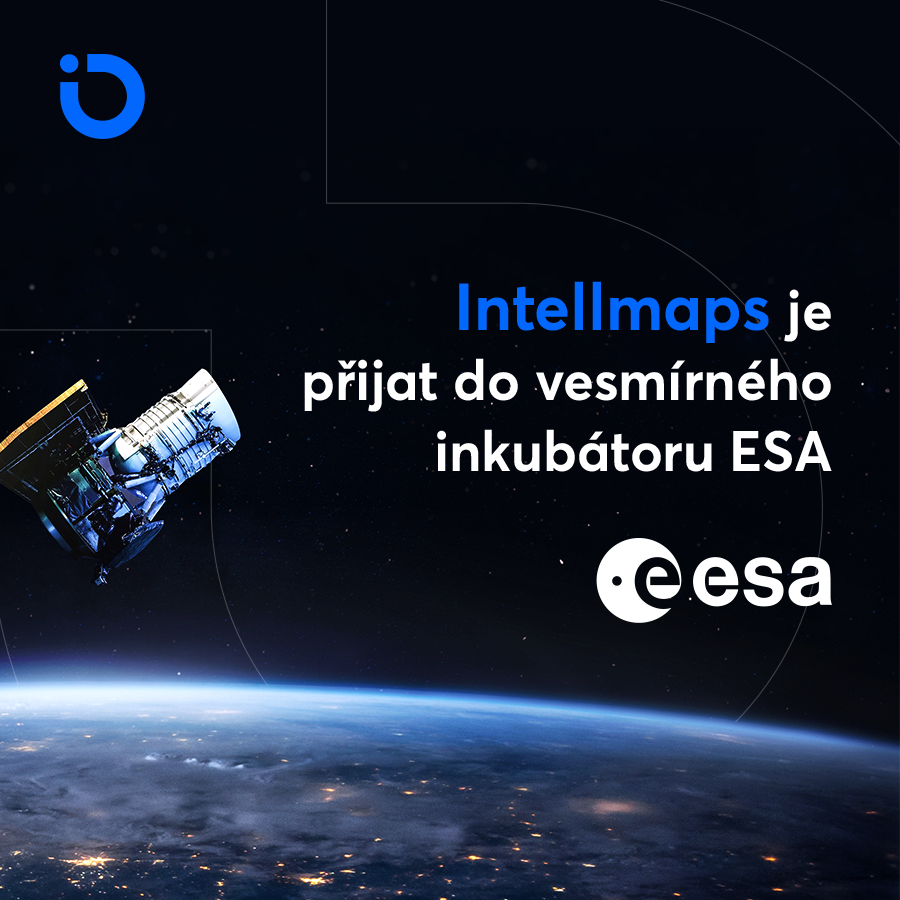
Českému start-upu Intellmaps se podařilo dostat do prestižního inkubátoru ESA (European Space Agency). Otevřela se jim tím příležitost k využití finančních prostředků na plánovaný vývoj, mezinárodní PR, umístění v samotném inkubátoru, mentoring a konzultace s předními odborníky nejen z kosmických technologií, ale také otevření celého ekosystému kolem ESA-BIC inkubátoru. Zároveň je to jistý punc kvality, […]
The post Intellmaps s.r.o. vstoupila do kosmického inkubátoru ESA (TZ) appeared first on GISportal.cz.
Eye-tracking a kartografie
28.4.2021 8:30 Katedra geoinformatiky UP OlomoucEye-tracking, technologie, která nám umožní zjistit, kam se díváte další super věc, se kterou se můžete prakticky setkat při studiu geoinformatiky v Olomouci Pokud chcete u nás studovat, neváhejte, podejte si přihlášku ve druhém kole přijímacího řízení. Ale pozor, přihlášky na doktorát jsou otevřeny jen do tohoto pátku Video vytvořil náš student Martin […]
The post Eye-tracking a kartografie appeared first on Katedra geoinformatiky.
Eye-tracking a kartografie
28.4.2021 7:30 Katedra geoinformatiky UP Olomouc Eye-tracking, technologie, která nám umožní zjistit, kam se díváte další super věc, se kterou se můžete prakticky setkat při studiu geoinformatiky v Olomouci Pokud chcete u nás studovat, neváhejte, podejte si přihlášku ve druhém kole přijímacího řízení. Ale pozor, přihlášky na doktorát jsou otevřeny jen do tohoto pátku Video vytvořil náš student Martin […]Eye-tracking a kartografie
28.4.2021 7:30 Katedra geoinformatiky UP OlomoucEye-tracking, technologie, která nám umožní zjistit, kam se díváte další super věc, se kterou se můžete prakticky setkat při studiu geoinformatiky v Olomouci Pokud chcete u nás studovat, neváhejte, podejte si přihlášku ve druhém kole přijímacího řízení. Ale pozor, přihlášky na doktorát jsou otevřeny jen do tohoto pátku Video vytvořil náš student Martin […]
The post Eye-tracking a kartografie appeared first on Katedra geoinformatiky.
Eye-tracking a kartografie
28.4.2021 7:30 Katedra geoinformatiky UP OlomoucEye-tracking, technologie, která nám umožní zjistit, kam se díváte další super věc, se kterou se můžete prakticky setkat při studiu geoinformatiky v Olomouci Pokud chcete u nás studovat, neváhejte, podejte si přihlášku ve druhém kole přijímacího řízení. Ale pozor, přihlášky na doktorát jsou otevřeny jen do tohoto pátku Video vytvořil náš student Martin […]
The post Eye-tracking a kartografie appeared first on Katedra geoinformatiky.
vrchní referent / rada v oddělení dokumentace Katastrálního pracoviště Trutnov
28.4.2021 6:07 ČÚZK - předpisy a opatření Katastrální úřad pro Královéhradecký kraj Katastrální pracoviště Trutnovvypisuje výběrové řízení na místo
vrchní referent / rada v oddělení dokumentace Katastrálního pracoviště Trutnov
vrchní referent / rada v oddělení dokumentace Katastrálního pracoviště Trutnov
28.4.2021 6:07 ČÚZK /Urady/Katastralni-urady/Katastralni-urady/Katastralni-urad-pro-Kralovehradecky-kraj/Volna-mista/DMS/vrchni-referent-rada-v-oddeleni-dokumentace-Katavrchní referent / rada v oddělení dokumentace Katastrálního pracoviště Trutnov
28.4.2021 6:07 ČÚZK - volná místa Katastrální úřad pro Královéhradecký kraj Katastrální pracoviště Trutnov vypisuje výběrové řízení na místo vrchní referent / rada v oddělení dokumentace Katastrálního pracoviště TrutnovAPGEO - Hospodářský výbor PSP ČR doporučil doplnění geodetů do stavebního zákona
28.4.2021 2:00 Asociace podnikatelů v geomatice Hospodářský výbor Poslanecké sněmovny PČR na svém dnešním zasedání jednomyslně doporučil Sněmovně ke schválení ...S&P CoreLogic Case-Shiller Index Reports 12.0% Annual Home Price Gain In February 2021
27.4.2021 19:16 GISCafe.com Webcasts-Webinars NEW YORK, April 27, 2021 — (PRNewswire) — S&P Dow Jones Indices (S&P DJI) today released the latest results for the S&P …T-MAPY oznamují majetkové propojení se společností GRID
27.4.2021 16:55 T-MAPYThe post T-MAPY oznamují majetkové propojení se společností GRID appeared first on T-MAPY spol. s r.o..
ScaleOut Software Announces Geospatial Mapping for its ScaleOut Digital Twin Streaming Service™
27.4.2021 16:38 GISCafe.com Webcasts-Webinars Users can bring analytics to life with visualizations that provide richer dynamic context and situational awarenessBELLEVUE, Wash. — (BUSINESS …
XAG Drones Joining Australian Taskforce to Defend Land from Invasion of Noxious Weed
27.4.2021 16:38 GISCafe.com Webcasts-Webinars SYDNEY, April 27, 2021 — (PRNewswire) — As Australia has long been troubled by the threat of invasive weeds, XAG Agricultural Drone …rada/odborný rada – kontrolor Katastrálního úřadu pro hlavní město Prahu
27.4.2021 16:02 ČÚZK /Urady/Katastralni-urady/Katastralni-urady/Katastralni-urad-pro-hlavni-mesto-Prahu/Uredni-deska/Oznameni-a-jina-uredni-sdeleni/Volna-mista/DMS/rada-odborny-rada-–-kontrolor-Katastralniho-uradurada/odborný rada – kontrolor Katastrálního úřadu pro hlavní město Prahu
27.4.2021 16:02 ČÚZK - předpisy a opatření Katastrální úřad pro hlavní město Prahuvypisuje výběrové řízení na místo
rada/odborný rada – kontrolor Katastrálního úřadu pro hlavní město Prahu
rada/odborný rada – kontrolor Katastrálního úřadu pro hlavní město Prahu
27.4.2021 16:02 ČÚZK - volná místa Katastrální úřad pro hlavní město Prahu vypisuje výběrové řízení na místo rada/odborný rada – kontrolor Katastrálního úřadu pro hlavní město Prahuvrchní referent/odborný referent – informační a kontrolní pracovník
27.4.2021 15:54 ČÚZK - předpisy a opatření Katastrální úřad pro hlavní město Prahu - Katastrální pracoviště Prahavypisuje výběrové řízení na místo
vrchní referent/odborný referent – informační a kontrolní pracovník
vrchní referent/odborný referent – informační a kontrolní pracovník
27.4.2021 15:54 ČÚZK /Urady/Katastralni-urady/Katastralni-urady/Katastralni-urad-pro-hlavni-mesto-Prahu/Uredni-deska/Oznameni-a-jina-uredni-sdeleni/Volna-mista/DMS/vrchni-referent-odborny-referent-–-informacni-a-kovrchní referent/odborný referent – informační a kontrolní pracovník
27.4.2021 15:54 ČÚZK - volná místa Katastrální úřad pro hlavní město Prahu - Katastrální pracoviště Praha vypisuje výběrové řízení na místo vrchní referent/odborný referent – informační a kontrolní pracovníkodborný referent / vrchní referent v oddělení aktualizace katastru nemovitostí Katastrálního pracovi
27.4.2021 9:51 ČÚZK - volná místa Katastrální úřad pro Královéhradecký kraj Katastrální pracoviště Hradec Králové vypisuje výběrové řízení na místo odborný referent / vrchní referent v oddělení aktualizace katastru nemovitostí Katastrálního pracoviodborný referent / vrchní referent v oddělení aktualizace katastru nemovitostí Katastrálního pracovi
27.4.2021 9:51 ČÚZK - předpisy a opatření Katastrální úřad pro Královéhradecký kraj Katastrální pracoviště Hradec Královévypisuje výběrové řízení na místo
odborný referent / vrchní referent v oddělení aktualizace katastru nemovitostí Katastrálního pracoviště Hradec Králové
odborný referent / vrchní referent v oddělení aktualizace katastru nemovitostí Katastrálního pracovi
27.4.2021 9:51 ČÚZK /Urady/Katastralni-urady/Katastralni-urady/Katastralni-urad-pro-Kralovehradecky-kraj/Uredni-deska/Oznameni-a-jina-uredni-sdeleni/Volna-mista/DMS/odborny-referent-vrchni-referent-v-oddeleni-aktuvrchní referent/rada – kontrola aktualizace
27.4.2021 9:26 ČÚZK - volná místa Katastrální úřad pro Olomoucký kraj - Katastrální pracoviště Přerov vypisuje výběrové řízení na místo vrchní referent/rada – kontrola aktualizacevrchní referent/rada – kontrola aktualizace
27.4.2021 9:26 ČÚZK - předpisy a opatření Katastrální úřad pro Olomoucký kraj - Katastrální pracoviště Přerovvypisuje výběrové řízení na místo
vrchní referent/rada – kontrola aktualizace
vrchní referent/rada – kontrola aktualizace
27.4.2021 9:26 ČÚZK /Urady/Katastralni-urady/Katastralni-urady/Katastralni-urad-pro-Olomoucky-kraj/Uredni-deska/Oznameni-a-jina-uredni-sdeleni/Volna-mista/vrchni-referent-rada-–-kontrola-aktualizaceAtlas Moravskoslezského kraje
27.4.2021 9:05 Katedra geoinformatiky UP OlomoucPředstavujeme vám nový tematický atlas vytvořený pro Moravskoslezský kraj, na kterém jsme pracovali společně s Urban Planner. Atlas je rozdělen do osmi kapitol, ve kterých najdete celkem 532 prvků, z toho 111 map, 93 grafů a diagramů, 12 schémat, 74 tabulek a přehledů, 123 textových polí a 119 ilustrací (fotografie a loga). Kromě obvyklých […]
The post Atlas Moravskoslezského kraje appeared first on Katedra geoinformatiky.
Portál doplnkových služieb katastra nehnuteľností KaRepoS
27.4.2021 8:30
ÚGKK SR
Dovoľujeme si Vám oznámiť, že bol spustený do overovacej prevádzky portál doplnkových služieb katastra nehnuteľností KaRepoS (Katastrálne reporty Slovenska) prístupný na adrese https://karepos.vugk.sk/
Portál poskytuje nadštandardné služby výpisu pre vlastníkov - FO a PO nad celým územím SR, ktorých základná forma je súčasťou portálu Elektronických služieb katastra nehnuteľností.
Mapy.cz jsou dostupné pro Android Auto. V automobilovém segmentu poskytují navigaci v obou klíčových systémech (TZ)
27.4.2021 8:19 GISportal.cz
Dlouho očekávaná a fanoušky žádaná novinka přichází. Mapy.cz se staly součástí systému Android Auto, který po dobu jízdy sdílí navigaci z mobilu na velkou obrazovku v přístrojové desce. Od konce loňského roku jsou Mapy.cz dostupné pro uživatele Apple platformy CarPlay. V rámci automobilového segmentu jsou tak součástí obou klíčových multimediálních systémů. Cesta Map do systému […]
The post Mapy.cz jsou dostupné pro Android Auto. V automobilovém segmentu poskytují navigaci v obou klíčových systémech (TZ) appeared first on GISportal.cz.
rada/odborný rada - vedoucí oddělení dokumentace KN Katastrálního pracoviště České Budějovice (ID SM
27.4.2021 8:06 ČÚZK - předpisy a opatření Katastrální úřad pro Jihočeský kraj Katastrální pracoviště České Budějovicevypisuje výběrové řízení na místo
rada/odborný rada - vedoucí oddělení dokumentace KN Katastrálního pracoviště České Budějovice (ID SM 30000138/30003762)
rada/odborný rada - vedoucí oddělení dokumentace KN Katastrálního pracoviště České Budějovice (ID SM
27.4.2021 8:06 ČÚZK - volná místa Katastrální úřad pro Jihočeský kraj Katastrální pracoviště České Budějovice vypisuje výběrové řízení na místo rada/odborný rada - vedoucí oddělení dokumentace KN Katastrálního pracoviště České Budějovice (ID SMrada/odborný rada - vedoucí oddělení dokumentace KN Katastrálního pracoviště České Budějovice (ID SM
27.4.2021 8:06 ČÚZK /Urady/Katastralni-urady/Katastralni-urady/Katastralni-urad-pro-Jihocesky-kraj/Uredni-deska/Oznameni-a-jina-uredni-sdeleni/Volna-mista/DMS/rada-odborny-rada-vedouci-oddeleni-dokumentace-(1)Atlas Moravskoslezského kraje
27.4.2021 8:05 Katedra geoinformatiky UP Olomouc Představujeme vám nový tematický atlas vytvořený pro Moravskoslezský kraj, na kterém jsme pracovali společně s Urban Planner. Atlas je rozdělen do osmi kapitol, ve kterých najdete celkem 532 prvků, z toho 111 map, 93 grafů a diagramů, 12 schémat, 74 tabulek a přehledů, 123 textových polí a 119 ilustrací (fotografie a loga). Kromě obvyklých […]Atlas Moravskoslezského kraje
27.4.2021 8:05 Katedra geoinformatiky UP OlomoucPředstavujeme vám nový tematický atlas vytvořený pro Moravskoslezský kraj, na kterém jsme pracovali společně s Urban Planner. Atlas je rozdělen do osmi kapitol, ve kterých najdete celkem 532 prvků, z toho 111 map, 93 grafů a diagramů, 12 schémat, 74 tabulek a přehledů, 123 textových polí a 119 ilustrací (fotografie a loga). Kromě obvyklých […]
The post Atlas Moravskoslezského kraje appeared first on Katedra geoinformatiky.
Atlas Moravskoslezského kraje
27.4.2021 8:05 Katedra geoinformatiky UP OlomoucPředstavujeme vám nový tematický atlas vytvořený pro Moravskoslezský kraj, na kterém jsme pracovali společně s Urban Planner. Atlas je rozdělen do osmi kapitol, ve kterých najdete celkem 532 prvků, z toho 111 map, 93 grafů a diagramů, 12 schémat, 74 tabulek a přehledů, 123 textových polí a 119 ilustrací (fotografie a loga). Kromě obvyklých […]
The post Atlas Moravskoslezského kraje appeared first on Katedra geoinformatiky.
Plánovaná revize údajů KN na období 2021
27.4.2021 7:12 ČÚZK - předpisy a opatření Katastrální úřad pro Jihomoravský kraj zveřejnil novou aktualitu: Plánovaná revize údajů KN na období 2021Plánovaná revize údajů KN na období 2021
27.4.2021 7:12 ČÚZK /Urady/Katastralni-urady/Katastralni-urady/Katastralni-urad-pro-Jihomoravsky-kraj/O-uradu/Aktuality/Planovana-revize-udaju-KN-na-obdobi-2021Plánovaná obnova operátu novým mapováním na období 2021
27.4.2021 7:06 ČÚZK - předpisy a opatření Katastrální úřad pro Jihomoravský kraj zveřejnil novou aktualitu: Plánovaná obnova operátu novým mapováním na období 2021Plánovaná obnova operátu novým mapováním na období 2021
27.4.2021 7:06 ČÚZK /Urady/Katastralni-urady/Katastralni-urady/Katastralni-urad-pro-Jihomoravsky-kraj/O-uradu/Aktuality/Planovana-obnova-operatu-novym-mapovanim-na-ob-(1)20210427_Oznámení o omezení provozu
27.4.2021 6:44 ČÚZK - předpisy a opatření Katastrální úřad pro Středočeský kraj - Katastrální pracoviště Nymburk zveřejnil novou aktualitu: Oznámení o omezení provozu Oznámení o omezení provozu - plánovaná údržba systému O2Ve středu dne 28.4. 2021 od 10.00 hod. z důvodu údržby dojde k částečnému výpadku služeb, nebude možný výdej listin- výpis z LV, snímky z mapy, nabývací listiny, platební terminál nebude v provozu. Příjem vkladů a záznamů není omezen.
20210427_Oznámení o omezení provozu
27.4.2021 6:44 ČÚZK /Urady/Katastralni-urady/Katastralni-urady/Katastralni-urad-pro-Stredocesky-kraj/Katastralni-pracoviste/KP-Nymburk/O-uradu/Aktuality/20210427_Oznameni-o-omezeni-provozuGKÚ Prešov hľadá operátora pre letecké laserové skenovanie LiDAR
26.4.2021 18:22 Geocommunity.skPríspevok GKÚ Prešov hľadá operátora pre letecké laserové skenovanie LiDAR zobrazený najskôr GeoCommunity.sk.
Fathom Holdings Completes Acquisition of Technology Platform LiveBy
26.4.2021 16:37 GISCafe.com Webcasts-Webinars -- LiveBy to be Integrated into Fathom's intelliAgent Software Suite, Providing Added Competitive Tools for Real Estate Professionals --CARY, N.C., …
Atlas Moravskoslezského kraje
26.4.2021 15:08 GISportal.cz
Moravskoslezský kraj se může pochlubit zcela novým atlasem, který vznikl ve spolupráci společnosti Urban Planner s. r. o. a Katedry geoinformatiky Univerzity Palackého v Olomouci. Svým čtenářům nabízí unikátní pohled na přírodní i socioekonomické charakteristiky regionu na východě země. Atlas Moravskoslezského kraje prezentuje prostorové informace kartografickými metodami ve formě různých tematických map a grafických ilustrací. […]
The post Atlas Moravskoslezského kraje appeared first on GISportal.cz.