


![]()

zprávy
zdroje zpráv:Atlas Moravskoslezského kraje
26.4.2021 15:08 GISportal.cz
Moravskoslezský kraj se může pochlubit zcela novým atlasem, který vznikl ve spolupráci společnosti Urban Planner s. r. o. a Katedry geoinformatiky Univerzity Palackého v Olomouci. Svým čtenářům nabídne unikátní pohled na přírodní i socioekonomické charakteristiky regionu. Atlas Moravskoslezského kraje prezentuje prostorové informace kartografickými metodami ve formě různých tematických map a grafických ilustrací. V několika kapitolách […]
The post Atlas Moravskoslezského kraje appeared first on GISportal.cz.
Odborný referent / vrchní referent – poskytování informací KN, poskytování podkladů, nahlížení do KN
26.4.2021 14:52 ČÚZK /Urady/Katastralni-urady/Katastralni-urady/Katastralni-urad-pro-Zlinsky-kraj/Uredni-deska/Oznameni-a-jina-uredni-sdeleni/Volna-mista/DMS/Odborny-referent-vrchni-referent-–-poskytovani-iOdborný referent / vrchní referent – poskytování informací KN, poskytování podkladů, nahlížení do KN
26.4.2021 14:52 ČÚZK - volná místa Katastrální úřad pro Zlínský kraj Katastrální pracoviště Vsetín vypisuje výběrové řízení na místo Odborný referent / vrchní referent – poskytování informací KN, poskytování podkladů, nahlížení do KNOdborný referent / vrchní referent – poskytování informací KN, poskytování podkladů, nahlížení do KN
26.4.2021 14:52 ČÚZK - předpisy a opatření Katastrální úřad pro Zlínský kraj Katastrální pracoviště Vsetínvypisuje výběrové řízení na místo
Odborný referent / vrchní referent – poskytování informací KN, poskytování podkladů, nahlížení do KN, poskytování informací PK v oddělení dokumentace KN Katastrálního pracoviště Vsetín
odborný / vrchní referent - správce informačních a komunikačních technologií v oddělení podpory ICT
26.4.2021 14:50 ČÚZK - volná místa Katastrální úřad pro Královéhradecký kraj vypisuje výběrové řízení na místo odborný / vrchní referent - správce informačních a komunikačních technologií v oddělení podpory ICTodborný / vrchní referent - správce informačních a komunikačních technologií v oddělení podpory ICT
26.4.2021 14:50 ČÚZK - předpisy a opatření Katastrální úřad pro Královéhradecký krajvypisuje výběrové řízení na místo
odborný / vrchní referent - správce informačních a komunikačních technologií v oddělení podpory ICT technického útvaru Katastrálního úřadu pro Královéhradecký kraj
odborný / vrchní referent - správce informačních a komunikačních technologií v oddělení podpory ICT
26.4.2021 14:50 ČÚZK - předpisy a opatření Katastrální úřad pro Královéhradecký kraj technický útvarvypisuje výběrové řízení na místo
odborný / vrchní referent - správce informačních a komunikačních technologií v oddělení podpory ICT technického útvaru Katastrálního úřadu pro Královéhradecký kraj
odborný / vrchní referent - správce informačních a komunikačních technologií v oddělení podpory ICT
26.4.2021 14:50 ČÚZK /Urady/Katastralni-urady/Katastralni-urady/Katastralni-urad-pro-Kralovehradecky-kraj/Uredni-deska/Oznameni-a-jina-uredni-sdeleni/Volna-mista/DMS/odborny-vrchni-referent-spravce-informacnich-aodborný / vrchní referent - správce informačních a komunikačních technologií v oddělení podpory ICT
26.4.2021 14:50 ČÚZK - volná místa Katastrální úřad pro Královéhradecký kraj technický útvar vypisuje výběrové řízení na místo odborný / vrchní referent - správce informačních a komunikačních technologií v oddělení podpory ICTUzavření parkoviště
26.4.2021 14:11 ČÚZK /Urady/Katastralni-urady/Katastralni-urady/Katastralni-urad-pro-Vysocinu/Katastralni-pracoviste/KP-Zdar-nad-Sazavou/O-uradu/Aktuality/Uzavreni-parkovisteUzavření parkoviště
26.4.2021 14:11 ČÚZK - předpisy a opatření Katastrální úřad pro Vysočinu - Katastrální pracoviště Žďár nad Sázavou zveřejnil novou aktualitu: Od 26.4.2021 do odvolání je parkoviště u Katastrálního pracoviště ve Ždáru nad Sázavou, Strojírenská 8, Žďár nad Sázavou z technických důvodů uzavřeno.Příchod ke Katastrálnímu pracovišti ve Žďáru nad Sázavou je umožněn pouze po chodníku.
Termíny státních závěrečných zkoušek [Katedra aplikované geoinformatiky a kartografie, byTopic]
26.4.2021 14:10 Katedra aplikované geoinformatiky a kartografie Přf UK Termíny pro bakalářské a magisterské obory - jaro 2021.Změny v podpoře webových prohlížečů
26.4.2021 13:00 ČÚZK - Geoportál Změny v podpoře webových prohlížečůSpolečnost Microsoft před časem ukončila podporu svých starších webových prohlížečů, tedy Internet Explorer a starší verzi Microsoft Edge (Legacy).
Zeměměřický úřad na začátku května aktualizuje webové aplikace Geoprohlížeč, Archiv, Analýzy výškopisu a Jména světa, které již nebudou v uvedených prohlížečích podporovány.
Změny v podpoře webových prohlížečů
26.4.2021 13:00 ČÚZK - Geoportál Změny v podpoře webových prohlížečůSpolečnost Microsoft před časem ukončila podporu svých starších webových prohlížečů, tedy Internet Explorer a starší verzi Microsoft Edge (Legacy).
Zeměměřický úřad na začátku května aktualizuje webové aplikace Geoprohlížeč, Archiv, Analýzy výškopisu a Jména světa, které již nebudou v uvedených prohlížečích podporovány.
Copernicus Masters 2021 submissions open
26.4.2021 12:30 ESA Observing the Earth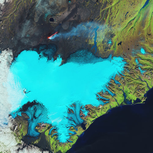
The Copernicus Masters 2021 competition is now open for submissions. This international competition awards prizes to innovative solutions, developments and ideas for business and society that use satellite data from the Copernicus programme.
20210426_Odborný referent oddělení aktualizace PI KN I.
26.4.2021 9:01 ČÚZK /Urady/Katastralni-urady/Katastralni-urady/Katastralni-urad-pro-Stredocesky-kraj/Katastralni-pracoviste/KP-Praha-zapad/O-uradu/Aktuality/20210113_odborny-rada,-reditel-Katastralniho-p-(2)20210426_Odborný referent oddělení aktualizace PI KN I.
26.4.2021 9:01 ČÚZK - předpisy a opatření Katastrální úřad pro Středočeský kraj - Katastrální pracoviště Praha-západ Vyhlášení výběrového řízení: Odborný referent oddělení aktualizace PI KN I. V části "Úřední deska", v sekci "Oznámení a jiná úřední sdělení" bylo vystaveno "Oznámení o vyhlášení výběrového řízení na obsazení služebního místa Odborný referent oddělení aktualizace PI KN I."Nová poštovní známka připomíná vznik první turistické trasy (TZ)
26.4.2021 7:49 GISportal.cz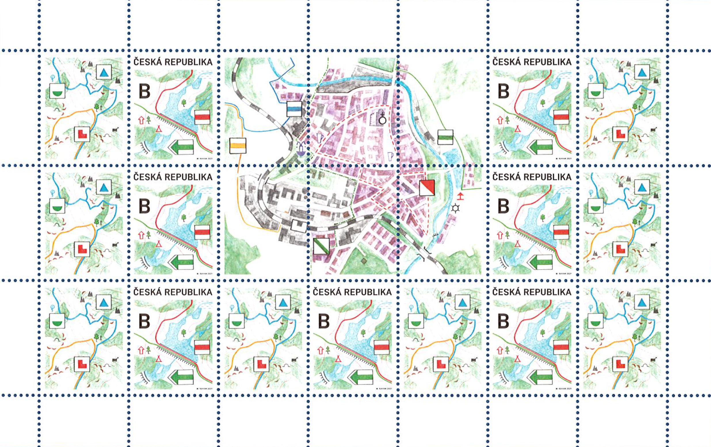
Česká pošta představila 21. dubna novou výplatní písmenovou známku s kupóny pro přítisky, jejímž motivem je fiktivní mapa s turistickými značkami. Cenina z autorské dílny Mikuláše Kavana tak upozornila na 132 let od vzniku první značené turistické trasy na našem území. Značení turistických tras má v České republice dlouholetou tradici. První pěší turistická trasa vznikla […]
The post Nová poštovní známka připomíná vznik první turistické trasy (TZ) appeared first on GISportal.cz.
Výzva k podání návrhu - Čejkovice
26.4.2021 0:00 Státní pozemkový úřad SPÚ vyhlašuje výzvu k podání návrhů na uzavření nájemní smlouvy - ČejkoviceTurboCAD PLATINUM 27 CZ v akční ceně s bonusy do 05. 05. 2021
25.4.2021 18:48 ŠPINAR - softwareVážení zákazníci,
dovolujeme si Vám nabídnout program TurboCAD PLATINUM 27 CZ pro kreslení ve 2D / 3D včetně vizualizací s akční slevou a bonusy do 5. 5. 2021.
The post TurboCAD PLATINUM 27 CZ v akční ceně s bonusy do 05. 05. 2021 appeared first on ŠPINAR – software.
TurboCAD PLATINUM 27 CZ v akční ceně s bonusy do 05. 05. 2021
25.4.2021 18:48 ŠPINAR - software Vážení zákazníci,dovolujeme si Vám nabídnout program TurboCAD PLATINUM 27 CZ pro kreslení ve 2D / 3D včetně vizualizací s akční slevou a bonusy do 5. 5. 2021.
Europa Technologies launches europaIQ property intelligence
24.4.2021 3:03 GISCafe.com Webcasts-Webinars Europa Technologies has launched europaIQ, a suite of property intelligence data for Great Britain which can provide new and deeper insights into …Maptek shares innovation stories at Connect 2021 on May 19
24.4.2021 2:45 GISCafe.com Webcasts-Webinars Global technology provider Maptek has released the program for a 24-hour online conference on May 19 as part of its 40-year anniversary …View from Munich: 2021 a key year for the EU Space Programme
23.4.2021 14:54 European GNSS Agency
Following the challenges of 2020, this year will be a key year for the EU Space Programme, European GNSS Agency (GSA) Executive Director Rodrigo da Costa said at a panel discussion at the Munich Satellite Navigation Conference, which was held online on March 16-17. The GSA executive director went on to outline some of the upcoming events to look forward to in the year ahead.
The decision to expand the GSA into the European Union Agency for the Space Programme (EUSPA) was motivated, among others, by a desire to support Europe’s investment in space, da Costa told the Munich conference participants, adding that this was yet another confirmation that space is an economic enabler with a positive spill-over effect in many sectors of the economy.
“With EUSPA, new horizons are opening up and the generation of synergies between the different components of the space programme is very much in focus,” he said. Da Costa added that, by combining navigation and Earth observation it would be possible to create value-adding solutions, for example, that mitigate the risk of disasters like oil spills, illegal fishing, or support new precision agriculture practices.
Galileo and EGNOS update
Guerric Pont, Acting Head of Galileo Services Department shared some achievements in the system’s infrastructure, regulatory framework, services and the major milestones in the development of Galileo 2nd generation. The data on positioning, navigation and timing (PNT) show the remarkable performance of Galileo, and its unique search and rescue (SAR) feature – the return link – which regularly and reliably contributes to the rescue missions all across the globe.
“With new services in development: Emergency Warning Service, High Accuracy and Authentication Service (HAAS) and the contribution to the Safety of Life (SoL), Galileo keeps delivering added value to European citizens, business communities and governmental bodies, and its potential for synergies with other EU Space Programme components makes the future of European space bright,” said Pont.
Vincent Brison, GNSS Operations and Maintenance Manager from the EGNOS Programme highlighted some of the novelties we can expect from EGNOS in the near future, such as the EGNOS internal waterways and maritime service. In the rail sector also, EGNOS is currently being included in the European Rail Traffic Management System (ERTMS) and an EGNSS service for train localisation is under study. “The extension of EGNOS coverage to North Africa and Ukraine is currently planned and the possibility of an extension to Iceland, the Middle East and Africa is being assessed,” he said.
EUSpace: A flourishing market
With respect to precision agriculture, a session on EU Space for Agriculture highlighted that the creation of EUSPA put space data and services at the heart of a technological and digital revolution in agriculture, helping Europe to accelerate its transition to a sustainable food system, mitigate and adapt to the effects of climate change, and reverse its loss of biodiversity.
And this: GSA publishes High Accuracy Service information update
A session on the GNSS industry’s response to the current pandemic highlighted how a number of GNSS-based solutions had helped to resolve issues caused by lockdowns, interruption of supply chains and operations, and the re-introduction of border controls. Among these, the Galileo Green Lane application made a significant contribution to keeping intra-continental road traffic flowing, without queues and delays. Another session dedicated to critical trends for future navigation and timing systems presented technology trends in PNT user equipment, highlighting the key role of four criteria: accuracy, ubiquity, security and connectivity.
With respect to the Galileo Public Regulated Service (PRS), it was noted that the GSA is actively contributing to the development of all areas of the PRS user segment, to continuously meet user needs, and is supporting PRS joint test activities with Member States. The Agency is also planning to launch a consultation on a PRS technology and service roadmap to support the development of the PRS user segment and market uptake to 2027 in the field of user equipment and dedicated infrastructure.
Looking ahead
In her address at the conference, GSA Head of Market Development Fiammetta Diani outlined some of the new challenges ahead for the Galileo programme, including completing uptake in longer-term market segments, leveraging the programme’s differentiators to position Galileo as a market leader and supporting the EU downstream industry, with a focus on competitiveness and innovation of SMEs and start-ups.
Executive Director da Costa stressed that, just like its predecessor, EUSPA would continue to link space to user needs and maximize its efforts to bring the benefits of space down to Earth for all EU citizens.
Media note: This feature can be republished without charge provided the European GNSS Agency (GSA) is acknowledged as the source at the top or the bottom of the story. You must request permission before you use any of the photographs on the site. If you republish, we would be grateful if you could link back to the GSA website (http://www.gsa.europa.eu).
View from Munich: 2021 a key year for the EU Space Programme
23.4.2021 14:54 European GNSS AgencyFollowing the challenges of 2020, this year will be a key year for the EU Space Programme, European GNSS Agency (GSA) Executive Director Rodrigo da Costa said at a panel discussion at the Munich Satellite Navigation Conference, which was held online on March 16-17. The GSA executive director went on to outline some of the upcoming events to look forward to in the year ahead.
The decision to expand the GSA into the European Union Agency for the Space Programme (EUSPA) was motivated, among others, by a desire to support Europe’s investment in space, da Costa told the Munich conference participants, adding that this was yet another confirmation that space is an economic enabler with a positive spill-over effect in many sectors of the economy.
“With EUSPA, new horizons are opening up and the generation of synergies between the different components of the space programme is very much in focus,” he said. Da Costa added that, by combining navigation and Earth observation it would be possible to create value-adding solutions, for example, that mitigate the risk of disasters like oil spills, illegal fishing, or support new precision agriculture practices.
Galileo and EGNOS update
Guerric Pont, Acting Head of Galileo Services Department shared some achievements in the system’s infrastructure, regulatory framework, services and the major milestones in the development of Galileo 2nd generation. The data on positioning, navigation and timing (PNT) show the remarkable performance of Galileo, and its unique search and rescue (SAR) feature – the return link – which regularly and reliably contributes to the rescue missions all across the globe.
“With new services in development: Emergency Warning Service, High Accuracy and Authentication Service (HAAS) and the contribution to the Safety of Life (SoL), Galileo keeps delivering added value to European citizens, business communities and governmental bodies, and its potential for synergies with other EU Space Programme components makes the future of European space bright,” said Pont.
Vincent Brison, GNSS Operations and Maintenance Manager from the EGNOS Programme highlighted some of the novelties we can expect from EGNOS in the near future, such as the EGNOS internal waterways and maritime service. In the rail sector also, EGNOS is currently being included in the European Rail Traffic Management System (ERTMS) and an EGNSS service for train localisation is under study. “The extension of EGNOS coverage to North Africa and Ukraine is currently planned and the possibility of an extension to Iceland, the Middle East and Africa is being assessed,” he said.
EUSpace: A flourishing market
With respect to precision agriculture, a session on EU Space for Agriculture highlighted that the creation of EUSPA put space data and services at the heart of a technological and digital revolution in agriculture, helping Europe to accelerate its transition to a sustainable food system, mitigate and adapt to the effects of climate change, and reverse its loss of biodiversity.
And this: GSA publishes High Accuracy Service information update
A session on the GNSS industry’s response to the current pandemic highlighted how a number of GNSS-based solutions had helped to resolve issues caused by lockdowns, interruption of supply chains and operations, and the re-introduction of border controls. Among these, the Galileo Green Lane application made a significant contribution to keeping intra-continental road traffic flowing, without queues and delays. Another session dedicated to critical trends for future navigation and timing systems presented technology trends in PNT user equipment, highlighting the key role of four criteria: accuracy, ubiquity, security and connectivity.
With respect to the Galileo Public Regulated Service (PRS), it was noted that the GSA is actively contributing to the development of all areas of the PRS user segment, to continuously meet user needs, and is supporting PRS joint test activities with Member States. The Agency is also planning to launch a consultation on a PRS technology and service roadmap to support the development of the PRS user segment and market uptake to 2027 in the field of user equipment and dedicated infrastructure.
Looking ahead
In her address at the conference, GSA Head of Market Development Fiammetta Diani outlined some of the new challenges ahead for the Galileo programme, including completing uptake in longer-term market segments, leveraging the programme’s differentiators to position Galileo as a market leader and supporting the EU downstream industry, with a focus on competitiveness and innovation of SMEs and start-ups.
Executive Director Da Costa stressed that, just like its predecessor, EUSPA would continue to link space to user needs and maximize its efforts to bring the benefits of space down to Earth for all EU citizens.
Media note: This feature can be republished without charge provided the European GNSS Agency (GSA) is acknowledged as the source at the top or the bottom of the story. You must request permission before you use any of the photographs on the site. If you republish, we would be grateful if you could link back to the GSA website (http://www.gsa.europa.eu).
View from Munich: 2021 a key year for the EU Space Programme
23.4.2021 14:54 European GNSS AgencyFollowing the challenges of 2020, this year will be a key year for the EU Space Programme, European GNSS Agency (GSA) Executive Director Rodrigo da Costa said at a panel discussion at the Munich Satellite Navigation Conference, which was held online on March 16-17. The GSA executive director went on to outline some of the upcoming events to look forward to in the year ahead.
The decision to expand the GSA into the European Union Agency for the Space Programme (EUSPA) was motivated, among others, by a desire to support Europe’s investment in space, da Costa told the Munich conference participants, adding that this was yet another confirmation that space is an economic enabler with a positive spill-over effect in many sectors of the economy.
“With EUSPA, new horizons are opening up and the generation of synergies between the different components of the space programme is very much in focus,” he said. Da Costa added that, by combining navigation and Earth observation it would be possible to create value-adding solutions, for example, that mitigate the risk of disasters like oil spills, illegal fishing, or support new precision agriculture practices.
Galileo and EGNOS update
Guerric Pont, Acting Head of Galileo Services Department shared some achievements in the system’s infrastructure, regulatory framework, services and the major milestones in the development of Galileo 2nd generation. The data on positioning, navigation and timing (PNT) show the remarkable performance of Galileo, and its unique search and rescue (SAR) feature – the return link – which regularly and reliably contributes to the rescue missions all across the globe.
“With new services in development: Emergency Warning Service, High Accuracy and Authentication Service (HAAS) and the contribution to the Safety of Life (SoL), Galileo keeps delivering added value to European citizens, business communities and governmental bodies, and its potential for synergies with other EU Space Programme components makes the future of European space bright,” said Pont.
Vincent Brison, GNSS Operations and Maintenance Manager from the EGNOS Programme highlighted some of the novelties we can expect from EGNOS in the near future, such as the EGNOS internal waterways and maritime service. In the rail sector also, EGNOS is currently being included in the European Rail Traffic Management System (ERTMS) and an EGNSS service for train localisation is under study. “The extension of EGNOS coverage to North Africa and Ukraine is currently planned and the possibility of an extension to Iceland, the Middle East and Africa is being assessed,” he said.
EUSpace: A flourishing market
With respect to precision agriculture, a session on EU Space for Agriculture highlighted that the creation of EUSPA put space data and services at the heart of a technological and digital revolution in agriculture, helping Europe to accelerate its transition to a sustainable food system, mitigate and adapt to the effects of climate change, and reverse its loss of biodiversity.
And this: GSA publishes High Accuracy Service information update
A session on the GNSS industry’s response to the current pandemic highlighted how a number of GNSS-based solutions had helped to resolve issues caused by lockdowns, interruption of supply chains and operations, and the re-introduction of border controls. Among these, the Galileo Green Lane application made a significant contribution to keeping intra-continental road traffic flowing, without queues and delays. Another session dedicated to critical trends for future navigation and timing systems presented technology trends in PNT user equipment, highlighting the key role of four criteria: accuracy, ubiquity, security and connectivity.
With respect to the Galileo Public Regulated Service (PRS), it was noted that the GSA is actively contributing to the development of all areas of the PRS user segment, to continuously meet user needs, and is supporting PRS joint test activities with Member States. The Agency is also planning to launch a consultation on a PRS technology and service roadmap to support the development of the PRS user segment and market uptake to 2027 in the field of user equipment and dedicated infrastructure.
Looking ahead
In her address at the conference, GSA Head of Market Development Fiammetta Diani outlined some of the new challenges ahead for the Galileo programme, including completing uptake in longer-term market segments, leveraging the programme’s differentiators to position Galileo as a market leader and supporting the EU downstream industry, with a focus on competitiveness and innovation of SMEs and start-ups.
Executive Director da Costa stressed that, just like its predecessor, EUSPA would continue to link space to user needs and maximize its efforts to bring the benefits of space down to Earth for all EU citizens.
Media note: This feature can be republished without charge provided the European GNSS Agency (GSA) is acknowledged as the source at the top or the bottom of the story. You must request permission before you use any of the photographs on the site. If you republish, we would be grateful if you could link back to the GSA website (http://www.gsa.europa.eu).
Odborný referent/vrchní referent v oddělení právním č.2 na Katastrálním pracovišti Brno - město
23.4.2021 10:58 ČÚZK - volná místa Katastrální úřad pro Jihomoravský kraj Katastrální pracoviště Brno-město vypisuje výběrové řízení na místo Odborný referent/vrchní referent v oddělení právním č.2 na Katastrálním pracovišti Brno - městoOdborný referent/vrchní referent v oddělení právním č.2 na Katastrálním pracovišti Brno - město
23.4.2021 10:58 ČÚZK - předpisy a opatření Katastrální úřad pro Jihomoravský kraj Katastrální pracoviště Brno-městovypisuje výběrové řízení na místo
Odborný referent/vrchní referent v oddělení právním č.2 na Katastrálním pracovišti Brno - město
Odborný referent/vrchní referent v oddělení právním č.2 na Katastrálním pracovišti Brno - město
23.4.2021 10:58 ČÚZK /Urady/Katastralni-urady/Katastralni-urady/Katastralni-urad-pro-Jihomoravsky-kraj/Uredni-deska/Oznameni-a-jina-uredni-sdeleni/Volna-mista/DMS/Odborny-referent-vrchni-referent-v-oddeleni-pravniEvropská Komise finálně schválila U-Space nařízení a je publikován český překlad
23.4.2021 10:23 UAVAEvropská komise po EASA Committee finálně včera schválila regulaci k U-Space, které bude v EU platit od 26.1.2023. K tomuto nařízení je připravováno ještě AMC a GM (přijatelné způsoby průkazu a poradenský materiál), které do konce tohoto roku připravuje EASA s expertní skupinou v které je prezident Aliance UAVA. Současně dnes byl publikován i český […]
The post Evropská Komise finálně schválila U-Space nařízení a je publikován český překlad appeared first on UAV Aliance pro bezpilotní letecký průmysl.
ESA-backed autonomous driving lab set for Italy
23.4.2021 10:10 ESA Navigation
Central Italy – already home to an ambitious national autonomous driving research initiative – will be the site of the ESA-backed P-CARS laboratory, intended to certify positioning devices for use within driverless cars.
Earth from Space: Laizhou Bay
23.4.2021 10:00 ESA Observing the Earth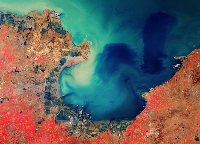
The Copernicus Sentinel-2 mission takes us over the sediment-stained waters in Laizhou Bay, located on the southern shores of the Bohai Sea, on the east coast of mainland China.
Earth from Space: Laizhou Bay
23.4.2021 10:00 ESA Observing the Earth
The Copernicus Sentinel-2 mission takes us over the sediment-stained waters in Laizhou Bay, located on the southern shores of the Bohai Sea, on the east coast of mainland China.
Every Day is Earth Day at MAPS.COM
23.4.2021 9:00 GISCafe.com Webcasts-Webinars Company Values Align with the EnvironmentSANTA BARBARA, Calif., April 22, 2021 — (PRNewswire) — Earth Day, an event with a …
Map of the Month: GfK Purchasing Power in Germany, Austria and Switzerland 2021
23.4.2021 9:00 GISCafe.com Webcasts-Webinars GfK’s Map of the Month for April shows the regional distribution of purchasing power in Germany, Austria and Switzerland in 2021.With an …
NMCAs point way for Europe to become global hub for trustworthy artificial intelligence
23.4.2021 9:00 GISCafe.com Webcasts-Webinars National Mapping, Cadastral and Land Registration Authorities (NMCAs) expertise in providing reliable, authoritative data has a significant part to …ProStar Partners with Vivax Metrotech to Integrate PointMan into the First Utility Locate Device with Integrated RTK GNSS Receiver
23.4.2021 9:00 GISCafe.com Webcasts-Webinars GRAND JUNCTION, Colo., April 22, 2021 — (PRNewswire) — ProStar Holdings Inc. ("ProStar®" or the "the Company") (TSXV:MAPS) …Wiltshire uses Bluesky National Tree Map to Manage Public Tree Stock
23.4.2021 9:00 GISCafe.com Webcasts-Webinars Leicestershire, UK, 22 April 2021 – The UK’s Wiltshire Council is using data from a map which details the location and attributes of more …20210423 - změna úředních hodin od 26.4.2021
23.4.2021 8:26 ČÚZK /Urady/Katastralni-urady/Katastralni-urady/Katastralni-urad-pro-Ustecky-kraj/Katastralni-pracoviste/KP-Chomutov/O-uradu/Aktuality/20210423-zmena-urednich-hodin-od-26-4-202120210423 - změna úředních hodin od 26.4.2021
23.4.2021 8:26 ČÚZK - předpisy a opatření Katastrální úřad pro Ústecký kraj - Katastrální pracoviště Chomutov zveřejnil novou aktualitu: S účinností od 26.4.2021 je provedena změna Úředních hodin na Katastrálním pracovišti Chomutov Katastrálního úřadu pro Ústecký kraj.Úřední hodiny jsou nově pro všechny agendy:
Pondělí, Středa : 8:00 - 17:00
Úterý, Čtvrtek : 8:00 - 14:00
Pátek : 8:00 - 12:00
Výběrové řízení
23.4.2021 8:02 ČÚZK - předpisy a opatření Katastrální úřad pro Plzeňský kraj - Katastrální pracoviště Tachov zveřejnil novou aktualitu: Ředitelka Katastrálního úřadu pro Plzeňský kraj vyhlašuje výběrové řízení na služební místo odborný referent/vrchní referent – zápisy v řízení V a Z ZRVZ1501, oddělení právních vztahů k nemovitostem, Katastrální úřad pro Plzeňský kraj, Katastrální pracoviště Tachov, v oboru služby 55. Zeměměřictví a katastr nemovitostí.Odborný referent/vrchní referent – zápisy v řízení V a Z ZRVZ1501
23.4.2021 7:58 ČÚZK - volná místa Katastrální úřad pro Plzeňský kraj Katastrální pracoviště Tachov vypisuje výběrové řízení na místo Odborný referent/vrchní referent – zápisy v řízení V a Z ZRVZ1501Odborný referent/vrchní referent – zápisy v řízení V a Z ZRVZ1501
23.4.2021 7:58 ČÚZK /Urady/Katastralni-urady/Katastralni-urady/Katastralni-urad-pro-Plzensky-kraj/Uredni-deska/Oznameni-a-jina-uredni-sdeleni/Volna-mista/DMS/Odborny-referent-vrchni-referent-–-zapisy-v-rizeniOdborný referent/vrchní referent – zápisy v řízení V a Z ZRVZ1501
23.4.2021 7:58 ČÚZK - předpisy a opatření Katastrální úřad pro Plzeňský kraj Katastrální pracoviště Tachovvypisuje výběrové řízení na místo
Odborný referent/vrchní referent – zápisy v řízení V a Z ZRVZ1501
Změna úředních hodin
23.4.2021 7:50 ČÚZK - předpisy a opatření Katastrální úřad pro Středočeský kraj - Katastrální pracoviště Slaný zveřejnil novou aktualitu: Změna úředních hodinS účinností od 3.5.2021 dojde ke změně úředních hodin na KP Slaný.
Podatelna a Poskytování údajů z KN:
Pondělí, Středa 8:00 - 17:00 hodin
Úterý, Čtvrtek 8:00 - 14:00 hodin
Pátek 8:00 - 12:00 hodin
Změna úředních hodin
23.4.2021 7:50 ČÚZK - předpisy a opatření Katastrální úřad pro Středočeský kraj - Katastrální pracoviště Slaný zveřejnil novou aktualitu: Změna úředních hodinS účinností od 3.5.2021 dojde ke změně úředních hodin na KP Slaný:
Pondělí, Středa 8:00 - 17:00 hodin
Úterý, Čtvrtek 8:00 - 14:00 hodin
Pátek 8:00 - 12:00 hodin
One week until application deadline for WOC Internship Program
23.4.2021 0:17 GISCafe.com Webcasts-Webinars GLOBAL OCEAN SUSTAINABLE DEVELOPMENT INTERNSHIP OPPORTUNITIES WITH THE WORLD OCEAN COUNCILWOC Invites Graduate Students and Early Career …
May GeoInnovation Speaker Series: How Businesses Can Gain a Competitive Edge Using Geospatial Technology
23.4.2021 0:12 GISCafe.com Webcasts-Webinars May 5 discussion will feature Will Cadell, the Chief Executive Officer of SparkGeo, and be moderated by Tony Sardella, Vice Chairman and Founder, …Výzva k podání návrhu - Valtice
23.4.2021 0:00 Státní pozemkový úřad SPÚ vyhlašuje výzvu k podání návrhů na uzavření pachtovní smlouvy - Valtice
Výzva k podání návrhu - Valtice
23.4.2021 0:00 Státní pozemkový úřad SPÚ vyhlašuje výzvu k podání návrhů na uzavření pachtovní smlouvy - ValticeArora ATLAS® Fix and ATLAS® Inspect Implemented by Broward County's FLL
22.4.2021 21:13 GISCafe.com Webcasts-Webinars CHADDS FORD, Pa., April 22, 2021 — (PRNewswire) — Broward County's Fort Lauderdale-Hollywood International Airport (FLL) has …Skycatch Announces New Technology Initiatives to Achieve Climate-Resilient Infrastructure Globally
22.4.2021 17:23 GISCafe.com Webcasts-Webinars Skycatch unveils new initiatives to help companies and governments worldwide combat climate change with digital twin technology in construction, …HERE Marketplace to include Tomorrow.io weather data to improve operational efficiency for enterprises
22.4.2021 16:33 GISCafe.com Webcasts-Webinars Tomorrow.io weather data accessible via HERE Marketplace to help enterprises manage weather related challenges with information and insightsWeather …Space synergies serving the environment
22.4.2021 11:08 European GNSS Agency
On Earth Day, which is celebrated on April 22, it has become a tradition for us to take a look at how the European Space programme, Galileo, EGNOS and Copernicus, is helping to protect the environment by driving innovation and enabling solutions that increase efficiency across a wide range of sectors, from aviation and maritime transport to energy and engineering. However, it is in the agriculture sector in particular that synergies between the three EU space components are helping to reduce the environmental footprint.
EU farmers are leveraging synergies between Galileo, EGNOS and Copernicus to increase crop productivity, make processes more efficient and reduce resource use with a view to improving their environmental footprint. One example of this is the Spanish company Ixoriguè, which is leveraging satellite and other technology to optimise processes in mountain stockbreeding, which is usually difficult to achieve due to the challenging geographical terrain.
Read this: Space synergies key for EUSPA
The Ixoriguè solution is an excellent example of how by integrating satellite positioning, sensors, Earth observation with data management and analysis, it is possible to respond to various livestock management needs. In the solution, better geo-localization performance is achieved thanks to Galileo, and when this is combined with Copernicus Sentinel 1 and Sentinel 2 Earth observation data, Ixoriguè is able to predict grazing areas and available pasture, providing data-driven recommendations to optimise pasture and cattle management.
Solutions platform
Another project that harnesses space synergies, specifically Copernicus and Galileo, in the service of more sustainable agriculture is the FaST digital service platform. Supported by the European Commission’s DG AGRI, DG DEFIS, and the EU ISA2 Programme (DG DIGIT), the platform aims to provide EU farmers, Member State Paying Agencies, farm advisors and developers of digital solutions with capabilities for agriculture, environment and sustainability. The platform uses data from Galileo and Copernicus and will help lay the foundations of a comprehensive digital ecosystem for sustainable farm and land management in Europe. It will support farmers in their administrative decision-making processes, for farm profitability and environmental sustainability.
Innovative ideas
The Farming by Satellite competition has consistently generated innovative ideas that increase efficiency and improve the environmental footprint of agriculture, and last year was no different. The contestants were tasked with creating a new sustainable and environmentally friendly agriculture solution using Galileo, EGNOS and/or Copernicus, and they did exactly that.
And this: Space synergies to drive economic growth and job creation
First prize in the 2020 edition of the competition went to the Spanish startup Graniot, for a web application that uses European satellite technologies to help agronomists and farmers monitor crops, reduce water waste and avoid poor fertilizer practices. Second prize in the competition went to the Italian team Genuine, for another web-based solution that identifies crop stress and calculates the optimal tractor path for irrigation and fertilisation using Copernicus, EGNOS and Galileo. Third prize went to AI4OceanFarming, for a solution that uses satellite data to identify ocean farming threats such as harmful algal blooms (HABs), ocean acidification (OA), and invasive species. Finally, the Africa prize winner GeoM&E monitoring coffee farms in central Kenya, and indicating the changes over time and areas where farmers could increase yield.
A key objective of the European Space Programme is to support the European Union in achieving its priority policy goals. One such policy objective is the European Green Deal. Through the projects highlighted above, and countless other initiatives, services and applications that make European industries, including agriculture, more efficient – Galileo, EGNOS and Copernicus are helping the EU to achieve its sustainability goals and to make Europe greener.
Media note: This feature can be republished without charge provided the European GNSS Agency (GSA) is acknowledged as the source at the top or the bottom of the story. You must request permission before you use any of the photographs on the site. If you republish, we would be grateful if you could link back to the GSA website (http://www.gsa.europa.eu).
Space synergies serving the environment
22.4.2021 11:08 European GNSS Agency
On Earth Day, which is celebrated on April 22, it has become a tradition for us to take a look at how the European Space programme, Galileo, EGNOS and Copernicus, is helping to protect the environment by driving innovation and enabling solutions that increase efficiency across a wide range of sectors, from aviation and maritime transport to energy and engineering. However, it is in the agriculture sector in particular that synergies between the three EU space components are helping to reduce the environmental footprint.
EU farmers are leveraging synergies between Galileo, EGNOS and Copernicus to increase crop productivity, make processes more efficient and reduce resource use with a view to improving their environmental footprint. One example of this is the Spanish company Ixoriguè, which is leveraging satellite and other technology to optimise processes in mountain stockbreeding, which is usually difficult to achieve due to the challenging geographical terrain.
Read this: Space synergies key for EUSPA
The Ixoriguè solution is an excellent example of how by integrating satellite positioning, sensors, Earth observation with data management and analysis, it is possible to respond to various livestock management needs. In the solution, better geo-localization performance is achieved thanks to Galileo, and when this is combined with Copernicus Sentinel 1 and Sentinel 2 Earth observation data, Ixoriguè is able to predict grazing areas and available pasture, providing data-driven recommendations to optimise pasture and cattle management.
Solutions platform
Another project that harnesses space synergies, specifically Copernicus and Galileo, in the service of more sustainable agriculture is the FaST digital service platform. Supported by the European Commission’s DG AGRI, DG DEFIS, and the EU ISA2 Programme (DG DIGIT), the platform aims to provide EU farmers, Member State Paying Agencies, farm advisors and developers of digital solutions with capabilities for agriculture, environment and sustainability. The platform uses data from Galileo and Copernicus and will help lay the foundations of a comprehensive digital ecosystem for sustainable farm and land management in Europe. It will support farmers in their administrative decision-making processes, for farm profitability and environmental sustainability.
Innovative ideas
The Farming by Satellite competition has consistently generated innovative ideas that increase efficiency and improve the environmental footprint of agriculture, and last year was no different. The contestants were tasked with creating a new sustainable and environmentally friendly agriculture solution using Galileo, EGNOS and/or Copernicus, and they did exactly that.
And this: Space synergies to drive economic growth and job creation
First prize in the 2020 edition of the competition went to the Spanish startup Graniot, for a web application that uses European satellite technologies to help agronomists and farmers monitor crops, reduce water waste and avoid poor fertilizer practices. Second prize in the competition went to the Italian team Genuine, for another web-based solution that identifies crop stress and calculates the optimal tractor path for irrigation and fertilisation using Copernicus, EGNOS and Galileo. Third prize went to AI4OceanFarming, for a solution that uses satellite data to identify ocean farming threats such as harmful algal blooms (HABs), ocean acidification (OA), and invasive species. Finally, the Africa prize winner GeoM&E monitoring coffee farms in central Kenya, and indicating the changes over time and areas where farmers could increase yield.
A key objective of the European Space Programme is to support the European Union in achieving its priority policy goals. One such policy objective is the European Green Deal. Through the projects highlighted above, and countless other initiatives, services and applications that make European industries, including agriculture, more efficient – Galileo, EGNOS and Copernicus are helping the EU to achieve its sustainability goals and to make Europe greener.
Media note: This feature can be republished without charge provided the European GNSS Agency (GSA) is acknowledged as the source at the top or the bottom of the story. You must request permission before you use any of the photographs on the site. If you republish, we would be grateful if you could link back to the GSA website (http://www.gsa.europa.eu).
výběrové řízení odb. referent - obnova katastrálního operátu
22.4.2021 10:51 ČÚZK - předpisy a opatření Katastrální úřad pro Jihočeský kraj zveřejnil novou aktualitu: Vypsáno výběrové řízení na služební místo odborný referent – obnova katastrálního operátu v odd. obnovy kat. operátu (3030) KÚ pro Jihočeský krajvýběrové řízení odb. referent - obnova katastrálního operátu
22.4.2021 10:51 ČÚZK /Urady/Katastralni-urady/Katastralni-urady/Katastralni-urad-pro-Jihocesky-kraj/O-uradu/Aktuality/vyberove-rizeni-odb-referent-obnova-katastralnivýběrové řízení rozhodování o povolení vkladu KP Písek
22.4.2021 10:25 ČÚZK /Urady/Katastralni-urady/Katastralni-urady/Katastralni-urad-pro-Jihocesky-kraj/O-uradu/Aktuality/vyberove-rizeni-rozhodovani-o-povoleni-vkladu-KP-Pvýběrové řízení rozhodování o povolení vkladu KP Písek
22.4.2021 10:25 ČÚZK - předpisy a opatření Katastrální úřad pro Jihočeský kraj - Katastrální pracoviště Písek zveřejnil novou aktualitu: Vypsáno výběrové řízení na služební místo rada/odborný rada – rozhodování o povolení vkladuv odd. právních vztahů k nem. Katastrálního prac. Písek
výběrové řízení vedoucí odd. dokumentace KP J. Hradec
22.4.2021 9:34 ČÚZK - předpisy a opatření Katastrální úřad pro Jihočeský kraj - Katastrální pracoviště Jindřichův Hradec zveřejnil novou aktualitu: Vypsáno výběrové řízení na služební místo rada/odbornýrada - vedoucí odd. dokumentace KN Katastrálního pracoviště J. Hradec
výběrové řízení vedoucí odd. dokumentace KP J. Hradec
22.4.2021 9:34 ČÚZK /Urady/Katastralni-urady/Katastralni-urady/Katastralni-urad-pro-Jihocesky-kraj/Katastralni-pracoviste/KP-Jindrichuv-Hradec/O-uradu/Aktuality/vyberove-rizeni-vedouci-odd-dokumentace-KP-J-Hravýběrové řízení vedoucí odd. dokumentace KP J. Hradec
22.4.2021 9:24 ČÚZK /Urady/Katastralni-urady/Katastralni-urady/Katastralni-urad-pro-Jihocesky-kraj/O-uradu/Aktuality/vyberove-rizeni-vedouci-odd-dokumentace-KP-J-Hravýběrové řízení vedoucí odd. dokumentace KP J. Hradec
22.4.2021 9:24 ČÚZK - předpisy a opatření Katastrální úřad pro Jihočeský kraj - Katastrální pracoviště Jindřichův Hradec zveřejnil novou aktualitu: Vypsáno výběrové řízení na služební místo rada/odbornýrada - vedoucí odd. dokumentace KN Katastrálního pracoviště J. Hradec
Výpadek - mapové služby
22.4.2021 9:09 CENIA - národní geoportál INSPIRE Vzhledem k výpadku ArcGIS serveru neběží námi poskytované mapové služby. Předběžný termín obnovení provozu je odpoledne dne 22.4.2021. Děkujeme za pochopení.Webinář: Správa dat v ArcGIS Pro
22.4.2021 9:05 ARCDATAV úterý 27. dubna 2021 si vás dovolujeme pozvat na další webový seminář, ve kterém se tentokrát zaměříme na správu dat v ArcGIS Pro.
Základem většiny GIS projektů je totiž navržení vhodného datového modelu – což se ale odvíjí od způsobu zpracovávání dat, metody jejich uložení nebo třeba i přístupových oprávnění jednotlivých uživatelů.
Podíváme se proto na možnosti správy dat, které jsou v aplikaci ArcGIS k dispozici. Ukážeme si například:
- uživatelské prostředí pro správu dat,
- práci s rozšířeným datovým modelem geodatabáze (subtypy, domény),
- sdílení dat pomocí balíčků, předpisů a šablon,
- poodhalíme zákoutí dávkového zpracování dat.
Pro sledování semináře není zapotřebí instalovat žádný software, ani doplněk prohlížeče, stačí se pouze zaregistrovat na stránce webináře. Registrace i účast na semináři jsou zdarma.
Pokud vás témata jednotlivých webových seminářů zajímají, neváhejte se ptát a diskutovat s námi na Esri Community. Naleznete zde nejen přehled všech námi chystaných i proběhlých akcí, ale především odpovědi na otázky, které během jednotlivých webových seminářů padly.
20210423 - volné místo - Odborný/vrchní referent v OPV k nemov. KP Chomutov na KÚ pro Ústecký kraj
22.4.2021 8:34 ČÚZK - předpisy a opatření Katastrální úřad pro Ústecký kraj - Katastrální pracoviště Chomutov zveřejnil novou aktualitu: Nabídka volného pracovního místa - Odborný / vrchní referent v oddělení právních vztahů k nemovitostem Katastrálního pracoviště Chomutov na Katastrálním úřadu pro Ústecký kraj20210423 - volné místo - Odborný/vrchní referent v OPV k nemov. KP Chomutov na KÚ pro Ústecký kraj
22.4.2021 8:34 ČÚZK /Urady/Katastralni-urady/Katastralni-urady/Katastralni-urad-pro-Ustecky-kraj/Katastralni-pracoviste/KP-Chomutov/O-uradu/Aktuality/20210319-volne-misto-Odborny-vrchni-referent-v20210423 - volné místo - Odborný/vrchní referent v OPV k nemov. KP Chomutov na KÚ pro Ústecký kraj
22.4.2021 8:33 ČÚZK /Urady/Katastralni-urady/Katastralni-urady/Katastralni-urad-pro-Ustecky-kraj/O-uradu/Aktuality/20210319-volne-misto-Odborny-vrchni-referent-v20210423 - volné místo - Odborný/vrchní referent v OPV k nemov. KP Chomutov na KÚ pro Ústecký kraj
22.4.2021 8:33 ČÚZK - předpisy a opatření Katastrální úřad pro Ústecký kraj - Katastrální pracoviště Chomutov zveřejnil novou aktualitu: Nabídka volného pracovního místa - Odborný / vrchní referent v oddělení právních vztahů k nemovitostem Katastrálního pracoviště Chomutov na Katastrálním úřadu pro Ústecký krajOdborný / vrchní referent v oddělení právních vztahů k nemovitostem Katastrálního pracoviště Chomuto
22.4.2021 8:28 ČÚZK /Urady/Katastralni-urady/Katastralni-urady/Katastralni-urad-pro-Ustecky-kraj/Uredni-deska/Oznameni-a-jina-uredni-sdeleni/Volna-mista/DMS/Odborny-vrchni-referent-v oddeleni-pravnich-vztaOdborný / vrchní referent v oddělení právních vztahů k nemovitostem Katastrálního pracoviště Chomuto
22.4.2021 8:28 ČÚZK - předpisy a opatření Katastrální úřad pro Ústecký kraj Katastrální pracoviště Chomutovvypisuje výběrové řízení na místo
Odborný / vrchní referent v oddělení právních vztahů k nemovitostem Katastrálního pracoviště Chomutov na Katastrálním úřadu pro Ústecký kraj
Odborný / vrchní referent v oddělení právních vztahů k nemovitostem Katastrálního pracoviště Chomuto
22.4.2021 8:28 ČÚZK - volná místa Katastrální úřad pro Ústecký kraj Katastrální pracoviště Chomutov vypisuje výběrové řízení na místo Odborný / vrchní referent v oddělení právních vztahů k nemovitostem Katastrálního pracoviště ChomutoVýroční zpráva dle zákona č. 106/1999 Sb. za rok 2020
22.4.2021 8:04 Zeměměřický úřad Zeměměřický úřadvydává výroční zprávu úřadu za rok
2020
Výroční zpráva dle zákona č. 106/1999 Sb. za rok 2020
22.4.2021 8:04 ČÚZK - předpisy a opatření Zeměměřický úřadvydává výroční zprávu úřadu za rok
2020
Výroční zpráva dle zákona č. 106/1999 Sb. za rok 2020
22.4.2021 8:04 ČÚZK /Urady/Zememericky-urad/Dalsi-informace/UAZK/Vyrocni-zprava-UAZK/Vyrocni-zprava-dle-zakona-c-106-1999-Sb-za-rok-(2)RoboSense LiDAR Partners with Banma and AutoX on High-Level Autonomous Driving Platform
22.4.2021 1:25 GISCafe.com Webcasts-Webinars SHENZHEN, China — (BUSINESS WIRE) — April 21, 2021 —RoboSense (https://www.robosense.ai/), the leading smart LiDAR sensor …
Rediscovering the Golden State: California Geography Releases Dynamic Web Site and Updated Book Edition at Perfect Time
22.4.2021 1:25 GISCafe.com Webcasts-Webinars Originally for Education Community, Now Tourists, Geographers, and Travelers BenefitSANTA MONICA, Calif., April 21, 2021 — (PRNewswire) …
Peraton CEO Stu Shea To Receive USGIF Lifetime Achievement Award
21.4.2021 20:46 GISCafe.com Webcasts-Webinars HERNDON, Va., April 21, 2021 — (PRNewswire) — Peraton CEO Stu Shea, who has spent nearly four decades serving both government and …Robotic Skies Drone Maintenance Firm Receives Investment From Japan-Based DRONE FUND
21.4.2021 17:18 GISCafe.com Webcasts-Webinars Robotic Skies, a global professional maintenance services firm for commercial and industrial drones, will use the DRONE FUND investment to support …Innoviz Announces Filing of Annual Report on Form 20-F
21.4.2021 17:11 GISCafe.com Webcasts-Webinars TEL AVIV, Israel, April 21, 2021 — (PRNewswire) — Innoviz Technologies Ltd. (Nasdaq: INVZ), a leading provider of high-performance …Nearmap Partners With Geographic Technologies Group To Help Local Governments Make More Informed Decisions
21.4.2021 17:11 GISCafe.com Webcasts-Webinars SALT LAKE CITY, April 21, 2021 (GLOBE NEWSWIRE) -- Leading aerial imagery company Nearmap announced today a partnership with Geographic …Kratos Awarded Approximately $30 Million to Support Space-Related National Security Efforts
21.4.2021 17:11 GISCafe.com Webcasts-Webinars SAN DIEGO, April 21, 2021 (GLOBE NEWSWIRE) -- Kratos Defense & Security Solutions, Inc. (Nasdaq: KTOS), a leading National Security Solutions …Flirtey implements Kongsberg Geospatial IRIS Airspace Awareness technology to enable FAA Certification for BVLOS drone delivery operations
21.4.2021 17:11 GISCafe.com Webcasts-Webinars Kongsberg Geospatial IRIS enables a single operator to control multiple Flirtey Eagle drone delivery systems simultaneously for Beyond Visual Line of …Autonomous Air Cargo Startup Set to Revolutionize Logistics
21.4.2021 17:11 GISCafe.com Webcasts-Webinars Female-led drone company MightyFly raises $5.1 million seed funding to scale hiring and production of its eVTOL aircraft.SAN FRANCISCO, April 21, …
Woolpert Selected by Department of Fisheries and Oceans Canada for Topo-Bathy Lidar Collection
21.4.2021 17:08 GISCafe.com Webcasts-Webinars Supporting the Canadian Hydrographic Service, these data will be used to update nautical charts and evaluate emerging technologies.VICTORIA, …
Naše hlavní pevná linka 251 55
21.4.2021 14:37 GEUSware Naše hlavní pevná linka 251 55 556 má poruchy, místo ní můžete použít telefonní číslo: 234 697 698Naše hlavní pevná linka 251 55
21.4.2021 14:37 GEUSware Naše hlavní pevná linka 251 555 556 má poruchy, místo ní můžete použít telefonní číslo: 234 697 698Satellites highlight a 30-year rise in ocean acidification
21.4.2021 11:00 ESA Observing the Earth
Oceans play a vital role in taking the heat out of climate change, but at a cost. New research supported by ESA and using different satellite measurements of various aspects of seawater along with measurements from ships has revealed how our ocean waters have become more acidic over the last three decades – and this is having a detrimental effect on marine life.
21042021 - Statistické údaje za 1. čtvrtletí 2021
21.4.2021 9:57 ČÚZK /Aktuality-resort/2021/21042021-Statisticke-udaje-za-1-ctvrtleti-202121042021 - Statistické údaje za 1. čtvrtletí 2021
21.4.2021 9:57 ČÚZK - aktuality v resortu Zveřejněny statistické údaje za 1. čtvrtletí roku 2021 o vybraných transakcích s nemovitostmi evidovanými v KN.21042021 - Statistické údaje za 1. čtvrtletí 2021
21.4.2021 9:57 ČÚZK - předpisy a opatření Český úřad zeměměřický a katastrální zveřejnil novou aktualitu: Zveřejněny statistické údaje za 1. čtvrtletí roku 2021 o vybraných transakcích s nemovitostmi evidovanými v KN.Najděte kůrovce včas s aplikací ForestGuard
21.4.2021 9:54 Unicorn Kůrovcová kalamita ohrožuje českou krajinu. V tomto boji s kůrovcem však lesníkům pomáhá ForestGuard. Přečtěte si více o tom, jak aplikace funguje a proč má smysl chránit lesy online.Interview with Lison Leonetti, OneAtlas Data Marketing Manager, Airbus
21.4.2021 9:00 GISCafe.com Webcasts-WebinarsKonference GIS Esri v ČR 2021 (první informace)
21.4.2021 8:35 GISportal.cz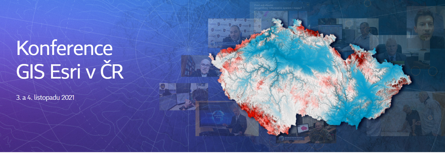
Společnost ARCDATA PRAHA si dovoluj Vás pozvat na letošní ročník Konference GIS Esri v ČR, která se bude konat 3. a 4. listopadu 2021. V tuto chvíli sice ještě není jasné, jakou formou bude toto tradiční setkání českých geoinformatiků probíhat, ale termín si prosím již rezervujte. Ve svých kalendářích si zašketněte termín 3.–4. listopadu 2021 […]
The post Konference GIS Esri v ČR 2021 (první informace) appeared first on GISportal.cz.
Bezplatný přístup k normám ČSN [Knihovna geografie, byTopic]
21.4.2021 0:00 Katedra aplikované geoinformatiky a kartografie Přf UK V rámci zprostředkování informací z vnějších informačních zdrojů, zejména ze státní správy, upozorňujeme všechny zájemce, že Česká agentura pro standardizaci (ČAS) zveřejnila bezplatně na svém webu více než 200 technických norem, kterými jsou jejich uživatelé povinni se řídit.Warren Equity Announces Acquisition of Magnolia River
20.4.2021 21:54 GISCafe.com Webcasts-Webinars DECATUR, Ala. — (BUSINESS WIRE) — April 20, 2021 —Warren Equity Partners, a lower middle market private equity fund, is pleased …
The Sanborn Map Company, Inc. to Provide the State of Vermont with New Digital Orthoimagery
20.4.2021 17:43 GISCafe.com Webcasts-Webinars Imagery will deliver updates and improvements to Vermont’s Orthoimagery ProgramCOLORADO SPRINGS, Colo. — (BUSINESS WIRE) — April 20, …
3D at Depth Delivers Subsea LiDAR Metrology to Support North Sea Project
20.4.2021 17:43 GISCafe.com Webcasts-Webinars Subsea LiDAR Metrology Delivers Survey Value and Project Construction BenefitsLONGMONT, Colo., April 20, 2021 — (PRNewswire) — 3D …
Velodyne Lidar Signs Multi-Year Sales Agreement with Gatik
20.4.2021 17:05 GISCafe.com Webcasts-Webinars Utilizing Velodyne Sensors, Gatik has Established North America’s First Autonomous Middle Mile Transportation NetworkSAN JOSE, Calif. — …
UAS and Aviation Expert Susan Roberts Joins Ondas Networks to Lead Strategy and Business Development Efforts in UAS and Aviation Markets
20.4.2021 17:05 GISCafe.com Webcasts-Webinars New Role to Accelerate Growth of FullMAX Adoption in DronesNANTUCKET, Mass. — (BUSINESS WIRE) — April 20, 2021 —
Ondas Holdings …
CACI Awarded $376 Million Contract by National Geospatial-Intelligence Agency
20.4.2021 17:05 GISCafe.com Webcasts-Webinars CACI to Provide NGA with Advanced Artificial Intelligence and Machine Learning ToolsARLINGTON, Va. — (BUSINESS WIRE) — April 20, 2021 …
HawkEye 360 Leverages Machine Learning from AWS to Optimize Maritime Security and Vessel Monitoring Capabilities
20.4.2021 17:05 GISCafe.com Webcasts-Webinars Purpose-built, proprietary algorithms rapidly derive maritime domain insights from radio frequency and vessel informationHERNDON, Va., April 20, …
odborný rada - právník v oddělení právních vztahů
20.4.2021 14:06 ČÚZK - předpisy a opatření Katastrální úřad pro Středočeský kraj - Katastrální pracoviště Mladá Boleslavvypisuje výběrové řízení na místo odborný rada - právník v oddělení právních vztahů
odborný rada - právník v oddělení právních vztahů