


![]()

zprávy
zdroje zpráv:Kotlíkové dotace 3. výzva
22.10.2019 9:50 Ústecký krajVe spolupráci s Odborem strategie přípravy a realizace projektů byla aktualizována mapová aplikace "Kotlíkové dotace v Ústeckém kraji". V mapové aplikaci naleznete vyhodnocení 1. 2. a 3. výzvy a jejich porovnání. Vše je přehledně zobrazeno po obcích či ORP.
Mapovou aplikaci naleznete na úvodní straně a také v sekci MAPY - > Rozvoj kraje a dotace- > Kotlíkové dotace.
Zimní údržba silnic v Ústeckém kraji 2019/20
22.10.2019 9:40 Ústecký krajVe spolupráci s Odborem dopravy a silničního hospodářství a SÚS byla aktualizována mapová aplikace "Plán zimní údržby silnic v Ústeckém kraji". V mapové aplikaci naleznete pořadí údržby jednotlivých komunikací dle důležitosti, způsob jejich údržby a jednotlivé trasy posypových vozů SÚS.
Mapovou aplikaci naleznete na úvodní straně a také v sekci MAPY - > Doprava a silniční hospodářství- > Mapa pořadí zímní údržby silnic Ústeckého kraje 2019/20.
5. porada vedení firem holdingu HRDLIČKA Group
22.10.2019 9:37 HrdličkaVýkonní ředitelé firem a další kolegové se již po páté sešli, tentokrát v prostředí šumavských luhů a hájů, aby si navzájem vyměnili informace a představili své vize do nadcházejícího roku 2020. V zázemí penzionu Lyer probíhal celodenní workshop s množstvím přednášek, který byl zakončen prohlídkou místního minipivovaru. Následující den účastnici ve dvou menších skupinkách vyrazili... View Article
The post 5. porada vedení firem holdingu HRDLIČKA Group appeared first on HRDLIČKA spol. s r.o. - komplexní služby v oblasti geodézie.
Making Sure Your Organization Is Data Driven (ArcNews Online)
22.10.2019 9:00 GISCafe.com Webcasts-Webinars20191022 Vrchní referent / rada oddělení dokumentace KN
22.10.2019 8:41 ČÚZK /Urady/Katastralni-urady/Katastralni-urady/Katastralni-urad-pro-Stredocesky-kraj/Katastralni-pracoviste/KP-Praha-zapad/O-uradu/Aktuality/20191022-Vrchni-referent-rada-oddeleni-dokumenta20191022 Vrchní referent / rada oddělení dokumentace KN
22.10.2019 8:41 ČÚZK - předpisy a opatření Katastrální úřad pro Středočeský kraj - Katastrální pracoviště Praha-západ Vyhlášení výběrového řízení: Vrchní referent / rada oddělení dokumentace KN V části "Úřední deska", v sekci "Oznámení a jiná úřední sdělení" bylo vystaveno "Oznámení o vyhlášení výběrového řízení na obsazení služebního místa Vrchní referent / rada oddělení dokumentace KN"20191022 Vrchní referent / rada oddělení dokumentace KN
22.10.2019 8:39 ČÚZK /Urady/Katastralni-urady/Katastralni-urady/Katastralni-urad-pro-Stredocesky-kraj/O-uradu/Aktuality/20191022-Vrchni-referent-rada-oddeleni-dokumenta20191022 Vrchní referent / rada oddělení dokumentace KN
22.10.2019 8:39 ČÚZK - předpisy a opatření Katastrální úřad pro Středočeský kraj - Katastrální pracoviště Praha-západ Vyhlášení výběrového řízení: Vrchní referent / rada oddělení dokumentace KN Katastrálního pracoviště Praha - západ V části "Úřední deska", v sekci "Oznámení a jiná úřední sdělení" bylo vystaveno "Oznámení o vyhlášení výběrového řízení na obsazení služebního místa Vrchní referent / rada oddělení dokumentace KN Katastrálního pracoviště Praha - západ"Vrchní referent / rada oddělení dokumentace KN
22.10.2019 8:30 ČÚZK - volná místa Katastrální úřad pro Středočeský kraj - Katastrální pracoviště Praha-západ vypisuje výběrové řízení na místo Vrchní referent / rada oddělení dokumentace KNVrchní referent / rada oddělení dokumentace KN
22.10.2019 8:30 ČÚZK - předpisy a opatření Katastrální úřad pro Středočeský kraj - Katastrální pracoviště Praha-západvypisuje výběrové řízení na místo Vrchní referent / rada oddělení dokumentace KN
Vrchní referent / rada oddělení dokumentace KN
revize
22.10.2019 8:05 ČÚZK /Urady/Katastralni-urady/Katastralni-urady/Katastralni-urad-pro-Ustecky-kraj/Katastralni-pracoviste/KP-Rumburk/O-uradu/Aktuality/revizerevize
22.10.2019 8:05 ČÚZK - předpisy a opatření Katastrální úřad pro Ústecký kraj - Katastrální pracoviště Rumburk zveřejnil novou aktualitu: HeroutováVážení klienti, oznamujeme Vám, že v katastrálních územích Rybniště, Nová Chřibská a Varnsdorf probíhá revize katastru nemovitostí a v katastrálním území Staré Křečany nové mapování. Předmětem revize i nového mapování jsou zejména zápisy staveb, druhů pozemků a způsobů využití pozemků a typů staveb, kdy výsledkem by mělo být dosažení, co nejlepšího souladu katastru nemovitostí se skutečným stavem v terénu. Oznámení jsou vyvěšena na úřední desce obecního i katastrálního úřadu.
revize
22.10.2019 8:05 ČÚZK - předpisy a opatření Katastrální úřad pro Ústecký kraj - Katastrální pracoviště Rumburk zveřejnil novou aktualitu: HeroutováVážení klienti, oznamujeme Vám, že v katastrálních územích Nová Chřibská, Varnsdorf a Dolní Chřibská probíhá revize katastru nemovitostí a v katastrálním území Staré Křečany nové mapování. Předmětem revize i nového mapování jsou zejména zápisy staveb, druhů pozemků a způsobů využití pozemků a typů staveb, kdy výsledkem by mělo být dosažení, co nejlepšího souladu katastru nemovitostí se skutečným stavem v terénu. Oznámení jsou vyvěšena na úřední desce obecního i katastrálního úřadu.
Omezení provozu dne 25. 10. 2019
22.10.2019 7:35 ČÚZK - předpisy a opatření Katastrální úřad pro Liberecký kraj - Katastrální pracoviště Česká Lípa zveřejnil novou aktualitu:Vážení klienti,
z důvodu nezbytné provozní odstávky informačních systémů v pátek dne 25. 10. 2019 nebudou poskytovány údaje katastru nemovitostí, a to na žádném katastrálním pracovišti ani pobočce CzechPOINT.
Příjem podání bude probíhat v omezeném režimu. Podáním tento den nebude přidělelno standardní číslo jednací, pod kterým by je bylo možno dohledat v Nahlížení do KN. Platby za podání návrhu na vklad budeme přijímat pouze v hotovosti s vydáním zjednodušeného příjmového dokladu, nebo v kolkových známkách.
Za případné komplikace spojené s tímto mimořádným omezením provozu se omlouváme a děkujeme za pochopení.
Omezení provozu dne 25. 10. 2019
22.10.2019 7:35 ČÚZK - předpisy a opatření Katastrální úřad pro Liberecký kraj - Katastrální pracoviště Česká Lípa zveřejnil novou aktualitu:Vážení klienti,
z důvodu provozní odstávky informačního systému katastru nemovitostí v pátek dne 25. 10. 2019 nebudou poskytovány údaje katastru nemovitostí, a to na žádném katastrálním pracovišti ani pobočce CzechPOINT. Příjem podání bude probíhat v omezeném režimu. Podáním tento den nebude přidělelno standardní číslo jednací, pod kterým by je bylo možno dohledat v Nahlížení do KN. Platby za podání návrhu na vklad budeme přijímat pouze v hotovosti s vydáním zjednodušeného příjmového dokladu, nebo v kolkových známkách. Obnovení běžného provozu se předpokládá v úterý dne 29. 10. 2019. Omlouváme se za případné komplikace.
Omezení provozu dne 25. 10. 2019
22.10.2019 7:35 ČÚZK - předpisy a opatření Katastrální úřad pro Liberecký kraj - Katastrální pracoviště Česká Lípa zveřejnil novou aktualitu:Vážení klienti,
z důvodu provozní odstávky informačního systému katastru nemovitostí v pátek dne 25. října 2019 nebudou poskytovány údaje katastru nemovitostí a to na žádném pracovišti ani pobočce CzechPOINT.
Příjem podání bude probíhat v omezeném režimu. Podáním tento den nebude přiděleno standardní číslo jednací, pod kterým by je bylo možno dohledat v Nahlížení do KN. Platby za podání návrhu na vklad budeme přijímat pouze v hotovosti s vydáním zjednodušeného příjmového dokladu, nebo v kolkových známkách. Obnovení běžného provozu se předpokládá v úterý 29. října 2019.
Omezení provozu dne 25. 10. 2019
22.10.2019 7:35 ČÚZK /Urady/Katastralni-urady/Katastralni-urady/Katastralni-urad-pro-Liberecky-kraj/Katastralni-pracoviste/KP-Ceska-Lipa/O-uradu/Aktuality/Omezeni-provozu-dne-25-10-2019Bentley Systems Accelerates Focus on Infrastructure Engineering for Digital Cities
22.10.2019 2:00 Bentley SystemsAdvancing BIM and GIS through 4D Digital Twins
SINGAPORE – The Year in Infrastructure 2019 Conference – 23 October 2019 – Bentley Systems, Incorporated, the leading global provider of comprehensive software and digital twin cloud services for advancing the design, construction, and operations of infrastructure, today presented its new digital cities initiatives, applying digital twins for more efficient city and regional operations and for more connected and resilient infrastructure. Digital twins converge assets’ 4D-surveyed and engineering representations to enable new collaborative digital workflows to serving planners and engineers in public works, utilities, property management and development, and city stakeholders. Digital twin cloud services provide an intuitive and immersive 4D environment converging digital context and digital components with digital chronology for “evergreen” infrastructure digital twins over asset lifecycles. For infrastructure professionals, BIM and GIS are effectively advanced through 4D digital twins.
Greg Bentley, CEO of Bentley Systems said, “Bentley Systems’ major technical thrust is the advancement of digital twins across infrastructure domains. This finally opens up for owners their previously “dark” engineering technologies and data (ET), for federation with traditional information technology (IT) and newly connected operating technologies (OT). Correspondingly, because the opportunities for benefits are so compelling, our major organizational initiative is our new digital cities product advancement group. Our digital cities group’s charter is both to ramp infrastructure engineering digital twins to full city scale, and at the same time to help with going digital through entry points for any engineering department in any municipality.”
“At Bentley Systems we have long and rich histories in respectively geospatial technology (GIS), and in BIM, for municipal infrastructure applications spanning capex and opex,” said Robert Mankowski, vice president, digital cities. “Today, I believe we are the leading innovator in reality modeling and in geotechnical modeling and data management. With our new cloud-based iTwin Services bringing this all together, city and campus digital twins now offer an immediate opportunity to help cities and regions solve a wide range of challenges and problems, enhancing their infrastructure performance and their constituents’ quality of life.”
Infrastructure Digital Twins for Digital Cities
City-scale digital twins begin and are updated through 4D surveying and reality modeling by ContextCapture and Orbit GT to derive as-operated 3D models from photogrammetry (including from UAVs) and/or point clouds. Reality modeling provides engineering-precise, real-world context to support planning, design, construction, and operations. Users of Bentley’s open applications (OpenBuildings, OpenSite, OpenRoads, OpenRail, OpenUtilities) can leverage this digital context to model new and improved buildings, roads, transit systems, tunnels, bridges, utilities, and more.
4D digital twins become a common and federating index for previously siloed information, without requiring source systems to change their existing environments or data formats. The foundation context for any digital twin includes reality meshes, terrain models, imagery, and GIS sources. Engineering models (from any BIM software) of buildings, streets, transit systems, utilities, and other city infrastructure, both surface and subsurface, are semantically aligned and geo-referenced to enhance the richness and relevance of digital twins over time.
Public works departments, property developers, utilities, transportation agencies, and others now have access to a full and current contextual view of the built environment. Engineering and architectural firms will be able to develop new services that contemplate updating and managing digital assets over their lifecycles. And, cities will benefit from living and current digital twins of their infrastructure and surrounding environment.
Sustainability and Resilience Digital Twins
Now, cities can combine their surface and subsurface surveys and engineering data into cohesive 4D digital twins to ensure over time their asset performance, resiliency, and sustainability. Using Bentley’s open simulation applications during asset lifecycles, for example, as-constructed buildings can be evaluated for seismic resilience (STAAD), the evacuation of vehicles and people in stations, stadiums, and other public places can be assessed and optimized (LEGION and CUBE), the impact of flooding events like hurricanes can be determined (OpenFlows FLOOD), and the suitability of subsurface conditions for urban projects can be ensured (PLAXIS, SoilVision).
Geotechnical Digital Twins: Introducing OpenGround
Bentley’s geotechnical engineering and analysis applications empower subsurface digital twins, critical for assessing and managing risks in infrastructure projects and assets. Subsurface digital twins entail modeling of the underground environment, including the geology, hydrology, chemistry, and engineering properties, made possible by Bentley’s geotechnical offerings (PLAXIS, SoilVision, Keynetix and gINT). To further enable subsurface digital twins, Bentley today announced OpenGround, a new cloud service (available end of 2019) to store, manage, report, and share data about natural ground conditions.
Water Network Digital Twins
Building upon its deep experience with hydraulics and hydrology software, Bentley is introducing OpenFlows WaterOPS for water and wastewater utility operators. OpenFlows WaterOPS provides water and wastewater utilities with real-time operational support, smart water response planning, and optimized performance and business intelligence, converging IT (GIS) with OT (telemetry, SCADA instrumentation, sensors) and ET (hydraulic simulation). WaterOPS provides real-time operational decision support extending Supervisory Control and Data Acquisition (SCADA) to help users monitor, maintain, and forecast various hydraulics and water quality scenarios.
City Planning Digital Twins
Digital twins for cities have many stakeholders, including constituents not directly involved in engineering or infrastructure. Now hosted in Microsoft Azure, OpenCities Planner delivers cloud-based, city-scale digital twins to improve stakeholder and citizen engagement and to simplify and facilitate urban development. Addressing a wide variety of potential use cases, OpenCitiesPlanner helps users, through devices like web, mobile, touchscreens, and digital billboards, to intuitively visualize and explore 2D, 3D, GIS and other data aligned with the reality modeling of the city.
Digital Co-ventures for Digital Cities
(With Topcon) Cloud-based photogrammetry processing powered by Bentley’s ContextCapture is incorporated in Topcon MAGNET Collage Web, a web-based service for publication, sharing, and analysis of reality capture data. The intrinsic Bentley ContextCapture Cloud Processing Service enables operators to upload UAV imagery direct-to-web without the need for high-end hardware requirements or IT constraints.
###
About Bentley Systems’ Digital Cities Offerings
Bentley Systems undertakes to advance BIM and GIS through 4D infrastructure engineering digital twins for digital cities. Engineers, geospatial professionals, and infrastructure owner-operators benefit from applications and digital twin cloud services that advance reality modeling (ContextCapture and OrbitGT); water, wastewater, and stormwater system planning, design and operations, and flood resilience (OpenFlows); engineering-ready geospatial urban planning and visualization (OpenCities Map and OpenCities Planner); geotechnical information management (OpenGround); and mobility simulation and analytics (LEGION and CUBE).
In both 2018 and 2019, Microsoft named Bentley Systems as Partner of the Year in its CityNext category. In 2019, ARC Advisory Group’s Engineering Design Tools for Plants, Infrastructure, and BIM market study ranked Bentley #1 in Water and Wastewater Distribution.
About Bentley Systems
Bentley Systems is the leading global provider of software solutions to engineers, architects, geospatial professionals, constructors, and owner-operators for the design, construction, and operations of infrastructure, including public works, utilities, industrial plants, and digital cities. Bentley’s MicroStation-based open modeling applications, and its open simulation applications, accelerate design integration; its ProjectWise and SYNCHRO offerings accelerate project delivery; and its AssetWise offerings accelerate asset and network performance. Spanning infrastructure engineering, Bentley’s iTwin Services are fundamentally advancing BIM and GIS to 4D digital twins.
Bentley Systems employs more than 3,500 colleagues, generates annual revenues of $700 million in 170 countries, and has invested more than $1 billion in research, development, and acquisitions since 2014. From inception in 1984, the company has remained majority-owned by its five founding Bentley brothers. www.bentley.com
Bentley, the Bentley logo, AssetWise, ContextCapture, gINT, iTwin, Keynetix, LEGION, MicroStation, OpenBuildings, OpenCities, OpenCities Map, OpenCities Planner, OpenFlows, OpenFlows FLOOD, OpenFlows WaterOPS, OpenGround, OpenRail, OpenRoads, OpenSite, OpenUtilities, Orbit GT, PLAXIS, ProjectWise, SoilVision, STAAD, and SYNCHRO are either registered or unregistered trademarks or service marks of Bentley Systems, Incorporated or one of its direct or indirect wholly owned subsidiaries. All other brands and product names are trademarks of their respective owners.
Bentley Systems’ Design Integration Offerings Advance BIM to 4D through Digital Twins
22.10.2019 2:00 Bentley Systems“Evergreen” digital twins extend the value of infrastructure engineers’ work,
and of Bentley’s open modeling applications and open simulation applications
throughout asset lifecycles
SINGAPORE – The Year in Infrastructure 2019 Conference – 22 October 2019 – Bentley Systems, Incorporated, the leading global provider of comprehensive software and digital twin cloud services for advancing the design, construction, and operations of infrastructure, today announced new additions and updates to its open modeling applications and open simulation applications to advance engineering digital twins throughout asset lifecycles. Bentley’s open applications enable collaborative, iterative, and automated digital workflows spanning infrastructure professional disciplines. Now, with new digital twin cloud services, they extend business value and actionable insights throughout the construction and operations phases of an infrastructure asset.
“The broad acceptance of BIM has substantially benefited AEC professionals and projects over the last fifteen years, but now—with cloud services, reality modeling, and advanced analytics—we can advance BIM through digital twins,” said Santanu Das, Bentley’s senior vice president, design integration. “Until now, the use of BIM has been limited to static deliverables, which, after handing off to construction, quickly go out-of-date, losing the potential further value of the engineering data locked in BIM models. Now, with digital twins, we can open up the engineering data in a BIM model with its constituent digital components as a starting point, continually refresh the digital context with drone surveys and reality modeling, and—this is where it gets really exciting— continue to model and simulate the fitness for purpose of an asset over the digital chronology of its lifecycle. Finally, the value of the engineering data in a BIM model can extend beyond handoff to construction, and even beyond handover to operations, assuring and improving both project and asset performance. Advancing BIM to 4D through evergreen digital twins means that design models and simulations can serve a greater purpose than merely project deliverables, as the living asset’s digital DNA!”
New Digital Twin Cloud Services for Design Integration
Bentley’s design integration offerings now extend from desktop applications to cloud services to enable organizations to create, 4D-visualize, and analyze digital twins of infrastructure assets. iTwin Services enable digital information managers to incorporate engineering data created by diverse design tools into a living digital twin and align it with reality modeling and other associated data, with no disruption to their current tools or processes.
iTwin Design Review facilitates faster design review sessions. It enables practitioners to initiate “ad hoc” design reviews in a hybrid 2D/3D environment as well as project teams working on digital twins to conduct design reviews and multidiscipline design coordination. It provides workflows:
• (for practitioners) to markup and comment directly on elements of 3D models and switch between 2D and 3D views without leaving the 3D environment
• (for projects using ProjectWise) to visualize 4D digital twins—capturing engineering change along the timeline of the project, and providing an accountable record of who-changed-what-and-when
iTwin OpenPlant Design Service provides OpenPlant users with a distributed work environment and bi-directional referencing between 2D and 3D representations of plant digital components.
Open Modeling Applications and Open Simulation Applications
Sharing digital components and connecting digital workflows across disciplines are the foundation of an open modeling environment. Comprising MicroStation-based engineering and BIM applications specialized for asset types and solutions, Bentley’s open modeling environment advances collaboration, enabling clash resolution and production of multidiscipline deliverables from any application.
Building its applications on the MicroStation platform ensures interoperability, access to a connected data environment, and digital services like Components Center for shared components libraries and GenerativeComponents for generative design capabilities. In addition, integrated engineering analysis and simulation empowers designers to iterate on various scenarios to achieve the most appropriate solution, not only for the initial design, but also for subsequent interventions and capital improvements to infrastructure assets.
Open Modeling Applications Updates
(New) OpenWindPower offers interoperability between geotechnical, structural, and piping analysis and design applications, automating data-exchange workflows between disciplines, to minimize risk in the design and operations of fixed and floating offshore wind farms. OpenWindPower enables users of a wind turbine model to check design status, perform analyses, mitigate risks, and generate insights into its predicted performance.
“OpenWindPower shortens the overall design cycle and effectively solves the problem of large design margins, reducing the cost of offshore wind power development,” said Dr. Bin Wang, deputy chief engineer of the New Energy Research Institute, POWERCHINA Huadong Engineering.
(New) OpenTower is a purpose-built application for the design, documentation, and fabrication of new communication towers, and for the rapid re-analysis of existing telecom towers for tower owners, consultants, and carriers who need to continually update equipment. OpenTower’s introduction is timed for the upcoming 5G rollout.
“With the help of Bentley’s applications, tower design and analyses are easier, faster, and reliable. It also gives our clients satisfaction, trust and peace of mind, and improves public safety,” said Frederick L. Cruz, president and CEO, F.L. Cruz Engineering Consultancy.
OpenBuildings Station Designer now includes LEGION and improves design quality by optimizing the functional space layout of the station building and the path of travel for the pedestrian.
OpenSite Designer now includes residential capabilities, supporting the conception and design of residential parceling and parcel grading, and custom parcel creation.
OpenBridge Designer now combines OpenBridge Modeler with the analysis and design features of LEAP Bridge Concrete, LEAP Bridge Steel, and RM Bridge Advanced.
OpenRoads SignCAD enhances OpenRoads to perform 3D modeling of signs within new or existing roadway designs.
Open Simulation Applications Updates
(New) Bentley Systems announced the acquisition of Citilabs, to enable its CUBE traffic simulations to be intrinsically available from OpenRoads.
PLAXIS and SoilVision geotechnical applications allow engineers to run multiple analysis methods, in either finite element or limit equilibrium, interchangeably. New interoperability with RAM, STAAD, and OpenGround enhances the quality of comprehensive geostructural solutions for integrated design and analysis of soils, rocks, and associated structures.
Digital Co-ventures for Design Integration
(With Siemens) Bentley’s OpenRoads will take advantage of Siemens’ Aimsun for micro level traffic simulation.
(With Siemens) The forthcoming OpenRail Overhead Line Designer integrates OpenRail Designer, and Siemens SICAT Master.
(With Siemens) OpenRail-Entegro Train Simulator combines Siemens Entegro and Automatic Train Control Simulation with Bentley’s ContextCapture, OpenRail ConceptStation, OpenRail Designer, and LumenRT, for rail operations digital twins.
###
About Bentley’s Design Integration Offerings
Bentley Systems undertakes to provide uniquely comprehensive and uniquely open modeling applications, and open simulation applications, for infrastructure design integration. Bentley’s open modeling applications, including OpenRoads, OpenBuildings, OpenRail, OpenPlant, OpenBridge, and OpenSite share MicroStation’s continuously advancing modeling environment to support each respective engineering and architectural discipline, and to increasingly enable automated and iterative digital workflows across all disciplines, for infrastructure conceptioneering (ConceptStation applications), design (Designer applications) and constructioneering. Bentley’s open simulation applications, including STAAD, SACS, PLAXIS, AutoPIPE, RAM, LEAP, MOSES, LEGION, LARS, and CUBE, assure and improve compliance, resilience, and throughput. Design integration for all projects is advanced by market-leading iModel-based interoperability with third-party applications.
Bentley’s iTwin Services, including Design Review cloud services for practitioners and for projects, advance BIM through “evergreen” 4D digital twins, ensuring that design engineers’ work, with open modeling applications and open simulation applications, can continue to add value by sustaining fitness for purpose throughout asset lifecycles.
In 2019, ARC’s Engineering Design Tools for Plants, Infrastructure, and BIM market study ranked Bentley #2 overall, and #1 in Electric T&D, Communications, and in Water/Wastewater. Among the Engineering News-Record Top 640 Design Firms, more than 90 percent rely on Bentley’s portfolio for design integration across multiple disciplines.
About Bentley Systems
Bentley Systems is the leading global provider of software solutions to engineers, architects, geospatial professionals, constructors, and owner-operators for the design, construction, and operations of infrastructure, including public works, utilities, industrial plants, and digital cities. Bentley’s MicroStation-based open modeling applications, and its open simulation applications, accelerate design integration; its ProjectWise and SYNCHRO offerings accelerate project delivery; and its AssetWise offerings accelerate asset and network performance. Spanning infrastructure engineering, Bentley’s iTwin Services are fundamentally advancing BIM and GIS to 4D digital twins.
Bentley Systems employs more than 3,500 colleagues, generates annual revenues of $700 million in 170 countries, and has invested more than $1 billion in research, development, and acquisitions since 2014. From inception in 1984, the company has remained majority-owned by its five founding Bentley brothers. www.bentley.com
Bentley, the Bentley logo, AssetWise, AutoPIPE, Citilabs, ContextCapture, CUBE, Generative Components, iTwin, iTwin Design Review, iTwin Services, LEAP, LEGION, LumenRT, MicroStation, MOSES, OpenBridge, OpenBridge Designer, OpenBridge Modeler, Open Buildings, OpenBuildings Station Designer, OpenGround, OpenPlant, OpenRail, OpenRoads, OpenSite, OpenSite Designer, OpenTower, OpenWindPower, PLAXIS, ProjectWise, RAM, RM Bridge Advanced, SACS, SignCAD, SoilVision, STAAD, and SYNCHRO are either registered or unregistered trademarks or service marks of Bentley Systems, Incorporated or one of its direct or indirect wholly owned subsidiaries. All other brands and product names are trademarks of their respective owners.
INSPIRE – Koncentrace látek znečišťujících ovzduší / Air quality model areas
22.10.2019 2:00 Cenia - Katalog metadat ČR - INSPIRE Koncentrace látek znečišťujících ovzduší v gridu 1x1 km, rok 2017 Imisní limity pro ochranu lidského zdravíSO2 – 4. nejvyšší 24hod. koncentrace SO2 [µg.m-3]PM10 – roční průměrná koncentrace [µg.m-3]PM10 – 36. nejvyšší průměrná 24hod. koncentrace [µg.m-3]PM2.5 – roční průměrná koncentrace [µg.m-3]NO2 – roční průměrná koncentrace [µg.m-3]O3 – 26. nejvyšší maximální denní 8hod. klouzavý průměr koncentrace v průměru za 3 roky, 2015–2017 [µg.m-3]Cd – roční průměrná koncentrace [ng.m-3]As – roční průměrná koncentrace [ng.m-3]Benzo[a]pyren – roční průměrná koncentrace [ng.m-3]Benzen – roční průměrná koncentrace [µg.m-3]Oblasti s překročením imisních limitů bez zahrnutí O3Oblasti s překročením imisních limitů bez zahrnutí Imisní limity pro ochranu ekosystémů a vegetaceO3 – hodnoty expozičního indexu AOT40, průměr za 5 let, 2012–2016 [µg.m-3]NOx – roční průměrná koncentrace [µg.m-3]SO2 – rok a zimní období [µg.m-3]Legislativa vyžaduje, aby primárním zdrojem hodnocení byly výsledky stacionárních měření. Naměřené koncentrace mohou být při tvorbě map znečisťujících látek doplněny modelováním a indikativním měřením, aby výsledný odhad poskytoval dostatečné informace o prostorovém rozložení koncentrací znečišťujících látek v ovzduší.V ČR je využíván zejména Eulerovský chemický disperzní model CAMx, doplňkově též Gaussovský model SYMOS a evropský Eulerovský model EMEP. Dále jsou to v případě jednotlivých znečišťujících látek např. nadmořská výška či populační hustota.Dlouhodobá průměrná ztráta půdy (G)
22.10.2019 2:00 Cenia - Katalog metadat ČR - INSPIRE Potenciální ohroženost zemědělské půdy vodní erozí – vyjádřená dlouhodobým průměrným smyvem půdy (G) vychází z rovnice USLE (Wischmeier a Smith, 1978) s využitím faktoru ochranného vlivu vegetace C podle klimatických regionů.Bentley Systems Joins as a Multinational Member – Announces Support of IFC for Digital Twins
22.10.2019 2:00 Bentley Systems
London, U.K. - October 23, 2019 - buildingSMART International is delighted to welcome Bentley Systems to the community. Bentley Systems, Incorporated is the leading global provider of comprehensive software and digital twin cloud services for advancing the design, construction, and operations of infrastructure. Bentley Systems joins as a multinational member bringing a wealth of knowledge and expertise to the standards and solutions program.
At the same time, Bentley announced the availability of iModel Bridge for IFC, a generic IFC bridge that enables Bentley’s iModels to consume IFC geometry and business data. iModels are specialized containers for infrastructure information that are at the heart of Bentley’s digital twins strategy for infrastructure engineering. iTwin Services now enable iModels to export snapshots in IFC and treat IFC datasets as an input source, aligning their content for use by Bentley’s design applications. Earlier this year, Bentley announced the availability on GitHub of version 1.0 of iModel.js, an open source platform for digital twins (see imodeljs.org).
Bhupinder Singh, Bentley’s chief product officer, said: “Bentley is committed to supporting the best implementation of IFC for digital twins. We are committed to openness, and in fact we’re making plans to open source iModel Bridge for IFC. The combination of IFC support and open source principles should give the community confidence that they can create and curate digital twins without being boxed in by dark data.”
Richard Petrie, CEO, buildingSMART International said, “I am delighted that Bentley has joined buildingSMART International. As one of the major software vendors in our field, Bentley plays a critical role in our community. The vision Bentley has for iModels and open source offers the IFC community exciting new possibilities for open interoperable ways of working with digital twins.”
About buildingSMART International
buildingSMART International is a vendor-neutral and not for profit body that leads the development of open digital information flows across the built asset industry. Its mission is to proactively support industry participants who want to develop open standards for planning, design, procurement, assembly and operation of buildings and infrastructure worldwide. It provides the international network plus the necessary technical and process support. Its members, who range from across the built environment spectrum, collaborate under the buildingSMART organization. buildingSMART is engaged with other international standards bodies such as ISO, the European Committee for Standardisation (CEN) and the Open Geospatial Consortium (OGC). Its core Industry Foundation Class (IFC) standards achieved ISO approval in 2012.
Press Contact:
buildingSMART International
aidan.mercer@buildingsmart.org
Aidan Mercer, +44 7181-304-3435
INSPIRE – Státní síť imisního monitoringu / Air quality monitoring stations
22.10.2019 2:00 Cenia - Katalog metadat ČR - INSPIRE Síť imisních měřicích stanic registrovaných v databázi ISKO v roce 2017. Základem pro hodnocení kvality ovzduší jsou koncentrace naměřené na monitorovacích stanicích. Měřicí síť je nejhustší v oblastech s nejvyššími koncentracemi škodlivin, nicméně pokrývá celou ČR. Páteřní sítí monitorovacích stanic je Státní síť imisního monitoringu (SSIM), kterou provozuje ČHMÚ. Její součástí jsou jak automatizované monitorovací stanice (AIM), tak i manuální imisní stanice (MIM), ze kterých jsou odebrané vzorky analyzovány v laboratořích ČHMÚ. V mnoha případech je na jedné lokalitě znečištění ovzduší sledováno současně automatickými i manuálními metodami. Státní síť imisního monitoringu je doplněna monitorovacími stanicemi dalších organizací, jejichž měření je rovněž využíváno při hodnocení kvality ovzduší.Bentley Systems Announces New iTwin Cloud Services for Infrastructure Engineering Digital Twins
22.10.2019 2:00 Bentley SystemsDigital twins enter the mainstream – engineering firms and owner-operators
put digital twin aspirations into action
SINGAPORE – The Year in Infrastructure 2019 Conference – 24 October 2019 – Bentley Systems, Incorporated, the leading global provider of comprehensive software and digital twin cloud services for advancing the design, construction, and operations of infrastructure, today announced new cloud services for infrastructure engineering digital twins. Digital twins are digital representations of physical assets and their engineering information that allow users to understand and model their performance in the real world over their lifecycle. In effect, “evergreen” digital twins advance BIM and GIS through 4D.
Keith Bentley, founder and chief technology officer, said, “Today the ‘digital twin era’ is underway, and its pace accelerates every day. The early adopters we’ve worked with are already staking out leadership positions in the new digital twin economy, towards innovations in both their business processes and their business models. The advantages gained by replacing decades-old, disconnected paper-based workflows and work products with open, live, trusted, and evergreen digital twins are immense. Coupling that with an ecosystem of innovation through open-source platforms creates an unstoppable force for change in infrastructure. I can’t remember a more exciting time for the infrastructure professions or for Bentley Systems.”
New Digital Twin Cloud Services
iTwin Services enable engineering firms to create, visualize and analyze digital twins of infrastructure projects and assets. iTwin Services federate digital engineering content from BIM design tools and multiple data sources, enable “4D visualization” of digital twins, and log engineering changes along a project/asset timeline, to provide an accountable record of who-changed-what-and-when. Engineering teams are using iTwinServices to conduct design reviews, validate design data, and generate design insights. Users of Bentley’s design applications can apply the iTwin Design Review service for ad hoc design reviews, and project teams using ProjectWise can add the iTwin Design Review service to their digital workflows to facilitate overall project digital twins.
PlantSight is an offering jointly developed by Bentley Systems and Siemens, which enables owner-operators and their engineers to create living and evergreen digital twins of operating process plants. PlantSight allows operations, maintenance, and engineering to access trusted, accurate digital twin data immersively, including P&IDs, 3D models, and IoT data. It provides a single view of truth in a validated information model that facilitates situational intelligence, line of sight, and contextual awareness. PlantSightwas jointly developed by Bentley and Siemens using iTwin Services and is commercially available from either company.
iTwin Immersive Asset Service enables owner-operators using AssetWise to align asset performance data and operational analytics in their digital twins’ context, making engineering information accessible to a wider audience of users through immersive and intuitive user experiences. iTwin Immersive Asset Service shows “hotspots” of activity and change in asset status over time which leads to faster and better-informed decision-making that ultimately helps improve asset and network performance.
Digital Twins Enter the Mainstream
The ever-evolving physical reality of an as-operated asset has previously been difficult to capture digitally and keep current. In addition, the corresponding engineering information, in its assortment of incompatible file formats and constant change, has typically been “dark data,” essentially unavailable or unusable. With digital twin cloud services, Bentley helps users to create and curate digital twins to improve the operation and maintenance of physical assets, systems, and construction processes, through immersive 4D visualization and analytics visibility.
At Bentley’s Year in Infrastructure 2019 Conference, digital twin advancements featured in 24 finalist projects in 15 categories in project locations across 14 countries ranging from transportation, water networks and treatment plants, to power stations, steel plants, and buildings. Overall, 139 nominations in 17 categories cited digital twin objectives for the innovations used on their projects – a significant increase from 29 such nominations in 2018.
Digital Twin Ideas in Action
In the technology keynote at the conference, Keith Bentley was joined on stage by representatives from Sweco and Hatch, showcasing infrastructure digital twin ideas in action.
Sweco digitally integrated a nine-kilometer light rail system project for the city of Bergen in Norway. The extension of the existing system was managed entirely through 3D BIM models, from alternative studies into a detailed engineering design. The use of iTwin Services allowed Sweco to keep track of changes automatically and minimize errors, enabling 4D visualization.
Hatch completed pre-feasibility, feasibility, and detailed engineering for a sulfuric acid facility in the Democratic Republic of the Congo. Bentley’s plant design software enabled the project team to design a complete, intelligent digital twin to the most granular level of detail, moving the engineering quality processes upstream as part of the 3D modeling effort compared to traditional drawing-based quality processes. Hatch was able to reduce production ramp-up after hot commissioning, from six months to one week.
Microsoft is prototyping digital twins in its Asia headquarters in Singapore and its Redmond campus. Microsoft’s Real Estate and Security group is implementing an approach for the Digital Building Lifecycle to optimize building performance, cost-effectiveness, employee satisfaction, productivity and security. Microsoft’s efforts to create digital representations of physical assets like buildings are based on Microsoft Azure Digital Twins, an IoT service that helps organizations create comprehensive digital models of physical environments. Azure Digital Twins was released for public preview in 2018 and is now being adopted by Microsoft customers and partners globally, including Bentley for its iTwin Services. The companies are working together to create a digital twin of Microsoft’s new facilities in Singapore.
Digital Twin Ecosystem
Both iTwin Services and PlantSight were developed with the iModel.js open-source platform for digital twins, which was first launched in October 2018 and reached its version 1.0 milestone in June 2019. A primary reason for open-sourcing the iModel.js library is to foster an ecosystem of innovation for owners’ and engineers’ digital twin software developers and for digital integrators.
One such ecosystem software developer is vGIS Inc. which used iModel.js to integrate a mixed reality (XR) solution within a transportation infrastructure digital twin. Their mobile mixed reality app visually merges project design models with reality, in the field, in real-time. Users in the field can view subsurface utilities, such as pipes and cables, merged within their real-world orientation. Users simply point at objects with their mobile devices to see project design elements in this context.
Alec Pestov, vGIS founder and CEO, said, “The iModel.js platform is a great resource for developing and integrating value-added tools and services, such as the advanced augmented reality and mixed reality solution offered by vGIS. We love the seamless interoperability with iTwin Services and the frictionless development path to get to that seamless integration, and we look forward to expanding our collaboration potential, through iTwin Services.”
###
Digital Twins Defined
Digital twins are digital representations of physical assets and systems in the context of their surrounding environment, converged with their engineering information, for understanding and modeling of their performance. Like the real-world assets they represent, digital twins are ever changing. They are continuously updated from multiple sources, including sensors and drones, to represent the right-time status or working condition of real-world, physical infrastructure assets. In effect, digital twins—by combining digital context and digital components with digital chronology—advance BIM and GIS through 4D.
Benefits of Digital Twins
Digital twins enable users to visualize the entire asset – in a web browser, on a tablet, or with a mixed reality headset – check status, perform analysis and generate insights in order to predict and optimize asset performance. Users can build digitally before they build physically and plan out and de-risk maintenance activities before they carry them out in the real-world. They now have software at their disposal to envisage hundreds of scenarios, leverage machine learning to compare design alternatives or maintenance strategies and optimize across multiple parameters. Visualization and contextualization of engineering data lead to better informed decision-making and stakeholder engagement throughout the asset lifecycle.
About Bentley’s iTwin Services
iTwin Services enable project teams and owner-operators to create, 4D-visualize, and analyze digital twins of infrastructure assets. iTwin Services enable digital information managers to incorporate engineering data created by diverse design tools into a living digital twin and align it with reality modeling and other associated data, with no disruption to their current tools or processes. Users are able to visualize and track engineering change along the timeline of the project, providing an accountable record of who-changed-what-and-when. iTwin Services facilitate actionable insights for decision makers across the organization and asset lifecycle. Users make better informed decisions, anticipate and avoid issues before they arise, and react more quickly with confidence, resulting in cost savings, improved service availability, lower environmental impact, and improved safety.
About Bentley Systems
Bentley Systems is the leading global provider of software solutions to engineers, architects, geospatial professionals, constructors, and owner-operators for the design, construction, and operations of infrastructure, including public works, utilities, industrial plants, and digital cities. Bentley’s MicroStation-based open modeling applications, and its open simulation applications, accelerate design integration; its ProjectWise and SYNCHRO offerings accelerate project delivery; and its AssetWise offerings accelerate asset and network performance. Spanning infrastructure engineering, Bentley’s iTwin Services are fundamentally advancing BIM and GIS to 4D digital twins.
Bentley Systems employs more than 3,500 colleagues, generates annual revenues of $700 million in 170 countries, and has invested more than $1 billion in research, development, and acquisitions since 2014. From inception in 1984, the company has remained majority-owned by its five founding Bentley brothers. www.bentley.com
Bentley, the Bentley logo, AssetWise, iModel.js, iTwin, MicroStation, Open Buildings, ProjectWise, and SYNCHRO are either registered or unregistered trademarks or service marks of Bentley Systems, Incorporated or one of its direct or indirect wholly owned subsidiaries. All other brands and product names are trademarks of their respective owners.
Class of Your Own Announces School Curriculum Partnership with Bentley Systems
22.10.2019 2:00 Bentley Systems
Class of Your Own and Bentley Institute partner in secondary school learning programs to advance skills for future infrastructure professionals
SINGAPORE – The Year in Infrastructure 2019 Conference – 23 October 2019 – Class of Your Own, a UK-headquartered provider of STEAM (science, technology, engineering, arts, math) curriculum and built environment-focused learning programs for secondary school students, today announced a partnership with leading global provider of software solutions for the design, construction, and operations of infrastructure, Bentley Systems. The new, future-focused global curriculum, Design Engineer Construct!® (DEC) for the World’s Infrastructure, has developed over several years through Bentley Institute’s support of Class of Your Own’s DEC programs and provides opportunities for students to gain hands-on knowledge and skills for careers in infrastructure professions.
DEC is currently accredited and used in schools throughout the United Kingdom. The new program is already expanding into schools in Ireland, Lithuania, Thailand, and the United Arab Emirates and offers technology education and project-based, real-world experiences through interaction with industry professionals. The DEC curriculum for students ages 11 to 18 years is offered at intermediate levels to encourage and excite learners and is enhanced by Bentley’s engineering design and 3D modeling technologies including ContextCapture, OpenBuildings, OpenRail, and OpenRoads ConceptStation. The more advanced Future Infrastructure qualification framework, for students ages sixteen and older, including foundation level study at colleges and universities, focuses on rail, highway, port, and hyperloop projects.
Alison Watson, founder and chief executive of Class of Your Own, said, “Our vision is to inspire and engage young people and their teachers to reach their full potential through world class education. So, we’re very excited to partner with Bentley to offer the new curriculum, which applies industry knowledge and skills gained in the existing DEC program to the most exciting infrastructure projects around the world. Our students are provided with face-to-face support from world-class sector professionals thanks to industry partners who truly understand what DEC can do. Expanding the program outside the UK means we can offer genuine, meaningful opportunities for students and teachers around the world. We’re helping the surveyors, technologists, engineers, architects, and managers of future infrastructure!”
Earlier in 2019, Bentley Institute and Class of Your Own hosted the first ever Future Infrastructure Challenge: DEC Hyperloop challenge in London. The event included students from four schools in the UK whose assignment was to conceptualize a design of a hyperloop transport system and stations for their own towns, and then to adapt to Singapore. Students from Drummond Community High School from Edinburgh, Scotland won the challenge, and were awarded a complimentary trip from Bentley to attend its Year in Infrastructure Conference, held October 21 through 24 in Singapore.
David Robertson, director of digital advancement research for Bentley Systems, said, “Our partnership with Class of Your Own demonstrates the two organizations’ shared goal of providing students with valuable learning experiences that apply to real-world infrastructure professions and encourage students to pursue those professions. Bentley is very excited to participate in this important learning initiative to advance career opportunities for students around the world.”
Learn more about the Design Engineer Construct program.
##
About Class of Your Own
Class of Your Own is headed by founder and Chief Executive Alison Watson, MBE, a land surveyor, educational pioneer, and industry evangelist. Class of Your Own has been delivering workshops, projects, and built environment-focused student engagement programs to schools and colleges since 2009 and, from September 2012, the fully accredited DEC learning program.
In addition to the support from Bentley Systems for this and other initiatives, Class of Your Own is supported by Heriot Watt University as a key, long-standing partner in academia and by global industrial partners including Topcon Positioning Systems and Mott MacDonald Group.
About Bentley Institute
Bentley Institute advances the infrastructure professions by encouraging and supporting Bentley Systems users’ ambitions in going digital. Its initiatives attract and advance infrastructure professionals, and future professionals, through continuous learning about technology solutions, as well as project delivery and asset performance best practices.
Press contacts:
From Class of Your Own:
Alison Watson, Chief Executive
+44 1282 680946
alison@classofyourown.com
From Bentley Systems:
Jennifer Maguire, Director Corporate Communications
+1 610 458 2695
jennifer.maguire@bentley.com
Bentley Systems Joins as a Multinational Member – Announces Support of IFC for Digital Twins
22.10.2019 2:00 Bentley Systems
London, U.K. - October 23, 2019 - buildingSMART International is delighted to welcome Bentley Systems to the community. Bentley Systems, Incorporated is the leading global provider of comprehensive software and digital twin cloud services for advancing the design, construction, and operations of infrastructure. Bentley Systems joins as a multinational member bringing a wealth of knowledge and expertise to the standards and solutions program.
At the same time, Bentley announced the availability of iModel Bridge for IFC, a generic IFC bridge that enables Bentley’s iModels to consume IFC geometry and business data. iModels are specialized containers for infrastructure information that are at the heart of Bentley’s digital twins strategy for infrastructure engineering. iTwin Services now enable iModels to export snapshots in IFC and treat IFC datasets as an input source, aligning their content for use by Bentley’s design applications. Earlier this year, Bentley announced the availability on GitHub of version 1.0 of iModel.js, an open source platform for digital twins (see imodeljs.org).
Bhupinder Singh, Bentley’s chief product officer, said: “Bentley is committed to supporting the best implementation of IFC for digital twins. We are committed to openness, and in fact we’re making plans to open source iModel Bridge for IFC. The combination of IFC support and open source principles should give the community confidence that they can create and curate digital twins without being boxed in by dark data.”
Richard Petrie, CEO, buildingSMART International said, “I am delighted that Bentley has joined buildingSMART International. As one of the major software vendors in our field, Bentley plays a critical role in our community. The vision Bentley has for iModels and open source offers the IFC community exciting new possibilities for open interoperable ways of working with digital twins.”
About buildingSMART International
buildingSMART International is a vendor-neutral and not for profit body that leads the development of open digital information flows across the built asset industry. Its mission is to proactively support industry participants who want to develop open standards for planning, design, procurement, assembly and operation of buildings and infrastructure worldwide. It provides the international network plus the necessary technical and process support. Its members, who range from across the built environment spectrum, collaborate under the buildingSMART organization. buildingSMART is engaged with other international standards bodies such as ISO, the European Committee for Standardisation (CEN) and the Open Geospatial Consortium (OGC). Its core Industry Foundation Class (IFC) standards achieved ISO approval in 2012.
Press Contact:
buildingSMART International
aidan.mercer@buildingsmart.org
Aidan Mercer, +44 7181-304-3435
Bentley Systems Introduces AssetWise Digital Twin Services and OpenUtilities Digital Twin Services for Asset and Network Performance
22.10.2019 2:00 Bentley SystemsNew Immersive Asset Service enables 4D visualization
and analytics visibility for “evergreen” digital twins
SINGAPORE – The Year in Infrastructure 2019 Conference – 22 October 2019 – Bentley Systems, Incorporated, the leading global provider of comprehensive software and digital twin cloud services for advancing the design, construction, and operations of infrastructure, today introduced new digital twin services for asset and network performance. AssetWise Digital Twin Services converge digital context, digital components, and digital chronology to provide immersive visualization and advanced analytics for enhanced decision support and improved performance of infrastructure assets. OpenUtilities Digital Twin Services use digital twins for consolidating, validating, and aligning GIS, reality modeling, performance, simulation, and other enterprise data required to effectively manage assets including power plants, substations, and entire networks.
Alan Kiraly, senior vice president, asset and network performance for Bentley Systems, said, “In order to truly gain and act on insights that impact the performance and reliability of infrastructure assets, and also of the networks which connect them, digital twins must provide live and accurate physical and engineering data across time, effectively in 4D. Through the accessibility of cloud and web services, and our open-source platform for immersive visualization and analytics visibility, AssetWise Digital Twin Services will enable all AssetWise users, and new users, to broaden the benefits of going digital more comprehensively.”
AssetWise Digital Twin Services
iTwin Immersive Asset Service
iTwin Immersive Asset Service provides immersive visualization and analytics visibility, in a rich, interactive 4D digital twin context, for decision support to sustain and improve the performance of infrastructure assets. Its cloud and web services enable owner-operators to make infrastructure engineering information accessible and comprehensible to a wider population.
AssetWise 4D Analytics
AssetWise 4D Analytics uses advanced analytics and machine learning to provide insights into current conditions and trends, and to predict future performance. Data sources can include any information accessible to AssetWise including inspections, work history and extremely large data sets such as from IoT devices. Results can be understood in the digital twin’s context using extensive graphing and dashboarding capabilities.
AssetWise Linear Analytics
Traditionally, the complexity of linear assets makes it hard to visualize and understand the vast quantity of data associated with these types of networks. AssetWise Linear Analytics takes data from many observed sources and aligns it, with engineering fidelity, to location and time on a linear network. Once aligned, using a library of linear network-aware data processing rules, users can identify trends and anomalies within rail or road networks. AssetWise Linear Analytics includes visualization dashboards that provide users with instant access to all data at any location on the network.
OpenUtilities Digital Twin Services (ET, IT, OT)
Energy utilities are faced with modernizing their aging infrastructure along with the new challenges of distributed energy resources at the grid edge. OpenUtilities Digital Twin Services consolidate, validate, and align ET (engineering technology), IT, and OT information including network GIS, reality modeling, performance, simulation, and other enterprise data across departmental and workflow silos. OpenUtilities Digital Twin Services enable organizations to identify data quality issues, visualize these issues on a map, and resolve issues using smart rules and machine learning. Pre-defined and user-extensible dashboards and analytics provide insights and visualization for OpenUtilities digital twins.
Digital Co-ventures for Asset and Network Performance
(With Siemens) APM for Power Plants speeds up the digitalization of power plants and provides intelligent analytics with a range of innovative offerings and managed services solutions for Asset Performance Management.
(With Siemens) Digital Services for Brownfield T&D leverages OpenUtilities Digital Twin Services for existing substation resilience, linking together the substation model, reality context, and asset data to provide access to vital information to reduce downtime and streamline problem identification and resolution, particularly in cases where substations are remote and difficult to reach.
(With Siemens) OpenUtilities DER Planning and Design Assessment Solutions
Bentley’s OpenUtilities Analysis, OpenUtilities DER Optioneering, and OpenUtilities Design Optioneering incorporate Siemens PSS®SINCAL, a power systems analysis solution providing a seamless and continuously updated environment for modeling and simulation. These solutions enable owner-operators to more efficiently model the grid for decentralized energy without compromising safety and reliability.
##
About Bentley’s Asset and Network Performance Offerings
Bentley Systems undertakes to advance BIM and GIS through 4D infrastructure engineering digital twins for asset and network performance. AssetWise software and cloud services manage geo-coordinated information for asset performance modeling throughout the operations and maintenance lifecycle of infrastructure assets, and their associated networks, in transportation, water/wastewater, and energy and communications (OpenUtilities). Enterprise solutions can combine AssetWise ALIM, AssetWise Asset Reliability, AssetWise Enterprise Interoperability, and SUPERLOAD. All infrastructure owners can finally open up previously-dark engineering data for asset performance digital twins, progressively enabled by Bentley’s iTwin Services—including Immersive Asset, Linear Analytics, 4D Analytics, and OpenUtilities Digital Twin cloud services.
In 2019 ARC Advisory Group’s Asset Reliability market study named Bentley Systems as the APM market leader overall, and also as #1 in each of Transportation, Oil and Gas, and Electric Power T&D. Also in 2019, ARC’s Engineering Design Tools for Plants, Infrastructure, and BIM market study ranked Bentley #1 in Electrical T&D, Communications. Of the Bentley Infrastructure 500 Top Owners, 24 among the top 50 rely upon AssetWise.
More about Bentley’s Asset and Network Performance Offerings:
About Bentley Systems
Bentley Systems is the leading global provider of software solutions to engineers, architects, geospatial professionals, constructors, and owner-operators for the design, construction, and operations of infrastructure, including public works, utilities, industrial plants, and digital cities. Bentley’s MicroStation-based open modeling applications, and its open simulation applications, accelerate design integration; its ProjectWise and SYNCHRO offerings accelerate project delivery; and its AssetWise offerings accelerate asset and network performance. Spanning infrastructure engineering, Bentley’s iTwin Services are fundamentally advancing BIM and GIS to 4D digital twins.
Bentley Systems employs more than 3,500 colleagues, generates annual revenues of $700 million in 170 countries, and has invested more than $1 billion in research, development, and acquisitions since 2014. From inception in 1984, the company has remained majority-owned by its five founding Bentley brothers. www.bentley.com
Bentley, the Bentley logo, AssetWise, AssetWise ALIM, AssetWise Asset Reliability, AssetWise Enterprise Interoperability, iTwin, MicroStation, OpenUtilities, ProjectWise, SUPERLOAD, and SYNCHRO are either registered or unregistered trademarks or service marks of Bentley Systems, Incorporated or one of its direct or indirect wholly owned subsidiaries. All other brands and product names are trademarks of their respective owners.
INSPIRE – Kvalita ovzduší – imisní databáze ISKO / Air quality data
22.10.2019 2:00 Cenia - Katalog metadat ČR - INSPIRE Koncentrace naměřené všemi monitorovacími sítěmi jsou ukládány do imisní databáze ISKO. V databázi jsou archivovány údaje již od počátku měření, koncentrace oxidu siřičitého a suspendovaných částic ze staničních sítí ČHMÚ v severních Čechách a v Praze již od roku 1971. S imisními daty jsou do imisní databáze ukládána i doprovodná meteorologická data, která jsou měřena na velké části automatizovaných imisních stanic ČHMÚ a jsou využívána pro hodnocení imisně-meteorologických vztahů. Imisní databáze ISKO zahrnuje kromě výsledků měření ČHMÚ, které zajišťují pracovníci Imisního monitoringu v centru i na pobočkách, i data poskytovaná spolupracujícími institucemi. Jedná se zejména o zdravotní ústavy, ČEZ, a. s., Výzkumný ústav lesního hospodářství a myslivosti, v.v.i., Českou geologickou službu, Hydrobiologický ústav, městské úřady a další přispěvatele. V databázi jsou též zahrnuty informace z příhraničních oblastí Německa a Polska.INSPIRE Priority Data Set – Zóny a aglomerace hodnocení a řízení kvality ovzduší / Air quality management zones and agglomerations
22.10.2019 2:00 Cenia - Katalog metadat ČR - INSPIRE Vrstva zón a aglomerací hodnocení a řízení kvality ovzduší na území České republiky. Zóny a aglomerace jsou vymezeny na základě legislativních specifikací Směrnice EU 2008/50/EC a zákona č. 201/2012 Sb., o ochraně ovzduší. Zónou je území vymezené MŽP pro účely sledování a řízení kvality ovzduší; aglomerací je sídelní seskupení, v němž žije nejméně 250 000 obyvatel. Zákon o ochraně ovzduší stanovuje tři aglomerace a sedm zón (obr. I.3). Podrobnosti pak dále specifikuje vyhláška č. 330/2012 Sb., o způsobu posuzování a vyhodnocení úrovně znečištění, rozsahu informováníveřejnosti o úrovni znečištění a při smogových situacích.Seminář k citační databázi Web of Science - ZRUŠENO
22.10.2019 0:00 Geografický ústav MUDne 22. 10. 2019 od 14 h se bude v seminární místnosti (přízemí) naší knihovny konat seminář k citační databázi Web of Science. Naučíte se efektivně pracovat s touto databází při tvorbě rešerše, dozvíte se o užitečných nástrojích jako je citační manažer EndNote.
Kapacita místnosti je omezena, na akci je nutné se registrovat. Pokud si donesete vlastní notebook/tablet, budete si moci vše i prakticky hned vyzkoušet.
Z důvodu nemoci je seminář zrušen.
Seminář k citační databázi Web of Science
22.10.2019 0:00 Geografický ústav MUDne 22. 10. 2019 od 14 h se bude v seminární místnosti (přízemí) naší knihovny konat seminář k citační databázi Web of Science. Naučíte se efektivně pracovat s touto databází při tvorbě rešerše, dozvíte se o užitečných nástrojích jako je citační manažer EndNote.
Kapacita místnosti je omezena, na akci je nutné se registrovat. Pokud si donesete vlastní notebook/tablet, budete si moci vše i prakticky hned vyzkoušet.
EagleView to Broaden Customer Base After Court Orders Permanent Injunction Against Xactware, Verisk for Willful Infringement of EagleView Patents
21.10.2019 22:12 GISCafe.com Webcasts-Webinars BELLEVUE, Wash., Oct. 21, 2019 — (PRNewswire) — EagleView, a leading technology provider of aerial imagery and data analytics, today …Raytheon, AirMap virtually demo drone monitoring tools on next-generation air traffic control workstation
21.10.2019 19:04 GISCafe.com Webcasts-Webinars System offers streamlined access to real-time data, improving drone integration and safetyWASHINGTON, Oct. 21, 2019 — (PRNewswire) — …
TerraView Unveils Enterprise UAV with More Than 70-Minute Flight Time
21.10.2019 19:04 GISCafe.com Webcasts-Webinars RangePro X8 is proudly designed and assembled in the U.S.A.VALENCIA, Calif., Oct. 21, 2019 — (PRNewswire) — TerraView, a …
Bentley Systems and Topcon Positioning Systems Launch their Digital Construction Works Joint Venture, to Close the Constructioneering Advancement Gap
21.10.2019 16:37 GISCafe.com Webcasts-Webinars SINGAPORE, Oct. 20, 2019 — (PRNewswire) —New global company introduces digital integration services, advancing constructors' …
Bentley Systems Bolsters Digital Cities Offerings with Acquisitions of Citilabs and Orbit Geospatial Technologies
21.10.2019 16:37 GISCafe.com Webcasts-Webinars SINGAPORE, Oct. 20, 2019 — (PRNewswire) — The Year in Infrastructure 2019 Conference -- Bentley Systems, Incorporated, the leading …Bentley Systems' New ProjectWise 365 and Comprehensive SYNCHRO Offerings Advance 4D Digital Twins for Project Delivery
21.10.2019 16:37 GISCafe.com Webcasts-Webinars SINGAPORE, Oct. 21, 2019 — (PRNewswire) — The Year in Infrastructure 2019 Conference -- Bentley Systems, Incorporated, the leading …referent KN – návrh zápisu, kontrola a zplatnění do PO II
21.10.2019 16:25 ČÚZK - volná místa Katastrální úřad pro hlavní město Prahu - Katastrální pracoviště Praha vypisuje výběrové řízení na místo referent KN – návrh zápisu, kontrola a zplatnění do PO IIreferent KN – návrh zápisu, kontrola a zplatnění do PO II
21.10.2019 16:25 ČÚZK - předpisy a opatření Katastrální úřad pro hlavní město Prahu - Katastrální pracoviště Prahavypisuje výběrové řízení na místo
referent KN – návrh zápisu, kontrola a zplatnění do PO II
referent KN – návrh zápisu, kontrola a zplatnění do PO II
21.10.2019 16:25 ČÚZK /Urady/Katastralni-urady/Katastralni-urady/Katastralni-urad-pro-hlavni-mesto-Prahu/Uredni-deska/Oznameni-a-jina-uredni-sdeleni/Volna-mista/DMS/referent-KN-–-navrh-zapisu,-kontrola-a-zplatneni-dodborný referent – poskytování informací KN
21.10.2019 16:17 ČÚZK - předpisy a opatření Katastrální úřad pro hlavní město Prahu - Katastrální pracoviště Prahavypisuje výběrové řízení na místo
odborný referent – poskytování informací KN
odborný referent – poskytování informací KN
21.10.2019 16:17 ČÚZK /Urady/Katastralni-urady/Katastralni-urady/Katastralni-urad-pro-hlavni-mesto-Prahu/Uredni-deska/Oznameni-a-jina-uredni-sdeleni/Volna-mista/DMS/odborny-referent-–-poskytovani-informaci-KNodborný referent – poskytování informací KN
21.10.2019 16:17 ČÚZK - předpisy a opatření Katastrální úřad pro hlavní město Prahu Katastrální pracoviště Prahavypisuje výběrové řízení na místo
odborný referent – poskytování informací KN
odborný referent – poskytování informací KN
21.10.2019 16:17 ČÚZK - volná místa Katastrální úřad pro hlavní město Prahu - Katastrální pracoviště Praha vypisuje výběrové řízení na místo odborný referent – poskytování informací KNrada/odborný rada - právník
21.10.2019 16:08 ČÚZK - volná místa Katastrální úřad pro hlavní město Prahu - Katastrální pracoviště Praha vypisuje výběrové řízení na místo rada/odborný rada - právníkrada/odborný rada - právník
21.10.2019 16:08 ČÚZK - předpisy a opatření Katastrální úřad pro hlavní město Prahu - Katastrální pracoviště Prahavypisuje výběrové řízení na místo
rada/odborný rada - právník
rada/odborný rada - právník
21.10.2019 16:08 ČÚZK /Urady/Katastralni-urady/Katastralni-urady/Katastralni-urad-pro-hlavni-mesto-Prahu/Uredni-deska/Oznameni-a-jina-uredni-sdeleni/Volna-mista/DMS/rada-odborny-rada-pravnikT-MAPY se se svými uživateli tentokrát potkaly v Přerově
21.10.2019 15:30 T-MAPYThe post T-MAPY se se svými uživateli tentokrát potkaly v Přerově appeared first on T-MAPY spol. s r.o..
Podrobný program jubilejního 25. ročníku setkání GEPRO a ATLAS 2019
21.10.2019 13:35 ZeměměřičV Praze se uskuteční již dvacáté páté setkání zákazníků a partnerů firem GEPRO a ATLAS, které společně zahájí Zdenek Hoffmann a Martin Volný. První den setkání – 22. října 2019 10:00-10:20 Zahájení 25. ročníku setkání GEPRO a ATLAS – Z.Hoffmann, M.Volný 10:20-12:30 Hlavní přednášky dne moderuje Zdenek Hoffmann DTM ČR a elektronizace stavebního řízení – Martin Kupka (PS PČR) Digitalizace stavebního řízení – […]
The post Podrobný program jubilejního 25. ročníku setkání GEPRO a ATLAS 2019 appeared first on Zeměměřič.
Výpadek telefonních linek
21.10.2019 13:11 ČÚZK /Urady/Katastralni-urady/Katastralni-urady/Katastralni-urad-pro-Moravskoslezsky-kraj/Katastralni-pracoviste/KP-Novy-Jicin/O-uradu/Aktuality/Vypadek-telefonnich-linekVýpadek telefonních linek
21.10.2019 13:11 ČÚZK - předpisy a opatření Katastrální úřad pro Moravskoslezský kraj - Katastrální pracoviště Nový Jičín zveřejnil novou aktualitu: V současné době je telefonní spojení s Katastrálním pracovištěm Nový Jičín nedostupné.Na odstranění závady operátor pracuje.
ČÚZK v pátek 25.10.2019 od 8:1
21.10.2019 12:05 GEUSware ČÚZK v pátek 25.10.2019 od 8:15 zcela přeruší provoz Dálkového přístupu (DP) i Webových služeb dálkového přístupu (WSDP). Z tohoto důvodu budou v GEUSu nefunkční Podklady měření a Odesílání GP.Nedostupnost služeb 25.10.2019
21.10.2019 10:46 ČÚZK /Urady/Katastralni-urady/Katastralni-urady/Katastralni-urad-pro-Liberecky-kraj/O-uradu/Aktuality/Nedostupnost-sluzeb-25-10-2019Nedostupnost služeb 25.10.2019
21.10.2019 10:46 ČÚZK - předpisy a opatření Katastrální úřad pro Liberecký kraj zveřejnil novou aktualitu: Vzhledem k plánované a nezbytně nutné provozní odstávce informačních systémů nebudou dne 25.10.2019 poskytovány údaje katastru nemovitostí, a to na žádném katastrálním pracovišti ani pobočce CzechPOINT.Za případné komplikace spojené s tímto mimořádným omezením provozu se omlouváme a děkujeme za pochopení.
PIN: EGNOS service for payment and liability-critical road applications
21.10.2019 10:30 European GNSS Agency
The European Commission’s Directorate-General for Internal Market, Industry, Entrepreneurship and SMEs (DG GROW) has issued a Prior Information Notice (PIN) for a planned call for a new service contract on using satellite-based augmentation systems (SBAS) for applications such as road tolling or pay-as-you-drive insurance with the aim of developing an appropriate integrity concept for payment/liability critical applications focused on the road sector.
When defining the service, the contractor shall consider to which extent evolutions of the EGNOS services, user equipment or the service provision scheme are needed to provide the required integrity assurance. Integrity in this context refers to the level of confidence that can be put in the navigation solution. The On-Board Unit (OBU) will have to allow all the features necessary to trust the position in situations where enforcement, payments and related claims are involved.
Since the E-GNSS sensor may just be one component among other sensors, the project shall address what other technologies or components may be needed on top of the current GNSS signals, and what would be the contribution of each element to the overall integrity assurance.
The contract notice will be published in the near future. More information can be found in the Prior Information Notice (PIN).
Tailored premiums
Pay-as-you-drive (PAYD) and pay-how-you-drive (PHYD) insurance are emerging applications in the road sector that rely on how much, where, when and how the road user drives. These applications make it possible to tailor the premiums paid by the policyholder.
Read this: European GNSS supports smarter mobility
In the future, other road applications such as reconstruction of accidents, mobility as a service, traffic infraction monitoring and fine management, traffic congestion monitoring, automatic charging in car parks, etc. may also rely on the vehicle’s position and navigation data.
EGNOS is the European SBAS and augments GPS L1 C/A civilian signal by providing corrections and integrity information for positioning and navigation applications over Europe. EGNOS Version 3, set to enter in service in the near future, will augment both GPS and Galileo constellations in the L1 and L5 bands and will extend the service area to the entire landmasses of EU Member States.
Media note: This feature can be republished without charge provided the European GNSS Agency (GSA) is acknowledged as the source at the top or the bottom of the story. You must request permission before you use any of the photographs on the site. If you republish, we would be grateful if you could link back to the GSA website (http://www.gsa.europa.eu).
Odstavka
21.10.2019 9:11 ČÚZK /Urady/Katastralni-urady/Katastralni-urady/Katastralni-urad-pro-Pardubicky-kraj/O-uradu/Aktuality/OdstavkaOdstavka
21.10.2019 9:11 ČÚZK - předpisy a opatření Katastrální úřad pro Pardubický kraj zveřejnil novou aktualitu: Odstávka informačních systémů 25.10.2019 Dne 25. října 2019 nebudou z důvodu nezbytné provozní odstávky informačních systémů poskytovány údaje katastru nemovitostí, a to na žádném katastrálním pracovišti ani pobočce CzechPOINT.Za případné komplikace spojené s tímto mimořádným omezením provozu se omlouváme a děkujeme za pochopení.
Tracker for ArcGIS Streamlines Fieldwork Management (ArcNews Online)
21.10.2019 9:00 GISCafe.com Webcasts-WebinarsBecome the 2019 StoryMapper of the Year (ArcUser Online)
21.10.2019 9:00 GISCafe.com Webcasts-WebinarsEUROPEAN GNSS AGENCY (GSA) AND WORLD GEOSPATIAL INDUSTRY COUNCIL (WGIC) SIGN A STRATEGIC COLLABORATION MEMORANDUM
21.10.2019 9:00 GISCafe.com Webcasts-Webinars STUTTGART – GERMANY, OCTOBER 17, 2019 - The World Geospatial Industry Council [WGIC] and The European Global Navigation Satellite System Agency …Doc. RNDr. Jaromír Kaňok, CSc. (parte)
21.10.2019 8:24 GISportal.cz
V pátek nás na vždy opustil geograf (hydrolog) a kartograf, pro mnohé z nás učitel a mentor doc. Kaňok. Pokud byste se s ním chtěli rozloučit, pohřeb proběhne ve čtvrtek 24. října od 15:00 ve Frýdlantu nad Ostravicí.
The post Doc. RNDr. Jaromír Kaňok, CSc. (parte) appeared first on GISportal.cz.
Odstavka25102019
21.10.2019 8:20 ČÚZK /Urady/Katastralni-urady/Katastralni-urady/Katastralni-urad-pro-Karlovarsky-kraj/Katastralni-pracoviste/KP-Cheb/O-uradu/Aktuality/Odstavka25102019Odstavka25102019
21.10.2019 8:20 ČÚZK - předpisy a opatření Český úřad zeměměřický a katastrální zveřejnil novou aktualitu: Dne 25. října 2019 nebudou z důvodu nezbytné provozní odstávky informačních systémů poskytovány údaje katastru nemovitostí, a to na žádném katastrálním pracovišti ani pobočce CzechPOINT. Provoz pracoviště bude výrazně omezen, podáním tento den nebude přiděleno standardní číslo jednací, pod kterým by je bylo možno dohledat v Nahlížení do KN. Rovněž nebude možno uhradit správní poplatek platební kartou, ani vydávat podklady pro platbu správního poplatku pro bezhotovostní převod (bude nutno vyčkat na výzvu k úhradě správního poplatku).Za případné komplikace spojené s tímto mimořádným omezením provozu se omlouváme a děkujeme za pochopení. Ing. Dagmar Juráková, ředitelka Katastrálního pracoviště Cheb
Odstavka25102019
21.10.2019 8:20 ČÚZK - předpisy a opatření Katastrální úřad pro Karlovarský kraj - Katastrální pracoviště Cheb zveřejnil novou aktualitu: Dne 25. října 2019 nebudou z důvodu nezbytné provozní odstávky informačních systémů poskytovány údaje katastru nemovitostí, a to na žádném katastrálním pracovišti ani pobočce CzechPOINT. Provoz pracoviště bude výrazně omezen, podáním tento den nebude přiděleno standardní číslo jednací, pod kterým by je bylo možno dohledat v Nahlížení do KN. Rovněž nebude možno uhradit správní poplatek platební kartou, ani vydávat podklady pro platbu správního poplatku pro bezhotovostní převod (bude nutno vyčkat na výzvu k úhradě správního poplatku).Za případné komplikace spojené s tímto mimořádným omezením provozu se omlouváme a děkujeme za pochopení. Ing. Dagmar Juráková, ředitelka Katastrálního pracoviště Cheb
EPCOR Adopts Risk-based Asset Management and Lowers Interruptions Duration Index Below Regulated Threshold
21.10.2019 2:00 Bentley SystemsEPCOR is an owner-operator of electrical, natural gas, and water transmission and distribution networks in Canada and the United States. Electric distribution systems such as EPCOR’s typically have over 100,000 assets spread out along the streets and alleys of their service territories. These assets degrade with weathering and electrical loading, and many typically have useful lives of 35 to 45 years. EPCOR historically employed an age-based and condition-based replacements strategy, waiting for assets to rust, leak, or fault electrically, to where simple field repairs or splices were no longer sufficient, before considering replacement.
A simple demographic analysis of their installed infrastructure in 2015 predicted a 74% increase in the number of assets reaching end of life over the next 10 years compared to the preceding 10 years. With a new Performance Based Rate (PBR) structure in 2018, EPCOR saw its capital spending effectively capped at an average of the 2013-2016 spend. EPCOR would need to maintain system reliability with the resources it had despite the forecasted increase in asset failures. To address these challenges, the EPCOR asset management team implemented an ISO 55000 risk-based asset management process using its AssetWise Asset Performance Management system. The system captures asset conditions and tracks asset failures to manage warehousing, direct crews, and capture costs to assets, projects, and commercial jobbing.
The project’s objective was to quantify the health of the assets and identify when to proactively replace assets that are key to optimizing safe and reliable system operation. Once implemented, this solution would minimize unplanned outages and the stress that such outages place on the rest of the aging infrastructure, and in turn was expected to reduce collateral damage to other assets. The project team conducted an asset condition assessment by statistically analyzing more than 10 years of data to develop failure probability curves and to define the statistical relationship between asset condition and probability of failure.
Integrating SCADA data provided valuable electrical loading information in near real time. All of the information gathered from various systems, including the SCADA data, was used to create an asset health index to score the assets out of 100%, and the resulting asset health scores were shared across the organization on dashboards. By combining the health scores with the failure probability curves, the team derived a more accurate probability of failure and identified assets at risk. An in-depth analysis of AssetWise work order history also provided an understanding of the consequence of asset failures on replacement cost, damage to adjacent assets, safety, and environmental cleanup costs. When coupling this information with outage times and the electrical load data, they could predict cost and potential enterprise risk (known as annual risk cost), which provided valuable input to capital asset budgeting.
The project team analyzed 117,000 unique assets within six asset classes: aerial and underground transformers; switching cubicles; poles; network transformers; and underground cables. The current annual risk cost of all six evaluated asset classes totaled CAD$ 95 million. In addition, EPCOR’s System Average Interruptions Duration Index (SAIDI, an average measurement of how long each customer was without power) for defective equipment related outages was reduced by 43% to 0.153 hours/customer from the 2016 SAIDI score. The total SAIDI score was 0.833, well below the regulated threshold of 1.15 hours/customers.
EPCOR is also realizing sustainable, long term advantages from this project. The analysis work and its tangible results facilitated strengthening of their long-term planning for capital investments, creating opportunities for further cost savings through the ability to use long-term contracts and improved bargaining power.
“This new process helps EPCOR identify the right actions or interventions to be applied to the right assets at the right time, improving the overall value of the services delivered by EPCOR to its customers,” said Stephen Seewald, manager, asset performance and risk management, EPCOR Utilities. “It also helps us to provide better control over system reliability and cost for the city of Edmonton, which is essential for economic development.”
Innovative and Comprehensive Use of Digital Twins for Grade-Separated Junction Project in East Yan’gang Region
21.10.2019 2:00 Bentley SystemsThe Grade-Separated Junction of East Yan’gang, east of the city of Shenzhen, is the intersection of four high-speed roads designed to provide access to Shenzhen’s Yantian Port and to the downtown area. The junction has a total length of 10.5 kilometers and includes 10 new ramps, 8 tunnels, and 16 bridges. With a total investment of RMB 1.47 billion, it will be one of the most complex grade separation projects and set the benchmark for future infrastructure projects in Shenzhen.
Shenzhen Highway Engineering Consultant Co., Ltd. is the first organization in China to have deployed Bentley’s iTwin Services to build digital twins for roadway design and operations. The team federated a large amount of data to support advanced multidiscipline BIM workflows with Bentley’s open modeling and simulation applications, including reality models, photogrammetry, geotechnical data, site information, grading, traffic monitoring, and business data. The team used ProjectWise as the collaborative platform so that the multidiscipline team could share and exchange models and information during design and construction.
ContextCapture was used to create 3D reality meshes of existing conditions for field measurement, land acquisition, demolition management, and earthmoving calculations. The team used Pointools to process point-cloud data and LumenRT to produce easily understandable visualizations. OpenRoads Designer, OpenBridge Modeler, ProStructures, and MicroStation were used to model roads, bridges, tunnels, and rebar.
With digital twins, the team could analyze the impact of road closures on traffic and the surrounding environment to help alleviate the impact of construction. Additionally, mixed reality workflows made it possible to analyze risk factors and verify the feasibility of the construction plan, including ensuring that municipal pipelines could be accurately located to avoid damage to existing facilities during construction.
As a result of using Bentley’s digital twin solution, Shenzhen Highway Engineering Consultant Co., Ltd. estimates it will improve overall communication efficiency by more than 15% and significantly enhance design efficiency. Once the project is completed, Shenzhen Highway Engineering Consultant Co., Ltd. will continue to leverage digital twins to support operations and maintenance, and as a foundation for future capital projects.
“Based on Bentley’s engineering design and simulation solutions and the use of digital twins, we have been able to achieve uniform conversion and integration of data from satellite images, laser point clouds, BIM models, and site information. This has allowed us to improve communication, collaboration, and design efficiency on the project,” said Lingyu Zhu, deputy general manager, BIM technology department.
Digital Twins Help Power Operators Improve Design Accuracy, Project Savings, and Regulatory Compliance
21.10.2019 2:00 Bentley SystemsUtilities are increasingly adopting digital twin workflows to improve cross-discipline collaboration in project delivery, to streamline maintenance and inspection work, and to meet compliance reporting requirements. Among the Year in Infrastructure 2019 nominees are two power operators that are implementing digital twins: Sargent & Lundy on the USD 853 million Big Bend Power Station in Tampa, Florida; and Companhia Paranaense de Energia (Copel) for its Copel dams safety plans in Brazil.
In 2018, Tampa Electric Company (TEC), an Emera company providing power to more than 750,000 customers across West Central Florida, initiated a modernization project for its Big Bend Power Station to convert from a coal to an efficient gas-fired combined-cycle facility. The Big Bend Power Station is located on a 1,500-acre site with four coal-fired units and a combined output of more than 1,700 megawatts. The four generating units were added over 15 years, and a natural gas peaking unit was installed in 2009 to provide additional power during peak demand.
To continue providing safe, reliable, and cost-effective power while meeting growing demand, TEC initiated the modernization project to eliminate coal consumption in generating electricity, and additionally sought to reduce water in the generation process, produce less wastewater, eliminate solid waste, and reduce air emissions. The project includes repowering Unit 1 into a combined-cycle generating facility with two combustion turbine generators (CTGs), two heat recovery steam generators (HRSGs), and major modifications to repower the existing Unit 1 steam turbine generator (STG). The project scope also includes associated transmission and interconnection facilities and natural-gas infrastructure.
Sargent & Lundy leveraged the full modeling functionality of MicroStation to continuously update the digital twin, which was created from multidiscipline design models and more than 2,000 files. MicroStation was also used to incorporate point-cloud data from laser scans of physical assets that were then enhanced with engineering components and as-built designs.
This digital context was used to design the plant with OpenBuildings and Bentley’s open simulation applications, including STAAD and ProStructures, were used to optimize the integration of pipe support auxiliary steel and to reduce field welds on galvanized steel, saving the project more than USD 500,000. Designs were also enlivened for visualization with the help of LumenRT.
Using a digital twin led to improved collaboration and increased focus on implementing best practices to ensure on-time delivery. A digital twin was used for visualization and design review workflows, which allowed the team to get immediate feedback with internal and external stakeholders, achieve an estimated 40% reduction in response time, and improve constructability, site safety, and long-term maintenance planning. These collaborative model reviews reduced drawing release quantities, saving approximately 200 resource hours. Also, leveraging digital context improved design accuracy by 20% and reduced site visits by half.
“Innovating with digital twins is a game-changer that allowed our designers to align all the engineering data into a single source of truth model so that they can design with existing conditions and see the impact of changes immediately,” said Edward Hanko, design manager, Sargent & Lundy. “Having this capability was invaluable, as it allowed our engineers to efficiently problem solve and be more confident in the impact of their designs.”
Recent legislation in Brazil required Copel to implement new safety requirements for the dams that it operates. Copel operates 30 of its own plants and has interests in 11 others, including 24 hydroelectric, two thermoelectric, and 15 wind power plants, with a combined installed capacity of 5,675 megawatts. Copel also has 4,647 kilometers of transmission lines and 45 substations to serve more than 4.6 million distribution customers and provides 33,495 kilometers of fiber optic and service to serve 178,000 telecommunication consumers. For many years, Copel has pioneered environmental impact studies and construction reports on hydroelectric plants and is committed to sustainable development.
The new federal legislation went into effect in 2010 and established a new national dam safety plan, the Política Nacional de Segurança de Barragens (PNSB), applicable to dams intended for storing water for all uses, including energy generation. The PNSB requires that a set of documents be drawn up for each dam to help management determine the safety of the structure. The documentation contains technical data from construction, operations, and maintenance, and serves as a tool for safety planning and management.
Until 2018, Copel had only a representative portion of the technical data of the oldest dams, and the majority were hand-drawn drawings, created when the dams were built, that have been damaged over time. Additionally, some of the dam structures had been renovated and altered without systematically recording the changes, creating concern that the drawings were no longer valid.
The team overcame many challenges to prepare documentation for the PNSB, including interpreting old drawings, overcoming difficult-to-access locations for surveying, and compiling decentralized information. Despite thorough surveying – electronic measuring tape, use of photographs for key elements – it has never been possible to record all details of these complex dams. The dam, spillway, power house, and some elements of the generation circuit, such as the water intake and penstock, are difficult to access, often due to rugged topography and naturally dense vegetation.
Copel determined that a new strategy was needed. Since most of the dam information was dark data, the team determined that they needed to create digital twins for each dam to federate reality modeling context, historical data, and new data that would be produced from Bentley’s open modeling and open simulation applications. Knowing that they would eventually need to comply with the Dam Safety Plan (PSB) for all 10 of its dams, Copel decided that the first step would be to conduct a pilot project and develop digital twins for three small hydroelectric plants: Marumbi, Chaminé, and Salto do Meio.
Surveys were conducted using unmanned aerial vehicles and all images were processed using ContextCapture. Additionally, the team also used OpenBuildings and Descartes to help build the digital twin. They extracted information for terrain and level curves and used OpenRoads Designer and MicroStation to complete the models. The team then created plan views, cross-sections, and visualizations with previously configured dynamic cross-section tools so that line thicknesses, hatching, and color met Copel’s engineering standards. Lastly, LumenRT provided a simple and intuitive interface to visualize and communicate information about each of the plants.
The use of drone surveys greatly increased the quality and richness of detail yet also reduced the time required to complete the work for each dam to 16 hours from the 120 hours typical of previous incomplete surveys. The team not only met the deadlines for the three plants piloted using this new digital twin process but were also able to meet the deadline for all 10 plants, surpassing customer expectations for quality, richness of detail, and time to capture and document the information. The new process not only helped to speed the time to create the reports and meet the PSB deadline, but also reduced labor resources to support the process by 87%.
“The use of this software, together with drone fly-through, provided rapid and detailed technical inspection to evaluate the safety of dams and related structures, allowing their registration and digital recording. Now, we have an updated, digital, technical archive, which makes it easy to manage our assets,” said Roberto Seara, manager of the department of civil engineering, engineering superintendency and Copel generation and transmission projects.
Adopting Digital Twin Speeds Design and Construction of the Morandi Bridge Replacement in Genoa, Italy
21.10.2019 2:00 Bentley SystemsItalferr S.p.A is a company of the Italian State Railways Group Ferrovie dello Stato Italiano and has been at the forefront of Italian and international large-scale infrastructure projects for 30 years. The organization specializes in conventional and high-speed rail, metropolitan and road transport, and port facilities. The company’s scope includes engineering design, project management, construction site management and supervision, and acceptance testing and commissioning.
After the collapse of the Morandi Bridge in August of 2018, the Pergenova Consortium Company in the city of Genoa, Italy commissioned Italferr to develop the executive design phase of the new viaduct over the Polcevera River to replace the damaged 200-meter section. The bridge collapse, which received worldwide attention, destroyed the buildings below it and resulted in many fatalities. The incident raised concerns about the condition of bridges in Europe, with studies suggesting that many need to be renovated or replaced because of corrosion and structural deterioration.
The project, estimated to cost EUR 20.2 million, is scheduled to be completed in June of 2020. To limit the amount of time that the bridge will be out of service, the project team needed to complete the project as quickly as possible on the same footprint as the previous bridge and meet regulatory adjustments for new Italian standards for the cross-section of the deck and the curvature radii of the junctions and entrances. The new bridge’s main deck will include a continuous girder with a length of 1,067 meters, 19 reinforced concrete piers, and 20 spans, compared to the previous bridge, which had eight piers and nine spans.
To meet the tight schedule, Italferr created a digital twin to support all BIM workflows through the executive design phase. Digital twins have broad application in advanced design environments, where fully functioning virtual models are developed that help the design team collaborate and simulate the performance of an asset at any point in its design. The digital twin was enabled through a connected data environment built on ProjectWise that managed the flow of data coming from the multidiscipline project team using Bentley’s open modeling and open simulation applications. Utilizing MicroStation, OpenRoads, and OpenBuildings Designer, the project team created digital models of the terrain, road, and related civil works, as well as the mechanical and electrical systems.
To simulate construction, the team used SYNCHRO to understand critical works and other complex situations. SYNCRO’s 4D digital construction environment made it possible to visualize, analyze, edit, and track the evolution of the project dynamically through its various implementation phases. The team linked the iModels dynamically to SYNCHRO to identify and remove potential conflicts, which made it possible to virtually simulate and optimize construction.
Bentley’s applications have helped the team accelerate design decisions and improve the quality of design, while at the same time reducing design cost, minimizing changes, increasing the accuracy of data, and improving the efficiency of project team collaboration. The accelerated design will help to restore Genoa’s road system, which is essential to the social and economic balance of the city, by June of 2020. The new bridge will restore broken transportation connections within the city, offering a modern structure capable of increasing the flow of goods and vehicles. The design of the bridge will help restore public confidence, greatly improve road traffic safety, and ensure the durability of the bridge structures.
“The BIM methodology used in this project follows the digital twin approach,” said Daniela Aprea, project engineer and BIM manager with Italferr. “The visibility and insight it enabled allowed us to significantly change the way in which we deal with the design and management of infrastructure work.”
Digital Construction Works Announces its Partner Community and Partnership with O3 Solutions to Support Advanced Work Packaging Services
21.10.2019 2:00 Bentley SystemsSINGAPORE - The Year in Infrastructure Conference, October 21, 2019 - Digital Construction Works, Inc. (DCW), a new digital automation, integration, and digital twinning services company announces the launch of its Partner Community, including partners to provide services and partners to provide fit-for-purpose solutions. Advancements in the construction industry require a combination of people, processes, and technology to enable the construction industry to more efficiently, rapidly, and successfully transform to digital operations.
Digital Construction Works and its Partner Community enable DCW customers to digitally transform their construction operations through combined services, comprised of next-best practices, work packaging, digital twins, digital workflows, technology, and other outcomes-based services to improve operational efficiencies and better digital project delivery. DCW offers workflow solutions that serve as an ‘open-platform’ and integrate with a wide variety of products and deliverables from various suppliers.
The partnership between DCW and O3 Solutions, Inc. is already delivering customer success based on DCW’s Advanced Work Packaging (AWP) solution. Through its Partners Community, DCW supports a global network of service providers who engage in projects with customers to deliver digital workflows and successful value-based outcomes.
“From a technology perspective, digital construction can never actually happen if it is done in isolation or limited to a single provider’s portfolio. We need people, applications, tools, and machines to operate in harmony. That’s the Community we are building.”, said Scott Langbein Industry Partner Director for DCW.
Advanced Work Packaging is a recognized best practice of the Construction Industry Institute (CII) that focuses on the improvement of project safety, productivity, and predictability through the alignment of engineering, procurement, and construction planning, activities, and deliverables. AWP defines expectations of each applicable stakeholder group throughout the project lifecycle, from concept to construction to commissioning. AWP has been proven by CII to improve field productivity by up to 25% and reduce total install costs by up to 10%.
“I refer to AWP as a ‘modern production system’ because it really encourages new methods of production, rather than blindly accepting ‘time honored’ approaches and attempting to expend fewer worker hours. It even considers how design is done and, eventually, how the supply chain will collaborate to increase output,” said Stephen Mulva, director, Construction Industry Institute, University of Texas, Austin. DCW is pioneering a next-generation project execution solution that combines AWP and reality modeling to facilitate an outcomes-based model and the delivery of a digital twin during construction. The DCW solution uses digital threads to integrate, validate and automate the change management of data from multiple project IT systems and stakeholders throughout the supply chain and over the project lifecycle to create and maintain an evergreen AWP virtual construction model.
To optimize client returns, DCW is providing an integrated construction management solution with O3’s industry industry-leading AWP analytics, constraint management, and field productivity measurement tools. The combined digital construction solution will facilitate AWP digital workflows and capabilities for the development of the path of construction, work package creation and constraint analysis, integrated materials management, status visualization, predictive analytics, field progressing and completions, and commissioning. Additionally, DCW will offer a ‘planned versus actual versus as-is’ situational awareness service involving virtual construction models, O3 dashboards and analytics, continuous surveying, and digital twinning.
“The O3 software drives AWP into the supply chain by measuring key performance indicators of constraints, deliverables, work packages, and field productivity. With the ability to benchmark and measure performance with O3, we’re going to usher in a new era of visibility and integrated digital project delivery based on an outcomes-based model and the development of digital twins during construction.”, according to Eric Crivella – Director of Business Development and an AWP subject matter expert at DCW.
O3 Solutions is an industrial construction technology company providing agile project management, and Advanced Work Packaging reporting and analytics is excited to participate in the DCW Partner Community. “DCW and the skilled talents of its team offer subject matter expertise in work packaging, constraint management, and data collection to support the AWP Best Practice,” stated Josh Girvin, CEO of O3 Solutions. “We are eager to work with DCW and its services team to deliver a robust Advanced Work Packaging solution that supports visibility and accountability through the entire lifecycle of a project.” Mr. Girvin is proud of the new partnership and looks forward to continuing a rewarding relationship between the two companies.
DCW and O3 Solutions are working together to provide a complementary solution to collect real-time project data using reality capture technology to identify any potential issues to mitigate risks to construction productivity on capital projects. This solution includes providing reports and dashboards to help manage work packaging and workface planning activities.
About O3 Solutions
O3 helps Owner / Operators, EPC Firms, and Contractors building industrial capital assets manage their AWP program by setting the conditions for success during implementation, facilitating best practice adherence during execution, constantly driving continuous improvement, and effectively scaling across the enterprise over time. O3 institutionalizes best practices and lessons learned for Advanced Work Packaging developed through partnerships with thought-leading AWP implementation consultants and AWP-mature clients to significantly reduce the risk and effort required to develop and execute an enterprise AWP Program. To learn more visit www.o3.solutions.
About Digital Construction Works
Digital Construction Works: Company Launch Video
Founded in 2019, Digital Construction Works (DCW) provides digital automation, integration, and “twinning” services, around fit-for-purpose software and cloud services from Topcon Positioning Group, Bentley Systems, and other software vendors, to realize the breakthrough potential of constructioneering for industrializing construction. DCW is transforming the construction industry from its legacy document-centric paradigm and simplifying and enabling digital automated workflows and processes, technology integration, and digital twinning services for infrastructure. company. DCW is a Bentley Systems and Topcon Positioning Group joint venture www.digitalconstructionworks.com
Media Contact:
Digital Construction Works
Beth Emmert
Beth.emmert@digitalconstructionworks.com
+1 610 458 1874
Bentley’s Open Modeling Applications Key to RMB 50 Million Project Cost Savings in China’s First Anti-ice Offshore Wind Design Project
21.10.2019 2:00 Bentley SystemsThe Three Gorges Dalian Zhuanghe (300 megawatt) offshore wind farm will be built in the sea of Zhuanghe, Dalian, Liaoning province. Once operational, the plant will supply an annual on-grid energy capacity of 714 million kilowatt hours, meeting the annual electricity demand of 450,000 households. When compared with coal-fired power plants on the same scale, the Three Gorges wind farm will annually save about 230,000 tons of coal, reduce 55,300 tons of ash and slag, and reduce the emission of 6,000 tons of sulfur dioxide and 637,000 tons of carbon dioxide. Shanghai Investigation, Design & Research Institute Co., Ltd. (SIDRI) is responsible for the overall survey and design of this large project with Goldwind Science & Technology optimizing the anti-ice design for the integrated offshore wind turbine support structure.
The understaffed team faced several challenges, including a complicated design and a short design cycle. The most critical challenge, however, was the presence of floating ice during winter months, which added a complexity previously unseen in the field of offshore wind power in China. To help the structures withstand the impact of the floating ice, engineers needed to collaborate to design an anti-ice cone that would protect the single-pile foundation in the winter yet not adversely impact wave force performance in non-winter months.
A SACS interface with the turbine manufacturer (GH)Bladed produced an integrated design for the support structure, enabling engineers to balance the anti-ice design for winter and the wave force performance in non-winter seasons, and optimize the entire support structure. A multidiscipline design team (covering hydraulic, electrical, structural, HVAC, water, drainage, architecture, and construction) used OpenBuildings, OpenPlant, ProSteel, SACS, MicroStation, and Navigator for their modeling work. ProjectWise was used to manage the documentation and models and to facilitate collaboration from the contributing engineers.
The integrated design process using Bentley’s open modeling and simulation applications helped SIDRI complete the project three months ahead of schedule, while improving the design quality. SACS helped the Goldwind engineers streamline their workflow, reducing design time by 200 working days.
This first-of-its-kind project lays the foundation for future integrated design methods for China’s offshore wind anti-ice design projects. As well as the substantial environmental benefits, the project realized an RMB 50 million savings in overall project costs, and it is expected that at least RMB 5 million in savings will be achieved on each subsequent project.
“Using Bentley’s SACS, we were able to develop an effective and integrated design for the support structure for the offshore wind turbine,” said Yiming Zhou, design delivery manager of Offshore Wind Power Design Research Institute. “SACS has helped us effectively reduce the fatigue load of infrastructure design by more than 30%, saved the cost of designing supporting structures by more than 10% on average, and achieved a savings of RMB 50 million in supporting structure costs. The method we used has also contributed to promoting the wind power development in China’s ice area.”
4D Construction Planning Saves Tideway East GBP 1 Million on UK’s Largest-ever Water Infrastructure Project
21.10.2019 2:00 Bentley SystemsThe Thames Tideway Tunnel will capture and store raw sewage and rainwater from London’s 150-year-old sewer network, preventing overflow into the River Thames. It is the largest infrastructure project ever undertaken by the UK’s water industry.
The 25-kilometer-long tunnel is split into 24 construction sites, 11 of which are located along the river’s banks. The project involves 12 design disciplines and numerous supply-chain companies, which makes coordinating and communicating with all project stakeholders vitally important to organize construction successfully, particularly within the constraints of tight scheduling and small, challenging project sites.
The Costain, VINCI Construction Grands Projets & Bachy Soletanche (CVB) JV is pushing the boundaries of conventional construction to deliver value, right-first-time quality, and sustainability, all while leaving a legacy that will benefit Londoners for more than a century. The transformational vision of the Tideway project actively promotes innovation to challenge traditional ways of working and reduce complexity. Along with many other Bentley products, the CVB JV employed SYNCHRO 4D to streamline construction planning activities and to improve progress tracking and management. This new workflow combines 3D models with the construction schedule to produce a 4D plan that shows how the project will develop over time.
Implementing 4D collaborative planning enabled the Tideway construction teams to effectively manage highly congested sites with multiple, concurrent activities and different subcontractors who need to work together in tight confinement. Regular planning sessions among the the disciplines allowed the team to identify and resolve clashes and choose the optimum construction methodology, which reduced delays and field-change requests.
The planning sessions also involve value-engineering activities that consider all design, environmental, health and safety, logistical, cost, and time constraints, and providing the client and specialist subcontractors with the opportunity to influence and improve early decision making.
For example, during a one-hour start-up meeting between CVB and Network Rail, the team discussed a number of key interactions relating to safety and major deliverables. To ensure an opitmial solution was achieved, the team reviewed the site conditions at a number of key schedule milestones, and took measurements on the 4D model to identify asset protection requirements and explore potential crane locations. As a result, the work schedule was revised to avoid unnecessary set up and relocation, compressing the time to complete this phase by 50%.
To date, the combination of 4D with lean construction methodology has reduced the overall construction program by 30 days, achieving GBP 1 millon in direct and indirect cost reductions. The 4D construction models have also been a particularly useful method to engage local residents, community groups, and councils – individuals unfamiliar with interpreting traditional technical drawings and reports.
“Bentley’s 4D modeling application has resulted in considerable time and cost savings of more than GBP 1 million on Britain’s largest-ever water infrastructure project,” said Sandra Reis, BIM manager at Tideway. “The technology shortened design time, reduced resource hours, made meetings more productive, and eliminated tedious tasks. The collaborative approach achieved through SYNCHRO 4D has been key to involving the client, designers, and fabricators during early decision making.”
Going Digital Saves China CCCC CNY 33 Million and 3 Months in Constructing the JiHe Expressway to Connect Bao’an Airport to Shenzhen
21.10.2019 2:00 Bentley Systems The city of Shenzhen has grown from a small border town with a population of 30,000 in 1979 to China’s third largest and fastest-growing city with a population of 12.5 million. As a result of this rapid population increase, the city has experienced a large number of additional cars on its roads, which has led to a demand for more infrastructure to meet this capacity. The situation had become so severe that in 2014, Shenzhen banned passenger vehicles with license plates issued outside of Shenzhen’s four main districts during peak times on working days. The current average daily traffic volume had reached 136,000 vehicles, resulting in frequent congestion at numerous key junctions. The Shenzhen section of the expressway is the only trunk road connecting the city east to west, making it a core passageway supporting Shenzhen’s urban development.To meet the area’s road capacity needs and enable further development of the city, CCCC First Highway Consultants Company is building the JiHe Expressway, a new 43-kilometer highway to connect Bao’an International Airport to the He’ao Community of Longgang District in Shenzhen. The CNY 45 billion project includes 35 kilometers of new bridges.
Due to the project’s location in a well-established part of the city, a traditional method of surveying such a dense road network would have been cumbersome and time consuming. To complete this large-scale and complex project, CCCC is implementing a connected data environment (CDE) using ProjectWise to manage its reality modeling data and BIM models. The project team is using ContextCapture to create a 3D reality mesh of the entire 43 kilometers of the expressway, using photos taken from the air and ground. The project team is using this context to accurately measure distances and volumes and to provide accurate geometry to support design. This context is helping the team to speed planning and inspection and efficiently plan resources and scheduling, saving the project 42 days and CNY 8 million by streamlining field observation.
The project involved a large, multidiscipline team that CCCC supported with a collaborative environment using Bentley’s ProjectWise, a strategy expected to save 33 days in coordination time and about CNY 5 million. The team also used OpenRoads to create BIM models of roads, bridges, and landscaping along the route, improving design quality and efficiency and shortening the design cycle by 68 days, saving an additional CNY 20 million. Bentley’s LumenRT was used to visualize the project, analyze 3D spatial relationships, and determine what safety hazards existed in the interchange area.
Studying the complex road boundary by combining the reality mesh, GIS information, and BIM models enabled CCCC to meet the client’s requirements for BIM model accuracy. The team conducted a comparative analysis between the existing environment and the design scheme to discover potential issues in advance, seeking to limit the number of modifications needed during construction. By using these innovative applications, the project team reduced design errors and changes, provided design feedback, and improved quality optimization of the drawings by 97%.
“The JiHe Expressway is a major infrastructure scheme that is crucial to the future economic development of Shenzhen,” said Pramod Kumar Gupta, chief engineer of BIM Center CCCC First Highway Consultants Company. “Planning and coordinating construction on such a large-scale project would not have been as efficient and effective without Bentley’s ContextCapture, which empowered us to make more efficient decisions to deliver this excellent project, while saving our partners time and money.”
Mott MacDonald Leverages Advanced Geotechnical Analysis to Extend One of the Seven Engineering Wonders of the Modern World, Saving USD 250 Million
21.10.2019 2:00 Bentley SystemsThe Chesapeake Bay Bridge-Tunnel carries US 13, the main north-south thoroughfare on Virginia’s eastern shore, across the Chesapeake Bay to Virginia Beach. At almost 23 miles, it is considered the world’s largest bridge-tunnel complex, with 12 miles of low-level trestle, two one-mile tunnels, four artificial islands, two bridges, and five-and-a-half miles of approach roads.
Shortly after opening in 1964, the Bridge-Tunnel was selected as one of the Seven Engineering Wonders of the Modern World. More than 115 million vehicles have traveled over the Chesapeake Bay Bridge-Tunnel in its first 50 years. In the 1990s, the existing trestle was twinned to help meet traffic demand and improve safety, increasing capacity from two lanes to four lanes. However, a bottleneck exists with traffic restricted to single southbound and northbound lanes through the existing immersed tube tunnels.
The Chesapeake Bay Bridge and Tunnel District decided to augment capacity by creating a new tunnel under the Thimble Shoal Channel. Mott MacDonald was tasked with designing the new Parallel Thimble Shoal Tunnel that will consist of a new two-lane, 39-foot-in-diameter tunnel under the channel constructed between two existing artificial islands. When complete, the new tunnel will reduce congestion during peak travel season and improve operational safety. The design addresses long-term durability and maintenance, meeting the required design life of 100 years for the structures.
To address these challenges, the design team used PLAXIS 3D to create a 3D model of the immersed tube tunnel to conduct a comprehensive analysis of how the new design impacts the existing infrastructure. The requirements for the 2,000-foot model provided significant challenges, such as determining the construction sequence and consolidation analysis of a large Finite Element model. In addition, although bathymetry and geology for one of the islands was available, gINT was required to perform manual editing of geometries before PLAXIS could be used for meshing.
PLAXIS analytic capabilities helped demonstrate that the large-diameter tunnel could be constructed with minimal impact on the existing immersed tube tunnel and portal. In addition, the analysis demonstrated that the long-term performance requirements of the tunnel could be achieved despite the presence of soft clays. The unique approach to excavate a tunnel through fill under subaqueous conditions will help to create the largest undersea highway tunnel in the United States. It will also see the first use of steel fiber reinforced concrete segments for highway tunnels in the United States.
Mott MacDonald Creates New Carbon Portal on Europe’s Largest Infrastructure Project to Further Advance BIM
21.10.2019 2:00 Bentley SystemsThis year, Great Britain became the first major economy to enact legislation requiring it to deliver net zero carbon emissions by 2050. To support this goal, Mott MacDonald and SYSTRA JV leveraged digital advancements on High Speed Two (HS2), Europe’s largest infrastructure project, to create a BIM-enabled carbon portal that provides the project team with an online tool to assess the impact of design decisions on lifecycle carbon emissions.
HS2, a new 530-kilometer high-speed railway line, will enable Britain’s regional cities of Manchester, Leeds, and Birmingham to benefit from more passenger capacity and reliable train service to London. Mott MacDonald and SYSTRA JV is developing the design for Area North on behalf of the Balfour Beatty VINCI JV. Area North is a 70-kilometer-plus portion of track that includes 48 viaducts, 68 overbridges, 27 underbridges, 31 culverts, 74 embankments, 40 cuttings, three tunnels, and 14 retaining walls.
More than 600 people have collaborated on the design side from 35 offices in 28 cities across eight countries using a connected data environment, based on Bentley’s ProjectWise. The distributed project team developed a digital twin that included a component digital catalog that improved understanding, quality, and constructability. The project team also implemented a model-based delivery to reduce production drawings and promote collaboration and engagement. The models contain the project’s visual and embedded information, which can easily be shared across the project team. The approach contributed to streamlining design coordination across a multidiscipline team.
“Through our model-only delivery approach, we used OpenBridge, GenerativeComponents, and Navigator to create over 4,000 models, and have seen improvements among our joint-venture and BIM modelers,” said Rob Dickson, project delivery manager with Mott MacDonald.
Mott MacDonald’s carbon portal made it easy to identify low-carbon options during the design phase. The carbon portal’s drag-and-drop interface allows the team to import data from Bentley’s BIM models, incorporating comprehensive carbon and cost datasets. The team uses the carbon portal to compare various options, whether it is at needs definition, optioneering stage, or the detailed design stage, to help demonstrate where carbon and cost reductions have occurred.
Carbon savings accrue across all aspects of a project but, as in the case of HS2, industry research demonstrates 90% of possible savings and innovations are attained within the first 10% of project spend. The needs definition and optioneering stages are the best moments to influence the outcome. Therefore, Mott MacDonald and SYSTRA JV’s designers have to be aware of the implications of their decisions from the start, because they are locking-in impact on an asset that will last 100 years or more.
The carbon discipline team captured the construction methodology by using the bill of quantities of each asset to undertake the carbon calculations. The team used the carbon portal to assess the values and to provide a more complete picture of the environmental impact.
The calculations are complex, but Mott MacDonald estimates that construction emissions for Phase 1 (London-Birmingham) will be in the range of 5.8-6.1 million tons of carbon dioxide equivalent (MtCO2e). However, the first 60 years of its operational phase are expected to result in a carbon saving of 3.0-3.2 (MtCO2e).
“Visualizing the risks and assumptions geospatially enabled our design teams to better understand areas of high risk and identify gaps to respond to and address during the design development phase,” said Tom Olasina, project director with Mott MacDonald.
Larsen & Toubro Advance BIM for Rail on the Second Phase of India’s Western Dedicated Freight Corridor
21.10.2019 2:00 Bentley SystemsThe second phase of India’s Western Dedicated Freight Corridor is under construction to meet the growing demand for freight services in the states of Haryana, Rajasthan, and Uttar Pradesh. The project will reduce the unit cost of transportation and quadruple the current average freight speed from 20 kilometers an hour, introducing time tabled freight services and tripling container capacity from 5,000 to 15,000 tons.
Larsen & Toubro Limited (L&T) is constructing Package CTP-14, a 128-kilometer corridor between Rewari to Dadri passing through the regions of Rewari-Alwar-Mewat-Gurgaon-Palwal-Faridabad-GB Nagar. Since the adoption of BIM methodologies in rail in India is still in its infancy, and in light of significant increases in government expenditure in infrastructure, L&T realized its success on the project could be a game changer. Using a multidiscipline portfolio of Bentley applications, L&T was able to conceptualize, design, and construct the project in a timely manner, leveraging BIM methodologies to share information across the different disciplines involved in the design, delivery, and maintenance of physical assets along the railway.
In its work, L&T faced many environmental and technical challenges, including difficult and inaccessible terrain, ground stability concerns in areas of deep cut and high embankments, and optimizing horizontal and vertical alignments to reduce earthworks. In a critical section laying within a sensitive ecological zone of the Aravalli Hills in the northern part of India, the route crosses terrain requiring a vertical alignment with a maximum cut depth of 25 to 30 meters, plus a viaduct and tunnel. L&T explored two route options using OpenRail ConceptStation and leveraged reality modeling with ContextCapture using drone surveys to gain a comprehensive appreciation of the surrounding terrain and infrastructure and to visualize the potential challenges it could encounter during construction.
As detail design progressed, the dynamic interface of OpenRail Designer allowed team members to compare different scenarios to help simplify logistics, reduce cost, and create a safe environment for site personnel during construction. While asset tagging in OpenBuildings Designer afforded the team a smooth and consistent interface between design and site operations, LumenRT ensured the integration of lifelike animations. These animations helped personnel with non-engineering backgrounds to understand the scope of works and how the project might impact them. At all times and throughout the different stages of the project, Bentley applications helped L&T to reduce costs and optimize its resources – machinery, materials, and manpower – as well as provide a better understanding to stakeholders and achieve greater client satisfaction.
“Bentley software helped L&T achieve its vision of digitalization and implementation of BIM to enable designers, planners, and implementers to use a single repository for the free flow of accurate information and a collaborative way of working through the process of designing, delivering, and maintaining physical assets,” said Nikhil Jose, assistant engineering manager-civil with L&T.
Dow Chemicals Achieves over 60% Wrench-time on Construction Project, Setting New Benchmark for Construction Productivity
21.10.2019 2:00 Bentley SystemsThe Dow Chemical Company (Dow) is an owner-operator with the internal EPC capability to execute capital projects and manage the entire project lifecycle, a capability that sets Dow apart from other owner companies. As part of their strategy, Dow has integrated advanced work packaging (AWP) into its global project methodology and is applying AWP best practices on all large capital projects.
AWP is a work process framework fundamentally based on thinking with the end in mind. It is designed to drive engineering planning through construction sequencing and enable a step-change in field productivity on projects. Such productivity gains on capital projects are essential for a company like Dow to remain competitive.
Dow formed a core AWP team in 2015 and spent two years designing and developing an AWP implementation strategy. Dow’s strategy included selecting a construction integration solution that would allow ease of use of engineering and procurement data in construction. Several software packages were evaluated, with Dow selecting Bentley’s ConstructSim because of the simplicity of its field interface and its usability.
Dow first implemented automated AWP processes on a large construction project. The Dow project management and engineering teams were sceptical at first as they believed this approach would only be justified on megaprojects. Dow architected its methodology to make AWP and ConstructSim scalable, targeting its implementation on any project greater than USD 10 million.
On the first project where Dow implemented AWP, the project team was able to overcome many challenges, most of them cultural, using sustainable and practical work processes and were able to measure and show tangible business benefits.
The implementation of the AWP methods with ConstructSim helped the project team achieve amazing tool time results for piping and structural steel. Structural steel wrench time performance improved to 70% and piping wrench time performance rose to 63%. The industry average wrench time (CII) is 37%. Other non-quantifiable benefits were the transparency of construction progress, since Dow was able to use the ConstructSim model in weekly construction status meetings. The contractor was able to communicate more effectively with the construction field foreman on scope of work, as well as plan the job out much more accurately, resulting in a much safer job using upfront safety issue mitigation.
Digital Twins Help MRT Corp Spearhead the Future of Construction in Malaysia
21.10.2019 2:00 Bentley SystemsMass Rapid Transit Corporation (MRT Corp), developer of Malaysia’s largest transit project, successfully opened its Sungai Buloh-Kajang (SBK) Line in the Greater Klang Valley Region of Kuala Lumpur in 2017. Keen to leverage the wealth of experience that MRT Corp gained on that project, the team focused its efforts on improving time and cost certainty through the adoption of multidiscipline BIM workflows on the Sungai Buloh-Serdang-Putrajaya (SSP) Line, its second of three lines. Moreover, having identified a number of challenges in construction management and handover of digital as-built information to operations, MRT Corp decided to advance its BIM workflows through the adoption of digital twins using Bentley solutions. By going digital, MRT Corp can create and visualize its digital assets, as well as check their status, perform analyses, and leverage insight gained to predict and optimize the organization’s performance.
MRT Corp’s Asset Information Management (AIM) system maintains a list of documents, asset tags, and equipment, along with the maintenance class and frequency, manufacturer’s name, and contact details. To manage its data, MRT Corp created a custom classification system – the KVMRT Classification System – using AssetWise in its cloud-based connected data environment (CDE). By establishing a Master Asset Register (MAR), the system can be used to capture all the pertinent information related to assets and equipment, which will be used by the operations and maintenance teams throughout the operational life of the railway. The quality of data is greatly improved through its validation against MRT Corp’s standards to identify inaccurate, incomplete, or duplicate data and prevent it from entering the system. The project team uses the system to drill down through the asset hierarchy and find an asset in the register when the asset name or number is not known. The system makes it easier for teams to interact with asset information and get responses to the queries about a system or subsystem.
Asset data contributed to the digital twin during design, procurement, and commissioning remains available at every phase of the lifecycle, thereby easing discovery and access to information. Maintaining comprehensive information on the assets throughout project delivery minimizes the amount of human interaction needed during asset handover to operations.
Adopting this approach using Bentley applications is enabling MRT Corp to achieve compliance with the United Kingdom government’s Level 2 BIM maturity, a standard mandated for this project. Using iModels, the team at MRT Corp can visualize and locate an asset in the 3D model and gain a better understanding of connected or related assets and equipment. Moreover, increased insight gained through this approach is enabling the team to improve decisions that will ultimately contribute to a reduction in the whole life cost of the railway.
“Going digital with Bentley, including our use of a digital twins approach, is helping MRT Corp to implement the business processes and systems it needs to spearhead the digital future of construction in Malaysia,” said Aswadi Yusof, BIM Champion with MRT Corp.
Siemens Asset Performance Management for Power Plants Proves Its Value at the San Gabriel Power Plant
21.10.2019 2:00 Bentley SystemsFirst Gen Corporation, through its subsidiaries, is as an independent power producer in the Philippines. The company owns natural gas-fired power and hydroelectric power plants, and generates power through geothermal, wind, and solar facilities. First Gen’s wholly owned First NatGas Power Corp. (FNPC) owns the 414-megawatt-rated San Gabriel natural gas power plant located in Batangas City, Philippines. Siemens has been the facility operations and maintenance provider since the commercial operation started in November 2016. San Gabriel utilizes Siemens SCC6-8000H combined-cycle gas turbine, which is designed to have a combined-cycle efficiency rating greater than 60 percent and high operational flexibility.
plant is one of Siemens’ most up-to-date and highly efficient designs, deploying extensive advanced sensors and instrumentation. The state-of-the-art facility is the first to implement the new Siemens Asset Performance Management (APM) for Power Plants, a solution co-developed by Siemens and Bentley.
The APM solution is populated with proprietary models derived from Siemens’ extensive OEM and domain expertise as a power plant designer, EPC contractor, operator, and maintainer. The models were developed specifically for the combined cycle gas turbine and other critical equipment and plant assets. Prior to the development of APM, Siemens used human interpretation of maintenance and condition data as the main mechanism to determine the health of most components in the plant. APM for Power Plants fundamentally changed that dynamic by automating the process, interpreting condition data, trending patterns and finding abnormalities, and then comparing results against the predictive models in real-time. The system analyzes asset performance history and uses advanced analytical models to detect patterns or behaviors to predict equipment failure, visualizing real-time operating and condition data to make faster and more informed decisions.
The joint Bentley-Siemens solution automates the process of proactive daily inspections and maintenance, prioritizing work based on the current condition and risk profile of the asset. The predetermined, reliability-centered maintenance recommendations focus on the minimum work that is required to meet performance requirements. Real-time view of asset health, based on accurate condition data, facilitates timely and informed decisions and immediate action.
The experience and lessons learned from this first installation are slated to be incorporated into the worldwide deployment of APM into many of the thousands power plants powered by Siemens gas or steam turbines. The solution will be available for other OEM-based facilities as well. Since the software runs in an open, connected data environment it can be adjusted quickly and easily for the operating context of the unit. Combining the reliability program framework of Bentley’s AssetWise with the Siemens’ asset models, the team can optimally schedule planned outages and reduce the duration of unplanned outage events.
“We take seriously that we want reliable plants, and implementing APM is our strategy for the future,” said Jan Janssen, head of asset management in operations and maintenance, with Siemens AG.
Adopting Digital Twins for Substations Help Large Utilities Improve Design Performance
21.10.2019 2:00 Bentley SystemsElectric utilities are leveraging digital twins to manage substations over their lifecycles and are empowering multidiscipline teams to collaborate with other stakeholders. As a result, they are gaining accuracy in their modeling, streamlining design and construction, and increasing safety and reliability. To illustrate, here is how China-based POWERCHINA Hubei Electric Engineering Co., Ltd. and Southeast Asia-based Pestech are going digital in their substation design.
POWERCHINA Hubei was the lead designer on the Miluo Western 220-kilovolt substation project, which began operating in May. The substation will significantly improve the grid structure in the state of Miluo and enhance the reliability of power supplied to 150,000 residents. POWERCHINA Hubei adopted digital twins on this project to improve construction coordination and were able to deliver it 30 days ahead of schedule, saving CNY 1.5 million.
The landscape surrounding this site is complex, with large residential houses that affect the layout of the substation facility. The compressed area meant that the spatial location of each asset type – underground works, the building structure and facilities, hydraulic pipeline networks, cable trench, and ground grid – required close collaboration among the contributing disciplines. With only 10 months to complete construction, the team had to also closely coordinate with each participating construction organization to complete the project safely and on time.
To plan the project, POWERCHINA Hubei used ContextCapture to create the digital context. The inclusion of landscape, vegetation, rivers and lakes, roads, and houses surrounding the project location helped to support substation site planning and selection, as well as corridor planning. Moreover, the team optimized design and collaboration using Bentley Substation and OpenBuildings to address the challenges of the compact urban location.
POWERCHINA Hubei used SYNCHRO for 4D construction sequencing and to organize and share construction information, visualize and track progress, and manage change. At completion, the team provided 3D models to the owner to build virtual reality scenes to enhance operations and maintenance. POWERCHINA Hubei completedthe project within nine months, one month ahead of schedule.
“The pilot program implemented standards during construction that helped to improve design quality,” said Wei Wang, executive assistant, senior engineering, POWERCHINA Hubei Electric Engineering Co., Ltd. “The program set a great example for using digital twins to support future state grid projects.”
PESTECH, an integrated Malaysian electric utility providing power transmission infrastructure and assets, power generation, rail electrification, and power products and embedded system software, used digital twins for the design and delivery of a 275/33kV Gas insulated switchgear substation at Sibiyu Sarawak. The project, expected to be complete in January 2021, consists of supplying, erecting, and commissioning two 120 MVA 132/33-kilovolt transformer bays, four 132-kilovolt overhead line bays, one bus coupler bay, and a 33-kilovolt switchgear with ancillary equipment.
Using Bentley’s open modeling applications enabled the team to increase productivity significantly and to keep pace with refurbishment and expansion. The multidiscipline team used Bentley Substation and Promis.e to support primary and secondary design and Bentley Raceway and Cable Management to design the cable ladders, trays, underground trenches, and cabling routes. The team also used OpenBuildings Designer for the control building design, which was then referenced in the substation model.
PESTECH leveraged digital twins to deliver its integrated switchgear substation design 50% faster, saving RM 175,000 on the project, primarily from reduced labor costs. Automated construction deliverables produced directly from the intelligent substation model reduced the time and cost of producing and updating construction drawings, bills of material, wire list reports, wire label reports, and cost estimates.
“Bentley Substation offers an unmatched, streamlined, intelligent modeling approach to substation design,” said Afiq Rosli, design engineer with Pestech. “Unlike CAD-centric designs, Bentley Substation’s intelligent modeling maximizes design automation to dramatically reduce manual drafting, errors, and rework. The result is the ability to produce design drawings up to 50% faster.”
Heilongjiang Construction Kechuang Investment Group’s Going Digital Strategy Optimizes Development of a New Demonstration Park
21.10.2019 2:00 Bentley SystemsHeilongjiang Construction Kechuang Investment Group provides infrastructure and municipal utilities construction among its many services. Targeting long-term productivity, profitability, and sustainability, they charged their subsidiary, Heilongjiang Construction, Science and Technology Innovation (HCSTI), to construct the Construction Industry Modernization Demonstration Park in the Xinli area of South Harbin, China.
Covering 1.26 million square meters, the main purpose of the 3.6 billion CNY park is to help the group refine its project delivery and manufacturing processes for the inclusion of prefabricated components in infrastructure projects. It is hoped the park with contribute to a broader objective to adopt greener and more environmentally friendly construction methods in Heilongjiang province and help the group position itself as a key supplier, integrator, and service provider. The facilities at the park will be used to manufacture prefabricated components including building steel structures, road and bridge steel structures, special concrete and curtain walls, and process technology systems. HCSTI is responsible for coordinating and implementing the planning and design of the park and, once built, managing production, operations and maintenance.
The team at HCSTI is going digital with Bentley software, and is using Bentley’s open modeling and simulation applications to design and construct each of the buildings and related infrastructure within the demonstration park. They will refine and test industrialized processes as they execute their own project, building all structures with prefabricated components also designed with Bentley applications. Industrializing construction requires rethinking and redesigning processes, and innovators must be open to new material choices and fabrication and installation methodologies. The sheer quantity and variability of workflows, overreliance on bespoke on-site methodologies, scattered workplaces, and short project cycles all contribute to undermine construction productivity and prevent the advances enjoyed in other industrial sectors.
HCSTI faced many challenges in the early stages of the project, including a very tight schedule, many collaborating stakeholders, and the need to bring manufacturing rigor to design and construction documentation. Further, they needed to integrate design, production scheduling, production, transportation and other processes, to avoid low production and inefficient use of resources.
In planning the layout of the park, HCSTI challenged the site design team to create a road system that maximizes efficiency and optimizes locations for handling and construction of the prefabricated components. ContextCapture was used to create a reality 3D model of the project area. OpenRoads ConceptStation leveraged this context to generate layouts for roads and ancillary facilities, including holding areas for materials and constructed components. Navigator then helped the team detect and resolve clashes, after considering size and weight of the manufactured components to determine the best route from production to storage. When compared to traditional planning methods HCSTI’s use of Navigator in site layout optimization resulted in a 50% increase in vehicle accessibility and utilization.
During design and engineering, the multidiscipline design team used ProjectWise to manage its work and provide a secure, reliable, and unified working environment, increasing productivity by 50%. A primary goal of the project was to integrate design and construction and ensure that all design changes could be delivered to design, scheduling, and production stakeholders at the same time.
A library of components was built using OpenBuilding Designer for doors, windows, and other prefabricated components, which were then used to design the buildings and to plan manufacturing and construction. The rigor in the design of the components enabled the team to conduct detailed analysis and refine and improve their designs.
STAAD was used to design and check temporary structures at the construction site and to analyze BIM models to Chinese standards, increasing the efficiency of design and design checks. ProStructures was used to model the steel structures of the production workshops, as well as to optimize the design of prefabricated components. The information from the prefabricated components is being directly used by the CNC machining equipment, ensuring that data can move from design to the machines in assembly lines, making the whole production process extremely intelligent and effectively controlling production costs. MicroStation is being used to templatize and optimize line layout and assembly scheme for prefabricated components, significantly reducing the time to plan production for new components.
“Bentley’s solutions are highly effective when applied to the whole lifecycle of the Heilongjiang Construction Industry Modernization Demonstration Park project,” said Xuyuan Liang, general manager assistant of Heilongjiang Construction Kechuang Investment Group. “No matter which party – the builders, the designers, or the constructors – and no matter which phase – the design, construction, production, and management – we are in, we have realized the superiority of the digital twin model in the treatment of project delivery and asset management. Moreover, the innovative working and production management methods have saved us a lot of manpower and raw materials and helped improve the turnover efficiency of machines and templates.”
Main Roads Western Australia Creates Digital Twin to Improve Planning and Decision Making for Australian Road Network
21.10.2019 2:00 Bentley SystemsMain Roads Western Australia (MRWA) is responsible for managing one of the world’s most expansive state road networks, comprising more than 18,500 kilometers and representing the arterial road network in Western Australia. Committed to improving data collection and information sharing for road network management, MRWA needed to display and present accurate traffic data to stakeholders and the public.
To accomplish this goal, MRWA required a modern mapping interface to display and present traffic data collected in Western Australia to assist in road operations and used to ensure an efficient and safe road network. The traffic data also includes information that MRWA collects about vehicles traveling on Western Australian roads, including the number and type of vehicles, speed of travel, and, at some locations, the size of the vehicle.
Trafficmap was, therefore, developed to allow the general public open access to traffic data and to provide MRWA employees with the data that they needed to make informed asset management decisions. MRWA used Bentley’s AssetWise ALIM to provide an integrated road information system (IRIS), which is the foundation for Trafficmap. IRIS manages and stores MRWA’s road asset management information within a linear reference and spatially enabled asset information system that supports MRWA’s business processes. MRWA also uses this system to manage and disseminate traffic information.
AssetWise ALIM manages the transportation network infrastructure and all associated information, including assets, asset condition, and road attribute information, which gives MRWA a rich set of data to report road asset information. AssetWise ALIM enables MRWA to efficiently manage traffic information on Western Australian roads with data collected at traffic counting sites located at designated locations on the linear referenced network. The system allows road environment data to be related to the traffic count information to build a digital twin of traffic flow data. AssetWise ALIM saves MRWA significant time collecting, analyzing, and using the data for its mapping and information dissemination efforts, while optimizing decision-making regarding roadway infrastructure. Publishing this data through a web-based interface provides clarity and transparency in road asset management decisions and allows stakeholders to make better investments.
MRWA is now able to use this data for improved planning and decision-making for activities on the road network. Making the data available to the public allows MRWA to provide clarity and transparency on why road asset management decisions are made. Moreover, the interface allows public access to traffic data when they require it and has reduced the demand on internal resources tasked with routine inquiries. MRWA uses existing traffic information to determine the impact of private developments that will either create more traffic or have an impact on existing traffic flows. Private investors will want to place businesses in high traffic areas to attract attention, or in low traffic areas to provide ease of access. Robust traffic flow information is essential to making decisions that affect the economic, social, and environmental well-being of Western Australia.
Since the release of MRWA’s Trafficmap in December 2018, an approximate return on investment of AUD 150,000 per year has been realized. Users who can now access and find the relevant traffic flow data have saved 25% to 30% on the time to access the appropriate information. Across 100 users, this percentage savings would represent approximately AUD 250,000 per year based on saving AUD 50 per user per week.
Foth Transforms, Connects, and Revitalizes Cedar Falls, Iowa Corridor, Delivering USD 32 Million in Savings over 25 Years
21.10.2019 2:00 Bentley SystemsThe City of Cedar Falls, Iowa is a busy community with a growing economy and home to the University of Northern Iowa. University Avenue, a former Iowa Department of Transportation roadway that the city took ownership of in 2014, is a critical six-lane arterial corridor, which services a high volume of daily traffic for a mixture of land uses, including residential, public utilities, and commercial.
Due to the deterioration of the 60-year-old roadway and increasing public pressure to improve conditions, the Cedar Falls City Council identified this USD 38.9 million project as one of its top priorities. City Council hired Foth Infrastructure & Environment, LLC to develop a comprehensive transportation plan for the roadway based on public input and other design considerations from the preliminary engineering phase through final design and construction.
The new corridor design needed to modernize University Avenue. Their criteria were to improve traffic flow, enhance safety, ensure bicycle and pedestrian access and mobility, provide a “living street”, be compatible with the existing network, lower upfront capital investment and operational costs, and enhance commercial access. Working in close partnership with the City of Cedar Falls and the public, Foth worked to achieve these objectives using Bentley’s comprehensive infrastructure applications to create a design that both accommodated design requirements and supported public access to over 100 businesses along the corridor.
The project had many challenges, including aggressive timeframes, negative public perceptions by a vocal minority, two bid packages driven by city mayor/council elections, public and private utility stakeholders, and escalating costs due to a growing list of demands. To support the conception and public engagement phase of the project, Foth used MicroStation and LumenRT to create information-rich 3D models and visualizations to effectively share project information at key stakeholder and public meetings to ensure project buy-in and approvals.
During the design phase, the firm employed OpenRoads, OpenFlows, and STAAD to create multidiscipline 3D models for roadway, grading, drainage, and more to support right-of-way acquisitions and plan creation, specifications, and construction estimates. Foth also used these applications to design and analyze roadway and intersection alternatives, coordinate utilities, and develop traffic models for proposed road scenarios and corridor simulations. ProjectWise and OpenRoads were used during construction for project bidding, construction administration and observation, as well as construction surveys.
Collaboration and effective sharing of engineering project data were critical to meeting the aggressive schedule and developing an optimized, cost-effective design. The core project team changed during each of the three project phases, and work was dispersed across other regional offices and design teams. ProjectWise was instrumental in sharing the 122 gigabytes of data and more than 21,000 files, and helped teams remotely manage data and bring consistency in document management, digital workflows, naming taxonomies, and more. Audit trails were employed for design change management and helped the team to quickly diagnose issues and remediate them within hours instead of weeks.
Foth’s safe, efficient, and economical modern design delivered an ROI estimated at USD 32 million in savings to the public of Cedar Falls, Iowa to be realized over the next 25 years. Using Bentley’s open applications enabled Foth to meet the deadline for the design phase while reducing the timeline by 50%, from three years to one-and-a-half years. The achieved efficiencies represented a significant savings in resource hours. In addition, total construction costs came in 3% below the total contract bid amounts, saving the city more than USD 500,000.
“Our implementation of Bentley technologies has set up Foth to reap many benefits in the future. Through the University Avenue project, we fine-tuned our processes, modernized workflows, and increased our ability to collaborate internally and with our stakeholders,” said Blaine Buenger, senior technology manager, Foth Infrastructure & Environment, LLC. “All of these things increase our competitive advantage and allow us to deliver the highest level of service to our clients.”
Bentley Systems and Topcon Positioning Systems Launch their Digital Construction Works Joint Venture, to Close the Constructioneering Advancement Gap
21.10.2019 2:00 Bentley Systems
New global company introduces digital integration services,
advancing constructors’ innovative digital workflows
SINGAPORE - The Year in Infrastructure Conference, October 21, 2019 - Bentley Systems, the leading global provider of comprehensive software and digital twin cloud services for advancing the design, construction, and operations of infrastructure, and Topcon Positioning Systems, a world leader in positioning technology for the survey and construction industries, today announced that its new, jointly owned company – Digital Construction Works – is open for business, with a full global staff of digital construction experts who have been contributed by Bentley Systems and Topcon, respectively. Digital Construction Works provides digital automation, integration, and “twinning” services around a portfolio of fit-for-purpose software and cloud services, from Topcon, Bentley, and other software vendors, to realize the breakthrough potential of constructioneering, for industrializing construction.
Bentley Systems and Topcon joined forces in 2016, to jointly develop enhanced integration between their respective MAGNET and ProjectWise cloud services so that engineering and construction workflows could be integrated for improved project quality and performance. Since then, Bentley and Topcon have continuously introduced new “4D” innovations in surveying, reality modeling, scheduling and logistics, work packaging, machine control, and progressive assurance for construction. In 2017, they together opened Constructioneering Academies, including at Topcon’s “sandbox” facilities globally, for construction professionals to experience new digital best practices, first-hand. During 2018, the companies assimilated Bentley’s SYNCHRO and Topcon’s ClearEdge3D acquisitions into constructioneering offerings.
Now, Digital Construction Works is chartered to embed its experts within constructors’ major project teams to advance and optimize constructioneering processes for delivering better design-build outcomes. Through its digital integration services, to connect and automate constructors’ existing processes with constructioneering, Digital Construction Works can make the best projects better while also helping to institutionalize these digital workflows throughout a constructor’s full project portfolio.
At the same time, experiences gained by Digital Construction Works will help guide Bentley Systems and Topcon in prioritizing their constructioneering software development investments. Digital Construction Works is led by CEO Ted Lamboo, previously senior vice president of strategic partnerships for Bentley Systems, and COO Jason Hallett, formerly vice president of digital construction and business development for Topcon.
Greg Bentley, CEO of Bentley Systems, said, “When we and Topcon recognized the opportunity for constructioneering to finally industrialize capital project delivery, we committed respectively to completing its software requirements. Indeed, our new software capabilities make possible construction digital twins—converging digital context, digital components, and digital chronology. What remains, in going digital for infrastructure construction, is for constructors’ people and processes to take advantage of the technology. We and Topcon have now in turn committed many of our best resources, professionals experienced in both construction and software, to serve shoulder-to-shoulder, in virtual hardhats, to innovatively advance the required digital integration. The Digital Construction Works joint venture has the full management and capital commitments of both our companies, multiplying its unique strengths for helping to realize constructioneering’s potential to close the world’s infrastructure gap.”
Ray O’Connor, president and CEO of Topcon Positioning Systems, said, “What Topcon and Bentley Systems initiated in recent years was done in the spirit of changing mindsets and processes on how we approach construction, and that collaboration has led to the development of this joint venture. The creation of Digital Construction Works perfectly aligns with our focus of helping the industry succeed in meeting infrastructure demands through technological innovations. Through the new organization, companies will have the opportunity to integrate hardware and software capabilities to more quickly and efficiently adopt new technology for more rapid productivity improvements. With customized services to address the individual needs of an organization, widespread adoption and technology improvements can be more readily realized. We are excited to take this journey with Bentley Systems in moving the industry forward.”
###
About Digital Construction Works
Founded in 2019, Digital Construction Works provides digital automation, integration, and “twinning” services, around fit-for-purpose software and cloud services from Topcon Positioning Systems, Bentley Systems, and other software vendors, to realize the breakthrough potential of constructioneering for industrializing construction. Digital Construction Works is a Bentley Systems and Topcon Positioning Group joint venture company.
www.digitalconstructionworks.com
About Topcon Positioning Group
Topcon Positioning Group, always one step ahead in technology and customer benefits, is an industry leading designer, manufacturer and distributor of precision measurement and workflow solutions for the global construction, geospatial and agriculture markets. Topcon Positioning Group is headquartered in Livermore, California, U.S. (topconpositioning.com, LinkedIn, Twitter, Facebook). Its European head office is in Capelle a/d IJssel, the Netherlands. Topcon Corporation (topcon.com), founded in 1932, is traded on the Tokyo Stock Exchange (7732).
About Bentley Systems
Bentley Systems is the leading global provider of software solutions to engineers, architects, geospatial professionals, constructors, and owner-operators for the design, construction, and operations of infrastructure, including public works, utilities, industrial plants, and digital cities. Bentley’s MicroStation-based open modeling applications, and its open simulation applications, accelerate design integration; its ProjectWise and SYNCHRO offerings accelerate project delivery; and its AssetWise offerings accelerate asset and network performance. Spanning infrastructure engineering, Bentley’s iTwin Services are fundamentally advancing BIM and GIS to 4D digital twins.
Bentley Systems employs more than 3,500 colleagues, generates annual revenues of $700 million in 170 countries, and has invested more than $1 billion in research, development, and acquisitions since 2014. From inception in 1984, the company has remained majority-owned by its five founding Bentley brothers. www.bentley.com
Bentley, the Bentley logo, AssetWise, iTwin, iTwin Services, MicroStation, ProjectWise, and SYNCHRO are either registered or unregistered trademarks or service marks of Bentley Systems, Incorporated or one of its direct or indirect wholly owned subsidiaries. All other brands and product names are trademarks of their respective owners.
Press Contacts:
From Bentley Systems:
Jennifer Maguire
+1 610 458 2695
jennifer.maguire@bentley.com
From Topcon Positioning Group:
CorpComm@topcon.com
Staci Fitzgerald
+1 925 245 8610
From São Paulo to Beijing Pedestrian Simulation for Rail Goes Mainstream
21.10.2019 2:00 Bentley Systems Pedestrian simulation can help the designers of buildings, stations, stadiums, and other public facilities streamline people movement, avoid congestion, and manage crowds. Simulation is also essential for planning security and emergency evacuations of large and heavily occupied buildings, such as stations, airports, and stadiums. Pedestrian movement is fast becoming a critical design criterion, essential to many decisions during conceptual and detailed design on new buildings. Among this year’s submissions in Bentley’s Year in Infrastructure Awards were six excellent examples of how pedestrian simulation is being used by rail owner-operators to analyze and simulate people movement within existing stations as part of their ongoing operation and for maintenance and upgrade planning.Faced with the challenge of moving an average of 3 million passengers every business day across the seven lines that service the São Paulo metropolitan region, Companhia Paulista de Trens Metropolitanos (CPTM) is pioneering the use of dynamic pedestrian simulation at railway stations in Brazil since 2013. Using LEGION on São Paulo’s Morumbi Station enabled CPTM to identify the work that was required to solve the challenges that it faced with queueing on platforms and at the turnstiles in its entrance hall. The modeling helped CPTM develop a new design that considered the segregation of embarkation, disembarkation, and transfer flows to manage the capacity saturation within its existing infrastructure.
“CPTM’s use of LEGION is strategic for the development of new station designs and helps resolve passenger flow problems at existing stations and operational situations at major events, making the tool indispensable,” said Fernando Galego Boselli, head of project consistency and innovation with Companhia Paulista de Trens Metropolitanos.
Once the heart of London’s 2012 Olympic Games, Stratford Station is now the seventh busiest station in Great Britain. From 2012 to 2017, the station saw the number of daily passengers increase by approximately 100,000, and with several major nearby developments either planned or under construction, passenger numbers over the next 10 to 15 years is expected to increase. While Network Rail owns most of the infrastructure, overall management of the station sits with Transport for London’s delivery unit London Underground (LU), which operates the Jubilee and Central Lines from the station.
Working with MTR Crossrail, LU first identified that crowding at Stratford Station would require more intervention than the day-to-day management of flows by station staff. Initial attempts to assess pedestrian flows against LU’s own design standards statically, failed to capture the interaction of flows at key pinch points or adequately distinguish between the options being assessed. Using LEGION, however, meant that LU could capture important factors, such as different train service types, accurate pulsing of demand, and the impact of train capacity on platform crowding. The application also enabled the team to easily identify and visually present the key constraints within the station.
Interventions that LU considered ranged from the short-term lower cost, such as moving a gateline, to the long-term higher cost, such as providing a new wide overbridge. LEGION enabled each option to be modeled in isolation and in parallel with complementary options, to create a prioritized list of interventions. To date, this approach has allowed land required to create a new entrance to be safeguarded and has caused LU to reconsider an already-committed structural intervention. Moreover, LU has been able to examine different options for the management of current day event flows and provide evidence to secure financial contributions from commercial developments in the vicinity of the station.
“LEGION is one of a suite of tools used by Transport for London to assess and quantify station congestion impacts across the network,” said Madeleine Cox, principal planner transport modeling with Transport for London. “It is instrumental in the support of business cases, providing not only visual outputs that identify congestion hotspots, but also outputs that can easily be monetized, directly contributing to the calculation of a benefits cost ratio of a project.”
When completed in 2021, Beijing’s Fengtai High-speed Railway station will be the city’s most important transportation hub and one of the largest stations in Asia. Faced with the challenge of concentrated passenger flows and an innovative double-deck platform design, the client and the design team realized that the planning of passenger movement and layout of facilities within the station would be critical to its safe and effective operation.
Having found it difficult to perform comprehensive and direct assessments of the design using static computation and other software for that kind of complex environment, transport consultancy China Architecture Design and Research Group (CADG) turned to LEGION. CADG conducted pedestrian simulation analysis of the station’s aboveground and belowground floors, as well as functional supporting facilities for national railway, subway, bus hub, taxi ranks, and other traffic transfer. LEGION helped the project team determine a design strategy and, because of its ability to predict the station’s future performance, create a plan for its operational management.
“Bentley software helped CADG simplify the analysis process to demonstrate the optimal design for Fengtai High-speed Railway Station, improving design coordination efficiency and streamlining the production of deliverables that enabled us to help the design team successfully pass the relevant design reviews,” said Pingyi Ye, deputy director of the transportation planning and research center for the China Architecture Design & Research Group.
Bentley Systems’ New ProjectWise 365 and Comprehensive SYNCHRO Offerings Advance 4D Digital Twins for Project Delivery
21.10.2019 2:00 Bentley SystemsARC Advisory Group names Bentley Systems’ ProjectWise #1 for Collaborative BIM
SINGAPORE – The Year in Infrastructure 2019 Conference – 21 October 2019 – Bentley Systems, Incorporated, the leading global provider of comprehensive software and digital twin cloud services for advancing the design, construction, and operations of infrastructure, today announced new capabilities for its industry-leading ProjectWise collaboration platform and comprehensive expansion of its SYNCHRO 4D construction environment. Together, these robust offerings extend the value of project digital twins across the entire project delivery ecosystem, improving design and constructability coordination workflows. New ProjectWise 365 cloud services, leveraging Microsoft 365 technology and office productivity tools, extend the reach, affordability, and accessibility of BIM and infrastructure design data for organizations of all sizes. In addition, with Bentley’s new SYNCHRO cloud services, contractors can 4D-visualize design data and construction models for project and field management, advanced work packaging, and Microsoft HoloLens 2 augmented reality solutions.
Noah Eckhouse, senior vice president, project delivery for Bentley Systems, said, “Project digital twins for infrastructure engineering and construction surge forward with these announcements, particularly with our new cloud services. Users of ProjectWise, the #1 BIM collaboration software in ARC’s new market study, have made Bentley one of the largest ISV users of Azure. We are expanding our instant-on, web-based ProjectWise 365 cloud services; making iTwin cloud services broadly available for both practitioner- and project-level design reviews; and comprehensively expanding the scope of SYNCHRO through cloud services. Infrastructure project delivery is fundamentally about time, as well as space. Bentley’s 4D project and construction digital twins are driving digital advancement for infrastructure engineering, today, worldwide!”
#1 in Software for Collaborative BIM: ProjectWise
ARC Advisory Group, the leading technology research and advisory firm for industry, infrastructure, and cities, has cited Bentley as the leading provider of Collaborative BIM Software in their recently published report, Engineering Design Tools for Plants, Infrastructure, and BIM 2018-2023.
“Bentley has a strong relationship with Microsoft and applies the chief technologies that bring together engineering and office information for improved project delivery. This has borne fruit in the EDT/BIM market as evidenced by their leading position in the BIM Collaborative software category,” said Ralph Rio, vice president, Enterprise Software, ARC Advisory Group.
New ProjectWise 365 Cloud Services
Purpose-built for design teams, ProjectWise 365 is an innovative, 100 percent SaaS-based offering enabling teams involved in design and engineering, from practitioner and design leads to stakeholders, to readily store and find designs, accelerate content sharing and collaborative workflows, and manage feedback, for maximum team productivity. The new ProjectWise 365 cloud services will be generally available by the end of 2019.
iTwin Design Review (for practitioners) enables ProjectWise 365 users to initiate ad hoc design reviews in a 2D/3D environment. It provides workflows to markup and comment directly on elements of 3D models and to immersively link between 2D and 3D views.
iTwin Design Review (for projects) enables project teams using ProjectWise Design Integration services to capture engineering changes throughout the lifecycle of project digital twins, providing a record of who-changed-what-and-when. Multi-discipline design reviews can be conducted continuously and comprehensively, for design coordination through “4D” visualization.
New SYNCHRO Cloud Services for Construction
In 2019, Microsoft named Bentley as a finalist in the Mixed Reality category of its Partner of the Year awards for Bentley’s SYNCHRO/HoloLens 2 solution for 4D visualization of project digital twins. New SYNCHRO cloud services comprehensively extend SYNCHRO’s market-leading 4D construction modeling to span construction project management and execution, and to assimilate ConstructSim advanced work packaging. The new SYNCHRO cloud services, released in September 2019, are further advancing innovation in construction. Learn more about SYNCHRO.
SYNCHRO Field offers task, plan, model, and map views to accelerate field data capture for timely progress updates and issue identification.
SYNCHRO Control provides a single web interface for construction teams to capture, manage, access, and collaborate on design and construction data. It enables easier and faster design document access from ProjectWise 365, and complete submittal and RFI management and issues resolution capabilities.
Completions accelerates and validates project system readiness through collaborative workflows expediting closeout items for construction and commissioning teams.
Digital Co-ventures for Project Delivery
(With Siemens) Teamcenter for Capital Asset Lifecycle Management (CALM), available exclusively from Siemens, works within Siemens’ Teamcenter across the enterprise to advance and improve capital program decision making. Using Bentley’s services, it enables users to extend project advancement to the enterprise level.
(With Topcon Positioning Group) Digital Construction Works is a joint-venture “digital integration” company newly launched by Bentley Systems and Topcon Positioning Group. Digital Construction Works provides, for constructor enterprises and supply chains, digital automation, integration, and “twinning” services around a portfolio of fit-for-purpose software and cloud services from Topcon, Bentley, and other software vendors, to realize the breakthrough potential of constructioneering, for industrializing construction.
###
About Bentley’s Project Delivery Offerings
Bentley Systems undertakes to provide uniquely comprehensive collaboration and constructioneering software, and cloud services, for infrastructure project delivery. ProjectWise 365 cloud services take fullest advantage of Microsoft’s Azure and native web environments. For project digital twins, Bentley’s iTwin Design Review services range from ad hoc 2D/3D discipline-specific workflows through comprehensive and continuous 4D design reviews spanning the full scope of projects utilizing ProjectWise Design Integration. For 4D construction digital twins, Bentley’s SYNCHRO portfolio leverages iTwin services to integrate reality modeling with 4D construction modeling, ConstructSim advanced work packaging, ComplyPro, ProcureWare, and Control and Field cloud services.
Bentley is ranked by ARC Advisory Group as the leading provider of collaborative BIM software. Bentley’s ProjectWise services are the “workhorse for worksharing” for the majority of the ENR Top Design Firms, including 43 of the Top 50. In 2019, Microsoft named Bentley a finalist in the Mixed Reality category of its Partner of the Year program for SYNCHRO’s Microsoft HoloLens 2 use cases.
About Bentley Systems
Bentley Systems is the leading global provider of software solutions to engineers, architects, geospatial professionals, constructors, and owner-operators for the design, construction, and operations of infrastructure, including public works, utilities, industrial plants, and digital cities. Bentley’s MicroStation-based open modeling applications, and its open simulation applications, accelerate design integration; its ProjectWise and SYNCHRO offerings accelerate project delivery; and its AssetWise offerings accelerate asset and network performance. Spanning infrastructure engineering, Bentley’s iTwin Services are fundamentally advancing BIM and GIS to 4D digital twins.
Bentley Systems employs more than 3,500 colleagues, generates annual revenues of $700 million in 170 countries, and has invested more than $1 billion in research, development, and acquisitions since 2014. From inception in 1984, the company has remained majority-owned by its five founding Bentley brothers. www.bentley.com
Bentley, the Bentley logo, AssetWise, ComplyPro, ConstructSim, iTwin, iTwin Services, MicroStation, ProcureWare, ProjectWise, ProjectWise 365, and SYNCHRO are either registered or unregistered trademarks or service marks of Bentley Systems, Incorporated or one of its direct or indirect wholly owned subsidiaries. All other brands and product names are trademarks of their respective owners.
Interdisciplinary BIM Results in Projected Design and Build Savings for Harbour Road 2 Double-Decker Bridge Project in Jakarta
21.10.2019 2:00 Bentley Systems The Harbour Road 2 bridge design and build project in North Jakarta is the first government double-decker elevated toll road project in Indonesia. The project will establish a new benchmark in overcoming the technical challenges of building one of the longest double-decker bridges in the world with a total length of 3.985 kilometers. The project will provide efficient road access between Ancol and Pluit and will accommodate intermodal services, such as toll roads, trains, light rapid transit, and busways. Harbour Road 2 is expected to accommodate 63,500 vehicles per day along 9 kilometers of the elevated toll road. The project is part of the government’s strategic program to reduce traffic congestion on the north side of Jakarta.PT. Wijaya Karya (WIKA) is performing design review on this USD 530 million project. The double-decker design was chosen to make the best use of a site constrained by heavy traffic, surrounding buildings, road interchanges, railroads, and waterways, as well as underground and intertwined gas pipelines, water pipes, and optical fiber lines. The project required an effective road structure and alignment design so that the project team could place the piers without disturbing river traffic. The team also needed to gain all necessary approvals from the appropriate ministries, yet still adhere to a tight schedule. WIKA needed innovative design and work processes to face these challenges and to ensure they executed the project with the highest standards possible.
In the survey phase, the team used ContextCapture to process imagery for photogrammetry in only 10 days, six times faster than using previous methods. This reality context helped WIKA reduce design errors, compress the project timeline by four months, and save USD 6 million. OpenRoads Designer, OpenBridge Modeler, and gINT were used by WIKA to produce final designs and alignments, helping them to eliminate 1,600-square-meters of waterway foundation work and reduce design iterations by 25 working days, saving approximately USD 120,000. The parametric design capabilities of OpenBridge Modeler increased modeling efficiency by over 40% compared to previous modeling methods. Additionally, the project team used Bentley Navigator to analyze project progress and reduce time dimension conflicts, which allowed the project to be completed on time. Anticipated savings during the design stage, are expected to be as much as 10% of the project value.
The use of Bentley’s open modeling and simulation applications for their interdisciplinary collaborative workflows helped WIKA create very precise and dynamic deliverables. As construction progresses toward completion in 2022, WIKA anticipates these BIM applications will have helped them lower labor costs and reduce construction rework and increase profit margins and cost efficiency by another 10%. Bentley’s BIM applications will help increase the return on investment by achieving ROI three years earlier than the initial target date of 2035.
“Bentley’s BIM solutions provide comprehensive infrastructure applications that help us optimize project costs, improve the efficiency of the design process time, and ensure project safety. Bentley’s technology and interoperability have played a vital role in this project becoming a new benchmark in the construction industry in Indonesia,” said Romi Ramadhan, BIM manager, PT. Wijaya Karya.
Data Management, in-Situ Soil Testing, and Advanced Constitutive Models Support Rigorous Analysis for Singapore’s Tallest Tower
21.10.2019 2:00 Bentley SystemsTanjong Pagar Centre is a mixed-used development project in Singapore’s central business district. The development includes a 290-meter-tall mixed-used residential and office tower, a medium-rise hotel block, a six-story podium for commercial use, and an 18-meter deep three-level basement with a direct link to connect the existing underground Mass Rapid Transport (MRT) railway station. The development’s 64 stories make it the tallest tower in Singapore.
A high demand for development in the city means that many projects are expanding underground and into highly congested areas. As a result, local regulatory agencies have specified stringent criteria over the ground movement caused by the construction of new developments.
Key governing criteria for the Tanjong Pagar Centre project is that, at any stage of construction, the movement of MRT structures needs to be controlled within 15 millimeters in any direction, and the differential movement of rail tracks to be within a ratio of 1:1000. Additionally, there are two buildings resting on shallow foundation located less than 20 meters from the proposed development, and those movements need to be maintained below 25 millimeters. The foundation system also needs to be designed so that the differential settlement between the podium area and tower area with high loading is made within an allowable ratio of 1:500. With these technical and regulatory requirements, this project provided significant technical challenges for the engineers.
GuocoLand (Singapore) Pte. Ltd. engaged Arup Singapore Pte. Ltd. as the civil and structural consultant in charge of developing an effective and innovative solution for this SGD 3.2 billion project. The project team had to be sensitive to ground movements because of the proximity to high profile neighbors in the CBD area, and therefore it used robust geotechnical solutions for a safe and successful execution of foundation and basement excavation works. During the preliminary design stage, a detailed study of sub-soil conditions was conducted, as well as a thorough review of previous case studies with similar project conditions. The team considered all empirical and analytical methods available to select and size foundation and earth retaining and stabilizing (ERSS) work.
Given a tight program deadline, the proposal for the design of the foundation and basement had to be finalized immediately after ground investigation (GI) works. Arup Singapore used gINT software to manage the incoming geotechnical data, including borehole logs, lab, and in-situ soil testing results. While overseeing the site investigation works and reviewing the soil properties with data interpretation tools of gINT software, any findings or information were reviewed and incorporated in the design concurrently. The geotechnical interpretative report (GIR) was produced within a week of the completion of the GI works, enabling all the ground-associated risks to be addressed and final soil parameters incorporated during the preliminary design stage.
Phased excavation offered more control of ground disturbances, which avoided performing the bulk excavation at one time and enabled the team to start the superstructure works early and simultaneously with the basement construction. Arup used gINT for borehole data management and lab results from in-situ soil testing, providing the engineer greater confidence to decide what special tests are required for specific areas of the design. The team also used coupled 2D drawings and PLAXIS 3D for stress consolidation tests throughout excavation.
Since the bulk excavation of the basement was only six meters away from the existing MRT station wall, the deflection of the adjacent retaining wall contributed significantly to the movement of station structures. PLAXIS 3D modeling ensured the predicted wall deflection to be well controlled, thereby enabling the MRT structure movements to be below the 15-millimeter limit. Incorporating the pile-raft system into the PLAXIS 3D model allowed the behavior of the foundation under full permanent loading to be understood. Using the predicted proportion of load sharing between pile and soil enabled the team to reduce the loadings on bored piles by 30% to 35%, thereby optimizing the pile penetrations. It has also enabled the team to optimize the thickness of raft according to different loading zones.
Construction was successfully completed in 2016, and the development is fully operational and open to the public. The efficiency of PLAXIS 3D software with all-in-one analysis for both soil and structure provided cost and time optimization, efficient construction, and most importantly, it controlled the wall deformation and impact to the adjacent critical structures.
“Tanjong Pagar development (Guoco Tower) is recognized as a landmark building, which, together with other impressive structures, shapes the Singapore skyline as we see it today. The design and construction required engineering excellence for safe and cost-effective construction,” said Ei Sandar Aung Win, senior geotechnical engineer at Arup Singapore. “Bentley software enhanced the design methodology for prediction of ground behavior, which helped resolve site issues and challenges encountered during construction saving time, effort, and cost.”
Adopting Digital Twin Speeds Design and Construction of the Morandi Bridge Replacement in Genoa, Italy
21.10.2019 2:00 Bentley SystemsItalferr S.p.A is a company of the Italian State Railways Group Ferrovie dello Stato Italiano and has been at the forefront of Italian and international large-scale infrastructure projects for 30 years. The organization specializes in conventional and high-speed rail, metropolitan and road transport, and port facilities. The company’s scope includes engineering design, project management, construction site management and supervision, and acceptance testing and commissioning.
After the collapse of the Morandi Bridge in August of 2018, the Pergenova Consortium Company in the city of Genoa, Italy commissioned Italferr to develop the executive design phase of a 200-meter section of a new viaduct over the Polcevera River. The bridge collapse, which received worldwide attention, destroyed the buildings below it and resulted in many fatalities. The incident raised concerns about the condition of bridges in Europe, with studies suggesting that many need to be renovated or replaced because of corrosion and structural deterioration.
The project, estimated to cost EUR 202 million, is scheduled to be completed in June of 2020. To limit the amount of time that the bridge will be out of service, the project team needed to complete the new bridge as quickly as possible on the same footprint as the previous bridge and meet regulatory adjustments for new Italian standards for the cross-section of the deck and the curvature radii of the junctions and entrances. The new bridge’s main deck will include a continuous girder with a length of 1,067 meters, 19 reinforced concrete piers, and 20 spans, compared to the previous bridge, which had eight piers and nine spans.
To meet the tight schedule, Italferr created a digital twin to support all BIM workflows through the executive design phase. Digital twins have broad application in advanced design environments, where fully functioning virtual models are developed that help the design team collaborate and simulate the performance of an asset at any point in its design. The digital twin was enabled through a connected data environment built on ProjectWise that managed the flow of data coming from the multidiscipline project team using Bentley’s open modeling and open simulation applications. Utilizing MicroStation, OpenRoads, and OpenBuildings Designer, the project team created digital models of the terrain, road, and related civil works, as well as the mechanical and electrical systems.
To simulate construction, the team used SYNCHRO to understand critical works and other complex situations. SYNCRO’s 4D digital construction environment made it possible to visualize, analyze, edit, and track the evolution of the project dynamically through its various implementation phases. The team linked the iModels dynamically to SYNCHRO to identify and remove potential conflicts, which made it possible to virtually simulate and optimize construction.
Bentley’s applications have helped the team accelerate design decisions and improve the quality of design, while at the same time reducing design cost, minimizing changes, increasing the accuracy of data, and improving the efficiency of project team collaboration. The accelerated design will help to restore Genoa’s road system, which is essential to the social and economic balance of the city, by June of 2020. The new bridge will restore broken transportation connections within the city, offering a modern structure capable of increasing the flow of goods and vehicles. The design of the bridge will help restore public confidence, greatly improve road traffic safety, and ensure the durability of the bridge structures.
“The BIM methodology used in this project follows the digital twin approach,” said Daniela Aprea, project engineer and BIM manager with Italferr. “The visibility and insight it enabled allowed us to significantly change the way in which we deal with the design and management of infrastructure work.”
Hatch Sets New Record for Production Ramp-up Time Through Use of a Complete Intelligent Digital Twin
21.10.2019 2:00 Bentley SystemsHatch was retained as the engineering, procurement and construction management (EPCM) contractor for a new sulfuric acid manufacturing plant in a remote southern province of the Democratic Republic of the Congo (DRC). The USD 245 million project included a 1,400-ton-per-day manufacturing facility and a 20-megawatt electrical waste heat power generation system with a thermal cooling tower. Given the high environmental risks of hauling acid to this remote area to support copper mining operations and the constraints on supply, the client fast-tracked the project timeline. Overcoming geographical and logistical challenges, Hatch succeeded in delivering the plant in under two years, from feasibility to start up.
Hatch used Bentley’s plant open modeling applications to design a complete, intelligent digital twin to manage and share information among its engineering offices in Canada, South Africa, India, Australia, and the DRC. The project team decided not to produce traditional mechanical, piping, or structural general arrangement drawings and instead use the live model for all production needs. The project team moved engineering quality processes upstream using 3D modeling, enabling them to compress project timelines that would otherwise not have been possible using traditional drawing-based piping isometric quality processes.
This approach provided the project team with multiple alternative procurement strategies to lower bulk material costs. Bulk material purchases were determined directly from the 3D model components and free issued to the fabricator and installation contractor on site. The result was a 10% to 15% cost savings to the client in direct material requisitions. Moreover, transportation costs were reduced by a factor of 4 by shipping bulk piping materials instead of pre-fabricated piping spools. The impact of bulk shipping piping materials was significant, as all materials needed to be trucked 2,800 kilometers on roads with sections that are gravel. Moving the quality processes upstream also saved three months on the schedule, as piping material was purchased before the isometric drawing production. Concurrently with the material supply process, Hatch’s global project delivery team produced piping isometric deliverables in a continuous “follow-the-sun” progression with teams across three time zones.
Structural steel was also on the critical path of the accelerated construction schedule. Using Bentley’s integrated structural solutions helped the project team to cut six weeks from the delivery schedule. The structural steel design team used Bentley’s integrated structural steel modeling solution to leverage the same 3D model for layout, analysis, design, and fabrication, producing deliverables directly to automated fabrication management systems.
These results were achieved through quality-controlled, component-based 3D modeling workflows, all managed in a connected data environment. The Hatch strategy resulted in a distributed project team able to choose from multiple procurement alternatives and allowed them to lower the cost of material supply and to streamline delivery, cutting months off the schedule. In addition, Bentley applications played a significant role in setting a new industry benchmark during commissioning by reducing production ramp up from six months to one week after completion of hot commissioning. The result was a substantial increase on the return of investment for the client’s operations.
“Hatch has done several paperless projects, and it established an improved digital way of working that we offer on all our projects,” said Randy McMeekin, global managing director with Hatch. “The benefits our clients gain from our approach span not only the EPCM project delivery phase but extend well into operations and maintenance.
“We are excited with what Bentley is developing for digital twins and are committed to finding ways to further improve the outcomes from our clients with these technologies.”
Cities Leverage Digital Twin Initiatives to Advance BIM and GIS Improving the Quality of Life for Their Constituents
21.10.2019 2:00 Bentley SystemsLocal governments around the world are finding ways to work more collaboratively in innovative digital initiatives. They are gaining new insights by simulating real-world situations, optimizing systems and processes, and monitoring the performance and condition of assets. The results are improved public safety and smarter, more resilient city infrastructure. Among the cities going digital are Chengdu, China and Oporto, Portugal. These projects are represented as finalists in this year’s Year in Infrastructure Awards for their innovative use of digital context for digital twins and for their strategies in implementing digital workflows.
Chengdu, the capital of China’s Sichuan province, is undergoing a CNY 1.38 billion road reconstruction project in the Shanbanquio area of the city. The project includes constructing 4.3 kilometers of roads, as well as bridges, tunnels, an underground pedestrian passageway, and pipeline and auxiliary works. The design of the main road needed to accommodate cars traveling at 60 kilometers per hour while the auxiliary roads had to support speeds of 40 kilometers per hour.
The project team faced several design challenges, including space constraints between the elevated and lower portions of the roadway and the connectors. It also had to determine the horizontal distances between pile foundations, the extended overpass bridge, and the boundary conditions, and consider a power tunnel, two subway stations, and three sections of subway line 8. Moreover, the designs had to ensure smooth traffic flow on the connectors as well as the slower lanes that connect to commercial businesses along both sides of the roadway. Finally, the project team had to consider how it would design and construct a safe pedestrian passage system along the green space and parks that are next to the high traffic areas. Chengdu Urban Construction Investment Management Group Co., Ltd. required a high level of coordination at the design stage to avoid mistakes, omissions, and collisions.
To help with these challenges, the team used Bentley’s open modeling and simulation applications, all managed by ProjectWise, and created digital twins of all the project assets. OpenBridge Modeler was used to model bridge structures and develop a strategy to minimize the impact on local traffic, while OpenRoads was used to design 64 different roads. ProjectWise was chosen to store the road network information required for the traffic simulation, and helped the team to increase internal work efficiency by 20%, detect and resolve 16 collisions, and reduce construction drawing time by 120 hours. Using LumenRT for visualization shortened the approval process by 15%, saving additional time and cost.
“Intelligent transportation and the digital model are the foundation of a digital city. Digital twins provide a lightweight model, which expands the use of BIM applications beyond the project to the delivery of digital assets. Digital twins can be directly applied to the owner’s planning, construction, demolition, and other management,” said Yanxiang Wang, BIM engineer, Chengdu Urban Construction Investment Management Group Co., Ltd.
Águas do Porto (Oporto Water Utility - AdP) is responsible for the sustainable and integrated management of the entire urban water cycle in the coastal community of Oporto, Portugal. AdP delivers an average of 45,490 cubic meters of water daily and collects approximately the same amount for treatment. The density and complexity of the hydraulic infrastructure and water resources in Oporto drive the need for integrated management of the urban water cycle and complicate the integration requirements for the varied existing systems throughout the company.
To integrate information across multiple software systems, AdP decided to leverage digital twins in what they called the Integrated Water Management of the Urban Water Cycle – H2Porto. The overall solution integrated multiple systems, including OpenFlows FLOOD, OpenFlows WaterGEMS, OpenFlows SewerGEMS, and ACTION Server. The team produced fully integrated digital twins of the city water supply and the wastewater, stormwater, and beaches and bathing water systems. The digital twins were then used to forecast flooding and water quality issues, improve city services and responsiveness, and ensure resilience of water infrastructure.
Phase 1 of the project saw the creation of a federated environment from more than 20 sources to integrate data from customer service management, billing, maintenance, project management, asset accounting, operational systems, lab management, GIS, SCADA, and more. Instrumentation data integration, which was addressed in phase II, required integrating data from sensors, telemetry, and remote management, including 30,000 telemetry meters and more than 200 devices.
The digital twins provide digital representations of all water systems of the city and include three meteorological models: Combined sewer and storm models for the sea front; estuary, coastal area, and wave models; and forecasting models. The digital twins are leveraged to provide access to this information in real time, produce forecasts and to automatically update boundary conditions from water consumption and network sensors, run network scenario analysis for pipe bursts and valve and pump shut-downs, and to publish flows, velocity, water level, meteorology and currents. This digital twin environment has resulted in operating gains of 25% and has reduced water supply failures by around 30% and duration of pipe bursts repairs by 8%. The immediacy of sensor readings improved decision-making, and increased stability and reliability of data to close to 99%.
Phase III is underway and is focused on installing sensors and automating the decision-making tools and interfaces, autonomous systems and new liability models. Some of H2Porto’s priorities include sensor analysis, water supply model, burst simulation, meter operational management, and KPIs, as well as hydrodynamic model, faecal coliform prediction, and coastal hydrometeorology.
“H2Porto is an important catalyst for the digital transformation supporting changes in people, process, and technology and most importantly, helps us with operational mobility and the provision of information in real time on any device,” said Pedro Vieira, IT and innovation director, with Águas do Porto.
Bentley Systems’ New ProjectWise 365 and Comprehensive SYNCHRO Offerings Advance 4D Digital Twins for Project Delivery
21.10.2019 2:00 Bentley SystemsARC Advisory Group names Bentley Systems’ ProjectWise #1 for Collaborative BIM
SINGAPORE – The Year in Infrastructure 2019 Conference – 21 October 2019 – Bentley Systems, Incorporated, the leading global provider of comprehensive software and digital twin cloud services for advancing the design, construction, and operations of infrastructure, today announced new capabilities for its industry-leading ProjectWise collaboration platform and comprehensive expansion of its SYNCHRO 4D construction environment. Together, these robust offerings extend the value of project digital twins across the entire project delivery ecosystem, improving design and constructability coordination workflows. New ProjectWise 365 cloud services, leveraging Microsoft 365 technology and office productivity tools, extend the reach, affordability, and accessibility of BIM and infrastructure design data for organizations of all sizes. In addition, with Bentley’s new SYNCHRO cloud services, contractors can 4D-visualize design data and construction models for project and field management, advanced work packaging, and Microsoft HoloLens 2 augmented reality solutions.
Noah Eckhouse, senior vice president, project delivery for Bentley Systems, said, “Project digital twins for infrastructure engineering and construction surge forward with these announcements, particularly with our new cloud services. Users of ProjectWise, the #1 BIM collaboration software in ARC’s new market study, have made Bentley one of the largest ISV users of Azure. We are expanding our instant-on, web-based ProjectWise 365 cloud services; making iTwin cloud services broadly available for both practitioner- and project-level design reviews; and comprehensively expanding the scope of SYNCHRO through cloud services. Infrastructure project delivery is fundamentally about time, as well as space. Bentley’s 4D project and construction digital twins are driving digital advancement for infrastructure engineering, today, worldwide!”
#1 in Software for Collaborative BIM: ProjectWise
ARC Advisory Group, the leading technology research and advisory firm for industry, infrastructure, and cities, has cited Bentley as the leading provider of Collaborative BIM Software in their recently published report, Engineering Design Tools for Plants, Infrastructure, and BIM 2018-2023.
“Bentley has a strong relationship with Microsoft and applies the chief technologies that bring together engineering and office information for improved project delivery. This has borne fruit in the EDT/BIM market as evidenced by their leading position in the BIM Collaborative software category,” said Ralph Rio, vice president, Enterprise Software, ARC Advisory Group.
New ProjectWise 365 Cloud Services
Purpose-built for design teams, ProjectWise 365 is an innovative, 100 percent SaaS-based offering enabling teams involved in design and engineering, from practitioner and design leads to stakeholders, to readily store and find designs, accelerate content sharing and collaborative workflows, and manage feedback, for maximum team productivity. The new ProjectWise 365 cloud services will be generally available by the end of 2019.
iTwin Design Review (for practitioners) enables ProjectWise 365 users to initiate ad hoc design reviews in a 2D/3D environment. It provides workflows to markup and comment directly on elements of 3D models and to immersively link between 2D and 3D views.
iTwin Design Review (for projects) enables project teams using ProjectWise Design Integration services to capture engineering changes throughout the lifecycle of project digital twins, providing a record of who-changed-what-and-when. Multi-discipline design reviews can be conducted continuously and comprehensively, for design coordination through “4D” visualization.
New SYNCHRO Cloud Services for Construction
In 2019, Microsoft named Bentley as a finalist in the Mixed Reality category of its Partner of the Year awards for Bentley’s SYNCHRO/HoloLens 2 solution for 4D visualization of project digital twins. New SYNCHRO cloud services comprehensively extend SYNCHRO’s market-leading 4D construction modeling to span construction project management and execution, and to assimilate ConstructSim advanced work packaging. The new SYNCHRO cloud services, released in September 2019, are further advancing innovation in construction. Learn more about SYNCHRO.
SYNCHRO Field offers task, plan, model, and map views to accelerate field data capture for timely progress updates and issue identification.
SYNCHRO Control provides a single web interface for construction teams to capture, manage, access, and collaborate on design and construction data. It enables easier and faster design document access from ProjectWise 365, and complete submittal and RFI management and issues resolution capabilities.
Completions accelerates and validates project system readiness through collaborative workflows expediting closeout items for construction and commissioning teams.
Digital Co-ventures for Project Delivery
(With Siemens) Teamcenter for Capital Asset Lifecycle Management (CALM), available exclusively from Siemens, works within Siemens’ Teamcenter across the enterprise to advance and improve capital program decision making. Using Bentley’s services, it enables users to extend project advancement to the enterprise level.
(With Topcon Positioning Group) Digital Construction Works is a joint-venture “digital integration” company newly launched by Bentley Systems and Topcon Positioning Group. Digital Construction Works provides, for constructor enterprises and supply chains, digital automation, integration, and “twinning” services around a portfolio of fit-for-purpose software and cloud services from Topcon, Bentley, and other software vendors, to realize the breakthrough potential of constructioneering, for industrializing construction.
###
About Bentley’s Project Delivery Offerings
Bentley Systems undertakes to provide uniquely comprehensive collaboration and constructioneering software, and cloud services, for infrastructure project delivery. ProjectWise 365 cloud services take fullest advantage of Microsoft’s Azure and native web environments. For project digital twins, Bentley’s iTwin Design Review services range from ad hoc 2D/3D discipline-specific workflows through comprehensive and continuous 4D design reviews spanning the full scope of projects utilizing ProjectWise Design Integration. For 4D construction digital twins, Bentley’s SYNCHRO portfolio leverages iTwin services to integrate reality modeling with 4D construction modeling, ConstructSim advanced work packaging, ComplyPro, ProcureWare, and Control and Field cloud services.
Bentley is ranked by ARC Advisory Group as the leading provider of collaborative BIM software. Bentley’s ProjectWise services are the “workhorse for worksharing” for the majority of the ENR Top Design Firms, including 43 of the Top 50. In 2019, Microsoft named Bentley a finalist in the Mixed Reality category of its Partner of the Year program for SYNCHRO’s Microsoft HoloLens 2 use cases.
About Bentley Systems
Bentley Systems is the leading global provider of software solutions to engineers, architects, geospatial professionals, constructors, and owner-operators for the design, construction, and operations of infrastructure, including public works, utilities, industrial plants, and digital cities. Bentley’s MicroStation-based open modeling applications, and its open simulation applications, accelerate design integration; its ProjectWise and SYNCHRO offerings accelerate project delivery; and its AssetWise offerings accelerate asset and network performance. Spanning infrastructure engineering, Bentley’s iTwin Services are fundamentally advancing BIM and GIS to 4D digital twins.
Bentley Systems employs more than 3,500 colleagues, generates annual revenues of $700 million in 170 countries, and has invested more than $1 billion in research, development, and acquisitions since 2014. From inception in 1984, the company has remained majority-owned by its five founding Bentley brothers. www.bentley.com
Bentley, the Bentley logo, AssetWise, ComplyPro, ConstructSim, iTwin, iTwin Services, MicroStation, ProcureWare, ProjectWise, ProjectWise 365, and SYNCHRO are either registered or unregistered trademarks or service marks of Bentley Systems, Incorporated or one of its direct or indirect wholly owned subsidiaries. All other brands and product names are trademarks of their respective owners.
BIM Advancements and Digital Twins Optimize Design and Construction of China’s Meitan-Shiqian Expressway
21.10.2019 2:00 Bentley Systems Meitan-Shiqian Expressway is a key project in the 13th Five-Year Plan for Transportation Development in China’s Guizhou province. It is the first expressway in China that applies BIM methodologies for construction and management at scale across all disciplines. Located in a very mountainous area, the expressway is 113 kilometres long with the sections for bridges, elevated highways, and tunnels comprising 54.92% of its total length.The project challenges included complex topography and geology, numerous structures, a long implementation period, many interference factors, and a difficult-to-maintain project schedule. The Chongqing Traffic Planning, Survey and Design Institute leveraged digital twins to improve the quality of expressway design and construction and to implement the concept of full lifecycle management. With a total investment of CNY 17.88 billion, the line is expected to be completed and opened to traffic in 2021.
To prepare for design, unmanned aerial vehicles were flown to survey the existing site and ContextCapture was used to create a 3D reality model. Having this reality context helped the team accelerate and optimize the design, created with Bentley’s open modelling and simulation applications, shortening the construction period by 89 days.
Using OpenRoads to build a multidiscipline BIM model helped the team identify more than 100 collisions prior to construction. LumenRT helped the team develop an immersive, virtual experience for builders to understand design intent. Lightweight iModel files were exported into OpenRoads Navigator to facilitate review of designs. In all, the contributing disciplines accumulated 61 gigabytes of digital asset data, creating digital twins to support future operations and maintenance.
The use of multidiscipline modeling leveraging digital twins transformed the traditional construction lifecycle on this project. The project team identified issues in the design stage that would not have been found and solved until the construction stage using previous methods. Identifying problems at the design stage cut the design effort and time in half, improved construction quality, and reduced construction costs. The BIM models collected during the project provide the foundation for maintenance and for modeling and predicting future asset performance. The application of BIM methodologies will improve the quality and safety of project construction and accelerate a fully digital strategy for the entire asset lifecycle, including planning, design, construction, operations, and maintenance.
Digital Construction Works Simplifies Digital Transformation and Improves Operational Efficiencies for the Construction Industry
21.10.2019 2:00 Bentley SystemsProvides End-to-end Digital Automation of Workflows and Processes, Technology Integration, and Digital Twinning Services for the estimated $10 Trillion Global Construction Industry
SINGAPORE - The Year in Infrastructure Conference, October 21, 2019 - Digital Construction Works (DCW), a new digital automation, integration, and digital twinning services and fit-for-purpose solutions company formed by Bentley Systems and Topcon Positioning Group, will help revolutionize the construction industry by simplifying digital transformation. DCW solutions span every phase of the project – from planning to construction and operations through to asset management – creating a digital thread that connects technologies and workflows.
Contributing 13 percent of global GDP and an estimated $12.9 trillion market by 2022, construction is the largest industry in the world and is positioned to benefit from significant value through productivity improvements. The World Economic Forum estimates within ten years, full-scale digitization could lead to savings between USD 700 billion to 1.2 trillion (13% to 21%) in design, engineering, and construction efforts. Construction organizations need capabilities to analyze historical data, forecast what might happen in the future to avoid operational issues before they occur, reduce waste and downtime, improve safety, and reduce risk and liability. Logistics and on-site materials can be managed using digital tools to reduce waste and optimize for just-in-time delivery, increasing productivity on the construction site.
DCW end-to-end services automate and optimize construction operations through the digital transformation of the asset lowering full-lifecycle asset costs. Through digital twins, you can visualize the asset, check status, perform analysis, and generate insights to predict and optimize asset performance. Fast and continuous site surveying using modern technology shortens the digital twinning cycles between the physical and digital twin, achieved in combination with automated analytics. This process is applicable for linear infrastructure, but also vertical construction or the extensive off-site modular construction.
"We see the benefits of working with organizations such as DCW, whose position in the market as the only end-to-end construction solutions service provider brings us confidence in how our core business targets will be kept a priority throughout the entire project," said Harry Parnell, head of digital project delivery for Balfour Beatty. "Their ability to be agnostic to technology is also important. We know that a combination of technology and process improvement will provide us with the best digital solution and make sure that technology follows the operational process change efforts, but never leads it. The use of technology in silos throughout our organization will never bring real operational, or industry change, but the use of technology with digital twin workflows and key operations processes in a focused and strategic effort will enable Balfour Beatty to reduce the gap between the office and the site continually."
Brief Video Interview with Harry Parnell
Extended Video Interview with Harry Parnell
"Balfour Beatty's vision of 25% less on-site work on projects by 2025 can only be achieved through the successful implementation of digital twin workflows and key operational processes and the use of technology. Implementing full digital construction solutions into our business, such as those provided by DCW, will enable us to achieve our project outcomes and business goals, including 'Zero Waste' and ensure that Balfour Beatty projects can continually improve by learning from our successes", said Harry Parnell, head of digital project delivery for Balfour Beatty.
Owners don't need to do it on their own. DCW can do it for them. DCW will help them to automate and connect disparate tools, including fit-for-purpose software and cloud services from Bentley and Topcon or, if needed, by other third parties. DCW can provide next best practices and enable project teams to gain visibility and insights through data and analytics to improve construction planning, execution, reduce project costs, increase safety and reduce liability, and improve capital project delivery.
Through its Partnering and Community, DCW has a global network of service providers who engage in projects with our customers to deliver digital transformation outcomes. The network includes technology partners such as Bentley Systems and Topcon Positioning Group and other third-party technology providers. Educational resource providers, including schools, unions, and trades, will be partnered-with to help fill the construction skills gap.
The Labs at DCW drive increased transparency and efficiency in construction operations. The Labs turn big ideas into solutions and serves as the construction industries R&D engine, where we prove repeatable workflows and technology integrations affecting interoperability, reporting, analytics, and digital twin delivery. DCW' Labs use analytical solutions to extract meaning from enormous volumes of data to help organizations improve their data-driven decision making. Such solutions help support the integration of project data across disciplines and teams, at every step of the construction process, for better collaboration to identify conflicts and risks. It helps to transform the industry from its legacy document-centric paradigm to a complete digital space-time operating system. Project teams receive verification in near real-time for on-time, predictable, and on-budget project delivery.
Ted Lamboo, CEO of DCW, said: "The construction industry sees that digitizing their workflows will increase efficiency and avoid risk and overruns. Leveraging Digital Twins will accelerate this process, and DCW can support the marketplace to make this transition. Our broad spread of digital solutions and services will support our users in this process."
"We believe that open collaboration and a commitment to improving the industry are the primary requirements for step-function advancement in digital construction, said Jason Hallett, COO of DCW. No single tool company can, or should, own the entire construction process as that journey only leads to a lack of innovation. DCW is starting with the backing of two large product companies, and we will welcome technology partnerships and service providers that can contribute to delivering a complete portfolio of digital solutions that are capable of moving the industry toward a more efficient and automated future."
DCW brings together both a combination of Bentley and Topcon colleagues, including Domain Experts from the construction industry.
Meet the DCW Leadership Team:
DCW is led by CEO, Ted Lamboo, who most recently served as a senior vice president of strategic partnerships and held previous positions including senior vice president of reality modeling and business development, , senior vice president of international operations, president of Bentley Asia/Pacific, and vice president of sales for Bentley Europe, Middle East, and Africa. Before joining Bentley in 1994, Ted served for 12 years at Intergraph Europe.
Jason Hallett, formerly a vice president at Topcon responsible for global software business development and digital construction initiatives, serves as chief operations officer of DCW. Jason's responsibilities span global operations, including the Labs (Digital Twin Lab and Solutions Integration Lab), project delivery, partnering, and third-party resource management. His career spans 31 years in the surveying and construction industries.
Tom Dengenis, former chief executive for SYNCHRO, a 4D construction technology provider that Bentley Systems acquired in 2018, will serve as Principle Research Officer for the new company. With 40 years of experience in construction, both on the site and in the office, and construction consulting working for one of the big-4 professional services and accounting firms, Dengenis is committed to improving the construction industry through software platform development and systems implementation.
Susan Brandt serves as vice president of business development, where she has global responsibility for business strategy, growth, and user success within Digital Construction Works. Over a solid 30-year career, Susan has built a reputation as a trusted advisor to some of the largest and most respected owner-operators, engineers, and constructors in the world. She began her career in the OG&C industry as an early adopter of 2D and 3D CAD (BIM). Before joining Digital Construction Works, Susan served as Bentley's vice president of global accounts, achieving consistent top growth results for the company. In her 23-year tenure at Bentley, she has held several leadership roles in sales, product management, and business development and was a key contributor in scaling ProjectWise, one of Bentley's flagship products, from a first-mover advantage in 1998 to a sustainable #1 market share in top ENR firms. No matter the position, Susan has and will remain the voice of the user, always taking an 'outside-in' approach partnering with users on their outcomes. We are delighted that Susan will be on the Senior Leadership Team, as the voice and advocate for our users during this time of required change in the industry.
Beth Emmert serves as senior director of marketing joining the DCW leadership team most recently from Bentley Systems, where she held positions including that of strategic partnerships marketing director and head of Americas marketing. Beth is an industry award-winning marketing professional whose marketing career spans over 30 years, having started in marketing and communications for a global environmental engineering, design, construction, and consulting firm. Beth's background also includes 15 years in biotech and healthcare software technology and services. She’s held positions including product management, product and industry marketing, strategic marketing, communications, and global marketing responsibility for publicly traded and private start-ups. Her experience also includes M&A's and corporate restructuring.
DCW operates independently with a board of directors comprising members from both organizations. Bentley and Topcon will continue to co-develop AEC products for use across many industries. DCW serves as the Strategic Partner for both Topcon and Bentley for servicing the digital transformation in the construction industry.
###
About Digital Construction Works
Digital Construction Works: Company Launch Video
BIM Projects in China Using Bentley’s Open Applications Are Setting a Higher Bar in Manufacturing and Power Generation
21.10.2019 2:00 Bentley SystemsFour projects nominated as finalists and a fifth nomination in the Advancements in Manufacturing and Power Generation categories in the Year in Infrastructure 2019 Awards are setting new standards for efficiency and environmental sustainability in China. All five are massive projects and all are being completed in record time. What do they have in common? They are all using Bentley’s open modeling applications to advance their multidiscipline BIM authoring practices. The extraordinary projects include a blast furnace, a strip casting and rolling plant, an ultra-high-pressure primary reheat turbine generator, a nuclear power plant, and a CO2 emissions reduction plant.
A finalist in the Advancements in Manufacturing category, CISDI Engineering is building the world’s largest blast furnace for Tata Steel as part of the Belt and Road development between India and China. Using Bentley’s open applications along with ProjectWise and SYNCHRO, the design team is fast-tracking the project to complete it in less than two years. The team is using OpenPlant, OpenBuildings, AutoPIPE, and Bentley Raceway and Cable Management across multiple disciplines at three office locations. To date, the project has saved over CNY 3 million using Bentley’s ProjectWise to collaboratively manage design work across the distributed team, improving work processes and reducing rework.
An additional finalist in Advancements in Manufacturing, MCC Capital Engineering & Research Inc, is using OpenPlant, Siemens’ SolidEdge, and SYNCHRO, together with ProjectWise, to design and construct China’s first (and the world’s third) CASTRIPTM strip casting and rolling production process. This new steel making process uses about a fifth of the energy consumption of traditional hot rolling processes and produces a quarter of the CO2, while reducing the length of the production line from 800 meters to 50 meters. MCC CERI created a digital twin of the factory, and trained operations personnel virtually, including sessions on emergency simulation and accident prevention. The project team also used a digital twin to carry out quality analysis, process tracking, defect diagnosis, and quality prediction. Using Bentley’s technology, MCC CERI shortened the project schedule by five months and saved CNY 25 million in project costs.
MCC CERI is also conducting an innovative project that is now a benchmark for sustainable gas power generation in China. The 80-megawatt, high-temperature, ultra-high-pressure primary reheat turbine generator project reuses energy waste and gases from iron- and steel-making processes. Using Bentley’s open applications, including OpenPlant, AutoPIPE, and ProStructures, the team performed pipeline stress calculations to select and arrange supports and hangers and ensure the safety of the pipeline network. Moreover, several measures were adopted to improve the efficiency of the generator unit and ensure its stability. The design of this project was completed in four months, and the use of SYNCHRO 4D construction simulation reduced the construction period by five months.
“Bentley’s integrated software solution is incomparable for the convenience of industrial engineering construction, giving us unlimited possibilities for innovative design,” said Bingsong Yang, BIM project manager, MCC Capital Engineering & Research Incorporation Ltd.
Bentley’s open modeling applications have enabled China Nuclear Industry 24 Construction Company to achieve an 87% efficiency improvement over traditional manual approaches for the Haiyang Nuclear Power Plant Project. This CNY 40 billion plant is one of the largest nuclear power plants in China and is using third-generation AP1000 nuclear power plant technology. Using iModels improved the entire construction process through tighter integration of design information with construction work packages, while also incorporating BIM standards. The project is a finalist in the Advancements in Power Generation category.
“The overall solution provided by Bentley has realized the digitization of the design and construction process of more than 13,000 tons of steel, 42,000 cubic meters of concrete, and more than 3,300 tons of rebar. The digitization provided an efficient and synergistic working platform, so that the project can be constructed with high quality and efficiency, and the nuclear safety can be ensured from the source of construction,” said Yong Ye, deputy director of Department of Science & Technology and Information/Responsible Person of BIM Technology Research, China Nuclear Industry 24 Construction Co., Ltd.
Hunan Hydro & Power Design Institute, a finalist in the Advancements in Power Generation category, is using Bentley’s open applications and ProjectWise on a highly collaborative and innovative project that will reduce CO2 emissions, improve irrigation to 80,000 farms, and streamline shipping on an inland waterway. The project is part of a strategic development plan for the Hanjiang River in Hubei province, stretching from Danjiangkou City along the Hanjiang River to the Yangtze River in Wuhan. Working across 12 disciplines with 32 designers, the team established a completely BIM-driven strategy to design several buildings, a new power plant, and a new irrigation system, as well as to expand the shipping channel. The team developed 3D models within the scope of work and completed the entire project design in 45 days.
“Bentley’s hydropower solutions have solved problems, such as difficult discipline coordination, compact equipment space, and difficult engineering arrangements. They also helped us visualize and coordinate the overall project design. Moreover, the solutions enabled us to develop demonstrative and transferable BIM design experience on navigation junction projects to improve overall design quality and project efficiency,” said Zhongyuan Zuo, director of BIM Technology Center, Hunan Hydro & Power Design Institute.
WSP Delivers Optimized Design for Complex Basement Beneath London Landmark Using Bentley Applications
21.10.2019 2:00 Bentley SystemsThe Admiralty Arch, completed circa 1911, is one of London’s most iconic buildings. The structure is located at the end of The Mall, which connects Buckingham Palace with Trafalgar Square, and incorporates three archways that provide road and pedestrian access with six levels aboveground and two sublevels. WSP Global Inc., one of the world’s leading engineering professional services firms, was contracted to transform the Admiralty Arch into a new Waldorf Astoria hotel, projected to be completed in 2022.
WSP is providing structural engineering for this very challenging project. Belowground, there will be two new sublevels created on either side of the Arch, directly below the existing roadway. Project objectives included overcoming complex engineering and geotechnical requirements, providing both a temporary and permanent structural solution, and driving efficiency through streamlined design and project delivery processes.
The Trafalgar Square basement is 12 meters deep and contains two main levels, including spa and pool facilities at B1 and a ballroom at B2. The sublevels are located directly above two London Underground tunnels, requiring a box-in-box system to provide acoustic isolation for the rooms. Another challenge facing the team was building a new basement under one of the most famous roads in London, while keeping traffic flowing. Only one of the three lanes could be closed at a time, which meant the site had to be divided into three stages, closing one lane, and moving the operation in coordination to traffic needs.
The complex basement structure presented major challenges, such as how it would interact with the soil and two exiting underground tunnels below the site. Without proper planning, the integrity of the tunnels could be compromised, and the upwards movement could deform and permanently damage them. In standard building construction, foundations hold buildings up. However, in this case, without a superstructure above the basement, piles need to be located at either side of the exclusion zones of the tunnels to hold the ground down as the clay begins to expand. Effectively, the foundation of this basement is in tension, holding the tunnels in place as they try to move and deform upwards.
Relying on Bentley’s structural and geotechnical applications, the project team employed a top-down construction methodology to overcome these engineering, modeling, and coordination challenges. As a result, the project team reduced the overall structural design time by approximately 25% and was able to provide timely construction documentation to the site.
WSP used PLAXIS to develop a detailed ground movement assessment (GMA) to fully understand the soil-structure interaction and effectively provide the required tension piles and balance loads. WSP used RAM to prepare the analysis and design model to match the results from the GMA by varying the spring stiffness of the different piles. RAM allowed for effective collaboration within the design team, creating information that is easy to understand and communicate.
The project team also used PLAXIS to predict the movements and forces at a cross-section level and to determine from that analysis the maximum changes in diameter and lining forces and stresses. A two-dimensional finite element analysis (FEA) was undertaken using PLAXIS 2D and a three-dimensional FEA was undertaken using PLAXIS 3D to look at the longitudinal effects along the chain of tunnels.
Using RAM, WSP determined the most efficient solution for all basement slabs and raft foundations for the project. The team was also able to iterate with different thicknesses to find the right balance between slab thickness, reinforcement requirements, and self-weight that was most beneficial against the uplift of the basement. The Bentley open modeling and simulation applications also enabled effective collaboration across the design team and helped create information that was easy to understand and communicate and that was the key to obtaining the proper statutory approvals.
“RAM provides a successful platform for analysis, design, and delivery that exceeds all our expectations,” said Diego Padilla Philipps, associate structural engineer with WSP. “We are committed to using RAM software in our concrete buildings. RAM provides flexibility to coordinate and communicate clearly and efficiently our design process and intent.”
Bentley Systems Bolsters Digital Cities Offerings with Acquisitions of Citilabs and Orbit Geospatial Technologies
21.10.2019 2:00 Bentley SystemsAdvancing mobility digital twins through Orbit GT’s automated mobile mapping workflows
(digital context) and Citilabs’ CUBE simulations (digital components)
for predictive transportation scenarios (digital chronology)
SINGAPORE - The Year in Infrastructure 2019 Conference - 21 October 2019 - Bentley Systems, Incorporated, the leading global provider of comprehensive software and digital twin cloud services for advancing the design, construction, and operations of infrastructure, today announced the acquisitions of global mobility simulation (CUBE) and analytics (Streetlytics) software provider Citilabs, and global provider of 3D and mobile mapping software, Orbit Geospatial Technologies (Orbit GT). The newly acquired technologies, in conjunction with Bentley’s existing design integration and digital cities offerings, enable engineering-based mobility digital twins. Road mobility digital twins converge cities’ digital context (including 4D surveying facilitated by Orbit GT for drone-and vehicle-mounted mobile mapping), and digital components (including from Bentley’s OpenRoads engineering applications) with CUBE simulations—to model and assure real-world throughput capacity for proposed and existing roadway assets. Streetlytics traffic data will become increasingly available through Bentley’s cloud services to calibrate and validate mobility digital twins.
Robert Mankowski, vice president, digital cities, for Bentley Systems, said, “Mobility is a priority opportunity for city digital twins, because too often existing planning and simulation efforts are disconnected from the infrastructure’s engineering reality. As the roadway design software leaders, we’re very enthusiastic to be the first to enable engineering-founded mobility digital twins. With these acquisitions, we can now bring together traffic simulations, by way of the respected and versatile CUBE software—led by traffic engineer Michael Clarke to have now become a market leader—with automated mobile mapping workflows for reality modeling of roadways, as envisioned and realized by Peter Bonne, and his family, in leading the team behind Orbit GT. This will serve communities and regions in designing, testing, and optimizing the resilience of their mobility infrastructure.”
About CitilabsCitilab’s CUBE simulation software provides world-leading predictive transportation technology, helping engineers and planners to design and optimize safe, efficient, effective, and environmentally sustainable mobility systems. Citilab’s Streetlytics provides mobility data and analytics on the moving population within the U.S. and Canada for planners, engineers, and infrastructure asset managers to make data-informed decisions about transportation trends.
Michael Clarke, president and CEO for Citilabs, said, “We are excited to become a part of Bentley Systems. Our customers and partners will have a fantastic opportunity to fully integrate the planning, design, and operation of multi-modal transportation systems. At Citilabs, our mission has been to enable our customers to leverage location-based data, behavioral models, and machine learning through our products to understand and forecast movement in our cities, regions and nations. Today’s announcement will truly bring together a rich understanding of current and projected travel to improve the design and operation of tomorrow’s mobility systems.”
About Orbit Geospatial Technologies
Orbit GT’s offerings help users efficiently manage, process, and share very large amounts of imagery, point cloud, and 3D (mobile, oblique, terrestrial, UAS, indoor) mapping data for use with reality modeling and digital twins. Orbit GT’s technology adds to Bentley’s existing digital cities, reality modeling, and point cloud processing offerings including ContextCapture and Pointools.
Peter Bonne, CEO of Orbit GT, said, “Today’s announcement offers our team, partners, and customers a unique opportunity to take a big leap forward in addressing today’s need for increasingly accurate, versatile, manageable, and embedded use of digital twins. Advancing the 3D mapping paradigm has always been at the heart of Orbit GT’s activities. In adding to Bentley’s digital cities offerings, we will jointly broaden the solutions portfolio and provide unprecedented possibilities for collaboration among platforms. I am excited to help build this future together with great teams at Bentley Systems. In effect, we are now advancing 3D mapping to underlie 4D digital twins!”
###
About Bentley Systems’ Digital Cities Offerings
Bentley Systems undertakes to advance BIM and GIS through 4D infrastructure engineering digital twins for digital cities. Engineers, geospatial professionals, and infrastructure owner-operators benefit from applications and digital twin cloud services that advance reality modeling (ContextCapture and Orbit GT); water, wastewater, and stormwater system planning, design and operations, and flood resilience (OpenFlows); engineering-ready geospatial urban planning and visualization (OpenCities Map and OpenCities Planner); geotechnical information management (OpenGround); and mobility simulation and analytics (LEGION and CUBE).
In both 2018 and 2019, Microsoft named Bentley Systems as Partner of the Year in its CityNext category. In 2019 ARC Advisory Group’s Engineering Design Tools for Plants, Infrastructure, and BIM market study ranked Bentley #1 in Water and Wastewater distribution.
About Bentley Systems
Bentley Systems is the leading global provider of software solutions to engineers, architects, geospatial professionals, constructors, and owner-operators for the design, construction, and operations of infrastructure, including public works, utilities, industrial plants, and digital cities. Bentley’s MicroStation-based open modeling applications, and its open simulation applications, accelerate design integration; its ProjectWise and SYNCHRO offerings accelerate project delivery; and its AssetWise offerings accelerate asset and network performance. Spanning infrastructure engineering, Bentley’s iTwin Services are fundamentally advancing BIM and GIS to 4D digital twins.
Bentley Systems employs more than 3,500 colleagues, generates annual revenues of $700 million in 170 countries, and has invested more than $1 billion in research, development, and acquisitions since 2014. From inception in 1984, the company has remained majority-owned by its five founding Bentley brothers. www.bentley.com
Bentley, the Bentley logo, AssetWise, Citilabs, ContextCapture, CUBE, iTwin, iTwin Services, LEGION, MicroStation, OpenCities, OpenCities Map, OpenCities Planner, OpenFlows, OpenGround, OpenRoads, Orbit GT, Pointools, ProjectWise, Streetlytics, and SYNCHRO are either registered or unregistered trademarks or service marks of Bentley Systems, Incorporated or one of its direct or indirect wholly owned subsidiaries. All other brands and product names are trademarks of their respective owners.
Bentley Systems’ New ProjectWise 365 and Comprehensive SYNCHRO Offerings Advance 4D Digital Twins for Project Delivery
21.10.2019 2:00 Bentley SystemsARC Advisory Group names Bentley Systems’ ProjectWise #1 for Collaborative BIM
SINGAPORE – The Year in Infrastructure 2019 Conference – 21 October 2019 – Bentley Systems, Incorporated, the leading global provider of comprehensive software and digital twin cloud services for advancing the design, construction, and operations of infrastructure, today announced new capabilities for its industry-leading ProjectWise collaboration platform and comprehensive expansion of its SYNCHRO 4D construction environment. Together, these robust offerings extend the value of project digital twins across the entire project delivery ecosystem, improving design and constructability coordination workflows. New ProjectWise 365 cloud services, leveraging Microsoft 365 technology and office productivity tools, extend the reach, affordability, and accessibility of BIM and infrastructure design data for organizations of all sizes. In addition, with Bentley’s new SYNCHRO cloud services, contractors can 4D-visualize design data and construction models for project and field management, advanced work packaging, and Microsoft HoloLens 2 augmented reality solutions.
Noah Eckhouse, senior vice president, project delivery for Bentley Systems, said, “Project digital twins for infrastructure engineering and construction surge forward with these announcements, particularly with our new cloud services. Users of ProjectWise, the #1 BIM collaboration software in ARC’s new market study, have made Bentley one of the largest ISV users of Azure. We are expanding our instant-on, web-based ProjectWise 365 cloud services; making iTwin cloud services broadly available for both practitioner- and project-level design reviews; and comprehensively expanding the scope of SYNCHRO through cloud services. Infrastructure project delivery is fundamentally about time, as well as space. Bentley’s 4D project and construction digital twins are driving digital advancement for infrastructure engineering, today, worldwide!”
#1 in Software for Collaborative BIM: ProjectWise
ARC Advisory Group, the leading technology research and advisory firm for industry, infrastructure, and cities, has cited Bentley as the leading provider of Collaborative BIM Software in their recently published report, Engineering Design Tools for Plants, Infrastructure, and BIM 2018-2023.
“Bentley has a strong relationship with Microsoft and applies the chief technologies that bring together engineering and office information for improved project delivery. This has borne fruit in the EDT/BIM market as evidenced by their leading position in the BIM Collaborative software category,” said Ralph Rio, vice president, Enterprise Software, ARC Advisory Group.
New ProjectWise 365 Cloud Services
Purpose-built for design teams, ProjectWise 365 is an innovative, 100 percent SaaS-based offering enabling teams involved in design and engineering, from practitioner and design leads to stakeholders, to readily store and find designs, accelerate content sharing and collaborative workflows, and manage feedback, for maximum team productivity. The new ProjectWise 365 cloud services will be generally available by the end of 2019.
iTwin Design Review (for practitioners) enables ProjectWise 365 users to initiate ad hoc design reviews in a 2D/3D environment. It provides workflows to markup and comment directly on elements of 3D models and to immersively link between 2D and 3D views.
iTwin Design Review (for projects) enables project teams using ProjectWise Design Integration services to capture engineering changes throughout the lifecycle of project digital twins, providing a record of who-changed-what-and-when. Multi-discipline design reviews can be conducted continuously and comprehensively, for design coordination through “4D” visualization.
New SYNCHRO Cloud Services for Construction
In 2019, Microsoft named Bentley as a finalist in the Mixed Reality category of its Partner of the Year awards for Bentley’s SYNCHRO/HoloLens 2 solution for 4D visualization of project digital twins. New SYNCHRO cloud services comprehensively extend SYNCHRO’s market-leading 4D construction modeling to span construction project management and execution, and to assimilate ConstructSim advanced work packaging. The new SYNCHRO cloud services, released in September 2019, are further advancing innovation in construction. Learn more about SYNCHRO.
SYNCHRO Field offers task, plan, model, and map views to accelerate field data capture for timely progress updates and issue identification.
SYNCHRO Control provides a single web interface for construction teams to capture, manage, access, and collaborate on design and construction data. It enables easier and faster design document access from ProjectWise 365, and complete submittal and RFI management and issues resolution capabilities.
Completions accelerates and validates project system readiness through collaborative workflows expediting closeout items for construction and commissioning teams.
Digital Co-ventures for Project Delivery
(With Siemens) Teamcenter for Capital Asset Lifecycle Management (CALM), available exclusively from Siemens, works within Siemens’ Teamcenter across the enterprise to advance and improve capital program decision making. Using Bentley’s services, it enables users to extend project advancement to the enterprise level.
(With Topcon Positioning Group) Digital Construction Works is a joint-venture “digital integration” company newly launched by Bentley Systems and Topcon Positioning Group. Digital Construction Works provides, for constructor enterprises and supply chains, digital automation, integration, and “twinning” services around a portfolio of fit-for-purpose software and cloud services from Topcon, Bentley, and other software vendors, to realize the breakthrough potential of constructioneering, for industrializing construction.
###
About Bentley’s Project Delivery Offerings
Bentley Systems undertakes to provide uniquely comprehensive collaboration and constructioneering software, and cloud services, for infrastructure project delivery. ProjectWise 365 cloud services take fullest advantage of Microsoft’s Azure and native web environments. For project digital twins, Bentley’s iTwin Design Review services range from ad hoc 2D/3D discipline-specific workflows through comprehensive and continuous 4D design reviews spanning the full scope of projects utilizing ProjectWise Design Integration. For 4D construction digital twins, Bentley’s SYNCHRO portfolio leverages iTwin services to integrate reality modeling with 4D construction modeling, ConstructSim advanced work packaging, ComplyPro, ProcureWare, and Control and Field cloud services.
Bentley is ranked by ARC Advisory Group as the leading provider of collaborative BIM software. Bentley’s ProjectWise services are the “workhorse for worksharing” for the majority of the ENR Top Design Firms, including 43 of the Top 50. In 2019, Microsoft named Bentley a finalist in the Mixed Reality category of its Partner of the Year program for SYNCHRO’s Microsoft HoloLens 2 use cases.
About Bentley Systems
Bentley Systems is the leading global provider of software solutions to engineers, architects, geospatial professionals, constructors, and owner-operators for the design, construction, and operations of infrastructure, including public works, utilities, industrial plants, and digital cities. Bentley’s MicroStation-based open modeling applications, and its open simulation applications, accelerate design integration; its ProjectWise and SYNCHRO offerings accelerate project delivery; and its AssetWise offerings accelerate asset and network performance. Spanning infrastructure engineering, Bentley’s iTwin Services are fundamentally advancing BIM and GIS to 4D digital twins.
Bentley Systems employs more than 3,500 colleagues, generates annual revenues of $700 million in 170 countries, and has invested more than $1 billion in research, development, and acquisitions since 2014. From inception in 1984, the company has remained majority-owned by its five founding Bentley brothers. www.bentley.com
Bentley, the Bentley logo, AssetWise, ComplyPro, ConstructSim, iTwin, iTwin Services, MicroStation, ProcureWare, ProjectWise, ProjectWise 365, and SYNCHRO are either registered or unregistered trademarks or service marks of Bentley Systems, Incorporated or one of its direct or indirect wholly owned subsidiaries. All other brands and product names are trademarks of their respective owners.
Siemens Asset Performance Management for Power Plants Proves Its Value at the San Gabriel Power Plant
21.10.2019 2:00 Bentley SystemsFirst Gen Corporation, through its subsidiaries, is as an independent power producer in the Philippines. The company owns natural gas-fired power and hydroelectric power plants, and generates power through geothermal, wind, and solar facilities. First Gen’s wholly owned First NatGas Power Corp. (FNPC) owns the 414-megawatt-rated San Gabriel natural gas power plant located in Batangas City, Philippines. Siemens has been the facility operations and maintenance provider since the commercial operation started in November 2016. San Gabriel utilizes Siemens SCC6-8000H combined-cycle gas turbine, which is designed to have a combined-cycle efficiency rating greater than 60 percent and high operational flexibility.
The plant is one of Siemens’ most up-to-date and highly efficient designs, deploying extensive advanced sensors and instrumentation. The state-of-the-art facility is the first to implement the new Siemens Asset Performance Management (APM) for Power Plants, a solution co-developed by Siemens and Bentley.
The APM solution is populated with proprietary models derived from Siemens’ extensive OEM and domain expertise as a power plant designer, EPC contractor, operator, and maintainer. The models were developed specifically for the combined cycle gas turbine and other critical equipment and plant assets. Prior to the development of APM, Siemens used human interpretation of maintenance and condition data as the main mechanism to determine the health of most components in the plant. APM for Power Plants fundamentally changed that dynamic by automating the process, interpreting condition data, trending patterns and finding abnormalities, and then comparing results against the predictive models in real-time. The system analyzes asset performance history and uses advanced analytical models to detect patterns or behaviors to predict equipment failure, visualizing real-time operating and condition data to make faster and more informed decisions.
The joint Bentley-Siemens solution automates the process of proactive daily inspections and maintenance, prioritizing work based on the current condition and risk profile of the asset. The predetermined, reliability-centered maintenance recommendations focus on the minimum work that is required to meet performance requirements. Real-time view of asset health, based on accurate condition data, facilitates timely and informed decisions and immediate action.
The experience and lessons learned from this first installation are slated to be incorporated into the worldwide deployment of APM into many of the thousands power plants powered by Siemens gas or steam turbines. The solution will be available for other OEM-based facilities as well. Since the software runs in an open, connected data environment it can be adjusted quickly and easily for the operating context of the unit. Combining the reliability program framework of Bentley’s AssetWise with the Siemens’ asset models, the team can optimally schedule planned outages and reduce the duration of unplanned outage events.
“We take seriously that we want reliable plants, and implementing APM is our strategy for the future,” said Jan Janssen, head of asset management in operations and maintenance, with Siemens AG.
Bentley’s Connected Data Environment Helps Sweco Reduce Construction Errors by 25% on Bergen Light Rail Project
21.10.2019 2:00 Bentley SystemsIn March 2000, the Norwegian government decided it needed a light rail system to be the backbone of the city of Bergen’s public transport system. Aiming to deliver a transport solution that could serve both residents and visitors, the award-winning phase one of Bybanen, a 20-kilometer line from the city center to the Bergen airport at Flesland, was opened in 2010. Fast forward to 2019 and the city is planning a new 9-kilometer extension of the system at a cost of NOK 6.2 billion, further cementing it as one of the key components of this growing city and gateway to the Fjords of Norway.
In collaboration with its client Bybanen Utbygging and sister company Sweco Norway, Sweco Nederland B.V. is engaged in the design of the new light rail line with eight new stops, including a stopping place and a depot both situated underground at Bergen. Connecting and partly using the city’s existing tram line, Sweco’s work includes all adjacent infrastructure (roads, bicycle lanes, and pedestrian zones), supporting bridge structures, and surrounding public areas including parks, as well as relocating and adjusting existing infrastructure. The work will also require two new tunnels, totaling approximately 5 kilometers in length.
To drive efficiency within the multidiscipline workflows required for this complex project, Sweco leveraged data in its connected data environment (CDE) based on ProjectWise, through the use of Bentley’s open applications including OpenRail Designer and OpenBuildings Designer. This strategy ensured accurate information was continuously available to team members from the 18 disciplines across five countries working together on the project. A commitment to create designs in 3D enabled the project team to identify potential problems earlier in the process, reducing construction errors on site by 25%.
Sweco Nederland realized additional productivity gains using OpenBuildings Designer, leveraging track alignments from OpenRail Designer to place line wide equipment, such as sleepers, drainage boxes, ducting, and trackside equipment. Using OpenBuildings Designer’s GenerativeComponents, the team developed scripts to automate design iterations, saving approximately 500 resource hours and enabling automated reprocessing of all related objects when the client required alignment changes.
Sweco Nederland recognized that the client’s requirements and scale of the project required new digital approaches to advance BIM. Facing challenges around data integration, alignment, management of change, collaboration, and communication, it saw that digital twins – with the ability to track and manage change – offered an innovative solution for digital delivery. As an early adopter of Bentley’s iTwin Services, Sweco Nederland was able to realize measurable benefits in design review workflows by visualizing design changes and leveraging insights to make informed decisions, and, following a successful pilot, is rolling out the technology on new projects.
“Bentley’s solution has enabled Sweco to engineer the extension of Bergen’s Light Rail system ‘right first time,’ and as a result make significant time and cost savings on this complex project,” said Christiaan Post, consultant – 3D specialist/BIM with Sweco Nederland B.V. “In short, Bentley software made our work easier and more effective, enabling the team to optimize the design and complete work within a tight schedule.”
Foth Transforms, Connects, and Revitalizes Cedar Falls, Iowa Corridor, Delivering USD 32 Million in Savings over 25 Years
21.10.2019 2:00 Bentley SystemsThe City of Cedar Falls, Iowa is a busy community with a growing economy and home to the University of Northern Iowa. University Avenue, a former Iowa Department of Transportation roadway that the city took ownership of in 2014, is a critical six-lane arterial corridor, which services a high volume of daily traffic for a mixture of land uses, including residential, public utilities, and commercial.
Due to the deterioration of the 60-year-old roadway and increasing public pressure to improve conditions, the Cedar Falls City Council identified this USD 38.9 million project as one of its top priorities. City Council hired Foth Infrastructure & Environment, LLC to develop a comprehensive transportation plan for the roadway based on public input and other design considerations from the preliminary engineering phase through final design and construction.
The new corridor design needed to modernize University Avenue. Their criteria were to improve traffic flow, enhance safety, ensure bicycle and pedestrian access and mobility, provide a “living street”, be compatible with the existing network, lower upfront capital investment and operational costs, and enhance commercial access. Working in close partnership with the City of Cedar Falls and the public, Foth worked to achieve these objectives using Bentley’s comprehensive infrastructure applications to create a design that both accommodated design requirements and supported public access to over 100 businesses along the corridor.
The project had many challenges, including aggressive timeframes, negative public perceptions by a vocal minority, two bid packages driven by city mayor/council elections, public and private utility stakeholders, and escalating costs due to a growing list of demands. To support the conception and public engagement phase of the project, Foth used MicroStation and LumenRT to create information-rich 3D models and visualizations to effectively share project information at key stakeholder and public meetings to ensure project buy-in and approvals.
During the design phase, the firm employed OpenRoads, OpenFlows, and STAAD to create multidiscipline 3D models for roadway, grading, drainage, and more to support right-of-way acquisitions and plan creation, specifications, and construction estimates. Foth also used these applications to design and analyze roadway and intersection alternatives, coordinate utilities, and develop traffic models for proposed road scenarios and corridor simulations. ProjectWise and OpenRoads were used during construction for project bidding, construction administration and observation, as well as construction surveys.
Collaboration and effective sharing of engineering project data were critical to meeting the aggressive schedule and developing an optimized, cost-effective design. The core project team changed during each of the three project phases, and work was dispersed across other regional offices and design teams. ProjectWise was instrumental in sharing the 122 gigabytes of data and more than 21,000 files, and helped teams remotely manage data and bring consistency in document management, digital workflows, naming taxonomies, and more. Audit trails were employed for design change management and helped the team to quickly diagnose issues and remediate them within hours instead of weeks.
Foth’s safe, efficient, and economical modern design delivered an ROI estimated at USD 32 million in savings to the public of Cedar Falls, Iowa to be realized over the next 25 years. Using Bentley’s open applications enabled Foth to meet the deadline for the design phase while reducing the timeline by 50%, from three years to one-and-a-half years. The achieved efficiencies represented a significant savings in resource hours. In addition, total construction costs came in 3% below the total contract bid amounts, saving the city more than USD 500,000.
“Our implementation of Bentley applications is a key ingredient to Foth’s culture of continually making our clients successful. Using a BIM model we reduced design time, modernized workflows, enabled the reuse of rich digital deliverables throughout the project lifecycle and increased our ability to collaborate internally and with our stakeholders,” said Blaine Buenger, senior technology manager, Foth Infrastructure & Environment, LLC. “All of these things increase our competitive advantage and allow us to deliver the highest level of service to our clients.”
Bentley’s Connected Data Environment Optimizes Costs, Operations, and Maintenance on the Pan Borneo Highway
21.10.2019 2:00 Bentley Systems To accelerate socio-economic growth in East Malaysia, a plan to fully develop and upgrade the Pan Borneo Highway was announced in 2013. Construction began in 2015 and, when fully completed in 2021, the four-lane dual carriageway and toll-free Pan Borneo Highway will be the transportation backbone of the area and play a major role in opening up economic corridors and opportunities for residents and local businesses.The Pan Borneo Highway Sarawak is the benchmark for government road projects in Malaysia, providing increased efficiency throughout delivery of the project, and setting the stage for operation and maintenance of the highway in the future. Pan Borneo Highway Sarawak is the first road and highway project in Malaysia to utilize building information modeling (BIM). The BIM information has been integrated with a geographical information system (GIS) to produce highway information modeling (HIM) for the entire 786 kilometers of phase one.
During the phase-one delivery stage, a connected data environment (CDE) was used extensively to manage the design and construction data generated on the project. Project delivery partner Lebuhraya Borneo Utara (LBU) used ProjectWise to manage 3D design information and detect clashes earlier, which helped to avoid unnecessary rework and simplify construction management.
AssetWise enabled the team to link the valuable information being generated with asset tags in order to track and manage change throughout project delivery. For example, upon completion of the 32-kilometer span from Telok Melano to Sematan in January 2019, LBU began integrating construction data from ProjectWise into Bentley’s AssetWise for its ongoing operations and maintenance. The ability to provide seamless integration with a CDE that spans project delivery and operations unlocks the full potential of the organization’s data.
Having facilitated the integration of data from multiple sources, along with tagging assets in line with the Malaysian government highway asset tagging system MYSKATA, the CDE is providing a common view of accurate and reliable information. AssetWise supports the asset management needs of Pan Borneo Highway Sarawak as the single source of truth for asset management information. AssetWise combines a road information system, a bridge management system, and a maintenance management system that is specifically developed and designed to include development of non-conformance reports. It also includes a cyclic work program and customized interim payment certificate for managing work orders, as well as a web-based GIS, a mobile-based field data collection for inventory of assets and their condition, a pavement management system in conjunction with HDM-4, and a real-time dashboard and reporting system.
In addition to seamlessly integrating design and construction information on the newly built network, LBU is also using ContextCapture to incorporate the reality context for stretches of existing roads on a highway network built over the last 10 to 15 years. Leveraging images captured using unmanned aerial vehicles and drones, LBU has built an accurate record of asset information for the entire 1,060-kilometer Pan Borneo Highway as it works to meet the objectives of the Malaysian government to optimize costs during operation and maintenance.
AssetWise leverages a CDE to facilitate the inter-operation of multiple data sources, providing a common view of data that delivers accurate and reliable information when it is needed for operations, maintenance, and engineering. AssetWise enables LBU to mitigate risks, increase operational efficiency, and ensure regulatory compliance in the highway’s asset management. The improved information flow and seamless integration allows the collection, analysis, and control of relevant asset information.
As a result, senior management can make strategic decisions and policies that can be more efficiently translated into operational programs during the implementation stage. The result is efficient, economic, and effective management of the Pan Borneo Highway network.
Sauani Abdul Hamid, chief executive officer with LBU, said, “AssetWise provides industry-leading tools for network management and asset inventory coupled with unparalleled capabilities in the field of road asset maintenance. AssetWise helps to optimize operations and maintenance through more informed decisions based on the data in its CDE.”
Arcadis Successfully Advances Its Global Going Digital Strategy, Achieving “100% BIM” in 18 Months
21.10.2019 2:00 Bentley SystemsInfrasturucture organizations are embracing going digital strategies, but slowly changing decades of established working practices is not easy. The path to success can seem difficult and the timeline to achieve benefits uncertain. However, with a focused strategy and well-managed execution, substantial digital advancements can be achieved in a short timeframe. For example, Arcadis, the third largest international design firm according to Engineering News Review, took only 18 months to impelment a connected data environment (CDE) in support of its 100% BIM strategy.
Following large-scale acquisitions and mergers in 2016, Arcadis created a strategic, global digital plan to better connect its worldwide network of offices and transform Arcadis into a knowledge-based business. Arcadis formed a digital team and gave it the charter to change the organization across its offices around the globe by implementing a CDE to streamline their BIM processes and gain a competitive advantage.
Arcadis reviewed several software offerings before choosing Bentley, deciding to implement their CDE using on ProjectWise. ProjectWise was selected because of its capacity to manage the large amount of data the implementation required, and its ability to integrate with Bentley and other design applications deployed across Arcadis’ infrastructure business line.
According to Arcadis CEO Europe/UK/ME Alan Brookes, implementing a 100% BIM methodology allows the company to collect the knowledge it has in its business in a properly ordered manner. The CDE has enabled Arcadis to achieve many of the key performance indicators established for its BIM initiative, including:
- Increasing efficiency due to open-information exchange with clients and stakeholders
- Improving design quality and effectively using analysis software
- Reducing risk of inaccuracies on the project through improved coordination
- Reducing costs through a more accurate design
- Reducing production time with dynamic updates, based on relationships and constraints and reflected throughout their BIM processes
Additional benefits include the acceleration of project starts and greater connectivity of distributed teams. For example, when Arcadis used ProjectWise on the I-595/I-95 highway design-build project for the Florida Department of Transportation, the workflow was fully functional in less than two weeks. The project team comprised users from multiple Arcadis offices, sub-consultants, and global excellence center staff working together through a CDE. Using previous methods, a project of this kind would have taken months to implement.
The success of Arcadis’ going digital strategy is demonstrated by the amount of projects it has added to the organization’s CDE, which in the U.S. alone has grown from eight new projects to 38 during the 18 months since the initative began.
“Using ProjectWise to store, maintain, control, and share the developing models enabled all design elements to have direct access to the data without the need to search multiple systems or share information by other means,” said Mark Lawton-Taylor, Arcadis’ UK BIM manager. “ProjectWise also ensured that all the deliverables were created and developed in a consistent manner, decreasing the need for rework or file alignment because of the use of uncontrolled templates. The challenge with using multiple suppliers, both externally and internally, to produce a deliverable is always going to be the consistency of those deliverables. ProjectWise has guaranteed that all deliverables meet a uniform presentation increasing our quality of product and reducing our risks.”
Arcadis Successfully Advances Its Global Going Digital Strategy, Achieving “100% BIM” in 18 Months
21.10.2019 2:00 Bentley SystemsInfrastructure organizations are embracing going digital strategies, but slowly changing decades of established working practices is not easy. The path to success can seem difficult and the timeline to achieve benefits uncertain. However, with a focused strategy and well-managed execution, substantial digital advancements can be achieved in a short timeframe. For example, Arcadis, a leading global natural and built asset design and consultancy firm, took only 18 months to implement a connected data environment (CDE) in support of its 100% BIM strategy.
Following large-scale acquisitions and mergers in 2016, Arcadis created a strategic, global digital plan to better connect its worldwide network of offices and transform Arcadis into a knowledge-based business. Arcadis formed a digital team and gave it the charter to change the organization across its offices around the globe by implementing a CDE to streamline their BIM processes and gain a competitive advantage.
Arcadis reviewed several software offerings before choosing Bentley, deciding to implement their CDE using on ProjectWise. ProjectWise was selected because of its capacity to manage the large amount of data the implementation required, and its ability to integrate with Bentley and other design applications deployed across Arcadis’ infrastructure business line.
According to Arcadis CEO Europe/UK/ME Alan Brookes, implementing a 100% BIM methodology allows the company to collect the knowledge it has in its business in a properly ordered manner. The CDE has enabled Arcadis to achieve many of the key performance indicators established for its BIM initiative, including:
- Increasing efficiency due to open-information exchange with clients and stakeholders
- Improving design quality and effectively using analysis software
- Reducing risk of inaccuracies on the project through improved coordination
- Reducing costs through a more accurate design
- Reducing production time with dynamic updates, based on relationships and constraints and reflected throughout their BIM processes
Additional benefits include the acceleration of project starts and greater connectivity of distributed teams. For example, when Arcadis used ProjectWise on the I-595/I-95 highway design-build project for the Florida Department of Transportation, the workflow was fully functional in less than two weeks. The project team comprised users from multiple Arcadis offices, sub-consultants, and global excellence center staff working together through a CDE. Using previous methods, a project of this kind would have taken months to implement.
The success of Arcadis’ going digital strategy is demonstrated by the amount of projects it has added to the organization’s CDE, which in the U.S. alone has grown from eight new projects to 38 during the 18 months since the initiative began.
“Using ProjectWise to store, maintain, control, and share the developing models enabled all design elements to have direct access to the data without the need to search multiple systems or share information by other means,” said Mark Lawton-Taylor, Arcadis’ UK BIM manager. “ProjectWise also ensured that all the deliverables were created and developed in a consistent manner, decreasing the need for rework or file alignment because of the use of uncontrolled templates. The challenge with using multiple suppliers, both externally and internally, to produce a deliverable is always going to be the consistency of those deliverables. ProjectWise has guaranteed that all deliverables meet a uniform presentation increasing our quality of product and reducing our risks.”
BIM Projects in China Using Bentley’s Open Applications Are Setting a Higher Bar in Manufacturing and Power Generation
21.10.2019 2:00 Bentley SystemsFour projects nominated as finalists and a fifth nomination in the Advancements in Manufacturing and Power Generation categories in the Year in Infrastructure 2019 Awards are setting new standards for efficiency and environmental sustainability in China. All five are massive projects and all are being completed in record time. What do they have in common? They are all using Bentley’s open modeling applications to advance their multidiscipline BIM authoring practices. The extraordinary projects include a blast furnace, a strip casting and rolling plant, an ultra-high-pressure primary reheat turbine generator, a nuclear power plant, and a CO2 emissions reduction plant.
A finalist in the Advancements in Manufacturing category, CISDI Engineering is building the world’s largest blast furnace for Tata Steel as part of the Belt and Road development between India and China. Using Bentley’s open applications along with ProjectWise and SYNCHRO, the design team is fast-tracking the project to complete it in less than two years. The team is using OpenPlant, OpenBuildings, AutoPIPE, and Bentley Raceway and Cable Management across multiple disciplines at three office locations. To date, the project has saved over CNY 3 million using Bentley’s ProjectWise to collaboratively manage design work across the distributed team, improving work processes and reducing rework.
An additional finalist in Advancements in Manufacturing, MCC Capital Engineering & Research Inc, is using OpenPlant, Siemens’ SolidEdge, and SYNCRO, together with ProjectWise, to design and construct China’s first (and the world’s third) CASTRIPTM strip casting and rolling production process. This new steel making process uses about a fifth of the energy consumption of traditional hot rolling processes and produces a quarter of the CO2, while reducing the length of the production line from 800 meters to 50 meters. MCC CERI created a digital twin of the factory, and trained operations personnel virtually, including sessions on emergency simulation and accident prevention. The project team also used a digital twin to carry out quality analysis, process tracking, defect diagnosis, and quality prediction. Using Bentley’s technology, MCC CERI shortened the project schedule by five months and saved CNY 25 million in project costs.
MCC CERI is also conducting an innovative project that is now a benchmark for sustainable gas power generation in China. The 80-megawatt, high-temperature, ultra-high-pressure primary reheat turbine generator project reuses energy waste and gases from iron- and steel-making processes. Using Bentley’s open applications, including OpenPlant, AutoPIPE, and ProStructures, the team performed pipeline stress calculations to select and arrange supports and hangers and ensure the safety of the pipeline network. Moreover, several measures were adopted to improve the efficiency of the generator unit and ensure its stability. The design of this project was completed in four months, and the use of SYNCHRO 4D construction simulation reduced the construction period by five months.
“Bentley’s integrated software solution is incomparable for the convenience of industrial engineering construction, giving us unlimited possibilities for innovative design,” said Bingsong Yang, BIM project manager, MCC Capital Engineering & Research Incorporation Ltd.
Bentley’s open modeling applications have enabled China Nuclear Industry 24 Construction Company to achieve an 87% efficiency improvement over traditional manual approaches for the Haiyang Nuclear Power Plant Project. This CNY 40 billion plant is one of the largest nuclear power plants in China and is using third-generation AP1000 nuclear power plant technology. Using iModels improved the entire construction process through tighter integration of design information with construction work packages, while also incorporating BIM standards. The project is a finalist in the Advancements in Power Generation category.
“The overall solution provided by Bentley has realized the digitization of the design and construction process of more than 13,000 tons of steel, 42,000 cubic meters of concrete, and more than 3,300 tons of rebar. The digitization provided an efficient and synergistic working platform, so that the project can be constructed with high quality and efficiency, and the nuclear safety can be ensured from the source of construction,” said Yong Ye, deputy director of Department of Science & Technology and Information/Responsible Person of BIM Technology Research, China Nuclear Industry 24 Construction Co., Ltd.
Hunan Hydro & Power Design Institute, a finalist in the Advancements in Power Generation category, is using Bentley’s open applications and ProjectWise on a highly collaborative and innovative project that will reduce CO2 emissions, improve irrigation to 80,000 farms, and streamline shipping on an inland waterway. The project is part of a strategic development plan for the Hanjiang River in Hubei province, stretching from Danjiangkou City along the Hanjiang River to the Yangtze River in Wuhan. Working across 12 disciplines with 32 designers, the team established a completely BIM-driven strategy to design several buildings, a new power plant, and a new irrigation system, as well as to expand the shipping channel. The team developed 3D models within the scope of work and completed the entire project design in 45 days.
“Bentley’s hydropower solutions have solved problems, such as difficult discipline coordination, compact equipment space, and difficult engineering arrangements. They also helped us visualize and coordinate the overall project design. Moreover, the solutions enabled us to develop demonstrative and transferable BIM design experience on navigation junction projects to improve overall design quality and project efficiency,” said Zhongyuan Zuo, director of BIM Technology Center, Hunan Hydro & Power Design Institute.
Wood, GHD Establish Consistent Global Processes to Manage Project Information, Making Every Project as Good as Their Best Project
21.10.2019 2:00 Bentley SystemsIn a business and economic climate where embracing change is necessary to survive, having suffered from many years of poor productivity versus other industries, it is widely accepted that the construction sector has been slow to respond and adapt. McKinsey’s latest report – Imagining Construction’s Digital Future – supports the notion that construction’s lack of progress in adoption of digital technology and information sharing has meant owners and contractors have been exposed to increased risk, principally as a result of working from different versions of the ‘same’ information.
As part of their efforts to maintain a competitive edge, and in response to demands from their clients, many consulting firms are making technological improvement a top priority. With more than 55,000 and 10,000 employees around the world, respectively, Wood Plc and GHD are just two of many organizations going digital to change their project delivery processes and improve business outcomes. Transforming work-sharing processes for handling project information across their respective organizations, through the application of consistent and repeatable digital workflows, each has increased productivity, saving thousands of labor hours on their projects around the globe.
A Bentley user for more than a decade, GHD needed a global information management system that could meet its goal of implementing newly released ISO standards. Starting with a discipline-based scope definition and automated project initiation objectives and building on its existing investments in building information modeling (BIM) processes, GHD built a new framework to accommodate the ISO 19650-2 BIM standard. GH created a project-centric connected data environment with ProjectWise at its core, to support projects of all scale and complexity.
With the adoption of a common set of standards and workflows, and access to information it can trust, GHD’s multidiscipline teams are able to move from one project to another, anywhere in the world, quickly and easily. Moreover, by removing the potential confusion created when working on several projects with only small differences, team members can avoid mistakes, wasted time and effort, as well as avoid the increased costs associated with learning multiple and unique project environments. Previously, when GHD staff joined a project, a considerable amount of their time would be spent understanding the variations in project structure. Currently, GHD has 1,800 people working on an average of 10 projects a year using a common set of standards, saving the organization an estimated 18,000 hours annually.
“Delivering consistent high-quality project outcomes is crucial to business success,” said David Nicholson, collaborations technologies manager at GHD. “Achieving this across the globe required consistent and repeatable systems to be implemented. The power of ProjectWise is globally recognized as the benchmark for management of AEC-based project content. GHD’s vision was to extend that potential into a globally adopted context to support a significantly wider range of project types and sizes. Our vision continues to extend the intended limits of the available tools and having worked with Bentley for more than a decade, we’re delighted that neither of us has stopped innovating.”
Currently working on many major capital projects for oil and gas owner-operators in the Middle East, Wood Plc, identified that the adoption of a consistent global approach to information management was key to delivering sustained growth in the sector. Implementing ProjectWise enabled Wood to create a single source of truth for project information, and alongside standardized project procedures and governance plans, deliver the consistency it needed. Moreover, as different teams joined the group through mergers or acquisitions, the ability to have each one follow a similar set of standards and workflows, enabled the organization to guarantee the same levels of consistency across projects and execution centres.
As a global provider of project, engineering, and technical services, Wood’s approach enables parallel working in a follow-the-sun manner, guaranteeing critical activities and milestones within the schedule are met without impacting consistency and the quality of delivery to its clients. Through its use of ProjectWise, with management of templates, SEED files, metadata, workflows, and access control, Wood has realized significant savings. With upwards of 20,000 drawings being developed on each of its projects, Wood is utilizing ProjectWise’s tag sets and title block integration to automatically populate these at the point of creation, saving an estimated 3,600 labor hours as a result.
“Recreating winning habits and best practice consistently anywhere in the world enables us to improve outcomes for our clients and for Wood,” said Andy Barr, head of engineering, capital projects at Wood. “The use of ProjectWise has ensured a consistent delivery across many projects operating across several work share locations. The rigor and discipline built into the system ensures deliverable quantity is improved and reliable across all office locations. This, coupled with the saving in man-hours and infrastructure costs, has proved to be an excellent development for our project delivery.”
Jiujiang Smart Water Management Project Adopts Digital Twins, Saving 800 Design Days and RMB 4 Million
21.10.2019 2:00 Bentley SystemsShanghai Investigation, Design & Research Institute is under way with a comprehensive water environment management project in downtown Jiujiang, China. The phased project is projected to cost RMB 7.7 billion with a construction timeframe of three years. Phase one includes a sewage plant and the supporting network, water ecological restoration, river regulation, and an ecological renovation of Sponge Avenue with a pump gate. The smart water management project faces many communication and coordination challenges, including managing work across multidiscipline design teams and federating multiple data sources.
For this project the Jiujiang team adopted a smart water management solution that includes ContextCapture to create the digital context of downtown Jiujiang, Bentley’s open modeling applications for water plant and network design, and ProjectWise to support collaborative design.
The team first used ContextCapture to create a 3D reality mesh of the 220-square-kilometer construction area. OpenPlant, OpenBuildings, and OpenRoads were then used to model the structure of the sewage plant, process facility, and plant terrain, as well as for structural design, water supply and drainage design, and surveying and mapping. Using iModelHub, the team consolidated BIM models from all contributing disciplines to create a digital twin, which was then used to coordinate work and track changes. In addition, 2D drawings and other information on the municipal underground network were incorporated as context to assist the project team.
The digital twin helped the team to make better-informed decisions, take corrective actions, and prevent potential issues. Using ProjectWise for collaborative design and Navigator for collision detection and resolution reduced design errors by 80%, saved 800 days of design and verification work, and saved RMB 4 million in design costs. Construction costs were also reduced by 20%, compressing the schedule by four months.
“With the help of Bentley Systems and an open, connected data environment, we make it possible for operators to gather the important data of water-related affairs along the Yangtze River Basin. We also provide intelligent services for the public and achieve information exchange and interaction benefiting both nature and people,” said Feng Qian, BIM engineer, Shanghai Investigation, Design & Research Institute Co., Ltd.
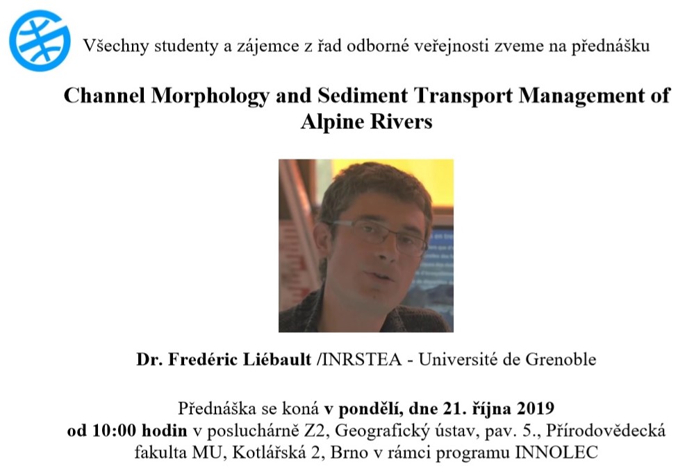
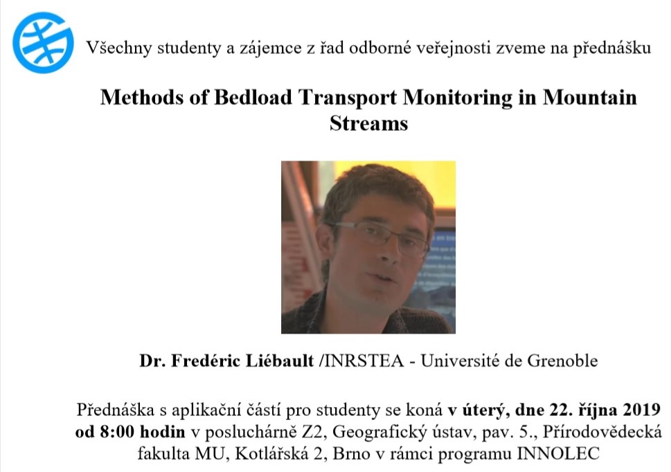
Ocenění pro dr. Lukáše Hermana
21.10.2019 0:00 Geografický ústav MUDr. Lukáš Herman zvítězil v soutěži studentských recenzovaných článků v časopise Cartographic Perspectives.
Článek The Design and Testing of 3DmoveR: an Experimental Tool for Usability Studies of Interactive 3D Maps byl vybrán jako nejlepší ze všech článků vydaných v roce 2018 ve zmíněném časopise a jejichž první autor byl v době publikování studentem.
Blahopřejeme.
Odešel kartograf a geograf Jaromír Kaňok
19.10.2019 10:12 Katedra geoinformatiky UP OlomoucV brzkých ranních hodinách dne 18. října 2019 uzavřel svoji životní a profesní pouť významný kartograf a geograf, autor desítek kartografických a hydrologických publikací, dlouholetý člen České geografické společnosti, čestný člen České kartografické společnosti a skvělý kamarád doc. RNDr. Jaromír Kaňok, CSc. S jeho jménem jsou spojeny roky výuky kartografie na ostravské a olomoucké univerzitě. Jaromír Kaňok […]
The post Odešel kartograf a geograf Jaromír Kaňok appeared first on Katedra geoinformatiky.
Smutná zpráva, kartograf a geograf doc. Jaromír Kaňok odešel…
19.10.2019 8:57 Česká kartografická společnost V brzkých ranních hodinách dne 18. října 2019 uzavřel svoji životní a profesní pouť významný kartograf a geograf, autor desítek kartografických a hydrologických publikací, dlouholetý člen České geografické společnosti, čestný člen České kartografické společnosti a skvělý kamarád doc. RNDr. Jaromír Kaňok, CSc. S jeho jménem jsou spojeny roky výuky kartografie na ostravské a olomoucké univerzitě. Jaromír Kaňok […]Barevná 3D mračna bodů a jejich používání pro dokumentaci – seminář
19.10.2019 7:27 ZeměměřičFirmy Gefos a Hexagon Geospatial pořádají ve čtvrtek 24. října 2019 v pražském konferenčním centru Green Point workshop, zaměřený na téma 3D mračen bodů. Na workshopu se účastníci seznámí s tematikou barevných 3D mračen bodů, jejich pořizováním, zpracováním a zejména sdílením dat a jejich vizualizací pro další využití. Workshop bude obsahovat živou ukázku postupu skenování 3D mračen bodů pomocí technologií firmy […]
The post Barevná 3D mračna bodů a jejich používání pro dokumentaci – seminář appeared first on Zeměměřič.
Orbit GT to exhibit and showcase v20 Portfolio at UAV Expo, Las Vegas
18.10.2019 20:52 GISCafe.com Webcasts-Webinars Lokeren, Belgium, October 17th, 2019Orbit GT will be exhibiting and showing version 20 of its 3D Mapping portfolio at UAV Expo, Las Vegas, NV, …
Data for Disasters: Leveraging Data Science for Disaster Response & Management
18.10.2019 16:46 GISCafe.com Webcasts-Webinars New Light Technologies and General Assembly Showcase Data Science Applications for Disaster ManagementWASHINGTON, Oct. 18, 2019 — (PRNewswire) …
WMR-532, LLC Signs $49.9M Geospatial Contract with USACE Mobile District
18.10.2019 16:46 GISCafe.com Webcasts-Webinars WMR-532 will provide bathymetric and topographic lidar and imagery around the world in support of JALBTCX.MOBILE, Ala., Oct. 18, 2019 — …
Emerging cracks in the Pine Island Glacier
18.10.2019 15:15 ESA Observing the Earth
The Copernicus Sentinel-1 and Sentinel-2 satellites have revealed new cracks, or rifts, in the Pine Island Glacier – one of the primary ice arteries in the West Antarctic Ice Sheet. The two large rifts were first spotted in early 2019 and have each rapidly grown to approximately 20 km in length.
Newsletter 10/2019
18.10.2019 14:42 Katedra geoinformatiky UP OlomoucMilí olomoučtí geoinformatici, přinášíme Vám první newsletter z vaší alma mater – Katedry geoinformatiky, Univerzity Palackého v Olomouci. Rádi bychom vás několikrát do roka seznámili s tím, co na katedře aktuálně děláme, co se u nás děje, co plánujeme do buducna nebo vás jenom potěšili nějakou zajímavostí.
The post Newsletter 10/2019 appeared first on Katedra geoinformatiky.
WSDP - aktualizace dokumentace verze 2.8
18.10.2019 13:33 ČÚZK /Aplikace-DP-do-KN/Aplikace-DP-do-KN/Archiv-DP/271012WSDP - aktualizace dokumentace verze 2.8
18.10.2019 13:33 ČÚZK - předpisy a opatření Vážení uživatelé Webových služeb DP,upozorňujeme, že došlo k aktualizaci dokumentace pro Webové služby Dálkového přístupu (WSDP) v2.8. Aktuální verzi najdete na http://www.cuzk.cz/Katastr-nemovitosti/Poskytovani-udaju-z-KN/Dalkovy-pristup/Webove-sluzby-dalkoveho-pristupu.aspx. Instalace bude provedena při hlášené odstávce od 25.10.2019 do 28.20.2019.
Za komplikace tímto způsobené se omlouváme a děkujeme za pochopení.