


![]()

zprávy
zdroje zpráv:Perspecta to Provide Geography Data Management Services to National Geospatial-Intelligence Agency
9.7.2018 20:35 GISCafe.com Webcasts-Webinars CHANTILLY, Va., July 9, 2018 — (PRNewswire) — Perspecta Inc. (NYSE: PRSP), a leading U.S. government services provider, announced …TomTom Acquires Full-Ownership of TomTom Africa
9.7.2018 16:56 GISCafe.com Webcasts-Webinars AMSTERDAM — (BUSINESS WIRE) — July 8, 2018 —TomTom (TOM2)
announces that it is strengthening its position in Africa …
Intermap Assists in Rescue of Thai Soccer Team, Congratulates Emergency Responders on recent progress
9.7.2018 16:56 GISCafe.com Webcasts-Webinars DENVER, July 8, 2018 — (PRNewswire) — (TSX: IMP) (ITMSF:BB) - Intermap Technologies® ("Intermap" or the "Company"), a leading …Maxar Technologies’ DigitalGlobe Introduces EarthWatch™, the Most Powerful Cloud-Based Commercial Product for Geospatial Information
9.7.2018 16:55 GISCafe.com Webcasts-Webinars WESTMINSTER, Colo. — (BUSINESS WIRE) — July 9, 2018 —DigitalGlobe,
a Maxar Technologies company (formerly MacDonald, …
Esri Developing ArcGIS Urban to Help Cities Orchestrate Real Estate Development
9.7.2018 16:52 GISCafe.com Webcasts-Webinars New Solution for Cities to Visualize Zoning Rules, Measure Impact,and Advance Projects
REDLANDS, Calif. — (BUSINESS WIRE) …
Esri Announces New Indoor Mapping Product
9.7.2018 16:52 GISCafe.com Webcasts-Webinars ArcGIS Indoors Will Modernize Corporate Facilities, Retail Stores,Airports, and More, by Offering Interactive, Real-Time Mapping
…
Esri Achieves FedRAMP Authorization for Cross-Cloud Location Intelligence
9.7.2018 16:52 GISCafe.com Webcasts-Webinars ArcGIS Online Now Available Government-Wide as Authorized Platformfor Geospatial Data Sharing
REDLANDS, Calif. — (BUSINESS …
odborný referent v oddělení právních vztahů k nemovitostem Katastrálního pracoviště Svitavy
9.7.2018 16:33 ČÚZK /Urady/Katastralni-urady/Katastralni-urady/Katastralni-urad-pro-Pardubicky-kraj/Uredni-deska/Oznameni-a-jina-uredni-sdeleni/Volna-mista/odborny-referent-v-oddeleni-pravnich-vztahu-k-nemoodborný referent v oddělení právních vztahů k nemovitostem Katastrálního pracoviště Svitavy
9.7.2018 16:33 ČÚZK - předpisy a opatření Katastrální úřad pro Pardubický kraj - Katastrální pracoviště Svitavyvypisuje výběrové řízení na místo odborný referent v oddělení právních vztahů k nemovitostem Katástrálního pracoviště Svitavy
odborný referent v oddělení právních vztahů k nemovitostem Katastrálního pracoviště Svitavy
odborný referent v oddělení právních vztahů k nemovitostem Katastrálního pracoviště Svitavy
9.7.2018 16:33 ČÚZK - volná místa Katastrální úřad pro Pardubický kraj - Katastrální pracoviště Svitavy vypisuje výběrové řízení na místo odborný referent v oddělení právních vztahů k nemovitostem Katastrálního pracoviště Svitavyodborný referent v oddělení obnovy katastrálního operátu Katastrálního úřadu pro Pardubický kraj
9.7.2018 16:26 ČÚZK /Urady/Katastralni-urady/Katastralni-urady/Katastralni-urad-pro-Pardubicky-kraj/Uredni-deska/Oznameni-a-jina-uredni-sdeleni/Volna-mista/odborny-referent-v-oddeleni-obnovy-katastralniho-oodborný referent v oddělení obnovy katastrálního operátu Katastrálního úřadu pro Pardubický kraj
9.7.2018 16:26 ČÚZK - volná místa Katastrální úřad pro Pardubický kraj vypisuje výběrové řízení na místo odborný referent v oddělení obnovy katastrálního operátu Katastrálního úřadu pro Pardubický krajodborný referent v oddělení obnovy katastrálního operátu Katastrálního úřadu pro Pardubický kraj
9.7.2018 16:26 ČÚZK - předpisy a opatření Katastrální úřad pro Pardubický krajvypisuje výběrové řízení na místo odborný referent v oddělení obnovy katastrálního operátu Katastrálního úřadu pro Pardubický kraj
odborný referent v oddělení obnovy katastrálního operátu Katastrálního úřadu pro Pardubický kraj
vrchní referent / rada v oddělení obnovy katastrálního operátu Katastrálního úřadu pro Pardubický k
9.7.2018 16:21 ČÚZK - předpisy a opatření Katastrální úřad pro Pardubický krajvypisuje výběrové řízení na místo vrchní referent / rada v oddělení obnovy katastrálního operátu Katastrálního úřadu pro Parubický kraj
vrchní referent / rada v oddělení obnovy katastrálního operátu Katastrálního úřadu pro Pardubický kraj
vrchní referent / rada v oddělení obnovy katastrálního operátu Katastrálního úřadu pro Pardubický k
9.7.2018 16:21 ČÚZK - volná místa Katastrální úřad pro Pardubický kraj vypisuje výběrové řízení na místo vrchní referent / rada v oddělení obnovy katastrálního operátu Katastrálního úřadu pro Pardubický kvrchní referent / rada v oddělení obnovy katastrálního operátu Katastrálního úřadu pro Pardubický k
9.7.2018 16:21 ČÚZK /Urady/Katastralni-urady/Katastralni-urady/Katastralni-urad-pro-Pardubicky-kraj/Uredni-deska/Oznameni-a-jina-uredni-sdeleni/Volna-mista/vrchni-referent-rada-v-oddeleni-obnovy-katastralNew efforts to better utilize complex plant models
9.7.2018 15:55 Bentley SystemsPress Coverage
Achema Daily, DACH
Read the articleNew efforts to better utilize complex plant models
9.7.2018 15:55 Bentley SystemsPress Coverage
Achema Daily, DACH
Read the articleNew efforts to better utilize complex plant models
9.7.2018 15:55 Bentley SystemsPress Coverage
Achema Daily, DACH
Read the articleACHEMA 2018 – Innovation and a strong plea for international cooperation
9.7.2018 15:49 Bentley SystemsPress Coverage
Hydrocarbon Processing, USA
Read the articleAIA Conference on Architecture 2018: Creating a Connected Data Environment with AECOsim Building Designer from Bentley Systems
9.7.2018 15:32 Bentley SystemsPress Coverage
AEC Next News, USA
Read the articleQuébec Celebrates Ties with Philadelphia at Barnes Foundation
9.7.2018 15:03 Bentley SystemsPress Coverage
The Daily Times, USA
Read the articleGalileos in place
9.7.2018 15:03 ESA Navigation
Attaching Europe's next Galileo navigation satellites to their dispenser ahead of their 25 July launch from Europe's Spaceport in French Guiana
Přímý přenos z konference Esri od 17.30
9.7.2018 12:46 ARCDATANejvětší GIS konference na světě začíná již dnes v 17.30 středoevropského času. Hlavní sekci prvního dne můžete zhlédnout prostřednictvím živého přenosu Facebooku.

20180709 Odborný referent oddělení dokumentace katastru nemovitostí
9.7.2018 10:33 ČÚZK - předpisy a opatření Katastrální úřad pro Středočeský kraj - Katastrální pracoviště Kolín zveřejnil novou aktualitu: V části "Úřední deska", v sekci "Oznámení a jiná úřední sdělení" bylo vystaveno "Oznámení o vyhlášení výběrového řízení na obsazení systemizovaného místa odborný referent oddělení dokumentace"20180709 Odborný referent oddělení dokumentace katastru nemovitostí
9.7.2018 10:33 ČÚZK /Urady/Katastralni-urady/Katastralni-urady/Katastralni-urad-pro-Stredocesky-kraj/Katastralni-pracoviste/KP-Kolin/O-uradu/Aktuality/20180709-Odborny-referent-oddeleni-dokumentace-kat20180709 Odborný referent oddělení dokumentace katastru nemovitostí
9.7.2018 10:31 ČÚZK - předpisy a opatření Katastrální úřad pro Středočeský kraj - Katastrální pracoviště Kolín zveřejnil novou aktualitu: Odborný referent oddělení dokumentace katastru nemovitostí V části "Úřední deska", v sekci "Oznámení a jiná úřední sdělení" bylo vystaveno "Oznámení o vyhlášení výběrového řízení na obsazení služebního místa Odborný referent oddělení dokumentace katastru nemovitostí Katastrálního pracoviště Kolín"20180709 Odborný referent oddělení dokumentace katastru nemovitostí
9.7.2018 10:31 ČÚZK /Urady/Katastralni-urady/Katastralni-urady/Katastralni-urad-pro-Stredocesky-kraj/O-uradu/Aktuality/20180709-Odborny-referent-oddeleni-dokumentace-katOdborný referent oddělení dokumentace katastru nemovitostí
9.7.2018 10:27 ČÚZK - předpisy a opatření Katastrální úřad pro Středočeský kraj - Katastrální pracoviště Kolínvypisuje výběrové řízení na místo Odborný referent oddělení dokumentace katastru nemovitostí
Odborný referent oddělení dokumentace katastru nemovitostí
Odborný referent oddělení dokumentace katastru nemovitostí
9.7.2018 10:27 ČÚZK - volná místa Katastrální úřad pro Středočeský kraj - Katastrální pracoviště Kolín vypisuje výběrové řízení na místo Odborný referent oddělení dokumentace katastru nemovitostíOslavte 100 let od založení Československa s projektem Lví stopa
9.7.2018 9:47 GISportal.cz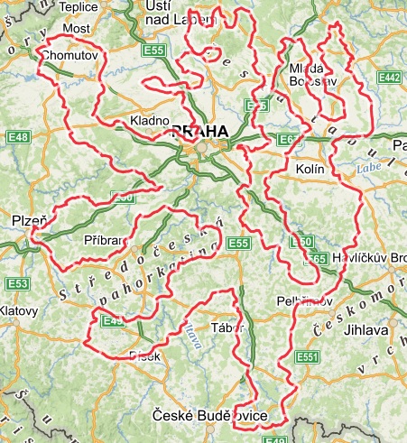
Letos je tomu přesně 100 let od založení Československa a organizátoři nejrůznějších akcí se předhánějí, kdo a jakým způsobem toto výročí připomene. Pokud svůj čas nejraději trávíte na kole v přírodě, můžete se do jedné z těchto akcí zapojit i Vy! Projekt Lví stopa je pro Vás jako stvořený! O co jde? V rámci projektu […]
The post Oslavte 100 let od založení Československa s projektem Lví stopa appeared first on GISportal.cz.
Fourth Annual Women in Drones Networking Event Planned for InterDrone
9.7.2018 9:29 GISCafe.com Webcasts-Webinars The Largest Annual Gathering in the Commercial Drone Space will also Partner with Women and Drones for the Special EventNEW YORK — July 10, …
UN-Space pledges greater use of space for sustainable development
9.7.2018 9:00 GISCafe.com Webcasts-Webinars VIENNA, 6 July (UN Information Service) – The United Nations Inter-Agency Meeting on Outer Space Activities (UN-Space) has issued a joint …Mapa zabezpečení lékařské pohotovostní péče v Děčíně.
9.7.2018 8:55 Ústecký krajOd 1.7. 2018 dochází v Děčíně k výrazné změně v systému služeb lékařské pohotovostní služby pro dospělé. Necelá polovina služeb bude sice nadále provozována a zajišťována v nemocnici, ostatní služby budou ale nově poskytovány v privátních ordinacích praktických lékařů, může se tedy stát, že každý den budou sloužit lékaři na jiné straně města.
Mapovou aplikaci naleznete na úvodní straně a také v sekci MAPY - > Zdravotní péče- > Mapa zabezpečení lékařské pohotovostní péče v Děčíně.
Registrace na INSPIRE Conference 2018 byla spuštěna
9.7.2018 8:53 CENIA - národní geoportál INSPIRE Od 18. do 21. září 2018 Belgie a Nizozemsko společně s Evropskou komisí pořádá INSPIRE konferenci v belgických Antverpách. S více než 250 prezentacemi a workshopy, velkou výstavou a místem, které se nachází v srdci krásného historického města Antverpy, jsou připraveni přivítat více než 1000 nadšených delegátů z celé Evropy i mimo ni. Registrace je otevřená! Centrálním tématem této konference je:...MetOp-C launch campaign kicks off
9.7.2018 8:40 ESA Observing the Earth
The MetOp-C launch campaign has kicked off with the first of three Antonovs landing at Cayenne Airport, French Guiana on 20 June.
Atlas Obscura
9.7.2018 7:00 Česká asociace pro geoinformace Už vás nebaví dovolená u moře? Už máte dost notoricky známých památek přeplněných turisty? Podívejte se na mapu nevšedních míst Atlas Obscura, třeba zde najdete ispiraci pro váš příštíRegistrace na INSPIRE Conference 2018 byla spuštěna
9.7.2018 7:00 Česká asociace pro geoinformace V belgických Anverpách se ve dnech 18. až 21. září 2018 uskuteční letošní ročník INSPIRE konference. Návštěvníci se mohou těšit na 250 prezentací a workshopů. Registrace je stále otevřená. Detailní program naleznete na webových stránkáchOrbit GT to showcase Geomni Oblique content in ArcOnline/ArcGIS at Esri UC, San Diego, CA
6.7.2018 19:54 GISCafe.com Webcasts-Webinars Lokeren, Belgium, July 6th, 2018.“Orbit GT and Geomni are proud to announce a major breakthrough for Esri users looking to use aerial Oblique …
2 Immersive Technologies/Learning Post Doc Opportunities
6.7.2018 18:25 ChoroPhronesis, in collaboration with other groups such as Teaching and Learning with Technology, the Stuckeman Center for Design Computing, the Pulse of the Earth Lab (and others), at The Pennsylvania State University, are delighted to announce the opening of two postdoctoral research positions. The postdocs will be working in vibrant transdiciplinary teams that are addressing […]Siemens and Bentley Systems Collaborate on Process Industries Academy Initiative
6.7.2018 15:14 Bentley SystemsPress Coverage
Society of Petroleum Engineers, USA
Read the articleSynchro and Bentley Systems enter technology partnership
6.7.2018 15:09 Bentley SystemsPress Coverage
Graphic Speak, USA
Read the articleBentley steps up 4D, acquires Synchro
6.7.2018 15:04 Bentley SystemsPress Coverage
Schnitger Corp, USA
Read the articleUnderstanding winds
6.7.2018 13:48 ESA Observing the Earth
ESA’s Aeolus wind satellite is being prepared for liftoff from Kourou. From orbit it will measure wind profiles on a global scale, using brand new technology
Full steam ahead for Aeolus launch
6.7.2018 11:10 ESA Observing the Earth
Having set sail from France on 15 June - Global Wind Day, ESA’s Aeolus wind satellite has arrived safe and sound at the launch site in French Guiana.
Airbus wins two ESA studies for Mars Sample Return mission
6.7.2018 10:51 GISCafe.com Webcasts-Webinars Sample Fetch Rover to retrieve cached samples on MarsEarth Return Orbiter to capture the samples and return them to EarthStevenage / Toulouse, …
Orbit GT will demo free ArcGIS Pro add-in for 3D Mapping Cloud at Esri UC, San Diego, CA
6.7.2018 10:41 GISCafe.com Webcasts-Webinars Lokeren, Belgium, July 5th, 2018 - Orbit GT will demo the free ArcGIS Pro pluginfor its 3D Mapping Cloud SaaS platform at next week’s Esri …Reykjavik
6.7.2018 10:05 ESA Observing the Earth
Earth observation image of the week: Sentinel-2 takes us over Iceland, a volcanic island famous for its volcanoes, glaciers, lakes, lava and hot springs
Earth from Space
6.7.2018 10:05 ESA Observing the Earth
In this week's edition, explore the volcanic island of Iceland with Sentinel-2
OSSConf Žilina 2018 (report)
6.7.2018 8:30 GISportal.czV dňoch 2.7. – 4.7.2018 sa na Fakulte riadenia a informatiky Žilinskej univerzity uskutočnil okrúhly 10. ročník konferencie OSSConf. Konferencia je primárne zameraná na otvorený softvér vo vzdelávaní, výskume a IT riešeniach, pričom jednotlivé sekcie sa venujú Open hardvéru, vývoju OSS, OSS vo vzdelávaní, LaTeXu a OpenGISu & OpenDatam. Posledná menovaná sekcia (t.j., OpenGIS & OpenData) prebehla […]
The post OSSConf Žilina 2018 (report) appeared first on GISportal.cz.
DigitalGlobe Appoints Mike Edwards as Vice President to Provide Strategic Leadership on Defense Programs
5.7.2018 15:52 GISCafe.com Webcasts-Webinars WESTMINSTER, Colo. — (BUSINESS WIRE) — July 5, 2018 —DigitalGlobe,
a Maxar Technologies company (formerly MacDonald, …
Superion to Showcase Unified GIS-Integrated Community Development Software at Esri User Conference
5.7.2018 15:52 GISCafe.com Webcasts-Webinars Smart automation in Superion Community Development software reducespermit turnaround time by as much as ten days in many cases.
LAKE …
Xplore Technologies Reports 12% Revenue Growth, $0.03 EPS in Fiscal 2018
5.7.2018 15:52 GISCafe.com Webcasts-Webinars Profitable Year Driven by Solid Growth, Operational ExecutionAgreement to be Acquired by Zebra TechnologiesAUSTIN, Texas, July 05, 2018 (GLOBE …
Jibestream First Indoor Mapping Platform to Export CAD-friendly Maps
5.7.2018 15:52 GISCafe.com Webcasts-Webinars TORONTO, July 05, 2018 (GLOBE NEWSWIRE) -- Jibestream, the premier indoor mapping platform provider, announced today the addition of another …Reducing Wastewater Treatment Design Cost in China
5.7.2018 15:41 Bentley SystemsPress Coverage
WaterWorld, USA
Read the articleBentley, Microsoft Malaysia Rail Scheme Team Up
5.7.2018 15:35 Bentley SystemsPress Coverage
News Publicist, USA
Read the articleTech and digitisation not optional for Middle East rail projects
5.7.2018 15:31 Bentley SystemsPress Coverage
Construction Week Online, Middle East
Read the articleOGC seeks public comment on proposed Statistical Domain Working Group
5.7.2018 15:26 GISCafe.com Webcasts-Webinars New OGC DWG seeks to identify how geospatial and statistical standards can support the integration of geospatial information into the statistical …Revolutionising asset management in the oil and gas industry
5.7.2018 15:25 Bentley SystemsPress Coverage
Process Technology, Australia/New Zealand
Read the articleOrbit GT releases free SDK/API for 3D Mapping Cloud SaaS platform
5.7.2018 12:12 GISCafe.com Webcasts-Webinars Lokeren, Belgium, July 4th, 2018 - Orbit GT releases free SDK/API for HTML5 Viewer supporting the 3D Mapping Cloud SaaS platform and the …Hexagon Launches Luciad's V2018.0 Release
5.7.2018 11:26 GISCafe.com Webcasts-Webinars NORCROSS, GA., 4 July, 2018 (GLOBE NEWSWIRE) – Hexagon’s Geospatial Division, a world leader in high performance geospatial solutions, …OGC Seeks Public Comment on new version of OpenSearch for Earth Observation Suite of Standards
5.7.2018 11:25 GISCafe.com Webcasts-Webinars Revision to OpenSearch extension for Earth Observation related searches includes two new encodings of the extension model using GeoJSON and …Nové verze 13.71 k dispozici
4.7.2018 18:11 GEPROZveřejnili jsme verze 13.71 našich produktů MISYS, MISYS-WEB, KOKEŠ, a PROLAND.
Stahovat je můžete z obvyklého umístění na našem download serveru:
… >>Nové verze 13.71 k dispozici
4.7.2018 18:11 GEPROZveřejnili jsme verze 13.71 našich produktů MISYS, MISYS-WEB, KOKEŠ, a PROLAND.
Stahovat je můžete z obvyklého umístění na našem download serveru:
… >>Nové verze 13.71 k dispozici
4.7.2018 18:11 GEPROZveřejnili jsme verze 13.71 našich produktů MISYS, MISYS-WEB, KOKEŠ, a PROLAND.
Stahovat je můžete z obvyklého umístění na našem download serveru:
… >>Nové verze 13.71 k dispozici
4.7.2018 18:11 GEPROZveřejnili jsme verze 13.71 našich produktů MISYS, MISYS-WEB, KOKEŠ, a PROLAND.
Stahovat je můžete z obvyklého umístění na našem download serveru:
… >>Nové verze 13.71 k dispozici
4.7.2018 18:11 GEPROZveřejnili jsme verze 13.71 našich produktů MISYS, MISYS-WEB, KOKEŠ, a PROLAND.
Stahovat je můžete z obvyklého umístění na našem download serveru:
… >>Nové verze 13.71 k dispozici
4.7.2018 18:11 GEPROZveřejnili jsme verze 13.71 našich produktů MISYS, MISYS-WEB, KOKEŠ, a PROLAND.
Stahovat je můžete z obvyklého umístění na našem download serveru:
… >>Nové verze 13.71 k dispozici
4.7.2018 18:11 GEPROZveřejnili jsme verze 13.71 našich produktů MISYS, MISYS-WEB, KOKEŠ, a PROLAND.
Stahovat je můžete z obvyklého umístění na našem download serveru:
… >>Geosoft add-in enhances integration with ArcGIS Pro
4.7.2018 18:03 GISCafe.com Webcasts-Webinars July 4, 2018 -- Geosoft, a geoscience software leader, has released a new add-in for importing and viewing Geosoft raster files within ArcGIS Pro, …GAF introduces perfect reference in x, y, z for orthorectification of VHR data
4.7.2018 18:02 GISCafe.com Webcasts-Webinars GAF AG introduces Euro-Maps 3D for Ortho, a transnational, homogeneous and geometrically consistent digital elevation model and ortho layer that …Mapová aplikace ÚPD - nové dokumentace
4.7.2018 12:45 Jihočeský kraj V mapové aplikaci Územně plánovací dokumentace obcí byla aktualizována územně plánovací dokumentace obcí Čestice, Drahov, Kájov, Litochovice, Horní Stropnice, Přeborov, Vodňany, Úlehle. Nově pak byla přidána územně plánovací dokumentace obce Nadějkov.OGC Seeks Public Comment on WFS 3.0 Candidate Standard
4.7.2018 12:19 GISCafe.com Webcasts-Webinars Latest version of Web Feature Service standard aligns with the current architecture of the Web and the joint OGC-W3C Spatial Data on the Web Best …Orbit GT will demo free ArcOnline widget for 3D Mapping Cloud at Esri UC, San Diego, CA
4.7.2018 12:19 GISCafe.com Webcasts-Webinars Lokeren, Belgium, July 3rd, 2018 - Orbit GT will demo the free ArcOnline widget for its 3D Mapping Cloud SaaS platform at next week’s Esri UC …Airbus completes the integration of Cheops satellite
4.7.2018 12:12 GISCafe.com Webcasts-Webinars ESA’s new exoplanet hunting satellite is on track for launch by the end of the yearMadrid, 03/07/2018 – Airbus has completed the …
20180704 Rada/odborný rada oddělení aktualizace katastru nemovitostí
4.7.2018 8:57 ČÚZK /Urady/Katastralni-urady/Katastralni-urady/Katastralni-urad-pro-Stredocesky-kraj/Katastralni-pracoviste/KP-Kladno/O-uradu/Aktuality/20180704-Rada-odborny-rada-oddeleni-aktualizace-ka20180704 Rada/odborný rada oddělení aktualizace katastru nemovitostí
4.7.2018 8:57 ČÚZK - předpisy a opatření Katastrální úřad pro Středočeský kraj - Katastrální pracoviště Kladno zveřejnil novou aktualitu: Rada/odborný rada oddělení aktualizace katastru nemovitostí V části "Úřední deska", v sekci "Oznámení a jiná úřední sdělení" bylo vystaveno "Oznámení o vyhlášení výběrového řízení na obsazení služebního místa Rada/odborný rada oddělení aktualizace katastru nemovitostí"20180704 Rada/odborný rada oddělení aktualizace katastru nemovitostí
4.7.2018 8:53 ČÚZK /Urady/Katastralni-urady/Katastralni-urady/Katastralni-urad-pro-Stredocesky-kraj/O-uradu/Aktuality/20180704-Rada-odborny-rada-oddeleni-aktualizace-ka20180704 Rada/odborný rada oddělení aktualizace katastru nemovitostí
4.7.2018 8:53 ČÚZK - předpisy a opatření Katastrální úřad pro Středočeský kraj - Katastrální pracoviště Kladno zveřejnil novou aktualitu: Rada/odborný rada oddělení aktualizace katastru nemovitostí V části "Úřední deska", v sekci "Oznámení a jiná úřední sdělení" bylo vystaveno "Oznámení o vyhlášení výběrového řízení na obsazení služebního místa "Rada/odborný rada oddělení aktualizace katastru nemovitostí Katastrálního pracoviště Kladno"Rada/odborný rada oddělení aktualizace katastru nemovitostí
4.7.2018 8:46 ČÚZK - předpisy a opatření Katastrální úřad pro Středočeský kraj - Katastrální pracoviště Kladnovypisuje výběrové řízení na místo Rada/odborný rada oddělení aktualizace katastru nemovitostí
Rada/odborný rada oddělení aktualizace katastru nemovitostí
Rada/odborný rada oddělení aktualizace katastru nemovitostí
4.7.2018 8:46 ČÚZK - volná místa Katastrální úřad pro Středočeský kraj - Katastrální pracoviště Kladno vypisuje výběrové řízení na místo Rada/odborný rada oddělení aktualizace katastru nemovitostíAktualizace dat zastávek veřejné dopravy
4.7.2018 8:35 Jihočeský kraj V sekci Doprava a silniční hospodářství byla aktualizována mapová aplikace se zastávkami veřejné dopravy a zároveň i otevřená data v licenci CC BY-SA 4.0.Geospatial Data Scientist
4.7.2018 6:33 Application Deadline July 10th https://jobs.uic.edu/job-board/job-details?jobID=98073GNSS dráhy družic a parametry rotace Země
4.7.2018 2:00 Cenia - Katalog metadat ČR - INSPIRE Dráhy GNSS družic a parametry rotace Země založené na zpracování GNSS měření z globální sítě IGS (Mezinárodní GNSS Služby) v rychlém či ultra-rychlém módu zpracování.Přírodní biotopy (aktualizace základního mapování biotopů)
4.7.2018 2:00 Cenia - Katalog metadat ČR - INSPIRE Hranice segmentů přírodních biotopů a relační databáze jejich charakteristik z aktualizace základního mapování biotopů; klasifikace biotopů viz CHYTRÝ, M.; KUČERA, T.; KOČÍ, M. (eds.) et al. (2010). Katalog biotopů České republiky. 2.upr. a rozš.vyd. Praha: Agentura ochrany přírody a krajiny ČR. 445 s. ISBN 978-80-87457-03-0.; popis charakteristik biotopů a segmentů viz platná metodika mapování biotopů (Portál ISOP/Mapování biotopů); vrstva obsahuje jednoduché prvky (Singlepart Features), kardinalita vztahu mezi záznamy v tabulkách 1 : N; © AOPK ČR, 2018Data z mapování biotopů neposkytují vyčerpávající informaci o vegetaci, resp. biotopech daného území. Mapování biotopů je opakováno v 12-leté periodě, především efemérní biotopy tak může pominout. Je metodicky nastaveno na celostátní úrovni, v lokálním měřítku je pouze zjednodušeným podkladem. Pro detailnější informaci je třeba odborný průzkum či konzultace.Časové řady troposférických parametrů z GNSS dat
4.7.2018 2:00 Cenia - Katalog metadat ČR - INSPIRE Časové řady troposférických parametrů ze zpracování GNSS měření z globální sítě IGS (Mezinárodní GNSS Služby) a regionálních sítí - EPN (Permanentní sítě EUREF) v Evropě a VESOG, GEONAS, CZEPOS v České republice.Habitaty (aktualizace základního mapování biotopů)
4.7.2018 2:00 Cenia - Katalog metadat ČR - INSPIRE Hranice segmentů habitatů a relační databáze jejich charakteristik z aktualizace základního mapování biotopů; převodní tabulka habitatů viz CHYTRÝ, M.; KUČERA, T.; KOČÍ, M. (eds.) et al. (2010). Katalog biotopů České republiky. 2.upr. a rozš.vyd. Praha: Agentura ochrany přírody a krajiny ČR. 445 s. ISBN 978-80-87457-03-0.; vrstva obsahuje jednoduché prvky (Singlepart Features), kardinalita vztahu mezi záznamy v tabulkách 1 : N; © AOPK ČR, 2018Data z mapování biotopů neposkytují vyčerpávající informaci o vegetaci, resp. biotopech daného území. Mapování biotopů je opakováno v 12-leté periodě, především efemérní biotopy tak může pominout. Je metodicky nastaveno na celostátní úrovni, v lokálním měřítku je pouze zjednodušeným podkladem. Pro detailnější informaci je třeba odborný průzkum či konzultace.Časové řady souřadnic GNSS stanic
4.7.2018 2:00 Cenia - Katalog metadat ČR - INSPIRE Časové řady souřadnic jsou výsledkem zpracování GNSS měření podmnožiny stanic EPN (Permanentní síť EUREF) nebo CZECH - GNSS sít v České republice - VESOG, GEONAS a CZEPOS. Obsahuje denní řešení EUREF zpracování nebo EUREF reanalýzy.Aktualizace základního mapování biotopů
4.7.2018 2:00 Cenia - Katalog metadat ČR - INSPIRE Aktualizace vrstvy segmentů biotopů a relačních databází (biotopy, taxony) ve dvanáctiletém cyklu; zahájení aktualizace v roce 2007. Ve vrstvě a tabulkách jsou aktualizované a neaktualizované záznamy (pole ROK_AKT). Vrstva obsahuje hranice segmentů přírodních biotopů a biotopů silně ovlivněných nebo vytvořených člověkem z aktualizace základního mapování biotopů. Znalost rozšíření biotopů silně ovlivněných nebo vytvořených člověkem není plošná, vrstva poskytuje informace o rozšíření nepřírodních biotopů pouze na malé části území ČR.Data z mapování biotopů neposkytují vyčerpávající informaci o vegetaci, resp. biotopech daného území. Mapování je metodicky nastaveno na celostátní úrovni, a především efemérní biotopy tak může pominout. V lokálním měřítku proto představuje pouze zjednodušený podklad. Pro detailnější informaci je třeba vyhledat jiné datové zdroje. Základní mapování bylo provedeno v letech 2001–2005.Klasifikace biotopů viz CHYTRÝ, M.; KUČERA, T.; KOČÍ, M. (eds.) et al. (2010). Katalog biotopů České republiky. 2.upr. a rozš.vyd. Praha: Agentura ochrany přírody a krajiny ČR. 445 s. ISBN 978-80-87457-03-0.Popis charakteristik biotopů a segmentů viz platná metodika mapování biotopů (Portál ISOP/Mapování biotopů). Botanická nomenklatura převzata z Nálezové databáze OP (http://isop.nature.cz/redlist/v_nd_taxon_category.php). Vrstva obsahuje jednoduché prvky (Singlepart Features), kardinalita vztahu tabulek je 1 : N. © AOPK ČR, 2018Opakovaná měření tíhového zrychlení absolutními gravimetry
4.7.2018 2:00 Cenia - Katalog metadat ČR - INSPIRE Opakovaná měření tíhového zrychlení na 5 absolutních tíhových bodech v České republice jsou prováděna absolutními gravimetry FG5 č. 215 a FG5X č. 251 vyrobenými Micro-g LaCoste, Inc. v USA. Data jsou distribuována do databáze AGrav.Kontinuální observace supravodivým gravimetrem
4.7.2018 2:00 Cenia - Katalog metadat ČR - INSPIRE Relativní supravodivý gravimetr OSG-050 vyrobený GWR Instruments, Inc. v USA provádí kontinuální měření změn tíhováho zrychlení s intervalem záznamu 1 sekunda v gravimetrické laboratoři Pecný od roku 2007. Data jsou distribuována do IGETS (Mezinárodní služba pro geodynamiku a zemské slapy).GNSS měření PPGNET
4.7.2018 2:00 Cenia - Katalog metadat ČR - INSPIRE Síť permanentních GNSS stanic v Řecku provozovaná Výzkumným ústavem geodetickým, topografickým a kartografickým - Geodetickou observatoří Pecný a Karlovou univerzitou v Praze, Matematicko-fyzikální fakultou, katedrou geofyziky v úzké spolupráci se Seismologickou laboratoří Univerzity v Patrasu.GNSS měření VESOG
4.7.2018 2:00 Cenia - Katalog metadat ČR - INSPIRE Výzkumná a experimentální síť permanentních GNSS stanic provozovaná Výzkumným ústavem geodetickým, topografickým a kartografickým - Geodetickou observatoří Pecný ve spolupráci s více akademickými a výzkumnými institucemi v České republice: Vysokým učením technickým v Brně, Universitou Palackého v Olomouci, VŠB-Technickou universitou Ostrava, Západočeskou universitou v Plzni, Ústavem fyziky atmosféry AV ČR, Vojenským geografickým a hydrometeorologickým úřadem v Dobrušce.CoreLogic Reports May Home Prices Increased by 7.1 Percent, Consumers Express Desire to Buy Despite High Prices
3.7.2018 19:10 GISCafe.com Webcasts-Webinars In Hottest Markets, Renters’ Desire to Buy Outpaces AvailableSellers by Four Times
Washington, Nevada, Idaho and …
European CIO Conference
3.7.2018 15:09 Bentley SystemsPress Coverage
Infrastructure Intelligence, UK
Read the articleEuropean CIO Conference
3.7.2018 15:09 Bentley SystemsPress Coverage
Infrastructure Intelligence, UK
Read the articleEuropean CIO Conference
3.7.2018 15:09 Bentley SystemsPress Coverage
Infrastructure Intelligence, UK
Read the articlePearl Harbor Memorial Bridge
3.7.2018 15:03 Bentley SystemsPress Coverage
Informed Infrastructure, USA
Read the articleMott MacDonald Optimized Complex Designs with Digital Workflows
3.7.2018 14:57 Bentley SystemsPress Coverage
Informed Infrastructure, USA
Read the articleSteel Bridge Design Specification Revised in New ASSHTO Edition
3.7.2018 14:51 Bentley SystemsPress Coverage
Informed Infrastructure, USA
Read the articleNext four Galileo satellites fuelled for launch
3.7.2018 12:55 ESA Navigation
Europe’s next four Galileo satellites have been fuelled at Europe’s Spaceport in Kourou, French Guiana, in preparation for their launch on 25 July.
Next four Galileo satellites fuelled for launch
3.7.2018 12:55 ESA NavigationEurope’s next four Galileo satellites have been fuelled for launch at Europe’s Spaceport in Kourou, French Guiana, in preparation for their launch on 25 July.
Zásobovací loď Dragon dodala experiment ICE Cubes na ISS
3.7.2018 12:23 Český Kosmický PortálNově instalované zařízení International Commercial Experiment (ICE Cubes) na ISS poskytuje komerční přístup k mikrogravitaci. Po úspěšném startu zásobovací lodi SpaceX Dragon pak již brzy získá pracovní náplň.
Vrátný
3.7.2018 10:47 ČÚZK - předpisy a opatření Zeměměřický úřadvypisuje výběrové řízení na místo
Vrátný
Vrátný
3.7.2018 10:47 ČÚZK - předpisy a opatření Zeměměřický úřadvypisuje výběrové řízení na místo
Vrátný
OGC Seeks Public Comment on 3D Tiles Candidate Community Standard
3.7.2018 10:44 GISCafe.com Webcasts-Webinars 2 July 2018: The Open Geospatial Consortium (OGC) seeks public comment on the 3D Tiles Specification 1.0 candidate Community standard.3D Tiles is a …
Konference GIS v plánování města a regionů 2018
3.7.2018 7:39 CENIA - národní geoportál INSPIRE Konference GIS v plánování měst a regionů. Akce proběhne 13.9.2018 v prostorách Vysoké školy regionálního rozvoje a Bankovního institutu - AMIBS a.s. na adrese Žalanského 68/54, Praha 17 - Řepy. Akci spolu s vysokou školou pořádá i Česká asociace pro geoinformace. Registrace zde.Konference GIS v plánování měst a regionů 2018
3.7.2018 7:39 CENIA - národní geoportál INSPIRE Česká asociace pro geoinformace a Vysoká škola regionálního rozvoje a Bankovní institut - AMIBS a.s. pořádají dne 13.9.2018 již 4. ročník konference GIS v plánování měst a regionů. Akce proběhne v prostorách vysoké školy na adrese Žalanského 68/54, Praha 17 - Řepy.CCSS zve na školení v oblasti odpovědného výzkumu
3.7.2018 7:00 Česká asociace pro geoinformaceČeské centrum pro vědu a společnost (CCSS), kolektivní člen CAGI, pořádá bezplatné školení v oblasti odpovědného výzkumu a inovací (RRI) se zaměřením na malé a střední podniky.
V připravovaném školení bude představen základní přístup RRI, jenž lze definovat jako zapojování společnosti do vědy a inovací prostřednictvím různých aspektů vztahu –
Zeměměřický úřad hledá kontrolora dat ZABAGED
3.7.2018 7:00 Česká asociace pro geoinformaceZeměměřický dat hledá do Opavy pracovníka na místo kontrolora dat ZABAGED. Náplní práce je obsahová kontrola dat zpracovávaného území, zejména s ohledem na jejich aktuálnost, věcnou správnost a topologii, podpořená terénním šetřením a kontrola geometrického zpřesňování objektů ZABAGED® na podkladě dat leteckého
měřického snímkování a leteckého