


![]()

zprávy
zdroje zpráv:GISfórum 2017 - ohlédnutí
12.10.2017 7:39 GIS FórumTřetího října proběhl jubilejní desátý ročník akce GISfórum zaměřené na výměnu zkušeností v oblasti GIS. Letošní program byl nasměrován především na zkušenosti spojené s životním cyklem dat ve společnosti a jejich návazností na systém GIS.
Na toto téma měl prezentaci Martin Vlček ze společnosti ČEZ, a.s. a dále na něj navázali Jakub Bican a Lubomír Lazar. Ten ukázal praktický příklad, jakým způsobem lze migrovat BIM data vytvořená projekční společností do aplikace twiGIS (GIS). K tomuto tématu se v nejbližší době určitě vrátíme a přineseme podrobnější informace.

Dalším prezentujícím byl Michal Štajnc z teplárenské společnosti R A T E s.r.o., který všem účastníkům dokázal, že i v malé společnosti má GIS praktické a především efektivní využití. Díky integraci systému GIS na obchodně-technický informační systém eSADA, dokáží v R A T E prostřednictvím klienta AutoCAD Map 3D prakticky do minuty vygenerovat hromadnou korespondenci pro odběratele dotčené pravidelnou odstávkou či poruchou.
Závěrečnou zákaznickou prezentaci obstarali pánové Branislav Štefanec (Bratislavská vodárenská spoločnosť a.s.) a Ján Kobyda (Infra Services a.s.). Oba prezentující předali všem účastníků své praktické zkušenosti s migrací dat a především následným čištění dat v GIS. Čištění dat bylo zaměřeno na odběrná místa s návazností na provozovaný zákaznický informační systém a slovenský katastr nemovitostí (registr adres). Pro všechny účastníky byly určitě zajímavé i praktické rady na téma jak zainteresovat více uživatelů do systému GIS.
Ještě jednou děkujeme všem prezentujícím za přínosné informace a všem účastníkům za příjemnou společnost!
Vedoucí skupiny GIS
12.10.2017 7:04 https://www.muni.cz/o-univerzite/kariera-na-mu/volna-mista/36426 Pracoviště Divize informačních systémů – Ústav výpočetní techniky Termín přihlášek 9. 11. 2017 Nástup dle dohody Místo poštovní adresy hlásíte souřadnice GPS? Za nejlepší mapu v historii považujete tu digitální? Pak čtěte dále: Hledáme koordinátora a integrátora interních i externích projektů webových GISů. Vyvíjíme mapové a vizualizační aplikace určené desítkám tisíc uživatelů na Masarykově […]INSPIRE téma Rozšířené Parcely (CPX)
12.10.2017 2:00 Cenia - Katalog metadat ČR - INSPIRE Rozšíření má za cíl poskytovat katastrální mapu s obsahem podle vyhlášky ve vektorové podobě ve struktuře plně v souladu se strukturou danou směrnicí INSPIRE. Data rozšiřují směrnici INSPIRE pro téma katastrální parcely (CP) o věcná břemena, geodetické body, další prvky mapy, původní obloukovou geometrii a o parcely určené definičním bodem (ty pouze v oblastech s analogovou mapou). Vychází z katastrální mapy, která je závazným státním mapovým dílem velkého měřítka, obsahuje body polohového bodového pole, polohopis a popis a může mít formu digitální mapy, analogové mapy nebo digitalizované mapy. Publikovaná data obsahují katastrální území pro celou Českou Republiku, parcely a jejich hranice, věcná břemena, další prvky mapy a původní obloukovou geometrii z území, kde je digitální mapa (k 09. 10. 2017 je to 92,66% území České republiky, t.j. 73 074,65km2) a ve zbytku území katastrální parcely určené pouze definičním bodem (tedy bez hranic a polygonu). Katastrální parcely a hranice obsahují oproti datové sadě INSPIRE některé atributy navíc. Jedná se o typ hranice, způsob využití území, druh pozemku, vazbu na budovu a o mapové značky. Více katastrální zákon 344/1992 SB., katastrální vyhláška č.26/2007 Sb. v platném znění a INSPIRE Data Specification on Cadastral Parcels v 3.0.1. Data ve formátu GML 3.2.1 jsou validní proti schématu XML pro Rozšířené Parcely (CPX) ve verzi 4.0.Katastrální mapa ve formátech DGN a DXF poskytovaná v e-shopu
12.10.2017 2:00 Cenia - Katalog metadat ČR - INSPIRE Katastrální mapa je závazným státním mapovým dílem velkého měřítka, obsahuje body polohového bodového pole, polohopis a popis. Katastrální mapa ve vektorové podobě je poskytována zdarma ve formátu DGN a DXF a obsahuje prvky Digitální katastrální mapy (DKM) a Katastrální mapy digitalizované (KMD), tedy bodová pole, budovy, další prvky mapy, hranice parcel, katastrální hranice, parcely katastru nemovitostí, prvky orientační mapy a hranice věcného břemene. Z důvodu použití formátu DGN produkt neobsahuje značky na liniích a oblouky jsou nahrazeny lomenými čárami. Katastrální mapa ve vektorové podobě k 09. 10. 2017 pokrývá 92,66% území České republiky, t.j. 73 074,65km2. Více katastrální vyhláška č.357/2013 Sb. v platném znění.Katastrální mapa v rastrové podobě poskytovaná v e-shopu
12.10.2017 2:00 Cenia - Katalog metadat ČR - INSPIRE Katastrální mapa v rastrové podobě je poskytována za úplatu a obsahuje analogovou mapu s kompletní kresbou. Analogová mapa pokrývá 5,87 % území České republiky, což je 4 626,65km2. Více katastrální vyhláška č.357/2013 Sb. v platném znění.INSPIRE téma Budovy (BU)
12.10.2017 2:00 Cenia - Katalog metadat ČR - INSPIRE Data odpovídají směrnici INSPIRE pro téma budovy (BU). Data pochází částečně z projektu RÚIAN (Registr územní identifikace, adres a nemovitostí), který je součástí základních registrů České Republiky a obsahuje informace o územní identifikaci, adresách a nemovitostech, a částečně z ISKN (Informační systém katastru nemovistostí). Zdrojem informací o budovách v ISKN je objekt Stavba, v RÚIAN je to Stavební objekt. Většina Staveb je zároveň Stavebními objekty, ale jsou případy, kdy tomu tak není. Kromě Budov datová sada obsahuje i části budov, které jsou pro potřeby INSPIRE vyjádřeny vchody z RÚIAN. Vchody obsahují informace o počtu podlaží, technickoekonomických atributech apod. Datová sada pokrývá celé území české republiky. V datové sadě není uvedeno 1,78%, t.j. 75275 budov (k 09. 10. 2017), protože neobsahují definiční bod ani polygon. Více v zákoně č. 111/2009 Sb., o základních registrech, ve vyhlášce č. 359/2011 Sb., o základním registru územní identifikace, adres a nemovitostí v platných zněních, v zákoně 256/2013 Sb., o katastru nemovitostí, v katastrální vyhlášce č. 357/2013 Sb. v platném znění a INSPIRE Data Specification on Buildings v 3.0 z 13.12.2013. Data ve formátu GML 3.2.1 jsou validní proti schématu XML pro INSPIRE téma Budovy ve verzi 4.0 a proti schématu pro prostorová data ELF ve verzi 1.0.INSPIRE stahovací služba ATOM pro téma Parcely (CP)
12.10.2017 2:00 Cenia - Katalog metadat ČR - INSPIRE Stahovací služba pro téma Parcely (CP) je veřejná stahovací služba pro poskytování dat z INSPIRE tématu Parcely (CP), umožňující uživatelům opakované stahování těchto dat v souborech po obcích a online přístup k těmto datům pomocí technologie Atom. Stahovací služba poskytuje harmonizovaná data tématu Parcely (CP) ve formátu GML 3.2.1 ve struktuře dané datovou specifikací a XML schématy ve verzi 4.0. Služba je dostupná pro celé území České Republiky. Služba splňuje technické pokyny pro INSPIRE stahovací služby verze 3.1.INSPIRE stahovací služba WFS pro téma Rozšířené Parcely (CPX)
12.10.2017 2:00 Cenia - Katalog metadat ČR - INSPIRE Stahovací služba pro Rozšířené Parcely (CPX) je veřejná stahovací služba pro poskytování dat z Informačního systému katastru nemovitostí (ISKN), umožňující uživatelům opakované stahování těchto dat v souborech po katastrálních územích a online přístup k těmto datům pomocí technologie WFS 2.0.0. Stahovací služba poskytuje harmonizovaná data Rozšířených Parcel (CPX) ve formátu GML vycházející z INSPIRE. Služba je dostupná pro celé území České republiky. Publikovaná data obsahují katastrální území pro celou Českou Republiku, parcely a jejich hranice, věcná břemena, další prvky mapy a původní obloukovou geometrii z území, kde je digitální mapa (k 09. 10. 2017 je to 92,66% území České republiky, t.j. 73 074,65km2) a ve zbytku území katastrální parcely určené pouze definičním bodem (tedy bez hranic a polygonu) jako analogové parcely. Služba splňuje technické pokyny pro INSPIRE stahovací služby verze 3.0.1 a zároveň splňuje standard OGC WFS 2.0.0.INSPIRE téma Adresy (AD)
12.10.2017 2:00 Cenia - Katalog metadat ČR - INSPIRE Data odpovídají směrnici INSPIRE pro téma adresy (AD). Vychází především z projektu RÚIAN (Registr územní identifikace, adres a nemovitostí), který je součástí základních registrů České Republiky a obsahuje informace o územní identifikaci, adresách a nemovitostech. Data publikovaná v rámci INSPIRE obsahují pouze adresní místa a jejich komponenty, kterými jsou stát, obec, část obce, městský obvod v Praze (MOP), městký obvod/městská část (MO/MČ), ulice a pošta a to na území celé České Republiky. Obsahují rozvněž geometrii, která určuje definiční bod adresního místa. V datové sadě nění uvedeno 1,92%, t.j. 55795 adresních míst (k 09. 10. 2017), protože neobsahují definiční bod, podle kterého by je bylo možné prostorově určit. Více v zákoně č. 111/2009 Sb., o základních registrech a ve vyhlášce č. 359/2011 Sb., o základním registru územní identifikace, adres a nemovitostí v platných zněních a INSPIRE Data Specification on Addresses v 3.0.1 z 26.4.2010. Data ve formátu GML 3.2.1 jsou validní proti schématu XML pro INSPIRE téma Adresy ve verzi 4.0 a proti schématu pro prostorová data ELF ve verzi 1.0.INSPIRE téma Parcely (CP)
12.10.2017 2:00 Cenia - Katalog metadat ČR - INSPIRE Data odpovídají směrnici INSPIRE pro téma katastrální parcely (CP). Vychází z katastrální mapy, která je závazným státním mapovým dílem velkého měřítka, obsahuje body polohového bodového pole, polohopis a popis a může mít formu digitální mapy, analogové mapy nebo digitalizované mapy. Data publikovaná v rámci INSPIRE obsahují pouze katastrální území (pro celou Českou Republiku) a parcely a jejich hranice z území, kde je digitální mapa (k 09. 10. 2017 je to 92,66% území České republiky, t.j. 73 074,65km2). Více katastrální zákon 344/1992 SB., katastrální vyhláška č.26/2007 Sb. v platném znění a INSPIRE Data Specification on Cadastral Parcels v 3.0.1. Data ve formátu GML 3.2.1 jsou validní proti schématu XML pro INSPIRE téma Parcely ve verzi 4.0 a proti schématu pro prostorová data ELF ve verzi 1.0.INSPIRE stahovací služba ATOM pro téma Rozšířené Parcely (CPX)
12.10.2017 2:00 Cenia - Katalog metadat ČR - INSPIRE Stahovací služba pro Rozšířené Parcely (CPX) je veřejná stahovací služba pro poskytování dat z rozšíření INSPIRE tématu Parcely (CP), umožňující uživatelům opakované stahování těchto dat v souborech po obcích a online přístup k těmto datům pomocí technologie Atom. Stahovací služba poskytuje harmonizovaná data Rozšířených Parcel (CPX) ve formátu GML 3.2.1 ve struktuře dané datovou specifikací a XML schématem pro aplikační schéma Cadastral Parcels Extended (CPX) ve verzi 4.0. Služba je dostupná pro celé území České Republiky. Služba splňuje technické pokyny pro INSPIRE stahovací služby verze 3.1.California fires
11.10.2017 15:51 ESA Observing the Earth
Sentinel-3 captured smoke from a recent outbreak of wildfires in the US state of California as they spread to the Pacific coast
Analytik - programátor (12. platová třída)
11.10.2017 15:00 ČÚZK - volná místa Český úřad zeměměřický a katastrální vypisuje výběrové řízení na místo Analytik - programátor (12. platová třída)Analytik - programátor (12. platová třída)
11.10.2017 15:00 ČÚZK - předpisy a opatření Český úřad zeměměřický a katastrálnívypisuje výběrové řízení na místo
Analytik - programátor (12. platová třída)
Analytik - programátor (12. platová třída)
11.10.2017 15:00 ČÚZK /Urady/Cesky-urad-zememericky-a-katastralni/Uredni-deska/Oznameni-a-jina-uredni-sdeleni/Volna-mista/Analytik-programator-(12-platova-trida)Analytik - programátor (13. platová třída)
11.10.2017 14:42 ČÚZK - předpisy a opatření Český úřad zeměměřický a katastrálnívypisuje výběrové řízení na místo
Analytik - programátor (13. platová třída)
Analytik - programátor (13. platová třída)
11.10.2017 14:42 ČÚZK /Urady/Cesky-urad-zememericky-a-katastralni/Uredni-deska/Oznameni-a-jina-uredni-sdeleni/Volna-mista/Analytik-programator-(13-platova-trida)Analytik - programátor (13. platová třída)
11.10.2017 14:42 ČÚZK - volná místa Český úřad zeměměřický a katastrální vypisuje výběrové řízení na místo Analytik - programátor (13. platová třída)Osobní automobil Škoda Fabia combi
11.10.2017 14:17 ČÚZK - předpisy a opatřeníKatastrální úřad pro Jihomoravský kraj nabízí nepotřebný majetek k odkupu. Jedná se o
Osobní automobil Škoda Fabia combi
Osobní automobil Škoda Fabia combi
11.10.2017 14:17 ČÚZK /Urady/Katastralni-urady/Katastralni-urady/Katastralni-urad-pro-Jihomoravsky-kraj/Nabidky-majetku/Osobni-automobil-Skoda-Fabia-combi20171011 - volné místo - Referent KN v odd.právních vztahů nemovitostem KP LT (zástup za MD)
11.10.2017 12:47 ČÚZK /Urady/Katastralni-urady/Katastralni-urady/Katastralni-urad-pro-Ustecky-kraj/O-uradu/Aktuality/20171011-volne-misto-Referent-KN-v-odd-pravnic20171011 - volné místo - Referent KN v odd.právních vztahů nemovitostem KP LT (zástup za MD)
11.10.2017 12:47 ČÚZK - předpisy a opatření Katastrální úřad pro Ústecký kraj - Katastrální pracoviště Litoměřice zveřejnil novou aktualitu: Nabídka volného pracovního místa dle Zákoníku práce - Referent KN v oddělení právních vztahů nemovitostem Katastrálního pracoviště Litoměřice (jedná se o zástup za mateřskou a rodičovskou dovolenou)20171011 - volné místo - Referent KN v odd.právních vztahů nemovitostem KP LT (zástup za MD)
11.10.2017 12:47 ČÚZK - předpisy a opatření Katastrální úřad pro Ústecký kraj - Katastrální pracoviště Litoměřice zveřejnil novou aktualitu: Nabídka volného pracovního místa dle Zákoníku práce - Referent KN v oddělení právních vztahů nemovitostem Katastrálního pracoviště Litoměřice (jedná se o zástup za mateřskou a rodičovskou dovolenou)Referent KN v oddělení právních vztahů nemovitostem Katastrálního pracoviště Litoměřice (jedná se o
11.10.2017 12:40 ČÚZK - volná místa Katastrální úřad pro Ústecký kraj - Katastrální pracoviště Litoměřice vypisuje výběrové řízení na místo Referent KN v oddělení právních vztahů nemovitostem Katastrálního pracoviště Litoměřice (jedná se oReferent KN v oddělení právních vztahů nemovitostem Katastrálního pracoviště Litoměřice (jedná se o
11.10.2017 12:40 ČÚZK - předpisy a opatření Katastrální úřad pro Ústecký kraj - Katastrální pracoviště Litoměřicevypisuje výběrové řízení na místo
Referent KN v oddělení právních vztahů nemovitostem Katastrálního pracoviště Litoměřice (jedná se o zástup za mateřskou a rodičovskou dovolenou)
Referent KN v oddělení právních vztahů nemovitostem Katastrálního pracoviště Litoměřice (jedná se o
11.10.2017 12:40 ČÚZK /Urady/Katastralni-urady/Katastralni-urady/Katastralni-urad-pro-Ustecky-kraj/Volna-mista/Referent-KN-v-oddeleni-pravnich-vztahu-nemovitosteV sekci Územní plánování - Plz
11.10.2017 12:00 Plzeňský kraj V sekci Územní plánování - Plzeňský kraj - Územně analytické podklady je k dispozici 4. Úplná aktualizace Územně analytických podkladů Plzeňského kraje 2017 (http://geoportal.plzensky-kraj.cz/gs/uap-pk-2017/), kterou dne 11.9.2017 projednalo svým usnesením č. 342/17 Zastupitelstvo Plzeňského kraje.V sekci Územní plánování - Plz
11.10.2017 12:00 Plzeňský kraj V sekci Územní plánování - Plzeňský kraj - Územně analytické podklady je k dispozici 4. Úplná aktualizace Územně analytických podkladů Plzeňského kraje 2017, kterou dne 11.9.2017 projednalo svým usnesením č. 342/17 Zastupitelstvo Plzeňského kraje.Sentinel-5P data
11.10.2017 10:59 ESA Observing the Earth
The data from Sentinel-5P’s Tropomi instrument will be processed by the DLR German Aerospace Center, then distributed to users worldwide for a variety of atmosphere-related applications
Sentinel-5P services
11.10.2017 10:59 ESA Observing the EarthThe data from Sentinel-5P’s Tropomi instrument will be processed by the DLR German Aerospace Center, then distributed to users worldwide for a variety of atmosphere-related applications
Follow the launch event
11.10.2017 10:20 ESA Observing the Earth
Live from ESA’s technical heart in the Netherlands, follow the event leading up to the launch of Sentinel-5P. Streaming begins at 08:30 GMT (10:30 CEST)
Follow the launch event
11.10.2017 10:20 ESA Observing the EarthLive from ESA’s technical heart in the Netherlands, follow events leading up to the launch of Sentinel-5P. Streaming begins at 08:30 GMT (10:30 CEST)
Two faculty positions, Data Science for Social Equity, University of Oregon
11.10.2017 10:01 The Department of Geography at the University of Oregon invites applications for two tenure-track positions at the ranks of Assistant and Associate Professor in the area of Data Science for Social Equity, to begin in fall 2018. We seek candidates who specialize in spatial data science, including (but not limited to) big data, spatial data […]Ph.D. Assistantships in Geospatial Analytics at NC State
11.10.2017 10:00 The cutting-edge Ph.D. program in Geospatial Analytics (go.ncsu.edu/geospatial-phd) at North Carolina State University’s Center for Geospatial Analytics (geospatial.ncsu.edu) is now accepting applications for Fall 2018 enrollment. Twelve fully funded graduate assistantships with $25,000 salary, benefits, and tuition support are available. The application deadline is February 1, 2018. The Center for Geospatial Analytics at NC State […]Tenure-Track Assistant Professor, GIScience
11.10.2017 10:00 The George Mason University Department of Geography and Geoinformation Science (GGS) invites applications for a Tenure-Track Assistant Professor position beginning August 2018. George Mason University has a strong institutional commitment to the achievement of excellence and diversity among its faculty and staff, and strongly encourages candidates to apply who will enrich Mason’s academic and culturally […]Secrets of hidden ice canyons revealed
11.10.2017 10:00 ESA Observing the Earth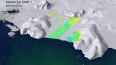
We are all aware that Antarctica’s ice shelves are thinning, but recently scientists have also discovered huge canyons cutting through the underbelly of these shelves, potentially making them even more fragile. Thanks to the CryoSat and Sentinel-1 missions, new light is being shed on this hidden world.
Nová posádka a nový výzkum v Antarktidě
11.10.2017 9:55 Český Kosmický PortálVýzkumná stanice Concordia v Antarktidě je místem extrémů: nějakých devět měsíců sem není možné dopravovat zásoby, nejbližší lidé jsou na 600 km vzdálené ruské stanici Vostok a čtyři měsíce v zimě se Slunce vůbec nepodívá nad obzor.
Video: Základy Smart Mappingu
11.10.2017 9:39 ARCDATANebojte se vytvářet tematické mapy. S funkcemi Smart Mapping vznikne poutavá mapa během několika kliknutí. Podívejte se na další díl videosemináře a zjistěte více o možnostech vizualizace dat.
Správce IKT
11.10.2017 9:27 Zeměměřický úřad Zeměměřický úřadvypisuje výběrové řízení na místo
Správce IKT
Správce IKT
11.10.2017 9:27 ČÚZK /Urady/Zememericky-urad/Uredni-deska/Oznameni-a-jina-uredni-sdeleni/Volna-mista/Spravce-IKTSprávce IKT
11.10.2017 9:27 ČÚZK - předpisy a opatření Zeměměřický úřadvypisuje výběrové řízení na místo
Správce IKT
Správce IKT
11.10.2017 9:27 ČÚZK - volná místa Zeměměřický úřad vypisuje výběrové řízení na místo Správce IKTNabídka GIS práce v Praze, Hradci Králové či Brně
11.10.2017 8:07 GISportal.cz V poslední době se snad roztrhl pytel s nabídkami práce, takže jen telegraficky: Seznam.cz hledá Kartografa/ku do Prahy či Hradce Králové. Nezisková organizace Júzit hledá někoho na marketing a distribuci jejich map do Prahy – ...Going Digital: Bentley Completes Rollout of its CONNECT Edition Application Portfolio, Fully Enabling a Comprehensive Modeling Environment for Infrastructure
11.10.2017 2:00 Bentley SystemsHighlights BIM Advancements in Interdisciplinary Digital Workflows
for Roads, Rail, Water, and Airports at The Year in Infrastructure 2017 Conference
revised November 11, 2017
SINGAPORE — The Year in Infrastructure 2017 Conference — Bentley Systems, Incorporated, a leading global provider of comprehensive software solutions for advancing infrastructure, today announced the completion of its CONNECT Edition application portfolio for design, analytical, construction, and asset performance modeling of infrastructure. The CONNECT Edition’s comprehensive modeling environment supports aligned digital workflows across applications for all project delivery disciplines, directly meeting the challenges presented from the most demanding infrastructure projects.
At Bentley’s The Year in Infrastructure 2017 Conference, held this year in Singapore, the Bentley product keynote presentation showcased digital workflows for digital cities newly enabled by the full CONNECT Edition application portfolio. Featured were four interdisciplinary vignettes on the design, construction, and operation of road, rail, water and wastewater, and airport infrastructure. These project vignettes illustrated the intersection and interdependence of civil, utility, building, and plant applications, and the digital workflow collaboration between interdisciplinary teams made possible by the CONNECT Edition portfolio, to deliver complex and multi-faceted projects.
Roads
Dustin Parkman, vice president, civil and reality modeling, presented CONNECT Edition digital workflows for a road project, from its conception through construction. He began by bringing engineering-ready digital context into OpenRoads ConceptStation, starting with highly precise reality meshes of the underlying terrain prepared using ContextCapture and streamed into the application through ContextShare. He then brought in orthophotos, digital surface models, and point clouds to use in combination with detailed surveying data. With this digital context, he rapidly created an interactively costed conceptual design. Then, moving to OpenRoads Designer for detailed design, he incorporated the digital context and geometry from the conceptual design, along with the bridge designed in OpenBridge Modeler CONNECT Edition and the geotechnical data for the substrata along the bridge footings and piles. He was then able to analyze the actual segmental bridge elements, ensuring form, function and structural integrity as he designed the roadways and other structures. Mr. Parkman then demonstrated a digital workflow for construction, through federation of ProjectWise CONNECT Edition and Topcon’s Magnet Enterprise cloud services, showing the OpenRoads design driving an autonomous paving machine. He concluded by showing Topcon drones capturing imagery of the completed highway, bringing that data via Topcon’s MAGNET Enterprise through ContextCapture Cloud Processing Serviceto create an as-constructed reality mesh for use in the new AssetWise road network management, maintenance, and inspection workflows.
Rail
Jeremy Shaffer, vice president rail solutions, announced Bentley’s new OpenRail solution, taking a rail project from planning through performance. He emphasized the importance of progressive assurance of operational requirements at the project outset, and of systems engineering as the framework for digital workflows for project delivery of complex rail systems. Mr. Shaffer began with conceptional design, bringing ContextCapture created digital context into OpenRail ConceptStation and leveraging digital components from Components Center to interactively design a section of track. Then he used AECOsim Station Designer to design a complex, multi-faceted rail station. The station was seamlessly coordinated with the detailed civil design, created with OpenRail Designer, to provide a view of the overall scheme and an optimal blend of form and function. Platform, facilities and road and parking changes were performed in parallel with bridge, tunnel, track, electrification, and signaling design, all taking advantage of the CONNECT Edition’s comprehensive modeling environment, to ensure delivery of a fully functional station. Mr. Shaffer then introduced Navigator Web, first exploring in a zero-footprint browser a large 3D model of the designed station and track for design and construction review, and then later interactively examining the 3D model for an operational inspection. He concluded by reviewing the new ConstructSim Completions cloud service for commissioning and mechanical handover, underscoring the importance of delivering the digital engineering models and digital context of the railroad for operational use in AssetWise.
Water and Wastewater
Robert Mankowski, vice president, asset performance, began his session using the CONNECT Editions of WaterGEMS and SewerGEMS to simulate the behavior of a water distribution network and a wastewater collection system to show how engineers can rapidly evaluate thousands of planning scenarios to identify optimal improvements to meet the future needs of the city. Focusing next on treatment plants, Mr. Mankowski introduced OpenPlant Modeler CONNECT Edition, which leverages digital components from Components Center for multi-discipline digital workflows, and used Navigator Web to interactively query a large and complex 3D OpenPlant model with just a web browser. He then demonstrated new AssetWise capabilities purpose built for water and wastewater operators to capture asset activities or interventions, including CCTV condition surveys, sanitary sewer overflows, pipe cleaning, and more. Owners can use this data combined with spatial and network analytics to make analytically and data-driven decisions for more targeted and optimized OPEX and CAPEX spending. He also announced that AssetWise now leverages machine learning services from Microsoft Azure to help owners find structure in their data, identify anomalous behavior, and predict future outcomes based on past performance. Finally, he showed how real-time sensor data combined with simulation models that will help operators forecast future system behavior to improve decision making and reduce costs.
Airports
The vignette on airports was presented by Andy Smith, Director Product Management, Design Modeling. Mr. Smith explained how the CONNECT Edition’s multi-discipline digital workflows are ideally suited to resolve land use, engineer the airfield, design the terminal, and support facility operations. Mr. Smith began by bringing in engineering-ready digital context of existing site and building conditions using ContextCapture. He created master and land use plans for the airport, demonstrating Bentley Map CONNECT Edition’s ability to combine GIS and BIM data. He then used OpenRoads Designer for detailed engineering of the runways and storm water management. Turning to the terminal itself, he used AECOsim Building Designer CONNECT Edition’s GenerativeComponents to explore innovative and unique building forms, the chosen structure then physically modeled and analyzed using STAAD CONNECT Edition. Design review was conducted with Navigator Web, where Mr. Smith interactively explored large complex models in a browser. The final design was then brought to life with stunning realism, using AECOsim Building Designer and its now included LumenRT functionality.
Bhupinder Singh, Bentley Systems’ chief product officer said, “Going digital is exemplified by aligned interdisciplinary digital workflows. Complex projects such as airports or railways require detailed coordination, particularly between horizontal and vertical infrastructure. The alignment of track, for example, has direct bearing on the design and structure of a rail station. The CONNECT Edition's applications meet these requirements, as we illustrated in the vignettes presented today.”
When upgrading from V8i versions to CONNECT Edition applications, users face no change in file formats. And thereafter, as CONNECT Edition applications are auto-updated, BIM advancements are continuous and never disruptive.
“We are excited to now offer the full portfolio of CONNECT Edition applications and to provide a connected data environment scalable to even the most complex of projects. By adopting the CONNECT Edition now, users can immediately take advantage of digital context, digital components, and digital workflows across the infrastructure lifecycle for on-time project delivery and better performing assets,” Mr. Singh said.
Update on Bentley Application Support Policies
With the scheduled availability of its full CONNECT Edition application portfolio, Bentley Systems’ technical support for pre-V8i versions of applications will end on January 1, 2019. The V8i generation of applications was introduced in 2008.
Users can be assured that Bentley Systems’ technical support, and support in ProjectWise, for V8i versions of applications will continue until July 1, 2019.
About Bentley Systems
Bentley Systems is a global leader in providing engineers, architects, geospatial professionals, constructors, and owner-operators with comprehensive software solutions for advancingthe design, construction, and operations of infrastructure. Bentley users leverage information mobility across disciplines and throughout the infrastructure lifecycle to deliver better-performing projects and assets. Bentley solutions encompass MicroStation applications for information modeling, ProjectWise collaboration services to deliver integrated projects, and AssetWise operations services to achieve intelligent infrastructure – complemented by managed services offered through customized Success Plans.
Founded in 1984, Bentley has more than 3,000 colleagues in over 50 countries, more than $600 million in annual revenues, and since 2011 has invested more than $1 billion in research, development, and acquisitions.
Additional information about Bentley is available at www.bentley.com. For Bentley news as it happens, subscribe to an RSS feed of Bentley press releases and news alerts. Visit The Year in Infrastructure Conference website for highlights of Bentley’s premier thought-leadership event. To view a searchable collection of innovative infrastructure projects from the annual Be Inspired Awards, access Bentley’s Infrastructure Yearbooks. To access a professional networking site that enables members of the infrastructure community to connect, communicate, and learn from each other, visit Bentley Communities.
To download the Bentley Infrastructure 500 Top Owners ranking, a unique global compendium of the top public- and private-sector owners of infrastructure based on the value of their cumulative infrastructure investments, visit BI 500.
About The Year in Infrastructure 2017 Conference
Bentley’s Year in Infrastructure 2017 Conference is a global gathering of leading executives in the world of infrastructure design, construction, and operations. The conference features a series of forums, presentations, technology demonstrations, and interactive workshops exploring the intersection of technology and business drivers, and how they are shaping the future of infrastructure project delivery and asset performance. For more on the conference, visit www.bentley.com/yii2017.
The Year in Infrastructure 2018 Conference will be held in London, 16-18 October.
# # #
Bentley, the “B” Bentley logo, Be, AECOsim Building Designer, AssetWise, ConstructSim, ContextCapture, GenerativeComponents, LumenRT, MicroStation, Navigator Web, OpenBridge Modeler, OpenPlant, OpenRail, OpenRoads, ProjectWise CONNECT Edition, SewerGEMS, STAAD, and WaterGEMS are either registered or unregistered trademarks or service marks of Bentley Systems, Incorporated or one of its direct or indirect wholly owned subsidiaries. All other brands and product names are trademarks of their respective owners.
Důlní díla a poddolovaná území
11.10.2017 2:00 Cenia - Katalog metadat ČR - INSPIRE Mapová aplikace zpřístupňuje ve společném mapovém okně základní informace o důlních dílech, rozsahu poddolovaných území a úložných místech těžebních odpadů (hald).Going Digital: Bentley Announces iModel 2.0 Cloud Platform and Its iModelHub Cloud Service – Automating Change Synchronization, Digital Alignment, and Immersive Visibility
11.10.2017 2:00 Bentley SystemsSeamlessly Overlays Current BIM Processes, Augmenting ProjectWise Design Integration to Enable Digital Workflows for Connected Projects and Connected Assets
SINGAPORE — The Year in Infrastructure 2017 Conference — Today, Bentley Systems’ founder Keith Bentley introduced the company’s “iModel 2.0” cloud platform and its first new service, iModelHub, to accelerate “going digital” for users of its ProjectWise Design Integration services. Without requiring changes to existing BIM applications or processes, the iModelHub cloud service, invoking application-specific “iModel bridges” triggered automatically by ProjectWise:
- synchronizes and distributes changes made through discipline-specific BIM applications;
- aligns semantically and physically their constituent digital components; and
- maintains immersive visibility for comprehensive and continuous design reviews across all project disciplines and participants.
Change Synchronization
The ProjectWise Design Integration service is relied upon as the “workhorse for work sharing” by 43 of the ENR Top 50 Design Firms. It manages the file-based workflows for project delivery which correspond to contractual roles and which acknowledge the asynchronous and often disconnected nature of infrastructure project work packaging and collaboration. Adding iModelHub takes advantage of Microsoft Azure cloud services to fully enable a connected project – synchronizing all checked-in project changes, and automatically updating a composite project iModel for comprehensive and continuous design reviews, highlighting progress and risks in digital workflows across disciplines.
iModelHub journals all project changes on a timeline, and notifies project participants, based on their ProjectWise workflow configuration, about the availability of relevant changes. Participants can choose to synchronize (or not) to and from particular timeline milestones, and can visualize, summarize, analyze, and interpret the impact of ongoing changes.
To fully enable analytics across multiple projects, and for connected assets, “iModel agents” can be programmed for each analytics subject, to be notified of project-level changes by iModelHub, and to filter appropriately for efficient incremental updates to enterprise “data lakes,” assuring secure accessibility of current infrastructure engineering model data for compliance and safety.
Digital Alignment
Bentley’s widely-utilized i-model (“1.0”) containers for BIM deliverables makes their native structures usefully self-describing in their own right, but that approach was not intended for aggregation and understanding across disciplines. iModel (“2.0”) advancement relies upon the iModelHub cloud service, and iModel Bridges, to achieve maximum possible digital alignment across iModels.
An iModel Bridge aligns information from an application’s native format into the iModelHub‘s registry of semantics, structure, units, and coordinates. Bentley Systems is providing iModel Bridge programs for its applications and for other common BIM applications, such as Autodesk REVIT, and will provide an API for the creation of bridges from other applications.
Immersive Visibility, Anywhere
By adding change synchronization and digital alignment to the connected data environment shared across ProjectWise and Bentley’s AssetWise operations services, iModelHub increases the value of digital workflows within and between connected projects, connected assets, and enterprise data lakes. By distributing and synchronizing copies of iModels anywhere, the iModel 2.0 cloud platform is designed to support massive scale-out for reliable, ubiquitous, and asynchronous project visibility. For example, Bentley’s new Navigator Web enables any authorized user on any modern browser to access project and asset digital component information securely through intuitive 3D immersion. Immersive visibility includes alignment of BIM models and digital components within their digital context of engineering-ready reality meshes, created by Bentley’s ContextCapture reality modeling software, for instance from continuous UAV surveying.
For the first time, project delivery and work packaging can reliably and accountably “industrialize” BIM, supported by the necessary tracking and management of constant change through design and construction workflows, and immersive design review visibility into ongoing project and site status. And for the first time, this fully connected data environment can enable digital engineering models to serve as the digital DNA for infrastructure asset performance modeling, connected to operational technology inputs and enterprise data lakes through Bentley’s market-leading AssetWise reliability services and operational analytics.
Keith Bentley’s Perspective
Keith Bentley said, “With our ‘iModel 2.0’ cloud platform, I foresee an accelerating ecosystem of innovation for true digital workflows around infrastructure assets. To get there, our first priority has been to make possible substantial improvements in infrastructure project delivery and asset performance outcomes, without needing to change current BIM workflows. iModelHub cloud services provide the solution for many infrastructure engineering challenges where BIM modeling has created the potential for advancement, but where information misalignment has limited its value. Indeed, we have engineered the iModel 2.0 cloud platform to instill digital alignment, change-based accountability and synchronization, and immersive visibility as its core tenants. The best news is that ProjectWise Design Integration users can set up their iModel Bridges to connect to iModelHub without retraining users or changing their existing applications or work processes - and without introducing any risk to their projects. If nothing else, the value of change-based visualization through Navigator Web will prove so indispensable, I predict most organizations will never want to do another project without it.
I would like to personally invite early-adopter organizations to put us and iModelHub to work in your going digital!”
For more about the iModel 2.0 cloud platform and iModelHub cloud service, read the white paper.
About Bentley Systems
Bentley Systems is a global leader in providing engineers, architects, geospatial professionals, constructors, and owner-operators with comprehensive software solutions for advancing the design, construction, and operations of infrastructure. Bentley users leverage information mobility across disciplines and throughout the infrastructure lifecycle to deliver better-performing projects and assets. Bentley solutions encompass MicroStation applications for information modeling, ProjectWise collaboration services to deliver integrated projects, and AssetWise operations services to achieve intelligent infrastructure – complemented by comprehensive managed services offered through customized Success Plans.
Founded in 1984, Bentley has more than 3,000 colleagues in over 50 countries, more than $600 million in annual revenues, and since 2011 has invested more than $1 billion in research, development, and acquisitions.
Additional information about Bentley is available at www.bentley.com. For Bentley news as it happens, subscribe to an RSS feed of Bentley press releases and news alerts. Visit The Year in Infrastructure Conference website for information on Bentley’s premier thought-leadership event. To view a searchable collection of innovative infrastructure projects from the annual Be Inspired Awards, access Bentley’s Infrastructure Yearbooks. To access a professional networking site that enables members of the infrastructure community to connect, communicate, and learn from each other, visit Bentley Communities.
To download the Bentley Infrastructure 500 Top Owners ranking, a unique global compendium of the top public- and private-sector owners of infrastructure based on the value of their cumulative infrastructure investments, visit BI 500.
# # #
Bentley, the “B” Bentley logo, AssetWise, ContextCapture, MicroStation, Navigator Web, and ProjectWise are either registered or unregistered trademarks or service marks of Bentley Systems, Incorporated or one of its direct or indirect wholly owned subsidiaries. All other brands and product names are trademarks of their respective owners.
Going Digital: Bentley Completes Rollout of its CONNECT Edition Application Portfolio, Fully Enabling a Comprehensive Modeling Environment for Infrastructure
11.10.2017 2:00 Bentley SystemsHighlights BIM Advancements in Interdisciplinary Digital Workflows
for Roads, Rail, Water, and Airports at The Year in Infrastructure 2017 Conference
SINGAPORE — The Year in Infrastructure 2017 Conference — Bentley Systems, Incorporated, a leading global provider of comprehensive software solutions for advancing infrastructure, today announced the completion of its CONNECT Edition application portfolio for design, analytical, construction, and asset performance modeling of infrastructure. The CONNECT Edition’s comprehensive modeling environment supports aligned digital workflows across applications for all project delivery disciplines, directly meeting the challenges presented from the most demanding infrastructure projects.
At Bentley’s The Year in Infrastructure 2017 Conference, held this year in Singapore, the Bentley product keynote presentation showcased digital workflows for digital cities newly enabled by the full CONNECT Edition application portfolio. Featured were four interdisciplinary vignettes on the design, construction, and operation of road, rail, water and wastewater, and airport infrastructure. These project vignettes illustrated the intersection and interdependence of civil, utility, building, and plant applications, and the digital workflow collaboration between interdisciplinary teams made possible by the CONNECT Edition portfolio, to deliver complex and multi-faceted projects.
Roads
Dustin Parkman, vice president, civil and reality modeling, presented CONNECT Edition digital workflows for a road project, from its conception through construction. He began by bringing engineering-ready digital context into OpenRoads ConceptStation, starting with highly precise reality meshes of the underlying terrain prepared using ContextCapture and streamed into the application through ContextShare. He then brought in orthophotos, digital surface models, and point clouds to use in combination with detailed surveying data. With this digital context, he rapidly created an interactively costed conceptual design. Then, moving to OpenRoads Designer for detailed design, he incorporated the digital context and geometry from the conceptual design, along with the bridge designed in OpenBridge Modeler CONNECT Edition and the geotechnical data for the substrata along the bridge footings and piles. He was then able to analyze the actual segmental bridge elements, ensuring form, function and structural integrity as he designed the roadways and other structures. Mr. Parkman then demonstrated a digital workflow for construction, through federation of ProjectWise CONNECT Edition and Topcon’s Magnet Enterprise cloud services, showing the OpenRoads design driving an autonomous paving machine. He concluded by showing Topcon drones capturing imagery of the completed highway, bringing that data via Topcon’s MAGNET Enterprise through ContextCapture Cloud Processing Serviceto create an as-constructed reality mesh for use in the new AssetWise road network management, maintenance, and inspection workflows.
Rail
Jeremy Shaffer, vice president rail solutions, announced Bentley’s new OpenRail solution, taking a rail project from planning through performance. He emphasized the importance of progressive assurance of operational requirements at the project outset, and of systems engineering as the framework for digital workflows for project delivery of complex rail systems. Mr. Shaffer began with conceptional design, bringing ContextCapture created digital context into OpenRail ConceptStation and leveraging digital components from Components Center to interactively design a section of track. Then he used AECOsim Station Designer to design a complex, multi-faceted rail station. The station was seamlessly coordinated with the detailed civil design, created with OpenRail Designer, to provide a view of the overall scheme and an optimal blend of form and function. Platform, facilities and road and parking changes were performed in parallel with bridge, tunnel, track, electrification, and signaling design, all taking advantage of the CONNECT Edition’s comprehensive modeling environment, to ensure delivery of a fully functional station. Mr. Shaffer then introduced Navigator Web, first exploring in a zero-footprint browser a large 3D model of the designed station and track for design and construction review, and then later interactively examining the 3D model for an operational inspection. He concluded by reviewing the new ConstructSim Completions cloud service for commissioning and mechanical handover, underscoring the importance of delivering the digital engineering models and digital context of the railroad for operational use in AssetWise.
Water and Wastewater
Robert Mankowski, vice president, asset performance, began his session using the CONNECT Editions of WaterGEMS and SewerGEMS to simulate the behavior of a water distribution network and a wastewater collection system to show how engineers can rapidly evaluate thousands of planning scenarios to identify optimal improvements to meet the future needs of the city. Focusing next on treatment plants, Mr. Mankowski introduced OpenPlant Modeler CONNECT Edition, which leverages digital components from Components Center for multi-discipline digital workflows, and used Navigator Web to interactively query a large and complex 3D OpenPlant model with just a web browser. He then demonstrated new AssetWise capabilities purpose built for water and wastewater operators to capture asset activities or interventions, including CCTV condition surveys, sanitary sewer overflows, pipe cleaning, and more. Owners can use this data combined with spatial and network analytics to make analytically and data-driven decisions for more targeted and optimized OPEX and CAPEX spending. He also announced that AssetWise now leverages machine learning services from Microsoft Azure to help owners find structure in their data, identify anomalous behavior, and predict future outcomes based on past performance. Finally, he showed how real-time sensor data combined with simulation models that will help operators forecast future system behavior to improve decision making and reduce costs.
Airports
The vignette on airports was presented by Andy Smith, Director Product Management, Design Modeling. Mr. Smith explained how the CONNECT Edition’s multi-discipline digital workflows are ideally suited to resolve land use, engineer the airfield, design the terminal, and support facility operations. Mr. Smith began by bringing in engineering-ready digital context of existing site and building conditions using ContextCapture. He created master and land use plans for the airport, demonstrating Bentley Map CONNECT Edition’s ability to combine GIS and BIM data. He then used OpenRoads Designer for detailed engineering of the runways and storm water management. Turning to the terminal itself, he used AECOsim Building Designer CONNECT Edition’s GenerativeComponents to explore innovative and unique building forms, the chosen structure then physically modeled and analyzed using STAAD CONNECT Edition. Design review was conducted with Navigator Web, where Mr. Smith interactively explored large complex models in a browser. The final design was then brought to life with stunning realism, using AECOsim Building Designer and its now included LumenRT functionality.
Bhupinder Singh, Bentley Systems’ chief product officer said, “Going digital is exemplified by aligned interdisciplinary digital workflows. Complex projects such as airports or railways require detailed coordination, particularly between horizontal and vertical infrastructure. The alignment of track, for example, has direct bearing on the design and structure of a rail station. The CONNECT Edition's applications meet these requirements, as we illustrated in the vignettes presented today.”
When upgrading from V8i versions to CONNECT Edition applications, users face no change in file formats. And thereafter, as CONNECT Edition applications are auto-updated, BIM advancements are continuous and never disruptive.
“We are excited to now offer the full portfolio of CONNECT Edition applications and to provide a connected data environment scalable to even the most complex of projects. By adopting the CONNECT Edition now, users can immediately take advantage of digital context, digital components, and digital workflows across the infrastructure lifecycle for on-time project delivery and better performing assets,” Mr. Singh said.
Update on Bentley Application Support Policies
With the scheduled availability of its full CONNECT Edition application portfolio, Bentley Systems’ technical support for pre-V8i versions of applications will end on January 1, 2019. The V8i generation of applications was introduced in 2008.
Users can be assured that Bentley Systems’ technical support, and support in ProjectWise, for V8i versions of applications will continue until January 1, 2021.
About Bentley Systems
Bentley Systems is a global leader in providing engineers, architects, geospatial professionals, constructors, and owner-operators with comprehensive software solutions for advancingthe design, construction, and operations of infrastructure. Bentley users leverage information mobility across disciplines and throughout the infrastructure lifecycle to deliver better-performing projects and assets. Bentley solutions encompass MicroStation applications for information modeling, ProjectWise collaboration services to deliver integrated projects, and AssetWise operations services to achieve intelligent infrastructure – complemented by managed services offered through customized Success Plans.
Founded in 1984, Bentley has more than 3,000 colleagues in over 50 countries, more than $600 million in annual revenues, and since 2011 has invested more than $1 billion in research, development, and acquisitions.
Additional information about Bentley is available at www.bentley.com. For Bentley news as it happens, subscribe to an RSS feed of Bentley press releases and news alerts. Visit The Year in Infrastructure Conference website for highlights of Bentley’s premier thought-leadership event. To view a searchable collection of innovative infrastructure projects from the annual Be Inspired Awards, access Bentley’s Infrastructure Yearbooks. To access a professional networking site that enables members of the infrastructure community to connect, communicate, and learn from each other, visit Bentley Communities.
To download the Bentley Infrastructure 500 Top Owners ranking, a unique global compendium of the top public- and private-sector owners of infrastructure based on the value of their cumulative infrastructure investments, visit BI 500.
About The Year in Infrastructure 2017 Conference
Bentley’s Year in Infrastructure 2017 Conference is a global gathering of leading executives in the world of infrastructure design, construction, and operations. The conference features a series of forums, presentations, technology demonstrations, and interactive workshops exploring the intersection of technology and business drivers, and how they are shaping the future of infrastructure project delivery and asset performance. For more on the conference, visit www.bentley.com/yii2017.
The Year in Infrastructure 2018 Conference will be held in London, 16-18 October.
# # #
Bentley, the “B” Bentley logo, Be, AECOsim Building Designer, AssetWise, ConstructSim, ContextCapture, GenerativeComponents, LumenRT, MicroStation, Navigator Web, OpenBridge Modeler, OpenPlant, OpenRail, OpenRoads, ProjectWise CONNECT Edition, SewerGEMS, STAAD, and WaterGEMS are either registered or unregistered trademarks or service marks of Bentley Systems, Incorporated or one of its direct or indirect wholly owned subsidiaries. All other brands and product names are trademarks of their respective owners.
Going Digital: Bentley Completes Rollout of its CONNECT Edition Application Portfolio, Fully Enabling a Comprehensive Modeling Environment for Infrastructure
11.10.2017 2:00 Bentley SystemsHighlights BIM Advancements in Interdisciplinary Digital Workflows
for Roads, Rail, Water, and Airports at The Year in Infrastructure 2017 Conference
SINGAPORE — The Year in Infrastructure 2017 Conference — Bentley Systems, Incorporated, a leading global provider of comprehensive software solutions for advancing infrastructure, today announced the completion of its CONNECT Edition application portfolio for design, analytical, construction, and asset performance modeling of infrastructure. The CONNECT Edition’s comprehensive modeling environment supports aligned digital workflows across applications for all project delivery disciplines, directly meeting the challenges presented from the most demanding infrastructure projects.
At Bentley’s The Year in Infrastructure 2017 Conference, held this year in Singapore, the Bentley product keynote presentation showcased digital workflows for digital cities newly enabled by the full CONNECT Edition application portfolio. Featured were four interdisciplinary vignettes on the design, construction, and operation of road, rail, water and wastewater, and airport infrastructure. These project vignettes illustrated the intersection and interdependence of civil, utility, building, and plant applications, and the digital workflow collaboration between interdisciplinary teams made possible by the CONNECT Edition portfolio, to deliver complex and multi-faceted projects.
Roads
Dustin Parkman, vice president, civil and reality modeling, presented CONNECT Edition digital workflows for a road project, from its conception through construction. He began by bringing engineering-ready digital context into OpenRoads ConceptStation, starting with highly precise reality meshes of the underlying terrain prepared using ContextCapture and streamed into the application through ContextShare. He then brought in orthophotos, digital surface models, and point clouds to use in combination with detailed surveying data. With this digital context, he rapidly created an interactively costed conceptual design. Then, moving to OpenRoads Designer for detailed design, he incorporated the digital context and geometry from the conceptual design, along with the bridge designed in OpenBridge Modeler CONNECT Edition and the geotechnical data for the substrata along the bridge footings and piles. He was then able to analyze the actual segmental bridge elements, ensuring form, function and structural integrity as he designed the roadways and other structures. Mr. Parkman then demonstrated a digital workflow for construction, through federation of ProjectWise CONNECT Edition and Topcon’s Magnet Enterprise cloud services, showing the OpenRoads design driving an autonomous paving machine. He concluded by showing Topcon drones capturing imagery of the completed highway, bringing that data via Topcon’s MAGNET Enterprise through ContextCapture Cloud Processing Serviceto create an as-constructed reality mesh for use in the new AssetWise road network management, maintenance, and inspection workflows.
Rail
Jeremy Shaffer, vice president rail solutions, announced Bentley’s new OpenRail solution, taking a rail project from planning through performance. He emphasized the importance of progressive assurance of operational requirements at the project outset, and of systems engineering as the framework for digital workflows for project delivery of complex rail systems. Mr. Shaffer began with conceptional design, bringing ContextCapture created digital context into OpenRail ConceptStation and leveraging digital components from Components Center to interactively design a section of track. Then he used AECOsim Station Designer to design a complex, multi-faceted rail station. The station was seamlessly coordinated with the detailed civil design, created with OpenRail Designer, to provide a view of the overall scheme and an optimal blend of form and function. Platform, facilities and road and parking changes were performed in parallel with bridge, tunnel, track, electrification, and signaling design, all taking advantage of the CONNECT Edition’s comprehensive modeling environment, to ensure delivery of a fully functional station. Mr. Shaffer then introduced Navigator Web, first exploring in a zero-footprint browser a large 3D model of the designed station and track for design and construction review, and then later interactively examining the 3D model for an operational inspection. He concluded by reviewing the new ConstructSim Completions cloud service for commissioning and mechanical handover, underscoring the importance of delivering the digital engineering models and digital context of the railroad for operational use in AssetWise.
Water and Wastewater
Robert Mankowski, vice president, asset performance, began his session using the CONNECT Editions of WaterGEMS and SewerGEMS to simulate the behavior of a water distribution network and a wastewater collection system to show how engineers can rapidly evaluate thousands of planning scenarios to identify optimal improvements to meet the future needs of the city. Focusing next on treatment plants, Mr. Mankowski introduced OpenPlant Modeler CONNECT Edition, which leverages digital components from Components Center for multi-discipline digital workflows, and used Navigator Web to interactively query a large and complex 3D OpenPlant model with just a web browser. He then demonstrated new AssetWise capabilities purpose built for water and wastewater operators to capture asset activities or interventions, including CCTV condition surveys, sanitary sewer overflows, pipe cleaning, and more. Owners can use this data combined with spatial and network analytics to make analytically and data-driven decisions for more targeted and optimized OPEX and CAPEX spending. He also announced that AssetWise now leverages machine learning services from Microsoft Azure to help owners find structure in their data, identify anomalous behavior, and predict future outcomes based on past performance. Finally, he showed how real-time sensor data combined with simulation models that will help operators forecast future system behavior to improve decision making and reduce costs.
Airports
The vignette on airports was presented by Andy Smith, Director Product Management, Design Modeling. Mr. Smith explained how the CONNECT Edition’s multi-discipline digital workflows are ideally suited to resolve land use, engineer the airfield, design the terminal, and support facility operations. Mr. Smith began by bringing in engineering-ready digital context of existing site and building conditions using ContextCapture. He created master and land use plans for the airport, demonstrating Bentley Map CONNECT Edition’s ability to combine GIS and BIM data. He then used OpenRoads Designer for detailed engineering of the runways and storm water management. Turning to the terminal itself, he used AECOsim Building Designer CONNECT Edition’s GenerativeComponents to explore innovative and unique building forms, the chosen structure then physically modeled and analyzed using STAAD CONNECT Edition. Design review was conducted with Navigator Web, where Mr. Smith interactively explored large complex models in a browser. The final design was then brought to life with stunning realism, using AECOsim Building Designer and its now included LumenRT functionality.
Bhupinder Singh, Bentley Systems’ chief product officer said, “Going digital is exemplified by aligned interdisciplinary digital workflows. Complex projects such as airports or railways require detailed coordination, particularly between horizontal and vertical infrastructure. The alignment of track, for example, has direct bearing on the design and structure of a rail station. The CONNECT Edition's applications meet these requirements, as we illustrated in the vignettes presented today.”
When upgrading from V8i versions to CONNECT Edition applications, users face no change in file formats. And thereafter, as CONNECT Edition applications are auto-updated, BIM advancements are continuous and never disruptive.
“We are excited to now offer the full portfolio of CONNECT Edition applications and to provide a connected data environment scalable to even the most complex of projects. By adopting the CONNECT Edition now, users can immediately take advantage of digital context, digital components, and digital workflows across the infrastructure lifecycle for on-time project delivery and better performing assets,” Mr. Singh said.
Update on Bentley Application Support Policies
With the scheduled availability of its full CONNECT Edition application portfolio, Bentley Systems’ technical support for pre-V8i versions of applications will end on January 1, 2019. The V8i generation of applications was introduced in 2008.
Users can be assured that Bentley Systems’ technical support, and support in ProjectWise, for V8i versions of applications will continue until July 1, 2019.
About Bentley Systems
Bentley Systems is a global leader in providing engineers, architects, geospatial professionals, constructors, and owner-operators with comprehensive software solutions for advancingthe design, construction, and operations of infrastructure. Bentley users leverage information mobility across disciplines and throughout the infrastructure lifecycle to deliver better-performing projects and assets. Bentley solutions encompass MicroStation applications for information modeling, ProjectWise collaboration services to deliver integrated projects, and AssetWise operations services to achieve intelligent infrastructure – complemented by managed services offered through customized Success Plans.
Founded in 1984, Bentley has more than 3,000 colleagues in over 50 countries, more than $600 million in annual revenues, and since 2011 has invested more than $1 billion in research, development, and acquisitions.
Additional information about Bentley is available at www.bentley.com. For Bentley news as it happens, subscribe to an RSS feed of Bentley press releases and news alerts. Visit The Year in Infrastructure Conference website for highlights of Bentley’s premier thought-leadership event. To view a searchable collection of innovative infrastructure projects from the annual Be Inspired Awards, access Bentley’s Infrastructure Yearbooks. To access a professional networking site that enables members of the infrastructure community to connect, communicate, and learn from each other, visit Bentley Communities.
To download the Bentley Infrastructure 500 Top Owners ranking, a unique global compendium of the top public- and private-sector owners of infrastructure based on the value of their cumulative infrastructure investments, visit BI 500.
About The Year in Infrastructure 2017 Conference
Bentley’s Year in Infrastructure 2017 Conference is a global gathering of leading executives in the world of infrastructure design, construction, and operations. The conference features a series of forums, presentations, technology demonstrations, and interactive workshops exploring the intersection of technology and business drivers, and how they are shaping the future of infrastructure project delivery and asset performance. For more on the conference, visit www.bentley.com/yii2017.
The Year in Infrastructure 2018 Conference will be held in London, 16-18 October.
# # #
Bentley, the “B” Bentley logo, Be, AECOsim Building Designer, AssetWise, ConstructSim, ContextCapture, GenerativeComponents, LumenRT, MicroStation, Navigator Web, OpenBridge Modeler, OpenPlant, OpenRail, OpenRoads, ProjectWise CONNECT Edition, SewerGEMS, STAAD, and WaterGEMS are either registered or unregistered trademarks or service marks of Bentley Systems, Incorporated or one of its direct or indirect wholly owned subsidiaries. All other brands and product names are trademarks of their respective owners.
Going Digital: Bentley Announces iModel 2.0 Cloud Platform and Its iModelHub Cloud Service – Automating Change Synchronization, Digital Alignment, and Immersive Visibility
11.10.2017 2:00 Bentley SystemsSeamlessly Overlays Current BIM Processes, Augmenting ProjectWise Design Integration to Enable Digital Workflows for Connected Projects and Connected Assets
SINGAPORE — The Year in Infrastructure 2017 Conference — Today, Bentley Systems’ founder Keith Bentley introduced the company’s “iModel 2.0” cloud platform and its first new service, iModelHub, to accelerate “going digital” for users of its ProjectWise Design Integration services. Without requiring changes to existing BIM applications or processes, the iModelHub cloud service, invoking application-specific “iModel bridges” triggered automatically by ProjectWise:
- synchronizes and distributes changes made through discipline-specific BIM applications;
- aligns semantically and physically their constituent digital components; and
- maintains immersive visibility for comprehensive and continuous design reviews across all project disciplines and participants.
Change Synchronization
The ProjectWise Design Integration service is relied upon as the “workhorse for work sharing” by 43 of the ENR Top 50 Design Firms. It manages the file-based workflows for project delivery which correspond to contractual roles and which acknowledge the asynchronous and often disconnected nature of infrastructure project work packaging and collaboration. Adding iModelHub takes advantage of Microsoft Azure cloud services to fully enable a connected project – synchronizing all checked-in project changes, and automatically updating a composite project iModel for comprehensive and continuous design reviews, highlighting progress and risks in digital workflows across disciplines.
iModelHub journals all project changes on a timeline, and notifies project participants, based on their ProjectWise workflow configuration, about the availability of relevant changes. Participants can choose to synchronize (or not) to and from particular timeline milestones, and can visualize, summarize, analyze, and interpret the impact of ongoing changes.
To fully enable analytics across multiple projects, and for connected assets, “iModel agents” can be programmed for each analytics subject, to be notified of project-level changes by iModelHub, and to filter appropriately for efficient incremental updates to enterprise “data lakes,” assuring secure accessibility of current infrastructure engineering model data for compliance and safety.
Digital Alignment
Bentley’s widely-utilized i-model (“1.0”) containers for BIM deliverables makes their native structures usefully self-describing in their own right, but that approach was not intended for aggregation and understanding across disciplines. iModel (“2.0”) advancement relies upon the iModelHub cloud service, and iModel Bridges, to achieve maximum possible digital alignment across iModels.
An iModel Bridge aligns information from an application’s native format into the iModelHub‘s registry of semantics, structure, units, and coordinates. Bentley Systems is providing iModel Bridge programs for its applications and for other common BIM applications, such as Autodesk REVIT, and will provide an API for the creation of bridges from other applications.
Immersive Visibility, Anywhere
By adding change synchronization and digital alignment to the connected data environment shared across ProjectWise and Bentley’s AssetWise operations services, iModelHub increases the value of digital workflows within and between connected projects, connected assets, and enterprise data lakes. By distributing and synchronizing copies of iModels anywhere, the iModel 2.0 cloud platform is designed to support massive scale-out for reliable, ubiquitous, and asynchronous project visibility. For example, Bentley’s new Navigator Web enables any authorized user on any modern browser to access project and asset digital component information securely through intuitive 3D immersion. Immersive visibility includes alignment of BIM models and digital components within their digital context of engineering-ready reality meshes, created by Bentley’s ContextCapture reality modeling software, for instance from continuous UAV surveying.
For the first time, project delivery and work packaging can reliably and accountably “industrialize” BIM, supported by the necessary tracking and management of constant change through design and construction workflows, and immersive design review visibility into ongoing project and site status. And for the first time, this fully connected data environment can enable digital engineering models to serve as the digital DNA for infrastructure asset performance modeling, connected to operational technology inputs and enterprise data lakes through Bentley’s market-leading AssetWise reliability services and operational analytics.
Keith Bentley’s Perspective
Keith Bentley said, “With our ‘iModel 2.0’ cloud platform, I foresee an accelerating ecosystem of innovation for true digital workflows around infrastructure assets. To get there, our first priority has been to make possible substantial improvements in infrastructure project delivery and asset performance outcomes, without needing to change current BIM workflows. iModelHub cloud services provide the solution for many infrastructure engineering challenges where BIM modeling has created the potential for advancement, but where information misalignment has limited its value. Indeed, we have engineered the iModel 2.0 cloud platform to instill digital alignment, change-based accountability and synchronization, and immersive visibility as its core tenants. The best news is that ProjectWise Design Integration users can set up their iModel Bridges to connect to iModelHub without retraining users or changing their existing applications or work processes - and without introducing any risk to their projects. If nothing else, the value of change-based visualization through Navigator Web will prove so indispensable, I predict most organizations will never want to do another project without it.
I would like to personally invite early-adopter organizations to put us and iModelHub to work in your going digital!”
For more about the iModel 2.0 cloud platform and iModelHub cloud service, read the white paper.
About Bentley Systems
Bentley Systems is a global leader in providing engineers, architects, geospatial professionals, constructors, and owner-operators with comprehensive software solutions for advancing the design, construction, and operations of infrastructure. Bentley users leverage information mobility across disciplines and throughout the infrastructure lifecycle to deliver better-performing projects and assets. Bentley solutions encompass MicroStation applications for information modeling, ProjectWise collaboration services to deliver integrated projects, and AssetWise operations services to achieve intelligent infrastructure – complemented by comprehensive managed services offered through customized Success Plans.
Founded in 1984, Bentley has more than 3,000 colleagues in over 50 countries, more than $600 million in annual revenues, and since 2011 has invested more than $1 billion in research, development, and acquisitions.
Additional information about Bentley is available at www.bentley.com. For Bentley news as it happens, subscribe to an RSS feed of Bentley press releases and news alerts. Visit The Year in Infrastructure Conference website for information on Bentley’s premier thought-leadership event. To view a searchable collection of innovative infrastructure projects from the annual Be Inspired Awards, access Bentley’s Infrastructure Yearbooks. To access a professional networking site that enables members of the infrastructure community to connect, communicate, and learn from each other, visit Bentley Communities.
To download the Bentley Infrastructure 500 Top Owners ranking, a unique global compendium of the top public- and private-sector owners of infrastructure based on the value of their cumulative infrastructure investments, visit BI 500.
# # #
Bentley, the “B” Bentley logo, AssetWise, ContextCapture, MicroStation, Navigator Web, and ProjectWise are either registered or unregistered trademarks or service marks of Bentley Systems, Incorporated or one of its direct or indirect wholly owned subsidiaries. All other brands and product names are trademarks of their respective owners.
Živý video přenos "Cesty kulturní krajinou"
11.10.2017 0:00 Státní pozemkový úřad Ve středu 18. října 2017 od 13.30 hodin proběhne na playtvak.cz druhý přímý přenos z procházky v rámci třídílného seriálu „Cesty kulturní krajinou“.Živý video přenos "Cesty kulturní krajinou"
11.10.2017 0:00 Státní pozemkový úřad Ve středu 11. října 2017 ve 13.30 hodin začal na playtvak.cz třídílný přímý přenos procházek „Cesty kulturní krajinou“.Vrchní referent/rada v oddělení aktualizace KN č. 1
10.10.2017 14:32 ČÚZK /Urady/Katastralni-urady/Katastralni-urady/Katastralni-urad-pro-Jihomoravsky-kraj/Volna-mista/Vrchni-referent-rada-v-oddeleni-aktualizace-KN-cVrchní referent/rada v oddělení aktualizace KN č. 1
10.10.2017 14:32 ČÚZK - volná místa Katastrální úřad pro Jihomoravský kraj - Katastrální pracoviště Brno-venkov vypisuje výběrové řízení na místo Vrchní referent/rada v oddělení aktualizace KN č. 1Vrchní referent/rada v oddělení aktualizace KN č. 1
10.10.2017 14:32 ČÚZK - předpisy a opatření Katastrální úřad pro Jihomoravský kraj - Katastrální pracoviště Brno-venkovnabízí služební místo
Vrchní referent/rada v oddělení aktualizace KN č. 1
Odborný referent v oddělení právních vztahů k nemovitostem
10.10.2017 14:24 ČÚZK - předpisy a opatření Katastrální úřad pro Jihomoravský kraj - Katastrální pracoviště Znojmovypisuje výběrové řízení na místo
Odborný referent v oddělení právních vztahů k nemovitostem
Odborný referent v oddělení právních vztahů k nemovitostem
10.10.2017 14:24 ČÚZK - volná místa Katastrální úřad pro Jihomoravský kraj - Katastrální pracoviště Znojmo vypisuje výběrové řízení na místo Odborný referent v oddělení právních vztahů k nemovitostem<em>Going Digital:</em> Bentley Systems’ New <em>OpenRail</em> is First to Advance BIM for the Full Rail and Transit Lifecycle – Systems Engineering from Planning Through Performance
10.10.2017 14:24 Bentley SystemsThrough connected data environment (CDE), digital components and digital context converge for digital workflow benefits for rail infrastructure
SINGAPORE – The Year in Infrastructure Conference – Today, Bentley Systems’ CEO Greg Bentley introduced the OpenRail solution, comprising applications and services for the comprehensive planning, engineering, project delivery, and operations of rail and transit infrastructure. OpenRail’s foundation is Bentley’s connected data environment (CDE), shared by ProjectWise collaboration services and AssetWise operations services, and which for OpenRail nowbrings together digital components and digital context, through digital workflows. OpenRail applications will include OpenRail ConceptStation, now available for conceptual railway planning and design; OpenRail Designer, for detailed engineering and 3D design of track, overhead line, tunnels, bridges, and related civil infrastructure, and AECOsim Station Designer, for the comprehensive modeling of rail and transit stations, each available early in 2018.
Mr. Bentley said, “Bentley Systems has a proven record in providing industry-leading solutions to improve project delivery and asset performance for the most challenging rail and transit projects around the world. Most of our portfolio applications are used on rail projects, and we’ve advanced BIM for rail, in particular, with our Rail Track offering, rail corridor maintenance optimization through Optram, and via ComplyPro railway requirements compliance progressive assurance. However, the conception of these specific tools for specific purposes preceded the aspiration for what we now call digital workflows, where engineering deliverables are meant to be reused throughout the asset lifecycle.
“Moreover, our railway engineer users have been persuasive in making the case that a railway—more so than any other infrastructure asset—is a system of connected components, meriting a systems engineering approach from the outset. So, rail has become our company priority for putting everything together—industrializing BIM for project delivery and leveraging digital DNA for asset performance. At this point, while there are still scheduled stops ahead on our OpenRail application journey, every rail project and asset can benefit now from OpenRail’s CDE and digital workflow services—starting their digital railway infrastructure advancement at any OpenRail ‘station’ and at any time.”
Connected Data Environment
OpenRail is based on a connected data environment, comprising the shared services of ProjectWise and AssetWise, as configured specifically for rail systems engineering workflows.During project delivery, ProjectWise facilitates the collaboration among distributed engineering teams, coordination of structured workflows, and connected project visibility. For OpenRail, AssetWise provides asset lifecycle information services for linear, network and geospatial referencing, corridor maintenance decision support, inspection workflows, and reliability and change management.
OpenRail CDE services include Components Center for digital components, ContextShare for digital context, ComplyPro for progressive assurance, and ConstructSim Systems Completions for accessing operational readiness. ComplyPro is the established market leader in rail globally for governance of collaborative assurance systems of technical and safety requirements from concept to project handover. OpenRail extends this scope to progressive operations assurance and regulatory compliance. ConstructSim Systems Completions automates the inspections process to accelerate systems progress and validate system readiness for efficient project turnover and closeout.
Digital Components
Components Center is an Azure cloud service of libraries which align, across disciplines and applications, the semantic content of catalogued components, potentially including vendor data, fabrication details, component requirements (for example, electrical specifications and connections), reliability characteristics, and representational views required for documentation (for example, 3D, plan, schematic). A digital component is reused across BIM workflows in design modeling, analytical modeling, construction modeling, and asset registries—from catalogued component, to engineered component, to installed component, to operated component.
The OpenRail Components Center is being initialized with libraries of generic rail components with appropriate intelligence, and libraries from significant providers such as Siemens, but is intended to be maintained and extended by user organizations.
Digital Context
Reality modeling incorporates digital context in the rail infrastructure workflow. Bentley’s ContextCapture processes digital photography and/or laser scans, from UAVs or hand-held or train-mounted devices, to produce an engineering-ready “reality mesh” accurately representing the continuously surveyed conditions of a railway corridor, site, or station.
Throughout detailed design, the reality mesh, for example, can be used to consider sight lines for signal siting. Because the reality mesh can be captured continuously, construction progress can be tracked and compared to the expected progress of the detailed design. In operations, the reality mesh can be used to compare the as-operated 3D model with the as-designed model, and serve as an immersive 3D environment with hyperlinks to equipment sensors for operations visibility and emergency response training.
OpenRail ConceptStation
OpenRail ConceptStation, enabled by the combination of OpenRail’s digital components and digital context, uniquely extends BIM capabilities to rail conceptual planning and layout. Working in the 3D design environment of the geo-coordinated reality mesh as the digital context of the rail corridor, the user can access Components Center to drag and drop digital components into the design to quickly lay out rail lines, bridges, overhead lines, signals, tunnels, etc. With the context of the terrain, and the intelligence of the digital components, OpenRail ConceptStation can quickly calculate quantities of railway elements such as track, ballast, sleepers, contact and catenary wire, equipment, bridge decking, concrete, and steel, as well as the cut-and-fill earthwork required for the conceptual design, and interactively produce a preliminary cost estimate to evaluate feasibility. All the design information, components, and context in the conceptual design can be reused in a digital workflow to OpenRail Designer for detailed design of the railway infrastructure.
Digital Workflows
In digital workflows, data captured or created for one purpose is accessed by computer programs for other purposes, saving time, minimizing rework, and improving data quality over the asset lifecycle. Digital workflows can also converge the work of different disciplines for additional advancements in project delivery and asset performance. Examples enabled by digital workflows include conceptioneering, constructioneering, inspectioneering, and operationeering. Each of these workflows represent new opportunities for engineers and their work to add value beyond their traditional role in design, to include contributions to construction, inspections, and operations.
The advancement of digital workflows in OpenRail will help users to achieve faster delivery, system-wide visibility, assured compliance, and better decisions in design, construction, and operations of rail infrastructure.
Learn more about OpenRail.
About Bentley Systems
Bentley Systems is a global leader in providing engineers, architects, geospatial professionals, constructors, and owner-operators with comprehensive software solutions for advancing the design, construction, and operations of infrastructure. Bentley users leverage information mobility across disciplines and throughout the infrastructure lifecycle to deliver better-performing projects and assets. Bentley solutions encompass MicroStation applications for information modeling, ProjectWise collaboration services to deliver integrated projects, and AssetWise operations services to achieve intelligent infrastructure – complemented by comprehensive managed services offered through customized Success Plans.
Founded in 1984, Bentley has more than 3,000 colleagues in over 50 countries, more than $600 million in annual revenues, and since 2011 has invested more than $1 billion in research, development, and acquisitions.
Additional information about Bentley is available at www.bentley.com. For Bentley news as it happens, subscribe to an RSS feed of Bentley press releases and news alerts. Visit The Year in Infrastructure Conference website for information on Bentley’s premier thought-leadership event. To view a searchable collection of innovative infrastructure projects from the annual Be Inspired Awards, access Bentley’s Infrastructure Yearbooks. To access a professional networking site that enables members of the infrastructure community to connect, communicate, and learn from each other, visit Bentley Communities.
To download the Bentley Infrastructure 500 Top Owners ranking, a unique global compendium of the top public- and private-sector owners of infrastructure based on the value of their cumulative infrastructure investments, visit BI 500.
# # #
Bentley, the “B” Bentley logo, AECOsim Station Designer, AssetWise, ComplyPro, ConstructSim Systems Completions, ContextCapture, MicroStation, OpenRail, OpenRail ConceptStation, OpenRail Designer, and ProjectWise are either registered or unregistered trademarks or service marks of Bentley Systems, Incorporated or one of its direct or indirect wholly owned subsidiaries. All other brands and product names are trademarks of their respective owners.
Related Images:
Helmuth Ludwig, Siemens’ Global Head of Information Technology, Highlights Joint Development Projects with Bentley Systems at <em>Year in Infrastructure</em> 2017 Conference
10.10.2017 14:24 Bentley SystemsShares updates about joint development activities to advance product, production and performance “digital twins”
SINGAPORE – The Year in Infrastructure 2017 Conference – In his keynote at Bentley’s annual event for sharing thought leadership relevant to infrastructure design, construction, and operations, Helmuth Ludwig, Global Head of Information Technology for Siemens, presented a scenario illustrating the companies’ shared contributions towards digital workflows and digital cities, and provided an update on the various joint development projects underway with Bentley Systems, initiated as part of their strategic alliance that was announced in November 2016. These jointly funded and resourced development projects will result in jointly offered cloud services to advance their respective users’ strategies in going digital.
“Siemens and Bentley recognize the unprecedented opportunity that ubiquitous connectivity brings for assets with digital engineering models that incorporate both their physical and functional characteristics,” said Mr. Ludwig. “Siemens’ PLM has a head start in what we call the product digital twin, production digital twin, and performance digital twin. Combined with Bentley’s BIM head start we will especially take the performance digital twin to a new level, and we can accelerate realizing the full potential of digital cities, such as here in Singapore. Our cooperative developments are advancing rapidly, which I think can be attributed to our shared commitment to openness and interoperability.”
Mr. Ludwig’s presentation illustrated the approach Siemens takes to integrating and digitalizing the entire customer value chain in general, and as a particular example, he described the advances for connected asset visibility that can be achieved with the integration of Siemens and Bentley technologies. In the workflow described by Mr. Ludwig, a process plant was captured, through digital photography, in its as-operated state with Bentley’s ContextCapture software, providing immersive visual context of the plant. That 3D “production digital twin” was then linked to the IoT-enabled components in the operating plant via MindSphere, Siemens’ cloud-based, Internet of Things operating system. Using Bentley’s AssetWise, the MindSphere inputs were configured in a browser, and in the context of the 3D model, as the user navigated the “performance digital twin” to query asset health of various components—in particular a motor vibrating to failure. The “product digital twin” of a replacement motor was accessed with Siemens PLM software, and bespoke motor mounts designed and analyzed to solve the vibration problem—and then 3D-printed. The same logic can be applied to digital cities, so that through such connected asset visibility, engineering problems can not only be detected but also solved, leveraging fully digital workflows to improve asset performance.
Other digital projects are uniquely bridging Siemens and Bentley technology to address some of today’s critical infrastructure imperatives. For example, in energy management, new distributed energy resources (DER) like wind, solar, and energy storage, require electrical grids to be bi-directional, so the GIS and network design capabilities in Bentley’s OpenUtilities are being linked with Siemens PSS SINCAL for network analysis modeling to deliver an integrated DER planning and design assessment solution.
The global push for urbanization and the increasing requirements of mobility of people and goods have accelerated the demand for rail electrification via overhead and rigid contact lines. To meet this demand, the two companies are working together to industrialize the electrification process by integrating Siemens Sicat Master, for rail catenary overhead contact line modeling and analysis, with Bentley’s newly announced OpenRail Designer.
These new joint developments build on the continued collaborative work done between Siemens and Bentley converging Bentley’s BIM and reality modeling software with Siemens’ product design and production process engineering solutions, and with the integration of Siemens’ COMOS and Bentley’s OpenPlant. Additional joint projects spanning other Siemens divisions will be announced over the coming year.
Siemens AG (Berlin and Munich) is a global technology powerhouse that has stood for engineering excellence, innovation, quality, reliability, and internationality for more than 165 years. The company is active in more than 200 countries, focusing on the areas of electrification, automation and digitalization. One of the world’s largest producers of energy-efficient, resource-saving technologies, Siemens is a leading supplier of efficient power generation and power transmission solutions and a pioneer in infrastructure solutions as well as automation, drive and software solutions for industry. The company is also a leading provider of medical imaging equipment – such as computed tomography and magnetic resonance imaging systems – and a leader in laboratory diagnostics as well as clinical IT. In fiscal 2016, which ended on September 30, 2016, Siemens generated revenue of €79.6 billion and net income of €5.6 billion. At the end of September 2016, the company had around 351,000 employees worldwide. Further information is available on the Internet at www.siemens.com.
About Bentley Systems
Bentley Systems is a global leader in providing engineers, architects, geospatial professionals, constructors, and owner-operators with comprehensive software solutions for advancingthe design, construction, and operations of infrastructure. Bentley users leverage information mobility across disciplines and throughout the infrastructure lifecycle to deliver better-performing projects and assets. Bentley solutions encompass MicroStation applications for information modeling, ProjectWise collaboration services to deliver integrated projects, and AssetWise operations services to achieve intelligent infrastructure – complemented by managed services offered through customized Success Plans.
Founded in 1984, Bentley has more than 3,000 colleagues in over 50 countries, more than $600 million in annual revenues, and since 2011 has invested more than $1 billion in research, development, and acquisitions.
Additional information about Bentley is available at www.bentley.com. For Bentley news as it happens, subscribe to an RSS feed of Bentley press releases and news alerts. Visit The Year in Infrastructure Conference website for highlights of Bentley’s premier thought-leadership event. To view a searchable collection of innovative infrastructure projects from the annual Be Inspired Awards, access Bentley’s Infrastructure Yearbooks. To access a professional networking site that enables members of the infrastructure community to connect, communicate, and learn from each other, visit Bentley Communities.
To download the Bentley Infrastructure 500 Top Owners ranking, a unique global compendium of the top public- and private-sector owners of infrastructure based on the value of their cumulative infrastructure investments, visit BI 500.
About The Year in Infrastructure 2017 Conference
Bentley’s Year in Infrastructure 2017 Conference is a global gathering of leading executives in the world of infrastructure design, construction, and operations. The conference features a series of forums, presentations, technology demonstrations, and interactive workshops exploring the intersection of technology and business drivers, and how they are shaping the future of infrastructure project delivery and asset performance. For more on the conference, visit www.bentley.com/yii2017.
The Year in Infrastructure 2018 Conference will be held in London, 16-18 October.
# # #
Bentley, the “B” Bentley logo, Be, AssetWise, ContextCapture, MicroStation, OpenPlant, OpenRail, and ProjectWise are either registered or unregistered trademarks or service marks of Bentley Systems, Incorporated or one of its direct or indirect wholly owned subsidiaries. All other brands and product names are trademarks of their respective owners.
20171010-Aktualizovaný seznam úředně opráv. zeměměř. inženýru
10.10.2017 14:20 ČÚZK - předpisy a opatření Český úřad zeměměřický a katastrální zveřejnil novou aktualitu: Aktualizovaný seznam úředně oprávněných zeměměřických inženýrů.20171010-Aktualizovaný seznam úředně opráv. zeměměř. inženýru
10.10.2017 14:20 ČÚZK /Aktuality-resort/2017/20171010-Aktualizovany-seznam-uredne-oprav-zememeNezapomeňte se včas přihlásit na konferenci
10.10.2017 13:52 ARCDATAJeště nejste přihlášeni na letošní Konferenci GIS Esri v ČR? Pak vás jistě bude zajímat, že k využití slevy na registrační poplatek je potřeba poslat přihlášku nejpozději do tohoto pátku 13. října 2017. Těšit se můžete na bezmála dvacet hodin přednášek a workshopů. Mimo to na vás čeká také bohatý doprovodný program, ve kterém naleznete například:
- předkonferenční seminář plný mobilních aplikací GIS,
- krátké tematické minisemináře přímo na stánku technické podpory,
- interaktivní prezentace internetových aplikací,
- výstavu soutěžních posterů,
- soutěž v poznávání družicových snímků
- a zajímavou přednášku cestovatele Petra Čermáka.
K registraci na konferenci a předkonferenční seminář můžete použít naši on-line přihlášku.

Ready to assume control of Sentinel-5P
10.10.2017 13:32 ESA Observing the Earth
Mission controllers completed a critical final rehearsal today, confirming that everything and everyone on ground are ready to take over control of Sentinel-5P in the harsh environment of space.
Referent zeměměřictví a katastru nemovitostí
10.10.2017 13:29 ČÚZK - volná místa Zeměměřický úřad vypisuje výběrové řízení na místo Referent zeměměřictví a katastru nemovitostíReferent zeměměřictví a katastru nemovitostí
10.10.2017 13:29 Zeměměřický úřad Zeměměřický úřadvypisuje výběrové řízení na místo
Referent zeměměřictví a katastru nemovitostí
Referent zeměměřictví a katastru nemovitostí
10.10.2017 13:29 ČÚZK /Urady/Zememericky-urad/Uredni-deska/Oznameni-a-jina-uredni-sdeleni/Volna-mista/Referent-zememerictvi-a-katastru-nemovitosti-(2)Referent zeměměřictví a katastru nemovitostí
10.10.2017 13:29 ČÚZK - předpisy a opatření Zeměměřický úřadvypisuje výběrové řízení na místo
Referent zeměměřictví a katastru nemovitostí
WindyMaps – horká novinka od Seznamu
10.10.2017 13:25 GISportal.cz Již před několika dny začaly Mapy.cz na sociálních sítích lákat na novinku, kterou dnešního dne slavnostně představily na tiskové konferenci. Jedná se o aplikaci WindyMaps, na které tým Mapy.cz pracoval tři roky. Martin Fuchs ...Mapová aplikace Cyklokoncepce pro obodobí 2017 - 2023
10.10.2017 12:45 Středočeský kraj Do ostrého provozu byla uvedena mapová aplikace Cyklokoncepce pro období 2017 - 2023, která zobrazuje rozvojové priority Středočeského kraje v cyklistické dopravě a cykloturistice. Obsah mapové aplikace byl schválen dne 19.09.2017 v Zastupitelstvu Středočeského kraje pod usnesením 021-09/2017/ZK, odkaz ZDE.Nečekané překvapení: poslední snímek ze sondy Rosetta
10.10.2017 11:39 Český Kosmický PortálVědci provádějící analýzu závěrečné telemetrie odeslané sondou Rosetta bezprostředně před tím, než se vypnula po dosednutí na povrch komety 67P/Čurjumov-Gerasimenko v loňském roce, dokázali rekonstruovat poslední snímek místa přistání.
Nečekané překvapení: poslední snímek ze sondy Rosetta
10.10.2017 11:39 Český Kosmický PortálVědci provádějící analýzu závěrečné telemetrie odeslané sondou Rosetta bezprostředně před tím, než se vypnula po dosednutí na povrch komety 67P/Čurjumov-Gerasimenko v loňském roce, dokázali rekonstruovat poslední snímek místa přistání.
ÚVT MU hledá zájemce o pozici "Vývojář/ka GISových aplikací"
10.10.2017 11:06 Blogující geomatici - FAV ZČU Informace na:https://www.muni.cz/o-univerzite/kariera-na-mu/volna-mista/36266
Přerušení dodávky elektřiny
10.10.2017 10:50 ČÚZK - předpisy a opatření Katastrální úřad pro Moravskoslezský kraj - Katastrální pracoviště Nový Jičín zveřejnil novou aktualitu: Společnost ČEZ Distribuce a.s. oznámila Katastrálnímu úřadu pro Moravskoslezský kraj, Katastrálnímu pracovišti Nový Jičín Slovanská 232/5, 741 01 Nový Jičín přerušení dodávky elektřiny na den 27.10. 2017 v době od 8:30 do 18:30 hod. Z uvedeného důvodu budou v daném čase služby v budově katastrálního úřadu omezeny pouze na přijetí podání na podatelně a přijetí žádosti o poskytnutí údajů katastru nemovitostí.Dnes začíná výstava Okem dronu našich leteckých fotografií v Liberci
10.10.2017 8:23 UpVision Od dnešního dne se koná výstava našich leteckých fotografií "Okem dronu" v Liberci v Krajské vědecké knihovně. Výstava potrvá do konce října a je zdarma a je také součástí akce Mapy kolem nás, která se zde koná tento týden.V průběhu října zveřejníme fotky z Výstavy.
Více o celé akci zde:
http://geoportal.kraj-lbc.cz/mapy-kolem-nas-2017
Going Digital: Bentley Systems’ New OpenRail is First to Advance BIM for the Full Rail and Transit Lifecycle – Systems Engineering from Planning Through Performance
10.10.2017 2:00 Bentley SystemsThrough connected data environment (CDE), digital components and digital context converge for digital workflow benefits for rail infrastructure
SINGAPORE – The Year in Infrastructure Conference – Today, Bentley Systems’ CEO Greg Bentley introduced the OpenRail solution, comprising applications and services for the comprehensive planning, engineering, project delivery, and operations of rail and transit infrastructure. OpenRail’s foundation is Bentley’s connected data environment (CDE), shared by ProjectWise collaboration services and AssetWise operations services, and which for OpenRail nowbrings together digital components and digital context, through digital workflows. OpenRail applications will include OpenRail ConceptStation, now available for conceptual railway planning and design; OpenRail Designer, for detailed engineering and 3D design of track, overhead line, tunnels, bridges, and related civil infrastructure, and AECOsim Station Designer, for the comprehensive modeling of rail and transit stations, each available early in 2018.
Mr. Bentley said, “Bentley Systems has a proven record in providing industry-leading solutions to improve project delivery and asset performance for the most challenging rail and transit projects around the world. Most of our portfolio applications are used on rail projects, and we’ve advanced BIM for rail, in particular, with our Rail Track offering, rail corridor maintenance optimization through Optram, and via ComplyPro railway requirements compliance progressive assurance. However, the conception of these specific tools for specific purposes preceded the aspiration for what we now call digital workflows, where engineering deliverables are meant to be reused throughout the asset lifecycle.
“Moreover, our railway engineer users have been persuasive in making the case that a railway—more so than any other infrastructure asset—is a system of connected components, meriting a systems engineering approach from the outset. So, rail has become our company priority for putting everything together—industrializing BIM for project delivery and leveraging digital DNA for asset performance. At this point, while there are still scheduled stops ahead on our OpenRail application journey, every rail project and asset can benefit now from OpenRail’s CDE and digital workflow services—starting their digital railway infrastructure advancement at any OpenRail ‘station’ and at any time.”
Connected Data Environment
OpenRail is based on a connected data environment, comprising the shared services of ProjectWise and AssetWise, as configured specifically for rail systems engineering workflows.During project delivery, ProjectWise facilitates the collaboration among distributed engineering teams, coordination of structured workflows, and connected project visibility. For OpenRail, AssetWise provides asset lifecycle information services for linear, network and geospatial referencing, corridor maintenance decision support, inspection workflows, and reliability and change management.
OpenRail CDE services include Components Center for digital components, ContextShare for digital context, ComplyPro for progressive assurance, and ConstructSim Systems Completions for accessing operational readiness. ComplyPro is the established market leader in rail globally for governance of collaborative assurance systems of technical and safety requirements from concept to project handover. OpenRail extends this scope to progressive operations assurance and regulatory compliance. ConstructSim Systems Completions automates the inspections process to accelerate systems progress and validate system readiness for efficient project turnover and closeout.
Digital Components
Components Center is an Azure cloud service of libraries which align, across disciplines and applications, the semantic content of catalogued components, potentially including vendor data, fabrication details, component requirements (for example, electrical specifications and connections), reliability characteristics, and representational views required for documentation (for example, 3D, plan, schematic). A digital component is reused across BIM workflows in design modeling, analytical modeling, construction modeling, and asset registries—from catalogued component, to engineered component, to installed component, to operated component.
The OpenRail Components Center is being initialized with libraries of generic rail components with appropriate intelligence, and libraries from significant providers such as Siemens, but is intended to be maintained and extended by user organizations.
Digital Context
Reality modeling incorporates digital context in the rail infrastructure workflow. Bentley’s ContextCapture processes digital photography and/or laser scans, from UAVs or hand-held or train-mounted devices, to produce an engineering-ready “reality mesh” accurately representing the continuously surveyed conditions of a railway corridor, site, or station.
Throughout detailed design, the reality mesh, for example, can be used to consider sight lines for signal siting. Because the reality mesh can be captured continuously, construction progress can be tracked and compared to the expected progress of the detailed design. In operations, the reality mesh can be used to compare the as-operated 3D model with the as-designed model, and serve as an immersive 3D environment with hyperlinks to equipment sensors for operations visibility and emergency response training.
OpenRail ConceptStation
OpenRail ConceptStation, enabled by the combination of OpenRail’s digital components and digital context, uniquely extends BIM capabilities to rail conceptual planning and layout. Working in the 3D design environment of the geo-coordinated reality mesh as the digital context of the rail corridor, the user can access Components Center to drag and drop digital components into the design to quickly lay out rail lines, bridges, overhead lines, signals, tunnels, etc. With the context of the terrain, and the intelligence of the digital components, OpenRail ConceptStation can quickly calculate quantities of railway elements such as track, ballast, sleepers, contact and catenary wire, equipment, bridge decking, concrete, and steel, as well as the cut-and-fill earthwork required for the conceptual design, and interactively produce a preliminary cost estimate to evaluate feasibility. All the design information, components, and context in the conceptual design can be reused in a digital workflow to OpenRail Designer for detailed design of the railway infrastructure.
Digital Workflows
In digital workflows, data captured or created for one purpose is accessed by computer programs for other purposes, saving time, minimizing rework, and improving data quality over the asset lifecycle. Digital workflows can also converge the work of different disciplines for additional advancements in project delivery and asset performance. Examples enabled by digital workflows include conceptioneering, constructioneering, inspectioneering, and operationeering. Each of these workflows represent new opportunities for engineers and their work to add value beyond their traditional role in design, to include contributions to construction, inspections, and operations.
The advancement of digital workflows in OpenRail will help users to achieve faster delivery, system-wide visibility, assured compliance, and better decisions in design, construction, and operations of rail infrastructure.
Learn more about OpenRail.
About Bentley Systems
Bentley Systems is a global leader in providing engineers, architects, geospatial professionals, constructors, and owner-operators with comprehensive software solutions for advancing the design, construction, and operations of infrastructure. Bentley users leverage information mobility across disciplines and throughout the infrastructure lifecycle to deliver better-performing projects and assets. Bentley solutions encompass MicroStation applications for information modeling, ProjectWise collaboration services to deliver integrated projects, and AssetWise operations services to achieve intelligent infrastructure – complemented by comprehensive managed services offered through customized Success Plans.
Founded in 1984, Bentley has more than 3,000 colleagues in over 50 countries, more than $600 million in annual revenues, and since 2011 has invested more than $1 billion in research, development, and acquisitions.
Additional information about Bentley is available at www.bentley.com. For Bentley news as it happens, subscribe to an RSS feed of Bentley press releases and news alerts. Visit The Year in Infrastructure Conference website for information on Bentley’s premier thought-leadership event. To view a searchable collection of innovative infrastructure projects from the annual Be Inspired Awards, access Bentley’s Infrastructure Yearbooks. To access a professional networking site that enables members of the infrastructure community to connect, communicate, and learn from each other, visit Bentley Communities.
To download the Bentley Infrastructure 500 Top Owners ranking, a unique global compendium of the top public- and private-sector owners of infrastructure based on the value of their cumulative infrastructure investments, visit BI 500.
# # #
Bentley, the “B” Bentley logo, AECOsim Station Designer, AssetWise, ComplyPro, ConstructSim Systems Completions, ContextCapture, MicroStation, OpenRail, OpenRail ConceptStation, OpenRail Designer, and ProjectWise are either registered or unregistered trademarks or service marks of Bentley Systems, Incorporated or one of its direct or indirect wholly owned subsidiaries. All other brands and product names are trademarks of their respective owners.
Related Images:
Going Digital: Bentley Systems’ New OpenRail is First to Advance BIM for the Full Rail and Transit Lifecycle – Systems Engineering from Planning Through Performance
10.10.2017 2:00 Bentley SystemsThrough connected data environment (CDE), digital components and digital context converge for digital workflow benefits for rail infrastructure
SINGAPORE – The Year in Infrastructure Conference – Today, Bentley Systems’ CEO Greg Bentley introduced the OpenRail solution, comprising applications and services for the comprehensive planning, engineering, project delivery, and operations of rail and transit infrastructure. OpenRail’s foundation is Bentley’s connected data environment (CDE), shared by ProjectWise collaboration services and AssetWise operations services, and which for OpenRail nowbrings together digital components and digital context, through digital workflows. OpenRail applications will include OpenRail ConceptStation, now available for conceptual railway planning and design; OpenRail Designer, available early in 2018, for detailed engineering and 3D design of track, overhead line, tunnels, bridges, and related civil infrastructure, and AECOsim Station Designer, for the comprehensive modeling of rail and transit stations.
Mr. Bentley said, “Bentley Systems has a proven record in providing industry-leading solutions to improve project delivery and asset performance for the most challenging rail and transit projects around the world. Most of our portfolio applications are used on rail projects, and we’ve advanced BIM for rail, in particular, with our Rail Track offering, rail corridor maintenance optimization through Optram, and via ComplyPro railway requirements compliance progressive assurance. However, the conception of these specific tools for specific purposes preceded the aspiration for what we now call digital workflows, where engineering deliverables are meant to be reused throughout the asset lifecycle.
“Moreover, our railway engineer users have been persuasive in making the case that a railway—more so than any other infrastructure asset—is a system of connected components, meriting a systems engineering approach from the outset. So, rail has become our company priority for putting everything together—industrializing BIM for project delivery and leveraging digital DNA for asset performance. At this point, while there are still scheduled stops ahead on our OpenRail application journey, every rail project and asset can benefit now from OpenRail’s CDE and digital workflow services—starting their digital railway infrastructure advancement at any OpenRail ‘station’ and at any time.”
Connected Data Environment
OpenRail is based on a connected data environment, comprising the shared services of ProjectWise and AssetWise, as configured specifically for rail systems engineering workflows.During project delivery, ProjectWise facilitates the collaboration among distributed engineering teams, coordination of structured workflows, and connected project visibility. For OpenRail, AssetWise provides asset lifecycle information services for linear, network and geospatial referencing, corridor maintenance decision support, inspection workflows, and reliability and change management.
OpenRail CDE services include Components Center for digital components, ContextShare for digital context, ComplyPro for progressive assurance, and ConstructSim Systems Completions for accessing operational readiness. ComplyPro is the established market leader in rail globally for governance of collaborative assurance systems of technical and safety requirements from concept to project handover. OpenRail extends this scope to progressive operations assurance and regulatory compliance. ConstructSim Systems Completions automates the inspections process to accelerate systems progress and validate system readiness for efficient project turnover and closeout.
Digital Components
Components Center is an Azure cloud service of libraries which align, across disciplines and applications, the semantic content of catalogued components, potentially including vendor data, fabrication details, component requirements (for example, electrical specifications and connections), reliability characteristics, and representational views required for documentation (for example, 3D, plan, schematic). A digital component is reused across BIM workflows in design modeling, analytical modeling, construction modeling, and asset registries—from catalogued component, to engineered component, to installed component, to operated component.
The OpenRail Components Center is being initialized with libraries of generic rail components with appropriate intelligence, and libraries from significant providers such as Siemens, but is intended to be maintained and extended by user organizations.
Digital Context
Reality modeling incorporates digital context in the rail infrastructure workflow. Bentley’s ContextCapture processes digital photography and/or laser scans, from UAVs or hand-held or train-mounted devices, to produce an engineering-ready “reality mesh” accurately representing the continuously surveyed conditions of a railway corridor, site, or station.
Throughout detailed design, the reality mesh, for example, can be used to consider sight lines for signal siting. Because the reality mesh can be captured continuously, construction progress can be tracked and compared to the expected progress of the detailed design. In operations, the reality mesh can be used to compare the as-operated 3D model with the as-designed model, and serve as an immersive 3D environment with hyperlinks to equipment sensors for operations visibility and emergency response training.
OpenRail ConceptStation
OpenRail ConceptStation, enabled by the combination of OpenRail’s digital components and digital context, uniquely extends BIM capabilities to rail conceptual planning and layout. Working in the 3D design environment of the geo-coordinated reality mesh as the digital context of the rail corridor, the user can access Components Center to drag and drop digital components into the design to quickly lay out rail lines, bridges, overhead lines, signals, tunnels, etc. With the context of the terrain, and the intelligence of the digital components, OpenRail ConceptStation can quickly calculate quantities of railway elements such as track, ballast, sleepers, contact and catenary wire, equipment, bridge decking, concrete, and steel, as well as the cut-and-fill earthwork required for the conceptual design, and interactively produce a preliminary cost estimate to evaluate feasibility. All the design information, components, and context in the conceptual design can be reused in a digital workflow to OpenRail Designer for detailed design of the railway infrastructure.
Digital Workflows
In digital workflows, data captured or created for one purpose is accessed by computer programs for other purposes, saving time, minimizing rework, and improving data quality over the asset lifecycle. Digital workflows can also converge the work of different disciplines for additional advancements in project delivery and asset performance. Examples enabled by digital workflows include conceptioneering, constructioneering, inspectioneering, and operationeering. Each of these workflows represent new opportunities for engineers and their work to add value beyond their traditional role in design, to include contributions to construction, inspections, and operations.
The advancement of digital workflows in OpenRail will help users to achieve faster delivery, system-wide visibility, assured compliance, and better decisions in design, construction, and operations of rail infrastructure.
Learn more about OpenRail.
About Bentley Systems
Bentley Systems is a global leader in providing engineers, architects, geospatial professionals, constructors, and owner-operators with comprehensive software solutions for advancing the design, construction, and operations of infrastructure. Bentley users leverage information mobility across disciplines and throughout the infrastructure lifecycle to deliver better-performing projects and assets. Bentley solutions encompass MicroStation applications for information modeling, ProjectWise collaboration services to deliver integrated projects, and AssetWise operations services to achieve intelligent infrastructure – complemented by comprehensive managed services offered through customized Success Plans.
Founded in 1984, Bentley has more than 3,000 colleagues in over 50 countries, more than $600 million in annual revenues, and since 2011 has invested more than $1 billion in research, development, and acquisitions.
Additional information about Bentley is available at www.bentley.com. For Bentley news as it happens, subscribe to an RSS feed of Bentley press releases and news alerts. Visit The Year in Infrastructure Conference website for information on Bentley’s premier thought-leadership event. To view a searchable collection of innovative infrastructure projects from the annual Be Inspired Awards, access Bentley’s Infrastructure Yearbooks. To access a professional networking site that enables members of the infrastructure community to connect, communicate, and learn from each other, visit Bentley Communities.
To download the Bentley Infrastructure 500 Top Owners ranking, a unique global compendium of the top public- and private-sector owners of infrastructure based on the value of their cumulative infrastructure investments, visit BI 500.
# # #
Bentley, the “B” Bentley logo, AECOsim Station Designer, AssetWise, ComplyPro, ConstructSim Systems Completions, ContextCapture, MicroStation, OpenRail, OpenRail ConceptStation, OpenRail Designer, and ProjectWise are either registered or unregistered trademarks or service marks of Bentley Systems, Incorporated or one of its direct or indirect wholly owned subsidiaries. All other brands and product names are trademarks of their respective owners.
Related Images:
Helmuth Ludwig, Siemens’ Global Head of Information Technology, Highlights Joint Development Projects with Bentley Systems at Year in Infrastructure 2017 Conference
10.10.2017 2:00 Bentley SystemsShares updates about joint development activities to advance product, production and performance “digital twins”
SINGAPORE – The Year in Infrastructure 2017 Conference – In his keynote at Bentley’s annual event for sharing thought leadership relevant to infrastructure design, construction, and operations, Helmuth Ludwig, Global Head of Information Technology for Siemens, presented a scenario illustrating the companies’ shared contributions towards digital workflows and digital cities, and provided an update on the various joint development projects underway with Bentley Systems, initiated as part of their strategic alliance that was announced in November 2016. These jointly funded and resourced development projects will result in jointly offered cloud services to advance their respective users’ strategies in going digital.
“Siemens and Bentley recognize the unprecedented opportunity that ubiquitous connectivity brings for assets with digital engineering models that incorporate both their physical and functional characteristics,” said Mr. Ludwig. “Siemens’ PLM has a head start in what we call the product digital twin, production digital twin, and performance digital twin. Combined with Bentley’s BIM head start we will especially take the performance digital twin to a new level, and we can accelerate realizing the full potential of digital cities, such as here in Singapore. Our cooperative developments are advancing rapidly, which I think can be attributed to our shared commitment to openness and interoperability.”
Mr. Ludwig’s presentation illustrated the approach Siemens takes to integrating and digitalizing the entire customer value chain in general, and as a particular example, he described the advances for connected asset visibility that can be achieved with the integration of Siemens and Bentley technologies. In the workflow described by Mr. Ludwig, a process plant was captured, through digital photography, in its as-operated state with Bentley’s ContextCapture software, providing immersive visual context of the plant. That 3D “production digital twin” was then linked to the IoT-enabled components in the operating plant via MindSphere, Siemens’ cloud-based, Internet of Things operating system. Using Bentley’s AssetWise, the MindSphere inputs were configured in a browser, and in the context of the 3D model, as the user navigated the “performance digital twin” to query asset health of various components—in particular a motor vibrating to failure. The “product digital twin” of a replacement motor was accessed with Siemens PLM software, and bespoke motor mounts designed and analyzed to solve the vibration problem—and then 3D-printed. The same logic can be applied to digital cities, so that through such connected asset visibility, engineering problems can not only be detected but also solved, leveraging fully digital workflows to improve asset performance.
Other digital projects are uniquely bridging Siemens and Bentley technology to address some of today’s critical infrastructure imperatives. For example, in energy management, new distributed energy resources (DER) like wind, solar, and energy storage, require electrical grids to be bi-directional, so the GIS and network design capabilities in Bentley’s OpenUtilities are being linked with Siemens PSS SINCAL for network analysis modeling to deliver an integrated DER planning and design assessment solution.
The global push for urbanization and the increasing requirements of mobility of people and goods have accelerated the demand for rail electrification via overhead and rigid contact lines. To meet this demand, the two companies are working together to industrialize the electrification process by integrating Siemens Sicat Master, for rail catenary overhead contact line modeling and analysis, with Bentley’s newly announced OpenRail Designer.
These new joint developments build on the continued collaborative work done between Siemens and Bentley converging Bentley’s BIM and reality modeling software with Siemens’ product design and production process engineering solutions, and with the integration of Siemens’ COMOS and Bentley’s OpenPlant. Additional joint projects spanning other Siemens divisions will be announced over the coming year.
Siemens AG (Berlin and Munich) is a global technology powerhouse that has stood for engineering excellence, innovation, quality, reliability, and internationality for more than 165 years. The company is active in more than 200 countries, focusing on the areas of electrification, automation and digitalization. One of the world’s largest producers of energy-efficient, resource-saving technologies, Siemens is a leading supplier of efficient power generation and power transmission solutions and a pioneer in infrastructure solutions as well as automation, drive and software solutions for industry. The company is also a leading provider of medical imaging equipment – such as computed tomography and magnetic resonance imaging systems – and a leader in laboratory diagnostics as well as clinical IT. In fiscal 2016, which ended on September 30, 2016, Siemens generated revenue of €79.6 billion and net income of €5.6 billion. At the end of September 2016, the company had around 351,000 employees worldwide. Further information is available on the Internet at www.siemens.com.
About Bentley Systems
Bentley Systems is a global leader in providing engineers, architects, geospatial professionals, constructors, and owner-operators with comprehensive software solutions for advancingthe design, construction, and operations of infrastructure. Bentley users leverage information mobility across disciplines and throughout the infrastructure lifecycle to deliver better-performing projects and assets. Bentley solutions encompass MicroStation applications for information modeling, ProjectWise collaboration services to deliver integrated projects, and AssetWise operations services to achieve intelligent infrastructure – complemented by managed services offered through customized Success Plans.
Founded in 1984, Bentley has more than 3,000 colleagues in over 50 countries, more than $600 million in annual revenues, and since 2011 has invested more than $1 billion in research, development, and acquisitions.
Additional information about Bentley is available at www.bentley.com. For Bentley news as it happens, subscribe to an RSS feed of Bentley press releases and news alerts. Visit The Year in Infrastructure Conference website for highlights of Bentley’s premier thought-leadership event. To view a searchable collection of innovative infrastructure projects from the annual Be Inspired Awards, access Bentley’s Infrastructure Yearbooks. To access a professional networking site that enables members of the infrastructure community to connect, communicate, and learn from each other, visit Bentley Communities.
To download the Bentley Infrastructure 500 Top Owners ranking, a unique global compendium of the top public- and private-sector owners of infrastructure based on the value of their cumulative infrastructure investments, visit BI 500.
About The Year in Infrastructure 2017 Conference
Bentley’s Year in Infrastructure 2017 Conference is a global gathering of leading executives in the world of infrastructure design, construction, and operations. The conference features a series of forums, presentations, technology demonstrations, and interactive workshops exploring the intersection of technology and business drivers, and how they are shaping the future of infrastructure project delivery and asset performance. For more on the conference, visit www.bentley.com/yii2017.
The Year in Infrastructure 2018 Conference will be held in London, 16-18 October.
# # #
Bentley, the “B” Bentley logo, Be, AssetWise, ContextCapture, MicroStation, OpenPlant, OpenRail, and ProjectWise are either registered or unregistered trademarks or service marks of Bentley Systems, Incorporated or one of its direct or indirect wholly owned subsidiaries. All other brands and product names are trademarks of their respective owners.
Going Digital: Bentley Systems’ New OpenRail is First to Advance BIM for the Full Rail and Transit Lifecycle – Systems Engineering from Planning Through Performance
10.10.2017 2:00 Bentley SystemsThrough connected data environment (CDE), digital components and digital context converge for digital workflow benefits for rail infrastructure
SINGAPORE – The Year in Infrastructure Conference – Today, Bentley Systems’ CEO Greg Bentley introduced the OpenRail solution, comprising applications and services for the comprehensive planning, engineering, project delivery, and operations of rail and transit infrastructure. OpenRail’s foundation is Bentley’s connected data environment (CDE), shared by ProjectWise collaboration services and AssetWise operations services, and which for OpenRail nowbrings together digital components and digital context, through digital workflows. OpenRail applications will include OpenRail ConceptStation, now available for conceptual railway planning and design; OpenRail Designer, for detailed engineering and 3D design of track, overhead line, tunnels, bridges, and related civil infrastructure, and AECOsim Station Designer, for the comprehensive modeling of rail and transit stations, each available early in 2018.
Mr. Bentley said, “Bentley Systems has a proven record in providing industry-leading solutions to improve project delivery and asset performance for the most challenging rail and transit projects around the world. Most of our portfolio applications are used on rail projects, and we’ve advanced BIM for rail, in particular, with our Rail Track offering, rail corridor maintenance optimization through Optram, and via ComplyPro railway requirements compliance progressive assurance. However, the conception of these specific tools for specific purposes preceded the aspiration for what we now call digital workflows, where engineering deliverables are meant to be reused throughout the asset lifecycle.
“Moreover, our railway engineer users have been persuasive in making the case that a railway—more so than any other infrastructure asset—is a system of connected components, meriting a systems engineering approach from the outset. So, rail has become our company priority for putting everything together—industrializing BIM for project delivery and leveraging digital DNA for asset performance. At this point, while there are still scheduled stops ahead on our OpenRail application journey, every rail project and asset can benefit now from OpenRail’s CDE and digital workflow services—starting their digital railway infrastructure advancement at any OpenRail ‘station’ and at any time.”
Connected Data Environment
OpenRail is based on a connected data environment, comprising the shared services of ProjectWise and AssetWise, as configured specifically for rail systems engineering workflows.During project delivery, ProjectWise facilitates the collaboration among distributed engineering teams, coordination of structured workflows, and connected project visibility. For OpenRail, AssetWise provides asset lifecycle information services for linear, network and geospatial referencing, corridor maintenance decision support, inspection workflows, and reliability and change management.
OpenRail CDE services include Components Center for digital components, ContextShare for digital context, ComplyPro for progressive assurance, and ConstructSim Systems Completions for accessing operational readiness. ComplyPro is the established market leader in rail globally for governance of collaborative assurance systems of technical and safety requirements from concept to project handover. OpenRail extends this scope to progressive operations assurance and regulatory compliance. ConstructSim Systems Completions automates the inspections process to accelerate systems progress and validate system readiness for efficient project turnover and closeout.
Digital Components
Components Center is an Azure cloud service of libraries which align, across disciplines and applications, the semantic content of catalogued components, potentially including vendor data, fabrication details, component requirements (for example, electrical specifications and connections), reliability characteristics, and representational views required for documentation (for example, 3D, plan, schematic). A digital component is reused across BIM workflows in design modeling, analytical modeling, construction modeling, and asset registries—from catalogued component, to engineered component, to installed component, to operated component.
The OpenRail Components Center is being initialized with libraries of generic rail components with appropriate intelligence, and libraries from significant providers such as Siemens, but is intended to be maintained and extended by user organizations.
Digital Context
Reality modeling incorporates digital context in the rail infrastructure workflow. Bentley’s ContextCapture processes digital photography and/or laser scans, from UAVs or hand-held or train-mounted devices, to produce an engineering-ready “reality mesh” accurately representing the continuously surveyed conditions of a railway corridor, site, or station.
Throughout detailed design, the reality mesh, for example, can be used to consider sight lines for signal siting. Because the reality mesh can be captured continuously, construction progress can be tracked and compared to the expected progress of the detailed design. In operations, the reality mesh can be used to compare the as-operated 3D model with the as-designed model, and serve as an immersive 3D environment with hyperlinks to equipment sensors for operations visibility and emergency response training.
OpenRail ConceptStation
OpenRail ConceptStation, enabled by the combination of OpenRail’s digital components and digital context, uniquely extends BIM capabilities to rail conceptual planning and layout. Working in the 3D design environment of the geo-coordinated reality mesh as the digital context of the rail corridor, the user can access Components Center to drag and drop digital components into the design to quickly lay out rail lines, bridges, overhead lines, signals, tunnels, etc. With the context of the terrain, and the intelligence of the digital components, OpenRail ConceptStation can quickly calculate quantities of railway elements such as track, ballast, sleepers, contact and catenary wire, equipment, bridge decking, concrete, and steel, as well as the cut-and-fill earthwork required for the conceptual design, and interactively produce a preliminary cost estimate to evaluate feasibility. All the design information, components, and context in the conceptual design can be reused in a digital workflow to OpenRail Designer for detailed design of the railway infrastructure.
Digital Workflows
In digital workflows, data captured or created for one purpose is accessed by computer programs for other purposes, saving time, minimizing rework, and improving data quality over the asset lifecycle. Digital workflows can also converge the work of different disciplines for additional advancements in project delivery and asset performance. Examples enabled by digital workflows include conceptioneering, constructioneering, inspectioneering, and operationeering. Each of these workflows represent new opportunities for engineers and their work to add value beyond their traditional role in design, to include contributions to construction, inspections, and operations.
The advancement of digital workflows in OpenRail will help users to achieve faster delivery, system-wide visibility, assured compliance, and better decisions in design, construction, and operations of rail infrastructure.
Learn more about OpenRail.
About Bentley Systems
Bentley Systems is a global leader in providing engineers, architects, geospatial professionals, constructors, and owner-operators with comprehensive software solutions for advancing the design, construction, and operations of infrastructure. Bentley users leverage information mobility across disciplines and throughout the infrastructure lifecycle to deliver better-performing projects and assets. Bentley solutions encompass MicroStation applications for information modeling, ProjectWise collaboration services to deliver integrated projects, and AssetWise operations services to achieve intelligent infrastructure – complemented by comprehensive managed services offered through customized Success Plans.
Founded in 1984, Bentley has more than 3,000 colleagues in over 50 countries, more than $600 million in annual revenues, and since 2011 has invested more than $1 billion in research, development, and acquisitions.
Additional information about Bentley is available at www.bentley.com. For Bentley news as it happens, subscribe to an RSS feed of Bentley press releases and news alerts. Visit The Year in Infrastructure Conference website for information on Bentley’s premier thought-leadership event. To view a searchable collection of innovative infrastructure projects from the annual Be Inspired Awards, access Bentley’s Infrastructure Yearbooks. To access a professional networking site that enables members of the infrastructure community to connect, communicate, and learn from each other, visit Bentley Communities.
To download the Bentley Infrastructure 500 Top Owners ranking, a unique global compendium of the top public- and private-sector owners of infrastructure based on the value of their cumulative infrastructure investments, visit BI 500.
# # #
Bentley, the “B” Bentley logo, AECOsim Station Designer, AssetWise, ComplyPro, ConstructSim Systems Completions, ContextCapture, MicroStation, OpenRail, OpenRail ConceptStation, OpenRail Designer, and ProjectWise are either registered or unregistered trademarks or service marks of Bentley Systems, Incorporated or one of its direct or indirect wholly owned subsidiaries. All other brands and product names are trademarks of their respective owners.
Related Images:
Helmuth Ludwig, Siemens’ Global Head of Information Technology, Highlights Joint Development Projects with Bentley Systems at Year in Infrastructure 2017 Conference
10.10.2017 2:00 Bentley SystemsShares updates about joint development activities to advance product, production and performance “digital twins”
SINGAPORE – The Year in Infrastructure 2017 Conference – In his keynote at Bentley’s annual event for sharing thought leadership relevant to infrastructure design, construction, and operations, Helmuth Ludwig, Global Head of Information Technology for Siemens, presented a scenario illustrating the companies’ shared contributions towards digital workflows and digital cities, and provided an update on the various joint development projects underway with Bentley Systems, initiated as part of their strategic alliance that was announced in November 2016. These jointly funded and resourced development projects will result in jointly offered cloud services to advance their respective users’ strategies in going digital.
“Siemens and Bentley recognize the unprecedented opportunity that ubiquitous connectivity brings for assets with digital engineering models that incorporate both their physical and functional characteristics,” said Mr. Ludwig. “Siemens’ PLM has a head start in what we call the product digital twin, production digital twin, and performance digital twin. Combined with Bentley’s BIM head start we will especially take the performance digital twin to a new level, and we can accelerate realizing the full potential of digital cities, such as here in Singapore. Our cooperative developments are advancing rapidly, which I think can be attributed to our shared commitment to openness and interoperability.”
Mr. Ludwig’s presentation illustrated the approach Siemens takes to integrating and digitalizing the entire customer value chain in general, and as a particular example, he described the advances for connected asset visibility that can be achieved with the integration of Siemens and Bentley technologies. In the workflow described by Mr. Ludwig, a process plant was captured, through digital photography, in its as-operated state with Bentley’s ContextCapture software, providing immersive visual context of the plant. That 3D “production digital twin” was then linked to the IoT-enabled components in the operating plant via MindSphere, Siemens’ cloud-based, Internet of Things operating system. Using Bentley’s AssetWise, the MindSphere inputs were configured in a browser, and in the context of the 3D model, as the user navigated the “performance digital twin” to query asset health of various components—in particular a motor vibrating to failure. The “product digital twin” of a replacement motor was accessed with Siemens PLM software, and bespoke motor mounts designed and analyzed to solve the vibration problem—and then 3D-printed. The same logic can be applied to digital cities, so that through such connected asset visibility, engineering problems can not only be detected but also solved, leveraging fully digital workflows to improve asset performance.
Other digital projects are uniquely bridging Siemens and Bentley technology to address some of today’s critical infrastructure imperatives. For example, in energy management, new distributed energy resources (DER) like wind, solar, and energy storage, require electrical grids to be bi-directional, so the GIS and network design capabilities in Bentley’s OpenUtilities are being linked with Siemens PSS SINCAL for network analysis modeling to deliver an integrated DER planning and design assessment solution.
The global push for urbanization and the increasing requirements of mobility of people and goods have accelerated the demand for rail electrification via overhead and rigid contact lines. To meet this demand, the two companies are working together to industrialize the electrification process by integrating Siemens Sicat Master, for rail catenary overhead contact line modeling and analysis, with Bentley’s newly announced OpenRail Designer.
These new joint developments build on the continued collaborative work done between Siemens and Bentley converging Bentley’s BIM and reality modeling software with Siemens’ product design and production process engineering solutions, and with the integration of Siemens’ COMOS and Bentley’s OpenPlant. Additional joint projects spanning other Siemens divisions will be announced over the coming year.
Siemens AG (Berlin and Munich) is a global technology powerhouse that has stood for engineering excellence, innovation, quality, reliability, and internationality for more than 165 years. The company is active in more than 200 countries, focusing on the areas of electrification, automation and digitalization. One of the world’s largest producers of energy-efficient, resource-saving technologies, Siemens is a leading supplier of efficient power generation and power transmission solutions and a pioneer in infrastructure solutions as well as automation, drive and software solutions for industry. The company is also a leading provider of medical imaging equipment – such as computed tomography and magnetic resonance imaging systems – and a leader in laboratory diagnostics as well as clinical IT. In fiscal 2016, which ended on September 30, 2016, Siemens generated revenue of €79.6 billion and net income of €5.6 billion. At the end of September 2016, the company had around 351,000 employees worldwide. Further information is available on the Internet at www.siemens.com.
About Bentley Systems
Bentley Systems is a global leader in providing engineers, architects, geospatial professionals, constructors, and owner-operators with comprehensive software solutions for advancingthe design, construction, and operations of infrastructure. Bentley users leverage information mobility across disciplines and throughout the infrastructure lifecycle to deliver better-performing projects and assets. Bentley solutions encompass MicroStation applications for information modeling, ProjectWise collaboration services to deliver integrated projects, and AssetWise operations services to achieve intelligent infrastructure – complemented by managed services offered through customized Success Plans.
Founded in 1984, Bentley has more than 3,000 colleagues in over 50 countries, more than $600 million in annual revenues, and since 2011 has invested more than $1 billion in research, development, and acquisitions.
Additional information about Bentley is available at www.bentley.com. For Bentley news as it happens, subscribe to an RSS feed of Bentley press releases and news alerts. Visit The Year in Infrastructure Conference website for highlights of Bentley’s premier thought-leadership event. To view a searchable collection of innovative infrastructure projects from the annual Be Inspired Awards, access Bentley’s Infrastructure Yearbooks. To access a professional networking site that enables members of the infrastructure community to connect, communicate, and learn from each other, visit Bentley Communities.
To download the Bentley Infrastructure 500 Top Owners ranking, a unique global compendium of the top public- and private-sector owners of infrastructure based on the value of their cumulative infrastructure investments, visit BI 500.
About The Year in Infrastructure 2017 Conference
Bentley’s Year in Infrastructure 2017 Conference is a global gathering of leading executives in the world of infrastructure design, construction, and operations. The conference features a series of forums, presentations, technology demonstrations, and interactive workshops exploring the intersection of technology and business drivers, and how they are shaping the future of infrastructure project delivery and asset performance. For more on the conference, visit www.bentley.com/yii2017.
The Year in Infrastructure 2018 Conference will be held in London, 16-18 October.
# # #
Bentley, the “B” Bentley logo, Be, AssetWise, ContextCapture, MicroStation, OpenPlant, OpenRail, and ProjectWise are either registered or unregistered trademarks or service marks of Bentley Systems, Incorporated or one of its direct or indirect wholly owned subsidiaries. All other brands and product names are trademarks of their respective owners.
Vývojář/ka GISových aplikací
9.10.2017 18:26 Pracoviště Divize informačních systémů – Ústav výpočetní techniky Termín přihlášek 25. 10. 2017 Nástup dle dohody https://www.muni.cz/o-univerzite/kariera-na-mu/volna-mista/36266 Zapojte se do týmu vývojářů webových GISů a pracujte s námi na vývoji mapových a vizualizačních aplikací. Vaše práce přinese desítkám tisíc uživatelů na Masarykově univerzitě i mimo ni orientaci v prostorách univerzity a vizualizaci jejich vybavení. Základní podmínky: Pracoviště: […]Sentinel-5P poised for liftoff
9.10.2017 16:30 ESA Observing the Earth
With four days to liftoff, the next Sentinel satellite is now on the launch pad at the Plesetsk Cosmodrome in northern Russia.
20171009 odborný rada v oddělení právních vztahů
9.10.2017 15:59 ČÚZK /Urady/Katastralni-urady/Katastralni-urady/Katastralni-urad-pro-Stredocesky-kraj/Katastralni-pracoviste/KP-Kolin/O-uradu/Aktuality/20161013Rada-odborny-rada-–-informatik-(2)20171009 odborný rada v oddělení právních vztahů
9.10.2017 15:59 ČÚZK - předpisy a opatření Katastrální úřad pro Středočeský kraj - Katastrální pracoviště Kolín vypisuje výběrové řízení na místo odborný rada v oddělení právních vztahů V části "Úřední deska", v sekci "Oznámení a jiná úřední sdělení" bylo vystaveno "Oznámení o vyhlášení výběrového řízení na obsazení systemizovaného místa odborný rada v oddělení právních vztahů"odborný rada v oddělení právních vztahů
9.10.2017 15:54 ČÚZK - volná místa Katastrální úřad pro Středočeský kraj - Katastrální pracoviště Kolín vypisuje výběrové řízení na místo odborný rada v oddělení právních vztahůodborný rada v oddělení právních vztahů
9.10.2017 15:54 ČÚZK - předpisy a opatření Katastrální úřad pro Středočeský kraj - Katastrální pracoviště Kolínvypisuje výběrové řízení na místo odborný rada v oddělení právních vztahů
odborný rada v oddělení právních vztahů
odborný rada v oddělení právních vztahů
9.10.2017 15:54 ČÚZK /Urady/Katastralni-urady/Katastralni-urady/Katastralni-urad-pro-Stredocesky-kraj/Volna-mista/odborny-rada-v-oddeleni-pravnich-vztahuBureau Veritas introduces its new “digital cloning” services for industry and transportation, with partner Bentley Systems
9.10.2017 14:24 Bentley SystemsPress Coverage
Bureau Veritas
Read the articleBentley Systems and Topcon collaborate for <em>Constructioneering Academy</em> initiative
9.10.2017 14:24 Bentley Systems
Companies join efforts to provide opportunities for construction professionals to learn best practices in integrated engineering and construction
SINGAPORE – The Year in Infrastructure 2017 Conference – Topcon Positioning Systems, a world leader in positioning instruments for survey and construction, and Bentley Systems, a leading global provider of comprehensive software solutions for advancing infrastructure, announced today that they have joined efforts to provide opportunities for construction industry professionals to learn best practices in constructioneering, a process of managing and integrating survey, engineering, and construction data, to streamline construction workflows and improve project delivery.
“The future of construction automation continues to move forward today with efforts like constructioneering. Together with Bentley we are helping reshape the traditional surveying, engineering, and construction workflows,” said Ray O’Connor, president and CEO of Topcon Positioning Systems. “Our efforts are proving successful in several phases of project delivery, particularly in road resurfacing, but the opportunities to expand its benefits are tremendous. That’s a big driver for creating the Constructioneering Academy.”
Bentley Systems’ CEO Greg Bentley said, “The growing momentum in demand for infrastructure project delivery across the world, against finite resources including an aging construction workforce, makes ‘going digital’ imperative. We and Topcon, and early adopters of constructioneering over the past year, have become convinced that heavy civil construction can lead the way, starting by ‘industrializing BIM’ through digital workflows which make the work of surveyors, engineers, and constructors automated, continuous, and continuously more valuable, throughout the project lifecycle. Also over the past year, we and Topcon have advanced our digital co-venture to jointly deliver constructioneering technologies through instant-on cloud services, federating our respective connected data environments and applications.
“The benefits of constructioneering, with digital visibility into efficient and effective project outcomes, are so substantial that I believe civil infrastructure projects can finally become bankable, attracting abundant private financing to fill the funding gap. The results can be significant—improved overall economic growth and quality of life!
“The challenge in going digital, now, is to motivate and empower the historically conservative engineering and contracting firms, so that people and processes can catch up with constructioneering technology acceleration. We and Topcon enthusiastically accept this responsibility, and are pooling our experiences in promoting and sustaining digital advancement. At Bentley Systems, our Academy programs have helped major infrastructure owners to onboard their consultants, contractors, and supply chains into BIM and construction digital workflows which benefit every project delivery participant. Topcon has likewise invested in advancing people and processes, and we look forward to applying the same resourcefulness and creativity in collaborating for Constructioneering Academies, as we have already successfully shown in our joint technical endeavors.”
Constructioneering enables engineers to begin work with an accurate 3D model of current construction site conditions (as captured by Topcon’s UAS photogrammetry and laser scanners) which then can be processed into engineering-ready 3D reality meshes (by Bentley’s ContextCapture software). Cloud services convey the engineers’ work directly to construction processes in the field. The resulting digital engineering models work with the 3D machine control that guides construction machinery. Compared to traditional workflows between design and construction in which data in the digital engineering models is often lost and inefficiently recreated, constructioneering provides seamless integration for constructible models that offer real-time updates and data exchange for improved efficiency and cost reduction. Topcon and Bentley will collaborate to create the Constructioneering Academy curriculum which will be implemented through existing learning centers located in Livermore, California (Topcon), Houston, Texas, and London, UK (Bentley).
Vinayak Trivedi, Bentley Institute vice president, commented, “The constructioneering collaboration with our digital co-venturer Topcon will appropriately extend our successful program of global Academies for sharing advancements to help user organizations and their supply chains in going digital. We will be opening new Academy locations in the coming months in Pune, India; in Dubai, UAE; and in Beijing, China. Along with supporting Topcon’s training centers, our priorities also include virtualizing Constructioneering Academy offerings through universities with leading construction degree programs.”
About Digital Co-Ventures
Bentley Systems is undertaking to cooperate with other significant participants in the infrastructure asset supply chain, to accelerate benefits from going digital. The parties work together to assure that their respective cloud services uniquely federate and interoperate effectively to deliver transformative digital workflows. Each digital co-venturers can then bundle offerings which include the cloud services of both. Current digital co-venturers are Microsoft, Siemens, Topcon and Bureau Veritas.
About Topcon
Topcon Positioning Group is headquartered in Livermore, California, U.S. (topconpositioning.com). Its European head office is in Capelle a/d IJssel, the Netherlands. Topcon Positioning Group designs, manufactures and distributes precision measurement and workflow solutions for the global construction, geospatial and agriculture markets. Its brands include Topcon, Sokkia, Tierra, Digi-Star, RDS Technology, and NORAC. Topcon Corporation (topcon.com), founded in 1932, is traded on the Tokyo Stock Exchange (7732).
About Bentley Systems
Bentley Systems is a global leader in providing engineers, architects, geospatial professionals, constructors, and owner-operators with comprehensive software solutions for advancing the design, construction, and operations of infrastructure. Bentley users leverage information mobility across disciplines and throughout the infrastructure lifecycle to deliver better-performing projects and assets. Bentley solutions encompass MicroStation applications for information modeling, ProjectWise collaboration services to deliver integrated projects, and AssetWise operations services to achieve intelligent infrastructure – complemented by comprehensive managed services offered through customized Success Plans.
Founded in 1984, Bentley has more than 3,000 colleagues in over 50 countries, more than $600 million in annual revenues, and since 2011 has invested more than $1 billion in research, development, and acquisitions.
Additional information about Bentley is available at www.bentley.com. For Bentley news as it happens, subscribe to an RSS feed of Bentley press releases and news alerts. Visit The Year in Infrastructure Conference website for information on Bentley’s premier thought-leadership event. To view a searchable collection of innovative infrastructure projects from the annual Be Inspired Awards, access Bentley’s Infrastructure Yearbooks. To access a professional networking site that enables members of the infrastructure community to connect, communicate, and learn from each other, visit Bentley Communities.
To download the Bentley Infrastructure 500 Top Owners ranking, a unique global compendium of the top public- and private-sector owners of infrastructure based on the value of their cumulative infrastructure investments, visit BI 500.
# # #
Bentley, the “B” Bentley logo, Be, AssetWise, ContextCapture, MicroStation, and ProjectWise are either registered or unregistered trademarks or service marks of Bentley Systems, Incorporated or one of its direct or indirect wholly owned subsidiaries. All other brands and product names are trademarks of their respective owners.
Press Contacts:
Topcon Positioning Group
CorpComm@topcon.com
Staci Fitzgerald, +1 925-245-8610
Bentley Systems
jennifer.maguire@bentley.com
Jennifer Maguire, +1 610 458 2695
Bentley’s New CONNECT<em>services</em> Bring Comprehensive Learning, Mobility, and Collaboration Benefits to Bentley Application Subscribers
9.10.2017 14:24 Bentley SystemsGoing Digital: New Azure-based Services Accelerate Users’ Applications Mastery, and Empower Staying Connected Across Devices and Projects
SINGAPORE – The Year in Infrastructure 2017 Conference – Bentley Systems, Incorporated, a leading global provider of comprehensive software solutions for advancing infrastructure, today announced the introduction of SELECTCONNECTservices, new Azure-based services that deliver comprehensive learning, mobility, and collaboration benefits to Bentley application subscribers. The most significant update of the SELECT program since its inception, CONNECTservices are new benefits to all subscribers of Bentley applications, whether through SELECT for perpetual licenses, Enterprise License Subscriptions (ELS), or Cloud Services Subscriptions (CSS) for term licenses. SELECT CONNECTservices help user organizations to advance project delivery and accelerate “going digital.”
CONNECTservices include Adaptive Learning Services, Personal Mobility Services, and ProjectWise Connection Services:
Adaptive Learning Services
- Application subscribers’ application mastery is now advanced through CONNECT Advisor, a new in-application service that provides contextual and personalized learning. Learning benefits previously provided through optional LEARN subscriptions are now available to every Bentley application subscriber. Services include Quick Starts for new user onboarding, in-application feature videos, workflow videos, on-demand courses, live virtual training, personalized learning paths and knowledge maps, and more.
Personal Mobility Services
- Application subscribers benefit from unlimited access to Bentley apps, ensuring they have access to all the right project information when and where they need it – at the office, in the field, or on the site. Project team members can access project data, communicate with other team members, submit and resolve issues, and more. Bentley Mobile Apps for iOS, Android, and Windows include ProjectWise Edge Mobile, ProjectWise WorkSite, Bentley Navigator Mobile, OpenRoads Navigator Mobile, and Bentley Map Mobile.
ProjectWise Connection Services
- New services allow Bentley application subscribers to access BIM content and standards to support design, analytical, reality, and construction modeling and securely share application and other information via Azure cloud services. Application subscribers are also able to manage and resolve issues, and to create, send, track, and manage transmittals, submittals, and RFIs. Teams benefit from dashboards to review project status and benchmark project performance.
CEO Greg Bentley said about CONNECTservices, “Our application users and their organizations are appropriately making going digital their business priority. In our own business at Bentley Systems, I feel that we should be correspondingly responsible to take full advantage of cloud services to advance applications users’learning, mobility, and collaboration. In going digital ourselves, we are provisioning our application subscribers with intrinsic Microsoft Azure services. With CONNECTservices, our contribution to subscribers’ project success is not limited to application executables and sporadically requested support. Now, through Azure cloud services, our “connected” support for applications is literally continuous, and literally contextual, across users’ learning curves, devices, teams, and workdays—and we have been enabled to virtualize this expanded advancement responsibility across our thousands of applications-masterful colleagues globally: together, going digital! Bentley application subscribers can and should ’get connected’ immediately.”
About Bentley’s Subscription Programs
SELECT is Bentley’s comprehensive subscription program for its complete portfolio of applications for design, analytical, reality, and construction modeling. SELECT subscriptions provide application users of current and new perpetual licenses with 24/7/365 support, continuously updated software, access to Bentley’s entire application portfolio, and SELECT CONNECTservices. SELECT subscribers benefit from country-wide license pooling, which enables applications to be shared among users. Additionally, SELECT licenses are kept evergreen with portfolio balancing, an annual right to exchange perpetual licenses for other titles to best match current work requirements.
Through the Autodesk License Upgrade Program, subscribers may also receive full credit for the current value of Autodesk licenses toward the purchase of Bentley perpetual licenses.
The Enterprise License Subscription (ELS) is Bentley’s enterprise subscription program for large user organizations and includes all the benefits offered to SELECT subscribers, but in addition provides global license pooling. The ELS provides an annually renewed license for unlimited use of Bentley’s comprehensive application portfolio. In effect, ELS subscriber organizations are entitled to continuous portfolio balancing. The annual fee for an ELS is fixed, with actual usage measured throughout the year to determine the subsequent year’s renewal fee.
The Cloud Services Subscription (CSS) is a subscription program, primarily for consumption of cloud services by SELECT and ELS application subscribers, and also for organizations preferring only term licensing. Under a CSS, a budget is determined that enables organizations to cover their anticipated consumption costs. Actual usage charges are applied monthly, and CSS balances never expire. A CSS is required for use of Passports and of ProjectWise and AssetWise Visas, for application cloud services (such as ContextCapture Cloud Service), and for Success Plans. CSS balances may also be applied towards term licensing of applications, and for professional services.
About Bentley Systems
Bentley Systems is a global leader in providing engineers, architects, geospatial professionals, constructors, and owner-operators with comprehensive software solutions for advancing the design, construction, and operations of infrastructure. Bentley users leverage information mobility across disciplines and throughout the infrastructure lifecycle to deliver better-performing projects and assets. Bentley solutions encompass MicroStation applications for information modeling, ProjectWise collaboration services to deliver integrated projects, and AssetWise operations services to achieve intelligent infrastructure – complemented by comprehensive managed services offered through customized Success Plans.
Founded in 1984, Bentley has more than 3,000 colleagues in over 50 countries, more than $600 million in annual revenues, and since 2011 has invested more than $1 billion in research, development, and acquisitions.
Additional information about Bentley is available at www.bentley.com. For Bentley news as it happens, subscribe to an RSS feed of Bentley press releases and news alerts. Visit The Year in Infrastructure Conference website for information on Bentley’s premier thought-leadership event. To view a searchable collection of innovative infrastructure projects from the annual Be Inspired Awards, access Bentley’s Infrastructure Yearbooks. To access a professional networking site that enables members of the infrastructure community to connect, communicate, and learn from each other, visit Bentley Communities.
To download the Bentley Infrastructure 500 Top Owners ranking, a unique global compendium of the top public- and private-sector owners of infrastructure based on the value of their cumulative infrastructure investments, visit BI 500.
# # #
Bentley, the “B” Bentley logo, AssetWise, Bentley Map Mobile, Bentley Navigator, ContextCapture, MicroStation, OpenRoads Navigator Mobile, ProjectWise Edge Mobile, ProjectWise WorkSite, ProjectWise, and SELECT are either registered or unregistered trademarks or service marks of Bentley Systems, Incorporated or one of its direct or indirect wholly owned subsidiaries. All other brands and product names are trademarks of their respective owners.
Download Related Images:
Malaysia’s Mass Rapid Transit Corporation taps the power of Microsoft Azure
9.10.2017 14:24 Bentley SystemsPress Coverage
Microsoft
Read the articleTopcon announces session leadership for Bentley <em>Year in Infrastructure Conference</em>
9.10.2017 14:24 Bentley SystemsPress Coverage
Topcon, Japan
Read the articleTopcon announces connectivity enhancements with Bentley Systems
9.10.2017 14:24 Bentley SystemsPress Coverage
Topcon
Read the articleV Geoportálu ÚAP Ústeckého kra
9.10.2017 12:00 Ústecký kraj V Geoportálu ÚAP Ústeckého kraje byla provedena aktualizace údajů pro poskytovatele GasNet, s.r.o. – jev 73, 74, 75, 82Dvě družice Galileo dorazily do Francouzské Guayany
9.10.2017 11:37 Český Kosmický PortálDalší dvě nové družice evropského navigačního systému Galileo dorazily na kosmodrom do Francouzské Guayany. Jde o polovinu z kvarteta satelitů, která vynese před koncem letošního roku při jednom startu raketa Ariane 5.
Dvě družice Galileo dorazily do Francouzské Guayany
9.10.2017 11:37 Český Kosmický PortálDalší dvě nové družice evropského navigačního systému Galileo dorazily na kosmodrom do Francouzské Guayany. Jde o polovinu z kvarteta satelitů, která vynese před koncem letošního roku při jednom startu raketa Ariane 5.
Připravujete se na Den GIS?
9.10.2017 11:07 ARCDATA
Hlavním cílem Dne GIS je šířit povědomí o geografii a geoinformatice mezi studenty a širokou laickou veřejnost. Uspořádat můžete přednášky, diskuzní semináře, nebo různé výstavy. Níže jsme pro vás připravili přehled informačních zdrojů, které by vám při přípravě vaší akce mohli pomoci:
- Podpůrné výukové materiály
- Videa z dílny technické podpory ARCDATA PRAHA, s.r.o.
- Ukázky map s příběhem a aplikací od českých uživatelů
- Mapy připravené k použití (CZE/EN)
- Vzdělávací portál Learn ArcGIS. (EN)
- Výukové materiály a loga ze stránek GISday.com (EN)
- Galerie StoryMaps (EN)
- Ukázky zajímavých map včetně popisu, jak vznikaly, Maps We Love (EN)
- Ukázky 10 zajímavých aplikací a map Cool Maps (EN)
- Videa ArcGIS (EN)
Dobrou inspirací vám mohou být i zprávy od organizátorů loňského ročníku.
Aby si vás vaše publikum lépe našlo, připravili jsme tento formulář s mapou, kam můžete svoji akci přidat a dát tak o svém dni GIS vědět.
Ovládáš GIS a zajímají tě družicové technologie? ESA ti pomůže uplatnit tvé znalosti ─ přihlas se na EOVation Agriculture!
9.10.2017 10:32 GISportal.cz 13.─14. 10. 2017 proběhne v Kruhové hale na ČZU data festival EOVation Agriculture, nový typ soutěže nacházející se na pomezí hackathonu a ideathonu zaměřený na adaptaci zemědělství vůči klimatickým změnám. Soutěž probíhá pod hlavičkou mezinárodního projektu ...Bentley’s Reality Modeling Solution Now Offers Cloud Services, ContextCapture Cloud Processing Service, and ProjectWise ContextShare
9.10.2017 2:00 Bentley SystemsBentley Systems announces the general access of its reality modeling cloud services, ContextCapture Cloud Processing Service, and ProjectWise ContextShare.
UAV companies and surveying and engineering firms that leverage reality modeling in-house can utilize ContextCapture Cloud Processing Service to upload photos and generate 3D engineering-ready reality meshes, orthophotos, digital surface models, and point clouds dramatically faster than ever before. This high-performance, cloud-based service automates the production of 3D models of virtually any size without the need for high-end hardware or specialized IT support. Now organizations can leverage a simplified setup to quickly scale their projects and expand use to any project team to easily document as-is context affordably, with less investment of time and resources.
Through use of a desktop or a mobile application, users can quickly produce 3D models of existing conditions and upload them for processing to the ContextCapture Cloud Processing Service. This service is easy to use and simple to set up, making it practical for any organization to provide precise real-world context for all phases of an asset’s lifecycle.
The ContextCapture desktop application enables instant uploading of photos and setting of ground control points for generating 3D reality meshes. And, ContextCapture Mobile is an easy-to-use reality modeling app used to quickly create and display 3D models from photos taken with a phone or tablet.
Reality modeling data may now be stored in ProjectWise ContextShare, a new cloud service that extends Bentley’s connected data environment. Reality meshes can be securely uploaded to ProjectWise ContextShare and then streamed to ProjectWise users for use in design, analytical, and construction modeling workflows. This high-performance cloud service makes the use of very large reality meshes as context for engineering and geospatial work practical.
“ContextCapture Cloud Processing Service and ProjectWise ContextShare empowers engineering and surveying professionals to extend the value of their services throughout the infrastructure lifecycle,” said Francois Valois, senior product director of reality modeling. “These services are ideal for professionals using handheld devices or UAVs to perform 3D photogrammetry faster than ever before using the only available multi-engine cloud processing service on the market.”
Thomas Daubigny, Bureau Veritas chief digital officer, said, “Reality modeling is becoming pivotal in many industries as it fundamentally changes the management of assets and reinvents the handling of inspections, maintenance, and training, while opening doors to brand new services. Bureau Veritas is playing a key role in leveraging digital engineering models, implementing acquisition, and classifying objects based on its expertise on the asset, and ultimately operating the model as a data gatekeeper. The new Bentley ContextCapture cloud processing service will provide us the flexibility and power to accelerate the deployment of such innovations to our clients.”
About ContextCapture:
ContextCapture is Bentley’s reality modeling software that can quickly produce 3D models of existing conditions for infrastructure projects of all types, derived from simple photographs and/or point cloud. Without the need for expensive or specialized equipment, ContextCapture enables users to quickly create and use these highly detailed 3D engineering ready reality meshes to provide precise real-world context for design, construction, operations, and inspection decisions throughout the lifecycle of projects. Project teams can easily and consistently share reality modeling information, consumable and accessible, on desktop and mobile devices, in many formats, including native use within MicroStation for use in any engineering, operations, maintenance, or GIS workflow. For additional information, visit www.bentley.com/ContextCapture.
Videos:
Download Related Images:
Reality Modeling Comes of Age Helping to Streamline Brownfield Projects for the Process Industry
9.10.2017 2:00 Bentley SystemsOver 95 percent of projects in the process industry are retrofits or expansions of existing plants that seek to increase capacity, comply with regulations, or introduce new technology to improve performance. Moreover, often the building of a new plant is done on the brownfield site of an existing facility. For all these projects, capturing and modeling the existing context is critical to decision making and both conceptual and detailed engineering design. Bentley’s reality modeling technology is increasingly being leveraged to support these critical workflows.
In this year’s submissions for the Be Inspired Awards, there are five excellent examples using reality modeling technology in the process industry, demonstrating how this technology has now become an essential part of any brownfield or greenfield plant design project.
UCB, a global biopharmaceutical company, is using reality modeling for its iconic manufacturing plant in Belgium (which was established in 1928) to assess options and communicate ideas to help this complex and established site become carbon neutral by the year 2030. ContextCapture was used to create an engineering-ready 3D model of the entire complex, including all the buildings, production facilities, roads, and parking areas, using both drone and terrestrial photography. This context enabled the engineering team to quickly produce a 3D model to convey ideas and determine options. Point-cloud data from laser scans was then added to the model to enable accurate quantities to be calculated and precise measurements to be given to contractors for the priority work packages.
ABS Steel needed to modernize the fume extraction system for its large steel complex in Udine, Italy to meet new regulations. It did not have a survey of the entire site since the complex was the result of a merger of two plants in 1988. ABS Steel awarded the contract to BM Engineering to survey the site. It used laser scanning for inside the plant and photography for outside the plant, creating a combined engineering-ready model in MicroStation using ContextCapture and Bentley Pointools, which was read into AECOsim Building Designer and used to design the new fume extraction system. The model was then used to test the structural integrity of the aging parts of the factory. By using a drone to capture photos of the roofs of the industrial buildings, and using ContextCapture to accurately create the 3D model, the project avoided the need to construct at least 70,000 temporary structures (guardrails, walkways, ladders, PPE, etc.) to conduct the survey work.
Flightline Geographics LLC (FlightlineGeo) solved a problem for an owner of an ethanol plant in Kansas, United States whose plant expansion was impeded by a lack of a drainage plan that would satisfy the local municipality. Traditional alternative methods, such as ground surveying and either ground or aerial LiDAR, were eliminated as possible solutions due to the short time frame and limited project budget involved. It was decided to use a drone (UAV) and, once survey ground control was placed, the UAV capture of the 200-acre site was completed in a single one-hour flight. The team used ContextCapture to produce the 3D model that engineers needed to quickly calculate the results for the drainage and construction study, which was presented to municipal authorities a few days later. Moreover, the team leveraged the same work to create a 3MX reality mesh that could then be used for visualization within the Acute 3D viewer. It took just one week to conceive, capture, process, and deliver the project, and gain approval.
Technical Solutions International (RBI) is a world-class engineering inspection company headquartered in Durban, South Africa. RBI has deployed a solution that combines the use of unmanned autonomous vehicles (UAVs or drones), 3D reality modeling software (ContextCapture), a geographical information system (Bentley MAP), and engineering documentation management (ProjectWise) to manage the entire inspection process. Its clients include petrochemical, pulp and paper, power generation, and telecommunications firms. The new process enables RBI to deliver more competitive services to its clients that speed survey time considerably and increase the value and visibility of its inspection survey data.
Quotes:
“UCB SA is driving a ‘smart factories’ initiative, leveraging Industry 4.0 and Bentley technology. Our objective is to reorganize production so that we are more adaptable and effective in the allocation of resources. We store our engineering data in ProjectWise for better collaboration among colleagues. Using ContextCapture for 3D modeling of our site provides geo-referencing and allocates geographical coordinates to our data. Analyzing the 3D model together with the orthophoto drawings provides the official record of our land registry data, waterways, and buildings. We can also bring this 3D model into AECOsim Building Designer to support any building design changes. For proposed modifications to our production facilities, we use OpenPlant Modeler and OpenPlant Isometrics to provide precise 3D data for contractors and to automate the detection of clashes between pipes, structures, and equipment.”
Joseph Ciarmoli, Head of CADengineering, UCB SA
“The interoperability of Bentley products has made it possible to optimize and significantly reduce the survey and reality modeling time, while also allowing a BIM model to be created that can easily be used by all stakeholders (structural and plant designers), who have decidedly and significantly improved the efficiency of their integrated design, allowing the implementation of the first revamping phase to be reached just three months after delivery of the BIM model.”
Eng. Marco Barberini - Geom. Gianluca Rovituso. BM Engineering srl
“Reality modeling using ContextCapture from Bentley enabled FlightlineGeo to process a large amount of data into information for the client in near real time. The project was completed ahead of time and under budget, allowing the company to acquire its expansion permit and move on with production of renewable energy.”
Devon Humphrey, CEO, FlightlineGeo
“Bentley’s range of products and integration between their products and our automated UAV systems gives us and our clients an added advantage against an ever-improving competitive market. The future we live in today.”
Stanley du Toit, Technical and Solution Director, RBI Technical Solutions International
Bentley Systems Announces Agreement to Acquire ACTION Modulers’ Water Modeling Software Business
9.10.2017 2:00 Bentley SystemsTo Advance Flood Resilience through Integration of Infrastructure Engineering, Reality Modeling, and Environmental Predictive Analytics
SINGAPORE — The Year in Infrastructure 2017 Conference — Bentley Systems, Incorporated, a leading global provider of comprehensive software solutions for advancing infrastructure, today announced that it has signed an agreement to acquire ACTION Modulers’ water modeling software business based near Lisbon, Portugal. The team of environmental modeling scientists and researchers, led by general director, Frank Braunschweig, develops ACTION’s modeling software products including MOHID Studio, ACTION Server, ACTION Beach, ACTION Fire, ACTION Flood, ACTION Forecast, ACTION Seaport, and ACTION Weather.
For more information about ACTION Modulers, visit www.actionmodulers.pt.
About ACTION Modulers, Research and Development Unit
Action Modulers was founded in 2004. Established with strong, and maintained, connections to the University of Lisbon’s School of Engineering - Instituto Superior Técnico – the research & development team has built a strong reputation for expertise in applying numerical modeling tools to complex water situations including: flooding from overflowing drainage systems; environmental impacts of pollutants distributed by waterflow, tides, and winds; operational flood early warning systems for valuable resources. The ACTION Modulers team are regular participants in European Union funded research projects.
About Bentley Systems
Bentley Systems is a global leader in providing engineers, architects, geospatial professionals, constructors, and owner-operators with comprehensive software solutions for advancing the design, construction, and operations of infrastructure. Bentley users leverage information mobility across disciplines and throughout the infrastructure lifecycle to deliver better-performing projects and assets. Bentley solutions encompass MicroStation applications for information modeling, ProjectWise collaboration services to deliver integrated projects, and AssetWise operations services to achieve intelligent infrastructure – complemented by comprehensive managed services offered through customized Success Plans.
Founded in 1984, Bentley has more than 3,000 colleagues in over 50 countries, more than $600 million in annual revenues, and since 2011 has invested more than $1 billion in research, development, and acquisitions.
Additional information about Bentley is available at www.bentley.com. For Bentley news as it happens, subscribe to an RSS feed of Bentley press releases and news alerts. Visit The Year in Infrastructure Conference website for information on Bentley’s premier thought-leadership event. To view a searchable collection of innovative infrastructure projects from the annual Be Inspired Awards, access Bentley’s Infrastructure Yearbooks. To access a professional networking site that enables members of the infrastructure community to connect, communicate, and learn from each other, visit Bentley Communities.
To download the Bentley Infrastructure 500 Top Owners ranking, a unique global compendium of the top public- and private-sector owners of infrastructure based on the value of their cumulative infrastructure investments, visit BI 500.
# # #
Bentley, the “B” Bentley logo, AssetWise, MicroStation, and ProjectWise are either registered or unregistered trademarks or service marks of Bentley Systems, Incorporated or one of its direct or indirect wholly owned subsidiaries. All other brands and product names are trademarks of their respective owners.Dubai’s Roads and Transport Authority Leverages Common Data Environment to Advance Integrated Transportation for Expo 2020 and Beyond
9.10.2017 2:00 Bentley SystemsThe Roads and Transport Authority (RTA) is responsible for the planning and provisioning of an integrated transport system capable of achieving Dubai's vision of safe and smooth transport for all. As one of RTA’s strategic and primary business units, its Rail Agency was created to provide all modes of railway transportation and to help ease congestion within Dubai. Faced with a lack of a single source of truth for information relating to the operation and maintenance of the world’s longest driverless metro, it initiated a business transformation program to improve its performance in initiating, planning, designing, managing, maintaining, and operating of all its rail networks. Through the implementation of best practices for configuration management (CM), collaborative information management (CIM), and building information modeling (BIM), all provisioned on a common data environment (CDE) enabled by Bentley technology, the RTA anticipates a reduction of 12 percent in time and effort of managing its capital projects and 10 to 15 percent of maintenance costs within three years of implementation.
As the first major entity within the government of Dubai to recognize and undertake such a BIM transformation, the RTA has established a robust vision and strategy that provided the foundation for a four-year road map to meet and exceed the UK government’s Level 2 BIM maturity. To facilitate the implementation of CM, CIM, and BIM processes and standards within the implementation plan, the RTA selected its “Route 2020” Project as a pilot project, and engaged Bentley as a strategic partner and provider of its CDE, a core requirement for BIM Level 2.
The “Route 2020” Project is a 15-kilometer extension of Dubai Metro’s Red Line from Nakheel Harbour & Tower Metro Station to the Expo 2020 site in Dubai South (previously known as Dubai World Central), a self-contained city that currently includes Dubai’s Al Makhtoum International Airport. The 15-kilometer project includes 11 kilometers of elevated and 4 kilometers of underground sections, seven stations (five elevated and two underground), through communities inhabited by around 240,000 people.
RTA’s CDE is built upon Bentley’s ProjectWise and AssetWise and will significantly impact the project in the following ways:
- Creation of a single source of truth for all project data.
- Data structured in accordance with RTA’s standards and practices, including BS 1192.
- Ensured quality, consistency, and mobility of models and data produced by the RTA’s supply chain, in line with its BIM standards and manuals.
- Accelerated feedback to RTA’s supply chain to streamline project workflows and better coordinate on deliverables.
- Provision and access to structured, accurate, and trusted information throughout the CAPEX and OPEX phases, ensuring information value is retained.
“The RTA believes that Bentley’s CDE solution is the best overall implementation of a ‘central information store,’ and provides us with a comprehensive digital representation of the physical asset.”
Ahmed Dwidar, Engineering Support Manager, Rail Agency, Roads and Transport Authority
“Our implementation strategy is focused on enabling better outcomes through better decision making informed by a better quality of information.”
Salah Al Dilimi, Rail Infrastructure Maintenance Section Manager, Rail Agency, Roads, and Transport Authority
Water Utilities Capitalize on Hydraulic Modeling to Minimize TOTEX, Reduce Risk, and Mitigate Water Loss
9.10.2017 2:00 Bentley SystemsWater utilities are faced with meeting a myriad of challenges ranging from disaster preparedness to environmental conservation to driving down total expenditures (TOTEX), at the same time as they are expected to improve service. Three examples from the 2017 Be Inspired Awards nominations demonstrate the key role hydraulic modeling applications play in achieving water utilities goals.
Manila Water is a water utility concessionaire in the Philippines that provides water and wastewater services for 24 cities and municipalities and operates more than 100 facilities serving 6 million customers both in water distribution and wastewater treatment. The Philippines sits on the Pacific Ring of Fire where earthquakes and volcanic eruptions frequently occur. Metro Manila falls victim to this circumstance, being geographically transected by several fault systems, including the dangerous West Valley Fault System. The Philippines is also ravaged by an average of 20 typhoons per year.
To address the great level of risk, Manila Water conducted a Resiliency and Business Interruption (RBI) study to determine the systems and facilities that are most vulnerable in the event of such natural disasters. The study indicated that significant damages amounting to approximately USD 520 million in water infrastructure is inevitable. Consequently, the Natural Calamity Risk Resiliency and Mitigation Master Plan was developed in collaboration with National Disaster Risk Reduction and Management Council (NDRRMC) and Local Government Units (LGU). The NDRRMC and LGU provided the emergency response plan as well as locations of evacuation sites that will be used in the event of a catastrophe.
Manila Water must ensure that these identified sites will have a secure and reliable supply of water in case of emergency. WaterGEMS was used to identify and prioritize critical assets requiring resiliency and contingency measures by simulating the effect of losing one or several components of the water system and seeing how interconnected systems would react.
With the application of the resiliency and contingency measures, a reassessment was made of the RBI study that estimated property damage and business interruption would be reduced by USD 380 million in the event of a calamity. Also, looking at a more immediate benefit of the master plan, Manila Water saved a total of USD 30 million on insurance through the concession period.
Diogenes Adelbert Voltaire B. Evangelista, water system analysis and planning engineer, said, “Mitigation of the adverse effects of a natural calamity is a race against time. Bentley WaterGEMS helped Manila Water minimize the amount of its investment while maximizing the resiliency and contingency of its facilities, both being highly beneficial to the customers it serves.”
Prolagos, a concessionaire of AEGEA, provides water and sanitation services to five municipalities in the Região dos Lagos, in Rio de Janeiro, Brazil serving 400,000 inhabitants in low season and more than 2 million in the high season. Currently, 93 percent of the residents have access to the water supply and 76 percent to sewage collection and treatment. Prolagos strives to improve the sewer collection and treatment services with the highest possible ROI, while seeking complete decontamination of the Araruama lagoon to bring back social, environmental, economic, and tourist benefits to the region. The Araruama lagoon is the largest mass of hypersaline water in a permanent state in the world. In 1998, the lagoon was completely polluted leading to the death of aquatic plants and animals. This large-scale pollution raised the unemployment rate in the fishing industry, severely reduced trade and tourism activities, and increased risks to human health.
For the Sewerage Master Plan 2041, Prolagos integrated data from GIS, CAD, SCADA, and drones in a planimetric survey using SewerGEMS. They developed the models to analyze “what-if” scenarios, and to determine the best long-term hydraulic combination of both sewerage and drainage systems for environmental, social, and economic gains. SewerGEMS “scenarios comparisons” were instrumental in engaging AEGEA’s management team in the face-to-face meetings.
An initial comparison of the master plan preliminary results with previous official studies showed a reduction of approximately 60 percent on the necessary investment to achieve the same rate of sewage coverage – 90 percent. Moreover, the plan enables significant annual cost savings due to the decrease of the systems’ energy consumption. These savings would result from a decrease of 35 percent of the volume treated in the wastewater plants. The saving resulted from plan’s separation of sewage and drainage flows, which reduced the number of sewage lifting stations and improved the efficiency of the pumping systems, with some individual pump stations demonstrating gains of over 20 percent. Moreover, the expansion of the separated sewage collecting system helps mitigate environmental impacts in the lagoon by stopping untreated discharges when sanitary sewers overflow from stormwater inflow or ground water is infiltrated through the concrete drainage pipes. The model estimates a reduction of 6 million cubic meters of untreated discharges. Through integration with the operational control center, it was possible to easily simulate the effects of alternative investments scenarios in the networks operational efficiency.
Wagner Oliveira de Carvalho, senior project manager, Prolagos, said, “Bearing in mind the shortage of available funds for infrastructure investments in Brazil, SewerGEMS can really make a difference in the optimization of investments bridging the existing gap in sewage infrastructure, thus promoting social inclusion and increasing people’s living standards.”
Varkom is a utility providing water services to seven townships and 20 municipalities in Varazdin County in Croatia. Varkom sought to implement a major water loss program that would enable cost savings and increase service quality for the county. The project included development of an accurate network map in a GIS and a comprehensive model facilitated by field measurements. The model was the basis for applications that included water demand analysis, pressure management, and water loss analysis based on the International Water Association (IWA) Water Loss Specialty Group (WLSG) methodology, SCADA development, District Metered Area (DMA) zoning, cost-benefit analysis, and feasibility studies. Hidroing Ltd. developed the model and implemented these applications for Varkom.
The project enabled Varkom to make informed decisions for investing in water loss reduction with a final goal of reducing water loss by 2 million cubic meters per year. As Varkom pumps water from underground wells, water usage and energy usage will be reduced along with reduction of CO2 due to decreased pumping. Using WaterCAD, Hidroing fulfilled tight schedule demands and finished the project in 12 months, with an estimated 600 resource-days in savings attributed to the use of WaterCAD. A significant challenge was scheduling the field work for GIS mapping and field measurements to meet project timelines. WaterCAD’s capability to add sub-models saved Hidroing three months of time since it was possible to work on many tasks simultaneously.
“Bentley WaterCAD capabilities in combining different input database formats enabled us to make a precise hydraulic model and obtain accurate results, thus enabling Varkom to make valid decisions for its water supply network development,” said, Igor Dundovic, project manager, Hidroing Ltd.
AssetWise Provides Comprehensive Linear Road Network Infrastructure and Inspection Management
9.10.2017 2:00 Bentley SystemsBentley Systems announces new capabilities for the CONNECT Edition of AssetWise providing comprehensive management of road and bridge network infrastructure and all associated information including road network assets and linear events. The new capabilities of AssetWise include built-in linear referencing that enable transportation agencies to locate and manage all roadway information in an integrated environment, improving data consistency and enhancing decision support. This AssetWise release enables efficient and integrated management and inspection of a full range of assets and associated attributes – from signs, guardrails, and street lighting to culverts, gantries, retaining walls, and bridges – enabling cost-effective lifecycle management of transportation assets located or associated with road and bridge networks.
Inherently spatial and linear network aware, AssetWise allows users to view assets and attributes together with other spatially located information. With disciplined information management, as well as a consistent and auditable process for data integrity, transportation agencies can make smarter operational and asset management decisions that support superior asset performance.
AssetWise now offers a new modern map-based Web UI that enables organizations to easily manage linear asset data for roads and bridges with logical business-based, data-driven workflows. Using AssetWise, users can quickly and effectively collect, analyze, manage, and report inspection data while working in the field or at the office. User-friendly graphical reporting provides the ability to query and report on data.
AssetWise improves the efficiency of the road and bridge network infrastructure with key new capabilities:
- A centralized Asset Register for asset classes including bridges, culverts, gantries, and retaining walls
- Spatial and linear referenced location management
- Information to support network operations including weight and height restrictions
- Asset inspections to record conditions, defects, observations, and related items
- Activity scheduling based upon recurrence patterns, e.g. Inspection Intervals
- Load management and assessments to record load related readings
- Work order task ordering to manage repairs and other task related activities
- Document and records management related to assets, inspections, and defects
AssetWise eliminates the ad hoc solutions typically required to consolidate and analyze transportation data for regulatory reporting requirements. It reduces the time and effort required to extract, assemble, and analyze data to prepare for and meet legislative or mandated reporting submissions (including HPMS, HDM4, or other regulatory reporting requirements around the world). AssetWise allows users to perform complex analysis and spatial reporting without relying on GIS or IT resources to collect, consolidate, and analyze the extent, condition, performance, and operating characteristics of the roadway or highway.
Lorena Lambert, project coordinator with the Oregon DOT, said, “Oregon DOT needed a faster, more efficient way to capture, aggregate, and analyze asset data, ensure accuracy, run reports, and make data readily available to downstream systems and processes. AssetWise provided a foundational system — a single source of truth that other asset management systems could connect to and access the very latest data.”
Alan Kiraly, Bentley’s senior vice president, asset performance, said, “The AssetWise capabilities for linear road network management and road and bridge inspection management offer a unique, comprehensive solution that is already proven to maintain and prolong linear networks and associated assets, optimize productivity and financial resources, and improve return on software investment.”
About AssetWise CONNECT Edition
AssetWise optimizes asset performance and supports an asset strategy of safety, reliability, regulatory compliance, operational efficiency, and risk mitigation. Built on a hybrid cloud-computing platform that leverages a common data environment, AssetWiseconverges and analyzes IIoT and other data sources, providing operations, maintenance, and engineering with accurate and reliable information, when it is needed, to make informed decisions, from capital planning through proactive asset maintenance.
Aligned with international asset management standard ISO 55001 and BIM standard PAS 1192 (Level 3), AssetWise ensures assets are delivering optimal value and meeting business needs. AssetWise applies information modeling and information management technologies to asset operations and, when combined with Bentley’s ProjectWise, provides a complete lifecycle information management solution for owner-operators. AssetWise solutions are advancing intelligent infrastructure for owner-operators in asset-rich industries including oil, gas and chemical, transportation, electric power, and water/wastewater utilities, which have a combined net infrastructure value of over $4.5 trillion. For additional information about AssetWise, visit www.bentley.com/AssetWise.
Download Related Images:
Comprehensive BIM Strategy Helps Long Jian Road & Bridge Co., Ltd. Deliver CNY 2.4 Billion Amur River Bridge Connecting Russia and China
9.10.2017 2:00 Bentley SystemsThe Heihe - Blagoveshchensk Heilongjiang River (Amur River) Bridge is a bridge being constructed at a total cost of CNY 2.4 billion. It will connect Heilongjiang Province, China to Amur State, Russia. The Long Jian Road & Bridge Co., Ltd. is responsible for all civil construction for the 19.9-kilometer Armur River Bridge project. Bentley technology helped Long Jian Road & Bridge Co., Ltd. solve engineering challenges it faced in a complex construction environment, enabling high levels of collaboration and increasing project management efficiency by 25 percent on the project.
As the first road bridge over the Heilongjiang River, this project forms an important part of China’s Silk Road economic zone. Construction of the 1,284-meter Amur Bridge, which connects the 6.5-kilometer Chinese section from Changfatun, Heihe City with a 13.4-kilometer Russian section to Canikulgan Village, Blagoveshchensk City, commenced in 2016. The team met quality and cost objectives through the use of Bentley software, leveraging OpenBridge Modeler’s 3D parametric modeling to achieve the required accuracy levels for the bridge’s superstructure and RM Bridge’s finite element analysis to simulate pile foundations and main beam and other structures to optimize structural strength, rigidity, and stability.
Long Jian Road & Bridge Co., Ltd. also created a 5D BIM common modeling and connected data environment based on MicroStation, Bentley’s discipline-specific applications, and ProjectWise, which greatly enhanced collaboration and coordination for the different disciplines involved in the construction of the bridge, roads and culverts, civil works, and frontier inspection area, and related traffic engineering.
“Bentley’s comprehensive software solution provided the management and collaboration capabilities that allowed us to increase efficiency on the project by 25 percent, while coping with the engineering challenges faced in a complex construction environment.”
Xuyuan Liang, Director, Technology R&D Center
A Collaborative BIM Process Reduces Design Time by 60% on the Olympic Stadium in Hangzhou
9.10.2017 2:00 Bentley SystemsThe Hangzhou Olympic and International Expo Center contracted Beijing Institute of Architectural Design (BIAD) to plan and design a new stadium for the 2022 Hangzhou Asian Games. This 400,000-square-meter stadium included car park, commercial facilities, and the Olympic swimming pool.
For the Olympic swimming pool BIAD leveraged AECOsim Building Designer’s computational design capabilities for parametric design of the building. By adding algorithms for the structural analysis, BIAD determined the shape and detail of each component. Using this methodology ensured that an optimized design for the interior and exterior, as well as the relational dependencies, would be achieved.
The project team applied a BIM methodology to the structure, curtain walls, rainwater, lighting, ventilation, and underground commercial buildings by using innovative applications and new work processes. Challenging terrain caused by the Qiantang River required careful planning, and BIAD used automated complex modeling techniques in conjunction with parametric design to extract logic for the surface size and shapes. Consistency was needed between the steel structure and the architectural design, all carefully coordinated with the structural load analysis.
For this CNY 4.5 billion project, BIAD standardized on a BIM methodology to assemble all the components for the planning and design stages. With enhanced 3D modeling, the team could conform to design standards and ensure integration with the electromechanical systems. The comprehensive BIM models provided accuracy and integrity for all phases of the lifecycle and data consistency ensured validity through all phases of the project. Bentley Navigator supported clash detection and BIM review, ensuring errors were resolved before construction, saving valuable time and resources. ProStructures and STAAD were used for steel structure calculations, reducing design cycle time as well as providing engineering analysis for integrity.
ProjectWise created a common data environment, which enabled engineering data to be shared by a distributed team in structured BIM workflows. This interoperable digital workflow provided greater fidelity, flexibility, and transparency for the designers, construction firms, and the owner.
By using Bentley’s comprehensive modeling and common data environments, BIAD reduced design time by 60 percent. Moreover, clash detection and pipeline collision testing saved the project team 100 resource days.
“Powerful logic capabilities provided by AECOsim Building Designer delivered calculations not expressed by the human brain. MicroStation uses a common and simple way to achieve seamless links between the complex 3D model and the traditional 2D drawing. ProjectWise organized the complex file management and process control.”
Yapeng You, Director Architect, BIAD Huyue Studio
AssetWise Provides Comprehensive Linear Road Network Infrastructure and Inspection Management
9.10.2017 2:00 Bentley SystemsBentley Systems announces new capabilities for the CONNECT Edition of AssetWise providing comprehensive management of road and bridge network infrastructure and all associated information including road network assets and linear events. The new capabilities of AssetWise include built-in linear referencing that enable transportation agencies to locate and manage all roadway information in an integrated environment, improving data consistency and enhancing decision support. This AssetWise release enables efficient and integrated management and inspection of a full range of assets and associated attributes – from signs, guardrails, and street lighting to culverts, gantries, retaining walls, and bridges – enabling cost-effective lifecycle management of transportation assets located or associated with road and bridge networks.
Inherently spatial and linear network aware, AssetWise allows users to view assets and attributes together with other spatially located information. With disciplined information management, as well as a consistent and auditable process for data integrity, transportation agencies can make smarter operational and asset management decisions that support superior asset performance.
AssetWise now offers a new modern map-based Web UI that enables organizations to easily manage linear asset data for roads and bridges with logical business-based, data-driven workflows. Using AssetWise, users can quickly and effectively collect, analyze, manage, and report inspection data while working in the field or at the office. User-friendly graphical reporting provides the ability to query and report on data.
AssetWise improves the efficiency of the road and bridge network infrastructure with key new capabilities:
- A centralized Asset Register for asset classes including bridges, culverts, gantries, and retaining walls
- Spatial and linear referenced location management
- Information to support network operations including weight and height restrictions
- Asset inspections to record conditions, defects, observations, and related items
- Activity scheduling based upon recurrence patterns, e.g. Inspection Intervals
- Load management and assessments to record load related readings
- Work order task ordering to manage repairs and other task related activities
- Document and records management related to assets, inspections, and defects
AssetWise eliminates the ad hoc solutions typically required to consolidate and analyze transportation data for regulatory reporting requirements. It reduces the time and effort required to extract, assemble, and analyze data to prepare for and meet legislative or mandated reporting submissions (including HPMS, HDM4, or other regulatory reporting requirements around the world). AssetWise allows users to perform complex analysis and spatial reporting without relying on GIS or IT resources to collect, consolidate, and analyze the extent, condition, performance, and operating characteristics of the roadway or highway.
Lorena Lambert, project coordinator with the Oregon DOT, said, “Oregon DOT needed a faster, more efficient way to capture, aggregate, and analyze asset data, ensure accuracy, run reports, and make data readily available to downstream systems and processes. AssetWise provided a foundational system — a single source of truth that other asset management systems could connect to and access the very latest data.”
Alan Kiraly, Bentley’s senior vice president, asset performance, said, “The AssetWise capabilities for linear road network management and road and bridge inspection management offer a unique, comprehensive solution that is already proven to maintain and prolong linear networks and associated assets, optimize productivity and financial resources, and improve return on software investment.”
About AssetWise CONNECT Edition
AssetWise optimizes asset performance and supports an asset strategy of safety, reliability, regulatory compliance, operational efficiency, and risk mitigation. Built on a hybrid cloud-computing platform that leverages a common data environment, AssetWiseconverges and analyzes IIoT and other data sources, providing operations, maintenance, and engineering with accurate and reliable information, when it is needed, to make informed decisions, from capital planning through proactive asset maintenance.
Aligned with international asset management standard ISO 55001 and BIM standard PAS 1192 (Level 3), AssetWise ensures assets are delivering optimal value and meeting business needs. AssetWise applies information modeling and information management technologies to asset operations and, when combined with Bentley’s ProjectWise, provides a complete lifecycle information management solution for owner-operators. AssetWise solutions are advancing intelligent infrastructure for owner-operators in asset-rich industries including oil, gas and chemical, transportation, electric power, and water/wastewater utilities, which have a combined net infrastructure value of over $4.5 trillion. For additional information about AssetWise, visit www.bentley.com/AssetWise.
Download Related Images:
Highways England’s Network Occupancy Management System Has Potential to Save GBP 7.02 Million per year
9.10.2017 2:00 Bentley SystemsHighways England (HE) is the UK government organization charged with operating, maintaining, and improving England’s Strategic Road Network (SRN). As part of its work, HE manages lane closures across the 4,300 miles of motorways and major trunk roads that make up the network, and its license to operate requires that lane availability does not fall below 97 percent for a rolling year. Using its Network Occupancy Management System (NOMS), HE aims to reduce the number of lane closure events by 6,000 a month, with the potential to provide a cost savings of GBP 7.02 million per year.
NOMS is a core element of HE’s asset lifecycle information management solution, and has two specific duties: The planning and management of road closure events. Leveraging Bentley technology, NOMS provides its distributed asset management community with the ability to directly access and interrogate planned road closure events across the entire SRN. In addition to reducing road closures by 3,600 a year, HE expects NOMS to provide significant safety advantages for its workers, eliminating 14,400 hours of challenging nighttime work on the SRN. The reduction in closures is also expected to deliver a positive impact on the environment, saving an estimated 10,824 tons of carbon per year.
NOMS allows HE to share road closure event data with local authorities across the UK, and the traveling public, as well as manage road closure events requests from third parties. Its direct integration with Bentley’s asset lifecycle information management solution allows the scheduling of operational, maintenance, and scheme activities, and provides, for the first time, all HE’s asset managers with the ability to visualize every planned road closure on a map.
“Bentley's NOMS solution is key to us integrating asset information so that we can share information across the business. This reaps cohesive and comprehensive benefits in collaboration opportunities across the entire business.”
Richard Arrowsmith
Highways England Asset Information Group Leader.
CONNECT Editions of WaterGEMS and SewerGEMS Integrate Enterprise Data Sources for a More Efficient Network Operation
9.10.2017 2:00 Bentley SystemsBentley Systems announces the general access of WaterGEMS CONNECT Edition and SewerGEMS CONNECT Edition, hydraulic modeling software for water distribution and wastewater collection systems, respectively. These new releases allow utilities and their consultants to get more out of their enterprise data systems (such as GIS, SCADA, and more), improving the interoperability between those systems and Bentley’s simulation products.
With the CONNECT Editions of these applications, users now have better visibility into how their enterprise data has changed, better insight into how those changes might impact their hydraulic models, and better control over which changes they choose to synchronize with the model. This new functionality provides the ability to:
- Easily replicate the steps used to connect external data with model data by saving and re-running automated steps for any number of data source connections
- Preview source data changes before bringing them into the model, allowing the user to control which data to include while synchronizing
- Track the history of changes made within each model, to review the work of other modelers, confirm modifications, and troubleshoot any data-related problems that might arise
Stephen Jackson, senior engineer at Artesian Water, said, “Our hydraulic model is a critical part of our decision-making process, and to have confidence in those decisions, we need to have confidence in our modeling data. With Bentley’s software, not only do we have better control over how our models synchronize with GIS, customer records, and other data, but we have better visualization and analysis capabilities to ensure the integrity of model inputs and results. We are also very impressed by the response rate and expertise of Bentley’s technical support for their hydraulic modeling applications.”
Gregg Herrin, director of software development, Bentley Systems, said, “By continuing to streamline and expand our unique abilities to share and manage information across systems and departments, we enable our users to have more reliable models. The interoperability and flexibility that we provide leads them to make more effective decisions about everything from long-range planning to immediate emergency response.”
About WaterGEMS and SewerGEMS
WaterGEMS and SewerGEMS are hydraulic modeling applications for water distribution and wastewater collection modeling, respectively. Utilities and their consultants use these applications to support smarter decision making for every aspect of the system lifecycle, from master planning, to capital planning and design, to operations and maintenance.
About the CONNECT Edition
With the SELECT CONNECT Edition, Bentley is introducing SELECTCONNECTservices, new Azure-based services that provide comprehensive learning, mobility, and collaboration benefits to every Bentley application subscriber. Adaptive Learning Services help users master use of Bentley applications through CONNECT Advisor, a new in-application service that provides contextual and personalized learning. Personal Mobility Services provide unlimited access to Bentley apps, ensuring users have access to the right project information when and where they need it. ProjectWise Connection Services allow users to securely share application and project information, to manage and resolve issues, and to create, send, and receive transmittals, submittals, and RFIs.
Download Related Images:
CONNECT Edition of Bentley Substation Improves Electrical Design through Workflow Updates and Collaborative Engineering
9.10.2017 2:00 Bentley SystemsBentley Systems announces the early access of Bentley Substation CONNECT Edition – substation design software that unifies electrical and physical design. The new release supports improved project collaboration and coordination and provides visibility into the project’s progress and the quality of construction deliverables.
Bentley Substation CONNECT Edition provides users with the ability to:
- Increase productivity through a unified, more efficient, and consistent user interface and workflow
- Improve consistency and standards adherence across all participating disciplines and all project stakeholders through common worksets
- Quickly perform highly accurate lightning protection calculations
Riaan Dippenaar, project engineer, Aurecon Cape Town, said, “Bentley Substation’s design capabilities allow us to be proactive, accurate, innovative, and collaborative in a connected environment with our offices in South Africa and Australia.”
Slavica Bozic, senior product manager, Bentley Systems, said, “Bentley Substation CONNECT Edition enables seamless, interdisciplinary collaboration, and information standardization and reuse. The redesigned user interface ensures seamless transition between 2D and 3D workflows and improves the user experience. The addition of CONNECT Advisor provides direct access to extensive training content from different sources and tailors it to specific learning objectives, ensuring rapid onboarding of new users and helping existing users use the software to its fullest potential.”
The CONNECT Edition of Bentley Substation allows users to receive personalized support and learning recommendations directly within the design environment. Users gain better insights into product features, workflows, and best practices. The CONNECT Edition also provides users the ability to interact with product experts and discover live events.
About Bentley Substation
Bentley Substation, an integrated software application for intelligent electrical and physical substation design, empowers project teams to design substations at least 40 percent faster, increasing productivity, while also reducing errors and minimizing rework. Bentley Substation can be complemented with other Bentley design and simulation applications as well as collaboration and asset performance services to deliver a comprehensive lifecycle solution that accelerates delivery, increases reliability, and reduces operating costs of electric substations.
About the CONNECT Edition
With the SELECT CONNECT Edition, Bentley is introducing SELECTCONNECTservices, new Azure-based services that provide comprehensive learning, mobility, and collaboration benefits to every Bentley application subscriber. Adaptive Learning Services help users master use of Bentley applications through CONNECT Advisor, a new in-application service that provides contextual and personalized learning. Personal Mobility Services provide unlimited access to Bentley apps, ensuring users have access to the right project information when and where they need it. ProjectWise Connection Services allow users to securely share application and project information, to manage and resolve issues, and to create, send, and receive transmittals, submittals, and RFIs.
Download Related Images:
Bentley’s ContextCapture CONNECT Edition Streamlines Reality Modeling Capture and Delivery
9.10.2017 2:00 Bentley SystemsBentley Systems announces the general access of ContextCapture CONNECT Edition – reality modeling software that quickly produces highly detailed 3D engineering ready reality meshes of existing conditions for infrastructure projects of all types. Reality meshes are derived from simple photographs or point clouds and provide precise real-world context for design, construction, and operational decisions throughout the lifecycle of infrastructure. ContextCapture is the reality modeling solution for a complete capture-to-consumption workflow.
For more controlled and automated data acquisition, ContextCapture now offers a QR code framework to capture Ground Control points. This new capability streamlines the process by automatically finding ground control points in a scene leveraging QR codes carefully placed at known locations prior to capturing images. The same QR code functionality can also be used to link the reality mesh objects to an asset registry by identifying and locating objects in the scene. 3D spatial registration of assets requires only the placement of QR code tags on the assets before performing the photo acquisition. Additionally, the new 3D resolution mesh in ContextCapture features quality control and reporting that documents the resulting resolution of any location on the 3D reality mesh. This makes analyzing the quality of the capture and of the reconstruction more efficient, by providing direct visual feedback at any point of the scene.
ContextCapture CONNECT Edition offers up to 30 percent faster processing time with more robust and parallelized aerotriangulation, as well as faster multi-GPU support, to generate 3D reality meshes of virtually any size or precision much faster and with less processing time than previously possible. The global color equalization in ContextCapture significantly enriches the visual quality of 3D models.
To support the virtual inspection of critical assets, ContextCapture now offers thermal imagery support for mesh textures that enables quick identification of leaks or other asset abnormalities.
To increase team productivity and collaboration, ContextCapture is now integrated with ProjectWise ContextShare, a new cloud service that extends Bentley’s connected data environment. Reality meshes can be securely uploaded to ProjectWise ContextShare and then streamed to ProjectWise users for use in design, analytical, and construction modeling workflows. This high-performance cloud service makes the use of very large reality meshes as context for engineering and geospatial work practical.
Mingming Li, technical director, registered surveyor, Shanghai IFA Technology, said, “Bentley ContextCapture reality modeling software has changed our traditional manual 3D modeling approach. It makes data acquisition simpler and more efficient, and has fully automated data production to save 80 percent of our time and 60 percent of our cost for the 3D VR reality application project of our ancient city. The model produced by ContextCapture can be seamlessly connected with other pieces of Bentley software, avoiding the risks associated with data conversion.”
Phil Christensen, Bentley senior vice president, reality modeling, said, “ContextCapture CONNECT Edition continues to streamline the capture-to-consumption reality modeling workflow to help expand the scope of value for surveying and engineering organizations during all phases of an asset lifecycle.”
About ContextCapture
ContextCapture is Bentley’s reality modeling software that can quickly produce 3D models of existing conditions for infrastructure projects of all types, derived from simple photographs and/or point cloud. Without the need for expensive or specialized equipment, ContextCapture enables users to quickly create and use these highly detailed 3D engineering ready reality meshes to provide precise, real-world context for design, construction, operations, and inspection decisions throughout the lifecycle of projects. Project teams can easily and consistently share reality modeling information, consumable and accessible, on desktop and mobile devices, in many formats, including native use within MicroStation for use in any engineering, operations, maintenance, or GIS workflow. For additional information, visit www.bentley.com/ContextCapture.
About the CONNECT Edition
With the SELECT CONNECT Edition, Bentley is introducing SELECTCONNECTservices, new Azure-based services that provide comprehensive learning, mobility, and collaboration benefits to every Bentley application subscriber. Adaptive Learning Services helps users master use of Bentley applications through CONNECT Advisor, a new in-application service that provides contextual and personalized learning. Personal Mobility Services provides unlimited access to Bentley apps, ensuring users have access to the right project information when and where they need it. ProjectWise Connection Services allow users to securely share application and project information, to manage and resolve issues, and to create, send, and receive transmittals, submittals, and RFIs.
Videos:
Download Related Images:
The Thames Tideway Tunnel Benefits from a Digital Strategy and Saves 32% on Design
9.10.2017 2:00 Bentley SystemsMott MacDonald provided innovative leadership on the UK’s largest-ever water industry infrastructure project by enabling a going-digital strategy for the CVB JV project team (a joint venture of Costain, Vinci Construction Grands Projets, and Bachy Soletanche). The Thames Tideway Tunnel project sets the standard for construction projects around the world, as it connects diverse teams and improves collaboration.
The project’s primary objective was to reduce sewerage overflows into the River Thames, improve water quality, and create new infrastructure that lasts at least 120 years while meeting strict European environmental standards. An additional objective was meeting the government’s goal of adding 182,000 new engineers by 2022.
By adopting Bentley’s BIM methodology, Mott MacDonald ensured 3D digital engineering models would provide the immersive environment to support the planning and design phases. Project participants also took advantage of a connected data environment, leveraging an Azure cloud platform for improved collaboration and providing access to the right data at all times.
Mott MacDonald was the lead designer for the CVB JV responsible for the East contract from Chambers Wharf to Abbey Mills, as well as a connection tunnel from Greenwich to central London. Its responsibility included 10 kilometers of tunnel works located 70 meters below the city of London, with six publicly visible shaft sites. Faced with coordinating 12 design disciplines and numerous participating firms spread across Europe, Mott MacDonald had to ensure coordination and collaboration of all stakeholders. Some of the challenges included reducing the number of deliverables on the project (over 50,000), controlling the vast amount of data, standardizing processes, reducing rework, and streamlining the review process.
For this GBP 4 billion project, Mott MacDonald and the CVB JV venture leveraged Bentley applications for design and construction. The adoption of Bentley’s BIM methodology, which included 3D collaborative software, enabled better communication among the project disciplines to make informed decisions. Using ProjectWise, team members could access all deliverable information 80 percent faster than on similar projects. This advantage reduced the total number of deliverables on the project. Using Bentley Navigator, project participants could review models, secure approvals, identify issues, and reduce rework. This helped complete design time six months ahead of schedule.
Among the BIM processes adopted was COBie standards compliance for handover of project data to the owner-operator. BIM models were exchanged using iModels saving 22.5 hours per week. With all data stored in a cloud-enabled connected data environment, and all project participants adhering to the BS 1192 compliance workflow, the team saved 80 percent in project information delivery time and ensured everyone had access to the right data at the right time. Moreover, the 3D models leveraged an automated visualization method to identify potential hazards, ensuring data given to the field was fully compliant to desired safety standards.
Mott MacDonald drove significant change in process and culture, which was key to achieving these project results. By adopting BIM processes and a going-digital strategy, the project team improved collaboration and cooperation with the supply chain and stakeholders. 3D digital engineering models enabled immersive simulation for review and approvals, and provided engineering-ready data required for handover. Mott MacDonald and the CVB JV utilized Bentley applications to ensure a 32-percent savings on developed design.
“The project common data environment, hosted on ProjectWise, allows us to easily access the latest information and has improved and simplified design approvals. Bentley ProjectWise provided the tool to coordinate over 80,000 documents totalling 685 gigabytes of data to give 300 users across 12 design disciplines the latest controlled information on which to base design and construction decisions.”
Bentley’s New Cloud Services Offers Instant Insight on the Impact of Structural Design Changes on Project Schedule, Cost, and Safety
9.10.2017 2:00 Bentley SystemsBentley Systems announces the early access of Bentley’s Design Insights cloud service, a new extension of Bentley’s Scenario Services. Design Insights brings instant insight to the impact of design changes on the performance measures of organizations including project schedule, cost, and safety compliance.
Designers and engineers make hundreds of decisions in relative isolation, without fully understanding the impact of these decisions on other disciplines or downstream activities that influence project performance. Bentley’s Design Insights helps project teams make better-informed and more timely decisions that reduce cost overruns and unexpected project delays as insights into the project are gained much earlier.
Design Insights utilizes the common digital engineering iModel created by users of Bentley’s AECOsim Building Designer, OpenPlant Modeler, RAM, STAAD, or Autodesk’s Revit™ to extract insights on key performance metrics for designers, owners, and project managers.
Bentley’s Design Insights enables:
- Relative estimation of structural safety, cost, and schedule changes between design iterations
- Heatmaps to identify areas of change between design iterations
- Practical consideration of multiple design alternatives in parallel
Raoul Karp, Bentley’s VP of product development, analytical modeling, said, “Too often in today’s design world the true impact of important design decisions is not fully understood until construction is well underway. By providing designers, engineers, architects, and owners immediate insight into the downstream ramifications of decisions and tradeoffs to be made during design, team members can make better holistic decisions with the critical information at their fingertips.”
Download Related Images:
Bentley’s SACS Provides Optioneering and Revolutionary Performance Improvement for Wind Turbine Structures
9.10.2017 2:00 Bentley SystemsBentley Systems announces the general access of SACS Wind Turbine Analysis, an extension of Bentley’s Scenario Services. This new cloud service enables faster, more robust analysis of turbine structures subject to wind and wave loading. Leveraging the power of high performance parallel computing on the cloud, wind turbine structural analysis can now be performed in minutes rather than hours. This dramatically improved turnaround allows engineers to consider many more potential solutions to find the ideal and optimal design.
On typical wind turbine projects, engineers need to make tradeoffs between the number of design iterations they can practically perform in a certain period, the complexity of the idealized model, and the number and scope of wave, wind, and mechanical load conditions. Bentley SACS Wind Turbine Analysis eliminates the need for the engineer to provide crude idealization or reduce the number of load conditions, allowing them instead to consider multiple design alternatives in a fraction of the time it used to take to perform a comprehensive design.
This release comes with a new tiered performance capability that enables users to right size their cloud computing needs. Organizations can better control their analysis costs by selecting a tier that more closely matches the number of load cases, model complexity, and the desired time to complete the analysis.
Bentley’s new SACS Wind Turbine structural cloud analysis capabilities include:
- Practical consideration of multiple design alternatives in parallel
- Analysis and consideration of hundreds of load conditions in parallel on a single design
- Tiered performance levels to fit the scope, cost, and schedule needs of the user
- Transparent compute resource utilization and management controls
Zachary Finucane, P.E, project manager with Keystone Engineering Inc., said, “Bentley’s SACS Wind Turbine module allowed us to streamline the analysis process, thereby reducing the design cycle time, the cost to the client, and the risk of errors managing the tremendous amount of data needed to perform over 3,000 time-domain simulations.”
Raoul Karp, VP of analytical modeling development with Bentley Systems, said, “Performing comprehensive wind turbine analysis has always required significant compromises by engineers on the model complexity, loading completeness, and conservative assumptions. By unlocking the power of almost infinite cloud compute resources, engineers can now finally consider all load conditions and model complexities in far less time than using an in-house desktop solution.”
About SACS Wind Turbine
SACS Wind Turbine Structural Analysis Software allows engineers to explore design alternatives for safe, cost-effective offshore wind farm structures with confidence. Save time with comprehensive, automated capabilities to determine environmental and mechanical loading responses. The application reduces risks with integrated analysis for predicting fatigue and extreme loads for substructures and non-linear foundations. It also reduces runtime for the large number of time history simulations required for fatigue and strength analyses through distribution across multiple processor cores. SACS Wind Turbine improves the design process for offshore wind turbines with both fully coupled and uncoupled analyses.
About the CONNECT Edition
With the SELECT CONNECT Edition, Bentley is introducing SELECTCONNECTservices, new Azure-based services that provide comprehensive learning, mobility, and collaboration benefits to every Bentley application subscriber. Adaptive Learning Services help users master use of Bentley applications through CONNECT Advisor, a new in-application service that provides contextual and personalized learning. Personal Mobility Services provide unlimited access to Bentley apps, ensuring users have access to the right project information when and where they need it. ProjectWise Connection Services allow users to securely share application and project information, to manage and resolve issues, and to create, send, and receive transmittals, submittals, and RFIs.
Download Related Images:
Integrated Engineering Analysis Workflows Result in Optimized Designs and Improved Analytical Productivity by up to 50%
9.10.2017 2:00 Bentley SystemsEngineering analysis for complex structural, piping, and hydrodynamic systems requires expert input from distinct collaborating design teams. Many project teams rely on paper documents and manual data transfer to collaborate. It is not uncommon for design teams located in the same building to operate in silos. This disconnected workflow model tends to be error-prone, result in time lags, and discourage iteration, as the information is packaged, delivered, interpreted, and entered into distinctly managed systems. The lack of coordination among engineers often leads to project inefficiencies, design mistakes, and in some instances, costly operational failures. These workflows also do not support the real-time collaboration that is necessary for engineering innovation.
The common modeling environment that underpins Bentley’s analysis offering is changing this paradigm, paving the way for true collaboration, as several Be Inspired Awards submissions this year demonstrate, with new integrated, analytical workflows delivering significant and real ROI.
TOYO Engineering – used STAAD and STAAD Advanced Concrete Design to engineer the structure for a very complex ethylene plant in Malaysia. Spanning teams within the Toyo group across multiple locations, the project was the first to apply advanced engineering design codes in the country, with the team developing new EN codes for Malaysia. The combination of STAAD and STAAD Advanced Concrete Design enabled Toyo Engineering to reduce engineering hours by 30 percent and construction hours by 10 percent.
CS Softdesk – the Żuchlów’ natural gas field in Poland is the largest deposit of natural gas in the area and since the compressor station started production in 1979, it has been subjected to many modifications and extensions. To reduce the vibrations during installation (which were causing significant noise and accelerating component wear) a comprehensive redesign and reconstruction was required. CS Softdesk was brought in to search for the causes of vibrations and come up with a design that minimized these vibrations. Using AutoPLANT, AutoPIPE, and PULS, CS Softdesk carried out a dynamic, iterative analysis and design of the piping network, and produced an innovative design to solve the problem. The seamless interoperability of the Bentley applications not only enabled CS Softdesk to create an innovative solution, it allowed the company to use half the resource hours compared to working with other engineering analysis systems.
PetroVietnam Marine Shipyard – in Vũng Tàu, Vietnam PV Shipyard was retained to build the Tam Dao 05 Jack Up rig, which can operate at a depth of 120 meters and can drill to a depth of 9,000 meters. It used SACS for offshore structural analysis and design, MOSES for transportation and installation analysis, with AutoPIPE and ProjectWise to synchronize data and detect clashes. After 32 months of design and construction, PV Shipyard cut the expected transport and installation schedule by 50 percent.
Shanghai Design Branch, China Offshore Oil Engineering Co., Ltd. – for this extension project in the Bohai Bay oil field complex off the coast of China, Shanghai Design used both SACS and MOSES to quickly design the jacket and carry out the installation analysis, reducing overall project time by four weeks and saving 30 percent in engineering design hours.
Quotes:
“Seamless integration of STAAD.Pro and STAAD Advanced Concrete Design has completely turned around the detailed engineering of RCC structures delivering automation, accuracy, and consistency. Iterative and complex design checks are possible with a single run synchronizing the delivery of drawings resulting in a 30 percent reduction in man-hours.”
Ajay Marathe, Lead Engineer - Civil & Structural, Toyo Engineering
“Bentley applications allow us to preserve a multi-discipline approach in our design processes, and, at the same time, maintain a unique and specialized approach. The software allows for the engineering analyses to be performed at the scientific research level, provided that the applied method is implemented properly by knowledgeable staff.”
Maciej Rydlewicz, Ph.D. Eng., CEO Research & Development, CS Softdesk
“ProjectWise gave us the ability to coordinate over 3 million documents totaling 5 terabytes of data to give 500 participants the latest controlled information on which to base confident action. The repository provides the base of documents for ongoing asset management. The combination of SACS, MOSES, and ProjectWise enabled us to design, transport, and install a state-of-the-art jack-up rig, that increased drilling productivity for the owner and cut the expected delivery time in half.”
Phan Thanh Son, Engineering Manager, PetroVietnam Marine Shipyard
“Bentley SACS and MOSES software are essential tools for fixed offshore structural design.”
Yin Guangrong, Structural Engineer, Shanghai Design Branch, Offshore Oil Engineering Co., Ltd.
Water Utilities Capitalize on Hydraulic Modeling to Minimize TOTEX, Reduce Risk, and Mitigate Water Loss
9.10.2017 2:00 Bentley SystemsWater utilities are faced with meeting a myriad of challenges ranging from disaster preparedness to environmental conservation to driving down total expenditures (TOTEX), at the same time as they are expected to improve service. Three examples from the 2017 Be Inspired Awards nominations demonstrate the key role hydraulic modeling applications play in achieving water utilities goals.
Manila Water is a water utility concessionaire in the Philippines that provides water and wastewater services for 24 cities and municipalities and operates more than 100 facilities serving 6 million customers both in water distribution and wastewater treatment. The Philippines sits on the Pacific Ring of Fire where earthquakes and volcanic eruptions frequently occur. Metro Manila falls victim to this circumstance, being geographically transected by several fault systems, including the dangerous West Valley Fault System. The Philippines is also ravaged by an average of 20 typhoons per year.
To address the great level of risk, Manila Water conducted a Resiliency and Business Interruption (RBI) study to determine the systems and facilities that are most vulnerable in the event of such natural disasters. The study indicated that significant damages amounting to approximately USD 520 million in water infrastructure is inevitable. Consequently, the Natural Calamity Risk Resiliency and Mitigation Master Plan was developed in collaboration with National Disaster Risk Reduction and Management Council (NDRRMC) and Local Government Units (LGU). The NDRRMC and LGU provided the emergency response plan as well as locations of evacuation sites that will be used in the event of a catastrophe.
Manila Water must ensure that these identified sites will have a secure and reliable supply of water in case of emergency. WaterGEMS was used to identify and prioritize critical assets requiring resiliency and contingency measures by simulating the effect of losing one or several components of the water system and seeing how interconnected systems would react.
With the application of the resiliency and contingency measures, a reassessment was made of the RBI study that estimated property damage and business interruption would be reduced by USD 380 million in the event of a calamity. Also, looking at a more immediate benefit of the master plan, Manila Water saved a total of USD 30 million on insurance through the concession period.
Diogenes Adelbert Voltaire B. Evangelista, water system analysis and planning engineer, said, “Mitigation of the adverse effects of a natural calamity is a race against time. Bentley WaterGEMS helped Manila Water minimize the amount of its investment while maximizing the resiliency and contingency of its facilities, both being highly beneficial to the customers it serves.”
Prolagos, a concessionaire of AEGEA, provides water and sanitation services to five municipalities in the Região dos Lagos, in Rio de Janeiro, Brazil serving 400,000 inhabitants in low season and more than 2 million in the high season. Currently, 93 percent of the residents have access to the water supply and 76 percent to sewage collection and treatment. Prolagos strives to improve the sewer collection and treatment services with the highest possible ROI, while seeking complete decontamination of the Araruama lagoon to bring back social, environmental, economic, and tourist benefits to the region. The Araruama lagoon is the largest mass of hypersaline water in a permanent state in the world. In 1998, the lagoon was completely polluted leading to the death of aquatic plants and animals. This large-scale pollution raised the unemployment rate in the fishing industry, severely reduced trade and tourism activities, and increased risks to human health.
For the Sewerage Master Plan 2041, Prolagos integrated data from GIS, CAD, SCADA, and drones in a planimetric survey using SewerGEMS. They developed the models to analyze “what-if” scenarios, and to determine the best long-term hydraulic combination of both sewerage and drainage systems for environmental, social, and economic gains. SewerGEMS “scenarios comparisons” were instrumental in engaging AEGEA’s management team in the face-to-face meetings.
An initial comparison of the master plan preliminary results with previous official studies showed a reduction of approximately 60 percent on the necessary investment to achieve the same rate of sewage coverage – 90 percent. Moreover, the plan enables significant annual cost savings due to the decrease of the systems’ energy consumption. These savings would result from a decrease of 35 percent of the volume treated in the wastewater plants. The saving resulted from plan’s separation of sewage and drainage flows, which reduced the number of sewage lifting stations and improved the efficiency of the pumping systems, with some individual pump stations demonstrating gains of over 20 percent. Moreover, the expansion of the separated sewage collecting system helps mitigate environmental impacts in the lagoon by stopping untreated discharges when sanitary sewers overflow from stormwater inflow or ground water is infiltrated through the concrete drainage pipes. The model estimates a reduction of 6 million cubic meters of untreated discharges. Through integration with the operational control center, it was possible to easily simulate the effects of alternative investments scenarios in the networks operational efficiency.
Wagner Oliveira de Carvalho, senior project manager, Prolagos, said, “Bearing in mind the shortage of available funds for infrastructure investments in Brazil, SewerGEMS can really make a difference in the optimization of investments bridging the existing gap in sewage infrastructure, thus promoting social inclusion and increasing people’s living standards.”
Varkom is a utility providing water services to seven townships and 20 municipalities in Varazdin County in Croatia. Varkom sought to implement a major water loss program that would enable cost savings and increase service quality for the county. The project included development of an accurate network map in a GIS and a comprehensive model facilitated by field measurements. The model was the basis for applications that included water demand analysis, pressure management, and water loss analysis based on the International Water Association (IWA) Water Loss Specialty Group (WLSG) methodology, SCADA development, District Metered Area (DMA) zoning, cost-benefit analysis, and feasibility studies. Hidroing Ltd. developed the model and implemented these applications for Varkom.
The project enabled Varkom to make informed decisions for investing in water loss reduction with a final goal of reducing water loss by 2 million cubic meters per year. As Varkom pumps water from underground wells, water usage and energy usage will be reduced along with reduction of CO2 due to decreased pumping. Using WaterCAD, Hidroing fulfilled tight schedule demands and finished the project in 12 months, with an estimated 600 resource-days in savings attributed to the use of WaterCAD. A significant challenge was scheduling the field work for GIS mapping and field measurements to meet project timelines. WaterCAD’s capability to add sub-models saved Hidroing three months of time since it was possible to work on many tasks simultaneously.
“Bentley WaterCAD capabilities in combining different input database formats enabled us to make a precise hydraulic model and obtain accurate results, thus enabling Varkom to make valid decisions for its water supply network development,” said, Igor Dundovic, project manager, Hidroing Ltd.
Communications Organizations Capitalize on ContextCapture to Reduce Costs and Safety Risks of Tower Inspections
9.10.2017 2:00 Bentley SystemsCommunications tower inspections typically require the site to be shut down and the tower climbed by an expert rigging team. If the tower is non-climbable, an elevated work platform must be used to allow close-up inspection of the antennas and equipment. Capturing imagery and other information with drones enables significant cost savings, eliminates health and safety risks of tower climbs, and reduces the time required to assess tower conditions. The 2017 Be Inspired Awards submissions included several compelling examples of the use of reality modeling for tower inspections.
SEIKEY S.r.l. is using an innovative method for inspecting the operating parameters of 11,800 radio base stations (RBS) in Italy for risk prevention, compliance, and the maintenance and development of the 3, 4, 4.5, and 5G networks. Inspections are carried out through high definition photography, LiDAR sensors, thermographic cameras, and spectrum analyzers. During the inspection phase, it is possible to view the data that the drone is acquiring in real-time through ProjectWise. Using ContextCapture, MicroStation, and Bentley Map, data is collected, processed, and managed in ProjectWise where, through Bentley Navigator, 3D visualization provides a comprehensive and realistic view of situations requiring intervention. The management of flight schedules, the collection and preparation of the necessary permits, and the management of collected and processed data posed significant challenges. ProjectWise proved to be essential for this operational management. The inspection method led to a reduction in the risk to human life and a reduction in inspection times, where previously it took five days to perform an RBS inspection, it can now be done in six hours.
Cristiano De Leonardis, CEO and founder of SEIKEY S.r.l., said, “ProjectWise made it possible to quickly coordinate among the stakeholders, providing telecommunications operators with immediate access to up-to-date information and a huge amount of data (e.g. a detailed photogrammetric reconstruction with ContextCapture takes around 1,700 40MP photos, up to 30GB of photos for each RBS, and more than 400TB of data for all the RBSs). ProjectWise provides the documentation base to support continuous asset management.”
iSpatial Global Systems, working with RBI Technical Solutions International (RBI), developed the iGlobe Tower Management System (iGTMS), a proof of concept (POC) exploring the use of unmanned autonomous vehicles (UAV), 3D reality modeling, and geographic information systems (GIS) for the maintenance and engineering of cellular towers. RBI is an engineering inspection company with offices across South Africa that performs risk-based inspections for a broad range of industries. The project goals included reducing the time from inspection to a workable 3D model on the engineer’s desktop and, of course, drastic reduction of the need for tower climbs.
ProjectWise played a key role for the distributed teams in managing content and workflows from the information collected in the field right to final reports. All reports and inspections are linked to the geospatial information in Bentley Map as well as the spatial folders in ProjectWise. Bentley’s ContextCapture was used to generate rich reality meshes shared through the iGTMS portal. Bentley Map was used as the foundation of the underlying spatial content bringing together WMS layers from providers like TomTom and Google. The POC confirmed that reality modeling can enable the maintenance, engineering, and planning teams to make decisions based on common information and that planning in the office is now much more accurate, ensuring the correct technology and crews are sent to the site for any subsequent work.
Eye-bot Aerial Solutions produces 3D engineering ready meshes of structures, such as the monopole cell tower in Springdale, Pennsylvania, using ContextCapture. Modeling vertical structures with UAV photogrammetry is extremely difficult when the structure has complex cross bracing that can be seen through. Eye-bot relies on the unique capability of ContextCapture to use photogrammetry and UAV laser scanning to consistently generate accurate models of such complex towers. Lease holders take advantage of the model for remote inspection rather than each company sending a team to inspect their equipment, reducing work in a far safer environment than the traditional method of climbing towers. The models can be used to check for structural deformities that may have been caused by excessive stress and the surface area of components can be measured for wind and ice load calculations, allowing for well-informed decisions that no longer rely solely on the person climbing the tower.
Jake Lydick, founder and CEO of Eye-bot Aerial Solutions, said reality modeling with ContextCapture allows his team to “Deliver a vast and complete, verified accurate, up-to-date record of the current state and position of the client’s tangible assets contained in an easily consumable source.”
SiteSee used ContextCapture to create reality meshes for as-built auditing and analysis of a Telstra telecommunications tower in Brisbane, Australia and reported a reduction in asset inspection and maintenance costs of 69 percent along with a reduction in project delivery lead time of 86 percent. ContextCapture enabled SiteSee to export a dense point cloud for further analysis in their web-based application for remote site inspection to support automated corrosion detection and antenna identification with model, height, azimuth, and mechanical tilt, as well as preliminary radiation hazard EME simulation within the 3D reality mesh scene. Since Bentley’s ContextCapture supports Cesium 3D Tiles, SiteSee developed the web application based on Cesium tiles. SiteSee’s 3DTile viewer enables users from field teams, engineering, health and safety, real estate, and asset management to remotely view and analyze assets and run reports. The reality mesh can also be linked to the user’s internal asset management system to align records with the data extracted from the reality mesh, bridging the gap between reality and the database of record.
Bentley Technology Applied in Innovative Projects to Address the Challenges of Aging T&D Infrastructure Around the Globe
9.10.2017 2:00 Bentley SystemsFaced with aging transmission and distribution infrastructure and limited O&M budgets, utilities strive to maximize the lifespan of their current equipment by making optimal decisions on infrastructure replacement and maintenance while reducing costs and improving customer service. Here are three examples of how Bentley solutions addressed the unique and daunting challenges of aging T&D infrastructure.
Indianapolis Power & Light (IPL) began to collect substation indicator data in AssetWise for critical assets in 2011. In response to several publicly noticeable manhole events, IPL also began collecting data for the downtown underground network distribution system for indicators for manholes, vaults, network transformers, and network protectors. The goal was to use data to reduce the number of substation failures, improve proactive maintenance practices, and minimize the number of incidents in the downtown network system. Additionally, IPL wanted to improve the overall efficiency of the inspections and create an objective scoring method for asset health, criticality, risk, and follow-up work order priorities.
Business logic was built in to step the inspector through the inspection process to ensure a complete and thorough inspection. A calculated indicator was configured to take the inspection data and calculate an overall health score for that asset. Management and field personnel were kept fully informed via automatic notifications of the health and status of critical assets and maintenance programs through an internal website.
The sophistication of the inspection process (20,000 assets), automation of the data (300,000 indicators), and prioritization and follow-up work processes resulted in proactive maintenance practices that have reduced the number of equipment failures in the downtown network from 49 in 2011 to 15 in 2016. Similarly, substation transformer failures have been reduced to 0.2 percent, and the number of circuit breakers failing to close/open is trending down.
Energex determined via a condition-based risk management analysis that the 57-year-old Zillmere substation in Brisbane, Australia needed refurbishment. Existing in-service equipment had deteriorated requiring excessive maintenance on some of the 33-kilovolt circuit breakers and isolators. Aurecon was engaged to undertake the primary design for equipment that had reached retirement age – including the replacement of 5 x 33 kilovolt outdoor circuit breakers (including the foundations), the replacement of 6 x 33 kilovolt bus disconnectors (including the supporting structures), lightning masts, the replacement of the AC board, and installation of a new marshalling box for cutover of existing circuit breaker control circuits in the switchyard.
Aurecon completed the designs in Bentley Substation so Energex would get the benefit of accurate drawings and bills of materials and to ensure that the design integrated with any existing substation equipment not earmarked for replacement. Aurecon used LiDAR to scan the target area of the substation to develop an as-built 3D rendered representation. This model was brought into Bentley Substation and subsequently into their virtual reality facility in Cape Town, South Africa, enabling Aurecon to do a follow-up virtual site visit, walking through the substation and discussing the site, close to 12,000 kilometers away from Brisbane.
This strategy provided significant insight into how to approach the integration of the new equipment into the substation and ensure new and replacement equipment was designed and fabricated to work with existing equipment. The model was shared with civil services to design the plinths for the substation equipment footings. All the services models were incorporated into one design model and the project was registered in ProjectWise. Weekly meetings were held between South Africa- and Australia-based project engineers and project managers.
Riaan Dippenaar, project engineer, Aurecon Cape Town, said, “Bentley Substation allowed us the opportunity to be proactive, accurate, innovative, and collaborative on a common design base between South Africa and Australia with a feeling of accomplishment.”
In Sofia, Bulgaria, infrastructure is managed for the metropolitan region by the Transport Infrastructure Department. A comprehensive inventory of available public lighting facilities for the Transport Infrastructure Department was necessary after an analysis of current street lighting information proved it to be incomplete and insufficient. The inventory focused on the quantity of street lighting and the current condition of the infrastructure. The government also sought to reduce spending public funds on maintenance, improve infrastructure overall, and lessen the duration of repairs.
Sofia Municipality retained DAVID Holding Company to develop a geographic information system (GIS) to oversee and organize the infrastructure. DAVID Holding used Bentley OpenUtilities to manage the street lighting infrastructure and collected condition data. The project team used OpenUtilities’ pre-configured electric data model as the foundation for the customized street lighting data model, which lowered deployment costs and allowed DAVID Holding to meet the project deadline by cutting a significant amount of design time.
OpenUtilities provides a single source of information for Sofia planners, engineers, and operations professionals to understand the current physical state of the public lighting facilities and make better decisions about maintenance, improving customer service processes while reducing operational costs. The GIS also improved budget planning for the municipality. Upgrading the street lighting where needed, making requisite repairs swiftly, and lowering environmental impact will serve to benefit the nearly 1.3 million residents of the expansive Sofia Municipality.
Petya Todorova, senior expert, DAVID Holding, said, “Bentley OpenUtilities gave us the freedom to define a complex data model that best fits our needs. Moreover, OpenUtilities technology enables every participant in the management of the infrastructure to use a single source of information, which significantly improves our work.”