


![]()

zprávy
zdroje zpráv:Odborný referent / vrchní referent v oddělení aktualizace a dokumentace katastru nemovitostí Katastr
19.5.2023 6:53 ČÚZK - volná místa Katastrální úřad pro Ústecký kraj Katastrální pracoviště Ústí nad Labem vypisuje výběrové řízení na místo Odborný referent / vrchní referent v oddělení aktualizace a dokumentace katastru nemovitostí KatastrOdborný referent / vrchní referent v oddělení aktualizace a dokumentace katastru nemovitostí Katastr
19.5.2023 6:53 ČÚZK /Urady/Katastralni-urady/Katastralni-urady/Katastralni-urad-pro-Ustecky-kraj/Uredni-deska/Oznameni-a-jina-uredni-sdeleni/Volna-mista/DMS/Odborny-referent-vrchni-referent-v-oddeleni-ak-(1)Odborný referent / vrchní referent v oddělení aktualizace a dokumentace katastru nemovitostí Katastr
19.5.2023 6:53 ČÚZK - předpisy a opatření Katastrální úřad pro Ústecký kraj Katastrální pracoviště Ústí nad Labemvypisuje výběrové řízení na místo
Odborný referent / vrchní referent v oddělení aktualizace a dokumentace katastru nemovitostí Katastrálního pracoviště Ústí nad Labem na Katastrálním úřadu pro Ústecký kraj
20230519 - volné místo – Odborný/vrchní referent v OAaD KP Ústí n.L. na Katastrálním úřadu pro ÚK
19.5.2023 6:38 ČÚZK /Urady/Katastralni-urady/Katastralni-urady/Katastralni-urad-pro-Ustecky-kraj/Katastralni-pracoviste/KP-Usti-nad-Labem/O-uradu/Aktuality/20230519-volne-misto-–-Odborny-vrchni-referent-(1)20230519 - volné místo – Odborný/vrchní referent v OAaD KP Ústí n.L. na Katastrálním úřadu pro ÚK
19.5.2023 6:38 ČÚZK - předpisy a opatření Katastrální úřad pro Ústecký kraj - Katastrální pracoviště Ústí nad Labem zveřejnil novou aktualitu: Nabídka volného místa - Odborný referent / vrchní referent v oddělení aktualizace a dokumentace katastru nemovitostí Katastrálního pracoviště Ústí nad Labem na Katastrálním úřadu pro Ústecký kraj20230519 - volné místo – Odborný/vrchní referent v OAaD KP Ústí n.L. na Katastrálním úřadu pro ÚK
19.5.2023 6:37 ČÚZK /Urady/Katastralni-urady/Katastralni-urady/Katastralni-urad-pro-Ustecky-kraj/O-uradu/Aktuality/20230519-volne-misto-–-Odborny-vrchni-referent-(1)20230519 - volné místo – Odborný/vrchní referent v OAaD KP Ústí n.L. na Katastrálním úřadu pro ÚK
19.5.2023 6:37 ČÚZK - předpisy a opatření Katastrální úřad pro Ústecký kraj - Katastrální pracoviště Ústí nad Labem zveřejnil novou aktualitu: Nabídka volného místa - Odborný referent / vrchní referent v oddělení aktualizace a dokumentace katastru nemovitostí Katastrálního pracoviště Ústí nad Labem na Katastrálním úřadu pro Ústecký kraj20230519 - volné místo – Odborný/vrchní referent v OD katastru nemovit. KP Litoměřice na KÚ pro ÚK
19.5.2023 6:22 ČÚZK /Urady/Katastralni-urady/Katastralni-urady/Katastralni-urad-pro-Ustecky-kraj/Katastralni-pracoviste/KP-Litomerice/O-uradu/Aktuality/20230519-volne-misto-–-Odborny-vrchni-referent-v-O20230519 - volné místo – Odborný/vrchní referent v OD katastru nemovit. KP Litoměřice na KÚ pro ÚK
19.5.2023 6:22 ČÚZK - předpisy a opatření Katastrální úřad pro Ústecký kraj - Katastrální pracoviště Litoměřice zveřejnil novou aktualitu: Nabídka volného místa - Odborný/vrchní referent v oddělení dokumentace katastru nemovitostí Katastrálního pracoviště Litoměřice na Katastrálním úřadu pro Ústecký kraj20230519 - volné místo – Odborný/vrchní referent v OD katastru nemovit. KP Litoměřice na KÚ pro ÚK
19.5.2023 6:22 ČÚZK /Urady/Katastralni-urady/Katastralni-urady/Katastralni-urad-pro-Ustecky-kraj/O-uradu/Aktuality/20230519-volne-misto-–-Odborny-vrchni-referent-v-O20230519 - volné místo – Odborný/vrchní referent v OD katastru nemovit. KP Litoměřice na KÚ pro ÚK
19.5.2023 6:22 ČÚZK - předpisy a opatření Katastrální úřad pro Ústecký kraj - Katastrální pracoviště Litoměřice zveřejnil novou aktualitu: Nabídka volného místa - Odborný/vrchní referent v oddělení dokumentace katastru nemovitostí Katastrálního pracoviště Litoměřice na Katastrálním úřadu pro Ústecký krajOdborný / vrchní referent v oddělení dokumentace katastru nemovitostí Katastrálního pracoviště Litom
19.5.2023 6:18 ČÚZK - předpisy a opatření Katastrální úřad pro Ústecký kraj Katastrální pracoviště Litoměřicevypisuje výběrové řízení na místo
Odborný / vrchní referent v oddělení dokumentace katastru nemovitostí Katastrálního pracoviště Litoměřice na Katastrálním úřadu pro Ústecký kraj
Odborný / vrchní referent v oddělení dokumentace katastru nemovitostí Katastrálního pracoviště Litom
19.5.2023 6:18 ČÚZK - volná místa Katastrální úřad pro Ústecký kraj Katastrální pracoviště Litoměřice vypisuje výběrové řízení na místo Odborný / vrchní referent v oddělení dokumentace katastru nemovitostí Katastrálního pracoviště LitomOdborný / vrchní referent v oddělení dokumentace katastru nemovitostí Katastrálního pracoviště Litom
19.5.2023 6:18 ČÚZK /Urady/Katastralni-urady/Katastralni-urady/Katastralni-urad-pro-Ustecky-kraj/Uredni-deska/Oznameni-a-jina-uredni-sdeleni/Volna-mista/DMS/Odborny-vrchni-referent-v-oddeleni-dokumentace-katDAEX DESIGN Start pro truhláře a nábytkáře s akčními bonusy
18.5.2023 17:57 ŠPINAR - softwareVážení zákazníci, připravili jsme pro Vás DAEX DESIGN Start pro výrobce a návrháře nábytku a interiérů s rozšiřujícími bonusy do 28. 5. 2023
The post DAEX DESIGN Start pro truhláře a nábytkáře s akčními bonusy appeared first on ŠPINAR – software.
DAEX DESIGN Start pro truhláře a nábytkáře s akčními bonusy
18.5.2023 17:57 ŠPINAR - softwareVážení zákazníci, připravili jsme pro Vás DAEX DESIGN Standard pro výrobce a návrháře nábytku a interiérů s rozšiřujícími bonusy do 21. 5. 2023
The post DAEX DESIGN Start pro truhláře a nábytkáře s akčními bonusy appeared first on ŠPINAR – software.
rada / odborný rada – interní audit v Katastrálním úřadu pro Liberecký kraj
18.5.2023 12:47 ČÚZK - volná místa Katastrální úřad pro Liberecký kraj vypisuje výběrové řízení na místo rada / odborný rada – interní audit v Katastrálním úřadu pro Liberecký krajrada / odborný rada – interní audit v Katastrálním úřadu pro Liberecký kraj
18.5.2023 12:47 ČÚZK /Urady/Katastralni-urady/Katastralni-urady/Katastralni-urad-pro-Liberecky-kraj/Uredni-deska/Oznameni-a-jina-uredni-sdeleni/Volna-mista/DMS/rada-odborny-rada-–-interni-audit-v-Katastralnim-urada / odborný rada – interní audit v Katastrálním úřadu pro Liberecký kraj
18.5.2023 12:47 ČÚZK - předpisy a opatření Katastrální úřad pro Liberecký krajvypisuje výběrové řízení na místo
rada / odborný rada – interní audit v Katastrálním úřadu pro Liberecký kraj
Odstávka mapových aplikací Geoportálu a výdeje dat
18.5.2023 12:40 Jihočeský krajV pátek 19.5.2023 od 17:00 budou z technických důvodů nedostupné mapové aplikace Geoportálu a ve večerních hodinách budou dostupné na nových URL adresách.
rnrnOmlouváme se za komplikace
Odstávka mapových aplikací Geoportálu a výdeje dat
18.5.2023 10:55 Jihočeský krajV pátek 19.3.2023 od 17:00 budou z technických důvodů nedostupné mapové aplikace Geoportálu a ve večerních hodinách budou dostupné na nových URL adresách.
rnrnOmlouváme se za komplikace
Zkušenosti z leteckého snímkování a leteckého laserového skenování pro potřeby DTM ČR
18.5.2023 9:52 GeoBusinessZdeněk Klusoň z brněnské firmy Primis vystoupil na konferenci „GIS Esri v ČR 2022“ s referátem o snímkovacích pracech pro Digitální technickou mapu ČR. Firma Primis se specializuje na snímkování a laserové skenování z leteckých prostředků. V referátu Zdeněk Klusoň popisuje zkušenosti a poznatky z realizace leteckého snímkování a laserového skenování pro potřeby DTM ČR. […]
The post Zkušenosti z leteckého snímkování a leteckého laserového skenování pro potřeby DTM ČR appeared first on GeoBusiness.
Konference GIS Esri v ČR 2024 (první info)
18.5.2023 8:23 GISportal.cz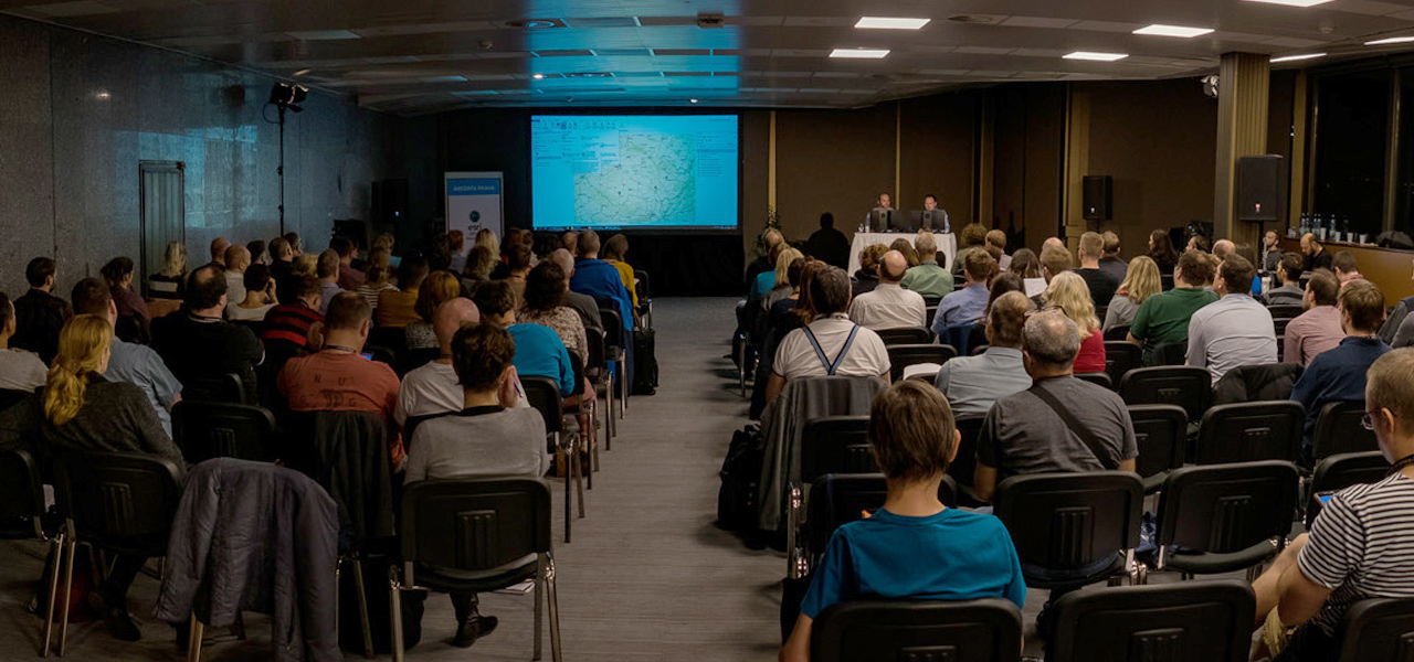
Organizační tým ARCDATA PRAHA si Vás dovolujeme pozvat na letošní ročník Konference GIS Esri v ČR, která se bude konat 8. a 9. listopadu 2023. Tentokrát se opět sejdeme v Kongresovém centru Praha. Největší setkání geoinformatiků v Česku proběhne opět kombinovanou formou – můžete dorazit osobně, nebo si celou konferenci následně pustit ze záznamu. Ať si […]
The post Konference GIS Esri v ČR 2024 (první info) appeared first on GISportal.cz.
Konference GIS Esri v ČR 2024 (první info)
18.5.2023 8:23 GISportal.czOrganizační tým ARCDATA PRAHA si Vás dovolujeme pozvat na letošní ročník Konference GIS Esri v ČR, která se bude konat 8. a 9. listopadu 2023. Tentokrát se opět sejdeme v Kongresovém centru Praha. Největší setkání geoinformatiků v Česku proběhne opět kombinovanou formou – můžete dorazit osobně, nebo si celou konferenci následně pustit ze záznamu. Ať si […]
The post Konference GIS Esri v ČR 2024 (první info) appeared first on GISportal.cz.
Our oceans are in hot water
17.5.2023 16:30 ESA Observing the Earth
Adding to the grim list of record ice losses, record air temperatures and record droughts, which have all hit the headlines recently, the temperature of the surface waters of our oceans is also at an all-time high. With an El Niño looming, concerns are that we will soon be facing even worse extremes. Satellites orbiting overhead are being used to carefully track the patterns that lead up to El Niño to further understand and predict the consequences of this cyclic phenomenon against the backdrop of climate change.
Geodetem nejefektivnějšího povrchového dolu světa?
17.5.2023 13:29 Blogující geomatici - FAV ZČUSpolečnost EXACT nabízí práci ve světově nejefektivnějším povrchovém dole Boliden [www.boliden.com , https://www.youtube.com/watch?v=EGI0dN012Qk ].
Povrchový důl je velký zážitek. Jsou tam ty největší stavební stroje. Exact Group tam má skoro 10 geodetů (Švédi, Češi, Slováci), takže je to jednodušší do začátku pro toho, kdo by si chtěl vyzkoušet pracovat v zahraničí. Teď na projektu plánují víc geodetů, než se čekalo a jako vždy rychle. Naše práce je převážně s GPS pro kontrolu kubatur zemních prací tam, kde buduje zázemí, odkaliště, infrastruktura, apod. 14 dní práce 12h, 14dní volno na projektovou smlouvu (jen na projekt květen – listopad/prosinec) s motivačním čistým příjmem 60.000,- kč/měsíc + ubytování + letenky.).
Geodet musí umět dobře anglicky, být komunikativní, pracovat samostatně, přizpůsobit se Švédskému systému práce. Není to pro každého. Je to pro toho, kdo chce něco zažít, prozkoumat možnosti a má motivaci překročit hranice „známého“. Toto je ideální start. Zde bude v Českém kolektivu, pracovat samostatně se Švédy.)
V případě, že máte o pozici zájem pošlete CV na e-mail: czech.office@teamexact.com
Technická odstávka ESKN
17.5.2023 12:45
ÚGKK SR
Úrad geodézie, kartografie a katastra SR v snahe vylepšiť svoje služby pre konzumentov bude realizovať aktualizáciu informačných systémov. Z tohto dôvodu je potrebné kvôli lepšej funkčnosti portálov ESKN urobiť TECHNICKÚ ODSTÁVKU. Dňa 19.05.2023 (piatok) od 18:00 do 21.05.2023 do 18:00 bude technická odstávka elektronických služieb katastra nehnuteľností, nakoľko bude realizovaná aktualizácia infraštruktúry systému elektronických služieb katastra nehnuteľností.
#PortálESKN #od:19.05.2023@18:00 #do:21.05.2023@18:00
Výběrové řízení
17.5.2023 11:45 ČÚZK - předpisy a opatření Katastrální úřad pro Plzeňský kraj - Katastrální pracoviště Klatovy zveřejnil novou aktualitu: Ředitelka Katastrálního úřadu pro Plzeňský kraj jako služební orgán příslušný podle § 10 odst. 1 písm. f) zákona č. 234/2014 Sb., o státní službě, ve znění pozdějších předpisů, vyhlašuje výběrové řízení na služební místo rada/odborný rada – rozhodování o povolení vkladu RPV0603, na Katastrálním úřadu pro Plzeňský kraj, oddělení právních vztahů k nemovitostem, na Katastrálním pracovišti Klatovy, se služebním působištěm v Klatovech.Na služebním místě je státní služba vykonávána v oboru služby 55. Zeměměřictví a katastr nemovitostí.
Služební místo je zařazeno podle přílohy č. 1 k zákonu o státní službě do 12. platové třídy.
Služba na služebním místě bude vykonávána ve služebním poměru na dobu neurčitou.
Předpokládaným dnem nástupu do služby na služebním místě je 1. srpen 2023 nebo dle dohody.
Posuzovány budou žádosti o přijetí do služebního poměru a zařazení na služební místo nebo žádosti o zařazení na služební místo podané ve lhůtě do 15. června 2023.
Vyhlášení výběrového řízení na služební místo rada/odborný rada – rozhodování o povolení vkladu
17.5.2023 11:42 ČÚZK /Urady/Katastralni-urady/Katastralni-urady/Katastralni-urad-pro-Plzensky-kraj/Uredni-deska/Oznameni-a-jina-uredni-sdeleni/Volna-mista/DMS/Vyhlaseni-vyberoveho-rizeni-na-sluzebni-misto-radaVyhlášení výběrového řízení na služební místo rada/odborný rada – rozhodování o povolení vkladu
17.5.2023 11:42 ČÚZK - předpisy a opatření Katastrální úřad pro Plzeňský kraj Katastrální pracoviště Klatovyvypisuje výběrové řízení na místo
Vyhlášení výběrového řízení na služební místo rada/odborný rada – rozhodování o povolení vkladu
Vyhlášení výběrového řízení na služební místo rada/odborný rada – rozhodování o povolení vkladu
17.5.2023 11:42 ČÚZK - volná místa Katastrální úřad pro Plzeňský kraj Katastrální pracoviště Klatovy vypisuje výběrové řízení na místo Vyhlášení výběrového řízení na služební místo rada/odborný rada – rozhodování o povolení vkladu20230517_Odborný / vrchní referent oddělení obnovy katastrálního operátu 03130 TS KÚ SČK
17.5.2023 11:12 ČÚZK /Urady/Katastralni-urady/Katastralni-urady/Katastralni-urad-pro-Stredocesky-kraj/O-uradu/Aktuality/20210922_Odborny-referent-oddeleni-aktualizace-(1)20230517_Odborný / vrchní referent oddělení obnovy katastrálního operátu 03130 TS KÚ SČK
17.5.2023 11:12 ČÚZK - předpisy a opatření Katastrální úřad pro Středočeský kraj Vyhlášení výběrového řízení: Odborný / vrchní referent oddělení obnovy katastrálního operátu 03130 TS KÚ SČK V části "Úřední deska", v sekci "Oznámení a jiná úřední sdělení" bylo vystaveno "Oznámení o vyhlášení výběrového řízení na obsazení služebního místa Odborný / vrchní referent oddělení obnovy katastrálního operátu 03130 TS KÚ SČK"Odborný / vrchní referent oddělení obnovy katastrálního operátu 03130 TS KÚ SČK
17.5.2023 10:50 ČÚZK - předpisy a opatření Katastrální úřad pro Středočeský krajvypisuje výběrové řízení na místo
Odborný / vrchní referent oddělení obnovy katastrálního operátu 03130 TS KÚ SČK
Odborný / vrchní referent oddělení obnovy katastrálního operátu 03130 TS KÚ SČK
17.5.2023 10:50 ČÚZK - volná místa Katastrální úřad pro Středočeský kraj vypisuje výběrové řízení na místo Odborný / vrchní referent oddělení obnovy katastrálního operátu 03130 TS KÚ SČK20230517_Vrchní referent / rada oddělení aktualizace KN
17.5.2023 10:23 ČÚZK - předpisy a opatření Katastrální úřad pro Středočeský kraj - Katastrální pracoviště Mladá Boleslav Vyhlášení výběrového řízení: Vrchní referent / rada oddělení aktualizace KN V části "Úřední deska", v sekci "Oznámení a jiná úřední sdělení" bylo vystaveno "Oznámení o vyhlášení výběrového řízení na obsazení služebního místa Odborný rada oddělení právních vztahů k nemovitostem"20230517_Vrchní referent / rada oddělení aktualizace KN
17.5.2023 10:23 ČÚZK /Urady/Katastralni-urady/Katastralni-urady/Katastralni-urad-pro-Stredocesky-kraj/Katastralni-pracoviste/KP-Mlada-Boleslav/O-uradu/Aktuality/20210922_Odborny-referent-oddeleni-aktualizace-(3)Vrchní referent / rada oddělení aktualizace KN
17.5.2023 10:21 ČÚZK - volná místa Katastrální úřad pro Středočeský kraj Katastrální pracoviště Mladá Boleslav vypisuje výběrové řízení na místo Vrchní referent / rada oddělení aktualizace KNVrchní referent / rada oddělení aktualizace KN
17.5.2023 10:21 ČÚZK - předpisy a opatření Katastrální úřad pro Středočeský kraj Katastrální pracoviště Mladá Boleslavvypisuje výběrové řízení na místo
Vrchní referent / rada oddělení aktualizace KN
20230517_Vedoucí oddělení právních vztahů k nemovitostem – odborný rada
17.5.2023 10:03 ČÚZK /Urady/Katastralni-urady/Katastralni-urady/Katastralni-urad-pro-Stredocesky-kraj/Katastralni-pracoviste/KP-Mlada-Boleslav/O-uradu/Aktuality/20210922_Odborny-referent-oddeleni-aktualizace-(2)20230517_Vedoucí oddělení právních vztahů k nemovitostem – odborný rada
17.5.2023 10:03 ČÚZK - předpisy a opatření Katastrální úřad pro Středočeský kraj - Katastrální pracoviště Mladá Boleslav Vyhlášení výběrového řízení: Vedoucí oddělení právních vztahů k nemovitostem – odborný rada V části "Úřední deska", v sekci "Oznámení a jiná úřední sdělení" bylo vystaveno "Oznámení o vyhlášení výběrového řízení na obsazení služebního místa Vedoucí oddělení právních vztahů k nemovitostem – odborný rada"Vedoucí oddělení dokumentace KN – odborný rada
17.5.2023 10:02 ČÚZK - volná místa Katastrální úřad pro Středočeský kraj Katastrální pracoviště Mladá Boleslav vypisuje výběrové řízení na místo Vedoucí oddělení dokumentace KN – odborný radaVedoucí oddělení dokumentace KN – odborný rada
17.5.2023 10:02 ČÚZK - předpisy a opatření Katastrální úřad pro Středočeský kraj Katastrální pracoviště Mladá Boleslavvypisuje výběrové řízení na místo
Vedoucí oddělení dokumentace KN – odborný rada
Vedoucí oddělení dokumentace KN – odborný rada
17.5.2023 10:02 ČÚZK /Urady/Katastralni-urady/Katastralni-urady/Katastralni-urad-pro-Stredocesky-kraj/Uredni-deska/Oznameni-a-jina-uredni-sdeleni/Volna-mista/DMS/Vedouci-oddeleni-dokumentace-KN-–-odborny-radaFirst ever SatCom Downstream Days a success
17.5.2023 9:47 European GNSS Agency
Satellite Communications (SatCom) play an essential role in ensuring continuity in a wide range of governmental missions, supporting the operations of key infrastructure as well as being an essential tool for the Crisis management and Surveillance missions– especially when terrestrial networks are not available or are not sufficiently secure. That’s why, in today’s volatile geopolitical landscape, having access to robust, assured satellite communications is of utmost importance. It was against this background that EUSPA hosted the very first SatCom Downstream Days. Over 100 industry players participated in the event, which was held at EUSPA headquarters in Prague.
“SatCom is a key domain for Europe. Its contribution is not only crucial for the economy but it is also supporting the other space segments transversally and securely. Together with the other components of the EU Space Programme, it will contribute to ensuring the EU’s strategic autonomy,” says EUSPA Executive Director Rodrigo da Costa.
Featuring a range of engaging panel discussions led by governmental users and industry representatives, the event helped facilitate open dialogue between end users (Member States, EU Agencies) and European SatCom downstream industry players. It was also a chance to reflect on current challenges and propose innovative solutions, such as the 14 downstream applications pitched by innovative SatCom companies.
Key takeaways from these discussions include the need to combine the benefits of multiple orbits (LEO, MEO and GEO) and the ability to deploy SatCom services swiftly and securely beyond terrestrial connection points as well as seamlessly integrate SatCom solutions with terrestrial based connectivity. Representatives from the European Commission specifically highlighted how standardisation and interoperability among terrestrial and satellite communication networks will influence the development of SatCom applications.
Secure SatCom in action
Participants were also treated to demonstrations of secured SatCom use cases by the EU-funded ENTRUSTED project.
Established to provide a concrete set of governmental user requirements for GOVSATCOM services, representatives from the project demonstrated how users can benefit from the secure and interoperable services the programme will provide. The demos included pooling and sharing capabilities, access to telecommunication services in remote areas, and the confidentiality, integrity and availability offered by secure and highly secure SatCom services.
The ENTRUSTED project has consolidated hundreds SatCom user needs and requirements, defined 85 governmental use cases and conducted an in-depth assessment of the user technology needs that the forthcoming GOVSATCOM and IRIS2 programmes will cover.
Presentations from the 1st SatCom Downstream Days can be found here.
Media note: This feature can be republished without charge provided the European Union Agency for the Space Programme (EUSPA) is acknowledged as the source at the top or the bottom of the story. You must request permission before you use any of the photographs on the site. If you republish, we would be grateful if you could link back to the EUSPA website (http://www.euspa.europa.eu).
Rada/odborný rada – vedoucí oddělení obnovy katastrálního operátu 1 v technickém odboru
17.5.2023 9:09 ČÚZK - předpisy a opatření Katastrální úřad pro Moravskoslezský kraj technický odborvypisuje výběrové řízení na místo
Rada/odborný rada – vedoucí oddělení obnovy katastrálního operátu 1 v technickém odboru
Rada/odborný rada – vedoucí oddělení obnovy katastrálního operátu 1 v technickém odboru
17.5.2023 9:09 ČÚZK - volná místa Katastrální úřad pro Moravskoslezský kraj technický odbor vypisuje výběrové řízení na místo Rada/odborný rada – vedoucí oddělení obnovy katastrálního operátu 1 v technickém odboruRada/odborný rada – vedoucí oddělení obnovy katastrálního operátu 1 v technickém odboru
17.5.2023 9:09 ČÚZK /Urady/Katastralni-urady/Katastralni-urady/Katastralni-urad-pro-Moravskoslezsky-kraj/Uredni-deska/Oznameni-a-jina-uredni-sdeleni/Volna-mista/DMS/Rada-odborny-rada-–-vedouci-oddeleni-obnovy-ka-(1)ISSS Hradec Králové 2023 (reportáž)
17.5.2023 8:40 GISportal.cz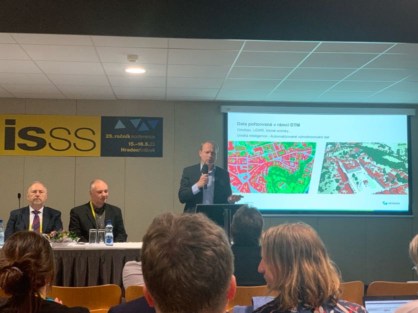
V kongresovém centru Aldis v Hradci Králové se i tento rok konala konference ISSS (dříve známé jako Internet ve státní správě a samosprávě), která se zabývala různými aspekty digitalizace státní správy. Na jubilejním 25. pátem ročníku našel v širokém rozpětí programových témat každý návštěvník musel přijít na své, redakce GISportal.cz se ale zaměřila sekce věnované geoinformatice […]
The post ISSS Hradec Králové 2023 (reportáž) appeared first on GISportal.cz.
ISSS Hradec Králové 2023 (reportáž)
17.5.2023 8:40 GISportal.czV kongresovém centru Aldis v Hradci Králové se i tento rok konala konference ISSS (dříve známé jako Internet ve státní správě a samosprávě), která se zabývala různými aspekty digitalizace státní správy. Na jubilejním 25. pátem ročníku našel v širokém rozpětí programových témat každý návštěvník musel přijít na své, redakce GISportal.cz se ale zaměřila sekce věnované geoinformatice […]
The post ISSS Hradec Králové 2023 (reportáž) appeared first on GISportal.cz.
Vrchní referent/rada v oddělení dokumentace KN na Katastrálním pracovišti Břeclav
17.5.2023 7:55 ČÚZK - předpisy a opatření Katastrální úřad pro Jihomoravský kraj Katastrální pracoviště Břeclavvypisuje výběrové řízení na místo
Vrchní referent/rada v oddělení dokumentace KN na Katastrálním pracovišti Břeclav
Vrchní referent/rada v oddělení dokumentace KN na Katastrálním pracovišti Břeclav
17.5.2023 7:55 ČÚZK /Urady/Katastralni-urady/Katastralni-urady/Katastralni-urad-pro-Jihomoravsky-kraj/Uredni-deska/Oznameni-a-jina-uredni-sdeleni/Volna-mista/DMS/Vrchni-referent-rada-v-oddeleni-dokumentace-KN-na-Vrchní referent/rada v oddělení dokumentace KN na Katastrálním pracovišti Břeclav
17.5.2023 7:55 ČÚZK - volná místa Katastrální úřad pro Jihomoravský kraj Katastrální pracoviště Břeclav vypisuje výběrové řízení na místo Vrchní referent/rada v oddělení dokumentace KN na Katastrálním pracovišti BřeclavRada/odborný rada – vedoucí oddělení obnovy katastrálního operátu 1
17.5.2023 7:35 ČÚZK - předpisy a opatření Katastrální úřad pro Moravskoslezský kraj technický odborvypisuje výběrové řízení na místo
Rada/odborný rada – vedoucí oddělení obnovy katastrálního operátu 1
Rada/odborný rada – vedoucí oddělení obnovy katastrálního operátu 1
17.5.2023 7:35 ČÚZK - volná místa Katastrální úřad pro Moravskoslezský kraj technický odbor vypisuje výběrové řízení na místo Rada/odborný rada – vedoucí oddělení obnovy katastrálního operátu 1Rada/odborný rada – vedoucí oddělení obnovy katastrálního operátu 1
17.5.2023 7:35 ČÚZK /Urady/Katastralni-urady/Katastralni-urady/Katastralni-urad-pro-Moravskoslezsky-kraj/Uredni-deska/Oznameni-a-jina-uredni-sdeleni/Volna-mista/DMS/Rada-odborny-rada-–-vedouci-oddeleni-obnovy-katastÚspěchy na soutěži Gisáček 2023
17.5.2023 6:56 Katedra geoinformatiky UP Olomouc Musíme se pochlubit dalším úspěchem našich studentů, tentokrát na soutěži Gisáček 2023! V kategorii bakalářských prací se stal vítězem Martin Kukrál 😊 Magisterskou sekci ovládla Michaela Vojtěchovská a na druhém místě se umístil Michal Plánka🙃 Děkujeme a gratulujeme 🥳Úspěchy na soutěži Gisáček 2023
17.5.2023 6:56 Katedra geoinformatiky UP Olomouc Musíme se pochlubit dalším úspěchem našich studentů, tentokrát na soutěži Gisáček 2023! V kategorii bakalářských prací se stal vítězem Martin Kukrál 😊 Magisterskou sekci ovládla Michaela Vojtěchovská a na druhém místě se umístil Michal Plánka🙃 Děkujeme a gratulujeme 🥳Úspěchy na soutěži Gisáček 2023
17.5.2023 6:56 Katedra geoinformatiky UP OlomoucMusíme se pochlubit dalším úspěchem našich studentů, tentokrát na soutěži Gisáček 2023! V kategorii bakalářských prací se stal vítězem Martin Kukrál 😊 Magisterskou sekci ovládla Michaela Vojtěchovská a na druhém místě se umístil Michal Plánka🙃 Děkujeme a gratulujeme 🥳
The post Úspěchy na soutěži Gisáček 2023 appeared first on Katedra geoinformatiky.
Tomáš Miniberger v Rozstřelu na iDNES.cz
17.5.2023 2:00 VARS.czGenerální ředitel VARS BRNO Tomáš Miniberger byl hostem pořadu Rozstřel na iDNES.cz. Okomentoval aktuální návrhy aktivistů požadujících snížení rychlosti v Praze a věnoval se i situaci okolo rekonstrukce Barrandovského mostu.
GISáček 2023 – výsledky studentské soutěže, pořádané od roku 1998
16.5.2023 14:01 GeoBusinessV Ostravě se 12. května sešli studenti a studentky ze všech vysokých škol a univerzit, kde se učí geoinformatika/geomatika, členové odborné komise a zástupci firem. Konal se 26. ročník studentské soutěže GISáček. Katedra geoinformatiky na VŠB – TU Ostrava tuto soutěž pořádá již od roku 1998. Pokud byste chtěli nahlédnout do výsledků předchozích ročníků, tak […]
The post GISáček 2023 – výsledky studentské soutěže, pořádané od roku 1998 appeared first on GeoBusiness.
Výběrové řízení na pozici rada / odborný rada - metodik KN v oddělení metodiky, kontroly a personal
16.5.2023 13:39 ČÚZK - volná místa Katastrální úřad pro Královéhradecký kraj kancelář ředitele vypisuje výběrové řízení na místo Výběrové řízení na pozici rada / odborný rada - metodik KN v oddělení metodiky, kontroly a personalVýběrové řízení na pozici rada / odborný rada - metodik KN v oddělení metodiky, kontroly a personal
16.5.2023 13:39 ČÚZK - předpisy a opatření Katastrální úřad pro Královéhradecký kraj kancelář ředitelevypisuje výběrové řízení na místo
Výběrové řízení na pozici rada / odborný rada - metodik KN v oddělení metodiky, kontroly a personalistiky kanceláře ředitele
Výběrové řízení na pozici rada / odborný rada - metodik KN v oddělení metodiky, kontroly a personal
16.5.2023 13:39 ČÚZK /Urady/Katastralni-urady/Katastralni-urady/Katastralni-urad-pro-Kralovehradecky-kraj/Uredni-deska/Oznameni-a-jina-uredni-sdeleni/Volna-mista/DMS/Vyberove-rizeni-na-pozici-rada-odborny-rada-metodiProdej 120 kusů betonových patek
16.5.2023 12:51 ČÚZK /Urady/Katastralni-urady/Katastralni-urady/Katastralni-urad-pro-Jihomoravsky-kraj/Nabidky-majetku/Prodej-120-kusu-betonovych-patek-(2)Prodej 120 kusů betonových patek
16.5.2023 12:51 ČÚZK - předpisy a opatřeníKatastrální úřad pro Jihomoravský kraj nabízí nepotřebný majetek k odkupu. Jedná se o
Prodej 120 kusů betonových patek
Rada/odborný rada - inspektor - vedení SPI a SGI
16.5.2023 11:07 ČÚZK /Urady/Zememericke-a-katastralni-inspektoraty/Zememericke-a-katastralni-inspektoraty/Zememericky-a-katastralni-inspektorat-v-Liberci/Uredni-deska/Oznameni-a-jina-uredni-sdeleni/Volna-mista/DMS/Rada-odborny-rada-inspektor-vedeni-SPI-a-SGIobnovaRada/odborný rada - inspektor - vedení SPI a SGI
16.5.2023 11:07 ČÚZK - předpisy a opatření Zeměměřický a katastrální inspektorát v Libercivypisuje výběrové řízení na místo
Rada/odborný rada - inspektor - vedení SPI a SGI
Rada/odborný rada - inspektor - vedení SPI a SGI
16.5.2023 11:07 ČÚZK - volná místa Zeměměřický a katastrální inspektorát v Liberci vypisuje výběrové řízení na místo Rada/odborný rada - inspektor - vedení SPI a SGIRada/odborný rada - inspektor Zeměměřického a katastrálního inspektorátu v Liberci
16.5.2023 10:50 ČÚZK - volná místa Zeměměřický a katastrální inspektorát v Liberci vypisuje výběrové řízení na místo Rada/odborný rada - inspektor Zeměměřického a katastrálního inspektorátu v LiberciRada/odborný rada - inspektor Zeměměřického a katastrálního inspektorátu v Liberci
16.5.2023 10:50 ČÚZK - předpisy a opatření Zeměměřický a katastrální inspektorát v Libercivypisuje výběrové řízení na místo
Rada/odborný rada - inspektor Zeměměřického a katastrálního inspektorátu v Liberci
Rada/odborný rada - inspektor Zeměměřického a katastrálního inspektorátu v Liberci
16.5.2023 10:50 ČÚZK /Urady/Zememericke-a-katastralni-inspektoraty/Zememericke-a-katastralni-inspektoraty/Zememericky-a-katastralni-inspektorat-v-Liberci/Uredni-deska/Oznameni-a-jina-uredni-sdeleni/Volna-mista/DMS/Rada-odborny-rada-inspektor-Zememerickeho-a-katastRada/odborný rada - inspektor Zeměměřického a katastrálního inspektorátu v Liberci
16.5.2023 10:50 ČÚZK - předpisy a opatření Zeměměřický a katastrální inspektorát v Libercivypisuje výběrové řízení na místo
Rada/odborný rada - inspektor - obnova katastrálního operátu a revize katastru
GISáček 2023 (výsledky)
16.5.2023 9:27 GISportal.cz
12. května se na VŠB-TUO konala tradiční soutěž/konference GISáček, která je určená studentům vysokých škol, kteří zde mají možnost prezentovat výsledky svých odborných studentských prací. Každoročně se zde setkávají studenti z Česka i Slovenska, aby prezentovali širokou paletu využití geoinformatiky v jejich kvalifikačních pracích. Letos obě kategorie – bakalářskou i magisterskou/inženýrskou oponovali studenti z olomoucké geoinformatiky, […]
The post GISáček 2023 (výsledky) appeared first on GISportal.cz.
GISáček 2023 (výsledky)
16.5.2023 9:27 GISportal.cz12. května se na VŠB-TUO konala tradiční soutěž/konference GISáček, která je určená studentům vysokých škol, kteří zde mají možnost prezentovat výsledky svých odborných studentských prací. Každoročně se zde setkávají studenti z Česka i Slovenska, aby prezentovali širokou paletu využití geoinformatiky v jejich kvalifikačních pracích. Letos obě kategorie – bakalářskou i magisterskou/inženýrskou oponovali studenti z olomoucké geoinformatiky, […]
The post GISáček 2023 (výsledky) appeared first on GISportal.cz.
Coming Soon by Way of Redefining 3D Reconstruction, the Lixel X1 SLAM Scanner
16.5.2023 3:32 Satlab Geosolutions Get full details of Lixel X1 on 18 May 2023 at 10:00 AM (CET)Autodesk Fusion 360 v akci – získejte 3, zaplaťte 2
16.5.2023 0:00 Arkance SystemsAkce "Získejte 3, zaplaťte 2". Nové roční předplatné 3D CAD/CAM produktu s výraznou slevou. Až do 6. června 2023.
Zpráva Autodesk Fusion 360 v akci – získejte 3, zaplaťte 2 pochází z arkance-systems.cz.
Autodesk Fusion 360 v akci – získejte 3, zaplaťte 2
16.5.2023 0:00 Arkance SystemsAkce "Zaplaťte 2 - získejte 3". Pořiďte si nové roční předplatné oblíbeného 3D CAD/CAM produktu s výraznou slevou. Až do do 6. června 2023.
Zpráva Autodesk Fusion 360 v akci – získejte 3, zaplaťte 2 pochází z arkance-systems.cz.
Autodesk Fusion 360 v akci – získejte 3, zaplaťte 2
16.5.2023 0:00 Arkance SystemsAkce "Získejte 3, zaplaťte 2". Nové roční předplatné 3D CAD/CAM produktu s výraznou slevou. Až do 6. července 2023.
Zpráva Autodesk Fusion 360 v akci – získejte 3, zaplaťte 2 pochází z arkance-systems.cz.
Safeguarding space infrastructure
15.5.2023 14:45 European GNSS Agency
Space traffic is a pressing issue. With over 20.000 satellites expected to be launched in the next decade, various orbits are becoming increasingly congested. The situation is especially pronounced in Low Earth Orbit (LEO).
The abundance of satellites is not only responsible for "an unprecedented space traffic jam". It is also the cause of a large amount of space debris, or ‘’junk’’, which is increasing at an alarming rate. According to the Directorate General for Defence Industry and Space (DG DEFIS), over 1 million debris items larger than 1cm are currently orbiting the Earth.
When we talk about space debris, we often refer to large objects, such as dead satellites, that have either failed or not been moved to their designated ‘’graveyard orbit’’. But space debris can also be any manmade object in space, ranging from small cables and screws that have fallen off a rocket to actual rocket components. While some debris (in LEO) may re-enter the atmosphere after some years and burn up, large part will remain in orbit for hundreds, or even thousands of years.
Space debris can go on to cause further damage, potentially taking out functioning satellites. What’s more, the collision of space debris with satellites, operational or not, creates even more debris, thus further aggravating the problem.
In summer 2016, Copernicus Sentinel-1A satellite was hit by a millimetre-size particle in orbit causing only minor damage to one of the solar panels, fortunately not affecting the satellite’s performance.
The damages caused by larger pieces of debris to any navigation, communications and Earth Observation satellites could be irreversible and the repercussions will certainly affect us, end users down on Earth.

Before and after debris impacted the Sentinel-1A solar panel. Credits: European Space Agency (ESA)
Towards a unified approach in Space Traffic Management
As both space debris and congestion jeopardise the operation and security of the EU’s and Member States’ space assets, such as Galileo, Copernicus and EGNOS, the European Commission recently proposed an EU integrated approach to Space Traffic Management (EU STM). This holistic approach will secure long-term viability of space activities by ensuring that space remains a sustainable, safe and secure environment encompassing the means and the rules to access, conduct activities in, and return from outer space safely, sustainably and securely.
"It is of a geostrategic question to be able to monitor autonomously space and enhance our collective situational awareness of threats to European or national Space assets," remarked Commissioner for Internal Market Thierry Breton during the European Space Conference in 2023.
To ensure the adequate protection of its satellite infrastructure, the European Union has been relying on EU Space Surveillance and Tracking (EU SST) Partnership, which is the main operational pillar of STM.
The EU SST Partnership operates a network of ground-based sensors capable of surveying and tracking space objects, together with processing capabilities aiming to provide data, information and services on space objects that orbit the Earth.
Today, EU SST provides collision avoidance services to more than 390 satellites distributed in Low Earth Orbit, Medium Earth Orbit and Geostationary Orbit using Member States’ civil and military assets that remain under the control of its Member States.
EUSPA to support the EU Space Traffic Management
As part of its expanded role in the Union Space Programme, and its expertise in service provision and security issues management, EUSPA will take responsibility for the Space Surveillance and Tracking (SST) service provision Front Desk as of July 1st, 2023.
"The EU SST Front Desk is a key interface for the delivery of SST information and services, including activities related to user coordination, service performance," says EUSPA Executive Director, Rodrigo da Costa. "Additionally, the SST Front Desk will be engaging with users and promoting the use of the SST services to further support the future of STM in the EU," he concludes.
The visit of the EU SST partnership Member States to EUSPA took place in this context, gathering all the representatives for a presentation of EUSPA and an exchange of views on future work.
"We are very pleased to visit EUSPA in Prague and we look forward to working with our future EU SST service provision front desk to support our growing user community" declared Pascal Faucher, Chairman, European Union Space Surveillance and Tracking Partnership, Defense and security, CNES. The responsibility is currently being transferred from the European Satellite Centre (SatCen), who currently operates the service, to EUSPA’s Galileo Security Monitoring Centre (GSMC) in Madrid.
Media note: This feature can be republished without charge provided the European Union Agency for the Space Programme (EUSPA) is acknowledged as the source at the top or the bottom of the story. You must request permission before you use any of the photographs on the site. If you republish, we would be grateful if you could link back to the EUSPA website (http://www.euspa.europa.eu).
Safeguarding space infrastructure
15.5.2023 14:45 European GNSS Agency
Space traffic is a pressing issue. With over 20.000 satellites expected to be launched in the next decade, various orbits are becoming increasingly congested. The situation is especially pronounced in Low Earth Orbit (LEO).
The abundance of satellites is not only responsible for "an unprecedented space traffic jam". It is also the cause of a large amount of space debris, or ‘’junk’’, which is increasing at an alarming rate. According to the Directorate General for Defence Industry and Space (DG DEFIS), over 1 million debris items larger than 1cm are currently orbiting the Earth.
When we talk about space debris, we often refer to large objects, such as dead satellites, that have either failed or not been moved to their designated ‘’graveyard orbit’’. But space debris can also be any manmade object in space, ranging from small cables and screws that have fallen off a rocket to actual rocket components. While some debris (in LEO) may re-enter the atmosphere after some years and burn up, large part will remain in orbit for hundreds, or even thousands of years.
Space debris can go on to cause further damage, potentially taking out functioning satellites. What’s more, the collision of space debris with satellites, operational or not, creates even more debris, thus further aggravating the problem.
In summer 2016, Copernicus Sentinel-1A satellite was hit by a millimetre-size particle in orbit causing only minor damage to one of the solar panels, fortunately not affecting the satellite’s performance.
The damages caused by larger pieces of debris to any navigation, communications and Earth Observation satellites could be irreversible and the repercussions will certainly affect us, end users down on Earth.
Before and after debris impacted the Sentinel-1A solar panel. Credits: European Space Agency (ESA)
Towards a unified approach in Space Traffic Management
As both space debris and congestion jeopardise the operation and security of the EU’s and Member States’ space assets, such as Galileo, Copernicus and EGNOS, the European Commission recently proposed an EU integrated approach to Space Traffic Management (EU STM). This holistic approach will secure long-term viability of space activities by ensuring that space remains a sustainable, safe and secure environment encompassing the means and the rules to access, conduct activities in, and return from outer space safely, sustainably and securely.
"It is of a geostrategic question to be able to monitor autonomously space and enhance our collective situational awareness of threats to European or national Space assets," remarked Commissioner for Internal Market Thierry Breton during the European Space Conference in 2023.
To ensure the adequate protection of its satellite infrastructure, the European Union has been relying on EU Space Surveillance and Tracking (EU SST) Partnership, which is the main operational pillar of STM.
The EU SST Partnership operates a network of ground-based sensors capable of surveying and tracking space objects, together with processing capabilities aiming to provide data, information and services on space objects that orbit the Earth.
Today, EU SST provides collision avoidance services to more than 390 satellites distributed in Low Earth Orbit, Medium Earth Orbit and Geostationary Orbit using Member States’ civil and military assets that remain under the control of its Member States.
EUSPA to support the EU Space Traffic Management
As part of its expanded role in the Union Space Programme, and its expertise in service provision and security issues management, EUSPA will take responsibility for the Space Surveillance and Tracking (SST) service provision Front Desk as of July 1st, 2023.
"The EU SST Front Desk is a key interface for the delivery of SST information and services, including activities related to user coordination, service performance," says EUSPA Executive Director, Rodrigo da Costa. "Additionally, the SST Front Desk will be engaging with users and promoting the use of the SST services to further support the future of STM in the EU," he concludes.
The visit of the EU SST partnership Member States to EUSPA took place in this context, gathering all the representatives for a presentation of EUSPA and an exchange of views on future work.
"We are very pleased to visit EUSPA in Prague and we look forward to working with our future EU SST service provision front desk to support our growing user community" declared Pascal Faucher, Chairman, European Union Space Surveillance and Tracking Partnership, Defense and security, CNES. The responsibility is currently being transferred from the European Satellite Centre (SatCen), who currently operates the service, to EUSPA’s Galileo Security Monitoring Centre (GSMC) in Madrid.
Media note: This feature can be republished without charge provided the European Union Agency for the Space Programme (EUSPA) is acknowledged as the source at the top or the bottom of the story. You must request permission before you use any of the photographs on the site. If you republish, we would be grateful if you could link back to the EUSPA website (http://www.euspa.europa.eu).
20230515 - GaKO 5/2023
15.5.2023 13:13 ČÚZK - předpisy a opatření Český úřad zeměměřický a katastrální zveřejnil novou aktualitu: Aktuální číslo Geodetického a kartografického obzoru (5/2023) je k dispozici ke stažení.20230515 - GaKO 5/2023
15.5.2023 13:13 ČÚZK - aktuality v resortu Aktuální číslo Geodetického a kartografického obzoru (5/2023) je k dispozici ke stažení.20230515 - GaKO 5/2023
15.5.2023 13:13 ČÚZK - předpisy a opatření Český úřad zeměměřický a katastrální zveřejnil novou aktualitu: Aktuální číslo Geodetického a kartografického obzoru (5/2023) je k dispozici ke stažení.20230515 - GaKO 5/2023
15.5.2023 13:13 ČÚZK - aktuality v resortu Aktuální číslo Geodetického a kartografického obzoru (5/2023) je k dispozici ke stažení.
Nové číslo GaKO
15.5.2023 12:56
ÚGKK SR
Nové číslo časopisu Geodetického a Kartografického Obzoru 05/2023
Omezení provozu z důsledků přerušení elektřiny
15.5.2023 12:18 ČÚZK - předpisy a opatření Katastrální úřad pro Jihomoravský kraj - Katastrální pracoviště Vyškov zveřejnil novou aktualitu: V DŮSLEDKU PŘERUŠENÍ DODÁVKY ELEKTŘINY BUDEPROVOZ KATASTRÁLNÍHO PRACOVIŠTĚ VYŠKOV DNE 31. 5. 2023
V DOBĚ OD 10:00 DO 12:00h
OMEZEN
Děkujeme za pochopení
Omezení provozu z důsledků přerušení elektřiny
15.5.2023 12:18 ČÚZK /Urady/Katastralni-urady/Katastralni-urady/Katastralni-urad-pro-Jihomoravsky-kraj/Katastralni-pracoviste/KP-Vyskov/O-uradu/Aktuality/Omezeni-provozu-z-dusledku-preruseni-elektrinyT-MAPY Semináře DTM - odborná setkání o Digitální technické mapě
15.5.2023 11:04 T-MAPYThe post T-MAPY Semináře DTM - odborná setkání o Digitální technické mapě appeared first on T-MAPY spol. s r.o..
T-MAPY Semináře DTM - odborná setkání o Digitální technické mapě
15.5.2023 11:04 T-MAPYThe post T-MAPY Semináře DTM - odborná setkání o Digitální technické mapě appeared first on T-MAPY spol. s r.o..
výběrové řízení na KP Jihlava
15.5.2023 11:03 ČÚZK - předpisy a opatření Katastrální úřad pro Vysočinu - Katastrální pracoviště Jihlava zveřejnil novou aktualitu: Oznámení o vyhlášení výběrového řízení na služební místo rada/odborný rada - oddělení aktualizace KN II Katastrálního pracoviště Jihlava na Katastrálním úřadu pro Vysočinu.výběrové řízení na KP Jihlava
15.5.2023 11:03 ČÚZK /Urady/Katastralni-urady/Katastralni-urady/Katastralni-urad-pro-Vysocinu/O-uradu/Aktuality/vyberove-rizeni-na-KP-Jihlava-(4)Odborný referentv oddělení obnovy katastrálního operátu č.3 na Technické sekci
15.5.2023 10:15 ČÚZK - předpisy a opatření Katastrální úřad pro Jihomoravský kraj technická sekcevypisuje výběrové řízení na místo
Odborný referentv oddělení obnovy katastrálního operátu č.3 na Technické sekci
Odborný referentv oddělení obnovy katastrálního operátu č.3 na Technické sekci
15.5.2023 10:15 ČÚZK /Urady/Katastralni-urady/Katastralni-urady/Katastralni-urad-pro-Jihomoravsky-kraj/Uredni-deska/Oznameni-a-jina-uredni-sdeleni/Volna-mista/DMS/Odborny-referentv-oddeleni-obnovy-katastralniho-opOdborný referentv oddělení obnovy katastrálního operátu č.3 na Technické sekci
15.5.2023 10:15 ČÚZK - volná místa Katastrální úřad pro Jihomoravský kraj technická sekce vypisuje výběrové řízení na místo Odborný referentv oddělení obnovy katastrálního operátu č.3 na Technické sekciCivil Tools pro Autodesk Civil 3D – nová verze nadstavbové aplikace
15.5.2023 9:00 Arkance SystemsAplikace z vlastního vývoje nyní s podporou Autodesk Civil 3D 2024 a novou funkcí Filtr dle sad vlastností.
Zpráva Civil Tools pro Autodesk Civil 3D – nová verze nadstavbové aplikace pochází z arkance-systems.cz.
GaKO 5/2023
15.5.2023 0:01 GaKO GaKO 5/2023 ŘEZNÍČEK, J.: Výsledky přesných nivelací spojnic Základní geodynamické sítě ČR provedených v letech 2007 – 2021buildingSMART International Standards Summit, Rome, Italy 27 – 30 March 2023
13.5.2023 15:40 buildingSMART.orgThe buildingSMART International Standards Summit took place in Rome from March 27th to March 30th, 2023. The event brought together professionals from the international openBIM community to discuss and shape…
The post buildingSMART International Standards Summit, Rome, Italy 27 – 30 March 2023 appeared first on buildingSMART International.
Aktualizace podrobného popisu služeb k v. 1.4.3
13.5.2023 0:10 ČÚZK - předpisy a opatření Český úřad zeměměřický a katastrální informuje, že k nainstalované nové verzi 1.4.3.1 IS DMVS na integračním prostředí INT1 byla v záložce Popis služeb aktualizována dokumentace Podrobného popisu služeb IS DMVS.On-line školení Trimble 3D Koridory
12.5.2023 15:33 GeotronicsGEODÉZIE - Připravili jsme pro Vás on-line školení Tvorba a využití 3D tras.
The post On-line školení Trimble 3D Koridory first appeared on GEOTRONICS Praha.
On-line školení Trimble 3D Koridory
12.5.2023 15:33 GeotronicsGEODÉZIE - Připravili jsme pro Vás on-line školení Tvorba a využití 3D tras.
The post On-line školení Trimble 3D Koridory first appeared on GEOTRONICS Praha.
DAEX DESIGN Standard v akční ceně
12.5.2023 15:20 ŠPINAR - software Vážení zákazníci, připravili jsme pro Vás DAEX DESIGN Standard pro výrobce a návrháře nábytku a interiérů v akční ceně s rozšiřujícími bonusy do 9. 9. 2023DAEX DESIGN Standard v akční ceně
12.5.2023 15:20 ŠPINAR - softwareVážení zákazníci, připravili jsme pro Vás DAEX DESIGN Standard pro výrobce a návrháře nábytku a interiérů v akční ceně s rozšiřujícími bonusy do 9. 9. 2023
The post DAEX DESIGN Standard v akční ceně appeared first on ŠPINAR – software.
rada/odborný rada - kontrola aktualizace - v oddělení právních vztahů k nemovitostem Katastrálního p
12.5.2023 14:59 ČÚZK /Urady/Katastralni-urady/Katastralni-urady/Katastralni-urad-pro-Jihocesky-kraj/Uredni-deska/Oznameni-a-jina-uredni-sdeleni/Volna-mista/DMS/rada-odborny-rada-kontrola-aktualizace-v-oddeleni-rada/odborný rada - kontrola aktualizace - v oddělení právních vztahů k nemovitostem Katastrálního p
12.5.2023 14:59 ČÚZK - volná místa Katastrální úřad pro Jihočeský kraj Katastrální pracoviště Tábor vypisuje výběrové řízení na místo rada/odborný rada - kontrola aktualizace - v oddělení právních vztahů k nemovitostem Katastrálního prada/odborný rada - kontrola aktualizace - v oddělení právních vztahů k nemovitostem Katastrálního p
12.5.2023 14:59 ČÚZK - předpisy a opatření Katastrální úřad pro Jihočeský kraj Katastrální pracoviště Táborvypisuje výběrové řízení na místo
rada/odborný rada - kontrola aktualizace - v oddělení právních vztahů k nemovitostem Katastrálního pracoviště Tábor (ID SM 30000315/30003939)
Online konference Autodesk LIVE 2024 – děkujeme za účast
12.5.2023 12:17 Arkance SystemsPro registrované účastníky i nové zájemce je nyní k dispozici kompletní archiv s videozáznamem všech prezentací.
Zpráva Online konference Autodesk LIVE 2024 – děkujeme za účast pochází z arkance-systems.cz.
Here’s How SatLab Explored In Ocean Business 2023
12.5.2023 11:55 Satlab Geosolutions SatLab Integrated Marine System displayed comprehensive industrial solutions in Ocean Business 2023.Výsledky soutěže Mapa roku 2022
12.5.2023 10:25 GeoBusinessVe středu 3. května 2023 byly v Praze vyhlášeny výsledky 25. ročníku kartografické soutěže Mapa roku. Česká kartografická společnost, která je každoročním pořadatelem soutěže, prostřednictvím soutěže oceňuje kvalitní mapová díla, vytvořená a vydaná na území České republiky. Vítězové kategorií Kategorie Atlasy, soubory a edice map Česká geologická služba za dílo Geology, Soil Environment and Hydrogeology […]
The post Výsledky soutěže Mapa roku 2022 appeared first on GeoBusiness.
Earth from Space: Nishinoshima island, Japan
12.5.2023 10:00 ESA Observing the Earth Image:
This Copernicus Sentinel-2 image features the Japanese island of Nishinoshima, in the northwest Pacific Ocean.
Image:
This Copernicus Sentinel-2 image features the Japanese island of Nishinoshima, in the northwest Pacific Ocean.
rada/odborný rada - vedoucí oddělení dokumentace KN Katastrálního pracoviště Strakonice (ID SM 30000
12.5.2023 7:45 ČÚZK - volná místa Katastrální úřad pro Jihočeský kraj Katastrální pracoviště Strakonice vypisuje výběrové řízení na místo rada/odborný rada - vedoucí oddělení dokumentace KN Katastrálního pracoviště Strakonice (ID SM 30000rada/odborný rada - vedoucí oddělení dokumentace KN Katastrálního pracoviště Strakonice (ID SM 30000
12.5.2023 7:45 ČÚZK /Urady/Katastralni-urady/Katastralni-urady/Katastralni-urad-pro-Jihocesky-kraj/Uredni-deska/Oznameni-a-jina-uredni-sdeleni/Volna-mista/DMS/rada-odborny-rada-vedouci-oddeleni-dokumentace-KN-rada/odborný rada - vedoucí oddělení dokumentace KN Katastrálního pracoviště Strakonice (ID SM 30000
12.5.2023 7:45 ČÚZK - předpisy a opatření Katastrální úřad pro Jihočeský kraj Katastrální pracoviště Strakonicevypisuje výběrové řízení na místo
rada/odborný rada - vedoucí oddělení dokumentace KN Katastrálního pracoviště Strakonice (ID SM 30000301/30003925)