


![]()

zprávy
zdroje zpráv:Smart competition for clever navigation at NAVISP Industry Days
7.7.2022 13:45 ESA Navigation
Europe’s leading companies and research institutes working on positioning, navigation, and timing (PNT) technologies met at ESA’s technical heart in the Netherlands in mid-June for this year’s NAVISP Industry Days, devoted to the latest developments in the Agency’s Navigation Innovation and Support Programme.
Vrchní referent/rada v oddělení obnovy katastrálního operátu č.1 na Technické sekci
7.7.2022 10:37 ČÚZK - předpisy a opatření Katastrální úřad pro Jihomoravský kraj technická sekcevypisuje výběrové řízení na místo
Vrchní referent/rada v oddělení obnovy katastrálního operátu č.1 na Technické sekci
Vrchní referent/rada v oddělení obnovy katastrálního operátu č.1 na Technické sekci
7.7.2022 10:37 ČÚZK /Urady/Katastralni-urady/Katastralni-urady/Katastralni-urad-pro-Jihomoravsky-kraj/Uredni-deska/Oznameni-a-jina-uredni-sdeleni/Volna-mista/DMS/Vrchni-referent-rada-v-oddeleni-obnovy-katastralniVrchní referent/rada v oddělení obnovy katastrálního operátu č.1 na Technické sekci
7.7.2022 10:37 ČÚZK - volná místa Katastrální úřad pro Jihomoravský kraj technická sekce vypisuje výběrové řízení na místo Vrchní referent/rada v oddělení obnovy katastrálního operátu č.1 na Technické sekciCo je nového v Drone2Map (červen 2022)
7.7.2022 9:49 blog ARCDATA V červnu 2022 byla vydána nová verze aplikace ArcGIS Drone2Map 2022.1, která obsahuje mnoho nových funkcí a vylepšení.20220707 - Novinky ve verzi 3.4
7.7.2022 7:47 ČÚZK /ruian/Novinky-RUIAN/Archiv-novinek-RUIAN/2022/20220707-Novinky-ve-verzi-3-4Commercial UAV Expo Announces Keynote Lineup for 2022 Event
6.7.2022 22:42 GISCafe.com Webcasts-Webinars PORTLAND, Maine, July 6, 2022 — (PRNewswire) —Leading voices elevating the commercial drone industry to present in Las …
Dominion Energy Secures Pivotal BVLOS Waiver for Power Facility Inspections Using Skydio X2
6.7.2022 19:13 GISCafe.com Webcasts-Webinars Authorization enables advanced drone operations to inspect 40+ power facilities in 7 statesRICHMOND, Va. — (BUSINESS WIRE) — July 6, …
Esri Recognizes Italian Rail Agency for Modernizing Infrastructure
6.7.2022 18:19 GISCafe.com Webcasts-Webinars Rete Ferroviaria Italiana to Receive Award at Esri User ConferenceREDLANDS, Calif. — (BUSINESS WIRE) — July 6, 2022 —
Last year, …
Rocket Lab to Launch Responsive Space Missions for National Reconnaissance Office
6.7.2022 16:38 GISCafe.com Webcasts-Webinars LONG BEACH, Calif. — (BUSINESS WIRE) — July 5, 2022 —Rocket Lab USA, Inc (Nasdaq: RKLB) (“Rocket Lab” or “the Company”), …
It is time to invite the financiers to the infrastructure digital transformation reform table
6.7.2022 16:19 Bentley SystemsPressCoverage
Eco Voice, Australia/New Zealand
Read the articleUser Consultation Meeting on Harmony: watch the replay
6.7.2022 15:00 ESA Observing the Earth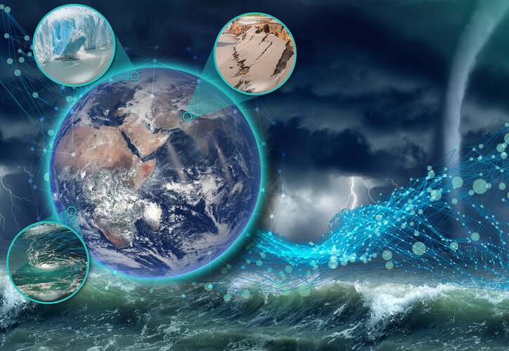
User Consultation Meeting on Harmony: watch the replay
Follow the discussions on Harmony – the candidate mission for ESA’s tenth Earth Explorer
City heat extremes
6.7.2022 13:30 ESA Observing the Earth
With air temperatures in excess of 10°C above the average for the time of year in parts of Europe, the United States and Asia, June 2022 has gone down as a record breaker. The fear is that these extreme early-season heatwaves are a taste of what could soon be the norm as climate change continues to take hold. For those in cities, the heat dissipates slower creating ‘urban heat islands’, which make everyday life even more of a struggle.
An instrument, carried on the International Space Station, has captured the recent land-surface temperature extremes for some European cities, including Milan, Paris and Prague.
New navigation missions for enhanced satnav and Earth mapping
6.7.2022 13:22 ESA Navigation
ESA’s Navigation Directorate – already the design architect of the Galileo satellite navigation system, Europe’s largest satellite constellation – is reaching out to European industry as it plans the development and in-orbit validation of future ‘positioning, navigation and timing’ (PNT) missions into novel orbits.
Lidar Data Collected by Woolpert for USGS Helps Prioritize Flood Risk, Speed Recovery at Yellowstone
5.7.2022 19:24 GISCafe.com Webcasts-Webinars PARK COUNTY, Mont., July 5, 2022 — (PRNewswire) —Thanks to the efforts of local officials, data was procured quickly to mitigate the …
The Worlds First 60MW Subcritical Blast Furnace Gas Power Generation Project
5.7.2022 17:06 Bentley SystemsPressCoverage
Oil and Gas Australia, Australia
Read the articleExamining the Economic Feasibility of Digital Twins
5.7.2022 17:02 Bentley SystemsPressCoverage
Water Finance and Management, USA
Read the articleDigital Twins and the Gemini Papers pt3
5.7.2022 16:51 Bentley SystemsPressCoverage
DC Hub, Middle East
Read the articleCoreLogic Data: National Home Price Gains Continue to Exceed 20% in May
5.7.2022 16:18 GISCafe.com Webcasts-Webinars Year-over-year home price growth dipped slightly from April but still posted a 20.2% increase in May, the 124th consecutive month of …Nextech AR Announces Updated Proposal To Spin Out Real-World Augmented Reality Spatial Mapping Platform ARitize Maps
5.7.2022 16:18 GISCafe.com Webcasts-Webinars Increases Number of Dividend Shares to Nextech Shareholders by 100% to 3,200,000 Common SharesNextech Direct Ownership of Shares to Increase
Now …
The buildingSMART Board and Strategic Advisory Council
5.7.2022 16:11 buildingSMART.orgThe buildingSMART Board and SAC London, U.K. – July 5, 2022 – The buildingSMART International Council, Board and Strategic Advisory Council meetings took place between 27-29 June with a variety of…
The post The buildingSMART Board and Strategic Advisory Council appeared first on buildingSMART International.
CAD Symbols – 30 miliónů symbolů
4.7.2022 20:52 ŠPINAR - softwareVážení zákazníci,
dovolujeme si vám nabídnout program CAD Symbols v16 s ohromnou databází přes 30 milionů CAD symbolů ve 2D a 3D, které jednoduše vyhledáte a vložíte do svého CAD programu
The post CAD Symbols – 30 miliónů symbolů appeared first on ŠPINAR – software.
Nefunkční TÚ
4.7.2022 14:45 ČÚZK /Urady/Katastralni-urady/Katastralni-urady/Katastralni-urad-pro-Moravskoslezsky-kraj/Katastralni-pracoviste/KP-Karvina/O-uradu/Aktuality/Nefunkcni-TUNefunkční TÚ
4.7.2022 14:45 ČÚZK - předpisy a opatření Katastrální úřad pro Moravskoslezský kraj - Katastrální pracoviště Karvinázveřejnil novou aktualitu: Upozorňujeme klienty na dočasně nefunkční telefonní ústřednu na Katastrálním pracovišti Karviná, zjištěno dne 4. 7. 2022. Dle sdělení technika oddělení péče o zákazníky společnosti ha-vel internet s.r.o. byl v lokalitě přerušen optický kabel. Na identifikaci a opravě problému se pracuje, zatím však není známo, kdy bude opraveno. Omlouváme se klientům za možné komplikace s tímto spojené.
Watch: Earth Explorer 10 Consultation
4.7.2022 12:30 ESA Observing the Earth
Watch: Earth Explorer 10 Consultation
On 5 July, follow the discussion on Harmony at the User Consultation Meeting for ESA's tenth Earth Explorer
20220704_Vrchní referent / rada oddělení aktualizace GI KN
4.7.2022 11:08 ČÚZK /Urady/Katastralni-urady/Katastralni-urady/Katastralni-urad-pro-Stredocesky-kraj/Katastralni-pracoviste/KP-Praha-zapad/O-uradu/Aktuality/20210922_Odborny-referent-oddeleni-aktualizace-(9)20220704_Vrchní referent / rada oddělení aktualizace GI KN
4.7.2022 11:08 ČÚZK - předpisy a opatření Katastrální úřad pro Středočeský kraj - Katastrální pracoviště Praha-západ Vyhlášení výběrového řízení: Vrchní referent / rada oddělení aktualizace GI KN V části "Úřední deska", v sekci "Oznámení a jiná úřední sdělení" bylo vystaveno "Oznámení o vyhlášení výběrového řízení na obsazení služebního místa Vrchní referent / rada oddělení aktualizace GI KN"Vrchní referent / rada oddělení aktualizace GI KN
4.7.2022 11:07 ČÚZK - volná místa Katastrální úrad pro Středočeský kraj Katastrální pracoviště Praha-západ vypisuje výběrové řízení na místo Vrchní referent / rada oddělení aktualizace GI KNVrchní referent / rada oddělení aktualizace GI KN
4.7.2022 11:07 ČÚZK - předpisy a opatření Katastrální úrad pro Středočeský kraj Katastrální pracoviště Praha-západvypisuje výběrové řízení na místo
Vrchní referent / rada oddělení aktualizace GI KN
Vrchní referent / rada oddělení aktualizace GI KN
4.7.2022 11:07 ČÚZK /Urady/Katastralni-urady/Katastralni-urady/Katastralni-urad-pro-Stredocesky-kraj/Uredni-deska/Oznameni-a-jina-uredni-sdeleni/Volna-mista/DMS/Vrchni-referent-rada-oddeleni-aktualizace-GI-KNOdstávka mapových aplikací Geoportálu
4.7.2022 10:53 Jihočeský krajV pondělí 4.7.2022, od 15:50, mohou být z technických důvodů nedostupné mapové aplikace Geoportálu. Obnovení plného provozu předpokládáme ve večerních hodinách.
rnrnOmlouváme se za komplikace
Interview with Kevin Madden, Principal, Business Development, Location Intelligence, CoreLogic
4.7.2022 9:00 GISCafe.com Webcasts-WebinarsPrázdninová pauza
4.7.2022 8:10 GISportal.cz
Vážené čtenářky, vážení čtenáři, podporovatelky, podporovatelé, inzerentky a inzerenti, přejeme vám všem klidné léto a dovolené. Zkuste si alespoň na pár dní nekontrolovat emaily a odpočinout si někde v přírodě. My budeme dělat to samé. GISportal.cz přechází na „letní režim“, tzn., že pokud dostaneme nějakou pozvánku na konferenci, či nabídku práce, tak je rádi zveřejníme, […]
The post Prázdninová pauza appeared first on GISportal.cz.
Prázdninová pauza
4.7.2022 8:10 GISportal.czVážené čtenářky, vážení čtenáři, podporovatelky, podporovatelé, inzerentky a inzerenti, přejeme vám všem klidné léto a dovolené. Zkuste si alespoň na pár dní nekontrolovat emaily a odpočinout si někde v přírodě. My budeme dělat to samé. GISportal.cz přechází na „letní režim“, tzn., že pokud dostaneme nějakou pozvánku na konferenci, či nabídku práce, tak je rádi zveřejníme, […]
The post Prázdninová pauza appeared first on GISportal.cz.
Antenova’s compact low-power GNSS receiver module to extend runtime by 500%
2.7.2022 0:08 GISCafe.com Webcasts-Webinars Hatfield, UK - Antenova Ltd, the UK-based manufacturer of antennas and RF modules for M2M and the IoT, is launching GNSSNOVA M20071, a brand new GNSS …Letitia A. Long to Receive 2022 Lundahl-Finnie Lifetime Achievement Award
1.7.2022 23:52 GISCafe.com Webcasts-Webinars Herndon, Virginia (June 29, 2022)—The United States Geospatial Intelligence Foundation (USGIF) is pleased to announce Letitia A. Long as the …Satellite data for reduced emission footprint – Boliden partners with Swedish Space Corporation
1.7.2022 23:38 GISCafe.com Webcasts-Webinars Swedish Space Corporation (SSC) and the Swedish mining and metals company Boliden enter into a partnership to track and reduce emissions from …Céline Bent – New Compliance Director for buildingSMART International
1.7.2022 14:02 buildingSMART.orgLondon, (June 27, 2022) – buildingSMART International is proud to announce the appointment of Céline Bent as its Compliance Director. An architect by profession, Céline has previously served various roles at…
The post Céline Bent – New Compliance Director for buildingSMART International appeared first on buildingSMART International.
Céline Bent Appointed as Compliance Director
1.7.2022 14:02 buildingSMART.orgLondon, (June 27, 2022) – buildingSMART International is proud to announce the appointment of Céline Bent as its Compliance Director. An architect by profession, Céline has previously served various roles at…
The post Céline Bent Appointed as Compliance Director appeared first on buildingSMART International.
Czech EU Presidency puts space at the centre of its security priority
1.7.2022 11:56 European GNSS Agency
July 1st marks the start of the Czech Presidency of the Council of the European Union. As the host country of the EU Agency for the Space Programme (EUSPA), it’s safe to say that space will play a key role in achieving some of the presidency’s top priorities.
The Council presidency rotates among the EU Member States every six months. During this time, it chairs meetings at every level in the Council, helping ensure the continuity of the EU's work in the Council.
With the Czech Presidency starting in the midst of growing global instability, it will use the next half year to focus on strengthening Europe’s defence capabilities and cybersecurity. As to the former, the presidency aims to pay particular attention to reducing the EU’s technological dependence on third-party countries and enhancing the EU’s own capacity for building disruptive technologies. As to the latter, the Czech Presidency plans to reinforce the Union’s cybersecurity infrastructure.
At the centre of both is the EU Space Programme.
EU Space for European autonomy
At the heart of the EU Space Programme is European autonomy. Before Galileo, GNSS users depended on other countries’ satellite signals. With Galileo, Europeans now have a reliable alternative that remains under civil control.
This is important as satellite positioning has become an essential service that is often taken for granted. Just think what would happen if GNSS signals were suddenly switched off. Truck and taxi drivers, ship and aircraft crews and millions of people around the world would suddenly be lost. Furthermore, financial and communication activities, public utilities, security and humanitarian operations and emergency services would all come to a standstill.
Galileo helps minimise the risk of any of this happening.
EUSPA answers the cybersecurity challenge
While the EU Space Programme has given the European Union a new level of autonomy and independence, by no means does this make it immune to cyberattacks. As the number of critical services and everyday devices that depend on satellite-based data continues to increase, so too does the cybersecurity risk.
Ensuring the confidentiality, integrity and availability of space data against cyber threats is a challenge that EUSPA takes very seriously. In addition to its service provision, EUSPA also serves as the security gatekeeper of the EU Space Programme – a role that includes, amongst other things, keeping Europe’s GNSS signals secure.
Building an even more robust EU Space Programme
Because security is such a critical issue, and one that space is playing an increasingly bigger role in, the EU is developing several new security-oriented, space-related initiatives. One of those is GOVSATCOM.
As the fourth pillar of the EU Space Programme, GOVSATCOM bridges the gap between the need for assured and secure communication and the capabilities already offered by Copernicus, Galileo and EGNOS. A user-centric programme, GOVSATCOM is designed to meet the unique requirements of governmental applications, including those used for crisis management, surveillance and the management of key infrastructures. The programme will provide a means of communication that is robustly protected against interference, interception, intrusion and other risks.
EUSPA has been entrusted with procuring the secure operational ground segment, its operations and the coordination of the user-related aspects of GOVSATCOM, all in close collaboration with Member States and other involved entities.
Complementing GOVSATCOM and the rest of the EU Space Programme is the EU’s Secure Connectivity Initiative. This new asset is set to provide secure communication services to the EU and its Member States, as well as offer a new level of connectivity for European citizens, private companies and governmental authorities. The initiative will build a resilient, ultra-secure space- and ground-based system that will put an end to dead zones and offer high-speed broadband to everyone in Europe and even some areas of Africa.
With the addition of the Secure Connectivity Initiative and GOVSATCOM, the EU and the Czech Presidency continue to ramp up Europe’s own space resources and infrastructure, strengthening its sovereignty and security.
EUSPA looks forward to working with the Czech Presidency. Together, we can leverage the many benefits of the EU Space Programme to keep European citizens and interests safe and secure.
Media note: This feature can be republished without charge provided the European Union Agency for the Space Programme (EUSPA) is acknowledged as the source at the top or the bottom of the story. You must request permission before you use any of the photographs on the site. If you republish, we would be grateful if you could link back to the EUSPA website (http://www.euspa.europa.eu).
Earth from Space: Patagonia
1.7.2022 10:00 ESA Observing the Earth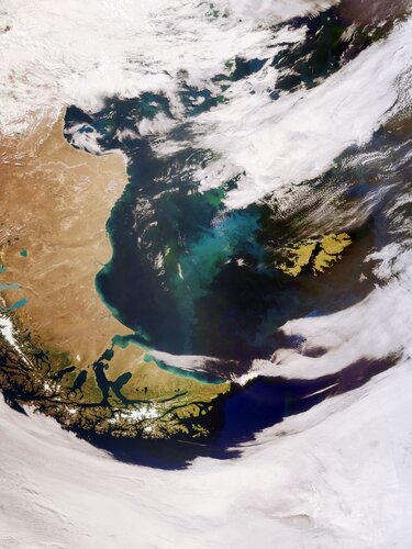
The Copernicus Sentinel-3 mission captured this impressive, wide-angled view of Patagonia at the southern end of South America, as well as the Falkland Islands (Malvinas).
Earth from Space: Patagonia
1.7.2022 10:00 ESA Observing the Earth
The Copernicus Sentinel-3 mission captured this impressive, wide-angled view of Patagonia at the southern end of South America, as well as the Falkland Islands.
20220701 - změny vyvolané zrušením okresu Praha
1.7.2022 9:56 ČÚZK /ruian/Novinky-RUIAN/Archiv-novinek-RUIAN/2022/20220701-zmeny-vyvolane-zrusenim-okresu-PrahaJednali jsme s Letištěm Česká Lípa o možném testovacím prostoru pro drony
1.7.2022 9:53 UAVAVčera jsme se s Ústav letecké dopravy – ČVUT a vybranými zástupci průmyslu (AgentFly Technologies s.r.o., Dronetag, DJI Telink, UpVision), Řízení letového provozu ČR, s.p. a Prague Airport – Letiště Praha účastnili představení a setkání s Letištěm Česká Lípa, kde probíhají jednání o vytvoření testovacího polygonu pro drony. O dalším průběhu budeme informovat…
The post Jednali jsme s Letištěm Česká Lípa o možném testovacím prostoru pro drony appeared first on UAV Aliance pro bezpilotní letecký průmysl.
Epson Now Shipping New High-Speed SureColor P8570D 44-Inch Production Photo and Graphics Printer
1.7.2022 9:00 GISCafe.com Webcasts-Webinars LOS ALAMITOS, Calif., June 27, 2022 — (PRNewswire) — Meeting the needs of high volume production environments, Epson today …Airspace Link Enables First Real-World Medical Package Delivery Operations In Michigan
1.7.2022 9:00 GISCafe.com Webcasts-Webinars DETROIT, June 27, 2022 — (PRNewswire) — Airspace Link, a leading provider of digital drone safety infrastructure services, announced …Kurz Bezpilotní letecké prostředky (UAV) pro ochranu životního prostředí (pozvánka)
1.7.2022 8:58 GISportal.cz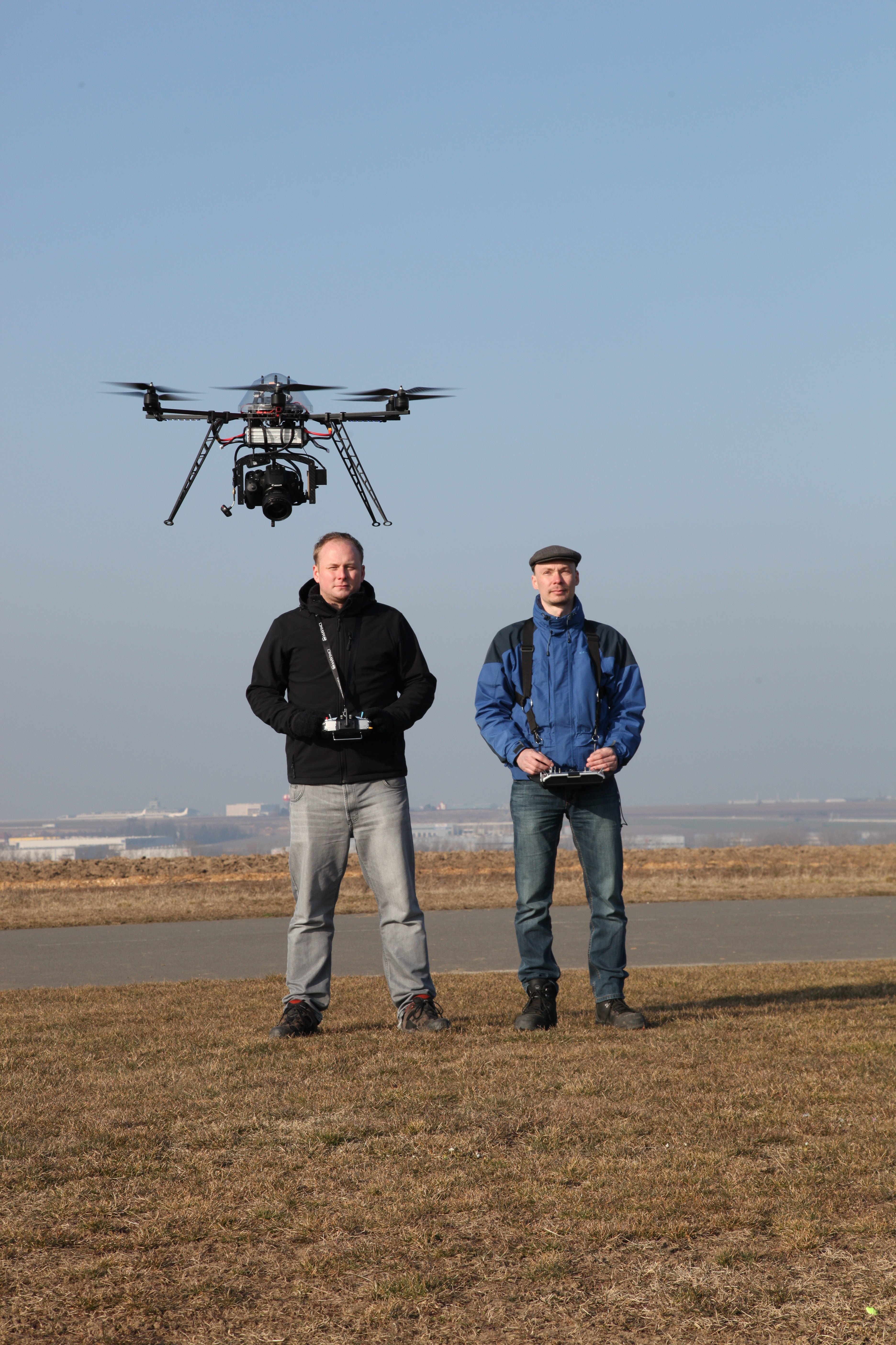
Odborná skupina CAGI OS 27 Vzdělávání si vás dovoluje pozvat na další běh akreditovaného kurzu Bezpilotní letecké prostředky (UAV) pro ochranu životního prostředí. Termín kurzu: 13.-14. 9. 2022 Kurz vedou: Ing. Jan Komárek, Ph.D. (ČZU Praha) a doc. Ing. Michal Kačmařík, Ph.D. (VŠB-TU Ostrava) Místo konání: Česká zemědělská univerzita v Praze […]
The post Kurz Bezpilotní letecké prostředky (UAV) pro ochranu životního prostředí (pozvánka) appeared first on GISportal.cz.
Kurz Bezpilotní letecké prostředky (UAV) pro ochranu životního prostředí (pozvánka)
1.7.2022 8:58 GISportal.czOdborná skupina CAGI OS 27 Vzdělávání si vás dovoluje pozvat na další běh akreditovaného kurzu Bezpilotní letecké prostředky (UAV) pro ochranu životního prostředí. Termín kurzu: 13.-14. 9. 2022 Kurz vedou: Ing. Jan Komárek, Ph.D. (ČZU Praha) a doc. Ing. Michal Kačmařík, Ph.D. (VŠB-TU Ostrava) Místo konání: Česká zemědělská univerzita v Praze […]
The post Kurz Bezpilotní letecké prostředky (UAV) pro ochranu životního prostředí (pozvánka) appeared first on GISportal.cz.
Buďte BIM Ready a 3D Ready s novými startovacími balíčky pro Autodesk Revit, Civil 3D a Inventor
1.7.2022 8:00 Arkance SystemsVyzkoušejte si startovací balíčky BIM a 3D CAD produktů Autodesku a Arkance Systems, využijte výukové nástroje a bonusy.
Zpráva Buďte BIM Ready a 3D Ready s novými startovacími balíčky pro Autodesk Revit, Civil 3D a Inventor pochází z arkance-systems.cz.
Buďte BIM nebo 3D Ready s novými startovacími balíčky pro Autodesk Revit, Civil 3D a Inventor
1.7.2022 8:00 Arkance SystemsVyzkoušejte si startovací balíčky Autodesk Inventor, Revit, Civil 3D s aplikacemi, výukou a bonusy od Arkance Systems!
Zpráva Buďte BIM nebo 3D Ready s novými startovacími balíčky pro Autodesk Revit, Civil 3D a Inventor pochází z arkance-systems.cz.
Buďte BIM Ready a 3D Ready s novými startovacími balíčky pro Autodesk Revit, Civil 3D a Inventor
1.7.2022 8:00 Arkance SystemsVyzkoušejte si startovací balíčky BIM a 3D CAD nástrojů Autodesk a Arkance Systems, využijte výukové nástroje a bonus obsah. Platí až do 30.9. 2022.
Zpráva Buďte BIM Ready a 3D Ready s novými startovacími balíčky pro Autodesk Revit, Civil 3D a Inventor pochází z arkance-systems.cz.
Buďte BIM nebo 3D Ready s novými startovacími balíčky pro Autodesk Revit, Civil 3D a Inventor
1.7.2022 8:00 Arkance SystemsVyzkoušejte si startovací balíčky BIM a 3D CAD produktů Autodesku a Arkance Systems, využijte výukové nástroje a bonusy.
Zpráva Buďte BIM nebo 3D Ready s novými startovacími balíčky pro Autodesk Revit, Civil 3D a Inventor pochází z arkance-systems.cz.
ASTERRA expands EarthWorks for efficient monitoring of critical infrastructures
1.7.2022 3:26 GISCafe.com Webcasts-Webinars TEL AVIV, Israel, June 30, 2022 (GLOBE NEWSWIRE) -- Today ASTERRA released an expansion to its EarthWorks product line that paves the way for …U.S. federal government access to powerful location intelligence services and location data boosted by addition of Nearmap as an approved GSA contractor
1.7.2022 3:26 GISCafe.com Webcasts-Webinars SALT LAKE CITY, June 30, 2022 — (PRNewswire) — Federal government agencies in the U.S. now have streamlined access to geospatial …Construction Software Company Ecobot Becomes a Silver Partner in the Esri Partner Network
1.7.2022 3:26 GISCafe.com Webcasts-Webinars ASHEVILLE, N.C., June 30, 2022 (GLOBE NEWSWIRE) -- Ecobot, the premier digital solution for pre-construction environmental permitting, has been …L3Harris Infrared Space Technology to Enhance Battlefield Imagery and Missile Defense Detection
1.7.2022 3:26 GISCafe.com Webcasts-Webinars Highlights:Enhanced Infrared instrument will provide superior resolution to collect battlefield information
Wide-field-of-view satellite will …
19. jednání KRS
30.6.2022 20:52 ČÚZK - předpisy a opatření Dne 14. září 2022 proběhne distančně devatenácté jednání Koordinační rady správců DMVS a DTM.19. jednání KRS
30.6.2022 20:52 ČÚZK - předpisy a opatření Dne 13. září 2022 proběhne prezenčně devatenácté jednání Koordinační rady správců DMVS a DTM.5. jednání KRS
30.6.2022 20:47 ČÚZK - předpisy a opatření Dne 7. září 2022 proběhne distančně páté jednání Technické pracovní skupiny Koordinační rady správců DMVS a DTM.Otevírací doba v pondělí 4.7.2022
30.6.2022 17:11 GEUSware Po 4.7.2022: ZAVŘENO - z technických důvodů. Mimo provoz je i technická podpora.Copernicus Sentinel-1 maps Bangladesh flood
30.6.2022 17:00 ESA Observing the Earth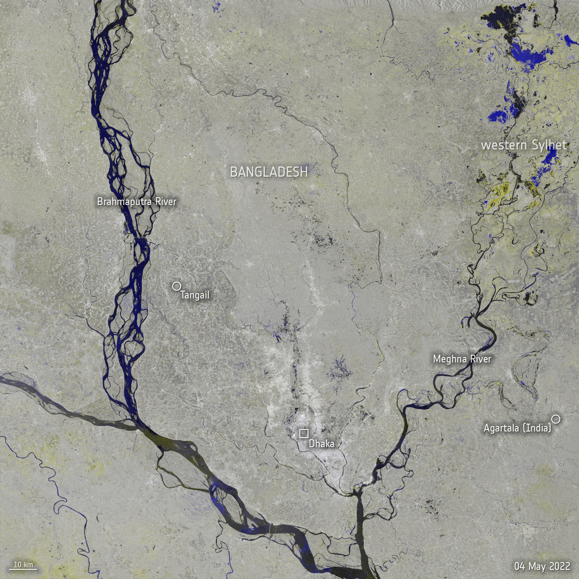 Image:
Copernicus Sentinel-1 maps Bangladesh flood
Image:
Copernicus Sentinel-1 maps Bangladesh flood
Nabídka spolupráce a zaměstnání pro studenty v geodetické kanceláři v Plzni
30.6.2022 16:06 Blogující geomatici - FAV ZČUVíce informací najdete na stránce http://www.geoplzen.cz/kariera.
VR do 01. 8.
30.6.2022 15:47 ČÚZK /Urady/Katastralni-urady/Katastralni-urady/Katastralni-urad-pro-hlavni-mesto-Prahu/O-uradu/Aktuality/VR-do-15-7-odborny-referent-vrchni-referentVR do 15. 7. odborný referent/vrchní referent
30.6.2022 15:47 ČÚZK /Urady/Katastralni-urady/Katastralni-urady/Katastralni-urad-pro-hlavni-mesto-Prahu/O-uradu/Aktuality/VR-do-15-7-odborny-referent-vrchni-referentVR do 01. 8.
30.6.2022 15:47 ČÚZK - předpisy a opatření Katastrální úřad pro hlavní město Prahu - Katastrální pracoviště Praha zveřejnil novou aktualitu: VŘ na služební místo odborný referent/vrchní referent Ředitelka úřadu vyhlašuje výběrové řízení na systemizované služební místo:odborný referent/vrchní referent – vedení katastrální mapy
VR do 24. 8.
30.6.2022 15:47 ČÚZK /Urady/Katastralni-urady/Katastralni-urady/Katastralni-urad-pro-hlavni-mesto-Prahu/O-uradu/Aktuality/VR-do-15-7-odborny-referent-vrchni-referentVR do 24. 8.
30.6.2022 15:47 ČÚZK - předpisy a opatření Katastrální úřad pro hlavní město Prahu - Katastrální pracoviště Praha zveřejnil novou aktualitu: VŘ na služební místo odborný referent/vrchní referent Ředitelka úřadu vyhlašuje výběrové řízení na služební místo:referent KN – právník do právního oddělení XI.
VR do 15. 7. odborný referent/vrchní referent
30.6.2022 15:47 ČÚZK - předpisy a opatření Katastrální úřad pro hlavní město Prahu - Katastrální pracoviště Praha zveřejnil novou aktualitu: VŘ na služební místo odborný referent/vrchní referent Ředitelka úřadu vyhlašuje výběrové řízení na systemizované služební místo:odborný referent/vrchní referent – zápis do protokolu řízení V a Z
VR do 01. 8.
30.6.2022 15:47 ČÚZK - předpisy a opatření Katastrální úřad pro hlavní město Prahu - Katastrální pracoviště Praha zveřejnil novou aktualitu: VŘ na služební místo odborný referent/vrchní referent Ředitelka úřadu vyhlašuje výběrové řízení na služební místo:odborný referent/vrchní referent – vedení katastrální mapy
VR do 18. 7. rada/odborný rada – právník
30.6.2022 15:40 ČÚZK /Urady/Katastralni-urady/Katastralni-urady/Katastralni-urad-pro-hlavni-mesto-Prahu/O-uradu/Aktuality/VR-do-18-7-rada-odborny-rada-–-pravnikVR do 22.8
30.6.2022 15:40 ČÚZK /Urady/Katastralni-urady/Katastralni-urady/Katastralni-urad-pro-hlavni-mesto-Prahu/O-uradu/Aktuality/VR-do-18-7-rada-odborny-rada-–-pravnikVR do 18. 7. rada/odborný rada – právník
30.6.2022 15:40 ČÚZK - předpisy a opatření Katastrální úřad pro hlavní město Prahu - Katastrální pracoviště Praha zveřejnil novou aktualitu: VŘ na služební místo rada/odborný rada – právník Ředitelka úřadu vyhlašuje výběrové řízení na samostatné systemizované služební místo:rada/odborný rada – právník
VR do 22.8
30.6.2022 15:40 ČÚZK - předpisy a opatření Katastrální úřad pro hlavní město Prahu - Katastrální pracoviště Praha zveřejnil novou aktualitu: VŘ na služební místo rada/odborný rada – právník Ředitelka úřadu vyhlašuje výběrové řízení na služební místo:pracovník podatelny
Odstávka Portálu ESKN
30.6.2022 15:40
ÚGKK SR
Dňa 30.06.2022 /štvrtok/ bude v čase od 21:00 hod. do 22:00 hod. plánovaná technická odstávka Portálu ESKN /aktualizácia systému/. Z uvedeného dôvodu nebudú v uvedenom čase dostupné elektronické služby katastra nehnuteľností pre verejnosť.
Za vzniknuté problémy sa ospravedlňujeme.
odborný referent/vrchní referent
30.6.2022 15:28 ČÚZK - předpisy a opatření Katastrální úřad pro hlavní město Prahu Katastrální pracoviště Prahavypisuje výběrové řízení na místo
odborný referent/vrchní referent
odborný referent/vrchní referent
30.6.2022 15:28 ČÚZK - předpisy a opatření Katastrální úřad pro hlavní město Prahuvypisuje výběrové řízení na místo
odborný referent/vrchní referent
odborný referent/vrchní referent
30.6.2022 15:28 ČÚZK - volná místa Katastrální úřad pro hlavní město Prahu Katastrální pracoviště Praha vypisuje výběrové řízení na místo odborný referent/vrchní referentodborný referent/vrchní referent
30.6.2022 15:28 ČÚZK /Urady/Katastralni-urady/Katastralni-urady/Katastralni-urad-pro-hlavni-mesto-Prahu/Uredni-deska/Oznameni-a-jina-uredni-sdeleni/Volna-mista/DMS/odborny-referent-vrchni-referentodborný referent/vrchní referent
30.6.2022 15:28 ČÚZK - volná místa Katastrální úřad pro hlavní město Prahu vypisuje výběrové řízení na místo odborný referent/vrchní referent20220630 – Informace o dopadech změn v ISÚI
30.6.2022 12:50 ČÚZK - Výměnný formát ISKN Vážení zákazníci,upozorňujeme, že od 1.7.2022 dojde v souvislosti se změnou zákona o územně správním členění státu - zrušením prováděcí vyhlášky č. 564/2002 Sb. (resp. s instalací změn v ISÚI) ke zrušení okresu 3100 Hlavní město Praha. Od tohoto data exportované soubory nebudou obsahovat záznam pro tento okres a současně záznam pro obec Praha nebude obsahovat vazbu na tento okres. Jedná se pouze o změnu v datech exportu VFK, struktura se nemění, verze VFK 6.0 zůstává.
Ukázka dopadu do číselníků OBCE a OKRESY:
Aktuální stav:
&BOBCE;KOD N6;OKRESY_KOD N4;NAZEV T48;PLATNOST_OD D;PLATNOST_DO D
&DOBCE;554782;3100;"Praha";"06.12.2017 00:00:00";""
&BOKRESY;KOD N4;KRAJE_KOD N2;NAZEV T32;PLATNOST_OD D;PLATNOST_DO D;NUTS4 T6;NKRAJE_KOD N3
&DOKRESY;3100;;"Hlavní město Praha";"02.01.2021 00:00:00";"";"CZ0100";19
Nový stav:
&BOBCE;KOD N6;OKRESY_KOD N4;NAZEV T48;PLATNOST_OD D;PLATNOST_DO D
&DOBCE;554782;;"Praha";"01.07.2022 00:00:00";""
&BOKRESY;KOD N4;KRAJE_KOD N2;NAZEV T32;PLATNOST_OD D;PLATNOST_DO D;NUTS4 T6;NKRAJE_KOD N3
20220630 – Informace o dopadech změn v ISÚI
30.6.2022 12:50 ČÚZK - předpisy a opatření Vážení zákazníci,upozorňujeme, že od 1.7.2022 dojde v souvislosti se změnou zákona o územně správním členění státu - zrušením prováděcí vyhlášky č. 564/2002 Sb. (resp. s instalací změn v ISÚI) ke zrušení okresu 3100 Hlavní město Praha. Od tohoto data exportované soubory nebudou obsahovat záznam pro tento okres a současně záznam pro obec Praha nebude obsahovat vazbu na tento okres. Jedná se pouze o změnu v datech exportu VFK, struktura se nemění, verze VFK 6.0 zůstává.
Ukázka dopadu do číselníků OBCE a OKRESY:
Aktuální stav:
&BOBCE;KOD N6;OKRESY_KOD N4;NAZEV T48;PLATNOST_OD D;PLATNOST_DO D
&DOBCE;554782;3100;"Praha";"06.12.2017 00:00:00";""
&BOKRESY;KOD N4;KRAJE_KOD N2;NAZEV T32;PLATNOST_OD D;PLATNOST_DO D;NUTS4 T6;NKRAJE_KOD N3
&DOKRESY;3100;;"Hlavní město Praha";"02.01.2021 00:00:00";"";"CZ0100";19
Nový stav:
&BOBCE;KOD N6;OKRESY_KOD N4;NAZEV T48;PLATNOST_OD D;PLATNOST_DO D
&DOBCE;554782;;"Praha";"01.07.2022 00:00:00";""
&BOKRESY;KOD N4;KRAJE_KOD N2;NAZEV T32;PLATNOST_OD D;PLATNOST_DO D;NUTS4 T6;NKRAJE_KOD N3
20220630 – Informace o dopadech změn v ISÚI
30.6.2022 12:50 ČÚZK - Výměnný formát ISKN Vážení zákazníci,upozorňujeme, že od 1.7.2022 dojde v souvislosti se změnou zákona o územně správním členění státu - zrušením prováděcí vyhlášky č. 564/2002 Sb. (resp. s instalací změn v ISÚI) ke zrušení okresu 3100 Hlavní město Praha. Od tohoto data exportované soubory nebudou obsahovat záznam pro tento okres a současně záznam pro obec Praha nebude obsahovat vazbu na tento okres. Jedná se pouze o změnu v datech exportu VFK, struktura se nemění, verze VFK 6.0 zůstává.
Ukázka dopadu do číselníků OBCE a OKRESY:
Aktuální stav:
&BOBCE;KOD N6;OKRESY_KOD N4;NAZEV T48;PLATNOST_OD D;PLATNOST_DO D
&DOBCE;554782;3100;"Praha";"06.12.2017 00:00:00";""
&BOKRESY;KOD N4;KRAJE_KOD N2;NAZEV T32;PLATNOST_OD D;PLATNOST_DO D;NUTS4 T6;NKRAJE_KOD N3
&DOKRESY;3100;;"Hlavní město Praha";"02.01.2021 00:00:00";"";"CZ0100";19
Nový stav:
&BOBCE;KOD N6;OKRESY_KOD N4;NAZEV T48;PLATNOST_OD D;PLATNOST_DO D
&DOBCE;554782;;"Praha";"01.07.2022 00:00:00";""
&BOKRESY;KOD N4;KRAJE_KOD N2;NAZEV T32;PLATNOST_OD D;PLATNOST_DO D;NUTS4 T6;NKRAJE_KOD N3
20220630 – Informace o dopadech změn v ISÚI
30.6.2022 12:50 ČÚZK - Výměnný formát ISKN Vážení zákazníci,upozorňujeme, že od 1.7.2022 dojde v souvislosti se změnou zákona o územně správním členění státu - zrušením prováděcí vyhlášky č. 564/2002 Sb. (resp. s instalací změn v ISÚI) ke zrušení okresu 3100 Hlavní město Praha. Od tohoto data exportované soubory nebudou obsahovat záznam pro tento okres a současně záznam pro obec Praha nebude obsahovat vazbu na tento okres. Jedná se pouze o změnu v datech exportu VFK, struktura se nemění, verze VFK 6.0 zůstává.
Ukázka dopadu do číselníků OBCE a OKRESY:
Aktuální stav:
&BOBCE;KOD N6;OKRESY_KOD N4;NAZEV T48;PLATNOST_OD D;PLATNOST_DO D
&DOBCE;554782;3100;"Praha";"06.12.2017 00:00:00";""
&BOKRESY;KOD N4;KRAJE_KOD N2;NAZEV T32;PLATNOST_OD D;PLATNOST_DO D;NUTS4 T6;NKRAJE_KOD N3
&DOKRESY;3100;;"Hlavní město Praha";"02.01.2021 00:00:00";"";"CZ0100";19
Nový stav:
&BOBCE;KOD N6;OKRESY_KOD N4;NAZEV T48;PLATNOST_OD D;PLATNOST_DO D
&DOBCE;554782;;"Praha";"01.07.2022 00:00:00";""
&BOKRESY;KOD N4;KRAJE_KOD N2;NAZEV T32;PLATNOST_OD D;PLATNOST_DO D;NUTS4 T6;NKRAJE_KOD N3
Výběrové řízení
30.6.2022 11:41 ČÚZK - předpisy a opatření Katastrální úřad pro Liberecký kraj zveřejnil novou aktualitu: Oznámení o vyhlášení výběrového řízení na služební místo odborný referent / vrchní referent ve 3. oddělení obnovy katastrálního operátu v technickém odboru u Katastrálního úřadu pro Liberecký krajVýběrové řízení
30.6.2022 11:41 ČÚZK /Urady/Katastralni-urady/Katastralni-urady/Katastralni-urad-pro-Liberecky-kraj/O-uradu/Aktuality/Vyberove-rizeni-(3)odborný referent / vrchní referent ve 3. oddělení obnovy katastrálního operátu v technickém odboru
30.6.2022 11:36 ČÚZK /Urady/Katastralni-urady/Katastralni-urady/Katastralni-urad-pro-Liberecky-kraj/Uredni-deska/Oznameni-a-jina-uredni-sdeleni/Volna-mista/DMS/odborny-referent-vrchni-referent-ve-3-oddeleniodborný referent / vrchní referent ve 3. oddělení obnovy katastrálního operátu v technickém odboru
30.6.2022 11:36 ČÚZK - předpisy a opatření Katastrální úřad pro Liberecký krajvypisuje výběrové řízení na místo
odborný referent / vrchní referent ve 3. oddělení obnovy katastrálního operátu v technickém odboru u Katastrálního úřadu pro Liberecký kraj
odborný referent / vrchní referent ve 3. oddělení obnovy katastrálního operátu v technickém odboru
30.6.2022 11:36 ČÚZK - volná místa Katastrální úřad pro Liberecký kraj vypisuje výběrové řízení na místo odborný referent / vrchní referent ve 3. oddělení obnovy katastrálního operátu v technickém odboru20220630 - změny vyvolané zrušením okresu Praha
30.6.2022 10:46 ČÚZK /ruian/Poskytovani-udaju-ISUI-RUIAN-VDP/Vymenny-format-RUIAN-(VFR)/Archiv-novinek-VFR/2022/20220630-zmeny-vyvolane-zrusenim-okresu-PrahaTenoumer Crater, Mauritania
30.6.2022 10:00 ESA Observing the Earth Image:
Deep within the Sahara Desert lies one of the best-preserved craters on Earth. On Asteroid Day, the Copernicus Sentinel-2 mission takes us over the almost-perfectly circular Tenoumer Crater in Mauritania.
Image:
Deep within the Sahara Desert lies one of the best-preserved craters on Earth. On Asteroid Day, the Copernicus Sentinel-2 mission takes us over the almost-perfectly circular Tenoumer Crater in Mauritania.
GIS v plánování měst a regionů 2022 (pozvánka)
30.6.2022 8:42 GISportal.cz
CAGI zve na tradiční konferenci GIS v plánování měst a regionů 2022, která se uskuteční 20. října 2022 v Praze. Konferenci pro Vás připravuje Česká asociace pro geoinformace ve spolupráci s Masarykovým ústavem vyšších studií ČVUT. Hlavními tématy letošního ročníku konference GIS v plánování měst a regionů 2022 jsou: Národní geoportál územního plánování Cílené investice […]
The post GIS v plánování měst a regionů 2022 (pozvánka) appeared first on GISportal.cz.
GIS v plánování měst a regionů 2022 (pozvánka)
30.6.2022 8:42 GISportal.czCAGI zve na tradiční konferenci GIS v plánování měst a regionů 2022, která se uskuteční 20. října 2022 v Praze. Konferenci pro Vás připravuje Česká asociace pro geoinformace ve spolupráci s Masarykovým ústavem vyšších studií ČVUT. Hlavními tématy letošního ročníku konference GIS v plánování měst a regionů 2022 jsou: Národní geoportál územního plánování Cílené investice […]
The post GIS v plánování měst a regionů 2022 (pozvánka) appeared first on GISportal.cz.
eTrac, a Woolpert Company, Selected by USACE Galveston District for $13M Hydrographic Surveying, Mapping Contract
29.6.2022 22:03 GISCafe.com Webcasts-Webinars GALVESTON, Texas, June 29, 2022 — (PRNewswire) —The shared capacity, indefinite delivery contract will support USACE Civil Works …
Luokung Affiliate eMapGo Continues Providing Autonomous Driving Data Services for Zenseact
29.6.2022 19:18 GISCafe.com Webcasts-Webinars BEIJING, June 29, 2022 — (PRNewswire) — Luokung Technology Corp. (NASDAQ: LKCO) ("Luokung" or the "Company"), a leading …City of Irvine Selects Clariti to Implement New Permitting and Land Management System
29.6.2022 19:18 GISCafe.com Webcasts-Webinars DOVER, Del. — (BUSINESS WIRE) — June 29, 2022 —As part of a citywide strategic initiative to provide high-quality, …
Regrid™ Announces Esri-compatible Feature Service
29.6.2022 19:18 GISCafe.com Webcasts-Webinars DETROIT, June 29, 2022 — (PRNewswire) — Regrid — a leading provider of nationwide land parcel data in the United States — today …EGNOS technology for Africa – ESA signs deal with ASECNA
29.6.2022 17:10 ESA Navigation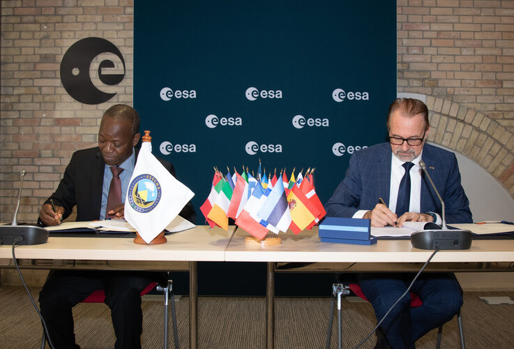
European technology that allows satellite navigation signals to safely guide aircraft down for landing in the majority of Europe’s airports will now be put to use across Africa and the Indian Ocean. ASECNA, the Agency for Air Navigation Safety in Africa and Madagascar, and ESA today signed an agreement to deploy a Satellite-based Augmentation System (SBAS) across a service region of more than 16.5 million sq. km, one and a half times the size of Europe’s coverage area.
CoreLogic Launches Property Analytics Ecosystem and Data Exchange, Discovery Platform™
29.6.2022 16:31 GISCafe.com Webcasts-Webinars New solution simplifies data science challenges to help enterprises accelerate innovation, mitigate risk and identify new revenue streamsIRVINE, …
Sierra Space Partners with Turkish Space Agency and ESEN Sistem Entegrasyon on Low-Earth Orbit, Lunar and Astronaut Programs
29.6.2022 16:31 GISCafe.com Webcasts-Webinars LOUISVILLE, Colo. — (BUSINESS WIRE) — June 29, 2022 —Sierra Space, a leading commercial space company at the forefront of …
AgEagle Reports Backlogged Sales of $2 Million Fueled by Growing Global Demand for MicaSense Drone Sensors
29.6.2022 16:31 GISCafe.com Webcasts-Webinars WICHITA, Kan., June 29, 2022 (GLOBE NEWSWIRE) -- AgEagle Aerial Systems Inc. (NYSE American: UAVS) (“AgEagle” or the “Company”), an …Novinky v aplikacích
29.6.2022 11:00 ČÚZK - Geoportál Novinky v aplikacíchGeoprohlížeč:
Produkty DMR 5G, DMR 4G a DMP 1G jsou nově zobrazovány pomocí Image služby - připravené rastrové funkce jsou po přidání do Seznamu vrstev k dispozici v kontextovém menu vrstvy.
Externí Image služby je nyní možné připojit ve widgetu Přidat data - REST. K dispozici je nastavení rastrových služeb, které jsou zohledněny i při sdílení Geoprohlížeče (uložení webové mapy).
Archiv:
Byly doplněny nejnovější letecké měřické snímky z roku 1975.
Analýzy výškopisu:
Byly doplněny příslušné nápovědy do každého widgetu.
Jména světa:
Byl doplněn francouzský překlad.
Novinky v aplikacích
29.6.2022 11:00 ČÚZK - Geoportál Novinky v aplikacíchGeoprohlížeč:
Produkty DMR 5G, DMR 4G a DMP 1G jsou nově zobrazovány pomocí Image služby - připravené rastrové funkce jsou po přidání do Seznamu vrstev k dispozici v kontextovém menu vrstvy.
Externí Image služby je nyní možné připojit ve widgetu Přidat data - REST. K dispozici je nastavení rastrových služeb, které jsou zohledněny i při sdílení Geoprohlížeče (uložení webové mapy).
Archiv:
Byly doplněny nejnovější letecké měřické snímky z roku 1975.
Analýzy výškopisu:
Byly doplněny příslušné nápovědy do každého widgetu.
Jména světa:
Byl doplněn francouzský překlad.