


![]()

zprávy
zdroje zpráv:Kraj Vysočina spustil nový Portál územního plánování
26.5.2021 12:58 ARCDATAKraj Vysočina oficiálně spustil vlastní Portál územního plánování, který zajišťuje rychlý a srozumitelný přístup k územně plánovací dokumentaci všech obcí na Vysočině, a to včetně Zásad územního rozvoje kraje.
Využití portálu
Mezi hlavní funkce portálu, na jehož realizaci spolupracovalo uskupení našich partnerů VARS BRNO, GEOREAL a T-MAPY, patří možnost vyhledávání územně plánovací dokumentace a územních studií pro vybranou obec či přímo konkrétní parcelu. Díky tomu lze získat přehled o dostupné dokumentaci územních plánů v dané obci s možností zobrazení jejich výkresů na mapě. Vedle toho si uživatel může zobrazit konkrétní podmínky, které územní plán pro dané území nebo parcelu stanovuje.
Došlo také na sjednocení formy prezentace územně plánovacích podkladů, jako je například technická infrastruktura, vymezení jevů ochrany přírody, ale i další záměry v daném území. Součástí Portálu územního plánování je rovněž výdejní modul prostorových dat.
Pro bližší seznámení se s novým portálem pořádá Kraj Vysočina online webový seminář, který se uskuteční ve středu 2. června od 16 hodin. Více informací o Portálu územního plánování a webovém semináři naleznete na oficiálních stránkách Kraje Vysočina.

Pracujte pro olomouckou společnost ze Silicon Valley
26.5.2021 12:05 Katedra geoinformatiky UP Olomouc Zajímavá IT nabídka přišla od společnosti viaGood, což je startup sídlící v Silicon Valley, Praze a působící v Olomouci. Nyní rozšiřuje svůj tým o následující pozice: seniorní / juniorní pozice místo práce: Olomouc (možné i online) nadstandardní finanční ohodnocení (srovnatelné s hodnocením v Praze) skvělý tým seniorních vývojářů (se zkušeností z USA a z Google v […]Pracujte pro olomouckou společnost ze Silicon Valley
26.5.2021 12:05 Katedra geoinformatiky UP OlomoucZajímavá IT nabídka přišla od společnosti viaGood, což je startup sídlící v Silicon Valley, Praze a působící v Olomouci. Nyní rozšiřuje svůj tým o následující pozice: seniorní / juniorní pozice místo práce: Olomouc (možné i online) nadstandardní finanční ohodnocení (srovnatelné s hodnocením v Praze) skvělý tým seniorních vývojářů (se zkušeností z USA a z Google v […]
The post Pracujte pro olomouckou společnost ze Silicon Valley appeared first on Katedra geoinformatiky.
Pracujte pro olomouckou společnost ze Silicon Valley
26.5.2021 12:05 Katedra geoinformatiky UP OlomoucZajímavá IT nabídka přišla od společnosti viaGood, což je startup sídlící v Silicon Valley, Praze a působící v Olomouci. Nyní rozšiřuje svůj tým o následující pozice: seniorní / juniorní pozice místo práce: Olomouc (možné i online) nadstandardní finanční ohodnocení (srovnatelné s hodnocením v Praze) skvělý tým seniorních vývojářů (se zkušeností z USA a z Google v […]
The post Pracujte pro olomouckou společnost ze Silicon Valley appeared first on Katedra geoinformatiky.
DKM na části Újezdu nad Zbečnem aneb ještě jednou Rakovnické události
26.5.2021 12:04 ZeměměřičNepředpokládám, že by tento příspěvek vzbudil po několika letech u čtenářů časopisu Zeměměřič přehnaný zájem, avšak zatím nikdo pravdivě neaktualizoval dřívější (roky 2014 a 2015) a dodnes veřejnost matoucí informace. Využívám proto časopis Zeměměřič – jinou cestu k veřejnosti nemám – a doplňuji své dřívější kritické články o novém mapování velmi malé části katastrálního území Újezd nad Zbečnem pří hranicích s katastrálním území […]
The post DKM na části Újezdu nad Zbečnem aneb ještě jednou Rakovnické události appeared first on Zeměměřič.
BroadGNSS to launch open market consultation
26.5.2021 11:29 European GNSS Agency
BroadGNSS, a Pre-Commercial Procurement (PCP) action funded by the European Union Agency for the Space Programme (EUSPA) under Horizon 2020, is inviting potentially interested bidders to participate in an open market consultation for its upcoming PCP to improve the services that public safety and disaster relief organisations offer to Europe's citizens. BroadGNSS will present the PCP challenge and process at an open market consultation webinar on 2 June 2021. Register here.
The BroadGNSS project started in December 2020 with the aim of procuring R&D services to develop deployable applications for synchronisation and monitoring of critical mobile broadband communication infrastructure and information assets for Public Protection and Disaster Relief (PPDR) based on EGNOS and Galileo.
EGNSS-based solutions
In particular, the project is targeting solutions that will enable a European GNSS-based (Galileo and EGNOS) solution for time-synchronisation in public safety organisations’ mission-critical wireless broadband networks, in addition to secure and highly accurate location and navigation information for mission-critical wireless communications equipment.
Read this: EUSPA launches High Accuracy Service call
Other solutions could address secure and highly accurate time synchronisation of mission-critical “Internet-of-Public-Safety-Things” and location and navigation information for drone fleet management by public safety organisations, or improve the quality of time synchronisation in their communications networks..
Market Consultation webinar
BroadGNSS is organising an Open Market Consultation (OMC) with potential tenderers and end-users to get feedback from the market about the project’s scope. The OMC will canvass wide stakeholder opinion on the suitability of the BroadGNSS PCP and provide an insight into the market, the state of the art and future developments, enabling the project to prepare an adequate procurement with the right scope.
And this: EU Space on a new trajectory with launch of EUSPA
The BroadGNSS PCP challenge and process will be presented at an open market consultation webinar on 2 June 2021. You can register to attend here. In addition, EU companies will be invited to fill in an online questionnaire on the BroadGNSS PCP Challenge. The questionnaire will be published on the BroadGNSS website from 2 June 2021 until the end of June 2021. Finally, on 3 November 2021, a Partnering Event will be held to assist companies search for a consortium – stay tuned for more details.
For more information, see the Prior Information Notice here, and a Corrigendum here.
Media note: This feature can be republished without charge provided the European Union Agency for the Space Programme (EUSPA) is acknowledged as the source at the top or the bottom of the story. You must request permission before you use any of the photographs on the site. If you republish, we would be grateful if you could link back to the EUSPA website (http://www.euspa.europa.eu).
Webinář: Projektová příprava - Nový modul pro zhotovitele ČEZ, ŘSD, SŽDC
26.5.2021 11:07 Unicorn Nenechte si ujít webinář, jehož hlavním tématem bude nový modul Projektová příprava pro zhotovitele ČEZ, ŘSD, SŽDC. Předvedeme vám zcela nový modul, který rozšiřuje stávající funkčnost modulu ČEZ Distribuce, ŘSD a SŽDC. Registrace právě probíhá, budeme se na vás těšit 1. 6. od 9 hodin.20210526_Rada / odborný rada oddělení aktualizace a dokumentace KN
26.5.2021 9:49 ČÚZK - předpisy a opatření Katastrální úřad pro Středočeský kraj - Katastrální pracoviště Kutná Hora Vyhlášení výběrového řízení: Rada / odborný rada oddělení aktualizace a dokumentace KN V části "Úřední deska", v sekci "Oznámení a jiná úřední sdělení" bylo vystaveno "Oznámení o vyhlášení výběrového řízení na obsazení služebního místa Rada / odborný rada oddělení aktualizace a dokumentace KN"20210526_Rada / odborný rada oddělení aktualizace a dokumentace KN
26.5.2021 9:49 ČÚZK /Urady/Katastralni-urady/Katastralni-urady/Katastralni-urad-pro-Stredocesky-kraj/Katastralni-pracoviste/KP-Kutna-Hora/O-uradu/Aktuality/20210113_odborny-rada,-reditel-Katastralniho-p-(2)Rada / odborný rada oddělení aktualizace a dokumentace KN
26.5.2021 9:08 ČÚZK - předpisy a opatření Katastrální úřad pro Středočeský kraj - Katastrální pracoviště Kutná Horavypisuje výběrové řízení na místo Rada / odborný rada oddělení aktualizace a dokumentace KN
Rada / odborný rada oddělení aktualizace a dokumentace KN
Rada / odborný rada oddělení aktualizace a dokumentace KN
26.5.2021 9:08 ČÚZK /Urady/Katastralni-urady/Katastralni-urady/Katastralni-urad-pro-Stredocesky-kraj/Uredni-deska/Oznameni-a-jina-uredni-sdeleni/Volna-mista/Rada-odborny-rada-oddeleni-aktualizace-a-dokum-(1)Rada / odborný rada oddělení aktualizace a dokumentace KN
26.5.2021 9:08 ČÚZK - volná místa Katastrální úřad pro Středočeský kraj - Katastrální pracoviště Kutná Hora vypisuje výběrové řízení na místo Rada / odborný rada oddělení aktualizace a dokumentace KNAPGEO - Ověřování zeměměřických prací vybranou činností ve výstavbě
26.5.2021 2:00 Asociace podnikatelů v geomatice Poslanecká sněmovna schválila náš pozměňovací návrh týkající se ověřování zeměměřických prací.Jak na 3D mapování podzemních prostor – od skenování po finální výsledek (záznam webináře)
26.5.2021 0:55 ZeměměřičFirmy 3gon Positioning, Data System a GeoSLAM uspořádaly webinář, na kterém ukázaly, jak v podzemních prostorách využít laserové skenery a následně data zpracovat. Za firmu 3gon Positioning mluvil Branislav Hroššo, za firmu Data System vystoupil Marcel Brejcha a firmu GeoSLAM prezentoval Tomáš Bláha. Na přibližně hodinovém webináři ukázali, jak skenovat v podzemí a následně vytvořit požadovaný výstup – tím může být […]
The post Jak na 3D mapování podzemních prostor – od skenování po finální výsledek (záznam webináře) appeared first on Zeměměřič.
Výzva k podání návrhu k nájmu bytu - Rýmařov
26.5.2021 0:00 Státní pozemkový úřad SPÚ vyhlašuje výzvu k podání návrhů na uzavření smlouvy o nájmu bytu - RýmařovVýzva k podání návrhu k nájmu bytu - Rýmařov
26.5.2021 0:00 Státní pozemkový úřad SPÚ vyhlašuje výzvu k podání návrhů na uzavření smlouvy o nájmu bytu - RýmařovVýzva k podání návrhu k nájmu bytu - Rýmařov
26.5.2021 0:00 Státní pozemkový úřad SPÚ vyhlašuje výzvu k podání návrhů na uzavření smlouvy o nájmu bytu - RýmařovNabídka práce - Pedagog/pedagožka v oblasti enviromentálního vzdělávání
26.5.2021 0:00 Geografický ústav MU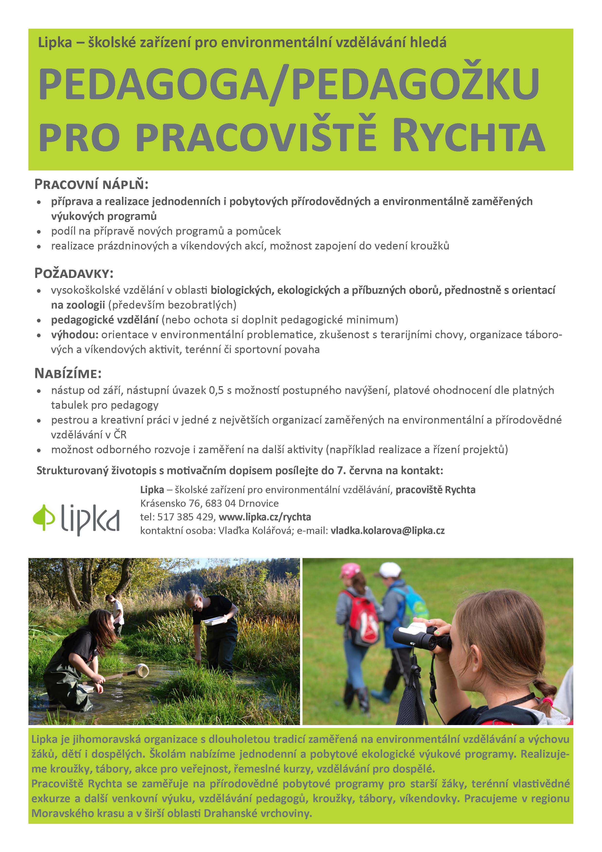
Upozornění - kontrolujte si stav vašich výpůjček [Knihovna geografie, byTopic]
26.5.2021 0:00 Katedra aplikované geoinformatiky a kartografie Přf UK Vážení studenti, kontrolujte si prosím průběžně stav vašich výpůjček a upomínek. Výpůjčky vám byly kvůli pandemii koronaviru centrálně prodlužovány až do 30.4.2021. Od 3. května 2021 je opět v platnosti normální režim výpůjček a upomínek. Knihovníci nejsou oprávněni Vám poskytnout žádné výjimky z výpůjčního řádu. Děkujeme za pochopení. Zaměstnanci Knihovny geografie PřF UKVýzva k podání návrhu k nájmu bytu - Rýmařov
26.5.2021 0:00 Státní pozemkový úřad SPÚ vyhlašuje výzvu k podání návrhů na uzavření smlouvy o nájmu bytu - RýmařovKonference 3D GeoInfo 2021 se letos zaměří také na 3D v katastru
25.5.2021 23:09 ZeměměřičVe dnech 11. až 14. října 2021 se virtuální formou uskuteční šestnáctý ročník konference 3D GeoInfo. Letos se akce uskuteční společně s konferencí 3D Cadastres. Témata 3D GeoInfo uvádíme v angličtině, protože letos konferenci organizuje realizační tým z New Yorku. 3D GeoInfo addresses advancements in (but not limited to) the following areas: 3D data creation and acquisition 3D data processing […]
The post Konference 3D GeoInfo 2021 se letos zaměří také na 3D v katastru appeared first on Zeměměřič.
Zemědělská aplikace ze SmartAgriHubs, na které se podíleli také Češi, zabodovala v mezinárodní soutěži
25.5.2021 22:47 GeoBusinessProjekt FIE20: Groundwater and meteo sensors, který vytvořil mezinárodní tým lotyšsko-česko-švýcarského konsorcia, postoupil do kategorie Champions projects v soutěži WSIS Prizes 2021. Soutěž WSIS Prizes organizuje Organizace pro výživu a zemědělství OSN (UN FAO) a Mezinárodní telekomunikační unie (ITU). Kategorie Champions projects zahrnuje devadesát projektů z celkových 1270 přihlášek, přičemž každá soutěžní kategorie je reprezentována […]
The post Zemědělská aplikace ze SmartAgriHubs, na které se podíleli také Češi, zabodovala v mezinárodní soutěži appeared first on GeoBusiness.
odborný referent – kontrola aktualizace
25.5.2021 21:17 ČÚZK /Urady/Katastralni-urady/Katastralni-urady/Katastralni-urad-pro-Olomoucky-kraj/Uredni-deska/Oznameni-a-jina-uredni-sdeleni/Volna-mista/odborny-referent-–-kontrola-aktualizace-(1)odborný referent – kontrola aktualizace
25.5.2021 21:17 ČÚZK - předpisy a opatření Katastrální úřad pro Olomoucký kraj - Katastrální pracoviště Přerovvypisuje výběrové řízení na místo
odborný referent – kontrola aktualizace
odborný referent – kontrola aktualizace
25.5.2021 21:17 ČÚZK - volná místa Katastrální úřad pro Olomoucký kraj - Katastrální pracoviště Přerov vypisuje výběrové řízení na místo odborný referent – kontrola aktualizaceEsri Publishes Children's Book Introducing Site Selection to Youth Audience
25.5.2021 20:24 GISCafe.com Webcasts-Webinars Finding the Best Place for a New PlaygroundREDLANDS, Calif. — (BUSINESS WIRE) — May 25, 2021 —
Esri, the global leader in …
S&P Corelogic Case-Shiller Index Shows Annual Home Price Gains Climbed To 13.2% In March
25.5.2021 17:55 GISCafe.com Webcasts-Webinars NEW YORK, May 25, 2021 — (PRNewswire) — S&P Dow Jones Indices (S&P DJI) today released the latest results for the …AgEagle Aerial Systems Appoints Drone Industry Leader Brandon Torres Declet as New Chief Executive Officer
25.5.2021 16:21 GISCafe.com Webcasts-Webinars WICHITA, Kan., May 24, 2021 (GLOBE NEWSWIRE) -- AgEagle™ Aerial Systems Inc. (NYSE American: UAVS) (“AgEagle” or the “Company”), an …Trimble Introduces Vegetation Management Solution for Improving Electric Utility Infrastructure Resilience
25.5.2021 16:21 GISCafe.com Webcasts-Webinars Solution Streamlines Vegetation Management Workflows, Helping Utilities Meet Regulatory Compliance and Sustainability Goals While Mitigating Wildfire …Garmin acquires AeroData, a leading provider of performance data solutions for commercial aircraft
25.5.2021 16:21 GISCafe.com Webcasts-Webinars Acquisition expands reach into air transport servicesSCHAFFHAUSEN, Switzerland — (BUSINESS WIRE) — May 25, 2021 —
Garmin® …
Concept3D Introduces New 360° Map, Bringing True 3D Navigation to Interactive Maps
25.5.2021 16:21 GISCafe.com Webcasts-Webinars Spin, Tilt and Fly Around 3D Models; 360° Map Offers a New Level of Precision, Wayfinding and Map ControlDENVER, May 25, 2021 — (PRNewswire) …
Simple Technology Solutions Wins ACT-IAC Innovation Award
25.5.2021 16:21 GISCafe.com Webcasts-Webinars AI/ML solution will save the U.S. Navy billions per year and improve fleet readinessWASHINGTON, May 25, 2021 — (PRNewswire) — …
Registrujte se na Den s INSPIRE 2021
25.5.2021 16:10 CENIA - národní geoportál INSPIRE CENIA, česká informační agentura životního prostředí vás zve na seminář – Den s INSPIRE. Letošní ročník se uskuteční opět online, a to dne 24. června od 13:00 do 15:00. Připravili jsme pro Vás prezentace o aktualitách z oblasti INSPIRE, o nové verzi validátoru a napojení Národního geoportálu INSPIRE na Národní katalog otevřených dat. Účast na akci je pro všechny registrované zdarma. Podívejte se...European Commissioner Breton makes first official visit at EUSPA headquarters and highlights the role of the Agency in the delivery of the EU Space Programme
25.5.2021 15:11 European GNSS Agency
Commissioner for Internal Market, Thierry Breton visited the headquarters of the European Union Agency for the Space Programme (EUSPA) in Prague on May 24, to speak about the future of the European Space Programme and the role of the newly formed Agency in delivering it.
Commissioner Breton was welcomed by the Executive Director Rodrigo da Costa to the EUSPA headquarters where he delivered a speech before EUSPA staff, the Administrative Board members and Security Accreditation Board members emphasizing on the evolution of the EU Space Programme and the crucial role the Agency is set to play.
The Commissioner noted that a visit to the EUSPA headquarters in Prague had been high on his agenda since he took up office but, unfortunately, this had not been possible due to Coronavirus travel restrictions. However, he said that the present moment was an excellent time for his visit, as the Agency had just entered a new era, by becoming the EU Agency for the Space Programme.
A new era for the EU in space
Read this: EU Space on a new trajectory with launch of EUSPA
“This is the moment we have all been waiting for. Finally, the Space Programme Regulation has entered into force, and we have now the framework that we need for our great ambitions in space. I know that the Agency has been ready in the starting blocks for quite a while to kick off with its new profile and extended tasks. This shows the professionalism with which you have prepared for this new time,” the Commissioner said.
Breton noted that the new Agency would be able to build on the excellent work it had carried out in the past as the GSA. “In the past, you have done a great job on Galileo and EGNOS, with your activities on market development, security and operations. The fact that the Agency is now tasked to extend such activities to other components of the Space Programme, like Copernicus, GOVSATCOM, SST etc. shows the appreciation of the Agency’s work until now,” he said.
A balanced deal
The Commissioner also spoke about governance of the programme. “We have had constructive negotiations on the Framework Financial Partnership Agreement (FFPA). This was very important, because when several players – the Commission, EUSPA, ESA – work together in a programme, it is crucial to define well the division of tasks and how the collaboration is organised,” he said.
Watch this: From GSA to #EUSPA: the evolution
In turn, the EUSPA Executive Director highlighted that EUSPA was ready to achieve Space Programme priorities and to deliver on the promise of space for the European Union. “Exploitation and 24/7 operations; security, downstream; innovation: these are key areas for the EU Space Programme today, and for its evolution. Moreover, these are our EUSPA key competencies. In a nutshell, we are ready to play a central role in achieving the ambitions of the Union for Space,” he said.
Media note: This feature can be republished without charge provided the European Union Agency for the Space Programme (EUSPA) is acknowledged as the source at the top or the bottom of the story. You must request permission before you use any of the photographs on the site. If you republish, we would be grateful if you could link back to the EUSPA website (http://www.euspa.europa.eu).
Hexagon and FlowMSP partner to enhance incident pre-planning and response for fire departments
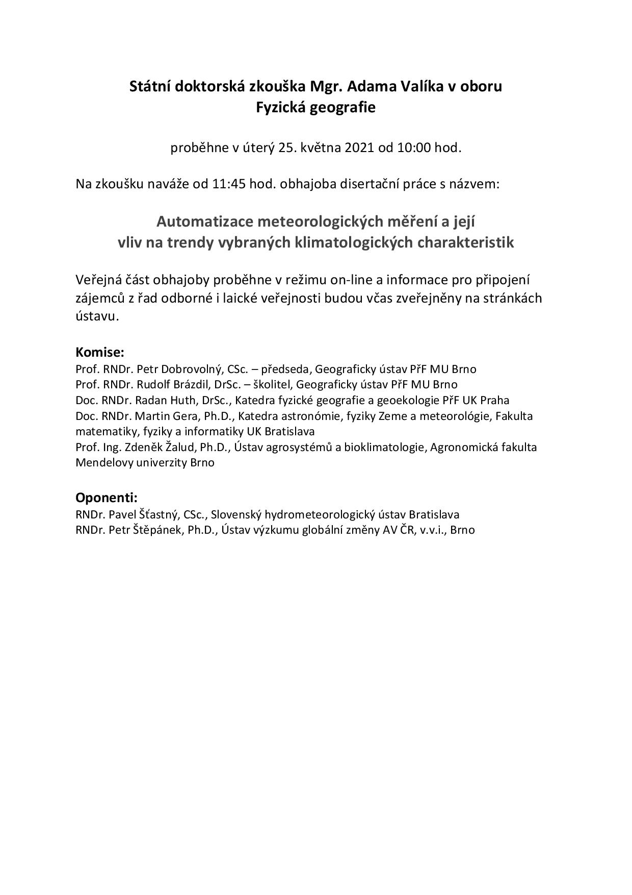
25.5.2021 12:00 Hexagon Safety & InfrastructureStátní doktorská zkouška Mgr. Adama Valíka
25.5.2021 10:00 Geografický ústav MUV úterý 25. května 2021 od 11:45 hod. se koná obhajoba disertační práce Mgr. Adama Valíka s názvem
Automatizace meteorologických měření a její vliv na trendy vybraných klimatologických charakteristik
Veřejná část obhajoby proběhne v režimu on-line a zájemci z řad odborné i laické veřejnosti se mohou připojit přes aplikaci MS-Teams tomto odkazu.
Unicorn úspěšně nasadil do provozu nové řešení lehkého klienta GIS ve společnosti PRE
25.5.2021 9:11 Unicorn Unicorn úspěšně nasadil do produkčního provozu nové řešení lehkého klienta GIS, které plně nahrazuje dosavadní řešení provozované ve společnosti Pražská energetika od roku 2012 na bázi technologie Silverlight 5. Použitím nejnovější technologie Esri ArcGIS Experience Builder tak výsledek projektu nyní klientovi poskytuje do příštích let moderní a udržitelné řešení s možností dalšího rozvoje.xyzt.ai introduces xyzt.ai explorer. A free version of the leading data analytics tool, to help you discover hidden stories in your big location data
25.5.2021 9:00 GISCafe.com Webcasts-Webinars xyzt.ai analytics platform announces the availability of its free trial and gives analysts working with large amounts of geospatial data access to an …Oznámení o vložení nové nabídky do Nabídky pronájmu domů a bytů k bydlení
25.5.2021 0:00 Státní pozemkový úřad Na webových stránkách byla vložena nová nabídka typu Nabídky pronájmu domů a bytů k bydlení, která je dostupná od 25.05.2021Oznámení o vložení nové nabídky do Nabídky pronájmu domů a bytů k bydlení
25.5.2021 0:00 Státní pozemkový úřad Na webových stránkách byla vložena nová nabídka typu Nabídky pronájmu domů a bytů k bydlení, která je dostupná od 25.05.2021Green Builder Media Announces Building Better Cities Webinar
24.5.2021 22:58 GISCafe.com Webcasts-Webinars Lake City, Colo., May 24, 2021 (GLOBE NEWSWIRE) -- Ever wanted to know how climate data is interpreted into actionable steps for communities? Join …DroneSense Introduces Mobile Streaming and Asset Tracking
24.5.2021 22:58 GISCafe.com Webcasts-Webinars DroneSense adds powerful features designed to provide better situational awareness to improve public safety outcomes.AUSTIN, Texas, May 24, 2021 …
Panzura Unveils World's First Global File System-as-a-Service (GFSaaS) for MSPs
24.5.2021 17:17 GISCafe.com Webcasts-Webinars CCL Emerges as Inaugural MSP Partner Amid Massive Post-Pandemic Transition to SaaS and Cloud-Native Services in the EnterpriseSAN JOSE, Calif., May …
Termíny státních závěrečných zkoušek [Katedra aplikované geoinformatiky a kartografie, byTopic]
24.5.2021 14:00 Katedra aplikované geoinformatiky a kartografie Přf UK Termíny pro bakalářské a magisterské obory - podzim 2021.Nová verze Lokalizačních tabulek Česka je k dispozici
24.5.2021 11:26 CEDA Maps a.s. Praha, 24. května 2021 – Společnost CEDA informuje o vydání nové verze dat Lokalizačních tabulek Česka verze 9.0 s certifikací mezinárodní agentury TISA.20210525 - volné místo - Odborný referent v OPV k nemovitostem KP Chomutov na KÚ pro Ústecký kraj
24.5.2021 10:58 ČÚZK /Urady/Katastralni-urady/Katastralni-urady/Katastralni-urad-pro-Ustecky-kraj/Katastralni-pracoviste/KP-Chomutov/O-uradu/Aktuality/20210525-volne-misto-Odborny-referent-v OPV-k20210525 - volné místo - Odborný referent v OPV k nemovitostem KP Chomutov na KÚ pro Ústecký kraj
24.5.2021 10:58 ČÚZK - předpisy a opatření Katastrální úřad pro Ústecký kraj - Katastrální pracoviště Chomutov zveřejnil novou aktualitu: Nabídka volného pracovního místa - Odborný referent v oddělení právních vztahů k nemovitostem Katastrálního pracoviště Chomutov na Katastrálním úřadu pro Ústecký kraj20210525 - volné místo - Odborný referent v OPV k nemovitostem KP Chomutov na KÚ pro Ústecký kraj
24.5.2021 10:57 ČÚZK - předpisy a opatření Katastrální úřad pro Ústecký kraj - Katastrální pracoviště Chomutov zveřejnil novou aktualitu: Nabídka volného pracovního místa - Odborný referent v oddělení právních vztahů k nemovitostem Katastrálního pracoviště Chomutov na Katastrálním úřadu pro Ústecký kraj20210525 - volné místo - Odborný referent v OPV k nemovitostem KP Chomutov na KÚ pro Ústecký kraj
24.5.2021 10:57 ČÚZK /Urady/Katastralni-urady/Katastralni-urady/Katastralni-urad-pro-Ustecky-kraj/O-uradu/Aktuality/20210525-volne-misto-Odborny-referent-v OPV-kNová verze aplikace Jména světa
24.5.2021 10:00 ČÚZK - Geoportál Nová verze aplikace Jména světaAplikace Jména světa, která vznikla jako produkt k vybraným publikacím vydávaným v ediční řadě Geografické názvoslovné seznamy OSN ČR, byla zcela přepracována.
Je nyní postavená na platformě ArcGIS Javascript API 4.xx, jednotně s aplikacemi Geoprohlížeč, Archiv a Analýzy výškopisu. Lze ji používat i na různých mobilních dotykových zařízeních.
Novou aplikaci naleznete na adrese https://ags.cuzk.cz/jmenasveta/ a lze do ní také přejít přímo z Geoprohlížeče pomocí menu "Další aplikace".
(Při použití URL původní aplikace https://jmenasveta.cuzk.cz/ dojde k přesměrování.)
Aplikace zahrnuje oddíly "Česká jména moří a mezinárodních území", "Jména států a jejich územních částí" a "Index českých exonym".
Standardizovaná geografická jména lze zobrazit na podkladě satelitních snímků nebo mapy oceánů. Po kliknutí do mapy lze získat další zajímavé informace, například o původu některých jmen. Obdobně jako v Geoprohlížeči nebo v Analýzách výškopisu lze nyní využít přepnutí do 3D prostředí, Uživatel navíc není omezen jen na území ČR a jména si může prohlížet nad prostorovým znázorněním celé planety Země. Jako bonus pak může pomocí doplňkového menu zavítat i na další vesmírná tělesa.
Nová verze aplikace Jména světa
24.5.2021 10:00 ČÚZK - Geoportál Nová verze aplikace Jména světaAplikace Jména světa, která vznikla jako produkt k vybraným publikacím vydávaným v ediční řadě Geografické názvoslovné seznamy OSN ČR, byla zcela přepracována.
Je nyní postavená na platformě ArcGIS Javascript API 4.xx, jednotně s aplikacemi Geoprohlížeč, Archiv a Analýzy výškopisu. Lze ji používat i na různých mobilních dotykových zařízeních.
Novou aplikaci naleznete na adrese https://ags.cuzk.cz/jmenasveta/ a lze do ní také přejít přímo z Geoprohlížeče pomocí menu "Další aplikace".
(Při použití URL původní aplikace https://jmenasveta.cuzk.cz/ dojde k přesměrování.)
Aplikace zahrnuje oddíly "Česká jména moří a mezinárodních území", "Jména států a jejich územních částí" a "Index českých exonym".
Standardizovaná geografická jména lze zobrazit na podkladě satelitních snímků nebo mapy oceánů. Po kliknutí do mapy lze získat další zajímavé informace, například o původu některých jmen. Obdobně jako v Geoprohlížeči nebo v Analýzách výškopisu lze nyní využít přepnutí do 3D prostředí, uživatel navíc není omezen jen na území ČR a jména si může prohlížet nad prostorovým znázorněním celé planety Země. Jako bonus pak může pomocí doplňkového menu zavítat i na další vesmírná tělesa.
Nová verze aplikace Jména světa
24.5.2021 10:00 ČÚZK - Geoportál Nová verze aplikace Jména světaAplikace Jména světa, která vznikla jako produkt k vybraným publikacím vydávaným v ediční řadě Geografické názvoslovné seznamy OSN ČR, byla zcela přepracována.
Je nyní postavená na platformě ArcGIS Javascript API 4.xx, jednotně s aplikacemi Geoprohlížeč, Archiv a Analýzy výškopisu. Lze ji používat i na různých mobilních dotykových zařízeních.
Novou aplikaci naleznete na adrese https://ags.cuzk.cz/jmenasveta/ a lze do ní také přejít přímo z Geoprohlížeče pomocí menu "Další aplikace".
(Při použití URL původní aplikace https://jmenasveta.cuzk.cz/ dojde k přesměrování.)
Aplikace zahrnuje oddíly "Česká jména moří a mezinárodních území", "Jména států a jejich územních částí" a "Index českých exonym".
Standardizovaná geografická jména lze zobrazit na podkladě satelitních snímků nebo mapy oceánů. Po kliknutí do mapy lze získat další zajímavé informace, například o původu některých jmen. Obdobně jako v Geoprohlížeči nebo v Analýzách výškopisu lze nyní využít přepnutí do 3D prostředí, uživatel není omezen jen na území ČR a jména si může prohlížet nad prostorovým znázorněním celé planety Země. Jako bonus pak může pomocí doplňkového menu zavítat i na další vesmírná tělesa.
Nová verze aplikace Jména světa
24.5.2021 10:00 ČÚZK - Geoportál Nová verze aplikace Jména světaAplikace Jména světa, která vznikla jako produkt k vybraným publikacím vydávaným v ediční řadě Geografické názvoslovné seznamy OSN ČR, byla zcela přepracována.
Je nyní postavená na platformě ArcGIS Javascript API 4.xx, jednotně s aplikacemi Geoprohlížeč, Archiv a Analýzy výškopisu. Lze ji používat i na různých mobilních dotykových zařízeních.
Novou aplikaci naleznete na adrese https://ags.cuzk.cz/jmenasveta/ a lze do ní také přejít přímo z Geoprohlížeče pomocí menu "Další aplikace".
(Při použití URL původní aplikace https://jmenasveta.cuzk.cz/ dojde k přesměrování.)
Aplikace zahrnuje oddíly "Česká jména moří a mezinárodních území", "Jména států a jejich územních částí" a "Index českých exonym".
Standardizovaná geografická jména lze zobrazit na podkladě satelitních snímků nebo mapy oceánů. Po kliknutí do mapy lze získat další zajímavé informace, například o původu některých jmen. Obdobně jako v Geoprohlížeči nebo v Analýzách výškopisu lze nyní využít přepnutí do 3D prostředí, Uživatel navíc není omezen jen na území ČR a jména si může prohlížet nad prostorovým znázorněním celé planety Země. Jako bonus pak může pomocí doplňkového menu zavítat i na další vesmírná tělesa.
Nová verze aplikace Jména světa
24.5.2021 10:00 ČÚZK - Geoportál Nová verze aplikace Jména světaAplikace Jména světa, která vznikla jako produkt k vybraným publikacím vydávaným v ediční řadě Geografické názvoslovné seznamy OSN ČR, byla zcela přepracována.
Je nyní postavená na platformě ArcGIS Javascript API 4.xx, jednotně s aplikacemi Geoprohlížeč, Archiv a Analýzy výškopisu. Lze ji používat i na různých mobilních dotykových zařízeních.
Novou aplikaci naleznete na adrese https://ags.cuzk.cz/jmenasveta/ a lze do ní také přejít přímo z Geoprohlížeče pomocí menu "Další aplikace".
(Při použití URL původní aplikace https://jmenasveta.cuzk.cz/ dojde k přesměrování.)
Aplikace zahrnuje oddíly "Česká jména moří a mezinárodních území", "Jména států a jejich územních částí" a "Index českých exonym".
Standardizovaná geografická jména lze zobrazit na podkladě satelitních snímků nebo mapy oceánů. Po kliknutí do mapy lze získat další zajímavé informace, například o původu některých jmen. Obdobně jako v Geoprohlížeči nebo v Analýzách výškopisu lze nyní využít přepnutí do 3D prostředí, uživatel není omezen jen na území ČR a jména si může prohlížet nad prostorovým znázorněním celé planety Země. Jako bonus pak může pomocí doplňkového menu zavítat i na další vesmírná tělesa.
Nová verze aplikace Jména světa
24.5.2021 10:00 ČÚZK - Geoportál Nová verze aplikace Jména světaAplikace Jména světa, která vznikla jako produkt k vybraným publikacím vydávaným v ediční řadě Geografické názvoslovné seznamy OSN ČR, byla zcela přepracována.
Je nyní postavená na platformě ArcGIS Javascript API 4.xx, jednotně s aplikacemi Geoprohlížeč, Archiv a Analýzy výškopisu. Lze ji používat i na různých mobilních dotykových zařízeních.
Novou aplikaci naleznete na adrese https://ags.cuzk.cz/jmenasveta/ a lze do ní také přejít přímo z Geoprohlížeče pomocí menu "Další aplikace".
(Při použití URL původní aplikace https://jmenasveta.cuzk.cz/ dojde k přesměrování.)
Aplikace zahrnuje oddíly "Česká jména moří a mezinárodních území", "Jména států a jejich územních částí" a "Index českých exonym".
Standardizovaná geografická jména lze zobrazit na podkladě satelitních snímků nebo mapy oceánů. Po kliknutí do mapy lze získat další zajímavé informace, například o původu některých jmen. Obdobně jako v Geoprohlížeči nebo v Analýzách výškopisu lze nyní využít přepnutí do 3D prostředí, Uživatel navíc není omezen jen na území ČR a jména si může prohlížet nad prostorovým znázorněním celé planety Země. Jako bonus pak může pomocí doplňkového menu zavítat i na další vesmírná tělesa.
Nová verze aplikace Jména světa
24.5.2021 10:00 ČÚZK - Geoportál Nová verze aplikace Jména světaAplikace Jména světa, která vznikla jako produkt k vybraným publikacím vydávaným v ediční řadě Geografické názvoslovné seznamy OSN ČR, byla zcela přepracována.
Je nyní postavená na platformě ArcGIS Javascript API 4.xx, jednotně s aplikacemi Geoprohlížeč, Archiv a Analýzy výškopisu. Lze ji používat i na různých mobilních dotykových zařízeních.
Novou aplikaci naleznete na adrese https://ags.cuzk.cz/jmenasveta/ a lze do ní také přejít přímo z Geoprohlížeče pomocí menu "Další aplikace".
(Při použití URL původní aplikace https://jmenasveta.cuzk.cz/ dojde k přesměrování.)
Aplikace zahrnuje oddíly "Česká jména moří a mezinárodních území", "Jména států a jejich územních částí" a "Index českých exonym".
Standardizovaná geografická jména lze zobrazit na podkladě satelitních snímků nebo mapy oceánů. Po kliknutí do mapy lze získat další zajímavé informace, například o původu některých jmen. Obdobně jako v Geoprohlížeči nebo v Analýzách výškopisu lze nyní využít přepnutí do 3D prostředí, uživatel není omezen jen na území ČR a jména si může prohlížet nad prostorovým znázorněním celé planety Země. Jako bonus pak může pomocí doplňkového menu zavítat i na další vesmírná tělesa.
Nová verze aplikace Jména světa
24.5.2021 10:00 ČÚZK - Geoportál Nová verze aplikace Jména světaAplikace Jména světa, která vznikla jako produkt k vybraným publikacím vydávaným v ediční řadě Geografické názvoslovné seznamy OSN ČR, byla zcela přepracována.
Je nyní postavená na platformě ArcGIS Javascript API 4.xx, jednotně s aplikacemi Geoprohlížeč, Archiv a Analýzy výškopisu. Lze ji používat i na různých mobilních dotykových zařízeních.
Novou aplikaci naleznete na adrese https://ags.cuzk.cz/jmenasveta/ a lze do ní také přejít přímo z Geoprohlížeče pomocí menu "Další aplikace".
(Při použití URL původní aplikace https://jmenasveta.cuzk.cz/ dojde k přesměrování.)
Aplikace zahrnuje oddíly "Česká jména moří a mezinárodních území", "Jména států a jejich územních částí" a "Index českých exonym".
Standardizovaná geografická jména lze zobrazit na podkladě satelitních snímků nebo mapy oceánů. Po kliknutí do mapy lze získat další zajímavé informace, například o původu některých jmen. Obdobně jako v Geoprohlížeči nebo v Analýzách výškopisu lze nyní využít přepnutí do 3D prostředí, uživatel navíc není omezen jen na území ČR a jména si může prohlížet nad prostorovým znázorněním celé planety Země. Jako bonus pak může pomocí doplňkového menu zavítat i na další vesmírná tělesa.
Nová verze aplikace Jména světa
24.5.2021 10:00 ČÚZK - Geoportál Nová verze aplikace Jména světaAplikace Jména světa, která vznikla jako produkt k vybraným publikacím vydávaným v ediční řadě Geografické názvoslovné seznamy OSN ČR, byla zcela přepracována.
Je nyní postavená na platformě ArcGIS Javascript API 4.xx, jednotně s aplikacemi Geoprohlížeč, Archiv a Analýzy výškopisu. Lze ji používat i na různých mobilních dotykových zařízeních.
Novou aplikaci naleznete na adrese https://ags.cuzk.cz/jmenasveta/ a lze do ní také přejít přímo z Geoprohlížeče pomocí menu "Další aplikace".
(Při použití URL původní aplikace https://jmenasveta.cuzk.cz/ dojde k přesměrování.)
Aplikace zahrnuje oddíly "Česká jména moří a mezinárodních území", "Jména států a jejich územních částí" a "Index českých exonym".
Standardizovaná geografická jména lze zobrazit na podkladě satelitních snímků nebo mapy oceánů. Po kliknutí do mapy lze získat další zajímavé informace, například o původu některých jmen. Obdobně jako v Geoprohlížeči nebo v Analýzách výškopisu lze nyní využít přepnutí do 3D prostředí, Uživatel navíc není omezen jen na území ČR a jména si může prohlížet nad prostorovým znázorněním celé planety Země. Jako bonus pak může pomocí doplňkového menu zavítat i na další vesmírná tělesa.
Nová verze aplikace Jména světa
24.5.2021 10:00 ČÚZK - Geoportál Nová verze aplikace Jména světaAplikace Jména světa, která vznikla jako produkt k vybraným publikacím vydávaným v ediční řadě Geografické názvoslovné seznamy OSN ČR, byla zcela přepracována.
Je nyní postavená na platformě ArcGIS Javascript API 4.xx, jednotně s aplikacemi Geoprohlížeč, Archiv a Analýzy výškopisu. Lze ji používat i na různých mobilních dotykových zařízeních.
Novou aplikaci naleznete na adrese https://ags.cuzk.cz/jmenasveta/ a lze do ní také přejít přímo z Geoprohlížeče pomocí menu "Další aplikace".
(Při použití URL původní aplikace https://jmenasveta.cuzk.cz/ dojde k přesměrování.)
Aplikace zahrnuje oddíly "Česká jména moří a mezinárodních území", "Jména států a jejich územních částí" a "Index českých exonym".
Standardizovaná geografická jména lze zobrazit na podkladě satelitních snímků nebo mapy oceánů. Po kliknutí do mapy lze získat další zajímavé informace, například o původu některých jmen. Obdobně jako v Geoprohlížeči nebo v Analýzách výškopisu lze nyní využít přepnutí do 3D prostředí, uživatel navíc není omezen jen na území ČR a jména si může prohlížet nad prostorovým znázorněním celé planety Země. Jako bonus pak může pomocí doplňkového menu zavítat i na další vesmírná tělesa.
Nová verze aplikace Jména světa
24.5.2021 10:00 ČÚZK - Geoportál Nová verze aplikace Jména světaAplikace Jména světa, která vznikla jako produkt k vybraným publikacím vydávaným v ediční řadě Geografické názvoslovné seznamy OSN ČR, byla zcela přepracována.
Je nyní postavená na platformě ArcGIS Javascript API 4.xx, jednotně s aplikacemi Geoprohlížeč, Archiv a Analýzy výškopisu. Lze ji používat i na různých mobilních dotykových zařízeních.
Novou aplikaci naleznete na adrese https://ags.cuzk.cz/jmenasveta/ a lze do ní také přejít přímo z Geoprohlížeče pomocí menu "Další aplikace".
(Při použití URL původní aplikace https://jmenasveta.cuzk.cz/ dojde k přesměrování.)
Aplikace zahrnuje oddíly "Česká jména moří a mezinárodních území", "Jména států a jejich územních částí" a "Index českých exonym".
Standardizovaná geografická jména lze zobrazit na podkladě satelitních snímků nebo mapy oceánů. Po kliknutí do mapy lze získat další zajímavé informace, například o původu některých jmen. Obdobně jako v Geoprohlížeči nebo v Analýzách výškopisu lze nyní využít přepnutí do 3D prostředí, uživatel není omezen jen na území ČR a jména si může prohlížet nad prostorovým znázorněním celé planety Země. Jako bonus pak může pomocí doplňkového menu zavítat i na další vesmírná tělesa.
Nová verze aplikace Jména světa
24.5.2021 10:00 ČÚZK - Geoportál Nová verze aplikace Jména světaAplikace Jména světa, která vznikla jako produkt k vybraným publikacím vydávaným v ediční řadě Geografické názvoslovné seznamy OSN ČR, byla zcela přepracována.
Je nyní postavená na platformě ArcGIS Javascript API 4.xx, jednotně s aplikacemi Geoprohlížeč, Archiv a Analýzy výškopisu. Lze ji používat i na různých mobilních dotykových zařízeních.
Novou aplikaci naleznete na adrese https://ags.cuzk.cz/jmenasveta/ a lze do ní také přejít přímo z Geoprohlížeče pomocí menu "Další aplikace".
(Při použití URL původní aplikace https://jmenasveta.cuzk.cz/ dojde k přesměrování.)
Aplikace zahrnuje oddíly "Česká jména moří a mezinárodních území", "Jména států a jejich územních částí" a "Index českých exonym".
Standardizovaná geografická jména lze zobrazit na podkladě satelitních snímků nebo mapy oceánů. Po kliknutí do mapy lze získat další zajímavé informace, například o původu některých jmen. Obdobně jako v Geoprohlížeči nebo v Analýzách výškopisu lze nyní využít přepnutí do 3D prostředí, Uživatel navíc není omezen jen na území ČR a jména si může prohlížet nad prostorovým znázorněním celé planety Země. Jako bonus pak může pomocí doplňkového menu zavítat i na další vesmírná tělesa.
Nová verze aplikace Jména světa
24.5.2021 10:00 ČÚZK - Geoportál Nová verze aplikace Jména světaAplikace Jména světa, která vznikla jako produkt k vybraným publikacím vydávaným v ediční řadě Geografické názvoslovné seznamy OSN ČR, byla zcela přepracována.
Je nyní postavená na platformě ArcGIS Javascript API 4.xx, jednotně s aplikacemi Geoprohlížeč, Archiv a Analýzy výškopisu. Lze ji používat i na různých mobilních dotykových zařízeních.
Novou aplikaci naleznete na adrese https://ags.cuzk.cz/jmenasveta/ a lze do ní také přejít přímo z Geoprohlížeče pomocí menu "Další aplikace".
(Při použití URL původní aplikace https://jmenasveta.cuzk.cz/ dojde k přesměrování.)
Aplikace zahrnuje oddíly "Česká jména moří a mezinárodních území", "Jména států a jejich územních částí" a "Index českých exonym".
Standardizovaná geografická jména lze zobrazit na podkladě satelitních snímků nebo mapy oceánů. Po kliknutí do mapy lze získat další zajímavé informace, například o původu některých jmen. Obdobně jako v Geoprohlížeči nebo v Analýzách výškopisu lze nyní využít přepnutí do 3D prostředí, uživatel není omezen jen na území ČR a jména si může prohlížet nad prostorovým znázorněním celé planety Země. Jako bonus pak může pomocí doplňkového menu zavítat i na další vesmírná tělesa.
Nová verze aplikace Jména světa
24.5.2021 10:00 ČÚZK - Geoportál Nová verze aplikace Jména světaAplikace Jména světa, která vznikla jako produkt k vybraným publikacím vydávaným v ediční řadě Geografické názvoslovné seznamy OSN ČR, byla zcela přepracována.
Je nyní postavená na platformě ArcGIS Javascript API 4.xx, jednotně s aplikacemi Geoprohlížeč, Archiv a Analýzy výškopisu. Lze ji používat i na různých mobilních dotykových zařízeních.
Novou aplikaci naleznete na adrese https://ags.cuzk.cz/jmenasveta/ a lze do ní také přejít přímo z Geoprohlížeče pomocí menu "Další aplikace".
(Při použití URL původní aplikace https://jmenasveta.cuzk.cz/ dojde k přesměrování.)
Aplikace zahrnuje oddíly "Česká jména moří a mezinárodních území", "Jména států a jejich územních částí" a "Index českých exonym".
Standardizovaná geografická jména lze zobrazit na podkladě satelitních snímků nebo mapy oceánů. Po kliknutí do mapy lze získat další zajímavé informace, například o původu některých jmen. Obdobně jako v Geoprohlížeči nebo v Analýzách výškopisu lze nyní využít přepnutí do 3D prostředí, uživatel není omezen jen na území ČR a jména si může prohlížet nad prostorovým znázorněním celé planety Země. Jako bonus pak může pomocí doplňkového menu zavítat i na další vesmírná tělesa.
Webinář: Projektování a výstavba sítí FTTx
24.5.2021 8:22 Unicorn Ve spolupráci se společností Geostruct vás zveme na webinář, jehož hlavním tématem bude řešení Geostruct IMS. Webinář účastníky seznámí s tipy, jak využívat tento moderní nástroj s mapovým rozhraním pro efektivnější návrhy a výstavbu optických sítí FTTx. Ukážeme, jak využít potenciál vašich dat a získat dokonalejší přehled nad výstavbovými procesy. Registrace právě probíhá, budeme se na váš těšit 16. 6. od 10 hodin.APGEO - Prof. Ing. Bohuslav Veverka, DrSc. (1945 - 2021)
24.5.2021 2:00 Asociace podnikatelů v geomatice S obrovským zármutkem uveřejňujeme zprávu, že nás navždy opustil významný kartograf Prof. Ing. Bohuslav Veverka DrSc.Další nabídky práce
22.5.2021 11:06 Katedra geoinformatiky UP OlomoucVýzkumný ústav meliorací a ochrany půdy, v.v.i. hledá do týmu laboratoře DPZ a pedometriky odborného pracovníka výzkumu a vývoje. Přihlášky je možné posílat do 28. 5. 2021. Více se dozvíte v přiloženém soubore zde. Vojenský geografický a hydrometeorologický úřad hledá kolegu na poziciGeograf(ka) / Geoinformatik(čka). Víc informací se dozvíte zde.
The post Další nabídky práce appeared first on Katedra geoinformatiky.
Vyrovnávací kurzy matematiky
22.5.2021 10:06 Katedra geoinformatiky UP OlomoucNastupujete k nám do prvního ročníku a nevíte, jestli jsou vaše znalosti matematiky dostačující? Pak rozhodně využijte nabídky Katedry matematické analýzy a přihlaste se na online Vyrovnávací kurz matematiky pro nastupující prváky, který začíná již tento pátek 😊 Tam se rozpočítáte raz dva… https://kma.upol.cz/vyrovnavaci-kurzy-matematiky/
The post Vyrovnávací kurzy matematiky appeared first on Katedra geoinformatiky.
Další nabídky práce
22.5.2021 10:06 Katedra geoinformatiky UP Olomouc Výzkumný ústav meliorací a ochrany půdy, v.v.i. hledá do týmu laboratoře DPZ a pedometriky odborného pracovníka výzkumu a vývoje. Přihlášky je možné posílat do 28. 5. 2021. Více se dozvíte v přiloženém soubore zde. Vojenský geografický a hydrometeorologický úřad hledá kolegu na poziciGeograf(ka) / Geoinformatik(čka). Víc informací se dozvíte zde.Vyrovnávací kurzy matematiky
22.5.2021 10:06 Katedra geoinformatiky UP OlomoucNastupujete k nám do prvního ročníku a nevíte, jestli jsou vaše znalosti matematiky dostačující? Pak rozhodně využijte nabídky Katedry matematické analýzy a přihlaste se na online Vyrovnávací kurz matematiky pro nastupující prváky, který začíná již tento pátek 😊 Tam se rozpočítáte raz dva… https://kma.upol.cz/vyrovnavaci-kurzy-matematiky/
The post Vyrovnávací kurzy matematiky appeared first on Katedra geoinformatiky.
Vyrovnávací kurzy matematiky
22.5.2021 10:06 Katedra geoinformatiky UP OlomoucNastupujete k nám do prvního ročníku a nevíte, jestli jsou vaše znalosti matematiky dostačující? Pak rozhodně využijte nabídky Katedry matematické analýzy a přihlaste se na online Vyrovnávací kurz matematiky pro nastupující prváky, který začíná již tento pátek 😊 Tam se rozpočítáte raz dva… https://kma.upol.cz/vyrovnavaci-kurzy-matematiky/
The post Vyrovnávací kurzy matematiky appeared first on Katedra geoinformatiky.
Další nabídky práce
22.5.2021 10:06 Katedra geoinformatiky UP OlomoucVýzkumný ústav meliorací a ochrany půdy, v.v.i. hledá do týmu laboratoře DPZ a pedometriky odborného pracovníka výzkumu a vývoje. Přihlášky je možné posílat do 28. 5. 2021. Více se dozvíte v přiloženém soubore zde. Vojenský geografický a hydrometeorologický úřad hledá kolegu na poziciGeograf(ka) / Geoinformatik(čka). Víc informací se dozvíte zde.
The post Další nabídky práce appeared first on Katedra geoinformatiky.
DAEX DESIGN Start v akční ceně
21.5.2021 21:26 ŠPINAR - software Vážení zákazníci,v akční ceně + bonusy nyní můžete získat program pro navrhování nábytku a interiérů DAEX Start.
DAEX DESIGN Start v akční ceně
21.5.2021 21:26 ŠPINAR - softwareVážení zákazníci,
v akční ceně + bonusy nyní můžete získat program pro navrhování nábytku a interiérů DAEX Start.
The post DAEX DESIGN Start v akční ceně appeared first on ŠPINAR – software.
First Detailed Images from the Pléiades Neo 3 Satellite
21.5.2021 21:24 GISCafe.com Webcasts-Webinars A New Era for Geospatial ApplicationsMay 21, 2021 -- Today, Airbus released a first collection of sharp images at 30cm …
"Pleiades Neo Launches with 30 Meter Resolutions" by Susan Smith
21.5.2021 20:40 GISCafe.com Webcasts-Webinars"Pleiades Neo Launches with 30 CM Resolutions" by Susan Smith
21.5.2021 20:40 GISCafe.com Webcasts-WebinarsNextBillion.ai Adds $6.25M to its Series A from M12, Microsoft’s Venture Fund
21.5.2021 20:16 GISCafe.com Webcasts-Webinars MOUNTAIN VIEW, Calif., – May 20, 2021 – NextBillion.ai, a leading spatial data platform has received $6.25 million in …20210521 - VŘ Řízení kvality
21.5.2021 15:30 ČÚZK - aktuality v resortu Oznámení o vyhlášení výběrového řízení na obsazení služebního místa odborný rada - Řízení kvality.20210521 - VŘ Řízení kvality
21.5.2021 15:30 ČÚZK - předpisy a opatření Český úřad zeměměřický a katastrální zveřejnil novou aktualitu: Oznámení o vyhlášení výběrového řízení na obsazení služebního místa odborný rada - Řízení kvality.DJI Adds To DJI Education Roster With RoboMaster Tello Talent Drone
21.5.2021 15:24 GISCafe.com Webcasts-Webinars SHENZHEN, China, May 21, 2021 — (PRNewswire) — DJI, the global leader in civilian drones and aerial imaging technology, today added …Odborný rada - Řízení kvality
21.5.2021 15:23 ČÚZK - předpisy a opatření Český úřad zeměměřický a katastrálnívypisuje výběrové řízení na místo
Odborný rada - Řízení kvality
Odborný rada - Řízení kvality
21.5.2021 15:23 ČÚZK /Urady/Cesky-urad-zememericky-a-katastralni/Uredni-deska/Oznameni-a-jina-uredni-sdeleni/Volna-mista/DMS/Odborny-rada-Rizeni-kvalityOdborný rada - Řízení kvality
21.5.2021 15:23 ČÚZK - volná místa Český úřad zeměměřický a katastrální vypisuje výběrové řízení na místo Odborný rada - Řízení kvalityPracovní pozice na Krajském úřadě Pardubického kraje
21.5.2021 15:13 Katedra geoinformatiky UP OlomoucKrajský úřad Pardubického kraje vypsal výběrové řízení na pozice referenta oddělení územního plánování a pracovníka do úseku tvorby digitální technické mapy. Na pozici referenta oddělení územního plánování se předpokládá zejména spolupráce na ÚAP a činnost nadřízeného orgánu vůči ORP, aj. Druhé výběrové řízení je na nově vznikající úsek digitální technické mapy, který souvisí s novelou […]
The post Pracovní pozice na Krajském úřadě Pardubického kraje appeared first on Katedra geoinformatiky.
Pracovní pozice na Krajském úřadě Pardubického kraje
21.5.2021 14:13 Katedra geoinformatiky UP OlomoucKrajský úřad Pardubického kraje vypsal výběrové řízení na pozice referenta oddělení územního plánování a pracovníka do úseku tvorby digitální technické mapy. Na pozici referenta oddělení územního plánování se předpokládá zejména spolupráce na ÚAP a činnost nadřízeného orgánu vůči ORP, aj. Druhé výběrové řízení je na nově vznikající úsek digitální technické mapy, který souvisí s novelou […]
The post Pracovní pozice na Krajském úřadě Pardubického kraje appeared first on Katedra geoinformatiky.
Pracovní pozice na Krajském úřadě Pardubického kraje
21.5.2021 14:13 Katedra geoinformatiky UP Olomouc Krajský úřad Pardubického kraje vypsal výběrové řízení na pozice referenta oddělení územního plánování a pracovníka do úseku tvorby digitální technické mapy. Na pozici referenta oddělení územního plánování se předpokládá zejména spolupráce na ÚAP a činnost nadřízeného orgánu vůči ORP, aj. Druhé výběrové řízení je na nově vznikající úsek digitální technické mapy, který souvisí s novelou […]Nové letecké snímky v aplikaci Archiv LMS
21.5.2021 12:31 ČÚZK - Geoportál Nové letecké snímky v aplikaci Archiv LMSAplikace Archiv leteckých měřických snímků byla doplněna o nově naskenované archivní snímky z let 1966 a 1968.
Nové letecké snímky v aplikaci Archiv LMS
21.5.2021 12:31 ČÚZK - Geoportál Nové letecké snímky v aplikaci Archiv LMSAplikace Archiv leteckých měřických snímků byla doplněna o nově naskenované archivní snímky z let 1966 a 1968.
Nové letecké snímky v aplikaci Archiv LMS
21.5.2021 12:31 ČÚZK - Geoportál Nové letecké snímky v aplikaci Archiv LMSAplikace Archiv leteckých měřických snímků byla doplněna o nově naskenované archivní snímky z let 1966 a 1968.
Nové letecké snímky v aplikaci Archiv LMS
21.5.2021 12:31 ČÚZK - Geoportál Nové letecké snímky v aplikaci Archiv LMSAplikace Archiv leteckých měřických snímků byla doplněna o nově naskenované archivní snímky z let 1966 a 1968.
Nové letecké snímky v aplikaci Archiv LMS
21.5.2021 12:31 ČÚZK - Geoportál Nové letecké snímky v aplikaci Archiv LMSAplikace Archiv leteckých měřických snímků byla doplněna o nově naskenované archivní snímky z let 1966 a 1968.
Nové letecké snímky v aplikaci Archiv LMS
21.5.2021 12:31 ČÚZK - Geoportál Nové letecké snímky v aplikaci Archiv LMSAplikace Archiv leteckých měřických snímků byla doplněna o nově naskenované archivní snímky z let 1966 a 1968.
Nové letecké snímky v aplikaci Archiv LMS
21.5.2021 12:31 ČÚZK - Geoportál Nové letecké snímky v aplikaci Archiv LMSAplikace Archiv leteckých měřických snímků byla doplněna o nově naskenované archivní snímky z let 1966 a 1968.
Nové letecké snímky v aplikaci Archiv LMS
21.5.2021 12:31 ČÚZK - Geoportál Nové letecké snímky v aplikaci Archiv LMSAplikace Archiv leteckých měřických snímků byla doplněna o nově naskenované archivní snímky z let 1966 a 1968.
Nové letecké snímky v aplikaci Archiv LMS
21.5.2021 12:31 ČÚZK - Geoportál Nové letecké snímky v aplikaci Archiv LMSAplikace Archiv leteckých měřických snímků byla doplněna o nově naskenované archivní snímky z let 1966 a 1968.
Nové letecké snímky v aplikaci Archiv LMS
21.5.2021 12:31 ČÚZK - Geoportál Nové letecké snímky v aplikaci Archiv LMSAplikace Archiv leteckých měřických snímků byla doplněna o nově naskenované archivní snímky z let 1966 a 1968.
Přerušení provozu Sbírky listin ve čtvrtek 27.5.2021 od 16:30 do cca 18:30
21.5.2021 12:28 Dálkový přístup k údajům KN ČR Vážení uživatelé,oznamujeme, že z provozních důvodů nebude ve čtvrtek 27.5.2021 od 16:30 do cca 18:30 dostupné poskytování dokumentů ze Sbírky listin.
Za komplikace tímto způsobené se omlouváme a děkujeme za pochopení.
Přerušení provozu Sbírky listin ve čtvrtek 27.5.2021 od 16:30 do cca 18:30
21.5.2021 12:28 ČÚZK /Aplikace-DP-do-KN/Aplikace-DP-do-KN/Archiv-DP/321327Přerušení provozu Sbírky listin ve čtvrtek 27.5.2021 od 16:30 do cca 18:30
21.5.2021 12:28 ČÚZK - předpisy a opatření Vážení uživatelé,oznamujeme, že z provozních důvodů nebude ve čtvrtek 27.5.2021 od 16:30 do cca 18:30 dostupné poskytování dokumentů ze Sbírky listin.
Za komplikace tímto způsobené se omlouváme a děkujeme za pochopení.
Úpravy aplikace Geoprohlížeč
21.5.2021 12:02 ČÚZK - Geoportál Úpravy aplikace GeoprohlížečByla provedena tato vylepšení funkcí aplikace Geoprohlížeč:
- V Seznamu vrstev je nyní dostupný pro otevřená data (DATA50 a DATA200) nástroj Exportovat data umožňující stahování výřezů dat v různých formátech.
- Přechod do aplikací nabízí novou aplikaci pro Jména světa.
- Ortofoto, RUIAN, DATA 50, DATA 200, Správní jednotky a Geomorfologické jednotky jsou nyní zobrazovány pomocí Esri mapových služeb, místo jejich WMS rozhraní.
- Doplněna podpora "Informace po kliknutí" pro Esri mapové služby.
- Sdílení nabízí generování obecných trvalých odkazů v případě, že prohlížíte samostatný produkt nebo jeho mapovou kompozici.
- Atributy nalezené parcely lze stáhnout v CSV z vyskakovacího okna.
- Skončila podpora pro Internet Explorer a starý Microsoft Edge (Legacy).
- RSS kanál aktualit Geoportálu je integrovaný v aplikaci.
Úpravy aplikace Geoprohlížeč
21.5.2021 12:02 ČÚZK - Geoportál Úpravy aplikace GeoprohlížečByla provedena tato vylepšení funkcí aplikace Geoprohlížeč:
V Seznamu vrstev je nyní dostupný pro otevřená data (DATA50 a DATA200) nástroj Exportovat data umožňující stahování výřezů dat v různých formátech.
- Přechod do aplikací nabízí novou aplikaci pro Jména světa.
- Ortofoto, RUIAN, DATA 50, DATA 200, Správní jednotky a Geomorfologické jednotky jsou nyní zobrazovány pomocí Esri mapových služeb, místo jejich WMS rozhraní.
- Doplněna podpora "Informace po kliknutí" pro Esri mapové služby.
- Sdílení nabízí generování obecných trvalých odkazů v případě, že prohlížíte samostatný produkt nebo jeho mapovou kompozici.
- Atributy nalezené parcely lze stáhnout v CSV z vyskakovacího okna.
- Skončila podpora pro Internet Explorer a starý Microsoft Edge (Legacy).
Úpravy aplikace Geoprohlížeč
21.5.2021 12:02 ČÚZK - Geoportál Úpravy aplikace GeoprohlížečByla provedena tato vylepšení funkcí aplikace Geoprohlížeč:
- V Seznamu vrstev je nyní dostupný pro otevřená data (DATA50 a DATA200) nástroj Exportovat data umožňující stahování výřezů dat v různých formátech.
- Přechod do aplikací nabízí novou aplikaci pro Jména světa.
- Ortofoto, RUIAN, DATA 50, DATA 200, Správní jednotky a Geomorfologické jednotky jsou nyní zobrazovány pomocí Esri mapových služeb, místo jejich WMS rozhraní.
- Doplněna podpora "Informace po kliknutí" pro Esri mapové služby.
- Sdílení nabízí generování obecných trvalých odkazů v případě, že prohlížíte samostatný produkt nebo jeho mapovou kompozici.
- Atributy nalezené parcely lze stáhnout v CSV z vyskakovacího okna.
- Skončila podpora pro Internet Explorer a starý Microsoft Edge (Legacy).
- RSS kanál aktualit Geoportálu je integrovaný v aplikaci.
Úpravy aplikace Geoprohlížeč
21.5.2021 12:02 ČÚZK - Geoportál Úpravy aplikace GeoprohlížečByla provedena tato vylepšení funkcí aplikace Geoprohlížeč:
- V Seznamu vrstev je nyní dostupný pro otevřená data (DATA50 a DATA200) nástroj Exportovat data umožňující stahování výřezů dat v různých formátech.
- Přechod do aplikací nabízí novou aplikaci pro Jména světa.
- Ortofoto, RUIAN, DATA 50, DATA 200, Správní jednotky a Geomorfologické jednotky jsou nyní zobrazovány pomocí Esri mapových služeb, místo jejich WMS rozhraní.
- Doplněna podpora "Informace po kliknutí" pro Esri mapové služby.
- Sdílení nabízí generování obecných trvalých odkazů v případě, že prohlížíte samostatný produkt nebo jeho mapovou kompozici.
- Atributy nalezené parcely lze stáhnout v CSV z vyskakovacího okna.
- Skončila podpora pro Internet Explorer a starý Microsoft Edge (Legacy).
- RSS kanál aktualit Geoportálu je integrovaný v aplikaci.