


![]()

zprávy
zdroje zpráv:Garmin reports fourth quarter results
17.2.2021 16:04 GISCafe.com Webcasts-Webinars Company reports record results and proposes dividend increaseSCHAFFHAUSEN, Switzerland — (BUSINESS WIRE) — February 17, 2021 …
RapidSOS Partners With Hexagon To Power The Future Of UK Emergency Response
17.2.2021 16:04 GISCafe.com Webcasts-Webinars UK emergency services will be able to receive fast and accurate access to critical medical and personal details that could save livesNEW YORK, Feb. …
Seoul Robotics Partners With Mando on Mass Production of 3D LiDAR and Imaging Radar
17.2.2021 16:04 GISCafe.com Webcasts-Webinars ANN ARBOR, Mich., Feb. 17, 2021 (GLOBE NEWSWIRE) -- Seoul Robotics, the 3D computer vision company using AI and machine learning to power the …T-Mobile, Georgia Tech and Curiosity Lab Team Up to Fuel 5G Innovation in Drones, Autonomous Vehicles, Robotics and More
17.2.2021 16:04 GISCafe.com Webcasts-Webinars New 5G Connected Future incubator program will support growth and development of 5G entrepreneurs and startupsBELLEVUE, Wash. & ATLANTA — …
Limitless Integrations to Utilize Draganfly Drones and AI Technology to Integrate Into its Mobile Onsite Detection Platform
17.2.2021 16:04 GISCafe.com Webcasts-Webinars Los Angeles, CA, Feb. 17, 2021 (GLOBE NEWSWIRE) -- Draganfly Inc. (OTCQB: DFLYF) (CSE: DFLY) (FSE: 3U8) (“Draganfly” or the “Company”), …EagleView Measurements Help Solar Installers Capture the Sun for American Homes
17.2.2021 16:04 GISCafe.com Webcasts-Webinars BELLEVUE, Wash., Feb. 17, 2021 (GLOBE NEWSWIRE) -- EagleView, a leading technology provider of aerial imagery, data analytics and GIS solutions, …Martin UAV to Demonstrate Their Upgraded V-BAT at the Army Expeditionary Warrior Experiment
17.2.2021 16:04 GISCafe.com Webcasts-Webinars PLANO, Texas, Feb. 17, 2021 — (PRNewswire) — Martin UAV, a leading advanced aviation technology manufacturer in the United States, today …HawkEye 360 Announces Kari A. Bingen as Chief Strategy Officer
17.2.2021 16:04 GISCafe.com Webcasts-Webinars Bingen brings defense and intelligence expertise to lead RF satellite startup's strategic directionHERNDON, Va., Feb. 17, 2021 — (PRNewswire) …
Edgybees Closes $9.5M in Series A Funding, Delivers Breakthrough Geo-Mapping Accuracy and Speed for Lifesaving Aerial Video
17.2.2021 16:04 GISCafe.com Webcasts-Webinars High precision geo-tagging of real-time video feeds enables defense, public safety, and critical infrastructure teams to accomplish lifesaving …Smutná zpráva
17.2.2021 14:46 Česká kartografická společnost V sobotu 13. února zemřel bývalý dlouholetý člen naší společnosti Ing. Jiří Kučera.More safety and security on two wheels with Galileo
17.2.2021 13:20 European GNSS Agency
Harnessing the benefits of EU Space, the GSA-funded H-Gear project places the safety and security of motorcyclists at the top of the list
In recent years, more and more adults switch to two-wheelers. Congested cities, fuel efficiency, lower environmental impact or simply the sense of freedom while riding are some of the reasons why motorcycles are gaining ground as a favorite means of transport. The double-digit spike in motorbike sales in 2020, notwithstanding the crisis in automotive, clearly underlines this preference. Seeing this shift in transportation patterns and with motorcycles thefts soaring, the H-Gear team developed a twofold solution to provide safety and security to motorcycle drivers by relying on EU Space technology, in particular that of Galileo.
An anti-theft service inspired by Galileo connected to your smartphone!
The consortium led by Vitrociset, Spaceexe, Antenna Provider and with the precious contribution of Honda rolled out a device equipped with sensors and a Galileo-enabled receiver that can be integrated into small/medium motorcycles. Here’s how it works: in case the vehicle is moved, an alert message is sent to the owner of the vehicle via a dedicated mobile app. It is then up to the user to decide whether to call the authorities and intervene. The Galileo chipset in the device allows users and the authorities to track down the vehicle but also authenticate that the location is not spoofed thanks the unique Galileo Authentication Service (OS-NMA). The app offers also features such as a parking locator for forgetful riders, and acts as a dashboard storing information on the vehicle status, travelled distance, driving time and speed, and monitoring the battery status, among others.
Read also this: eCall: 2 years of saving lives
Security hand in hand with safety
April 2018 marked the entry into force of the eCall, becoming mandatory in all newly produced car models across the Union. eCall is automatically activated as soon as in-vehicle sensors detect a serious crash. Once activated, the system dials the European emergency number 112 and establishes a telephone link to the appropriate emergency call centre. By speeding up emergency response times by 40% in urban areas and 50% in the countryside, it is estimated that eCall could help prevent 2,500 road deaths and save EUR 26 billion every year.
Tapping into the success of the European initiative eCall - an automatic system activated as soon as in-vehicle sensors detect a serious crash, and dialing the European emergency number 112 - the consortium integrated the eCall technology on a Honda motorbike. Once the H-Gear device detects a hard fall, the mobile app is activated, and a menu opens up with the options ‘’SOS Call’’ ‘’Cancel’’ and ‘’Service Center’’. Should this be a light fall and the biker is able to continue their journey, they can simply dismiss by tapping “I’m OK’’.
The mobile app will wait for the user to respond and will not automatically call the emergency services. If the user does not reply within 1 minute, the app will alert the Service Center and an operator will contact them. Failing to respond to the operator’s call, the emergency services will be alerted. The rider’s emergency contacts (provided while setting up the app profile) will also be notified about the incident location as an additional security layer.
“The characteristics that our clients are looking for are reliability and durability of the motorcycle, with particular attention to safety”, says Francesco Simone, Technical Quality Manager in Honda Italia. “In the future, the eCall and Anti-theft system will integrate perfectly in this evident customer´s need for enhanced protection’’ he concluded.
Media note: This feature can be republished without charge provided the European GNSS Agency (GSA) is acknowledged as the source at the top or the bottom of the story. You must request permission before you use any of the photographs on the site. If you republish, we would be grateful if you could link back to the GSA website (http://www.gsa.europa.eu).
More safety and security on two wheels with Galileo
17.2.2021 13:20 European GNSS AgencyHarnessing the benefits of EU Space, the GSA-funded H-Gear project places the safety and security of motorcyclists at the top of the list
In recent years, more and more adults switch to two-wheelers. Congested cities, fuel efficiency, lower environmental impact or simply the sense of freedom while riding are some of the reasons why motorcycles are gaining ground as a favorite means of transport. The double-digit spike in motorbike sales in 2020, notwithstanding the crisis in automotive, clearly underlines this preference. Seeing this shift in transportation patterns and with motorcycles thefts soaring, the H-Gear team developed a twofold solution to provide safety and security to motorcycle drivers by relying on EU Space technology, in particular that of Galileo.
An anti-theft service inspired by Galileo connected to your smartphone!
The consortium led by Vitrociset, Spaceexe, Antenna Provider and with the precious contribution of Honda rolled out a device equipped with sensors and a Galileo-enabled receiver that can be integrated into small/medium motorcycles. Here’s how it works: in case the vehicle is moved, an alert message is sent to the owner of the vehicle via a dedicated mobile app. It is then up to the user to decide whether to call the authorities and intervene. The Galileo chipset in the device allows users and the authorities to track down the vehicle but also authenticate that the location is not spoofed thanks to the unique Galileo Authentication Service (OS-NMA). The app offers also features such as a parking locator for forgetful riders, and acts as a dashboard storing information on the vehicle status, travelled distance, driving time and speed, and monitoring the battery status, among others.
Read also this: eCall: 2 years of saving lives
Security hand in hand with safety
April 2018 marked the entry into force of the eCall, becoming mandatory in all newly produced car models across the Union. eCall is automatically activated as soon as in-vehicle sensors detect a serious crash. Once activated, the system dials the European emergency number 112 and establishes a telephone link to the appropriate emergency call centre. By speeding up emergency response times by 40% in urban areas and 50% in the countryside, it is estimated that eCall could help prevent 2,500 road deaths and save EUR 26 billion every year.
Tapping into the success of the European initiative eCall - an automatic system activated as soon as in-vehicle sensors detect a serious crash, and dialing the European emergency number 112 - the consortium integrated the eCall technology on a Honda motorbike. Once the H-Gear device detects a hard fall, the mobile app is activated, and a menu opens up with the options ‘’SOS Call’’ ‘’Cancel’’ and ‘’Service Center’’. Should this be a light fall and the biker is able to continue their journey, they can simply dismiss by tapping “I’m OK’’.
The mobile app will wait for the user to respond and will not automatically call the emergency services. If the user does not reply within 1 minute, the app will alert the Service Center and an operator will contact them. Failing to respond to the operator’s call, the emergency services will be alerted. The rider’s emergency contacts (provided while setting up the app profile) will also be notified about the incident location as an additional security layer.
“The characteristics that our clients are looking for are reliability and durability of the motorcycle, with particular attention to safety”, says Francesco Simone, Technical Quality Manager in Honda Italia. “In the future, the eCall and Anti-theft system will integrate perfectly in this evident customer´s need for enhanced protection’’ he concluded.
Media note: This feature can be republished without charge provided the European GNSS Agency (GSA) is acknowledged as the source at the top or the bottom of the story. You must request permission before you use any of the photographs on the site. If you republish, we would be grateful if you could link back to the GSA website (http://www.gsa.europa.eu).
VM do 17.05 rada/odborný rada – kontrolor Katastrálního úřadu pro hlavní město Prahu
17.2.2021 11:18 ČÚZK /Urady/Katastralni-urady/Katastralni-urady/Katastralni-urad-pro-hlavni-mesto-Prahu/O-uradu/Aktuality/VYHLASENI-VYBEROVEHO-RIZENI-–-rada-odborny-rada-–VR do 02.07
17.2.2021 11:18 ČÚZK - předpisy a opatření Katastrální úřad pro hlavní město Prahu - Katastrální pracoviště Praha výběrové řízení – právník Ředitelka úřadu vyhlašuje výběrové řízení na služební místo:rada/odborný rada – návrh zápisu, kontrola a zplatnění
rada/odborný rada – právník
VYHLÁŠENÍ VÝBĚROVÉHO ŘÍZENÍ – rada/odborný rada – právník PO8
17.2.2021 11:18 ČÚZK - předpisy a opatření Katastrální úřad pro hlavní město Prahu - Katastrální pracoviště Praha výběrové řízení – právník Ředitel úřadu vyhlašuje výběrové řízení na služební místo:rada/odborný rada – právník v právním oddělení VIII
VYHLÁŠENÍ VÝBĚROVÉHO ŘÍZENÍ – rada/odborný rada – právník PO8
17.2.2021 11:18 ČÚZK /Urady/Katastralni-urady/Katastralni-urady/Katastralni-urad-pro-hlavni-mesto-Prahu/O-uradu/Aktuality/VYHLASENI-VYBEROVEHO-RIZENI-–-rada-odborny-rada-–VR do 09.08 rada/odborný rada
17.2.2021 11:18 ČÚZK /Urady/Katastralni-urady/Katastralni-urady/Katastralni-urad-pro-hlavni-mesto-Prahu/O-uradu/Aktuality/VYHLASENI-VYBEROVEHO-RIZENI-–-rada-odborny-rada-–VR do 01.07 rada/odborný rada – vedoucí podatelny
17.2.2021 11:18 ČÚZK - předpisy a opatření Katastrální úřad pro hlavní město Prahu - Katastrální pracoviště Praha výběrové řízení – právník Ředitelka úřadu vyhlašuje výběrové řízení na služební místo:rada/odborný rada – návrh zápisu, kontrola a zplatnění
rada/odborný rada – právník
VYHLÁŠENÍ VÝBĚROVÉHO ŘÍZENÍ – rada/odborný rada – právník PO8
17.2.2021 11:18 ČÚZK - předpisy a opatření Katastrální úřad pro hlavní město Prahu - Katastrální pracoviště Praha výběrové řízení – právník Ředitel úřadu vyhlašuje výběrové řízení na služební místo:odborný referent/vrchní referent – zápis do protokolu řízení V a Z
VR do 02.07
17.2.2021 11:18 ČÚZK /Urady/Katastralni-urady/Katastralni-urady/Katastralni-urad-pro-hlavni-mesto-Prahu/O-uradu/Aktuality/VYHLASENI-VYBEROVEHO-RIZENI-–-rada-odborny-rada-–VR do 01.07 rada/odborný rada – vedoucí podatelny
17.2.2021 11:18 ČÚZK /Urady/Katastralni-urady/Katastralni-urady/Katastralni-urad-pro-hlavni-mesto-Prahu/O-uradu/Aktuality/VYHLASENI-VYBEROVEHO-RIZENI-–-rada-odborny-rada-–rada/odborný rada – kontrolor Katastrálního úřadu pro hlavní město Prahu
17.2.2021 11:18 ČÚZK - předpisy a opatření Katastrální úřad pro hlavní město Prahu výběrové řízení – právník Ředitel úřadu vyhlašuje výběrové řízení na služební místo:rada/odborný rada – kontrolor Katastrálního úřadu pro hlavní město Prahu
VR do 09.08 rada/odborný rada
17.2.2021 11:18 ČÚZK - předpisy a opatření Katastrální úřad pro hlavní město Prahu výběrové řízení – právník Ředitelka úřadu vyhlašuje výběrové řízení na služební místo:rada/odborný rada – vedoucí právního oddělení VII.
referent KN – právník do právního oddělení XI.
17.2.2021 11:18 ČÚZK /Urady/Katastralni-urady/Katastralni-urady/Katastralni-urad-pro-hlavni-mesto-Prahu/O-uradu/Aktuality/VYHLASENI-VYBEROVEHO-RIZENI-–-rada-odborny-rada-–rada/odborný rada – kontrolor Katastrálního úřadu pro hlavní město Prahu
17.2.2021 11:18 ČÚZK - předpisy a opatření Katastrální úřad pro hlavní město Prahu výběrové řízení – právník Ředitelka úřadu vyhlašuje výběrové řízení na služební místo:rada/odborný rada – kontrolor Katastrálního úřadu pro hlavní město Prahu
VR do 01.07 rada/odborný rada – vedoucí podatelny
17.2.2021 11:18 ČÚZK - předpisy a opatření Katastrální úřad pro hlavní město Prahu - Katastrální pracoviště Praha výběrové řízení – právník Ředitelka úřadu vyhlašuje výběrové řízení na služební místo:rada/odborný rada – vedoucí podatelny
referent KN – právník do právního oddělení XI.
17.2.2021 11:18 ČÚZK - předpisy a opatření Katastrální úřad pro hlavní město Prahu výběrové řízení – právník Ředitel úřadu vyhlašuje výběrové řízení na služební místo:referent KN – právník do právního oddělení XI.
VM do 17.05 rada/odborný rada – kontrolor Katastrálního úřadu pro hlavní město Prahu
17.2.2021 11:18 ČÚZK - předpisy a opatření Katastrální úřad pro hlavní město Prahu výběrové řízení – právník Ředitelka úřadu vyhlašuje výběrové řízení na služební místo:rada/odborný rada – kontrolor Katastrálního úřadu pro hlavní město Prahu
rada/odborný rada – kontrolor Katastrálního úřadu pro hlavní město Prahu
17.2.2021 11:18 ČÚZK /Urady/Katastralni-urady/Katastralni-urady/Katastralni-urad-pro-hlavni-mesto-Prahu/O-uradu/Aktuality/VYHLASENI-VYBEROVEHO-RIZENI-–-rada-odborny-rada-–Vrchní referent/rada v personálním oddělení v Kanceláři ředitele katastrálního úřadu
17.2.2021 11:03 ČÚZK - předpisy a opatření Katastrální úřad pro Jihomoravský kraj kancelář úřaduvypisuje výběrové řízení na místo
Vrchní referent/rada v personálním oddělení v Kanceláři ředitele katastrálního úřadu
Vrchní referent/rada v personálním oddělení v Kanceláři ředitele katastrálního úřadu
17.2.2021 11:03 ČÚZK - volná místa Katastrální úřad pro Jihomoravský kraj kancelář úřadu vypisuje výběrové řízení na místo Vrchní referent/rada v personálním oddělení v Kanceláři ředitele katastrálního úřaduVrchní referent/rada v personálním oddělení v Kanceláři ředitele katastrálního úřadu
17.2.2021 11:03 ČÚZK /Urady/Katastralni-urady/Katastralni-urady/Katastralni-urad-pro-Jihomoravsky-kraj/Volna-mista/DMS/Vrchni-referent-rada-v-personalnim-oddeleni-v-Kancrada/odborný rada - právník PO8
17.2.2021 10:56 ČÚZK - předpisy a opatření Katastrální úřad pro hlavní město Prahu Katastrální pracoviště Prahavypisuje výběrové řízení na místo
rada/odborný rada - právník PO8
rada/odborný rada - právník PO8
17.2.2021 10:56 ČÚZK /Urady/Katastralni-urady/Katastralni-urady/Katastralni-urad-pro-hlavni-mesto-Prahu/Uredni-deska/Oznameni-a-jina-uredni-sdeleni/Volna-mista/DMS/rada-odborny-rada-pravnik-PO8rada/odborný rada - právník PO8
17.2.2021 10:56 ČÚZK - volná místa Katastrální úřad pro hlavní město Prahu Katastrální pracoviště Praha vypisuje výběrové řízení na místo rada/odborný rada - právník PO8OchranaObliceje
17.2.2021 10:04 ČÚZK /Urady/Katastralni-urady/Katastralni-urady/Katastralni-urad-pro-Karlovarsky-kraj/Katastralni-pracoviste/KP-Sokolov/O-uradu/Aktuality/OchranaOblicejeOchranaObliceje
17.2.2021 10:04 ČÚZK - předpisy a opatření Katastrální úřad pro Karlovarský kraj - Katastrální pracoviště Sokolov zveřejnil novou aktualitu:v souladu s Usnesením Vlády ČR ze dne 14. února 2021 č. 134 o přijetí krizového opatření je vstup do budovy a pohyb v ní povolen POUZE s nasazenou zdravotnickou obličejovou maskou (chirurgickou rouškou) nebo respirátorem či polomaskou bez výdechového ventilu s filtrační účinností minimálně FFP2, KN95 nebo N 95. Děkujeme za dodržování uvedeného usnesení, které chrání Vás i nás.
OchranaObliceje
17.2.2021 10:04 ČÚZK - předpisy a opatření Katastrální úřad pro Karlovarský kraj - Katastrální pracoviště Sokolov zveřejnil novou aktualitu:na základě Mimořádného opatření Ministerstva zdravotnictví ČR ze dne 4. května 2021 č. j. MZDR 15757/2020-50/MIN/KAN je od pondělí 10. května 2021 vstup do budovy a pohyb v ní povolen POUZE s respirátorem nebo obdobným prostředkem (vždy bez výdechového ventilu) naplňujícím minimálně všechny technické podmínky a požadavky (pro výrobek), včetně filtrační účinnosti alespoň 94 % dle příslušných norem (např. FFP2, KN 95), nebo zdravotnickou obličejovou maskou nebo obdobným prostředkem naplňujícím minimálně všechny technické podmínky a požadavky (pro výrobek) normy ČSN EN 14683+AC, které brání šíření kapének. Po vstupu do budovy je Vám rovněž k dispozici stojan s desinfekcí na ruce, který je umístěn vedle vyvolávacího zařízení.
Děkujeme Vám za dodržování hygienických opatření, které chrání Vás i nás.
OchranaObliceje
17.2.2021 10:04 ČÚZK - předpisy a opatření Katastrální úřad pro Karlovarský kraj - Katastrální pracoviště Sokolov zveřejnil novou aktualitu:na základě Mimořádného opatření Ministerstva zdravotnictví ČR ze dne 27. dubna 2021 č. j. MZDR 15757/2020-49/MIN/KAN je od pondělí 3. května 2021 vstup do budovy a pohyb v ní povolen POUZE s respirátorem nebo obdobným prostředkem (vždy bez výdechového ventilu) naplňujícím minimálně všechny technické podmínky a požadavky (pro výrobek), včetně filtrační účinnosti alespoň 94 % dle příslušných norem (např. FFP2, KN 95), nebo zdravotnickou obličejovou maskou nebo obdobným prostředkem naplňujícím minimálně všechny technické podmínky a požadavky (pro výrobek) normy ČSN EN 14683+AC, které brání šíření kapének. Po vstupu do budovy je Vám rovněž k dispozici stojan s desinfekcí na ruce, který je umístěn vedle vyvolávacího zařízení.
Děkujeme Vám za dodržování hygienických opatření, které chrání Vás i nás.
OchranaObliceje
17.2.2021 10:04 ČÚZK - předpisy a opatření Katastrální úřad pro Karlovarský kraj - Katastrální pracoviště Sokolov zveřejnil novou aktualitu:na základě Mimořádného opatření Ministerstva zdravotnictví ČR ze dne 26. února 2021 č. j. MZDR 15757/2020-45/MIN/KAN je od pondělí 1. března 2021 vstup do budovy a pohyb v ní povolen POUZE s respirátorem nebo obdobným prostředkem (vždy bez výdechového ventilu) naplňujícím minimálně všechny technické podmínky a požadavky (pro výrobek), včetně filtrační účinnosti alespoň 94 % dle příslušných norem (např. FFP2, KN 95), nebo zdravotnickou obličejovou maskou nebo obdobným prostředkem naplňujícím minimálně všechny technické podmínky a požadavky (pro výrobek) normy ČSN EN 14683+AC, které brání šíření kapének.
Děkujeme Vám za dodržování uvedeného opatření, které chrání Vás i nás.
OchranaObliceje
17.2.2021 10:04 ČÚZK - předpisy a opatření Katastrální úřad pro Karlovarský kraj - Katastrální pracoviště Sokolov zveřejnil novou aktualitu:Děkujeme Vám za dodržování hygienických opatření, které chrání Vás i nás.
Nearmap Strikes Partnership With North Central Texas Council of Governments To Provide Recurring Oblique and Orthophotography Aerial Imagery
16.2.2021 22:32 GISCafe.com Webcasts-Webinars SALT LAKE CITY, Feb. 16, 2021 (GLOBE NEWSWIRE) -- Leading aerial imagery company Nearmap, announced today a partnership with the North Central …V čem se liší nová skenovací totální stanice Trimble SX12 od předchozí SX10?
16.2.2021 20:52 ZeměměřičTrimble představil novou verzi své skenovací totální stanice. Přístroj označený SX12 navazuje na předchozí model SX10, který byl představen již před čtyřmi lety. Skenovací totální stanice je přístroj, který v sobě kombinuje 3D laserový skener a totální stanici do jednoho zařízení. Přesnost měření úhlu je 1″ (0,3 mgon), čtení úhlů (nejmenší dílek) je 0,1″ (0,01 mgon). Technologie […]
The post V čem se liší nová skenovací totální stanice Trimble SX12 od předchozí SX10? appeared first on Zeměměřič.
Esri Releases New Book on Applying GIS to Resiliency Planning
16.2.2021 19:59 GISCafe.com Webcasts-Webinars How Geography Can Bring Insight to Communities Facing a Turbulent WorldREDLANDS, Calif. — (BUSINESS WIRE) — February 16, 2021 …
Esri Releases Guide Teaching ArcGIS Desktop 10.8
16.2.2021 18:05 GISCafe.com Webcasts-Webinars New Book Offers the Fundamentals of ArcMapREDLANDS, Calif. — (BUSINESS WIRE) — February 16, 2021 —
Esri, the global leader in …
Satlab introduces new mobile mapping software with improved imagery
16.2.2021 16:56 Satlab GeosolutionsThe post Satlab introduces new mobile mapping software with improved imagery appeared first on SatLab – Global Satellite Positioning Solutions.
LeddarTech Partners With Seoul Robotics to Deliver Robust Solid-State LiDAR-Based Perception Solutions
16.2.2021 16:16 GISCafe.com Webcasts-Webinars QUEBEC CITY and SEOUL, Korea, Feb. 16, 2021 (GLOBE NEWSWIRE) -- LeddarTech®, an industry leader in environmental sensing solutions for …LeddarTech Partners With Seoul Robotics to Deliver Robust Solid-State LiDAR-Based Perception Solutions
16.2.2021 16:16 GISCafe.com Webcasts-Webinars QUEBEC CITY and SEOUL, Korea, Feb. 16, 2021 (GLOBE NEWSWIRE) -- LeddarTech®, an industry leader in environmental sensing solutions for autonomous …infiniDome Delivers GPS Monitoring and Protection Solution to Israel Railways
16.2.2021 16:16 GISCafe.com Webcasts-Webinars - Ensuring Continuous Operations of GPS-based services -CAESAREA, Israel — (BUSINESS WIRE) — February 16, 2021 —
infiniDome Ltd., …
AImotive Integrates RoadRunner 3D Scene Editing Capability by MathWorks into aiSim
16.2.2021 16:16 GISCafe.com Webcasts-Webinars MOUNTAIN VIEW, Calif., Feb. 16, 2021 — (PRNewswire) — MathWorks, the leading developer of mathematical computing software for …Vodafone Tests New Tech That Can Track Vehicles, Drones And Precious Cargo Remotely Within Centimetres
16.2.2021 16:16 GISCafe.com Webcasts-Webinars Tech key to safe adoption of autonomous vehicles, flying objects and machineryLONDON, Feb. 16, 2021 — (PRNewswire) — Autonomous trucks …
CoStar Group Makes Superior Proposal to Acquire CoreLogic for $95.76 Per Share
16.2.2021 16:16 GISCafe.com Webcasts-Webinars All-Stock Merger Proposal Represents a 20% Improvement to the Value of CoreLogic’s Pending TransactionCombination of CoStar Group and CoreLogic …
New Trimble SX12 Scanning Total Station Adds Features and Applications for Versatile Everyday Surveying and Scanning
16.2.2021 16:16 GISCafe.com Webcasts-Webinars Enhancements Open Up New Applications in Tunneling and Underground MiningSUNNYVALE, Calif., Feb. 16, 2021 — (PRNewswire) — …
Florida’s Most Populous City Selects Tyler Technologies’ Civic Services Solution
16.2.2021 16:16 GISCafe.com Webcasts-Webinars Tyler to help Jacksonville increase citizen transparency and automate processesPLANO, Texas — (BUSINESS WIRE) — February 16, 2021 …
Red Cat Signs Definitive Agreement to Acquire Skypersonic and its "Fly Anywhere" Drone Technologies
16.2.2021 16:16 GISCafe.com Webcasts-Webinars ORLANDO, Fla., Feb. 16, 2021 — (PRNewswire) — Red Cat Holdings, Inc. (OTC: RCAT) ("Red Cat" or the "Company"), a leading brand in …AgEagle Aerial Systems and Valqari Piloting On-Demand Drone Delivery of Food and Beverages to Golfers
16.2.2021 16:16 GISCafe.com Webcasts-Webinars WICHITA, Kan. and CHICAGO, Feb. 16, 2021 (GLOBE NEWSWIRE) -- AgEagle Aerial Systems Inc. (NYSE American: UAVS) (“AgEagle” or the …Iris Automation Launches Canada Pathfinder Program to Advance Commercial Drone Operations Readiness, Approvals
16.2.2021 16:16 GISCafe.com Webcasts-Webinars Partners with Canada's leading RPAS testing centers CED Alma and Foremost to jumpstart BVLOS operationsSAN FRANCISCO, Feb. 16, 2021 — …
ESA’s InCubed co-funds new Belgian mission
16.2.2021 16:00 ESA Observing the Earth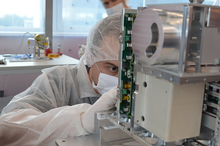 Image:
A contract signed today secures ESA InCubed co-funding towards the development of Aerospacelab’s Multispectral Companion Mission
Image:
A contract signed today secures ESA InCubed co-funding towards the development of Aerospacelab’s Multispectral Companion Mission
IZS a doprava 2021 – dobře vyjeté koleje i průzkum neznámých vod
16.2.2021 15:18 T-MAPYThe post IZS a doprava 2021 – dobře vyjeté koleje i průzkum neznámých vod appeared first on T-MAPY spol. s r.o..
20210216 - změna úředních hodin od 17.2.2021
16.2.2021 14:14 ČÚZK /Urady/Katastralni-urady/Katastralni-urady/Katastralni-urad-pro-Ustecky-kraj/Katastralni-pracoviste/KP-Rumburk/O-uradu/Aktuality/20210216-zmena-urednich-hodin-od-17-2-202120210216 - změna úředních hodin od 17.2.2021
16.2.2021 14:14 ČÚZK - předpisy a opatření Katastrální úřad pro Ústecký kraj - Katastrální pracoviště Rumburk zveřejnil novou aktualitu: S účinností od 17.2.2021 je provedena změna Úředních hodin na Katastrálním pracovišti Rumburk Katastrálního úřadu pro Ústecký kraj.Úřední hodiny jsou nově pro všechny agendy:
Pondělí, Středa : 8:00 - 17:00
Úterý, Čtvrtek : 8:00 - 14:00
Pátek : 8:00 - 12:00
20210216 - změna úředních hodin od 17.2.2021
16.2.2021 14:04 ČÚZK /Urady/Katastralni-urady/Katastralni-urady/Katastralni-urad-pro-Ustecky-kraj/Katastralni-pracoviste/KP-Louny/O-uradu/Aktuality/20201125-zmena-urednich-hodin-od-30-11-2020-(1)20210216 - změna úředních hodin od 17.2.2021
16.2.2021 14:04 ČÚZK - předpisy a opatření Katastrální úřad pro Ústecký kraj - Katastrální pracoviště Louny zveřejnil novou aktualitu: S účinností od 17.2.2021 je provedena změna Úředních hodin na Katastrálním pracovišti Louny Katastrálního úřadu pro Ústecký kraj.Úřední hodiny jsou nově pro všechny agendy:
Pondělí, Středa : 8:00 - 17:00
Úterý, Čtvrtek : 8:00 - 14:00
Pátek : 8:00 - 12:00
20201125 - změna úředních hodin od 30.11.2020
16.2.2021 14:04 ČÚZK - předpisy a opatření Katastrální úřad pro Ústecký kraj zveřejnil novou aktualitu: S účinností od 30.11.2020 je provedena změna Úředních hodin na pracovištích Katastrálního úřadu pro Ústecký kraj.Úřední hodiny jsou nově pro všechny agendy:
Pondělí : 8:00 - 17:00
Středa : 8:00 - 17:00
Upozorňujeme na možnost učinit podání bezkontaktně do schránky umístěné za dveřmi vchodu do budovy! Lze tak podat i návrh na vklad v zalepené obálce. Uveďte v podání Váš mail, budeme Vás informovat o přijetí, případně vyzveme k zaplacení poplatku převodem na účet. Schránka je přístupná : Po, St 8:00-17:00 hodin, Út, Čt 8:00-14:00 hodin, Pá 8:00-12:00 hodin.
20201125 - změna úředních hodin od 30.11.2020
16.2.2021 14:04 ČÚZK /Urady/Katastralni-urady/Katastralni-urady/Katastralni-urad-pro-Ustecky-kraj/Katastralni-pracoviste/KP-Louny/O-uradu/Aktuality/20201125-zmena-urednich-hodin-od-30-11-2020-(1)20210216 - Upozornění uživatelům ISÚI a VDP
16.2.2021 13:14 ČÚZK - předpisy a opatření Upozornění uživatelům ISÚI a VDP: Grafická část (práce s mapou) se potýkala s výkonnostními problémy v důsledku nezákonného vytěžování dat. Od poloviny března 2021 se zhoršené odezvy podařilo eliminovat, ale plnohodnotná funkčnost bude k dispozici v červnu 2021 po nasazení úprav.20210216 - Upozornění uživatelům ISÚI a VDP
16.2.2021 13:14 ČÚZK - předpisy a opatření Upozornění uživatelům ISÚI a VDP: Grafická část (práce s mapou) má v současné době výkonnostní problémy, pracujeme na jejich odstranění. Do jejich vyřešení mohou být delší odezvy aplikace. Omlouváme se za komplikace.20210216 - Upozornění uživatelům ISÚI a VDP
16.2.2021 13:14 ČÚZK /Uvod/Produkty-a-sluzby/RUIAN/RUIAN-novinky/2021/20210216-Upozorneni-uzivatelum-ISUI-a-VDPAktuality pracoviště
16.2.2021 12:52 ČÚZK - předpisy a opatření Katastrální úřad pro Vysočinu - Katastrální pracoviště Velké Meziříčí zveřejnil novou aktualitu: Od 15. 2. 2021 dochází ke změně úředních hodin na katastrálním pracovišti. Podrobnosti o provozu najdete v tomto dokumentu.Aktuality pracoviště
16.2.2021 12:52 ČÚZK - předpisy a opatření Katastrální úřad pro Vysočinu - Katastrální pracoviště Velké Meziříčí zveřejnil novou aktualitu: Od 15. 2. 2021 dochází ke změně úředních hodin na katastrálním pracovišti. Podrobnosti o provozu najdete v tomtodokumentu
20210216_Úprava úředních hodin
16.2.2021 12:51 ČÚZK /Urady/Katastralni-urady/Katastralni-urady/Katastralni-urad-pro-Stredocesky-kraj/O-uradu/Aktuality/20210216_Uprava-urednich-hodin20210216_Úprava úředních hodin
16.2.2021 12:51 ČÚZK - předpisy a opatření Katastrální úřad pro Středočeský kraj zveřejnil novou aktualitu: Úprava úředních hodin ÚPRAVA ÚŘEDNÍCH HODIN:S účinností od 15. 2. 2021 jsou rozšířeny úřední hodiny na všech pracovištích Katastrálního úřadu pro Středočeský kraj. Před návštěvou si prosím ověřte přesný rozsah úředních hodin na www stránkách katastrálních pracovišť. Děkujeme za pochopení.
Covid_box
16.2.2021 11:19 ČÚZK - předpisy a opatření Katastrální úřad pro Středočeský kraj - Katastrální pracoviště Kolín zveřejnil novou aktualitu: Vážení klienti,z důvodů nepříznivého epidemiologického vývoje a stavu bude možné během pátků podat listiny pouze přes Covid box umístění ve vstupních dveří Katastrálního pracoviště. Covid box je pravidelně vybírán pouze v pátek od 8:00 do 12:00.
Dokumenty prosím podávejte v zalepené A4 obálce s Vaším e-mailovým kontaktem, na který by Vám byl zaslán případný podklad pro platbu. Termín podání dokumentu je čas výběru z boxu.
Za případné komplikace se omlouváme.
Covid_box
16.2.2021 11:19 ČÚZK /Urady/Katastralni-urady/Katastralni-urady/Katastralni-urad-pro-Stredocesky-kraj/Katastralni-pracoviste/KP-Kolin/O-uradu/Aktuality/Covid_boxCovid_box
16.2.2021 11:19 ČÚZK - předpisy a opatření Katastrální úřad pro Středočeský kraj - Katastrální pracoviště Kolín zveřejnil novou aktualitu: Vážení klienti,z důvodů nepříznivého epidemiologického vývoje a stavu bude možné během pátků podat listiny pouze přes Covid box umístění ve vstupních dveří Katastrálního pracoviště. Covid box je pravidelně vybírán pouze v pátek od 8:00 do 13:00.
Dokumenty prosím podávejte v zalepené A4 obálce s Vaším e-mailovým kontaktem, na který by Vám byl zaslán případný podklad pro platbu. Termín podání dokumentu je čas výběru z boxu.
Za případné komplikace se omlouváme.
Covid_box
16.2.2021 11:19 ČÚZK - předpisy a opatření Katastrální úřad pro Středočeský kraj - Katastrální pracoviště Kolín zveřejnil novou aktualitu: Vážení klienti,z důvodů nepříznivého epidemiologického vývoje a stavu bude možné během pátků podat listiny pouze přes Covid box umístění ve vstupních dveří Katastrálního pracoviště.
Dokumenty prosím podávejte v zalepené A4 obálce s Vaším e-mailovým kontaktem, na který by Vám byl zaslán případný podklad pro platbu. Termín podání dokumentu je čas výběru z boxu.
Za případné komplikace se omlouváme.
MyGalileoDrone – The news you’ve been waiting for!
16.2.2021 10:08 European GNSS Agency
We are ready to announce the finalists in this year’s MyGalileoDrone competition. After serious deliberation, our jury has narrowed down the 30 semi-finalists to the final 10 teams still in the running for the EUR 230,000 prize pot.
From 190 submissions, 346 registered teams and 470 registered applicants, we have arrived at a shortlist of 10 teams. And so, without further ado, the finalists are:
- Raytrack - Inspection and maintenance
- RigiTech - Medical delivery services
- NAUTILUS - Medical delivery services
- D2X-ination - Communication and navigation
- TF-ATMON - Weather monitoring
- SOARER - Leisure
- Pixbrush - Inspection and maintenance
- Spectalight.io - Leisure
- PortDrone - Port operations
- SmartSAR - Emergency management
“We have been very impressed by the high number and quality of proposals received by start-ups and innovators from 28 European countries,” said Fiammetta Diani, GSA Head of Market Development.
“The goal of the competition is to harness Europe’s innovative potential to deliver solutions needed by people and industry. The teams have done exactly that: from search and rescue to monitoring, maintenance and service delivery, the proposed solutions show great market potential. The GSA provided focused support to entrepreneurs to boost their business model and will continue to support them identifying first customers and match with potential investors.” she said.
For more information on the innovative applications and services developed by the 10 finalists, click here.
The final stretch
The MyGalileoDrone finals will take place on 17 February, when the 10 teams will have to perform a pre-demo of their solution and explain their strategy to bring their solution to the market to GSA board. Based on these presentations, the jury will select the four winners. The winners will be announced and awarded during Entrepreneurship Day on 2 March, where the projects will also be able to present their ideas to investors. Take a look here for more information on the selection process.
Read this: Entrepreneurship Day to showcase the most innovative Galileo-based solutions
The winning team will receive EUR 100,000, with EUR 60,000 going to the team in second place, EUR 40,000 for third place, and a fourth prize of EUR 30,000. The 10 finalists have a little over a week left to polish up their final presentations - we wish them all the best of luck on 17 February!
Media note: This feature can be republished without charge provided the European GNSS Agency (GSA) is acknowledged as the source at the top or the bottom of the story. You must request permission before you use any of the photographs on the site. If you republish, we would be grateful if you could link back to the GSA website (http://www.gsa.europa.eu).
15.2.2021
16.2.2021 9:33 ČÚZK /Urady/Katastralni-urady/Katastralni-urady/Katastralni-urad-pro-Stredocesky-kraj/Katastralni-pracoviste/KP-Kladno/O-uradu/Aktuality/15-2-202115.2.2021
16.2.2021 9:33 ČÚZK - předpisy a opatření Katastrální úřad pro Středočeský kraj - Katastrální pracoviště Kladno zveřejnil novou aktualitu: Nadále zůstává možnost bezkontaktního podání do sběrného boxu: veškerá podání je možné vhodit v zalepené obálce do uzavřeného sběrného boxu, který je pro KP Kladno zpřístupněn v hale u vchodu do budovy KP Kladno v pracovní dny od 7:00 do 17:00. Pokud bude v podání uvedena e-mailová adresa, bude na ní zasláno potvrzení o přijetí podání. Za okamžik podání návrhu na vklad se považuje okamžik výběru sběrného boxu. V případě, že je s podáním spojena poplatková povinnost, bude účastníkům zaslána i výzva k úhradě správního poplatku převodem na účet.Děkujeme, že budete v co největší míře využívat této zcela bezkontaktní možnosti podání vůči katastrálnímu úřadu.
20210216 - volné místo - Vedoucí OAaD KP Ústí n.L. na KÚ pro Ústecký kraj
16.2.2021 9:26 ČÚZK - předpisy a opatření Katastrální úřad pro Ústecký kraj - Katastrální pracoviště Ústí nad Labem zveřejnil novou aktualitu: Nabídka volného pracovního místa - Vedoucí oddělení aktualizace a dokumentace katastru nemovitostí Katastrálního pracoviště Ústí nad Labem na KÚ pro Ústecký kraj20210216 - volné místo - Vedoucí OAaD KP Ústí n.L. na KÚ pro Ústecký kraj
16.2.2021 9:26 ČÚZK /Urady/Katastralni-urady/Katastralni-urady/Katastralni-urad-pro-Ustecky-kraj/Katastralni-pracoviste/KP-Usti-nad-Labem/O-uradu/Aktuality/20210216-volne-misto-Vedouci-OAaD-KP-Usti-n-L20210216 - volné místo - Vedoucí OAaD KP Ústí n.L. na KÚ pro Ústecký kraj
16.2.2021 9:23 ČÚZK /Urady/Katastralni-urady/Katastralni-urady/Katastralni-urad-pro-Ustecky-kraj/O-uradu/Aktuality/20210216-volne-misto-Vedouci-OAaD-KP-Usti-n-L20210216 - volné místo - Vedoucí OAaD KP Ústí n.L. na KÚ pro Ústecký kraj
16.2.2021 9:23 ČÚZK - předpisy a opatření Katastrální úřad pro Ústecký kraj - Katastrální pracoviště Ústí nad Labem zveřejnil novou aktualitu: Nabídka volného pracovního místa - Vedoucí oddělení aktualizace a dokumentace katastru nemovitostí Katastrálního pracoviště Ústí nad Labem na KÚ pro Ústecký kraj20210216 - volné místo - Vedoucí OAaD KP Ústí n.L. na KÚ pro Ústecký raj
16.2.2021 9:23 ČÚZK - předpisy a opatření Katastrální úřad pro Ústecký kraj - Katastrální pracoviště Ústí nad Labem zveřejnil novou aktualitu: Nabídka volného pracovního místa - Vedoucí oddělení aktualizace a dokumentace katastru nemovitostí Katastrálního pracoviště Ústí nad Labem na KÚ pro Ústecký krajVedoucí oddělení aktualizace a dokumentace katastru nemovitostí Katastrálního pracoviště Ústí nad La
16.2.2021 9:19 ČÚZK - předpisy a opatření Katastrální úřad pro Ústecký kraj Katastrální pracoviště Ústí nad Labemvypisuje výběrové řízení na místo
Vedoucí oddělení aktualizace a dokumentace katastru nemovitostí Katastrálního pracoviště Ústí nad Labem na KÚ pro Ústecký kraj
Soutěž o knihu Webová kartografie – výsledky!
16.2.2021 8:48 GISportal.cz
Na začátku měsíce jsme psali o nové knize od Rostislava Nétka Webová kartografie a součástí článku byla i minisoutěž o podepsanou knihu. Rosťa vymyslel 3 otázky: Jaký produkt je považován za první mapovou aplikaci vůbec? Kolik uživatelů měsíčně využívá Google Maps? Jaký tradiční formát není vhodný pro webové mapy a proč právě Shapefile 🙂 Odpovědi, […]
The post Soutěž o knihu Webová kartografie – výsledky! appeared first on GISportal.cz.
Změna úředních hodin od 15. 2. 2021
16.2.2021 8:33 ČÚZK - předpisy a opatření Český úřad zeměměřický a katastrální - Katastrální pracoviště Třebíč zveřejnil novou aktualitu: Od 15. 2. 2021 dochází ke změně úředních na katastrálním pracovišti. Podrobnosti o provozu najdete v tomto dokumentu.Změna úředních hodin od 15. 2. 2021
16.2.2021 8:33 ČÚZK - předpisy a opatření Katastrální úřad pro Vysočinu - Katastrální pracoviště Třebíč zveřejnil novou aktualitu: Od 15. 2. 2021 dochází ke změně úředních na katastrálním pracovišti. Podrobnosti o provozu najdete v tomto dokumentu.Změna úředních hodin od 15. 2. 2021
16.2.2021 8:33 ČÚZK /Urady/Katastralni-urady/Katastralni-urady/Katastralni-urad-pro-Vysocinu/Katastralni-pracoviste/KP-Trebic/O-uradu/Aktuality/Zmena-urednich-hodin-od-15-2-2021Změna úředních hodin od 15. 2. 2021
16.2.2021 8:33 ČÚZK - předpisy a opatření Katastrální úřad pro Vysočinu - Katastrální pracoviště Třebíč zveřejnil novou aktualitu: Od 15. 2. 2021 dochází ke změně úředních hodin na katastrálním pracovišti. Podrobnosti o provozu najdete v tomto dokumentu.CAD Studio slaví 30 let
16.2.2021 1:00 CAD Studio Společnost CAD Studio s.r.o. slaví 30 let svého působení. Již 30 let pomáháme zavádět CAD, CAM, BIM, GIS a PDM technologie u zákazníků po celé České republice, na Slovensku, ale v mnoha případech i u zákazníků na jiných kontinentech.
Oslavte toto ...
Společnost CAD Studio s.r.o. slaví 30 let svého působení. Již 30 let pomáháme zavádět CAD, CAM, BIM, GIS a PDM technologie u zákazníků po celé České republice, na Slovensku, ale v mnoha případech i u zákazníků na jiných kontinentech.
Oslavte toto ...Vytvářejte efektní prezentace
16.2.2021 0:00 SolidVision Vytvářejte efektní prezentace vašich výrobků pomocí SOLIDWORKS Visualize, nyní za velmi výhodnou cenu.Vytvářejte efektní prezentace
16.2.2021 0:00 SolidVision Vytvářejte efektní prezentace vašich výrobků pomocí SOLIDWORKS Visualize, nyní za velmi výhodnou cenu.Public comment sought on new work items for OGC API - Processes Standards Working Group
15.2.2021 22:04 GISCafe.com Webcasts-Webinars
New work items for the SWG include extensions to OGC API - Processes that will simplify the deployment and execution of …
Hexagon launches R-evolution, a new business venture focused on a sustainable future
15.2.2021 16:21 GISCafe.com Webcasts-Webinars NACKA STRAND, Sweden, Feb. 15, 2021 — (PRNewswire) — Hexagon AB, a global leader in sensor, software and autonomous solutions, today …HERE Technologies is powering the Lynk & Co 01 SUV in Europe
15.2.2021 16:21 GISCafe.com Webcasts-Webinars Gothenburg and Amsterdam – Lynk & Co, the global mobility brand, and HERE Technologies, the leading location data and technology platform, have …Meet the Next Generation of Industry Leading Drone LiDAR Survey Equipment from Microdrones
15.2.2021 16:21 GISCafe.com Webcasts-Webinars ROME, NY, Feb. 15, 2021 (GLOBE NEWSWIRE) -- Building upon the momentum of the Microdrones as a Service (mdaaS) program launched in mid-2020 (which …Oznámení o omezeném provozu katastrálních pracovišť
15.2.2021 16:17 ČÚZK - předpisy a opatření Katastrální úřad pro Jihočeský kraj zveřejnil novou aktualitu: Oznámení o omezeném provozu katastrálních pracovišť Katastrálního úřadu pro Jihočeský kraj v období od 15. února 2021 po dobu nouzového stavu.20210215_Badatelna_Prodejna
15.2.2021 16:15 ČÚZK - předpisy a opatření Zeměměřický úřadzveřejnil novou aktualitu: Od 15.2.2021 jsou úřední hodiny badatelny archivu a prodejny map nově otevřeny v těchto úředních hodinách: po, st 8-17, út, čt 8-14.
20210215_Badatelna
15.2.2021 16:15 ČÚZK /Urady/Zememericky-urad/O-uradu/Aktuality/20210215_Badatelna20210215_Badatelna
15.2.2021 16:15 Zeměměřický úřad Zeměměřický úřadzveřejnil novou aktualitu: Od 15.2.2021 jsou úřední hodiny badatelny archivu nově otevřeny v těchto úředních hodinách: po, st 8-17, út, čt 8-14.
20210215_Badatelna
15.2.2021 16:15 ČÚZK - předpisy a opatření Zeměměřický úřadzveřejnil novou aktualitu: Od 15.2.2021 jsou úřední hodiny badatelny archivu nově otevřeny v těchto úředních hodinách: po, st 8-17, út, čt 8-14.
20210215_Badatelna_Prodejna
15.2.2021 16:15 ČÚZK - předpisy a opatření Zeměměřický úřadzveřejnil novou aktualitu: Od 15.2.2021 jsou úřední hodiny badatelny Ústředního archivu zeměměřictví a katastru a prodejny map otevřeny v běžných úředních hodinách.
20210215_Badatelna_Prodejna
15.2.2021 16:15 Zeměměřický úřad Zeměměřický úřadzveřejnil novou aktualitu: Od 15.2.2021 jsou úřední hodiny badatelny Ústředního archivu zeměměřictví a katastru a prodejny map otevřeny v běžných úředních hodinách.
20210215_Badatelna_Prodejna
15.2.2021 16:15 ČÚZK /Urady/Zememericky-urad/O-uradu/Aktuality/20210215_BadatelnaZMĚNA ÚŘEDNÍCH HODIN OD 15. 2. 2021
15.2.2021 15:56 ČÚZK - předpisy a opatření Katastrální úřad pro hlavní město Prahu - Katastrální pracoviště Praha ZMĚNA ÚŘEDNÍCH HODIN OD 15. 2. 2021 ZMĚNA ÚŘEDNÍCH HODIN OD 15. ÚNORA 2021ZMĚNA ÚŘEDNÍCH HODIN OD 15. 2. 2021
15.2.2021 15:56 ČÚZK /Urady/Katastralni-urady/Katastralni-urady/Katastralni-urad-pro-hlavni-mesto-Prahu/Katastralni-pracoviste/KP-Praha/O-uradu/Aktuality/ZMENA-UREDNICH-HODIN-OD-15-2-2021ZMĚNA ÚŘEDNÍCH HODIN OD 15. 2. 2021
15.2.2021 14:53 ČÚZK /Urady/Katastralni-urady/Katastralni-urady/Katastralni-urad-pro-hlavni-mesto-Prahu/O-uradu/Aktuality/ZMENA-UREDNICH-HODIN-OD-15-2-2021-(1)ZMĚNA ÚŘEDNÍCH HODIN OD 15. 2. 2021
15.2.2021 14:53 ČÚZK - předpisy a opatření Český úřad zeměměřický a katastrální - Katastrální pracoviště PrahaZMĚNA ÚŘEDNÍCH HODIN OD 15. 2. 2021 VŠECHNA PRACOVIŠTĚ KATASTRÁLNÍHO ÚŘADU PRO HLAVNÍ MĚSTO PRAHU V BUDOVĚ V PRAZE-KOBYLISÍCH MAJÍ PO DOBU OPATŘENÍ PROTI ŠÍŘENÍ KORONAVIRU OD 15. ÚNORA 2021 ZMĚNĚNU ÚŘEDNÍ DOBU.
Opatření 15.2.2021
15.2.2021 14:52 ČÚZK - předpisy a opatření Katastrální úřad pro Královéhradecký kraj zveřejnil novou aktualitu: Přijetí krizových opatření:v návaznosti na Usnesení vlády ČR ze dne 14. 2. 2021 č. 128 o přijetí krizového opatření oznamuje Katastrální úřad pro Královéhradecký kraj, že všechna katastrální pracoviště v jeho územní působnosti mají nadále omezeny služby vyžadující přímý kontakt s veřejností.
Na Katastrálních pracovištích Hradec Králové, Jičín, Náchod, Rychnov nad Kněžnou a Trutnov jsou úřední hodiny stanoveny takto:
pondělí 8:00–17:00
středa 8:00–17:00
Více podrobností v oznámení.
Opatření 15.2.2021
15.2.2021 14:52 ČÚZK - předpisy a opatření Katastrální úřad pro Královéhradecký kraj zveřejnil novou aktualitu: Přijetí krizových opatření:v návaznosti na Usnesení vlády ČR ze dne 14. 2. 2021 č. 28 o přijetí krizového opatření oznamuje Katastrální úřad pro Královéhradecký kraj, že všechna katastrální pracoviště v jeho územní působnosti mají nadále omezeny služby vyžadující přímý kontakt s veřejností.
Na Katastrálních pracovištích Hradec Králové, Jičín, Náchod, Rychnov nad Kněžnou a Trutnov jsou úřední hodiny stanoveny takto:
pondělí 8:00–17:00
středa 8:00–17:00
Více podrobností v oznámení.
Opatření 15.2.2021
15.2.2021 14:52 ČÚZK - předpisy a opatření Katastrální úřad pro Královéhradecký kraj zveřejnil novou aktualitu: Přijetí krizových opatření:v návaznosti na Usnesení vlády ČR ze dne 14. 2. 2021 č. 28 o přijetí krizového opatření oznamuje Katastrální úřad pro Královéhradecký kraj oznamuje, že všechna katastrální pracoviště v jeho územní působnosti mají nadále omezeny služby vyžadující přímý kontakt s veřejností.
Na Katastrálních pracovištích Hradec Králové, Jičín, Náchod, Rychnov nad Kněžnou a Trutnov jsou úřední hodiny stanoveny takto:
pondělí 8:00–17:00
středa 8:00–17:00
Více podrobností v oznámení.
Opatření 15.2.2021
15.2.2021 14:52 ČÚZK /Urady/Katastralni-urady/Katastralni-urady/Katastralni-urad-pro-Kralovehradecky-kraj/O-uradu/Aktuality/Opatreni-15-2-2021ZMĚNA ÚŘEDNÍCH HODIN OD 15. 2. 2021
15.2.2021 14:45 ČÚZK /Urady/Katastralni-urady/Katastralni-urady/Katastralni-urad-pro-hlavni-mesto-Prahu/O-uradu/Aktuality/ZMENA-UREDNICH-HODIN-OD-15-2-2021ZMĚNA ÚŘEDNÍCH HODIN OD 15. 2. 2021
15.2.2021 14:45 ČÚZK - předpisy a opatření Katastrální úřad pro hlavní město Prahu ZMĚNA ÚŘEDNÍCH HODIN OD 15. 2. 2021 VŠECHNA PRACOVIŠTĚ KATASTRÁLNÍHO ÚŘADU PRO HLAVNÍ MĚSTO PRAHU V BUDOVĚ V PRAZE-KOBYLISÍCH MAJÍ PO DOBU OPATŘENÍ PROTI ŠÍŘENÍ KORONAVIRU OD 15. ÚNORA 2021 ZMĚNĚNU ÚŘEDNÍ DOBU.ZMĚNA ÚŘEDNÍCH HODIN OD 15. 2. 2021
15.2.2021 14:45 ČÚZK - předpisy a opatření Katastrální úřad pro hlavní město PrahuZMĚNA ÚŘEDNÍCH HODIN OD 15. 2. 2021 VŠECHNA PRACOVIŠTĚ KATASTRÁLNÍHO ÚŘADU PRO HLAVNÍ MĚSTO PRAHU V BUDOVĚ V PRAZE-KOBYLISÍCH MAJÍ PO DOBU OPATŘENÍ PROTI ŠÍŘENÍ KORONAVIRU OD 15. ÚNORA 2021 ZMĚNĚNU ÚŘEDNÍ DOBU.
ZMĚNA ÚŘEDNÍCH HODIN OD 15. 2. 2021
15.2.2021 14:45 ČÚZK - předpisy a opatření Katastrální úřad pro hlavní město Prahu ZMĚNA ÚŘEDNÍCH HODIN OD 15. 2. 2021 ZMĚNA ÚŘEDNÍCH HODIN OD 15. ÚNORA 202115. Kartografický den Olomouc bude v online prostředí
15.2.2021 14:16 GISportal.cz
Jak jsme již informovali dříve, 15. Kartografický den Olomouc, který se tradičně koná poslední únorový pátek bude letos formou online setkání. Tématem letošního ročníku je Kartografie&technologie. Protože nejlepší částí každé konference je pauza na kávu a s ní spojené diskuze, rozhodli se organizátoři podpořit možnost setkávání pomocí prostředí GatherTown, což je virtuální prostor, ve kterém […]
The post 15. Kartografický den Olomouc bude v online prostředí appeared first on GISportal.cz.
Bezkontaktní podání
15.2.2021 13:30 ČÚZK - předpisy a opatření Katastrální úřad pro Jihomoravský kraj - Katastrální pracoviště Břeclav zveřejnil novou aktualitu: Bezkontaktní podání:Sběrný box