


![]()

zprávy
zdroje zpráv:Motorola Solutions Announces Mapping, Analytics Enhancements to CommandCentral Aware Software
10.4.2019 19:32 GISCafe.com Webcasts-Webinars Enhancements to cloud-based application enable first responders tohave eyes on a scene in seconds
CHICAGO — (BUSINESS WIRE) …
Trimble Announces High-Accuracy Field Solution for GIS Applications
10.4.2019 17:20 GISCafe.com Webcasts-Webinars Trimble TDC150 Handheld Maximizes Productivity for Mobile WorkersSUNNYVALE, Calif., April 10, 2019 — (PRNewswire) — Trimble …
FLIR Completes Strategic Investment in DroneBase
10.4.2019 17:20 GISCafe.com Webcasts-Webinars FLIR Becomes Exclusive Provider of Thermal Technology for DroneBase’sInspection Services and Training Partner for its Enterprise Pilot …
HERE launches XYZ: Mapmaking and geospatial data management made easy for developers and non-coders alike
10.4.2019 17:20 GISCafe.com Webcasts-Webinars Extends the HERE Freemium plan for developers by adding new tools to build location-aware applications.Empowers users to create maps without writing …20190410-VŘ Ředitel/ka odboru informatiky
10.4.2019 16:58 ČÚZK - předpisy a opatření Český úřad zeměměřický a katastrální zveřejnil novou aktualitu: Oznámení o vyhlášení výběrového řízení na služební místo vrchní rada - Ředitel/ředitelka odboru informatiky.20190410-VŘ Ředitel/ka odboru informatiky
10.4.2019 16:58 ČÚZK /Aktuality-resort/2019/20190410-VR-Reditel-ka-odboru-informatikyŘeditel/ředitelka odboru informatiky
10.4.2019 16:48 ČÚZK /Urady/Cesky-urad-zememericky-a-katastralni/Uredni-deska/Oznameni-a-jina-uredni-sdeleni/Volna-mista/Reditel-reditelka-odboru-informatikyŘeditel/ředitelka odboru informatiky
10.4.2019 16:48 ČÚZK - předpisy a opatření Český úřad zeměměřický a katastrálnívypisuje výběrové řízení na místo
Ředitel/ředitelka odboru informatiky
Ředitel/ředitelka odboru informatiky
10.4.2019 16:48 ČÚZK - volná místa Český úřad zeměměřický a katastrální vypisuje výběrové řízení na místo Ředitel/ředitelka odboru informatikyPři odeslání GP přes WSGP apli
10.4.2019 16:43 GEUSware Při odeslání GP přes WSGP aplikace v některých případech hlásí chybu "Špatný podpis skupiny příloh". Pravděpodobně se jedná o problém služby, zjišťujeme bližší informace na ČÚZK.15.4.2019: Nyní by již mělo být odeslání GP přes webové služby v pořádku, problém byl na straně ČÚZK opraven.
20190410-VŘ Řízení projektů - metodik RÚIAN
10.4.2019 15:12 ČÚZK /Aktuality-resort/2019/20190410-VR-Rizeni-projektu-metodik-RUIAN20190410-VŘ Řízení projektů - metodik RÚIAN
10.4.2019 15:12 ČÚZK - předpisy a opatření Český úřad zeměměřický a katastrální zveřejnil novou aktualitu: Oznámení o vyhlášení výběrového řízení na služební místo odborný rada Řízení projektů - metodik RÚIAN.Řízení projektů - metodik RÚIAN
10.4.2019 14:57 ČÚZK /Urady/Cesky-urad-zememericky-a-katastralni/Uredni-deska/Oznameni-a-jina-uredni-sdeleni/Volna-mista/Rizeni-projektu-metodik-RUIANŘízení projektů - metodik RÚIAN
10.4.2019 14:57 ČÚZK - volná místa Český úřad zeměměřický a katastrální vypisuje výběrové řízení na místo Řízení projektů - metodik RÚIANŘízení projektů - metodik RÚIAN
10.4.2019 14:57 ČÚZK - předpisy a opatření Český úřad zeměměřický a katastrálnívypisuje výběrové řízení na místo
Řízení projektů - metodik RÚIAN
Aktualizujte na verzi 14.21
10.4.2019 14:05 GEPROZveřejnili jsme verze 14.21 našich produktů MISYS, MISYS-WEB – licenční server, KOKEŠ, Geoportál GEPRO a PROLAND, které přinášejí řadu novinek.… >>
vrchní referent/rada v oddělení aktualizace KN II
10.4.2019 13:52 ČÚZK - předpisy a opatření Katastrální úřad pro Vysočinu zveřejnil novou aktualitu: Oznámení o vyhlášení výběrového řízení na služební místo vrchní referent/rada v oddělení aktualizace KN II Katastrálního pracoviště Jihlava na Katastrálním úřadu pro Vysočinuvrchní referent/rada v oddělení aktualizace KN II
10.4.2019 13:52 ČÚZK /Urady/Katastralni-urady/Katastralni-urady/Katastralni-urad-pro-Vysocinu/O-uradu/Aktuality/vrchni-referent-rada-v-oddeleni-aktualizace-KN-IIJak importovat SGI KN ve formátu VFK
10.4.2019 13:34 GEPROČÚZK data SGI KN (soubor geodetických informací katastru nemovitostí, zjednodušeně katastrální mapy) ve výměnném formátu VFK jednotlivým uživatelům již nedistribuuje.… >>
Jak importovat SGI KN ve formátu VFK
10.4.2019 13:34 GEPROČÚZK data SGI KN (soubor geodetických informací katastru nemovitostí, zjednodušeně katastrální mapy) ve výměnném formátu VFK jednotlivým uživatelům již samostatně nedistribuuje.… >>
Orders for HD Ultra X Series Exceeds Q1 Expectations as Customers Embrace Newest Standard in Scanning
10.4.2019 12:34 GISCafe.com Webcasts-Webinars Chantilly, VA — April 9, 2019 — Contex, the world leader in large format scanning, today announces that the HD Ultra X …Amsterdam Drone Week and Commercial UAV Expo Europe Join Forces
10.4.2019 12:20 GISCafe.com Webcasts-Webinars Biggest drone platform in Europe, tradeshow and conference in oneAmsterdam, 9 April 2019 – Amsterdam Drone Week and global organizer of …
Hemisphere GNSS Announces New Atlas®-Capable, Multi-GNSS Vector™ V200 GNSS Compass
10.4.2019 12:10 GISCafe.com Webcasts-Webinars Southampton, UK – April 9, 2019 – Today, from Ocean Business 2019 in Southampton, UK, Hemisphere GNSS, Inc. …OGC publishes results from its Testbed-14 Innovation Initiative
10.4.2019 12:04 GISCafe.com Webcasts-Webinars The Engineering Reports document state-of-the-art research across topics including OGC APIs, bringing ‘applications to the data’, …20190410-přehled přestupků
10.4.2019 8:59 ČÚZK - předpisy a opatření Český úřad zeměměřický a katastrální zveřejnil novou aktualitu: V souladu s § zákona č.250/2016 Sb., o odpovědnosti za přestupky a řízení o nich, byl zveřejněn přehled přestupků za rok 2018.20190410-přehled přestupků
10.4.2019 8:59 ČÚZK - předpisy a opatření Český úřad zeměměřický a katastrální zveřejnil novou aktualitu: V souladu s § 110 zákona č.250/2016 Sb., o odpovědnosti za přestupky a řízení o nich, byl zveřejněn přehled přestupků za rok 2018.Konference GIS Esri v ČR (pozvánka)
10.4.2019 8:20 GISportal.cz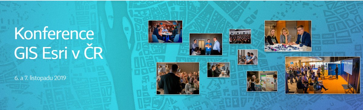
Společnost ARCDATA PRAHA zve na letošní ročník Konference GIS Esri v ČR, která se v Kongresovém centru Praha uskuteční ve dnech 6. a 7. listopadu 2019. Konference nabízí možnost seznámit se s aktuálními projekty v oboru GIS, příležitost inspirovat se prací kolegů z celé České republiky a v neposlední řadě také vidět spoustu technologických novinek, o […]
The post Konference GIS Esri v ČR (pozvánka) appeared first on GISportal.cz.
Nabídka nepotřebného majetku - Frankovací stroje
10.4.2019 7:44 ČÚZK - předpisy a opatřeníKatastrální úřad pro Ústecký kraj nabízí nepotřebný majetek k odkupu. Jedná se o
Nabídka nepotřebného majetku - Frankovací stroje
Nabídka nepotřebného majetku - Frankovací stroje
10.4.2019 7:44 ČÚZK /Urady/Katastralni-urady/Katastralni-urady/Katastralni-urad-pro-Ustecky-kraj/Nabidky-majetku/Nabidka-nepotrebneho-majetku-Frankovaci-stro-(1)Elastic and Google Cloud Expand Elasticsearch Service Partnership
9.4.2019 22:36 GISCafe.com Webcasts-Webinars New integrated management and billing gives Elasticsearch users asimplified experience on GCP
SAN FRANCISCO — (BUSINESS WIRE) …
SAM, LLC Announces Acquisition of Haag 3D Solutions' New Jersey Operations
9.4.2019 22:36 GISCafe.com Webcasts-Webinars SAM, LLC is pleased to announce it has completed the acquisition of the New Jersey operations of Haag 3D Solutions (H3DS), a division of Haag …CoreLogic Reports U.S. Overall Delinquency and Foreclosure Rates Lowest for January in at Least 20 Years
9.4.2019 18:12 GISCafe.com Webcasts-Webinars Delinquency rates remain elevated in some regions impacted bynatural disasters
January U.S. serious delinquency rate …
FARO® Appoints Michael D. Burger as President and Chief Executive Officer
9.4.2019 18:12 GISCafe.com Webcasts-Webinars LAKE MARY, Fla., April 9, 2019 — (PRNewswire) — FARO® (NASDAQ: FARO), the world's most trusted source for 3D measurement and …BlackSky Completes Critical On-Orbit Milestones with Global-1 and -2 Satellites as It Readies for Start of Commercial Operations
9.4.2019 18:12 GISCafe.com Webcasts-Webinars COLORADO SPRINGS, Colo. — (BUSINESS WIRE) — April 9, 2019 —Today, at the 35th Space Symposium, held in Colorado Springs, …
Mexico City Police Department and Cape Announce Drone Integration Program to Improve Public Safety
9.4.2019 18:12 GISCafe.com Webcasts-Webinars Cape-enabled drones will support first response efforts and enhance aerial intelligence in North America's largest city.REDWOOD CITY, Calif., April …
T-MAPY aplikace získaly ocenění v soutěži Zlatý erb
9.4.2019 15:00 T-MAPYThe post T-MAPY aplikace získaly ocenění v soutěži Zlatý erb appeared first on T-MAPY spol. s r.o..
Naši zákazníci opět získali ocenění v soutěži Zlatý erb
9.4.2019 15:00 T-MAPYThe post Naši zákazníci opět získali ocenění v soutěži Zlatý erb appeared first on T-MAPY spol. s r.o..
Zavírací dny o Velikonocích [Knihovna geografie, byTopic]
9.4.2019 14:45 Katedra aplikované geoinformatiky a kartografie Přf UK Knihovna zavřená na Velký pátek - 19. 4. a Velikonoční pondělí - 22. 4. 2019!Galileo and EGNOS easing road toll interoperability
9.4.2019 13:14 European GNSS Agency
Lack of interoperability is a significant issue in electronic road tolling systems. These systems need to be reliable, user friendly, and cost-efficient to enable the development and implementation of fair road-charging policies and to cope with future technical developments. A significant step forward for interoperability at EU level has been made with the publication in March of a new European Directive on the interoperability of electronic road tolling systems and the European GNSS (Galileo and EGNOS) is slated to play a major role.
Lower costs for European Electronic Toll Service (EETS) operators mean that charges can be lower, more traffic will flow on toll roads and/or more fees can be raised to improve road infrastructure; bringing benefits for operators, users and the public economy.
Interoperability of tolling systems also makes sense in terms of usability, with drivers able to seamlessly switch from one road-pricing scheme to another as easily as they ‘roam’ across borders on mobile phone networks.
Read this: Satellite positioning is changing how we move
The new EU Directive 2019/520 lays down the conditions necessary to ensure the interoperability of electronic road toll systems across the entire European Union road network, including urban and interurban motorways, major and minor roads, and other road infrastructure such as tunnels or bridges, and ferries. It will also facilitate the cross-border exchange of vehicle registration data to ensure collection of any road tolls due.
Toll technology choices
For all new electronic road toll systems that require the installation or use of an on-board unit (OBU) to carry out electronic toll transactions, the Directive stipulates the use of one or more specified technologies: satellite positioning, mobile communications, or 5.8 GHz microwave technology.
Any existing electronic road toll system that requires the installation or use of an OBU will also need to adopt one or more of these technologies if substantial technological improvements are carried out to the system.
In addition, any OBU using satellite positioning technology and placed on the market after 19 October 2021 will need to be compatible with the European GNSS positioning services provided by Galileo and EGNOS.
Watch this: European Space Programmes - Strengthening Internal Markets
In fact, EGNOS and Galileo are already activated in over 70% and 60%, respectively, of GNSS-enabled on-board units for tolling of heavy goods vehicles (HGVs) in Europe today.
Powerful solution
GNSS represents a powerful solution to many of the challenges of today’s road tolling operators, who need to know who is on a given road, for how long and over what distance – all with a very high degree of accuracy and reliability.
In terms of the total cost of implementation, GNSS-based solutions are much more flexible and cheaper in the long term, allowing operators to modify virtually instantaneously which road segments are covered. This way they can easily enlarge or reduce charging schemes, if and when needed, ultimately optimizing traffic and improving the efficiency of road transport.
Media note: This feature can be republished without charge provided the European GNSS Agency (GSA) is acknowledged as the source at the top or the bottom of the story. You must request permission before you use any of the photographs on the site. If you republish, we would be grateful if you could link back to the GSA website (http://www.gsa.europa.eu).
Augment your reality with GNSS
9.4.2019 11:39 European GNSS Agency told the conference that GNSS is ready to meet augmented reality’s needs in terms of ubiquity, accuracy and security.")
Augmented reality is becoming increasingly widespread, with a variety of professional and leisure applications using digital content to complement and augment the physical world, and many augmented reality software developers are taking advantage of GNSS high-accuracy for their localisation needs. A session at the Munich Satellite Navigation Summit at the end of March discussed the challenges of combining these two technologies.
Augmented reality is a major emerging trend, the societal impact of which will be increasingly felt in the coming years. “When we look at the forecasts for augmented reality, we expect 50% growth over the next two to three years,” said Dr Philipp Rauschnabel, Professor for Digital Marketing and Media Innovation at the Bundeswehr University Munich.
Rauschnabel noted that augmented reality can create significant value for companies in a number of ways, through new AR-enabled business models, in the marketing sphere, and in industrial production, maintenance and training, where AR solutions can make processes more efficient.
Scan the world with GNSS
In his presentation, Darius Pajouh, Managing Director of computer vision company Visualix, stressed the essential contribution of positioning to augmented reality applications. “Visual mapping and localisation are the key technologies that original equipment manufacturers use to create shared experiences,” he said.
Read this: Helping the visually impaired explore the outdoors
Pajouh noted that, as the technology is still relatively new, not all the use cases are totally clear yet. One thing that is clear, however, is the size of the potential market. “The market is about to explode,” he said.
Visualix uses the tracking capabilities of mobile phones, like ARCore and ARKit, as well as Google glasses and other hardware, to generate a 3D model of an indoor space as a base for AR deployment in an area of up to 10,000 square meters.
The aim is that, by incorporating satellite technology, it will be possible to remove the size constraints, Pajouh said. “I am very excited about the possibility of also doing outdoor localisation and combining visual and satellite tracking to see how satellite navigation can reduce our computational load.”
Tracking user requirements
Fiammetta Diani, Head of Market Development at the European GNSS Agency (GSA), looked at the ways that GNSS can support augmented reality and how augmented reality can be an opportunity for GNSS innovators.
Diani said that the GSA met with augmented reality users last December, in the frame of the European GNSS User Consultation Platform, to discuss their requirements. At the meeting, users categorised use cases in two streams - leisure and professional, with applications targeting travel and tourism, live sporting events, and augmented navigation for assisted driving. Professional use cases included industrial design and architecture.
“These augmented reality applications have three main requirements - ubiquity, accuracy and security,” Diani said, adding that accuracy requirements vary – for some applications, accuracy of one to two metres is sufficient, while others require decimetre or even centimetre accuracy, in addition to protection against spoofing.
And this: LBS user requirements highlighted in GSA special report
GNSS can meet these requirements, Diani said. “Firstly, the second E5/L5 frequency is already providing metre-level accuracy and many chipmakers in the professional and consumer domains are investing in dual-frequency,” she said.
GNSS driving innovation
Diani noted that in 2020 Galileo would also offer a precise point positioning (PPP) service that will give global decimetre-level accuracy free of charge. “So you will have dual-frequency accuracy to which you can add correction services. In the same timeframe we will also offer authentication, which will provide protection against spoofing. What’s more, the E5 signal also offers better multipath protection,” she said.
In this way, GNSS is ready to meet the needs of the burgeoning augmented reality segment, which is set to see record growth. “Recent market research shows that augmented reality may be the fastest growing GNSS segment, worth up to EUR 40 billion,” Diani said.
Other participants noted that GNSS not only supports augmented reality applications, but is driving innovation in the augmented reality segment. “The more accurately you can track, the more use cases there will be,” said Wolfgang Stelzle, CEO of RE’FLEKT GmbH.
Media note: This feature can be republished without charge provided the European GNSS Agency (GSA) is acknowledged as the source at the top or the bottom of the story. You must request permission before you use any of the photographs on the site. If you republish, we would be grateful if you could link back to the GSA website (http://www.gsa.europa.eu).
Augment your reality with GNSS
9.4.2019 11:39 European GNSS AgencyAugmented reality is becoming increasingly widespread, with a variety of professional and leisure applications using digital content to complement and augment the physical world, and many augmented reality software developers are taking advantage of GNSS high-accuracy for their localisation needs. A session at the Munich Satellite Navigation Summit at the end of March discussed the challenges of combining these two technologies.
Augmented reality is a major emerging trend, the societal impact of which will be increasingly felt in the coming years. “When we look at the forecasts for augmented reality, we expect 50% growth over the next two to three years,” said Dr Philipp Rauschnabel, Professor for Digital Marketing and Media Innovation at the Bundeswehr University Munich.
Rauschnabel noted that augmented reality can create significant value for companies in a number of ways, through new AR-enabled business models, in the marketing sphere, and in industrial production, maintenance and training, where AR solutions can make processes more efficient.
Scan the world with GNSS
In his presentation, Darius Pajouh, Managing Director of computer vision company Visualix, stressed the essential contribution of positioning to augmented reality applications. “Visual mapping and localisation are the key technologies that original equipment manufacturers use to create shared experiences,” he said.
Read this: Helping the visually impaired explore the outdoors
Pajouh noted that, as the technology is still relatively new, not all the use cases are totally clear yet. One thing that is clear, however, is the size of the potential market. “The market is about to explode,” he said.
Visualix uses the tracking capabilities of mobile phones, like ARCore and ARKit, as well as Google glasses and other hardware, to generate a 3D model of an indoor space as a base for AR deployment in an area of up to 10,000 square meters.
The aim is that, by incorporating satellite technology, it will be possible to remove the size constraints, Pajouh said. “I am very excited about the possibility of also doing outdoor localisation and combining visual and satellite tracking to see how satellite navigation can reduce our computational load.”
Tracking user requirements
Fiammetta Diani, Head of Market Development at the European GNSS Agency (GSA), looked at the ways that GNSS can support augmented reality and how augmented reality can be an opportunity for GNSS innovators.
Diani said that the GSA met with augmented reality users last December, in the frame of the European GNSS User Consultation Platform, to discuss their requirements. At the meeting, users categorised use cases in two streams - leisure and professional, with applications targeting travel and tourism, live sporting events, and augmented navigation for assisted driving. Professional use cases included industrial design and architecture.
“These augmented reality applications have three main requirements - ubiquity, accuracy and security,” Diani said, adding that accuracy requirements vary – for some applications, accuracy of one to two metres is sufficient, while others require decimetre or even centimetre accuracy, in addition to protection against spoofing.
And this: LBS user requirements highlighted in GSA special report
GNSS can meet these requirements, Diani said. “Firstly, the second E5/L5 frequency is already providing metre-level accuracy and many chipmakers in the professional and consumer domains are investing in dual-frequency,” she said.
GNSS driving innovation
Diani noted that in 2020 Galileo would also offer a precise point positioning (PPP) service that will give global decimetre-level accuracy free of charge. “So you will have dual-frequency accuracy to which you can add correction services. In the same timeframe we will also offer authentication, which will provide protection against spoofing. What’s more, the E5 signal also offers better multipath protection,” she said.
In this way, GNSS is ready to meet the needs of the burgeoning augmented reality segment, which is set to see record growth. “Recent market research shows that augmented reality may be the fastest growing GNSS segment, worth up to EUR 40 billion,” Diani said.
Other participants noted that GNSS not only supports augmented reality applications, but is driving innovation in the augmented reality segment. “The more accurately you can track, the more use cases there will be,” said Wolfgang Stelzle, CEO of RE’FLEKT GmbH.
Media note: This feature can be republished without charge provided the European GNSS Agency (GSA) is acknowledged as the source at the top or the bottom of the story. You must request permission before you use any of the photographs on the site. If you republish, we would be grateful if you could link back to the GSA website (http://www.gsa.europa.eu).
Odborný referent – zápisy v řízení V a Z v oddělení právních vztahů k nemovitostem
9.4.2019 11:32 ČÚZK - předpisy a opatření Katastrální úřad pro Zlínský kraj - Katastrální pracoviště Kroměřížvypisuje výběrové řízení na místo
Odborný referent – zápisy v řízení V a Z v oddělení právních vztahů k nemovitostem
Odborný referent – zápisy v řízení V a Z v oddělení právních vztahů k nemovitostem
9.4.2019 11:32 ČÚZK /Urady/Katastralni-urady/Katastralni-urady/Katastralni-urad-pro-Zlinsky-kraj/Uredni-deska/Oznameni-a-jina-uredni-sdeleni/Volna-mista/Odborny-referent-–-zapisy-v-rizeni-V-a-Z-v-oddelenOdborný referent – zápisy v řízení V a Z v oddělení právních vztahů k nemovitostem
9.4.2019 11:32 ČÚZK - volná místa Katastrální úřad pro Zlínský kraj - Katastrální pracoviště Kroměříž vypisuje výběrové řízení na místo Odborný referent – zápisy v řízení V a Z v oddělení právních vztahů k nemovitostemRada / odborný rada – vedoucí oddělení dokumentace KN
9.4.2019 11:27 ČÚZK - předpisy a opatření Katastrální úřad pro Zlínský kraj - Katastrální pracoviště Vsetínvypisuje výběrové řízení na místo
Rada / odborný rada – vedoucí oddělení dokumentace KN
Rada / odborný rada – vedoucí oddělení dokumentace KN
9.4.2019 11:27 ČÚZK - volná místa Katastrální úřad pro Zlínský kraj - Katastrální pracoviště Vsetín vypisuje výběrové řízení na místo Rada / odborný rada – vedoucí oddělení dokumentace KNRada / odborný rada – vedoucí oddělení dokumentace KN
9.4.2019 11:27 ČÚZK /Urady/Katastralni-urady/Katastralni-urady/Katastralni-urad-pro-Zlinsky-kraj/Uredni-deska/Oznameni-a-jina-uredni-sdeleni/Volna-mista/Rada-odborny-rada-–-vedouci-oddeleni-dokumentaceTechnologie pro sledování hvězd slouží k odhalování rakoviny
9.4.2019 10:49 Český Kosmický PortálRentgenový přístroj, který používá kosmickou technologii ke generování ostrých snímků, takže lékaři mohou detekovat příznaky rakoviny již ve velmi raném stádiu, získal financování ve výši 1,2 miliónu liber od ESA a UKSA (UK Space Agency).
Omezení provozu na KP Znojmo
9.4.2019 9:46 ČÚZK - předpisy a opatření Český úřad zeměměřický a katastrální zveřejnil novou aktualitu:Provozní informace
Ve středu dne 10.4.2019 v době od 7:30 do 11:00 hod.
proběhne ze strany EON a.s. odstávka elektrického proudu.
Provoz na KP Znojmo bude omezen.
Omezení provozu na KP Znojmo
9.4.2019 9:46 ČÚZK - předpisy a opatření Katastrální úřad pro Jihomoravský kraj - Katastrální pracoviště Znojmo zveřejnil novou aktualitu:Provozní informace
Ve středu dne 10.4.2019 v době od 7:30 do 11:00 hod.
proběhne ze strany EON a.s. odstávka elektrického proudu.
Provoz na KP Znojmo bude omezen.
Omezení provozu na KP Znojmo
9.4.2019 9:46 ČÚZK /Urady/Katastralni-urady/Katastralni-urady/Katastralni-urad-pro-Jihomoravsky-kraj/Katastralni-pracoviste/KP-Znojmo/O-uradu/Aktuality/Omezeni-provozu-na-KP-ZnojmoAirbus and The Climate Corporation join forces to empower farmers with reliable satellite imagery
9.4.2019 9:38 GISCafe.com Webcasts-Webinars Toulouse, 08 April 2019 – Airbus Defence and Space and The Climate Corporation (Climate), a subsidiary of Bayer, have announced a new global …Další zajímavá vizualizace teplotních anomálií
9.4.2019 8:58 GISportal.cz
O existenci globálního oteplování, či globální klimatické změny již pochybuje opravdu málokdo. Nechceme se zde pouštět do debaty, zda je tato změna přirozená, či, zda je za ni zodpovědný svým chováním člověk. Nicméně, existuje mnoho ukázek, jak data, která o změnách teplot máme vizualizovat. Mezi ty více povedené patří i práce amerického programátora Grega Hunkinse, který […]
The post Další zajímavá vizualizace teplotních anomálií appeared first on GISportal.cz.
Canadian-Swedish co-operation to strengthen Earth Observation capabilities at the Inuvik Satellite Station Facility
9.4.2019 8:30 GISCafe.com Webcasts-Webinars Swedish Space Corporation (SSC) in co-operation with Natural Resources Canada (NRCan) is expanding its data reception capabilities at the Inuvik …More about scale factors
9.4.2019 3:02 Carlson Software One of the more frequent questions I have received so far this year has to do with combined scale factors and grid-to-ground conversions. As surveyors increase their use of GPS-RTK measurements for preparing plats, clients are requesting more detailed information regarding those measurements. If a surveyor simply puts a note on their plat stating “all […]Uzavření poboček Rakovník a Semily dne 16. 4. 2019
9.4.2019 0:00 Státní pozemkový úřad Z důvodu plánovaného přerušení dodávky elektrické energie bude v úterý 16. 4. 2019 uzavřena Pobočka Rakovník . Ve stejný den bude z provozních důvodů uzavřena i Pobočka Semily. Děkujeme za pochopení.Uzavření Pobočky Rakovník dne 16. 4. 2019
9.4.2019 0:00 Státní pozemkový úřad Z důvodu plánovaného přerušení dodávky elektrické energie bude v úterý 16. 4. 2019 uzavřena Pobočka Rakovník . Děkujeme za pochopení.Riverside Research adds new SSA capabilities to robust constellation planning tool
8.4.2019 21:45 GISCafe.com Webcasts-Webinars WASHINGTON, April 8, 2019 — (PRNewswire) — Geospatial intelligence (GEOINT) is a key source of important information about human …Photogrammetry for People Like Me with Carlson PhotoCapture
8.4.2019 21:02 Carlson Software I bet most of you are just like me. You love watching hourglasses, spinning wheels, and progress bars on your computer screen. If only it would play elevator versions of The Girl from Ipanema by Frank Sinatra or I Want it That Way by the Backstreet Boys the afternoon would be perfect! Say farewell to […]odborný referent – zápis do protokolu řízení V a Z
8.4.2019 19:41 ČÚZK /Urady/Katastralni-urady/Katastralni-urady/Katastralni-urad-pro-hlavni-mesto-Prahu/Uredni-deska/Oznameni-a-jina-uredni-sdeleni/Volna-mista/rada-odborny-rada-–-vedouci-pravniho-oddeleni-IVrada/odborný rada – vedoucí právního oddělení IV.
8.4.2019 19:41 ČÚZK /Urady/Katastralni-urady/Katastralni-urady/Katastralni-urad-pro-hlavni-mesto-Prahu/Uredni-deska/Oznameni-a-jina-uredni-sdeleni/Volna-mista/rada-odborny-rada-–-vedouci-pravniho-oddeleni-IVrada/odborný rada – vedoucí právního oddělení IV.
8.4.2019 19:41 ČÚZK - volná místa Katastrální úřad pro hlavní město Prahu - Katastrální pracoviště Praha vypisuje výběrové řízení na místo rada/odborný rada – vedoucí právního oddělení IV.rada/odborný rada – vedoucí právního oddělení IV.
8.4.2019 19:41 ČÚZK - předpisy a opatření Katastrální úřad pro hlavní město Prahu - Katastrální pracoviště Prahavypisuje výběrové řízení na místo
rada/odborný rada – vedoucí právního oddělení IV.
odborný referent – zápis do protokolu řízení V a Z
8.4.2019 19:41 ČÚZK - volná místa Katastrální úřad pro hlavní město Prahu - Katastrální pracoviště Praha vypisuje výběrové řízení na místo odborný referent – zápis do protokolu řízení V a Zodborný referent – zápis do protokolu řízení V a Z
8.4.2019 19:41 ČÚZK - předpisy a opatření Katastrální úřad pro hlavní město Prahu - Katastrální pracoviště Prahavypisuje výběrové řízení na místo
odborný referent – zápis do protokolu řízení V a Z
Carlson Announces Precision 3D New Features: Learn More during April 11 Webinar
8.4.2019 18:34 Carlson Software MAYSVILLE, Kentucky, U.S.A. (April 2018) — Just released, Carlson Precision 3D 2019 (P3D 2019) provides land surveyors, engineers, and construction designers the ability to quickly and easily generate quality surfaces with smooth contours from both large and small LiDAR point clouds. Both easy-to-learn and -use, Carlson P3D 2019 imports all common types of clouds and […]Glaciers lose nine trillion tonnes of ice in half a century
8.4.2019 17:10 ESA Observing the Earth
When we think of climate change, one of the first things to come to mind is melting polar ice. However, ice loss isn’t just restricted to the polar regions. According to research published today, glaciers around the world have lost well over 9000 gigatonnes (nine trillion tonnes) of ice since 1961, raising sea level by 27 mm.
3D at Depth Subsea Laser LiDAR Takes Underwater Survey Capabilities to the Next Level for Recent Douglas TBD-1 Devastator Expedition
8.4.2019 16:33 GISCafe.com Webcasts-Webinars LONGMONT, Colo., April 08, 2019 (GLOBE NEWSWIRE) -- 3D at Depth Inc., the world's leading expert in subsea LiDAR laser technology and 3D data …Trimble Siteworks Software Adds Full GNSS Tilt Compensation and Android Support
8.4.2019 16:33 GISCafe.com Webcasts-Webinars Tilt Compensation Functionality Makes Construction Surveying Faster and Easier Even in Hard to Access AreasMUNICH, April 8, 2019 — …
Maxar and NASA Successfully Complete Design Review for Restore-L On-Orbit Servicing Spacecraft Bus
8.4.2019 16:33 GISCafe.com Webcasts-Webinars WESTMINSTER, CO, April 8, 2019 — (PRNewswire) — Maxar Technologies (NYSE:MAXR) (TSX:MAXR), a U.S.-based global technology …Rada / odborný rada v oddělení právních vztahů k nemovitostem na Katastrálním pracovišti Znojmo
8.4.2019 13:40 ČÚZK - volná místa Katastrální úřad pro Jihomoravský kraj - Katastrální pracoviště Znojmo vypisuje výběrové řízení na místo Rada / odborný rada v oddělení právních vztahů k nemovitostem na Katastrálním pracovišti ZnojmoRada / odborný rada v oddělení právních vztahů k nemovitostem na Katastrálním pracovišti Znojmo
8.4.2019 13:40 ČÚZK /Urady/Katastralni-urady/Katastralni-urady/Katastralni-urad-pro-Jihomoravsky-kraj/Uredni-deska/Oznameni-a-jina-uredni-sdeleni/Volna-mista/Rada-odborny-rada-v-oddeleni-pravnich-vztahu-k-nRada / odborný rada v oddělení právních vztahů k nemovitostem na Katastrálním pracovišti Znojmo
8.4.2019 13:40 ČÚZK - předpisy a opatření Katastrální úřad pro Jihomoravský kraj - Katastrální pracoviště Znojmovypisuje výběrové řízení na místo
Rada / odborný rada v oddělení právních vztahů k nemovitostem na Katastrálním pracovišti Znojmo
Přerušení provozu Sbírky listin od pátku 12.4.2019 do neděle 14.4.2019
8.4.2019 13:40 ČÚZK /Aplikace-DP-do-KN/Aplikace-DP-do-KN/Archiv-DP/253854Přerušení provozu Sbírky listin od pátku 12.4.2019 do neděle 14.4.2019
8.4.2019 13:40 Dálkový přístup k údajům KN ČR Vážení uživatelé,oznamujeme, že z provozních důvodů bude od pátku 12.4.2019 od 14:30 do neděle 14.4.2019 do cca 20:00 kompletní odstávka poskytování dokumentů ze Sbírky listin.
Za komplikace tímto způsobené se omlouváme a děkujeme za pochopení.
Přerušení provozu Sbírky listin od pátku 12.4.2019 do neděle 14.4.2019
8.4.2019 13:40 ČÚZK - předpisy a opatření Vážení uživatelé,oznamujeme, že z provozních důvodů bude od pátku 12.4.2019 od 14:30 do neděle 14.4.2019 do cca 20:00 kompletní odstávka poskytování dokumentů ze Sbírky listin.
Za komplikace tímto způsobené se omlouváme a děkujeme za pochopení.
Rozpočet úřadu za rok 2018
8.4.2019 12:45 ČÚZK - předpisy a opatření Katastrální úřad pro Jihočeský krajvystavuje rozpočet úřadu včetně účetních výkazů za rok
2018
Rozpočet úřadu za rok 2018
8.4.2019 12:45 ČÚZK /Urady/Katastralni-urady/Katastralni-urady/Katastralni-urad-pro-Jihocesky-kraj/Rozpocet/Rozpocet-uradu-za-rok-2018budova Okresního soudu v Jičíně bude z technických důvodu uzavřena
8.4.2019 12:14 ČÚZK - předpisy a opatření Katastrální úřad pro Královéhradecký kraj - Katastrální pracoviště Jičín zveřejnil novou aktualitu: V úterý dne 9. 4. 2019 v době od 13.30 do 18.00 bude budova Okresního soudu v Jičíně z technických důvodu uzavřena. Katastrální pracoviště Jičín ukončí mimořádně úřední hodiny ve 13.30.Návrhy na vklad práva do katastru nemovitostí lze podat poštou nebo osobně na kterémkoliv katastrálním pracovišti Katastrálního úřadu pro Královéhradecký kraj.
Omlouváme se za případné komplikace.
V Jičíně dne 8. 4. 2019
Ing. Pavel Řehák v.r.
ředitel KP Jičín
604 957 944
budova Okresního soudu v Jičíně bude z technických důvodu uzavřena
8.4.2019 12:14 ČÚZK /Urady/Katastralni-urady/Katastralni-urady/Katastralni-urad-pro-Kralovehradecky-kraj/Katastralni-pracoviste/KP-Jicin/O-uradu/Aktuality/budova-Okresniho-soudu-v-Jicine-bude-z-technickychLetecké snímky vybraných obcí 2014-2016 v rozlišení 5 cm
8.4.2019 11:30 Plzeňský kraj V seznamu mapových služeb oblasti Referenční mapy v mapové službě Letecké snímky vybraných obcí 2014-2016 v rozlišení 5 cm bylo aktualizováno pokrytí leteckými snímky vybraných obcí v rozlišení 5cm/px. Snímky jsou pořizovány v rámci projektu Digitální technická mapa Plzeňského kraje a jsou pořizovány a poskytovány společností GEOREAL spol. s r.o.20190408 - volné místo - Odborný/vrchní referent v oddělení OKO II. v TO na KÚ pro Ústecký kraj
8.4.2019 10:48 ČÚZK /Urady/Katastralni-urady/Katastralni-urady/Katastralni-urad-pro-Ustecky-kraj/O-uradu/Aktuality/20190408-volne-misto-Odborny-vrchni-referent-v20190408 - volné místo - Odborný/vrchní referent v oddělení OKO II. v TO na KÚ pro Ústecký kraj
8.4.2019 10:48 ČÚZK - předpisy a opatření Katastrální úřad pro Ústecký kraj zveřejnil novou aktualitu: Nabídka volného místa - Odborný/vrchní referent v oddělení obnovy katastrálního operátu II. v technickém oboru na Katastrálním úřadu pro Ústecký kraj20190408
8.4.2019 10:46 ČÚZK - předpisy a opatření Český úřad zeměměřický a katastrální zveřejnil novou aktualitu: Zveřejněna Výroční zpráva Českého úřadu zeměměřického a katastrálního za rok 2018.20190408-Výroční zpráva 2018
8.4.2019 10:46 ČÚZK - předpisy a opatření Český úřad zeměměřický a katastrální zveřejnil novou aktualitu: Zveřejněna Výroční zpráva Českého úřadu zeměměřického a katastrálního za rok 2018.Výroční souhrnná resortní zpráva za rok 2018
8.4.2019 10:41 ČÚZK - předpisy a opatření Český úřad zeměměřický a katastrálnívydává výroční zprávu úřadu za rok
2018
20190408 - volné místo - Rada/odborný rada v oddělení OKO II. v TO na KÚ pro Ústecký kraj
8.4.2019 10:39 ČÚZK - předpisy a opatření Katastrální úřad pro Ústecký kraj zveřejnil novou aktualitu: Nabídka volného místa - Rada/odborný rada v oddělení obnovy katastrálního operátu II. v technickém oboru na Katastrálním úřadu pro Ústecký kraj20190408 - volné místo - Rada/odborný rada v oddělení OKO II. v TO na KÚ pro Ústecký kraj
8.4.2019 10:39 ČÚZK /Urady/Katastralni-urady/Katastralni-urady/Katastralni-urad-pro-Ustecky-kraj/O-uradu/Aktuality/20190408-volne-misto-Rada-odborny-rada-v-oddel20190408 - volné místo - Rada/odborný rada v oddělení OKO II. v TO na KÚ pro Ústecký kraj
8.4.2019 10:39 ČÚZK - předpisy a opatření Katastrální úřad pro Ústecký kraj zveřejnil novou aktualitu: Nabídka volného místa - Rada/odborný rada v oddělení OKO II. v technickém odboru na Katastrálním úřadu pro Ústecký krajRada/odborný rada v oddělení OKO II. v technickém odboru na Katastrálním úřadu pro Ústecký kraj
8.4.2019 10:34 ČÚZK - předpisy a opatření Katastrální úřad pro Ústecký kraj - technický odborvypisuje výběrové řízení na místo
Rada/odborný rada v oddělení OKO II. v technickém odboru na Katastrálním úřadu pro Ústecký kraj
Rada/odborný rada v oddělení OKO II. v technickém odboru na Katastrálním úřadu pro Ústecký kraj
8.4.2019 10:34 ČÚZK - volná místa Katastrální úřad pro Ústecký kraj - technický odbor vypisuje výběrové řízení na místo Rada/odborný rada v oddělení OKO II. v technickém odboru na Katastrálním úřadu pro Ústecký krajRada/odborný rada v oddělení OKO II. v technickém odboru na Katastrálním úřadu pro Ústecký kraj
8.4.2019 10:34 ČÚZK /Urady/Katastralni-urady/Katastralni-urady/Katastralni-urad-pro-Ustecky-kraj/Uredni-deska/Oznameni-a-jina-uredni-sdeleni/Volna-mista/Rada-odborny-rada-v-oddeleni-OKO-II-v-technickemMapová služba Studie propojení skupinových vodovodů
8.4.2019 9:40 Plzeňský kraj V seznamu mapových služeb oblasti Životní prostředí byla publikováno nová mapová služba Studie propojení skupinových vodovodů. Mapa zobrazuje data technickoekonomické studie analyzující situaci v zásobování pitnou vodou z nadobecních vodárenských soustav včetně zobrazení kartogramů dokumentu Vyhodnocení sucha.obsah>Mapová služba Studie propojení skupinových vodovodů
8.4.2019 9:40 Plzeňský kraj V seznamu mapových služeb oblasti Životní prostředí byla publikována nová mapová služba Studie propojení skupinových vodovodů. Mapa zobrazuje data technickoekonomické studie analyzující situaci v zásobování pitnou vodou z nadobecních vodárenských soustav včetně zobrazení kartogramů dokumentu Vyhodnocení sucha.Připomenutí: Zabezpečení ArcGIS Online bude používat novou verzi protokolu TLS
8.4.2019 9:15 ARCDATAPřipomínáme, že od 16. dubna 2019 bude aktualizován protokol, kterým se přistupuje k obsahu a službám ArcGIS Online (Transport Layer Security, TLS), na verzi 1.2. Tato změna se dotkne produktů Esri, které využívají služby ArcGIS Online, kam patří například podkladové mapy, hostované vrstvy prvků, geoprocessingové služby nebo položky ArcGIS Living Atlas. Zejména se jedná o produkty ArcGIS Desktop, ArcGIS Enterprise, aplikace postavené na ArcGIS Engine (ArcObjects), ArcGIS Runtime SDK a mobilní aplikace.
Ověřte si, zda vaše aplikace protokol TLS 1.2 podporují, nebo zda bude pro zajištění funkčnosti služeb ArcGIS Online v těchto aplikacích potřeba učinit nějaké kroky (např. instalaci patche). Přehled všech verzí produktů Esri s informací o podpoře TLS 1.2 naleznete na stránce technické podpory Esri. V případě, že není daná verze na TLS 1.2 připravena, naleznete tam také kroky k nápravě.
Stručné shrnutí:
ArcGIS Pro: bez problémů od verze 2.0, dřívější vyžadují patch.
ArcMap: bez problémů od verze 10.7, dřívější vyžadují patch.
ArcGIS Enterprise: bez problémů od verze 10.5.
Kam pro další informace
Kompletní informace o problematice TLS nabízí také článek zabezpečení ArcGIS Online služeb pomocí protokolu Transport Layer Security (TLS). Jelikož jsou informace na této stránce průběžně doplňovány a aktualizovány, doporučujeme sledovat aktualizace této stránky kliknutím na tlačítko Subscribe.
V dalším technickém článku Esri naleznete také odpovědi na často kladené otázky k TLS 1.2.
Postup pro otestování funkčnosti služeb ArcGIS Online se zabezpečením TLS 1.2 před 16. dubnem 2019 naleznete v článku na našich stránkách v sekci Tipy a Triky.
Crowdfunding na novou funkci grafů v QGISu
8.4.2019 8:01 GISportal.cz
North Road založilo crowdfundingovou kampaň, díky které chce vybrat finance, na doprogramování Data Plotly pluginu v QGISu, který umožňuje tvorbu vizuálně přitažlivých grafů přímo v prostředí populárního open source GISu. Jejich cílem je vybrat v kampani do konce dubna 8600 Euro.
The post Crowdfunding na novou funkci grafů v QGISu appeared first on GISportal.cz.
Výstava Vltavské ostrovy je k vidění ve Strakonicích [Knihovna geografie, byTopic]
8.4.2019 7:50 Katedra aplikované geoinformatiky a kartografie Přf UK Knihovna geografie zapůjčila výstavu Vltavské ostrovy pro instalaci v prostorách Šmidingerovy knihovnyFully funded PhD position
7.4.2019 20:43 Dear colleagues, as part of a recently granted H2020 project in the secure society domain (topic SU-DRS02-2018-2019-2020: Technologies for first responders) I am currently advertising a fully-funded PhD position for 4 years. The PhD project is called “UAV/drones to support first responders, using advanced computer vision and machine learning”. We need someone with a solid […]Advert for new Centre for Doctoral Training
7.4.2019 20:42 The EPSRC Centre for Doctoral Training (CDT) in Geospatial Systems invites high-quality applications for up to 9 fully funded 4-year PhDs at Newcastle University and University of Nottingham. We are looking to recruit graduates from a wide range of backgrounds including Engineering, Geographical/Environmental sciences, Computing, Mathematics and related disciplines. The Geospatial Systems CDT will help deliver a world leading generation […]Postdoctoral Fellow, Modeling Linguistic and Population Diffusion in Time and Space (at U Zurich)
7.4.2019 20:38Maxar Voted Top Workplace for Third Year in a Row By Tony Frazier, Executive Vice President of Global Field Operations
7.4.2019 14:19 GISCafe.com Webcasts-Webinars April 05, 2019 -- Today, Radiant Solutions, which was unified under the Maxar brand in February, was named one of the top places to work in the …Satellite images show whales being held captive in Russia’s Srednyaya Bay amongst international outcries for the animals’ release.
7.4.2019 14:12 GISCafe.com Webcasts-Webinars Munich, 05/04/19 -- Reports say that up to 100 whales are being illegally held in small pens near Nakhodka, Russia. The collection of both orcas …"Using Synthetic Aperture Radar (SAR) for Agriculture" by Susan Smith
7.4.2019 13:47 GISCafe.com Webcasts-WebinarsFirst private Moon lander now in orbit around the Moon – SSC supporting historic Moon mission
7.4.2019 13:45 GISCafe.com Webcasts-Webinars After a successful lunar capture on April 4th, the Israeli Moon lander Beresheet is now close to its final destination – …Claudio Mingrino joins Planetek Italia as Business Advisor
7.4.2019 9:00 GISCafe.com Webcasts-Webinars Planetek Italia announces that Claudio Mingrino has joined the organization as Business Advisor.Claudio joins Planetek Italia with 30+ years of …
ZÚ hledá geografa pracovište v Pardubicích
7.4.2019 7:00 Česká asociace pro geoinformaceZeměměřický úřad (Oddělení sběru dat Pardubicce) vyhlašuje výběrové řízení na obsazení místa Geograf-Fotogrammetr. Předpokladem pro práci je kvalitní stereovidění. Náplní práce bude vyhodnocení výškopisu na základě dat z leteckého laserového skenování a leteckého měřického snímkování a zpracování dat objektů a atributů ZABAGED.
Více informací
GIS Esri v ČR 2019 - termín
7.4.2019 7:00 Česká asociace pro geoinformace Ve dnech 6. a 7. listopadu 2019 proběhne v Kongresovém centru Praha další ročník konference GIS Esri v ČR. Navštivte již nyní webové stránky konference!Důležité termíny:
Květen 2019 - spuštění webové registrace
30. 6. 2019 - mezní termín přihlášení příspěvku, firemní prezentace a stánku
11. 10. 2019 - mezní termín přihlášení posterů a online
Global Temperature Anomalies
7.4.2019 7:00 Česká asociace pro geoinformace Global Temperature Anomalies - zajímavá vizalizace teplotních anomálií, která ukazuje poutavou formou o kolik se lišily roční průměrné teploty od dlouhodobého průměru pro každý rok od roku 1950 po celé2. Bc den (středa 10.4.2019)
5.4.2019 17:45 Katedra geoinformatiky UP OlomoucVe středu 10. 4. 2019 se koná druhý bakalářský den, na kterém budou studenti třetího ročníku bakalářského studia prezentovat své výsledky. Účast veřejnosti i ostatních studentů je vítána. Rozpis ke stažení je zde.
The post 2. Bc den (středa 10.4.2019) appeared first on Katedra geoinformatiky.
Lithuanian Transport Safety Administration Renews Partnership with Esri to Modernize Maritime Location Data Infrastructure
5.4.2019 17:16 GISCafe.com Webcasts-Webinars LTSA Chooses Esri to Strengthen Nautical Charting and BathymetryCapabilities
REDLANDS, Calif. — (BUSINESS WIRE) — April …
April 6, 2019 GPS Week Rollover: Carlson GPS Hardware to Function Normally
5.4.2019 16:20 Carlson Software MAYSVILLE, Kentucky, U.S.A. (April 2019) — A GPS Week Rollover will occur on April 6, 2019. Operators of Carlson BRx6+, BRx6, BRx5, or older Carlson branded hardware should not experience any problems or interruptions. The receivers are expecting to function normally through our partner, Hemisphere. Click here for Hemisphere’s statement Carlson SurvCE users with receivers […]April 6, 2019 GPS Week Rollover: Carlson GPS Hardware to Function Normally
5.4.2019 16:20 Carlson Software MAYSVILLE, Kentucky, U.S.A. (April 2019) — A GPS Week Number Rollover will occur on April 6, 2019. Operators of Carlson BRx6+, BRx6, BRx5, or older Carlson branded hardware should not experience any problems or interruptions. The receivers are expecting to function normally through our partner, Hemisphere. Click here for Hemisphere’s statement Carlson SurvCE users with […]Nabídka doktorátu v Anglii
5.4.2019 15:45 Katedra geoinformatiky UP OlomoucUvažujete nad doktorátem ale neláká vás zůstávat doma? Co tak využít následující nabídku Newcastle University & University of Nottingham! The EPSRC Centre for Doctoral Training (CDT) in Geospatial Systems invites high-quality applications for up to 9 fully funded 4-year PhDs at Newcastle University and University of Nottingham. We are looking to recruit graduates from a wide […]
The post Nabídka doktorátu v Anglii appeared first on Katedra geoinformatiky.
Breathe easier
5.4.2019 15:00 ESA Observing the Earth
For UN World Health Day, we look at how monitoring air quality can help with health and wellbeing