


![]()

zprávy
zdroje zpráv:Pozvánka na konferenciu o využiteľnosti datasetov CORINE Land Cover
15.2.2019 10:08 Geocommunity.skSlovenská agentúra životného prostredia (SAŽP) v spolupráci s mediálnym partnerom AMAVET 962 vás pozýva na konferenciu CORINE Land Cover 2018: metodika, spracovanie, výstupy. Odborné podujatie sa uskutoční 28. marca 2019 v Banskej Bystrici. Konferencia je určená nielen pre odborníkov v oblasti geoinformatiky, diaľkového prieskumu Zeme a mapovania krajinnej pokrývky, ale aj pre akademickú obec a … … Čítať ďalej
Príspevok Pozvánka na konferenciu o využiteľnosti datasetov CORINE Land Cover zobrazený najskôr GeoCommunity.sk.
Maldive jewels
15.2.2019 10:05 ESA Observing the Earth
Earth observation image of the week: Copernicus Sentinel-2 brings you jewels of the Maldives for Valentine’s week
Earth from Space
15.2.2019 10:05 ESA Observing the Earth
For Valentine’s week, Copernicus Sentinel-2 takes us to one of the most romantic destinations in the world: the Maldives
OGC requests public comment on draft charter for new Portrayal Domain Working Group
15.2.2019 9:27 GISCafe.com Webcasts-Webinars The Portrayal DWG is being established to maintain consistency in the portrayal of geospatial data across a host of new technologies, including 3D, …PCI Geomatics Releases Geomatica and GXL 2018, SP1
15.2.2019 9:00 GISCafe.com Webcasts-Webinars MARKHAM, Ontario, Canada, February 11, 2019 - PCI Geomatics, a world leading developer of remote sensing and photogrammetric software and systems, …The Mobile Mapping System Road-Scanner for the first tram line in Bologna (IT)
15.2.2019 9:00 GISCafe.com Webcasts-Webinars 4 February, 2019, Bologna, Italy – SITECO Infomatica SRL, in collaboration with the Engineering Department of the University of …RESEARCH SPECIALIST
15.2.2019 7:00 Link to more information – http://jobs.hr.wisc.edu/cw/en-us/job/500443/research-specialist?&lApplicationSubSourceID=11291 RESEARCH SPECIALIST JOB NO:97554-AS WORK TYPE:STAFF-FULL TIME DEPARTMENT:L&S/GEOGRAPHY/GEOGRAPHY LOCATION:MADISON CATEGORIES:EXTENSION, OUTREACH, PUBLIC ENGAGEMENT, GEOLOGY/CARTOGRAPHY, NATURAL RESOURCES, ENVIRONMENTAL SCIENCESJen v Olomouckém kraji bude SPÚ letos realizovat pozemkové úpravy za bezmála sto milionů korun
15.2.2019 0:00 Státní pozemkový úřad Praha, 15. února 2019 – Krajský pozemkový úřad (KPÚ) pro Olomoucký kraj je připraven prostřednictvím svých pěti poboček v Přerově, Prostějově, Olomouci, Šumperku a Jeseníku realizovat v roce 2019 na desítku projektů financovaných z Programu rozvoje venkova 2014 – 2020. Projekty za bezmála sto milionů korun přispějí ke zvýšení ekologické stability a pestrosti krajiny a pomohou k ochraně území před negativními klimatickými vlivy.SESAR-JU Demonstrations Projects Sessions to Take Place During Commercial UAV Expo Europe
14.2.2019 23:37 GISCafe.com Webcasts-Webinars Free sessions to provide important updates on Europe's ambitious Single European Sky initiativeAMSTERDAM, Feb. 14, 2019 — (PRNewswire) — …
Virginia Loves Unmanned Systems
14.2.2019 19:36 GISCafe.com Webcasts-Webinars Richmond, VA, Feb. 14, 2019 (GLOBE NEWSWIRE) -- RICHMOND, VA - The Virginia General Assembly unanimously approved Senate Joint Resolution 347 …Another Embry-Riddle First: Penguin C Aircraft Added for UAS Flight Training
14.2.2019 19:36 GISCafe.com Webcasts-Webinars The acquisition of three Penguin C unmanned aircraft earlier this year instantly transformed Embry-Riddle Aeronautical University, already the …Capella Space Expands Team with Former Lockheed and Planet Executives
14.2.2019 19:36 GISCafe.com Webcasts-Webinars Seasoned executive bench to accelerate access to reliable Earth observation data on demand as company prepares for second launchSAN FRANCISCO, Feb. …
Save and get only what’s needed with Carlson Select Suites
14.2.2019 17:52 Carlson Software MAYSVILLE, Kentucky, U.S.A. (February 2019) — Recognizing that its customers in the land surveying, civil engineering, and construction fields have diverse needs, Carlson Software is now offering Select Suites. Customers can choose from two to all six software modules from Carlson’s most popular programs: Survey, Civil, Hydrology, GIS, CADnet, and PointCloud Basic and configure them […]Up to Speed in Twenty-Nineteen
14.2.2019 17:45 Carlson Software I was reading a recent edition of xyHt magazine and came across an article regarding changes to the 2019 Professional Surveyors exam by NCEES. In the “why” section of the article explaining the need for routine updates to the exam criteria, I read “…because of the rapid adoption of unmanned aerial systems, laser scanning, and […]Link between trees and mental health revealed by researchers using Bluesky Tree Map
14.2.2019 16:59 GISCafe.com Webcasts-Webinars February 14, 2019 -- he location and size of urban trees plays an important role in providing health and wellbeing benefits, according to a new study …Esri Designates ROK Technologies, LLC a Release Ready Specialty Partner
14.2.2019 16:58 GISCafe.com Webcasts-Webinars CHARLESTON, S.C., Feb. 14, 2019 — (PRNewswire) — ROK Technologies, LLC, the premier provider of GIS Managed Cloud Services, …Juvare™ Acquires Australia / New Zealand WebEOC™ Distributorship From Critchlow Ltd.
14.2.2019 16:58 GISCafe.com Webcasts-Webinars Strategic Purchase Expands WebEOC Parent Company Presence In Asia Pacific RegionWELLINGTON, New Zealand, Feb. 13, 2019 — (PRNewswire) — …
Illegally Operated Drones Pose an Outsized Risk for U.S. Aviation and the Public, Veteran Aviation Attorney Warns
14.2.2019 16:58 GISCafe.com Webcasts-Webinars Country should rethink selling millions of 'toy' aircraft to uncertified and untrained operators, writes LeClairRyan's Mark A. Dombroff.ALEXANDRIA, …
Trimble Announces Trimble Exchange, an e-Commerce Platform for Pre-Owned Trimble Products
14.2.2019 16:58 GISCafe.com Webcasts-Webinars Purchase Used, Refurbished and Legacy Trimble Construction Products Online from a Trusted Local SourceSUNNYVALE, Calif., Feb. 14, 2019 — …
At your service: What expanding services offerings looks like for four industry-focused organizations
14.2.2019 15:56 Bentley SystemsPress Coverage
Plant Services, USA
Read the articlePatch rail: Improving the planning process
14.2.2019 15:52 Bentley SystemsPress Coverage
Railway Age, USA
Read the articleInnovation Mindset
14.2.2019 15:49 Bentley SystemsPress Coverage
Construction Week, India
Read the article20190214-GaKO-2-2019
14.2.2019 15:47 ČÚZK - předpisy a opatření Český úřad zeměměřický a katastrální zveřejnil novou aktualitu: Aktuální číslo Geodetického a kartografického obzoru (2/2019) je k dispozici ke stažení.20190214-GaKO-2-2019
14.2.2019 15:47 ČÚZK - předpisy a opatření Český úřad zeměměřický a katastrálnízveřejnil novou aktualitu: Aktuální číslo Geodetického a kartografického obzoru (2/2019) je k dispozici ke stažení.
Like shuffling along in a crowd? No? Simulation to the rescue!
14.2.2019 15:46 Bentley SystemsPress Coverage
Schnitger Corp, USA
Read the articleGeograf
14.2.2019 14:30 ČÚZK /Urady/Zememericky-urad/Uredni-deska/Oznameni-a-jina-uredni-sdeleni/Volna-mista/Geograf-(1)Geograf
14.2.2019 14:30 ČÚZK - volná místa Zeměměřický úřad vypisuje výběrové řízení na místo GeografGeograf
14.2.2019 14:30 ČÚZK - předpisy a opatření Zeměměřický úřadvypisuje výběrové řízení na místo
Geograf
13. kartografický den Olomouc – Kartografie a média
14.2.2019 13:38 Katedra geoinformatiky UP Olomouc13. kartografický den Olomouc se blíží. Čekají na vás na slovo vzatí experti se zajímavými přednáškami na téma Kartografie a média. Již budoucí pátek 22. 2. 2019 v aule Přírodovědecké fakulty UP. Více informací na webe: http://kartografickyden.upol.cz/ nebo na události: https://www.facebook.com/events/316735862298531/permalink/325927014712749/.
The post 13. kartografický den Olomouc – Kartografie a média appeared first on Katedra geoinformatiky.
Corpis Maps 4.0 – Novinky ve verzi Únor 2019
14.2.2019 13:09 T-MAPYThe post Corpis Maps 4.0 – Novinky ve verzi Únor 2019 appeared first on T-MAPY spol. s r.o..
Nové 3D Mapy.cz
14.2.2019 13:03 GISportal.cz
Webový portál Mapy.cz dnes představil dvojici nových 3D map. Kromě dříve dostupné 3D mapy s leteckými snímky jsou nyní k dispozici i trojrozměrné varianty turistické a zimní mapy. Vylepšená mapová aplikace vznikla ve spolupráci se společností Melown Techonogies. Prohlédnout si tuto žhavou novinku z dílny českých producentů webových map můžete na propagačním videu níže nebo přímo […]
The post Nové 3D Mapy.cz appeared first on GISportal.cz.
Nové číslo GaKO
14.2.2019 12:40
ÚGKK SR
Nové číslo časopisu Geodetického a Kartografického Obzoru 2/2019
GaKO 2/2019
14.2.2019 12:30 GaKO GaKO 2/2019 ŠAFÁŘ, V.–KAŇA, D.: Úskalí při definování parametrů vnitřní a absolutní orientace archivních leteckých měřických snímků SLATKOVSKÁ, Z.–ZÁPOTOCKÝ, M.: Automatická extrakcia lesnej pokrývky na podklade historických ortofotosnímokFall in love
14.2.2019 10:30 ESA Observing the Earth
It’s easy to take our home planet for granted, but sit back and enjoy this sequence of stunning images from space and fall in love all over again
NAPSALI O NÁS: Vzniknou nové ortofotomapy západní části země
14.2.2019 10:05 TopGis Obyvatelé regionů na západě Česka budou moci již letos na jaře spatřit nad svými domovy přelétat Cessnu 404 nebo Partenavii P68 brněnské společnosti TopGis. Specialista na letecké snímkování totiž zahájí již třetí detailní mapování republiky. Další kolo leteckého snímkování České republiky začne v květnu a podle odhadů společnosti TopGis potrvá do září. Vzniknou při němState reports show that robot cars aren’t ready for public roads
14.2.2019 9:17 GISCafe.com Webcasts-Webinars Company tests reveal cars can go from less than a mile to over 16,000 miles before human intervention neededAn earlier version of the release …
USGIF Publishes Version 2.0 of its Geospatial Intelligence Essential Body of Knowledge
14.2.2019 9:09 GISCafe.com Webcasts-Webinars This document is at the heart of the Foundation’s efforts to create a GEOINT workforce pipelineHerndon, Virginia (February 14, 2019) — …
Několik nabídek práce na Ministerstvu vnitra ČR
14.2.2019 9:02 GISportal.cz
Ministerstvo vnitra ČR vypisuje hned několik nových pozic, které jsou vhodné pro geoinformatiky. VÝBĚROVÉ ŘÍZENÍ – na služební místo vrchního ministerského rady v oddělení geoinformatiky (ID 30355645) VÝBĚROVÉ ŘÍZENÍ – na služební místo ministerského rady v oddělení geoinformatiky (ID 30355683) VÝBĚROVÉ ŘÍZENÍ – na služební místo vrchního ministerského rady v oddělení geoinformatiky (ID 30252924) VÝBĚROVÉ […]
The post Několik nabídek práce na Ministerstvu vnitra ČR appeared first on GISportal.cz.
UPOZORNĚNÍ - Internet Explorer
14.2.2019 9:00 Středočeský kraj Po vydání poslední aktualizace pro zabezpečení Microsoft Windows všech verzí a po její následné instalaci není možné používat naše mapové aplikace ve webovém prohlížeči Internet Explorer. Nezobrazuje se hlavní panel nástrojů vč. zapnutých widgetů. Doporučujeme použít jiné webové prohlížeče. Vzniklou situaci řešíme. Děkujeme za pochopení.OGC Seeks Public Comment on MetOcean profile and extensions to WCS 2.1
14.2.2019 8:57 GISCafe.com Webcasts-Webinars Extension to and Profile for WCS 2.1 will enable MetOcean community to efficiently query and access required data contained in datacubes13 February …
20190214 Odborný rada – metodik katastru nemovitostí v oddělení metodiky a kontroly
14.2.2019 7:51 ČÚZK /Urady/Katastralni-urady/Katastralni-urady/Katastralni-urad-pro-Stredocesky-kraj/O-uradu/Aktuality/20190214-Odborny-rada-–-metodik-katastru-nemovitos20190214 Odborný rada – metodik katastru nemovitostí v oddělení metodiky a kontroly
14.2.2019 7:51 ČÚZK - předpisy a opatření Katastrální úřad pro Středočeský kraj Vyhlášení výběrového řízení: Odborný rada – metodik katastru nemovitostí v oddělení metodiky a kontroly V části "Úřední deska", v sekci "Oznámení a jiná úřední sdělení" bylo vystaveno oznámení o vyhlášení výběrového řízení na obsazení služebního místa "odborný rada – metodik katastru nemovitostí v oddělení metodiky a kontroly"Odborný rada – metodik katastru nemovitostí v oddělení metodiky a kontroly
14.2.2019 7:48 ČÚZK - předpisy a opatření Katastrální úřad pro Středočeský krajvypisuje výběrové řízení na místo Odborný rada – metodik katastru nemovitostí v oddělení metodiky a kontroly
Odborný rada – metodik katastru nemovitostí v oddělení metodiky a kontroly
Odborný rada – metodik katastru nemovitostí v oddělení metodiky a kontroly
14.2.2019 7:48 ČÚZK /Urady/Katastralni-urady/Katastralni-urady/Katastralni-urad-pro-Stredocesky-kraj/Uredni-deska/Oznameni-a-jina-uredni-sdeleni/Volna-mista/Odborny-rada-–-metodik-katastru-nemovitosti-v-oddeOdborný rada – metodik katastru nemovitostí v oddělení metodiky a kontroly
14.2.2019 7:48 ČÚZK - volná místa Katastrální úřad pro Středočeský kraj vypisuje výběrové řízení na místo Odborný rada – metodik katastru nemovitostí v oddělení metodiky a kontrolyMetadatový katalog Zlínského kraje
14.2.2019 1:00 Cenia - Katalog metadat ČR - INSPIRE Metadatový katalog Zlínského krajeEsri's Dr. Dawn Wright to Speak at the College of William & Mary Celebration 100 Years of Women
13.2.2019 18:24 GISCafe.com Webcasts-Webinars Esri Chief Scientist Will Discuss the Book Women and GIS: MappingTheir Stories
REDLANDS, Calif. — (BUSINESS WIRE) — …
Rozpočet úřadu za rok 2019
13.2.2019 15:38 ČÚZK - předpisy a opatření Katastrální úřad pro Středočeský krajvystavuje rozpočet úřadu za rok 2019
2019
Rozpočet úřadu za rok 2019
13.2.2019 15:38 ČÚZK /Urady/Katastralni-urady/Katastralni-urady/Katastralni-urad-pro-Stredocesky-kraj/Rozpocet/Rozpocet-uradu-za-rok-2019Dynamic Map Platform to Acquire EnerTech Portfolio Company Ushr
13.2.2019 15:12 GISCafe.com Webcasts-Webinars EnerTech’s Vision and Support Recognized as ‘Fundamental’ to OutcomePHILADELPHIA & TORONTO — (BUSINESS WIRE) — …
20190213 - volné místo - Rada/odborný rada v OAaD katastru nemovitostí KP Rumburk na KÚ pro ÚK
13.2.2019 14:00 ČÚZK - předpisy a opatření Katastrální úřad pro Ústecký kraj - Katastrální pracoviště Rumburk zveřejnil novou aktualitu: Nabídka volného místa - Rada/odborný rada v oddělení aktualizace a dokumentace katastru nemovitostí KP Rumburk na Katastrálním úřadu pro Ústecký kraj20190213 - volné místo - Rada/odborný rada v OAaD katastru nemovitostí KP Rumburk na KÚ pro ÚK
13.2.2019 14:00 ČÚZK /Urady/Katastralni-urady/Katastralni-urady/Katastralni-urad-pro-Ustecky-kraj/O-uradu/Aktuality/20190213-volne-misto-Rada-odborny-rada-v-OAaDThe March 5 deadline approaching for 4th Horizon 2020 EGNSS Call
13.2.2019 13:55 European GNSS Agency
If you have an idea for an EGNSS solution addressing one or more of these challenges, be sure to submit your proposal before March 5, deadline for submissions in the 4th Horizon 2020 EGNSS Call. The call was opened last October with four topics aiming to tap into EGNSS-based innovation in support of economic growth, digitisation and environmental sustainability.
The 4th EGNSS-related Call aims to support the development of innovative downstream applications that use Galileo and/or EGNOS to address a range of societal challenges and is targeted at the EU GNSS industry, SMEs, universities, research organisations and public bodies.
Four topics, four challenges
The four topics in the call each address a specific challenge. The first targets EGNSS applications fostering green, safe and smart mobility and the development of EGNSS-based applications to lower emissions and make mobility safer and more cost-effective. The challenge of the second topic is to develop EGNSS applications fostering digitisation, helping to digitise products and services that address major societal challenges in areas such as health, citizen safety, smart cities, and other areas.
Read this: GSA opens new GSMC invitation to tenders
The third topic, on EGNSS applications fostering societal resilience and protecting the environment, aims to develop EGNSS applications that support societal resilience, safeguard the wellbeing of EU citizens, improve emergency and disaster management, and promote green growth. Finally, the last topic of Awareness raising and capacity building aims to create networks of industrial relationships in Europe and globally that leverage EGNSS excellence and facilitate EGNSS investments.
Information at your fingertips
Detailed information on all of these calls is available on the Horizon 2020 web portal. Furthermore, ahead of the call, the European GNSS Agency (GSA) together with the European Commission and COSMOS2020, the network of National Contact Points for Space, co-organised a Horizon 2020 International Space Information Day and Brokerage Event at the GSA’s Prague headquarters. You can find presentations from this event here.
Media note: This feature can be republished without charge provided the European GNSS Agency (GSA) is acknowledged as the source at the top or the bottom of the story. You must request permission before you use any of the photographs on the site. If you republish, we would be grateful if you could link back to the GSA website (http://www.gsa.europa.eu).
The March 5 deadline approaching for 4th Horizon 2020 EGNSS Call
13.2.2019 13:55 European GNSS Agency
If you have an idea for an EGNSS solution addressing one or more of these challenges, be sure to submit your proposal before March 5, deadline for submissions in the 4th Horizon 2020 EGNSS Call. The call was opened last October with four topics aiming to tap into EGNSS-based innovation in support of economic growth, digitisation and environmental sustainability.
The 4th EGNSS-related Call aims to support the development of innovative downstream applications that use Galileo and/or EGNOS to address a range of societal challenges and is targeted at the EU GNSS industry, SMEs, universities, research organisations and public bodies.
Four topics, four challenges
The four topics in the call each address a specific challenge. The first targets EGNSS applications fostering green, safe and smart mobility and the development of EGNSS-based applications to lower emissions and make mobility safer and more cost-effective. The challenge of the second topic is to develop EGNSS applications fostering digitisation, helping to digitise products and services that address major societal challenges in areas such as health, citizen safety, smart cities, and other areas.
Read this: GSA opens new GSMC invitation to tenders
The third topic, on EGNSS applications fostering societal resilience and protecting the environment, aims to develop EGNSS applications that support societal resilience, safeguard the wellbeing of EU citizens, improve emergency and disaster management, and promote green growth. Finally, the last topic of Awareness raising and capacity building aims to create networks of industrial relationships in Europe and globally that leverage EGNSS excellence and facilitate EGNSS investments.
Information at your fingertips
Detailed information on all of these calls is available on the Horizon 2020 web portal. Furthermore, ahead of the call, the European GNSS Agency (GSA) together with the European Commission and COSMOS2020, the network of National Contact Points for Space, co-organised a Horizon 2020 International Space Information Day and Brokerage Event at the GSA’s Prague headquarters. You can find presentations from this event here.
Media note: This feature can be republished without charge provided the European GNSS Agency (GSA) is acknowledged as the source at the top or the bottom of the story. You must request permission before you use any of the photographs on the site. If you republish, we would be grateful if you could link back to the GSA website (http://www.gsa.europa.eu).
Rada/odborný rada v oddělení aktualizace a dokumentace katastru nemovitostí KP Rumburk na Katastráln
13.2.2019 13:38 ČÚZK /Urady/Katastralni-urady/Katastralni-urady/Katastralni-urad-pro-Ustecky-kraj/Uredni-deska/Oznameni-a-jina-uredni-sdeleni/Volna-mista/Rada-odborny-rada-v-oddeleni-aktualizace-a-dokumenRada/odborný rada v oddělení aktualizace a dokumentace katastru nemovitostí KP Rumburk na Katastráln
13.2.2019 13:38 ČÚZK - předpisy a opatření Katastrální úřad pro Ústecký kraj - Katastrální pracoviště Rumburkvypisuje výběrové řízení na místo
Rada/odborný rada v oddělení aktualizace a dokumentace katastru nemovitostí KP Rumburk na Katastrálním úřadu pro Ústecký kraj
Rada/odborný rada v oddělení aktualizace a dokumentace katastru nemovitostí KP Rumburk na Katastráln
13.2.2019 13:38 ČÚZK - volná místa Katastrální úřad pro Ústecký kraj - Katastrální pracoviště Rumburk vypisuje výběrové řízení na místo Rada/odborný rada v oddělení aktualizace a dokumentace katastru nemovitostí KP Rumburk na KatastrálnSlužba kalkulace vzdálenosti pro poskytovatele zdravotních dopravních služeb
13.2.2019 12:00 T-MAPYThe post Služba kalkulace vzdálenosti pro poskytovatele zdravotních dopravních služeb appeared first on T-MAPY spol. s r.o..
Nové jméno, stará krása – Villa Hrdlička
13.2.2019 9:56 HrdličkaV loňském roce byla Villa Hrdlička zařazena v rámci projektu Má Vlast cestami proměn jako jedna ze zajímavých proměn v republice. K projektu patří veřejná putovní výstava po celé zemi. „Ještě stále je možné podpořit proměnu nádherné budovy v České Lípě, kterou má na svědomí pan Hrdlička, majitel geodetické společnosti HRDLIČKA spol. s r.o. Hlasovat v soutěži o nejpovedenější proměnu... View Article
The post Nové jméno, stará krása – Villa Hrdlička appeared first on HRDLIČKA spol. s r.o. - komplexní služby v oblasti geodézie.
Přerušení provozu DP a WSDP ve středu 20.2.2019 od 17:30 do cca 19:00
13.2.2019 9:52 ČÚZK /Aplikace-DP-do-KN/Aplikace-DP-do-KN/Archiv-DP/248466Přerušení provozu DP a WSDP ve středu 20.2.2019 od 17:30 do cca 19:00
13.2.2019 9:52 Dálkový přístup k údajům KN ČR Vážení uživatelé,oznamujeme, že ve středu 20.2.2019 od 17:30 bude z provozních důvodů zcela přerušen provoz Dálkového přístupu i Webových služeb dálkového přístupu. Obnovení provozu předpokládáme v cca 19:00 hodin.
Za komplikace tímto způsobené se omlouváme a děkujeme za pochopení.
Přerušení provozu DP a WSDP ve středu 20.2.2019 od 17:30 do cca 19:00
13.2.2019 9:52 ČÚZK - předpisy a opatření Vážení uživatelé,oznamujeme, že ve středu 20.2.2019 od 17:30 bude z provozních důvodů zcela přerušen provoz Dálkového přístupu i Webových služeb dálkového přístupu. Obnovení provozu předpokládáme v cca 19:00 hodin.
Za komplikace tímto způsobené se omlouváme a děkujeme za pochopení.
Shrinking heart
13.2.2019 9:30 ESA Observing the Earth
This heart-shaped body of water may look cute for Valentine’s Day but just as love sometimes fades, this emerald sea is withering away.
Shrinking heart
13.2.2019 9:30 ESA Observing the EarthThis heart-shaped body of water may look cute for Valentine’s Day but just as love sometimes fades, this emerald sea is withering away.
Fórum mladých geoinformatikov 2019 (pozvánka)
13.2.2019 8:30 GISportal.cz
Dňa 17.5.2019 sa na TU vo Zvolene uskutoční 12. ročník Fóra mladých geoinformatikov (FMG). Podujatie je zamerané na prezentáciu príspevkov PhD. študentov (interných/externých) a mladých vedecko-výskumných pracovníkov, ktorí sa venujú geoinformatike, DPZ a príbuznej tematike. Odborným garantom konferencie je prof. Ing. Ján Tuček, CSc. Dôležité termíny sú nasledovné: 1.4.2019 – zaslanie prihlášok a abstraktov 6.5.2019 – uzávierka […]
The post Fórum mladých geoinformatikov 2019 (pozvánka) appeared first on GISportal.cz.
New for 2019 – GeoDATA Forum co-locates at GEO Business 2019 - A leading event for data specialists focused on location intelligence
13.2.2019 8:11 GISCafe.com Webcasts-Webinars 12th February 2019 -- GeoDATA Forum is a new event for data specialists focused on location intelligence and is co-locating with the long established …Hmotná dokumentace ČGS - dokumentační vzorky ke geologickým mapám
13.2.2019 1:00 Cenia - Katalog metadat ČR - INSPIRE Databáze představuje registr hmotné dokumentace, tj. kusových vzorků (kromě vrtů), uložené v bednách ve skladu ČGS v Lužné. Tento registr bude postupně rozšířen o seznam kusových vzorků archivovaných v Brně a v Jeseníku. Jedná se o dokladové vzorky ke geologickému mapování, ložiskovým, geochemickým, mineralogickým a speciálním výzkumům.
International LiDAR Mapping Forum Draws 1,682 Professionals for Education, Networking, and Geospatial Technology
12.2.2019 23:36 GISCafe.com Webcasts-Webinars The International LiDAR Mapping Forum wrapped up Wednesday, January 30th in Denver, CO having attracted 104 exhibitors and 1,682 geospatial …Airbus and Hisdesat successfully processed the first TerraSAR-X / PAZ Radar Interferogram. 12, Februay 2019
12.2.2019 19:51 GISCafe.com Webcasts-Webinars Friedrichshafen, Madrid, 12 February 2019 – Airbus Defence and Space and Hisdesat Servicios Estratégicos, S.A. have generated the first …DLT Named Master Government Aggregator by 3D Design, Engineering, and Entertainment Software Leader Autodesk
12.2.2019 16:30 GISCafe.com Webcasts-Webinars DLT to manage entire public sector business channel for Autodesk.HERNDON, Va., Feb. 12, 2019 — (PRNewswire) — DLT Solutions, the …
Trimble Launches Division Dedicated to Advancing Commercial Map-Centric Technology
12.2.2019 16:30 GISCafe.com Webcasts-Webinars SUNNYVALE, Calif., Feb. 12, 2019 — (PRNewswire) — Trimble (NASDAQ: TRMB) announced today the launch of a new division, Trimble MAPS …70% of Map Business Online Users Create Customer Visualizations for Sales Planning
12.2.2019 16:30 GISCafe.com Webcasts-Webinars CORNISH, Maine, Feb. 12, 2019 — (PRNewswire) — SpatialTEQ Inc., publisher of North America's most advanced cloud-based business …EarthCARE mission to improve weather forecasts
12.2.2019 16:01 ESA Observing the Earth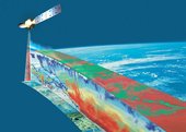
Earth observation satellite data are crucial for generating accurate weather predictions. They provide a global picture of the current state of the atmosphere, which is used as the starting point for creating a forecast. But our knowledge of that current state is limited, partly because satellites have so far not been able to collect much information about clouds, which play a key role in the weather. The ESA/JAXA future mission EarthCARE will provide this information to improve our predictions about the future weather and climate.
EarthCARE mission to improve weather forecasts
12.2.2019 16:01 ESA Observing the EarthEarth observation satellite data are crucial for generating accurate weather predictions. They provide a global picture of the current state of the atmosphere, which is used as the starting point for creating a forecast. But our knowledge of that current state is limited, partly because satellites have so far not been able to collect much information about clouds, which play a key role in the weather. The ESA/JAXA future mission EarthCARE will provide this information to improve our predictions about the future weather and climate.
Drive, Park, Ride: Moovit and TomTom Align With Microsoft to Introduce World’s First Truly Comprehensive Multi-Modal Trip Planner
12.2.2019 15:20 GISCafe.com Webcasts-Webinars LONDON — (BUSINESS WIRE) — February 12, 2019 —Some of the world’s top urban mobility leaders today unveiled the
…
AeroVironment Introduces Next Generation of Quantix Drone and AV DSS with New Product Updates, FMS Integration, Plant Count Beta Trial and Custom-tailored Pricing Packages for Growers to Ag Service Providers
12.2.2019 15:20 GISCafe.com Webcasts-Webinars Next generation of Quantix™ and AV Decision Support System™ (AV DSS)delivers performance improvements that optimize the user experience …
CoreLogic Reports U.S. Overall Delinquency and Foreclosure Rates Are Lowest for November Since at Least 2000
12.2.2019 15:20 GISCafe.com Webcasts-Webinars Delinquency rates rose year over year in some areas throughoutCalifornia and the Southeast due to natural disasters
…
Kratos Ballistic Missile Target Supports Test of the AN/SPY-6(V)1 Advanced Missile Defense Radar
12.2.2019 15:20 GISCafe.com Webcasts-Webinars SAN DIEGO, Feb. 12, 2019 (GLOBE NEWSWIRE) -- Kratos Defense & Security Solutions, Inc.(NASDAQ:KTOS), a leading National Security Solutions …Latest batch of Galileo satellites enters service
12.2.2019 14:54 European GNSS Agency
The latest batch of four Galileo satellites - GSAT0219, GSAT0220, GSAT0221, and GSAT0222 - has been commissioned for operational use.
On 11 February 2019, the four satellites launched from the European spaceport in Kourou, French Guiana, on July 25 2018, were put into service following the completion of the relevant commissioning activities. This means that the Galileo constellation is now providing services with 22 satellites.
“This is another important milestone for Galileo and the European Union. Each satellite that is commissioned brings us closer to our full operating capacity. More satellites in operation mean better coverage and more availability, which translates into increased accuracy and better services for users,” European GNSS Agency (GSA) Executive Director Carlo des Dorides said. “The entry into service of the latest four satellites will boost Galileo service provision around the world.”
Thanks to the addition of four more satellites to the Galileo constellation, users will be able to reap the high accuracy benefits of multi-constellation capacity, but it goes further than that, according to Rodrigo da Costa, Galileo Services Programme Manager at the GSA.
“Today we finished the testing characterization of the satellites that were launched last July,” da Costa said. “The satellites are now ready to provide services to users, and with 22 satellites now in operation users will not only be able to benefit from Galileo signals in combination with other constellations, but the possibility of using Galileo as a stand-alone service also increases.”
GSA at the helm
The 10th Galileo launch was the second for which the GSA was responsible for the mission’s Early Orbit Phase (EOP) and In-Orbit Testing (IOT) phase, overseeing Spaceopal - a joint venture between Telespazio and DLR-GfR - in its role as Galileo Service Operator (GSOp).
The EOP and IOT are one of the most important phases of a space mission during which the satellite is launched, put into the correct orbit and the satellite platform and payload elements are gradually switched on and tested.
Galileo – because Accuracy Matters!
A huge number of end users stand to benefit from the improved coverage offered by the latest satellites. It is only just over two years since Galileo Initial Services were declared in December 2016, but already over 600 million devices around the world are using Galileo. To make Europeans more aware of how they are already benefitting from Galileo services, the European Union has launched the Accuracy Matters campaign.
The new campaign includes a series of short video clips that give an entertaining glimpse of everyday situations where ‘Accuracy Matters’ to anyone using location data on their smartphones. The videos can be viewed on a dedicated YouTube channel.
You can keep track of Galileo-enabled devices serving a variety of needs as they become available, by checking out: usegalileo.eu
Galileo status information
To stay up to date on the status of the Galileo constellation, you can also check the Constellation Status section of European GNSS Service Centre (GSC) website. What’s more, you can register on the GSC web portal to receive Notice Advisory to Galileo Users (NAGUs) automatically and, if you have any questions about Galileo, you are invited to contact the GSC Helpdesk.
Media note: This feature can be republished without charge provided the European GNSS Agency (GSA) is acknowledged as the source at the top or the bottom of the story. You must request permission before you use any of the photographs on the site. If you republish, we would be grateful if you could link back to the GSA website (http://www.gsa.europa.eu).
Latest batch of Galileo satellites enters service
12.2.2019 14:54 European GNSS Agency
The latest batch of four Galileo satellites - GSAT0219, GSAT0220, GSAT0221, and GSAT0222 - has been commissioned for operational use.
On 11 February 2019, the four satellites launched from the European spaceport in Kourou, French Guiana, on July 25 2018, were put into service following the completion of the relevant commissioning activities. This means that the Galileo constellation is now providing services with 22 satellites.
“This is another important milestone for Galileo and the European Union. Each satellite that is commissioned brings us closer to our full operating capacity. More satellites in operation mean better coverage and more availability, which translates into increased accuracy and better services for users,” European GNSS Agency (GSA) Executive Director Carlo des Dorides said. “The entry into service of the latest four satellites will boost Galileo service provision around the world.”
Thanks to the addition of four more satellites to the Galileo constellation, users will be able to reap the high accuracy benefits of multi-constellation capacity, but it goes further than that, according to Rodrigo da Costa, Galileo Services Programme Manager at the GSA.
“Today we finished the testing characterization of the satellites that were launched last July,” da Costa said. “The satellites are now ready to provide services to users, and with 22 satellites now in operation users will not only be able to benefit from Galileo signals in combination with other constellations, but the possibility of using Galileo as a stand-alone service also increases.”
GSA at the helm
The 10th Galileo launch was the second for which the GSA was responsible for the mission’s Early Orbit Phase (EOP) and In-Orbit Testing (IOT) phase, overseeing Spaceopal - a joint venture between Telespazio and DLR-GfR - in its role as Galileo Service Operator (GSOp).
The EOP and IOT are one of the most important phases of a space mission during which the satellite is launched, put into the correct orbit and the satellite platform and payload elements are gradually switched on and tested.
Galileo – because Accuracy Matters!
A huge number of end users stand to benefit from the improved coverage offered by the latest satellites. It is only just over two years since Galileo Initial Services were declared in December 2016, but already over 600 million devices around the world are using Galileo. To make Europeans more aware of how they are already benefitting from Galileo services, the European Union has launched the Accuracy Matters campaign.
The new campaign includes a series of short video clips that give an entertaining glimpse of everyday situations where ‘Accuracy Matters’ to anyone using location data on their smartphones. The videos can be viewed on a dedicated YouTube channel.
You can keep track of Galileo-enabled devices serving a variety of needs as they become available, by checking out: usegalileo.eu
Galileo status information
To stay up to date on the status of the Galileo constellation, you can also check the Constellation Status section of European GNSS Service Centre (GSC) website. What’s more, you can register on the GSC web portal to receive Notice Advisory to Galileo Users (NAGUs) automatically and, if you have any questions about Galileo, you are invited to contact the GSC Helpdesk.
Media note: This feature can be republished without charge provided the European GNSS Agency (GSA) is acknowledged as the source at the top or the bottom of the story. You must request permission before you use any of the photographs on the site. If you republish, we would be grateful if you could link back to the GSA website (http://www.gsa.europa.eu).
Kvarteto nových družic Galileo doplnilo největší evropskou družicovou konstelaci
12.2.2019 12:52 Český Kosmický PortálNejnovější čtveřice družic Galileo dostala zelenou, takže se může přidat ke zbytku evropské navigační flotily jako plnohodnotný člen. Tím se opět zvýšila celosvětová kvalita navigační služby Galileo.
Přehled o obnovách katastrálního operátu a revizích
12.2.2019 12:38 ČÚZK /Urady/Katastralni-urady/Katastralni-urady/Katastralni-urad-pro-Pardubicky-kraj/Katastralni-pracoviste/KP-Svitavy/O-uradu/Aktuality/Prehled-o-obnovach-katastralniho-operatu-a-rev-(1)Přehled o obnovách katastrálního operátu a revizích
12.2.2019 12:38 ČÚZK - předpisy a opatření Katastrální úřad pro Pardubický kraj - Katastrální pracoviště Svitavy zveřejnil novou aktualitu: Aktuální přehled OO a revizích ve formátu PDF spolu s kontakty na příslušné pracovníky.Přehled o obnovách katastrálního operátu a revizích
12.2.2019 12:38 ČÚZK - předpisy a opatření Katastrální úřad pro Pardubický kraj - Katastrální pracoviště Svitavy zveřejnil novou aktualitu: Aktuální přehled obnov operátu a revizí ve formátu PDF spolu s kontakty na příslušné pracovníky.Přehled o obnovách katastrálního operátu a revizích
12.2.2019 12:38 ČÚZK - předpisy a opatření Katastrální úřad pro Pardubický kraj - Katastrální pracoviště Svitavy zveřejnil novou aktualitu: Aktuální přehled obnov operátu a revizí ve formátu PDF Aktuální přehled obnov operátu a revizí ve formátu PDF spolu s kontakty na příslušné pracovníky.Přehled o obnovách katastrálního operátu a revizích
12.2.2019 12:38 ČÚZK - předpisy a opatření Český úřad zeměměřický a katastrální - Katastrální pracoviště Svitavy zveřejnil novou aktualitu: Aktuální přehled OO a revizích ve formátu PDF spolu s kontakty na příslušné pracovníky.Loving big
12.2.2019 9:50 ESA Observing the Earth
Since it’s Valentine’s Day soon, we’re all feeling romantic and so we bring you this image of a heart-shaped lake in Argentina – and like all love, it’s special.
Loving big
12.2.2019 9:50 ESA Observing the EarthSince it’s Valentine’s Day soon, we’re all feeling romantic and so we bring you this image of a heart-shaped lake in Argentina – and like all love, it’s special.
Oddělení geoinformatiky – Ministerstvo vnitra – nabídka zaměstnání
12.2.2019 9:29 https://www.mvcr.cz/clanek/vyberove-rizeni-na-sluzebni-misto-vrchniho-ministerskeho-rady-v-oddeleni-geoinformatiky-id-30355645-765302.aspx https://www.mvcr.cz/clanek/vyberove-rizeni-na-sluzebni-misto-ministerskeho-rady-v-oddeleni-geoinformatiky-id-30355683-43095.aspx https://www.mvcr.cz/clanek/oeg-vyberove-rizeni-na-sluzebni-misto-vrchniho-ministerskeho-rady-v-oddeleni-geoinformatiky-id-30252924.aspxOnline studium webových map, geovizualizací a D3.js
12.2.2019 9:26 Katedra geoinformatiky UP OlomoucUniversity of Kentucky nabízí zajímavé online studijní programy Digital Mapping a Master of Science. Programy jsou určeny pro studenty, který se chtějí neustále zlepšovat svoje teoretické a hlavně praktické znalosti z oblasti digitální kartografie. Stručný opis programů v angličtině naleznete níž nebo na uvedených webových stránkách: The University of Kentucky Department of Geography and New […]
The post Online studium webových map, geovizualizací a D3.js appeared first on Katedra geoinformatiky.
Pozvánka na seminář Družicové metody v geodézii a katastru
12.2.2019 7:00 Česká asociace pro geoinformace Ústav geodézie Fakulty stavební VUT v Brně pořádá ve čtvrtek 30. ledna 2020 23. ročník semináře s mezinárodní účastí Družicové metody v geodézii a katastru. Uzávěrka přihlášek na seminář je 22. ledna 2020. Registrujte se prostřednictvím webovéhoGeoinformatikem na Ministerstvu vnitra
12.2.2019 7:00 Česká asociace pro geoinformace Ministerstvo vnitra České republiky vypisuje hned několik výběrových řízení na služební místa v oddělení geoinformatiky. Pokud vás zajímá zaměstnání ve státní správě, neváhejte navštívit pro více informací webové stránky MVKartografický den Olomouc 2020 - první informace
12.2.2019 7:00 Česká asociace pro geoinformaceKartografický den Olomouc 2020 - první informace
Tradičně poslední únorový pátek (28. února) se v Olomouci v budově Přírodovědecké fakulty Univerzity Palackého koná již 14. Kartografický den, tentokrát na téma Kartografie a sport.
Více informací již brzy na webových stránkách akce.
Tradičně poslední únorový pátek (28. února) se v Olomouci v budově
ProStar Geocorp Strengthens Its Management Team with Vasa Dasan
12.2.2019 1:17 GISCafe.com Webcasts-Webinars GRAND JUNCTION, Colo. — (BUSINESS WIRE) — February 11, 2019 — Doxa Energy Ltd (“Doxa” or the “Company”) and …Paleontologické kolekce (sbírky ČGS)
12.2.2019 1:00 Cenia - Katalog metadat ČR - INSPIRE Databáze představuje registr unikátních paleontologických kolekcí ČGS včetně typového a originálního materiálu. Starší kolekce jsou postupně převáděny do evidence CES Ministerstva kultury ČR, nový materiál je spravován již pouze ve smyslu zákona 122/2000 Sb. a následných předpisů. V databázi jsou průběžně evidovány přírůstky, a je do ní převáděna i kartotéka paleontologických kolekcí, která je přístupná v pracovně oddělení sbírek.Výbrusová dokumentace (sbírky ČGS) - krabice s výbrusy
12.2.2019 1:00 Cenia - Katalog metadat ČR - INSPIRE Databáze zahrnuje soupis kolekcí (krabic) petrografických výbrusů uložených v ČGS a nově i jednotlivých skel, příp. výčtu horninotvorných minerálů. Jedná se výbrusy pocházející z geologického mapování, regionálních a speciálních výzkumů ČGS od 30. let.Hluková mapa automobilové dopravy - den
12.2.2019 1:00 Cenia - Katalog metadat ČR - INSPIRE Výpočtová hluková mapa automobilové dopravy v Praze pro denní a noční dobu- deskriptor LdHluková pásma po 5 dB.Hodnota DB_LO udává dolní hranici intervalu, hodnota DB_HI udává horní hranici intervalu.Stav 2010Výbrusová dokumentace (sbírky ČGS) - skla
12.2.2019 1:00 Cenia - Katalog metadat ČR - INSPIRE Databáze jednotlivých skel výbrusů uložených v ČGS, příp. výčtu horninotvorných minerálů. Jedná se výbrusy pocházející z geologického mapování, regionálních a speciálních výzkumů ČGÚ od 30. let.Hluková mapa automobilové dopravy - noc
12.2.2019 1:00 Cenia - Katalog metadat ČR - INSPIRE Výpočtová hluková mapa automobilové dopravy v Praze pro denní a noční dobu- deskriptor LnHluková pásma po 5 dB.Hodnota DB_LO udává dolní hranici intervalu, hodnota DB_HI udává horní hranici intervalu.Stav 2010LAREM (laboratoře rentgenové mikroanalýzy), Praha - rezervace analytických a servisních prací
12.2.2019 1:00 Cenia - Katalog metadat ČR - INSPIRE Databáze rezervace termínů analytických a servisních prací na rastrovacím elektronovém mikroskopu CamScan 3200 a EDS a WDS mikroanalytickém systému Laboratoře rentgenové mikroanalýzy (LAREM).Dokumentační vzorky ke geologickým mapám (sbírky ČGS)
12.2.2019 1:00 Cenia - Katalog metadat ČR - INSPIRE Databáze představuje registr hmotné dokumentace, tj. kusových vzorků (kromě vrtů), uložené v bednách ve skladu ČGS v Lužné. Tento registr bude postupně rozšířen o seznam kusových vzorků archivovaných v Brně a v Jeseníku. Jedná se o dokladové vzorky ke geologickému mapování, ložiskovým, geochemickým, mineralogickým a speciálním výzkumům.Geologicko-mineralogická kolekce (sbírky ČGS)
12.2.2019 1:00 Cenia - Katalog metadat ČR - INSPIRE Databáze zahrnuje registr v České republice jedinečných, regionálně-geologicky zaměřených kolekcí, uložených v České geologické službě. Ty sestávají ze vzorků mineralogických (často velmi cenných) i geologických (vzorky hornin, často z již dnes zaniklých lokalit). V minulosti byla část předána na VŠB Ostrava k didaktickým účelům. Nejcennější součástí je Šafránkova kolekce převážně příbramských rudních a kladenských rudních a sekundárních minerálů, dále i kolekce vltavínů (Žebera, Krejčí, Hrabě aj.). Kolekce slouží hlavně jako srovnávací studijní materiál z České republiky, v menší míře obsahují i zahraniční materiál, pocházející zejména ze studijních cest pracovníků ČGS.Mapovací a dokumentační vrty ČGS (v procesu reskartace)
12.2.2019 1:00 Cenia - Katalog metadat ČR - INSPIRE Databáze představuje registr vrtů uložených ve skladech hmotné dokumentace ČGS a dílčí databázi vrtů předaných Geofondu. Vrtná jádra jsou uložena v bednách v depozitáři ČGS v Lužné u Rakovníka. V současné době je veškerý materiál reskartován pracovníky odboru Geofond (dr. Alan Donát) a zařazován do systému Vrtné hmotné dokumentace Geofond, tudíž je dočasně nepřístupný ke studiu.EagleView Secures Significant Court Wins In Ongoing Patent Litigation Against Xactware And Verisk
12.2.2019 0:04 GISCafe.com Webcasts-Webinars BELLEVUE, Wash., Feb. 11, 2019 — (PRNewswire) — EagleView®, a leading technology provider of aerial imagery and data …EagleView Secures Significant Court Wins In Ongoing Patent Litigation Against Xactware And Verisk
12.2.2019 0:04 GISCafe.com Webcasts-Webinars BELLEVUE, Wash., Feb. 11, 2019 — (PRNewswire) — EagleView®, a leading technology provider of aerial imagery and data analytics, …Dstillery Awarded Patent for Determining Geodata Authenticity
11.2.2019 20:39 GISCafe.com Webcasts-Webinars NEW YORK, Feb. 11, 2019 (GLOBE NEWSWIRE) -- Dstillery, the leading applied data science company serving the marketing & advertising industry, …Kratos Receives $14 Million in Unmanned Aerial Drone System Contract Awards
11.2.2019 15:53 GISCafe.com Webcasts-Webinars SAN DIEGO, Feb. 11, 2019 (GLOBE NEWSWIRE) -- Kratos Defense & Security Solutions, Inc. (Nasdaq: KTOS), a leading National Security Solutions …Esri Demonstrates at HIMSS Conference How Location Intelligence Helps Grow Healthier Communities
11.2.2019 15:53 GISCafe.com Webcasts-Webinars Esri Customer Providence St. Joseph Health Showcases How EsriTechnology Can Improve Community Health Status across the Health
System's …
Bentley Systems Announces Acquisition of SignCAD Systems, Leading Provider of Traffic Sign Design Software
11.2.2019 15:11 Bentley SystemsSign design solutions augment Bentley’s software portfolio to enable greater detail for
digital twins of transportation assets
EXTON, Pa. – Bentley Systems, Incorporated, the leading global provider of comprehensive software solutions for advancing the design, construction, and operations of infrastructure, today announced the acquisition of leading provider of software for traffic sign design and manufacturing, SignCAD Systems, based in Minneapolis, Minnesota. SignCAD provides sign design solutions to 43 state departments of transportation (DOTs) in the U.S., as well as many cities, counties, engineering firms, and manufacturers. SignCAD’s sign design capabilities complement Bentley’s OpenRoads civil design software offerings for roadway projects.
SignCAD’s offerings for traffic signs include sign design, sign manufacturing, and asset management software solutions. The acquisition builds upon Bentley’s ability to provide the most comprehensive set of solutions for design and construction of transportation assets. It will also allow Bentley to better serve roadway asset owners for the purposes of maintaining safer construction work zones while sustaining roadway performance criteria for the public.
Dustin Parkman, vice president, civil infrastructure design engineering for Bentley Systems, said, “For the past five years, we have been working diligently on increasing the level of detail that can be modeled and simulated within the OpenRoads environment. With the addition of SignCAD, 3D modeling of signs within the context of our roadway designs allows us to provide a higher fidelity representation of roadway assets, yielding benefits beyond design and construction workflows.
“In this new era of autonomous vehicles, the digital representation of roadway networks is quickly becoming just as vital as the physical roadway,” Parkman continued. “Faded or obscured signs and unusual intersections are commonplace throughout most of world’s roadway networks, presenting new and interesting challenges for roadway owners—challenges that often cannot be met by physical upgrades alone. To bridge that gap, we need a digital representation of roadway assets often referred to as a ‘digital twin.’ Roadway signs provide important information about the road network that can be leveraged far beyond conventional line of site machine learning methods, to provide additional depth of information and calibration. With the addition of SignCAD, Bentley’s digital twin for roadway assets will provide this valuable data to roadway asset owners.”
Judd Roby, president of SignCAD, said, “We are extremely excited about adding SignCAD into the realm of 3D modeling with OpenRoads. This acquisition supports our goals of continuing to meet the transportation owner/operators’ needs across the design, build, operate, and maintain lifecycle.”
Learn more at signcad.com.
About SignCAD
Founded in 1994, SignCAD Systems, Inc. is the leading provider of CAD/CAM software solutions for traffic sign design and manufacturing for the transportation industry. Its SignCAD®, SignTRACK®, and ConeZONE® applications are used by cities, counties, engineering firms, manufacturers and state DOTs. More about SignCAD.
Caption and Image:
SignCAD traffic sign design software is used by 43 state departments of transportation in the U.S.
Bentley, the Bentley logo, AssetWise, MicroStation, OpenRoads, ProjectWise, SignCAD, SignTRACK, and ConeZONE are either registered or unregistered trademarks or service marks of Bentley Systems, Incorporated or one of its direct or indirect wholly owned subsidiaries. All other brands and product names are trademarks of their respective owners.
Media Alert – Alta Devices: How Can Innovative Solar Technology Improve the Capabilities of High Altitude Pseudo Satellites (HAPS)?
11.2.2019 14:55 GISCafe.com Webcasts-Webinars LEIDEN, Netherlands — (BUSINESS WIRE) — February 10, 2019 —Alta Devices:
…
Taking Aeolus to the next level
11.2.2019 13:28 ESA Observing the Earth
Since ESA’s Aeolus satellite was launched in August, engineers and scientists have been carefully checking the information that this pioneering mission is delivering on the world’s winds – and now it’s time for the next phase.
Pojďme využít ISS
11.2.2019 12:27 Česká kosmická kancelář
Evropská kosmická agentura vyhlásila několik výzev na vědecké využívání Mezinárodní kosmické stanice ISS zaměřené na materiálový výzkum a studium vlivu prostředí kosmického letu na lidský organizmus. Výzvy jsou jedinečnou příležitostí pro zapojení českých vědeckých institucí do prestižního evropského kosmického výzkumu.