


![]()

zprávy
zdroje zpráv:Huawei leads the way with Galileo
27.3.2017 9:41 European GNSS Agency
Huawei’s New P10 and P10 Plus smartphones support Galileo, providing users with more precise positioning.
Huawei, the world’s third largest smartphone vendor, recently announced that its newest flagship smartphones are Galileo-enabled. This includes the company’s newly-launched P10 and P10 plus models, as well as its Mate 9, Mate 9 pro and Porsche Design Mate 9 smartphones. The Huawei phones are equipped with Broadcom Limited’s Galileo-enabled BCM4774 GNSS chipset.
“Our investment in providing people with a better location experience is another example of our commitment to delivering meaningful innovation,” says Huawei Head of Handset Portfolio and Planning, Europe, Arne Herkelmann. “With our Mate 9 and P10 families, all being Galileo-enabled, we ensure our customers have the most connected device no matter where they are.”
“We are excited to see our leading edge GNSS receiver chip, the BCM4774, which supports Galileo, being utilized in flagship smartphones from Huawei,” adds Broadcom Limited Senior Vice President and General Manager of Mobile Connectivity Products Division Michael Hurlston. “With the experience from our early work on BOC-modulated signals and its performance benefit for mass market devices, we anticipate Galileo support will soon become a de facto standard in smartphones and tablets and enrich the end-user experience of location-based services (LBS).”
As the new Huawei phones use the Android Operating System 7.0, called Nougat, application developers also have access to raw GNSS measurements directly from their Huawei phones. This feature opens up the possibility for higher accuracy and the deployment of algorithms traditionally restricted to more advanced GNSS receivers.
Multi-constellation access in the palm of your hand
In addition to Galileo, all of these phones support GPS, GLONASS and BeiDou, making Huawei one of the very first companies to take full advantage of today’s multi-constellation environment. Galileo is fully interoperable/compatible with these other GNSS systems, a combination that provides users with such improvements as stronger performance and service levels. With Galileo satellites working in conjunction with these other systems, there are more satellites available, meaning more accurate and reliable positioning for users. In particular, navigation in cities, where satellite signals can often be blocked by tall buildings, benefit from the increased positioning accuracy this provides.
Also read: The shift towards a multi-constellation environment
“We are very proud to see global handset vendors using Galileo so soon after the Declaration of Galileo Initial Services,” says GSA Executive Director Carlo des Dorides. “Today, with the booming use of context-aware applications, precise location information will be an increasingly important feature of smartphones, alongside camera and screen size.”
Des Dorides notes that the quick uptake of Galileo by major smartphone providers is important as LBS is the future of GNSS. According to the most recent edition of the GSA’s GNSS Market Report, well over 3 billion mobile applications in use today rely on positioning information. By 2020, more than 2 billion GNSS-enabled devices within the LBS sector will be shipped every year, and up to more than 2.5 billion units by 2023. By then, the overall installed base of GNSS devices will reach almost 9 billion units.
Industry collaboration pays off
It is because of the continued collaboration between the GSA and the smartphone and chipset sector that Galileo arrived onto a market ready and able to immediately start using it. In addition to Huwaei, such smartphone vendors as BQ and Sony also provide Galileo-enabled phones. More and more companies are being added every week, and an up-to-date listing of all available Galileo compatible products can be found at www.useGalileo.eu.
Read this: Use Galileo!
To further increase the level of Galileo integration, the GSA continues to work directly with device, chipset and receiver manufacturers. Through technology workshops, sharing Galileo updates, co-marketing efforts, and dedicated funding for receiver development projects and studies, the GSA is working with manufacturers to build an even better navigation experience. You can learn more about all of these opportunities here.
Media note: This feature can be republished without charge provided the European GNSS Agency (GSA) is acknowledged as the source at the top or the bottom of the story. You must request permission before you use any of the photographs on the site. If you republish, we would be grateful if you could link back to the GSA website (http://www.gsa.europa.eu).
Nefunkční telefonické spojení na Katastrální pracoviště Svitavy
27.3.2017 7:42 ČÚZK /Urady/Katastralni-urady/Katastralni-urady/Katastralni-urad-pro-Pardubicky-kraj/Katastralni-pracoviste/KP-Svitavy/O-uradu/Aktuality/Nefunkcni-telefonicke-spojeni-na-Katastralni-pracoNefunkční telefonické spojení na Katastrální pracoviště Svitavy
27.3.2017 7:42 ČÚZK - předpisy a opatřeníNefunkční telefonické spojení na Katastrální pracoviště Svitavy
Kdo vyhrál poslední 10. ročník soutě Společné zařízení roku?
25.3.2017 22:34 Zeměměřič Dne 23. března 2017 se v prostorách Senátu Parlamentu ČR uskutečnilo vyhláení výsledků 10. ročníku soutěe Společné zařízení roku.52. GIDy ve fotografiích
25.3.2017 9:13 Spolek zeměměřičů Brno “ order_by=“sortorder“ order_direction=“ASC“ returns=“included“ maximum_entity_count=“500″]CryoSat reveals Antarctica in 3D
24.3.2017 22:43 ESA Observing the Earth
Around 250 million measurements taken by ESA’s CryoSat over the last six years have been used to create a unique 3D view of Antarctica, offering a snapshot of the undulating surface of this vast ice sheet.
Keystone Engineering’s Innovative Design Delivers the First Commercial Offshore Wind Farm in U.S.
24.3.2017 16:38 Bentley SystemsPress Coverage
Process and Plant Engineering
Read the articleKeystone Engineering’s Innovative Design Delivers the First Commercial Offshore Wind Farm in U.S.
24.3.2017 16:38 Bentley SystemsPress Coverage
Process and Plant Engineering
Read the articleKeystone Engineering’s Innovative Design Delivers the First Commercial Offshore Wind Farm in U.S.
24.3.2017 16:38 Bentley SystemsPress Coverage
Process and Plant Engineering
Read the articleKeystone Engineering’s Innovative Design Delivers the First Commercial Offshore Wind Farm in U.S.
24.3.2017 16:38 Bentley SystemsPress Coverage
Process and Plant Engineering
Read the articleLaunch of BIM Academy: MAHA Metro Rail Corporation, Ltd.
24.3.2017 16:36 Bentley SystemsPress Coverage
Read the Article
Read the articleLaunch of BIM Academy: MAHA Metro Rail Corporation, Ltd.
24.3.2017 16:36 Bentley SystemsPress Coverage
Read the Article
Read the articleLaunch of BIM Academy: MAHA Metro Rail Corporation, Ltd.
24.3.2017 16:36 Bentley SystemsPress Coverage
Read the Article
Read the articleLaunch of BIM Academy: MAHA Metro Rail Corporation, Ltd.
24.3.2017 16:36 Bentley SystemsPress Coverage
Read the Article
Read the articleMaha metro, Bentley opens a new BIM academy in Nagpur
24.3.2017 16:34 Bentley SystemsPress Coverage
ACE Update
Read the articleMaha metro, Bentley opens a new BIM academy in Nagpur
24.3.2017 16:34 Bentley SystemsPress Coverage
ACE Update
Read the articleMaha metro, Bentley opens a new BIM academy in Nagpur
24.3.2017 16:34 Bentley SystemsPress Coverage
ACE Update
Read the articleMaha metro, Bentley opens a new BIM academy in Nagpur
24.3.2017 16:34 Bentley SystemsPress Coverage
ACE Update
Read the articleONGC extends life of offshore assets with Bentley SACS
24.3.2017 16:29 Bentley SystemsPress Coverage
Oil Review ME
Read the articleONGC extends life of offshore assets with Bentley SACS
24.3.2017 16:29 Bentley SystemsPress Coverage
Oil Review ME
Read the articleONGC extends life of offshore assets with Bentley SACS
24.3.2017 16:29 Bentley SystemsPress Coverage
Oil Review ME
Read the articleONGC extends life of offshore assets with Bentley SACS
24.3.2017 16:29 Bentley SystemsPress Coverage
Oil Review ME
Read the articleThe benefits of construction in the cloud
24.3.2017 16:27 Bentley SystemsPress Coverage
Big Project ME
Read the articleThe benefits of construction in the cloud
24.3.2017 16:27 Bentley SystemsPress Coverage
Big Project ME
Read the articleThe benefits of construction in the cloud
24.3.2017 16:27 Bentley SystemsPress Coverage
Big Project ME
Read the articleThe benefits of construction in the cloud
24.3.2017 16:27 Bentley SystemsPress Coverage
Big Project ME
Read the articleGet Yourself Connected
24.3.2017 16:19 Bentley SystemsPress Coverage
Plant Services
Read the articleGet Yourself Connected
24.3.2017 16:19 Bentley SystemsPress Coverage
Plant Services
Read the articleGet Yourself Connected
24.3.2017 16:19 Bentley SystemsPress Coverage
Plant Services
Read the articleGet Yourself Connected
24.3.2017 16:19 Bentley SystemsPress Coverage
Plant Services
Read the articleCondition Monitoring Via Video
24.3.2017 16:17 Bentley SystemsPress Coverage
Plant Services, USA
Read the articleCondition Monitoring Via Video
24.3.2017 16:17 Bentley SystemsPress Coverage
Plant Services, USA
Read the articleCondition Monitoring Via Video
24.3.2017 16:17 Bentley SystemsPress Coverage
Plant Services, USA
Read the articleCondition Monitoring Via Video
24.3.2017 16:17 Bentley SystemsPress Coverage
Plant Services, USA
Read the articleNEWS: Bentley Systems issues call for submissions to 2017 awards
24.3.2017 16:15 Bentley SystemsPress Coverage
AEC Magazine
Read the articleNEWS: Topcon bundles reality modelling software with UAS
24.3.2017 16:12 Bentley SystemsPress Coverage
AEC Magazine
Read the articleSpecial report part #2: Why more women should work in rail... and why they don't at the moment
24.3.2017 16:08 Bentley SystemsPress Coverage
Smart Rail World
Read the articleSpecial report part #2: Why more women should work in rail... and why they don't at the moment
24.3.2017 16:08 Bentley SystemsPress Coverage
Smart Rail World
Read the articleSpecial Report Part #1: Why are Less than a Quarter of Rail Employees Women
24.3.2017 16:05 Bentley SystemsPress Coverage
Smart Rail World
Read the articleBentley Systems participation at ME Rail 2017
24.3.2017 16:03 Bentley SystemsPress Coverage
Jordan TV Today
Read the article#Waterchat: What is a Smart City?
24.3.2017 16:00 Bentley SystemsPress Coverage
Water and Wastewater International
Read the articleImproving land cover mapping with Sentinel-2
24.3.2017 15:04 ESA Observing the Earth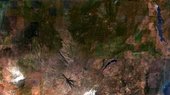
With the pair of Sentinel-2 satellites now in orbit, users are looking ahead to mapping global land cover at 10 m resolution.
Plasma jets
24.3.2017 14:39 ESA Observing the Earth
New findings from ESA’s magnetic field Swarm mission were the highlight of ESA’s science conference in Canada
Oznámení o vyhlášení výběrového řízení na služební místo Rada/odborný rada oddělení právních vztahů
24.3.2017 13:23 ČÚZK /Urady/Katastralni-urady/Katastralni-urady/Katastralni-urad-pro-Stredocesky-kraj/Katastralni-pracoviste/KP-Slany/O-uradu/Aktuality/Oznameni-o-vyhlaseni-vyberoveho-rizeni-na-sluzebniOznámení o vyhlášení výběrového řízení na služební místo Rada/odborný rada oddělení právních vztahů
24.3.2017 13:23 ČÚZK - předpisy a opatřeníOznámení o vyhlášení výběrového řízení na služební místo "Rada/odborný rada oddělení prvních vztahů k nemovitostem Katastrálního pracoviště Slaný
Oznámení o vyhlášení výběrového řízení na služební místo Rada/odborný rada oddělení právních vztahů
24.3.2017 13:23 ČÚZK - předpisy a opatření Oznámení o vyhlášení výběrového řízení na služební místo "Rada/odborný rada oddělení prvních vztahů k nemovitostem Katastrálního pracoviště SlanýPRÁVNÍKA - REFERENTA ODDĚLENÍ PRÁVNÍCH VZTAHŮ, zástup na dobu určitou za mateřskou/rodičovskou dovo
24.3.2017 12:47 ČÚZK /Urady/Katastralni-urady/Katastralni-urady/Katastralni-urad-pro-Plzensky-kraj/Volna-mista/PRAVNIKA-REFERENTA-ODDELENI-PRAVNICH-VZTAHU,-zastuPRÁVNÍKA - REFERENTA ODDĚLENÍ PRÁVNÍCH VZTAHŮ, zástup na dobu určitou za mateřskou/rodičovskou dovo
24.3.2017 12:47 ČÚZK - volná místa Katastrální úřad pro Plzeňský kraj, Katastrální pracoviště Plzeň-město vypisuje výběrové řízení na místo PRÁVNÍKA - REFERENTA ODDĚLENÍ PRÁVNÍCH VZTAHŮ, zástup na dobu určitou za mateřskou/rodičovskou dovoPRÁVNÍKA - REFERENTA ODDĚLENÍ PRÁVNÍCH VZTAHŮ, zástup na dobu určitou za mateřskou/rodičovskou dovo
24.3.2017 12:47 ČÚZK - předpisy a opatření Katastrální úřad pro Plzeňský kraj Katastrální pracoviště Plzeň-městovypisuje výběrové řízení na místo
PRÁVNÍKA - REFERENTA ODDĚLENÍ PRÁVNÍCH VZTAHŮ, zástup na dobu určitou za mateřskou/rodičovskou dovolenou
20170324 - Rada/odborný rada právního oddělení
24.3.2017 12:33 ČÚZK /Urady/Katastralni-urady/Katastralni-urady/Katastralni-urad-pro-Stredocesky-kraj/Katastralni-pracoviste/KP-Praha-vychod/O-uradu/Aktuality/20152509-Oznameni-na-reditele-PZ-(4)20170324 - Rada/odborný rada právního oddělení
24.3.2017 12:33 ČÚZK - předpisy a opatření Na úřední elektronické desce Katastrálního úřadu pro Středočeský kraj, v sekci "Oznámení a jiná úřední sdělení"bylo vystaveno "Oznámení o vyhlášení výběrového řízení na služební místo Rada/odborný rada právního oddělení pro Katastrální pracoviště Praha-východ"Rada/odborný rada právního oddělení
24.3.2017 12:32 ČÚZK - volná místa Katastrální úřad pro Středočeský kraj, Katastrální pracoviště Praha-východ vypisuje výběrové řízení na místo Rada/odborný rada právního odděleníRada/odborný rada právního oddělení
24.3.2017 12:32 ČÚZK /Urady/Katastralni-urady/Katastralni-urady/Katastralni-urad-pro-Stredocesky-kraj/Uredni-deska/Oznameni-a-jina-uredni-sdeleni/Volna-mista/Rada-odborny-rada-pravniho-oddeleniRada/odborný rada právního oddělení
24.3.2017 12:32 ČÚZK - předpisy a opatření Katastrální úřad pro Středočeský kraj Katastrální pracoviště Praha-východvypisuje výběrové řízení na místo Rada/odborný rada právního oddělení
Rada/odborný rada právního oddělení
20170324-Rada/odborný rada oddělení právních vztahů k nemovitostem
24.3.2017 12:18 ČÚZK - předpisy a opatření Na úřední elektronické desce Katastrálního úřadu pro Středočeský kraj, v sekci "Oznámení a jiná úřední sdělení" bylo vystaveno "Oznámení o vyhlášení výběrového řízení na služební místo Rada/odborný rada oddělení právních vztahů k nemovitostem pro Katastrální pracoviště Slaný"20170324-Rada/odborný rada oddělení právních vztahů k nemovitostem
24.3.2017 12:18 ČÚZK /Urady/Katastralni-urady/Katastralni-urady/Katastralni-urad-pro-Stredocesky-kraj/Katastralni-pracoviste/KP-Slany/O-uradu/Aktuality/20140318-Geodet-Melnik-(3)Rada/odborný rada oddělení právních vztahů k nemovitostem (1)
24.3.2017 12:14 ČÚZK - volná místa Katastrální úřad pro Středočeský kraj, Katastrální pracoviště Slaný vypisuje výběrové řízení na místo Rada/odborný rada oddělení právních vztahů k nemovitostem (1)Rada/odborný rada oddělení právních vztahů k nemovitostem (1)
24.3.2017 12:14 ČÚZK - předpisy a opatření Katastrální úřad pro Středočeský kraj Katastrální pracoviště Slanývypisuje výběrové řízení na místo Rada/odborný rada oddělení právních vztahů k nemovitostem
Rada/odborný rada oddělení právních vztahů k nemovitostem
Rada/odborný rada oddělení právních vztahů k nemovitostem (1)
24.3.2017 12:14 ČÚZK /Urady/Katastralni-urady/Katastralni-urady/Katastralni-urad-pro-Stredocesky-kraj/Uredni-deska/Oznameni-a-jina-uredni-sdeleni/Volna-mista/Rada-odborny-rada-oddeleni-pravnich-vztahu-k-n-(1)Kterak přežít lunární noc
24.3.2017 11:13 Český Kosmický PortálPlánovači budoucích lunárních misí a základen se budou muset vypořádat se skutečně mrazivou výzvou: jak to udělat, aby jejich výtvory bez úhony přečkaly dvoutýdenní noc na Měsíci? ESA zná odpověď a přináší nízkonákladové řešení tohoto problému.
Ondřej Tomas: CleverMaps pomáhá zemědělcům, bankéřům i maloobchodním řetězcům
24.3.2017 11:07Rozhovor s Ondřejem Tomasem o využití dat pro chytré mapy, čemu se CleverMaps momentálně věnuje a co chystá do budoucna.
Společnost CleverMaps v současné době pracuje pro firmy jako Česká spořitelna, ČEZ, Teta drogerie, Ředitelství silnic a dálnic nebo zemědělské farmy a velké vlastníky půdy. V dubnu uvede na trh nový agroevidenční software a ve druhém pololetí se soustředí na nové zahraniční trhy, především na Velkou Británii a Německo.
Celý článek je k dispozici zde.
20170324-Rada/odborný rada oddělení právních vztahů k nemovitostem
24.3.2017 10:20 ČÚZK - předpisy a opatření Na úřední elektronické desce Katastrálního úřadu pro Středočeský kraj, v sekci "Oznámení a jiná úřední sdělení" bylo vystaveno "Oznámení o vyhlášení výběrového řízení na služební místo Rada/odborný rada oddělení právních vztahů k nemovitostem pro Katastrálním pracovišti Mělník"20170324-Rada/odborný rada oddělení právních vztahů k nemovitostem
24.3.2017 10:20 ČÚZK /Urady/Katastralni-urady/Katastralni-urady/Katastralni-urad-pro-Stredocesky-kraj/Katastralni-pracoviste/KP-Melnik/O-uradu/Aktuality/20140318-Geodet-Melnik-(3)Rada/odborný rada oddělení právních vztahů k nemovitostem
24.3.2017 10:17 ČÚZK - předpisy a opatření Katastrální úřad pro Středočeský kraj Katastrální pracoviště Mělníkvypisuje výběrové řízení na místo Rada/odborný rada oddělení právních vztahů k nemovitostem
Rada/odborný rada oddělení právních vztahů k nemovitostem
Rada/odborný rada oddělení právních vztahů k nemovitostem
24.3.2017 10:17 ČÚZK /Urady/Katastralni-urady/Katastralni-urady/Katastralni-urad-pro-Stredocesky-kraj/Uredni-deska/Oznameni-a-jina-uredni-sdeleni/Volna-mista/Rada-odborny-rada-oddeleni-pravnich-vztahu-k-nemovRada/odborný rada oddělení právních vztahů k nemovitostem
24.3.2017 10:17 ČÚZK - volná místa Katastrální úřad pro Středočeský kraj, Katastrální pracoviště Mělník vypisuje výběrové řízení na místo Rada/odborný rada oddělení právních vztahů k nemovitostemRome
24.3.2017 10:05 ESA Observing the Earth
Earth observation image of the week: a Sentinel-2 image of Rome and its surroundings, also featured on the Earth from Space video programme
20170324 - inzerát - REFERENT/KA KATASTRU NEMOVITOSTÍ - KP Praha-západ
24.3.2017 9:58 ČÚZK /Urady/Katastralni-urady/Katastralni-urady/Katastralni-urad-pro-Stredocesky-kraj/Katastralni-pracoviste/KP-Praha-zapad/O-uradu/Aktuality/20151202REFERENT-KA-KATASTRU-NEMOVITOSTI-praco-(4)20170324 - inzerát - REFERENT/KA KATASTRU NEMOVITOSTÍ - KP Praha-západ
24.3.2017 9:58 ČÚZK - předpisy a opatření Na internetových stránkách Katastrálního úřadu pro Středočeský kraj, v části "Volná místa" byl vystaven inzerát na pracovní pozici "REFERENT/KA KATASTRU NEMOVITOSTÍ pro Katastrální pracoviště Praha-západ"20170324 - inzerát - REFERENT/KA KATASTRU NEMOVITOSTÍ - KP Praha-západ - PRÁVNÍK
24.3.2017 9:58 ČÚZK - předpisy a opatření Na internetových stránkách Katastrálního úřadu pro Středočeský kraj, v části "Volná místa" byl vystaven inzerát na pracovní pozici "REFERENT/KA KATASTRU NEMOVITOSTÍ - PRÁVNÍK pro Katastrální pracoviště Praha-západ"20170324 - inzerát - REFERENT/KA KATASTRU NEMOVITOSTÍ - KP Praha-západ - PRÁVNÍK
24.3.2017 9:58 ČÚZK /Urady/Katastralni-urady/Katastralni-urady/Katastralni-urad-pro-Stredocesky-kraj/Katastralni-pracoviste/KP-Praha-zapad/O-uradu/Aktuality/20151202REFERENT-KA-KATASTRU-NEMOVITOSTI-praco-(4)REFERENT/KA KATASTRU NEMOVITOSTÍ - PRÁVNÍK
24.3.2017 9:54 ČÚZK - volná místa Katastrální úřad pro Středočeský kraj, Katastrální pracoviště Praha-západ vypisuje výběrové řízení na místo REFERENT/KA KATASTRU NEMOVITOSTÍ - PRÁVNÍKREFERENT/KA KATASTRU NEMOVITOSTÍ (1)
24.3.2017 9:54 ČÚZK /Urady/Katastralni-urady/Katastralni-urady/Katastralni-urad-pro-Stredocesky-kraj/Volna-mista/REFERENT-KA-KATASTRU-NEMOVITOSTI-(1)REFERENT/KA KATASTRU NEMOVITOSTÍ - PRÁVNÍK
24.3.2017 9:54 ČÚZK /Urady/Katastralni-urady/Katastralni-urady/Katastralni-urad-pro-Stredocesky-kraj/Volna-mista/REFERENT-KA-KATASTRU-NEMOVITOSTI-(1)REFERENT/KA KATASTRU NEMOVITOSTÍ (1)
24.3.2017 9:54 ČÚZK - volná místa Katastrální úřad pro Středočeský kraj, Katastrální pracoviště Praha-západ vypisuje výběrové řízení na místo REFERENT/KA KATASTRU NEMOVITOSTÍ (1)REFERENT/KA KATASTRU NEMOVITOSTÍ - PRÁVNÍK
24.3.2017 9:54 ČÚZK - předpisy a opatření Katastrální úřad pro Středočeský kraj Katastrální pracoviště Praha-západvypisuje výběrové řízení na místo REFERENT/KA KATASTRU NEMOVITOSTÍ - PRÁVNÍK
REFERENT/KA KATASTRU NEMOVITOSTÍ - PRÁVNÍK
REFERENT/KA KATASTRU NEMOVITOSTÍ (1)
24.3.2017 9:54 ČÚZK - předpisy a opatření Katastrální úřad pro Středočeský kraj Katastrální pracoviště Praha-západvypisuje výběrové řízení na místo REFERENT/KA KATASTRU NEMOVITOSTÍ
REFERENT/KA KATASTRU NEMOVITOSTÍ
STOP-STAV Habrovany u Řehlovic
24.3.2017 9:32 ČÚZK - předpisy a opatření Vzhledem k obnově katastrálního operátu byl dne 24.3.2017 vyhlášen tzv. STOP-STAV zápisů v katastrálním území Habrovany u Řehlovic. V této závěrečné etapě obnovy katastrálního operátu nelze provádět změny v zápisech vlastnických a jiných věcných práv do tohoto operátu, tj. nelze provádět zápisy vkladem nebo záznamem. Předpokládané datum vyhlášení platnosti obnoveného operátu je 24. 4. 2017.STOP-STAV Habrovany u Řehlovic
24.3.2017 9:32 ČÚZK /Urady/Katastralni-urady/Katastralni-urady/Katastralni-urad-pro-Ustecky-kraj/Katastralni-pracoviste/KP-Usti-nad-Labem/O-uradu/Aktuality/STOP-STAV-Habrovany-u-RehlovicGalileo search and rescue service ready for green light!
24.3.2017 9:25 European GNSS Agency
The Galileo search and rescue (SAR) service is Europe‘s contribution to the international emergency beacon locating system called COSPAS-SARSAT. This essential Galileo service has the potential to dramatically reduce the time to locate and reach people in distress on sea and land. The 2017 Munich Satellite Navigation Summit saw a dedicated session that outlined the potential impact of the full Galileo SAR service on the afternoon of 15 March.
Session chair Xavier Maufroid of the European Commission welcomed participants to the first ever discussion of Galileo SAR at a Munich Summit by screening a preview of the service’s launch video. The service itself will be officially launched on 6 April 2017 – a date chosen to highlight the COSPAS-SARSAT 406 MHz signal.
He described the Galileo SAR service as the fruit of a “long-lasting collaboration with COSPAS-SARSAT” that began with the early offer from the European Commission to host COSPAS-SARSAT signal repeaters on the satellites. The SAR antennae weighed only 8 kg and consumed just 3 % of the satellite’s power. He stated that: “The SAR service represented just 1 % of total Galileo programme costs, but should result in thousands of lives being saved.”
Steven Lett, Head of COSPAS-SARSAT Secretariat based in Montreal, described the service that had helped rescue some 42 000 people since 1982. It was not a regulatory agency, but enabled the delivery of global alerts to over 200 countries and territories, whether they were members of the organisation or not. It was the only system that can independently locate a distress beacon wherever it was on Earth.

Steven Lett, Head of COSPAS-SARSAT Secretariat, talking in Munich.
The Galileo service was part of an upgrade of the COSPAS-SARSAT system, which would eventually see it hosted on three medium-earth orbit (MEO) GNSS hosts: Galileo, GLONASS and GPS. “Galileo will be the first full constellation with global SAR capability,” said Lett. “This new MEOSAR system has a larger footprint than the current low-earth orbit (LEO) system.” It also provided improved location accuracy, and the return link available on the Galileo implementation allowed a reassuring response to be sent to the person who had activated the beacon.
The Galileo SAR is operated by the French Space Agency CNES in Toulouse. Jérémie Benoist from CNES described the various components of the system and highlighted the global nature of its reach. This will be further improved when a fourth element of the Galileo SAR ground segment is established on the French island of La Reunion in the Indian Ocean to better cover the southern hemisphere. The performance of the service was already impressive. “Even though only nine Galileo satellites are fully commissioned currently, the system is performing better than its specification,” he said.
Capability proven
And the system has already proven its worth. Tore Wangsfjord is Chief of Operations at Norway’s Joint Rescue Coordination Centre and is responsible for search and rescue operations in a huge region, covering from 55 degrees north to the North Pole. Most of his operations are in response to 406 MHz beacon alerts as there are no other communication systems in the area. The northern ground segment for MEOSAR has been hosted in Spitsbergen since 2013.
“The results with Galileo have been good so far and will improve with more satellites,” he said. Wangsfjord compared a recent mission in response to a distress signal from a crashed helicopter in the far north of Norway. The distress signal from the Galileo SAR system arrived at his centre 46 minutes before the current LEO system and its position was within 100 metres of the actual crash site, while the LEO system position proved to be some 1.5 kilometres from the site.
“This is just one of several real life distress situations where MEOSAR has already shown improved accuracy and timing,” he said. “Galileo SAR will undoubtedly contribute to saving lives.”
Finally Eric Pautal from French 406 beacon manufacturer ELTA looked to the future and other potential applications for the COSPAS-SARSAT system. He reiterated that the MEO implementation gave better coverage and better accuracy, which may be appropriate to address the requirements of the new commercial airline regulations. From 2021, a new Global Aeronautical Distress Safety System (GADSS) to track and locate all international commercial air transport aircraft with a take-off mass of 27 tonnes or more will be required. “Flight location will be normally transmitted every 15 minutes,” he said, “with autonomous distress tracking triggered by abnormal events increasing flight location transmission to once per minute.” This could be yet another important opportunity for the use of Galileo SAR technology.
Media note: This feature can be republished without charge provided the European GNSS Agency (GSA) is acknowledged as the source at the top or the bottom of the story. You must request permission before you use any of the photographs on the site. If you republish, we would be grateful if you could link back to the GSA website (http://www.gsa.europa.eu).
Galileo search and rescue service ready for green light!
24.3.2017 9:25 European GNSS AgencyThe Galileo Search and Rescue (SAR) service is Europe‘s contribution to the international emergency beacon locating system called COSPAS-SARSAT. This essential Galileo service has the potential to dramatically reduce the time to locate and reach people in distress on sea and land. The 2017 Munich Satellite Navigation Summit saw a dedicated session that outlined the potential impact of the full Galileo SAR service on the afternoon of 15 March.
Session chair Xavier Maufroid of the European Commission welcomed participants to the first ever discussion of Galileo SAR at a Munich Summit by screening a preview of the service’s launch video. The service itself will be officially launched on 6 April 2017 – a date chosen to highlight the COSPAS-SARSAT 406 MHz signal.
He described the Galileo SAR service as the fruit of a “long-lasting collaboration with COSPAS-SARSAT” that began with the early offer from the European Commission to host COSPAS-SARSAT signal repeaters on the satellites. The SAR antennae weighed only 8 kg and consumed just 3 % of the satellite’s power. He stated that: “The SAR service represented just 1 % of total Galileo programme costs, but should result in thousands of lives being saved.”
Steven Lett, Head of COSPAS-SARSAT Secretariat based in Montreal, described the service that had helped rescue some 42 000 people since 1982. It was not a regulatory agency, but enabled the delivery of global alerts to over 200 countries and territories, whether they were members of the organisation or not. It was the only system that can independently locate a distress beacon wherever it was on Earth.
Steven Lett, Head of COSPAS-SARSAT Secretariat, talking in Munich.
The Galileo service was part of an upgrade of the COSPAS-SARSAT system, which would eventually see it hosted on three medium-earth orbit (MEO) GNSS hosts: Galileo, GLONASS and GPS. “Galileo will be the first full constellation with global SAR capability,” said Lett. “This new MEOSAR system has a larger footprint than the current low-earth orbit (LEO) system.” It also provided improved location accuracy, and the return link available on the Galileo implementation allowed a reassuring response to be sent to the person who had activated the beacon.
The Galileo SAR is operated by the French Space Agency CNES in Toulouse. Jérémie Benoist from CNES described the various components of the system and highlighted the global nature of its reach. This will be further improved when a fourth element of the Galileo SAR ground segment is established on the French island of La Reunion in the Indian Ocean to better cover the southern hemisphere. The performance of the service was already impressive. “Even though only nine Galileo satellites are fully commissioned currently, the system is performing better than its specification,” he said.
Capability proven
And the system has already proven its worth. Tore Wangsfjord is Chief of Operations at Norway’s Joint Rescue Coordination Centre and is responsible for search and rescue operations in a huge region, covering from 55 degrees north to the North Pole. Most of his operations are in response to 406 MHz beacon alerts as there are no other communication systems in the area. The northern ground segment for MEOSAR has been hosted in Spitsbergen since 2013.
“The results with Galileo have been good so far and will improve with more satellites,” he said. Wangsfjord compared a recent mission in response to a distress signal from a crashed helicopter in the far north of Norway. The distress signal from the Galileo SAR system arrived at his centre 46 minutes before the current LEO system and its position was within 100 metres of the actual crash site, while the LEO system position proved to be some 1.5 kilometres from the site.
“This is just one of several real life distress situations where MEOSAR has already shown improved accuracy and timing,” he said. “Galileo SAR will undoubtedly contribute to saving lives.”
Finally Eric Pautal from French 406 beacon manufacturer ELTA looked to the future and other potential applications for the COSPAS-SARSAT system. He reiterated that the MEO implementation gave better coverage and better accuracy, which may be appropriate to address the requirements of the new commercial airline regulations. From 2021, a new Global Aeronautical Distress Safety System (GADSS) to track and locate all international commercial air transport aircraft with a take-off mass of 27 tonnes or more will be required. “Flight location will be normally transmitted every 15 minutes,” he said, “with autonomous distress tracking triggered by abnormal events increasing flight location transmission to once per minute.” This could be yet another important opportunity for the use of Galileo SAR technology.
Media note: This feature can be republished without charge provided the European GNSS Agency (GSA) is acknowledged as the source at the top or the bottom of the story. You must request permission before you use any of the photographs on the site. If you republish, we would be grateful if you could link back to the GSA website (http://www.gsa.europa.eu).
Galileo search and rescue service ready for green light!
24.3.2017 9:25 European GNSS AgencyThe Galileo search and rescue (SAR) service is Europe‘s contribution to the international emergency beacon locating system called COSPAS-SARSAT. This essential Galileo service has the potential to dramatically reduce the time to locate and reach people in distress on sea and land. The 2017 Munich Satellite Navigation Summit saw a dedicated session that outlined the potential impact of the full Galileo SAR service on the afternoon of 15 March.
Session chair Xavier Maufroid of the European Commission welcomed participants to the first ever discussion of Galileo SAR at a Munich Summit by screening a preview of the service’s launch video. The service itself will be officially launched on 6 April 2017 – a date chosen to highlight the COSPAS-SARSAT 406 MHz signal.
He described the Galileo SAR service as the fruit of a “long-lasting collaboration with COSPAS-SARSAT” that began with the early offer from the European Commission to host COSPAS-SARSAT signal repeaters on the satellites. The SAR antennae weighed only 8 kg and consumed just 3 % of the satellite’s power. He stated that: “The SAR service represented just 1 % of total Galileo programme costs, but should result in thousands of lives being saved.”
Steven Lett, Head of COSPAS-SARSAT Secretariat based in Montreal, described the service that had helped rescue some 42 000 people since 1982. It was not a regulatory agency, but enabled the delivery of global alerts to over 200 countries and territories, whether they were members of the organisation or not. It was the only system that can independently locate a distress beacon wherever it was on Earth.
Steven Lett, Head of COSPAS-SARSAT Secretariat, talking in Munich.
The Galileo service was part of an upgrade of the COSPAS-SARSAT system, which would eventually see it hosted on three medium-earth orbit (MEO) GNSS hosts: Galileo, GLONASS and GPS. “Galileo will be the first full constellation with global SAR capability,” said Lett. “This new MEOSAR system has a larger footprint than the current low-earth orbit (LEO) system.” It also provided improved location accuracy, and the return link available on the Galileo implementation allowed a reassuring response to be sent to the person who had activated the beacon.
The Galileo SAR is operated by French company CNES in Toulouse. Jeremie Benoist from CNES described the various components of the system and highlighted the global nature of its reach. This will be further improved when a fourth element of the Galileo SAR ground segment is established on the French island of La Reunion in the Indian Ocean to better cover the southern hemisphere. The performance of the service was already impressive. “Even though only nine Galileo satellites are fully commissioned currently, the system is performing better than its specification,” he said.
Capability proven
And the system has already proven its worth. Tore Wangsfjord is Chief of Operations at Norway’s Joint Rescue Coordination Centre and is responsible for search and rescue operations in a huge region, covering from 55 degrees north to the North Pole. Most of his operations are in response to 406 MHz beacon alerts as there are no other communication systems in the area. The northern ground segment for MEOSAR has been hosted in Spitsbergen since 2013.
“The results with Galileo have been good so far and will improve with more satellites,” he said. Wangsfjord compared a recent mission in response to a distress signal from a crashed helicopter in the far north of Norway. The distress signal from the Galileo SAR system arrived at his centre 46 minutes before the current LEO system and its position was within 100 metres of the actual crash site, while the LEO system position proved to be some 1.5 kilometres from the site.
“This is just one of several real life distress situations where MEOSAR has already shown improved accuracy and timing,” he said. “Galileo SAR will undoubtedly contribute to saving lives.”
Finally Eric Pautal from French 406 beacon manufacturer ELTA looked to the future and other potential applications for the COSPAS-SARSAT system. He reiterated that the MEO implementation gave better coverage and better accuracy, which may be appropriate to address the requirements of the new commercial airline regulations. From 2021, a new Global Aeronautical Distress Safety System (GADSS) to track and locate all international commercial air transport aircraft with a take-off mass of 27 tonnes or more will be required. “Flight location will be normally transmitted every 15 minutes,” he said, “with autonomous distress tracking triggered by abnormal events increasing flight location transmission to once per minute.” This could be yet another important opportunity for the use of Galileo SAR technology.
Media note: This feature can be republished without charge provided the European GNSS Agency (GSA) is acknowledged as the source at the top or the bottom of the story. You must request permission before you use any of the photographs on the site. If you republish, we would be grateful if you could link back to the GSA website (http://www.gsa.europa.eu).
vrchní referent/rada – obnova katastrálního operátu Katastrálního pracoviště Frýdek-Místek, Katastrá
24.3.2017 9:18 ČÚZK - volná místa Katastrální úřad pro Moravskoslezský kraj, Katastrální pracoviště Frýdek-Místek vypisuje výběrové řízení na místo vrchní referent/rada – obnova katastrálního operátu Katastrálního pracoviště Frýdek-Místek, Katastrávrchní referent/rada – obnova katastrálního operátu Katastrálního pracoviště Frýdek-Místek, Katastrá
24.3.2017 9:18 ČÚZK /Urady/Katastralni-urady/Katastralni-urady/Katastralni-urad-pro-Moravskoslezsky-kraj/Uredni-deska/Oznameni-a-jina-uredni-sdeleni/Volna-mista/vrchni-referent-rada-–-obnova-katastralniho-op-(2)vrchní referent/rada – obnova katastrálního operátu Katastrálního pracoviště Frýdek-Místek, Katastrá
24.3.2017 9:18 ČÚZK - předpisy a opatření Katastrální úřad pro Moravskoslezský kraj Katastrální pracoviště Frýdek-Místekvrchní referent/rada – obnova katastrálního operátu Katastrálního pracoviště Frýdek-Místek
vrchní referent/rada – obnova katastrálního operátu Katastrálního pracoviště Frýdek-Místek, Katastrálního úřadu pro Moravskoslezský kraj
Satellites shed new light on earthquakes
24.3.2017 8:45 ESA Observing the Earth
Satellite radar scans of last year’s earthquake in New Zealand are changing the way we are thinking about earthquake hazards in regions where our planet’s tectonic plates meet.
HRDLIČKA podruhé v porotě GISÁČKA
24.3.2017 8:30 Hrdlička„Byl pro mě zážitek být poprvé v pozici porotce a hodnotit technickou úroveň prací spolu s prezentačními dovednostmi studentů v anglickém jazyce. Potěšili mě především soutěžící z Česka, jejichž úroveň převyšovala ostatní, což se odrazilo i na stupních vítězů. V obou sekcích (bakalářské i magisterské práce) opanovali první místa právě studenti z českých univerzit (UK v Praze a UP v Olomouci). Obě... View Article
The post HRDLIČKA podruhé v porotě GISÁČKA appeared first on HRDLIČKA spol. s r.o. - komplexní služby v oblasti geodézie.
Soutěž Společné zařízení roku zná vítěze posledního ročníku
24.3.2017 0:00 Státní pozemkový úřad Dne 23. března 2017 se v prostorách Senátu Parlamentu ČR uskutečnilo vyhlášení výsledků 10. ročníku soutěže Společné zařízení roku. Akce, kterou pořádá Státní pozemkový úřad (SPÚ) ve spolupráci s Českomoravskou komorou pro pozemkové úpravy, se v této podobě letos uskutečnila naposled. Od příštího roku soutěž ponese název „Cena krajiny“. Nový koncept bude SPÚ realizovat společně s Ministerstvem zemědělství, které celou akci bude zastřešovat, a také s dalšími subjekty.Odborný referent/vrchní referent – Oddělení dokumentace katastru nemovitostí
23.3.2017 15:16 ČÚZK - volná místa Katastrální úřad pro Karlovarský kraj, Katastrální pracoviště Cheb vypisuje výběrové řízení na místo Odborný referent/vrchní referent – Oddělení dokumentace katastru nemovitostíOdborný referent/vrchní referent – Oddělení dokumentace katastru nemovitostí
23.3.2017 15:16 ČÚZK /Urady/Katastralni-urady/Katastralni-urady/Katastralni-urad-pro-Karlovarsky-kraj/Uredni-deska/Oznameni-a-jina-uredni-sdeleni/Volna-mista/Odborny-referent-vrchni-referent-–-Oddeleni-dokumeOdborný referent/vrchní referent – Oddělení dokumentace katastru nemovitostí
23.3.2017 15:16 ČÚZK - předpisy a opatření Katastrální úřad pro Karlovarský kraj Katastrální pracoviště Chebvypisuje výběrové řízení na místo
Odborný referent/vrchní referent – Oddělení dokumentace katastru nemovitostí
20170323 - Nové kontroly v Aplikaci pro kontroly dat RÚIAN
23.3.2017 14:21 ČÚZK - předpisy a opatření V Aplikaci pro kontroly dat RÚIAN byly doplněny dvě nové kontroly: "7. Neidentifikovatelné SO" a "8. SO bez vyplněného způsobu využití".Zveřejněno 23. 3. 2017
20170323 - Nové kontroly v Aplikaci pro kontroly dat RÚIAN
23.3.2017 14:21 ČÚZK /Uvod/Produkty-a-sluzby/RUIAN/RUIAN-novinky/2016/20170323-Nove-kontroly-v-Aplikaci-pro-kontroly-dat20170323 - Nové kontroly v Aplikaci pro kontroly dat RÚIAN
23.3.2017 14:21 ČÚZK - předpisy a opatření V Aplikaci pro kontroly dat RÚIAN byly doplněny dvě nové kontroly: "7. Neidentifikovatelné SO" a "8. SO bez vyplněného způsobu využití".Zveřejněno 23. 3. 2017
20170323 - Nové kontroly v Aplikaci pro kontroly dat RÚIAN
23.3.2017 14:21 ČÚZK /Uvod/Produkty-a-sluzby/RUIAN/RUIAN-novinky/2017/20170323-Nove-kontroly-v-Aplikaci-pro-kontroly-dat20170323 - Nové kontroly v Aplikaci pro kontroly dat RÚIAN
23.3.2017 14:21 ČÚZK /Uvod/Produkty-a-sluzby/RUIAN/RUIAN-novinky/2017/20170323-Nove-kontroly-v-Aplikaci-pro-kontroly-dat20170323 - Nové kontroly v Aplikaci pro kontroly dat RÚIAN
23.3.2017 14:21 ČÚZK - předpisy a opatření V Aplikaci pro kontroly dat RÚIAN byly doplněny dvě nové kontroly: "7. Neidentifikovatelné SO" a "8. SO bez vyplněného způsobu využití".Zveřejněno 23. 3. 2017
2017
23.3.2017 13:12 ČÚZK /Urady/Zememericke-a-katastralni-inspektoraty/Zememericke-a-katastralni-inspektoraty/Zememericky-a-katastralni-inspektorat-v-Brne/Casto-hledane-informace/Poskytovani-informaci-106-1999-Sb/Zverejneni-obsahu-informaci-poskytnutych-na-za-(1)/20172017
23.3.2017 13:12 ČÚZK - předpisy a opatření Zeměměřický a katastrální inspektorát v Brnězveřejňuje obsah informace poskytnutých na žádost dle zákona č. 106/1999 Sb. za rok
2017
SAVE THE DATE: Česko-lucemburský průmyslový den ke spolupráci v oblasti kosmických aktivit, 8. června, Lucemburk
23.3.2017 12:44 Český Kosmický PortálDne 8. června 2017 se uskuteční „Česko-lucemburský průmyslový den ke spolupráci v oblasti kosmických aktivit“. Cílem průmyslového dnu bude otevřít příležitost pro hledání nových partnerů do projektů ESA, Horizontu 2020 nebo pro čistě komerční spolupráci v oblasti kosmických aktivit mezi českými a lucemburskými subjekty. Zvláštním zájem lucemburské strany je pak problematika těžby nerostných surovin ve vesmíru („Space Mining“). Případné spolupráci v dané oblasti bude v rámci průmyslového dnu věnována speciální pozornost.
Earth from Space
23.3.2017 12:20 ESA Observing the Earth
Join us Friday, 24 March, at 10:00 CET for the ‘Earth from Space’ video programme.
Mapová aplikace Zastavěné územ
23.3.2017 12:00 Jihočeský kraj Mapová aplikace Zastavěné území byla aktualizována k 23.3.2017.V datech územně analytických p
23.3.2017 12:00 Plzeňský kraj V datech územně analytických podkladů Plzeňského kraje byla provedena kompletní aktualizace dat o vodovodech a kanalizací od poskytovatele Vodárna Plzeň a.s. (http://geoportal.plzensky-kraj.cz/gs/rss?url=http%3A%2F%2Fgeoportal.plzensky-kraj.cz%2Ftw%2Fost%2Fgp%2Fuap%2Fposkytovatele%2Findex.php%3Fframe%26ID%3D119). Jedná se o aktualizaci stavu dat k lednu 2017. Data byla zároveň vložena i do Digitální technické mapy a Programu rozvoje vodovodu a kanalizací.V datech územně analytických p
23.3.2017 12:00 Plzeňský kraj V datech územně analytických podkladů Plzeňského kraje byla provedena kompletní aktualizace dat o vodovodech a kanalizací od poskytovatele Vodárna Plzeň a.s.. Jedná se o aktualizaci stavu dat k lednu 2017. Data byla zároveň vložena i do Digitální technické mapy a Programu rozvoje vodovodu a kanalizací.Mapová aplikace byla aktualiz
23.3.2017 12:00 Jihočeský kraj Mapová aplikace byla aktualizována k 23.3.2017.V datech územně analytických p
23.3.2017 12:00 Plzeňský kraj V datech územně analytických podkladů Plzeňského kraje byla provedena kompletní aktualizace dat o vodovodech a kanalizací od poskytovatele Vodárna Plzeň a.s. (http://geoportal.plzensky-kraj.cz/gs/rss?url=http%3A%2F%2Fgeoportal.plzensky-kraj.cz%2Ftw%2Fost%2Fgp%2Fuap%2Fposkytovatele%2Findex.php%3Fframe%26ID%3D10973). Jedná se o aktualizaci stavu dat k lednu 2017. Data byla zároveň vložena i do Digitální technické mapy a Programu rozvoje vodovodu a kanalizací.20170323REFERENT/KA KATASTRU NEMOVITOSTÍ -KP Mladá Boleslav
23.3.2017 11:20 ČÚZK - předpisy a opatření Na internetových stránkách Katastrálního úřadu pro Středočeský kraj, v části "Volná místa" byl vystaven inzerát na pracovní pozici "REFERENT/KA KATASTRU NEMOVITOSTÍ pro Katastrální pracoviště Mladá Boleslav"20170323REFERENT/KA KATASTRU NEMOVITOSTÍ -KP Mladá Boleslav
23.3.2017 11:20 ČÚZK /Urady/Katastralni-urady/Katastralni-urady/Katastralni-urad-pro-Stredocesky-kraj/Katastralni-pracoviste/KP-Mlada-Boleslav/O-uradu/Aktuality/20151202REFERENT-KA-KATASTRU-NEMOVITOSTI-praco-(1)REFERENT/KA KATASTRU NEMOVITOSTÍ -PRÁVNÍK
23.3.2017 11:13 ČÚZK - předpisy a opatření Katastrální úřad pro Středočeský kraj Katastrální pracoviště Mladá Boleslavvypisuje výběrové řízení na místo REFERENT/KA KATASTRU NEMOVITOSTÍ - PRÁVNÍK
REFERENT/KA KATASTRU NEMOVITOSTÍ -PRÁVNÍK
REFERENT/KA KATASTRU NEMOVITOSTÍ
23.3.2017 11:13 ČÚZK - předpisy a opatření Katastrální úřad pro Středočeský kraj Katastrální pracoviště Mladá Boleslavvypisuje výběrové řízení na místo REFERENT/KA KATASTRU NEMOVITOSTÍ
REFERENT/KA KATASTRU NEMOVITOSTÍ
REFERENT/KA KATASTRU NEMOVITOSTÍ
23.3.2017 11:13 ČÚZK - volná místa Katastrální úřad pro Středočeský kraj, Katastrální pracoviště Mladá Boleslav vypisuje výběrové řízení na místo REFERENT/KA KATASTRU NEMOVITOSTÍREFERENT/KA KATASTRU NEMOVITOSTÍ -PRÁVNÍK
23.3.2017 11:13 ČÚZK - volná místa Katastrální úřad pro Středočeský kraj, Katastrální pracoviště Mladá Boleslav vypisuje výběrové řízení na místo REFERENT/KA KATASTRU NEMOVITOSTÍ -PRÁVNÍKKolabující převis odhalil interiér komety
23.3.2017 11:11 Český Kosmický PortálVědci mise meziplanetární sondy Rosetta poprvé prokázali spojitost mezi výtryskem plynu a prachu - a kolapsem významného útesu. Při této události byl zároveň obnažený čistý ledový interiér komety.
Supersonic plasma jets discovered
23.3.2017 10:50 ESA Observing the Earth
Information from ESA’s magnetic field Swarm mission has led to the discovery of supersonic plasma jets high up in our atmosphere that can push temperatures up to almost 10 000°C.
Odborný rada v oddělení právních vztahů k nemovitostem - právník Katastrálního pracoviště Chomutov n
23.3.2017 8:45 ČÚZK - volná místa Katastrální úřad pro Ústecký kraj, Katastrální pracoviště Chomutov vypisuje výběrové řízení na místo Odborný rada v oddělení právních vztahů k nemovitostem - právník Katastrálního pracoviště Chomutov nOdborný rada v oddělení právních vztahů k nemovitostem - právník Katastrálního pracoviště Chomutov n
23.3.2017 8:45 ČÚZK /Urady/Katastralni-urady/Katastralni-urady/Katastralni-urad-pro-Ustecky-kraj/Uredni-deska/Oznameni-a-jina-uredni-sdeleni/Volna-mista/Odborny-rada-v-oddeleni-pravnich-vztahu-k-nemo-(1)Odborný rada v oddělení právních vztahů k nemovitostem - právník Katastrálního pracoviště Chomutov n
23.3.2017 8:45 ČÚZK - předpisy a opatření Katastrální úřad pro Ústecký kraj Katastrální pracoviště Chomutovvypisuje výběrové řízení na místo
Odborný rada v oddělení právních vztahů k nemovitostem - právník Katastrálního pracoviště Chomutov na Katastrálním úřadu pro Ústecký kraj
Na Českém Rozhlasu Jakub komentoval koncept multifunkční kapsle od Airbusu na ženevském autosalonu
23.3.2017 8:23 UpVision Na Českém Rozhlasu Jakub stručně komentoval zajímavý koncept multifunkční kapsle pro osobní přepravu včetně dronu, který byl představen na ženevském autosalonu od Airbusu a Italdesignu. Určitě je potřeba takových konceptů a prototypů vyvíjet více a vytvářet tlak na zažité postupy a posouvat hranice při zaručení bezpečnosti jako u všech nových technologií, které dnes bereme jako samozřejmost, ačkoliv v době jejich objevu budí vždy velké emoce. :-)Více zde:
http://www.rozhlas.cz/plus/dnesniplus/_zprava/letajici-auto-uz-nemusi-byt-scifi-koncept-predstavili-v-zeneve--1705767