


![]()

zprávy
zdroje zpráv:ISSS 2022 očima redaktorů GISportálu
19.5.2022 8:57 GISportal.cz
24. ročník konference Internet ve státní správě a samosprávě (ISSS 2022) se konal tradičně v Hradci Králové. Mnoho řečníků na konferenci zmínilo, že ISSS je takovou „pamětí národa“ co se týče digitalizace státní správy a samosprávy, a pokud tomu tak opravdu je, tak do letošní paměti se nám z konference zarylo hned několik poznatků (viz níže). Na […]
The post ISSS 2022 očima redaktorů GISportálu appeared first on GISportal.cz.
Nová metodika pasportu vysokoškolských budov
19.5.2022 0:47 BIM NewsNová metodika pasportu vysokoškolských budov pomůže veřejným vysokým školám nejen při jednání s ministerstvem školství, ale poslouží jim pro lepší přehled o budovách, které univerzita vlastní a spravuje. Ministerstvo školství, mládeže a tělovýchovy (MŠMT) tak může připravovat dotační programy na základě porovnatelných informací o univerzitních nemovitostech. Metodiku vytvořila expertní skupina složená z odborníků z VUT, […]
The post Nová metodika pasportu vysokoškolských budov appeared first on BIM News.
Nová metodika pasportu vysokoškolských budov
19.5.2022 0:47 BIM News Nová metodika pasportu vysokoškolských budov pomůže veřejným vysokým školám nejen při jednání s ministerstvem školství, ale poslouží jim pro lepší přehled o budovách, které univerzita vlastní a spravuje. Ministerstvo školství, mládeže a tělovýchovy (MŠMT) tak může připravovat dotační programy na základě porovnatelných informací o univerzitních nemovitostech. Metodiku vytvořila expertní skupina složená z odborníků z VUT, […]British Land unifies data for a GPB 4 billion mixed-use development
18.5.2022 22:05 Bentley SystemsPress Announcements
Network Rail Uses Digital Twin for the Transpennine Route Upgrade
18.5.2022 21:38 Bentley SystemsPressCoverage
Arc Advisory Group, USA
Read the articleBIM dopravních staveb. 3D BIM modely jsou správným směrem pro dokumentaci mostů a vybraných propustků
18.5.2022 20:55 ZeměměřičSpolečnost Hrdlička v prvním čtvrtletí roku 2021 pro Ředitelství silnic a dálnic ČR (ŘSD) zpracovala pilotní zakázku pasportizace mostů a propustků v BIM. Zakázka byla zadána ve vazbě na zaváděné legislativní změny v dokumentaci staveb, především jde o Digitální technickou mapu krajů dle vyhlášky 393/2020 Sb. v platném znění (DTM) a o chystaný zákon o informačním modelu stavby, informačním a digitálním modelování, tzv. zákon o BIM, který předpokládá […]
The post BIM dopravních staveb. 3D BIM modely jsou správným směrem pro dokumentaci mostů a vybraných propustků appeared first on Zeměměřič.
Ukazuje se, že dokumentovat mosty a vybrané propustky jako 3D BIM modely je správný směr
18.5.2022 20:48 BIM News Společnost Hrdlička v prvním čtvrtletí roku 2021 pro Ředitelství silnic a dálnic ČR (ŘSD) zpracovala pilotní zakázku pasportizace mostů a propustků v BIM. Zakázka byla zadána ve vazbě na zaváděné legislativní změny v dokumentaci staveb, především jde o Digitální technickou mapu krajů dle vyhlášky 393/2020 Sb. v platném znění (DTM) a o chystaný zákon o informačním modelu stavby, informačním a digitálním modelování, […]Ukazuje se, že dokumentovat mosty a vybrané propustky jako 3D BIM modely je správný směr
18.5.2022 20:48 BIM NewsSpolečnost Hrdlička v prvním čtvrtletí roku 2021 pro Ředitelství silnic a dálnic ČR (ŘSD) zpracovala pilotní zakázku pasportizace mostů a propustků v BIM. Zakázka byla zadána ve vazbě na zaváděné legislativní změny v dokumentaci staveb, především jde o Digitální technickou mapu krajů dle vyhlášky 393/2020 Sb. v platném znění (DTM) a o chystaný zákon o informačním modelu stavby, informačním a digitálním modelování, […]
The post Ukazuje se, že dokumentovat mosty a vybrané propustky jako 3D BIM modely je správný směr appeared first on BIM News.
Dozvuky 24. ročníku konference ISSS (TZ)
18.5.2022 18:56 GISportal.cz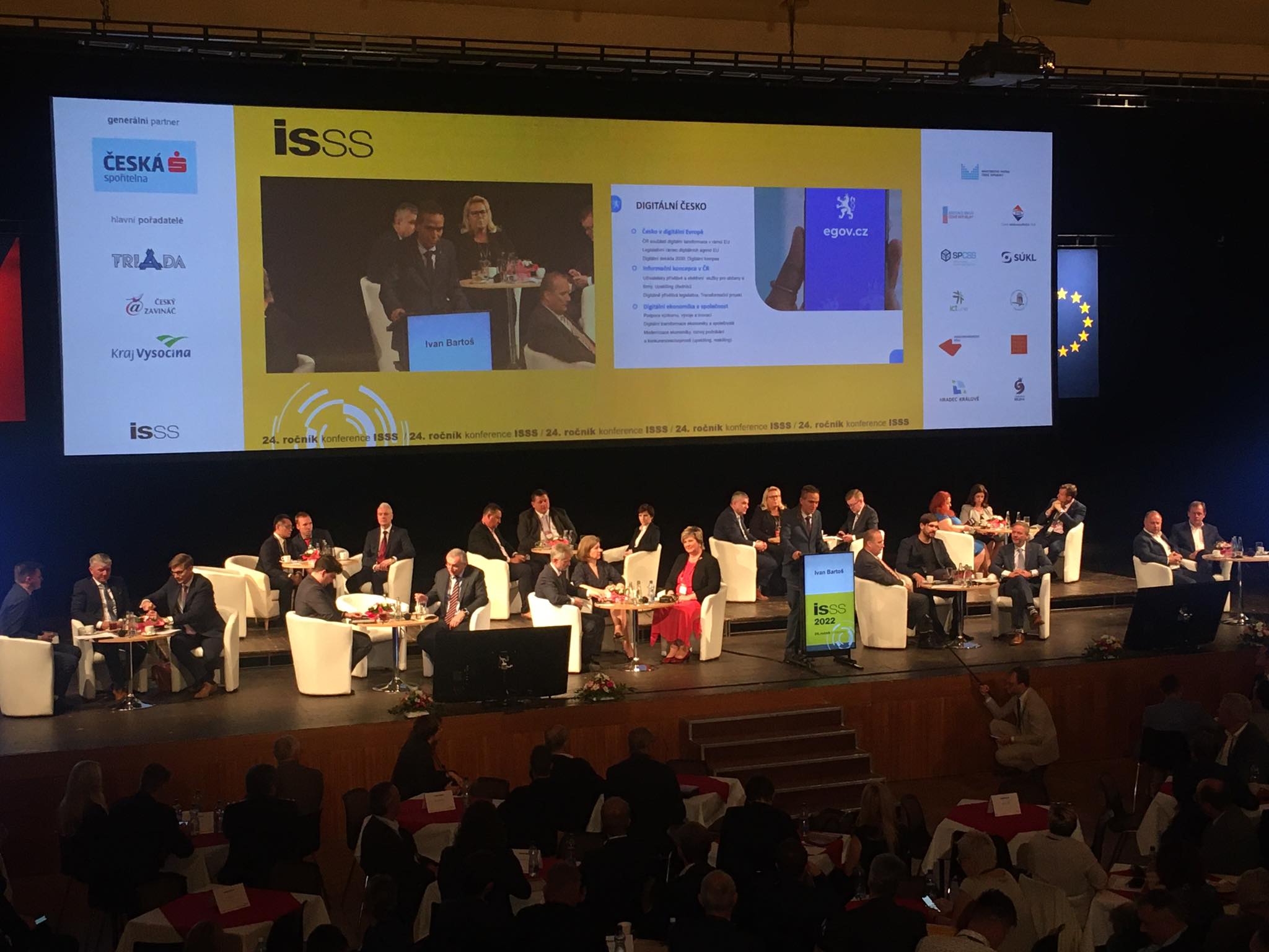
Pořadatelské město Hradec Králové dva dny 16. a 17. května hostilo prestižní konferenci ISSS zabývající se digitalizaci veřejné správy. Letošního ročníku se v Kongresovém centru Aldis zúčastnilo téměř 1 800 hostů, vystavovalo přes 60 firem a proběhlo kolem 200 přednášek. Vystoupily přední osobnosti z politiky, businessu a veřejné správy – například Ivan Bartoš, Věra Jourová, […]
The post Dozvuky 24. ročníku konference ISSS (TZ) appeared first on GISportal.cz.
Dozvuky 24. ročníku konference ISSS (TZ)
18.5.2022 18:56 GISportal.czPořadatelské město Hradec Králové dva dny 16. a 17. května hostilo prestižní konferenci ISSS zabývající se digitalizaci veřejné správy. Letošního ročníku se v Kongresovém centru Aldis zúčastnilo téměř 1 800 hostů, vystavovalo přes 60 firem a proběhlo kolem 200 přednášek. Vystoupily přední osobnosti z politiky, businessu a veřejné správy – například Ivan Bartoš, Věra Jourová, […]
The post Dozvuky 24. ročníku konference ISSS (TZ) appeared first on GISportal.cz.
Nearmap and Carahsoft Partner to Provide Geospatial Content and Location Intelligence Services at Scale to U.S. Federal Government Agencies
18.5.2022 17:20 GISCafe.com Webcasts-Webinars SALT LAKE CITY, May 18, 2022 — (PRNewswire) — Nearmap, a leading aerial imagery and location intelligence company, and Carahsoft …Spire Global to Launch Five Satellites on SpaceX Transporter-5 Mission
18.5.2022 17:12 GISCafe.com Webcasts-Webinars Launch will include three satellites and hosted payloads for Space Services, the company’s Space-as-a-Service (SPaaS) businessVIENNA, Va. — …
MOV.AI Partners with Ouster to Equip Autonomous Mobile Robots with High-Resolution Digital Lidar for Challenging Warehouse Environments
18.5.2022 17:12 GISCafe.com Webcasts-Webinars TEL AVIV, Israel, May 18, 2022 — (PRNewswire) — MOV.AI announced today its partnership with Ouster, a leading provider of …Rodney Cope Joins GeoCue as Senior Vice President of Federal Programs
18.5.2022 17:12 GISCafe.com Webcasts-Webinars Huntsville, Ala., May 18, 2022 (GLOBE NEWSWIRE) -- GeoCue, a leader in LiDAR and photogrammetry equipment and software, recently appointed Rodney …Slavíme 30 let na trhu. I díky vám!
18.5.2022 13:44 T-MAPYThe post Slavíme 30 let na trhu. I díky vám! appeared first on T-MAPY spol. s r.o..
Slavíme 30 let na trhu. I díky vám!
18.5.2022 13:44 T-MAPYThe post Slavíme 30 let na trhu. I díky vám! appeared first on T-MAPY spol. s r.o..
Odborný referent v právním oddělení na Katastrálním pracovišti Brno - venkov
18.5.2022 12:54 ČÚZK - předpisy a opatření Katastrální úřad pro Jihomoravský kraj Katastrální pracoviště Brno-venkovvypisuje výběrové řízení na místo
Odborný referent v právním oddělení na Katastrálním pracovišti Brno - venkov
Odborný referent v právním oddělení na Katastrálním pracovišti Brno - venkov
18.5.2022 12:54 ČÚZK - volná místa Katastrální úřad pro Jihomoravský kraj Katastrální pracoviště Brno-venkov vypisuje výběrové řízení na místo Odborný referent v právním oddělení na Katastrálním pracovišti Brno - venkovOdborný referent v právním oddělení na Katastrálním pracovišti Brno - venkov
18.5.2022 12:54 ČÚZK /Urady/Katastralni-urady/Katastralni-urady/Katastralni-urad-pro-Jihomoravsky-kraj/Volna-mista/DMS/Odborny-referent-v-pravnim-oddeleni-na-KatastralniCo přinášejí nové verze FME Desktop a FME Server
18.5.2022 10:53 GeoBusinessSoftware FME od kanadské firmy Safe Software se používá pro transformaci celé řady datových formátů. Firma pořádá FME World Tour 2022, která ve spolupráci s brněnskou firmou CSmap bude také v České republice. Udělejte si čas a podívejte se, co přinášejí nové verze nástrojů FME Desktop a FME Server. Akce se koná 24. května 2022 […]
The post Co přinášejí nové verze FME Desktop a FME Server appeared first on GeoBusiness.
Setkání geodetů Jihočeského kraje
18.5.2022 10:01 ZeměměřičAsociace podnikatelů v geomatice (APG) ve spolupráci s Katastrálním úřadem pro Jihočeský kraj a ZKI v Českých Budějovicích zvou na 9. setkání geodetů Jihočeského kraje. Seminář se koná v úterý 24. května 2022 v Českých Budějovicích v přednáškové aule E1 Vysoké školy technické a ekonomické v Českých Budějovicích (VŠTE ČB) (Okružní 517/10, 370 01 České Budějovice). Parkování je zajištěno v areálu VŠTE ČB. Dopolední blok Přivítání za VŠTE […]
The post Setkání geodetů Jihočeského kraje appeared first on Zeměměřič.
Innovative Technology continues to advance Chesapeake Bay restoration
18.5.2022 9:00 GISCafe.com Webcasts-Webinars New land use/land cover and change data provide powerful insights into how the watershed is transformingAnnapolis, MD – The Chesapeake Bay …
Intermap Files Final Short Form Base Shelf Prospectus
18.5.2022 9:00 GISCafe.com Webcasts-Webinars DENVER, May 16, 2022 — (PRNewswire) — Intermap Technologies (TSX: IMP) (OTCQX: ITMSF) ("Intermap" or the "Company"), a global leader in …Oznámení o výběru zástupu na služební místo rada/odborný rada – rozhodování o povolení vkladu RPV090
18.5.2022 8:14 ČÚZK /Urady/Katastralni-urady/Katastralni-urady/Katastralni-urad-pro-Plzensky-kraj/Volna-mista/DMS/Oznameni-o-vyberu-zastupu-na-sluzebni-misto-rada-oOznámení o výběru zástupu na služební místo rada/odborný rada – rozhodování o povolení vkladu RPV090
18.5.2022 8:14 ČÚZK - předpisy a opatření Katastrální úřad pro Plzeňský kraj Katastrální pracoviště Plzeň-jihvypisuje výběrové řízení na místo
Oznámení o výběru zástupu na služební místo rada/odborný rada – rozhodování o povolení vkladu RPV0903
Oznámení o výběru zástupu na služební místo rada/odborný rada – rozhodování o povolení vkladu RPV090
18.5.2022 8:14 ČÚZK - volná místa Katastrální úřad pro Plzeňský kraj Katastrální pracoviště Plzeň-jih vypisuje výběrové řízení na místo Oznámení o výběru zástupu na služební místo rada/odborný rada – rozhodování o povolení vkladu RPV090API Launches DYNAMIC 9D LADAR at Control 2022
18.5.2022 0:32 GISCafe.com Webcasts-Webinars Breakthrough LADAR technology sets new standard in non-contact optical dimensional metrology for manufacturing industriesAt Control 2022, API …
Topcon represents construction industry in "CampusOS" 5G research project
18.5.2022 0:03 GISCafe.com Webcasts-Webinars LIVERMORE, Calif. – May 5, 2022 – Topcon Positioning Germany is one of 22 partners involved in CampusOS; a research project with the goal …Změna otevírací doby knihovny [Knihovna geografie, byTopic]
18.5.2022 0:00 Katedra aplikované geoinformatiky a kartografie Přf UK Z provozních důvodů bude Knihovna geografie otevřena ve středu 18.5.2022 pouze do 16,00, ve čtvrtek 19.5.2022 pak bude přes poledne (12-13 h) uzavřena. Děkujeme za pochopení.The countdown is on for GEO Business 2022
17.5.2022 23:39 GISCafe.com Webcasts-Webinars GEO Business – the UK’s largest event dedicated to the geospatial profession – will soon open its doors at ExCeL London for two …AgEagle to Participate at MundoGEO Connect 2022 in Sao Paulo, Brazil on May 17-19, 2022
17.5.2022 23:38 GISCafe.com Webcasts-Webinars WICHITA, Kan – May 12, 2022 – (GLOBE NEWSWIRE) – AgEagle Aerial Systems Inc. (NYSE American: UAVS) …IDS GeoRadar launches cloud-based AI solution AiMaps
17.5.2022 23:14 GISCafe.com Webcasts-Webinars AiMaps offers utility professionals enhanced underground utility detection, productivity gains, cost savings and easier use.PISA, Italy (May 04, …
Allvision Joins the Esri Marketplace
17.5.2022 23:11 GISCafe.com Webcasts-Webinars Enable your fast and accurate asset inventory, now easily accessible on the Esri ArcGIS MarketplacePITTSBURGH, May 5, 2022 -- Allvision IO, a …
The new Leica Pegasus TRK makes mobile mapping smart, autonomous and easy
17.5.2022 23:02 GISCafe.com Webcasts-Webinars (Heerbrugg, Switzerland, 09/05/2022) Leica Geosystems, part of Hexagon, today announced the introduction of the reality capture mobile …
Leica Geosystems, part of Hexagon, opens nominations for Carl Pulfrich Award 2022
17.5.2022 22:53 GISCafe.com Webcasts-Webinars Prestigious award honours advancements in the fields of photogrammetry, remote sensing, earth imaging(Heerbrugg, Switzerland, 10 May 2022) – …
Wood County, Wisconsin, Selects DATAMARK to Provide NG9-1-1 GIS Data Validation Software
17.5.2022 22:11 GISCafe.com Webcasts-Webinars SANTA ANA, Calif., May 17, 2022 — (PRNewswire) — DATAMARK, the public safety geographic information systems (GIS) team of Michael Baker …Conference Program Announced for Commercial UAV Expo 2022
17.5.2022 22:11 GISCafe.com Webcasts-Webinars PORTLAND, Maine, May 17, 2022 — (PRNewswire) —The 2022 edition of Commercial UAV Expo in Las Vegas is set to be the most valuable yet …
Help from Space sees Local Governments keep the Lights On
17.5.2022 17:00 GISCafe.com Webcasts-Webinars Veritas Imagery Services and NOKTOsat are collaborating to provide a new commercial application of earth observation satellite imagery to local …Intermap Announces 135% Quarterly Revenue Growth
17.5.2022 16:54 GISCafe.com Webcasts-Webinars DENVER, May 16, 2022 — (PRNewswire) — Intermap Technologies (TSX: IMP) (OTCQX: ITMSF) ("Intermap" or the "Company"), a global leader in …AgEagle Announces First Quarter 2022 Results
17.5.2022 16:54 GISCafe.com Webcasts-Webinars WICHITA, Kan., May 17, 2022 (GLOBE NEWSWIRE) -- AgEagle Aerial Systems Inc. (NYSE American: UAVS) (“AgEagle” or the “Company”), a …Autodesk Spacemaker – optimalizujte projekty pomocí AI nástrojů
17.5.2022 14:00 Arkance SystemsNový intuitivní cloudový software s umělou inteligencí pro efektivnější architektonické, urbanistické a developerské projekty.
Zpráva Autodesk Spacemaker – optimalizujte projekty pomocí AI nástrojů pochází z arkance-systems.cz.
20220517_Odborný / vrchní referent oddělení obnovy katastrálního operátu č. 03130 - 03361
17.5.2022 13:34 ČÚZK - předpisy a opatření Katastrální úřad pro Středočeský kraj Vyhlášení výběrového řízení: Odborný / vrchní referent oddělení obnovy katastrálního operátu č. 03130 - 03361 V části "Úřední deska", v sekci "Oznámení a jiná úřední sdělení" bylo vystaveno "Oznámení o vyhlášení výběrového řízení na obsazení služebního místa Odborný / vrchní referent oddělení obnovy katastrálního operátu č. 03130 - 03361"20220517_Odborný / vrchní referent oddělení obnovy katastrálního operátu č. 03130 - 03361
17.5.2022 13:34 ČÚZK /Urady/Katastralni-urady/Katastralni-urady/Katastralni-urad-pro-Stredocesky-kraj/O-uradu/Aktuality/20210922_Odborny-referent-oddeleni-aktualizace-(5)Odborný / vrchní referent oddělení obnovy katastrálního operátu č. 03130 - 03361
17.5.2022 13:33 ČÚZK - předpisy a opatření Katastrální úrad pro Strřdočeský kraj technická sekcevypisuje výběrové řízení na místo
Odborný / vrchní referent oddělení obnovy katastrálního operátu č. 03130 - 03361
Odborný / vrchní referent oddělení obnovy katastrálního operátu č. 03130 - 03361
17.5.2022 13:33 ČÚZK - volná místa Katastrální úrad pro Strřdočeský kraj technická sekce vypisuje výběrové řízení na místo Odborný / vrchní referent oddělení obnovy katastrálního operátu č. 03130 - 03361Odborný / vrchní referent oddělení obnovy katastrálního operátu č. 03130 - 03361
17.5.2022 13:33 ČÚZK - volná místa Katastrální úřad pro Středočeský kraj vypisuje výběrové řízení na místo Odborný / vrchní referent oddělení obnovy katastrálního operátu č. 03130 - 03361Odborný / vrchní referent oddělení obnovy katastrálního operátu č. 03130 - 03361
17.5.2022 13:33 ČÚZK - předpisy a opatření Katastrální úřad pro Středočeský krajvypisuje výběrové řízení na místo
Odborný / vrchní referent oddělení obnovy katastrálního operátu č. 03130 - 03361
Odborný / vrchní referent oddělení obnovy katastrálního operátu č. 03130 - 03361
17.5.2022 13:33 ČÚZK /Urady/Katastralni-urady/Katastralni-urady/Katastralni-urad-pro-Stredocesky-kraj/Uredni-deska/Oznameni-a-jina-uredni-sdeleni/Volna-mista/DMS/Odborny-vrchni-referent-oddeleni-obnovy-katast-(2)20220517_Odborný / vrchní referent oddělení obnovy katastrálního operátu 03110 - 03360
17.5.2022 13:17 ČÚZK - předpisy a opatření Katastrální úřad pro Středočeský kraj Vyhlášení výběrového řízení: Odborný / vrchní referent oddělení obnovy katastrálního operátu 03110 - 03360 V části "Úřední deska", v sekci "Oznámení a jiná úřední sdělení" bylo vystaveno "Oznámení o vyhlášení výběrového řízení na obsazení služebního místa Odborný / vrchní referent oddělení obnovy katastrálního operátu 03110 - 03360"20220517_Odborný / vrchní referent oddělení obnovy katastrálního operátu 03110 - 03360
17.5.2022 13:17 ČÚZK /Urady/Katastralni-urady/Katastralni-urady/Katastralni-urad-pro-Stredocesky-kraj/O-uradu/Aktuality/20210922_Odborny-referent-oddeleni-aktualizace-(4)Odborný / vrchní referent oddělení obnovy katastrálního operátu č. 03110 - 03360
17.5.2022 13:16 ČÚZK - volná místa Katastrální úřad pro Středočeský kraj vypisuje výběrové řízení na místo Odborný / vrchní referent oddělení obnovy katastrálního operátu č. 03110 - 03360Odborný / vrchní referent oddělení obnovy katastrálního operátu č. 03110 - 03360
17.5.2022 13:16 ČÚZK - volná místa Katastrální úrad pro Strřdočeský kraj technická sekce vypisuje výběrové řízení na místo Odborný / vrchní referent oddělení obnovy katastrálního operátu č. 03110 - 03360Odborný / vrchní referent oddělení obnovy katastrálního operátu č. 03110 - 03360
17.5.2022 13:16 ČÚZK - předpisy a opatření Katastrální úřad pro Středočeský krajvypisuje výběrové řízení na místo
Odborný / vrchní referent oddělení obnovy katastrálního operátu č. 03110 - 03360
Odborný / vrchní referent oddělení obnovy katastrálního operátu č. 03110 - 03360
17.5.2022 13:16 ČÚZK /Urady/Katastralni-urady/Katastralni-urady/Katastralni-urad-pro-Stredocesky-kraj/Uredni-deska/Oznameni-a-jina-uredni-sdeleni/Volna-mista/DMS/Odborny-vrchni-referent-oddeleni-obnovy-katast-(1)Odborný / vrchní referent oddělení obnovy katastrálního operátu č. 03110 - 03360
17.5.2022 13:16 ČÚZK - předpisy a opatření Katastrální úrad pro Strřdočeský kraj technická sekcevypisuje výběrové řízení na místo
Odborný / vrchní referent oddělení obnovy katastrálního operátu č. 03110 - 03360
20220517_Odborný / vrchní referent oddělení obnovy katastrálního operátu č. 03110 Technické sekce
17.5.2022 12:55 ČÚZK - předpisy a opatření Katastrální úřad pro Středočeský kraj Vyhlášení výběrového řízení: Odborný / vrchní referent oddělení obnovy katastrálního operátu č. 03110 Technické sekce V části "Úřední deska", v sekci "Oznámení a jiná úřední sdělení" bylo vystaveno "Oznámení o vyhlášení výběrového řízení na obsazení služebního místa Odborný / vrchní referent oddělení obnovy katastrálního operátu č. 03110 Technické sekce"20220517_Odborný / vrchní referent oddělení obnovy katastrálního operátu č. 03110 Technické sekce
17.5.2022 12:55 ČÚZK /Urady/Katastralni-urady/Katastralni-urady/Katastralni-urad-pro-Stredocesky-kraj/O-uradu/Aktuality/20210922_Odborny-referent-oddeleni-aktualizace-(3)Odborný / vrchní referent oddělení obnovy katastrálního operátu č. 03110
17.5.2022 10:54 ČÚZK - volná místa Katastrální úřad pro Středočeský kraj vypisuje výběrové řízení na místo Odborný / vrchní referent oddělení obnovy katastrálního operátu č. 03110Odborný / vrchní referent oddělení obnovy katastrálního operátu č. 03110
17.5.2022 10:54 ČÚZK - předpisy a opatření Katastrální úřad pro Středočeský krajvypisuje výběrové řízení na místo
Odborný / vrchní referent oddělení obnovy katastrálního operátu č. 03110
Odborný / vrchní referent oddělení obnovy katastrálního operátu č. 03110
17.5.2022 10:54 ČÚZK /Urady/Katastralni-urady/Katastralni-urady/Katastralni-urad-pro-Stredocesky-kraj/Uredni-deska/Oznameni-a-jina-uredni-sdeleni/Volna-mista/DMS/Odborny-vrchni-referent-oddeleni-obnovy-katastraOdborný / vrchní referent oddělení obnovy katastrálního operátu č. 03110
17.5.2022 10:54 ČÚZK - předpisy a opatření Katastrální úrad pro Strřdočeský kraj technická sekcevypisuje výběrové řízení na místo
Odborný / vrchní referent oddělení obnovy katastrálního operátu č. 03110
Odborný / vrchní referent oddělení obnovy katastrálního operátu č. 03110
17.5.2022 10:54 ČÚZK - volná místa Katastrální úrad pro Strřdočeský kraj technická sekce vypisuje výběrové řízení na místo Odborný / vrchní referent oddělení obnovy katastrálního operátu č. 03110Hradec Králové ožil, konference ISSS je zpátky ve svém tradičním jarním termínu (TZ)
17.5.2022 8:33 GISportal.czV Hradci Králové včera odstartoval čtyřiadvacátý ročník konference ISSS. Slavnostní zahájení ISSS 2022 proběhlo jako obvykle v zaplněném Velkém sále Kongresového centra Aldis. Významné hosty přivítal moderátor Jan Pokorný a postupně jim předával slovo a diskutoval s nimi o tématech spojených s vizemi nové vlády o digitalizaci české společnosti napříč všemi IT sektory. První zdravici […]
The post Hradec Králové ožil, konference ISSS je zpátky ve svém tradičním jarním termínu (TZ) appeared first on GISportal.cz.
Hradec Králové ožil, konference ISSS je zpátky ve svém tradičním jarním termínu (TZ)
17.5.2022 8:33 GISportal.czV Hradci Králové včera odstartoval čtyřiadvacátý ročník konference ISSS. Slavnostní zahájení ISSS 2022 proběhlo jako obvykle v zaplněném Velkém sále Kongresového centra Aldis. Významné hosty přivítal moderátor Jan Pokorný a postupně jim předával slovo a diskutoval s nimi o tématech spojených s vizemi nové vlády o digitalizaci české společnosti napříč všemi IT sektory. První zdravici […]
The post Hradec Králové ožil, konference ISSS je zpátky ve svém tradičním jarním termínu (TZ) appeared first on GISportal.cz.
odborný referent / vrchní referent – zápisy v řízení V a Z v oddělení právních vztahů k nemovitostem
17.5.2022 7:17 ČÚZK - předpisy a opatření Katastrální úřad pro Liberecký kraj Katastrální pracoviště Liberecvypisuje výběrové řízení na místo
odborný referent / vrchní referent – zápisy v řízení V a Z v oddělení právních vztahů k nemovitostem
odborný referent / vrchní referent – zápisy v řízení V a Z v oddělení právních vztahů k nemovitostem
17.5.2022 7:17 ČÚZK - předpisy a opatření Katastrální úřad pro Liberecký krajvypisuje výběrové řízení na místo
odborný referent / vrchní referent – zápisy v řízení V a Z v oddělení právních vztahů k nemovitostem
odborný referent / vrchní referent – zápisy v řízení V a Z v oddělení právních vztahů k nemovitostem
17.5.2022 7:17 ČÚZK /Urady/Katastralni-urady/Katastralni-urady/Katastralni-urad-pro-Liberecky-kraj/Uredni-deska/Oznameni-a-jina-uredni-sdeleni/Volna-mista/DMS/odborny-referent-vrchni-referent-–-zapisy-v-rizeodborný referent / vrchní referent – zápisy v řízení V a Z v oddělení právních vztahů k nemovitostem
17.5.2022 7:17 ČÚZK - volná místa Katastrální úřad pro Liberecký kraj Katastrální pracoviště Liberec vypisuje výběrové řízení na místo odborný referent / vrchní referent – zápisy v řízení V a Z v oddělení právních vztahů k nemovitostemodborný referent / vrchní referent – zápisy v řízení V a Z v oddělení právních vztahů k nemovitostem
17.5.2022 7:17 ČÚZK - volná místa Katastrální úřad pro Liberecký kraj vypisuje výběrové řízení na místo odborný referent / vrchní referent – zápisy v řízení V a Z v oddělení právních vztahů k nemovitostemLaunch of AssetAdvanced™, a decision-support solution to deliver smart and sustainable planning for water and sanitation infrastructure investments
17.5.2022 1:43 GISCafe.com Webcasts-Webinars CHICAGO, May 16, 2022 — (PRNewswire) — SUEZ has just launched its latest Advanced™ solutions innovation: AssetAdvanced™. By …Virtuální výstava Opevněná krajina – lidé ve východních Krkonoších 1938 [Knihovna geografie, byTopic]
17.5.2022 0:00 Katedra aplikované geoinformatiky a kartografie Přf UK V rámci projektu Prameny Krkonoš, který si klade za cíl zpřístupnit informační zdroje o historii a kulturní paměti Krkonoš z období Československa (1918 – 1992), vás jeho zpracovatelé zvou k návštěvě on-line výstavy věnované lidem ve východních Krkonoších v roce 1938.Workshop zaměřený na metody ve fluviální geomorfologii
17.5.2022 0:00 Geografický ústav MUČeská asociace geomorfologů zve zájemce z řad studentů na jarní workshop zaměřený na metody ve fluviální geomorfologii. Workshop se uskuteční v Horní Bečvě v termínu 17.-18. května 2022.
Program workshopu a kontakt pro přihlášení najdete v přiloženém cirkuláři.
Kongsberg Geospatial provides 3D operator visualization for Iris Automation Ground-Based Optical Detect and Avoid (DAA) Solution - Casia G
16.5.2022 22:32 GISCafe.com Webcasts-Webinars OTTAWA, Ontario, May 16, 2022 — (PRNewswire) —Airspace Situational Awareness from the Optical DAA sensor will be provided to the user …
PABLO AIR Wins for AUVSI XCELLENCE Award
16.5.2022 17:47 GISCafe.com Webcasts-Webinars INCHEON, South Korea, May 16, 2022 — (PRNewswire) — PABLO AIR, a South Korea-based drone solution and service company and a member of …Fortem Technologies Deploys Man Portable Counter-UAS Solution in Ukraine
16.5.2022 17:47 GISCafe.com Webcasts-Webinars PLEASANT GROVE, Utah, May 16, 2022 — (PRNewswire) — Fortem Technologies, leaders in airspace security and defense for detecting and …Finite Element Analysis in Infrastructure
16.5.2022 16:17 Bentley SystemsPressCoverage
Connected World, USA
Read the articleToying With Minecraft Inspired Digital Twin
16.5.2022 16:12 Bentley SystemsPressCoverage
Digital Engineering 24/7, USA
Read the articleState DOTs Leveraging Data To Manage Information
16.5.2022 16:07 Bentley SystemsPressCoverage
AASHTO, USA
Read the articleGreat Lakes Digital Surface Model Products Released to the Public
16.5.2022 16:06 GISCafe.com Webcasts-Webinars St. Paul, Minnesota, May 16, 2022 – The Great Lakes Alliance for Remote Sensing (GLARS) is pleased to announce Digital Surface Model (DSM) …Sterlite Power delivers light to Indias most remote regions using renewable energy
16.5.2022 15:58 Bentley SystemsPressCoverage
ME Construction News, Middle East
Read the articleFind your way to the future at ESA’s NAVISP Industry Days
16.5.2022 11:46 ESA Navigation
After a pandemic-induced gap of more than two years, Europe’s leading companies working on positioning, navigation and timing technologies will meet face-to-face at ESA’s technical heart in the Netherlands for the NAVISP Industry Days, devoted to the latest developments in the Agency’s Navigation Innovation and Support Programme.
Odstávka telefonních služeb na KP Vyškov
16.5.2022 8:19 ČÚZK - předpisy a opatření Český úřad zeměměřický a katastrální - Katastrální pracoviště Vyškov zveřejnil novou aktualitu: Vážení zákazníci,dovolujeme si Vás upozornit, že dne 19. 05. 2022, mezi 8:00 - 18:00, dojde k několikahodinovému výpadku telefonních služeb. Pokud byste se v této době nemohli na KP dovolat, využijte prosím ke kontaktu naší mailové adresy - kp.vyskov@cuzk.cz.
Děkujeme za pochopení.
Odstávka telefonních služeb na KP Vyškov
16.5.2022 8:19 ČÚZK /Urady/Katastralni-urady/Katastralni-urady/Katastralni-urad-pro-Jihomoravsky-kraj/Katastralni-pracoviste/KP-Vyskov/O-uradu/Aktuality/Odstavka-telefonnich-sluzeb-na-KP-VyskovOdstávka telefonních služeb na KP Vyškov
16.5.2022 8:19 ČÚZK - předpisy a opatření Katastrální úřad pro Jihomoravský kraj - Katastrální pracoviště Vyškov zveřejnil novou aktualitu: Vážení zákazníci,dovolujeme si Vás upozornit, že dne 19. 05. 2022, mezi 8:00 - 18:00, dojde k několikahodinovému výpadku telefonních služeb. Pokud byste se v této době nemohli na KP dovolat, využijte prosím ke kontaktu naší mailové adresy - kp.vyskov@cuzk.cz.
Děkujeme za pochopení.
nepotřebný nábytek
16.5.2022 8:17 ČÚZK /Urady/Katastralni-urady/Katastralni-urady/Katastralni-urad-pro-Vysocinu/Nabidky-majetku/nepotrebny-nabyteknepotřebný nábytek
16.5.2022 8:17 ČÚZK - předpisy a opatřeníKatastrální úřad pro Vysočinu - Katastrální pracoviště Pelhřimov nabízí nepotřebný majetek k odkupu. Jedná se o
nepotřebný nábytek
TurboPDF CZ nyní za akční cenu jen do 21. 5. 2022
14.5.2022 8:43 ŠPINAR - softwaredovolujeme si Vám nabídnout program TurboPDF CZ pro otevírání, editaci, správu a převod Vašich PDF dokumentů.
The post TurboPDF CZ nyní za akční cenu jen do 21. 5. 2022 appeared first on ŠPINAR – software.
TurboPDF CZ nyní za akční cenu jen do 21. 5. 2022
14.5.2022 8:43 ŠPINAR - software dovolujeme si Vám nabídnout program TurboPDF CZ pro otevírání, editaci, správu a převod Vašich PDF dokumentů.AgEagle Announces Enhancements to Measure Ground Control, Designed to Support and Manage Autonomous Drone Operations of Any Scale
13.5.2022 15:13 GISCafe.com Webcasts-Webinars WICHITA, Kan., May 13, 2022 (GLOBE NEWSWIRE) -- AgEagle Aerial Systems Inc. (NYSE American: UAVS) (“AgEagle” or the “Company”), an …URISA's Vanguard Cabinet Announces the 2022 Student and Young Professional Competition
13.5.2022 15:04 GISCafe.com Webcasts-Webinars (May 11, 2022 – Des Plaines, Illinois USA) URISA’s Vanguard Cabinet is proud to host the sixth annual Digital Competition to …Open Maps For Europe releases open cadastral map prototype and data updates
13.5.2022 15:04 GISCafe.com Webcasts-Webinars May 13, 2022 -- Open Maps for Europe has released an Open Cadastral Map prototype which provides large-scale coverage for four countries. The …
Ark-Tex Council of Governments Selects DATAMARK for NG9-1-1 GIS Validation Services
13.5.2022 15:03 GISCafe.com Webcasts-Webinars SANTA ANA, Calif., May 17, 2022 — (PRNewswire) — DATAMARK, the public safety geographic information systems (GIS) team of Michael Baker …Maxar Technologies Announces Voting Results from Annual Meeting of Stockholders
13.5.2022 15:03 GISCafe.com Webcasts-Webinars WESTMINSTER, Colo. — (BUSINESS WIRE) — May 12, 2022 —Maxar Technologies (NYSE:MAXR) (TSX:MAXR), a provider of comprehensive space …
Vrchní referent/Rada – oddělení dokumentace KN
13.5.2022 13:38 ČÚZK /Urady/Katastralni-urady/Katastralni-urady/Katastralni-urad-pro-Karlovarsky-kraj/Uredni-deska/Oznameni-a-jina-uredni-sdeleni/Volna-mista/DMS/Vrchni-referent-Rada-–-oddeleni-dokumentace-KNVrchní referent/Rada – oddělení dokumentace KN
13.5.2022 13:38 ČÚZK - předpisy a opatření Katastrální úřad pro Karlovarský kraj Katastrální pracoviště Chebvypisuje výběrové řízení na místo
Vrchní referent/Rada – oddělení dokumentace KN
Vrchní referent/Rada – oddělení dokumentace KN
13.5.2022 13:38 ČÚZK - volná místa Katastrální úřad pro Karlovarský kraj Katastrální pracoviště Cheb vypisuje výběrové řízení na místo Vrchní referent/Rada – oddělení dokumentace KNEstakáda Plzeň – důležitost geodetů na stavbě
13.5.2022 13:30 Hrdlička Nový západní okruh je pro město Plzeň klíčovou dopravní stavbou.Přerušení dodávky el. energie
13.5.2022 12:25 ČÚZK /Urady/Katastralni-urady/Katastralni-urady/Katastralni-urad-pro-Moravskoslezsky-kraj/Katastralni-pracoviste/KP-Ostrava/O-uradu/Aktuality/Preruseni-dodavky-el-energiePřerušení dodávky el. energie
13.5.2022 12:25 ČÚZK - předpisy a opatření Český úřad zeměměřický a katastrálnízveřejnil novou aktualitu: Dne 2.6.2022 bude v budově Katastrálního pracoviště Ostrava realizována odstávka elektřiny firmou ČEZ Distribuce, a.s., a to v době od 7.30h do 15.30h. Příjem podání bude prováděn manuálně, správní poplatky bude možno uhradit pouze v hotovosti.
Přerušení dodávky el. energie
13.5.2022 12:25 ČÚZK - předpisy a opatření Katastrální úřad pro Moravskoslezský kraj - Katastrální pracoviště Ostravazveřejnil novou aktualitu: Dne 2.6.2022 bude v budově Katastrálního pracoviště Ostrava realizována odstávka elektřiny firmou ČEZ Distribuce, a.s., a to v době od 7.30h do 15.30h. Příjem podání bude prováděn manuálně, správní poplatky bude možno uhradit pouze v hotovosti.
Referent / vrchní referent – návrh zápisu v katastru v oddělení aktualizace KN Katastrálního pracovi
13.5.2022 10:03 ČÚZK - předpisy a opatření Katastrální úřad pro Zlínský kraj Katastrální pracoviště Valašské Meziříčívypisuje výběrové řízení na místo
Referent / vrchní referent – návrh zápisu v katastru v oddělení aktualizace KN Katastrálního pracoviště Valašské Meziříčí
Referent / vrchní referent – návrh zápisu v katastru v oddělení aktualizace KN Katastrálního pracovi
13.5.2022 10:03 ČÚZK - volná místa Katastrální úřad pro Zlínský kraj Katastrální pracoviště Valašské Meziříčí vypisuje výběrové řízení na místo Referent / vrchní referent – návrh zápisu v katastru v oddělení aktualizace KN Katastrálního pracoviReferent / vrchní referent – návrh zápisu v katastru v oddělení aktualizace KN Katastrálního pracovi
13.5.2022 10:03 ČÚZK /Urady/Katastralni-urady/Katastralni-urady/Katastralni-urad-pro-Zlinsky-kraj/Uredni-deska/Oznameni-a-jina-uredni-sdeleni/Volna-mista/DMS/Referent-vrchni-referent-–-navrh-zapisu-v-katastEarth from Space: Arc de Triomphe
13.5.2022 10:00 ESA Observing the Earth
This striking, high-resolution image of the Arc de Triomphe, in Paris, was captured by Planet SkySat – a fleet of satellites that have just joined ESA’s Third Party Mission Programme in April 2022.
Rada / odborný rada – rozhodování o povolení vkladu v oddělení právních vztahů k nemovitostem Katast
13.5.2022 9:25 ČÚZK - volná místa Katastrální úřad pro Zlínský kraj Katastrální pracoviště Valašské Meziříčí vypisuje výběrové řízení na místo Rada / odborný rada – rozhodování o povolení vkladu v oddělení právních vztahů k nemovitostem KatastRada / odborný rada – rozhodování o povolení vkladu v oddělení právních vztahů k nemovitostem Katast
13.5.2022 9:25 ČÚZK - předpisy a opatření Katastrální úřad pro Zlínský kraj Katastrální pracoviště Valašské Meziříčívypisuje výběrové řízení na místo
Rada / odborný rada – rozhodování o povolení vkladu v oddělení právních vztahů k nemovitostem Katastrálního pracoviště Valašské Meziříčí
URISA's GIS Leadership Academy Opportunities Announced
13.5.2022 9:00 GISCafe.com Webcasts-Webinars May 12, 2022 (Des Plaines, IL) - URISA is pleased to announce three opportunities to attend the GIS Leadership Academy (GLA) in 2022.Grab a seat at …
Vrchní referent/rada – vedení katastrální mapy
13.5.2022 7:50 ČÚZK /Urady/Katastralni-urady/Katastralni-urady/Katastralni-urad-pro-Moravskoslezsky-kraj/Uredni-deska/Oznameni-a-jina-uredni-sdeleni/Volna-mista/DMS/Vrchni-referent-rada-–-vedeni-katastralni-mapyVrchní referent/rada – vedení katastrální mapy
13.5.2022 7:50 ČÚZK - předpisy a opatření Katastrální úřad pro Moravskoslezský kraj Katastrální pracoviště Frýdek-Místekvypisuje výběrové řízení na místo
Vrchní referent/rada – vedení katastrální mapy
Vrchní referent/rada – vedení katastrální mapy
13.5.2022 7:50 ČÚZK - volná místa Katastrální úřad pro Moravskoslezský kraj Katastrální pracoviště Frýdek-Místek vypisuje výběrové řízení na místo Vrchní referent/rada – vedení katastrální mapyJuniper Systems Limited Launches Android 11 Update for the Mesa 3 Rugged Tablet
12.5.2022 17:51 GISCafe.com Webcasts-Webinars BIRMINGHAM, United Kingdom, May 11, 2022 (GLOBE NEWSWIRE) -- Juniper Systems Limited, a manufacturer of rugged handheld computers and GNSS …Planet to Announce Fiscal First Quarter 2023 Results on Tuesday, June 14, 2022
12.5.2022 17:51 GISCafe.com Webcasts-Webinars SAN FRANCISCO — (BUSINESS WIRE) — May 12, 2022 —Planet Labs PBC (NYSE:PL), a leading provider of daily data and insights about …
ASTERRA Poised for Expansion in Latin America and the Caribbean
12.5.2022 17:51 GISCafe.com Webcasts-Webinars SAN DIEGO, May 12, 2022 (GLOBE NEWSWIRE) -- Following successful projects in 59 countries and poised for expansion, ASTERRA recently announced the …4S Mapper to Enter North America Market With Its Car-free Street Mapping Solution Creating Clear Road Surface Without Driving Vehicles
12.5.2022 17:51 GISCafe.com Webcasts-Webinars SEONGNAM, South Korea — (BUSINESS WIRE) — May 12, 2022 —4S Mapper has developed the Car-free Street Mapping solution (CfSM), a …
Woolpert Selected by USGS to Provide Elevation-Derived Hydrography for Oregon, Alaska
12.5.2022 17:51 GISCafe.com Webcasts-Webinars WASILLA, Alaska, May 12, 2022 — (PRNewswire) —The data will be used to model and analyze surface water and flow patterns for use in …