


![]()

zprávy
zdroje zpráv:EU Space Week 2019: Investors meet innovation
8.1.2020 13:25 European GNSS Agency
A major theme running through EU Space Week 2019 in Helsinki was the wealth of innovative space-based applications, products and services being created in Europe. The ‘New Space’ sector is full of bright ideas and creative people, but turning a brilliant concept into a profitable enterprise is not easy. Fortunately, Space Week provided a wide range of opportunities for space innovators to develop ideas, meet investors and network with partners. One session allowed entrepreneurs to pitch their ideas to business angels, venture capitalists and other sources of public and private investment.
Over the two days prior to the main Space Week events, the Finnish Transport and Communication Agency Traficom had invited teams of developers to an Innovation Challenge to develop innovative applications using the enhanced performance of Galileo in three areas: high accuracy (supported by the GSA), signal interference, and robotics.
Space Week itself also included sessions on the EGNSS Accelerator initiative that provides multiple benefits to Galileo Masters winners and finalists, such as coaching services and business incubation opportunities, and, of course, the glittering 2019 Galileo Masters Award Ceremony too.
Read this: Put your project in the spotlight at MWC Barcelona
The European GNSS Agency (GSA) organised a specific ‘Investors meet the Innovators’ event on the morning of 3 December with three panel discussions that covered an introduction to the most promising application areas from the investors’ point of view, the most common mistakes of start-ups and SMEs when applying for private funding, and advice on how to grow, minimise risks, and achieve self-sustainability once initial finance or funding has been obtained.
Following these panel debates innovators had the opportunity to meet the investors on a one-to-one basis in a ‘speed dating’ session that extended through into a wider SME showcase Fair in the afternoon. Here SMEs and entrepreneurs had the possibility to talk to investors who provided them with investment readiness and pitch training.
Pitch perfect
The highlight of the day was the dynamic, early evening pitching session, where 13 space-based companies were given just four minutes to sell their ideas and aspirations to a broader audience of potential investors, press, corporates, public sector officials and fellow startups. Their presentations were followed by testing questions from the audience.
The pitching entrepreneurs illustrated the wide range and ambitions of the growing space-based business sector.
| EUSW PITCHERS |
| 1/Collective crunch is a Finnish-German company with a leading position in applying artificial intelligence (AI) to forestry asset planning with their Linda Forest application. |
| 2/ CX-GEODRONE from the Spanish universities of Vigo and Oviedo have developed a drone carrying a synthetic aperture radar package for underground and over ground applications. The development has high market potential and a university spin-out company is planned in 2020. |
| 3/ Deep Planet uses satellites and machine learning to understand risk and discover intelligence usually invisible to the human eye. Their presentation focused on an application to optimise irrigation in vineyards and boost yield. The app is currently being tested in Australia. |
| 4/ Greensense is an Austrian enterprise developing smart solutions for smarter farms; described as ‘Agriculture 4.0’. Their intuitive app helps space data seamlessly integrate into the normal farm workflow including the use of augmented reality tools. |
| 5/ Hurricane UNwinder is building an intensity forecast service for hurricanes, typhoons and tropical cyclones. The long-term goal is to find weather modification opportunities for reducing storm intensity. As well as software the team is developing a customised ‘sonde’ that can be dropped into the eye of a storm to collect data. |
| 6/ Qascom is a thought leader on satellite navigation and space cybersecurity, a market growth area, to provide robust PNT information. The company is already one of the leaders in the use of authentication signals that will be introduced to Galileo services during 2020. |
| 7/ Topview Sal EASY PV uses drones to improve maintenance of photoelectric (PV) plants by detecting faulty panels in situ. This solution, which uses an auto detect algorithm to identify broken panels, is much cheaper than manual inspection procedures. |
| 8/ uMaze was the winner of the Accuracy Matters theme of the Innovation Challenge in Helsinki with their virtual maze builder and navigator app. Mazes have fascinated humanity for millennia and this Galileo-powered app brings the maze craze up to date! |
| 9/ UNISPHERE core business is the use of high-level platforms, or pseudo-satellites, to build up the ecosystem for unmanned aviation and enable it to become a commodity for society. |
| 10/ Xylene is working to boost trust in timber by allowing clients to take full control of their supply chain from forest to finished product using geolocation and blockchain technologies. |
| 11/ Aurora is a small Finnish company developing novel propulsion technologies for manoeuvring small satellites. This is a rapidly growing market and the company is currently moving from hand production to mass production. Future products include an E-sail module for possible interplanetary missions. |
| 12/ Deep Blue Globe is a group of ex-ESA engineers who are creating exciting space data products including the POSEIDON project which combines weather and ocean data in a navigation algorithm to optimise maritime routes and save on energy costs, reduce emissions and increase safety. |
|
13/ The final presentation was on Feverr – the dating app with a twist. The app aims to enable singles to spend more time meeting potential partners rather than staring at their phone screen. The app also has a focus on personal safety. |
Hopefully all these entrepreneurs will have met their ideal investor at Space Week 2019 whether they are starting up, scaling up or looking to go global!
Media note: This feature can be republished without charge provided the European GNSS Agency (GSA) is acknowledged as the source at the top or the bottom of the story. You must request permission before you use any of the photographs on the site. If you republish, we would be grateful if you could link back to the GSA website (http://www.gsa.europa.eu).
EU Space Week 2019: Investors meet innovation
8.1.2020 13:25 European GNSS AgencyA major theme running through EU Space Week 2019 in Helsinki was the wealth of innovative space-based applications, products and services being created in Europe. The ‘New Space’ sector is full of bright ideas and creative people, but turning a brilliant concept into a profitable enterprise is not easy. Fortunately, Space Week provided a wide range of opportunities for space innovators to develop ideas, meet investors and network with partners. One session allowed entrepreneurs to pitch their ideas to business angels, venture capitalists and other sources of public and private investment.
Over the two days prior to the main Space Week events, the Finnish Transport and Communication Agency Traficom had invited teams of developers to an Innovation Challenge to develop innovative applications using the enhanced performance of Galileo in three areas: high accuracy (supported by the GSA), signal interference, and robotics.
Space Week itself also included sessions on the EGNSS Accelerator initiative that provides multiple benefits to Galileo Masters winners and finalists, such as coaching services and business incubation opportunities, and, of course, the glittering 2019 Galileo Masters Award Ceremony too.
Read this: Put your project in the spotlight at MWC Barcelona
The European GNSS Agency (GSA) organised a specific ‘Investors meet the Innovators’ event on the morning of 3 December with three panel discussions that covered an introduction to the most promising application areas from the investors’ point of view, the most common mistakes of start-ups and SMEs when applying for private funding, and advice on how to grow, minimise risks, and achieve self-sustainability once initial finance or funding has been obtained.
Following these panel debates innovators had the opportunity to meet the investors on a one-to-one basis in a ‘speed dating’ session that extended through into a wider SME showcase Fair in the afternoon. Here SMEs and entrepreneurs had the possibility to talk to investors who provided them with investment readiness and pitch training.
Pitch perfect
The highlight of the day was the dynamic, early evening pitching session, where 13 space-based companies were given just four minutes to sell their ideas and aspirations to a broader audience of potential investors, press, corporates, public sector officials and fellow startups. Their presentations were followed by testing questions from the audience.
The pitching entrepreneurs illustrated the wide range and ambitions of the growing space-based business sector.
| EUSW PITCHERS |
| 1/Collective crunch is a Finnish-German company with a leading position in applying artificial intelligence (AI) to forestry asset planning with their Linda Forest application. |
| 2/ CX-GEODRONE from the Spanish universities of Vigo and Oviedo have developed a drone carrying a synthetic aperture radar package for underground and over ground applications. The development has high market potential and a university spin-out company is planned in 2020. |
| 3/ Deep Planet uses satellites and machine learning to understand risk and discover intelligence usually invisible to the human eye. Their presentation focused on an application to optimise irrigation in vineyards and boost yield. The app is currently being tested in Australia. |
| 4/ Greensense is an Austrian enterprise developing smart solutions for smarter farms; described as ‘Agriculture 4.0’. Their intuitive app helps space data seamlessly integrate into the normal farm workflow including the use of augmented reality tools. |
| 5/ Hurricane UNwinder is building an intensity forecast service for hurricanes, typhoons and tropical cyclones. The long-term goal is to find weather modification opportunities for reducing storm intensity. As well as software the team is developing a customised ‘sonde’ that can be dropped into the eye of a storm to collect data. |
| 6/ Qascom is a thought leader on satellite navigation and space cybersecurity, a market growth area, to provide robust PNT information. The company is already one of the leaders in the use of authentication signals that will be introduced to Galileo services during 2020. |
| 7/ Topview Sal EASY PV uses drones to improve maintenance of photoelectric (PV) plants by detecting faulty panels in situ. This solution, which uses an auto detect algorithm to identify broken panels, is much cheaper than manual inspection procedures. |
| 8/ uMaze was the winner of the Accuracy Matters theme of the Innovation Challenge in Helsinki with their virtual maze builder and navigator app. Mazes have fascinated humanity for millennia and this Galileo-powered app brings the maze craze up to date! |
| 9/ UNISPHERE core business is the use of high-level platforms, or pseudo-satellites, to build up the ecosystem for unmanned aviation and enable it to become a commodity for society. |
| 10/ Xylene is working to boost trust in timber by allowing clients to take full control of their supply chain from forest to finished product using geolocation and blockchain technologies. |
| 11/ Aurora is a small Finnish company developing novel propulsion technologies for manoeuvring small satellites. This is a rapidly growing market and the company is currently moving from hand production to mass production. Future products include an E-sail module for possible interplanetary missions. |
| 12/ Deep Blue Globe is a group of ex-ESA engineers who are creating exciting space data products including the POSEIDON project which combines weather and ocean data in a navigation algorithm to optimise maritime routes and save on energy costs, reduce emissions and increase safety. |
|
13/ The final presentation was on Feverr – the dating app with a twist. The app aims to enable singles to spend more time meeting potential partners rather than staring at their phone screen. The app also has a focus on personal safety. |
Hopefully all these entrepreneurs will have met their ideal investor at Space Week 2019 whether they are starting up, scaling up or looking to go global!
Media note: This feature can be republished without charge provided the European GNSS Agency (GSA) is acknowledged as the source at the top or the bottom of the story. You must request permission before you use any of the photographs on the site. If you republish, we would be grateful if you could link back to the GSA website (http://www.gsa.europa.eu).
Odborný referent/vrchní referent v oddělení obnovy a revize KN na Katastrálním pracovišti Brno-venko
8.1.2020 12:52 ČÚZK - volná místa Katastrální úřad pro Jihomoravský kraj Katastrální pracoviště Brno-venkov vypisuje výběrové řízení na místo Odborný referent/vrchní referent v oddělení obnovy a revize KN na Katastrálním pracovišti Brno-venkoOdborný referent/vrchní referent v oddělení obnovy a revize KN na Katastrálním pracovišti Brno-venko
8.1.2020 12:52 ČÚZK - volná místa Katastrální úřad pro Jihomoravský kraj vypisuje výběrové řízení na místo Odborný referent/vrchní referent v oddělení obnovy a revize KN na Katastrálním pracovišti Brno-venkoOdborný referent/vrchní referent v oddělení obnovy a revize KN na Katastrálním pracovišti Brno-venko
8.1.2020 12:52 ČÚZK - předpisy a opatření Katastrální úřad pro Jihomoravský kraj Katastrální pracoviště Brno-venkovvypisuje výběrové řízení na místo
Odborný referent/vrchní referent v oddělení obnovy a revize KN na Katastrálním pracovišti Brno-venkov
Odborný referent/vrchní referent v oddělení obnovy a revize KN na Katastrálním pracovišti Brno-venko
8.1.2020 12:52 ČÚZK - předpisy a opatření Katastrální úřad pro Jihomoravský krajvypisuje výběrové řízení na místo
Odborný referent/vrchní referent v oddělení obnovy a revize KN na Katastrálním pracovišti Brno-venkov
Odborný referent/vrchní referent v oddělení obnovy a revize KN na Katastrálním pracovišti Brno-venko
8.1.2020 12:52 ČÚZK /Urady/Katastralni-urady/Katastralni-urady/Katastralni-urad-pro-Jihomoravsky-kraj/Uredni-deska/Oznameni-a-jina-uredni-sdeleni/Volna-mista/DMS/Odborny-referent-vrchni-referent-v-oddeleni-obnovyRevize KN
8.1.2020 12:37 ČÚZK /Urady/Katastralni-urady/Katastralni-urady/Katastralni-urad-pro-Ustecky-kraj/Katastralni-pracoviste/KP-Teplice/O-uradu/Aktuality/Revize-KN-(2)Revize KN
8.1.2020 12:37 ČÚZK - předpisy a opatření Katastrální úřad pro Ústecký kraj - Katastrální pracoviště Teplice zveřejnil novou aktualitu: Vážení klienti, oznamujeme Vám, že od 16.3.2020 - do 30.6.2020 bude probíhat v katastrálním území Mackov obce Osek revize katastru nemovitostí. Účelem provádění revize je soulad údajů katastru nemovitostí se skutečným stavem v terénu, kdy jsou zjišťovány změny a ověřován dosavadní stav předmětu evidence katastru nemovitostí.Revize KN
8.1.2020 12:34 ČÚZK - předpisy a opatření Katastrální úřad pro Ústecký kraj - Katastrální pracoviště Teplice zveřejnil novou aktualitu: Vážení klienti, oznamujeme Vám, že od 16.3.2020 - do 30.9.2020 bude probíhat v katastrálním území Nová Ves u Oseka obce Osek revize katastru nemovitostí. Účelem provádění revize je soulad údajů katastru nemovitostí se skutečným stavem v terénu, kdy jsou zjišťovány změny a ověřován dosavadní stav předmětu evidence katastru nemovitostí.Revize KN
8.1.2020 12:33 ČÚZK - předpisy a opatření Katastrální úřad pro Ústecký kraj - Katastrální pracoviště Teplice zveřejnil novou aktualitu: Vážení klienti, oznamujeme Vám, že od 16.3.2020 - do 30.11.2020 bude probíhat v katastrálním území Hrdlovka-Nový Dvůr obce Teplice revize katastru nemovitostí. Účelem provádění revize je soulad údajů katastru nemovitostí se skutečným stavem v terénu, kdy jsou zjišťovány změny a ověřován dosavadní stav předmětu evidence katastru nemovitostí.Revize KN
8.1.2020 12:33 ČÚZK - předpisy a opatření Katastrální úřad pro Ústecký kraj - Katastrální pracoviště Teplice zveřejnil novou aktualitu: Vážení klienti, oznamujeme Vám, že od 16.3.2020 - do 30.11.2020 bude probíhat v katastrálním území Hrdlovka-Nový Dvůr obce Osek revize katastru nemovitostí. Účelem provádění revize je soulad údajů katastru nemovitostí se skutečným stavem v terénu, kdy jsou zjišťovány změny a ověřován dosavadní stav předmětu evidence katastru nemovitostí.Senior Researcher Position – RMCA/VUB FED-tWIN mandate
8.1.2020 11:30 https://jobs.vub.be/job/Elsene-Senior-Researcher-Position-RMCAVUB-FED-tWIN-mandate/569275901/Senior Lecturer, Committee on Geographical Sciences, University of Chicago
8.1.2020 11:28 Senior Lecturer Committee on Geographical Sciences Position Description: The Division of Social Sciences at the University of Chicago invites applicants for a position as Senior Lecturer in the Committee on Geographic Science and in the College. This is a full-time, career-track teaching position beginning in the 2020–21 academic year. We anticipate that by the start […]Mail o vypínání SELECT Serveru (8.1.2020)
8.1.2020 10:07 GISoftFirma Bentley Systems rozeslala všem svým zákazníkům informační mail, který je těžko pochopitelný vhledem k použitým formulacím. Jednoduše řečeno:
- uživatel bez služby Bentley SELECT - nic se nemění, licenci musíte vyzvedávat do počítače.
- uživatel má uzavřenu službu Bentley SELECT - v tomto případě je doporučováno, abyste přešli na verze V8i SS10 (SES) nebo CONNECT Edition a nadále tak využívali hlavních výhod služby, tj. např. plovoucích licencí, včetně oznámení o překračování počtu zakoupených licencí
Bohužel v mailu nebylo uvedeno, jak se vypnutí licenčního serveru dotkne uživatelů bez uzavřené služby Bentley SELECT, a to u nich vyvolává obavy. Na zjištění situace pracujeme.
Výroční zpráva dle zákona č. 106/1999 Sb. za rok 2019
8.1.2020 9:40 ČÚZK - předpisy a opatření Katastrální úřad pro Jihomoravský krajvydává výroční zprávu úřadu za rok
2019
Otevírací doba ve zkouškovém období [Knihovna geografie, byTopic]
8.1.2020 9:40 Katedra aplikované geoinformatiky a kartografie Přf UK Od 13. 1. do 14. 2. platí mírně upravená otevírací dobaGoogle Maps připravily cestování “hyperprostorem” pro fanoušky sci-fi
8.1.2020 8:14 GISportal.cz
Google Maps připravily Vánoční dárek pro fanoušky sci-fi a to ve formě cestování “hyperprostorem” mezi jednotlivými planetami a měsíci. Postup je relativně jednoduchý, ale pro lepší přehlednost jsme pro Vás připravili krátké video. Pokud patříte mezi fanoušky, tak jako my, určitě si s novou funkcí pohrajete 🙂 Mimo “cestování” si můžete prohlížet i detailní mapy […]
The post Google Maps připravily cestování “hyperprostorem” pro fanoušky sci-fi appeared first on GISportal.cz.
OGC announces the creation of new GeoPose Standards Working Group
7.1.2020 22:03 GISCafe.com Webcasts-Webinars Members of the new GeoPose SWG will work towards a standard to provide an interoperable way to express, record, and share the location, position, and …Swift Navigation Kicks Off a 2020 Filled with Precision and Partnerships
7.1.2020 21:16 GISCafe.com Webcasts-Webinars SAN FRANCISCO, Jan. 07, 2020 (GLOBE NEWSWIRE) -- Swift Navigation, a San Francisco-based tech firm redefining GNSS positioning …Velodyne Lidar Introduces Velabit™
7.1.2020 21:16 GISCafe.com Webcasts-Webinars $100 Lidar Sensor Delivers Small Size, Big SafetySAN JOSE, Calif. — (BUSINESS WIRE) — January 7, 2020 —
Velodyne
…
Uznesenie Valného zhromaždenia KPÚ SR z 5.12.2020
7.1.2020 20:32 Komora pozemkových úprav SR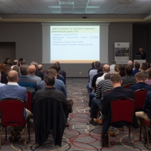
Dňa 5.12.2019 sa vo Zvolene uskutočnilo 7. Valné zhromaždenie KPÚ SR.
Prinášame Výsledky volieb do orgánov KPÚ SR a Uznesenie zo 7. Valného zhromaždenia KPÚ SR.
Uznesenie Valného zhromaždenia KPÚ SR z 5.12.2020
7.1.2020 20:32 Komora pozemkových úprav SRDňa 5.12.2019 sa vo Zvolene uskutočnilo 7. Valné zhromaždenie KPÚ SR.
Alfa Romeo Giulia and Stelvio Launch with TomTom Connected Navigation and Maps for Advanced Driver Assistance
7.1.2020 18:53 GISCafe.com Webcasts-Webinars AMSTERDAM, The Netherlands, Jan. 07, 2020 (GLOBE NEWSWIRE) -- Location technology specialist, TomTom (TOM2), today announced that its easy-to-use …HERE unveils 3D road models for Advanced Driver Assistance Systems and driver safety
7.1.2020 18:53 GISCafe.com Webcasts-Webinars • Vehicle or mobile application is fed precise data on lane markings, road width and slope, rules of the road and more• Delivers end user with …HERE launches HERE Last Mile to remove uncertainty in urban delivery
7.1.2020 18:53 GISCafe.com Webcasts-Webinars January 7, 2020 Las Vegas, CES 2020 – The last mile is not only the most expensive part of the supply chain, it is also a key element of the …Hitachi Automotive Systems Americas and TomTom Collaborate on a Proof of Concept for Developing Next-Gen Smart Navigation Solution
7.1.2020 18:53 GISCafe.com Webcasts-Webinars SILICON VALLEY, Calif., Jan. 07, 2020 (GLOBE NEWSWIRE) -- Hitachi Automotive Systems Americas, Inc. and TomTom (TOM2), the location technology …South Dakota Signs Participating Addendum with DroneUp Providing Public Sector Agencies Access to Drone Services
7.1.2020 18:53 GISCafe.com Webcasts-Webinars VIRGINIA BEACH, Va., Jan. 7, 2020 — (PRNewswire) — DroneUp, LLC and the State of South Dakota have signed a Participating Addendum …Hexagon Introduces Visualisation Platform for the Accurate Digital Representation of the Real World
7.1.2020 18:51 GISCafe.com Webcasts-Webinars NACKA STRAND, Sweden, Jan. 7, 2020 — (PRNewswire) — Hexagon AB, a global leader in sensor, software and autonomous solutions, today …Velodyne Lidar Announces Anand Gopalan as New CEO
7.1.2020 16:40 GISCafe.com Webcasts-Webinars Company Founder David Hall to Continue as Chairman of the BoardSAN JOSE, Calif. — (BUSINESS WIRE) — January 6, 2020 —
…
LeddarTech to Showcase LiDAR Technologies at Multiple Locations at CES 2020
7.1.2020 16:40 GISCafe.com Webcasts-Webinars QUEBEC CITY, Jan. 07, 2020 (GLOBE NEWSWIRE) -- LeddarTech®, an industry leader in LiDAR technology who provides the most versatile and scalable …CoreLogic Reports November Home Prices Increased by 3.7% Year Over Year
7.1.2020 16:40 GISCafe.com Webcasts-Webinars The CoreLogic HPI Forecast indicates U.S. price index will reach5.3% by November 2020
Ten states still have prices …
Esri Joins HERE Technologies at CES 2020
7.1.2020 16:40 GISCafe.com Webcasts-Webinars Esri Experts Will Discuss How Location Data Can Help Retailers Make Better Business DecisionsREDLANDS, Calif. — (BUSINESS WIRE) — …
Kratos Receives $6 Million in Unmanned Aerial Target Drone System Orders
7.1.2020 16:40 GISCafe.com Webcasts-Webinars SAN DIEGO, Jan. 07, 2020 (GLOBE NEWSWIRE) -- Kratos Defense & Security Solutions, Inc. (Nasdaq: KTOS), a leading National Security Solutions …Gretchen Larsen Idsinga joins Avineon as President, U.S. Federal
7.1.2020 16:40 GISCafe.com Webcasts-Webinars MCLEAN, Va., Jan. 07, 2020 (GLOBE NEWSWIRE) -- Avineon, Inc., a successful provider of information technology, geospatial, and engineering support …Boosting the car sensor data ecosystem: HERE introduces neutral server for safe and secure third-party access
7.1.2020 16:40 GISCafe.com Webcasts-Webinars HERE adds neutral server capabilities to the HERE Marketplace to enable safe, secure and privacy-compliant third-party access to car sensor data for …Inpixon’s Indoor Mapping Platform Chosen by Chile’s Leading Shopping Mall to Deliver Indoor Intelligence
7.1.2020 16:40 GISCafe.com Webcasts-Webinars PALO ALTO, Calif. and TORONTO, Jan. 07, 2020 (GLOBE NEWSWIRE) -- Inpixon (Nasdaq: INPX), a leading indoor data company that specializes in …HERE introduces HD GNSS, a precise global positioning solution for the mass-market
7.1.2020 16:40 GISCafe.com Webcasts-Webinars • Enables new user experiences with lane level navigation, augmented and virtual reality • HD GNSS combines Precise Point Positioning …Spatial Networks Announces $42.5 Million Series A Financing Round from Kayne Partners and Kennet Partners
7.1.2020 16:40 GISCafe.com Webcasts-Webinars Leading field force data intelligence software platform provider to leverage funds to advance product development, sales and marketing, and market …Oznámení o vyhlášení výběrového řízení
7.1.2020 15:15 ČÚZK - předpisy a opatření Katastrální úřad pro Královéhradecký kraj zveřejnil novou aktualitu: Oznámení o vyhlášení výběrového řízení na služební místo rada / odborný rada – vedoucí oddělení hospodářské správy kanceláře ředitele Katastrálního úřadu pro Královéhradecký krajOznámení o vyhlášení výběrového řízení
7.1.2020 15:15 ČÚZK - předpisy a opatření Katastrální úřad pro Královéhradecký kraj zveřejnil novou aktualitu: Oznámení o vyhlášení výběrového řízení na služební místo rada / odborný rada – vedoucí oddělení hospodářské správy kanceláře ředitele Katastrálního úřadu pro Královéhradecký krajRada / odborný rada – vedoucí oddělení hospodářské správy kanceláře ředitele Katastrálního úřadu pro
7.1.2020 15:07 ČÚZK /Urady/Katastralni-urady/Katastralni-urady/Katastralni-urad-pro-Kralovehradecky-kraj/Uredni-deska/Oznameni-a-jina-uredni-sdeleni/Volna-mista/Rada-odborny-rada-–-vedouci-oddeleni-hospodarskeRada / odborný rada – vedoucí oddělení hospodářské správy kanceláře ředitele Katastrálního úřadu pro
7.1.2020 15:07 ČÚZK - předpisy a opatření Katastrální úřad pro Královéhradecký kraj - kancelář úřaduvypisuje výběrové řízení na místo
Rada / odborný rada – vedoucí oddělení hospodářské správy kanceláře ředitele Katastrálního úřadu pro Královéhradecký kraj
Rada / odborný rada – vedoucí oddělení hospodářské správy kanceláře ředitele Katastrálního úřadu pro
7.1.2020 15:07 ČÚZK - volná místa Katastrální úřad pro Královéhradecký kraj - kancelář úřadu vypisuje výběrové řízení na místo Rada / odborný rada – vedoucí oddělení hospodářské správy kanceláře ředitele Katastrálního úřadu proHledáme marketingovou posilu
7.1.2020 14:22 ARCDATAZajímáte se o vše ze světa geografie a geoinformatiky? Rádi píšete a rozvíjíte kreativního ducha? Pak hledáme právě Vás.
 Koho hledáme?
Rádi bychom náš tým posílili o marketingového specialistu. Uvítáme, pokud již budete mít s marketingem nějakou zkušenost, ale pozice je vhodná i pro absolventy.
Na co se těšit?
Na různorodou a kreativní práci, jako je správa sociálních sítí, psaní textů pro firemní web a časopis či organizace menších akcí.
Co nabízíme?
V první řadě je to pro Vás příležitost získávat GIS novinky hned z první ruky a skvěle se také seznámíte s využitím GIS v nejrůznějších odvětvích. Budete se učit od nejlepších lidí v oboru a dlouhodobá pracovní perspektiva v přátelském kolektivu k tomu patří samo sebou.
Pokud Vás nabídka zaujala, tak se nám neváhejte ozvat na adresu jobs@arcdata.cz.
Podrobný popis pozice naleznete na stránkách Kariéra.
Výběrové řízení na služební místo vedoucí oddělení metodiky a kontroly
7.1.2020 14:21 ČÚZK /Urady/Katastralni-urady/Katastralni-urady/Katastralni-urad-pro-Vysocinu/O-uradu/Aktuality/Vyberove-rizeni-na-sluzebni-misto-vedouci-oddeleniVýběrové řízení na služební místo vedoucí oddělení metodiky a kontroly
7.1.2020 14:21 ČÚZK - předpisy a opatření Katastrální úřad pro Vysočinu zveřejnil novou aktualitu: Oznámení o vyhlášení výběrového řízení na služební místo rada nebo odborný rada - vedoucí oddělení metodiky a kontroly Kanceláře ředitele katastrálního úřadu na Katastrálním úřadu pro Vysočinu.Odborný rada – rozhodování o povolení vkladu – RPV0902
7.1.2020 14:18 ČÚZK - předpisy a opatření Katastrální úřad pro Plzeňský kraj - Katastrální pracoviště Plzeň-jihvypisuje výběrové řízení na místo
Odborný rada – rozhodování o povolení vkladu – RPV0902
Odborný rada – rozhodování o povolení vkladu – RPV0902
7.1.2020 14:18 ČÚZK /Urady/Katastralni-urady/Katastralni-urady/Katastralni-urad-pro-Plzensky-kraj/Uredni-deska/Oznameni-a-jina-uredni-sdeleni/Volna-mista/Odborny-rada-–-rozhodovani-o-povoleni-vkladu-–-RPVOdborný rada – rozhodování o povolení vkladu – RPV0902
7.1.2020 14:18 ČÚZK - volná místa Katastrální úřad pro Plzeňský kraj - Katastrální pracoviště Plzeň-jih vypisuje výběrové řízení na místo Odborný rada – rozhodování o povolení vkladu – RPV0902Výroční zpráva dle zákona č. 106/1999 Sb. za rok 2019
7.1.2020 14:06 ČÚZK /Urady/Zememericky-urad/Zpravy-ZU/Vyrocni-zprava-ZU-dle-zakona-c-106-1999-Sb/Vyrocni-zprava-dle-zakona-c-106-1999-Sb-za-rok-(1)Výroční zpráva dle zákona č. 106/1999 Sb. za rok 2019
7.1.2020 14:06 ČÚZK - předpisy a opatření Zeměměřický úřadvydává výroční zprávu úřadu za rok
2019
Výroční zpráva dle zákona č. 106/1999 Sb. za rok 2019
7.1.2020 14:06 Zeměměřický úřad Zeměměřický úřadvydává výroční zprávu úřadu za rok
2019
Témata a semináře na sympoziu GIS Ostrava 2020. Ještě můžete přihlásit svůj referát
7.1.2020 13:52 GeoBusiness Sympozium GIS Ostrava 2020 se koná ve dnech 18. až 20. března. Do 17. 1. 2020 se můžete přihlásit s referátem nebo navrhnout svůj seminář. Hlavními řečníky letos budou Francesco Nex (University of Twente) – New trends of UAV technology in Geomatics Jakub Karas (UpVision) – Challenges and future of the UAV regulation Témata Tématy […]Rozpočet úřadu za rok 2020
7.1.2020 13:46 ČÚZK /Urady/Zememericke-a-katastralni-inspektoraty/Zememericke-a-katastralni-inspektoraty/Zememericky-a-katastralni-inspektorat-v-CB/Rozpocet/Rozpocet-uradu-za-rok-2020Rozpočet úřadu za rok 2020
7.1.2020 13:46 ČÚZK - předpisy a opatření Zeměměřický a katastrální inspektorát v Českých Budějovicíchvystavuje rozpočet úřadu za rok
2020
Rada nebo odborný rada - vedoucí oddělení metodiky a kontroly Kanceláře ředitele katastrálního úřadu
7.1.2020 13:41 ČÚZK - předpisy a opatření Katastrální úřad pro Vysočinu kancelář ředitelevypisuje výběrové řízení na místo
Rada nebo odborný rada - vedoucí oddělení metodiky a kontroly Kanceláře ředitele katastrálního úřadu
Rada nebo odborný rada - vedoucí oddělení metodiky a kontroly Kanceláře ředitele katastrálního úřadu
7.1.2020 13:41 ČÚZK - volná místa Katastrální úřad pro Vysočinu kancelář ředitele vypisuje výběrové řízení na místo Rada nebo odborný rada - vedoucí oddělení metodiky a kontroly Kanceláře ředitele katastrálního úřaduRada nebo odborný rada - vedoucí oddělení metodiky a kontroly Kanceláře ředitele katastrálního úřadu
7.1.2020 13:41 ČÚZK /Urady/Katastralni-urady/Katastralni-urady/Katastralni-urad-pro-Vysocinu/Uredni-deska/Oznameni-a-jina-uredni-sdeleni/Volna-mista/DMS/Rada-nebo-odborny-rada-vedouci-oddeleni-metodikySběr podnětů pro nový Geoportál
7.1.2020 13:23 CENIA - národní geoportál INSPIRE CENIA, česká informační agentura životního prostředí zahájila sběr uživatelských požadavků pro nový geoportál. Současný Národní geoportál INSPIRE, který CENIA provozuje již od roku 2011, čeká obnova. Pro nový geoportál sbíráme podněty a nápady a chceme znát Váš názor na stávající řešení. Chtěli bychom Vás proto požádat o vyplnění tohoto dotazníku. Dotazník obsahuje 60 stručných otázek a jeho...ThinkPad X1 Fold. Lenovo představilo první skládací PC na světě
7.1.2020 12:25 ZeměměřičNení to notebook ani desktop. Firma Lenovo představila světově první skládací PC ve formátu stran 4:3. ThinkPad X1 Fold má 13,3 palcový OLED displej, dotykový displej lze ovládat také pomocí pera a k zařízení se bude dát magneticky připojit klávesnice. Uvnitř je procesor Intel Hybrid Core. S hmotností cca 1 kg má být ThinkPad X1 v prodeji v polovině roku 2020. Prodejní […]
The post ThinkPad X1 Fold. Lenovo představilo první skládací PC na světě appeared first on Zeměměřič.
Mapová aplikace ÚPD - nové dokumentace
7.1.2020 12:00 Jihočeský kraj V mapové aplikaci Územně plánovací dokumentace obcí byla aktualizována územně plánovací dokumentace obcí v ORP České Budějovice – Dobrá Voda, Pištín, Jivno, Hluboká nad Vltavou; v ORP Týn nad Vltavou – Všemyslice, Týn nad Vltavou; v ORP Jindřichův Hradec – Rodvínov; ORP Písek – Varvažov a v ORP Vimperk – Nicov.Dron V-Coptr Falcon od Zero Zero Robotics má být tišší a s větší výdrží ve vzduchu
7.1.2020 11:25 GeoBusiness Ačkoliv většina současných x-koptér (civilních dronů) používá čtyři rotory, ve firmě Zero Zero Robotics, založené v roce 2014, použili rotory pouze dva. V prosinci představený dron nazvaný V-Coptr Falcon může být ve vzduchu až 50 minut (letový čas na jedno nabití baterie se u běžně dostupných „amatérských“ dronů pohybuje kolem půl hodiny). Nové uspořádání rotorů […]Rada/Odborný rada – oddělení právních vztahů k nemovitostem
7.1.2020 10:59 ČÚZK - předpisy a opatření Katastrální úřad pro Karlovarský kraj Katastrální pracoviště Sokolovvypisuje výběrové řízení na místo
Rada/Odborný rada – oddělení právních vztahů k nemovitostem
Rada/Odborný rada – oddělení právních vztahů k nemovitostem
7.1.2020 10:59 ČÚZK - volná místa Katastrální úřad pro Karlovarský kraj Katastrální pracoviště Sokolov vypisuje výběrové řízení na místo Rada/Odborný rada – oddělení právních vztahů k nemovitostemRada/Odborný rada – oddělení právních vztahů k nemovitostem
7.1.2020 10:59 ČÚZK /Urady/Katastralni-urady/Katastralni-urady/Katastralni-urad-pro-Karlovarsky-kraj/Uredni-deska/Oznameni-a-jina-uredni-sdeleni/Volna-mista/DMS/Rada-Odborny-rada-–-oddeleni-pravnich-vztahu-k-nemVýroční zpráva dle zákona č. 106/1999 Sb. za rok 2019
7.1.2020 10:44 ČÚZK /Urady/Zememericke-a-katastralni-inspektoraty/Zememericke-a-katastralni-inspektoraty/Zememericky-a-katastralni-inspektorat-v-CB/Vyrocni-zpravy/Vyrocni-zprava-dle-zakona-c-106-1999-Sb-za-rok-(1)Výroční zpráva dle zákona č. 106/1999 Sb. za rok 2019
7.1.2020 10:44 ČÚZK - předpisy a opatření Zeměměřický a katastrální inspektorát v Českých Budějovicíchvydává výroční zprávu úřadu za rok
2019
20200107 Rada / odborný rada – interní auditor Katastrálního úřadu pro Středočeský kraj
7.1.2020 9:53 ČÚZK /Urady/Katastralni-urady/Katastralni-urady/Katastralni-urad-pro-Stredocesky-kraj/O-uradu/Aktuality/20190828-Odborny-rada-oddeleni-pravnich-vztahu-(2)20200107 Rada / odborný rada – interní auditor Katastrálního úřadu pro Středočeský kraj
7.1.2020 9:53 ČÚZK - předpisy a opatření Katastrální úřad pro Středočeský kraj Vyhlášení výběrového řízení: Rada / odborný rada – interní auditor Katastrálního úřadu pro Středočeský kraj V části "Úřední deska", v sekci "Oznámení a jiná úřední sdělení" bylo vystaveno "Oznámení o vyhlášení výběrového řízení na obsazení služebního místa Rada / odborný rada – interní auditor Katastrálního úřadu pro Středočeský kraj"Radiometrická mapa 1 : 500 000 (GEOČR500)
7.1.2020 1:00 Cenia - Katalog metadat ČR - INSPIRE WMS služba zobrazuje Radiometrickou mapu České republiky 1:500 000 (M. Manová, M. Matolín,1995), která byla publikována ČGS v rámci Atlasu map České republiky (GEOČR500) v roce 1998. Údaje o dávkovém příkonu gama záření hornin jsou založeny na výsledcích regionálních a detailních leteckých měřeních terestrického záření a ilustrují distribuci přírodních radionuklidů v horninách v České republice.Geomagnetická mapa 1 : 500 000 (GEOČR500)
7.1.2020 1:00 Cenia - Katalog metadat ČR - INSPIRE WMS služba zobrazující Geomagnetickou mapu České republiky (K. Šalanský, 1995) v měřítku 1 : 500 000. Jsou zobrazeny plochy a izolinie hodnot magnetických anomálií ve formě izanomál ?T. Zvolený základní interval izolinií po 25 nT zde dostatečně přesně zachycuje průběh magnetického pole.Magnetometrie
7.1.2020 1:00 Cenia - Katalog metadat ČR - INSPIRE Databáze obsahuje magnetické anomálie delta ?T z leteckého geomagnetického mapování ČR v měřítku 1 : 25 000 od roku 1960 (ca 85 % celého území); zbytek území je pokryt měřítem 1 : 200 000 z předcházejících etap (1958-1960). Měření v letech v letech 1960-1971 bylo realizováno s analogovou registrací (flux-gate magnetometr) s přesností ca 10 nT. Další etapy měření byly již registrovány digitálně (protonový nebo cesiový magnetometr) s přesností ca 2 nT. Aeromagnetická měření jsou doplněna pozemním měřením (východní Morava, Krkonoše, Šumava) v oblastech, kde letecké měření chybí.Spektrometrie
7.1.2020 1:00 Cenia - Katalog metadat ČR - INSPIRE Databáze obsahuje data ze spektrometrického průzkumu. Gama spektrometrie představuje měření koncentrace přirozených radioizotopů uranu 328U a 235U [ppm], thoria 232Th [ppm] a draslíku 40K [%]. Měření spektrometrie jako součást letecké geofyziky začalo v roce 1976, současně se měřila úhrnná aktivita gama. Tímto měřením je pokryto ca 60 % území České republiky.Vertikální elektrické sondování (VES)
7.1.2020 1:00 Cenia - Katalog metadat ČR - INSPIRE WMS služba znázorňuje lokalizace měřících stanovišť vertikálního elektrického sondování (VES) vybraných akcí (kampaní) na území České republiky od roku 1957.Radiometrie
7.1.2020 1:00 Cenia - Katalog metadat ČR - INSPIRE Databáze obsahuje data z radiometrického průzkumu. Radiometrie představuje měření úplné aktivita gama přirozených radioizotopů hornin na zemském povrchu, dříve se měřil úplný expoziční příkon. Měření expozičního příkonu probíhalo v letech 1957-1973 s využitím Geiger-Muellerova počítače a pokrývá celé území České republiky; naměřená data jsou uložena v jednotkách [µR/h]. Další etapa radiometrie začala v roce 1976 měřením úplné aktivity gama současně s měřením spektrometrie; měření pokrývá asi 60 % území ČR, data jsou uložena v jednotkách [Ur].HERE Mobility Kicks Off 2020 With Over 700 Partners, Counting More Than 1M Driven KM Saved
7.1.2020 0:26 GISCafe.com Webcasts-Webinars The HERE Mobility Marketplace witnessed 150% year-over-year growth in 2019, marking a significant milestone in its mission to establish mobility …Baraja Unveils Next Generation LiDAR Sensing Platform With Interference Immunity
7.1.2020 0:26 GISCafe.com Webcasts-Webinars LAS VEGAS — (BUSINESS WIRE) — January 6, 2020 —At CES 2020, Baraja, developer of Spectrum-Scan™ LiDAR, is unveiling its …
Innovusion to Release a New LiDAR System More Advanced Than Human Sight, “Falcon”
7.1.2020 0:26 GISCafe.com Webcasts-Webinars Built with safety and reliability in mind, the groundbreakingtechnology is able to intelligently focus anywhere
SUNNYVALE, Calif. …
Insight LiDAR Announces Highest Resolution FMCW LiDAR for Autonomous Vehicles
7.1.2020 0:26 GISCafe.com Webcasts-Webinars Digital Coherent LiDAR™ puts 10-20 times more pixels on objects,enabling fast, accurate identification.
LAS VEGAS — …
DroneInch Introduces Industry's First Carrier-Class Drone Operations Management Platform
7.1.2020 0:26 GISCafe.com Webcasts-Webinars FREMONT, Calif., Jan. 6, 2020 — (PRNewswire) — DroneInch, Inc. today announced DroneInch 2.0, the industry's first carrier-class drone …Hexagon Introduces Smart Autonomous Mobility Solutions Portfolio at CES 2020
7.1.2020 0:26 GISCafe.com Webcasts-Webinars NACKA STRAND, Sweden, Jan. 6, 2020 — (PRNewswire) — Hexagon AB, a global leader in sensor, software and autonomous solutions, introduced …NV5 to Host Conference Call to Discuss Acquisition of Quantum Spatial
7.1.2020 0:26 GISCafe.com Webcasts-Webinars HOLLYWOOD, Fla., Jan. 06, 2020 (GLOBE NEWSWIRE) -- NV5 Global, Inc. (the “Company” or “NV5”) (Nasdaq: NVEE), a provider of professional and …Pokyny pro zpracování závěrečných prací
7.1.2020 0:00 Geografický ústav MUAktualizované pokyny pro zpracování bakalářských a diplomových prací z geografie a kartografie jsou ke stažení na adrese https://is.muni.cz/auth/el/sci/jaro2020/Z6004/Pokyny_BPDP_GU.pdf.
Od předchozí verze se tyto nové pokyny liší v následujících bodech:
- nové logo Masarykovy univerzity na deskách a titulním listu,
- možnost tisku vlastního textu práce oboustranně,
- odevzdání dvou tištěných exemplářů.
HERE at CES: new products, new partners, new possibilities
6.1.2020 17:51 GISCafe.com Webcasts-Webinars The New Reality is HERE and it's location-powered January 6, 2020 Las Vegas, CES 2020 – This week at CES 2020, HERE …51WORLD Unveils All-Element Virtual Scenarios to Empower Various Industries
6.1.2020 17:51 GISCafe.com Webcasts-Webinars Shanghai, China, Jan. 06, 2020 (GLOBE NEWSWIRE) -- 51WORLD unveiled its latest product, named all-element virtual scenarios, in the Earth Clone3 …Sense Photonics Introduces Osprey, the First Modular FLASH LiDAR for Autonomous Vehicles
6.1.2020 17:51 GISCafe.com Webcasts-Webinars Units now available for preorder for $3,200 on sensephotonics.comDURHAM, N.C., Jan. 6, 2020 — (PRNewswire) — Sense Photonics, a …
Cepton to Showcase Award-Winning Lidar Solutions and Multimarket Collaborations at CES 2020
6.1.2020 17:51 GISCafe.com Webcasts-Webinars From award winning sensors to perception software to complete smart solutions, Cepton highlights lidar leadership and industry collaborations shaping …Ouster Releases New Ultra-Wide View OS0 Lidar Sensor and Full Lineup of 128-Channel Resolution Lidar Sensors
6.1.2020 17:51 GISCafe.com Webcasts-Webinars Introducing the OS0, a new category of ultra-wide field-of-view lidar128-channel resolution now available across Ouster OS0, OS1, and OS2 series …
Dotační titul určený obcím pro mapování a tvorbu dat DTM
6.1.2020 15:35 Plzeňský kraj Plzeňský kraj na svých stránkách uveřejnil informace o novém dotačním titulu pro podporu datového fondu technické mapy, který je určen pro obce a jeho hlavním účelem je podpora mapování inženýrských sítí. Více o titulu – zde.ITT: EGNSS-based rail safety service analysis
6.1.2020 11:23 European GNSS Agency
The European Commission’s Directorate-General for Internal Market, Industry, Entrepreneurship and SMEs (DG GROW) has issued an Invitation to Tender (ITT) for a planned call for a new service contract to assess the feasibility of an EGNSS-based safety service for the rail sector beyond 2022 which would enable the rationalisation of rail signalling infrastructure.
The main tasks of the study are the identification of user and service requirements, the development of an appropriate integrity concept and the definition of the service provision scheme. As part of the user level integrity concept, the contractor shall develop an algorithm to cope with the local environment of the rail sector.
When defining the service, the contractor shall produce the service concept and consolidate it through iteration with a Working Group of experts. The analysis will enable the EC to determine whether a European rail safety service based on EGNOS and Galileo needs to be created specifically to enable the rationalisation of the current rail signalling infrastructure.
More information about the Invitation to Tender (ITT) can be found here.
European GNSS in ERTMS
Rail signalling systems are used to safely control railway traffic in order to prevent train collisions. There are currently more than 20 rail signalling systems in Europe, since each country has developed its own railway infrastructure, equipment and operational rules. This has led to increased costs and technical and operational complexity of the train sets. This is why the European rail industry, supported by the EU Institutions, is working on the European Rail Traffic Management System (ERTMS), with an aim to implement a common signalling system for Europe.
Read this: GNSS and the future of rail.
The European Commission (EC) is currently specifying the long-term evolution of the EGNSS programme, including new services for Galileo and EGNOS. The use of an EGNSS receiver in combination with other sensors could provide an accurate and reliable position which would translate into the overall improvement of the rail system.
Galileo is Europe’s Global Navigation Satellite System (GNSS) providing a highly accurate, guaranteed global positioning service under civilian control. Galileo has been operational since the Initial Service declaration at the end of 2016. Full Operational Capability is expected to be reached in 2020.
EGNOS is the European SBAS and augments GPS L1 C/A civilian signal by providing corrections and integrity information for positioning and navigation applications over Europe. EGNOS Version 3, set to enter into service in the near future, will augment both GPS and Galileo constellations in the L1 and L5 bands and will extend the service area to the entire landmasses of EU Member States.
Media note: This feature can be republished without charge provided the European GNSS Agency (GSA) is acknowledged as the source at the top or the bottom of the story. You must request permission before you use any of the photographs on the site. If you republish, we would be grateful if you could link back to the GSA website (http://www.gsa.europa.eu).
ITT: EGNSS-based rail safety service analysis
6.1.2020 11:23 European GNSS AgencyThe European Commission’s Directorate-General for Internal Market, Industry, Entrepreneurship and SMEs (DG GROW) has issued an Invitation To Tender (ITT) for a planned call for a new service contract to assess the feasibility of an EGNSS-based safety service for the rail sector beyond 2022 which would enable the rationalisation of rail signalling infrastructure.
The main tasks of the study are the identification of user and service requirements, the development of an appropriate integrity concept and the definition of the service provision scheme. As part of the user level integrity concept, the contractor shall develop an algorithm to cope with the local environment of the rail sector.
When defining the service, the contractor shall produce the service concept and consolidate it through iteration with a Working Group of experts. The analysis will enable the EC to determine whether a European rail safety service based on EGNOS and Galileo needs to be created specifically to enable the rationalisation of the current rail signalling infrastructure.
More information about the Invitation to Tender (ITT) can be found here.
European GNSS in ERTMS
Rail signalling systems are used to safely control railway traffic in order to prevent train collisions. There are currently more than 20 rail signalling systems in Europe, since each country has developed its own railway infrastructure, equipment and operational rules. This has led to increased costs and technical and operational complexity of the train sets. This is why the European rail industry, supported by the EU Institutions, is working on the European Rail Traffic Management System (ERTMS), with an aim to implement a common signalling system for Europe.
Read this: GNSS and the future of rail.
The European Commission (EC) is currently specifying the long-term evolution of the EGNSS programme, including new services for Galileo and EGNOS. The use of an EGNSS receiver in combination with other sensors could provide an accurate and reliable position which would translate into the overall improvement of the rail system.
Galileo is Europe’s Global Navigation Satellite System (GNSS) providing a highly accurate, guaranteed global positioning service under civilian control. Galileo has been operational since the Initial Service declaration at the end of 2016. Full Operational Capability is expected to be reached in 2020.
EGNOS is the European SBAS and augments GPS L1 C/A civilian signal by providing corrections and integrity information for positioning and navigation applications over Europe. EGNOS Version 3, set to enter into service in the near future, will augment both GPS and Galileo constellations in the L1 and L5 bands and will extend the service area to the entire landmasses of EU Member States.
Media note: This feature can be republished without charge provided the European GNSS Agency (GSA) is acknowledged as the source at the top or the bottom of the story. You must request permission before you use any of the photographs on the site. If you republish, we would be grateful if you could link back to the GSA website (http://www.gsa.europa.eu).
ITT: EGNSS-based rail safety service analysis
6.1.2020 11:23 European GNSS AgencyThe European Commission’s Directorate-General for Internal Market, Industry, Entrepreneurship and SMEs (DG GROW) has issued an Invitation to Tender (ITT) for a planned call for a new service contract to assess the feasibility of an EGNSS-based safety service for the rail sector beyond 2022 which would enable the rationalisation of rail signalling infrastructure.
The main tasks of the study are the identification of user and service requirements, the development of an appropriate integrity concept and the definition of the service provision scheme. As part of the user level integrity concept, the contractor shall develop an algorithm to cope with the local environment of the rail sector.
When defining the service, the contractor shall produce the service concept and consolidate it through iteration with a Working Group of experts. The analysis will enable the EC to determine whether a European rail safety service based on EGNOS and Galileo needs to be created specifically to enable the rationalisation of the current rail signalling infrastructure.
More information about the Invitation to Tender (ITT) can be found here.
European GNSS in ERTMS
Rail signalling systems are used to safely control railway traffic in order to prevent train collisions. There are currently more than 20 rail signalling systems in Europe, since each country has developed its own railway infrastructure, equipment and operational rules. This has led to increased costs and technical and operational complexity of the train sets. This is why the European rail industry, supported by the EU Institutions, is working on the European Rail Traffic Management System (ERTMS), with an aim to implement a common signalling system for Europe.
Read this: GNSS and the future of rail.
The European Commission (EC) is currently specifying the long-term evolution of the EGNSS programme, including new services for Galileo and EGNOS. The use of an EGNSS receiver in combination with other sensors could provide an accurate and reliable position which would translate into the overall improvement of the rail system.
Galileo is Europe’s Global Navigation Satellite System (GNSS) providing a highly accurate, guaranteed global positioning service under civilian control. Galileo has been operational since the Initial Service declaration at the end of 2016. Full Operational Capability is expected to be reached in 2020.
EGNOS is the European SBAS and augments GPS L1 C/A civilian signal by providing corrections and integrity information for positioning and navigation applications over Europe. EGNOS Version 3, set to enter into service in the near future, will augment both GPS and Galileo constellations in the L1 and L5 bands and will extend the service area to the entire landmasses of EU Member States.
Media note: This feature can be republished without charge provided the European GNSS Agency (GSA) is acknowledged as the source at the top or the bottom of the story. You must request permission before you use any of the photographs on the site. If you republish, we would be grateful if you could link back to the GSA website (http://www.gsa.europa.eu).
Nabídka práce na plný úvazek Etnologický ústav Akademie věd ČR, v.v.i., Brno (analýza DMT, historických kartografických pramenů a modelování změn krajiny)
6.1.2020 10:59 Etnologický ústav Akademie věd České republiky, v. v. i., vyhlašuje výběrové řízení na pozici geoinformatik pro projekt NAKI Stopy lidského umu s místem výkonu práce na detašovaném pracovišti Brno a předpokládaným nástupem 1. 3. 2020 popř. dle dohody. Předpokládaná pracovní náplň úspěšného uchazeč/uchazečky: • analýza DMT a kartografických pramenů (Valašsko) • modelování vývoje krajiny • […]Nabídka práce (geoinformatik), Etnologický ústav Akademie věd ČR, v.v.i., Brno
6.1.2020 10:59 Etnologický ústav Akademie věd České republiky, v. v. i., vyhlašuje výběrové řízení na pozici geoinformatik pro projekt NAKI Stopy lidského umu s místem výkonu práce na detašovaném pracovišti Brno a předpokládaným nástupem 1. 3. 2020 popř. dle dohody. Předpokládaná pracovní náplň úspěšného uchazeč/uchazečky: • analýza DMT a kartografických pramenů (Valašsko) • modelování vývoje krajiny • […]Rozpočet úřadu za rok 2020
6.1.2020 9:28 ČÚZK - předpisy a opatření Katastrální úřad pro Liberecký krajvystavuje rozpočet úřadu za rok
2020
Rozpočet úřadu za rok 2020
6.1.2020 9:28 ČÚZK /Urady/Katastralni-urady/Katastralni-urady/Katastralni-urad-pro-Liberecky-kraj/Rozpocet/Rozpocet-uradu-za-rok-2020Veselé Vánoce a šťastný nový rok 2020
6.1.2020 9:25 Hrdlička Přejeme Vám hezké prožití Vánočních svátků a vše nejlepší do nového roku 2020.HRDLIČKA spol. s r.o. - Veselé Vánoce a šťastný nový rok 2020
6.1.2020 9:25 Hrdlička Přejeme Vám hezké prožití Vánočních svátků a vše nejlepší do nového roku 2020.Výroční souhrnná resortní zpráva za rok 2019
6.1.2020 9:23 ČÚZK - předpisy a opatření Katastrální úřad pro Ústecký krajvydává výroční zprávu úřadu za rok
2019
Rozpočet úřadu za rok 2020
6.1.2020 9:20 ČÚZK - předpisy a opatření Katastrální úřad pro Jihočeský krajvystavuje rozpočet úřadu za rok
2020
Rozpočet úřadu za rok 2020
6.1.2020 9:20 ČÚZK /Urady/Katastralni-urady/Katastralni-urady/Katastralni-urad-pro-Jihocesky-kraj/Rozpocet/Rozpocet-uradu-za-rok-2020Zveřejnění obsahu informací poskytnutých na žádost dle zákona č. 106/1999 Sb. za rok 2019
6.1.2020 8:56 ČÚZK /Urady/Katastralni-urady/Katastralni-urady/Katastralni-urad-pro-Ustecky-kraj/Casto-hledane-informace/Poskytovani-informaci-106-1999-Sb/Zverejneni-obsahu-informaci-poskytnutych-na-za-(1)/Zverejneni-obsahu-informaci-poskytnutych-na-za-(1)Zveřejnění obsahu informací poskytnutých na žádost dle zákona č. 106/1999 Sb. za rok 2019
6.1.2020 8:56 ČÚZK - předpisy a opatření Katastrální úřad pro Ústecký krajzveřejňuje obsah informace poskytnutých na žádost dle zákona č. 106/1999 Sb. za rok
2019
vrchní referent/rada – investiční referent
6.1.2020 8:50 ČÚZK /Urady/Katastralni-urady/Katastralni-urady/Katastralni-urad-pro-hlavni-mesto-Prahu/O-uradu/Aktuality/KU-00068KÚ-00068
6.1.2020 8:50 ČÚZK - předpisy a opatření Katastrální úřad pro hlavní město Prahu zveřejnil novou aktualitu: Ředitel úřadu vyhlašuje výběrové řízení na služební místo: odborný referent/vrchní referent – návrh zápisu v katastruKÚ-00068
6.1.2020 8:50 ČÚZK - předpisy a opatření Český úřad zeměměřický a katastrální zveřejnil novou aktualitu: Ředitel úřadu vyhlašuje výběrové řízení na služební místo: odborný referent/vrchní referent – návrh zápisu v katastruvrchní referent/rada – investiční referent
6.1.2020 8:50 ČÚZK - předpisy a opatření Katastrální úřad pro hlavní město Prahu zveřejnil novou aktualitu: Ředitel úřadu vyhlašuje výběrové řízení na služební místo: vrchní referent/rada – investiční referentKÚ-00068
6.1.2020 8:50 ČÚZK /Urady/Katastralni-urady/Katastralni-urady/Katastralni-urad-pro-hlavni-mesto-Prahu/O-uradu/Aktuality/KU-00068KÚ-00068-2020-100-01001 42-Oznameni_o vyhlášení VŘ-návrh zápisu v katastru_signed
6.1.2020 8:47 ČÚZK - volná místa Katastrální úřad pro hlavní město Prahu Katastrální pracoviště Praha vypisuje výběrové řízení na místo KÚ-00068-2020-100-01001 42-Oznameni_o vyhlášení VŘ-návrh zápisu v katastru_signedKÚ-00068-2020-100-01001 42-Oznameni_o vyhlášení VŘ-návrh zápisu v katastru_signed
6.1.2020 8:47 ČÚZK - předpisy a opatření Katastrální úřad pro hlavní město Prahu Katastrální pracoviště Prahavypisuje výběrové řízení na místo
odborný referent/vrchní referent – návrh zápisu v katastru
KÚ-00068-2020-100-01001 42-Oznameni_o vyhlášení VŘ-návrh zápisu v katastru_signed
6.1.2020 8:47 ČÚZK /Urady/Katastralni-urady/Katastralni-urady/Katastralni-urad-pro-hlavni-mesto-Prahu/Uredni-deska/Oznameni-a-jina-uredni-sdeleni/Volna-mista/DMS/KU-00068-2020-100-01001-42-Oznameni_o-vyhlaseni-VRVzniká Uživatelské fórum pro dynamické dopravní informace
6.1.2020 8:32 GeoBusiness Začátkem listopadu 2019 uspořádalo Ředitelství silnic a dálnic ČR a Ministerstvo dopravy ve spolupráci se Sdružením pro dopravní telematiku v Praze workshop a zároveň úvodní setkání potenciálních zájemců o členství v Uživatelském fóru pro dynamické dopravní informace s cílem představit myšlenku nového fóra. Prioritním zájmem ŘSD je dle Filipa Týce, vedoucího odboru silniční databanky a […]Vzniká Uživatelské fórum pro dynamické dopravní informace
6.1.2020 8:32 GeoBusiness Ředitelství silnic a dálnic ČR a Ministerstvo dopravy ve spolupráci se Sdružením pro dopravní telematiku v Praze uspořádalo workshop a zároveň úvodní setkání potenciálních zájemců o členství v nově vznikajícím Uživatelském fóru pro dynamické dopravní informace. Prioritním zájmem ŘSD je dle Filipa Týce, vedoucího odboru silniční databanky a Národního dopravního informačního centra ŘSD, využití a sdílení […]Vzniká Uživatelské fórum pro dynamické dopravní informace
6.1.2020 8:32 GeoBusiness Dne 6. listopadu 2019 Ředitelství silnic a dálnic ČR a Ministerstvo dopravy ve spolupráci se Sdružením pro dopravní telematiku uspořádalo v Praze workshop a zároveň úvodní setkání potenciálních zájemců o členství v Uživatelském fóru pro dynamické dopravní informace s cílem představit myšlenku nového fóra. Fórum vzniklo jako platforma pro výměnu zkušeností a cílenou optimalizaci využití […]Školení QGIS pro začátečníky (PR)
6.1.2020 8:10 GISportal.cz
V pátek 24. ledna 2020 se v Praze na FSv ČVUT uskuteční další kurz GISMentors na téma QGIS. Kurz je určen začátečníkům . Přihláška na kurz je možná prostřednictvím formuláře na https://kurzy.gismentors.cz/. Při registraci do 8. ledna je cena 5000 Kč, pro studenty 1500 Kč. Sdružení školitelů GISMentors vzniklo v roce 2014 a zabývá se školením […]
The post Školení QGIS pro začátečníky (PR) appeared first on GISportal.cz.