


![]()

zprávy
zdroje zpráv:Pod naší přípravou a dohledem proběhla úspěšná registrace dronů Topcon Falcon 8 na ÚCL
6.11.2018 8:39 UpVision Minulý týden proběhlo úspěšné přezkoušení pilotů dronů Topcon/Intel Falcon 8 pod naší celkovou přípravou a dohledem, a které jsou první svého druhu registrované v ČR.Více zde s fotkami:
https://plus.google.com/u/0/b/115833877689730865211/+UpvisionCz1/posts/Weq3Fndy6iJ
Mapová aplikace ÚAP - aktualizace
6.11.2018 8:25 Jihočeský kraj Mapová aplikace Územně analytické podklady byla aktualizována k 5. 11. 2018.Mapová aplikace ÚPD - nové dokumentace
6.11.2018 8:20 Jihočeský kraj V mapové aplikaci Územně plánovací dokumentace obcí byla aktualizována územně plánovací dokumentace obcí Dačice, Dolní Třebonín, Kunžak, Plavsko, Přední Výtoň, Příbraz a Vyšší Brod.Odpočítávání ke startu družice MetOp-C
6.11.2018 7:28 Český Kosmický PortálTýmy ve středisku ESA ESOC (European Space Operations Centre) v Německu se už několik měsíců připravují na nadcházející start družice MetOp-C. Jde o nejnovější z řady meteorologických satelitů, které poskytnou data z polární oběžné dráhy ve vysokém rozlišení pro předpovídání počasí a monitorování klimatu.
Odpočítávání ke startu družice MetOp-C
6.11.2018 7:28 Český Kosmický PortálTýmy ve středisku ESA ESOC (European Space Operations Centre) v Německu se už několik měsíců připravují na nadcházející start družice MetOp-C. Jde o nejnovější z řady meteorologických satelitů, které poskytnou data z polární oběžné dráhy ve vysokém rozlišení pro předpovídání počasí a monitorování klimatu.
Geohazardy (optimalizováno pro mobilní zařízení)
6.11.2018 1:00 Cenia - Katalog metadat ČR - INSPIRE Mapová aplikace, zobrazuje vymapované objekty, které patří do kategorie geohazardů. Jedná se o data úložných míst těžebního odpadu, důlní díla, poddolovaná území, svahové nestability a radonová mapa. Stručný popis je doplněn odkazy na další informace a u důlních děl i na dokumentační fotografie. Aplikace využívá řešení vyvinuté ČGS pro zobrazování mapových služeb pomocí ESRI API 3.x. Je funkčně a designem optimalizována pro použití na dotykových zařízeních a malých displejích. Aplikace umožňuje lokalizovat aktuální polohu uživatele na mapě pomocí geolokačních schopností použitého zařízení, čímž usnadňuje využití přímo v terénu. Vše na podkladě podrobných topografických map nebo leteckých snímků přebíraných od společnosti Seznam.cz, a.s..Geovědní mapy (optimalizováno pro mobilní zařízení)
6.11.2018 1:00 Cenia - Katalog metadat ČR - INSPIRE Mapová aplikace zobrazuje Geologickou mapu České republiky v měřítku 1 : 50 000, indexy ke geologické mapě a vrstvu rukopisných map geologické mapy 1 : 28 800 z 19. století pro srovnání geologického poznání. Dále je v aplikaci vrstva vrtné prozkoumanosti (databáze Geologicky dokumentovaných objektů), kde jsou data: hloubka horniny pod kvartérem, kvartér v celé hloubce vrtu a vrty bez litologických dat.Aplikace využívá řešení vyvinuté ČGS pro zobrazování mapových služeb pomocí ESRI API 3.x. Je funkčně a designem optimalizována pro použití na dotykových zařízeních a malých displejích. Aplikace umožňuje lokalizovat aktuální polohu uživatele na mapě pomocí geolokačních schopností použitého zařízení, čímž usnadňuje využití přímo v terénu.Vše na podkladě podrobných topografických map nebo leteckých snímků přebíraných od společnosti Seznam.cz, a.s..INSPIRE téma Rozšířené Parcely (CPX)
6.11.2018 1:00 Cenia - Katalog metadat ČR - INSPIRE Rozšíření má za cíl poskytovat katastrální mapu s obsahem podle vyhlášky ve vektorové podobě ve struktuře plně v souladu se strukturou danou směrnicí INSPIRE. Data rozšiřují směrnici INSPIRE pro téma katastrální parcely (CP) o věcná břemena, geodetické body, další prvky mapy, původní obloukovou geometrii a o parcely určené definičním bodem (ty pouze v oblastech s analogovou mapou). Vychází z katastrální mapy, která je závazným státním mapovým dílem velkého měřítka, obsahuje body polohového bodového pole, polohopis a popis a může mít formu digitální mapy, analogové mapy nebo digitalizované mapy. Publikovaná data obsahují katastrální území pro celou Českou Republiku, parcely a jejich hranice, věcná břemena, další prvky mapy a původní obloukovou geometrii z území, kde je digitální mapa (k 26. 11. 2018 je to 96,16% území České republiky, t.j. 75 840,00km2) a ve zbytku území katastrální parcely určené pouze definičním bodem (tedy bez hranic a polygonu). Katastrální parcely a hranice obsahují oproti datové sadě INSPIRE některé atributy navíc. Jedná se o typ hranice, způsob využití území, druh pozemku, vazbu na budovu a o mapové značky. Více katastrální zákon 344/1992 SB., katastrální vyhláška č.26/2007 Sb. v platném znění a INSPIRE Data Specification on Cadastral Parcels v 3.0.1. Data ve formátu GML 3.2.1 jsou validní proti schématu XML pro Rozšířené Parcely (CPX) ve verzi 4.0.Prohlížecí služba WMS - ZABAGED® (vizualizace nad ortofoto)
6.11.2018 1:00 Cenia - Katalog metadat ČR - INSPIRE Prohlížecí služba ZABAGED® (vizualizace nad ortofoto) je veřejná prohlížecí mapová služba určená k prohlížení objektů ZABAGED® (včetně výškopisu ve formě vrstevnic) ve spojení s produktem Ortofoto ČR. Jedná se o prohlížecí službu poskytovanou technologií Esri ArcGIS Server. Jedná se o on-line dynamickou mapovou službu publikovanou z vektorových databázově uložených dat, lze proto i pracovat s jednotlivými vrstvami. WMS rozhraní navíc poskytuje oproti REST rozhraní i operaci GetFeatureInfo, která umožňuje klientům WMS dotazování na atributové záznamy objektů ZABAGED®. Kartografická vizualizace objektů ZABAGED® je provedena s ohledem na možnost kombinace s produktem Ortofoto ČR. Službu lze proto využít pro tvorbu tematických ortofotomap. Bodové a liniové mapové značky mají výrazné barevné provedení, aby vynikly na pozadí ortofota. Plochy reprezentující objekty ZABAGED® jsou ve službě znázorněny jen konturou bez výplně, aby nezakrývaly situaci zachycenou na ortofotu. Služba je určena k prohlížení od měřítka cca 1:10 000.Emise ze stacionárních zdrojů
6.11.2018 1:00 Cenia - Katalog metadat ČR - INSPIRE Služba prezentuje produkci emisí vybraných polutantů ze stacionárních zdrojů znečišťování ovzduší. Zdroje jsou rozděleny do kategorií: Vyjmenované zdroje (REZZO 1- zdroje s úplným ohlášením do ISPOP, REZZO 2 - zdroje se zjednodušeným ohlášením do ISPOP) a nevyjmenované zdroje (REZZO 3). Emise z vyjmenovaných zdrojů jsou sledovány za jednotlivé zdroje, emise z nevyjmenovaných zdrojů jsou v součtu za základní sídelní jednotky. Sledované látky: SO2, CO, NOx, tuhé znečišťující látky, suspendované frakce prachu PM10 a PM2.5 - vše v t/rok. Data jsou každoročně aktualizována. Poslední aktualizace: listopad 2018. Prezentovaný stav: 2017.Prohlížecí služba Esri ArcGIS Server - ZABAGED® (vizualizace nad ortofoto)
6.11.2018 1:00 Cenia - Katalog metadat ČR - INSPIRE Prohlížecí služba ZABAGED® (vizualizace nad ortofoto) je veřejná prohlížecí mapová služba určená k prohlížení objektů ZABAGED® (včetně výškopisu ve formě vrstevnic) ve spojení s produktem Ortofoto ČR. Jedná se o prohlížecí službu poskytovanou technologií Esri ArcGIS Server. Službu lze využít prostřednictvím rozhraní REST, SOAP nebo jako WMS službu. Jedná se o on-line dynamickou mapovou službu publikovanou z vektorových databázově uložených dat, lze proto i pracovat s jednotlivými vrstvami. WMS rozhraní navíc poskytuje i operaci GetFeatureInfo, která umožňuje klientům WMS dotazování na atributové záznamy objektů ZABAGED®. Kartografická vizualizace objektů ZABAGED® je provedena s ohledem na možnost kombinace s produktem Ortofoto ČR. Službu lze proto využít pro tvorbu tematických ortofotomap. Bodové a liniové mapové značky mají výrazné barevné provedení, aby vynikly na pozadí ortofota. Plochy reprezentující objekty ZABAGED® jsou ve službě znázorněny jen konturou bez výplně, aby nezakrývaly situaci zachycenou na ortofotu. Služba je určena k prohlížení od měřítka cca 1:10 000.Svahové nestability (optimalizováno pro mobilní zařízení)
6.11.2018 1:00 Cenia - Katalog metadat ČR - INSPIRE ArcGIS Server služba zobrazuje detailně vymapované svahové nestability. Jejich zobrazení je přizpůsobeno pro mobilní aplikace.Geologické zajímavosti České republiky (optimalizováno pro mobilní zařízení)
6.11.2018 1:00 Cenia - Katalog metadat ČR - INSPIRE ArcGIS Server služba Služba zobrazuje vybraná data z databáze Geologické zajímavosti, která jsou přizpůsobená pro mobilní aplikace. Konkrétně jsou zde publikovány přirozené geologické výchozy a útvary, jeskyně a krasové jevy, pozůstatky po činnosti člověka a geoparky.Prohlížecí služba WMS - ZABAGED® (vizualizace ZM10)
6.11.2018 1:00 Cenia - Katalog metadat ČR - INSPIRE Prohlížecí služba WMS ZABAGED® (vizualizace ZM10) je poskytována jako veřejná prohlížecí služba nad daty ZABAGED® (včetně výškopisu ve formě vrstevnic). Jedná se o prohlížecí službu poskytovanou technologií Esri ArcGIS Server. Jedná se o on-line dynamickou databázově uložených dat, lze proto i pracovat s jednotlivými vrstvami. WMS rozhraní navíc poskytuje oproti REST rozhraní i operaci GetFeatureInfo, která umožňuje klientům WMS dotazování na atributové záznamy objektů ZABAGED®. Kartografická vizualizace objektů ZABAGED® vychází z podoby Základní mapy 1:10 000 a službu lze proto využít také jako základní topografický podklad pro tvorbu tematických map. Služba je určena pro prohlížení od měřítka cca 1:10 000.Geologická mapa České republiky 1 : 50 000 (GEOČR50, optimalizováno pro mobilní zařízení)
6.11.2018 1:00 Cenia - Katalog metadat ČR - INSPIRE ArcGIS Server mapová služba zobrazující bezešvou geologickou mapu v měřítku 1:50 000 pokrývající celé území ČR (GEOCR50). Data jsou přizpůsobena pro mobilní aplikace.Exkurzní průvodce (optimalizováno pro mobilní zařízení)
6.11.2018 1:00 Cenia - Katalog metadat ČR - INSPIRE ArcGIS Server služba Služba zobrazuje vybraná data z databáze Geologické zajímavosti, která jsou přizpůsobená pro mobilní aplikace. Konkrétně jsou zde publikovány exkurzní lokality.Geologické expozice a muzea (optimalizováno pro mobilní zařízení)
6.11.2018 1:00 Cenia - Katalog metadat ČR - INSPIRE ArcGIS Server služba Služba zobrazuje vybraná data z databáze Geologické zajímavosti, která jsou přizpůsobená pro mobilní aplikace. Konkrétně jsou zde publikovány geologické expozice a muzea s geovědní tematikou.Pozůstatky po těžbě (optimalizováno pro mobilní zařízení)
6.11.2018 1:00 Cenia - Katalog metadat ČR - INSPIRE ArcGIS Server služba zobrazuje sdružená data z databází České geologické služby (Důlní díla, Poddolovaná území, Inventarizace úložných míst), která jsou přizpůsobená pro mobilní aplikace.Popularizace geologie (optimalizováno pro mobilní zařízení)
6.11.2018 1:00 Cenia - Katalog metadat ČR - INSPIRE Aplikace zobrazuje pro širokou veřejnost stručné popisy ke stovkám geologicky zajímavých míst, geoparkům, geologickým expozicím v muzeích nebo přírodě a dostupným exkurzním průvodcům. Stručný popis zajímavostí je doplněn fotografií, údajem o ochraně lokality a případně odkazy na další informace. Odbornějším účelům slouží vrstva geologicky významných lokalit zobrazující lokalizaci a základní charakteristiku dalších tisíců lokalit na území ČR s odkazem na stránky s jejich podrobným popisem. Navíc je možné zobrazit i vrstvu s geologickou mapou 1 : 50 000.Aplikace využívá řešení vyvinuté ČGS pro zobrazování mapových služeb pomocí ESRI API 3.x. Je funkčně a designem optimalizována pro použití na dotykových zařízeních a malých displejích. Aplikace umožňuje lokalizovat aktuální polohu uživatele na mapě pomocí geolokačních schopností použitého zařízení, čímž usnadňuje využití přímo v terénu. Vše na podkladě podrobných topografických map nebo leteckých snímků přebíraných od společnosti Seznam.cz, a.s..DJI Introduces Black Friday Promotion
5.11.2018 20:53 GISCafe.com Webcasts-Webinars Special Discount Up To $100 On DJI Drones, Handheld Products And Goggles RENEW YORK, Nov. 4, 2018 — (PRNewswire) — DJI, the world …
Trimble Introduces New Field Staking and Design Solution for Electric Utilities
5.11.2018 20:53 GISCafe.com Webcasts-Webinars LAS VEGAS, Nov. 5, 2018 — (PRNewswire) — Trimble (NASDAQ: TRMB) announced today the launch of Trimble® Field Designer, an innovative …Drone Industry Launches to New Heights with FT Aviator: Industry's First Single-Handed, Precision Flight Controller with Advanced Camera Interfaces
5.11.2018 20:53 GISCafe.com Webcasts-Webinars Astronaut and pilot-designed controller by Fluidity Technologies makes drone flight more precise, intuitive and easier to learnHOUSTON, Nov. 5, 2018 …
Video Shows How Geospatial Intelligence Center Imagery is Transforming Catastrophe Response
5.11.2018 20:53 GISCafe.com Webcasts-Webinars Images Available to Emergency Personnel, Insurers and the PublicDES PLAINES, Ill., Nov. 5, 2018 — (PRNewswire) — Technology …
Trimble Expands its Portfolio of GNSS Smart Antennas for Civil Construction
5.11.2018 20:53 GISCafe.com Webcasts-Webinars Dynamic Tilt Functionality and a New Receiver Priced for a Faster Return on InvestmentLAS VEGAS, Nov. 5, 2018 — (PRNewswire) — …
New Version of Trimble Earthworks Grade Control Platform Includes Support for Motor Graders and Automatic Guidance for Tiltrotators
5.11.2018 20:53 GISCafe.com Webcasts-Webinars Full Family of Machine Types Now Available on the Trimble Earthworks PlatformLAS VEGAS, Nov. 5, 2018 — (PRNewswire) — Trimble …
Trimble Introduces Satellite-Based RTX Corrections to the Kestrel Seismogeodetic System for Earthquake, Volcano and Infrastructure Monitoring
5.11.2018 20:53 GISCafe.com Webcasts-Webinars Enhanced System Performance and Detailed Data Enables Scientists and Structural Engineers to Make More Informed DecisionsLAS VEGAS, Nov. 5, 2018 …
Trimble Unifies Business Center Software to Provide a Single Version for Survey and Civil Construction
5.11.2018 20:53 GISCafe.com Webcasts-Webinars Complete Office Software Solution Lowers Operational Costs, Increases Productivity for EnterprisesLAS VEGAS, Nov. 5, 2018 — (PRNewswire) …
Microdrones Acquires Service Provider Navmatica ME
5.11.2018 20:53 GISCafe.com Webcasts-Webinars DUBAI, United Arab Emirates, Nov. 05, 2018 (GLOBE NEWSWIRE) -- As part of an ongoing global expansion, Microdrones has acquired geomatics service …Rada / odborný rada – vedoucí ekonomicko – správního oddělení Kanceláře ředitele
5.11.2018 16:18 ČÚZK - volná místa Katastrální úřad pro Zlínský kraj vypisuje výběrové řízení na místo Rada / odborný rada – vedoucí ekonomicko – správního oddělení Kanceláře řediteleRada / odborný rada – vedoucí ekonomicko – správního oddělení Kanceláře ředitele
5.11.2018 16:18 ČÚZK - předpisy a opatření Katastrální úřad pro Zlínský krajvypisuje výběrové řízení na místo
Rada / odborný rada – vedoucí ekonomicko – správního oddělení Kanceláře ředitele
Rada / odborný rada – vedoucí ekonomicko – správního oddělení Kanceláře ředitele
5.11.2018 16:18 ČÚZK /Urady/Katastralni-urady/Katastralni-urady/Katastralni-urad-pro-Zlinsky-kraj/Uredni-deska/Oznameni-a-jina-uredni-sdeleni/Volna-mista/Rada-odborny-rada-–-vedouci-ekonomicko-–-sprav-(1)BIM 360 a komunikace
5.11.2018 16:11 Konference BIM OpenJakými nástroji efektivně spravovat data a kompletní komunikaci na projektu v celém životním cyklu stavby? V následujícím video záznamu prezentace z konference BIM Open se dozvíte, jak vám umí platforma BIM 360 s tímto problémem pomoci.
The post BIM 360 a komunikace appeared first on BIM Open.
Školení o citacích v Knihovně geografie [Knihovna geografie, byTopic]
5.11.2018 16:05 Katedra aplikované geoinformatiky a kartografie Přf UK 15. 11. 2018 ve 14:00Bentley Gives Birth to Twins
5.11.2018 15:21 Bentley SystemsPress Coverage
Engineering.com, USA
Read the articleBentley iTwin Services connect your 3D and engineering data to create flexible digital twins
5.11.2018 15:18 Bentley SystemsPress Coverage
Spar3D, USA
Read the articleOdborný rada – ředitel kanceláře ředitele Katastrálního úřadu pro Moravskoslezský kraj
5.11.2018 15:16 ČÚZK /Urady/Katastralni-urady/Katastralni-urady/Katastralni-urad-pro-Moravskoslezsky-kraj/Uredni-deska/Oznameni-a-jina-uredni-sdeleni/Volna-mista/Odborny-rada-–-reditel-kancelare-reditele-KatastraOdborný rada – ředitel kanceláře ředitele Katastrálního úřadu pro Moravskoslezský kraj
5.11.2018 15:16 ČÚZK - předpisy a opatření Katastrální úřad pro Moravskoslezský krajvypisuje výběrové řízení na místo
Odborný rada – ředitel kanceláře ředitele Katastrálního úřadu pro Moravskoslezský kraj
Odborný rada – ředitel kanceláře ředitele Katastrálního úřadu pro Moravskoslezský kraj
5.11.2018 15:16 ČÚZK - volná místa Katastrální úřad pro Moravskoslezský kraj vypisuje výběrové řízení na místo Odborný rada – ředitel kanceláře ředitele Katastrálního úřadu pro Moravskoslezský krajBentley Acquires Agency9 to Help Them Realize 'Digital Twin' for Every City
5.11.2018 15:11 Bentley SystemsPress Coverage
Architosh, USA
Read the article20181105-VŘ Specialista GIS
5.11.2018 15:11 ČÚZK - předpisy a opatření Český úřad zeměměřický a katastrální zveřejnil novou aktualitu: Oznámení o vyhlášení výběrového řízení na služební místo Specialista GIS.Bentley acquires LEGION, launches OpenBuildings
5.11.2018 15:02 Bentley SystemsPress Coverage
Railway Age, USA
Read the articlePublicly Shared Data is Called the Key to Better Infrastructure Decisions
5.11.2018 14:53 Bentley SystemsPress Coverage
ENR, USA
Read the articleVrchní referent/rada – obnova katastrálního operátu v technickém odboru Katastrálního úřadu pro Mora
5.11.2018 14:25 ČÚZK /Urady/Katastralni-urady/Katastralni-urady/Katastralni-urad-pro-Moravskoslezsky-kraj/Uredni-deska/Oznameni-a-jina-uredni-sdeleni/Volna-mista/Vrchni-referent-rada-–-obnova-katastralniho-op-(6)Vrchní referent/rada – obnova katastrálního operátu v technickém odboru Katastrálního úřadu pro Mora
5.11.2018 14:25 ČÚZK - předpisy a opatření Katastrální úřad pro Moravskoslezský kraj - technický odborvypisuje výběrové řízení na místo
Vrchní referent/rada – obnova katastrálního operátu v technickém odboru Katastrálního úřadu pro Moravskoslezský kraj
Vrchní referent/rada – obnova katastrálního operátu v technickém odboru Katastrálního úřadu pro Mora
5.11.2018 14:25 ČÚZK - volná místa Katastrální úřad pro Moravskoslezský kraj - technický odbor vypisuje výběrové řízení na místo Vrchní referent/rada – obnova katastrálního operátu v technickém odboru Katastrálního úřadu pro MoraMetOp-C ready for big day
5.11.2018 14:24 ESA Observing the Earth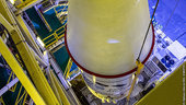
With liftoff set for 7 November, the latest MetOp weather satellite has been rolled out to the launch pad and positioned on the Soyuz rocket for its ride into space from French Guiana.
Odborný referent/vrchní referent – obnova katastrálního operátu na Katastrálním pracovišti Třinec Ka
5.11.2018 14:23 ČÚZK /Urady/Katastralni-urady/Katastralni-urady/Katastralni-urad-pro-Moravskoslezsky-kraj/Uredni-deska/Oznameni-a-jina-uredni-sdeleni/Volna-mista/Odborny-referent-vrchni-referent-–-obnova-katastraOdborný referent/vrchní referent – obnova katastrálního operátu na Katastrálním pracovišti Třinec Ka
5.11.2018 14:23 ČÚZK - volná místa Katastrální úřad pro Moravskoslezský kraj - Katastrální pracoviště Třinec vypisuje výběrové řízení na místo Odborný referent/vrchní referent – obnova katastrálního operátu na Katastrálním pracovišti Třinec KaOdborný referent/vrchní referent – obnova katastrálního operátu na Katastrálním pracovišti Třinec Ka
5.11.2018 14:23 ČÚZK - předpisy a opatření Katastrální úřad pro Moravskoslezský kraj - Katastrální pracoviště Třinecvypisuje výběrové řízení na místo
Odborný referent/vrchní referent – obnova katastrálního operátu na Katastrálním pracovišti Třinec Katastrálního úřadu pro Moravskoslezský kraj
Rada/odborný rada – správce informačních a komunikačních technologií
5.11.2018 14:20 ČÚZK /Urady/Katastralni-urady/Katastralni-urady/Katastralni-urad-pro-Moravskoslezsky-kraj/Uredni-deska/Oznameni-a-jina-uredni-sdeleni/Volna-mista/Rada-odborny-rada-–-spravce-informacnich-a-komunikRada/odborný rada – správce informačních a komunikačních technologií
5.11.2018 14:20 ČÚZK - předpisy a opatření Katastrální úřad pro Moravskoslezský krajvypisuje výběrové řízení na místo
Rada/odborný rada – správce informačních a komunikačních technologií
Rada/odborný rada – správce informačních a komunikačních technologií
5.11.2018 14:20 ČÚZK - volná místa Katastrální úřad pro Moravskoslezský kraj vypisuje výběrové řízení na místo Rada/odborný rada – správce informačních a komunikačních technologiíVrchní referent/rada – obnova katastrálního operátu na Katastrálním pracovišti Opava Katastrálního ú
5.11.2018 14:06 ČÚZK - volná místa Katastrální úřad pro Moravskoslezský kraj - Katastrální pracoviště Opava vypisuje výběrové řízení na místo Vrchní referent/rada – obnova katastrálního operátu na Katastrálním pracovišti Opava Katastrálního úVrchní referent/rada – obnova katastrálního operátu na Katastrálním pracovišti Opava Katastrálního ú
5.11.2018 14:06 ČÚZK - předpisy a opatření Katastrální úřad pro Moravskoslezský kraj - Katastrální pracoviště Opavavypisuje výběrové řízení na místo
Vrchní referent/rada – obnova katastrálního operátu na Katastrálním pracovišti Opava Katastrálního úřadu pro Moravskoslezský kraj
Vrchní referent/rada – obnova katastrálního operátu na Katastrálním pracovišti Opava Katastrálního ú
5.11.2018 14:06 ČÚZK /Urady/Katastralni-urady/Katastralni-urady/Katastralni-urad-pro-Moravskoslezsky-kraj/Uredni-deska/Oznameni-a-jina-uredni-sdeleni/Volna-mista/Vrchni-referent-rada-–-obnova-katastralniho-op-(5)Vrchní referent/rada – řízení o opravě chyby v SPI na Katastrálním pracovišti Krnov Katastrálního úř
5.11.2018 13:54 ČÚZK - předpisy a opatření Katastrální úřad pro Moravskoslezský kraj - Katastrální pracoviště Krnovvypisuje výběrové řízení na místo
Vrchní referent/rada – řízení o opravě chyby v SPI na Katastrálním pracovišti Krnov Katastrálního úřadu pro Moravskoslezský kraj
Vrchní referent/rada – řízení o opravě chyby v SPI na Katastrálním pracovišti Krnov Katastrálního úř
5.11.2018 13:54 ČÚZK /Urady/Katastralni-urady/Katastralni-urady/Katastralni-urad-pro-Moravskoslezsky-kraj/Uredni-deska/Oznameni-a-jina-uredni-sdeleni/Volna-mista/Vrchni-referent-rada-–-rizeni-o-oprave-chyby-v-(1)Vrchní referent/rada – řízení o opravě chyby v SPI na Katastrálním pracovišti Krnov Katastrálního úř
5.11.2018 13:54 ČÚZK - volná místa Katastrální úřad pro Moravskoslezský kraj - Katastrální pracoviště Krnov vypisuje výběrové řízení na místo Vrchní referent/rada – řízení o opravě chyby v SPI na Katastrálním pracovišti Krnov Katastrálního úř44_odborný referent – obnova katastrálního operátu v technickém odboru Katastrálního úřadu pro Morav
5.11.2018 13:49 ČÚZK - volná místa Katastrální úřad pro Moravskoslezský kraj - technický odbor vypisuje výběrové řízení na místo 44_odborný referent – obnova katastrálního operátu v technickém odboru Katastrálního úřadu pro Morav44_odborný referent – obnova katastrálního operátu v technickém odboru Katastrálního úřadu pro Morav
5.11.2018 13:49 ČÚZK - předpisy a opatření Katastrální úřad pro Moravskoslezský kraj - technický odborvypisuje výběrové řízení na místo
44_odborný referent – obnova katastrálního operátu v technickém odboru Katastrálního úřadu pro Moravskoslezský kraj
44_odborný referent – obnova katastrálního operátu v technickém odboru Katastrálního úřadu pro Morav
5.11.2018 13:49 ČÚZK /Urady/Katastralni-urady/Katastralni-urady/Katastralni-urad-pro-Moravskoslezsky-kraj/Uredni-deska/Oznameni-a-jina-uredni-sdeleni/Volna-mista/44_odborny-referent-–-obnova-katastralniho-ope-(2)Galileo supports compliance with ICAO SAR requirements
5.11.2018 12:12 European GNSS Agency
Galileo supports compliance with new Standards and Recommended Practices (SARPs) from the International Civil Aviation Organisation relating to the location of an aeroplane in distress. This and other benefits of European GNSS (Galileo and EGNOS) for the aviation sector were in focus at the European Regions Airline Association (ERA) General Assembly, which took place on 9-11 October in Edinburg, UK.
The new ICAO SARPs address the Global Aeronautical Distress & Safety System (GADSS) Autonomous Distress Tracking (ADT) concept, which became effective on 11 July 2016 and will be applicable from 1 January 2021.
ADT is defined as the capability, using transmission of information, from which the position of an aircraft in distress can be determined at least once every minute and which is resilient to failures of the aircraft’s electrical power, navigation and communication systems.
At a meeting of the ERA Operations Group held during the General Assembly, Katerina Strelcova, Aviation Market Development Officer at the European GNSS Agency (GSA) stressed that Galileo would enable compliance with these requirements, thanks to the Galileo Search and Rescue (SAR) service. The Galileo SAR service is Europe’s contribution to the international COSPAS-SARSAT system.
The corresponding European regulation for ADT is (EU) 2015/2338, which is not technology-specific. One of the solutions – the Emergency Locator Transmitter for Distress Tracking ELT (DT) – is based on the use of the Galileo SAR service and the COSPAS-SARSAT system.
New Galileo Services
Noting that the Galileo SAR service makes a fundamental European contribution to the COSPAS-SARSAT International Programme, Strelcova highlighted the new Galileo services that support improved SAR, in particular the Forward Link Service (FLS) capability.
The SAR transponder on Galileo satellites picks up signals emitted from distress beacons and broadcasts this information to dedicated ground stations (MEOLUTs). Once these signals are detected and the beacons are located by the MEOLUTs, COSPAS-SARSAT Mission Control Centres (MCC) receive the beacon location information and distribute the data to the relevant rescue centres (RCC) worldwide. In addition, Galileo introduces a new concept, i.e. the Return Link Service (RLS) that is currently being defined and standardised by EUROCAE.
“All Galileo satellites are able to offer a Return Link Service (RLS), which enables an acknowledgement message that allows people in distress to know that their message has been received and that help is on the way,” Strelcova said. She also noted that the RLS Command Service could make it possible to remotely activate and deactivate an emergency locator transmitter, ELT (DT) on an aircraft.
Watch this: Galileo Search and Rescue (SAR) Service
“This link will enable the ELT to be triggered from the ground, by a third party having access to the Return Link Service Provider, and establish the position of a non-cooperative aircraft with which communications have been lost. This will make it possible to track the aircraft when other systems are not responding,” she said.
User Consultation
At the General, Assembly, the GSA launched a consultation process among airlines about the Galileo RLS with a view to gathering requirements from interested parties, raising awareness about the need for cooperation, and fostering the adoption of new standards and equipment in order to improve safety in SAR operations.
Also highlighted at the session was the EGNSS User Consultation Platform, which will be held as part of European Space Week in Marseille in December. This Platform is a forum for interaction between the Galileo and EGNOS programmes and end users, focused on user needs and requirements. It is an opportunity for the EGNSS programmes to listen to users and key industry players in order to optimise current use of the systems, continuously improve them, and plan for future evolutions. To contribute to the Platform and have your say, register to attend European Space Week here.
ERA General Assembly
The GSA was present at the General Assembly with a stand which included a EGNOS enabled flight simulator at which airlines were briefed on LPV approach procedures. Speaking at the Operations group, Loganair Flight Support Manager Stewart Houston said that the airline was flying LPV approaches at Kirkwall – the main airport serving Scotland’s Orkney Islands – on its Twin Otter and Islander planes, equipped with G430W.
“Between 19 and 46 Very High Frequency Omni-Directional Ranges (VORs) will be removed in the UK, potentially leaving required navigation performance (RNP) as the only approaches available at several airports,” Houston said.
The ERA General Assembly is a key event for Regional Aviation Stakeholders. This year’s event brought together more than 400 key figures from the European aviation industry. The event is an opportunity to network, discuss key issues affecting the industry, learn from a wide range of thought-provoking conference sessions and celebrate the industry’s successes.
Media note: This feature can be republished without charge provided the European GNSS Agency (GSA) is acknowledged as the source at the top or the bottom of the story. You must request permission before you use any of the photographs on the site. If you republish, we would be grateful if you could link back to the GSA website (http://www.gsa.europa.eu).
Galileo supports compliance with ICAO SAR requirements
5.11.2018 12:12 European GNSS AgencyGalileo supports compliance with new Standards and Recommended Practices (SARPs) from the International Civil Aviation Organisation relating to the location of an aeroplane in distress. This and other benefits of European GNSS (Galileo and EGNOS) for the aviation sector were in focus at the European Regions Airline Association (ERA) General Assembly, which took place on 9-11 October in Edinburg, UK.
The new ICAO SARPs address the Global Aeronautical Distress & Safety System (GADSS) Autonomous Distress Tracking (ADT) concept, which became effective on 11 July 2016 and will be applicable from 1 January 2021.
ADT is defined as the capability, using transmission of information, from which the position of an aircraft in distress can be determined at least once every minute and which is resilient to failures of the aircraft’s electrical power, navigation and communication systems.
At a meeting of the ERA Operations Group held during the General Assembly, Katerina Strelcova, Aviation Market Development Officer at the European GNSS Agency (GSA) stressed that Galileo would enable compliance with these requirements, thanks to the Galileo Search and Rescue (SAR) service. The Galileo SAR service is Europe’s contribution to the international COSPAS-SARSAT system.
The corresponding European regulation for ADT is (EU) 2015/2338, which is not technology-specific. One of the solutions – the Emergency Locator Transmitter for Distress Tracking ELT (DT) – is based on the use of the Galileo SAR service and the COSPAS-SARSAT system.
New Galileo Services
Noting that the Galileo SAR service makes a fundamental European contribution to the COSPAS-SARSAT International Programme, Strelcova highlighted the new Galileo services that support improved SAR, in particular the Forward Link Service (FLS) capability.
The SAR transponder on Galileo satellites picks up signals emitted from distress beacons and broadcasts this information to dedicated ground stations (MEOLUTs). Once these signals are detected and the beacons are located by the MEOLUTs, COSPAS-SARSAT Mission Control Centres (MCC) receive the beacon location information and distribute the data to the relevant rescue centres (RCC) worldwide. In addition, Galileo introduces a new concept, i.e. the Return Link Service (RLS) that is currently being defined and standardised by EUROCAE.
“All Galileo satellites are able to offer a Return Link Service (RLS), which enables an acknowledgement message that allows people in distress to know that their message has been received and that help is on the way,” Strelcova said. She also noted that the RLS Command Service could make it possible to remotely activate and deactivate an emergency locator transmitter, ELT (DT) on an aircraft.
Watch this: Galileo Search and Rescue (SAR) Service
“This link will enable the ELT to be triggered from the ground, by a third party having access to the Return Link Service Provider, and establish the position of a non-cooperative aircraft with which communications have been lost. This will make it possible to track the aircraft when other systems are not responding,” she said.
User Consultation
At the General, Assembly, the GSA launched a consultation process among airlines about the Galileo RLS with a view to gathering requirements from interested parties, raising awareness about the need for cooperation, and fostering the adoption of new standards and equipment in order to improve safety in SAR operations.
Also highlighted at the session was the EGNSS User Consultation Platform, which will be held as part of European Space Week in Marseille in December. This Platform is a forum for interaction between the Galileo and EGNOS programmes and end users, focused on user needs and requirements. It is an opportunity for the EGNSS programmes to listen to users and key industry players in order to optimise current use of the systems, continuously improve them, and plan for future evolutions. To contribute to the Platform and have your say, register to attend European Space Week here.
ERA General Assembly
The GSA was present at the General Assembly with a stand which included a G1000 EGNOS simulator at which airline operators were briefed on LPV approach procedures. Speaking at the General Assembly, Loganair Flight Support Manager Stewart Houston said that his airline was flying LPV approaches at Kirkwall – the main airport serving Scotland’s Orkney Islands – on its Twin Otter and Islander planes, equipped with G430W.
“Between 19 and 46 Very High Frequency Omni-Directional Ranges (VORs) will be removed in the UK, potentially leaving required navigation performance (RNP) as the only approaches available at several airports,” Houston said.
The ERA General Assembly is a key event for Regional Aviation Stakeholders. This year’s event brought together more than 400 key figures from the European aviation industry. The event is an opportunity to network, discuss key issues affecting the industry, learn from a wide range of thought-provoking conference sessions and celebrate the industry’s successes.
Media note: This feature can be republished without charge provided the European GNSS Agency (GSA) is acknowledged as the source at the top or the bottom of the story. You must request permission before you use any of the photographs on the site. If you republish, we would be grateful if you could link back to the GSA website (http://www.gsa.europa.eu).
NAPSALI O NÁS: Pasport majetku nemusí být jen splněním povinnosti. Obcím pomáhá plánovat parkovací místa i žádat o dotace
5.11.2018 12:00 TopGis Pasportizace, neboli zaevidování majetku obce, je pro řadu radnic nepříjemnou povinností. Zatímco některé k ní přistupují, jen aby ji splnily, jiné jdou i za její rámec. Důkladně provedený pasport veřejných komunikací či veřejného osvětlení zavedený do moderního geoinformačního systému jim totiž může ušetřit čas i peníze. A navíc poslouží též občanům. Pasportizace je pro správu majetku20181105 Vrchní referent/rada oddělení aktualizace katastru nemovitostí
5.11.2018 10:44 ČÚZK /Urady/Katastralni-urady/Katastralni-urady/Katastralni-urad-pro-Stredocesky-kraj/Katastralni-pracoviste/KP-Benesov/O-uradu/Aktuality/20161013Rada-odborny-rada-–-informatik-(2)20181105 Vrchní referent/rada oddělení aktualizace katastru nemovitostí
5.11.2018 10:44 ČÚZK - předpisy a opatření Katastrální úřad pro Středočeský kraj - Katastrální pracoviště Benešov Vyhlášení výběrového řízení: Vrchní referent/rada oddělení aktualizace katastru nemovitostí V části "Úřední deska", v sekci "Oznámení a jiná úřední sdělení" bylo vystaveno "Oznámení o vyhlášení výběrového řízení na obsazení služebního místa Vrchní referent/rada oddělení aktualizace katastru nemovitostí "Vrchní referent/rada oddělení aktualizace katastru nemovitostí
5.11.2018 10:42 ČÚZK /Urady/Katastralni-urady/Katastralni-urady/Katastralni-urad-pro-Stredocesky-kraj/Uredni-deska/Oznameni-a-jina-uredni-sdeleni/Volna-mista/Vrchni-referent-rada-oddeleni-aktualizace-kata-(1)Vrchní referent/rada oddělení aktualizace katastru nemovitostí
5.11.2018 10:42 ČÚZK - volná místa Katastrální úřad pro Středočeský kraj - Katastrální pracoviště Benešov vypisuje výběrové řízení na místo Vrchní referent/rada oddělení aktualizace katastru nemovitostíVrchní referent/rada oddělení aktualizace katastru nemovitostí
5.11.2018 10:42 ČÚZK - předpisy a opatření Katastrální úřad pro Středočeský kraj - Katastrální pracoviště Benešovvypisuje výběrové řízení na místo Vrchní referent/rada oddělení aktualizace katastru nemovitostí
Vrchní referent/rada oddělení aktualizace katastru nemovitostí
Odborný referent/vrchní referent – obnova katastrálního operátu OKO0312
5.11.2018 10:13 ČÚZK - předpisy a opatření Katastrální úřad pro Plzeňský kraj - odbor obnovy katastrálního operátuvypisuje výběrové řízení na místo
Odborný referent/vrchní referent – obnova katastrálního operátu OKO0312
Odborný referent/vrchní referent – obnova katastrálního operátu OKO0312
5.11.2018 10:13 ČÚZK /Urady/Katastralni-urady/Katastralni-urady/Katastralni-urad-pro-Plzensky-kraj/Uredni-deska/Oznameni-a-jina-uredni-sdeleni/Volna-mista/Odborny-referent-vrchni-referent-–-obnova-katastraOdborný referent/vrchní referent – obnova katastrálního operátu OKO0312
5.11.2018 10:13 ČÚZK - volná místa Katastrální úřad pro Plzeňský kraj - odbor obnovy katastrálního operátu vypisuje výběrové řízení na místo Odborný referent/vrchní referent – obnova katastrálního operátu OKO031220181105 odborný referent/vrchní referent - obnova katastrálního operátu
5.11.2018 10:02 ČÚZK - předpisy a opatření Katastrální úřad pro Středočeský kraj zveřejnil novou aktualitu: odborný referent/vrchní referent - obnova katastrálního operátu V části "Úřední deska", v sekci "Oznámení a jiná úřední sdělení" bylo vystaveno "Oznámení o vyhlášení výběrového řízení na obsazení systemizovaného místa odborný referent/vrchní referent - obnova katastrálního operátu"20181105 odborný referent/vrchní referent - obnova katastrálního operátu
5.11.2018 10:02 ČÚZK /Urady/Katastralni-urady/Katastralni-urady/Katastralni-urad-pro-Stredocesky-kraj/O-uradu/Aktuality/20180829-Odborny-referent-oddeleni-dokumentace-(4)odborný referent/vrchní referent - obnova katastrálního operátu
5.11.2018 10:01 ČÚZK /Urady/Katastralni-urady/Katastralni-urady/Katastralni-urad-pro-Stredocesky-kraj/Volna-mista/odborny-referent-vrchni-referent-obnova-katast-(1)odborný referent/vrchní referent - obnova katastrálního operátu
5.11.2018 10:01 ČÚZK - předpisy a opatření Katastrální úřad pro Středočeský kraj - technická sekcevypisuje výběrové řízení na místo odborný referent/vrchní referent - obnova katastrálního operátu
odborný referent/vrchní referent - obnova katastrálního operátu
odborný referent/vrchní referent - obnova katastrálního operátu
5.11.2018 10:01 ČÚZK - volná místa Katastrální úřad pro Středočeský kraj - technická sekce vypisuje výběrové řízení na místo odborný referent/vrchní referent - obnova katastrálního operátuvrchní referent/rada - obnova katastrálního operátu
5.11.2018 9:57 ČÚZK - předpisy a opatření Katastrální úřad pro Středočeský kraj - technická sekcevypisuje výběrové řízení na místo vrchní referent/rada - obnova katastrálního operátu
vrchní referent/rada - obnova katastrálního operátu
vrchní referent/rada - obnova katastrálního operátu
5.11.2018 9:57 ČÚZK /Urady/Katastralni-urady/Katastralni-urady/Katastralni-urad-pro-Stredocesky-kraj/Volna-mista/vrchni-referent-rada-obnova-katastralniho-oper-(1)vrchní referent/rada - obnova katastrálního operátu
5.11.2018 9:57 ČÚZK - volná místa Katastrální úřad pro Středočeský kraj - technická sekce vypisuje výběrové řízení na místo vrchní referent/rada - obnova katastrálního operátu20181105 vrchní referent/rada - obnova katastrálního operátu
5.11.2018 9:55 ČÚZK - předpisy a opatření Katastrální úřad pro Středočeský kraj zveřejnil novou aktualitu: vrchní referent/rada - obnova katastrálního operátu V části "Úřední deska", v sekci "Oznámení a jiná úřední sdělení" bylo vystaveno "Oznámení o vyhlášení výběrového řízení na obsazení systemizovaného místa vrchní referent/rada - obnova katastrálního operátu"20181105 vrchní referent/rada - obnova katastrálního operátu
5.11.2018 9:55 ČÚZK /Urady/Katastralni-urady/Katastralni-urady/Katastralni-urad-pro-Stredocesky-kraj/O-uradu/Aktuality/20180829-Odborny-referent-oddeleni-dokumentace-(3)20181105 odborný referent/vrchní referent - obnova katastrálního operátu
5.11.2018 9:50 ČÚZK /Urady/Katastralni-urady/Katastralni-urady/Katastralni-urad-pro-Stredocesky-kraj/O-uradu/Aktuality/20180829-Odborny-referent-oddeleni-dokumentace-(2)20181105 odborný referent/vrchní referent - obnova katastrálního operátu
5.11.2018 9:50 ČÚZK - předpisy a opatření Katastrální úřad pro Středočeský kraj zveřejnil novou aktualitu: odborný referent/vrchní referent - obnova katastrálního operátu V části "Úřední deska", v sekci "Oznámení a jiná úřední sdělení" bylo vystaveno "Oznámení o vyhlášení výběrového řízení na obsazení systemizovaného místa odborný referent/vrchní referent - obnova katastrálního operátu"Aktualizace údajů
5.11.2018 9:50 Ústecký kraj V Geoportálu ÚAP Ústeckého kraje byla provedena aktualizace údajů pro poskytovatele České Radiokomunikace a.s. – jev 81, 82odborný referent/vrchní referent - obnova katastrálního operátu
5.11.2018 9:49 ČÚZK - předpisy a opatření Katastrální úřad pro Středočeský kraj - technická sekcevypisuje výběrové řízení na místo odborný referent/vrchní referent - obnova katastrálního operátu
odborný referent/vrchní referent - obnova katastrálního operátu
odborný referent/vrchní referent - obnova katastrálního operátu
5.11.2018 9:49 ČÚZK - volná místa Katastrální úřad pro Středočeský kraj - technická sekce vypisuje výběrové řízení na místo odborný referent/vrchní referent - obnova katastrálního operátuodborný referent/vrchní referent - obnova katastrálního operátu
5.11.2018 9:49 ČÚZK /Urady/Katastralni-urady/Katastralni-urady/Katastralni-urad-pro-Stredocesky-kraj/Volna-mista/odborny-referent-vrchni-referent-obnova-katastraInterview with Dr. Yuri Raizman, CEO of GeoCloud at Intergeo 2018
5.11.2018 9:00 GISCafe.com Webcasts-WebinarsArcGIS Pro Customizations in No Time with No Code (ArcUser Online)
5.11.2018 9:00 GISCafe.com Webcasts-WebinarsNová učebnice Tvorba map – kartografie v teorii i praxi (TZ)
5.11.2018 8:12 GISportal.cz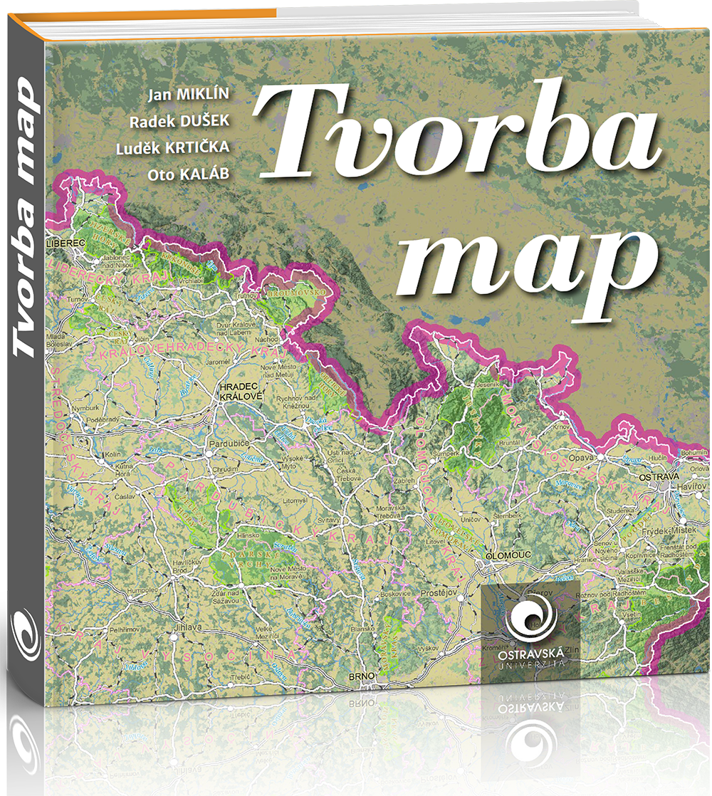
Na Ostravské univerzitě vznikla nová učebnice kartografické tvorby. Ve dvanácti kapitolách sleduje postup tvorby mapy od získání dat po tvorbu finálního mapového výstupu. Kromě teoretických poznatků obsahuje i praktické postupy v ArcGIS, QGIS a OCAD. Kniha je ve formátu PDF volně ke stažení. Cílem autorů bylo vytvořit moderní kartografickou učebnici, zaměřenou na praktickou tvorbu map od […]
The post Nová učebnice Tvorba map – kartografie v teorii i praxi (TZ) appeared first on GISportal.cz.
V pátečních Událostech na ČT byla s námi reportáž o našem mapování dronem v Mongolsku
5.11.2018 7:40 UpVision V pátečních Událostech na České televizi byla reportáž o našem mapování drony v Mongolsku s geologickým průzkumem jednoho z největších měděných dolů na světě.Více zde:
https://ct24.ceskatelevize.cz/2641784-dron-nad-mongolskym-dolem-cesi-pomahaji-s-tezbou-medi-kterou-nasli-jejich-predchudci
Sbohem Evropo, vzhůru k Měsíci: již brzy se vydá na cestu evropský servisní modul
5.11.2018 7:33 Český Kosmický PortálEvropský servisní modul (ESM), který bude zajišťovat pohon a energii pro kosmickou loď Orion na její první misi kolem Měsíce bude již brzy odeslán z Brém do Spojených států. Na svoji cestu se vydá na palubě letounu Antonov An-124 v časných ranních hodinách 5. listopadu. Do Kennedyho kosmického střediska na Floridě dorazí 6. listopadu.
MŽP - Hodnocení území pro realizaci VTE z hlediska limitů ochrany přírody a krajiny
5.11.2018 1:00 Cenia - Katalog metadat ČR - INSPIRE Hodnocení území pro realizaci VTE z hlediska limitů ochrany přírody a krajiny.Svahové nestability (optimalizované pro mobil)
5.11.2018 1:00 Cenia - Katalog metadat ČR - INSPIRE ArcGIS Server služba zobrazuje detailně vymapované svahové nestability. Jejich zobrazení je přizpůsobeno pro mobilní aplikace.Pozůstatky po těžbě (optimalizované pro mobil)
5.11.2018 1:00 Cenia - Katalog metadat ČR - INSPIRE ArcGIS Server služba zobrazuje sdružená data z databází České geologické služby (Důlní díla, Poddolovaná území, Inventarizace úložných míst), která jsou přizpůsobená pro mobilní aplikace.Popularizace geologie (optimalizované pro mobil)
5.11.2018 1:00 Cenia - Katalog metadat ČR - INSPIRE Aplikace zobrazuje pro širokou veřejnost stručné popisy ke stovkám geologicky zajímavých míst, geoparkům, geologickým expozicím v muzeích nebo přírodě a dostupným exkurzním průvodcům. Stručný popis zajímavostí je doplněn fotografií, údajem o ochraně lokality a případně odkazy na další informace. Odbornějším účelům slouží vrstva geologicky významných lokalit zobrazující lokalizaci a základní charakteristiku dalších tisíců lokalit na území ČR s odkazem na stránky s jejich podrobným popisem. Navíc je možné zobrazit i vrstvu s geologickou mapou 1 : 50 000.Aplikace využívá řešení vyvinuté ČGS pro zobrazování mapových služeb pomocí ESRI API 3.x. Je funkčně a designem optimalizována pro použití na dotykových zařízeních a malých displejích. Aplikace umožňuje lokalizovat aktuální polohu uživatele na mapě pomocí geolokačních schopností použitého zařízení, čímž usnadňuje využití přímo v terénu. Vše na podkladě podrobných topografických map nebo leteckých snímků přebíraných od společnosti Seznam.cz, a.s..Geologická mapa České republiky 1 : 50 000 (GEOČR50 - optimalizované pro mobil)
5.11.2018 1:00 Cenia - Katalog metadat ČR - INSPIRE ArcGIS Server mapová služba zobrazující bezešvou geologickou mapu v měřítku 1:50 000 pokrývající celé území ČR (GEOCR50). Data jsou přizpůsobena pro mobilní aplikace.MŽP - Hodnocení území pro realizaci FVE z hlediska ochrany zemědělského půdního fondu
5.11.2018 1:00 Cenia - Katalog metadat ČR - INSPIRE Hodnocení území pro realizaci FVE z hlediska ochrany zemědělského půdního fonduMožnosti umístění větrných a fotovoltaických elektráren z hlediska ochrany přírody a krajiny
5.11.2018 1:00 Cenia - Katalog metadat ČR - INSPIRE Vyhodnocení možností umístění větrných a fotovoltaických elektráren z hlediska ochrany přírody a krajiny.Geohazardy (optimalizované pro mobil)
5.11.2018 1:00 Cenia - Katalog metadat ČR - INSPIRE Mapová aplikace, zobrazuje vymapované objekty, které patří do kategorie geohazardů. Jedná se o data úložných míst těžebního odpadu, důlní díla, poddolovaná území, svahové nestability a radonová mapa. Stručný popis je doplněn odkazy na další informace a u důlních děl i na dokumentační fotografie. Aplikace využívá řešení vyvinuté ČGS pro zobrazování mapových služeb pomocí ESRI API 3.x. Je funkčně a designem optimalizována pro použití na dotykových zařízeních a malých displejích. Aplikace umožňuje lokalizovat aktuální polohu uživatele na mapě pomocí geolokačních schopností použitého zařízení, čímž usnadňuje využití přímo v terénu. Vše na podkladě podrobných topografických map nebo leteckých snímků přebíraných od společnosti Seznam.cz, a.s..Stacionární zdroje znečišťování - palivo, výkon
5.11.2018 1:00 Cenia - Katalog metadat ČR - INSPIRE Mapová služba prezentuje vyjmenované stacionární zdroje znečištění ovzduší (REZZO 1 a 2) dle jejich instalovaného tepelného výkonu a převládajícího druhu paliva. Vstupní data jsou každoročně aktualizována. Poslední aktualizace: listopad 2018. Stav dat: 2017.Možnosti umístění VTE a FVE z hlediska ochrany přírody a krajiny
5.11.2018 1:00 Cenia - Katalog metadat ČR - INSPIRE Datová sada vycházející z metodického návodu "Vyhodnocení možností umístění větrných a fotovoltaických elektráren z hlediska ochrany přírody a krajiny".Metodický návod popisuje zásady preventivního hodnocení území z hlediska ochrany přírody a krajiny, zejm. z hlediska ochrany krajinného rázu, zvláště chráněných území, lokalit soustavy Natura 2000 a druhů, a dále ochrany kulturních památek a ochrany zemědělského půdního fondu, a to se zaměřením na umísťování větrných a fotovoltaických elektráren.Výstup je preventivním hodnocením velkého krajinného celku na úrovni kraje, ORP či jejich části, který však nepracuje s přesnými parametry potenciální výstavby VTE a FVE. Proto datový výstup pouze stanovuje obecné principy hodnocení, které budou v případě posuzování konkrétních záměrů upřesňovány a může být využit jako specifický oborový podklad v procesech územního plánování (zásady územního rozvoje, územní plány), případně jako podklad pro další koncepční dokumenty (územní studie krajiny, krajská koncepce ochrany přírody a krajiny, územní energetická koncepce a další).Geovědní mapy (optimalizované pro mobil)
5.11.2018 1:00 Cenia - Katalog metadat ČR - INSPIRE Mapová aplikace zobrazuje Geologickou mapu České republiky v měřítku 1 : 50 000, indexy ke geologické mapě a vrstvu rukopisných map geologické mapy 1 : 28 800 z 19. století pro srovnání geologického poznání. Dále je v aplikaci vrstva vrtné prozkoumanosti (databáze Geologicky dokumentovaných objektů), kde jsou data: hloubka horniny pod kvartérem, kvartér v celé hloubce vrtu a vrty bez litologických dat.Aplikace využívá řešení vyvinuté ČGS pro zobrazování mapových služeb pomocí ESRI API 3.x. Je funkčně a designem optimalizována pro použití na dotykových zařízeních a malých displejích. Aplikace umožňuje lokalizovat aktuální polohu uživatele na mapě pomocí geolokačních schopností použitého zařízení, čímž usnadňuje využití přímo v terénu.Vše na podkladě podrobných topografických map nebo leteckých snímků přebíraných od společnosti Seznam.cz, a.s..MŽP - Hodnocení území pro realizaci FVE z hlediska limitů ochrany přírody a krajiny
5.11.2018 1:00 Cenia - Katalog metadat ČR - INSPIRE Vyhodnocení možností umístění větrných a fotovoltaických elektráren z hlediska ochrany přírody a krajiny.České studentské experimenty letěly do stratosféry
4.11.2018 18:31 Česká kosmická kancelář
Česká kosmická kancelář bez nároku na finanční odměnu zajistila příležitost pro české studentské týmy k vypuštění jejich experimentů na stratosférickém balónu až do výšky přibližně 22 km v rámci Near Space konference konané během jediného dne, 22. září 2018.
České studentské experimenty letěly do stratosféry
4.11.2018 18:31 Česká kosmická kancelář
Česká kosmická kancelář bez nároku na finanční odměnu zajistila příležitost pro české studentské týmy k vypuštění jejich experimentů na stratosférickém balónu až do výšky přibližně 22 km v rámci Near Space konference konané během jediného dne, 22. září 2018.
INSPIRE téma Rozšířené Parcely (CPX)
3.11.2018 1:00 Cenia - Katalog metadat ČR - INSPIRE Rozšíření má za cíl poskytovat katastrální mapu s obsahem podle vyhlášky ve vektorové podobě ve struktuře plně v souladu se strukturou danou směrnicí INSPIRE. Data rozšiřují směrnici INSPIRE pro téma katastrální parcely (CP) o věcná břemena, geodetické body, další prvky mapy, původní obloukovou geometrii a o parcely určené definičním bodem (ty pouze v oblastech s analogovou mapou). Vychází z katastrální mapy, která je závazným státním mapovým dílem velkého měřítka, obsahuje body polohového bodového pole, polohopis a popis a může mít formu digitální mapy, analogové mapy nebo digitalizované mapy. Publikovaná data obsahují katastrální území pro celou Českou Republiku, parcely a jejich hranice, věcná břemena, další prvky mapy a původní obloukovou geometrii z území, kde je digitální mapa (k 26. 11. 2018 je to 96,16% území České republiky, t.j. 75 840,00km2) a ve zbytku území katastrální parcely určené pouze definičním bodem (tedy bez hranic a polygonu). Katastrální parcely a hranice obsahují oproti datové sadě INSPIRE některé atributy navíc. Jedná se o typ hranice, způsob využití území, druh pozemku, vazbu na budovu a o mapové značky. Více katastrální zákon 344/1992 SB., katastrální vyhláška č.26/2007 Sb. v platném znění a INSPIRE Data Specification on Cadastral Parcels v 3.0.1. Data ve formátu GML 3.2.1 jsou validní proti schématu XML pro Rozšířené Parcely (CPX) ve verzi 4.0.INSPIRE téma Rozšířené Parcely (CPX)
3.11.2018 1:00 Cenia - Katalog metadat ČR - INSPIRE Rozšíření má za cíl poskytovat katastrální mapu s obsahem podle vyhlášky ve vektorové podobě ve struktuře plně v souladu se strukturou danou směrnicí INSPIRE. Data rozšiřují směrnici INSPIRE pro téma katastrální parcely (CP) o věcná břemena, geodetické body, další prvky mapy, původní obloukovou geometrii a o parcely určené definičním bodem (ty pouze v oblastech s analogovou mapou). Vychází z katastrální mapy, která je závazným státním mapovým dílem velkého měřítka, obsahuje body polohového bodového pole, polohopis a popis a může mít formu digitální mapy, analogové mapy nebo digitalizované mapy. Publikovaná data obsahují katastrální území pro celou Českou Republiku, parcely a jejich hranice, věcná břemena, další prvky mapy a původní obloukovou geometrii z území, kde je digitální mapa (k 26. 11. 2018 je to 96,16% území České republiky, t.j. 75 840,00km2) a ve zbytku území katastrální parcely určené pouze definičním bodem (tedy bez hranic a polygonu). Katastrální parcely a hranice obsahují oproti datové sadě INSPIRE některé atributy navíc. Jedná se o typ hranice, způsob využití území, druh pozemku, vazbu na budovu a o mapové značky. Více katastrální zákon 344/1992 SB., katastrální vyhláška č.26/2007 Sb. v platném znění a INSPIRE Data Specification on Cadastral Parcels v 3.0.1. Data ve formátu GML 3.2.1 jsou validní proti schématu XML pro Rozšířené Parcely (CPX) ve verzi 4.0.Sledujte naše video se zajímavými komentáři z konference Aliance a představení UTM v Plzni
2.11.2018 21:39 UpVision Prohlédněte si naše video z 4. konference Aliance pro bezpilotní letecký průmysl, která se konala v Plzni a kde jsme poprvé představili UTM systém ,který dodáváme s americkou firmou AirMap pro Řízení letového provozu. Ve videu jsou i krátké rozhovory s ředitelem ŘLP a AirMapu.Video zde:
https://youtu.be/5Ng7ZOLjHWc
Digital Evolution Moves on at Bentley Year in Infrastructure 2019 in London
2.11.2018 20:10 Bentley SystemsPress Coverage
GISCafe, USA
Read the articleGoing Digital is Theme of Bentley’s YII 2018 Conference
2.11.2018 20:05 Bentley SystemsPress Coverage
Lidar News, USA
Read the articleiModel.js Library Released by Bentley to Open-Source
2.11.2018 20:00 Bentley SystemsPress Coverage
Lidar News, USA
Read the articleDigital Twin – The Key Concept from YII 2018
2.11.2018 19:55 Bentley SystemsPress Coverage
Lidar News, USA
Read the articleYear in Infrastructure Awards 2018 in London
2.11.2018 19:48 Bentley SystemsPress Coverage
Lidar News, USA
Read the articleTopcon Announces Release of Next Generation All-In-One Mass Data Processing Software
2.11.2018 19:43 Bentley SystemsPress Coverage
American Surveyor, USA
Read the article