


![]()

zprávy
zdroje zpráv:Výňatky z Informace OMŘPÚ č. 4/2016
14.11.2016 18:53 Asociace poskytovatelů služeb v pozemkových úpravách Výňatky z Informace OMŘPÚ č. 4/2016 vydané Odborem metodiky a řízení pozemkových úprav Státního pozemkového úřadu dne 31. 10. 2016 pod č.j. SPU 554194/2016 Obsah: 1. Aktualizace částí projektové dokumentace zhotoviteli a úhrada těchto částí dokumentace 2. Aplikace § 9 odst. 12 a 13 zákona 3. Aplikace § 12 odst. 5 zákona 4. K §…20161114-GaKO-11-2016
14.11.2016 15:20 ČÚZK - předpisy a opatření Aktuální číslo Geodetického a kartografického obzoru (11/2016) ke stažení zde.20161114-GaKO-11-2016
14.11.2016 15:20 ČÚZK - předpisy a opatření Aktuální číslo Geodetického a kartografického obzoru (11/2016) ke stažení zde.
Nové číslo GaKO
14.11.2016 15:20
ÚGKK SR
Nové číslo časopisu Geodetického a Kartografického Obzoru 11/2016
Vedoucí oddělení metodiky a kontroly Katastrálního úřadu pro Královéhradecký kraj
14.11.2016 12:32 ČÚZK - volná místa Katastrální úřad pro Královéhradecký kraj, vypisuje výběrové řízení na místo Vedoucí oddělení metodiky a kontroly Katastrálního úřadu pro Královéhradecký krajVedoucí oddělení metodiky a kontroly Katastrálního úřadu pro Královéhradecký kraj
14.11.2016 12:32 ČÚZK /Urady/Katastralni-urady/Katastralni-urady/Katastralni-urad-pro-Kralovehradecky-kraj/Uredni-deska/Oznameni-a-jina-uredni-sdeleni/Volna-mista/Vedouci-oddeleni-metodiky-a-kontroly-Katastral-(1)Vedoucí oddělení metodiky a kontroly Katastrálního úřadu pro Královéhradecký kraj
14.11.2016 12:32 ČÚZK - předpisy a opatření Katastrální úřad pro Královéhradecký krajvypisuje výběrové řízení na místo
Vedoucí oddělení metodiky a kontroly Katastrálního úřadu pro Královéhradecký kraj
Vedoucí oddělení metodiky a kontroly Katastrálního úřadu pro Královéhradecký kraj (1)
14.11.2016 12:32 ČÚZK - volná místa Katastrální úřad pro Královéhradecký kraj, vypisuje výběrové řízení na místo Vedoucí oddělení metodiky a kontroly Katastrálního úřadu pro Královéhradecký kraj (1)Rada/odborný rada v oddělení aktualizace a dokumentace KP Rumburk na Katastrálním úřadu pro Ústecký
14.11.2016 10:29 ČÚZK - předpisy a opatření Katastrální úřad pro Ústecký kraj Katastrální pracoviště Rumburkvypisuje výběrové řízení na místo
Rada/odborný rada v oddělení aktualizace a dokumentace KP Rumburk na Katastrálním úřadu pro Ústecký kraj
Rada/odborný rada v oddělení aktualizace a dokumentace KP Rumburk na Katastrálním úřadu pro Ústecký
14.11.2016 10:29 ČÚZK /Urady/Katastralni-urady/Katastralni-urady/Katastralni-urad-pro-Ustecky-kraj/Uredni-deska/Oznameni-a-jina-uredni-sdeleni/Volna-mista/Rada-odborny-rada-v-oddeleni-aktualizace-a-dokumenRada/odborný rada v oddělení aktualizace a dokumentace KP Rumburk na Katastrálním úřadu pro Ústecký
14.11.2016 10:29 ČÚZK - volná místa Katastrální úřad pro Ústecký kraj, Katastrální pracoviště Rumburk vypisuje výběrové řízení na místo Rada/odborný rada v oddělení aktualizace a dokumentace KP Rumburk na Katastrálním úřadu pro ÚsteckýNabídky služební místo do 6.12 2016
14.11.2016 10:26 ČÚZK - předpisy a opatření Uchazeči mají do 6.12 2016 možnost přihlásit se do nově vyhlášených vývěrových řízení na služební místa:Referent KN – nahlížení do KN,
Referent KN – poskytování inf. KN,
a další
Nabídky služební místo do 6.12 2016
14.11.2016 10:26 ČÚZK /Urady/Katastralni-urady/Katastralni-urady/Katastralni-urad-pro-hlavni-mesto-Prahu/O-uradu/Aktuality/Nabidky-sluzebni-misto-do-6-12-2016Nabídky služební místo do 6.12 2016
14.11.2016 10:26 ČÚZK - předpisy a opatření Uchazeči mají do 6.12 2016 možnost přihlásit se do nově vyhlášených vývěrových řízení na služební místa:Právník katastru nemovitostí,
Referent KN – nahlížení do KN,
Referent KN – poskytování inf. KN,
a další
Uzavření KP PT
14.11.2016 10:23 ČÚZK - předpisy a opatření Z důvodu probíhajících stavebních prací nebudou dne 18.11.2016 na Katastrálním úřadě pro Jihočeský kraj, Katastrálním pracovišti Prachatice, Za Baštou 232, Prachatice, poskytovány údaje z KN na počkání. Katastrální pracoviště Prachatice bude pouze přijímat osobní podání na podatelně úřadu v obvyklých úředních hodinách. Údaje z KN poskytuje jakékoliv katastrální pracoviště v rámci ČR nebo ověřovatelé údajů z KN (CzechPoint).Uzavření KP PT
14.11.2016 10:23 ČÚZK /Urady/Katastralni-urady/Katastralni-urady/Katastralni-urad-pro-Jihocesky-kraj/O-uradu/Aktuality/Uzavreni-KP-PTReferent KN – nahlížení do KN
14.11.2016 9:52 ČÚZK /Urady/Katastralni-urady/Katastralni-urady/Katastralni-urad-pro-hlavni-mesto-Prahu/Uredni-deska/Oznameni-a-jina-uredni-sdeleni/Volna-mista/Referent-KN-–-nahlizeni-do-KNReferent KN – nahlížení do KN
14.11.2016 9:52 ČÚZK - volná místa Katastrální úřad pro hlavní město Prahu, Katastrální pracoviště Praha vypisuje výběrové řízení na místo Referent KN – nahlížení do KNReferent KN – nahlížení do KN
14.11.2016 9:52 ČÚZK - předpisy a opatření Katastrální úřad pro hlavní město Prahu Katastrální pracoviště Prahavypisuje výběrové řízení na místo
Referent KN – nahlížení do KN
WhereCamp Berlin focus on LBS and Geo-IoT
14.11.2016 9:05 European GNSS Agency
The WhereCamp Berlin ‘unconference’ on 3 and 4 November offered exciting insights on the future of Location Based Services (LBS) and the Geo-IoT (Geolocation - Internet of Things) including some interesting developments around the use of LBS provided by European GNSS. The meeting featured the first ever Galileo Hackathon (link) and a plenary session hosted by the GSA on Technology Trends in Geolocation presented by the global leaders in the field: Qualcomm, Broadcom and Google.
WhereCamp ‘unconferences’ are dedicated to geolocation professionals and students. This sixth European version took place at Berlin’s Beuth University of Applied Sciences. A feature of the WhereCamp is the relative young age of the enthusiastic audience. They were welcomed by Prof. Dr. Sebastian von Klinski, Vice President of the university, who claimed that the advances in location based services in recent years were just the “tip of the iceberg” in terms of expected societal changes. New regulations and economic structures would be needed to cope with the disruptive changes that Geo-IoT technologies would bring.
In an opening panel moderated by Prof. Dr. Roland Wagner of the WhereCamp organisers Association for Geoinformatics, GeoIT and Navigation, some LBS experts considered where the industry was going. Nicholas Goubert, Senior Director Product Management at HERE Open Location Platform talked about the need for “location intelligence”. He thought users were becoming lazier so there was a need to push the right amount of relevant data at the right time to them. “Location is one angle to bring that right data,” he claimed.
Gary Gale of Malstow Geospatial, who described himself as a Geotechnologist and Neogeographer, said that “we should not be surprised when the next disruptive innovation arrives” in location. He agreed that “we are currently drowning in data” and the big change will occur when “services will be created to make sense of all these data.”
Tech Trends in Geo-IoT
Justyna Redelkiewicz from the GSA opened the GNSS-focussed session by presenting the highlights of the recently published GNSS User Technology report. According to the report, five main areas of innovation will drive the future of LBS:
- connectivity (providing faster fixes in assisted mode and enabling all crowd-sourced apps that include sharing location);
- indoor usage with the objective of a seamless location everywhere;
- continuous availability of signal in difficult environments;
- better accuracy (one metre or less); and
- power consumption reduction especially with increasing complexity.

Technology Trends in Geolocation, panel discussion, WhereCamp Berlin, 3-4 November 2016
“As connectivity increases, the need for ubiquitous location increases,” she said. “Emerging indoor location technologies and GNSS multi-constellation outdoors will enable this true ubiquity”. At a technical level, the recent decision by Google to allow users to access raw GNSS data in the latest releases of Android software and the advent of dual frequency GNSS signals could both bring enhanced accuracy to mass market applications.
In terms of Geo-IoT, Mrs. Redelkiewicz saw GNSS as a key component. “IoT is driven by a combination of sensors and connectivity that must include GNSS,” she argued.
Hamid Nazeman from Qualcomm Europe described the latest location technology and GNSS innovations in the current generation of Snapdragon processors. He estimated that between 2015 and 2019, some 8.5 billion smartphones would be shipped cumulatively. He argued that while connectivity is the key enabling technology for smartphone users, that location is also increasingly integral to the mobile experience – and that users won’t compromise on experience. Snapdragon processors fully integrate location technologies, leveraging GNSS, cellular, and Wi-Fi signals, as well as other third party sensor inputs. Qualcomm Technologies, Inc. is rolling out broad support for Galileo this year across its Snapdragon processor and modem portfolios. In July, the first European Galileo-ready smartphone – the BQ Aquaris X5 Plus – was launched with a Qualcomm Snapdragon 652 processor.
The opportunities for dual frequency in consumer applications were described by Manuel Del Castillo of another leading chip maker: Broadcom. He saw the main benefit of accessing both L1/E1 and L5/E5 signals in terms of increased accuracy. The inherent improved properties of Galileo E1 and L5/E5 provide better accuracy and allow some mitigation of multipath issues, which would be a benefit for navigation and LBS in urban environments. He also claimed that sensitivity would be improved due to the higher transmission power of the L5/E5 signals.
“In real world testing, Broadcom has already shown four-times more accuracy using dual frequency as compared to single frequency solutions,” claimed Mr. Del Castillo. The company will implement dual frequency with the next generation of Broadcom chips. Despite having dual frequency capability, the new chips will also consume less power due to an advanced manufacturing process.
Android for surveying?
Finally, Ed Parsons from Google explored the developments in Android software that now allow users to access more easily GNSS data, including raw signal measurements, to build innovative applications. He said that “location was an essential element of making contextual applications work” and that “GPS is old school, now we are in the era of multi-constellation GNSS.” This will add new functions: in particular a much quicker time to get a location fix.
He stated that the ability to access and use raw measurements could enable new levels of accuracy – even down to few centimetres. This enhanced sensitivity and precision would make a whole host of new and exciting applications and uses possible in the surveying domain.
Mr. Parsons was asked if Google was considering running its own base station network for precise positioning. He thought the idea was conceivable, but there might be better ways to reach precise positioning RTK-like solutions, including, for example, the usage of EGNOS.
“As connectivity increases, the need for ubiquitous location increases.”
More information:
WhereCamp
BQ Aquaris X5 Plus smartphone
Qualcomm
Broadcom
Google
Association for Geoinformatics, GeoIT and Navigation
GSA Technology Trends Report
Media note: This feature can be republished without charge provided the European GNSS Agency (GSA) is acknowledged as the source at the top or the bottom of the story. You must request permission before you use any of the photographs on the site. If you republish, we would be grateful if you could link back to the GSA website (http://www.gsa.europa.eu).
WhereCamp Berlin focus on LBS and Geo-IoT
14.11.2016 9:05 European GNSS Agency
The WhereCamp Berlin ‘unconference’ on 3 and 4 November offered exciting insights on the future of Location Based Services (LBS) and the Geo-IoT (Geolocation - Internet of Things) including some interesting developments around the use of LBS provided by European GNSS. The meeting featured the first ever Galileo Hackathon (link) and a plenary session hosted by the GSA on Technology Trends in Geolocation presented by the global leaders in the field: Qualcomm, Broadcom and Google.
WhereCamp ‘unconferences’ are dedicated to geolocation professionals and students. This sixth European version took place at Berlin’s Beuth University of Applied Sciences. A feature of the WhereCamp is the relative young age of the enthusiastic audience. They were welcomed by Prof. Dr. Sebastian von Klinski, Vice President of the university, who claimed that the advances in location based services in recent years were just the “tip of the iceberg” in terms of expected societal changes. New regulations and economic structures would be needed to cope with the disruptive changes that Geo-IoT technologies would bring.
In an opening panel moderated by Prof. Dr. Roland Wagner of the WhereCamp organisers Association for Geoinformatics, GeoIT and Navigation, some LBS experts considered where the industry was going. Nicholas Goubert, Senior Director Product Management at HERE Open Location Platform talked about the need for “location intelligence”. He thought users were becoming lazier so there was a need to push the right amount of relevant data at the right time to them. “Location is one angle to bring that right data,” he claimed.
Gary Gale of Malstow Geospatial, who described himself as a Geotechnologist and Neogeographer, said that “we should not be surprised when the next disruptive innovation arrives” in location. He agreed that “we are currently drowning in data” and the big change will occur when “services will be created to make sense of all these data.”
Tech Trends in Geo-IoT
Justyna Redelkiewicz from the GSA opened the GNSS-focussed session by presenting the highlights of the recently published GNSS User Technology report. According to the report, five main areas of innovation will drive the future of LBS:
- connectivity (providing faster fixes in assisted mode and enabling all crowd-sourced apps that include sharing location);
- indoor usage with the objective of a seamless location everywhere;
- continuous availability of signal in difficult environments;
- better accuracy (one metre or less); and
- power consumption reduction especially with increasing complexity.
Technology Trends in Geolocation, panel discussion, WhereCamp Berlin, 3-4 November 2016
“As connectivity increases, the need for ubiquitous location increases,” she said. “Emerging indoor location technologies and GNSS multi-constellation outdoors will enable this true ubiquity”. At a technical level, the recent decision by Google to allow users to access raw GNSS data in the latest releases of Android software and the advent of dual frequency GNSS signals could both bring enhanced accuracy to mass market applications.
In terms of Geo-IoT, Mrs. Redelkiewicz saw GNSS as a key component. “IoT is driven by a combination of sensors and connectivity that must include GNSS,” she argued.
Hamid Nazeman from Qualcomm Europe described the latest location technology and GNSS innovations in the current generation of Snapdragon processors. He estimated that between 2015 and 2019, some 8.5 billion smartphones would be shipped cumulatively. He argued that while connectivity is the key enabling technology for smartphone users, that location is also increasingly integral to the mobile experience – and that users won’t compromise on experience. Snapdragon processors fully integrate location technologies, leveraging GNSS, cellular, and Wi-Fi signals, as well as other third party sensor inputs. Qualcomm Technologies, Inc. is rolling out broad support for Galileo this year across its Snapdragon processor and modem portfolios. In July, the first European Galileo-ready smartphone – the BQ Aquaris X5 Plus – was launched with a Qualcomm Snapdragon 652 processor.
The opportunities for dual frequency in consumer applications were described by Manuel Del Castillo of another leading chip maker: Broadcom. He saw the main benefit of accessing both L1/E1 and L5/E5 signals in terms of increased accuracy. The inherent improved properties of Galileo E1 and L5/E5 provide better accuracy and allow some mitigation of multipath issues, which would be a benefit for navigation and LBS in urban environments. He also claimed that sensitivity would be improved due to the higher transmission power of the L5/E5 signals.
“In real world testing, Broadcom has already shown four-times more accuracy using dual frequency as compared to single frequency solutions,” claimed Mr. Del Castillo. The company will implement dual frequency with the next generation of Broadcom chips. Despite having dual frequency capability, the new chips will also consume less power due to an advanced manufacturing process.
Android for surveying?
Finally, Ed Parsons from Google explored the developments in Android software that now allow users to access more easily GNSS data, including raw signal measurements, to build innovative applications. He said that “location was an essential element of making contextual applications work” and that “GPS is old school, now we are in the era of multi-constellation GNSS.” This will add new functions: in particular a much quicker time to get a location fix.
He stated that the ability to access and use raw measurements could enable new levels of accuracy – even down to few centimetres. This enhanced sensitivity and precision would make a whole host of new and exciting applications and uses possible in the surveying domain.
Mr. Parsons was asked if Google was considering running its own base station network for precise positioning. He thought the idea was conceivable, but there might be better ways to reach precise positioning RTK-like solutions, including, for example, the usage of EGNOS.
“As connectivity increases, the need for ubiquitous location increases.”
More information:
WhereCamp
BQ Aquaris X5 Plus smartphone
Qualcomm
Broadcom
Google
Association for Geoinformatics, GeoIT and Navigation
GSA Technology Trends Report
Media note: This feature can be republished without charge provided the European GNSS Agency (GSA) is acknowledged as the source at the top or the bottom of the story. You must request permission before you use any of the photographs on the site. If you republish, we would be grateful if you could link back to the GSA website (http://www.gsa.europa.eu).
Čtyři družice Galileo na jedné raketě Ariane 5
14.11.2016 8:43 Český Kosmický PortálHned čtyři družice evropského navigačního systému Galileo se potkaly na adaptéru nosné rakety Ariane 5, která se chystá ke startu z evropského kosmodromu Kourou (stát Francouzská Guayana).
Čtyři družice Galileo na jedné raketě Ariane 5
14.11.2016 8:43 Český Kosmický PortálHned čtyři družice evropského navigačního systému Galileo se potkaly na adaptéru nosné rakety Ariane 5, která se chystá ke startu z evropského kosmodromu Kourou (stát Francouzská Guayana).
Stavební práce
14.11.2016 8:10 ČÚZK /Urady/Katastralni-urady/Katastralni-urady/Katastralni-urad-pro-Jihocesky-kraj/Katastralni-pracoviste/KP-Prachatice/O-uradu/Aktuality/Stavebni-praceStavební práce
14.11.2016 8:10 ČÚZK - předpisy a opatření Z důvodu probíhajících stavebních prací nebudou dne 18.11.2016 na Katastrálním úřadě pro Jihočeský kraj, Katastrálního pracoviště Prachatice, Za Baštou 232, Prachatice, poskytovány údaje z KN na počkání. Katastrální pracoviště Prachatice bude pouze přijímat osobní podání na podatelně úřadu v obvyklých úředních hodinách. Údaje z KN poskytuje jakékoliv katastrální pracoviště v rámci ČR nebo ověřovatelé údajů z KN (CzechPoint).Stavební práce
14.11.2016 8:10 ČÚZK - předpisy a opatření Z důvodu probíhajících stavebních prací nebudou dne 18.11.2016 na Katastrálním úřadě pro Jihočeský kraj, Katastrálním pracovišti Prachatice, Za Baštou 232, Prachatice, poskytovány údaje z KN na počkání. Katastrální pracoviště Prachatice bude pouze přijímat osobní podání na podatelně úřadu v obvyklých úředních hodinách. Údaje z KN poskytuje jakékoliv katastrální pracoviště v rámci ČR nebo ověřovatelé údajů z KN (CzechPoint).DNY GEOGRAFIE 2016 v Olomouci
14.11.2016 7:35 Katedra geografie UP Olomouc Letos ve třetím a čtvrtém listopadovém týdnu (14.–27. 11. 2016) se opět konají celostátní Dny geografie. Naše pracoviště se k nim připojuje organizací akcí, jejichž přehled a popis najdete na stránce Dny geografie 2016 v Olomouci. Přehled ještě budeme doplňovat o některé podrobnosti, ale už teď doporučujeme věnovat pozornost vyhlášení Soutěže o nejlepší poster!WSDP na zkoušku jsou opět dostupné
14.11.2016 7:24 Dálkový přístup k údajům KN ČR Webové služby dálkového přístupu na zkoušku jsou opět dostupnéWSDP na zkoušku jsou opět dostupné
14.11.2016 7:24 ČÚZK - předpisy a opatřeníWebové služby dálkového přístupu na zkoušku jsou opět dostupné
WSDP na zkoušku jsou opět dostupné
14.11.2016 7:24 ČÚZK /Aplikace-DP-do-KN/Aplikace-DP-do-KN/Archiv-DP/150341Informativní mapa inženýrských sítí
14.11.2016 1:00 Cenia - Katalog metadat ČR - INSPIRE V informativní mapě sítí jsou sloučeny sítě technické infrastruktury z Digitální technické mapy Prahy a z Územně analytických podkladů hl. m. Prahy. Liniové značky jsou zakresleny dle legendy Digitální technické mapy Prahy.Imise - pětileté průměry v síti 1 x 1 km
14.11.2016 1:00 Cenia - Katalog metadat ČR - INSPIRE Služba obsahuje pětileté průměry imisních koncentrací vybraných polutantů (PM10, PM2.5, NO2, benzen, arsen, Benzo(a)pyren, SO2, olovo, nikl, kadmium) v síti 1x1 km pro období 2011 - 2015. Zdroj dat: Český hydrometeorologický ústavZákladní mapa MTVU
14.11.2016 1:00 Cenia - Katalog metadat ČR - INSPIRE Služba ve formě mapové cache zobrazuje území Prahy a Středočeského kraje a je základní podkladovou vrstvou pro prezentaci tématických dat. Vychází z mapového projektu, ve kterém jsou v okolí Prahy data ZABAGEDu. Na území města Prahy jsou malá měřítka zastoupena vrstvami ZABAGEDu (1:750000 - 1:75000), střední měřítka Základní mapou 1:25000(1:50000 - 1:10000) a velká měřítka Mapou technického využití území(1:7500 - 1:500).Základní mapa MTVU - černobílá
14.11.2016 1:00 Cenia - Katalog metadat ČR - INSPIRE Služba ve formě mapové cache zobrazuje území Prahy a Středočeského kraje a je základní podkladovou vrstvou pro prezentaci tématických dat. Vychází z mapového projektu, ve kterém jsou v okolí Prahy data ZABAGEDu. Na území města Prahy jsou malá měřítka zastoupena vrstvami ZABAGEDu (1:750000 - 1:75000), střední měřítka Základní mapou 1:25000(1:50000 - 1:10000) a velká měřítka Mapou technického využití území(1:7500 - 1:500). Barevnost mapy je v tónech šedé.Katastrální mapa - vektorová
14.11.2016 1:00 Cenia - Katalog metadat ČR - INSPIRE Katastrální mapa je závazným státním mapovým dílem velkého měřítka, obsahuje body polohového bodového pole, polohopis a popis. Katastrální mapa ve vektorové podobě je poskytována zdarma ve formátu DGN a obsahuje prvky Digitální katastrální mapy (DKM) a Katastrální mapy digitalizované (KMD), tedy bodová pole, budovy, další prvky mapy, hranice parcel, katastrální hranice, parcely katastru nemovitostí, prvky orientační mapy a hranice věcného břemene. Z důvodu použití formátu DGN produkt neobsahuje značky na liniích a oblouky jsou nahrazeny lomenými čárami. U vztažného bodu popisných textů a parcelních čísel dochází k posunu o vzdálenost mezi vztažným bodem textu a bodem ve středu popisného textu. Katastrální mapa ve vektorové podobě k 14. 11. 2016 pokrývá 86,76% území České republiky, t.j. 68 424,03km2. Více katastrální vyhláška č.357/2013 Sb. v platném znění.Katastrální mapa - rastrová
14.11.2016 1:00 Cenia - Katalog metadat ČR - INSPIRE Katastrální mapa je závazným státním mapovým dílem velkého měřítka, obsahuje body polohového bodového pole, polohopis a popis. Katastrální mapa v rastrové podobě je poskytována za úplatu a obsahuje analogovou mapu s kompletní kresbou. Analogová mapa pokrývá 9,50 % území České republiky, což je 7 493,53km2. Více katastrální vyhláška č.357/2013 Sb. v platném znění.Základní mapa hranic
14.11.2016 1:00 Cenia - Katalog metadat ČR - INSPIRE Služba obsahuje základní vrstvy pro identifikaci a vyhledávání v mapě Prahy: hranice katastrálních území, městských částí a správních obvodů, uliční úseky, adresní body, budovy a parcely.Oznámení o vyhlášení výběrového řízení na služební místo odborný rada oddělení analýz a strategie
14.11.2016 0:00 Státní pozemkový úřad Ústřední ředitelka Státního pozemkového úřadu, jako služební orgán příslušný podle § 10 odst. 1 písm. f) zákona č. 234/2014 Sb., o státní službě (dále jen „zákon“), vyhlašuje výběrové řízení.Recenze: 3D skener DotProduct DPI-8
13.11.2016 20:25 mensuroZajímáte se o 3D skenování a nové možnosti, které vám tato technologie může přinést? Jedním z problémů, kterým zájemci o tyto nástroje musí čelit, je vysoká cena laserových skenerů. Často je těžké získat možnost otestovat si 3D skenování pro vaši práci předtím, než investujete mnohdy nemalé částky peněz do mapovacích systémů, lidarů a dalšího příslušenství. Na internetu najdete samozřejmě spoustu […]
The post Recenze: 3D skener DotProduct DPI-8 appeared first on Mensuro.cz.
Mimořádný přesun konzultačních hodin dr. Šimáčka
11.11.2016 21:16 Katedra geografie UP Olomouc V úterý 15. listopadu 2016 budou mimořádně přesunuty konzultační hodiny dr. Šimáčka na 10.00 až 11.30.Siemens, Bentley Systems form alliance to push intelligent infrastructure
11.11.2016 20:47 Bentley SystemsPress Coverage
RT&S
Read the articleSpace agencies combine efforts for space hydrology
11.11.2016 16:15 ESA Observing the Earth
Heads of space agencies are meeting today in Marrakesh, Morocco at the COP22 climate change summit to reaffirm their commitment to a coordinated approach for monitoring Earth’s climate, with particular focus on the water cycle.
Four Galileo satellites on one Ariane 5
11.11.2016 15:46 ESA Navigation
Europe’s next four Galileo navigation satellites are together on their dispenser atop the Ariane 5 launcher due to launch them next Thursday from Europe’s Spaceport in French Guiana.
20161111-Rada/odborný rada oddělení právních vztahů k nemovitostem-KP Mělník
11.11.2016 13:14 ČÚZK /Urady/Katastralni-urady/Katastralni-urady/Katastralni-urad-pro-Stredocesky-kraj/Katastralni-pracoviste/KP-Melnik/O-uradu/Aktuality/20140318-Geodet-Melnik-(2)20161207-Rada/odborný rada oddělení právních vztahů k nemovitostem-KP Mělník
11.11.2016 13:14 ČÚZK /Urady/Katastralni-urady/Katastralni-urady/Katastralni-urad-pro-Stredocesky-kraj/Katastralni-pracoviste/KP-Melnik/O-uradu/Aktuality/20140318-Geodet-Melnik-(2)20161207-Rada/odborný rada oddělení právních vztahů k nemovitostem-KP Mělník
11.11.2016 13:14 ČÚZK - předpisy a opatření V sekci "Volná místa" byl vystaven inzerát "Rada/odborný rada oddělení právních vztahů k nemovitostem pro Katastrální pracoviště Mělník"20161111-Rada/odborný rada oddělení právních vztahů k nemovitostem-KP Mělník
11.11.2016 13:14 ČÚZK - předpisy a opatření V sekci "Volná místa" byl vystaven inzerát "Rada/odborný rada oddělení právních vztahů k nemovitostem pro Katastrální pracoviště Mělník"20161207-Rada/odborný rada oddělení právních vztahů k nemovitostem - KP Mělník
11.11.2016 13:12 ČÚZK - předpisy a opatření V části "Volná místa" byl vystaven inzerát na pracovní pozici "rada/odborný rada oddělení právních vztahů k nemovitostem pro Katastrální pracoviště Mělník"20161111-Rada/odborný rada oddělení právních vztahů k nemovitostem - KP Mělník
11.11.2016 13:12 ČÚZK /Urady/Katastralni-urady/Katastralni-urady/Katastralni-urad-pro-Stredocesky-kraj/O-uradu/Aktuality/20150907-inzerat-odborny-rada,-pravnik-KP-Prah-(2)20161207-Rada/odborný rada oddělení právních vztahů k nemovitostem - KP Mělník
11.11.2016 13:12 ČÚZK /Urady/Katastralni-urady/Katastralni-urady/Katastralni-urad-pro-Stredocesky-kraj/O-uradu/Aktuality/20150907-inzerat-odborny-rada,-pravnik-KP-Prah-(2)20161111-Rada/odborný rada oddělení právních vztahů k nemovitostem - KP Mělník
11.11.2016 13:12 ČÚZK - předpisy a opatření V části "Volná místa" byl vystaven inzerát na pracovní pozici "rada/odborný rada oddělení právních vztahů k nemovitostem pro Katastrální pracoviště Mělník"Rada/odborný rada oddělení právních vztahů k nemovitostem (2)
11.11.2016 13:10 ČÚZK - předpisy a opatření Katastrální úřad pro Středočeský kraj Katastrální pracoviště Mělníkvypisuje výběrové řízení na místo Rada/odborný rada oddělení právních vztahů k nemovitostem
Rada/odborný rada oddělení právních vztahů k nemovitostem
Rada/odborný rada oddělení právních vztahů k nemovitostem
11.11.2016 13:10 ČÚZK /Urady/Katastralni-urady/Katastralni-urady/Katastralni-urad-pro-Stredocesky-kraj/Uredni-deska/Oznameni-a-jina-uredni-sdeleni/Volna-mista/Rada-odborny-rada-oddeleni-pravnich-vztahu-k-n-(4)Rada/odborný rada oddělení právních vztahů k nemovitostem (2)
11.11.2016 13:10 ČÚZK - volná místa Katastrální úřad pro Středočeský kraj, Katastrální pracoviště Mělník vypisuje výběrové řízení na místo Rada/odborný rada oddělení právních vztahů k nemovitostem (2)Rada/odborný rada oddělení právních vztahů k nemovitostem (2)
11.11.2016 13:10 ČÚZK /Urady/Katastralni-urady/Katastralni-urady/Katastralni-urad-pro-Stredocesky-kraj/Uredni-deska/Oznameni-a-jina-uredni-sdeleni/Volna-mista/Rada-odborny-rada-oddeleni-pravnich-vztahu-k-n-(4)Rada/odborný rada oddělení právních vztahů k nemovitostem
11.11.2016 13:10 ČÚZK - volná místa Katastrální úřad pro Středočeský kraj, Katastrální pracoviště Mělník vypisuje výběrové řízení na místo Rada/odborný rada oddělení právních vztahů k nemovitostem20161111Vedoucí oddělení obnovy katastrálního operátu Technické sekce-KÚ SČK
11.11.2016 12:50 ČÚZK - předpisy a opatření V části "Úřední deska", v sekci "Oznámení a jiná úřední sdělení" bylo vystaveno "Oznámení o vyhlášení výběrového řízení na služební místo Vedoucí oddělení obnovy katastrálního operátu Technické sekce Katastrálního úřadu pro Středočeský kraj"20161111Vedoucí oddělení obnovy katastrálního operátu Technické sekce-KÚ SČK
11.11.2016 12:50 ČÚZK /Urady/Katastralni-urady/Katastralni-urady/Katastralni-urad-pro-Stredocesky-kraj/O-uradu/Aktuality/20150901Oznameni-o-vyhlaseni-vyberoveho-rizeni-(6)Vedoucí oddělení obnovy katastrálního operátu Technické sekce
11.11.2016 12:48 ČÚZK - předpisy a opatření Katastrální úřad pro Středočeský krajvypisuje výběrové řízení na místo Vedoucí oddělení obnovy katastrálního operátu Technické sekce
Vedoucí oddělení obnovy katastrálního operátu Technické sekce
Vedoucí oddělení obnovy katastrálního operátu Technické sekce
11.11.2016 12:48 ČÚZK /Urady/Katastralni-urady/Katastralni-urady/Katastralni-urad-pro-Stredocesky-kraj/Uredni-deska/Oznameni-a-jina-uredni-sdeleni/Volna-mista/Vedouci-oddeleni-obnovy-katastralniho-operatu-TechVedoucí oddělení obnovy katastrálního operátu Technické sekce
11.11.2016 12:48 ČÚZK - volná místa Katastrální úřad pro Středočeský kraj, vypisuje výběrové řízení na místo Vedoucí oddělení obnovy katastrálního operátu Technické sekcePrávník katastru nemovitostí
11.11.2016 12:01 ČÚZK - předpisy a opatření Katastrální úřad pro hlavní město Prahu Katastrální pracoviště Prahavypisuje výběrové řízení na místo
Právník katastru nemovitostí
Právník katastru nemovitostí
11.11.2016 12:01 ČÚZK /Urady/Katastralni-urady/Katastralni-urady/Katastralni-urad-pro-hlavni-mesto-Prahu/Uredni-deska/Oznameni-a-jina-uredni-sdeleni/Volna-mista/Pravnik-katastru-nemovitosti-(1)Právník katastru nemovitostí (1)
11.11.2016 12:01 ČÚZK - volná místa Katastrální úřad pro hlavní město Prahu, Katastrální pracoviště Praha vypisuje výběrové řízení na místo Právník katastru nemovitostí (1)Právník katastru nemovitostí
11.11.2016 12:01 ČÚZK - volná místa Katastrální úřad pro hlavní město Prahu, Katastrální pracoviště Praha vypisuje výběrové řízení na místo Právník katastru nemovitostíPrávník katastru nemovitostí (1)
11.11.2016 12:01 ČÚZK /Urady/Katastralni-urady/Katastralni-urady/Katastralni-urad-pro-hlavni-mesto-Prahu/Uredni-deska/Oznameni-a-jina-uredni-sdeleni/Volna-mista/Pravnik-katastru-nemovitosti-(1)V Geoportálu ÚAP Ústeckého kra
11.11.2016 12:00 Ústecký kraj V Geoportálu ÚAP Ústeckého kraje byla provedena aktualizace údajů pro poskytovatele Ústecký kraj - Krajský úřad Ústeckého kraje, odbor regionálního rozvoje – jev 106, Český hydrometeorologický ústav – jev 49, 65, Výzkumný ústav vodohospodářský T. G. Masaryka, v. v. i. – jev 44, 45, 46, 47, 48.Referent KN – návrh zápisu, kontrola a zplatnění
11.11.2016 11:59 ČÚZK - předpisy a opatření Katastrální úřad pro hlavní město Prahu Katastrální pracoviště Prahavypisuje výběrové řízení na místo
Referent KN – návrh zápisu, kontrola a zplatnění
Referent KN – návrh zápisu, kontrola a zplatnění
11.11.2016 11:59 ČÚZK - volná místa Katastrální úřad pro hlavní město Prahu, Katastrální pracoviště Praha vypisuje výběrové řízení na místo Referent KN – návrh zápisu, kontrola a zplatněníReferent KN – návrh zápisu, kontrola a zplatnění
11.11.2016 11:59 ČÚZK /Urady/Katastralni-urady/Katastralni-urady/Katastralni-urad-pro-hlavni-mesto-Prahu/Uredni-deska/Oznameni-a-jina-uredni-sdeleni/Volna-mista/Referent-KN-–-pravnikOdborný referent – Oddělení dokumentace katastru nemovitostí
11.11.2016 11:31 ČÚZK - předpisy a opatření Katastrální úřad pro Karlovarský kraj Katastrální pracoviště Sokolovvypisuje výběrové řízení na místo odborný referent – oddělení dokumentace katastru nemovitostí
Odborný referent – Oddělení dokumentace katastru nemovitostí
Odborný referent – Oddělení dokumentace katastru nemovitostí
11.11.2016 11:31 ČÚZK /Urady/Katastralni-urady/Katastralni-urady/Katastralni-urad-pro-Karlovarsky-kraj/Uredni-deska/Oznameni-a-jina-uredni-sdeleni/Volna-mista/Odborny-referent-–-oddeleni-dokumentace-katastru-nOdborný referent – oddělení dokumentace katastru nemovitostí
11.11.2016 11:31 ČÚZK - předpisy a opatření Katastrální úřad pro Karlovarský kraj Katastrální pracoviště Sokolovvypisuje výběrové řízení na místo odborný referent – oddělení dokumentace katastru nemovitostí
Odborný referent – oddělení dokumentace katastru nemovitostí
Odborný referent – oddělení dokumentace katastru nemovitostí
11.11.2016 11:31 ČÚZK /Urady/Katastralni-urady/Katastralni-urady/Katastralni-urad-pro-Karlovarsky-kraj/Uredni-deska/Oznameni-a-jina-uredni-sdeleni/Volna-mista/Odborny-referent-–-oddeleni-dokumentace-katastru-nOdborný referent – oddělení dokumentace katastru nemovitostí
11.11.2016 11:31 ČÚZK - volná místa Katastrální úřad pro Karlovarský kraj, Katastrální pracoviště Sokolov vypisuje výběrové řízení na místo Odborný referent – oddělení dokumentace katastru nemovitostíOdborný referent – Oddělení dokumentace katastru nemovitostí
11.11.2016 11:31 ČÚZK - volná místa Katastrální úřad pro Karlovarský kraj, Katastrální pracoviště Sokolov vypisuje výběrové řízení na místo Odborný referent – Oddělení dokumentace katastru nemovitostíRefurbished GEOSS portal now online
11.11.2016 11:20 ESA Observing the Earth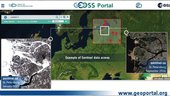
A new and improved version of the GEOSS web portal is ready to provide users with faster, more intuitive access to the ever-growing wealth of diverse Earth observation resources worldwide.
Sweden gets set for Galileo
11.11.2016 10:50 European GNSS Agency
In an effort to promote the benefits of Galileo and the imminent declaration of Initial Services to the broader GNSS user community in Sweden, the Swedish Board of Radio Navigation (RNN) recently held a seminar in Stockholm with the participation of the European GNSS Agency (GSA). Entitled How can Galileo contribute to more cost-effective production applications in the PNT field?, the seminar provided an overview of how Sweden is preparing to implement Galileo signals into professional Positioning, Navigation and Time (PNT) applications.
The event brought together over 60 chipset and receiver manufacturers, government authorities and end users who discussed such topics as: the efforts and requirements for implementing Galileo into GNSS-equipment and Network Real Time Kinetic (RTK) platforms, testing and needs, status of Sweden’s national GNSS infrastructure, and an overview of how Galileo is set to enhance PNT services in Sweden.
Infrastructure and Equipment are getting ready
According to a GNSS-user panel, there is an expectation that Galileo will:
- Improve GNSS-measurements
- Allow users to take measurements in environments with limited satellite visibility (i.e., in urban settings and dense tree cover)
- Decrease uncertainty in a signal’s position and time
The panel was comprised of local authorities from Malmö (Sweden’s third largest city), forest administrators from Lidingö, Lantmäteriet (the Swedish Mapping Cadastral and Land Registration Authority), WSP Consultancy Group, the Swedish Maritime Administration, and marine surveying company Clinton Marin Survey and Time Applications.
The panel members expect that Galileo will improve their GNSS-measurements in environments with limited “satellite visibility” and decrease uncertainty in position and time determination. Panel members noted that additional field tests showing the benefits of implementing Galileo data and a list of Galileo-enabled equipment would be helpful to them as they make the transition towards Galileo. Here the GSA noted that numerous chipset and receiver manufacturers – including Leica, Topcon and Trimble – are already offering Galileo-enabled equipment, products and applications. In fact, according to the GSA’s GNSS Market Report, almost 60% of all available receivers, chipsets and modules support a minimum of two GNSS constellations. Of these, nearly 40% are Galileo compatible – a figure that is increasing every day. As of December 2016, a full list of Galileo-enabled products, services and devices will be available at www.useGalileo.eu.
The Agency also noted that with the imminent declaration of Initial Services, the Galileo GNSS constellation will become operationally ready to offer its first range of services, including the Open Service, Public Regulated Service (PRS) and Search and Rescue Service (SAR). The Declaration of Galileo Initial Services is the first step towards full operational capability, which will occur when the Galileo constellation is complete in 2020. Between the Declaration of Galileo Initial Services and full operational capability, additional satellites will be added to the constellation, allowing new services to become available.
Positive Signs in Sweden
According to SWEPOS, the Swedish network of permanent reference stations has Galileo-compatible equipment on all of its 300 stations. The network is now only waiting for the manufacturer to provide a software upgrade so the system can handle Galileo data on its control side. On-going developments on the infrastructure required to use Galileo and EGNOS in professional applications were also reported by representatives of the Swedish Maritime Authority, Luftfartsverket Air Navigation Services and Lantmäteriet.
Likewise, Lantmäteriet and Chalmers University reported on their Galileo field-tests on the ability for GNSS equipment to process Galileo signals. According to the researchers, although the tests show that Galileo can already be used, additional testing is needed in order to demonstrate all the benefits of implementing Galileo capabilities.
Great Expectations
Many participants left noting that they look forward to a close cooperation between infrastructure providers, the user community, research institutes and equipment manufacturers for a cost-effect and smooth implementation of Galileo into professional GNSS applications in Sweden. And although with the launch of Galileo Initial Services comes great expectations from the end users, as can be seen from this seminar, Sweden is well on its way to meeting them.
Media note: This feature can be republished without charge provided the European GNSS Agency (GSA) is acknowledged as the source at the top or the bottom of the story. You must request permission before you use any of the photographs on the site. If you republish, we would be grateful if you could link back to the GSA website (http://www.gsa.europa.eu).
Virunga Mountains
11.11.2016 10:05 ESA Observing the Earth
Earth observation image of the week: a Sentinel-1 radar composite image of the Virunga Mountains in East Africa, also featured on the Earth from Space video programme
Fotíme opět pro NPÚ různé lokality reliktní krajiny v Česku
11.11.2016 10:01 UpVision Fotíme opět pro Národní památkový ústav různé lokality tzv. reliktní krajiny po Česku. Na naší podzimní fotce soustavy alejí u Ratibořských hor na Táborsku.Fotky zde:
https://plus.google.com/+UpvisionCz1/posts/JqNADkMpQXR
Seminář Programování widgetů pro Web AppBuilder for ArcGIS
11.11.2016 9:29 ARCDATANaučte se vytvářet specializované webové aplikace díky programování widgetů pro Web AppBuilder for ArcGIS. V tomto jednodenním semináři získáte ucelený přehled principů produktu Web AppBuilder, seznámíte se se základy ArcGIS API for JavaScript a dozvíte se, jak jeho prostřednictvím Web AppBuilder rozšiřovat. Budete tak mít možnost nahlédnout pod pokličku našim specialistům z oddělení služeb, kteří vám předají know-how, jež během práce s touto technologií získali.
Těšit se tak můžete na:
- Úvod do ArcGIS API for JavaScript
- Mapa, vrstvy, dotazování a zobrazování výsledků, komponenty Esri, editace dat.
- ArcGIS Web AppBuilder
- Principy fungování, konfigurace.
- Rozšiřování ArcGIS Web AppBuilderu
- Vývoj vlastního motivu.
- Vývoj vlastního widgetu.
- Tipy pro vývoj widgetů
- Využití open source nástrojů a knihoven pro tvorbu widgetů.
- Komunikace mezi widgety.
Organizační informace
- Přihlásit se můžete zasláním e-mailu na adresu skoleni@arcdata.cz.
- Cena kurzu: 3 900 Kč bez DPH za osobu.
- Termín: úterý 29. 11. a úterý 6. 12. 2016.
- Místo konání: ARCDATA PRAHA, s.r.o., Hybernská 24, 110 00 Praha 1
Seminář je určen posluchačům, kteří mají znalosti sdílení obsahu GIS pomocí ArcGIS for Server nebo Portal for ArcGIS a základy JavaScriptu a HTML.
Kapacita semináře je omezena, proto neváhejte a přihlaste se ještě dnes.
Uzavření úřadu
11.11.2016 8:44 ČÚZK - předpisy a opatřeníUpozorňujeme klienty, že 23.12. 2016 bude Katastrální pracoviště Most z technických důvodů uzavřeno.
Uzavření úřadu
11.11.2016 8:44 ČÚZK - předpisy a opatřeníUpozorňujeme klienty, že 18.11.2016 bude Katastrální pracoviště Most z technických důvodů uzavřeno.
Uzavření úřadu
11.11.2016 8:44 ČÚZK /Urady/Katastralni-urady/Katastralni-urady/Katastralni-urad-pro-Ustecky-kraj/Katastralni-pracoviste/KP-Most/O-uradu/Aktuality/Uzavreni-uradu-(1)odborný referent/vrchní referent – poskytování informací KN Katastrálního pracoviště Ostrava, Katast
11.11.2016 8:34 ČÚZK - předpisy a opatření Katastrální úřad pro Moravskoslezský kraj Katastrální pracoviště Ostravavypisuje výběrové řízení na místo odborný referent/vrchní referent – poskytování informací KN
odborný referent/vrchní referent – poskytování informací KN Katastrálního pracoviště Ostrava, Katastrálního úřadu pro Moravskoslezský kraj
odborný referent/vrchní referent – poskytování informací KN Katastrálního pracoviště Ostrava, Katast
11.11.2016 8:34 ČÚZK /Urady/Katastralni-urady/Katastralni-urady/Katastralni-urad-pro-Moravskoslezsky-kraj/Uredni-deska/Oznameni-a-jina-uredni-sdeleni/Volna-mista/odborny-referent-vrchni-referent-–-poskytovani-infodborný referent/vrchní referent – poskytování informací KN Katastrálního pracoviště Ostrava, Katast
11.11.2016 8:34 ČÚZK - volná místa Katastrální úřad pro Moravskoslezský kraj, Katastrální pracoviště Ostrava vypisuje výběrové řízení na místo odborný referent/vrchní referent – poskytování informací KN Katastrálního pracoviště Ostrava, KatastEarth from Space
10.11.2016 18:20 ESA Observing the Earth
Join us Friday, 11 November, at 10:00 CET for the ‘Earth from Space’ video programme. This week features the Virunga Mountains in East Africa
Engineers on a Dare—Building a Bridge Near the World’s Strongest Quake
10.11.2016 17:12 Bentley SystemsPress Coverage
Engineering.com
Read the articlePrestižní ocenění IFMA pro aplikaci twiGIS
10.11.2016 13:58 GIS Fórum Aplikace twiGIS získala ocenění organizace IFMA, "FM Awards 2016 - PROJEKT ROKU" a to konkrétně za její nasazení v projektu "HUGIS - efektivní zdroj informací pro správu majetku v Řízení letového provozu, s.p.". více informací zde.
Přednáška: Obchod se smrtí 15. 11. 2016
10.11.2016 13:57 Katedra geografie UP Olomouc Zveme Vás na přednášku absolventa olomoucké geografie na témaObchod se smrtí: Dodávání zbraní do problematických zemí světa
která se uskuteční v úterý 15. listopadu 2016 od 15.00 v učebně LP 1033. Přednáší Petr Holeček z České zbrojovky a. s. Uherský Brod (pozvánka).
V rámci mezinárodního Dne geog
10.11.2016 12:00 Plzeňský kraj V rámci mezinárodního Dne geografických informačních systémů, který letos připadá na 16. listopadu, je ve vstupních prostorách Krajského úřadu Plzeňského kraje k vidění malá výstava ukázek výstupů z Geografického informačního systému Plzeňského kraje. Výstava je přístupná do 23. listopadu 2016. Plakáty jsou ke stažení k dispozici zde Ke stažení / Mapové kompozice a projekty / Den GIS - GIS DAY.V rámci mezinárodního Dne geog
10.11.2016 12:00 Plzeňský kraj V rámci mezinárodního Dne geografických informačních systémů (https://www.arcdata.cz/zpravy-a-akce/akce/den-gis), který letos připadá na 16. listopadu, je ve vstupních prostorách Krajského úřadu Plzeňského kraje k vidění malá výstava ukázek výstupů z Geografického informačního systému Plzeňského kraje. Výstava je přístupná do 23. listopadu 2016. Plakáty jsou ke stažení k dispozici zde Ke stažení / Mapové kompozice a projekty / Den GIS - GIS DAY (https://geoportal.plzensky-kraj.cz/gs/den-gis/).V rámci mezinárodního Dne geog
10.11.2016 12:00 Plzeňský kraj V rámci mezinárodního Dne geografických informačních systémů (https://www.arcdata.cz/zpravy-a-akce/akce/den-gis), který letos připadá na 16. listopadu, je ve vstupních prostorách Krajského úřadu Plzeňského kraje k vidění malá výstava ukázek výstupů z Geografického informačního systému Plzeňského kraje. Výstava je přístupná do 23. listopadu 2016.Výsledky veřejné soutěže EPSILON Technologické agentury ČR
10.11.2016 11:00 CEDA Maps a.s. Praha, 10. listopadu 2016 – Technologická agentura ČR podpořila společnost CEDA v rámci veřejné soutěže programu EPSILON s projektem „Automatizované mapování tras a bariér pro pěší a hendikepované“.Galileo bringing added value to ITS all around the World
10.11.2016 9:29 European GNSS Agency
At this year’s ITS World Congress in Melbourne, Australia, the European GNSS Agency (GSA) demonstrated the added value that Galileo will bring to intelligent transportation systems, starting with the declaration of Galileo Initial Services later this year.
Galileo took to the global stage at the recent World Congress on Intelligent Transport Systems (ITS) in Melbourne, Australia. In the lead up to the declaration of Galileo Initial Services later this year, the GSA used the Galileo Village to showcase the programme’s many ITS-related benefits. The stand was organised in conjunction with the Joint European Project for International ITS/EGNSS awareness raising, also known as JUPITER, a Horizon 2020 supported project.
“The goal was to both highlight the many benefits that Galileo will soon offer the ITS sector and to catalyse resources, investments and partnerships, particularly in the Asia Pacific Region, to scale up and really maximise the citizen’s return on investment,” says GSA Officer Alberto Fernández Wyttenbach.
Introducing Galileo to the ITS market
Through project demonstrations and presentations, the GSA showed how public stakeholders and actors in the transportation fields stand to benefit from the improved positioning and navigation performance that Galileo offers. “With the Declaration of Galileo Initial Services just several months away, the Galileo Village is a unique opportunity for the JUPITER Project to truly introduce the programme to the ITS market and the Asia Pacific region,” says project coordinator Hanna-Kaisa Saari. “Through these demonstrations and interactions, we were able to directly show visitors the value that Galileo brings to this sector.”
One SME on display at the Village, M3 Systems, specialises in navigation studies, technologies and applications that require accuracy, availability and integrity. As to Galileo, the company is helping define and study Galileo signals and develop performance enhancing algorithms for receivers. One of these, the GNSS Simulator StellaNGC, allows for accurate testing so a user can easily verify positioning performance under varied conditions – of vital importance for companies looking to bring accurate GNSS products to market.
NSL, another British company exhibiting at the Village, are pioneers in the use of European GNSS technologies within the critical markets that directly affect the safety of citizens, national security and the way business is conducted. The company delivers a range of GNSS-based services, systems, solutions and research to ensure one’s positioning and navigation is accurate, reliable, safe and secure. On display at the Village was the company’s DETECTOR product, a GNSS interference detection and characterisation system. By using DETECTOR, GNSS developers and service regulators can test their systems in the presence of captured interferences.
In addition to JUPITER, two other GSA-supported projects were exhibiting at the Village: GNSS.asia and INLANE. GNSS.asia is dedicated to developing and implementing GNSS industrial cooperation between European and Asia Pacific GNSS industries, with a focus on the downstream sector. “Industrial collaboration within the international context of the GNSS downstream sector is becoming increasingly important, particularly as Galileo moves towards operational readiness,” says project coordinator Rainer Horn.
The INLANE project, on the other hand, is focusing on the prospective autonomous vehicle industry. According to the project, the launch of Galileo Initial Services will be a major step towards achieving the level of accuracy and reliability needed to make the autonomous vehicle a reality. “Galileo will provide a stronger service that is more resistant to multipath interference in urban canyons, along with an authenticated signal capable of detecting spoofing attacks – both absolute musts for the safe operation of autonomous cars,” says project coordinator Oihana Otaegui. In this line, the project is working to fuse computer vision with GNSS technologies via dynamic maps that are updated in real time via cloud crowdsourcing techniques. The project’s products were also featured at the Honda and TomTom booths.

A ride on the Galileo Bus
Beyond the Galileo Village, the ITS World Congress also featured live demonstrations of Galileo’s improved performance. Delegates were able to catch a ride on the Galileo Bus to shuttle back and forth from the event venue to the Albert Park Demo Precinct. The bus was equipped with a Galileo enabled receiver and a Controlled Reception Pattern Antenna (CRPA) that removes the negative impact that signal reflections has on GNSS positioning within an urban environment. The benefits of using Galileo to determine the position of the bus in real time were experienced by around 500 international delegates.
Media note: This feature can be republished without charge provided the European GNSS Agency (GSA) is acknowledged as the source at the top or the bottom of the story. You must request permission before you use any of the photographs on the site. If you republish, we would be grateful if you could link back to the GSA website (http://www.gsa.europa.eu).
Galileo bringing added value to ITS all around the World
10.11.2016 9:29 European GNSS AgencyAt this year’s ITS World Congress in Melbourne, Australia, the European GNSS Agency (GSA) demonstrated the added value that Galileo will bring to intelligent transportation systems, starting with the declaration of Galileo Initial Services later this year.
Galileo took to the global stage at the recent World Congress on Intelligent Transport Systems (ITS) in Melbourne, Australia. In the lead up to the declaration of Galileo Initial Services later this year, the GSA used the Galileo Village to showcase the programme’s many ITS-related benefits. The stand was organised in conjunction with the Joint European Project for International ITS/EGNSS awareness raising, also known as JUPITER, a Horizon 2020 supported project.
“The goal was to both highlight the many benefits that Galileo will soon offer the ITS sector and to catalyse resources, investments and partnerships, particularly in the Asia Pacific Region, to scale up and really maximise the citizen’s return on investment,” says GSA Officer Alberto Fernández Wyttenbach.
Introducing Galileo to the ITS market
Through project demonstrations and presentations, the GSA showed how public stakeholders and actors in the transportation fields stand to benefit from the improved positioning and navigation performance that Galileo offers. “With the Declaration of Galileo Initial Services just several months away, the Galileo Village is a unique opportunity for the JUPITER Project to truly introduce the programme to the ITS market and the Asia Pacific region,” says project coordinator Hanna-Kaisa Saari. “Through these demonstrations and interactions, we were able to directly show visitors the value that Galileo brings to this sector.”
One SME on display at the Village, M3 Systems, specialises in navigation studies, technologies and applications that require accuracy, availability and integrity. As to Galileo, the company is helping define and study Galileo signals and develop performance enhancing algorithms for receivers. One of these, the GNSS Simulator StellaNGC, allows for accurate testing so a user can easily verify positioning performance under varied conditions – of vital importance for companies looking to bring accurate GNSS products to market.
NSL, another British company exhibiting at the Village, are pioneers in the use of European GNSS technologies within the critical markets that directly affect the safety of citizens, national security and the way business is conducted. The company delivers a range of GNSS-based services, systems, solutions and research to ensure one’s positioning and navigation is accurate, reliable, safe and secure. On display at the Village was the company’s DETECTOR product, a GNSS interference detection and characterisation system. By using DETECTOR, GNSS developers and service regulators can test their systems in the presence of captured interferences.
In addition to JUPITER, two other GSA-supported projects were exhibiting at the Village: GNSS.asia and INLANE. GNSS.asia is dedicated to developing and implementing GNSS industrial cooperation between European and Asia Pacific GNSS industries, with a focus on the downstream sector. “Industrial collaboration within the international context of the GNSS downstream sector is becoming increasingly important, particularly as Galileo moves towards operational readiness,” says project coordinator Rainer Horn.
The INLANE project, on the other hand, is focusing on the prospective autonomous vehicle industry. According to the project, the launch of Galileo Initial Services will be a major step towards achieving the level of accuracy and reliability needed to make the autonomous vehicle a reality. “Galileo will provide a stronger service that is more resistant to multipath interference in urban canyons, along with an authenticated signal capable of detecting spoofing attacks – both absolute musts for the safe operation of autonomous cars,” says project coordinator Oihana Otaegui. In this line, the project is working to fuse computer vision with GNSS technologies via dynamic maps that are updated in real time via cloud crowdsourcing techniques. The project’s products were also featured at the Honda and TomTom booths.
A ride on the Galileo Bus
Beyond the Galileo Village, the ITS World Congress also featured live demonstrations of Galileo’s improved performance. Delegates were able to catch a ride on the Galileo Bus to shuttle back and forth from the event venue to the Albert Park Demo Precinct. The bus was equipped with a Galileo enabled receiver and a Controlled Reception Pattern Antenna (CRPA) that removes the negative impact that signal reflections has on GNSS positioning within an urban environment. The benefits of using Galileo to determine the position of the bus in real time were experienced by around 500 international delegates.
Media note: This feature can be republished without charge provided the European GNSS Agency (GSA) is acknowledged as the source at the top or the bottom of the story. You must request permission before you use any of the photographs on the site. If you republish, we would be grateful if you could link back to the GSA website (http://www.gsa.europa.eu).
ČGS – Cestovatelský úterek 15. 11. 2016 (Na kole za polární kruh)
10.11.2016 6:57 Katedra geografie UP Olomouc Zveme Vás na přednášku v cyklu Cestovatelské úterkyNa kole za polární kruh
která se uskuteční v úterý 15. listopadu 2016 od 18.30 do 20.00 na učebně LP 2005. Přednáší Jiří Zámečník (pozvánka).
ČGS – Cestovatelský úterek 15. 11. 2016 (Etiopie)
10.11.2016 6:42 Katedra geografie UP Olomouc Zveme Vás na přednášku v cyklu Cestovatelské úterkyNa kole za polární kruh
která se uskuteční v úterý 15. listopadu 2016 od 18.30 do 20.00 na učebně LP 2005. Přednáší Jiří Zámečník (pozvánka).
Obraz katastrální mapy
10.11.2016 1:00 Cenia - Katalog metadat ČR - INSPIRE Obraz katastrální mapy Zlínského kraje.Stav dat k 1. 10. 2016. Vznik spojením DKM, KMD, KM-D a ÚKM(orientační mapy parcel - vektorové).Siemens and Bentley Systems Advance Strategic Alliance Including Joint Investment Initiatives
10.11.2016 1:00 Bentley SystemsTo realize new growth opportunities in industry and infrastructure through integration of complementary digital engineering models
EXTON, Pa., U.S.A. – Siemens and Bentley Systems announced today that they have formalized a strategic alliance agreement to drive new business value by accelerating digitalization to advance infrastructure project delivery and asset performance in complementary business areas. Siemens and Bentley Systems will initially invest at least Euro 50 million in developing joint solutions to enlarge their respective offerings for infrastructure and industry to the benefit of the end-customers. This work will uniquely leverage new cloud services for a connected data environment to converge respective digital engineering models from both companies. In addition to those elements of the agreement, approximately Euro 70 million of secondary shares of Bentley’s common stock have been acquired by Siemens, under a company program that will continue until such time as Bentley Systems’ stock is publicly traded.
Siemens and Bentley Systems have a track record of complementing their respective portfolios through the licensing of each other’s technology to provide solutions in the Digital Factory and Process Industries & Drives divisions, where respective software offerings have already been integrated. For example, Bentley’s reality modeling software has been integrated into Siemens Process Simulate to leverage laser-scanned point clouds in modeling the existing context of brownfield industrial environments. The automotive industry manufacturer Turnkey Manufacturing Systems (TMS) successfully employed the innovative point cloud capabilities to create a “digital twin” of their production line to significantly enhance their planning and validation processes, while saving time and costs.
The new investment initiatives will involve virtually all Siemens divisions. The major benefit will be accumulating intelligence from Siemens solutions throughout Bentley’s complementary applications for design modeling, analytical modeling, construction modeling and asset performance modeling. As a result, the integrated and accessible digital engineering models, such as the “digital twin” viewed through an immersive 3D interface, will enable unprecedented operational performance, visibility and reliability. This work will uniquely converge digital engineering models: physical engineering models in their 3D physical reality context by way of Bentley’s software solutions and the corresponding functional engineering 2D models within Siemens’ solutions.
Siemens and Bentley Systems have identified opportunities to work together in Energy Management, Power Generation, Building Technology and Mobility where each company can leverage their respective technology and industry expertise to bring new business value to the market. For example, Bentley’s applications for the 3D modeling and structural analysis of industrial and infrastructure assets complement Siemens’ solutions and unparalleled domain expertise in electrification and automation. Siemens and Bentley Systems will each provide software from the other to deliver complete solutions from either company to the benefit of their respective customers in order to improve their project and asset performance through simulation and virtual commissioning. Development work will benefit from and extend Siemens’ and Bentley Systems’ established commitments to openness and interoperability.
Klaus Helmrich, member of the Managing Board of Siemens AG, said, “This move further extends our industry software ecosystem from 2D to 3D software solutions, taking the simulation portfolio in our Digital Enterprise offering to a new dimension. We’re rigorously executing our ‘digital twin’ vision from virtual planning to the real product to the benefit of our customers who themselves are driving digitalization across their value chains. Bentley Systems’ independence, track record in interoperability and leadership in engineering- and design-software make them our ideal partner for this undertaking.”
Bentley Systems CEO Greg Bentley said, “Only with Siemens could we so purposefully advance beyond merely linking the ‘Industrial Internet of Things’ to ultimately leverage digital engineering models for visual operations and connected infrastructure asset performance. Given our long history of sharing complementary technologies, we are very excited to now contribute so broadly to Siemens’ industrial digitalization leadership.”
Siemens AG (Berlin and Munich) is a global technology powerhouse that has stood for engineering excellence, innovation, quality, reliability and internationality for more than 165 years. The company is active in more than 200 countries, focusing on the areas of electrification, automation and digitalization. One of the world’s largest producers of energy-efficient, resource-saving technologies, Siemens is No. 1 in offshore wind turbine construction, a leading supplier of gas and steam turbines for power generation, a major provider of power transmission solutions and a pioneer in infrastructure solutions as well as automation, drive and software solutions for industry. The company is also a leading provider of medical imaging equipment – such as computed tomography and magnetic resonance imaging systems – and a leader in laboratory diagnostics as well as clinical IT. In fiscal 2015, which ended on September 30, 2015, Siemens generated revenue of €75.6 billion and net income of €7.4 billion. At the end of September 2015, the company had around 348,000 employees worldwide. Further information is available on the Internet at www.siemens.com.
Bentley Systems is a global leader in providing architects, engineers, geospatial professionals, constructors, and owner-operators with comprehensive software solutions for advancing the design, construction, and operations of infrastructure. Bentley users leverage information mobility across disciplines and throughout the infrastructure lifecycle to deliver better-performing projects and assets. Bentley solutions encompass MicroStation applications for information modeling, ProjectWise collaboration services to deliver integrated projects, and AssetWise operations services to achieve intelligent infrastructure – complemented by worldwide professional services and comprehensive managed services. Founded in 1984, Bentley has more than 3,000 colleagues in over 50 countries, more than $600 million in annual revenues, and since 2009 has invested more than $1 billion in research, development, and acquisitions. Additional information about Bentley is available at www.bentley.com.
This press release and further information is available at www.siemens.com/press/PR2016110064COEN
Siemens and Bentley Systems Advance Strategic Alliance Including Joint Investment Initiatives
10.11.2016 1:00 Bentley SystemsTo realize new growth opportunities in industry and infrastructure through integration of complementary digital engineering models
EXTON, Pa., U.S.A. – Siemens and Bentley Systems announced today that they have formalized a strategic alliance agreement to drive new business value by accelerating digitalization to advance infrastructure project delivery and asset performance in complementary business areas. Siemens and Bentley Systems will initially invest at least Euro 50 million in developing joint solutions to enlarge their respective offerings for infrastructure and industry to the benefit of the end-customers. This work will uniquely leverage new cloud services for a connected data environment to converge respective digital engineering models from both companies. In addition to those elements of the agreement, approximately Euro 70 million of secondary shares of Bentley’s common stock have been acquired by Siemens, under a company program that will continue until such time as Bentley Systems’ stock is publicly traded.
Siemens and Bentley Systems have a track record of complementing their respective portfolios through the licensing of each other’s technology to provide solutions in the Digital Factory and Process Industries & Drives divisions, where respective software offerings have already been integrated. For example, Bentley’s reality modeling software has been integrated into Siemens Process Simulate to leverage laser-scanned point clouds in modeling the existing context of brownfield industrial environments. The automotive industry manufacturer Turnkey Manufacturing Systems (TMS) successfully employed the innovative point cloud capabilities to create a “digital twin” of their production line to significantly enhance their planning and validation processes, while saving time and costs.
The new investment initiatives will involve virtually all Siemens divisions. The major benefit will be accumulating intelligence from Siemens solutions throughout Bentley’s complementary applications for design modeling, analytical modeling, construction modeling and asset performance modeling. As a result, the integrated and accessible digital engineering models, such as the “digital twin” viewed through an immersive 3D interface, will enable unprecedented operational performance, visibility and reliability. This work will uniquely converge digital engineering models: physical engineering models in their 3D physical reality context by way of Bentley’s software solutions and the corresponding functional engineering 2D models within Siemens’ solutions.
Siemens and Bentley Systems have identified opportunities to work together in Energy Management, Power Generation, Building Technology and Mobility where each company can leverage their respective technology and industry expertise to bring new business value to the market. For example, Bentley’s applications for the 3D modeling and structural analysis of industrial and infrastructure assets complement Siemens’ solutions and unparalleled domain expertise in electrification and automation. Siemens and Bentley Systems will each provide software from the other to deliver complete solutions from either company to the benefit of their respective customers in order to improve their project and asset performance through simulation and virtual commissioning. Development work will benefit from and extend Siemens’ and Bentley Systems’ established commitments to openness and interoperability.
Klaus Helmrich, member of the Managing Board of Siemens AG, said, “This move further extends our industry software ecosystem from 2D to 3D software solutions, taking the simulation portfolio in our Digital Enterprise offering to a new dimension. We’re rigorously executing our ‘digital twin’ vision from virtual planning to the real product to the benefit of our customers who themselves are driving digitalization across their value chains. Bentley Systems’ independence, track record in interoperability and leadership in engineering- and design-software make them our ideal partner for this undertaking.”
Bentley Systems CEO Greg Bentley said, “Only with Siemens could we so purposefully advance beyond merely linking the ‘Industrial Internet of Things’ to ultimately leverage digital engineering models for visual operations and connected infrastructure asset performance. Given our long history of sharing complementary technologies, we are very excited to now contribute so broadly to Siemens’ industrial digitalization leadership.”
Siemens AG (Berlin and Munich) is a global technology powerhouse that has stood for engineering excellence, innovation, quality, reliability and internationality for more than 165 years. The company is active in more than 200 countries, focusing on the areas of electrification, automation and digitalization. One of the world’s largest producers of energy-efficient, resource-saving technologies, Siemens is a leading supplier of efficient power generation and power transmission solutions and a pioneer in infrastructure solutions as well as automation, drive and software solutions for industry. The company is also a leading provider of medical imaging equipment – such as computed tomography and magnetic resonance imaging systems – and a leader in laboratory diagnostics as well as clinical IT. In fiscal 2016, which ended on September 30, 2016, Siemens generated revenue of €79.6 billion and net income of €5.6 billion. At the end of September 2016, the company had around 351,000 employees worldwide. Further information is available on the Internet at www.siemens.com.
Bentley Systems is a global leader in providing architects, engineers, geospatial professionals, constructors, and owner-operators with comprehensive software solutions for advancing the design, construction, and operations of infrastructure. Bentley users leverage information mobility across disciplines and throughout the infrastructure lifecycle to deliver better-performing projects and assets. Bentley solutions encompass MicroStation applications for information modeling, ProjectWise collaboration services to deliver integrated projects, and AssetWise operations services to achieve intelligent infrastructure – complemented by worldwide professional services and comprehensive managed services. Founded in 1984, Bentley has more than 3,000 colleagues in over 50 countries, more than $600 million in annual revenues, and since 2009 has invested more than $1 billion in research, development, and acquisitions. Additional information about Bentley is available at www.bentley.com.
This press release and further information is available at www.siemens.com/press/PR2016110064COEN
Siemens and Bentley Systems Advance Strategic Alliance Including Joint Investment Initiatives
10.11.2016 1:00 Bentley SystemsTo realize new growth opportunities in industry and infrastructure through integration of complementary digital engineering models
EXTON, Pa., U.S.A. – Siemens and Bentley Systems announced today that they have formalized a strategic alliance agreement to drive new business value by accelerating digitalization to advance infrastructure project delivery and asset performance in complementary business areas. Siemens and Bentley Systems will initially invest at least Euro 50 million in developing joint solutions to enlarge their respective offerings for infrastructure and industry to the benefit of the end-customers. This work will uniquely leverage new cloud services for a connected data environment to converge respective digital engineering models from both companies. In addition to those elements of the agreement, approximately Euro 70 million of secondary shares of Bentley’s common stock have been acquired by Siemens, under a company program that will continue until such time as Bentley Systems’ stock is publicly traded.
Siemens and Bentley Systems have a track record of complementing their respective portfolios through the licensing of each other’s technology to provide solutions in the Digital Factory and Process Industries & Drives divisions, where respective software offerings have already been integrated. For example, Bentley’s reality modeling software has been integrated into Siemens Process Simulate to leverage laser-scanned point clouds in modeling the existing context of brownfield industrial environments. The automotive industry manufacturer Turnkey Manufacturing Systems (TMS) successfully employed the innovative point cloud capabilities to create a “digital twin” of their production line to significantly enhance their planning and validation processes, while saving time and costs.
The new investment initiatives will involve virtually all Siemens divisions. The major benefit will be accumulating intelligence from Siemens solutions throughout Bentley’s complementary applications for design modeling, analytical modeling, construction modeling and asset performance modeling. As a result, the integrated and accessible digital engineering models, such as the “digital twin” viewed through an immersive 3D interface, will enable unprecedented operational performance, visibility and reliability. This work will uniquely converge digital engineering models: physical engineering models in their 3D physical reality context by way of Bentley’s software solutions and the corresponding functional engineering 2D models within Siemens’ solutions.
Siemens and Bentley Systems have identified opportunities to work together in Energy Management, Power Generation, Building Technology and Mobility where each company can leverage their respective technology and industry expertise to bring new business value to the market. For example, Bentley’s applications for the 3D modeling and structural analysis of industrial and infrastructure assets complement Siemens’ solutions and unparalleled domain expertise in electrification and automation. Siemens and Bentley Systems will each provide software from the other to deliver complete solutions from either company to the benefit of their respective customers in order to improve their project and asset performance through simulation and virtual commissioning. Development work will benefit from and extend Siemens’ and Bentley Systems’ established commitments to openness and interoperability.
Klaus Helmrich, member of the Managing Board of Siemens AG, said, “This move further extends our industry software ecosystem from 2D to 3D software solutions, taking the simulation portfolio in our Digital Enterprise offering to a new dimension. We’re rigorously executing our ‘digital twin’ vision from virtual planning to the real product to the benefit of our customers who themselves are driving digitalization across their value chains. Bentley Systems’ independence, track record in interoperability and leadership in engineering- and design-software make them our ideal partner for this undertaking.”
Bentley Systems CEO Greg Bentley said, “Only with Siemens could we so purposefully advance beyond merely linking the ‘Industrial Internet of Things’ to ultimately leverage digital engineering models for visual operations and connected infrastructure asset performance. Given our long history of sharing complementary technologies, we are very excited to now contribute so broadly to Siemens’ industrial digitalization leadership.”
Siemens AG (Berlin and Munich) is a global technology powerhouse that has stood for engineering excellence, innovation, quality, reliability and internationality for more than 165 years. The company is active in more than 200 countries, focusing on the areas of electrification, automation and digitalization. One of the world’s largest producers of energy-efficient, resource-saving technologies, Siemens is No. 1 in offshore wind turbine construction, a leading supplier of gas and steam turbines for power generation, a major provider of power transmission solutions and a pioneer in infrastructure solutions as well as automation, drive and software solutions for industry. The company is also a leading provider of medical imaging equipment – such as computed tomography and magnetic resonance imaging systems – and a leader in laboratory diagnostics as well as clinical IT. In fiscal 2015, which ended on September 30, 2015, Siemens generated revenue of €75.6 billion and net income of €7.4 billion. At the end of September 2015, the company had around 348,000 employees worldwide. Further information is available on the Internet at www.siemens.com.
Bentley Systems is a global leader in providing architects, engineers, geospatial professionals, constructors, and owner-operators with comprehensive software solutions for advancing the design, construction, and operations of infrastructure. Bentley users leverage information mobility across disciplines and throughout the infrastructure lifecycle to deliver better-performing projects and assets. Bentley solutions encompass MicroStation applications for information modeling, ProjectWise collaboration services to deliver integrated projects, and AssetWise operations services to achieve intelligent infrastructure – complemented by worldwide professional services and comprehensive managed services. Founded in 1984, Bentley has more than 3,000 colleagues in over 50 countries, more than $600 million in annual revenues, and since 2009 has invested more than $1 billion in research, development, and acquisitions. Additional information about Bentley is available at www.bentley.com.
This press release and further information is available at www.siemens.com/press/PR2016110064COEN
Archiv ortofotomap
10.11.2016 1:00 Cenia - Katalog metadat ČR - INSPIRE Služba obsahuje ortofotomapy Prahy, příp. okolí, dostupné na IPR - historické černobílé z let 1938, 1953, 1975 a 1989; barevné na celém území města z r. 1996 a 2003; na části Prahy z let 2000, 2001-2, 2004-5; okolí Prahy z r. 2006 a 2011.Od r. 2007 po současnost je ve službě každý rok zastoupen barevnou ortofotomapou celé Prahy o velikosti pixelu 10cm. Služba dále obsahuje speciální ortofotomapy - infračervenou z r. 2011, mimovegetační z r. 2012, TrueOrto 2012 ze středu města a ortofotomapu zaplavených území z června 2013.Offshore design and analysis software assists wind farm engineering
9.11.2016 21:44 Bentley SystemsPress Coverage
Offshore Magazine
Read the article5 Things I Learned About 3D Capture at YII 2016
9.11.2016 21:10 Bentley SystemsPress Coverage
SPAR 3D
Read the articleAEC Tech News: Bentley Integrates SITEOPS, ContextCapture for Reality Modeling and Visualizations
9.11.2016 21:06 Bentley SystemsPress Coverage
Civil + Structural Engineer
Read the articleAEC Tech News: Bentley's ProStructures Streamlines Building Design Workflows
9.11.2016 21:03 Bentley SystemsPress Coverage
Civil + Structural Engineer
Read the articleClarity and Context The Emerging Tool of Operational Analytics
9.11.2016 20:25 Bentley SystemsPress Coverage
Electric Light & Power
Read the articleCall for Media
9.11.2016 16:43 ESA Observing the Earth
ESA and the European Commission together with Airbus Defence and Space are inviting media to view the Sentinel-2B satellite at ESA’s site in the Netherlands on 15 November
300letá Müllerova mapa Moravy k vidění v Brně
9.11.2016 15:11 Zeměměřič Na výstavě u příleitosti 300. výročí vydání stavovské mapy Moravy (1716) Johanna Christopha Müllera se seznámíte s měřickými postupy, kartografickým zpracováním i tiskem starých map...Iceberg patrol gains faster updates from orbit
9.11.2016 14:35 ESA Observing the Earth
The international iceberg patrol service set up after the sinking of the Titanic is now able to track drifting ice from orbit more swiftly through ESA-backed cloud computing.