


![]()

zprávy
zdroje zpráv:DAEX DESIGN pro školy
10.12.2023 18:25 ŠPINAR - softwareDAEX DESIGN EDU pro školy s oborem truhlář, nábytkář, tesař, dřevovýroba, stavební řemesla...
The post DAEX DESIGN pro školy appeared first on ŠPINAR – software.
Věcné úkoly Katastrálního úřadu pro Moravskoslezský kraj v roce 2023/12
8.12.2023 14:11 ČÚZK - předpisy a opatření Katastrální úřad pro Moravskoslezský kraj zveřejnil novou aktualitu: Seznam schválených věcných úkolů s plánovaným dokončením v roce 2023 (s uvedeným datem již dokončených VÚ).Věcné úkoly Katastrálního úřadu pro Moravskoslezský kraj v roce 2023/12
8.12.2023 14:11 ČÚZK /Urady/Katastralni-urady/Katastralni-urady/Katastralni-urad-pro-Moravskoslezsky-kraj/O-uradu/Aktuality/Vecne-ukoly-Katastralniho-uradu-pro-Moravskosl-(2)Getting dirty – from space
8.12.2023 11:55 European GNSS Agency
It’s World Soil Day, so let's talk about actual dirt.
Like the fact that 95% of our food comes from soils, and how just one cubic metre of healthy soil can retain over 250 litres of water. Healthy soil also plays a crucial role as a natural filter, purifying and storing water as it infiltrates into the ground, not to mention its ability to support biodiversity and help regulate climate.
Unfortunately, the world’s soils aren’t in very good shape. In the face of climate change, human activity and excessive pesticide use, soils have become degraded, which has had a domino effect, impacting everything from water resources to erosion and food production.
The good news is that it’s not too late.
With sustainable soil management practices, such as minimum tillage, crop rotation, organic matter addition and cover cropping, we can improve soil health, reduce erosion and pollution and enhance water infiltration and storage. These practices also preserve soil biodiversity, improve fertility and contribute to carbon sequestration – playing a crucial role in the fight against climate change.
This is why the European Commission, through its EU Soil Strategy for 2030, is taking concrete steps to not only protect and restore soils, but to ensure that they are used sustainably.
Supporting this strategy is EU Space.
At the forefront of sustainable soil management
EU Space is at the forefront of sustainable soil management. Take Earth Observation for instance. With data gathered by Copernicus satellites, combined with various ground measurements, researchers can monitor and verify soil conditions including soil moisture, soil sealing and temperature.
Having access to such information can help farmers increase yields and productivity while also reducing their environmental impact. It does this by essentially letting them ‘see’ which crops would benefit most from the use of pesticides and allowing them to apply pesticides to just those crops. The net result is a decrease in the amount of contaminating pesticides being put into the ground and an overall increase in soil health.
Read more: Can we halve the use of pesticides in the EU by 2030?
EU Space’s soil-saving capabilities go beyond the agricultural sector. For example, with EGNSS and Copernicus, and the European Ground Motion Service (EGMS) scientists can monitor ground movement and deformation, allowing them to take steps to prevent the erosion of our precious topsoil. This same data can be used to provide early warnings for such natural disasters as earth and mudslides.
EU Space is the key
If having healthy soil is the lock to a healthy, sustainable society, then EU Space is the key.
Learn more: 10 ways EU Space helps fight global hunger
“By helping the agriculture sector sustainably manage its soil resources, EU Space helps increase crop yields to ensure we have enough food to feed the world’s growing population,” says EUSPA Executive Director Rodrigo da Costa. “Furthermore, because healthy soil can naturally remove and store carbon dioxide, by protecting it, EU Space is helping balance the global carbon budget and slowing the pace of global warming.”
So, as we celebrate the dirt below our feet, let’s take a moment to look up and remember the important role EU Space plays in protecting and restoring our soils.
Media note: This feature can be republished without charge provided the European Union Agency for the Space Programme (EUSPA) is acknowledged as the source at the top or the bottom of the story. You must request permission before you use any of the photographs on the site. If you republish, we would be grateful if you could link back to the EUSPA website (http://www.euspa.europa.eu).
Mapová aplikace ÚPD - nové dokumentace
8.12.2023 11:21 Jihočeský krajV mapové aplikaci Územně plánovací dokumentace obcí byla aktualizována ÚPD obcí ORP Prachatice – Bušanovice, Lažiště, ORP Blatná – Lažánky, ORP Třeboň – Halámky, ORP Strakonice – Volyně, ORP České Budějovice – Adamov, Boršov nad Vltavou, Břehov, Záboří.
Vrchní referent/rada v oddělení aktualizace KN na Katastrálním pracovišti Blansko
8.12.2023 11:16 ČÚZK /Urady/Katastralni-urady/Katastralni-urady/Katastralni-urad-pro-Jihomoravsky-kraj/Uredni-deska/Oznameni-a-jina-uredni-sdeleni/Volna-mista/DMS/Vrchni-referent-rada-v-oddeleni-aktualizace-KN-na-Vrchní referent/rada v oddělení aktualizace KN na Katastrálním pracovišti Blansko
8.12.2023 11:16 ČÚZK - volná místa Katastrální úřad pro Jihomoravský kraj Katastrální pracoviště Blansko vypisuje výběrové řízení na místo Vrchní referent/rada v oddělení aktualizace KN na Katastrálním pracovišti BlanskoVrchní referent/rada v oddělení aktualizace KN na Katastrálním pracovišti Blansko
8.12.2023 11:16 ČÚZK - předpisy a opatření Katastrální úřad pro Jihomoravský kraj Katastrální pracoviště Blanskovypisuje výběrové řízení na místo
Vrchní referent/rada v oddělení aktualizace KN na Katastrálním pracovišti Blansko
Iceland Joins buildingSMART International as a Chapter-in-Formation
8.12.2023 10:33 buildingSMART.orgLondon, (December 8, 2023) – buildingSMART International (bSI) is pleased to announce that Iceland has been formally approved as a "Chapter-in-formation". It will begin work to move to the "Developing Chapter"…
The post Iceland Joins buildingSMART International as a Chapter-in-Formation appeared first on buildingSMART International.
Earth from Space: Hurricane Otis
8.12.2023 10:00 ESA Observing the Earth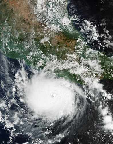 Image:
The powerful Hurricane Otis has been captured in this Copernicus Sentinel-3 image when it was approaching Mexico’s southern Pacific coast in October 2023.
Image:
The powerful Hurricane Otis has been captured in this Copernicus Sentinel-3 image when it was approaching Mexico’s southern Pacific coast in October 2023.
odborný referent / vrchní referent v oddělení podpory ICT v technickém odboru Katastrálního úřadu pr
7.12.2023 12:15 ČÚZK - předpisy a opatření Katastrální úřad pro Liberecký kraj - technický odborvypisuje výběrové řízení na místo
odborný referent / vrchní referent v oddělení podpory ICT v technickém odboru Katastrálního úřadu pro Liberecký kraj
odborný referent / vrchní referent v oddělení podpory ICT v technickém odboru Katastrálního úřadu pr
7.12.2023 12:15 ČÚZK - volná místa Katastrální úřad pro Liberecký kraj - technický odbor vypisuje výběrové řízení na místo odborný referent / vrchní referent v oddělení podpory ICT v technickém odboru Katastrálního úřadu prodborný referent / vrchní referent v oddělení podpory ICT v technickém odboru Katastrálního úřadu pr
7.12.2023 12:15 ČÚZK /Urady/Katastralni-urady/Katastralni-urady/Katastralni-urad-pro-Liberecky-kraj/Uredni-deska/Oznameni-a-jina-uredni-sdeleni/Volna-mista/DMS/odborny-referent-vrchni-referent-v-oddeleni-podpor33. jednání KRS
7.12.2023 11:40 ČÚZK - předpisy a opatření Dne 17. ledna 2024 proběhne distančně 33. jednání Koordinační rady správců DMVS a DTM.14. jednání TPS
7.12.2023 11:38 ČÚZK - předpisy a opatření Dne 10. ledna 2024 proběhne distančně 14. jednání Technické pracovní skupiny Koordinační rady správců DMVS a DTM.Minding the gap on tropical forest carbon
7.12.2023 9:00 ESA Observing the Earth
Tropical forests are clearly critical to Earth’s climate system, but understanding exactly how much carbon they absorb from the atmosphere, store and release is tricky to calculate, not least because measuring and reporting methods vary. With these measurements paramount for nations assessing the action they are taking to combat the climate crisis, new research shows how differences in estimates of carbon flux associated with human activity can be reconciled.
Lednový den s CAD technikem – bezplatná online konzultace pro vaši firmu
7.12.2023 8:30 Arkance Systems19. ledna 2024 - přihlaste se na nový termín akce společnosti Arkance Systems. Těšíme se na vás.
Zpráva Lednový den s CAD technikem – bezplatná online konzultace pro vaši firmu pochází z arkance-systems.cz.
ČKZ: Členové komory se ptali kandidátů do představenstva
7.12.2023 7:38 ZeměměřičPrvní volby do orgánů České komory zeměměřičů proběhnou již v pondělí 11. prosince 2023 na ustavujícím sněmu v Praze. Je skvělé, že se do voleb přihlásila celá řada odborníků, kteří chtějí v úvodním období komory pomoci s jejím nastavením a rozvojem. Ukázalo, že se zeměměřiči navzájem moc neznají a pro některé členy byly komorou publikované profily kandidátů příliš krátké pro kvalifikované rozhodování […]
The post ČKZ: Členové komory se ptali kandidátů do představenstva appeared first on Zeměměřič.
Tracking human emissions from space
6.12.2023 16:00 ESA Observing the EarthThe Copernicus Anthropogenic Carbon Dioxide Monitoring (CO2M) mission will be the first satellite mission to measure how much carbon dioxide is released into the atmosphere through human activity.
CO2M isn't just a mission; it's a crucial step in our commitment to understanding and mitigating climate change. It will offer unprecedented precision in monitoring carbon dioxide emissions from the combustion of fossil fuel at national and regional scales.
Its data will provide the EU with a unique and independent source of information to assess the effectiveness of policy measures and to track their impact towards decarbonising Europe ahead of the next Global Stocktake set to place in 2028.
The video features interviews with Valerie Fernandez, CO2M Mission Project Manager, Yannig Durand, CO2M Payload Manager and Yasjka Meijer, CO2M Mission Scientist.
Tracking human emissions from space
6.12.2023 16:00 ESA Observing the EarthThe Copernicus Anthropogenic Carbon Dioxide Monitoring (CO2M) mission will be the first satellite mission to measure how much carbon dioxide is released into the atmosphere through human activity.
CO2M isn't just a mission; it's a crucial step in our commitment to understanding and mitigating climate change. It will offer unprecedented precision in monitoring carbon dioxide emissions from the combustion of fossil fuel at national and regional scales.
Its data will provide the EU with a unique and independent source of information to assess the effectiveness of policy measures and to track their impact towards decarbonising Europe ahead of the next Global Stocktake set to place in 2028.
CO2M is one of six Copernicus Sentinel Expansion missions that ESA is developing on behalf of the EU. The missions will expand the current capabilities of the Copernicus Space Component – the world’s biggest supplier of Earth observation data.
The video features interviews with Valerie Fernandez, CO2M Mission Project Manager, Yannig Durand, CO2M Payload Manager and Yasjka Meijer, CO2M Mission Scientist.
Osprey: Inovace v leteckém šikmém snímkování
6.12.2023 15:50 TopGisVčera k nám dorazila nová UltraCam Osprey 4.1 - velkoformátová letecká kamera pro šikmé snímkování od Vexcel Imaging, kterou jsme vybalili a nainstalovali na letadlo. Tento pokročilý systém zvyšuje naše schopnosti ve vytváření interaktivních 3D modelů měst a budov, což nám umožňuje dodávat zákazníkům vizualizace s více detaily a přesností. S UltraCam Osprey 4.1, ...
Článek Osprey: Inovace v leteckém šikmém snímkování se nejdříve objevil na TopGis, s.r.o..
Odborný referent – oddělení právních vztahů k nemovitostem
6.12.2023 14:49 ČÚZK - předpisy a opatření Katastrální úřad pro Karlovarský kraj Katastrální pracoviště Karlovy Varyvypisuje výběrové řízení na místo
Odborný referent – oddělení právních vztahů k nemovitostem
Odborný referent – oddělení právních vztahů k nemovitostem
6.12.2023 14:49 ČÚZK - volná místa Katastrální úřad pro Karlovarský kraj Katastrální pracoviště Karlovy Vary vypisuje výběrové řízení na místo Odborný referent – oddělení právních vztahů k nemovitostemUnderstanding climate tipping points
6.12.2023 14:30 ESA Observing the Earth
As the planet warms, many parts of the Earth system are undergoing large-scale changes. Ice sheets are shrinking, sea levels are rising and coral reefs are dying off.
While climate records are being continuously broken, the cumulative impact of these changes could also cause fundamental parts of the Earth system to change dramatically. These ‘tipping points’ of climate change are critical thresholds in that, if exceeded, can lead to irreversible consequences.
Výběrové řízení
6.12.2023 13:37 ČÚZK - předpisy a opatření Katastrální úřad pro Plzeňský kraj - Katastrální pracoviště Rokycany zveřejnil novou aktualitu: Ředitelka Katastrálního úřadu pro Plzeňský kraj jako služební orgán příslušný podle § 10 odst. 1 písm. f) zákona č. 234/2014 Sb., o státní službě, ve znění pozdějších předpisů, vyhlašuje výběrové řízení na služební místo odborný/vrchní referent – obnova katastrálního operátu OKO0408, oddělení dokumentace KN, na Katastrálním úřadu pro Plzeňský kraj, na Katastrálním pracovišti Domažlice, se služebním působištěm v Domažlicích.Na služebním místě je státní služba (dále jen „služba“) vykonávána v oboru služby 55. Zeměměřictví a katastr nemovitostí.
Služební místo je zařazeno podle přílohy č. 1 k zákonu o státní službě do 9. platové třídy.
Služba na služebním místě bude vykonávána ve služebním poměru na dobu určitou, po dobu mateřské/rodičovské dovolené státní zaměstnankyně.
Předpokládaným dnem nástupu do služby na služebním místě je 1. ledna 2024.
Délka stanovené týdenní služební doby je 40 hodin.
Na služebním místě se umožňuje služba se zkrácenou služební dobou („kratší úvazek“).
Vvýběrové řízení na služební místo odborný/vrchní referent – obnova katastrálního operátu
6.12.2023 13:32 ČÚZK - volná místa Katastrální úřad pro Plzeňský kraj Katastrální pracoviště Domažlice vypisuje výběrové řízení na místo Vvýběrové řízení na služební místo odborný/vrchní referent – obnova katastrálního operátuVvýběrové řízení na služební místo odborný/vrchní referent – obnova katastrálního operátu
6.12.2023 13:32 ČÚZK /Urady/Katastralni-urady/Katastralni-urady/Katastralni-urad-pro-Plzensky-kraj/Uredni-deska/Oznameni-a-jina-uredni-sdeleni/Volna-mista/DMS/Vvyberove-rizeni-na-sluzebni-misto-odborny-vrc-(1)Vvýběrové řízení na služební místo odborný/vrchní referent – obnova katastrálního operátu
6.12.2023 13:32 ČÚZK - předpisy a opatření Katastrální úřad pro Plzeňský kraj Katastrální pracoviště Domažlicevypisuje výběrové řízení na místo
Vvýběrové řízení na služební místo odborný/vrchní referent – obnova katastrálního operátu
Zkrácení otevírací doby [Knihovna geografie, byTopic]
6.12.2023 12:20 Katedra aplikované geoinformatiky a kartografie Přf UK v pondělí 14. prosince. Knihovna geografie bude otevřena pouze do 16:00.Vánoční svátky [Knihovna geografie, byTopic]
6.12.2023 11:10 Katedra aplikované geoinformatiky a kartografie Přf UK Knihovna geografie bude od 19. prosince 2023 uzavřena do 1. ledna 2024Vánoční svátky a nový rok [Knihovna geografie, byTopic]
6.12.2023 11:10 Katedra aplikované geoinformatiky a kartografie Přf UK Knihovna geografie bude od 19. prosince 2023 uzavřena do 1. ledna 2024Výběrové řízení
6.12.2023 10:37 ČÚZK - předpisy a opatření Katastrální úřad pro Plzeňský kraj - Katastrální pracoviště Rokycany zveřejnil novou aktualitu: Ředitelka Katastrálního úřadu pro Plzeňský kraj jako služební orgán příslušný podle § 10 odst. 1 písm. f) zákona č. 234/2014 Sb., o státní službě, ve znění pozdějších předpisů, vyhlašuje výběrové řízení na služební místo odborný/vrchní referent – vedení katastrální mapy VKM1301, oddělení aktualizace a dokumentace KN, na Katastrálním úřadu pro Plzeňský kraj, na Katastrálním pracovišti Rokycany, se služebním působištěm v Rokycanech.Na služebním místě je státní služba (dále jen „služba“) vykonávána v oboru služby 55. Zeměměřictví a katastr nemovitostí.
Služební místo je zařazeno podle přílohy č. 1 k zákonu o státní službě do 9. platové třídy.
Služba na služebním místě bude vykonávána ve služebním poměru na dobu neurčitou.
Předpokládaným dnem nástupu do služby na služebním místě je 1. ledna 2024.
Délka stanovené týdenní služební doby je 40 hodin.
Na služebním místě se umožňuje služba se zkrácenou služební dobou („kratší úvazek“).
Vvýběrové řízení na služební místo odborný/vrchní referent – vedení katastrální mapy VKM1301
6.12.2023 10:32 ČÚZK - předpisy a opatření Katastrální úřad pro Plzeňský kraj Katastrální pracoviště Rokycanyvypisuje výběrové řízení na místo
Vvýběrové řízení na služební místo odborný/vrchní referent – vedení katastrální mapy VKM1301
Vvýběrové řízení na služební místo odborný/vrchní referent – vedení katastrální mapy VKM1301
6.12.2023 10:32 ČÚZK - volná místa Katastrální úřad pro Plzeňský kraj Katastrální pracoviště Rokycany vypisuje výběrové řízení na místo Vvýběrové řízení na služební místo odborný/vrchní referent – vedení katastrální mapy VKM1301Vvýběrové řízení na služební místo odborný/vrchní referent – vedení katastrální mapy VKM1301
6.12.2023 10:32 ČÚZK /Urady/Katastralni-urady/Katastralni-urady/Katastralni-urad-pro-Plzensky-kraj/Uredni-deska/Oznameni-a-jina-uredni-sdeleni/Volna-mista/DMS/Vvyberove-rizeni-na-sluzebni-misto-odborny-vrchni-NAVISP Industry 2023 @ ESTEC
5.12.2023 18:00 ESA Navigation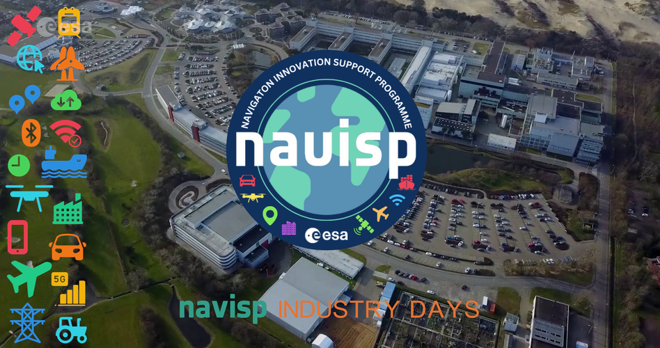 Video:
00:02:04
Video:
00:02:04
In November 2023, ESA hosted its annual NAVISP Industry Days event. This year, more than 200 positioning, navigation and timing (PNT) professionals from across Europe gathered at ESA’s Space Research and Technology Centre (ESTEC) in the Netherlands to explore together opportunities for innovation, commercialisation and collaboration via ESA’s Navigation Innovation and Support Programme (NAVISP).
For more information: visit https://navisp.esa.int
Galileo Second Generation satellites take shape
5.12.2023 13:10 ESA Navigation
To make the future of Galileo a reality, ESA and European industry are hard at work developing ultra-precise atomic clocks, system testbeds, ground mission and ground control segments and, of course, the satellites. Airbus Defence and Space, who is building six of the Galileo Second Generation constellation satellites, presented their first flight model structure to the programme’s stakeholders last week.
Odborný rada – ředitel odboru PV II. – Záznamy a OR
5.12.2023 12:55 ČÚZK - předpisy a opatření Katastrální úřad pro hlavní město Prahu zveřejnil novou aktualitu: Ředitelka úřadu vyhlašuje výběrové řízení na služební místo:Odborný rada – ředitel odboru PV II. – Záznamy a OR
Odborný rada – ředitel odboru PV II. – Záznamy a OR
5.12.2023 12:55 ČÚZK /Urady/Katastralni-urady/Katastralni-urady/Katastralni-urad-pro-hlavni-mesto-Prahu/O-uradu/Aktuality/Odborny-rada-–-reditel-odboru-PV-II-–-Zaznamy-a-OROdborný rada – ředitel odboru PV II. – Záznamy a OR
5.12.2023 12:53 ČÚZK - předpisy a opatření Katastrální úřad pro hlavní město Prahuvypisuje výběrové řízení na místo
Odborný rada – ředitel odboru PV II. – Záznamy a OR
Odborný rada – ředitel odboru PV II. – Záznamy a OR
5.12.2023 12:53 ČÚZK /Urady/Katastralni-urady/Katastralni-urady/Katastralni-urad-pro-hlavni-mesto-Prahu/Uredni-deska/Oznameni-a-jina-uredni-sdeleni/Volna-mista/Odborny-rada-–-reditel-odboru-PV-II-–-Zaznamy-a-OROdborný rada – ředitel odboru PV II. – Záznamy a OR
5.12.2023 12:53 ČÚZK - volná místa Katastrální úřad pro hlavní město Prahu vypisuje výběrové řízení na místo Odborný rada – ředitel odboru PV II. – Záznamy a OROdborný rada – ředitel odboru digitalizace a IT
5.12.2023 12:51 ČÚZK /Urady/Katastralni-urady/Katastralni-urady/Katastralni-urad-pro-hlavni-mesto-Prahu/O-uradu/Aktuality/Odborny-rada-–-reditel-odboru-digitalizace-a-ITOdborný rada – ředitel odboru digitalizace a IT
5.12.2023 12:51 ČÚZK - předpisy a opatření Katastrální úřad pro hlavní město Prahu zveřejnil novou aktualitu: Ředitelka úřadu vyhlašuje výběrové řízení na služební místo:Odborný rada – ředitel odboru digitalizace a IT
Odborný rada – ředitel odboru digitalizace a IT
5.12.2023 12:48 ČÚZK - předpisy a opatření Katastrální úřad pro hlavní město Prahuvypisuje výběrové řízení na místo
Odborný rada – ředitel odboru digitalizace a IT
Odborný rada – ředitel odboru digitalizace a IT
5.12.2023 12:48 ČÚZK - volná místa Katastrální úřad pro hlavní město Prahu vypisuje výběrové řízení na místo Odborný rada – ředitel odboru digitalizace a ITOdborný rada – ředitel odboru digitalizace a IT
5.12.2023 12:48 ČÚZK /Urady/Katastralni-urady/Katastralni-urady/Katastralni-urad-pro-hlavni-mesto-Prahu/Uredni-deska/Oznameni-a-jina-uredni-sdeleni/Volna-mista/Odborny-rada-–-reditel-odboru-digitalizace-a-ITZveřejnění obsahu informací poskytnutých na žádost dle zákona č. 106/1999 Sb. za rok 20
5.12.2023 12:42 ČÚZK /Urady/Katastralni-urady/Katastralni-urady/Katastralni-urad-pro-Liberecky-kraj/Casto-hledane-informace/Poskytovani-informaci-106-1999-Sb/Zverejneni-obsahu-informaci-poskytnutych-na-za-(1)/Zverejneni-obsahu-informaci-poskytnutych-na-za-(3)Zveřejnění obsahu informací poskytnutých na žádost dle zákona č. 106/1999 Sb. za rok 20
5.12.2023 12:42 ČÚZK - předpisy a opatření Katastrální úřad pro Liberecký krajzveřejňuje obsah informace poskytnutých na žádost dle zákona č. 106/1999 Sb. za rok
2023
Výběrové řízení
5.12.2023 11:40 ČÚZK - předpisy a opatření Katastrální úřad pro Plzeňský kraj zveřejnil novou aktualitu: Ředitelka Katastrálního úřadu pro Plzeňský kraj jako služební orgán příslušný podle § 10 odst. 1 písm. f) zákona č. 234/2014 Sb., o státní službě, ve znění pozdějších předpisů, vyhlašuje výběrové řízení na služební místo rada/odborný rada – interní auditor - IA, na Katastrálním úřadu pro Plzeňský kraj, se služebním působištěm v Plzni.Na služebním místě je státní služba (dále jen „služba“) vykonávána v oboru služby 3. Audit.
Služební místo je zařazeno podle přílohy č. 1 k zákonu o státní službě do 11. platové třídy.
Služba na služebním místě bude vykonávána ve služebním poměru na dobu neurčitou.
Předpokládaným dnem nástupu do služby na služebním místě je 1. březen 2024.
Délka stanovené týdenní služební doby je 40 hodin.
Na služebním místě se umožňuje služba se zkrácenou služební dobou („kratší úvazek“).
Co se událo [Knihovna geografie, byTopic]
5.12.2023 11:40 Katedra aplikované geoinformatiky a kartografie Přf UK Seminář ICONCLASS & e-ilustrace: nové nástroje a perspektivy výzkumu vizuální kultury raného novověkuVýběrové řízení na služební místo rada/odborný rada – interní auditor
5.12.2023 11:33 ČÚZK /Urady/Katastralni-urady/Katastralni-urady/Katastralni-urad-pro-Plzensky-kraj/Uredni-deska/Oznameni-a-jina-uredni-sdeleni/Volna-mista/DMS/Vyberove-rizeni-na-sluzebni-misto-rada-odborny-radVýběrové řízení na služební místo rada/odborný rada – interní auditor
5.12.2023 11:33 ČÚZK - volná místa Katastrální úřad pro Plzeňský kraj kancelář ředitele vypisuje výběrové řízení na místo Výběrové řízení na služební místo rada/odborný rada – interní auditorVýběrové řízení na služební místo rada/odborný rada – interní auditor
5.12.2023 11:33 ČÚZK - předpisy a opatření Katastrální úřad pro Plzeňský kraj kancelář ředitelevypisuje výběrové řízení na místo
Výběrové řízení na služební místo rada/odborný rada – interní auditor
Delve into the new CEOS Earth Observation Handbook
5.12.2023 10:15 ESA Observing the Earth
Delve into the new CEOS Earth Observation Handbook
Odborný rada/odborný rada – vedoucí oddělení výpravna
4.12.2023 17:20 ČÚZK /Urady/Katastralni-urady/Katastralni-urady/Katastralni-urad-pro-hlavni-mesto-Prahu/O-uradu/Aktuality/Odborny-rada-odborny-rada-–-vedouci-oddeleni-vypraOdborný rada/odborný rada – vedoucí oddělení výpravna
4.12.2023 17:20 ČÚZK - předpisy a opatření Katastrální úřad pro hlavní město Prahu zveřejnil novou aktualitu: Ředitelka úřadu vyhlašuje výběrové řízení na služební místo:Odborný rada/odborný rada – vedoucí oddělení výpravna
Odborný rada/odborný rada – vedoucí oddělení výpravna
4.12.2023 17:17 ČÚZK - předpisy a opatření Katastrální úřad pro hlavní město Prahuvypisuje výběrové řízení na místo
Odborný rada/odborný rada – vedoucí oddělení výpravna
Odborný rada/odborný rada – vedoucí oddělení výpravna
4.12.2023 17:17 ČÚZK /Urady/Katastralni-urady/Katastralni-urady/Katastralni-urad-pro-hlavni-mesto-Prahu/Uredni-deska/Oznameni-a-jina-uredni-sdeleni/Volna-mista/Odborny-rada-odborny-rada-–-vedouci-oddeleni-vypraOdborný rada/odborný rada – vedoucí oddělení výpravna
4.12.2023 17:17 ČÚZK - volná místa Katastrální úřad pro hlavní město Prahu vypisuje výběrové řízení na místo Odborný rada/odborný rada – vedoucí oddělení výpravnaInspektor ZKI v Liberci (obor služby 55)
4.12.2023 16:08 ČÚZK - předpisy a opatření Zeměměřický a katastrální inspektorát v Libercivypisuje výběrové řízení na místo
Inspektor ZKI v Liberci (obor služby 55)
Inspektor ZKI v Liberci (obor služby 55)
4.12.2023 16:08 ČÚZK /Urady/Zememericke-a-katastralni-inspektoraty/Zememericke-a-katastralni-inspektoraty/Zememericky-a-katastralni-inspektorat-v-Liberci/Uredni-deska/Oznameni-a-jina-uredni-sdeleni/Volna-mista/DMS/Inspektor-ZKI-v-Liberci-(obor-sluzby-55)Inspektor ZKI v Liberci (obor služby 55)
4.12.2023 16:08 ČÚZK - volná místa Zeměměřický a katastrální inspektorát v Liberci vypisuje výběrové řízení na místo Inspektor ZKI v Liberci (obor služby 55)oznámení o rušení kontaktního místa v Bystřici nad Pernštejnem
4.12.2023 14:00 ČÚZK - předpisy a opatření Katastrální úřad pro Vysočinu - Katastrální pracoviště Žďár nad Sázavou zveřejnil novou aktualitu: Katastrální úřad pro Vysočinu oznamuje, že k 31.12.2023 se ruší kontaktní místo Bytřice nad Pernštejnem.oznámení o rušení kontaktního místa v Bystřici nad Pernštejnem
4.12.2023 14:00 ČÚZK /Urady/Katastralni-urady/Katastralni-urady/Katastralni-urad-pro-Vysocinu/O-uradu/Aktuality/oznameni-o-ruseni-kontaktniho-mista-v-Bystrici-nad20231204 - volné místo - Ředitel/ředitelka KP Ústí nad Labem
4.12.2023 13:27 ČÚZK /Urady/Katastralni-urady/Katastralni-urady/Katastralni-urad-pro-Ustecky-kraj/Katastralni-pracoviste/KP-Usti-nad-Labem/O-uradu/Aktuality/20231204-volne-misto-Reditel-reditelka-KP-Usti-nad20231204 - volné místo - Ředitel/ředitelka KP Ústí nad Labem
4.12.2023 13:27 ČÚZK - předpisy a opatření Katastrální úřad pro Ústecký kraj - Katastrální pracoviště Ústí nad Labem zveřejnil novou aktualitu: Nabídka volného místa - Ředitel / ředitelka KP Ústí nad Labem20231204 - volné místo - Ředitel/ředitelka KP Ústí nad Labem
4.12.2023 13:25 ČÚZK /Urady/Katastralni-urady/Katastralni-urady/Katastralni-urad-pro-Ustecky-kraj/O-uradu/Aktuality/20231204-volne-misto-Reditel-reditelka-KP-Usti-nad20231204 - volné místo - Ředitel/ředitelka KP Ústí nad Labem
4.12.2023 13:25 ČÚZK - předpisy a opatření Katastrální úřad pro Ústecký kraj - Katastrální pracoviště Ústí nad Labem zveřejnil novou aktualitu: Nabídka volného místa - Ředitel / ředitelka KP Ústí nad LabemŘeditel / ředitelka KP Ústí nad Labem
4.12.2023 13:20 ČÚZK - předpisy a opatření Katastrální úřad pro Ústecký kraj Katastrální pracoviště Ústí nad Labemvypisuje výběrové řízení na místo
Ředitel / ředitelka KP Ústí nad Labem
Ředitel / ředitelka KP Ústí nad Labem
4.12.2023 13:20 ČÚZK - volná místa Katastrální úřad pro Ústecký kraj Katastrální pracoviště Ústí nad Labem vypisuje výběrové řízení na místo Ředitel / ředitelka KP Ústí nad LabemŘeditel / ředitelka KP Ústí nad Labem
4.12.2023 13:20 ČÚZK /Urady/Katastralni-urady/Katastralni-urady/Katastralni-urad-pro-Ustecky-kraj/Uredni-deska/Oznameni-a-jina-uredni-sdeleni/Volna-mista/DMS/Reditel-reditelka-KP-Usti-nad-LabemEUSpace4Ukraine publishes a White Paper and interactive maps to showcase Copernicus supported agricultural insights linked to Ukraine for NGOs
4.12.2023 13:06 European GNSS Agency
The newly published EUSpace4Ukraine white paper and interactive maps, called StoryMap help interested parties understand how EU space capabilities especially Earth Observation can benefit NGOs in areas of war and crises.
For example, Copernicus-derived insights regarding agricultural parameters such as variations of crop type and cropland extent in time and space in Ukraine can inform short-term operations (e.g., directing remediation efforts) and medium to long-term strategies (e.g., anticipating possible food shortages).
The European Union (EU) Agency for the Space Programme (EUSPA) launched the EUSpace4Ukraine initiative in April 2022 in response to the war in Ukraine. The objective is to support innovation and uptake of EU Space Programme solutions by humanitarian aid actors working in Ukraine, with the new white paper and StoryMap on Copernicus-enabled impact assessment as one of three demonstrators within the initiative.
As part of the EU Space Programme, the Copernicus Programme relies upon the EU Sentinels and third party Earth Observation (EO) satellites, in-situ (non-space based) data, and data-derived products available via the Copernicus Services. EO data in general and Copernicus in particular can be utilised for various use cases across several market segments, including agriculture.
The white paper provides context regarding the importance of the agricultural sector within Ukraine, and then dives into a quantitative assessment of the impacts of war on agriculture derived from Copernicus data. Sentinel data was used to estimate cropland extent before and during the intensification of the war (2022). The total cropland area in 2022 compared to 2017-2021 mean across all crops decreased by ~7% (nearly 2 million ha), while the most affected crops (wheat / barley, sunflower and corn) experienced up to ~13% drop in cropland extent. Regional differences and temporal evolution suggest that war activities directly impact cropland extent for important crops. The data can be explored in more detail in the accompanying interactive online StoryMap.
The decline in cropland extent as assessed via Sentinel data comes with implications for local, regional and global food security as well as people’s economic circumstances and livelihoods. Furthermore, such insights derived from the Copernicus Programme can support operational decision-making for NGOs in areas where remediation is most critical to enable the continuation of agricultural activities that ultimately support lives.
Additional examples of Copernicus capabilities showcase applications beyond agriculture to inspire the uptake of existing solutions and the development of new use cases. The paper also presents key stakeholders within the EUSpace4Ukraine initiative and their relevant capabilities to give a flavour of the variety and depth of technical EO-related expertise available within the EU. In addition, example end-user perspectives validate the usefulness and give an idea of how the Copernicus-enabled insights can be implemented.
Stakeholders interested in learning more about the solutions or being part of the EUSpace4Ukraine network can get in touch via euspace4ukraine@euspa.europa.eu.
Media note: This feature can be republished without charge provided the European Union Agency for the Space Programme (EUSPA) is acknowledged as the source at the top or the bottom of the story. You must request permission before you use any of the photographs on the site. If you republish, we would be grateful if you could link back to the EUSPA website (http://www.euspa.europa.eu).
EUSpace4Ukraine publishes a White Paper and interactive maps to showcase Copernicus supported agricultural insights linked to Ukraine for NGOs
4.12.2023 13:06 European GNSS AgencyThe newly published EUSpace4Ukraine white paper and interactive maps, called StoryMap help interested parties understand how EU space capabilities especially Earth Observation can benefit NGOs in areas of war and crises.
For example, Copernicus-derived insights regarding agricultural parameters such as variations of crop type and cropland extent in time and space in Ukraine can inform short-term operations (e.g., directing remediation efforts) and medium to long-term strategies (e.g., anticipating possible food shortages).
The EU Agency for the Space Programme (EUSPA) launched the EUSpace4Ukraine initiative in April 2022 in response to the war in Ukraine. The objective is to support innovation and uptake of EU Space Programme solutions by humanitarian aid actors working in Ukraine, with the new white paper and StoryMap on Copernicus-enabled impact assessment as one of three demonstrators within the initiative.
As part of the EU Space Programme, the Copernicus Programme relies upon the EU Sentinels and third party Earth Observation (EO) satellites, in-situ (non-space based) data, and data-derived products available via the Copernicus Services. EO data in general and Copernicus in particular can be utilised for various use cases across several market segments, including agriculture.
The white paper provides context regarding the importance of the agricultural sector within Ukraine, and then dives into a quantitative assessment of the impacts of war on agriculture derived from Copernicus data. Sentinel data was used to estimate cropland extent before and during the intensification of the war (2022). The total cropland area in 2022 compared to 2017-2021 mean across all crops decreased by ~7% (nearly 2 million ha), while the most affected crops (wheat / barley, sunflower and corn) experienced up to ~13% drop in cropland extent. Regional differences and temporal evolution suggest that war activities directly impact cropland extent for important crops. The data can be explored in more detail in the accompanying interactive online StoryMap.
The decline in cropland extent as assessed via Sentinel data comes with implications for local, regional and global food security as well as people’s economic circumstances and livelihoods. Furthermore, such insights derived from the Copernicus Programme can support operational decision-making for NGOs in areas where remediation is most critical to enable the continuation of agricultural activities that ultimately support lives.
Additional examples of Copernicus capabilities showcase applications beyond agriculture to inspire the uptake of existing solutions and the development of new use cases. The paper also presents key stakeholders within the EUSpace4Ukraine initiative and their relevant capabilities to give a flavour of the variety and depth of technical EO-related expertise available within the EU. In addition, example end-user perspectives validate the usefulness and give an idea of how the Copernicus-enabled insights can be implemented.
Stakeholders interested in learning more about the solutions or being part of the EUSpace4Ukraine network can get in touch via euspace4ukraine@euspa.europa.eu.
Media note: This feature can be republished without charge provided the European Union Agency for the Space Programme (EUSPA) is acknowledged as the source at the top or the bottom of the story. You must request permission before you use any of the photographs on the site. If you republish, we would be grateful if you could link back to the EUSPA website (http://www.euspa.europa.eu).
Přehledně: Pozměňovací návrhy k vnitřní legislativě komory zeměměřičů
4.12.2023 12:54 ZeměměřičV programu ustavujícího sněmu České komory zeměměřičů je rovněž projednání pozměňovacích návrhů k vnitřní legislativě. Přípravný výbor všechny pozměňovací návrhy vystavil na webu komory. Ing. Jan Pěčonka si všechny komorové řády zpracoval a zapracoval si do nich barevně jednotlivé pozměňovací návrhy, o kterých se na sněmu bude hlasovat. Každý řád je jeden dokument s barevným vyznačením změn a s případnými odůvodněními […]
The post Přehledně: Pozměňovací návrhy k vnitřní legislativě komory zeměměřičů appeared first on Zeměměřič.
ESA and UNEP collaborate for a greener future
4.12.2023 11:56 ESA Observing the Earth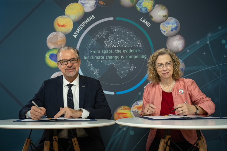
In a significant step towards a more sustainable future, ESA and the United Nations Environment Programme (UNEP) have signed a Memorandum of Understanding during Earth Information Day at COP28 currently taking place in Dubai.
The memorandum signifies a commitment to harness the power of space technology and data for environmental conservation, nature and biodiversity protection and restoration.
Odborný referent / vrchní referent - obnova katastrálního operátu v oddělení dokumentace KN Katastrá
4.12.2023 11:47 ČÚZK /Urady/Katastralni-urady/Katastralni-urady/Katastralni-urad-pro-Zlinsky-kraj/Uredni-deska/Oznameni-a-jina-uredni-sdeleni/Volna-mista/DMS/Odborny-referent-vrchni-referent-obnova-katastralnOdborný referent / vrchní referent - obnova katastrálního operátu v oddělení dokumentace KN Katastrá
4.12.2023 11:47 ČÚZK - volná místa Katastrální úřad pro Zlínský kraj Katastrální pracoviště Valašské Meziříčí vypisuje výběrové řízení na místo Odborný referent / vrchní referent - obnova katastrálního operátu v oddělení dokumentace KN KatastráOdborný referent / vrchní referent - obnova katastrálního operátu v oddělení dokumentace KN Katastrá
4.12.2023 11:47 ČÚZK - předpisy a opatření Katastrální úřad pro Zlínský kraj Katastrální pracoviště Valašské Meziříčívypisuje výběrové řízení na místo
Odborný referent / vrchní referent - obnova katastrálního operátu v oddělení dokumentace KN Katastrálního pracoviště Valašské Meziříčí
Contract secures next step for TRUTHS climate mission
4.12.2023 11:00 ESA Observing the Earth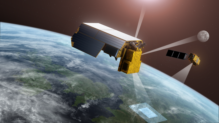
Delegates from around 200 countries are convened at the United Nations COP28 summit in Dubai to assess the action they are taking to combat the climate crisis. With satellites fundamental to understanding and monitoring climate change, ESA has awarded a contract to Airbus to take the TRUTHS satellite mission to its next development phase.
TRUTHS is set to provide the gold reference for climate measurements, thereby giving decision-makers more confidence in the data they use for climate action.
20231204_Odborný rada právního oddělení
4.12.2023 10:10 ČÚZK /Urady/Katastralni-urady/Katastralni-urady/Katastralni-urad-pro-Stredocesky-kraj/Katastralni-pracoviste/KP-Praha-vychod/O-uradu/Aktuality/20210922_Odborny-referent-oddeleni-aktualizace-(5)20231204_Odborný rada právního oddělení
4.12.2023 10:10 ČÚZK - předpisy a opatření Katastrální úřad pro Středočeský kraj - Katastrální pracoviště Praha-východ Vyhlášení výběrového řízení: Odborný rada právního oddělení V části "Úřední deska", v sekci "Oznámení a jiná úřední sdělení" bylo vystaveno "Oznámení o vyhlášení výběrového řízení na obsazení služebního místa Odborný rada právního oddělení"20231204_Odborný rada právního oddělení
4.12.2023 10:10 ČÚZK /Urady/Katastralni-urady/Katastralni-urady/Katastralni-urad-pro-Stredocesky-kraj/Katastralni-pracoviste/KP-Praha-vychod/20210922_Odborny-referent-oddeleni-aktualizace-(4)Odborný rada právního oddělení
4.12.2023 10:08 ČÚZK - volná místa Katastrální úřad pro Středočeský kraj Katastrální pracoviště Praha-východ vypisuje výběrové řízení na místo Odborný rada právního odděleníOdborný rada právního oddělení
4.12.2023 10:08 ČÚZK - předpisy a opatření Katastrální úřad pro Středočeský kraj Katastrální pracoviště Praha-východvypisuje výběrové řízení na místo
Odborný rada právního oddělení
DAEX DESIGN Standard 24
2.12.2023 6:03 ŠPINAR - softwareNová verze DAEX DESIGN Standard 24 s importérem korpusů s kováním Blum!
The post DAEX DESIGN Standard 24 appeared first on ŠPINAR – software.
DAEX DESIGN Standard 24
2.12.2023 6:03 ŠPINAR - software Nová verze DAEX DESIGN Standard 24 s importérem korpusů - kováním Blum!DAEX DESIGN Standard 24
2.12.2023 6:03 ŠPINAR - softwareNová verze DAEX DESIGN Standard 24 s importérem korpusů - kováním Blum!
The post DAEX DESIGN Standard 24 appeared first on ŠPINAR – software.
Pracovní pomůcka k JVF DTM 1.4.3
1.12.2023 17:40 ČÚZK - předpisy a opatření Do záložky JVF DTM byla pro možné využití vystavena pracovní pomůcka k nové verzi JVF DTM 1.4.3 - jedná se o přehledy rozdílů v objektechSoutěž o Atlas libereckých živých jmen – vyhlášení
1.12.2023 16:03 GISportal.cz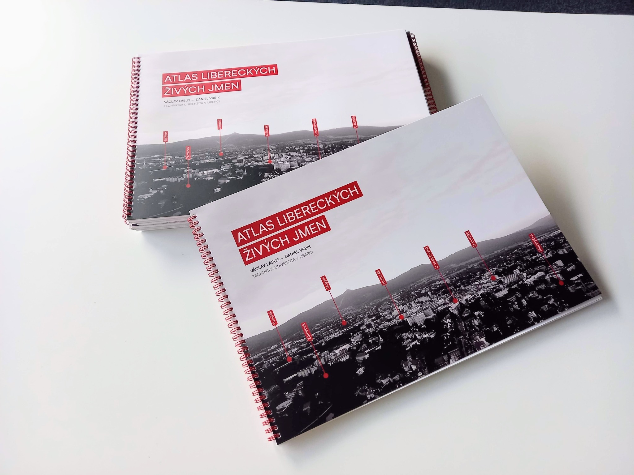
V polovině listopadu jsme spolu s autory Atlasu libereckých živých jmen vyhlásili soutěž o podepsaný atlas. Otázka byla, kolik míst v Liberci jeho obyvatelé nazývají jménem „Myší díra“ v mapě živých jmen? Správná odpověď byla 11x! Celkem se nám sešlo 14 odpovědí z toho 6 bylo správných. Ty správné jsme seřadili podle toho, kdy nám přišly […]
The post Soutěž o Atlas libereckých živých jmen – vyhlášení appeared first on GISportal.cz.
Soutěž o nejlepší kvalifikační práci [Knihovna geografie, byTopic]
1.12.2023 13:25 Katedra aplikované geoinformatiky a kartografie Přf UK Česká asociace geomorfologů vyhlašuje každoroční soutěž o nejlepší kvalifikační práciVěcné úkoly Katastrálního úřadu pro Moravskoslezský kraj v roce 2023/11
1.12.2023 13:15 ČÚZK /Urady/Katastralni-urady/Katastralni-urady/Katastralni-urad-pro-Moravskoslezsky-kraj/O-uradu/Aktuality/Vecne-ukoly-Katastralniho-uradu-pro-Moravskosl-(1)Věcné úkoly Katastrálního úřadu pro Moravskoslezský kraj v roce 2023/11
1.12.2023 13:15 ČÚZK - předpisy a opatření Katastrální úřad pro Moravskoslezský kraj zveřejnil novou aktualitu: Seznam schválených věcných úkolů s plánovaným dokončením v roce 2023 (s uvedeným datem již dokončených VÚ).vrchní referent / rada v oddělení dokumentace katastru nemovitostí na Katastrálním pracovišti Semily
1.12.2023 12:33 ČÚZK - předpisy a opatření Katastrální úřad pro Liberecký kraj - Katastrální pracoviště Semilyvypisuje výběrové řízení na místo
vrchní referent / rada v oddělení dokumentace katastru nemovitostí na Katastrálním pracovišti Semily Katastrálního úřadu pro Liberecký kraj
vrchní referent / rada v oddělení dokumentace katastru nemovitostí na Katastrálním pracovišti Semily
1.12.2023 12:33 ČÚZK /Urady/Katastralni-urady/Katastralni-urady/Katastralni-urad-pro-Liberecky-kraj/Uredni-deska/Oznameni-a-jina-uredni-sdeleni/Volna-mista/DMS/vrchni-referent-rada-v-oddeleni-dokumentace-katastvrchní referent / rada v oddělení dokumentace katastru nemovitostí na Katastrálním pracovišti Semily
1.12.2023 12:33 ČÚZK - volná místa Katastrální úřad pro Liberecký kraj - Katastrální pracoviště Semily vypisuje výběrové řízení na místo vrchní referent / rada v oddělení dokumentace katastru nemovitostí na Katastrálním pracovišti Semilyvrchní referent / rada v oddělení dokumentace katastru nemovitostí na Katastrálním pracovišti Semily
1.12.2023 12:33 ČÚZK - předpisy a opatření Katastrální úřad pro Liberecký kraj Katastrální pracoviště Semilyvypisuje výběrové řízení na místo
vrchní referent / rada v oddělení dokumentace katastru nemovitostí na Katastrálním pracovišti Semily Katastrálního úřadu pro Liberecký kraj
rada / odborný rada - analytik v oddělení hospodářské správy kanceláře úřadu ředitele Katastrálního
1.12.2023 11:55 ČÚZK /Urady/Katastralni-urady/Katastralni-urady/Katastralni-urad-pro-Kralovehradecky-kraj/Uredni-deska/Oznameni-a-jina-uredni-sdeleni/Volna-mista/DMS/rada-odborny-rada-analytik-v-oddeleni-hospodarske-rada / odborný rada - analytik v oddělení hospodářské správy kanceláře úřadu ředitele Katastrálního
1.12.2023 11:55 ČÚZK - předpisy a opatření Katastrální úřad pro Královéhradecký kraj kancelář ředitelevypisuje výběrové řízení na místo
rada / odborný rada - analytik v oddělení hospodářské správy kanceláře úřadu ředitele Katastrálního úřadu pro Královéhradecký kraj
rada / odborný rada - analytik v oddělení hospodářské správy kanceláře úřadu ředitele Katastrálního
1.12.2023 11:55 ČÚZK - volná místa Katastrální úřad pro Královéhradecký kraj kancelář ředitele vypisuje výběrové řízení na místo rada / odborný rada - analytik v oddělení hospodářské správy kanceláře úřadu ředitele KatastrálníhoEarth from Space: American Samoa
1.12.2023 11:40 ESA Observing the Earth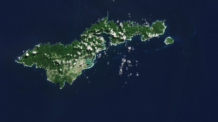 Image:
The Copernicus Sentinel-2 mission shows us an amazing view of the tropical island of Tutuila, the largest in the American Samoa archipelago in the South Pacific Ocean.
Image:
The Copernicus Sentinel-2 mission shows us an amazing view of the tropical island of Tutuila, the largest in the American Samoa archipelago in the South Pacific Ocean.
20231201_Investiční referent OHS – vrchní referent / rada
1.12.2023 10:57 ČÚZK - předpisy a opatření Katastrální úřad pro Středočeský kraj Vyhlášení výběrového řízení: Investiční referent OHS – vrchní referent / rada V části "Úřední deska", v sekci "Oznámení a jiná úřední sdělení" bylo vystaveno "Oznámení o vyhlášení výběrového řízení na obsazení služebního místa Investiční referent OHS – vrchní referent / rada"20231201_Investiční referent OHS – vrchní referent / rada
1.12.2023 10:57 ČÚZK /Urady/Katastralni-urady/Katastralni-urady/Katastralni-urad-pro-Stredocesky-kraj/O-uradu/Aktuality/20210922_Odborny-referent-oddeleni-aktualizac-(5)Iceberg on the loose
1.12.2023 9:00 ESA Observing the Earth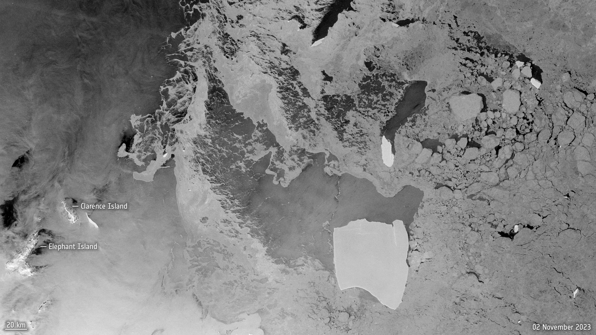 Image:
After being grounded on the ocean floor for well over four decades, the largest iceberg in the world is on the loose.
Image:
After being grounded on the ocean floor for well over four decades, the largest iceberg in the world is on the loose.
Ztráta služebního průkazu
1.12.2023 8:31 ČÚZK /Urady/Katastralni-urady/Katastralni-urady/Katastralni-urad-pro-Liberecky-kraj/O-uradu/Aktuality/Ztrata-sluzebniho-prukazuZtráta služebního průkazu
1.12.2023 8:31 ČÚZK - předpisy a opatření Katastrální úřad pro Liberecký kraj zveřejnil novou aktualitu: Služební průkaz č. 182576712 uživatele 10087657 byl ke dni 30.11.2023 zablokován. V případě nalezení průkazu, prosíme o odevzdání na Katastrálním úřadě pro Liberecký kraj.Zrušení kontaktního místa
1.12.2023 7:56 ČÚZK - předpisy a opatření Katastrální úřad pro Vysočinu - Katastrální pracoviště Žďár nad Sázavou zveřejnil novou aktualitu: Katastrální úřad pro Vysočinu, Katastrální pracoviště Žďár nad Sázavou oznamuje, že od 1.1.2024 bude Kontaktní místo Bystřice nad Pernštejnem zrušeno.Zrušení kontaktního místa
1.12.2023 7:56 ČÚZK /Urady/Katastralni-urady/Katastralni-urady/Katastralni-urad-pro-Vysocinu/Katastralni-pracoviste/KP-Zdar-nad-Sazavou/O-uradu/Aktuality/Zruseni-kontaktniho-mistaPředběžný program Zlíngeo 2024. Zkušenosti s DTM, měřické práce, monitoring dlouhých konstrukcí
30.11.2023 22:05 ZeměměřičV pátek 26. ledna 2024 se ve Zlíně uskuteční další setkání zeměměřičů, působících ve Zlínském kraji. Akce s názvem ZLÍNGEO 2024 bude opět v Centroprojektu (Štefánikova 167, 76001 Zlín). Organizátoři zaslali redakci Zeměměřiče předběžný program. Témata referátů na Zlíngeo 2024 Přesnosti v obtížných podmínkách při použití GNSS – Michal Martinek, Geotronics Praha Měřické práce při rekonstrukci pražského Průmyslového paláce, přehled metod, […]
The post Předběžný program Zlíngeo 2024. Zkušenosti s DTM, měřické práce, monitoring dlouhých konstrukcí appeared first on Zeměměřič.
Předběžný program Zlíngeo 2024. Zkušenosti s DTM, měřické práce, monitoring dlouhých konstrukcí
30.11.2023 22:05 ZeměměřičV pátek 26. ledna 2024 se ve Zlíně uskuteční další setkání zeměměřičů, působících ve Zlínském kraji. Akce s názvem ZLÍNGEO 2024 bude opět v Centroprojektu (Štefánikova 167, 76001 Zlín) Organizátoři zaslali redakci Zeměměřiče předběžný program. Témata referátů na Zlíngeo 2024 Přesnosti v obtížných podmínkách při použití GNSS – Michal Martinek, Geotronics Praha Měřické práce při rekonstrukci pražského Průmyslového paláce, přehled metod, […]
The post Předběžný program Zlíngeo 2024. Zkušenosti s DTM, měřické práce, monitoring dlouhých konstrukcí appeared first on Zeměměřič.
Setkání Zlíngeo 2024. V programu je stavební právo, zkušenosti s DTM
30.11.2023 22:05 ZeměměřičV pátek 26. ledna 2024 se ve Zlíně uskuteční další setkání zeměměřičů, působících ve Zlínském kraji. Akce s názvem ZLÍNGEO 2024 bude opět v Centroprojektu (Štefánikova 167, 76001 Zlín) Organizátoři zaslali redakci Zeměměřiče předběžný program. Témata referátů na Zlíngeo 2024 Přesnosti v obtížných podmínkách při použití GNSS – Michal Martinek, Geotronics Praha Měřické práce při rekonstrukci pražského Průmyslového paláce, přehled metod, […]
The post Setkání Zlíngeo 2024. V programu je stavební právo, zkušenosti s DTM appeared first on Zeměměřič.
Global Stocktake: how space drives climate action
30.11.2023 17:30 ESA Observing the Earth Video:
00:12:34
Video:
00:12:34
Almost 200 countries are gathering in Dubai to attend the biggest climate event of the year. COP28 – the 2023 United Nations climate change summit – isn’t just another conference though. For the first time, country representatives will assess the progress they’ve made towards cutting their greenhouse gas emissions through a process called the ‘global stocktake’.
Satellites are critical in the quest to tackle climate change as they give the robustness and transparency needed to monitor progress towards a lower-emissions and more resilient world. If undertaken effectively, the global stocktake can provide an opportunity to leverage decisions and accelerate ambition in climate action plans.
This video contains interviews with ESA Director of Earth Observation Programmes, Simonetta Cheli, Antony Delavois, ESA Junior Professional, Atmospheric Composition and Yasjka Meijer, CO2M Mission Scientist.
Safeguarding space operations with STM
30.11.2023 15:05 European GNSS Agency is working to mitigate the threat of space debris colliding with satellites.")
Haven’t heard of Space Traffic Management? Well, it’s time you get familiar. After all, it has a direct impact on your everyday life.
“From communication to navigation, observation to aviation, all of these depend on the data and services coming from satellites in space,” said João Alves, SST Team Leader at EUSPA, who moderated a panel discussion on EU Space Traffic Management during EU Space Week. “As a result, keeping these systems safe and operational is paramount.”
But doing so is becoming increasingly more challenging. That’s because as the number of satellites being put into space continues to grow, so too does the amount of debris floating around space.
In fact, there are now more than 1 million pieces of space debris orbiting the Earth. If one of these tiny pieces of old launchers or satellites happens to collide with a satellite, not only could it damage the satellite itself, end users could lose access to the services those satellites provide.
Helping answer this threat is Space Traffic Management (STM).
Space Surveillance and Tracking as the backbone of Space Traffic Management
Space Traffic Management encompasses the means and the rules to access, conduct activities in and return from outer space safely, sustainably and securely. “With STM, the EU is at the forefront of shaping a new era of space governance, safeguarding EU interests in full respect of the respective competencies of the EU and its Member States,” said Rodolphe Muñoz, a Legal Officer at the European Commission.
However, for STM to work, it needs to be able to continuously observe space traffic. This is why the EU has made Space Surveillance and Tracking (SST) the operational backbone of its approach to STM.
“Between the European Commission, the SST partnership of 15 Member States and EUSPA, all of whom are working together, I can assure you that we are in very good hands when it comes to delivering EU SST’s services,” said Pascal Faucher, Chair of the EU SST Partnership and Head of Defence and Security at CNES.
A key component of the EU Space Programme, EU SST safeguards Europe’s space assets – including Galileo, EGNOS, Copernicus and GOVSATCOM satellites – along with those of its Member States and other space operators. To do so, it uses a network of ground-based sensors capable of surveying and tracking artificial space objects, together with processing capabilities aiming to provide data, information and services on space objects orbiting the Earth.
“One of the main pillars of EU STM in general and EU SST in particular is technology – radars, sensors, lasers, telescopes, etc.,” remarked Alberto Águeda, Director of Space Surveillance and Traffic Management at GMV. “This requires having the best European companies working on the technology that gives us the ability to build the best STM system.”
Here, as mentioned by Rodolphe Munoz and Pascal Faucher, the EU Industry and Start-ups Forum on STM (EISF) was established with the purpose of bringing together EU stakeholders and industry to jointly develop R&D priorities. “This fosters the industrial ecosystem, strengthens operational STM capabilities and enhances EU autonomy,” said Águeda.
EUSPA responsible for SST Front Desk operations
EUSPA is responsible for the SST Front Desk. The Front Desk is the main interface for delivering SST information and services between the SST Partnership and the user community, including activities related to user coordination, service performance, engagement and communication.
Those services, which currently include collision avoidance, re-entry analysis and fragmentation analysis, are already being leveraged by such satellite operators as EUMETSAT, the European operational satellite agency for monitoring weather, climate and the environment from space. “We regularly receive messages from EU SST that make us aware of potential risks and allow our team to analyse the problem and, when necessary, take mitigation action,” explained EUMETSAT Flight Dynamics Manager Pierluigi Righetti.
In addition to its SST Front Desk responsibilities, EUSPA also contributes to the system’s security monitoring, including establishing the security requirements needed to shape the SST network in support of the European Commission and the EU SST Partnership.
You can learn more about EUSPA’s role here.
Did you know? |
|
Did you know that the increase in space activity has the potential to impact air travel and safety? That’s because the launches and re-entries of space assets often go through controlled airspace, causing flight delays and creating a potential safety risk. “Although very congested, Europe is the safest region for aviation in the world – and we would like this to continue,” said Nathalie Le Cam, Project Manager Higher Airspace Operations at the European Union Aviation Safety Agency (EASA). According to Le Cam, the key to ensuring the safety of both space and air travel is to create a level of harmonisation between space and air traffic management – something that EU SST could help do. |
Media note: This feature can be republished without charge provided the European Union Agency for the Space Programme (EUSPA) is acknowledged as the source at the top or the bottom of the story. You must request permission before you use any of the photographs on the site. If you republish, we would be grateful if you could link back to the EUSPA website (http://www.euspa.europa.eu).
Geoportál ČSÚ oceněn v soutěži Egovernment The Best 2023
30.11.2023 12:12 T-MAPYThe post Geoportál ČSÚ oceněn v soutěži Egovernment The Best 2023 appeared first on T-MAPY spol. s r.o..
Souhrn změn v provozu dronů v EU od roku 2024
30.11.2023 10:57 UAVA Od začátku roku 2024 nás čeká několik změn v pravidlech provozu i prodeji dronů v EU. Pokud Vás zajímá souhrn změn, tak ho najdete na stránkách EASA nebo jsme připravili souhrn na stránkách Aliance, zde: https://uavaliance.cz/eu-pravidla/ Současně budeme hlavní změny představovat postupně na Facebooku Aliance.Taking climate action with Earth observation
30.11.2023 10:10 ESA Observing the Earth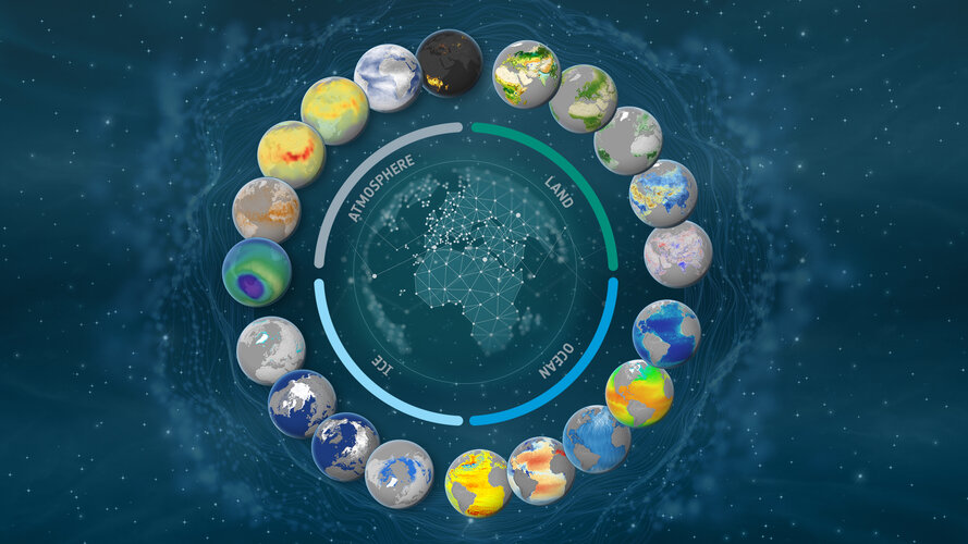
As global temperatures records are smashed and greenhouse gas emissions reach new highs, a new report from the UN Environment Programme finds that current pledges under the Paris Agreement put the world on track for a 2.5–2.9°C temperature rise this century – pointing to the urgent need for increased climate action.
The report is timely as nearly 200 nations gather in the coming two weeks at the United Nations COP28 Climate Change Summit to conclude the world’s first ever ‘Global Stocktake’ on climate change. Swift and sustained climate action is needed to avoid the worst consequences of climate change. Satellites are critical tools in the quest to tackle climate change and monitor progress towards a lower-emissions and more resilient world.
Zveřejnění obsahu informací poskytnutých na žádost dle zákona č. 106/1999 Sb. za rok 2015
30.11.2023 9:44 Zeměměřický úřad Zeměměřický úřadzveřejňuje obsah informace poskytnutých na žádost dle zákona č. 106/1999 Sb. za rok
2015
Zveřejnění obsahu informací poskytnutých na žádost dle zákona č. 106/1999 Sb. za rok 2015
30.11.2023 9:44 ČÚZK /Urady/Zememericky-urad/Casto-hledane-informace/Poskytovani-informaci-106-1999-Sb/Zverejneni-obsahu-informaci-poskytnutych-na-za-(1)/Zverejneni-obsahu-informaci-poskytnutych-na-za-(8)Zveřejnění obsahu informací poskytnutých na žádost dle zákona č. 106/1999 Sb. za rok 2015
30.11.2023 9:44 ČÚZK - předpisy a opatření Zeměměřický úřadzveřejňuje obsah informace poskytnutých na žádost dle zákona č. 106/1999 Sb. za rok
2015