


![]()

zprávy
zdroje zpráv:Provoz 31.12.2019
6.12.2019 10:21 ČÚZK - předpisy a opatření Katastrální úřad pro Královéhradecký kraj zveřejnil novou aktualitu:Děkujeme za pochopení
Provoz 31.12.2019
6.12.2019 10:21 ČÚZK - předpisy a opatření Český úřad zeměměřický a katastrální zveřejnil novou aktualitu:Vážení klienti,
dne 31.12.2019 budou úřední hodiny 8:00 – 13:00 hod.
Úřední hodiny Katastrálního pracoviště Jičín budou 8:00 – 11:00 hod.
Děkujeme za pochopení
Provoz 31.12.2019
6.12.2019 10:21 ČÚZK - předpisy a opatření Český úřad zeměměřický a katastrální zveřejnil novou aktualitu:Děkujeme za pochopení
Provoz 31.12.2019
6.12.2019 10:21 ČÚZK /Urady/Katastralni-urady/Katastralni-urady/Katastralni-urad-pro-Kralovehradecky-kraj/O-uradu/Aktuality/Provoz-31-12-2019Mato Grosso, Brazil
6.12.2019 10:00 ESA Observing the Earth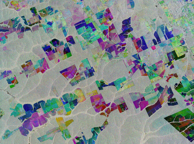 Image:
The Copernicus Sentinel-1 mission takes us over part of the Brazilian state of Mato Grosso deep in the Amazon interior.
This image combines three separate radar images from the Copernicus Sentinel-1 mission taken about two years apart to show change in crops and land cover over time.
Unlike images from satellites carrying optical or ‘camera-like’ instruments, images acquired with imaging radar are interpreted by studying the intensity of the backscatter radar signal, which is related to the roughness of the ground.
Here, the first image, from 2 May 2015, is picked out in blue; the second, from 16 March 2017, picks out changes in green; and the third from 18 March 2019 in red; areas in grey depict little or no change between 2015 and 2019.
Ironically, Mato Grosso means ‘great woods’, but, as these coloured rectangular shapes portray, much of the tropical forest has been cut down and given over to farming. While this image only shows a small area, Mato Grosso is one of Brazil’s top cattle-producing and crop-producing states, with the main crops including corn, soya and wheat.
However, although the state has one of the highest historical rates of deforestation in Amazonian Brazil, deforestation is slowing and Mato Grosso is now said to be a global leader in climate-change solutions.
As an advanced radar mission, Copernicus Sentinel-1 can image the surface of Earth through cloud and rain and regardless of whether it is day or night. This makes it ideal for monitoring areas that tend to be covered by cloud such as rainforests.
This image is also featured on the Earth from Space video programme.
Mapová aplikace ÚAP - aktualizace
6.12.2019 10:00 Jihočeský kraj Mapová aplikace Územně analytické podklady byla aktualizována k 6.12.2019.Earth from Space: Mato Grosso
6.12.2019 10:00 ESA Observing the Earth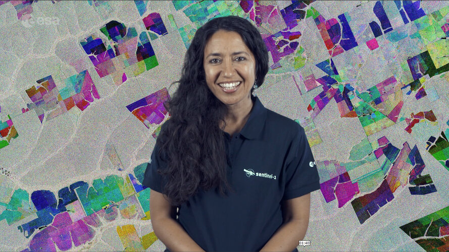 Video:
00:02:33
Video:
00:02:33
In this week's edition of the Earth from Space programme, the Copernicus Sentinel-1 mission takes us over part of the Brazilian state of Mato Grosso deep in the Amazon interior.
See also Mato Grosso, Brazil to download the image.
DigEplan Integrates Electronic Plan Review to Cityworks Platform
6.12.2019 9:00 GISCafe.com Webcasts-Webinars December 04, 2019 -- DigEplan, a leading integrated electronic plan review solution, and GIS-centric public asset management solution firm, Cityworks …Map of the Month: Online & brick-and-mortar purchasing power for toys & hobbies, Germany 2019
6.12.2019 9:00 GISCafe.com Webcasts-Webinars GfK's Map of the Month for December illustrates the 2019 regional distribution of purchasing power for toys and hobbies via online and …Astronaut assistant CIMON-2 is on its way to the International Space Station
6.12.2019 9:00 GISCafe.com Webcasts-Webinars Human-machine interaction and artificial intelligence in spaceNew technology demonstrator with improved ‘sense of direction’ and …Cena za nejlepší mapu putuje do Olomouce
6.12.2019 8:59 GISportal.cz
Kartografický časopis Journal of Maps udělil cenu Best Map Award za rok 2019 Jiřímu Pánkovi a Bohumilu Ptáčkovi, autorům článku Mapping citizens’ emotions: participatory planning support system in Olomouc, Czech Republic. Cena je udělována od roku 2008 a nejedná se o čistě ocenění nejlepší mapy, či akademického článku, ale spíše o kombinaci excelentních výsledků v obou oblastech. Letošní […]
The post Cena za nejlepší mapu putuje do Olomouce appeared first on GISportal.cz.
INSPIRE téma Rozšířené Parcely (CPX)
6.12.2019 1:00 Cenia - Katalog metadat ČR - INSPIRE Rozšíření má za cíl poskytovat katastrální mapu s obsahem podle vyhlášky ve vektorové podobě ve struktuře plně v souladu se strukturou danou směrnicí INSPIRE. Data rozšiřují směrnici INSPIRE pro téma katastrální parcely (CP) o věcná břemena, geodetické body, další prvky mapy, původní obloukovou geometrii a o parcely určené definičním bodem (ty pouze v oblastech s analogovou mapou). Vychází z katastrální mapy, která je závazným státním mapovým dílem velkého měřítka, obsahuje body polohového bodového pole, polohopis a popis a může mít formu digitální mapy, analogové mapy nebo digitalizované mapy. Publikovaná data obsahují katastrální území pro celou Českou Republiku, parcely a jejich hranice, věcná břemena, další prvky mapy a původní obloukovou geometrii z území, kde je digitální mapa (k 02. 12. 2019 je to 96,63% území České republiky, t.j. 76 208,84km2) a ve zbytku území katastrální parcely určené pouze definičním bodem (tedy bez hranic a polygonu). Katastrální parcely a hranice obsahují oproti datové sadě INSPIRE některé atributy navíc. Jedná se o typ hranice, způsob využití území, druh pozemku, vazbu na budovu a o mapové značky. Více katastrální zákon 344/1992 SB., katastrální vyhláška č.26/2007 Sb. v platném znění a INSPIRE Data Specification on Cadastral Parcels v 3.0.1. Data ve formátu GML 3.2.1 jsou validní proti schématu XML pro Rozšířené Parcely (CPX) ve verzi 4.0.Katastrální mapa ve formátech DGN a DXF poskytovaná v e-shopu
6.12.2019 1:00 Cenia - Katalog metadat ČR - INSPIRE Katastrální mapa je závazným státním mapovým dílem velkého měřítka, obsahuje body polohového bodového pole, polohopis a popis. Katastrální mapa ve vektorové podobě je poskytována zdarma ve formátu DGN a DXF a obsahuje prvky Digitální katastrální mapy (DKM) a Katastrální mapy digitalizované (KMD), tedy bodová pole, budovy, další prvky mapy, hranice parcel, katastrální hranice, parcely katastru nemovitostí, prvky orientační mapy a hranice věcného břemene. Z důvodu použití formátu DGN produkt neobsahuje značky na liniích a oblouky jsou nahrazeny lomenými čárami. Katastrální mapa ve vektorové podobě k 02. 12. 2019 pokrývá 96,63% území České republiky, t.j. 76 208,84km2. Více katastrální vyhláška č.357/2013 Sb. v platném znění.Katastrální mapa v rastrové podobě poskytovaná v e-shopu
6.12.2019 1:00 Cenia - Katalog metadat ČR - INSPIRE Katastrální mapa v rastrové podobě je poskytována za úplatu a obsahuje analogovou mapu s kompletní kresbou. Analogová mapa pokrývá 3,20 % území České republiky, což je 2 522,72km2. Více katastrální vyhláška č.357/2013 Sb. v platném znění.INSPIRE téma Parcely (CP)
6.12.2019 1:00 Cenia - Katalog metadat ČR - INSPIRE Data odpovídají směrnici INSPIRE pro téma katastrální parcely (CP). Vychází z katastrální mapy, která je závazným státním mapovým dílem velkého měřítka, obsahuje body polohového bodového pole, polohopis a popis a může mít formu digitální mapy, analogové mapy nebo digitalizované mapy. Data publikovaná v rámci INSPIRE obsahují pouze katastrální území (pro celou Českou Republiku) a parcely a jejich hranice z území, kde je digitální mapa (k 02. 12. 2019 je to 96,63% území České republiky, t.j. 76 208,84km2). Více katastrální zákon 344/1992 SB., katastrální vyhláška č.26/2007 Sb. v platném znění a INSPIRE Data Specification on Cadastral Parcels v 3.0.1. Data ve formátu GML 3.2.1 jsou validní proti schématu XML pro INSPIRE téma Parcely ve verzi 4.0 a proti schématu pro prostorová data ELF ve verzi 1.0.INSPIRE téma Adresy (AD)
6.12.2019 1:00 Cenia - Katalog metadat ČR - INSPIRE Data odpovídají směrnici INSPIRE pro téma adresy (AD). Vychází především z projektu RÚIAN (Registr územní identifikace, adres a nemovitostí), který je součástí základních registrů České Republiky a obsahuje informace o územní identifikaci, adresách a nemovitostech. Data publikovaná v rámci INSPIRE obsahují pouze adresní místa a jejich komponenty, kterými jsou stát, obec, část obce, městský obvod v Praze (MOP), městký obvod/městská část (MO/MČ), ulice a pošta a to na území celé České Republiky. Obsahují rozvněž geometrii, která určuje definiční bod adresního místa. V datové sadě nění uvedeno 1,28%, t.j. 37566 adresních míst (k 02. 12. 2019), protože neobsahují definiční bod, podle kterého by je bylo možné prostorově určit. Více v zákoně č. 111/2009 Sb., o základních registrech a ve vyhlášce č. 359/2011 Sb., o základním registru územní identifikace, adres a nemovitostí v platných zněních a INSPIRE Data Specification on Addresses v 3.0.1 z 26.4.2010. Data ve formátu GML 3.2.1 jsou validní proti schématu XML pro INSPIRE téma Adresy ve verzi 4.0 a proti schématu pro prostorová data ELF ve verzi 1.0.INSPIRE téma Budovy (BU)
6.12.2019 1:00 Cenia - Katalog metadat ČR - INSPIRE Data odpovídají směrnici INSPIRE pro téma budovy (BU). Data pochází částečně z projektu RÚIAN (Registr územní identifikace, adres a nemovitostí), který je součástí základních registrů České Republiky a obsahuje informace o územní identifikaci, adresách a nemovitostech, a částečně z ISKN (Informační systém katastru nemovistostí). Zdrojem informací o budovách v ISKN je objekt Stavba, v RÚIAN je to Stavební objekt. Většina Staveb je zároveň Stavebními objekty, ale jsou případy, kdy tomu tak není. Kromě Budov datová sada obsahuje i části budov, které jsou pro potřeby INSPIRE vyjádřeny vchody z RÚIAN. Vchody obsahují informace o počtu podlaží, technickoekonomických atributech apod. Datová sada pokrývá celé území české republiky. V datové sadě není uvedeno 1,16%, t.j. 48688 budov (k 02. 12. 2019), protože neobsahují definiční bod ani polygon. Více v zákoně č. 111/2009 Sb., o základních registrech, ve vyhlášce č. 359/2011 Sb., o základním registru územní identifikace, adres a nemovitostí v platných zněních, v zákoně 256/2013 Sb., o katastru nemovitostí, v katastrální vyhlášce č. 357/2013 Sb. v platném znění a INSPIRE Data Specification on Buildings v 3.0 z 13.12.2013. Data ve formátu GML 3.2.1 jsou validní proti schématu XML pro INSPIRE téma Budovy ve verzi 4.0 a proti schématu pro prostorová data ELF ve verzi 1.0.SAIC Announces Third Quarter of Fiscal Year 2020 Results
6.12.2019 0:35 GISCafe.com Webcasts-Webinars Revenues: $1.6 billion; 38% revenue growthDiluted earnings per share: $0.94; Adjusted diluted earnings per share(1): $1.39
Adjusted EBITDA(1) as …
Nabídka práce - Správce prostorových dat
6.12.2019 0:00 Geografický ústav MUOdbor dopravy Magistrátu města Brna hledá pracovníka na pozici Správce prostorových dat (Brno).
Bližší informace naleznete ZDE.
Stipendium ke studiu v Čínské lidové republice v akademickém roce 2020/2021
6.12.2019 0:00 Geografický ústav MUČínská vláda nabízí v rámci iniciativy 17+1 českým zájemcům 40 stipendijních míst ke studiu bakalářských, magisterských i doktorských studijních programů v ČLR počínaje akademickým rokem 2020/2021, jakož i ke studijním či výzkumným stážím v ČLR v délce jednoho až dvou semestrů v akademickém roce 2020/2021.
Zájemci doručí požadované dokumenty ve stanoveném termínu na Odbor mezinárodních vztahů MŠMT.Termín pro odevzdání přihlášek je 13. ledna 2020 do 15 hodin.
Podrobné informace naleznete ZDE.
New 35-year satellite data record charts sea-temperature change
5.12.2019 17:47 ESA Observing the Earth
Four trillion satellite measurements, taken over four decades from 1981 to 2018, have been merged to create a continuous global record and will help to understand the science behind Earth’s climate.
A paper published recently in Nature Scientific Data describes how this new dataset of global sea-surface temperature is one of the longest satellite climate data records available. The dataset will play a key role in evaluating global models used to predict how our oceans will influence future climate change.
35-year data record charts sea-temperature change
5.12.2019 17:47 ESA Observing the Earth
Four trillion satellite measurements, taken over four decades from 1981 to 2018, have been merged to create a continuous global record that will help to understand the science behind Earth’s climate.
A paper published recently in Nature Scientific Data describes how this new dataset of global sea-surface temperature is one of the longest satellite climate data records available. The dataset will play a key role in evaluating global models used to predict how our oceans will influence future climate change.
35-year data record charts sea temperature change
5.12.2019 17:47 ESA Observing the Earth
Four trillion satellite measurements, taken over four decades from 1981 to 2018, have been merged to create a continuous global record that will help to understand the science behind Earth’s climate.
A paper published recently in Nature Scientific Data describes how this new dataset of global sea-surface temperature is one of the longest satellite climate data records available. The dataset will play a key role in evaluating global models used to predict how our oceans will influence future climate change.
Unicorn bude pro CETIN zavádět software pro projektování a plánování optické kabeláže
5.12.2019 16:42 GeoBusiness Společnost Česká telekomunikační infrastruktura (CETIN), která provozuje telekomunikační sítě a datová centra oddělené od operátora O2, si ve výběrovém řízení vybrala společnost Unicorn, aby do jejích GISů a systémů pro podporu provozu zavedla software nizozemské firmy Geostruct. Řešení od Geostructu bude umožňovat plánování a projektování FTTx sítí ve všech lokalitách. „Dodávaný software podporuje kompletně celý […]Unicorn bude pro CETIN zajišťovat projektování a plánování optické kabeláže
5.12.2019 16:42 GeoBusiness Společnost Česká telekomunikační infrastruktura (CETIN), která provozuje telekomunikační sítě a datová centra oddělené od operátora O2, si ve výběrovém řízení vybrala společnost Unicorn, aby do jejích GISů a systémů pro podporu provozu zavedla software nizozemské firmy Geostruct. Řešení od Geostructu bude umožňovat plánování a projektování FTTx sítí ve všech lokalitách. „Dodávaný software podporuje kompletně celý […]Dedrone Counter-Drone Technology Achieves Approval by the UK Centre for the Protection of National Infrastructure (CPNI)
5.12.2019 16:39 GISCafe.com Webcasts-Webinars UK Centre for Protection of National Infrastructure (CPNI) approves Dedrone Technology for sUAS detectionLONDON and SAN FRANCISCO, Dec. 5, 2019 …
rideOS adds Mapping and Automotive Technologies Industry Leaders, Brian McClendon & Ralf Lenninger, to Advisory Board
5.12.2019 16:39 GISCafe.com Webcasts-Webinars SAN FRANCISCO, Dec. 05, 2019 (GLOBE NEWSWIRE) -- rideOS, a technology platform designed to accelerate the safe, global rollout of next-generation …Clark Regional Waste Water District and FLO Analytics Leverage Flowfinity to Achieve GIS-Centric Digital Transformation Project
5.12.2019 16:39 GISCafe.com Webcasts-Webinars VANCOUVER, British Columbia, Dec. 5, 2019 — (PRNewswire) — Flowfinity Wireless Inc. today published a case study outlining how …Pozvánka na seminář Družicové metody v geodézii a katastru
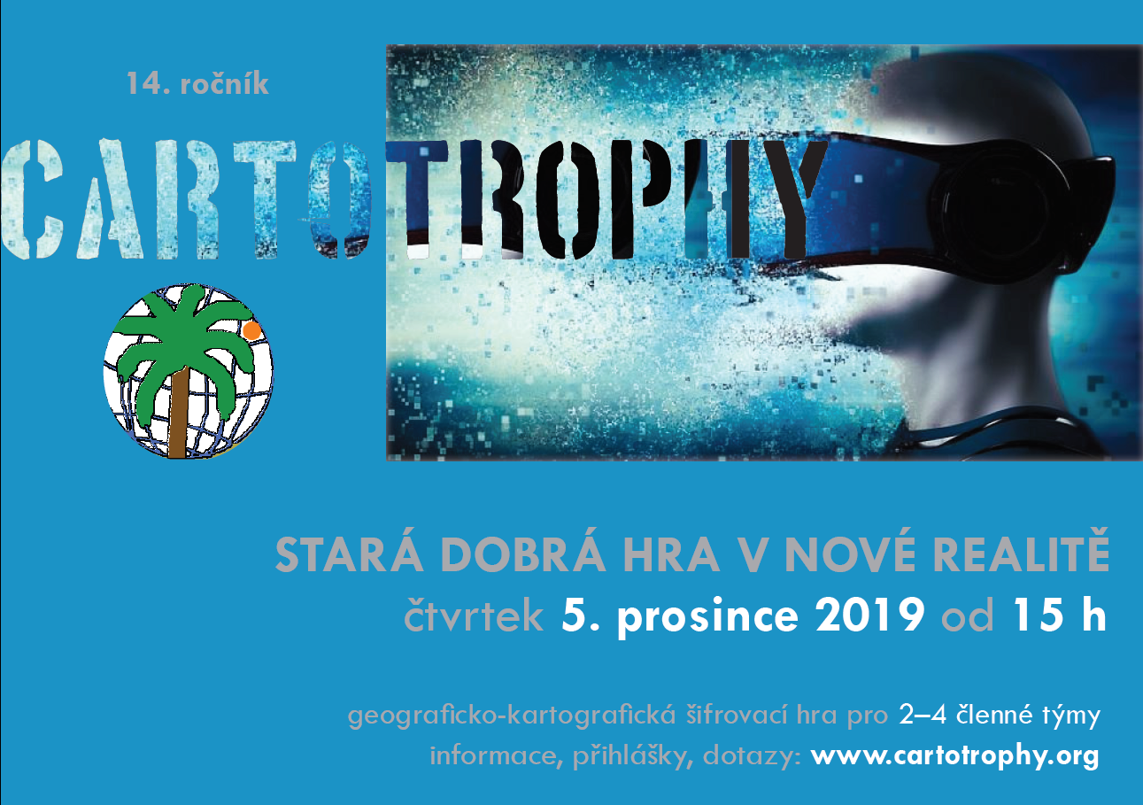
5.12.2019 16:18 Blogující geomatici - FAV ZČU Seminář Družicové metody v geodézii a katastru se bude konat ve čtvrtek 30. ledna 2020 na VUT v Brně. Jedná se již o 23. ročník této akce. Podrobnosti naleznete na http://geodesy.fce.vutbr.cz/konference/gnss-seminar/, kde je možno se i přihlásit.Cartotrophy 2019
5.12.2019 15:00 Geografický ústav MUV pondělí 5. prosince 2019 se na Geografickém ústavu uskuteční již 14. ročník šifrovací hry s geograficko-kartografickým nádechem - Cartotrophy. Letos ve znamení virtuální reality.
Podrobné informace o hře a odkaz na registraci naleznete na http://www.geogr.muni.cz/cartotrophy. Možnost přihlášení vyprší 1. prosince 2019 v 18:00, tak neváhejte.
Těší se na vás organizační tým.
Sentinel-6 Mission
5.12.2019 14:00 ESA Observing the Earth Video:
00:05:20
Video:
00:05:20
In a cleanroom in Ottobrunn, Germany, the latest Copernicus Sentinel satellite is ready for final testing before it is packed up and shipped to the US for liftoff next year. Designed and built to chart changing sea level, it is the first of two identical Sentinel-6 satellites that will be launched consecutively to continue the time series of sea-level measurements. This new mission builds on heritage from previous ocean topography satellites, including the French–US Topex-Poseidon and Jason missions, previous ESA missions such as the ERS satellites, Envisat and CryoSat, as well as Copernicus Sentinel-3. With millions of people around the world at risk from rising seas, it is essential to continue measuring the changing height of the sea surface so that decision-makers are equipped to take appropriate mitigating action – as is being currently highlighted at the COP-25 Climate Change Conference in Spain.
Sentinel-6: charting sea level
5.12.2019 14:00 ESA Observing the Earth Video:
00:05:20
Video:
00:05:20
In a cleanroom in Ottobrunn, Germany, the latest Copernicus Sentinel satellite is ready for final testing before it is packed up and shipped to the US for liftoff next year. Designed and built to chart changing sea level, it is the first of two identical Sentinel-6 satellites that will be launched consecutively to continue the time series of sea-level measurements. This new mission builds on heritage from previous ocean topography satellites, including the French–US Topex-Poseidon and Jason missions, previous ESA missions such as the ERS satellites, Envisat and CryoSat, as well as Copernicus Sentinel-3. With millions of people around the world at risk from rising seas, it is essential to continue measuring the changing height of the sea surface so that decision-makers are equipped to take appropriate mitigating action – as is being currently highlighted at the COP-25 Climate Change Conference in Spain.
Capella Space Appoints RSI as Marketing Partner in India
5.12.2019 11:57 GISCafe.com Webcasts-Webinars SAN FRANCISCO and HYDERABAD, December 4, 2019 — Capella Space, an information services company providing Earth observation data on demand, …New 2019 CRESTA zones offer universal standard for global risk management
5.12.2019 11:42 GISCafe.com Webcasts-Webinars GfK’s new CRESTA zones provide a worldwide cartographic standard for the aggregation and exchange of risk insightsBruchsal, Germany, …
Universidad del Valle de Guatemala is ready to deploy Guatemala’s first satellite under UNOOSA-JAXA KiboCUBE Programme
5.12.2019 11:29 GISCafe.com Webcasts-Webinars VIENNA/TOKYO, 4 December (UN Information Service) – The team from Universidad del Valle de Guatemala have completed the development of their …Vrchní referent/rada v oddělení dokumentace KN na katastrálním pracovišti Hodonín
5.12.2019 11:29 ČÚZK - předpisy a opatření Katastrální úřad pro Jihomoravský krajvypisuje výběrové řízení na místo
Vrchní referent/rada v oddělení dokumentace KN na katastrálním pracovišti Hodonín
Vrchní referent/rada v oddělení dokumentace KN na katastrálním pracovišti Hodonín
5.12.2019 11:29 ČÚZK - volná místa Katastrální úřad pro Jihomoravský kraj Katastrální pracoviště Hodonín vypisuje výběrové řízení na místo Vrchní referent/rada v oddělení dokumentace KN na katastrálním pracovišti HodonínVrchní referent/rada v oddělení dokumentace KN na katastrálním pracovišti Hodonín
5.12.2019 11:29 ČÚZK - předpisy a opatření Katastrální úřad pro Jihomoravský kraj Katastrální pracoviště Hodonínvypisuje výběrové řízení na místo
Vrchní referent/rada v oddělení dokumentace KN na katastrálním pracovišti Hodonín
Vrchní referent/rada v oddělení dokumentace KN na katastrálním pracovišti Hodonín
5.12.2019 11:29 ČÚZK /Urady/Katastralni-urady/Katastralni-urady/Katastralni-urad-pro-Jihomoravsky-kraj/Uredni-deska/Oznameni-a-jina-uredni-sdeleni/Volna-mista/DMS/Vrchni-referent-rada-v-oddeleni-dokumentace-KN-naVrchní referent/rada v oddělení dokumentace KN na katastrálním pracovišti Hodonín
5.12.2019 11:29 ČÚZK - volná místa Katastrální úřad pro Jihomoravský kraj vypisuje výběrové řízení na místo Vrchní referent/rada v oddělení dokumentace KN na katastrálním pracovišti HodonínGreen City Watch grabs top prize at Copernicus Masters
5.12.2019 11:20 ESA Observing the Earth
Green City Watch won this year’s Copernicus Masters competition in a ceremony held yesterday at the European Space Week in Helsinki, Finland. Using Copernicus Sentinel satellite data, this application combines big data from space with artificial intelligence to measure the quality of green urban spaces.
Plánovaná odstávka - Výpadek sítě
5.12.2019 10:00 Středočeský kraj Z důvodu výměny infrastrukturních prvků dojde termínu od 06.12. 14:00 do 08.12. do 23:59 k výpadku sítě, tj. k výpadku webových stránek úřadu a dalších informačních systémů provozovaných v síti Krajského úřadu Středočeského kraje.Zkrácení úředních hodin 31.12.2019
5.12.2019 9:28 ČÚZK /Urady/Katastralni-urady/Katastralni-urady/Katastralni-urad-pro-Pardubicky-kraj/O-uradu/Aktuality/Zkraceni-urednich-hodin-31-12-2019Zkrácení úředních hodin 31.12.2019
5.12.2019 9:28 ČÚZK - předpisy a opatření Katastrální úřad pro Pardubický kraj zveřejnil novou aktualitu: Zkrácení úředních hodin 31.12.2019 VÁŽENÍ KLIENTI,V ÚTERÝ DNE 31. 12. 2019 BUDOU ÚŘEDNÍ HODINY POUZE V DOBĚ OD 8:00 DO 12:00 HODIN.
DĚKUJEME ZA POCHOPENÍ.
Geoobchod zve na setkání uživatelů GNSS techniky 2020
5.12.2019 7:19 ZeměměřičSpolečnost Geoobchod zve na setkání uživatelů GNSS techniky, které se uskuteční ve dnech 14. a 15. ledna 2020 v Koutech u Ledče nad Sázavou. Pozvánka na setkání Letos se chceme zaměřit na podrobné informace o fungování všech satelitních systémů, které u nás můžete využívat a na jejich výhody, nevýhody a hlavně možnosti. Internetové připojení se stále vyvíjí a vy potřebujete vědět, jaké máte možnosti v terénu, […]
The post Geoobchod zve na setkání uživatelů GNSS techniky 2020 appeared first on Zeměměřič.
EUGEO 2021
5.12.2019 7:00 Česká asociace pro geoinformace 8th EUGEO CongressPřírodovědecká fakulta Univerzity Karlovy a Česká Geografická společnost ve spolupráci s Asociací geografických společností v Evropě organizuje 8th EUGEO Congress on the Geography of Europe v Praze. Kongres se uskuteční od 28. Června do 1. Července 2021. Hlavní téma kongresu je "Sustainable geographies in the heart of Europe", odkazující na vášeň
Poslanci schválili vznik Portálu stavebníka, standard BIM, digitální stavební deník a novelu zeměměřického zákona
5.12.2019 6:00 GeoBusiness Poslanecká sněmovna dne 4. prosince 2019 schválila novelu zákona o zeměměřictví a o změně a doplnění některých zákonů, souvisejících s jeho zavedením. Předlohu zákona nyní dostanou k projednání senátoři. Digitalizace by od července 2023 měla zkracovat a zjednodušovat stavební řízení všem účastníkům. Vzniknout má elektronický informační systém pro vyřizování všech záležitostí, které se týkají stavebního […]Drone Aviation and LTE Advanced / 5G-NR Wireless Technology Provider ComSovereign Announce Merger
5.12.2019 1:26 GISCafe.com Webcasts-Webinars Combined Organization to Focus on Penetration of 5G Systems to New and Existing Global Carrier Customer Base for Fixed Infrastructure and Aerial …Srážkoodtoková data
5.12.2019 1:00 Cenia - Katalog metadat ČR - INSPIRE Vybraná, veřejně přístupná, část dat z databází ČHMÚ určená pro studijní účely.V hydrologické části je umístěno 10 stanic povrchových vod na větších povodích s průměrnými denními průtoky od začátku pozorování a 3 stanice na malých povodích v Jizerských horách s průměrnými denními průtoky, hodinovými průtoky, měřením sněhu, denními úhrny srážek a hodinovými úhrny srážek od roku 2002.V klimatologické části jsou umístěny 3 stanice s denními úhrny srážek a teplotami od roku 2002.Stahovací služba - srážkoodtoková data
5.12.2019 1:00 Cenia - Katalog metadat ČR - INSPIRE Vybraná, veřejně přístupná, část dat z databází ČHMÚ určená pro studijní účely.V hydrologické části je umístěno 10 stanic povrchových vod na větších povodích s průměrnými denními průtoky od začátku pozorování a 3 stanice na malých povodích v Jizerských horách s průměrnými denními průtoky, hodinovými průtoky, měřením sněhu, denními úhrny srážek a hodinovými úhrny srážek od roku 2002.V klimatologické části jsou umístěny 3 stanice s denními úhrny srážek a teplotami od roku 2002.Stránka existuje i v angličtině.Geoelektrika – Vertikální elektrické sondování (VES)
5.12.2019 1:00 Cenia - Katalog metadat ČR - INSPIRE Databáze obsahuje situaci měřících stanovišť vertikálního elektrického profilování a měřené sondážní křivky.Petrofyzika
5.12.2019 1:00 Cenia - Katalog metadat ČR - INSPIRE Databáze obsahuje soubor laboratorních měření komplexu fyzikálních vlastností hornin, který lze rozdělit na dvě skupiny: 1) skalární parametry - hustotní parametry (mineralogická a objemová hustota), pórovitost, střední magnetická susceptibilita a parametry přirozené radioaktivity (U, Th, K, celková aktivita gama),2) parametry směrově závislé - remanentní magnetizace, hodnoty šíření elastických vln, elektrické vlastnosti a vyzvaná polarizace. Databáze se člení na 2 subregistry – fyzikální vlastnosti vzorků z povrchu (20371 ks) a vzorků z vrtných jader z 550 vrtů.Gravimetrie
5.12.2019 1:00 Cenia - Katalog metadat ČR - INSPIRE Databáze obsahuje data z gravimetrického mapování ČR v měřítkách 1 : 200 000 z let 1957-1960 (pokryto 100% území – ca 23tis tíhových bodů). Od roku 1960 začalo systematické mapování v měřítku 1 : 25 000, které pokrývá téměř 70% rozlohy republiky. Ke konci roku 2018 je v databázi využíváno pouze ca 4 tisíce bodů (3992) z původního mapování 1 : 200 000 a 304199 tisíc bodů z měření 1 : 25 000, které stará měření 1 : 200 000 na příslušných mapách postupně nahrazují.Nexit Launches as the Next Generation in Mobile Mapping With $10 Million in Funding
4.12.2019 23:47 GISCafe.com Webcasts-Webinars All-in-One Road Trip App Launches During Peak Holiday Travel Season, Providing Drivers with Unmatched Navigation & Search FeaturesNEW YORK …
Poslanecká sněmovna schválila novelu zeměměřického zákona
4.12.2019 23:28 ZeměměřičPoslanecká sněmovna dne 4. prosince 2019 schválila novelu zákona o zeměměřictví a o změně a doplnění některých zákonů, souvisejících s jeho zavedením. Předlohu zákona nyní dostanou k projednání senátoři. Digitalizace by od července 2023 měla zkracovat a zjednodušovat stavební řízení všem účastníkům. Vzniknout má elektronický informační systém pro vyřizování všech záležitostí, které se týkají stavebního řízení. Povolovací řízení se má vést prostřednictvím tzv. Portálu […]
The post Poslanecká sněmovna schválila novelu zeměměřického zákona appeared first on Zeměměřič.
MGISS Appoints Mike Cooper to Expand Geospatial Business
4.12.2019 16:55 GISCafe.com Webcasts-Webinars December 04, 2019 -- Mike Cooper has joined the management team at MGISS, a specialist in the use of geospatial technology in the utility, …The Latest RoboSense LiDAR Perception Solution Will Support Robo Taxi Development
4.12.2019 16:54 GISCafe.com Webcasts-Webinars A Developed And Complete RS-Fusion-P5 Was Launched In Markets Outside ChinaSHENZHEN, China — (BUSINESS WIRE) — December 4, 2019 …
Learn About the Science Behind the Data in Precision Mapping with Drone Based LiDAR
4.12.2019 16:54 GISCafe.com Webcasts-Webinars Rome, NY, Dec. 04, 2019 (GLOBE NEWSWIRE) -- December 18, at 9am or 6pm, join Microdrones for their final Wednesday Webinar of 2019, with a special …Novinky v Geoorbitu, síti referenčních GNSS stanic + týdenní účet na vyzkoušení
4.12.2019 15:49 ZeměměřičGeoorbit je referenční síť, poskytující korekční data všem GNSS (GPS) přijímačům a aplikacím. Síť, provozovaná firmou Geoobchod, poskytuje zpřesňující data ve formátu RTCM 3.0 a nově také ve formátu RTCM 3.2. Celkem 29 referenčních stanic je rozmístěno a provozováno v plném provozu od počátku roku 2016. Od 9. dubna 2017 je síť monitorována nezávislým státním monitoringem ČÚZK. S korekcemi ze […]
The post Novinky v Geoorbitu, síti referenčních GNSS stanic + týdenní účet na vyzkoušení appeared first on Zeměměřič.
Senát odmítl zvýšení poplatku za vklad do katastru
4.12.2019 15:20 ZeměměřičO záměru zvýšení poplatku za vklad do katastru nemovitostí jsme psali již dříve, nyní Server České noviny České tiskové kanceláře uvedl ve své zprávě, že Senát se postavil proti vládní snaze o zvýšení poplatku za vklad do katastru nemovitostí. Daňovými změnami, jimiž chce vláda vylepšit příjmy státního rozpočtu, se tak bude muset znovu zabývat Sněmovna. Poplatek […]
The post Senát odmítl zvýšení poplatku za vklad do katastru appeared first on Zeměměřič.
20191204 Odborný / vrchní referent oddělení aktualizace KN
4.12.2019 12:31 ČÚZK - předpisy a opatření Katastrální úřad pro Středočeský kraj - Katastrální pracoviště Mělník Vyhlášení výběrového řízení: Odborný / vrchní referent oddělení aktualizace KN Katastrálního pracoviště Mělník V části "Úřední deska", v sekci "Oznámení a jiná úřední sdělení" bylo vystaveno "Oznámení o vyhlášení výběrového řízení na obsazení služebního místa Odborný / vrchní referent oddělení aktualizace KN Katastrálního pracoviště Mělník"20191204 Odborný / vrchní referent oddělení aktualizace KN
4.12.2019 12:31 ČÚZK /Urady/Katastralni-urady/Katastralni-urady/Katastralni-urad-pro-Stredocesky-kraj/O-uradu/Aktuality/20191204-Odborny-vrchni-referent-oddeleni-aktual20191204 Odborný / vrchní referent oddělení aktualizace KN
4.12.2019 12:26 ČÚZK /Urady/Katastralni-urady/Katastralni-urady/Katastralni-urad-pro-Stredocesky-kraj/Katastralni-pracoviste/KP-Melnik/O-uradu/Aktuality/20191204-Odborny-vrchni-referent-oddeleni-aktual20191204 Odborný / vrchní referent oddělení aktualizace KN
4.12.2019 12:26 ČÚZK - předpisy a opatření Katastrální úřad pro Středočeský kraj - Katastrální pracoviště Mělník Vyhlášení výběrového řízení: Odborný / vrchní referent oddělení aktualizace KN Katastrálního pracoviště Mělník V části "Úřední deska", v sekci "Oznámení a jiná úřední sdělení" bylo vystaveno "Oznámení o vyhlášení výběrového řízení na obsazení služebního místa Odborný / vrchní referent oddělení aktualizace KN Katastrálního pracoviště Mělník"Odborný / vrchní referent oddělení aktualizace KN
4.12.2019 12:16 ČÚZK - předpisy a opatření Katastrální úřad pro Středočeský kraj - Katastrální pracoviště Mělníkvypisuje výběrové řízení na místo Odborný / vrchní referent oddělení aktualizace KN
Odborný / vrchní referent oddělení aktualizace KN
Odborný / vrchní referent oddělení aktualizace KN
4.12.2019 12:16 ČÚZK - volná místa Katastrální úřad pro Středočeský kraj - Katastrální pracoviště Mělník vypisuje výběrové řízení na místo Odborný / vrchní referent oddělení aktualizace KNOdborný / vrchní referent oddělení aktualizace KN
4.12.2019 12:16 ČÚZK /Urady/Katastralni-urady/Katastralni-urady/Katastralni-urad-pro-Stredocesky-kraj/Uredni-deska/Oznameni-a-jina-uredni-sdeleni/Volna-mista/Odborny-vrchni-referent-oddeleni-aktualizace-KNGeodetické služby pro KPÚ pro Středočeský kraj a hl. m. Praha 2020 – 2021
4.12.2019 12:04 ZeměměřičStátní pozemkový úřad vypsal veřejnou zakázku malého rozsahu. Předmětem je provádění geodetických služeb ve smyslu zákona č. 200/1994 Sb., o zeměměřictví a o změně a doplnění některých zákonů související s jeho zavedením, ve znění pozdějších předpisů, a to na základě podkladů Státního pozemkového úřadu, které vyplývají ze zákona č. 503/2012 Sb., o Státním pozemkovém úřadu a o změně některých souvisejících zákonů, ve znění pozdějších předpisů, tj. poskytování […]
The post Geodetické služby pro KPÚ pro Středočeský kraj a hl. m. Praha 2020 – 2021 appeared first on Zeměměřič.
EU space ambition in focus in Prague
4.12.2019 11:51 European GNSS Agency
The European Union’s ambitions in space were in focus during a recent visit to the European GNSS Agency’s (GSA) Prague headquarters by French State Secretary for European Affairs Amélie de Montchalin, who visited the Agency on Friday 29 November.
Madame de de Montchalin was in Prague to visit the GSA and, during her visit, she noted that: “European ambition in space is considerable, as we saw on 28 November in Seville, and the GSA is transforming this ambition into concrete projects that are improving the life of European citizens.”
The EU is a global leader in space and the space sector in Europe employs over 231,000 professionals, with an estimated value of €53-62 billion to the European economy in 2017. What’s more, Europe manufactures one third of all the world's satellites and, according to Eurospace, the space manufacturing industry posted sales worth €8.5 billion in 2018.
Read this: Horizon 2020 key to international cooperation for Galileo & EGNOS
French Space Agency (CNES) President and GSA Administrative Board Chair Jean-Yves Le Gall following his attendance at the European Space Agency ministerial meeting in Seville, Spain on November 27-28 welcomed Madame de Montchalin to the GSA headquarters. “We are very pleased to welcome Madame de Montchalin to the GSA, her visit bears testimony to the importance that France places on ensuring that space serves all Europeans,” he said.
Key contribution
At the meeting, GSA Executive Director Carlo des Dorides highlighted the central role of Europe’s GNSS programmes in the overall contribution of space to the European economy. “According to the latest edition of our GNSS Market Report, European companies account for an estimated 27% of the global GNSS downstream market, which is forecast to increase to EUR 325 billion in 2029,” he said.
“France has been a valued partner for the Galileo programme since the launch of the first operational satellite from the Guiana Space Centre at Kourou in French Guiana in 2011, and the critical Launch and Early Orbit Phase (LEOP) for our Galileo launches is controlled from the CNES Space Centre in Toulouse,” des Dorides said.
‘When the GSA is taking on new its responsibilities in becoming EUSPA at the beginning of 2021 and with Galileo reaching full capability, it is important that all the Member States continue to support our activities, and so we are pleased to take the opportunity of the visit of Mrs Montchalin to explain the evolution of the Galileo services,” he said.
Media note: This feature can be republished without charge provided the European GNSS Agency (GSA) is acknowledged as the source at the top or the bottom of the story. You must request permission before you use any of the photographs on the site. If you republish, we would be grateful if you could link back to the GSA website (http://www.gsa.europa.eu).
EU space ambition in focus in Prague
4.12.2019 11:51 European GNSS AgencyThe European Union’s ambitions in space were in focus during a recent visit to the European GNSS Agency’s (GSA) Prague headquarters by French State Secretary for European Affairs Amélie de Montchalin, who visited the Agency on Friday 29 November.
Madame de de Montchalin was in Prague to visit the GSA and, during her visit, she noted that: “European ambition in space is considerable, as we saw on 28 November in Seville, and the GSA is transforming this ambition into concrete projects that are improving the life of European citizens.”
The EU is a global leader in space and the space sector in Europe employs over 231,000 professionals, with an estimated value of €53-62 billion to the European economy in 2017. What’s more, Europe manufactures one third of all the world's satellites and, according to Eurospace, the space manufacturing industry posted sales worth €8.5 billion in 2018.
Read this: Horizon 2020 key to international cooperation for Galileo & EGNOS
French Space Agency (CNES) President and GSA Administrative Board Chair Jean-Yves Le Gall following his attendance at the European Space Agency ministerial meeting in Seville, Spain on November 27-28 welcomed Madame de Montchalin to the GSA headquarters. “We are very pleased to welcome Madame de Montchalin to the GSA, her visit bears testimony to the importance that France places on ensuring that space serves all Europeans,” he said.
Key contribution
At the meeting, GSA Executive Director Carlo des Dorides highlighted the central role of Europe’s GNSS programmes in the overall contribution of space to the European economy. “According to the latest edition of our GNSS Market Report, European companies account for an estimated 27% of the global GNSS downstream market, which is forecast to increase to EUR 325 billion in 2029,” he said.
“France has been a valued partner for the Galileo programme since the launch of the first operational satellite from the Guiana Space Centre at Kourou in French Guiana in 2011, and the critical Launch and Early Orbit Phase (LEOP) for our Galileo launches is controlled from the CNES Space Centre in Toulouse,” des Dorides said.
‘When the GSA is to taking on new its responsibilities in becoming EUSPA at the beginning of 2021 and with Galileo reaching full capability, this is important that all the Member States continue to support our activities and so we are pleased to take the opportunity of the visit of Mrs Montchalin to explain the evolution of the Galileo services,” he said.
Media note: This feature can be republished without charge provided the European GNSS Agency (GSA) is acknowledged as the source at the top or the bottom of the story. You must request permission before you use any of the photographs on the site. If you republish, we would be grateful if you could link back to the GSA website (http://www.gsa.europa.eu).
EU space ambition in focus in Prague
4.12.2019 11:51 European GNSS AgencyThe European Union’s ambitions in space were in focus during a recent visit to the European GNSS Agency’s (GSA) Prague headquarters by French State Secretary for European Affairs Amélie de Montchalin, who visited the Agency on Friday 29 November.
Madame de de Montchalin was in Prague to visit the GSA and, during her visit, she noted that: “European ambition in space is considerable, as we saw on 28 November in Seville, and the GSA is transforming this ambition into concrete projects that are improving the life of European citizens.”
The EU is a global leader in space and the space sector in Europe employs over 231,000 professionals, with an estimated value of €53-62 billion to the European economy in 2017. What’s more, Europe manufactures one third of all the world's satellites and, according to Eurospace, the space manufacturing industry posted sales worth €8.5 billion in 2018.
Read this: Horizon 2020 key to international cooperation for Galileo & EGNOS
French Space Agency (CNES) President and GSA Administrative Board Chair Jean-Yves Le Gall following his attendance at the European Space Agency ministerial meeting in Seville, Spain on November 27-28 welcomed Madame de Montchalin to the GSA headquarters. “We are very pleased to welcome Madame de Montchalin to the GSA, her visit bears testimony to the importance that France places on ensuring that space serves all Europeans,” he said.
Key contribution
At the meeting, GSA Executive Director Carlo des Dorides highlighted the central role of Europe’s GNSS programmes in the overall contribution of space to the European economy. “According to the latest edition of our GNSS Market Report, European companies account for an estimated 27% of the global GNSS downstream market, which is forecast to increase to EUR 325 billion in 2029,” he said.
“France has been a valued partner for the Galileo programme since the launch of the first operational satellite from the Guiana Space Centre at Kourou in French Guiana in 2011, and the critical Launch and Early Orbit Phase (LEOP) for our Galileo launches is controlled from the CNES Space Centre in Toulouse,” des Dorides said.
‘With the GSA taking on new its responsibilities in becoming EUSPA at the beginning of 2021 and with Galileo reaching full capability, it is important that all the Member States continue to support our activities, and so we are pleased to take the opportunity of the visit of Mrs Montchalin to explain the evolution of the Galileo services,” he said.
Media note: This feature can be republished without charge provided the European GNSS Agency (GSA) is acknowledged as the source at the top or the bottom of the story. You must request permission before you use any of the photographs on the site. If you republish, we would be grateful if you could link back to the GSA website (http://www.gsa.europa.eu).
Orbit Logic Awarded NASA Machine Learning Contract for Fault Detection and Response
4.12.2019 9:17 GISCafe.com Webcasts-Webinars GREENBELT, MD (December 3rd, 2019) – Orbit Logic has been awarded a Phase I Small Business Innovation Research (SBIR) contract …INSPIRE WCS: Live and Hands-On in Helsinki
4.12.2019 9:00 GISCafe.com Webcasts-Webinars November 2019. "WCS is the natural way to deliver and exploit coverage data" - this insight shared by INSPIRE orthoimage and elevation data cluster …Ekologicky významný prvek (EVP)
4.12.2019 1:00 Cenia - Katalog metadat ČR - INSPIRE Krajinné prvky v Registru půdy netvoří samostatnou datovou sadu, ale jsou součástí datové sady Ekologicky významných prvků. Základní jednotkou evidence ekologicky významných prvků je prvek, který představuje souvislou plochu i zemědělsky neobhospodařované půdy plnící mimoprodukční funkci zemědělství, popřípadě jiný útvar, který je součástí zemědělsky obhospodařované půdy nebo k ní bezprostředně přiléhá. Druhy ekologicky významných prvků jsou definované v Nařízení vlády 307/2014 Sb.WMS – DPB dle kultury
4.12.2019 1:00 Cenia - Katalog metadat ČR - INSPIRE Vizualizace aktuálních dat dílů půdních bloků (DPB) dle zemědělské kultury.INSPIRE Workshop Helsinki
3.12.2019 23:06 GISCafe.com Webcasts-Webinars November 2019. "WCS is the natural way to deliver and exploit coverage data", Jordi Escriu (Cartographic and Geologcal Institut of Catalonia/Spain) …INSPIRE Workshop Helsinki
3.12.2019 23:06 GISCafe.com Webcasts-Webinars NovNovember 2019. "WCS is the natural way to deliver and exploit coverage data" - this insight shared by INSPIRE orthoimage and elevation data …
SAM Announces Acquisition of JMC Professional Surveying and Mapping, LLC
3.12.2019 19:17 GISCafe.com Webcasts-Webinars SAM Companies, a leading provider of geospatial solutions and construction phase services in North America, has completed the acquisition of JMC …20191203-VŘ Řízení projektů
3.12.2019 17:43 ČÚZK - předpisy a opatření Český úřad zeměměřický a katastrální zveřejnil novou aktualitu: Oznámení o vyhlášení výběrového řízení na obsazení služebního místa Řízení projektů.Řízení projektů
3.12.2019 17:35 ČÚZK - předpisy a opatření Český úřad zeměměřický a katastrálnívypisuje výběrové řízení na místo
Řízení projektů
Řízení projektů
3.12.2019 17:35 ČÚZK - volná místa Český úřad zeměměřický a katastrální vypisuje výběrové řízení na místo Řízení projektůŘízení projektů
3.12.2019 17:35 ČÚZK /Urady/Cesky-urad-zememericky-a-katastralni/Uredni-deska/Oznameni-a-jina-uredni-sdeleni/Volna-mista/DMS/Rizeni-projektuWebové Mapy.cz začaly zobrazovat dopravní uzavírky a trasu plánují s objížďkou
3.12.2019 17:31 GeoBusiness Firma Seznam.cz představila technologickou novinku ve službě Mapy.cz. V dopravní mapě jsou vedle nehod, průjezdnosti či dobíjecích stanic nově také zobrazovány dopravní uzavírky. S dopravními uzavírkami pak počítá routovací algoritmus, který vám vypočítá trasu. Uzavírky jsou v mapě, podobně jako to má například Waze, vyznačeny přerušovanou čárou. Data jsou přebírána z JSDI, tedy Jednotného systému […]Velodyne Lidar Supports Next Generation of AV Developers in Formula Student Competitions
3.12.2019 16:47 GISCafe.com Webcasts-Webinars Velodyne Participation in Student Engineering Challenges Brings State-of-the-Art Lidar Technology and Skills to Future EngineersSAN JOSE, Calif. …
CoreLogic Reports October Home Prices Increased by 3.5% Year Over Year
3.12.2019 16:47 GISCafe.com Webcasts-Webinars The CoreLogic HPI Forecast indicates U.S. annual price growth will increase by 5.4% by October 2020 but with price declines in some metro areasAll …
Zamluvte si týdenní testování nových GNSS přijímačů řady South Galaxy G1 2020
3.12.2019 15:28 ZeměměřičNa českém trhu již mnoho let působí značka SOUTH se svými GNSS přijímači, které se staly velmi oblíbenými pro svoji spolehlivost a dobrou cenu. Do nového roku přichází značka SOUTH s řadou Galaxy G1 2020, která se od předchozích typů liší několika novinkami – ty zaujmou všechny uživatele, kteří měří ve velmi ztížených podmínkách. Přístroje této řady jsou […]
The post Zamluvte si týdenní testování nových GNSS přijímačů řady South Galaxy G1 2020 appeared first on Zeměměřič.
KÚ-06628-2019
3.12.2019 14:49 ČÚZK - předpisy a opatření Katastrální úřad pro hlavní město Prahu - Katastrální pracoviště Praha zveřejnil novou aktualitu: Ředitel úřadu vyhlašuje výběrové řízení na služební místo: rada/odborný rada - právníkKÚ-06628-2019
3.12.2019 14:49 ČÚZK /Urady/Katastralni-urady/Katastralni-urady/Katastralni-urad-pro-hlavni-mesto-Prahu/O-uradu/Aktuality/KU-06169-2019KÚ-06169-2019
3.12.2019 14:49 ČÚZK - předpisy a opatření Katastrální úřad pro hlavní město Prahu - Katastrální pracoviště Praha zveřejnil novou aktualitu: Ředitel úřadu vyhlašuje výběrové řízení na služební místo: rada/odborný rada - právníkKÚ-06169-2019
3.12.2019 14:49 ČÚZK /Urady/Katastralni-urady/Katastralni-urady/Katastralni-urad-pro-hlavni-mesto-Prahu/O-uradu/Aktuality/KU-06169-2019KÚ-06169-2019
3.12.2019 14:49 ČÚZK - předpisy a opatření Katastrální úřad pro hlavní město Prahu - Katastrální pracoviště Praha zveřejnil novou aktualitu: Ředitel úřadu vyhlašuje výběrové řízení na služební místo: rada/odborný rada - právníkKÚ-00391/2020-100-01001
3.12.2019 14:49 ČÚZK /Urady/Katastralni-urady/Katastralni-urady/Katastralni-urad-pro-hlavni-mesto-Prahu/O-uradu/Aktuality/KU-06169-2019právník KP Praha - PO IV
3.12.2019 14:49 ČÚZK /Urady/Katastralni-urady/Katastralni-urady/Katastralni-urad-pro-hlavni-mesto-Prahu/O-uradu/Aktuality/KU-06169-2019právník KP Praha - PO IV
3.12.2019 14:49 ČÚZK - předpisy a opatření Katastrální úřad pro hlavní město Prahu - Katastrální pracoviště Praha zveřejnil novou aktualitu: Ředitel úřadu vyhlašuje výběrové řízení na služební místo: rada/odborný rada – právník Katastrálního úřadu pro hlavní město Prahu, KP Praha - PO IVKÚ-00391/2020-100-01001
3.12.2019 14:49 ČÚZK - předpisy a opatření Katastrální úřad pro hlavní město Prahu - Katastrální pracoviště Praha zveřejnil novou aktualitu: Ředitel úřadu vyhlašuje výběrové řízení na služební místo: odborný referent/vrchní referent – vedení katastrální mapy, potvrzování geometrických plánůrada/odborný rada - právník
3.12.2019 14:45 ČÚZK - volná místa Katastrální úřad pro hlavní město Prahu Katastrální pracoviště Praha vypisuje výběrové řízení na místo rada/odborný rada - právníkrada/odborný rada - právník
3.12.2019 14:45 ČÚZK /Urady/Katastralni-urady/Katastralni-urady/Katastralni-urad-pro-hlavni-mesto-Prahu/Uredni-deska/Oznameni-a-jina-uredni-sdeleni/Volna-mista/DMS/rada-odborny-rada-pravnikrada/odborný rada - právník
3.12.2019 14:45 ČÚZK - předpisy a opatření Katastrální úřad pro hlavní město Prahu Katastrální pracoviště Prahavypisuje výběrové řízení na místo
rada/odborný rada - právník
UNICORN implementuje pro CETIN řešení pro plánování výstavby optiky
3.12.2019 14:31 Unicorn představil na semináři CETIN 2020+ nové softwarové požadavky pro zpracovávání prostorových dat pro CETIN. Účastníci semináře se také mohli dozvědět konkrétní možnosti přechodu na nový systém a potřebné upgrady stávajících licencí. Prohlédněte si fotky ze semináře a stáhněte si prezentace a další materiály k tématu.Have your say on the future of Galileo and EGNOS
3.12.2019 12:41 European GNSS AgencyThe European GNSS Agency (GSA) is launching the 2019 edition of its Galileo User Satisfaction Survey and its EGNOS User Satisfaction Survey. These surveys aim to gain a better understanding of the needs and requirements of Galileo and EGNOS end users and to ensure that these needs are taken into consideration in future evolutions of the programmes.
Users have always been at the heart of European GNSS (Galileo and EGNOS) service provision, and feedback from users on their experience of Galileo and EGNOS is invaluable in shaping these services, helping ensure that they continuously improve and better serve the user community.
Tailored by segment
The Galileo User Satisfaction Survey is tailored to fit different categories of users and market segments. Likewise, this year’s EGNOS survey is broken down per EGNOS market segment (Aviation, Maritime, Rail, Road, Agriculture, Surveying and Mapping and LBS). When responding to the survey, select the market segment in which you operate; the market segment that corresponds to your main area of activity; or the market segment that is the most important for your company or organisation, if you are active in multiple market segments.
Read this: Latest updates to Reports on User Needs and Requirements released
The EGNOS survey covers all market segments and services, including the Open Service, the Safety of Life Service and the EGNOS Data Access Service (EDAS). It also assesses the EGNOS service provider’s management of EGNOS User Support Services.
If you are a Galileo or EGNOS user, we strongly encourage you to participate and let your voice be heard. The more users that respond, the better the GSA and the Galileo and EGNOS systems will be able to continue to meet your requirements. The surveys will only take about five minutes to complete, and your feedback will make a real difference to future EGNSS service provision.
Survey results
Based on the 2018 Galileo User Satisfaction Results, we can see that user satisfaction was up compared with the previous year, with 90% of users satisfied with Galileo. In total, 98% of users would recommend Galileo to others. Based on feedback from the community, a number of actions were identified for implementation to strengthen Galileo’s market position.
These include spreading the message that Galileo is already available and performing well; putting additional communications and training efforts in place in the LBS community; and collecting all user related information on EGNSS in a single website, in order to provide users with an integrated interface to support them with application development.
The 2018 EGNOS User Satisfaction Survey also showed a positive trend, with a global user satisfaction score of 8.3 out of 10, up from 8.1 in 2017. User satisfaction was highest in the road segment, which scored 9.4 points. User satisfaction with the accuracy, availability, continuity and coverage of the EGNOS Safety of Life (SoL) and Open Service were all up compared to the previous year.
The main outcomes and conclusions from the 2018 EGNOS User Satisfaction Survey are available, and can be downloaded here.
Media note: This feature can be republished without charge provided the European GNSS Agency (GSA) is acknowledged as the source at the top or the bottom of the story. You must request permission before you use any of the photographs on the site. If you republish, we would be grateful if you could link back to the GSA website (http://www.gsa.europa.eu).
Have your say on the future of Galileo and EGNOS
3.12.2019 12:41 European GNSS Agency
The European GNSS Agency (GSA) is launching the 2019 edition of its Galileo User Satisfaction Survey and its EGNOS User Satisfaction Survey. These surveys aim to gain a better understanding of the needs and requirements of Galileo and EGNOS end users and to ensure that these needs are taken into consideration in future evolutions of the programmes.
Users have always been at the heart of European GNSS (Galileo and EGNOS) service provision, and feedback from users on their experience of Galileo and EGNOS is invaluable in shaping these services, helping ensure that they continuously improve and better serve the user community.
Tailored by segment
The Galileo User Satisfaction Survey is tailored to fit different categories of users and market segments. Likewise, this year’s EGNOS survey is broken down per EGNOS market segment (Aviation, Maritime, Rail, Road, Agriculture, Surveying and Mapping and LBS). When responding to the survey, select the market segment in which you operate; the market segment that corresponds to your main area of activity; or the market segment that is the most important for your company or organisation, if you are active in multiple market segments.
Read this: Latest updates to Reports on User Needs and Requirements released
The EGNOS survey covers all market segments and services, including the Open Service, the Safety of Life Service and the EGNOS Data Access Service (EDAS). It also assesses the EGNOS service provider’s management of EGNOS User Support Services.
If you are a Galileo or EGNOS user, we strongly encourage you to participate and let your voice be heard. The more users that respond, the better the GSA and the Galileo and EGNOS systems will be able to continue to meet your requirements. The surveys will only take about five minutes to complete, and your feedback will make a real difference to future EGNSS service provision.
Survey results
Based on the 2018 Galileo User Satisfaction Results, we can see that user satisfaction was up compared with the previous year, with 90% of users satisfied with Galileo. In total, 98% of users would recommend Galileo to others. Based on feedback from the community, a number of actions were identified for implementation to strengthen Galileo’s market position.
These include spreading the message that Galileo is already available and performing well; putting additional communications and training efforts in place in the LBS community; and collecting all user related information on EGNSS in a single website, in order to provide users with an integrated interface to support them with application development.
The 2018 EGNOS User Satisfaction Survey also showed a positive trend, with a global user satisfaction score of 8.3 out of 10, up from 8.1 in 2017. User satisfaction was highest in the road segment, which scored 9.4 points. User satisfaction with the accuracy, availability, continuity and coverage of the EGNOS Safety of Life (SoL) and Open Service were all up compared to the previous year.
The main outcomes and conclusions from the 2018 EGNOS User Satisfaction Survey are available, and can be downloaded here.
Media note: This feature can be republished without charge provided the European GNSS Agency (GSA) is acknowledged as the source at the top or the bottom of the story. You must request permission before you use any of the photographs on the site. If you republish, we would be grateful if you could link back to the GSA website (http://www.gsa.europa.eu).
Have your say on the future of Galileo and EGNOS
3.12.2019 12:41 European GNSS AgencyThe European GNSS Agency (GSA) is launching the 2019 edition of its Galileo User Satisfaction Survey and its EGNOS User Satisfaction Survey. These surveys aim to gain a better understanding of the needs and requirements of Galileo and EGNOS end users and to ensure that these needs are taken into consideration in future evolutions of the programmes.
Users have always been at the heart of European GNSS (Galileo and EGNOS) service provision, and feedback from users on their experience of Galileo and EGNOS is invaluable in shaping these services, helping ensure that they continuously improve and better serve the user community.
Tailored by segment
The Galileo User Satisfaction Survey is tailored to fit different categories of users and market segments. Likewise, this year’s EGNOS survey is broken down per EGNOS market segment (Aviation, Maritime, Rail, Road, Agriculture, Surveying and Mapping and LBS). When responding to the survey, select the market segment in which you operate; the market segment that corresponds to your main area of activity; or the market segment that is the most important for your company or organisation, if you are active in multiple market segments.
Read this: Latest updates to Reports on User Needs and Requirements released
The EGNOS survey covers all market segments and services, including the Open Service, the Safety of Life Service and the EGNOS Data Access Service (EDAS). It also assesses the EGNOS service provider’s management of EGNOS User Support Services.
If you are a Galileo or EGNOS user, we strongly encourage you to participate and let your voice be heard. The more users that respond, the better the GSA and the Galileo and EGNOS systems will be able to continue to meet your requirements. The surveys will only take about five minutes to complete, and your feedback will make a real difference to future EGNSS service provision.
Survey results
Based on the 2018 Galileo User Satisfaction Results, we can see that user satisfaction was up compared with the previous year, with 90% of users satisfied with Galileo. In total, 98% of users would recommend Galileo to others. Based on feedback from the community, a number of actions were identified for implementation to strengthen Galileo’s market position.
These include spreading the message that Galileo is already available and performing well; putting additional communications and training efforts in place in the LBS community; and collecting all user related information on EGNSS in a single website, in order to provide users with an integrated interface to support them with application development.
The 2018 EGNOS User Satisfaction Survey also showed a positive trend, with a global user satisfaction score of 8.3 out of 10, up from 8.1 in 2017. User satisfaction was highest in the road segment, which scored 9.4 points. User satisfaction with the accuracy, availability, continuity and coverage of the EGNOS Safety of Life (SoL) and Open Service were all up compared to the previous year.
The main outcomes and conclusions from the 2018 EGNOS User Satisfaction Survey are available, and can be downloaded here.
Media note: This feature can be republished without charge provided the European GNSS Agency (GSA) is acknowledged as the source at the top or the bottom of the story. You must request permission before you use any of the photographs on the site. If you republish, we would be grateful if you could link back to the GSA website (http://www.gsa.europa.eu).
Nové termíny školení
3.12.2019 9:44 ARCDATA
V kompletní nabídce školení nyní naleznete termíny až do poloviny roku 2020.
ESA at COP25
3.12.2019 9:10 ESA Observing the Earth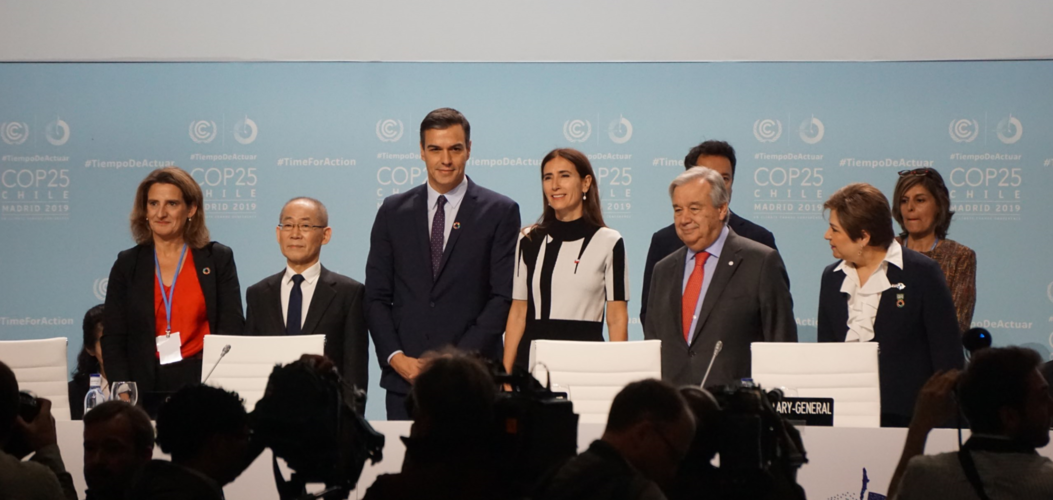
The European parliament declared a climate emergency ahead of the latest UN COP25 Climate Change Conference taking place over the next two weeks in Madrid. The 12-day summit will focus on encouraging governments to increase their commitments to combatting climate change. ESA is present highlighting the vital importance of observing our changing world from space and showing how data from satellites play a critical role in underpinning climate policy.
Nefungují telefony
3.12.2019 8:25 ČÚZK - předpisy a opatření Katastrální úřad pro Liberecký kraj - Katastrální pracoviště Semily zveřejnil novou aktualitu: Dne 3.12. 2019 cca od 8:30 hod., pravděpodobně až do odpoledních hodin, nebudou z důvodu neodkladného servisního zásahu na digitální telefonní ústředně fungovat telefony.Za případné problémy se omlouváme.
Ing. Jiří Bekr
ředitel KP
Nefungují telefony
3.12.2019 8:25 ČÚZK /Urady/Katastralni-urady/Katastralni-urady/Katastralni-urad-pro-Liberecky-kraj/Katastralni-pracoviste/KP-Semily/O-uradu/Aktuality/Nefunguji-telefonyrada/odborný rada – rozhodování o povolení vkladu
3.12.2019 7:38 ČÚZK - volná místa Katastrální úřad pro Olomoucký kraj Katastrální pracoviště Prostějov vypisuje výběrové řízení na místo rada/odborný rada – rozhodování o povolení vkladurada/odborný rada – rozhodování o povolení vkladu
3.12.2019 7:38 ČÚZK - předpisy a opatření Katastrální úřad pro Olomoucký kraj Katastrální pracoviště Prostějovvypisuje výběrové řízení na místo
rada/odborný rada – rozhodování o povolení vkladu