


![]()

zprávy
zdroje zpráv:Odborný referent v oddělení obnovy katastrálního operátu technického útvaru (03010) Katastrálního úř
3.11.2017 12:17 ČÚZK - volná místa Katastrální úřad pro Královéhradecký kraj vypisuje výběrové řízení na místo Odborný referent v oddělení obnovy katastrálního operátu technického útvaru (03010) Katastrálního úřOdborný referent v oddělení obnovy katastrálního operátu technického útvaru (03010) Katastrálního úř
3.11.2017 12:17 ČÚZK /Urady/Katastralni-urady/Katastralni-urady/Katastralni-urad-pro-Kralovehradecky-kraj/Uredni-deska/Oznameni-a-jina-uredni-sdeleni/Volna-mista/Odborny-referent-v-oddeleni-obnovy-katastralniho-oVrchní referent/rada v oddělení obnovy katastrálního operátu technického útvaru (03010) Katastrálníh
3.11.2017 12:10 ČÚZK - volná místa Katastrální úřad pro Královéhradecký kraj vypisuje výběrové řízení na místo Vrchní referent/rada v oddělení obnovy katastrálního operátu technického útvaru (03010) KatastrálníhVrchní referent/rada v oddělení obnovy katastrálního operátu technického útvaru (03010) Katastrálníh
3.11.2017 12:10 ČÚZK /Urady/Katastralni-urady/Katastralni-urady/Katastralni-urad-pro-Kralovehradecky-kraj/Uredni-deska/Oznameni-a-jina-uredni-sdeleni/Volna-mista/Vrchni-referent-rada-v-oddeleni-obnovy-katastr-(2)Vrchní referent/rada v oddělení obnovy katastrálního operátu technického útvaru (03010) Katastrálníh
3.11.2017 12:10 ČÚZK - předpisy a opatření Katastrální úřad pro Královéhradecký krajvypisuje výběrové řízení na místo
Vrchní referent/rada v oddělení obnovy katastrálního operátu technického útvaru (03010) Katastrálního úřadu pro Královéhradecký kraj
Mapová aplikace Technická infr
3.11.2017 12:00 Jihočeský kraj Mapová aplikace Technická infrastruktura a mapová aplikace Zastavěné území byly aktualizovány k 2.11.2017.Mapová aplikace a mapová apli
3.11.2017 12:00 Jihočeský kraj Mapová aplikace a mapová aplikace byly aktualizovány k 2.11.2017.Data katastru nemovitostí (DKM
3.11.2017 12:00 Jihočeský kraj Data katastru nemovitostí (DKM, KMD, KM-D a ÚKM) byla v mapových aplikacích i výdejním modulu aktualizována k 1. 10. 2017.Nearly four decades of soil moisture data now available
3.11.2017 11:45 ESA Observing the Earth
A new, long-term and global dataset of soil moisture measurements from space has been released to help us better understand the water cycle and climate, monitor agriculture and manage our water resources.
odborný rada - vedoucí oddělení dokumentace KN
3.11.2017 11:21 ČÚZK - předpisy a opatření Katastrální úřad pro Vysočinu - Katastrální pracoviště Pelhřimov zveřejnil novou aktualitu: Oznámení o vyhlášení výběrového řízení na služební místo odborný rada - vedoucí oddělení dokumentace KN Katastrálního pracoviště Pelhřimov na Katastrálním úřadu pro Vysočinu Oznámení o vyhlášení výběrového řízení na služební místo odborný rada - vedoucí oddělení dokumentace KN Katastrálního pracoviště Pelhřimov na Katastrálním úřadu pro Vysočinu, místo výkonu služby Pelhřimov zde.odborný rada - vedoucí oddělení dokumentace KN
3.11.2017 11:21 ČÚZK /Urady/Katastralni-urady/Katastralni-urady/Katastralni-urad-pro-Vysocinu/Katastralni-pracoviste/KP-Pelhrimov/O-uradu/Aktuality/odborny-rada-vedouci-oddeleni-dokumentace-KNodborný rada - vedoucí oddělení dokumentace KN Katastrálního pracoviště Pelhřimov.
3.11.2017 11:18 ČÚZK /Urady/Katastralni-urady/Katastralni-urady/Katastralni-urad-pro-Vysocinu/Uredni-deska/Oznameni-a-jina-uredni-sdeleni/Volna-mista/odborny-rada-vedouci-oddeleni-dokumentace-KN-Katodborný rada - vedoucí oddělení dokumentace KN Katastrálního pracoviště Pelhřimov.
3.11.2017 11:18 ČÚZK - předpisy a opatření Katastrální úřad pro Vysočinu - Katastrální pracoviště Pelhřimovvypisuje výběrové řízení na místo odborný rada - vedoucí oddělení dokumentace KN Katastrálního pracoviště Pelhřimov.
odborný rada - vedoucí oddělení dokumentace KN Katastrálního pracoviště Pelhřimov.
odborný rada - vedoucí oddělení dokumentace KN Katastrálního pracoviště Pelhřimov.
3.11.2017 11:18 ČÚZK - volná místa Katastrální úřad pro Vysočinu - Katastrální pracoviště Pelhřimov vypisuje výběrové řízení na místo odborný rada - vedoucí oddělení dokumentace KN Katastrálního pracoviště Pelhřimov.odborný referent v oddělení dokumentace KN
3.11.2017 11:14 ČÚZK - předpisy a opatření Katastrální úřad pro Vysočinu - Katastrální pracoviště Žďár nad Sázavou zveřejnil novou aktualitu: Oznámení o vyhlášení výběrového řízení na služební místo odborný referent v oddělení dokumentace KN Katastrálního pracoviště Žďár nad Sázavou na Katastrálním úřadu pro Vysoč Oznámení o vyhlášení výběrového řízení na služební místo odborný referent v oddělení dokumentace KN Katastrálního pracoviště Žďár nad Sázavou na Katastrálním úřadu pro Vysočinu, místo výkonu služby Žďár nad Sázavou zde.odborný referent v oddělení dokumentace KN
3.11.2017 11:14 ČÚZK /Urady/Katastralni-urady/Katastralni-urady/Katastralni-urad-pro-Vysocinu/Katastralni-pracoviste/KP-Zdar-nad-Sazavou/O-uradu/Aktuality/odborny-referent-v-oddeleni-dokumentace-KNodborný referent v oddělení dokumentace KN Katastrálního pracoviště Žďár nad Sázavou.
3.11.2017 11:07 ČÚZK - předpisy a opatření Katastrální úřad pro Vysočinu - Katastrální pracoviště Žďár nad Sázavouvypisuje výběrové řízení na místo odborný referent v oddělení dokumentace KN Katastrálního pracoviště Žďár nad Sázavou.
odborný referent v oddělení dokumentace KN Katastrálního pracoviště Žďár nad Sázavou.
odborný referent v oddělení dokumentace KN Katastrálního pracoviště Žďár nad Sázavou.
3.11.2017 11:07 ČÚZK /Urady/Katastralni-urady/Katastralni-urady/Katastralni-urad-pro-Vysocinu/Uredni-deska/Oznameni-a-jina-uredni-sdeleni/Volna-mista/odborny-referent-v-oddeleni-dokumentace-KN-Katastrodborný referent v oddělení dokumentace KN Katastrálního pracoviště Žďár nad Sázavou.
3.11.2017 11:07 ČÚZK - volná místa Katastrální úřad pro Vysočinu - Katastrální pracoviště Žďár nad Sázavou vypisuje výběrové řízení na místo odborný referent v oddělení dokumentace KN Katastrálního pracoviště Žďár nad Sázavou.Qnap představil QRM+ pro centrální správu síťových zařízení
3.11.2017 10:53 GeoBusiness Všem firmám a institucím, ve kterých je více než jedno k síti připojené zařízení, se hodí jejich centrální správa. Mít přehled nad všemi síťovými ... PřečístQnap představil QRM+ pro centrální správu síťových zařízení
3.11.2017 10:53 GeoBusiness Všem firmám a institucím, ve kterých je více než jedno k síti připojené zařízení, se hodí jejich centrální správa. Mít přehled nad všemi síťovými ... Read MoreQnap představil QRM+ pro centrální správu síťových zařízení
3.11.2017 10:53 GeoBusiness Všem firmám a institucím, ve kterých je více než jedno k síti připojené zařízení, se hodí jejich centrální správa. Mít přehled nad všemi síťovými zařízeními, ať už jsou to servery, počítače, tencí klienti, může být docela složité. Firma Qnap proto představila řešení QRM+ (zkratka pro QNAP Remote Manager Plus), které má správu síťových zařízení zjednodušit […]Western Australia
3.11.2017 10:05 ESA Observing the Earth
Earth observation image of the week: a Sentinel-3 wide-ranging view over Australia’s southwestern corner
Earth from Space
3.11.2017 10:05 ESA Observing the Earth
In this week's edition, the Sentinel-3A satellite gives us a view from the fourth most populous city to the rugged Outback of Australia
USGIF Accepting Nominations for 2018 Awards Program
3.11.2017 9:47 GISCafe.com Webcasts-Webinars The Foundation annually awards outstanding work in the GEOINT CommunityHerndon, Virginia (Nov. 2, 2017)—The United States Geospatial …
Hledá se lékař pro ledové dobrodružství
3.11.2017 9:41 Český Kosmický PortálChcete pomoci pilotovanému průzkumu naší Sluneční soustavy? Máte lékařské vysokoškolské vzdělání a nebojíte se tmy nebo chladu? ESA hledá někoho ochotného strávit šest měsíců v Antarktidě, kde bude provádět výzkum v rámci příprav misí na Měsíc nebo Mars.
20171103 Odborný referent oddělení právních vztahů k nemovitostem
3.11.2017 9:34 ČÚZK - předpisy a opatření Katastrální úřad pro Středočeský kraj - Katastrální pracoviště Mělník Vyhlášení výběrového řízení: Odborný referent oddělení právních vztahů k nemovitostem V části "Úřední deska", v sekci "Oznámení a jiná úřední sdělení" bylo vystaveno "Oznámení o vyhlášení výběrového řízení na obsazení služebního místa Odborný referent oddělení právních vztahů k nemovitostem"20171103 Odborný referent oddělení právních vztahů k nemovitostem
3.11.2017 9:34 ČÚZK /Urady/Katastralni-urady/Katastralni-urady/Katastralni-urad-pro-Stredocesky-kraj/Katastralni-pracoviste/KP-Melnik/O-uradu/Aktuality/20161013Rada-odborny-rada-–-informatik-(5)Odborný referent oddělení právních vztahů k nemovitostem
3.11.2017 9:32 ČÚZK - předpisy a opatření Katastrální úřad pro Středočeský kraj - Katastrální pracoviště Mělníkvypisuje výběrové řízení na místo Odborný referent oddělení právních vztahů k nemovitostem
Odborný referent oddělení právních vztahů k nemovitostem
Odborný referent oddělení právních vztahů k nemovitostem
3.11.2017 9:32 ČÚZK - volná místa Katastrální úřad pro Středočeský kraj - Katastrální pracoviště Mělník vypisuje výběrové řízení na místo Odborný referent oddělení právních vztahů k nemovitostem"High Flying SORA 200 3D LiDAR Sensing Solution from Cepton Provides High-Rez, Low Cost Mapping for UAVs" by Susan Smith
3.11.2017 9:18 GISCafe.com Webcasts-WebinarsMapová aplikace turistické zajímavosti v Ústí nad Labem a okolí (TZ)
3.11.2017 8:44 GISportal.cz Oddělení GIS magistrátu města Ústí nad Labem připravilo pro veřejnost novou aplikaci, která formou dynamické mapy, rozsáhlé fotodokumentace a dalšího materiálu, prezentuje zajímavá turistická místa a trasy v Ústí nad Labem a jeho okolí (celý správní ...20171103 - Odborný/ vrchní referent v oddělení právních vztahů k nemovitostem
3.11.2017 8:21 ČÚZK - předpisy a opatření Katastrální úřad pro Středočeský kraj - Katastrální pracoviště Mělník zveřejnil novou aktualitu:vyhlášení výběrového řízení na systemizované místo odborný/ vrchní referent v oddělení právních vztahů k nemovitostem Na úřední elektronické desce Katastrálního úřadu pro Středočeský kraj, v sekci "Oznámení a jiná úřední sdělení" bylo vystaveno "Oznámení o vyhlášení výběrového řízení na systemizované místo odborný/ vrchní referent v oddělení právních vztahů k nemovitostem Katastrálního pracoviště Mělník"20171103 - Odborný/ vrchní referent v oddělení právních vztahů k nemovitostem
3.11.2017 8:21 ČÚZK /Urady/Katastralni-urady/Katastralni-urady/Katastralni-urad-pro-Stredocesky-kraj/Katastralni-pracoviste/KP-Melnik/O-uradu/Aktuality/20140318-Geodet-Melnik-(1)odborný/ vrchní referent v oddělení právních vztahů k nemovitostem
3.11.2017 8:20 ČÚZK - předpisy a opatření Katastrální úřad pro Středočeský kraj - Katastrální pracoviště Mělníkvypisuje výběrové řízení na místo odborný/ vrchní referent v oddělení právních vztahů k nemovitostem
odborný/ vrchní referent v oddělení právních vztahů k nemovitostem
odborný/ vrchní referent v oddělení právních vztahů k nemovitostem
3.11.2017 8:20 ČÚZK - volná místa Katastrální úřad pro Středočeský kraj - Katastrální pracoviště Mělník vypisuje výběrové řízení na místo odborný/ vrchní referent v oddělení právních vztahů k nemovitostemodborný/ vrchní referent v oddělení právních vztahů k nemovitostem
3.11.2017 8:20 ČÚZK /Urady/Katastralni-urady/Katastralni-urady/Katastralni-urad-pro-Stredocesky-kraj/Volna-mista/odborny-vrchni-referent-v-oddeleni-pravnich-vztahVideo: Interview with Gerd Buziek, Dir Public Affairs at Esri Germany during 2017 Intergeo Conference
3.11.2017 8:00 GISCafe.com Webcasts-WebinarsTuristická aplikace města Ústí nad Labem
3.11.2017 7:35 Statutární město Ústí nad Labem Oddělení GIS spouští novou aplikaci pro veřejnost, která formou dynamické mapy, rozsáhlé fotodokumentace a dalšího materiálu, prezentuje zajímavá turistická místa a trasy v Ústí nad Labem a jeho okolí (celý správní obvod ORP). V aplikaci jsou v současné době dostupná tři rámcová témata – cyklus Trasy netušených krás, zajímavá vyhlídková místa a naučné stezky. Další obsah bude postupně přibývat.Oznámení o vyhlášení výběrového řízení na služební místo vrchní referent/rada, oddělení převodu majetku státu, Krajský pozemkový úřad pro Ústecký kraj I.
3.11.2017 0:00 Státní pozemkový úřad Ústřední ředitelka Státního pozemkového úřadu, jako služební orgán příslušný podle § 10 odst. 1 písm. f) zákona č. 234/2014 Sb., o státní službě (dále jen „zákon“), vyhlašuje výběrové řízení na služební místo vrchní referent/rada, oddělení převodu majetku státu, Krajský pozemkový úřad pro Ústecký kraj I.Oznámení o vyhlášení výběrového řízení na služební místo rada/odborný rada, oddělení převodu majetku státu, Krajský pozemkový úřad pro Ústecký kraj
3.11.2017 0:00 Státní pozemkový úřad Ústřední ředitelka Státního pozemkového úřadu, jako služební orgán příslušný podle § 10 odst. 1 písm. f) zákona č. 234/2014 Sb., o státní službě (dále jen „zákon“), vyhlašuje výběrové řízení na služební místo rada/odborný rada, oddělení převodu majetku státu, Krajský pozemkový úřad pro Ústecký kraj.Oznámení o vyhlášení výběrového řízení na služební místo vrchní referent/rada, oddělení převodu majetku státu, Krajský pozemkový úřad pro Ústecký kraj II.
3.11.2017 0:00 Státní pozemkový úřad Ústřední ředitelka Státního pozemkového úřadu, jako služební orgán příslušný podle § 10 odst. 1 písm. f) zákona č. 234/2014 Sb., o státní službě (dále jen „zákon“), vyhlašuje výběrové řízení na služební místo vrchní referent/rada, oddělení převodu majetku státu, Krajský pozemkový úřad pro Ústecký kraj II.Oznámení o vyhlášení výběrového řízení na služební místo vrchní referent/rada, Pobočka Jičín
3.11.2017 0:00 Státní pozemkový úřad Ústřední ředitelka Státního pozemkového úřadu, jako služební orgán příslušný podle § 10 odst. 1 písm. f) zákona č. 234/2014 Sb., o státní službě (dále jen „zákon“), vyhlašuje výběrové řízení na služební místo vrchní referent/rada, Pobočka Jičín.Motor Vulcain pro Ariane 6 se chystá na první zážeh
2.11.2017 17:05 Český Kosmický PortálDo Německa dorazil raketový motor Vulcain, aby zde byl připravený na prosincový testovací zážeh. Ten má demonstrovat nové schopnosti a technologie, které byly vyvinuté pro raketu Ariane 6.
Motor Vulcain pro Ariane 6 se chystá na první zážeh
2.11.2017 17:05 Český Kosmický PortálDo Německa dorazil raketový motor Vulcain, aby zde byl připravený na prosincový testovací zážeh. Ten má demonstrovat nové schopnosti a technologie, které byly vyvinuté pro raketu Ariane 6.
RQGIS – spojenie prostredia R a QGISu
2.11.2017 16:08 GISportal.cz Nedávno som narazil na zaujímavú stránku (jannesm), ktorá je venovaná balíku RQGIS, ktorý bol vyvinutý v softvérovom prostredí R. RQGIS umožňuje spojenie medzi prostredím R a populárnym QGISom. Balík RQGIS rozširuje štatistickú silu R o rozsiahlu geografickú funkčnosť ...American Traffic Solutions Partners with Laser Technology Inc. To Launch ATS StreetSafe
2.11.2017 15:20 GISCafe.com Webcasts-Webinars MESA, Ariz., Nov. 2, 2017 — (PRNewswire) — American Traffic Solutions (ATS) has partnered with Laser Technology Inc. (LTI) to …Microdesk Expands Services In United Kingdom And Europe As A Newly Authorized Autodesk Reseller
2.11.2017 15:19 GISCafe.com Webcasts-Webinars NEW YORK, Nov. 1, 2017 — (PRNewswire) — Microdesk announced the expansion of its services in the United Kingdom and Europe as a …Epson Launches Stunning New Line of GPS Running Watches
2.11.2017 15:18 GISCafe.com Webcasts-Webinars World Class GPS Battery Life, at a Compelling ValueLONG BEACH, Calif., Nov. 2, 2017 — (PRNewswire) — Drawing on its decades-long …
Pitney Bowes Hails Success of Harvey Nichols Partnership
2.11.2017 15:17 GISCafe.com Webcasts-Webinars Retailer’s online presence now provides shipping to 214 countries in 75 different currencies, and local payment solutionsLONDON — …
Trimble Named a Leader in 2017 Green Quadrant for Integrated Workplace Management Systems
2.11.2017 15:17 GISCafe.com Webcasts-Webinars Independent Global Research Firm Rates Trimble's Manhattan as Market-Leading for FASB and IASB Lease Accounting Compliance FunctionalitySUNNYVALE, …
Mobile Mapping Market to touch US$24.4 bn by the end of 2022 - Transparency Market Research
2.11.2017 15:16 GISCafe.com Webcasts-Webinars ALBANY, New York, Nov. 02, 2017 (GLOBE NEWSWIRE) -- The global mobile mapping market is likely to be driven at a solid 13.7% CAGR over the …Leidos Holdings, Inc. Reports Third Quarter Fiscal Year 2017 Results
2.11.2017 15:15 GISCafe.com Webcasts-Webinars -- Revenues: $2.50 billion(PRNewswire) — Leidos Holdings, Inc. (NYSE: LDOS), a FORTUNE 500® science and technology solutions …
Ovlivněte výzkum na ISS
2.11.2017 14:22 Česká kosmická kancelář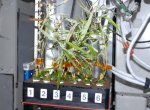
Evropská kosmická agentura vyzývá vědeckou komunitu k účasti na diskuzi o budoucím výzkumu zaměřeném na biologii rostlin v podmínkách kosmického letu. K této příležitosti uspořádá 20. listopadu 2017 jednodenní workshop, který se uskuteční ve středisku ESA ESTEC. Výstupy ovlivní chystanou výzvu na nové experimenty pro ISS.
Ovlivněte výzkum na ISS
2.11.2017 14:22 Česká kosmická kancelář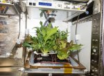
Evropská kosmická agentura vyzývá vědeckou komunitu k účasti na diskuzi o budoucím výzkumu zaměřeném na biologii rostlin v podmínkách kosmického letu. K této příležitosti uspořádá 20. listopadu 2017 workshop, který se uskuteční ve středisku ESA ESTEC. Výstupy ovlivní chystanou výzvu na nové experimenty pro ISS.
Nový twiGIS na Letišti Václava Havla Praha
2.11.2017 14:00 GIS Fórum Společnost Český Aeroholding používá aplikaci twiGIS už téměř dva roky. V uplynulých týdnech byla nasazena nová verze, která kromě velkého množství drobných vylepšení přináší zejména práci s tabulkovým zobrazením dat, zobrazování připojených fotek a dokumentů, reporty atd.twiGIS je ve společnosti používán jako lehká a rychlá nadstavba systému LetGIS a je přístupný všem zaměstnancům pro rychlou navigaci po areálu či zobrazení umístění osoby odklikem z telefonního seznamu aj.


Byl aktualizován tematický obs
2.11.2017 12:00 Plzeňský kraj Byl aktualizován tematický obsah mapy zobrazující Velkochovy drůbeže, skotu a vepřů. Data jsou s platností k říjnu 2017.Byl aktualizován tematický obs
2.11.2017 12:00 Plzeňský kraj Byl aktualizován tematický obsah mapy zobrazující Velkochovy drůbeže, skotu a vepřů (http://mapy.kr-plzensky.cz/gis/velkochovy). Data jsou s platností k říjnu 2017.Wind satellite vacuum packed
2.11.2017 11:30 ESA Observing the Earth
With liftoff on the horizon, ESA’s Aeolus satellite is going through its last round of tests to make sure that this complex mission will work in orbit. Over the next month, it is sitting in a large chamber that has had all the air sucked out to simulate the vacuum of space.
Sentinel-5P timelapse
2.11.2017 10:30 ESA Observing the Earth
A look back on the preparations for the 13 October liftoff of Sentinel-5P
Vytiskněte si povrch Měsíce ve 3D
2.11.2017 9:51 GISportal.cz Máte doma nebo v práci 3D tiskárnu a rádi byste si na ní vytvořili model své oblíbené hory nebo terénu ve svém okolí? Dnes již existuje řada webových aplikací, které vám dovolí takový model uzpůsobený pro ...Airbus-built EchoStar 105/SES-11 satellite now in geostationary orbit and handed-over to customer
2.11.2017 9:27 GISCafe.com Webcasts-Webinars The dual-mission communications satellite is the 47th Eurostar E3000, and will provide Ku and C-Band capacity to Echostar and SES, …Video: Esri UC 2017: ArcGIS Enterprise—Improving Installation and Configuration
2.11.2017 8:00 GISCafe.com Webcasts-WebinarsGeofyzikální metody - kódy
2.11.2017 1:00 Cenia - Katalog metadat ČR - INSPIRE Databáze obsahuje kódovník geofyzikálních metod.Seismokarotáž
2.11.2017 1:00 Cenia - Katalog metadat ČR - INSPIRE Databáze obsahuje informace o seismokarotážních měřeních na vrtech z let 1968-1994, odměřených na území České republiky z prostředků státního rozpočtu.Oznámení o vyhlášení výběrového řízení na služební místo rada/odborný rada, Pobočka České Budějovice II.
2.11.2017 0:00 Státní pozemkový úřad Ústřední ředitelka Státního pozemkového úřadu, jako služební orgán příslušný podle § 10 odst. 1 písm. f) zákona č. 234/2014 Sb., o státní službě (dále jen „zákon“), vyhlašuje výběrové řízení na služební místo rada/odborný rada, Pobočka České Budějovice II.Oznámení o vyhlášení výběrového řízení na služební místo vrchní referent/rada oddělení správy majetku státu, Krajský pozemkový úřad pro Jihočeský kraj I.
2.11.2017 0:00 Státní pozemkový úřad Ústřední ředitelka Státního pozemkového úřadu, jako služební orgán příslušný podle § 10 odst. 1 písm. f) zákona č. 234/2014 Sb., o státní službě (dále jen „zákon“), vyhlašuje výběrové řízení na služební místo vrchní referent/rada oddělení správy majetku státu, Krajský pozemkový úřad pro Jihočeský kraj I.Oznámení o vyhlášení výběrového řízení na služební místo rada/odborný rada, Pobočka České Budějovice I.
2.11.2017 0:00 Státní pozemkový úřad Ústřední ředitelka Státního pozemkového úřadu, jako služební orgán příslušný podle § 10 odst. 1 písm. f) zákona č. 234/2014 Sb., o státní službě (dále jen „zákon“), vyhlašuje výběrové řízení na služební místo rada/odborný rada, Pobočka České Budějovice I.Oznámení o vyhlášení výběrového řízení na služební místo vrchní referent/rada oddělení správy majetku státu, Krajský pozemkový úřad pro Jihočeský kraj II.
2.11.2017 0:00 Státní pozemkový úřad Ústřední ředitelka Státního pozemkového úřadu, jako služební orgán příslušný podle § 10 odst. 1 písm. f) zákona č. 234/2014 Sb., o státní službě (dále jen „zákon“), vyhlašuje výběrové řízení na služební místo vrchní referent/rada oddělení správy majetku státu, Krajský pozemkový úřad pro Jihočeský kraj II.Transportation Security Administration Awards Leidos Prime Contract
1.11.2017 18:10 GISCafe.com Webcasts-Webinars Company to Continue to Provide Technical Support for Leidos-Designed Transportation Security Equipment Systems in Airports, TSA Warehouses, and …Pitney Bowes Announces Third Quarter 2017 Financial Results
1.11.2017 18:09 GISCafe.com Webcasts-Webinars STAMFORD, Conn. — (BUSINESS WIRE) — November 1, 2017 — Pitney Bowes Inc. (NYSE:PBI), a global technology company providing …Global GPS Receiver Market 2017-2021: Driven by Increasing Applications of Augmented Reality
1.11.2017 18:09 GISCafe.com Webcasts-Webinars DUBLIN, November 1, 2017 — (PRNewswire) —The "Global GPS Receiver Market 2017-2021" report has been added to Research and Markets' …
Velodyne LiDAR and BoE Systems Partner for Integrated UAV-Borne LiDAR in Geospatial Data Collection
1.11.2017 18:08 GISCafe.com Webcasts-Webinars BoE Systems’ LiDAR platforms leverage lightweight Velodyne 3D LiDAR sensors for safe and accurate inspections of land, work sites, and …Initial signals received from six small satellites built by SSL for Planet
1.11.2017 18:07 GISCafe.com Webcasts-Webinars PALO ALTO, CA, Nov. 1, 2017 — (PRNewswire) — SSL, a business unit of Maxar Technologies (formerly MacDonald, Dettwiler and …Autodesk Extends Invitation to Join Financial Results Conference Call
1.11.2017 18:07 GISCafe.com Webcasts-Webinars Third Quarter Fiscal 2018 Financial Results Conference Call to be Held Tuesday, November 28, 2:00 p.m. Pacific TimeSAN RAFAEL, Calif., Nov. 1, 2017 …
Boundless Opens New Headquarters in St. Louis
1.11.2017 18:06 GISCafe.com Webcasts-Webinars Open GIS Leader Puts Down Roots in St. Louis to Support the Local Geospatial Community as it Continues to Scale the Business St. Louis, MO …
New MapVida Mobile App Helps House Hunters and Travelers Explore and Compare Neighborhoods Across the Country
1.11.2017 18:06 GISCafe.com Webcasts-Webinars Neighborhood translator provides familiar context across key location characteristics to find the perfect neighborhoodDENVER, Nov. 1, 2017 — …
20171101 odborný rada v oddělení právních vztahů
1.11.2017 15:26 ČÚZK - předpisy a opatření Katastrální úřad pro Středočeský kraj - Katastrální pracoviště Kolín vypisuje výběrové řízení na místo odborný rada v oddělení právních vztahů V části "Úřední deska", v sekci "Oznámení a jiná úřední sdělení" bylo vystaveno "Oznámení o vyhlášení výběrového řízení na obsazení systemizovaného místa odborný rada v oddělení právních vztahů"20171101 odborný rada v oddělení právních vztahů
1.11.2017 15:26 ČÚZK /Urady/Katastralni-urady/Katastralni-urady/Katastralni-urad-pro-Stredocesky-kraj/Katastralni-pracoviste/KP-Kolin/O-uradu/Aktuality/20161013Rada-odborny-rada-–-informatik-(1)Inspektor
1.11.2017 13:00 ČÚZK /Urady/Zememericke-a-katastralni-inspektoraty/Zememericke-a-katastralni-inspektoraty/Zememericky-a-katastralni-inspektorat-v-Plzni/Uredni-deska/Oznameni-a-jina-uredni-sdeleni/Volna-mista/InspektorInspektor
1.11.2017 13:00 ČÚZK - volná místa Zeměměřický a katastrální inspektorát v Plzni vypisuje výběrové řízení na místo InspektorInspektor
1.11.2017 13:00 ČÚZK - předpisy a opatření Zeměměřický a katastrální inspektorát v Plznivypisuje výběrové řízení na místo
Inspektor
odborný referent – podatelna v personálním oddělení
1.11.2017 12:21 ČÚZK - předpisy a opatření Katastrální úřad pro Zlínský krajvypisuje výběrové řízení na místo odborný referent – podatelna v personálním oddělení
odborný referent – podatelna v personálním oddělení
odborný referent – podatelna v personálním oddělení
1.11.2017 12:21 ČÚZK - volná místa Katastrální úřad pro Zlínský kraj vypisuje výběrové řízení na místo odborný referent – podatelna v personálním odděleníodborný referent – podatelna v personálním oddělení
1.11.2017 12:21 ČÚZK /Urady/Katastralni-urady/Katastralni-urady/Katastralni-urad-pro-Zlinsky-kraj/Uredni-deska/Oznameni-a-jina-uredni-sdeleni/Volna-mista/odborny-referent-–-podatelna-v-personalnim-oddelenrada / odborný rada – obnova katastrálního operátu v oddělení dokumentace KN
1.11.2017 12:19 ČÚZK - předpisy a opatření Katastrální úřad pro Zlínský kraj - Katastrální pracoviště Zlínvypisuje výběrové řízení na místo rada / odborný rada – obnova katastrálního operátu v oddělení dokumentace KN
rada / odborný rada – obnova katastrálního operátu v oddělení dokumentace KN
rada / odborný rada – obnova katastrálního operátu v oddělení dokumentace KN
1.11.2017 12:19 ČÚZK - volná místa Katastrální úřad pro Zlínský kraj - Katastrální pracoviště Zlín vypisuje výběrové řízení na místo rada / odborný rada – obnova katastrálního operátu v oddělení dokumentace KNrada / odborný rada – obnova katastrálního operátu v oddělení dokumentace KN
1.11.2017 12:19 ČÚZK /Urady/Katastralni-urady/Katastralni-urady/Katastralni-urad-pro-Zlinsky-kraj/Uredni-deska/Oznameni-a-jina-uredni-sdeleni/Volna-mista/rada-odborny-rada-–-obnova-katastralniho-opera-(1)Byl aktualizován tematický obs
1.11.2017 12:00 Plzeňský kraj Byl aktualizován tematický obsah mapy zobrazující Válečné hroby a pietní místa v Plzeňském kraji. Data jsou s platností k 10/2017.Výsledky voleb do Poslanecké s
1.11.2017 12:00 Plzeňský kraj Výsledky voleb do Poslanecké sněmovny Parlamentu České republiky 2017 v mapě (http://geoportal.plzensky-kraj.cz/gs/rss?url=http%3A%2F%2Fapp.seerns.cz%2Fpublic%2Fopen%2Fnlink%2F%3Fu%3D50e719de-be08-11e2-8558-002590a1e88e%26c%3Dd0ce46af-cf65-11e2-b328-002590a1e732%26l%3D5c3c42f6-bf0a-11e7-ae1a-06d7625d9f3d%26sid%3D51943b30abaa43f0826dd47b0f807095). Mapa umožňuje zobrazení vysledků za kraje, okresy, obce a jednotlivé volební okrsky.Výsledky voleb do Poslanecké s
1.11.2017 12:00 Plzeňský kraj Výsledky voleb do Poslanecké sněmovny Parlamentu České republiky 2017 v mapě. Mapa umožňuje zobrazení vysledků za kraje, okresy, obce a jednotlivé volební okrsky.Byl aktualizován tematický obs
1.11.2017 12:00 Plzeňský kraj Byl aktualizován tematický obsah mapy zobrazující Válečné hroby a pietní místa v Plzeňském kraji (http://mapy.kr-plzensky.cz/gis/valecne_hroby). Data jsou s platností k 10/2017.Low-cost multikamerový systém na tvorbu 3D modelov (DendroPi)
1.11.2017 8:54 GISportal.cz Na Technickej univerzite vo Zvolene (Katedra hospodárskej úpravy lesov a geodézie) v súčasnosti pracujeme na vývoji multikamerového systému pre účely odvodzovania parametrov individuálnych stromov. Tento systém je schopný rekonštruovať scénu, bez toho aby musel užívateľ ovládať ...Ransomware Bad Rabbit ukazuje potřebu centrální a automatizované správy aktualizací
1.11.2017 8:14 GeoBusiness Nejnovější útok ransomware BadRabbit se maskoval jako softwarová aktualizace programu Adobe Flash Player. V geoinformatice se na spoustě geoportálů technologie Flash stále vyskytuje, proto ... Read MoreRansomware Bad Rabbit ukazuje potřebu centrální a automatizované správy aktualizací
1.11.2017 8:14 GeoBusiness Nejnovější útok ransomware BadRabbit se maskoval jako softwarová aktualizace programu Adobe Flash Player. V geoinformatice se na spoustě geoportálů technologie Flash stále vyskytuje, proto je důležité upozornit na její velkou…Ransomware Bad Rabbit ukazuje potřebu centrální a automatizované správy aktualizací
1.11.2017 8:14 GeoBusiness Nejnovější útok ransomware BadRabbit se maskoval jako softwarová aktualizace programu Adobe Flash Player. V geoinformatice se na spoustě geoportálů technologie Flash stále vyskytuje, proto ... PřečístRansomware Bad Rabbit ukazuje potřebu centrální a automatizované správy aktualizací
1.11.2017 8:14 GeoBusiness Nejnovější útok ransomware BadRabbit se maskoval jako softwarová aktualizace programu Adobe Flash Player. V geoinformatice se na spoustě geoportálů technologie Flash stále vyskytuje, proto je důležité upozornit na její velkou zranitelnost. Společnost GFI Software, která do podniků a institucí dodává bezpečnostní řešení, právě v souvislosti s ransomwarovým útokem „Bad Rabbit“ poukazuje na potřebu posílit centrální […]Video: Interview with John Allan, VP Sales & Marketing at GeoSLAM during 2017 Intergeo Conference
1.11.2017 8:00 GISCafe.com Webcasts-WebinarsSunPower is First to Receive Automated Access for Drone Flights in U.S. FAA Controlled Airspace
31.10.2017 17:14 GISCafe.com Webcasts-Webinars LAANC Approval Allows SunPower Unique, Expanded Access to Drone Survey Potential Solar Plant SitesSAN JOSE, Calif., Oct. 30, 2017 — …
Garmin® introduces ECHOMAP Plus chartplotter/sonar combos, updates and expands capabilities of its popular series
31.10.2017 17:11 GISCafe.com Webcasts-Webinars OLATHE, Kan. — (BUSINESS WIRE) — October 31, 2017 — Garmin International Inc., a unit of Garmin Ltd. (NASDAQ: GRMN), today …Introducing the Garmin® STRIKER Plus series, bringing new features to its popular line of fishfinders
31.10.2017 17:10 GISCafe.com Webcasts-Webinars OLATHE, Kan. — (BUSINESS WIRE) — October 31, 2017 — Garmin International, Inc., a unit of Garmin Ltd. (NASDAQ: GRMN), today …Garmin® announces the ultimate connected boating experience with the introduction of the ActiveCaptain mobile app
31.10.2017 17:10 GISCafe.com Webcasts-Webinars OLATHE, Kan. — (BUSINESS WIRE) — October 31, 2017 — Garmin International, Inc., a unit of Garmin Ltd. (NASDAQ: GRMN), today …Garmin® debuts its first dive computer, the Descent Mk1, featuring surface GPS in a sleek, everyday wearable design
31.10.2017 17:09 GISCafe.com Webcasts-Webinars OLATHE, Kan. — (BUSINESS WIRE) — October 31, 2017 — Garmin International, Inc., a unit of Garmin Ltd. (NASDAQ: GRMN), today …Harris Corporation Reports Fiscal 2018 First Quarter Results With Robust Orders Across All Segments
31.10.2017 17:09 GISCafe.com Webcasts-Webinars EPS from continuing operations up 19%, 8% versus non-GAAP, on flat revenueOrders of $2.3 billion; book-to-bill of 1.6
Operating cash flow $95 …
Kratos Receives $14.5 Million in Unmanned Aerial Drone System Contract Awards
31.10.2017 17:06 GISCafe.com Webcasts-Webinars SAN DIEGO, Oct. 31, 2017 (GLOBE NEWSWIRE) -- Kratos Defense & Security Solutions, Inc. (Nasdaq:KTOS), a leading National Security Solutions …Lafayette Parish Louisiana Assessor’s Office Selects MobileAssessor Mobile App for Field Appraisers
31.10.2017 17:06 GISCafe.com Webcasts-Webinars CourthouseUSA, a leading provider of web-based and mobile applications for the assessment and real estate communities announces Lafayette Parish, LA …LGS Innovations and Government Leaders Cut Ribbon on Fort Leonard Wood IMOD VoIP Installation
31.10.2017 17:04 GISCafe.com Webcasts-Webinars HERNDON, Va. — (BUSINESS WIRE) — October 31, 2017 — LGS Innovations announced the successful installation of the first complete …DroneDeploy Releases Fortune 500 Enterprise Mapping Software
31.10.2017 17:01 GISCafe.com Webcasts-Webinars Massive Rollout Puts the Power of Enterprise-Grade Software in the Hands of SMBs and Enterprises AlikeSAN FRANCISCO, Oct. 31, 2017 — …
Pitney Bowes and Arrow Electronics Bring Smarter Physical Infrastructure Capabilities to Market through New IoT Collaboration
31.10.2017 16:59 GISCafe.com Webcasts-Webinars STAMFORD, Conn. — (BUSINESS WIRE) — October 31, 2017 — Pitney Bowes Inc. (NYSE:PBI), a global technology company that provides …CASE STUDY: Sefton Council uses GIS to support ‘One Council’ policy
31.10.2017 16:59 GISCafe.com Webcasts-Webinars Cadcorp software customised and branded Sefton Interactive Maps ONline (SIMON)One of the roles of the technical services team at Sefton Council is …
Calspan Invests in the Future of Drone Technology
31.10.2017 16:58 GISCafe.com Webcasts-Webinars Adding another aircraft to an ever-growing fleet allows Calspan to better address the needs of an evolving customer base.BUFFALO, N.Y., Oct. 31, …
G4S plc UK DK : Security and drones: a force for good
31.10.2017 16:57 GISCafe.com Webcasts-Webinars Joe Young is the Senior Director of Cloud and Enterprise Solutions for G4S responsible for overseeing technology, strategy and innovation for a …20171101-VŘ Ředitel odboru správy dat
31.10.2017 16:46 ČÚZK /Aktuality-resort/2017/20171101-VR-Reditel-odboru-spravy-dat20171101-VŘ Ředitel odboru správy dat
31.10.2017 16:46 ČÚZK - předpisy a opatření Český úřad zeměměřický a katastrální zveřejnil novou aktualitu: Oznámení o vyhlášení výběrového řízení na služební místo Ředitel odboru správy dat.ředitel odboru správy dat
31.10.2017 16:26 ČÚZK - předpisy a opatření Český úřad zeměměřický a katastrálnívypisuje výběrové řízení na místo
ředitel odboru správy dat