


![]()

zprávy
zdroje zpráv:odborný referent/vrchní referent – poskytování informací, nahlížení do KN
6.5.2020 8:02 ČÚZK - předpisy a opatření Katastrální úřad pro hlavní město Prahu Katastrální pracoviště Prahavypisuje výběrové řízení na místo
odborný referent/vrchní referent – poskytování informací, nahlížení do KN
odborný referent/vrchní referent – poskytování informací, nahlížení do KN
6.5.2020 8:02 ČÚZK - volná místa Katastrální úřad pro hlavní město Prahu - Katastrální pracoviště Praha vypisuje výběrové řízení na místo odborný referent/vrchní referent – poskytování informací, nahlížení do KNodborný referent/vrchní referent – poskytování informací, nahlížení do KN
6.5.2020 8:02 ČÚZK /Urady/Katastralni-urady/Katastralni-urady/Katastralni-urad-pro-hlavni-mesto-Prahu/Uredni-deska/Oznameni-a-jina-uredni-sdeleni/Volna-mista/DMS/odborny-referent-vrchni-referent-–-poskytovani-infrada/odborný rada – kontrola listin určených k záznamu
6.5.2020 7:58 ČÚZK /Urady/Katastralni-urady/Katastralni-urady/Katastralni-urad-pro-hlavni-mesto-Prahu/Uredni-deska/Oznameni-a-jina-uredni-sdeleni/Volna-mista/DMS/rada-odborny-rada-–-kontrola-listin-urcenych-k-zazrada/odborný rada – kontrola listin určených k záznamu
6.5.2020 7:58 ČÚZK - volná místa Katastrální úřad pro hlavní město Prahu Katastrální pracoviště Praha vypisuje výběrové řízení na místo rada/odborný rada – kontrola listin určených k záznamurada/odborný rada – kontrola listin určených k záznamu
6.5.2020 7:58 ČÚZK - předpisy a opatření Katastrální úřad pro hlavní město Prahu Katastrální pracoviště Prahavypisuje výběrové řízení na místo
rada/odborný rada – kontrola listin určených k záznamu
Výroční zpráva dle zákona č. 106/1999 Sb. za rok 2019
6.5.2020 7:18 ČÚZK - předpisy a opatření Katastrální úřad pro Královéhradecký krajvydává výroční zprávu úřadu za rok 2019
2019
KGItalks online každý týden
6.5.2020 6:44 Katedra geoinformatiky UP OlomoucNestihli jste některý z #KGItalk online? Nevadí, všechny díly naleznete na našem Youtube https://www.youtube.com/channel/UCIFjdPwidw5bTCsljCnzVxQ Rozhovory s experty, bývalými absolventy, pracovníky z katedry a mnohem víc. Připravujeme pro vás spoustu dalších dílů, prosto sledujte i naše sociální sítě! Zůstaňte naladěni 🙂
The post KGItalks online každý týden appeared first on Katedra geoinformatiky.
Airbus and Xenesis Sign Payload Contract for New Bartolomeo Platform on the International Space Station
6.5.2020 1:29 GISCafe.com Webcasts-Webinars Houston, 05 May 2020 – Airbus and Xenesis have signed a contract for a payload slot on the International Space Station (ISS) Bartolomeo …L3Harris Reports First Quarter 2020 Results and Updates Outlook
5.5.2020 18:59 GISCafe.com Webcasts-Webinars 1Q20 revenue $4.6 billion; up 168% and 5% versus prior-year GAAP and pro forma1, respectively; funded book-to-bill of 1.111Q20 GAAP earnings per …
CoreLogic Reports March Home Prices Increased by 4.5% Year Over Year
5.5.2020 18:59 GISCafe.com Webcasts-Webinars Following the spike in homebuying activity in the first two months of 2020, home price growth continued to accelerate in MarchClosed home sales …
REscan Unveils 3D Mapping Technology to Capture and Digitize Physical Spaces from the Human Perspective
5.5.2020 18:59 GISCafe.com Webcasts-Webinars MENLO PARK, Calif., May 5, 2020 — (PRNewswire) — Following four years of R&D, REscan Inc. today officially emerged from …vHive Demonstrates New Data Analytics Capabilities for the Tower Industry
5.5.2020 18:59 GISCafe.com Webcasts-Webinars NEW YORK, May 5, 2020 — (PRNewswire) — vHive, the only software solution that enables enterprises to digitize their field assets …Frame.io Releases v3.6 Alongside a Beta of New Frame.io Transfer App to Help Remote Workflow Needs
5.5.2020 18:59 GISCafe.com Webcasts-Webinars Frame.io Transfer streamlines one-click downloads with EDL and XML support; updates to Frame.io v3.6 make efficiency and robust security a top …2020_05_05
5.5.2020 16:00 ČÚZK - předpisy a opatření Katastrální úřad pro hlavní město Prahu - Katastrální pracoviště Praha zveřejnil novou aktualitu: Volná místa:* Inzerát_PP_na_právník_POIII
* Inzerát_PP na referent KN-zápis do protokolu řízení V a Z_PO7
Podrobnosti zde
2020_05_05
5.5.2020 16:00 ČÚZK /Urady/Katastralni-urady/Katastralni-urady/Katastralni-urad-pro-hlavni-mesto-Prahu/O-uradu/Aktuality/2020_05_05referent KN – zápis do protokolu řízení V a Z
5.5.2020 15:55 ČÚZK /Urady/Katastralni-urady/Katastralni-urady/Katastralni-urad-pro-hlavni-mesto-Prahu/Volna-mista/DMS/referent-KN-–-zapis-do-protokolu-rizeni-V-a-Zreferent KN – zápis do protokolu řízení V a Z
5.5.2020 15:55 ČÚZK - volná místa Katastrální úřad pro hlavní město Prahu Katastrální pracoviště Praha vypisuje výběrové řízení na místo referent KN – zápis do protokolu řízení V a Zreferent KN – zápis do protokolu řízení V a Z
5.5.2020 15:55 ČÚZK - předpisy a opatření Katastrální úřad pro hlavní město Prahu Katastrální pracoviště Prahavypisuje výběrové řízení na místo
referent KN – zápis do protokolu řízení V a Z
referent KN – právník do právního oddělení III
5.5.2020 15:43 ČÚZK - volná místa Katastrální úřad pro hlavní město Prahu Katastrální pracoviště Praha vypisuje výběrové řízení na místo referent KN – právník do právního oddělení IIIreferent KN – právník do právního oddělení III
5.5.2020 15:43 ČÚZK /Urady/Katastralni-urady/Katastralni-urady/Katastralni-urad-pro-hlavni-mesto-Prahu/Volna-mista/DMS/referent-KN-–-pravnik-do-pravniho-oddeleni-IIIreferent KN – právník do právního oddělení III
5.5.2020 15:43 ČÚZK - předpisy a opatření Katastrální úřad pro hlavní město Prahu Katastrální pracoviště Prahavypisuje výběrové řízení na místo
referent KN – právník do právního oddělení III
Videa: Představení služby UtilityReport pro vyjádření k existenci sítí
5.5.2020 14:37 GeoBusinessSpolečnost Hrdlička již více než deset let poskytuje službu UtilityReport, sloužící k zjednodušení získání vyjádření od jednotlivých subjektů technické infrastruktury. Služba, kterou používá více než 400 subjektů veřejné správy, prošla v roe 2018 redesignem a byly přidány další funkce. Firma Hrdlička pro další představení služby UtilityReport natočila krátká instruktážní videa. Vyjádření k existenci sítí Rozeslání […]
The post Videa: Představení služby UtilityReport pro vyjádření k existenci sítí appeared first on GeoBusiness.
V britském časopise Geoconnexion vyšel Jakubův článek o využití LiDARu z dronů
5.5.2020 13:21 UpVisionV novém čísle britského časopisu Geoconnexion vyšel další Jakubův článek o výhodách využití námi využívaného laserového skenování z UAV především pro lokality s obtížným přístupem a vegetací, jako například téměř kolmé břehy se sesuvy nad Nechranickou nádrží a nebo v Krkonošském národním parku v hlubokém karu pod nejvyšší horou Sněžkou.
The post V britském časopise Geoconnexion vyšel Jakubův článek o využití LiDARu z dronů appeared first on Upvision.
Důležité upozornění!
5.5.2020 13:18 ČÚZK - předpisy a opatření Katastrální úřad pro Středočeský kraj - Katastrální pracoviště Mělník zveřejnil novou aktualitu: Důležité upozornění!S účinností od 4. května 2020 dochází na katastrálních pracovištích ke zrušení omezení úředních hodin pro veřejnost.
Důležité upozornění!
5.5.2020 13:18 ČÚZK - předpisy a opatření Český úřad zeměměřický a katastrální zveřejnil novou aktualitu: Důležité upozornění!S účinností od 4. května 2020 dochází na katastrálních pracovištích ke zrušení omezení úředních hodin pro veřejnost.
Důležité upozornění!
5.5.2020 13:18 ČÚZK /Urady/Katastralni-urady/Katastralni-urady/Katastralni-urad-pro-Stredocesky-kraj/Katastralni-pracoviste/KP-Melnik/O-uradu/Aktuality/Dulezite-upozorneni!Výroční zpráva dle zákona č. 106/1999 Sb. za rok 2019
5.5.2020 12:59 ČÚZK /Urady/Katastralni-urady/Katastralni-urady/Katastralni-urad-pro-Zlinsky-kraj/Vyrocni-zpravy/Vyrocni-zprava-dle-zakona-c-106-1999-Sb-za-rok-(2)Výroční zpráva dle zákona č. 106/1999 Sb. za rok 2019
5.5.2020 12:59 ČÚZK - předpisy a opatření Katastrální úřad pro Zlínský krajvydává výroční zprávu úřadu za rok
2019
Výroční zpráva dle zákona č. 106/1999 Sb. za rok 2019
5.5.2020 12:58 ČÚZK - předpisy a opatření Katastrální úřad pro Ústecký krajvydává výroční zprávu úřadu za rok
2019
Výroční zpráva dle zákona č. 106/1999 Sb. za rok 2019
5.5.2020 12:57 ČÚZK /Urady/Katastralni-urady/Katastralni-urady/Katastralni-urad-pro-Stredocesky-kraj/Vyrocni-zpravy/Vyrocni-zprava-dle-zakona-c-106-1999-Sb-za-rok-(2)Výroční zpráva dle zákona č. 106/1999 Sb. za rok 2020
5.5.2020 12:55 ČÚZK - předpisy a opatření Katastrální úřad pro Plzeňský krajvydává výroční zprávu úřadu za rok
2020
Výroční zpráva dle zákona č. 106/1999 Sb. za rok 2020
5.5.2020 12:55 ČÚZK /Urady/Katastralni-urady/Katastralni-urady/Katastralni-urad-pro-Plzensky-kraj/Vyrocni-zpravy/Vyrocni-zprava-dle-zakona-c-106-1999-Sb-za-rok-(2)Výroční zpráva dle zákona č. 106/1999 Sb. za rok 2019
5.5.2020 12:54 ČÚZK - předpisy a opatření Katastrální úřad pro Plzeňský krajvydává výroční zprávu úřadu za rok
2019
Výroční zpráva dle zákona č. 106/1999 Sb. za rok 2019
5.5.2020 12:54 ČÚZK /Urady/Katastralni-urady/Katastralni-urady/Katastralni-urad-pro-Plzensky-kraj/Vyrocni-zpravy/Vyrocni-zprava-dle-zakona-c-106-1999-Sb-za-rok-(1)Výroční zpráva dle zákona č. 106/1999 Sb. za rok 2019
5.5.2020 12:37 ČÚZK - předpisy a opatření Katastrální úřad pro Ústecký krajvydává výroční zprávu úřadu za rok 2019
2019
Výroční zpráva dle zákona č. 106/1999 Sb. za rok 2019
5.5.2020 12:37 ČÚZK /Urady/Katastralni-urady/Katastralni-urady/Katastralni-urad-pro-Ustecky-kraj/Vyrocni-zpravy/Vyrocni-zprava-dle-zakona-c-106-1999-Sb-za-rok-(2)Výroční zpráva dle zákona č. 106/1999 Sb. za rok 2019
5.5.2020 12:29 ČÚZK - předpisy a opatření Katastrální úřad pro Vysočinuvydává výroční zprávu úřadu za rok
2019
Výroční zpráva dle zákona č. 106/1999 Sb. za rok 2019
5.5.2020 12:29 ČÚZK /Urady/Katastralni-urady/Katastralni-urady/Katastralni-urad-pro-Vysocinu/Vyrocni-zpravy/Vyrocni-zprava-dle-zakona-c-106-1999-Sb-za-rok-(1)Výroční zpráva dle zákona č. 106/1999 Sb. za rok 2019
5.5.2020 12:07 ČÚZK - předpisy a opatření Katastrální úřad pro Pardubický krajvydává výroční zprávu úřadu za rok
2019
Výroční zpráva dle zákona č. 106/1999 Sb. za rok 2019
5.5.2020 12:07 ČÚZK /Urady/Katastralni-urady/Katastralni-urady/Katastralni-urad-pro-Pardubicky-kraj/Vyrocni-zpravy/Vyrocni-zprava-dle-zakona-c-106-1999-Sb-za-rok-(2)Výroční zpráva dle zákona č. 106/1999 Sb. za rok 2019
5.5.2020 12:06 ČÚZK - předpisy a opatření Katastrální úřad pro Olomoucký krajvydává výroční zprávu úřadu za rok
2019
Výroční zpráva dle zákona č. 106/1999 Sb. za rok 2019
5.5.2020 12:06 ČÚZK /Urady/Katastralni-urady/Katastralni-urady/Katastralni-urad-pro-Olomoucky-kraj/Vyrocni-zpravy/Vyrocni-zprava-dle-zakona-c-106-1999-Sb-za-rok-(1)Výroční zpráva dle zákona č. 106/1999 Sb. za rok 2019
5.5.2020 12:05 ČÚZK - předpisy a opatření Katastrální úřad pro Moravskoslezský krajvydává výroční zprávu úřadu za rok
2019
Výroční zpráva dle zákona č. 106/1999 Sb. za rok 2019
5.5.2020 12:05 ČÚZK /Urady/Katastralni-urady/Katastralni-urady/Katastralni-urad-pro-Moravskoslezsky-kraj/Vyrocni-zpravy/Vyrocni-zprava-dle-zakona-c-106-1999-Sb-za-rok-(1)Výroční zpráva dle zákona č. 106/1999 Sb. za rok 2019
5.5.2020 12:04 ČÚZK /Urady/Katastralni-urady/Katastralni-urady/Katastralni-urad-pro-Liberecky-kraj/Vyrocni-zpravy/Vyrocni-zprava-dle-zakona-c-106-1999-Sb-za-rok-(2)Výroční zpráva dle zákona č. 106/1999 Sb. za rok 2019
5.5.2020 12:04 ČÚZK - předpisy a opatření Katastrální úřad pro Liberecký krajvydává výroční zprávu úřadu za rok
2019
Výroční zpráva dle zákona č. 106/1999 Sb. za rok 2019
5.5.2020 12:03 ČÚZK - předpisy a opatření Katastrální úřad pro Královéhradecký krajvydává výroční zprávu úřadu za rok
2019
Výroční zpráva dle zákona č. 106/1999 Sb. za rok 2019
5.5.2020 12:03 ČÚZK /Urady/Katastralni-urady/Katastralni-urady/Katastralni-urad-pro-Kralovehradecky-kraj/Vyrocni-zpravy/Vyrocni-zprava-dle-zakona-c-106-1999-Sb-za-rok-(2)Výroční zpráva dle zákona č. 106/1999 Sb. za rok 2019
5.5.2020 12:00 ČÚZK - předpisy a opatření Katastrální úřad pro Karlovarský krajvydává výroční zprávu úřadu za rok
2019
Výroční zpráva dle zákona č. 106/1999 Sb. za rok 2019
5.5.2020 12:00 ČÚZK /Urady/Katastralni-urady/Katastralni-urady/Katastralni-urad-pro-Karlovarsky-kraj/Vyrocni-zpravy/Vyrocni-zprava-dle-zakona-c-106-1999-Sb-za-rok-(2)Výroční zpráva dle zákona č. 106/1999 Sb. za rok 2019
5.5.2020 11:59 ČÚZK /Urady/Katastralni-urady/Katastralni-urady/Katastralni-urad-pro-Jihomoravsky-kraj/Vyrocni-zpravy/Vyrocni-zprava-dle-zakona-c-106-1999-Sb-za-rok-(2)Výroční zpráva dle zákona č. 106/1999 Sb. za rok 2019
5.5.2020 11:59 ČÚZK - předpisy a opatření Katastrální úřad pro Jihomoravský krajvydává výroční zprávu úřadu za rok
2019
Výroční zpráva dle zákona č. 106/1999 Sb. za rok 2019
5.5.2020 11:58 ČÚZK /Urady/Katastralni-urady/Katastralni-urady/Katastralni-urad-pro-Jihocesky-kraj/Vyrocni-zpravy/Vyrocni-zprava-dle-zakona-c-106-1999-Sb-za-rok-(1)Výroční zpráva dle zákona č. 106/1999 Sb. za rok 2019
5.5.2020 11:58 ČÚZK - předpisy a opatření Katastrální úřad pro Jihočeský krajvydává výroční zprávu úřadu za rok
2019
Výroční zpráva dle zákona č. 106/1999 Sb. za rok 2019
5.5.2020 11:55 ČÚZK /Urady/Katastralni-urady/Katastralni-urady/Katastralni-urad-pro-hlavni-mesto-Prahu/Vyrocni-zpravy/Vyrocni-zprava-dle-zakona-c-106-1999-Sb-za-rok-(2)Výroční zpráva dle zákona č. 106/1999 Sb. za rok 2019
5.5.2020 11:55 ČÚZK - předpisy a opatření Katastrální úřad pro hlavní město Prahuvydává výroční zprávu úřadu za rok
2019
Důležité upozornění:
5.5.2020 11:28 ČÚZK - předpisy a opatření Zeměměřický a katastrální inspektorát v Opavě zveřejnil novou aktualitu:Z důvodů ohrožení zdraví
v souvislosti s prokázáním
výskytu koronaviru
(označovaný jako SARS CoV-2)
žádáme klienty, aby i nadále
upřednostňovali bezkontaktní
způsob podání (prostřednictvím
provozovatele poštovních služeb
nebo elektronicky), a aby
přednostně využívali možnost
elektronické (e-mail, datová
schránka) nebo telefonické
komunikace.
Děkujeme za pochopení
Epson Introduces its First A3 Color Multifunction Supertank Cartridge-Free Printer
5.5.2020 11:04 GISCafe.com Webcasts-Webinars WorkForce ST-C8000 Ideal for Businesses in Financial, Hospitality and Real Estate Markets that Require Wide-Format Printing with High-Yield and …20200505 Odborný referent oddělení právních vztahů k nemovitostem
5.5.2020 10:28 ČÚZK - předpisy a opatření Katastrální úřad pro Středočeský kraj - Katastrální pracoviště Nymburk Vyhlášení výběrového řízení: Odborný referent oddělení právních vztahů k nemovitostem V části "Úřední deska", v sekci "Oznámení a jiná úřední sdělení" bylo vystaveno "Odborný referent oddělení právních vztahů k nemovitostem"20200505 Odborný referent oddělení právních vztahů k nemovitostem
5.5.2020 10:28 ČÚZK /Urady/Katastralni-urady/Katastralni-urady/Katastralni-urad-pro-Stredocesky-kraj/Katastralni-pracoviste/KP-Nymburk/O-uradu/Aktuality/20200505-Odborny-referent-oddeleni-pravnich-vztahu20200505 Odborný referent oddělení právních vztahů k nemovitostem
5.5.2020 10:27 ČÚZK - předpisy a opatření Katastrální úřad pro Středočeský kraj - Katastrální pracoviště Nymburk Vyhlášení výběrového řízení: Odborný referent oddělení právních vztahů k nemovitostem V části "Úřední deska", v sekci "Oznámení a jiná úřední sdělení" bylo vystaveno "Odborný referent oddělení právních vztahů k nemovitostem"20200505 Odborný referent oddělení právních vztahů k nemovitostem
5.5.2020 10:27 ČÚZK /Urady/Katastralni-urady/Katastralni-urady/Katastralni-urad-pro-Stredocesky-kraj/O-uradu/Aktuality/20200505-Odborny-referent-oddeleni-pravnich-vztahuOdborný referent oddělení právních vztahů k nemovitostem Katastrálního pracoviště Nymburk
5.5.2020 10:23 ČÚZK - předpisy a opatření Katastrální úřad pro Středočeský kraj - Katastrální pracoviště Nymburkvypisuje výběrové řízení na místo Odborný referent oddělení právních vztahů k nemovitostem
Odborný referent oddělení právních vztahů k nemovitostem Katastrálního pracoviště Nymburk
Odborný referent oddělení právních vztahů k nemovitostem Katastrálního pracoviště Nymburk
5.5.2020 10:23 ČÚZK - volná místa Katastrální úřad pro Středočeský kraj - Katastrální pracoviště Nymburk vypisuje výběrové řízení na místo Odborný referent oddělení právních vztahů k nemovitostem Katastrálního pracoviště NymburkOdborný referent oddělení právních vztahů k nemovitostem Katastrálního pracoviště Nymburk
5.5.2020 10:23 ČÚZK /Urady/Katastralni-urady/Katastralni-urady/Katastralni-urad-pro-Stredocesky-kraj/Uredni-deska/Oznameni-a-jina-uredni-sdeleni/Volna-mista/Odborny-referent-oddeleni-pravnich-vztahu-k-ne-(3)20200505
5.5.2020 10:17 ČÚZK /Urady/Katastralni-urady/Katastralni-urady/Katastralni-urad-pro-Stredocesky-kraj/O-uradu/Aktuality/2020050520200505
5.5.2020 10:17 ČÚZK - předpisy a opatření Katastrální úřad pro Středočeský kraj Vyhlášení výběrového řízení: Vrchní referent / rada oddělení obnovy katastrálního operátu 03120 V části "Úřední deska", v sekci "Oznámení a jiná úřední sdělení" bylo vystaveno "Oznámení o vyhlášení výběrového řízení na obsazení služebního místa Vrchní referent / rada oddělení obnovy katastrálního operátu 03120"Vrchní referent / rada oddělení obnovy katastrálního operátu 03120
5.5.2020 10:13 ČÚZK /Urady/Katastralni-urady/Katastralni-urady/Katastralni-urad-pro-Stredocesky-kraj/Uredni-deska/Oznameni-a-jina-uredni-sdeleni/Volna-mista/Vrchni-referent-rada-oddeleni-obnovy-katastral-(1)Vrchní referent / rada oddělení obnovy katastrálního operátu 03120
5.5.2020 10:13 ČÚZK - volná místa Katastrální úřad pro Středočeský kraj - technická sekce vypisuje výběrové řízení na místo Vrchní referent / rada oddělení obnovy katastrálního operátu 03120Vrchní referent / rada oddělení obnovy katastrálního operátu 03120
5.5.2020 10:13 ČÚZK - předpisy a opatření Katastrální úřad pro Středočeský kraj - technická sekcevypisuje výběrové řízení na místo Vrchní referent / rada oddělení obnovy katastrálního operátu
Vrchní referent / rada oddělení obnovy katastrálního operátu 03120
CEDA jezdí "Do práce na kole"
5.5.2020 9:27 CEDA Maps a.s. Praha, 4. května 2020 - V minulém roce jsme pro CEDA navrhli nové logo, ale trochu jsme přitom zapomněli na zelenou barvu. Proto jsme se tento rok přihlásili jako firma do květnové akce „Do práce na kole“, abychom alespoň dočasně udělali naše logo zelenější.Interview with Damian DiPippa, SVP & GM, Mission & Intel Solutions Business Unit at ManTech
5.5.2020 9:00 GISCafe.com Webcasts-Webinars"Freakonomics take on “How Do You Reopen a Country?”" by Sanjay Gangal
5.5.2020 7:42 GISCafe.com Webcasts-WebinarsHra geocaching oslavila 20 let. Česko patří mezi top 10 států s počtem skrýší
5.5.2020 7:00 GeoBusinessOutdoorová geolokační hra geocaching, která vás dostane na zajímavá místa, slaví 20 let. Prvního května 2000 americký prezident Bill Clinton nechal vypnout nepřesnost navigačního signálu z družic GPS, takže veřejnost mohla rázem začít používat polohovou přesnost v GPS přístrojích kolem 10 metrů. Předtím byla pro civilní využití povolena přesnost kolem 100 metrů, přesnější poloha byla […]
The post Hra geocaching oslavila 20 let. Česko patří mezi top 10 států s počtem skrýší appeared first on GeoBusiness.
Mapa dopadu COVID-19 na 0,7 milionu ekonomických subjektů
5.5.2020 5:55 T-MAPYThe post Mapa dopadu COVID-19 na 0,7 milionu ekonomických subjektů appeared first on T-MAPY spol. s r.o..
Velodyne Lidar Announces Digital Learning Series on Automation and Safety During COVID-19
4.5.2020 16:44 GISCafe.com Webcasts-Webinars Bi-Weekly Webinars Examine How Autonomous Mobile Robots are Improving Public Safety and Fighting DiseaseSAN JOSE, Calif. — (BUSINESS WIRE) …
Pitney Bowes Announces First Quarter 2020 Financial Results
4.5.2020 16:44 GISCafe.com Webcasts-Webinars STAMFORD, Conn. — (BUSINESS WIRE) — May 4, 2020 —Pitney Bowes Inc. (NYSE: PBI), a global technology company that provides …
Microdrones as a Service (mdaaS) Available Now
4.5.2020 16:44 GISCafe.com Webcasts-Webinars ROME, NY, May 04, 2020 (GLOBE NEWSWIRE) -- Microdrones announces the launch of mdaaS- Microdrones as a Service, making its survey equipment and …McMurry Ready Mix Boosts Inventory Management and Mine Mapping Effectiveness with Kespry's Touchless, Drone-Based Aerial Intelligence Platform
4.5.2020 16:44 GISCafe.com Webcasts-Webinars Leading Wyoming aggregates and ready mix producer also streamlines distributed team auditing processes with the Kespry CloudMENLO PARK, Calif., May …
Building satellites amid COVID-19
4.5.2020 15:40 ESA Observing the Earth
During these unprecedented times of the COVID-19 lockdown, trying to work poses huge challenges for us all. For those that can, remote working is now pretty much the norm, but this is obviously not possible for everybody. One might assume that like many industries, the construction and testing of satellites has been put on hold, but engineers and scientists are finding ways of continuing to prepare Europe’s upcoming satellite missions such as the next Copernicus Sentinels.
Důležité upozornění!
4.5.2020 14:41 ČÚZK /Urady/Katastralni-urady/Katastralni-urady/Katastralni-urad-pro-Vysocinu/Katastralni-pracoviste/KP-Moravske-Budejovice/O-uradu/Aktuality/Dulezite-upozorneni!Důležité upozornění!
4.5.2020 14:41 ČÚZK - předpisy a opatření Katastrální úřad pro Vysočinu - Katastrální pracoviště Moravské Budějovice zveřejnil novou aktualitu:S účinností od 4. května 2020 dochází k obnovení standardního rozvrhu úředních hodin, tj. na pondělí a středu od 8:00 do 17:00 hodin, úterý, čtvrtek a pátek od 8:00 do 14:00 hodin. I nadále upřednostňujeme bezkontaktní způsob podání (poštou, elektronicky či bezkontaktní schránkou ve vestibulu pracoviště). Při osobním kontaktu Vás žádáme o dodržování hygienických zásad a respektování pokynů našich zaměstnanců.
Děkujeme za pochopení.
Důležité upozornění!
4.5.2020 14:41 ČÚZK - předpisy a opatření Český úřad zeměměřický a katastrální zveřejnil novou aktualitu:S účinností od 4. května 2020 dochází k obnovení standardního rozvrhu úředních hodin, tj. na pondělí a středu od 8:00 do 17:00 hodin, úterý, čtvrtek a pátek od 8:00 do 14:00 hodin. I nadále upřednostňujeme bezkontaktní způsob podání (poštou, elektronicky či bezkontaktní schránkou ve vestibulu pracoviště). Při osobním kontaktu Vás žádáme o dodržování hygienických zásad a respektování pokynů našich zaměstnanců.
Děkujeme za pochopení.
Mapping methane emissions on a global scale
4.5.2020 14:00 ESA Observing the Earth
An important new tool to combat climate change is now available. Using data from the Copernicus Sentinel-5P satellite, this new technology makes it possible to track and attribute methane emissions around the world.
Mapa odběrových míst na přítomnost koronaviru v těle
4.5.2020 13:05 GeoBusinessMinisterstvo zdravotnictví informovalo o mapě s přehledem odběrových míst na testování koronavirové nákazy. Jednoduchou mapu vytvořilo brněnské VIDA! science centrum. https://mscb.vida.cz/covid/
The post Mapa odběrových míst na přítomnost koronaviru v těle appeared first on GeoBusiness.
Bezpilotně 2020 o mapování a inspekci dronem a 3D modelech
4.5.2020 12:47 GeoBusinessSeminář o používání bezpilotních leteckých prostředků se letos kvůli koronaviru Covid-19 přesunul přechodně do formy virtuálních seminářů. První seminář o multispektrálním snímkování pomocí dronů v zemědělství, se uskutečnil 30. dubna. Hosty byli Ing. Zdeněk Patočka, Ph.D. (Mendelova univerzita v Brně) a doc. Mgr. Jitka Kumhálová, Ph.D. (Česká zemědělská univerzita v Praze). Dron s multispektrální kamerou […]
The post Bezpilotně 2020 o mapování a inspekci dronem a 3D modelech appeared first on GeoBusiness.
Rychlé podání
4.5.2020 12:45 ČÚZK - předpisy a opatření Katastrální úřad pro Liberecký kraj - Katastrální pracoviště Liberec zveřejnil novou aktualitu:Rychlé podání – není třeba jednat v podatelně. Osobně přinesená podání lze vložit do schránky u vchodu - veškeré žádosti včetně návrhů na vklad. Uveďte eMail, zašleme Vám platební údaje a potvrzení o převzetí (např. kopii s podacím razítkem). Vkládejte v uzavřené obálce max. A4, vybíráme průběžně každý den.
Zkontrolujte, zda je návrh na vklad podepsaný.
Podrobnosti zde.
Návrh na vklad: aplikace.
Podrobnosti o elektronickém podání.
Rychlé podání
4.5.2020 12:45 ČÚZK /Urady/Katastralni-urady/Katastralni-urady/Katastralni-urad-pro-Liberecky-kraj/Katastralni-pracoviste/KP-Liberec/O-uradu/Aktuality/Rychle-podaniSvůj #CoronaVirusDanceChallenge posílají do světa i geodetické firmy
4.5.2020 12:21 ZeměměřičK taneční výzvě #CoronaVirusDanceChallenge se vedle zaměstnanců Dopravního podniku Ostrava, PDMP, Celní správy ČR, Policie ČR či odběrového týmu Fakultní nemocnice Brno přidaly také geodetické firmy GEFOS a Hrdlička. GEFOS Hrdlička
The post Svůj #CoronaVirusDanceChallenge posílají do světa i geodetické firmy appeared first on Zeměměřič.
Malá JavaScript knihovna pro rychlé vykreslování dlouhých časových řad
4.5.2020 11:54 GeoBusinessNa GitHubu se objevila rychlá javascriptová knihovna μPlot. Sto padesát tisíc bodů umí vykreslit za 135 milisekund. μPlot is a fast, memory-efficient Canvas 2D-based chart for plotting time series, lines, areas, ohlc & bars; from a cold start it can create an interactive chart containing 150,000 data points in 135ms, scaling linearly at ~3,300 pts/ms. […]
The post Malá JavaScript knihovna pro rychlé vykreslování dlouhých časových řad appeared first on GeoBusiness.
Carlson Software Releases FiX1 Fixed Installation Scanner
4.5.2020 11:15 Carlson Software MAYSVILLE, Ky., U.S.A. (May 4, 2020) — Carlson Software has released the FiX1 Fixed Installation Scanner for volumetric scanning and stockpile measurement. Designed as a permanent installation, the FiX1 is used to automate the delivery of volumetric data without the need for personnel and additional measurement tools on-site. The Carlson FiX1 provides a simple, automated […]20200427-Přehled přestupků r. 2019
4.5.2020 11:08 ČÚZK - předpisy a opatření Český úřad zeměměřický a katastrálnízveřejnil novou aktualitu: Přehled přestupků r. 2019 V souladu s § 110 zákona č. 250/2016 Sb., o odpovědnosti za přestupky a řízení o nich, byl zveřejněn přehled přestupků za rok 2019.
20200427-Přehled přestupků r. 2019
4.5.2020 11:08 ČÚZK /Aktuality-resort/2020/20200427-Prehled-prestupku-r-201920200427-Přehled přestupků r. 2019
4.5.2020 11:08 ČÚZK - předpisy a opatření Český úřad zeměměřický a katastrální zveřejnil novou aktualitu: Přehled přestupků r. 2019 V souladu s § 110 zákona č. 250/2016 Sb., o odpovědnosti za přestupky a řízení o nich, byl zveřejněn přehled přestupků za rok 2019.20200428-Statistické údaje 1. čtvrtletí 2020
4.5.2020 11:02 ČÚZK /Aktuality-resort/2020/20200428-Statisticke-udaje-1-ctvrtleti-202020200428-Statistické údaje 1. čtvrtletí 2020
4.5.2020 11:02 ČÚZK - předpisy a opatření Český úřad zeměměřický a katastrální zveřejnil novou aktualitu: Statistické údaje 1. čtvrtletí 2020 Zveřejněny statistické údaje za 1. čtvrtletí roku 2020 o vybraných transakcích s nemovitostmi evidovanými v KN.Video + pozvánka: Jak si vytvořit ArcGIS Dashboard (bezplatný webinář)
4.5.2020 10:59 GeoBusinessFirma Esri, která produkuje software ArcGIS, před časem přišla s ArcGIS Dashboards, což jsou v podstatě digitální nástěnky s těmi nejdůležitějšími údaji z vašeho GISu (ArcGISu). Data si zobrazíte ve formě map, tabulek, grafů či diagramů. Webinář Arcdata Praha o ArcGIS Dashboards Prostředí ArcGIS Dashboards je tu s námi již dlouho, ale stále jako […]
The post Video + pozvánka: Jak si vytvořit ArcGIS Dashboard (bezplatný webinář) appeared first on GeoBusiness.
Video: Jak si vytvořit ArcGIS Dashboard
4.5.2020 10:59 GeoBusinessFirma Esri, která produkuje software ArcGIS, před časem přišla s ArcGIS Dashboards, což jsou v podstatě digitální nástěnky s těmi nejdůležitějšími údaji z vašeho GISu (ArcGISu). Data si zobrazíte ve formě map, tabulek, grafů či diagramů. Webinář Arcdata Praha o ArcGIS Dashboards Prostředí ArcGIS Dashboards je tu s námi již dlouho, ale stále jako […]
The post Video: Jak si vytvořit ArcGIS Dashboard appeared first on GeoBusiness.
Výpadek telefonních ústředny
4.5.2020 9:37 ČÚZK - předpisy a opatření Katastrální úřad pro Středočeský kraj - Katastrální pracoviště Kolín zveřejnil novou aktualitu: Výpadek telefonní ústředny Došlo k poruše na telefonní ústředně.Na nápravě se pracuje
Omlouváme se za komplikace.
Výpadek telefonních ústředny
4.5.2020 9:37 ČÚZK /Urady/Katastralni-urady/Katastralni-urady/Katastralni-urad-pro-Stredocesky-kraj/Katastralni-pracoviste/KP-Kolin/O-uradu/Aktuality/Vypadek-telefonnich-ustrednyZrušení omezení úředních hodin
4.5.2020 8:20 ČÚZK /Urady/Zememericke-a-katastralni-inspektoraty/Zememericke-a-katastralni-inspektoraty/Zememericky-a-katastralni-inspektorat-v-Liberci/O-uradu/Aktuality/Zruseni-omezeni-urednich-hodinZrušení omezení úředních hodin
4.5.2020 8:20 ČÚZK - předpisy a opatření Zeměměřický a katastrální inspektorát v Libercizveřejnil novou aktualitu: Zrušení omezení úředních hodin S účinností od 4. května 2020 se ruší dosavadní omezení úředních hodin pro veřejnost. Tímto dnem se úřední hodiny vrací do režimu před vyhlášením nouzového stavu. Žádáme klienty, aby i nadále upřednostňovali písemný, elektronický či telefonický kontakt, před osobním kontaktem ve všech případech, kdy je to možné.
Bezkontaktní podání prostřednictvím sběrného boxu
2.5.2020 14:41 ČÚZK /Urady/Katastralni-urady/Katastralni-urady/Katastralni-urad-pro-Jihocesky-kraj/Katastralni-pracoviste/KP-Prachatice/O-uradu/Aktuality/Bezkontaktni-podani-prostrednictvim-sberneho-boxuBezkontaktní podání prostřednictvím sběrného boxu
2.5.2020 14:41 ČÚZK - předpisy a opatření Katastrální úřad pro Jihočeský kraj - Katastrální pracoviště Prachatice zveřejnil novou aktualitu:Percepto Lauded by Frost & Sullivan for Accelerating Clients' Decision-Making with its Emerging Technology-led Autonomous Drone Solution
1.5.2020 16:06 GISCafe.com Webcasts-Webinars SANTA CLARA, Calif., April 29, 2020 — (PRNewswire) — Based on its recent analysis of the global autonomous drones market, Frost …CoreLogic Reports First Quarter 2020 Financial Results
1.5.2020 16:06 GISCafe.com Webcasts-Webinars Strong Operating Performance Highlighted by Revenue Growth,Margin Expansion, and Cash Flow Generation
IRVINE, Calif. — (BUSINESS WIRE) — …
Intermap Technologies Provides an Update on Business and Board of Directors
1.5.2020 16:06 GISCafe.com Webcasts-Webinars DENVER, April 30, 2020 — (PRNewswire) — Intermap Technologies Corporation ("Intermap" or the "Company"), a global leader in …Maxar Technologies First Quarter 2020 Investor Call Scheduled for Monday, May 11, 2020
1.5.2020 16:06 GISCafe.com Webcasts-Webinars WESTMINSTER, Colo. — (BUSINESS WIRE) — May 1, 2020 —Maxar Technologies (NYSE:MAXR) (TSX:MAXR) plans to release its first quarter …
Maxar Selected to Support Dynetics in Designing and Building a Lunar Human Landing System for NASA
1.5.2020 16:06 GISCafe.com Webcasts-Webinars WESTMINSTER, Colo. — (BUSINESS WIRE) — May 1, 2020 —Maxar Technologies (NYSE:MAXR) (TSX:MAXR), a trusted partner and innovator in …
Autodesk Extends Invitation to Join Financial Results Conference Call
1.5.2020 16:06 GISCafe.com Webcasts-Webinars First Quarter Fiscal 2021 Financial Results Conference Call to be Held Thursday, May 28, 2:00 p.m. Pacific TimeSAN RAFAEL, Calif., May 1, 2020 …
Southern Ukraine
1.5.2020 10:00 ESA Observing the Earth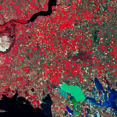 Image:
Southern Ukraine is featured in this false-colour image captured by the Copernicus Sentinel-2 mission.
Image:
Southern Ukraine is featured in this false-colour image captured by the Copernicus Sentinel-2 mission.
Earth from Space: Southern Ukraine
1.5.2020 10:00 ESA Observing the Earth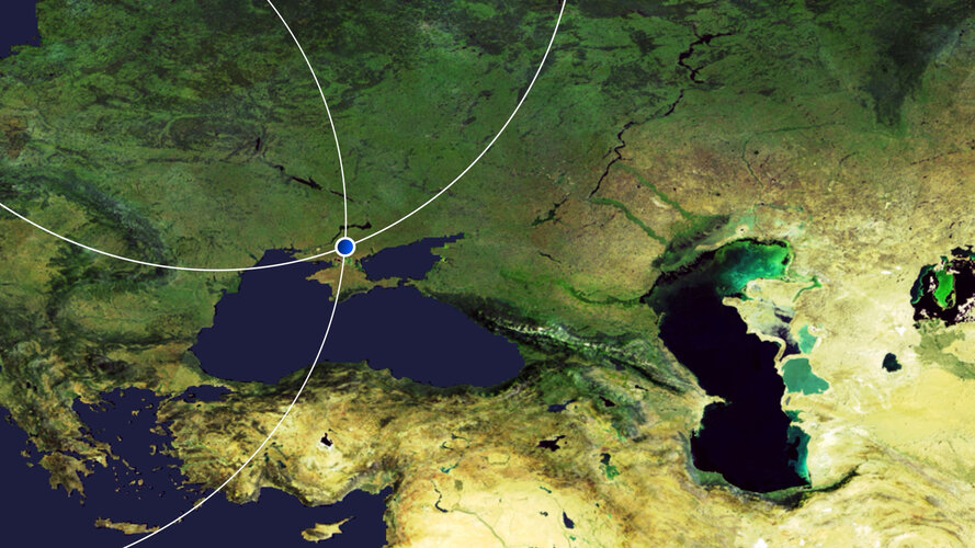 Video:
00:03:01
Video:
00:03:01
In this week's edition of the Earth from Space programme, we explore Southern Ukraine with Copernicus Sentinel-2.
See also Southern Ukraine to download the image.