


![]()

zprávy
zdroje zpráv:Veľký úspech mladých slovenských geografov na IGEO 2017 v Srbsku
7.9.2017 7:21 Geocommunity.skPríspevok Veľký úspech mladých slovenských geografov na IGEO 2017 v Srbsku zobrazený najskôr GeoCommunity.sk.
Konference Výzkum historických cest v interdisciplinárním kontextu
7.9.2017 7:00 Česká asociace pro geoinformace Již III. ročník konference Výzkum historických cest v interdisciplinárním kontextu, která bude letos zaměřená mj. i na geoinformatiku, pořádá Centrum dopravního výzkumu. Akce se uskuteční ve dnech 2. a 3. listopadu 2017 v Brně.Cílem konference je probrat problematiku výzkumu historických cest v širokém spektru výzkumných metod, které poskytuje současná věda.
Press Advisory: NCE Shortlists Bentley Systems as Technology Provider of the Year at the 2017 TechFest Awards
6.9.2017 18:25 Bentley SystemsBentley Systems, Incorporated, a leading global provider of comprehensive software solutions for advancing infrastructure, announces that leading industry publication New Civil Engineer (NCE) recently shortlisted the company as Technology Provider of the Year. Bentley is one of nine companies NCE nominated for the award. The winner will be announced at the 2017 Festival of Technology Awards Sept. 14, 2017, during a gala dinner at the Hilton Bankside in London, which will be held in conjunction with the Festival of Innovation and Technology (TechFest) event.
For more information about the award, please contact Christine Byrne, senior manager,
media relations, Bentley Systems, at christine.byrne@bentley.com.
About Bentley Systems
Bentley is a global leader dedicated to providing engineers, architects, geospatial professionals, constructors, and owner-operators with comprehensive software solutions for advancing infrastructure. Founded in 1984, Bentley has more than 3,000 colleagues in over 50 countries, more than $600 million in annual revenues, and since 2011 has invested more than $1 billion in research, development, and acquisitions.
Oficiální představení technologie 3D objekty
6.9.2017 15:36 T-MAPYThe post Oficiální představení technologie 3D objekty appeared first on T-MAPY spol. s r.o..
Oficiální představení unikátní technologie 3D Objekty
6.9.2017 15:36 T-MAPYThe post Oficiální představení <br/>unikátní technologie 3D Objekty appeared first on T-MAPY spol. s r.o..
Investing in industrial innovation
6.9.2017 15:15 ESA Observing the Earth
A new ESA initiative, Investing in Industrial Innovation in Earth Observation – also known as ‘InCubed’ – kicked off today with an open call for European businesses to apply for a chance to gain financial and practical support for industry projects.
Japan joins the GNSS table with QZSS
6.9.2017 14:21 European GNSS Agency
The Japanese government forecasts that 80% of the economic effects from QZSS will be in the car navigation, mobile terminal and value-added mobility application segments. The upcoming 2020 Tokyo Olympics will also give precise positioning and timing solutions an added boost. This instalment of our GNSS Asia series looks at Japan’s evolving QZSS system and the many benefits it is set to bring.
Japan’s own RNSS (Radio Navigation Satellite System) system, called QZSS, is set to become operational next year. Currently an SBAS system (like EGNOS), there are plans to extend it into an independent regional navigation system. As such, it is set to drive demand in submeter -class applications for receiver manufacturers, system integrators and application developers.
As QZSS is planned to enable better signal reception in urban areas, thanks to the availability of more satellites in general over Japan, the country will benefit from increased accuracy and continuity – essential for position-based applications. According to estimates provided by the Japanese government, 80% of the economic effects created by QZSS are forecasted to take place in the car navigation, mobile terminals and value-added mobility application segments. Furthermore, the upcoming 2020 Tokyo Olympics will give precise positioning and timing solutions an added boost.
A dramatic advancement
As more and more services rely on satellite positioning, there is a greater need for additional satellites in the sky. In Japan, like elsewhere, car navigation systems and smartphones have utilised the position services of GPS satellites. However, due to the limited number of GPS satellites in the field of vision for Japanese users at any given time, services have not always been offered in a stable way. This is already improving as new constellations, such as Galileo, also cover Japanese territory.
For this reason, the Japanese government decided to launch their own RNSS service. QZSS, like EGNOS and Galileo, is interoperable with GPS and can be utilised with other GNSS in an integrated fashion. The result will be a dramatic advancement of satellite positioning services, not only in Japan, but across the Asia-Oceania regions with longitudes close to Japan.
QZSS will launch as a four-satellite constellation as of 2018. When added together with GPS and Galileo the entire system will provide eight or more visible satellites covering most of Japan at all times – an ideal number for carrying out stable, high precision positioning. Knowing that even with eight visible satellites signals are often obstructed in urban areas and mountainous regions, QZSS plans to increase its number of satellites to seven in the near future.
Benefiting users
When providing navigation services to pedestrians, it is necessary that a service convey detailed information about roads, including which side they should walk on and which pedestrian crossings to use. Thanks to the stable, high precision positioning that will be provided by QZSS, users will soon benefit from the detailed information they need to select the route that best matches their navigation goals. This includes routes that help them reach their destination fastest, routes with many pedestrian arcades, routes with few stairs and even how to take ‘the scenic route’.
QZSS will also be capable of sending reports for disasters and crisis management, such as during an earthquake or tsunami. Disaster Crisis (DC) Report, the QZSS safety confirmation service, will send emails via satellite to close relatives if other means of communication are cut off during a disaster.
New Cooperation ArrangementTo ensure Japan benefits from European GNSS know-how and that European businesses can benefit from the GNSS developments happening in Japan, a Cooperation Arrangement was recently signed between the Government of Japan and the European Commission. The Cooperation Agreement aims to enhance EU-Japan policy cooperation in order to prioritise industrial sectors for utilising satellite positioning and creating new business services. The announcement was made during the annual EU-Japan GNSS mission. One of the hot topics discussed during the mission was the upcoming 2020 Tokyo Olympics, with the European team sharing how the 2012 London games benefited from GNSS applications and how the Tokyo games could similarly benefit. |
Media note: This feature can be republished without charge provided the European GNSS Agency (GSA) is acknowledged as the source at the top or the bottom of the story. You must request permission before you use any of the photographs on the site. If you republish, we would be grateful if you could link back to the GSA website (http://www.gsa.europa.eu).
Japan joins the GNSS table with QZSS
6.9.2017 14:21 European GNSS AgencyThe Japanese government forecasts that 80% of the economic effects from QZSS will be in the car navigation, mobile terminal and value-added mobility application segments. The upcoming 2020 Tokyo Olympics will also give precise positioning and timing solutions an added boost. This instalment of our GNSS Asia series looks at Japan’s evolving QZSS system and the many benefits it is set to bring.
Japan’s own RNSS (Radio Navigation Satellite System) system, called QZSS, is set to become operational next year. Currently an SBAS system (like EGNOS), there are plans to extend it into an independent regional navigation system. As such, it is set to drive demand in submeter -class applications for receiver manufacturers, system integrators and application developers.
As QZSS is planned to enable better signal reception in urban areas, thanks to the availability of more satellites in general over Japan, the country will benefit from increased accuracy and continuity – essential for position-based applications. According to estimates provided by the Japanese government, 80% of the economic effects created by QZSS are forecasted to take place in the car navigation, mobile terminals and value-added mobility application segments. Furthermore, the upcoming 2020 Tokyo Olympics will give precise positioning and timing solutions an added boost.
A dramatic advancement
As more and more services rely on satellite positioning, there is a greater need for additional satellites in the sky. In Japan, like elsewhere, car navigation systems and smartphones have utilised the position services of GPS satellites. However, due to the limited number of GPS satellites in the field of vision for Japanese users at any given time, services have not always been offered in a stable way. This is already improving as new constellations, such as Galileo, also cover Japanese territory.
For this reason, the Japanese government decided to launch their own RNSS service. QZSS, like EGNOS and Galileo, is interoperable with GPS and can be utilised with other GNSS in an integrated fashion. The result will be a dramatic advancement of satellite positioning services, not only in Japan, but across the Asia-Oceania regions with longitudes close to Japan.
QZSS will launch as a four-satellite constellation as of 2018. When added together with GPS and Galileo the entire system will provide eight or more visible satellites covering most of Japan at all times – an ideal number for carrying out stable, high precision positioning. Knowing that even with eight visible satellites signals are often obstructed in urban areas and mountainous regions, QZSS plans to increase its number of satellites to seven in the near future.
Benefiting users
When providing navigation services to pedestrians, it is necessary that a service convey detailed information about roads, including which side they should walk on and which pedestrian crossings to use. Thanks to the stable, high precision positioning that will be provided by QZSS, users will soon benefit from the detailed information they need to select the route that best matches their navigation goals. This includes routes that help them reach their destination fastest, routes with many pedestrian arcades, routes with few stairs and even how to take ‘the scenic route’.
QZSS will also be capable of sending reports for disasters and crisis management, such as during an earthquake or tsunami. Disaster Crisis (DC) Report, the QZSS safety confirmation service, will send emails via satellite to close relatives if other means of communication are cut off during a disaster.
New Cooperation ArrangementTo ensure Japan benefits from European GNSS know-how and that European businesses can benefit from the GNSS developments happening in Japan, a Cooperation Arrangement was recently signed between the Government of Japan and the European Commission. The Cooperation Agreement aims to enhance EU-Japan policy cooperation in order to prioritise industrial sectors for utilising satellite positioning and creating new business services. The announcement was made during the annual EU-Japan GNSS mission. One of the hot topics discussed during the mission was the upcoming 2020 Tokyo Olympics, with the European team sharing how the 2012 London games benefited from GNSS applications and how the Tokyo games could similarly benefit. |
Media note: This feature can be republished without charge provided the European GNSS Agency (GSA) is acknowledged as the source at the top or the bottom of the story. You must request permission before you use any of the photographs on the site. If you republish, we would be grateful if you could link back to the GSA website (http://www.gsa.europa.eu).
Koho si vyberete na letošní konferenci Student GIS Projekt?
6.9.2017 13:40 GeoBusinessStudent GIS Projekt je soutěž studentských prací z oblasti GIS, které jsou řešené s pomocí technologií Esri nebo ENVI. Letošní ročník soutěže se uskuteční ve středu 13. září 2017 na Fakultě životního…
The post Koho si vyberete na letošní konferenci Student GIS Projekt? appeared first on GeoBusiness.
Aktualizované nástroje Import RÚIAN a VFK2DB
6.9.2017 10:55 GIS FórumVFK2DB
- opravy zásadních chyb při importu,
- řádové zrychlení importu dat a vytváření geometrií zejména při větším objemu dat,
- možnost volat hlavní funkce z příkazové řádky (z dávkového souboru)
- úpravy GUI,
- upravené výpisy do logů a konzole,
- podrobnější manuál s částí pro administrátory a částí pro uživatele
- při chybě stahování dat se zkouší opakované stahovaní 3x (vždy po prodlevě 30s)
- z aplikace odstraněny knihovny Oracle a MS SQL (klient musí být nainstalován)
- nový licenční mechanismus (je potřeba si zažádat o nový licenční klíč)
- přidáno tlačítko pro editaci connection string
- přidáno tlačítko pro otevření pracovního adresáře
- přidána volba pro ukončení aplikace při výskytu chyby při zápisu do databáze
- upraveno GUI
- upravena nápověda
- ke stažení zde
Podzimní vzdělávací on-line kurzy
6.9.2017 10:52 ARCDATAVolně dostupné vzdělávací kurzy Esri startují od 6. září a vybrat si můžete hned ze dvou témat: Do-It-Yourself Geo Apps a Earth Imagery at Work.
V prvním z uvedených kurzů si zdokonalíte své dovednosti v oblasti webových aplikací. Trvá čtyři týdny a během sedmi lekcí se naučíte vytvářet aplikace, které budou vyhovovat vašim potřebám. Tento kurz se věnuje základům i pokročilým možnostem tvorby s využitím moderních API a SDK.
Druhý kurz, zaměřený na rastrová data, poběží šest týdnů a jeho hlavním cílem je představit postupy správné analýzy, interpretace a využití obrazových dat.
Po úspěšném absolvování kurzu získáte příslušný certifikát. Účast v kurzu je zdarma a můžete se do nich připojit až do 20. září 2017.

Odborný referent – obnova katastrálního operátu v technickém odboru Katastrálního úřadu pro Moravsko
6.9.2017 10:42 ČÚZK - volná místa Katastrální úřad pro Moravskoslezský kraj vypisuje výběrové řízení na místo Odborný referent – obnova katastrálního operátu v technickém odboru Katastrálního úřadu pro MoravskoOdborný referent – obnova katastrálního operátu v technickém odboru Katastrálního úřadu pro Moravsko
6.9.2017 10:42 ČÚZK - předpisy a opatření Katastrální úřad pro Moravskoslezský krajvypisuje výběrové řízení na místo odborný referent – obnova katastrálního operátu v technickém odboru Katastrálního úřadu pro Moravskoslezský kraj
Odborný referent – obnova katastrálního operátu v technickém odboru Katastrálního úřadu pro Moravskoslezský kraj
Odborný referent – obnova katastrálního operátu v technickém odboru Katastrálního úřadu pro Moravsko
6.9.2017 10:42 ČÚZK /Urady/Katastralni-urady/Katastralni-urady/Katastralni-urad-pro-Moravskoslezsky-kraj/Uredni-deska/Oznameni-a-jina-uredni-sdeleni/Volna-mista/Odborny-referent-–-obnova-katastralniho-operat-(1)Vrchní referent/rada – obnova katastrálního operátu v technickém odboru Katastrálního úřadu pro Mora
6.9.2017 10:40 ČÚZK - předpisy a opatření Katastrální úřad pro Moravskoslezský krajvypisuje výběrové řízení na místo vrchní referent/rada – obnova katastrálního operátu v technickém odboru Katastrálního úřadu pro Moravskoslezský kraj
Vrchní referent/rada – obnova katastrálního operátu v technickém odboru Katastrálního úřadu pro Moravskoslezský kraj
Vrchní referent/rada – obnova katastrálního operátu v technickém odboru Katastrálního úřadu pro Mora
6.9.2017 10:40 ČÚZK /Urady/Katastralni-urady/Katastralni-urady/Katastralni-urad-pro-Moravskoslezsky-kraj/Uredni-deska/Oznameni-a-jina-uredni-sdeleni/Volna-mista/Vrchni-referent-rada-–-obnova-katastralniho-o-(10)Vrchní referent/rada – obnova katastrálního operátu v technickém odboru Katastrálního úřadu pro Mora
6.9.2017 10:40 ČÚZK - volná místa Katastrální úřad pro Moravskoslezský kraj vypisuje výběrové řízení na místo Vrchní referent/rada – obnova katastrálního operátu v technickém odboru Katastrálního úřadu pro Mora20170906 - volné místo - Zásobovač – referent dopravy v oddělení hospodářské správy
6.9.2017 10:39 ČÚZK - předpisy a opatření Katastrální úřad pro Ústecký kraj zveřejnil novou aktualitu: Nabídka volného pracovního místa - Zásobovač – referent dopravy v oddělení hospodářské správy20170906 - volné místo - Zásobovač – referent dopravy v oddělení hospodářské správy
6.9.2017 10:39 ČÚZK /Urady/Katastralni-urady/Katastralni-urady/Katastralni-urad-pro-Ustecky-kraj/O-uradu/Aktuality/20170816-volne-misto-odborny-referent-v-oddele-(1)Zásobovač – referent dopravy v oddělení hospodářské správy
6.9.2017 10:38 ČÚZK /Urady/Katastralni-urady/Katastralni-urady/Katastralni-urad-pro-Ustecky-kraj/Volna-mista/Zasobovac-–-referent-dopravy-v oddeleni-hospodarskZásobovač – referent dopravy v oddělení hospodářské správy
6.9.2017 10:38 ČÚZK - předpisy a opatření Katastrální úřad pro Ústecký krajvypisuje výběrové řízení na místo
Zásobovač – referent dopravy v oddělení hospodářské správy
Zásobovač – referent dopravy v oddělení hospodářské správy
6.9.2017 10:38 ČÚZK - volná místa Katastrální úřad pro Ústecký kraj vypisuje výběrové řízení na místo Zásobovač – referent dopravy v oddělení hospodářské správyESA a průmysl spolupracují na vylepšení aerodynamických krytů raket
6.9.2017 10:36 Český Kosmický PortálAerodynamické kryty kosmických nosičů jsou nyní lehčí, rychleji se vyrábí a jsou i levnější. A to díky novému výrobnímu procesu adaptovanému firmou RUAG Space ze Švýcarska, který vznikl ve spolupráci s ESA.
Rada/odborný rada – obnova katastrálního operátu na Katastrálním pracovišti Opava, Katastrálního úřa
6.9.2017 8:29 ČÚZK - volná místa Katastrální úřad pro Moravskoslezský kraj - Katastrální pracoviště Opava vypisuje výběrové řízení na místo Rada/odborný rada – obnova katastrálního operátu na Katastrálním pracovišti Opava, Katastrálního úřaRada/odborný rada – obnova katastrálního operátu na Katastrálním pracovišti Opava, Katastrálního úřa
6.9.2017 8:29 ČÚZK /Urady/Katastralni-urady/Katastralni-urady/Katastralni-urad-pro-Moravskoslezsky-kraj/Uredni-deska/Oznameni-a-jina-uredni-sdeleni/Volna-mista/Rada-odborny-rada-–-obnova-katastralniho-operatu-nRada/odborný rada – obnova katastrálního operátu na Katastrálním pracovišti Opava, Katastrálního úřa
6.9.2017 8:29 ČÚZK - předpisy a opatření Katastrální úřad pro Moravskoslezský kraj - Katastrální pracoviště Opavavypisuje výběrové řízení na místo rada/odborný rada – obnova katastrálního operátu na Katastrálním pracovišti Opava, Katastrálního úřadu pro Moravskoslezský kraj
Rada/odborný rada – obnova katastrálního operátu na Katastrálním pracovišti Opava, Katastrálního úřadu pro Moravskoslezský kraj
Rada/odborný rada – řízení o údajích SGI na Katastrálním pracovišti Nový Jičín
6.9.2017 8:27 ČÚZK - volná místa Katastrální úřad pro Moravskoslezský kraj - Katastrální pracoviště Nový Jičín vypisuje výběrové řízení na místo Rada/odborný rada – řízení o údajích SGI na Katastrálním pracovišti Nový JičínRada/odborný rada – řízení o údajích SGI na Katastrálním pracovišti Nový Jičín
6.9.2017 8:27 ČÚZK - předpisy a opatření Katastrální úřad pro Moravskoslezský kraj - Katastrální pracoviště Nový Jičínvypisuje výběrové řízení na místo rada/odborný rada – řízení o údajích SGI na Katastrálním pracovišti Nový Jičín
Rada/odborný rada – řízení o údajích SGI na Katastrálním pracovišti Nový Jičín
Rada/odborný rada – řízení o údajích SGI na Katastrálním pracovišti Nový Jičín
6.9.2017 8:27 ČÚZK /Urady/Katastralni-urady/Katastralni-urady/Katastralni-urad-pro-Moravskoslezsky-kraj/Uredni-deska/Oznameni-a-jina-uredni-sdeleni/Volna-mista/Rada-odborny-rada-–-rizeni-o-udajich-SGI-na-KatastRada/odborný rada – správce informačních a komunikačních technologií
6.9.2017 8:24 ČÚZK /Urady/Katastralni-urady/Katastralni-urady/Katastralni-urad-pro-Moravskoslezsky-kraj/Uredni-deska/Oznameni-a-jina-uredni-sdeleni/Volna-mista/Rada-odborny-rada-–-spravce-informacnich-a-kom-(3)Rada/odborný rada – správce informačních a komunikačních technologií
6.9.2017 8:24 ČÚZK - předpisy a opatření Katastrální úřad pro Moravskoslezský krajvypisuje výběrové řízení na místo rada/odborný rada – správce informačních a komunikačních technologií
Rada/odborný rada – správce informačních a komunikačních technologií
Rada/odborný rada – správce informačních a komunikačních technologií
6.9.2017 8:24 ČÚZK - volná místa Katastrální úřad pro Moravskoslezský kraj vypisuje výběrové řízení na místo Rada/odborný rada – správce informačních a komunikačních technologiíGeomatika v projektech 2017 - poslední dny registrací
6.9.2017 7:00 Česká asociace pro geoinformaceDo 15. září mohou všichni zájemci zasílat abstrakty příspěvků pro letošní roční tradiční konference Geomatika v projektech. Na 22. září je pak stanoven mezní termín webové registrace účastníků.
Konference se letos koná spolu s 21. ročníkem konference Informačních systémů v zemědělství a lesnictví (ISAF) a druhou výroční konferencí asociace Plan4All 4.
GEFOS zve na další školení MISYS
6.9.2017 7:00 Česká asociace pro geoinformace Společnost GEFOS a.s., kolektivní člen CAGI, srdečně zve všechny zájemce na další školení MISYS, které se bude konat v úterý 26.9.2017 na adrese společnosti: Plánská 6, 370 07 České Budějovice. Začátek školení je plánován na 9:00.Více informací naleznete v oficiální pozvánce.
Více informací naleznete v oficiální
Finále soutěže Student GIS Projekt 2017
6.9.2017 7:00 Česká asociace pro geoinformaceStudent GIS Projekt je soutěž studentských prací z oblasti GIS, které jsou řešené s pomocí technologií Esri nebo ENVI. Finále soutěže proběhne ve středu 13. září na Fakultě životního prostředí ČZU v Praze. Na soutěž jsou srdečně zváni také diváci z řad studentů, odborníků a dalších zájemců o problematiku GIS.
Harmonogram soutěže
10.00 – 10.15
Oznámení o vyhlášení výběrového řízení na služební místo odborný rada oddělení bezpečnosti
6.9.2017 0:00 Státní pozemkový úřad Ústřední ředitelka Státního pozemkového úřadu, jako služební orgán příslušný podle § 10 odst. 1 písm. f) zákona č. 234/2014 Sb., o státní službě (dále jen „zákon“), vyhlašuje výběrové řízení na služební místo odborný rada oddělení bezpečnosti.Oznámení o vyhlášení výběrového řízení na služební místo vrchní referent/ rada oddělení převodu majetku státu, Krajský pozemkový úřad pro Pardubický kraj
6.9.2017 0:00 Státní pozemkový úřad Ústřední ředitelka Státního pozemkového úřadu, jako služební orgán příslušný podle § 10 odst. 1 písm. f) zákona č. 234/2014 Sb., o státní službě (dále jen „zákon“), vyhlašuje výběrové řízení na služební místo vrchní referent/ rada oddělení převodu majetku státu, Krajský pozemkový úřad pro Pardubický kraj.Seminář Katastr nemovitostí XXIII.
5.9.2017 17:37 Spolek zeměměřičů Brno Každoroční seminář v Třebíči se konal ve čtvrtek 21. září 2017 v Hotelu Atom Kde: Hotel Atom, Velkomeziříčská 640/45, Třebíč Program 8:00 – 9:00 Prezence účastníků 9:00 – 14:30 Seminář a diskuse Přednášejícími byli Mgr. Lenka Vrzalová (Český úřad zeměměřický a katastrální) Vybrané změny Návodu pro správu katastru Ing. Pavel... Read more »Seminář Katastr nemovitostí XXIII., 2017
5.9.2017 17:37 Spolek zeměměřičů Brno Každoroční seminář v Třebíči se konal ve čtvrtek 21. září 2017 v Hotelu Atom Kde: Hotel Atom, Velkomeziříčská 640/45, Třebíč Program 8:00 – 9:00 Prezence účastníků 9:00 – 14:30 Seminář a diskuse Přednášejícími byli Mgr. Lenka Vrzalová (Český úřad zeměměřický a katastrální) Vybrané změny Návodu pro správu katastru Ing. Pavel... Read more »„Street View“ Ricoh Theta V má certifikaci od Googlu a točí 4K video
5.9.2017 15:50 GeoBusinessSpolečnost Ricoh Theta představila na veletrhu IFA 2017 v Berlíně novou verzi svého 360° fotoaparátu Theta V. Ricoh Theta V je prvním zařízením, které natáčí videa v rozlišení 4K, nahrává…
The post „Street View“ Ricoh Theta V má certifikaci od Googlu a točí 4K video appeared first on GeoBusiness.
CEDA na Telematics Conference SSEurope
5.9.2017 14:40 CEDA Maps a.s. Praha, 5.9.2017 - Dovolujeme si Vás pozvat k setkání na stánku č. 1 a 28. září 2017 na konferenci Telematics Conference SEEurope v hotelu NH Bratislava Gate One.Přerušení provozu Sbírky listin DP 8.9.2017.
5.9.2017 13:51 ČÚZK /Aplikace-DP-do-KN/Aplikace-DP-do-KN/Archiv-DP/189541Přerušení provozu Sbírky listin v DP 8.9.2017.
5.9.2017 13:51 ČÚZK /Aplikace-DP-do-KN/Aplikace-DP-do-KN/Archiv-DP/189541Přerušení provozu Sbírky listin DP 8.9.2017.
5.9.2017 13:51 Dálkový přístup k údajům KN ČR Vážení uživatelé, oznamujeme, že z technických důvodů nebudou v pátek 8.9.2017 od 14:30 do cca 20:00 dostupné dokumenty ze Sbírky listin. Za komplikace tímto způsobené se omlouváme a děkujeme za pochopeníPřerušení provozu Sbírky listin DP 8.9.2017.
5.9.2017 13:51 ČÚZK - předpisy a opatření Vážení uživatelé, oznamujeme, že z technických důvodů nebudou v pátek 8.9.2017 od 14:30 do cca 20:00 dostupné dokumenty ze Sbírky listin. Za komplikace tímto způsobené se omlouváme a děkujeme za pochopeníPřerušení provozu Sbírky listin v DP 8.9.2017.
5.9.2017 13:51 ČÚZK - předpisy a opatření Vážení uživatelé, oznamujeme, že z technických důvodů nebudou v pátek 8.9.2017 od 14:30 do cca 20:00 dostupné dokumenty ze Sbírky listin. Za komplikace tímto způsobené se omlouváme a děkujeme za pochopeníPřerušení provozu Sbírky listin v DP 8.9.2017.
5.9.2017 13:51 Dálkový přístup k údajům KN ČR Vážení uživatelé, oznamujeme, že z technických důvodů nebudou v pátek 8.9.2017 od 14:30 do cca 20:00 dostupné dokumenty ze Sbírky listin. Za komplikace tímto způsobené se omlouváme a děkujeme za pochopeníPřijďte se podívat na soutěž studentských prací
5.9.2017 13:00 ARCDATA
Přihlásit se můžete do pátku 8. září 2017.
Více informací o soutěži včetně programu naleznete na samostatné stránce.
20170904-VŘ Specialista GIS
5.9.2017 12:36 ČÚZK - předpisy a opatření Český úřad zeměměřický a katastrální zveřejnil novou aktualitu: Oznámení o vyhlášení výběrového řízení na služební místo Specialista GIS.20170905-GaKO-9-2017
5.9.2017 10:33 ČÚZK - předpisy a opatření Český úřad zeměměřický a katastrální zveřejnil novou aktualitu: Aktuální číslo Geodetického a kartografického obzoru (9/2017) je k dispozici ke stažení.Specialista GIS
5.9.2017 10:33 ČÚZK - volná místa Český úřad zeměměřický a katastrální vypisuje výběrové řízení na místo Specialista GISSpecialista GIS
5.9.2017 10:33 ČÚZK - předpisy a opatření Český úřad zeměměřický a katastrálnívypisuje výběrové řízení na místo
Specialista GIS
Specialista GIS
5.9.2017 10:33 ČÚZK /Urady/Cesky-urad-zememericky-a-katastralni/Uredni-deska/Oznameni-a-jina-uredni-sdeleni/Volna-mista/Specialista-GISItaly’s drought seen from space
5.9.2017 10:25 ESA Observing the Earth
Despite the welcome showers at the weekend, abnormally low soil-moisture conditions persist in central Italy. Scientists are using satellite data to monitor the drought that has gripped the country.
Nabídka nadbytečného majetku - auto osobní terénní
5.9.2017 9:29 Zeměměřický úřadZeměměřický úřad nabízí nepotřebný majetek k odkupu. Jedná se o
Nabídka nadbytečného majetku - auto osobní terénní
Nabídka nadbytečného majetku - auto osobní terénní
5.9.2017 9:29 ČÚZK - předpisy a opatřeníZeměměřický úřad nabízí nepotřebný majetek k odkupu. Jedná se o
Nabídka nadbytečného majetku - auto osobní terénní
Nabídka nadbytečného majetku - auto osobní terénní
5.9.2017 9:29 ČÚZK /Urady/Zememericky-urad/Nabidka-majetku/Nabidka-nadbytecneho-majetku-auto-osobni-terenni
Nové číslo GaKO
5.9.2017 9:20
ÚGKK SR
Nové číslo časopisu Geodetického a Kartografického Obzoru 09/2017
BIM příručky od Allplanu
5.9.2017 8:00 GeoBusinessFirma Allplan, patřící do koncernu Nemetschek, vydala příručky v edici BIM Guide. Ve čtyřech příručkách jsou ukázány základní principy na konkrétních projektech, jak BIM funguje a jaké výhody přináší. BIM User…
The post BIM příručky od Allplanu appeared first on GeoBusiness.
Staying competitive in a tight market
5.9.2017 5:35 Carlson Software I saw this sign in Maine on the way back from a recent Carlson workshop. It seemed apropos because the workshop was on Carlson’s Field to Finish and its inherent time and cost saving benefits. A large part of my messaging since arriving here at Carlson is about ways to help surveyors become more profitable. […]Vrchní referent/rada – investiční referent v oddělení hospodářské správy
5.9.2017 4:06 ČÚZK - volná místa Katastrální úřad pro Královéhradecký kraj vypisuje výběrové řízení na místo Vrchní referent/rada – investiční referent v oddělení hospodářské správyVrchní referent/rada – investiční referent v oddělení hospodářské správy
5.9.2017 4:06 ČÚZK /Urady/Katastralni-urady/Katastralni-urady/Katastralni-urad-pro-Kralovehradecky-kraj/Uredni-deska/Oznameni-a-jina-uredni-sdeleni/Volna-mista/Vrchni-referent-rada-–-investicni-referent-v-o-(1)Vrchní referent/rada – investiční referent v oddělení hospodářské správy
5.9.2017 4:06 ČÚZK - předpisy a opatření Katastrální úřad pro Královéhradecký krajvypisuje výběrové řízení na místo
Vrchní referent/rada – investiční referent v oddělení hospodářské správy
Digitální model povrchu - 1m
5.9.2017 2:00 Cenia - Katalog metadat ČR - INSPIRE Digitální model povrchuvznikl vyhodnocením leteckých snímků. Zobrazuje terén včetně všech objektů na něm - budovy, mosty, porosty zeleně apod.Příprava pro budoucnost: geologický kurz Pangaea se stává operačním
5.9.2017 1:54 Český Kosmický PortálNa počátku září začal v Evropském středisku kosmonautů (European Astronaut Centre) v Kolíně nad Rýnem druhý běh geologického terénního výcvikového kurzu ESA Pangaea. Kurz obsahuje individuální hodiny a terénní práci a dláždí cestu pro budoucí mise ESA k dalším planetám.
Rozhovor s Martinem Hrdličkou o trasformaci Komory geodetů a kartografů
4.9.2017 17:19 HrdličkaUž delší dobu se diskutovala vize vzniku Svazu podnikatelů v geodézii. Slyšel jsem, že jste motorem této vize. Co Vás k tomu vede? Geodézie jako obor se dlouhodobě potýká s nedostatečnou prestiží v očích celé společnosti, což se negativně odráží i na ekonomiku celého oboru a příjmy nejen firem, ale i zaměstnanců působících v tomto oboru. To se... View Article
The post Rozhovor s Martinem Hrdličkou o trasformaci Komory geodetů a kartografů appeared first on HRDLIČKA spol. s r.o. - komplexní služby v oblasti geodézie.
odborný referent v personálním oddělení Kanceláře ředitele katastrálního úřadu
4.9.2017 15:48 ČÚZK - předpisy a opatření Český úřad zeměměřický a katastrální zveřejnil novou aktualitu: Oznámení o vyhlášení výběrového řízení na služební místo odborný referent v personálním oddělení Kanceláře ředitele katastrálního úřadu na Katastrálním úřadu pro Vysočinu, místo výkonu služby Jihlava zde.odborný referent v personálním oddělení Kanceláře ředitele katastrálního úřadu
4.9.2017 15:48 ČÚZK /Urady/Katastralni-urady/Katastralni-urady/Katastralni-urad-pro-Vysocinu/O-uradu/Aktuality/odborny-referent-v-personalnim-oddeleni-KancelareOdborný referent v personálním oddělení Kanceláře ředitele katastrálního úřadu na Katastrálním úřadu
4.9.2017 15:37 ČÚZK - předpisy a opatření Katastrální úřad pro Vysočinuvypisuje výběrové řízení na místo
Odborný referent v personálním oddělení Kanceláře ředitele katastrálního úřadu na Katastrálním úřadu pro Vysočinu.
Odborný referent v personálním oddělení Kanceláře ředitele katastrálního úřadu na Katastrálním úřadu
4.9.2017 15:37 ČÚZK /Urady/Katastralni-urady/Katastralni-urady/Katastralni-urad-pro-Vysocinu/Uredni-deska/Oznameni-a-jina-uredni-sdeleni/Volna-mista/odborny-referent-v-personalnim-oddeleni-KancelareOdborný referent v personálním oddělení Kanceláře ředitele katastrálního úřadu na Katastrálním úřadu
4.9.2017 15:37 ČÚZK - volná místa Katastrální úřad pro Vysočinu vypisuje výběrové řízení na místo Odborný referent v personálním oddělení Kanceláře ředitele katastrálního úřadu na Katastrálním úřaduLast Galileo leaves ESA’s Test Centre
4.9.2017 14:57 ESA Navigation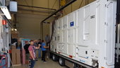
The last of 22 Galileo satellites has departed ESA’s Test Centre in the Netherlands – concluding the single longest and largest scale test campaign in the establishment’s history.
New era in air-quality monitoring a step away
4.9.2017 13:14 ESA Observing the Earth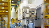
The Sentinel-5P satellite has arrived in Plesetsk in northern Russia to be prepared for liftoff on 13 October. Built to deliver global maps of air pollutants every day and in more detail than ever before, this latest Copernicus mission will set a new standard for monitoring air quality.
Spuštěna mapová aplikace Hlášení závad na komunikacích
4.9.2017 12:45 Středočeský kraj Do zkušebního provozu byla spuštěna nová mapová aplikace Hlašení závad na komunikacích. Tato aplikace umožňuje občanům rychle a jednoduše upozornit na závady na komunikacích na území Středočeského kraje. Občané se tak mohou aktivně podílet na zlepšení stavu silničních komunikací ve svém okolí. Na základě vložených informací je možné včas reagovat a nahlášený problém vyřešit. Zpracovatelem této aplikace je společnost T-Mapy spol. s r. o..V mapové aplikaci Územně pláno
4.9.2017 12:00 Jihočeský kraj V mapové aplikaci Územně plánovací dokumentace obcí byla aktualizována územně plánovací dokumentace obcí Bělčice, Borkovice, Český Krumlov, Lišov, Petříkov, Pohorovice, Slavče a Vodňany.V mapové aplikaci byla aktual
4.9.2017 12:00 Jihočeský kraj V mapové aplikaci byla aktualizována územně plánovací dokumentace obcí Bělčice, Borkovice, Český Krumlov, Lišov, Petříkov, Pohorovice, Slavče a Vodňany.ESA převzala kosmonauty NASA v rámci nové procedury uplatněné po hurikánu
4.9.2017 11:26 Český Kosmický PortálRuský kosmonaut Fjodor Jurčichin a jeho američtí protějšci Jack Fischer a Peggy Whitsonová se vrátili zpět na Zemi, když po dlouhodobém pobytu na Mezinárodní kosmické stanici přistáli v kazašských stepích. Odtud se pak oba američtí kosmičtí cestovatelé vydali do střediska ESA EAC (European Astronaut Centre) v německém Kolíně nad Rýnem.
ESA převzala kosmonauty NASA v rámci nové procedury uplatněné po hurikánu
4.9.2017 11:26 Český Kosmický PortálRuský kosmonaut Fjodor Jurčichin a jeho američtí protějšci Jack Fischer a Peggy Whitsonová se vrátili zpět na Zemi, když po dlouhodobém pobytu na Mezinárodní kosmické stanici přistáli v kazašských stepích. Odtud se pak oba američtí kosmičtí cestovatelé vydali do střediska ESA EAC (European Astronaut Centre) v německém Kolíně nad Rýnem.
Informace o stipendiích do Mexika pro studenty
4.9.2017 10:43 Blogující geomatici - FAV ZČUZatím nejvyšší kapacita microSD karty na světě – 400 GB od SanDisku
4.9.2017 9:25 GeoBusinessSanDisk uvedl microSD kartu s doposud největší kapacitou 400 GB, takže po předchozím rekordu 200 GB je tu rekord nový. Firma SanDisk, patřící společnosti Western Digital, představila paměťovou kartu SanDisk…
The post Zatím nejvyšší kapacita microSD karty na světě – 400 GB od SanDisku appeared first on GeoBusiness.
Oznámení o vyhlášení 2. kola výběrového řízení na služební místo vedoucí pobočky Karlovy Vary
4.9.2017 0:00 Státní pozemkový úřad Ústřední ředitelka Státního pozemkového úřadu, jako služební orgán příslušný podle § 10 odst. 1 písm. f) zákona č. 234/2014 Sb., o státní službě (dále jen „zákon“), vyhlašuje výběrové řízení na služební místo vedoucí pobočky Karlovy Vary.Oznámení o vyhlášení výběrového řízení na služební místo odborný rada oddělení řízení projektů a administrativy, odbor rozvoje ICT a řízení projektů
4.9.2017 0:00 Státní pozemkový úřad Ústřední ředitelka Státního pozemkového úřadu, jako služební orgán příslušný podle § 10 odst. 1 písm. f) zákona č. 234/2014 Sb., o státní službě (dále jen „zákon“), vyhlašuje výběrové řízení na služební místo odborný rada oddělení řízení projektů a administrativy, odbor rozvoje ICT a řízení projektů.Oznámení o vyhlášení výběrového řízení na služební místo odborný rada oddělení investičních činností a programového financování
4.9.2017 0:00 Státní pozemkový úřad Ústřední ředitelka Státního pozemkového úřadu, jako služební orgán příslušný podle § 10 odst. 1 písm. f) zákona č. 234/2014 Sb., o státní službě (dále jen „zákon“), vyhlašuje výběrové řízení na služební místo odborný rada oddělení investičních činností a programového financování.Geodézie a kartografie v dopravě 2017 - program
2.9.2017 7:00 Česká asociace pro geoinformaceSlovenská spoločnosť geodetov a kartografov a Český svaz geodetů a kartografů Vás zvou na konferenci Geodézie a kartografie v dopravě, která se uskuteční ve dnech 21. a 22. září 2017 v Košicích na Slovensku.
Přihlásit se můžete již nyní pomocí webového formuláře.
Program i další podrobnosti naleznete na webu akce.
Slovenská spoločnosť geodetov a kartografov
Společně otevíráme data 2017
2.9.2017 7:00 Česká asociace pro geoinformaceDo 31. října 2017 se můžou všichni tvůrci aplikací postavených nad otevřenými daty přihlásit do dalšího ročníku soutěže Společně otevíráme data, kterou pořádá Fond Otakara Motejla ve spolupráci s Fórem pro otevřená data.
Soutěž je otevřena všem zájemcům z řad studenstva, veřejnosti, neziskových organizací i firem. Základní podmínkou je, aby
Odborný referent v oddělení právním č. 2
1.9.2017 13:10 ČÚZK /Urady/Katastralni-urady/Katastralni-urady/Katastralni-urad-pro-Jihomoravsky-kraj/Uredni-deska/Oznameni-a-jina-uredni-sdeleni/Volna-mista/Odborny-referent-v-oddeleni-pravnim-c-2Odborný referent v oddělení právním č. 2
1.9.2017 13:10 ČÚZK - předpisy a opatření Katastrální úřad pro Jihomoravský kraj - Katastrální pracoviště Brno-městovypisuje výběrové řízení na místo
Odborný referent v oddělení právním č. 2
Odborný referent v oddělení právním č. 2
1.9.2017 13:10 ČÚZK - volná místa Katastrální úřad pro Jihomoravský kraj - Katastrální pracoviště Brno-město vypisuje výběrové řízení na místo Odborný referent v oddělení právním č. 2Odborný referent v oddělení právním č. 1
1.9.2017 13:08 ČÚZK - předpisy a opatření Katastrální úřad pro Jihomoravský kraj - Katastrální pracoviště Brno-městovypisuje výběrové řízení na místo
Odborný referent v oddělení právním č. 1
Odborný referent v oddělení právním č. 1
1.9.2017 13:08 ČÚZK /Urady/Katastralni-urady/Katastralni-urady/Katastralni-urad-pro-Jihomoravsky-kraj/Uredni-deska/Oznameni-a-jina-uredni-sdeleni/Volna-mista/Odborny-referent-v-oddeleni-pravnim-c-1Odborný referent v oddělení právním č. 1
1.9.2017 13:08 ČÚZK - volná místa Katastrální úřad pro Jihomoravský kraj - Katastrální pracoviště Brno-město vypisuje výběrové řízení na místo Odborný referent v oddělení právním č. 1GIS v plánování měst a regionů – program konference 14. 9. 2017
1.9.2017 11:07 GeoBusinessKonference České asociace pro geoinformace, věnovaná GIS v plánování měst a regionů, se blíží a už známe program. Třetí ročník konference GIS v plánování měst a regionů se bude konat…
The post GIS v plánování měst a regionů – program konference 14. 9. 2017 appeared first on GeoBusiness.
20170901-Vrchní referent/rada oddělení aktualizace katastru nemovitostí
1.9.2017 11:03 ČÚZK /Urady/Katastralni-urady/Katastralni-urady/Katastralni-urad-pro-Stredocesky-kraj/Katastralni-pracoviste/KP-Mlada-Boleslav/O-uradu/Aktuality/20140318-Geodet-Melnik-(2)20170901-Vrchní referent/rada oddělení aktualizace katastru nemovitostí
1.9.2017 11:03 ČÚZK - předpisy a opatření Katastrální úřad pro Středočeský kraj - Katastrální pracoviště Mladá Boleslav Oznámení o vyhlášení výběrového řízení na služební místo Vrchní referent/rada oddělení aktualizace katastru nemovitostí Na úřední elektronické desce Katastrálního úřadu pro Středočeský kraj, v sekci "Oznámení a jiná úřední sdělení" bylo vystaveno "Oznámení o vyhlášení výběrového řízení na služební místo Vrchní referent/rada oddělení aktualizace katastru nemovitostíKatastrálního pracoviště Mladá Boleslav"
Vrchní referent/rada oddělení aktualizace katastru nemovitostí
1.9.2017 11:00 ČÚZK - předpisy a opatření Katastrální úřad pro Středočeský kraj - Katastrální pracoviště Mladá Boleslavvypisuje výběrové řízení na místo Vrchní referent/rada oddělení aktualizace katastru nemovitostí
Vrchní referent/rada oddělení aktualizace katastru nemovitostí
Vrchní referent/rada oddělení aktualizace katastru nemovitostí
1.9.2017 11:00 ČÚZK /Urady/Katastralni-urady/Katastralni-urady/Katastralni-urad-pro-Stredocesky-kraj/Uredni-deska/Oznameni-a-jina-uredni-sdeleni/Volna-mista/Vrchni-referent-rada-oddeleni-aktualizace-kata-(3)Vrchní referent/rada oddělení aktualizace katastru nemovitostí
1.9.2017 11:00 ČÚZK - volná místa Katastrální úřad pro Středočeský kraj - Katastrální pracoviště Mladá Boleslav vypisuje výběrové řízení na místo Vrchní referent/rada oddělení aktualizace katastru nemovitostíBlízká setkání hvězdného druhu
1.9.2017 10:35 Český Kosmický PortálPohyb více než 300 tisíc hvězd pozorovaný observatoří ESA Gaia ukázal, že vzácná blízká setkání s naším Sluncem mohou narušit oblaka komet na samých okrajích naší Sluneční soustavy - a někdy v budoucnu některé z nich poslat i směrem k Zemi.
Extrémně rychlý SSD disk pro ukládání a čtení velkých objemů dat
1.9.2017 10:23 GeoBusinessSSD disk od firmy Adata dosahuje rychlostí až 2 800 MB/s pro čtení a 1 450 MB/s pro zápis. Ačkoliv firma Adata ve své tiskové zprávě uvádí, že disk je určen pro…
The post Extrémně rychlý SSD disk pro ukládání a čtení velkých objemů dat appeared first on GeoBusiness.
Zaměření stavby kamerou GoPro HERO 5
1.9.2017 10:00 HrdličkaMetoda sběru dat pro účely vytvoření geodetické dokumentace skutečného provedení stavby (DSPS) pomocí kamery je založena na principu digitální fotogrammetrie. Data lze pořídit buď pozemním sběrem kamerou nebo leteckým sběrem pomocí dronu. Při pozemním sběru se snímky pořizují snadno pomocí kamery umístěné na tyčce (trasírce, výtyčce), kterou se snímá okolí daného objektu (např. výkopu). Pořízené... View Article
The post Zaměření stavby kamerou GoPro HERO 5 appeared first on HRDLIČKA spol. s r.o. - komplexní služby v oblasti geodézie.
INSPIRE stahovací služba WFS pro téma Dopravní sítě-vodní doprava (TN_WATER)
1.9.2017 2:00 Cenia - Katalog metadat ČR - INSPIRE INSPIRE stahovací služba WFS pro téma Dopravní sítě-vodní doprava (TN_WATER) je služba umožňující registrovaným uživatelům opakované stahování dat pomocí technologie WFS 2.0.0. Stahovací služba poskytuje harmonizovaná data INSPIRE tématu Dopravní sítě-vodní doprava (TN_WATER) odpovídající INSPIRE xml schématu ve verzi 4.0 a ELF xml schématu ve verzi 1.0. Data jsou poskytována ve formátu GML 3.2.1. a v souřadnicovém systému ETRS89/TM33 stanoveném INSPIRE pro zobrazení dat velkých měřítek. Tato datová sada dopravních sítí České republiky má proto jednotnou podobu s ostatními daty vytvářenými pro toto INSPIRE téma v rámci celé Evropy. Základem poskytované datové sady je datová sada Státní plavební správy sloužící k popisu objektů na vodních cestách ČR. Služba splňuje technické pokyny pro INSPIRE stahovací služby verze 3.1 a zároveň splňuje standard OGC WFS 2.0.0.Mapa obcí s rozšířenou působností 1:50 000
1.9.2017 2:00 Cenia - Katalog metadat ČR - INSPIRE Mapa obcí s rozšířenou působností vzniká od roku 2008 a umožňuje ucelený pohled na správní obvod příslušné obce.Mapa je vyhotovena na podkladě Základní mapy ČR 1:50 000. Formát mapy je volen tak, aby příslušné správní území obce s rozšířenou působností bylo zobrazeno na samostatném mapovém listě. Nemá mapový rám a je zpracovávána a tištěna až ke kraji mapového archu.Stejně jako ZM 50 obsahuje polohopis, výškopis a popis. Předmětem polohopisu jsou sídla a jednotlivé objekty, komunikace, vodstvo, hranice správních a územních jednotek, hranice katastrálních území (včetně územně technických jednotek), hranice chráněných území, porost a povrch půdy. Předmětem výškopisu je terénní reliéf zobrazený vrstevnicemi a šrafami. Interval vrstevnic je 10 m. Popis sestává z druhového označení objektů, kót vrstevnic, výškových kót, standardizovaného geografického názvosloví, názvů a identifikačních čísel územně technických jednotek. Oproti ZM 50 je upraven obsah zvýrazněním hranic správních území a barevným rozlišením názvů obcí s rozšířenou působnosti a obcí s pověřeným obecním úřadem. Mapa je také doplněna o tematický obsah jako jsou sídlo správního úřadu, pošta, nemocnice, čerpací stanice pohonných hmot, skládka odpadu, zemní vodojem, čistírna odpadních vod a úpravna vody. Obsahem mapových listů je zeměpisná sít (ETRS89). Každý mapový list obsahuje vysvětlivky s výběrem nejpoužívanějších mapových značek. Ve vydavatelské působnosti ČÚZK je 205 mapových listů.INSPIRE stahovací služba WFS pro téma Dopravní sítě-vodní doprava (TN_WATER)
1.9.2017 2:00 Cenia - Katalog metadat ČR - INSPIRE INSPIRE stahovací služba WFS pro téma Dopravní sítě-vodní doprava (TN_WATER) je služba umožňující registrovaným uživatelům opakované stahování dat pomocí technologie WFS 2.0.0. Stahovací služba poskytuje harmonizovaná data INSPIRE tématu Dopravní sítě-vodní doprava (TN_WATER) odpovídající INSPIRE xml schématu ve verzi 4.0 a ELF xml schématu ve verzi 1.0. Data jsou poskytována ve formátu GML 3.2.1. a v souřadnicovém systému ETRS89/TM33 stanoveném INSPIRE pro zobrazení dat velkých měřítek. Tato datová sada dopravních sítí České republiky má proto jednotnou podobu s ostatními daty vytvářenými pro toto INSPIRE téma v rámci celé Evropy. Základem poskytované datové sady je Základní báze geografických dat České republiky (ZABAGED®) a datová sada Státní plavební správy sloužící k popisu objektů na vodních cestách ČR. Služba splňuje technické pokyny pro INSPIRE stahovací služby verze 3.1 a zároveň splňuje standard OGC WFS 2.0.0.Česká jména moří a mezinárodních území
1.9.2017 2:00 Cenia - Katalog metadat ČR - INSPIRE Publikace Česká jména moří a mezinárodních území po obsahové i koncepční stráncenavazuje na příručku Index českých exonym (2., rozšířené a aktualizované vydání, Praha2011). Rovněž jména oceánů, moří, jejich částí, mořských proudů a podmořských útvarů totižmohou existovat v podobě českých exonym (domácích podob cizích zeměpisných jmen),přestože je Česká republika vnitrozemským státem. V již publikovaném Indexu českýchexonym byly české podoby jmen moří uváděny jen tehdy, šlo-li o moře ležící v oblasti státnísvrchovanosti pouze jednoho státu. Názvoslovná komise Českého úřadu zeměměřického akatastrálního nyní pro standardizaci zpracovala obsáhlejší seznam moří a doplnila hoo objekty mimo osídlené kontinenty. ISBN 978-80-86918-71-6.Acquisition From Renishaw Increases Carlson’s Focus on Ore, Quarry, and Blasting Industries
31.8.2017 15:01 Carlson Software Carlson EMEA BV (“Carlson”), a wholly-owned subsidiary of Carlson Software Inc. has acquired the mining (Quarryman, Boretrak, C-ALS, Void Scanner), marine mapping (Merlin), and laser module (ILM) product lines previously owned by Renishaw plc (“Products”). This acquisition will enhance Carlson’s existing product portfolio for the benefit of its customers and for former Renishaw customers. “Carlson […]Acquisition From Renishaw Increases Carlson’s Focus on Ore, Quarry, and Blasting Industries
31.8.2017 15:01 Carlson Software Carlson EMEA BV (“Carlson”), a wholly-owned subsidiary of Carlson Software Inc. has acquired the mining (Quarryman, Boretrak, C-ALS, Voidscanner), marine mapping (Merlin), and laser module (ILM) product lines previously owned by Renishaw plc (“Products”). This acquisition will enhance Carlson’s existing product portfolio for the benefit of its customers and for former Renishaw customers. “Carlson has […]Můžete se hlásit do 5. ročníku soutěže Společně otevíráme data
31.8.2017 14:18 GeoBusinessFond Otakara Motejla ve spolupráci s Fórem pro otevřená data již po páté vyzývá všechny tvůrce aplikací postavených nad otevřenými daty, aby se přihlásili do dalšího ročníku soutěže Společně otevíráme…
The post Můžete se hlásit do 5. ročníku soutěže Společně otevíráme data appeared first on GeoBusiness.
Arcibiskupství pražské využívá aplikaci twiGIS
31.8.2017 13:52 GIS Fórum Aplikace twiGIS uspěla ve výběrovém řízení na dodání software pro správu pozemkové evidence. Arcibiskupství pražské se tak stalo dalším zákazníkem, který se rozhodl implementovat moderní webovou mapovou aplikaci pro správu svého majetku.
Holo360 a Vision360 – dvě kamery pro sférické video od Aceru
31.8.2017 13:05 GeoBusinessAcer Holo360 je 360° kamera, která uživatelům umožňuje zachycovat, prohlížet, sledovat, upravovat a sdílet snímky, a to pouze s pomocí jediného zařízení; Acer Vision360 je automobilová kamera připojená do cloudu. Společnost…
The post Holo360 a Vision360 – dvě kamery pro sférické video od Aceru appeared first on GeoBusiness.
Mapová aplikace Územně analyti
31.8.2017 12:00 Jihočeský kraj Mapová aplikace Územně analytické podklady byla aktualizována k 29. 8. 2017.Mapová aplikace byla aktualiz
31.8.2017 12:00 Jihočeský kraj Mapová aplikace byla aktualizována k 29. 8. 2017.EO Open Science
31.8.2017 11:56 ESA Observing the Earth
Sign up today to attend the September 2017 EO Open Science conference at ESA’s establishment in Frascati, Italy
Rekonstrukce venkovního schodiště
31.8.2017 10:51 ČÚZK - předpisy a opatření Katastrální úřad pro Středočeský kraj - Katastrální pracoviště Benešovzveřejnil novou aktualitu: Z důvodu rekonstrukce venkovního schodiště bude od 4.9.2017 přístup do budovy Lesů ČR, kde sídlí Katastrální pracoviště Benešov, možný pouze zadním vchodem.